
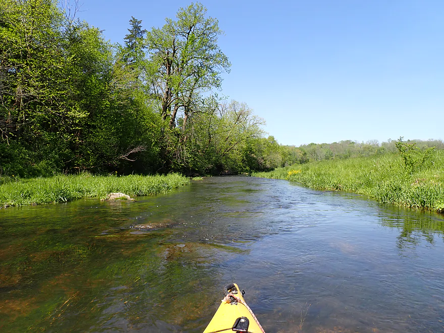
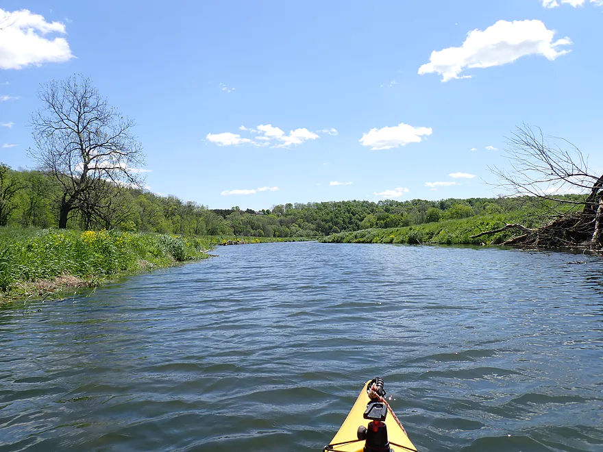
Starting the trip at Sinsinawa Road
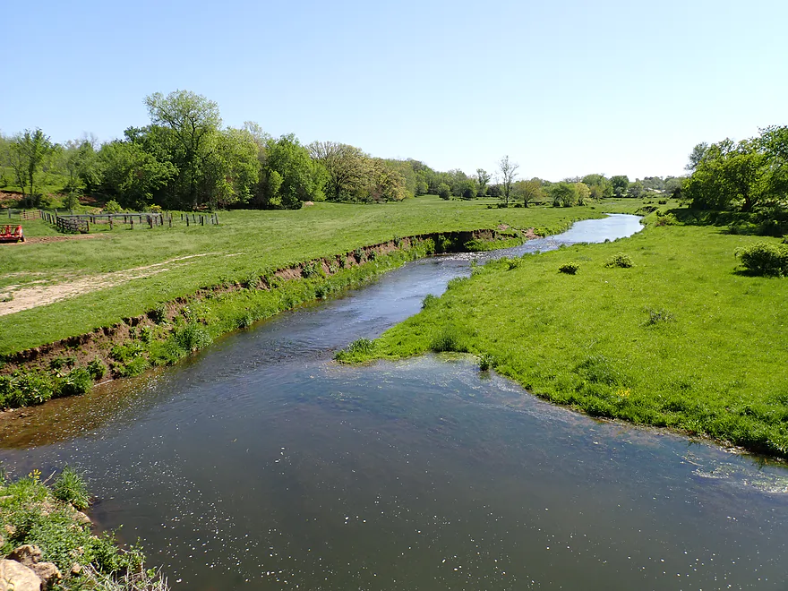
The fences and steep bank make this a poor access
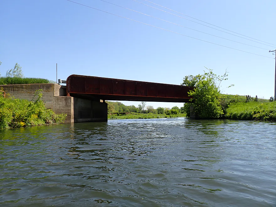
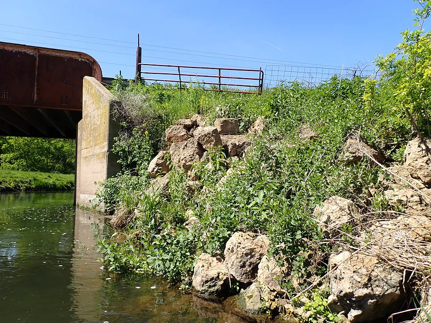
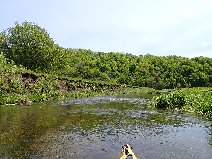
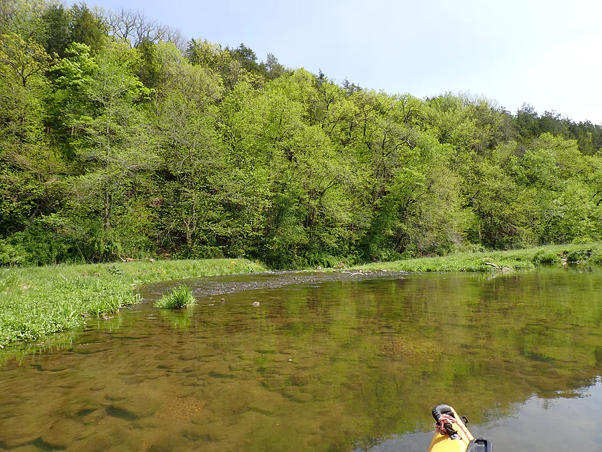
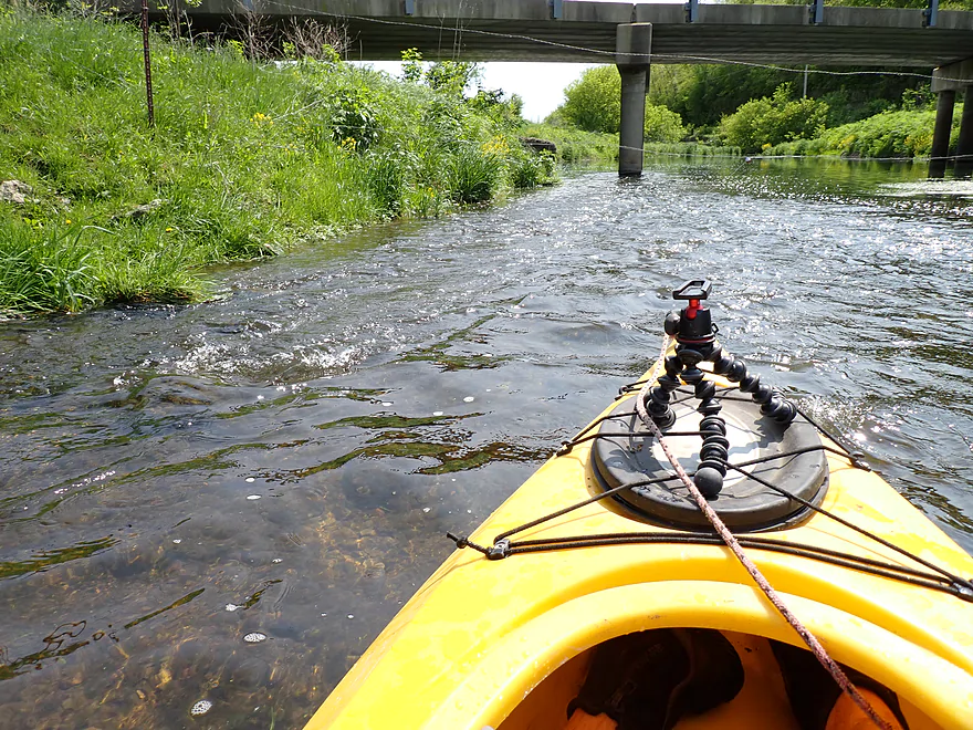
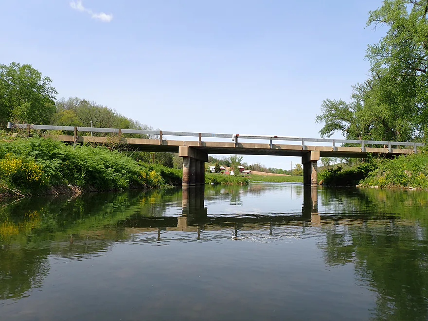
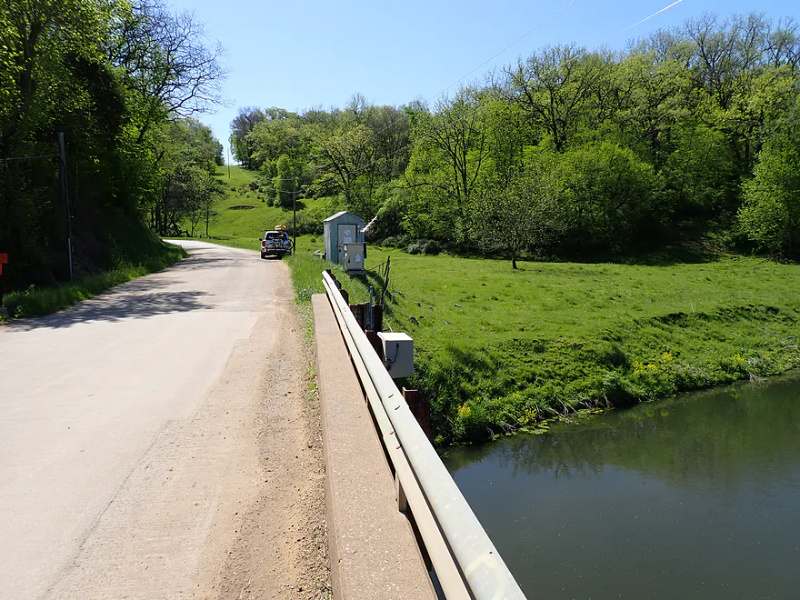
Wide view of the bridge
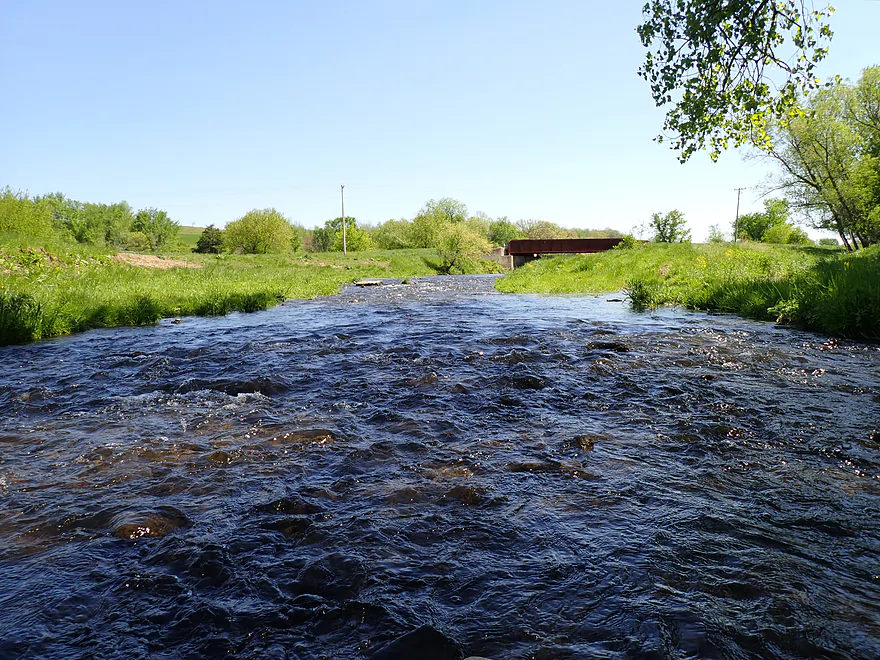
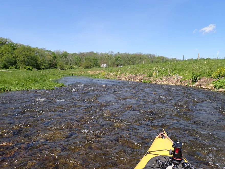
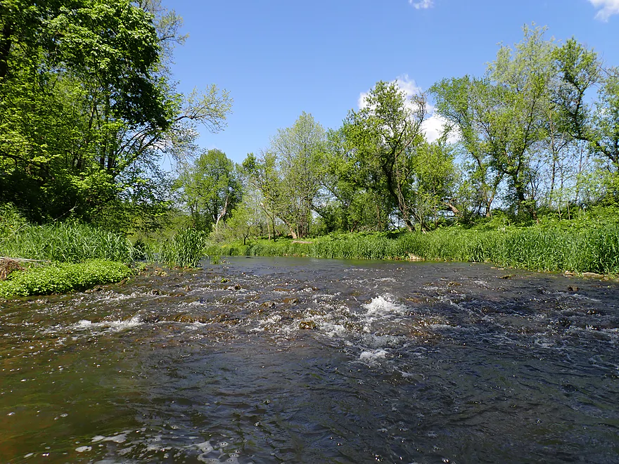
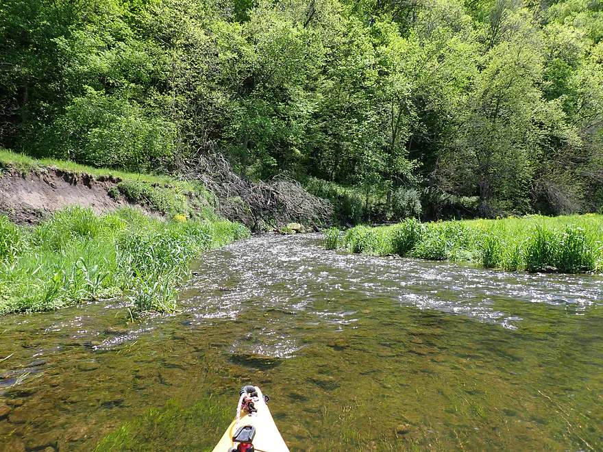
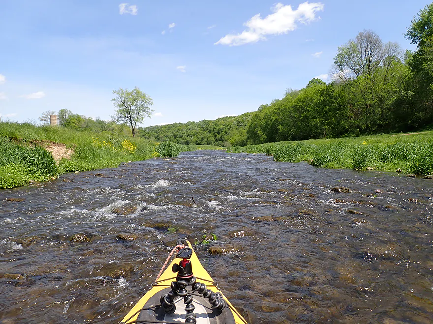
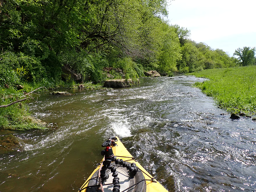
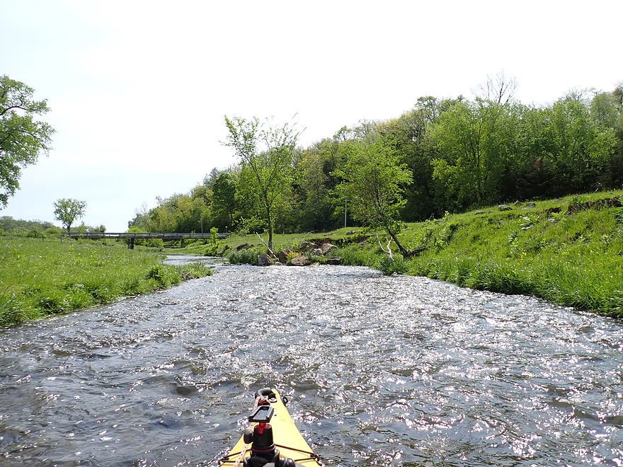
First of many light rapids
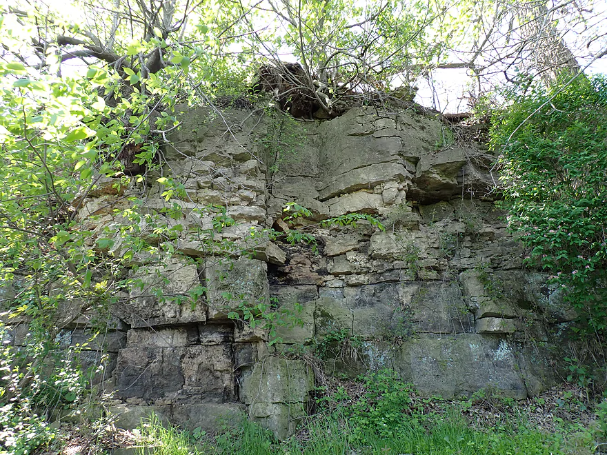
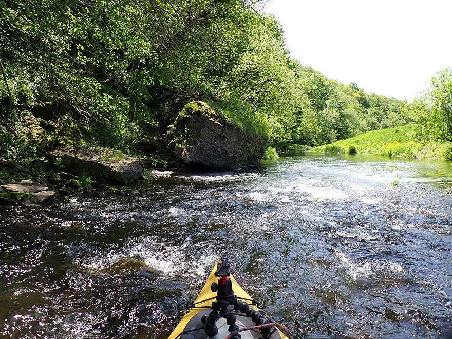
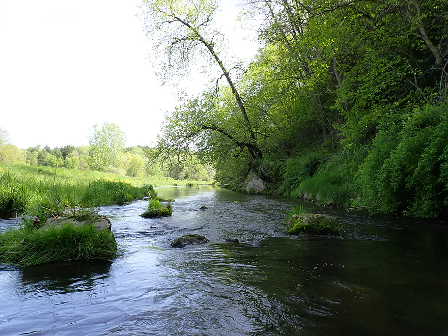
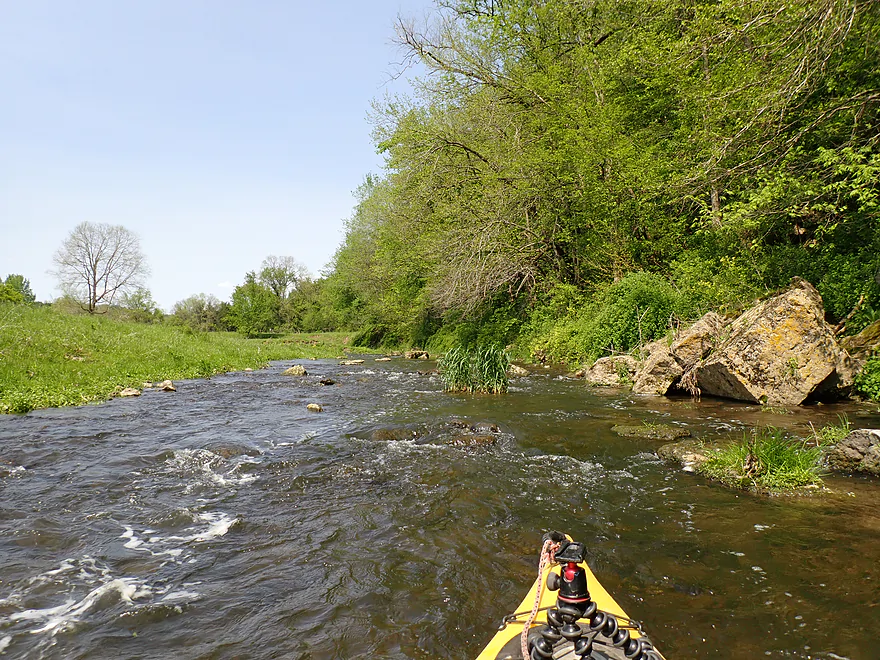
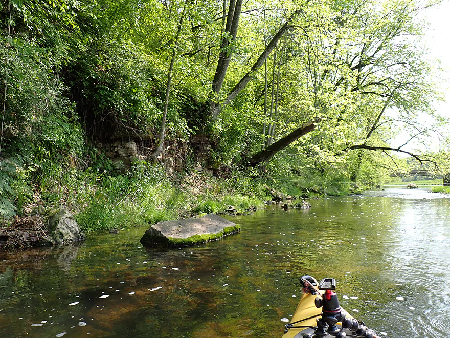
First of many outcrops
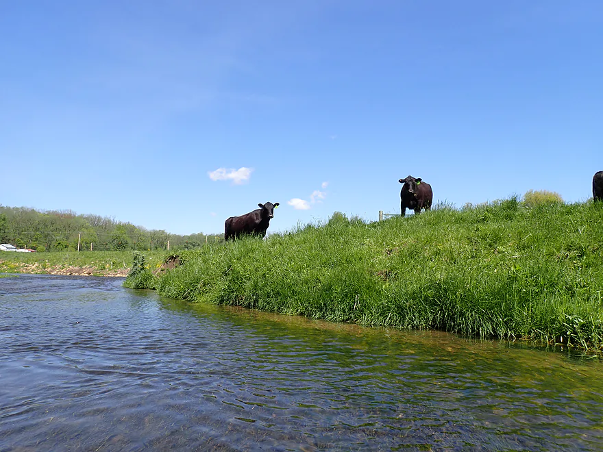
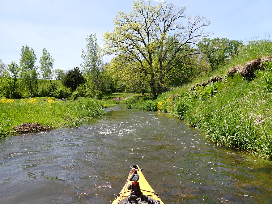
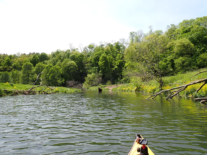
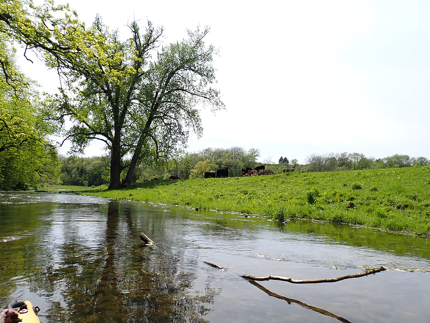
First of many cattle
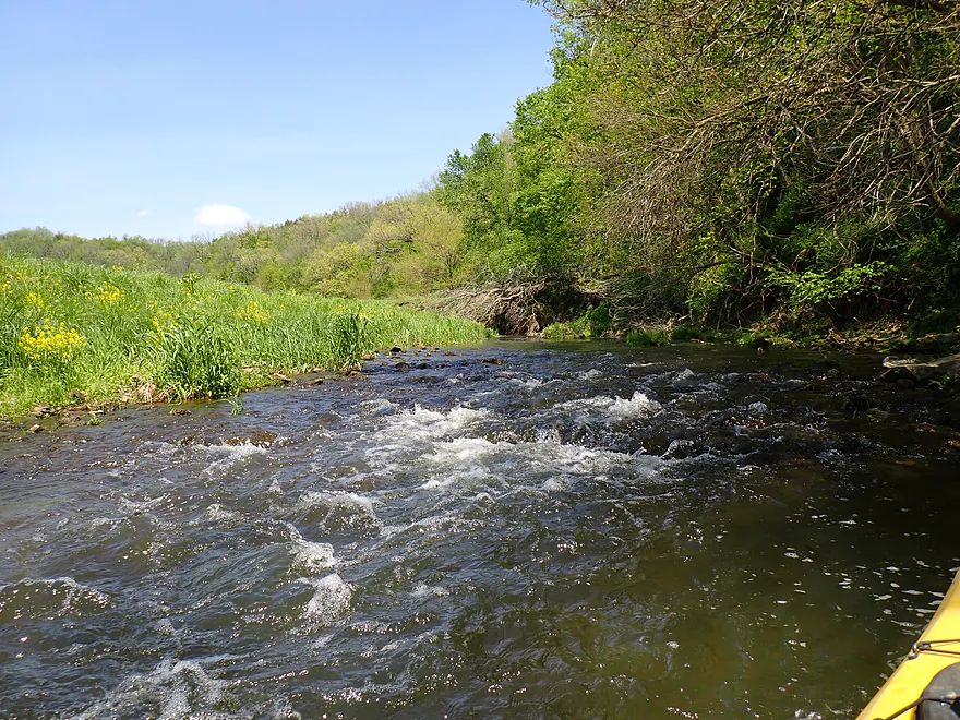
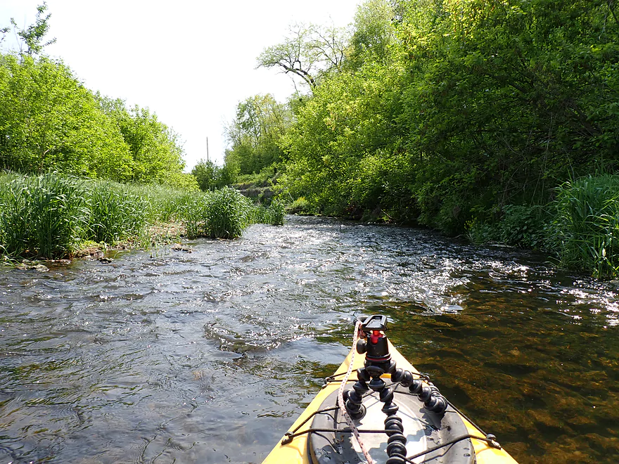
Very shallow rapids
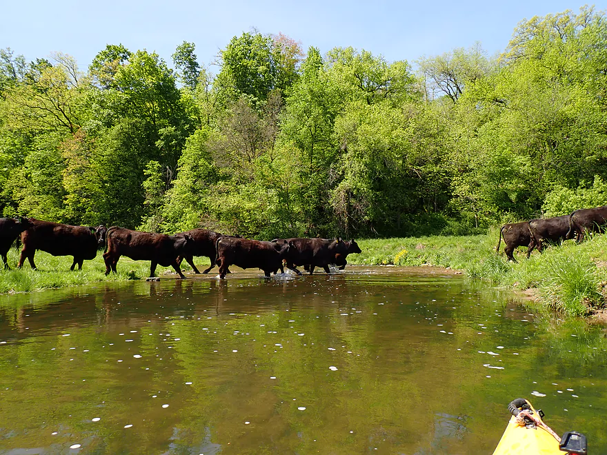
Waiting for the cattle to cross
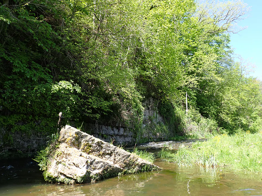
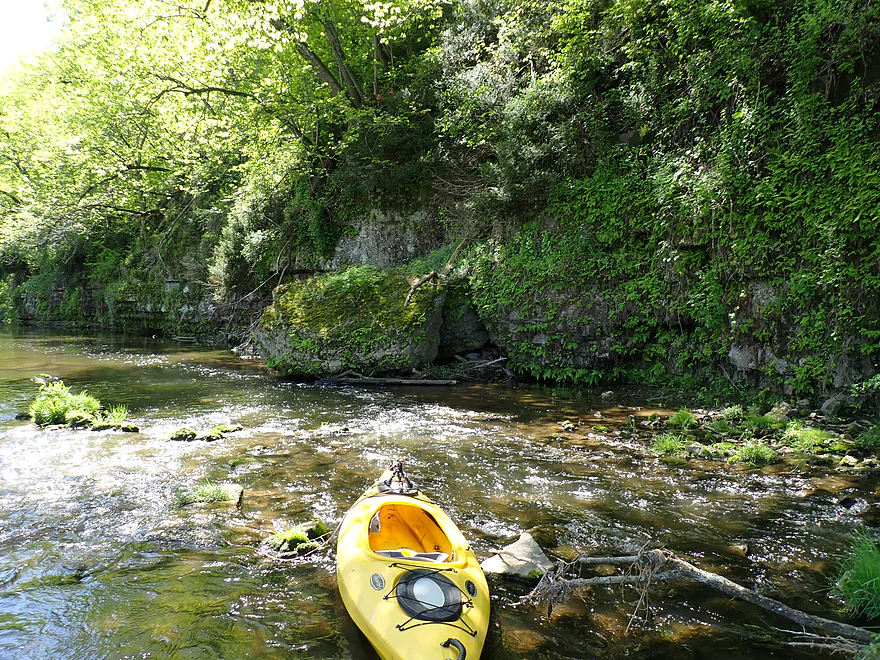
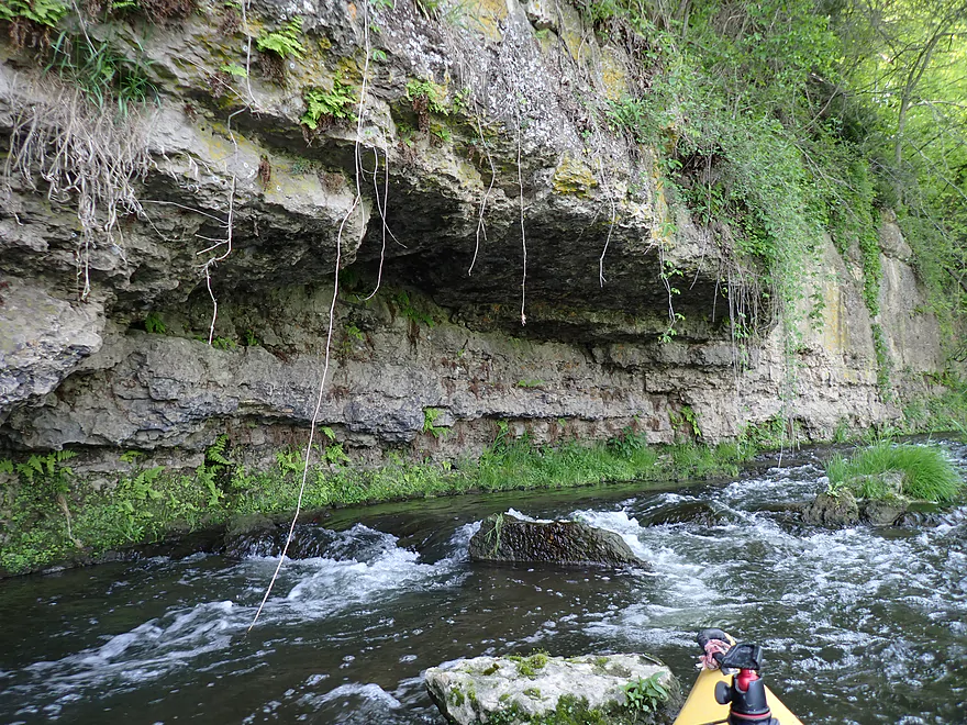
Tricky ledge
Had to portage…reverse view
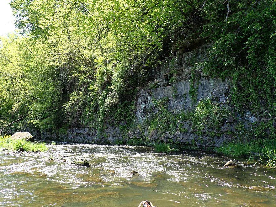
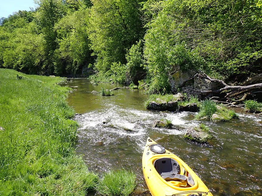
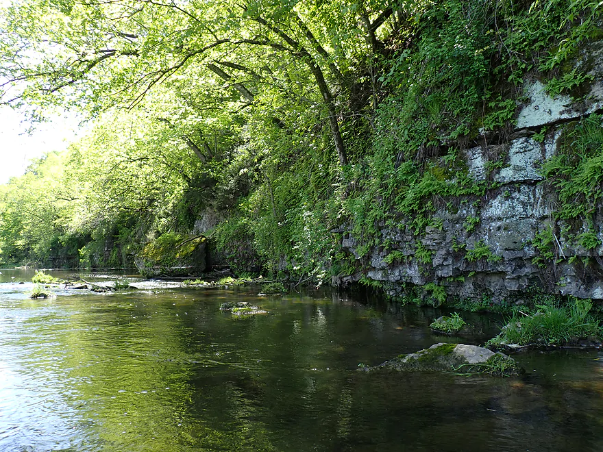
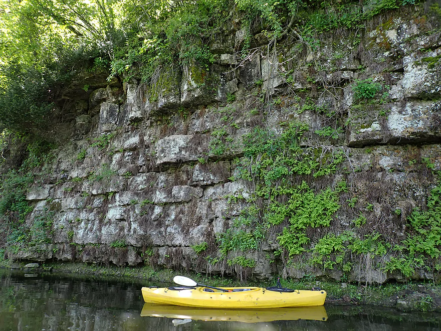
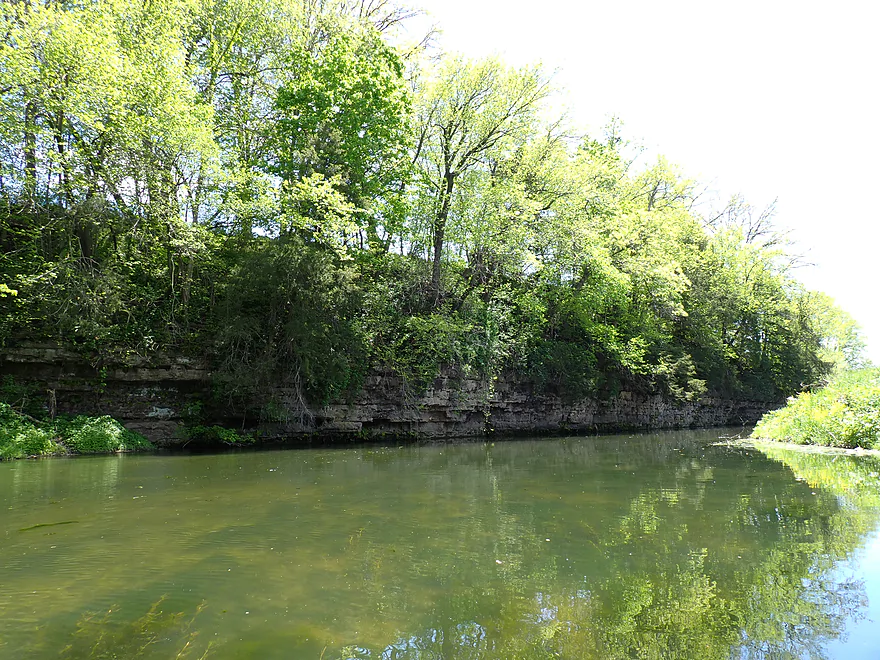
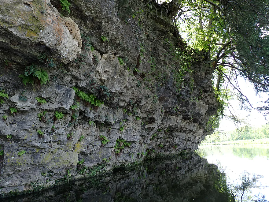
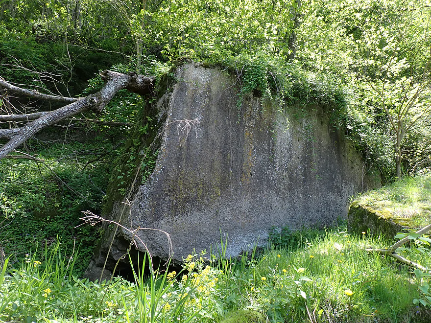
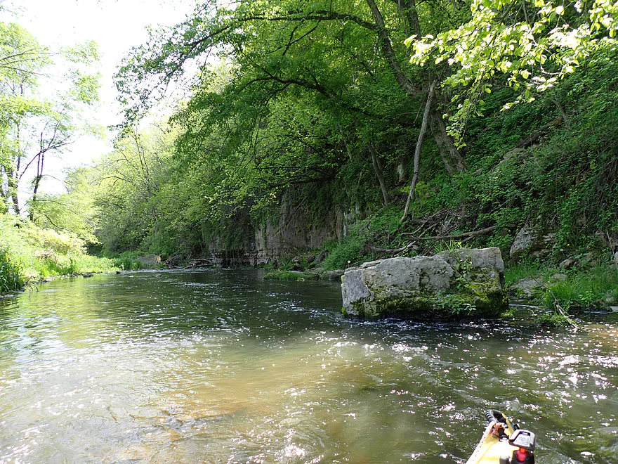
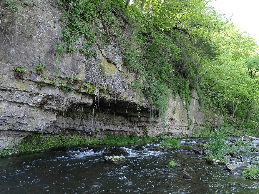
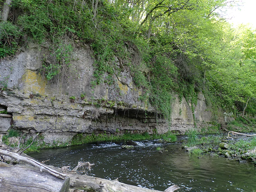
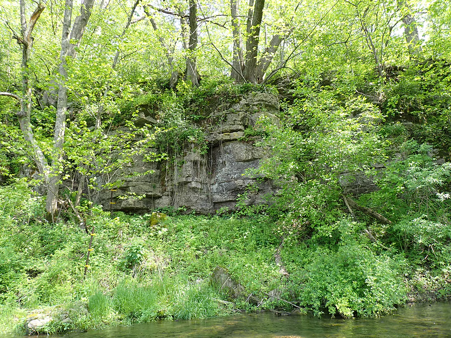
Scenic cliff
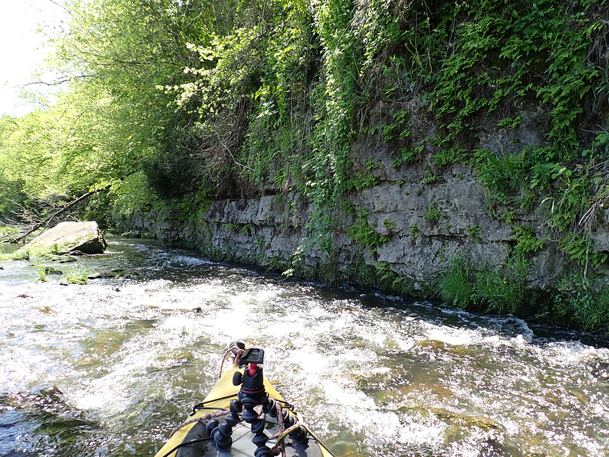
Rapids pushing the boat into the wall
Reverse view
Not a lot of room to get through
Hard to see…but that is a fence that had to be ducked
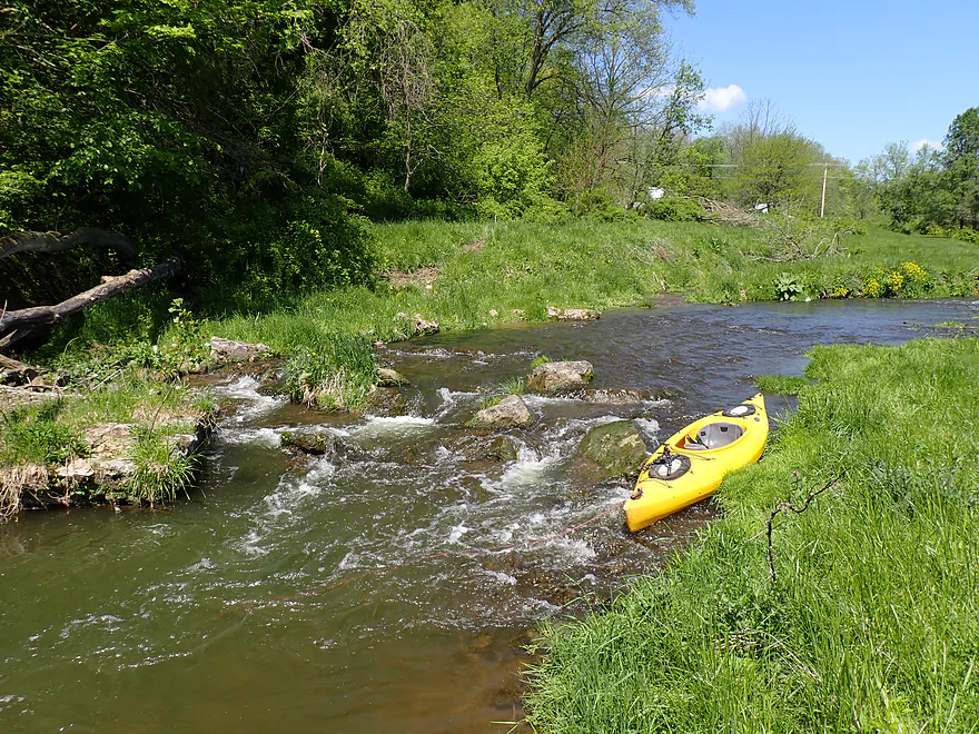
Had to portage these rapids (too shallow)
Reverse view
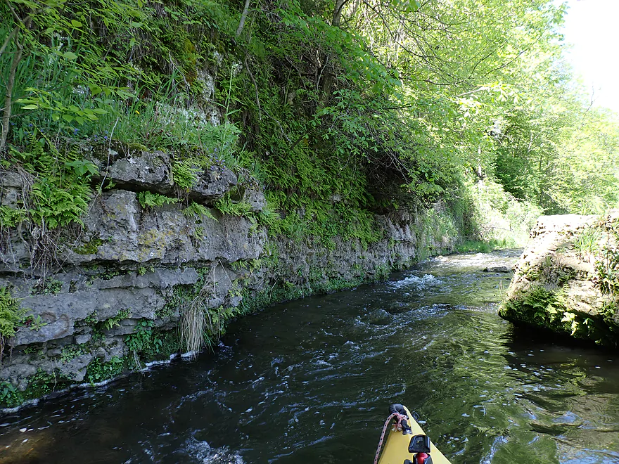
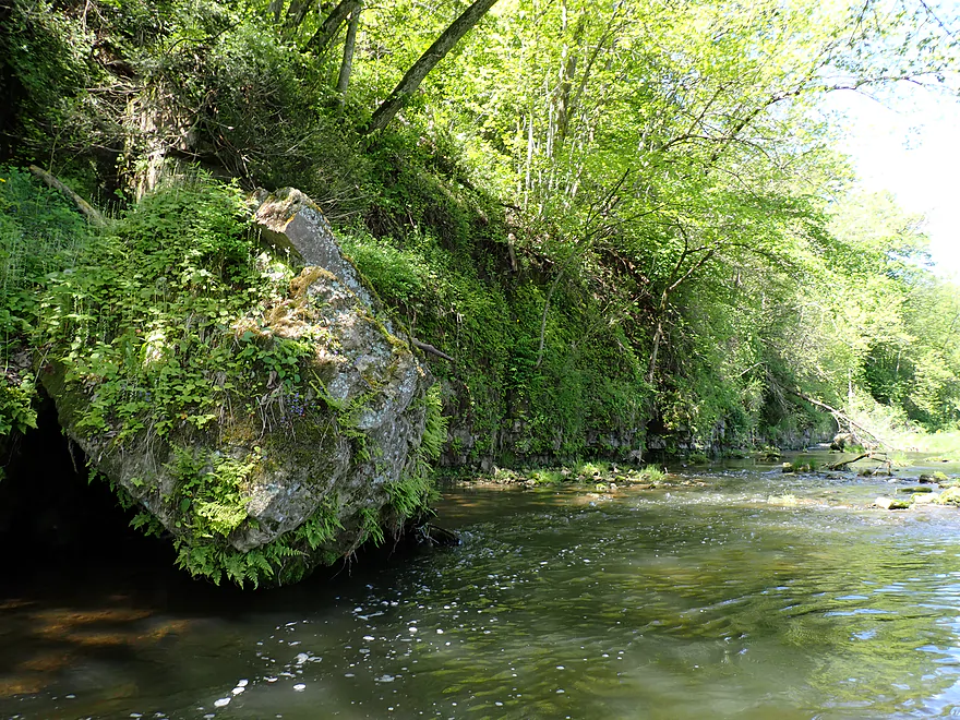
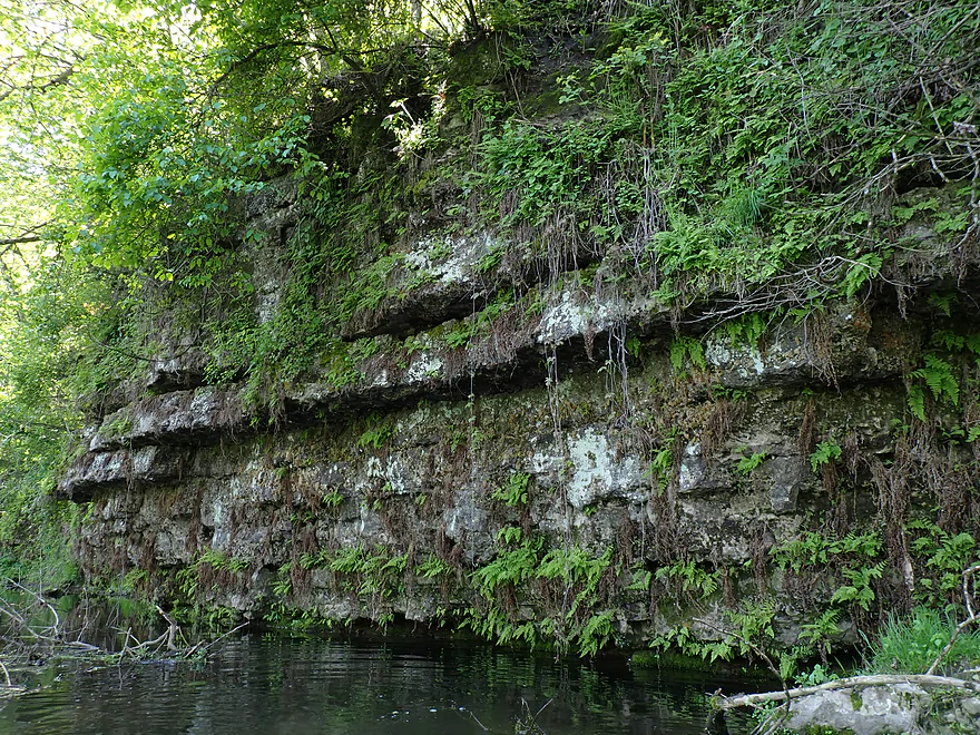
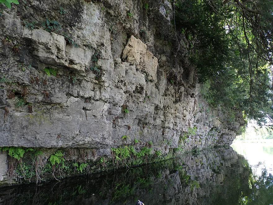
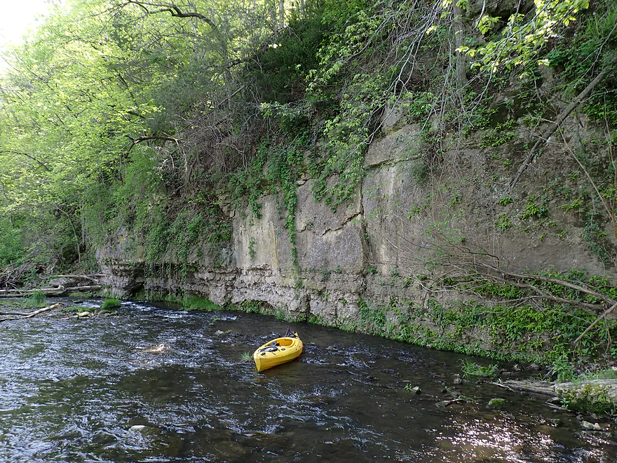
Fantastic limestone
This wall looked like it was made of stone blocks
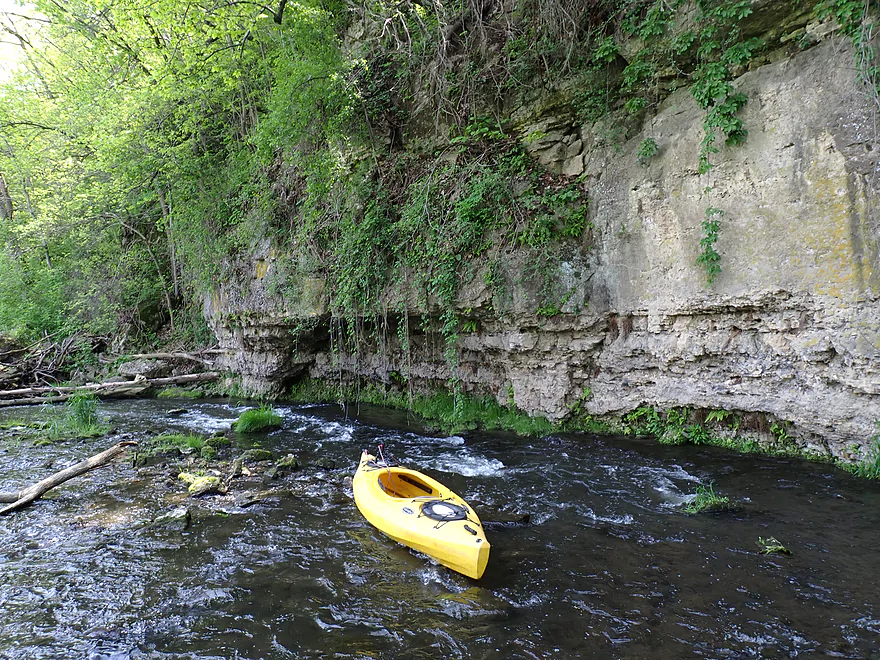
Next cliff had a “brow”
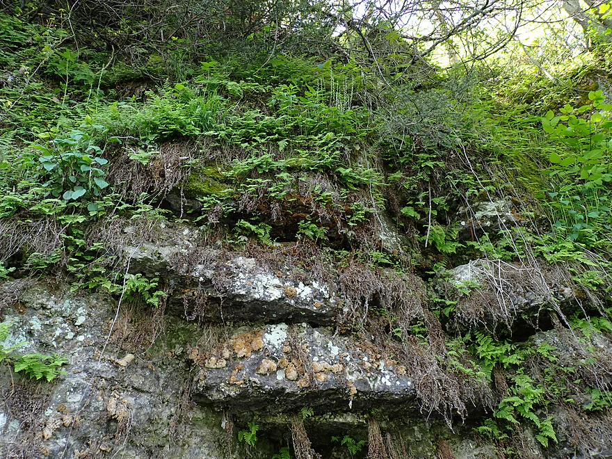
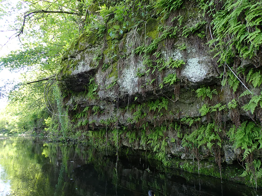
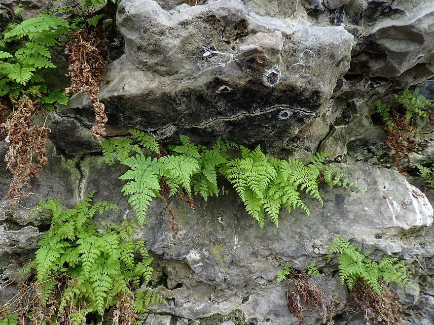
More nice ferns and lichens
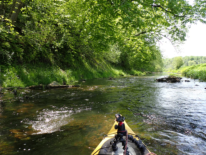
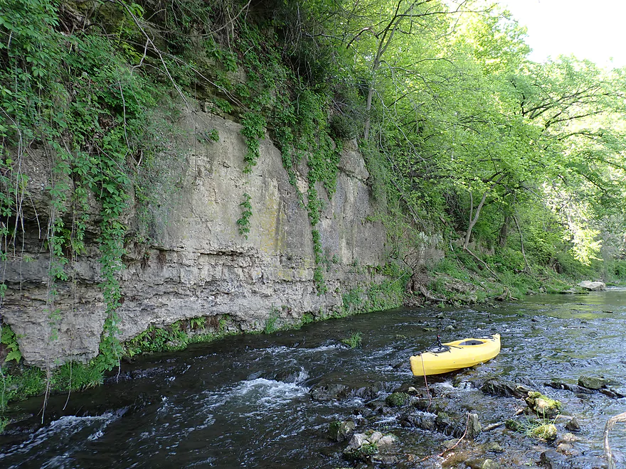
Exiting the cliff area
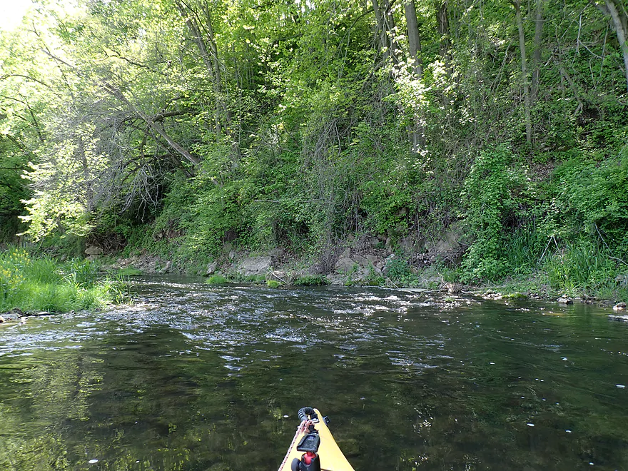
More bony rapids
Underwater algae forest
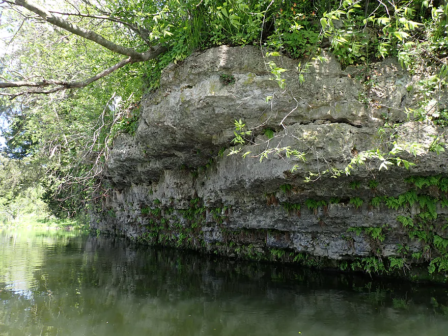
Approaching another long cliff
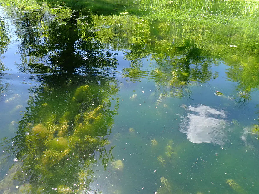
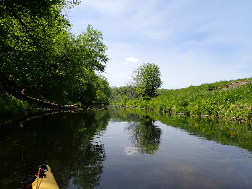
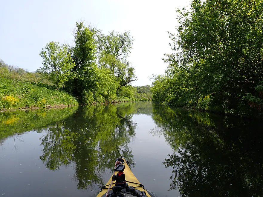
Nice reflection
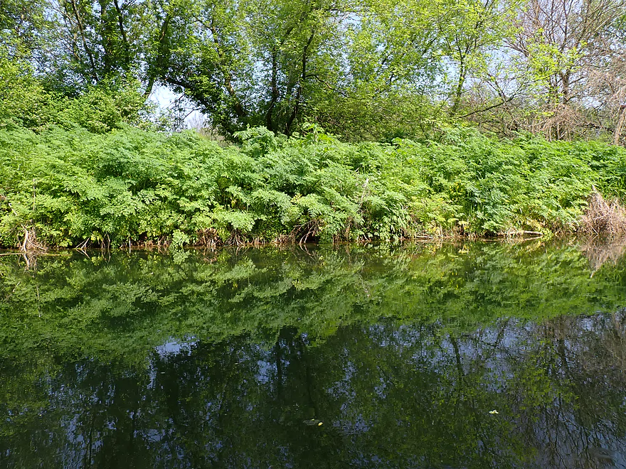
Ferns growing upside down
Reverse view
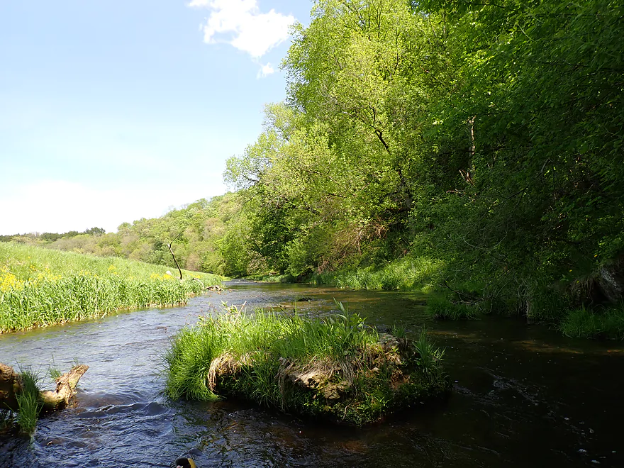
Grass growing in the middle of the river
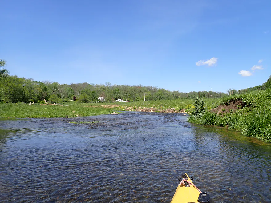
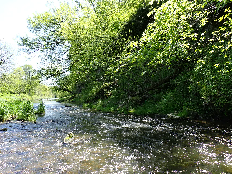
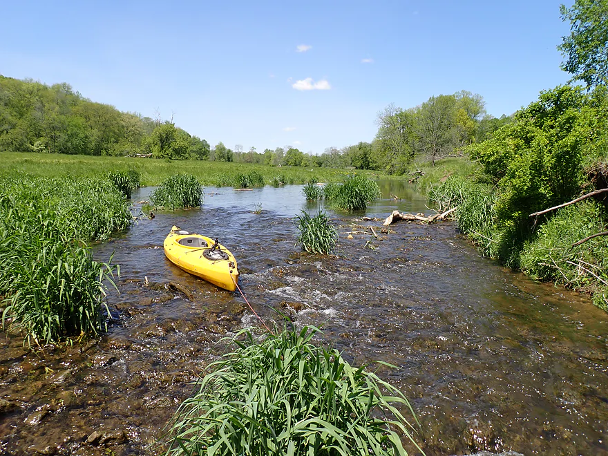
Paddling through an open valley
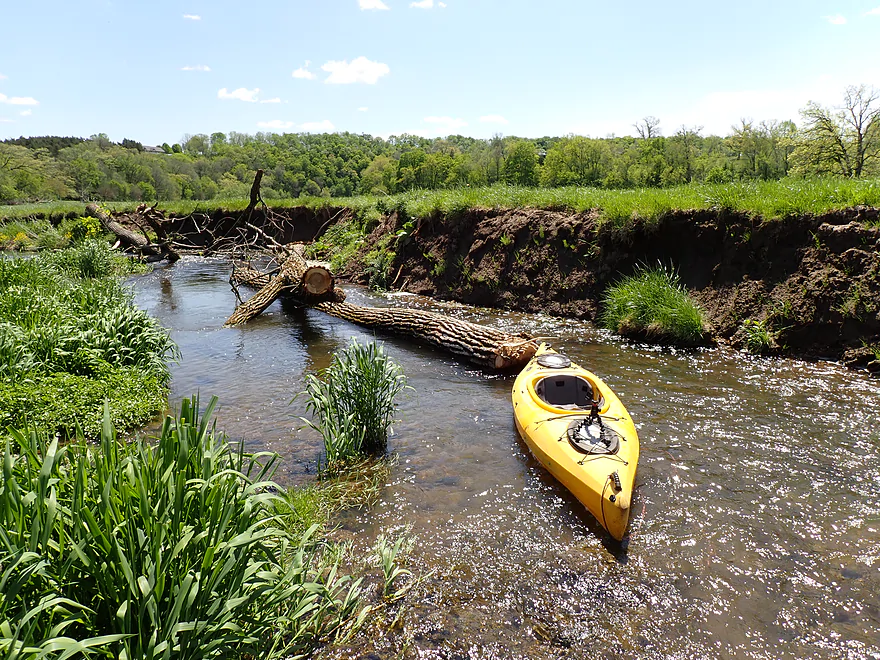
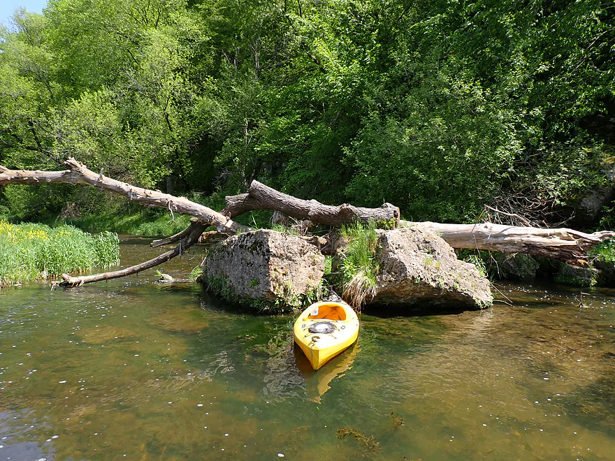
Only logjam of the trip
Easy portage
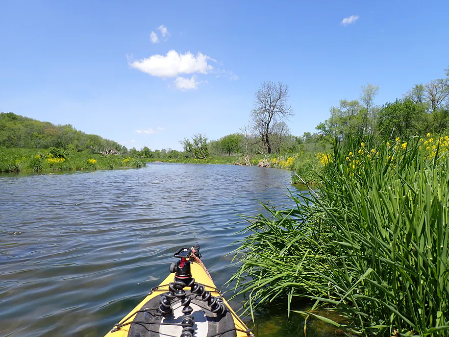
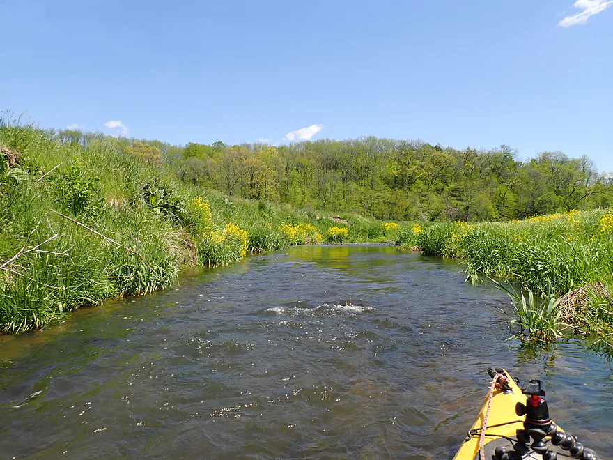
The wild mustard was actually kind of scenic
Approaching another large bluff
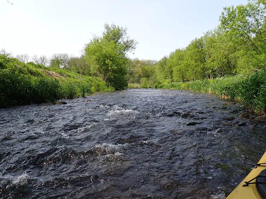
Fun rapids
Reverse view
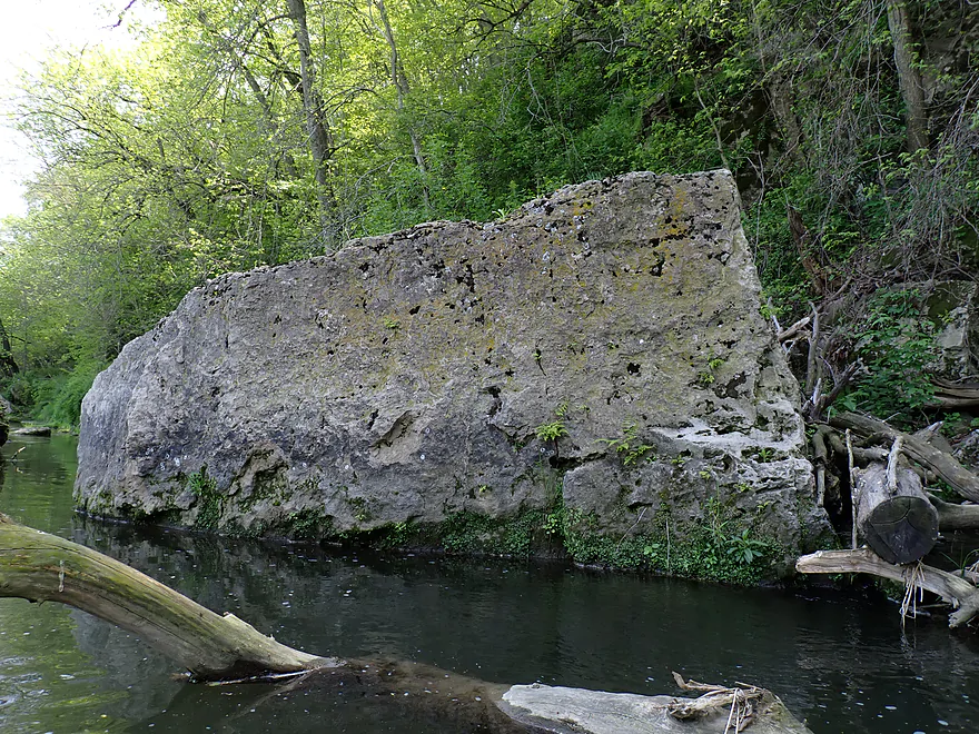
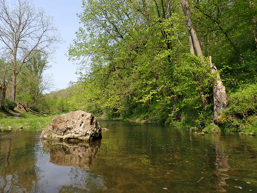
Some of the boulders here were huge
Bluff continues on the left
Sneaking through
Lots of great boulders on this stretch
Entering another open stretch
Cow blocking the river…I waited and it left
Approaching a smaller bluff
Favorite part of the trip
Rapids were digging into the cliff
Reverse view
It would have been a tight fit
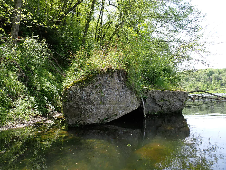
Jaws of the Sinsinawa
Last picture
Cliff remnants in the river
Nice reflection
One of five fences on the trip…I ducked under this one
Approaching a small bluff
This one wasn’t as scenic, but it did have some okay boulders
Reverse view
More cattle and another fences (not clearly pictured)
Last cliff of the trip
Fast current
This barbed wire fence was easy to get under
W. Valley Road
Fast current flowing under some brush
Fern reflection
Last half mile had deeper water, but there were still shallow spots
Last fence (this was easy to get under)
Last boulder of the trip
Ending the trip at N. High Ridge Road
This is an awful access because of the fences (note the depth gauge station)
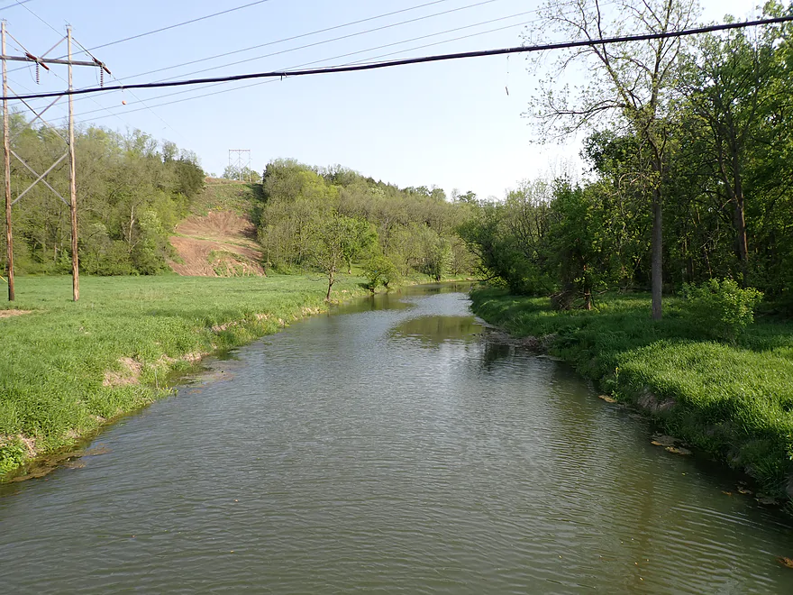
Scouting W. Chetlain Lane…likely a doable bridge access…river here is deeper, wider and slower
Sinsinawa River

The Sinsinawa is an obscure river located in far southwest Wisconsin near the tri-state area. It’s obscure for a reason though, as you will find out. I put it on my todo list after I read Bob Tyler’s review in his book “Canoeing Adventures in Northern Illinois“. His write-up didn’t go into too much detail, but did warn of shallows and fences. Unfortunately Bob did not provide depth gauge readings or estimates. So it was total guesswork to know what was “too low” and what was “too high”. During this weekend many of the rivers in nearby Iowa were very high, so I reasoned (incorrectly) this might be a good time to roll the dice and check out the Sinsinawa.
I started the trip in Wisconsin by the Sinsinawa Road bridge. When I arrived I was disheartened to see that all four corners of the bridge were fenced, but there was a slight gap in the northeast corner which allowed me to squeak around. Local fishermen arrived at the same time I did and actually brought with them a ladder to get over the fence. I’m not sure if they were the owners or not. Regardless, it’s never ideal to have to face a fence at a bridge access. If you ever find yourself in this situation, try to use a different bridge. And if you must launch, be considerate of private property and don’t stretch the fence.
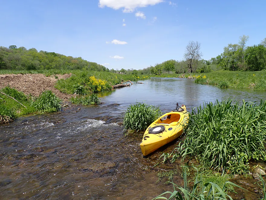
Right away I discovered levels were too low. This is a pool and riffle stream…the pools are plenty deep, but riffles (and there are many) were almost all too shallow. Often I had to scooch down and a handful of times I even had to get out of my boat. I’m pretty lenient when it comes to shallow water paddling, but this was too low even by my standards.
After I passed an outcrop (the first of many), I came upon an open pasture where there was a large herd of cattle. This included one cow in the middle of the river that didn’t seem interested in moving. After a bit of waiting the entire herd (including this cow) decided to cross in front of me and I was able to pass. Typically I don’t mind seeing cattle on paddle trips as long as there aren’t bulls. But they are big animals and you do need to be careful around them. I kept an eye out for bulls but didn’t see one (that doesn’t mean they weren’t in the area).
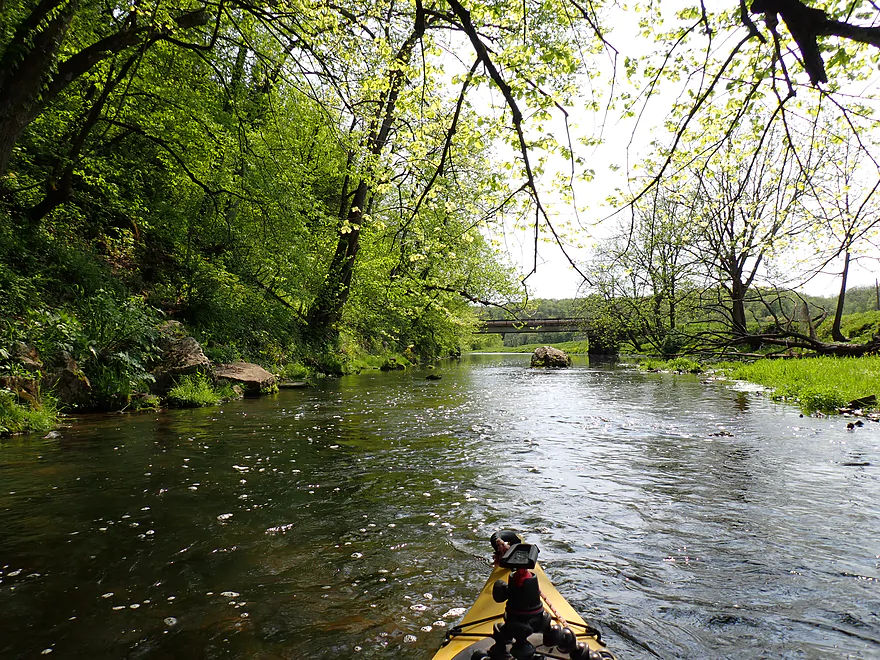
After some surprise Class 2 rapids, the river is bounced south by a nice bluff with a terrific series of limestone cliffs. At the base were attractive rapids that undercut the cliffs. I portaged part of this stretch as it was shallow and the strong current might have squished me into the rocks. Many of the cliffs had exotic ferns and mosses which were great to see.
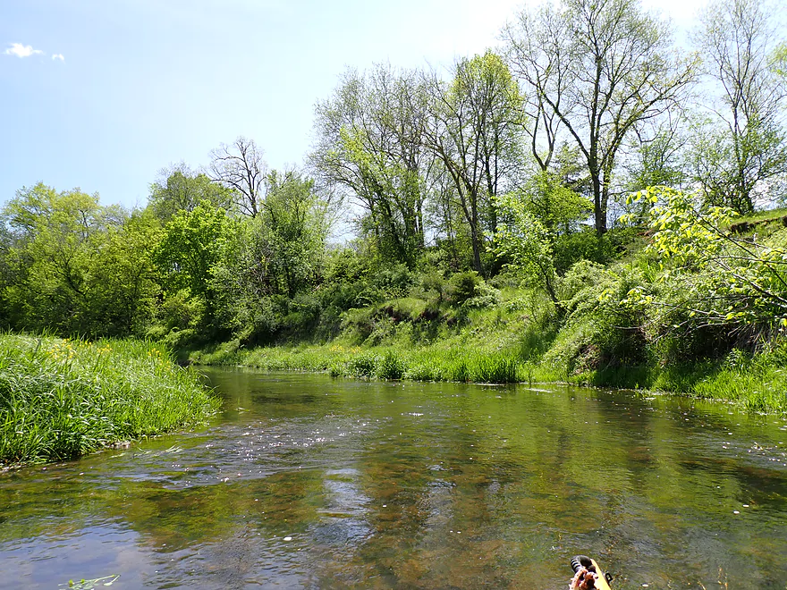
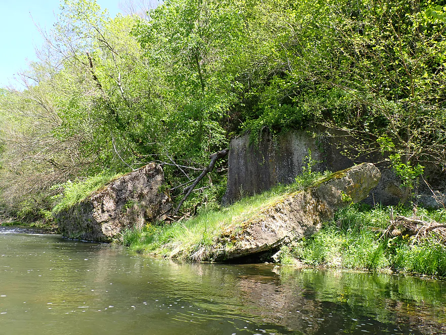
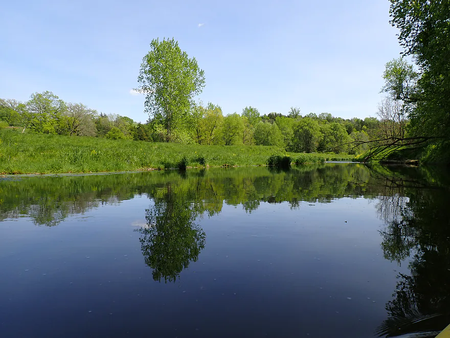
I then crossed the border from Wisconsin into Illinois. I was welcomed by huge algae blooms, which were surprising to see. This was followed by a short, wooded, and bumpy stretch, and then a 400′-long limestone cliff on my left. While not as big as the previous outcrop, it was still very photogenic. When the water calmed down, the cliff face was reflected in the water making it seem taller than it was.
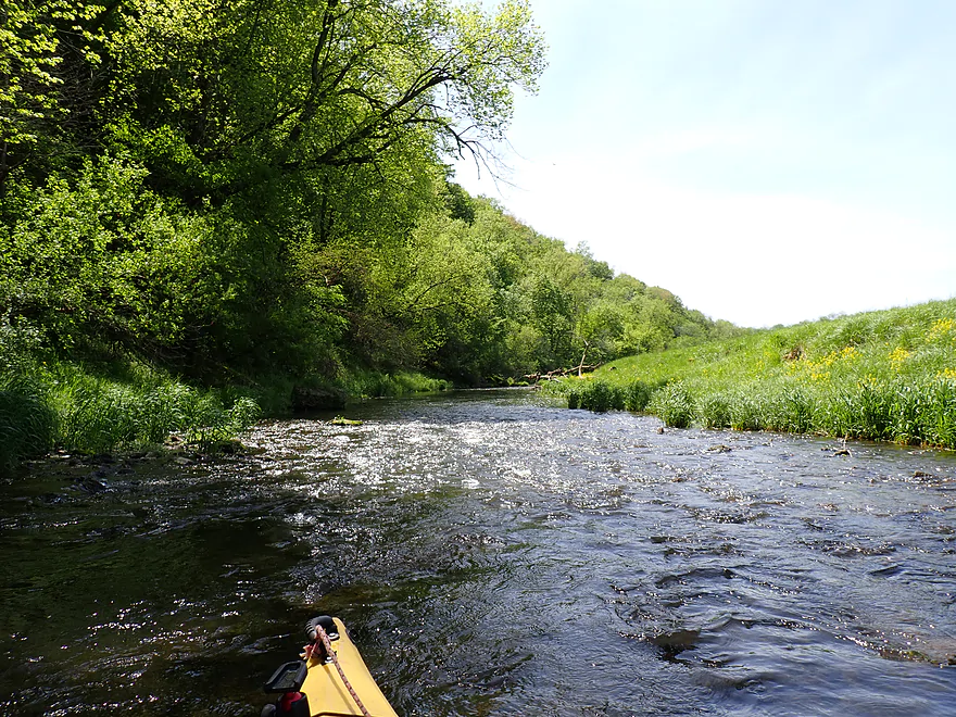
The next mile flowed through open valley bottomland, which was a different experience. The fresh May grasses and even the yellow mustard plants provided some great pastoral scenery. This area would have been very active during the lead mining boom back in the day. You can’t really see the tunnel entrances from the channel, but I suspect, given the proximity of the river and hills, there were some historic mine shafts hiding nearby.
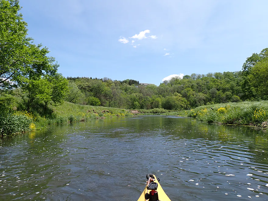
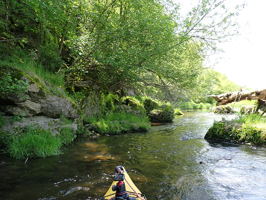
Finally the river left the open valley and collided with another bluff which bounced the channel back west. At the base of this particular bluff were a series of cliffs and boulders. Most of the cliffs here weren’t as impressive since they were receded, high up on the hills, and partially covered by vegetation (“Iowa outcrops”). Some of the boulders though were fantastic and very large.
The next bluff bounced the river south. At its base was a fantastic cliff/rapids combo. This was my favorite part of the trip, but I didn’t risk running these rapids (it would have been a tight fit).
Following this cliff I faced another herd of cattle, which was more stressful. It’s not so bad facing cattle on say the Lower Pecatonica, because the deep water means you can maneuver and the cows can’t. Here it was the reverse. I’m bumping through some shallow rapids and felt vulnerable. Granted most cows and steers are friendly and just curious. But you don’t want to get too close to one. I caught the attention of one of the bigger “cows” (it might have been a bull), but thankfully just then the rancher came by in his motorized mule and the bovine lost interest.
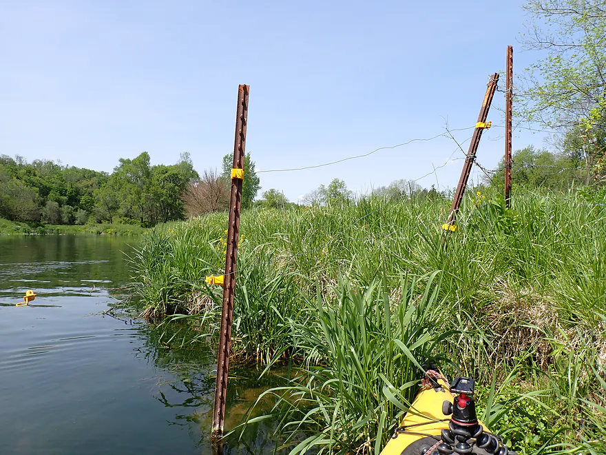
After a shallow, rocky stretch (which I didn’t appreciate because I was nervous about the cattle herd doubling back to join me), I passed under yet another fence. Four of the five fences on this trip looked electric, but I don’t think they were based on their wiring, lack of noise, and a few tests I did (carefully).
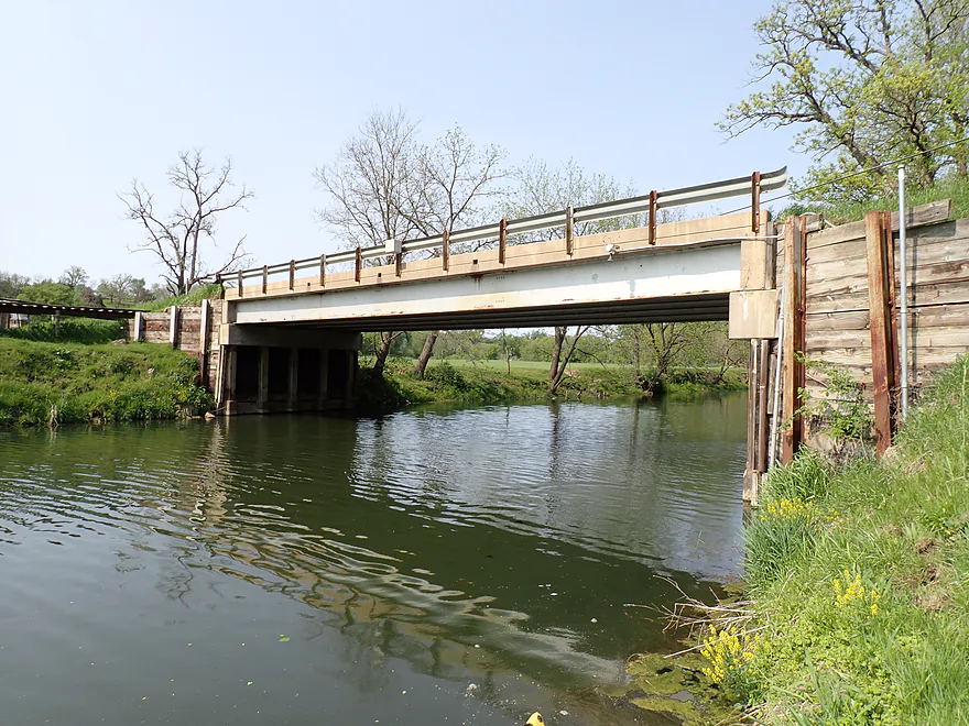
I passed under W. Valley Road bridge. While there were fences on the upstream side, it looked somewhat open on the downstream side. Maybe in hindsight I should have taken out here?
The next half mile, the channel was a bit deeper, but still shallow and it lacked any outcrops. I ended the trip at N. High Ridge Road which was another awful bridge access. I took out literally at the USGS depth gauge, which seemed kind of public, but I did have to cross an unpleasant fence to get to the shoulder.
In summary this is a trip I just can’t recommend. The scenery itself is five stars…but there are so many other problems.
- Awful access points
- Shallow water (maybe it’s ok after a big rain)
- Five fences (most were somewhat manageable but a few required low limbos)
- One logjam (although this was easy to portage)
- Many cattle
- Class 2 rapids (narrow chutes that have to be likely portaged no matter the depth)
Maybe if you’re an adventurous local, you might give this a try in high water. If you know the local grazing patterns and know when the cattle won’t be out to pasture that would be a big plus.
In hindsight the section AFTER my stretch might be better. The water should be deeper, there will be fewer pastures/fences, and there will still be some nice cliffs. Paddling author Bob Tyler also canoed this leg, but he really didn’t differentiate the upper and lower stretches.
In Wisconsin public access to rivers, creeks and lakes is enshrined in the state constitution. But Illinois is VERY different. Roughly speaking, Illinois water access laws are restrictive and go back to steamboat days. The state would define what a navigable stretch of river was and this correlated closely with how far upstream the steamboat could make it. eg For the Fever/Galena River, the navigability line ends at the city of Galena because the steamboats didn’t go further north. This despite the upstream legs being very viable for small boats like kayaks. You can see a public waterways map here. If you exclude the border rivers (like the Mississippi) and Illinois’ big rivers (like the Rock, Illinois, Des Plaines, Kaskaskia), the vast majority of counties have NO “navigable” rivers (let alone creeks). Various lawmakers have tried to update the laws to be inline with how neighboring states deal with water access, but the Illinois legislature and committees are completely dysfunctional and nothing substantial has happened. Illinois paddlers often kayak “non-navigable” rivers/streams anyways, but the situation isn’t ideal. A local property owner could give you a lot of grief and the law would likely be on their side. If you ever paddle these “grey area” rivers, always be considerate and polite.
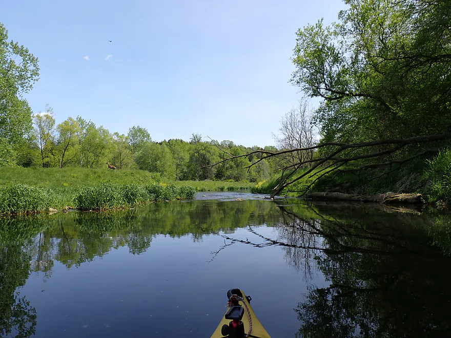
Sights included a pregnant deer taking a drink from the river, cattle (mostly angus cows and angus steers), swallows, a few dragonflies, a great blue heron, many small minnows, and what appeared to be some decent sized bass. Both the Wisconsin and Illinois DNRs have noted water quality issues with the river.
Sinsinawa Mound: Just west of the River is Sinsinawa Mound. These geological prominences are unique to this Illinois-Wisconsin border area–they can be seen for miles and were used as early landmarks by both Natives and settlers. The views from the top of these mounds are very good. The mound took its name from the creek, and this name was first applied to the mound former by Gen. George Wallace Jones when in 1827 he leased a thousand acres containing the mound. The creek first appears upon a map of the lead mines drawn in 1829, it is there spelled “Sinsineua.”
Sinsinawa Road: This is a bad bridge access. The bridge itself is on a bit of an embankment and all four corners are blocked by fences. There is a slight gap in the northeast corner fence which I was able to go through, but I then had to descend down a steep bank. There are shallower banks for launching, but then you stray away from the DOT right-of-way. The situation isn’t good at all.
Alternate Put-ins:
- Hwy 11 (3.4 miles upstream from Sinsinawa Road): This isn’t a great bridge access but might be better than Sinsinawa Road. There is a long guardrail and the west end is close to a large farm…but I think you could launch here (Google Streetview). This bonus leg might have some cliffs, but would be shallow and might have fences/cattle.
- W. Valley Road (3.2 miles downstream from Sinsinawa Road): Not a great bridge access…but likely better than its neighboring bridges. There appears to be a small open section on the southwest bank and I even saw a car parked here in satellite view. So maybe you can launch here…it would be a bit steep and weedy though.
N. High Ridge Road: This is another bad bridge access. It’s on a slight hill and the upstream/east corner is just too steep to use. There is a nice fence stile on the downstream/west side, but that looked like it was for a private snowmobile trail. I went with the downstream/east corner which housed the USGS depth gauge station, which I reasoned made it the most public area by the bridge. The bigger issue though is a fence blocks access to the road (and there isn’t much room to park on the shoulder). In hindsight I would not have taken out here…but instead would have tried to get out at W. Valley Road.
Alternate Take-outs:
- W. Valley Road (0.5 miles upstream from Sinsinawa Road): Not a great bridge access…but maybe better than its neighboring bridges. There appears to be a small open section on the southwest bank and I even saw a car parked here in satellite view. So maybe you can get out here…it would be a bit steep and weedy though.
- W. Chetlain Lane (5.3 miles downstream from Sinsinawa Road). This seems like an ok bridge access. There is a house on the northwest shore, but the east bank looks good for getting out with no fences. This bridge is also within the Illinois navigable designation. This bonus leg should be good with deeper water and some nice outcrops. This stretch should also be more wooded with less pastures and fences…but there might still be a few hazards.
Bike Shuttle – N. High Ridge Road to Sinsinawa Road: 4.0 miles with 266′ of ascent. This is a very hilly shuttle but isn’t too long at just 4.0 miles. I found this manageable, but some hills needed to be walked. I actually found the wind to be more of an issue than the hills though.
Fences: There were five fences. I’ve marked these on the trip map. Note, most (maybe all) weren’t electric but this could change. Generally, electric fences have insulators (colored plastic clips) on the posts, but the wire may or may not be live. Barbed wire is not electric. Paddlers should always be very careful around fences regardless.
- Fence #1: Located early in the trip by a big cliff…this was a single strander. It looked electric, but I don’t think it was. I had to get very low to get under.
- Fence #2: Another single strander that I don’t think was electric (trying to remember…I think I tested this one). This too required a low limbo to get under.
- Fence #3: This was a long, single wire that wasn’t electric. It droops, so you have to aim for a high point to duck under. This wasn’t too bad, but the limbo point is over a very shallow stretch of the river.
- Fence #4: Located almost under W. Valley Road, this was a non-electric barbed wire fence. I found this super easy to lift over my head.
- Fence #5: This was a single strand fence (don’t think it was electric). I found it easy to duck under on the left.
Logjams: There was only one logjam located about a mile into the trip. This was a super easy portage.
Rapids/Current: The river falls at a fast rate and there are many riffles and light rapids. I dreaded most riffles because that’s where the shallow parts were. There were several sections by the cliffs which I considered to have Class 2 rapids. There didn’t seem to be a safe or easy way through the rocks so I portaged the trickier sections.
Cattle: There were a lot of cattle in this area. Most were angus cows and angus steers. I did not see a bull, but that doesn’t mean there weren’t any. Generally speaking with cattle, cows are pretty gentle and curious. If they see you, they might run up to your boat because they associate humans with snacks. Steers are usually ok to be around but are not as docile as cows. Bulls are crazy dangerous and are to be avoided at all costs.
All that said, I’m not sure I was in any danger, but… shallow and narrow rivers like this leave a paddler very exposed. You are not mobile and the cattle are. If you ever encounter cattle on a paddling trip treat them very carefully. Most will just be curious, but you never know.
Closest Gauge: Sinsinawa River @ N High Ridge Road
My Trip Depth: 22 CFS or 4.63′ (too low)
Gauge Guide: Note much of this is guesswork. Always use your own judgement.
- < 10 CFS: I doubt the river gets this low.
- 11-20 CFS: An average winter depth. Too low for paddling.
- 21-28 CFS: An average depth for late spring and early fall. My trip at 22 CFS was just too bumpy…the pools were fine and plenty deep, but the riffles were very rocky and I was constantly getting hung up.
- 29-36 CFS: Creek might spike to these levels after say a quarter inch of rain. Many of the riffles will still be somewhat bumpy, but this should be on the low end of viability for those with flat bottom boats.
- 37-50 CFS: Likely a good target range. Be mindful some of the fences and rapids may be a bit tricky at this range. Portage what you’re not comfortable running. These levels will only occur briefly after a decent rain and will fall back down quickly.
- 51-70 CFS: At this point I think most riffles will be well padded. Again the fences and rapids could be difficult at high levels.
- 71-100 CFS: Perhaps only suitable for expert whitewater paddlers.
- 101+ CFS: Maybe too high for any type of paddling. Don’t quote me on any of this!
Click here to see an overview map.
- Upstream from Center Road: The river is joined by a significant unnamed tributary near the bridge. Upstream from this the river is likely too narrow to be kayaked (even during a flood).
- Center Road to Louisburg Road: 1.1 miles. Very small and would likely need crazy high level to be runnable. Even then, this flows mostly through pasture and past a huge farm. Likely not ever worth a kayak trip.
- Louisburg Road to Hwy 11: 1.4 miles. Very shallow and may need high water to run. Perhaps 1-2 logjams and a few fences.
- Hwy 11 to Sinsinawa Road: 3.4 miles. Likely a good prospect, but shallow with maybe one logjam. Many riffles and likely several outcrops. Fences could be an issue.
- Sinsinawa Road to N. High Ridge Road: 3.7 miles.
- Sinsinawa Road to W. Valley Road: 3.2 miles. A scenic stretch with incredible cliffs. But there are many issues including: 4 fences, 1 logjam, shallow water, a bad put-in, a few tricky Class 2 rapids, and quite a few cattle.
- W. Valley Road to N. High Ridge Road: 0.5 miles. A nondescript section. Nothing special with a few boulders/riffles. I didn’t see any cliffs. There is a fence to duck under but that was pretty easy.
- N. High Ridge Road to W. Chetlain Lane: 5.3 miles. This is an intriguing prospect. It should have some nice cliffs and also be deeper than preceding legs. There are some pastures/fences, but shouldn’t be many. Most of the river south of Hwy 20 should be fairly wooded. The navigability designation starts roughly near Hwy 20.
- W. Chetlain Lane to Mouth on Mississippi: 2.4 miles. This is the most navigable, yet least interesting stretch of the Sinsinawa. Water should be slow, mostly deep enough, but murky/weedy. The woods will be uninteresting floodbottom trees, but there should be some nice bluffs by the Mississippi and perhaps a few small cliffs.
- Mouth/Mississippi to North Ferry Landing: 2.6 miles. Likely a generic stretch on the Mississippi. The bluffs might be attractive though and you could explore the sloughs for a side adventure.
Trip Map
Overview Map
Video
Photos Size: