
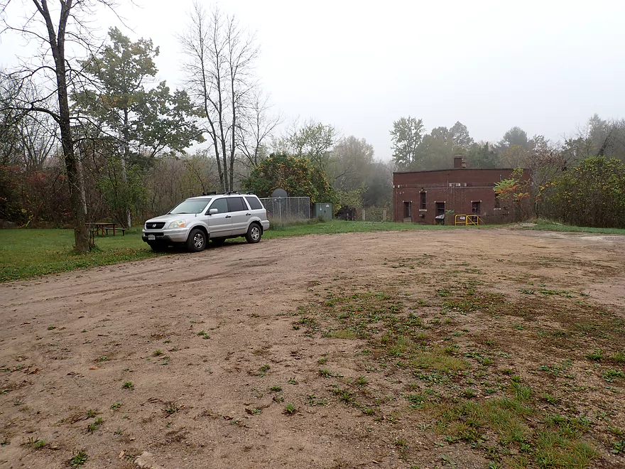
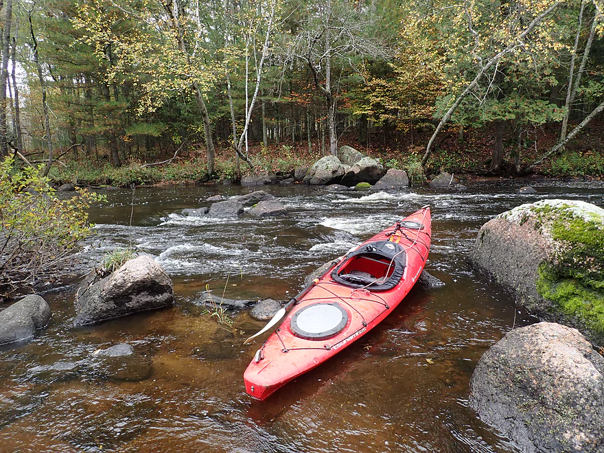
Good put-in at Big Falls
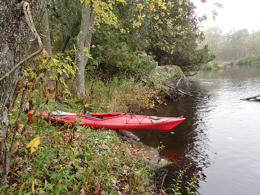
Bit of a ledge for launching but doable
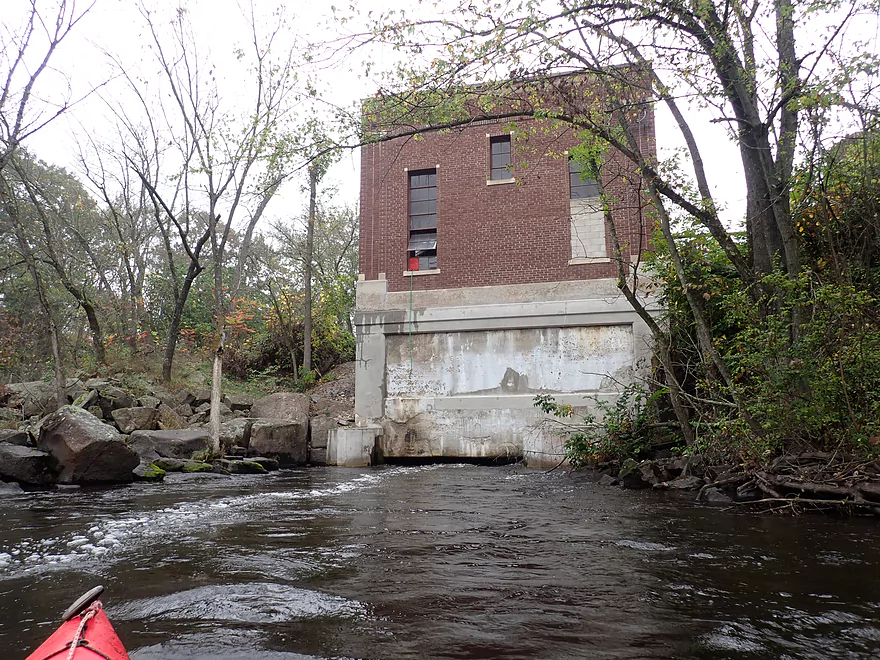
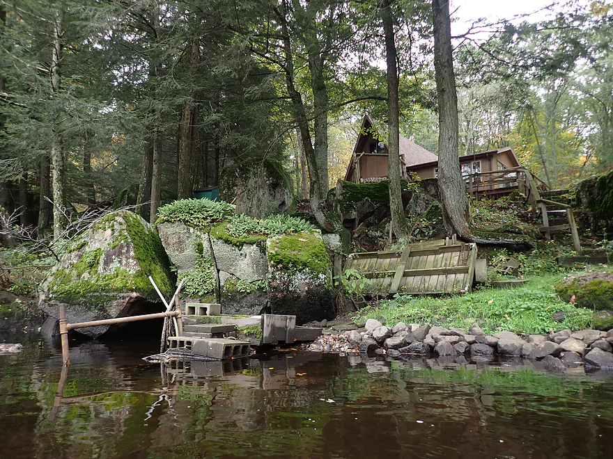
The main powerhouse
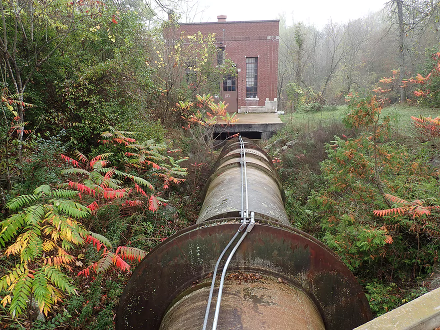
It’s fed by a long penstock
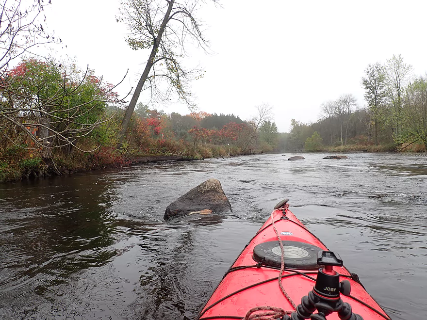
Big Falls was running shallow that day
Not very “big”
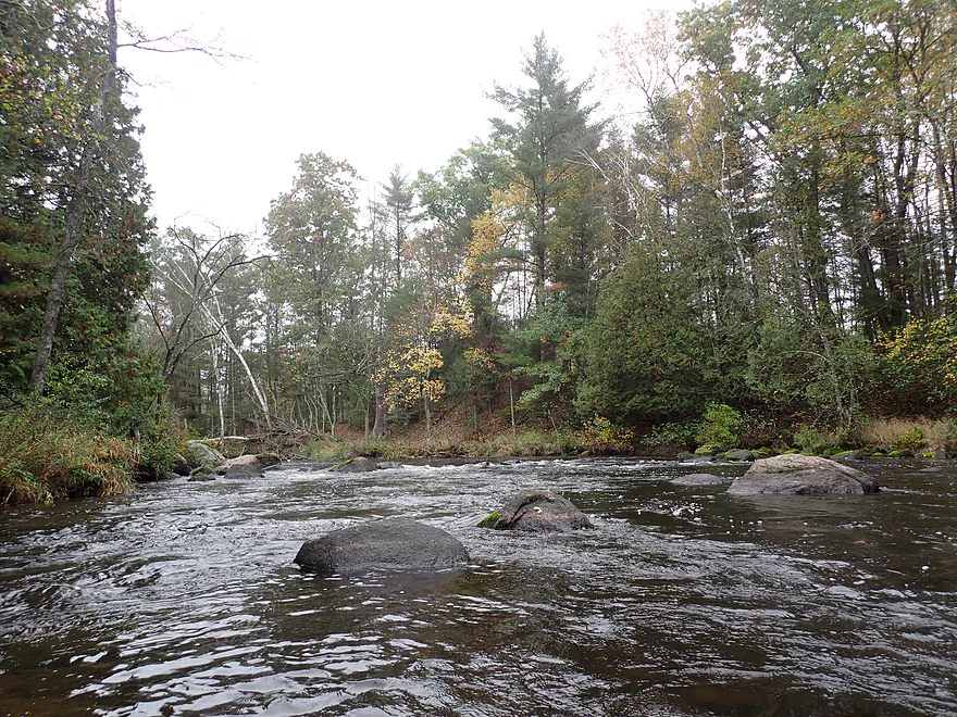
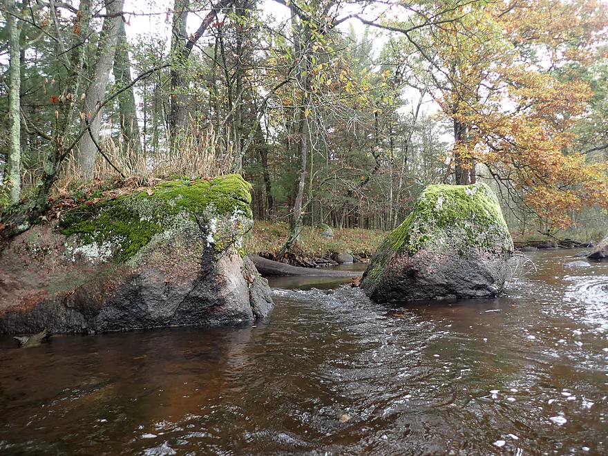
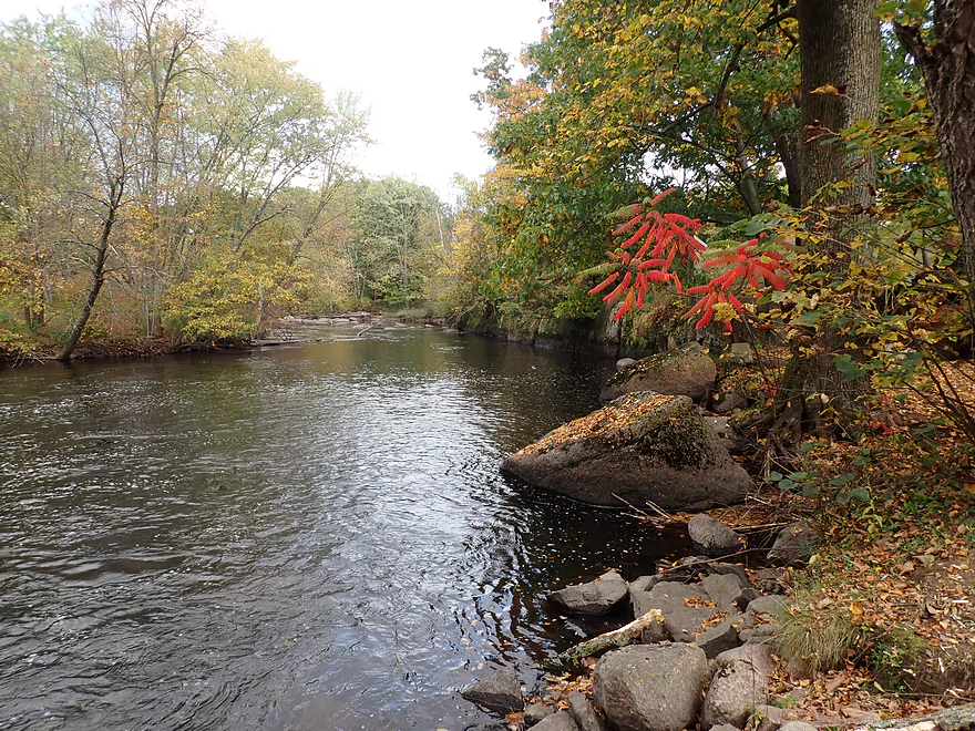
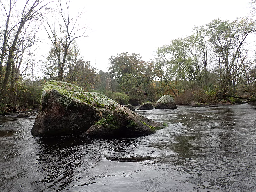
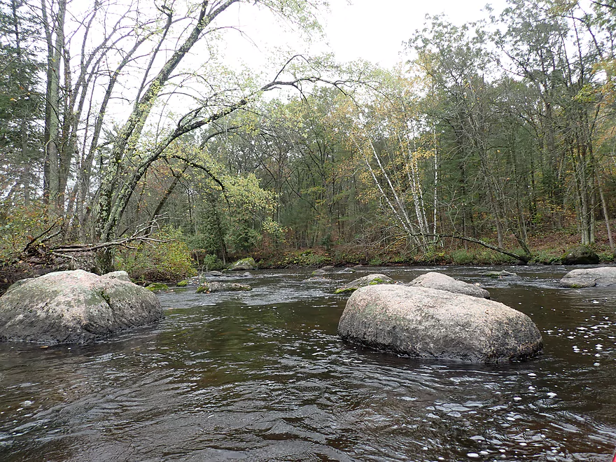
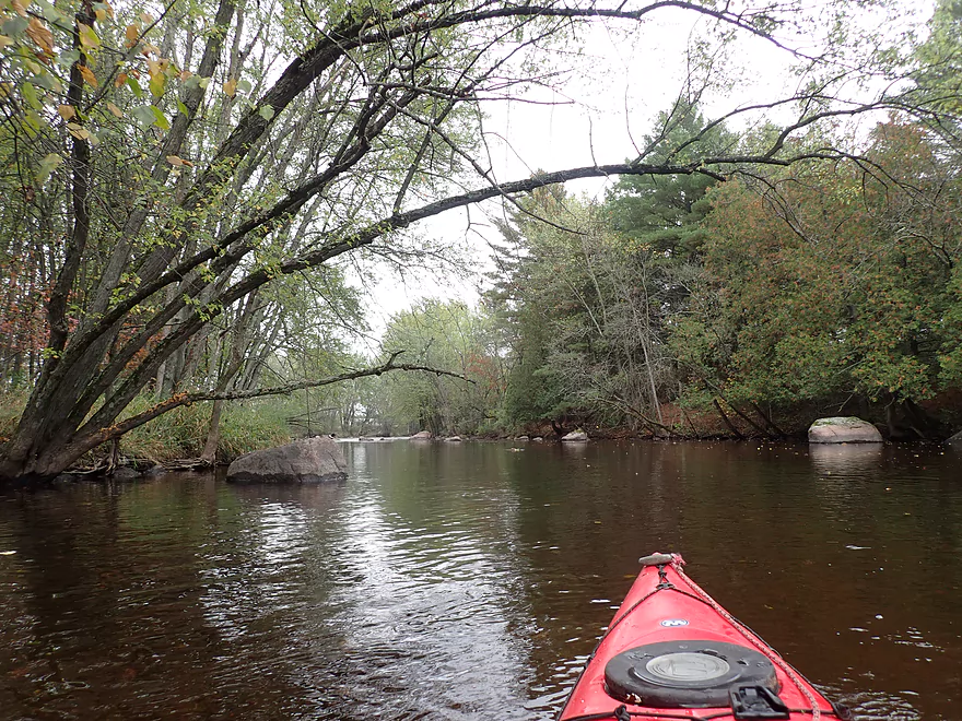
Lot of cool shoreline boulders
Granite bedrock is often visible
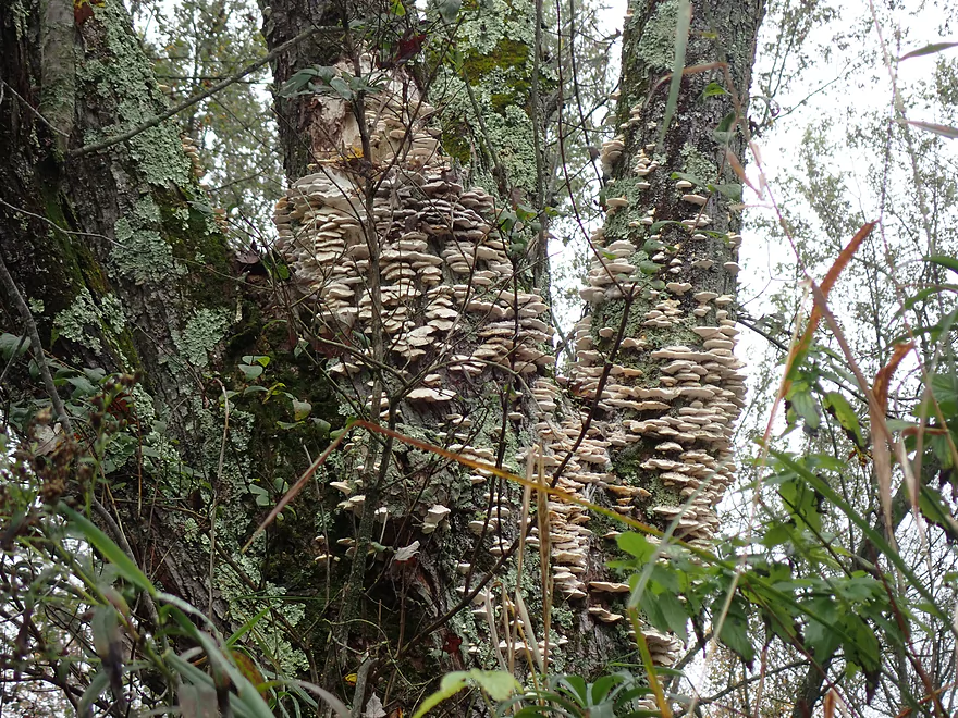
A huge colony of shelf fungi
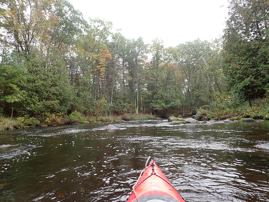
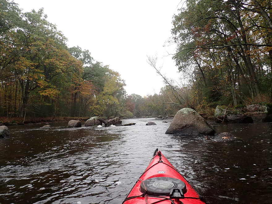
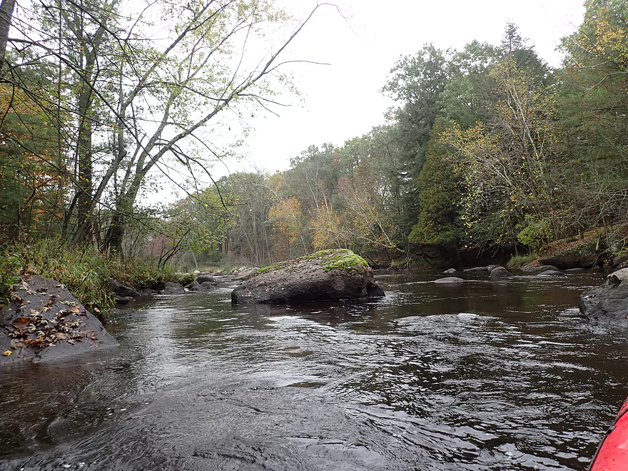
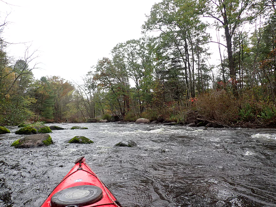
Just minor riffles to start
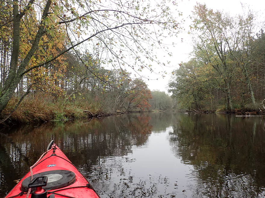
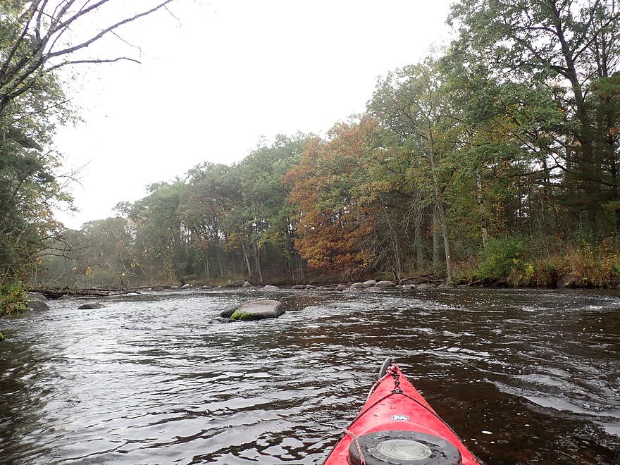
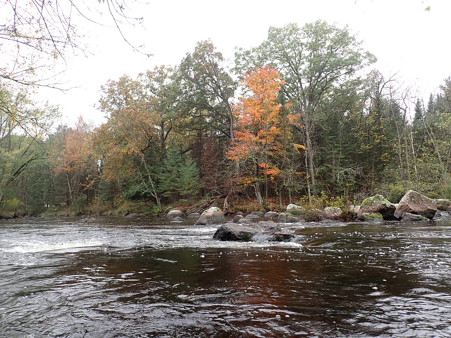
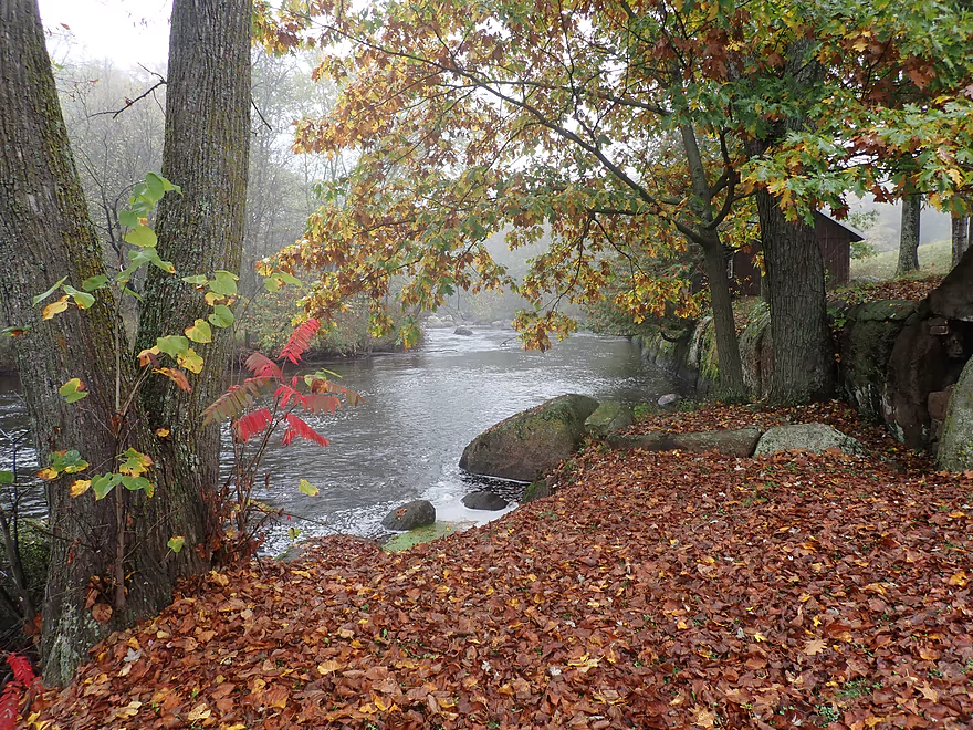
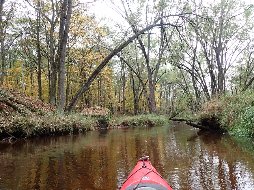
Fall color is past prime
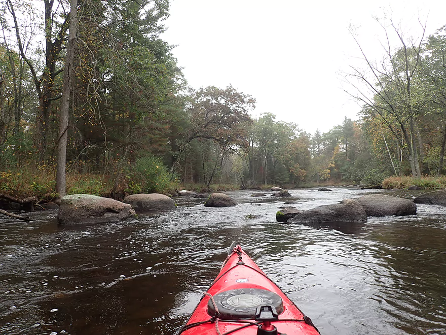
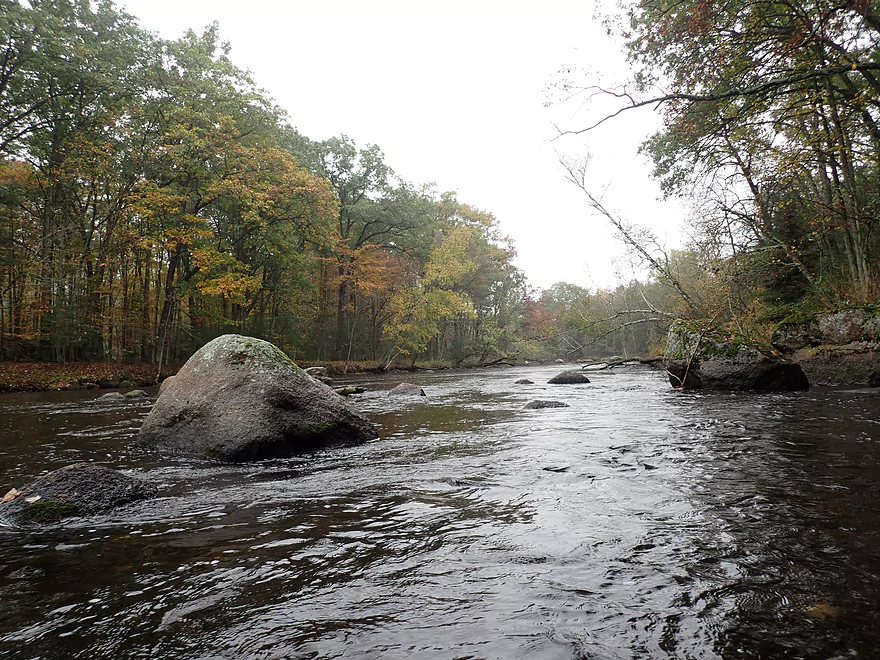
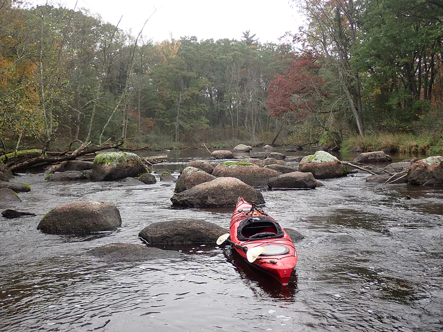
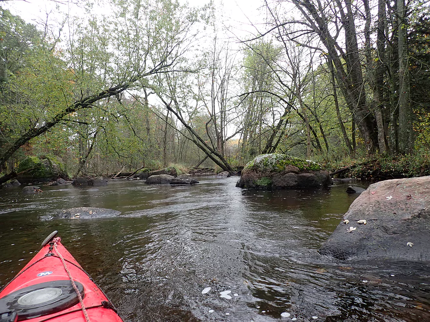
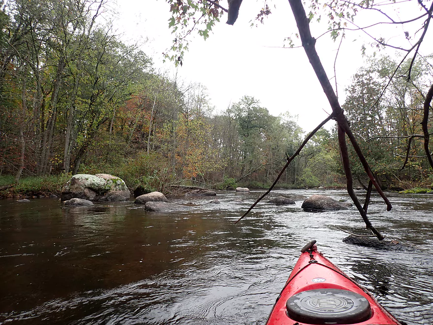
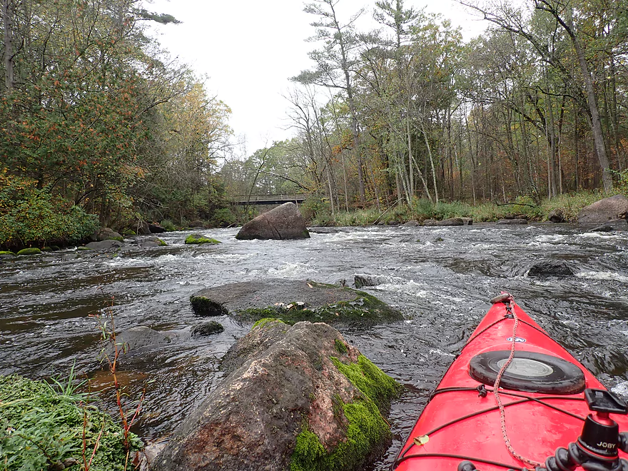
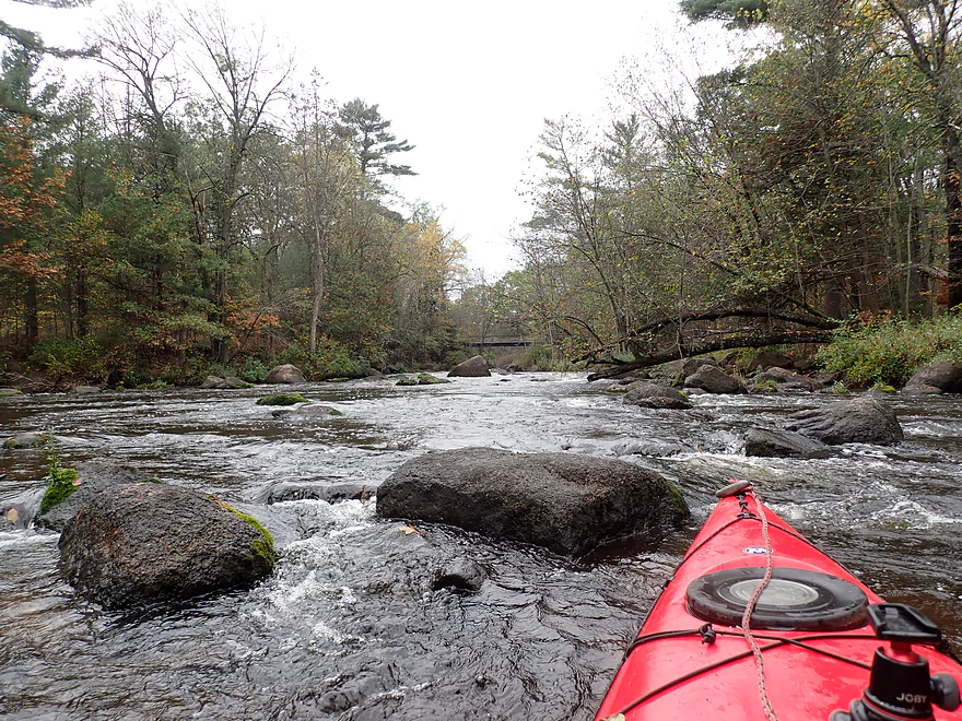
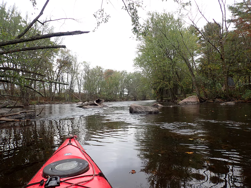
Entering a long boulder garden
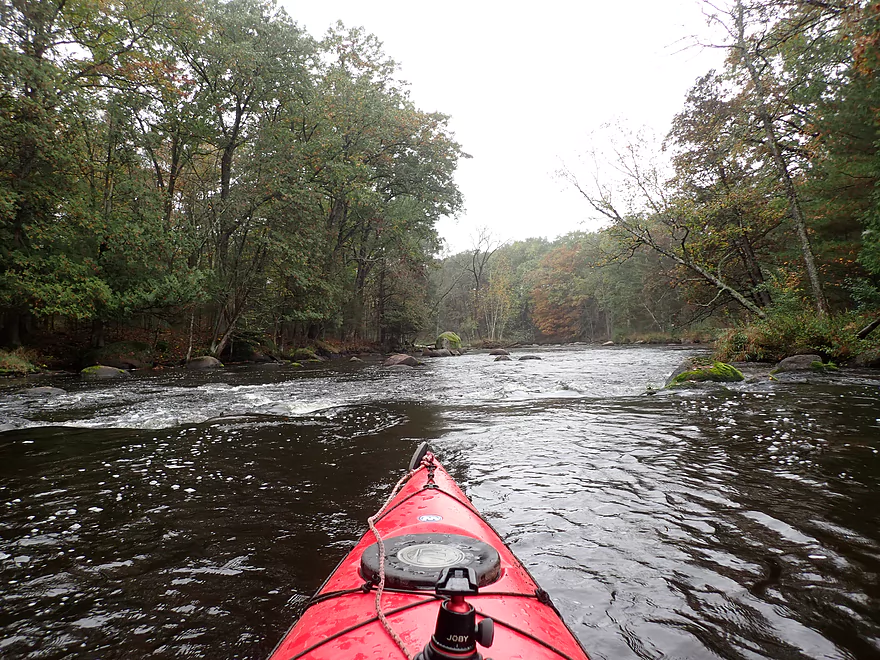
Some fun rapids
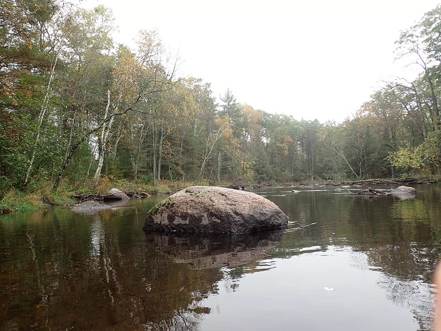
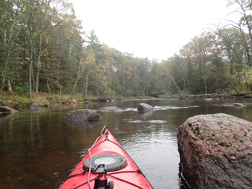
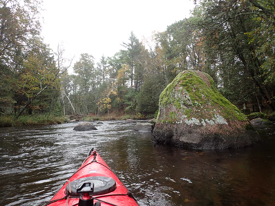
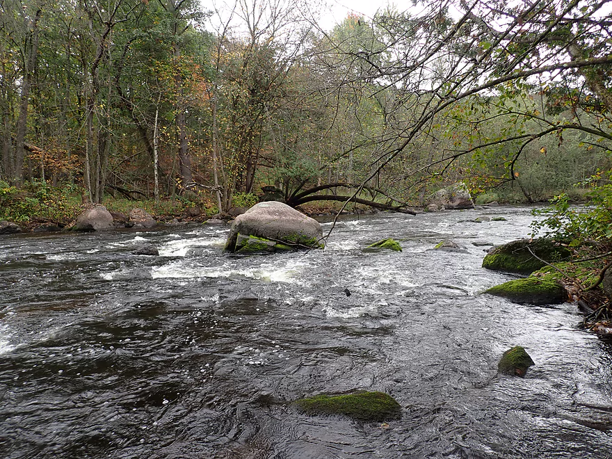
Huge boulders
Reverse view
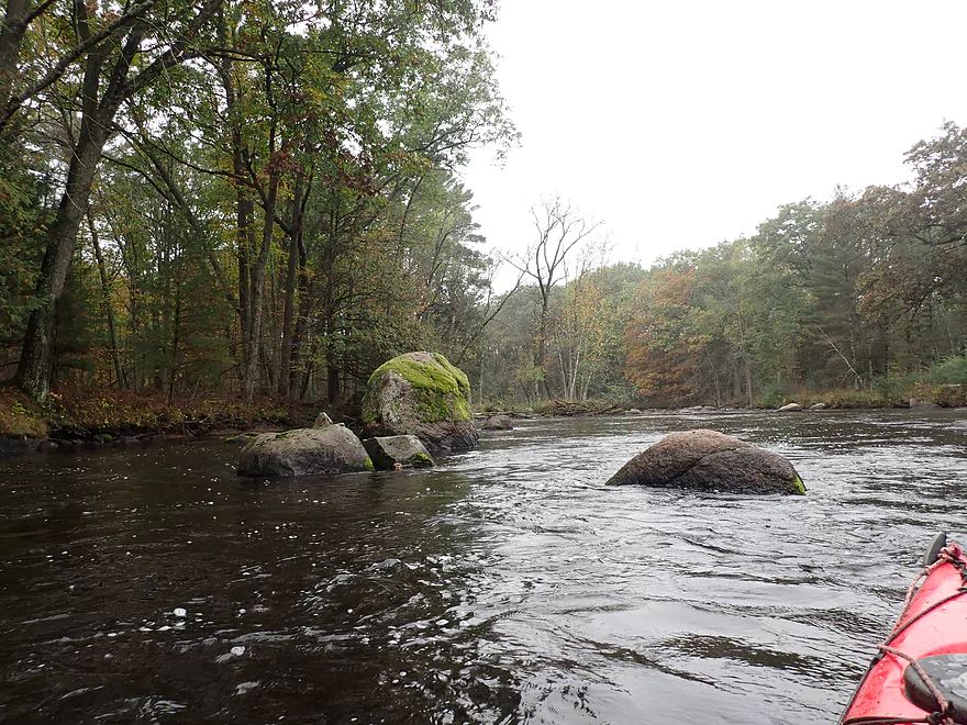
Boulder field goes on
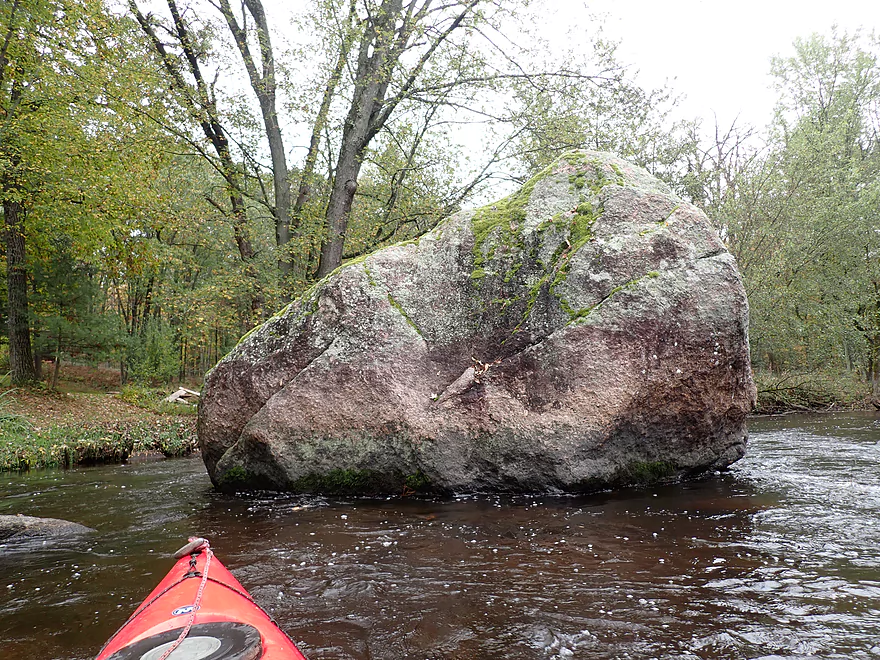
Split in half by something

A scenic pitch
Getting out for pictures
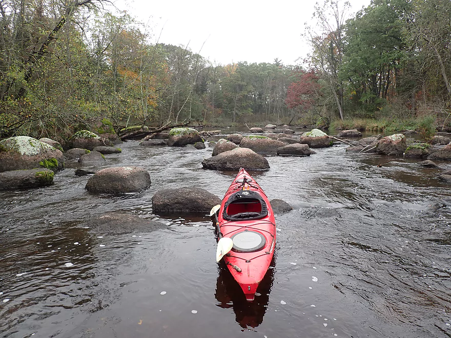
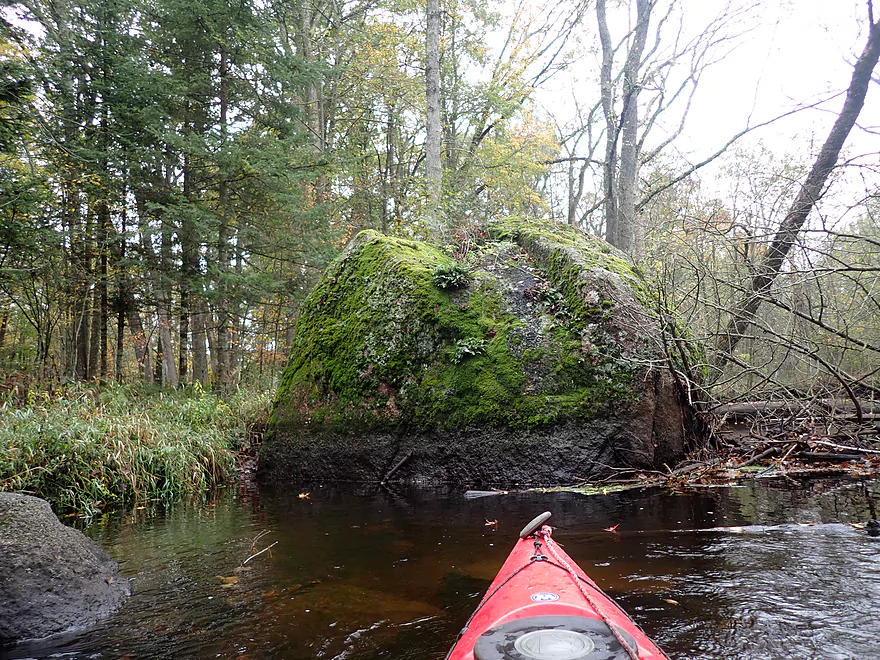
These boulders were huge
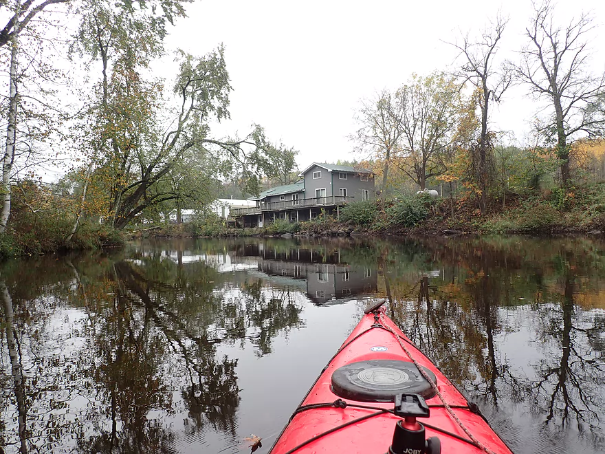
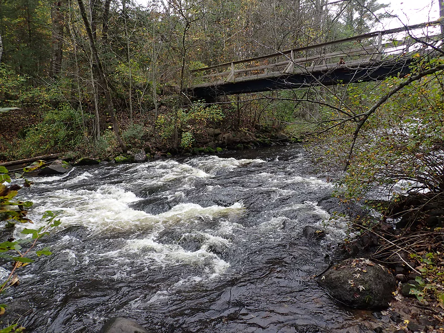
Entering the community of Little Falls
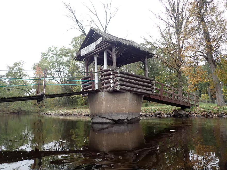
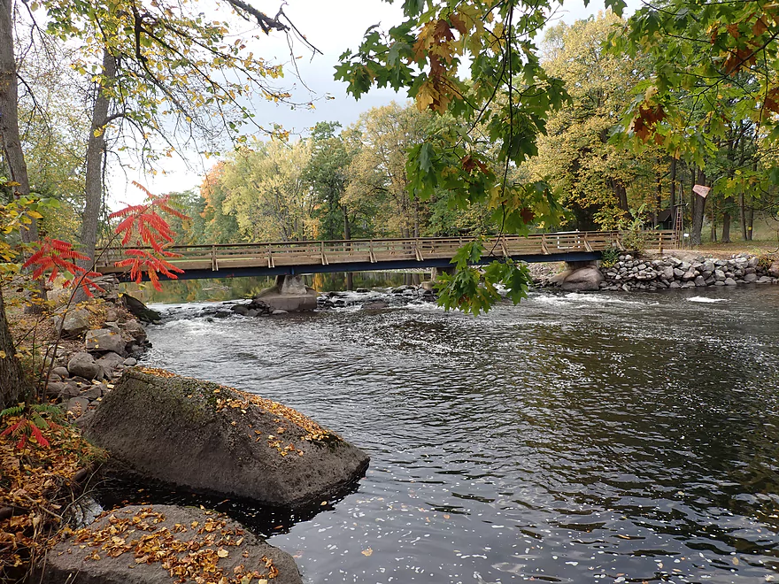
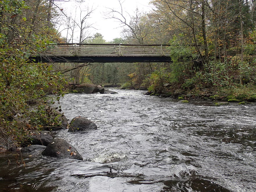
A neat suspension bridge
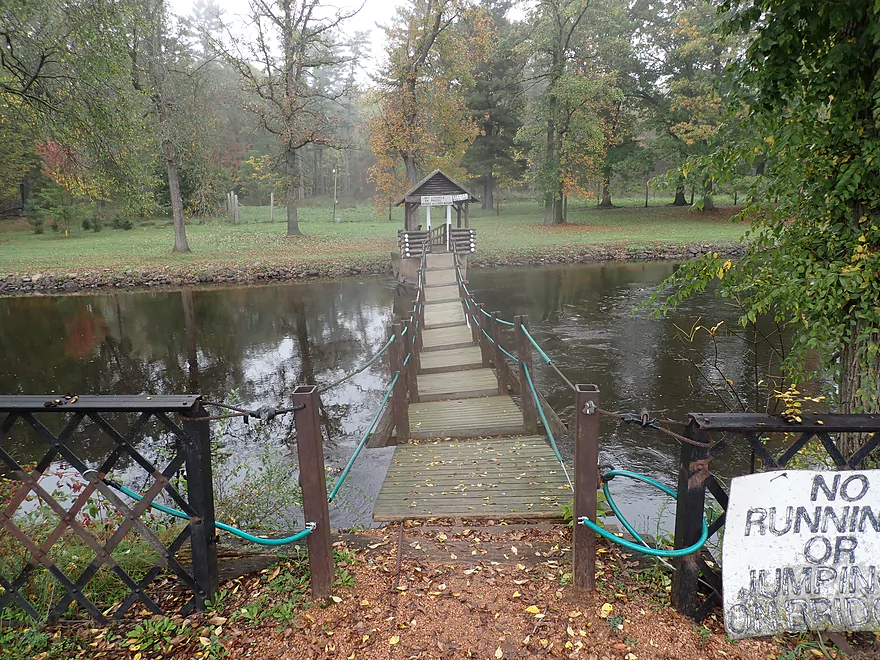
No jumping!
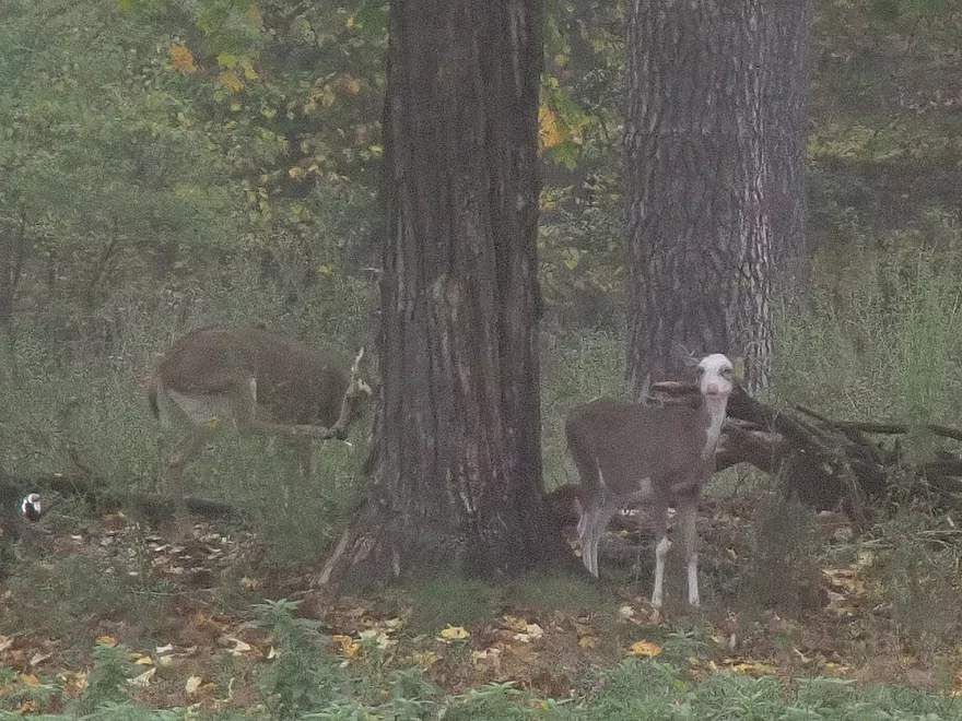
A piebald deer
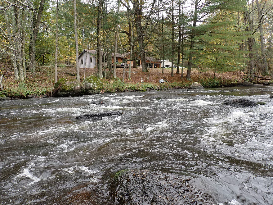
A mini-impoundment by the community
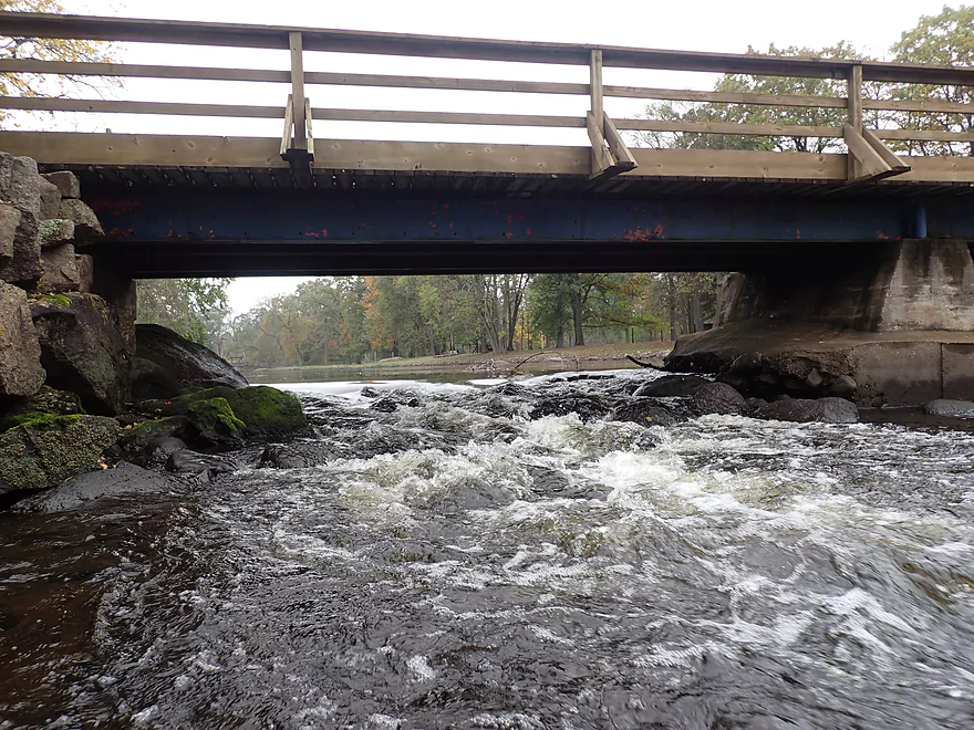
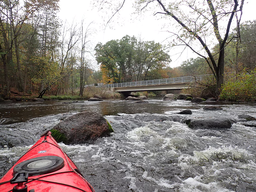
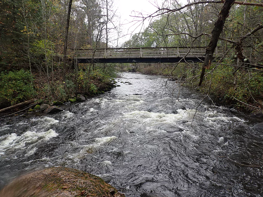
A Class 2 ledge under a second walk bridge
View from a week ago (when there was better color)
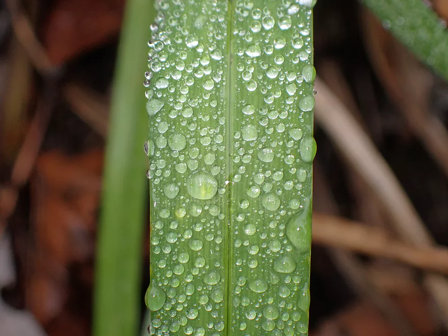
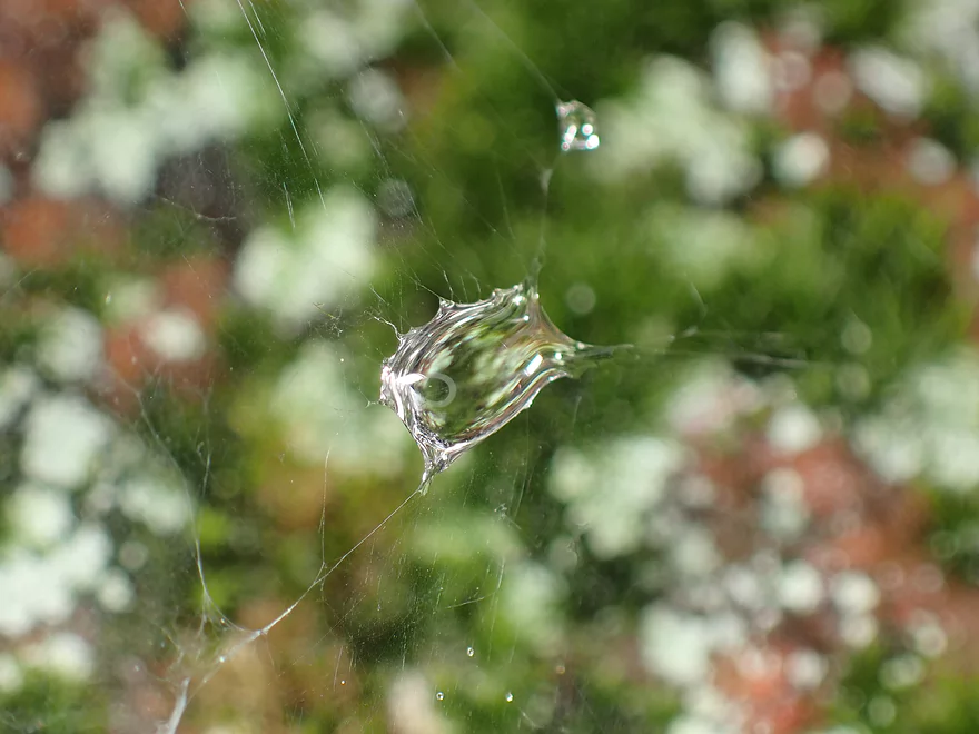
Droplets from a recent rain
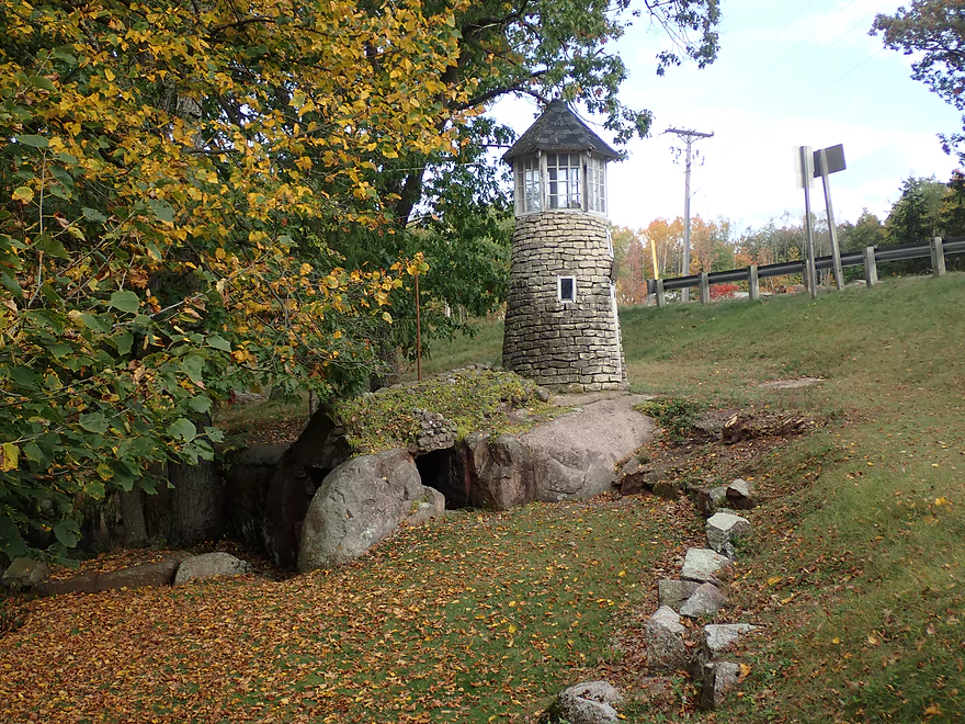
Nice litte lighthouse and “cave”
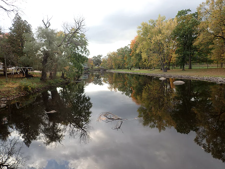
The park area is very scenic
Some granite outcrops
Entering another impressive boulder field
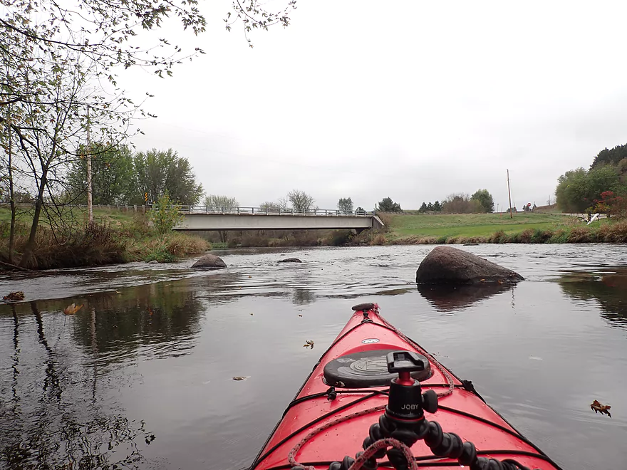
Hwy C
View from bridge
Some Class 1 rapids
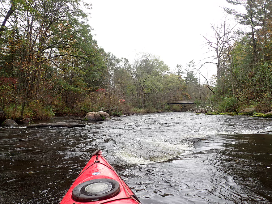
Coming up on the best part of the trip
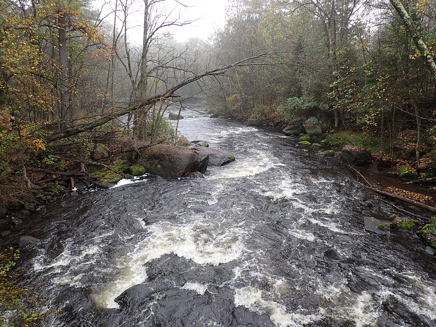
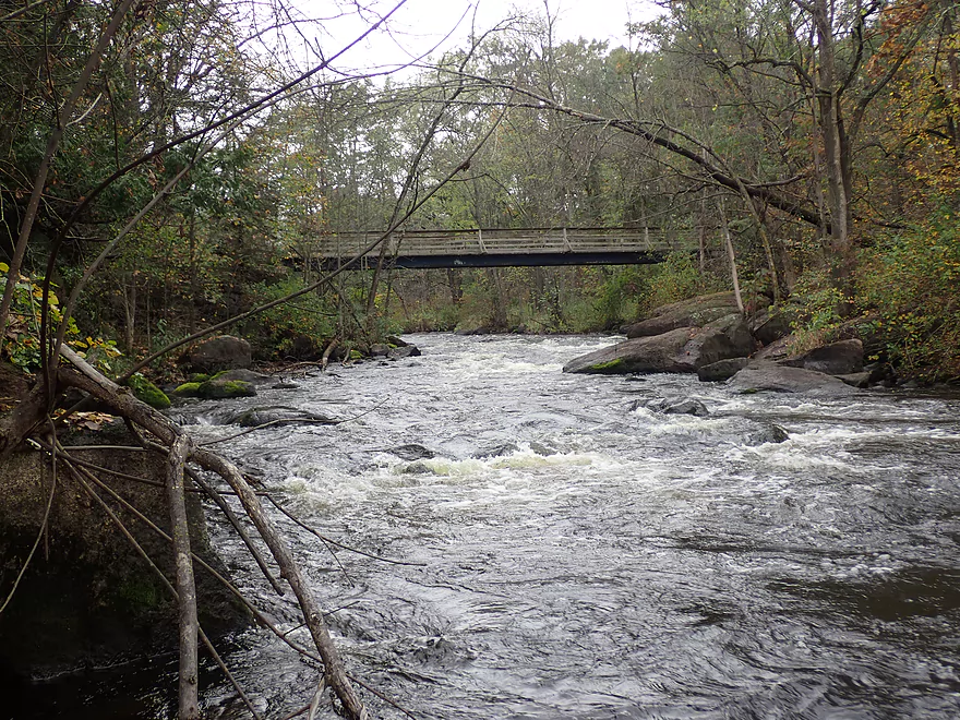
Class 2 rapids lead to a Class 3 under a trail bridge
View over the rapids
Same view but at 1.42′
Side view
Reverse view
Class 2 rapids after the Class 3
Another reverse view
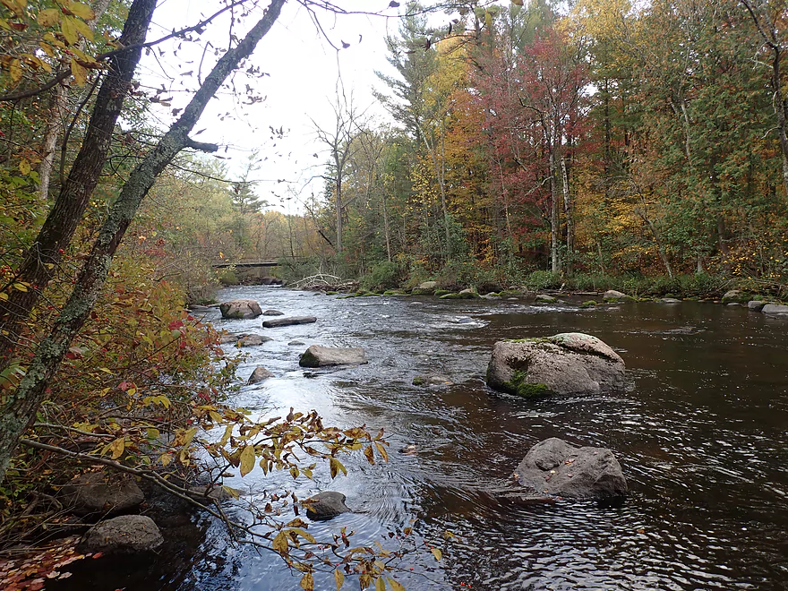
Yet another nice boulder field
Another huge granite boulder
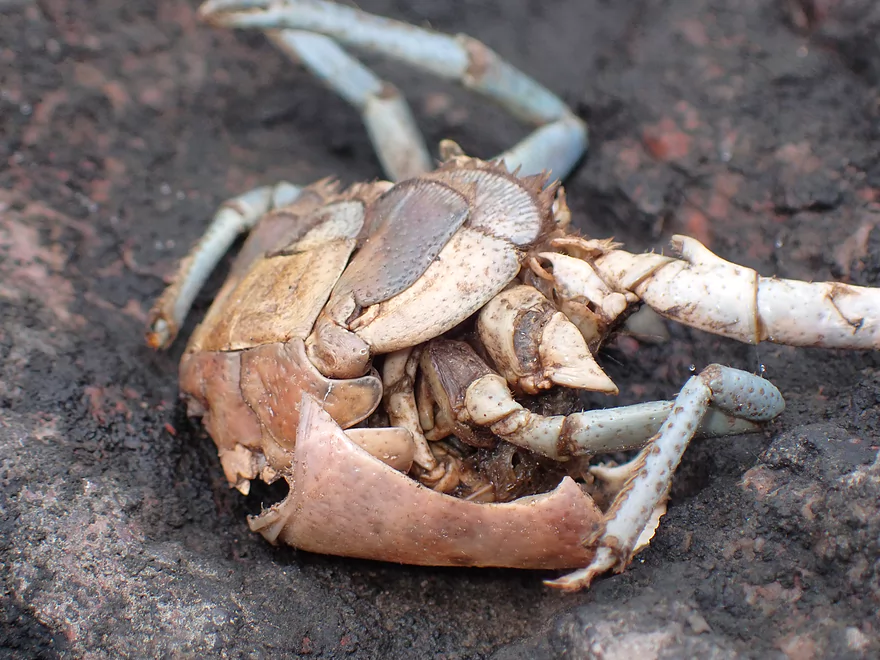
A beat-up crayfish
Paddling around a large island
Some of the best color of the trip
Cool granite outcrop
Suspended droplet
Scenic boulders
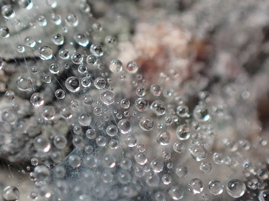
Spiderwebs always collect lots of droplets after a rain
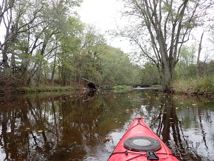
The Little Wolf settles down for the final stretch
Taking out at Kretchner Rd
Little Wolf River – Little Falls

One week ago I did a stretch on the far upper Little Wolf by Ness Rd. After the trip I scouted the river below Big Falls and was really impressed by what I saw. Not only were there fun rapids and scenic boulder gardens, but the levels were ideal and the fall color was good. On top of this Eric (see previous review) did this stretch and had a favorable review of it. Typically, I don’t like to do the same river in back-to-back weeks, but this seemed like a good time for an exception.
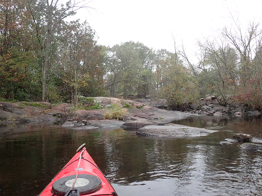
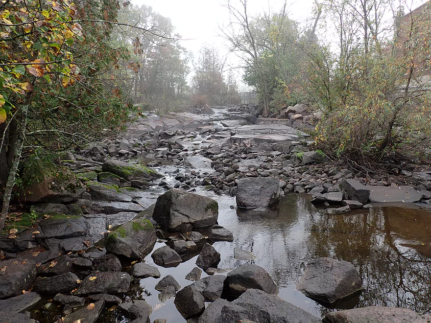
The trip started below Big Falls where there is a decent public access. Big Falls itself is a 300′-long steep drop over exposed granite bedrock. When water levels are sufficient, it can provide a fun Class 4 drop for experienced whitewater paddlers. But on most days, just a faint trickle falls over naked rocks. Much of Big Falls has been “stolen” to feed an adjacent 175′ long penstock that empties into a powerhouse. This dam (like so many) is a stupid tragedy. It doesn’t power that many homes, it submerges some cool granite dells/boulders upstream of the dam, it interferes with fish and clam migrations, and it killed Big Falls. Hopefully (but unlikely) the dam will be removed in the future as the penstock pipes are quite rusted and the powerhouse will likely need expensive maintenance to stay operational.
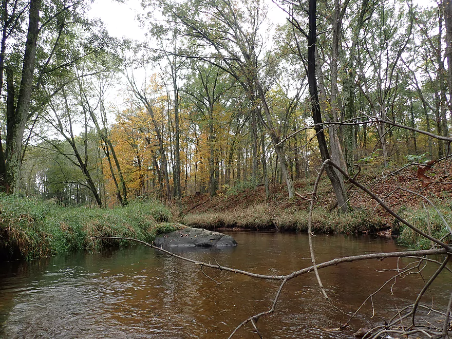
Prior to Spaulding Creek, there were a few minor riffles, boulder gardens, and granite outcrops, but nothing major yet. During the paddle, it was quite overcast and foggy which provide both unique photo opportunities and challenges. My “waterproof” camera would fog up on the inside and I had to waste a lot of time waiting for it to dry. Unfortunately the nice fall color I witnessed just a week earlier was mostly gone, due in part to a previous rain storm. But there were still some occasional nice spots.
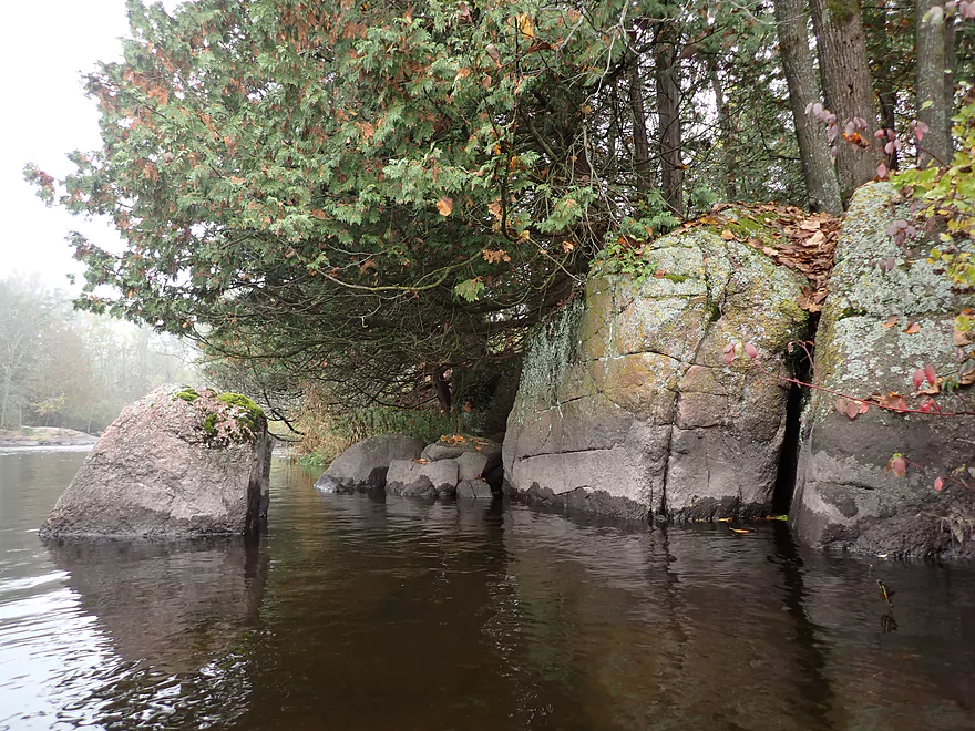
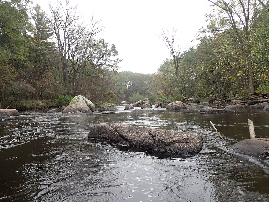
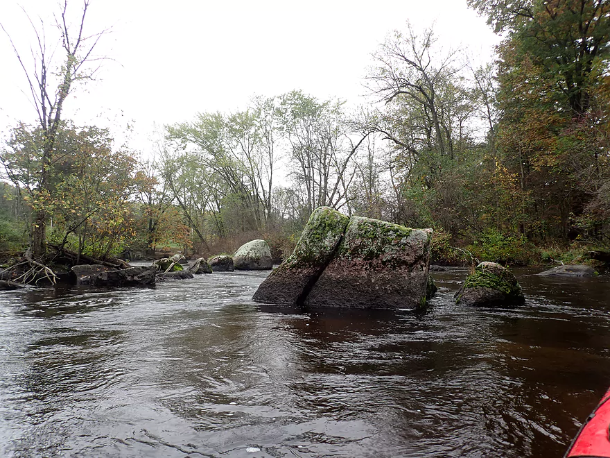
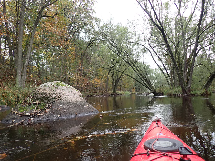
After Spaulding Creek, things started to get interesting. Here was the start of a 2000′ long stretch of mixed boulders and rapids. Some of the boulders were huge (among the biggest I’ve paddled around) and I would rank this the second best part of the trip.
Most of the rapids were manageable Class 1’s, but you do want to be careful. The water is clean, but dark-stained which can make seeing boulders hiding just an inch or two under water difficult to spot. It can be easy to hit these “mines” and get spun sideways (which you never, never, never want to do when going down rapids). Typically many of these rapids can be a bit shallow and bumpy to go down, but they had good padding during my trip thanks to a recent rain. While most of these rapids were manageable, there were some tricky spots and this trip is not for newbie paddlers. You should definitely have some competence with Class 2’s before attempting.
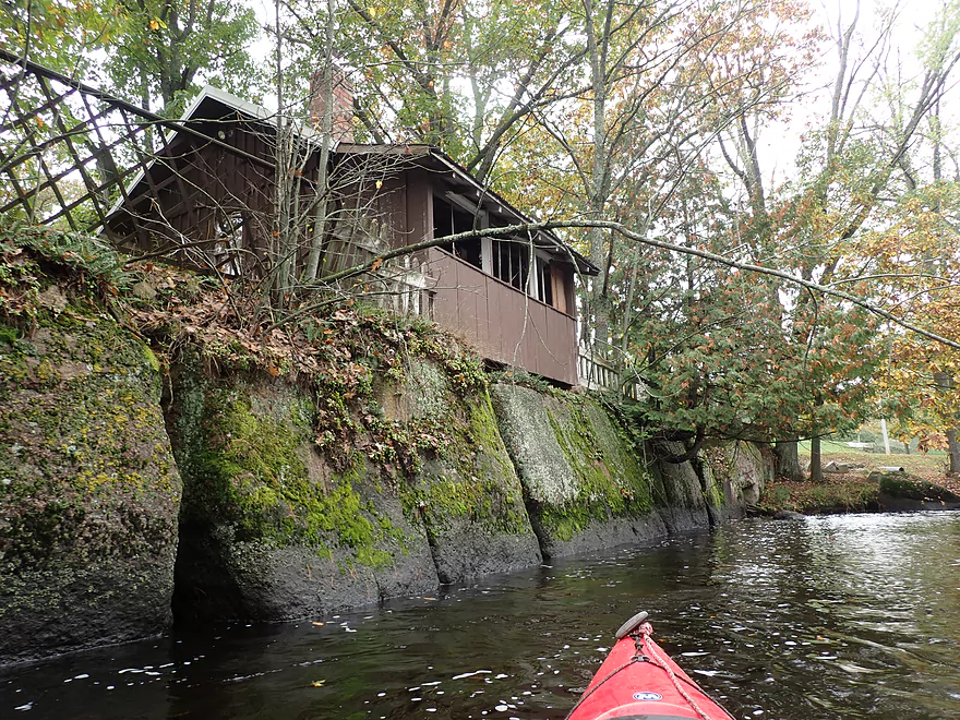
Following this long boulder field, I entered the community of Little Falls, which was unique. On the west bank was a mini-zoo with a peacock and a piebald deer. I then passed under an artsy wooden suspension bridge (with instructions not to jump). At the east end of the park was a second walk bridge supported by three arches. There is a Class 2 ledge under that bridge and this should be scouted before running. The far left chute is too rough, the middle chute is too shallow, and the right chute is (mostly) perfect. Following the 3 arch bridge there was a cool mini-lighthouse, a “cave”, and granite wall adorned with moss. Not exactly things you see on your typical paddle.
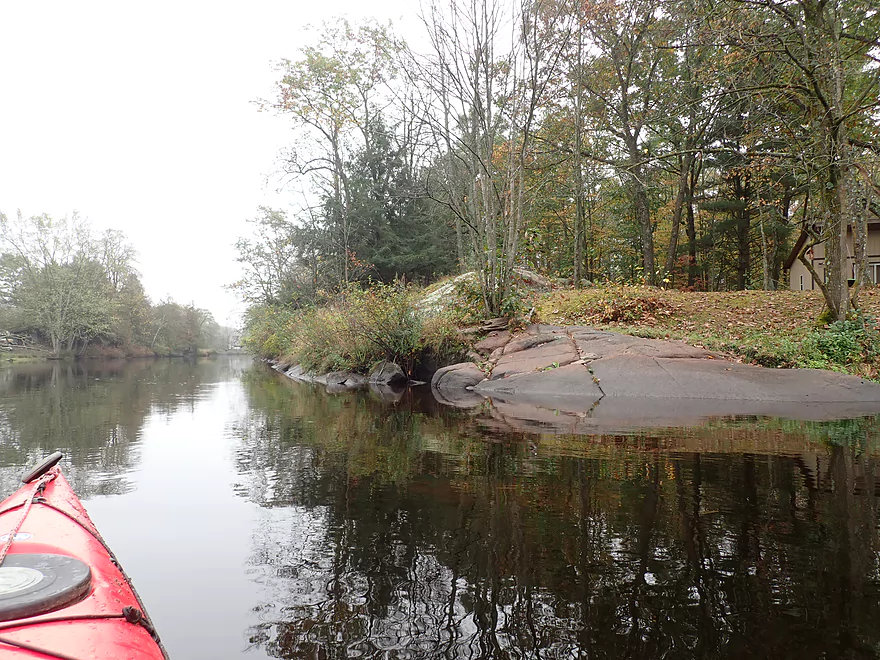
Little Falls Park was followed by a 1000′ boulder field and more Class 1 rapids. After this was the Hwy C bridge, which I suppose if you were really determined could be an access. But really Little Falls Park (located just upstream) is a much superior area launch option).
After Hwy C was yet another scenic boulder field and Class 1 pitch. This was followed by a Class 2 pitch, and then the trip highlight… Here the river narrowed into a scenic gorge with huge boulders on both banks. This created a Class 3 chute that flowed under a scenic local trail bridge. These rapids should be taken seriously. They are preceded and followed by Class 2’s and they don’t have a super clean line through. You should scout before running. Portaging is conceivable but tricky because of the steep banks. All talk of difficulty aside…the entire area is incredibly scenic. I’ve seen a lot of scenic river corridors for all my 2021 river paddles…but this was my favorite. In hindsight, I wonder if this was actually “Little Falls” which the local community is named after. Before this I just assumed the ledge upstream in the park was “Little Falls”, but now I’m not sure.
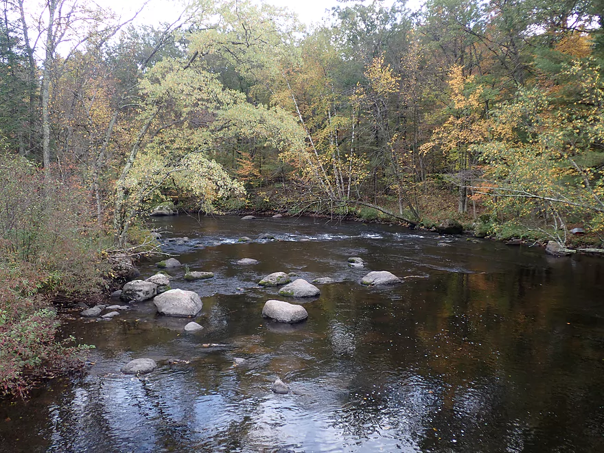
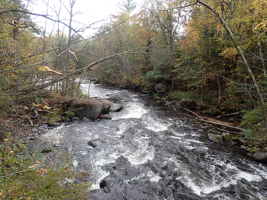
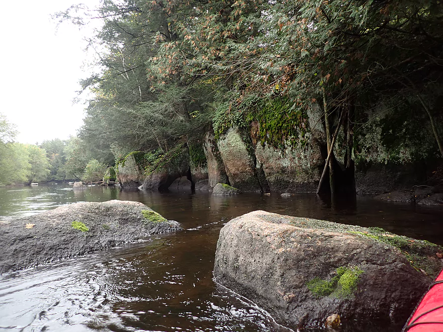
After the big rapids, the rest of the trip was a lot more mundane. There was a nice stretch of woods (~2000) that followed “Little Falls” which had the best color of the trip (but was still past peak). After that the river widened and slowed with only occasional minor riffles and scattered smaller boulders. The highlight of the second half of the trip was a ~300′ long granite outcrop with cool mosses growing on it.
I ended the trip at Kretchner Rd, which was a suitable bridge access.
In summary this was a terrific trip…in fact my favorite for the 2021 paddling season. It’s not for everybody though because of the rapids. Paddlers will also need to be very mindful of water levels as often the Little Wolf is “too high” or “too low”.
Sights included an eagle, a few clams, one dead crayfish, and several deer crossing the river. In Little Falls Park (next to the river) there is a “mini-zoo” which features a peacock and several deer. One was actually a piebald (part white, part brown) and is very rare. You can learn more about piebald deer here.
Big Falls Dam: This was a good access located at the end of Wall Street. There is a public area east of the powerhouse where you can park and use the outhouse. A faint trail south of the powerhouse leads to the water. At the bottom there is a bit of a ledge along the shore, but if you’re willing to wade in one foot deep water, it will be easy to get into your boat.
Alternate Put-ins:
- Hwy J (4.1 miles upstream from the dam) There is a good public access by J. This leg is scenic with granite outcrops, rapids (including one Class 3), and the famous Little Wolf “Dells”. You would need to portage the dam of course which would be a longer portage.
- Big Falls Itself (300′ upstream from the powerhouse) Skilled whitewater paddlers could run the falls with adequate water (it’s typically too shallow). Whitewater paddlers could access the top of the falls from either the west or east banks. When active, it can be a rough Class 4.
- Little Falls Park (1.4 miles downstream from the dam) There are several spots by Little Falls Park where you could launch and this is a decent access option. But if you start the trip here you miss out on a nice boulder field.
Kretchner Rd: This is a decent bridge access. An open grassy area leads to the water where I believe most paddlers park. Note the grassy area is likely not within the DOT right-of-way and maybe private, so you might want to park closer to the bridge instead. Also note, there is a fire hydrant here which your car shouldn’t block.
Alternate Take-outs:
- Little Falls Park (3.0 miles upstream from Kretchner) You could certainly take out at Little Falls Park, but I wouldn’t recommend it. There is a scenic boulder garden just after the park, and my favorite part (the Class 3 gorge) is located just downstream from Hwy C.
- Hwy 110 (4.3 miles downstream from Kretchner) This is a decent bridge access and I suspect most wanting to do a longer trip will take out here. This leg is ok with some minor boulder gardens and rapids, but isn’t as nice as the Little Falls stretch.
Bike Shuttle Route – Kretchner Rd to Big Falls: 3.6 miles with 95′ of ascent. This was a pretty easy shuttle with only minor hills.
Rental/Shuttle – Big Falls Kayak Rentals: I don’t know much about this business, but I believe they service this leg of the river. They can be contacted at 715-846-0078.
Logjams: None
Current: First half of the trip had decent current and the rapids were fast. The second half was much slower with far fewer rapids.
Rapids: Note, this is not a stretch for newbie whitewater paddlers. You should be equipped for and comfortable doing Class 2+ rapids before doing this paddle.
- Big Falls: This is a Class 4+ 300′ long chute that needs a lot of water to run and good experience. Most paddlers will simply launch below these rapids and not bother running them.
- Pre-Spaulding Creek: There are several minor Class 1 rapids. Be careful though as hidden boulders can stick and spin your kayak sideways.
- Spaulding Creek to Little Falls Park: This is a 2000′ long stretch that features a mix of rapids and boulder gardens. Very scenic. Most of the rapids are Class 1 with maybe one Class 2.
- Little Falls Park: There is a three arch bridge with a Class 2 ledge under it. Don’t go to the far left…that’s too irregular. The middle is too shallow. The right is (mostly) pretty good. This is easy to scout and/or portage.
- Little Falls Park to Hwy C: There is a 1500′ stretch of boulders and Class 1 rapids. Nothing major.
- Below Hwy C: The bridge is followed by a Class 1, then a Class 2, then a Class 3 under the trail bridge, then another Class 2. The Class 3 should be taken seriously. You can likely scout this ahead of time from the trail bridge but be respectful of local property owners. Portaging the Class 3 would be possible but not easy because the river narrows and runs through a bit of a gorge. Note there isn’t a “clean line” through the Class 3 gorge. The left side is deeper, but has a bit of a ledge at the bottom that would push a boat into a boulder. The right side is more open but rockier. You can see a 4k video of me running the Class 3 rapids here.
Trip done at 1.63′ per the Royalton gauge located downstream on the river. Note, I don’t trust this gauge because it is located too far downstream and is influenced by a dam. Definitely scout the river before running to make sure it isn’t too high or too low.
- 0-1.21′: The river rarely gets this low, but when it does paddlers can enjoy great clarity. A handful of rapids will have to be waded though.
- 1.21′-1.5′: An average later summer depth good for paddling and having good clarity. This is likely a decent depth, but some of the rapids will be bumpy.
- 1.5′-1.7′: River is above normal. Clarity isn’t as good but most rapids will be well padded. I went at 1.63′ which I think many would consider an ideal depth. Some spots will be a bit pushy.
- 1.7′-2.4′: A high depth only suitable for experienced whitewater paddlers. If you have the skill level, the rapids should be pretty fun.
- 2.4’+: Perhaps too high for enjoyable paddling. Expert whitewater paddlers though may enjoy these depths.
Detailed Overview
- Wolf River Road to Ness Road: (3.0 miles) Very narrow, heavily wooded, shallow in spots, and very rocky. Maybe 2 logjams. This is an intriguing prospect on my todo list.
- Ness Road to Wolf River Road: (2.5 miles) A good trip with clear water, boulders, and a few easy rapids.
- Wolf River Road to Big Falls Dam: (7.7 miles)
- Wolf River Road to Hwy J: (3.6 miles) Scenic section with some strong Class 2 whitewater. Good put-in.
- Hwy J to Big Falls: (4.1 miles) Also scenic and with whitewater, with perhaps a Class 3 by the Dells. Good launch by Hwy J.
- Big Falls Dam to Big Falls Powerhouse: (700') This is a steep chute of exposed granite that can create Class 4 rapids when it has sufficient water. But typically the dam penstock robs Big Falls of 99% of its flow. Access to the top of the falls is available from either the east or west shore.
- Big Falls Powerhouse to Kretchner Road: (4.4 miles)
- Big Falls Powerhouse to Little Falls Park: (1.7 miles) This is a good stretch with the highlight being a 2000' stretch of rapids.
- Little Falls Park to Hwy C: (0.3 miles) Features a Class 2 under a bridge, and then a 1500' stretch of boulders and Class 1 rapids. Hwy C isn't a great bridge access.
- Hwy C to Kretchner Road: (2.7 miles) Just below Hwy C is a series of rapids including a Class 3 that runs through a scenic gorge. After that the river slows down and becomes less interesting
- Kretchner Road to Hwy 110: (4.3 miles) A great leg with many scenic boulder gardens. Rapids on this stretch are mild and suitable for beginners. While nice, this leg isn't as terrific as Little Falls or Big Falls legs located upstream.
- Hwy 110 to Hwy 22/Symco: (8.0 miles) Unimproved bridge put-in but should be ok. This section likely has some deadfall issues (not sure how much though).
- Hwy 22/Symco to Manawa Dam: (5.9 miles)
- Hwy 22/Symco to Bridge Road: (2.0 miles) Looks like a nice section with some rapids and boulder gardens near Symco. Good put-in at Symco.
- Bridge Road to Manawa Dam: (3.9 miles) Likely a mediocre section with some flowage paddling at the end. Some of the flowage paddling can be avoided by taking out at Waupaca Park. Bridge Road is a good put-in.
- Manawa Dam to Road Bb: (3.9 miles)
- Manawa Dam to Hwy B: (1.9 miles) Honestly an uninteresting section with slow current and bland flood-bottom woods. Aquatic weeds are an issue (thanks to the Manawa Septic plant). River does get a bit more interesting after the railroad tracks and features a small boulder garden.
- Hwy B to Hwy 110/B: (0.9 miles) A good stretch with some boulder gardens and good clarity. There are Class 2 rapids by the "Rapid View" island.
- Hwy 110/B to Road Bb: (2.1 miles). A great stretch with several impressive boulder gardens and a few minor rapids.
- Road Bb to Hwy X: (7.6 miles)
- Road Bb to Royalton: (3.5 miles) Very good put-in. Nice clarity and boulders until the South Branch joins (almost doubling the river). Very nice boulder garden and rapids 2/3rds in.
- Royalton to Ostrander: (2.7 miles) After the brief rapids under Hwy 54/O, the Little Wolf goes back to sleep, with pleasant but monotonous scenery (the highlight being sporadic boulders). Finally, maybe a half mile prior to Ostrander Road, there is another set of rapids (Class 1) and an attractive boulder garden. Paddlers will have to deal with many tubers.
- Ostrander Road to Hwy X: (1.4 miles) Busiest tubing section probably in the state. Very nice boulder gardens and rapids at end. Public landing NE of Ostrander Road.
- Hwy X to the Mouth (Junction at Wolf River): (2.0 miles) Part of the Mukwa Bottomland Forest SNA
- Mouth to Dey Road/Shaw Road Boat Ramp: (0.8 miles) A short stretch on a now large Wolf River.
Trip Map
Overview Map
Video
Photos Size:
Can you provide me with the make and manufacturer of the red kayak you show in your pictures.
Wilderness Tsunami 125. They still make it…but the new version is a bit bigger and heavier. I like the old version better.