
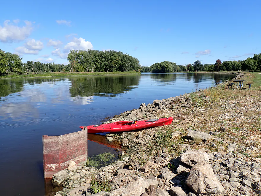
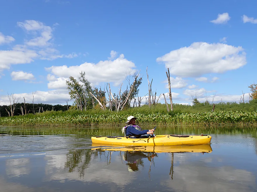
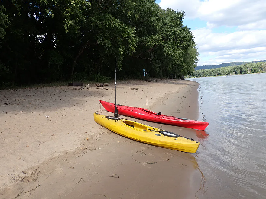
Starting the trip at the south end of Black Hawk Park
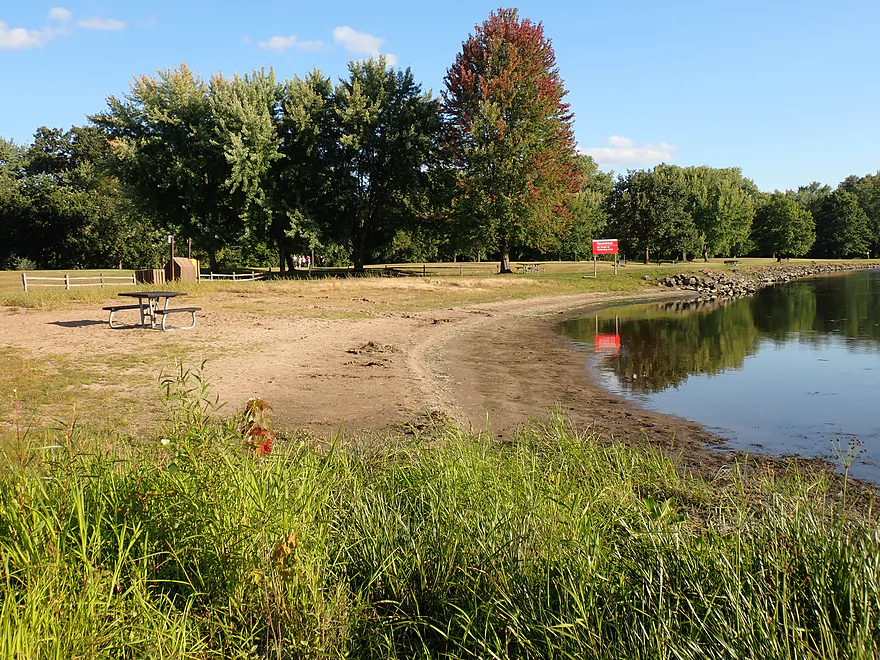
You can also launch at the beach (which is also a good option)
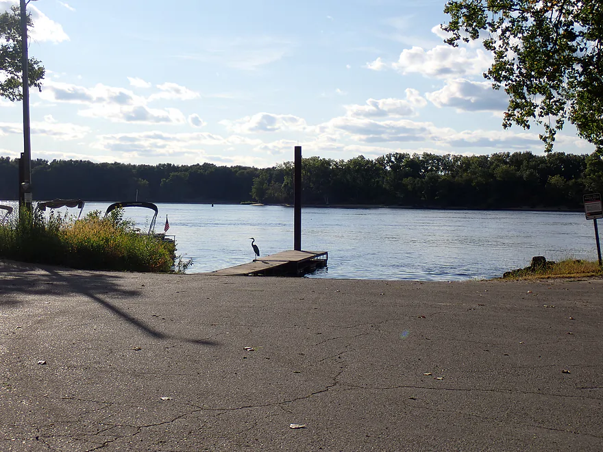
Or the landing…the official start of the Blue Heron Trail
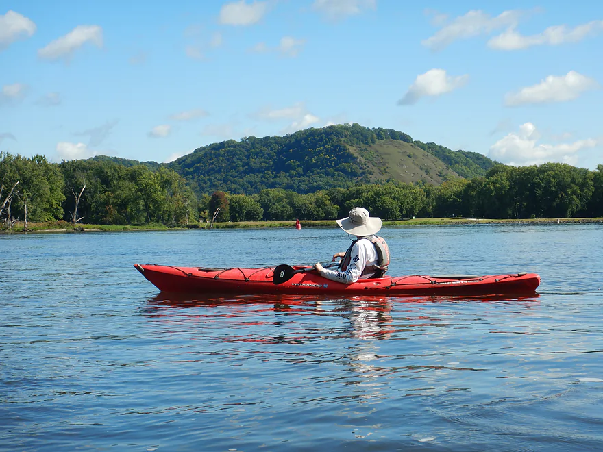
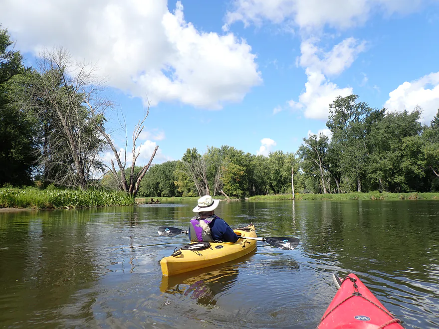
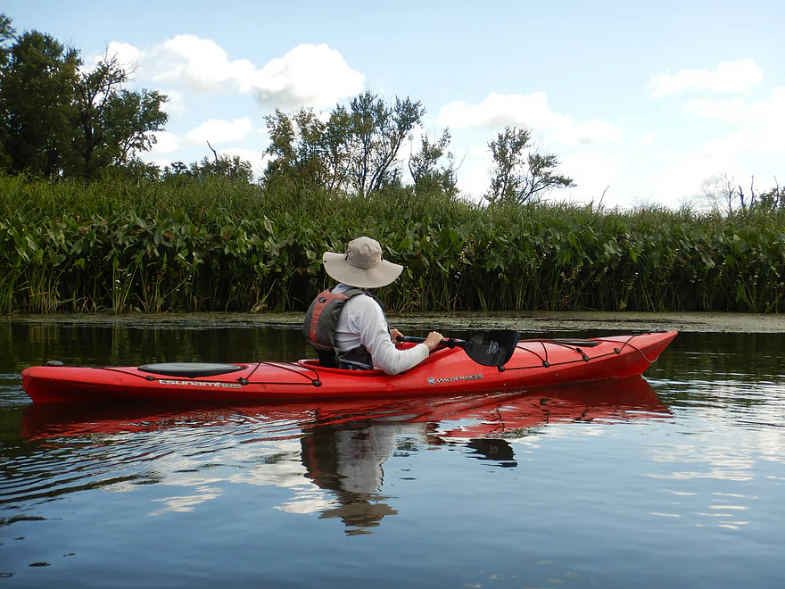
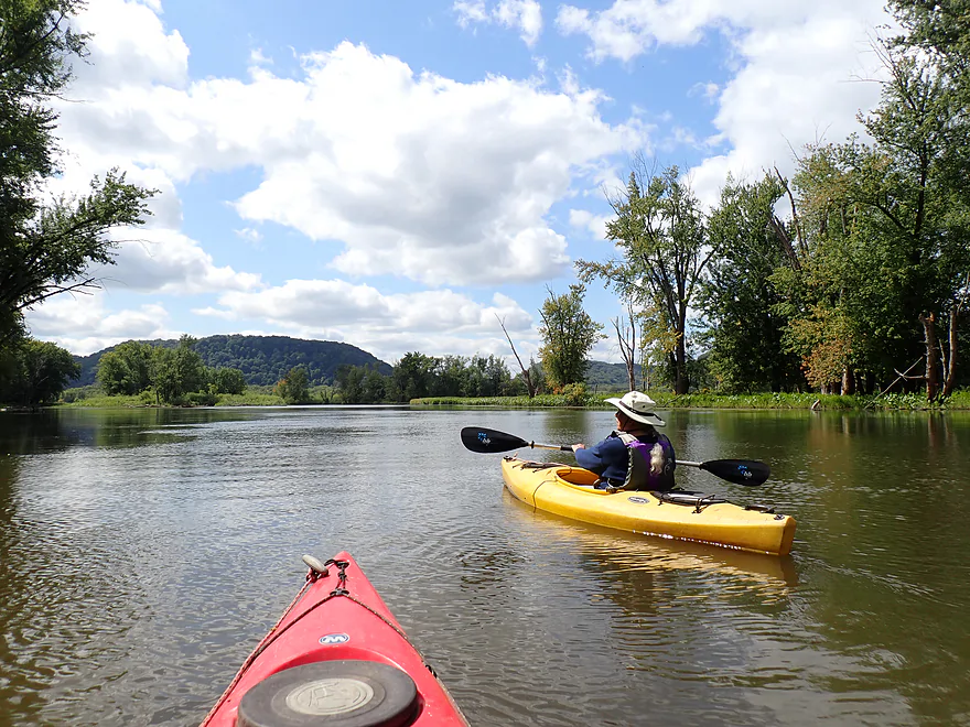
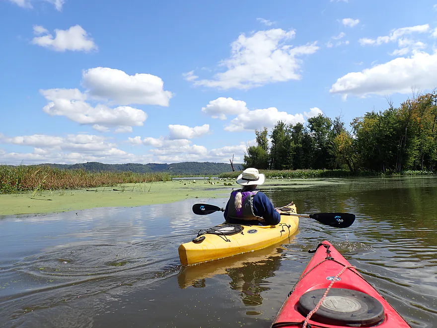
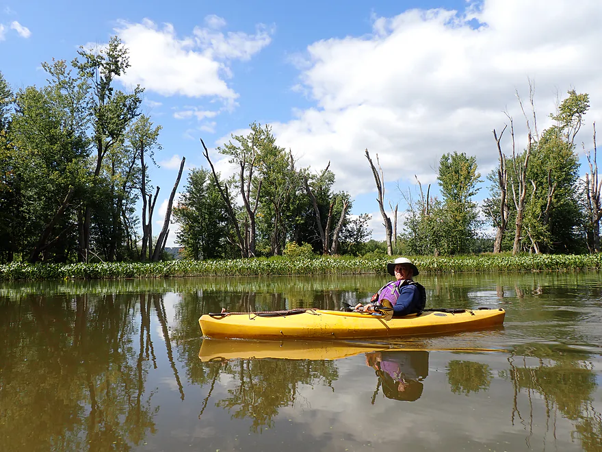
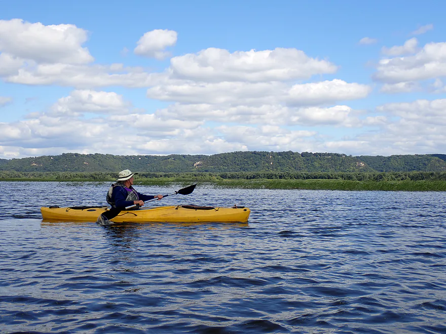
Crossing the main channel with a nice vista of Battle Bluff
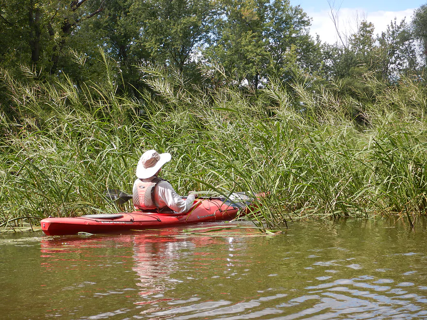
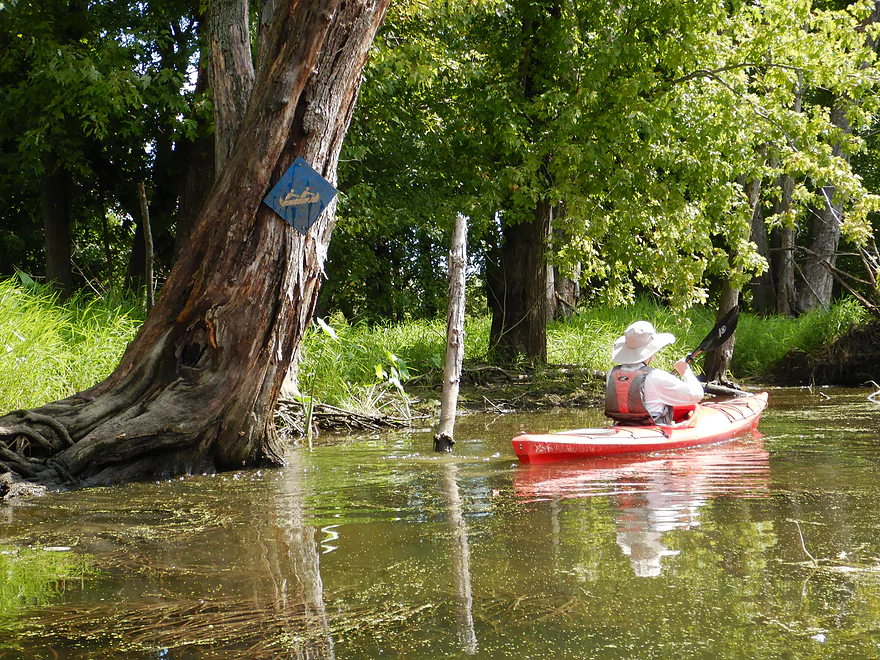
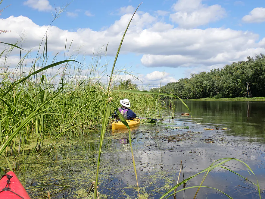
Entering the side sloughs and the marked trail
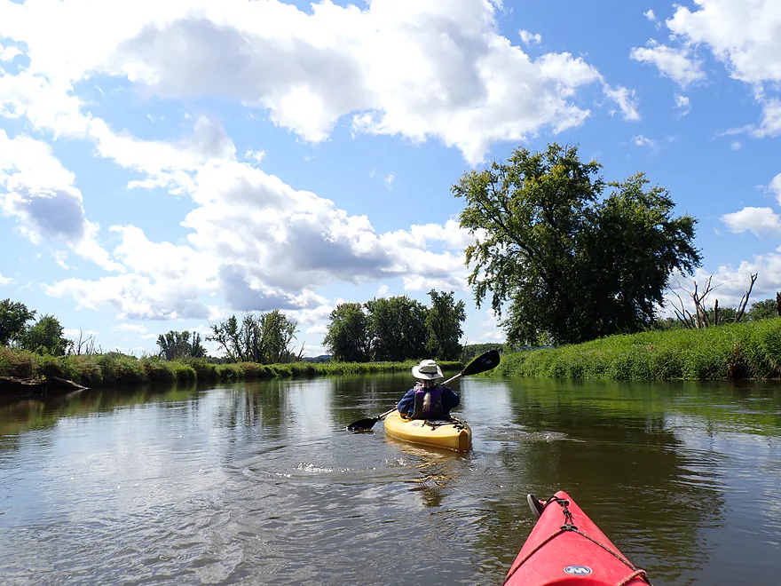
Very peaceful compared to the main channel
A wall of arrowheads
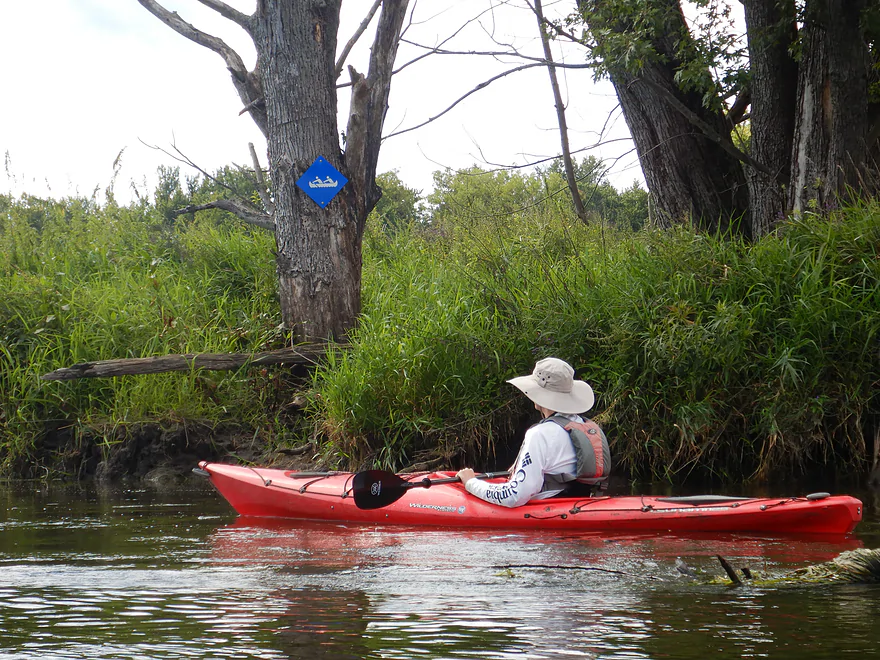
Little blue water trail signs point the way (sometimes…)
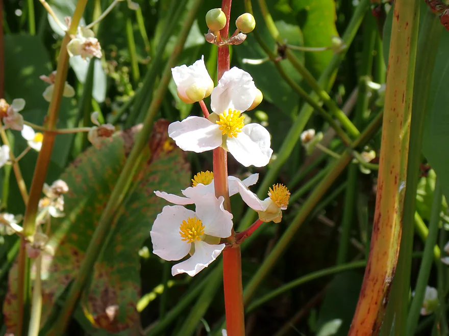
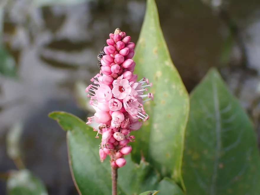
Some late arrowhead flowers
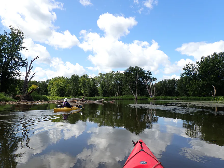
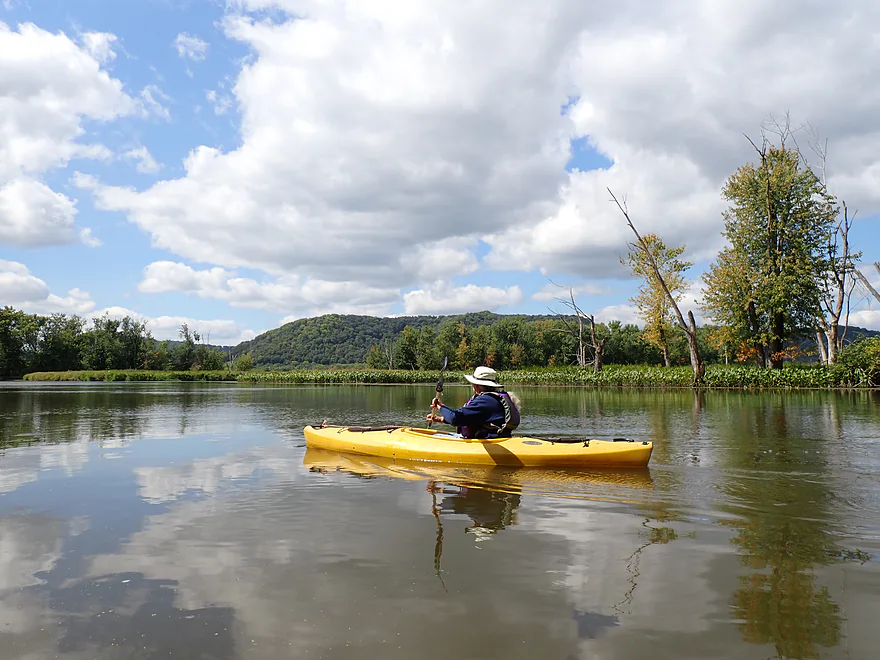
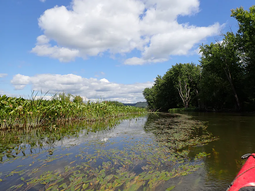
A scenic marshy spot
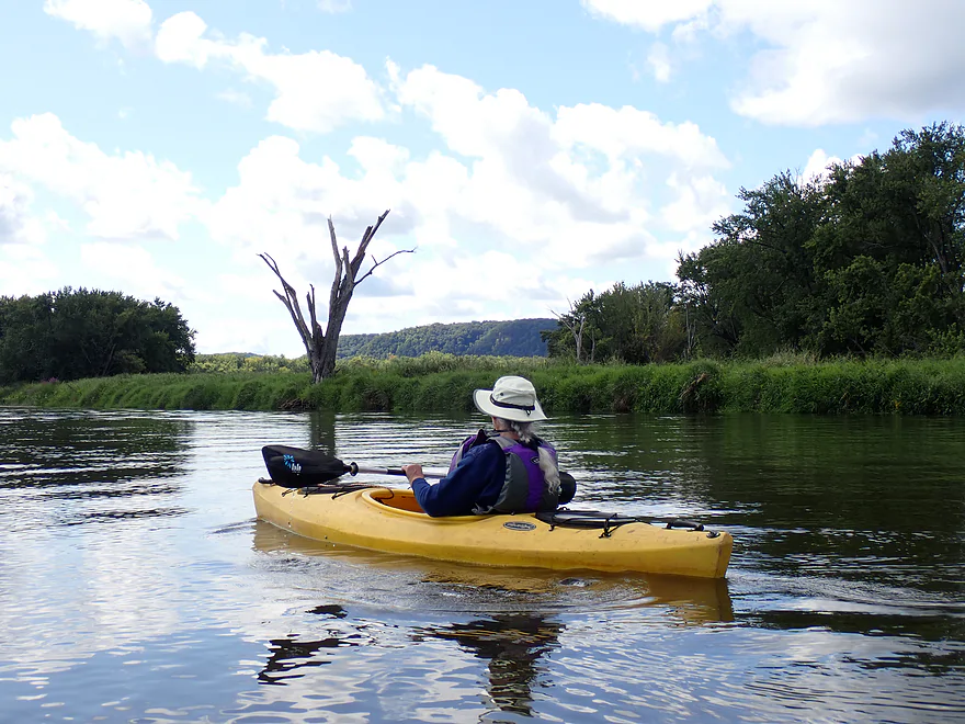
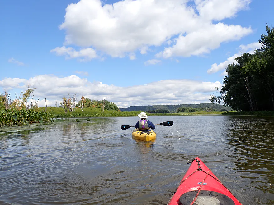
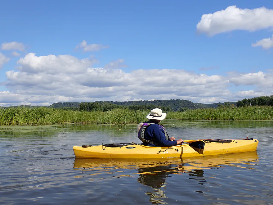
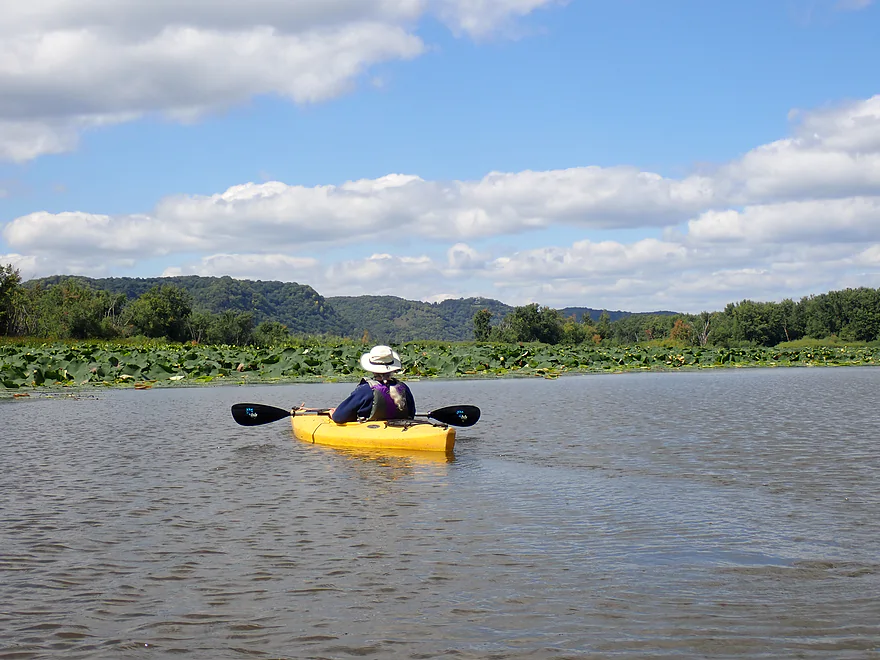
Wisconsin bluffs in the distance
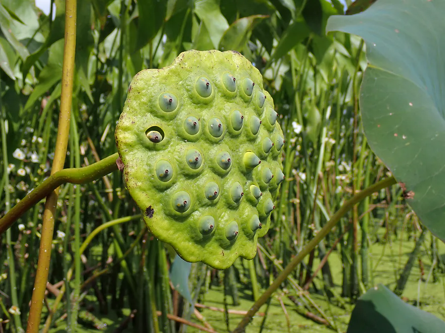
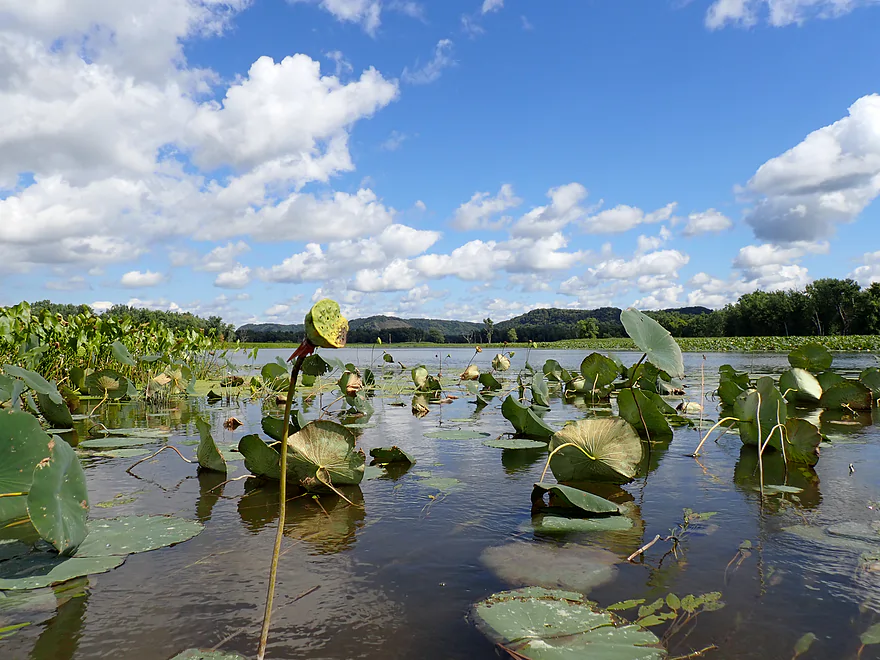
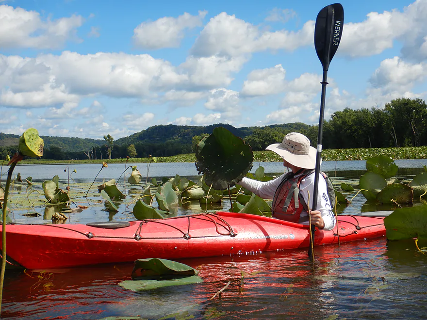
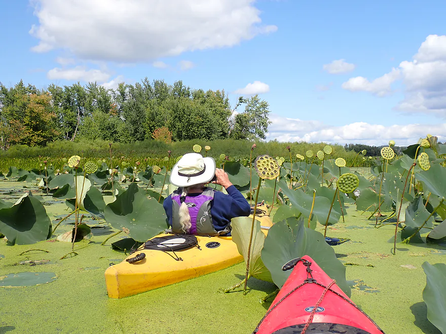
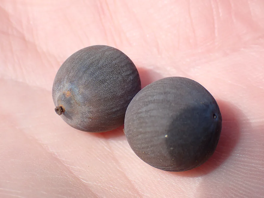
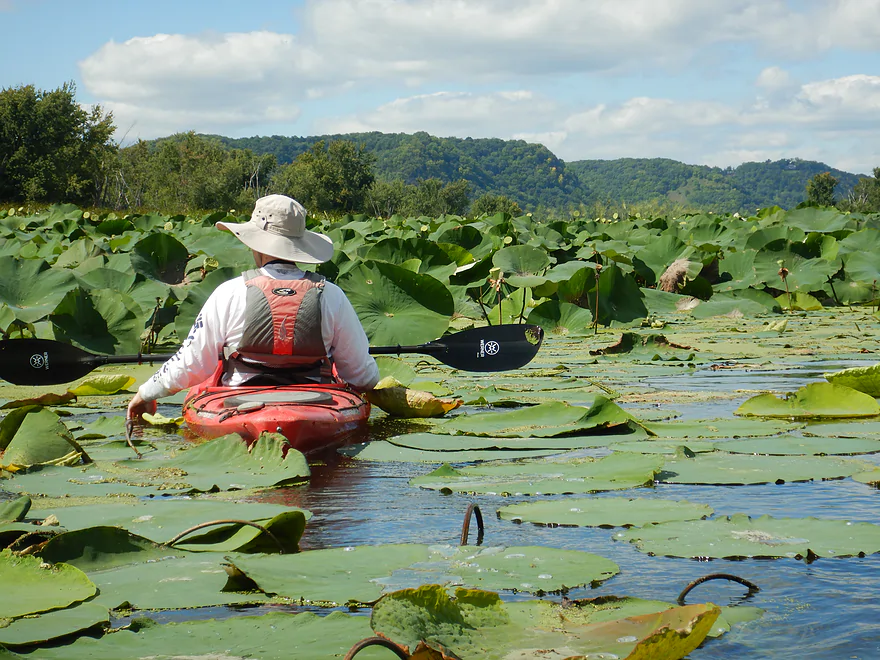
Fantastic lotus pods
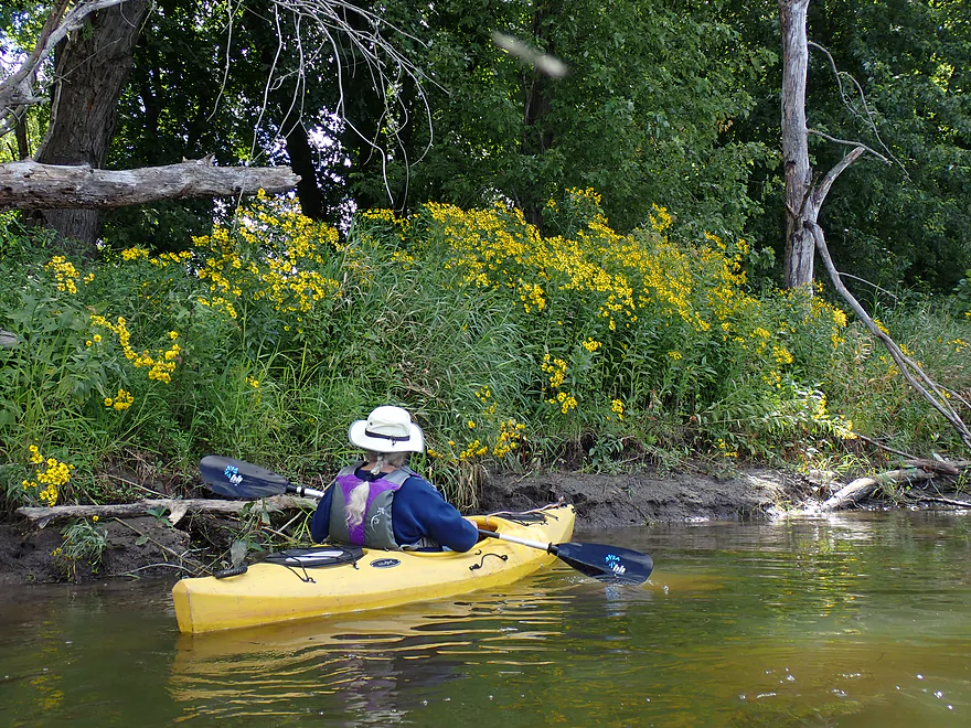
Wildflowers growing on the banks
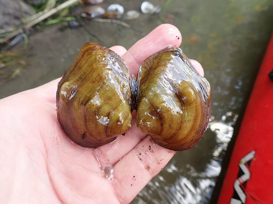
Some clam shells
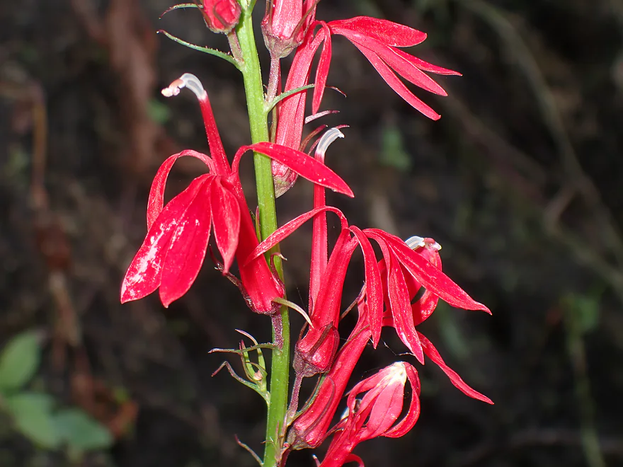
Cardinal Flowers
Cool Iowa bluffs in the distance
Started to see more wild rice
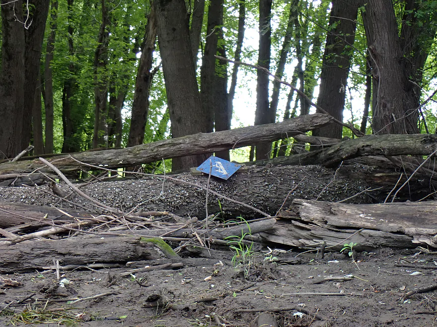
Not all Blue Heron Water Trail signs survived the floods
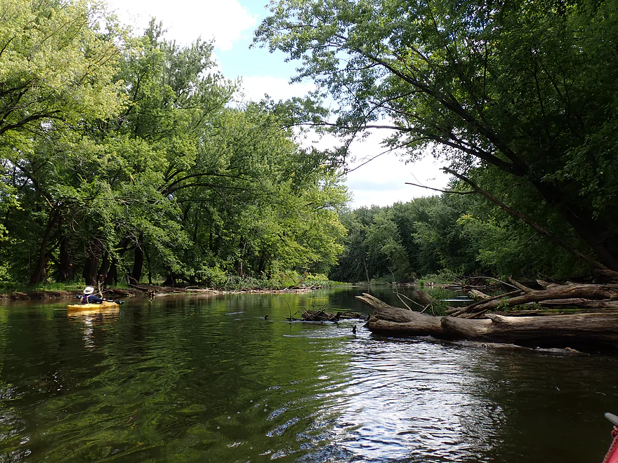
Some of the side sloughs were more wooded than others
Flowing potamogeton plants show the way
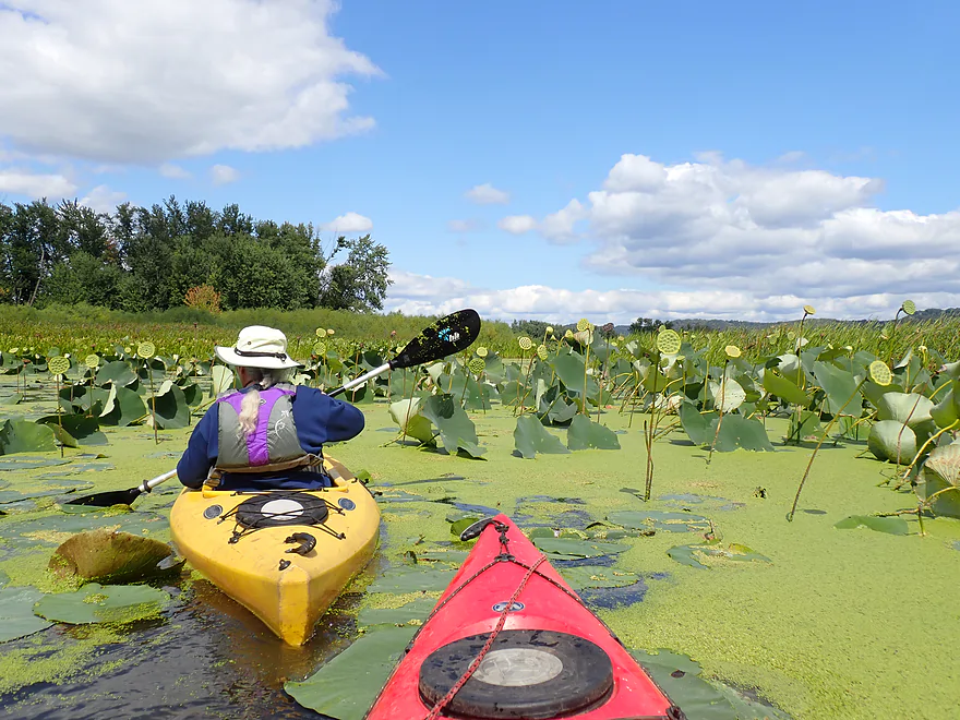
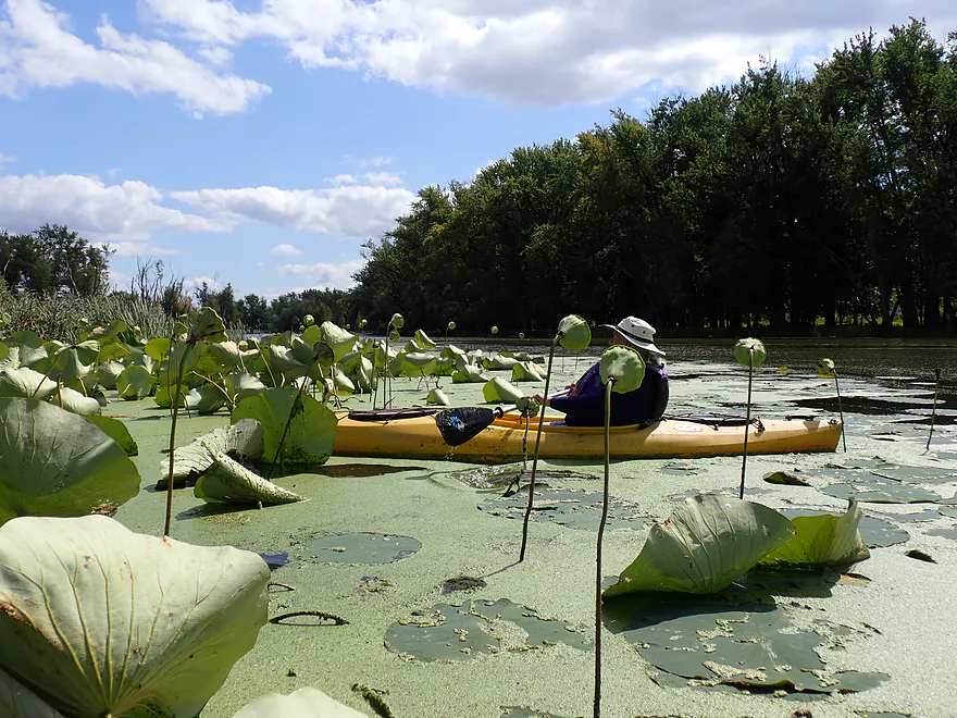
Another terrific lotus bed
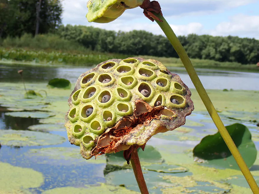
This pod has seeds just about ready to fall out
Pretty cool
Lotus stalks standing watch
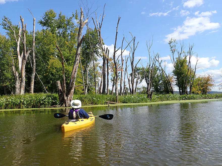
Lot of dead trees…killed by floods
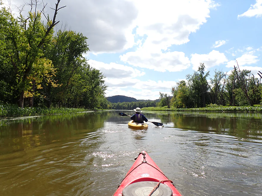
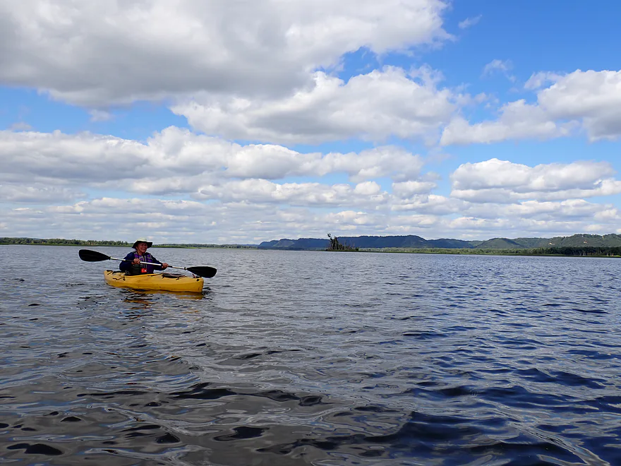
River starts to open up
The paddlers on the sign lean toward where you need to kayak
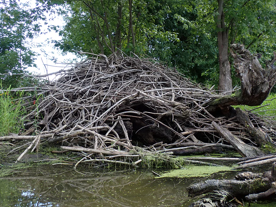
Huge beaver lodge
Another terrific vista of the Iowa bluffs
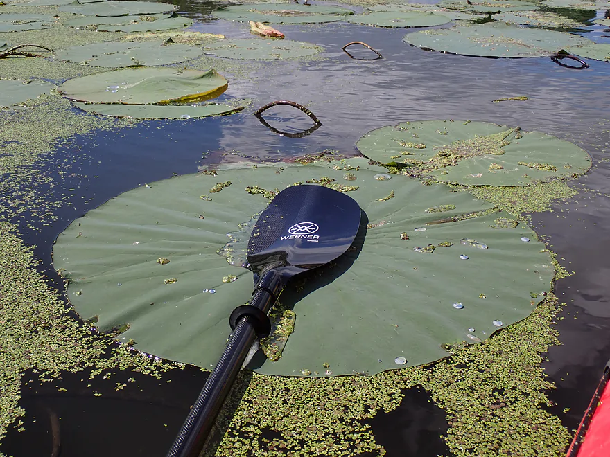
Lily pads were HUGE (this is a full sized paddle)
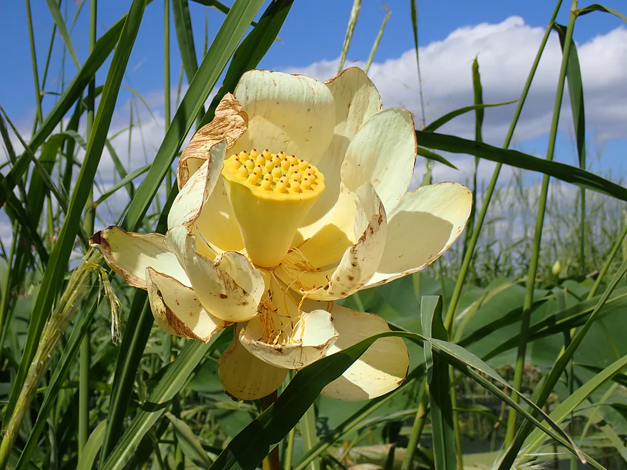
And a very late lotus flower (you can see how the pod forms)
Rock outcrops poking through the trees
Paddling Big Lake…a bit of a slog
A water smartweed flower
Taking a sandbar break on the main channel
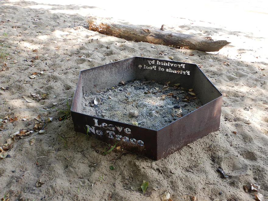
Where Friends of Pool 9 have provided a bunch of nice fire pits
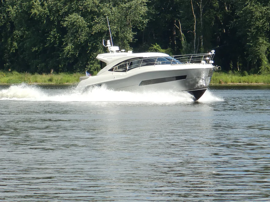
Cabin cruisers on the Mississippi kick up massive wake
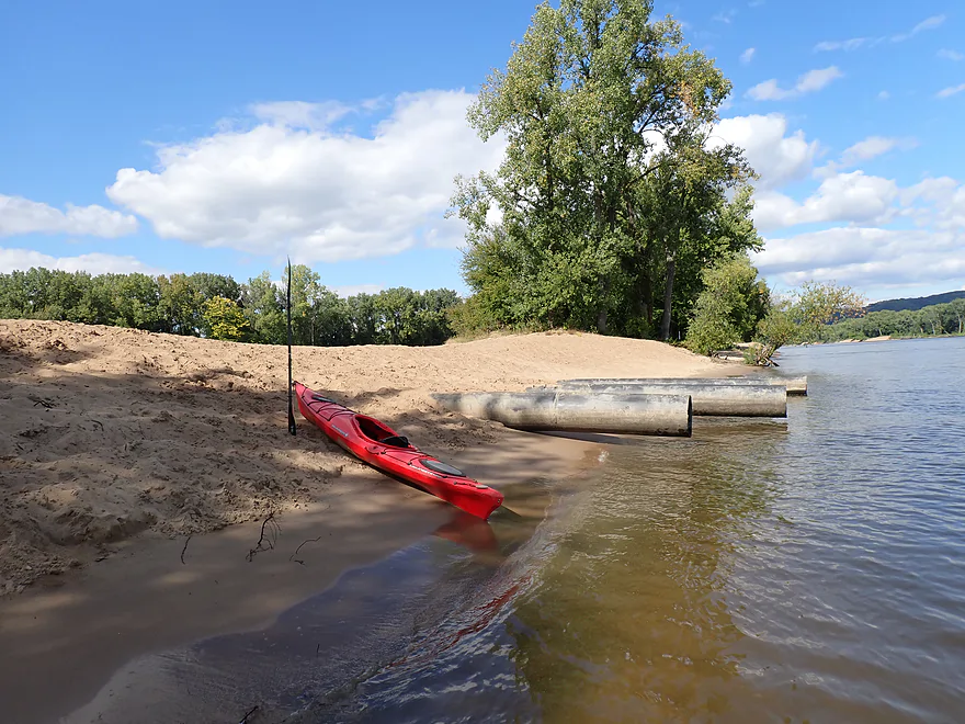
Taking a second sandbar break (the pipes drain a dredge crater)
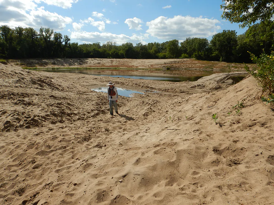
And here’s the interior of the crater
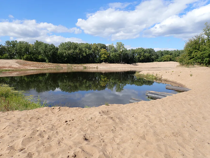
The west end was more scenic
Back on the river paddling toward Lansing
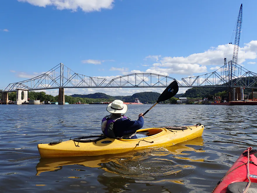
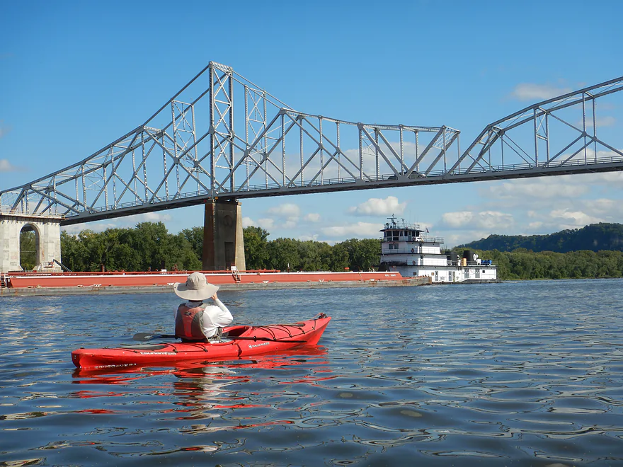
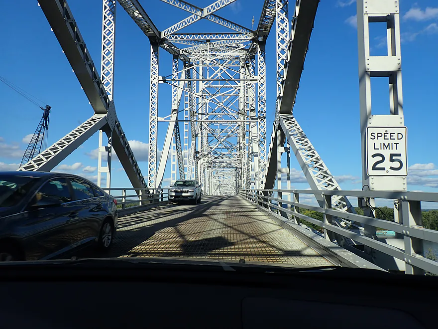
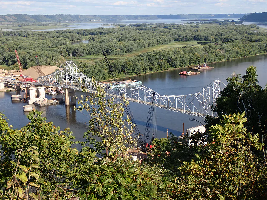
The famous Black Hawk Bridge
This barge conveniently posing for photos
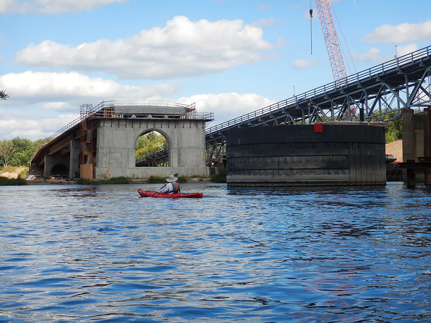
A new bridge is in the works (the old bridge will soon be torn down)
Heading back upstream to get to our landing (just around the island to the right)
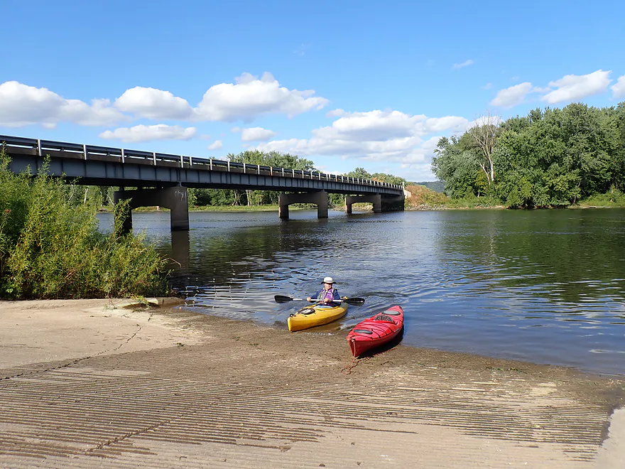
Taking out at Big Slough Landing
Nice access
Crossing the Black Hawk bridge to check out Lansing

Lansing is a quaint little river town
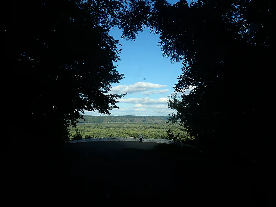
Driving up nearby Mount Hosmer Park
There is a fantastic downstream overlook of the Black Hawk Bridge
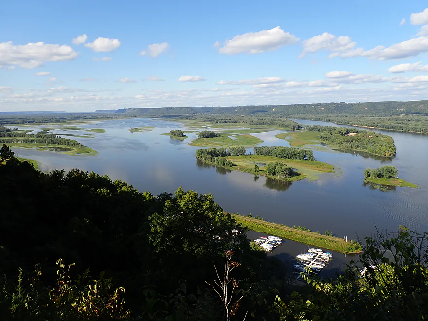
And of Big Lake
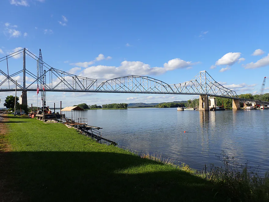
One final pictures of the Black Hwk Bridge
Mississippi River – Blue Heron Water Trail


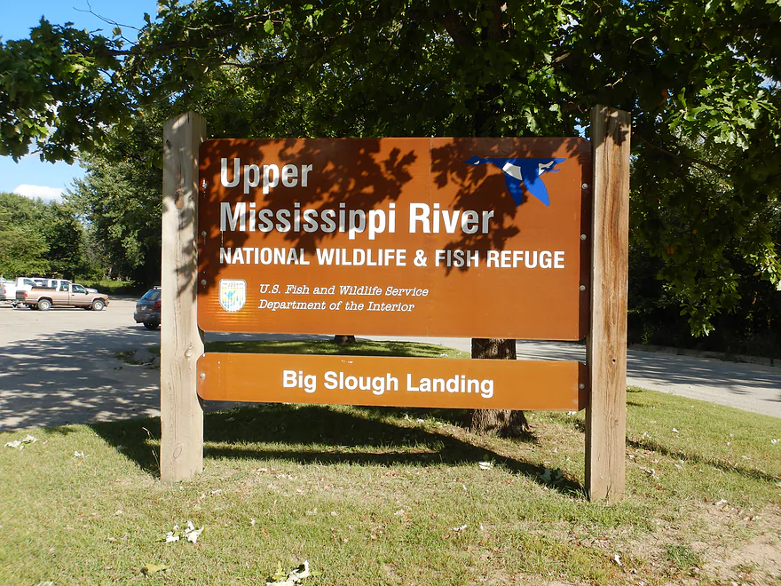
The Upper Mississippi sees surprisingly few kayakers. Most are likely intimidated by the massive pools located above the dams. But further upstream from the impoundments the river flows free with fantastic braided channels, islands, and bluffs to explore. The US Fish and Wildlife Service has designated 15 official water trails for paddlers to enjoy along the Wisconsin border. One of these is the “Blue Heron Trail” which is this week’s trip and located just south of the tri-state junction (MN, IA, WI).
We started at Black Hawk County Park, which is a massive 3 mile-long peninsula on the Wisconsin side of the river (almost an island). The park is very nice with an inviting campground and several spots to launch from…we chose the south end to shorten our trip. The local geographic names (Battle Island, Battle Slough, Battle Bluff, Battle Hollow Road, etc..) suggest a battle once occurred at this very spot and it did. It was here that much of the Sauk tribe, led by Chief Black Hawk, was massacred.
While the park is technically located on the main channel, we crossed it quickly to enter the sloughs and official water trail. Or at least attempted to do so quickly as the current was surprisingly strong and we ended up getting distracted taking pictures of the photogenic “Battle Bluff”, which was topped with a goat prairie. We soon found our slough “off-ramp” and were off the “main road” and on the more peaceful backwaters.
Partially created by the mouth of the Upper Iowa River, this network of sloughs is a massive labyrinth of islands and side channels. Getting lost can be a concern and FWS does post little blue water trail signs telling paddlers where to go, but the signs aren’t always clear or are missing at key slough junctions. GPS is highly recommended.
The core of the slough were flood bottom forests with occasional open marsh. The latter tended to be more scenic as they allowed you to see the river bluffs in the distance. Plant life was interesting–with wild rice, walls of arrowhead, crazy large lily pads, and fantastic lotus pods that were popping out seeds (see photo gallery). The wooded stretches (mostly on the west side of the river) were less interesting but peaceful with occasional wildflowers.
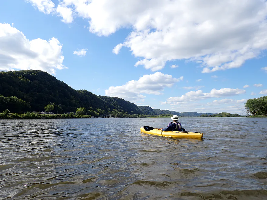
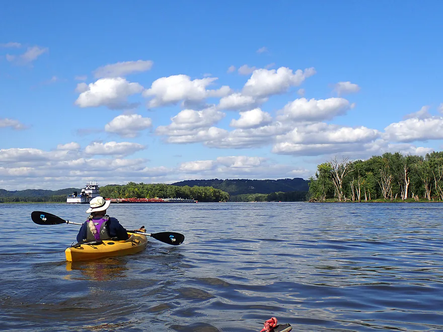
As we continued south, the woods receded into wild rice as the massive archipelago started to peter out and spill into Big Lake. While Big Lake featured some of the best bluff vistas of the trip, it was a bit “big” and repetitive. Just to cross it took about two miles of paddling and was the least interesting part of the trip.
Eventually we reached another chain of islands and finally reunited with the main channel, which we hadn’t seen since the put-in. We headed upstream a bit to check out the local sandbars, which were really nice. The highlight was a massive sand crater that is used as a dredge dump by the US Corp of Engineers.
Friends of Pool 9 has done a nice job of keeping the islands clean and providing fire pits for campers. Typically I believe these sandbars would be swarming with people and the main channel would feature countless powerboats cruising and kicking up big waves, but this being an NFL Sunday, things were relatively calm and devoid of people.
We then turned back downstream and headed toward the small city of Lansing, Iowa and the famous Black Hawk bridge. Some consider this the “scariest bridge” in Wisconsin because of its steep grade, extremely narrow width, open grate bottom, loud noises, and its history of mishaps. But it is a very striking and photogenic bridge, and you won’t be able to see it much longer as it is scheduled for demolition later this fall (before the new one is constructed!…more on this later).
A barge passed under just as we approached the bridge, which provided some nice photo ops. He was going super slow (almost kayak speed). I’m sure passing under this bridge is considered a big deal for barges because of the current, narrow width, and need to take a sharp turn immediately to the right. Two barges couldn’t cross under at the same time, and I presume some coordination must take place over the radio to avoid cross traffic in choke spots like this. We doubled back upstream against surprisingly strong current to reach Big Slough Landing on the other side of the island.
In summary, this was a long but enjoyable trip. The highlights were the fantastic plant life, scenic bluff vistas, and the Blackhawk bridge . The lowlight was “Big Lake”, but it was manageable (a tailwind helped). It’s too bad the bridge is being torn down as it is a sight to behold, but supposedly the new bridge will feature a somewhat similar trestle profile. A debate paddlers might have is whether to do this trip on the sloughs or the main channel. The sloughs are more peaceful and where the official water trail is…but the main channel might feature more sandbars and better bluff vistas (but also horrendous river traffic). Winneshiek Landing is located on the Wisconsin shore opposite Lansing and might be the go-to access once the Black Hawk bridge is torn down.
Sights included a couple of turtles , 5-6 eagles, two beaver lodges, a few clam shell piles, and fittingly enough, several blue herons. There was surprisingly little waterfowl…but that was likely unlucky timing. During seasonal migrations, I presume this area might be a hotbed of waterfowl activity.
Mt. Hosmer: This is a public park located above the town of Lansing. It’s definitely worth checking out as it has two overlooks with fantastic views of the Mississippi. The park also features several trails which we didn’t explore. Note: the road leading up to the park is crazy steep.
Lansing: This is a cute little tourist town located along the banks of the Mississippi. There are several novel eateries here worth checking out after a paddling trip (eg Coffee on the River and Skinny Dip).
Blackhawk Bridge: This is an important Mississippi bridge that connects Iowa to Wisconsin. Over 90 years old, it’s had a troubled history and has been closed due to ice and flood damage. It’s remarkably narrow, steep, and noisy…some don’t like it, but others do because of its scenic trestle structure. It’s a very striking sight crossing the Mississippi. The bridge is currently being replaced with a new bridge next door…in fact maybe too close, as apparently construction from the new bridge caused the piers of the old bridge to shift. Supposedly as a safety measure the old bridge will be torn down BEFORE the new bridge opens…leaving residents on both sides of the river separated from fall 2025 to 2027. Local residents are lobbying against this…as there are no other local Mississippi bridges unless you go north to La Crosse or south to Prairie du Chien. A water taxi will supposedly be available, but that will be limited. You can follow the latest in bridge updates on Facebook. There is also a live webcam of the bridge so you can know if it is active or not.
Black Hawk Park: This is an attractive park and campground on the Wisconsin side of the river. There are several monuments and historical references to the Black Hawk War. It was at this very spot that most of Black Hawk’s tribe were killed by a gunboat while trying to cross the Mississippi. Wikipedia has an extensive article about the conflict that you can read here.
Black Hawk County Park: This is a long public park and campground with multiple access options. There is the main public ramp (Vernon County Ramp) which is certainly an option, but then you have to compete with motorboats. I suggest launching from the Gazebo and beach to the south which is a better access and has a nearby parking area and outhouses.
Alt Put-ins: There are many…see trip map for locations. The following are some main options.
- Green Lake Boat Ramp: You could launch here but you would be sandwiched on the right side of the river and forced to stick to the main channel.
- Black Hawk Point Landing: This is a nice public access on the Great River Road that is technically on the Upper Iowa River. From here to Black Hawk Park on the Mississippi would be a roughly 3-mile paddle. The Upper Iowa mouth has been artificially straightened and channelized so might not be very interesting.
- New Albin Landing: This is located about 3 miles to the north of Black Hawk Park and would be a good access. This bonus stretch would include some open slough stretches (and the tail end of the Reno Bottoms, which is a neighboring water trail).
- Victory Landing: This is a main channel access option located a few miles north of Black Hawk Park.
Big Slough Landing: Located on an island just east of Lansing, this is a good public access. An outhouse is located on site. Note, the parking lot is not large, and I suspect it can fill up on busy summer weekends. Also note, the Blackhawk bridge is scheduled to be replaced, so access to the landing might be restricted from fall of 2025 into parts of 2027.
Alt Take-outs: See trip map for exact locations.
- Winneshiek Boat Landing: This is a nice public landing located on the north side of the Hwy 82 bridge/causeway. This might be a better option for those who prefer to paddle the main channel instead.
- Village Creek Boat Landing: This is a large boat ramp located south of Lansing and is a good access. Taking out here would be a bit of a longer trip but would allow you to paddle past the town of Lansing and under the Black Hawk bridge without backtracking.
Bike Shuttle – Big Slough Landing to Black Hawk County Park: 9.5 miles with 43′ of ascent. This would be a long bike shuttle, but it would be flat and scenic.
Kayak Rentals:
- Sitting Pretty Farm: They offer tours and rentals mostly based out of the Winneshiek Boat Landing. I’m not sure if they service the Lansing and/or Black Hawk Park areas.
- River N Ridge Outdoors LLC: Based out of Lansing, I believe they do offer kayak rentals and shuttle services.
Wind: Avoid this trip if a decent headwind is forecasted, as it’s fairly open.
Current: The sloughs mostly featured just mild current. There are a few stretches where you have to cross the main Mississippi channel and there the current is quite strong.
Getting Lost: There are countless islands and side channels. Getting lost can be an issue despite little blue trail marker signs (which are sometimes missing at key junctions). Bringing GPS is highly recommended.
Logjams: None.
Waves: There are practically none on the sloughs, which makes them very peaceful. But the brief stretches on the Mississippi can feature heavy powerboat traffic. Some boats, especially the “cabin cruisers”, can kick up massive wakes which could swamp a kayak if you’re not alert.
Life Jackets: On some rivers and lakes you can get away with not wearing a life jacket. The Mississippi though isn’t one of those and you definitely want to have your life jacket on at all times.
Closest Gauge: Mississippi @ Clayton Iowa
Trip Depth: 12.42′
Navigability Estimates: The following are very rough estimates. Always use your own judgement.
- <11′: Extremely low depth. Sloughs might be shallow in spots.
- 11′-12′: Low depth.
- 12′-13′: Likely an average depth.
- 13′-14′: Above average.
- 14′-15′: Minor flooding. You might be able to paddle between the trees on the islands.
- 15’+: Major flooding. River will be much dirtier/faster. Perhaps only suitable for experienced paddlers.
Detailed Overview
The Mississippi is both a blessing and a curse for paddlers. While rich in beauty and majesty, it can be problematic to paddle due to high wind, current, wakes, powerboats, and barges. The Upper Mississippi is frequently dammed and subdivided into “pools”, of which there are roughly 11 in Wisconsin. Generally speaking, just upstream of a dam the river is the least interesting (few islands, deep, monotonous, few sloughs, and a wide channel). But on the downstream side of pools there are often many sheltered islands and sloughs that offer unique paddling experiences.
For a list of Mississippi water trails see my overview map or use the bullet list below. Thanks to the US Fish and Wildlife Service for many of these suggestions. Check out their website for more details. Water trails are listed in order from north to south.
—
Chippewa River Trail: 6.8 miles. Chippewa River Landing to Tim’s Slough Landing. Basically the last part of the Chippewa River that connects with a slough on the Mississippi. Avoid in high water.
Nelson-Trevino Trail: 4.5 miles. South of the Chippewa River, Hwy 25 cuts across the river through a slough and over a grade. Many landings to pick from. Most paddlers venture south and then back north to one of the landings. The main water trail is roughly the biggest loop you can take south of Hwy 25 while remaining in the slough. Avoid in high water and high wind.
Finger Lakes Trail: 6.1 miles. North of the Zumbro River mouth, there is a sheltered collection of sloughs and lakes you can paddle. The main water trail skirts the south edge. In low water, some portages may be required. For a launch/take-out, use Pioneer Landing in Minnesota.
Halfmoon Trail: 5.1 miles. A scenic mix of sloughs, the main channel, and open marshlands, with a chance to explore two massive dredge piles. Note that timing is tricky: low water can dry out the interior channels, while high water makes completing the loop against the current difficult.
Verchota Trail: 11.3 miles. A long upstream paddle up the main slough then you double back mostly on the same trail. Use Verchota Landing for an access. Difficult because of its long length and upstream paddling.
Aghaming Trail: 6.7 miles. Start at the park in the main channel and float downstream until you find a gap in the slough which you can paddle upstream to explore. Turn back when done. Access at Latsch Island Park and Landing. Some upstream paddling in the main channel. Not usable in high water.
Voyageurs Canoe Trail/Perrot State Park: 6.5 miles. Your best bet is to do a one-way trip from Hwy 35 to S. Park Road. Very scenic. Completely sheltered from the main channel and is technically the Trempealeau River.
Long Lake Trail: 5 miles. A counter-clockwise circle through mostly backwater sloughs. Long Lake is mediocre and French Lake is boring and weedy. But the main channel is nice with good sandbars and bluff vistas. When in season, Big Marsh can contain scenic wild rice corridors.
Brown’s Marsh Canoe Area: More of a lake paddle and a way to experience Brown’s Marsh. Access at Lytle's Road.
Lake Onalaska Trail: Technically the last few miles on the Black River. Been on my to-do list for a while… Lytle's Road to Fred Funk Landing is 4 miles, while Lytle's to Mosey Landing is 8 miles.
Root River to Crater Island: This is mostly attractive slough paddling inside the vast Goose Island archipelago. It does include a bonus stretch on the fast Root River and some main channel paddling by Brownsville. The highlight is "Crater Island," a large man-made sand island.
Goose Island Trail: 8 miles. A nice paddle around Goose Island. Mostly simple sloughs but there are nice bluff views .
Reno Bottoms Trail: 3-14 miles. Put in on the Minnesota side and float down a long slough. Many intermediate take-out options. Access at Reno/Hwy 26 and New Albin. Some of the launches can be under water during high depths.
Blue Heron Trail: 9 miles. Located south of the Minnesota/Iowa border, this water trail features a fantastic labyrinth of islands and side sloughs. A trip highlight is being able to paddle up to the historic Black Hawk Bridge.
Ambro Slough: 8 miles. Very similar configuration to Wyalusing. You can paddle up the slough then downstream on the main channel if you wish. The upstream slough by Harper’s Ferry also looks interesting. Access is at North Ambro Road. 8.2 miles if you do a full loop on the main channel.
Yellow River to McGregor: ~4 miles. A scenic stretch featuring impressive river bluffs and a large arched bridge.
Wyalusing: 5 miles. A marked trail starts at the lower Wyalusing State Park landing, then weaves through bottomland before heading back to the landing. One of the neater areas on the Mississippi and it’s always fun to visit the park.
Johnson Slough: 6.2 miles. Just downstream of Wyalusing on the Iowa side is another nice slough to explore. Most launch at the landing, cut north through the slough, and then float back on the main channel. Some current to paddle against.
Jay's Landing to West Haven: 4.6 miles. This is a nice leg with many islands that protect paddlers from the main channel. Highlights include scenic bluffs.
Cassville Bluffs/McCartney Lake: 4.17 miles. There is a protected series of sloughs and islands on the Wisconsin side that features many scenic bluffs and outcrops.
Dubuque Water Trail: 9 miles. Start south of the dam by A.Y. McDonald Park. Float down the western shore by urban Dubuque, past the Mines of Spain to Massey Station Road. Easy to subdivide or to do round trip loops. For further information see the official webpage for the trail.
Trip Map
Overview Map
Video
Photos Size: