
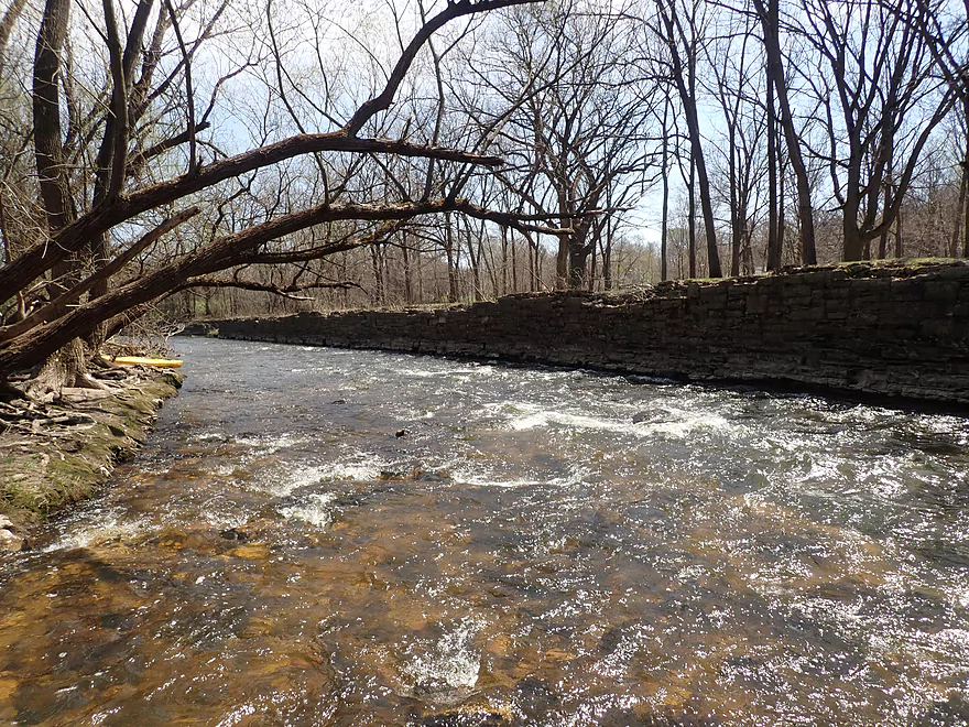
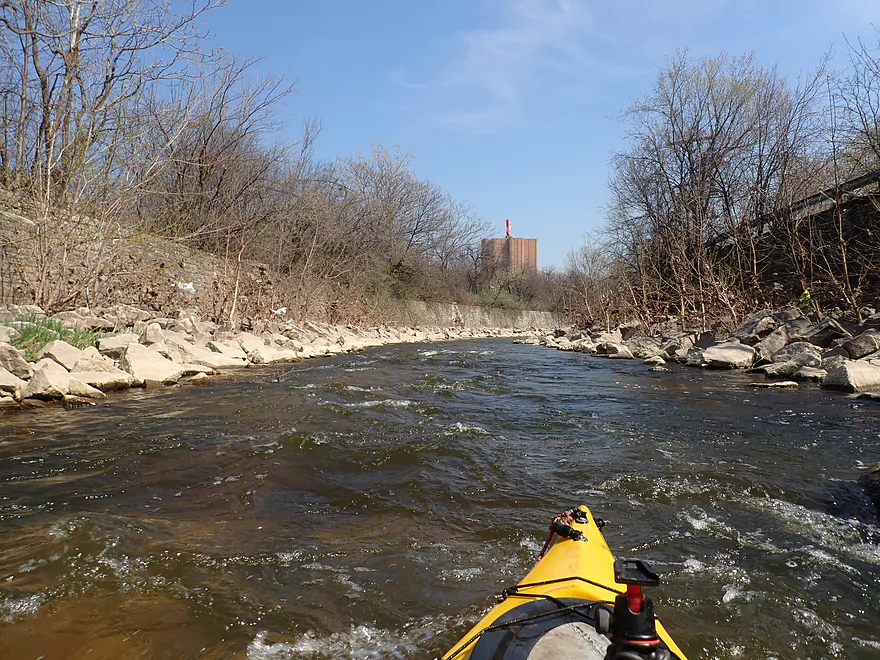
Starting the trip at Hoyt Park
“Rubble Rips” (where a previous river impediment was removed)
Bit of a tree strainer by “Second Rubble Rips”
A surprising number of gravel bars
Another minor strainer
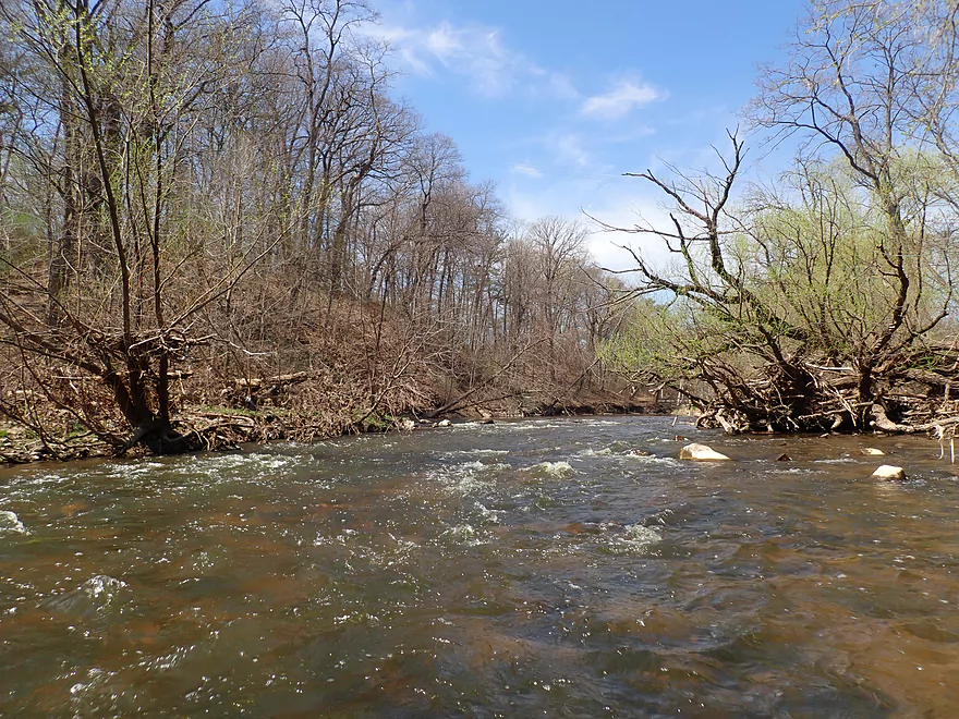
Scenic stretch
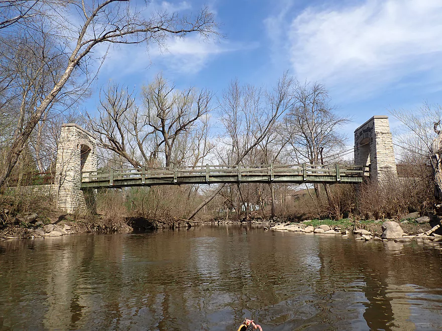
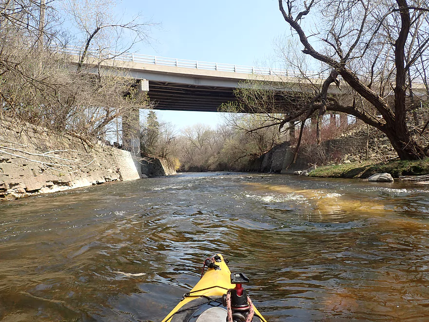
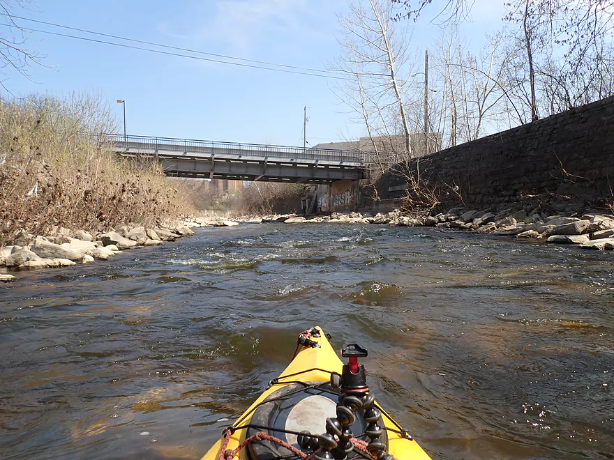
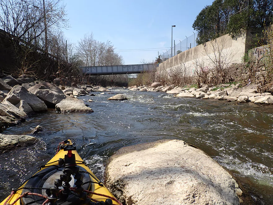
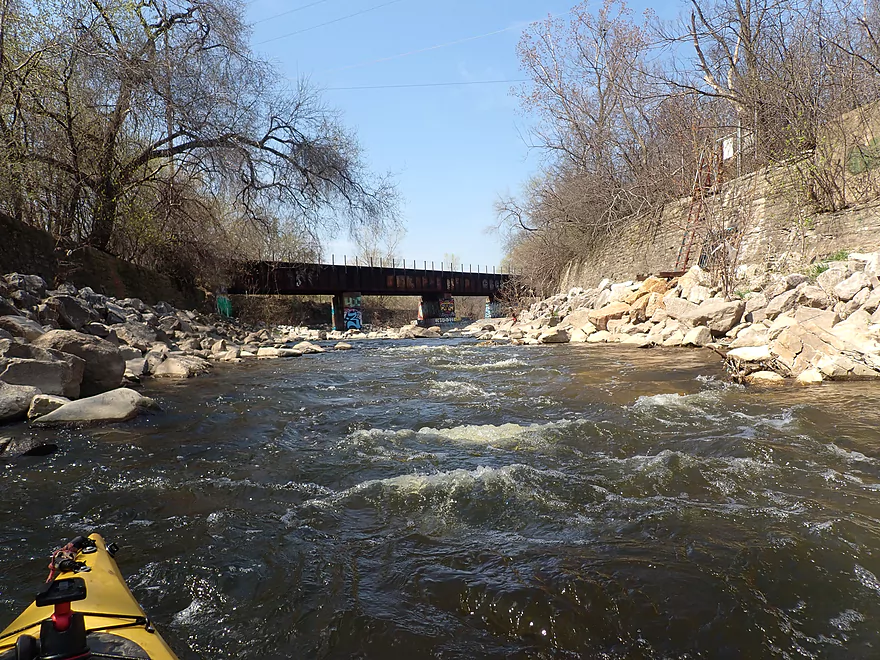
Second Oak Leaf Trail bridge
Harmonee Ave
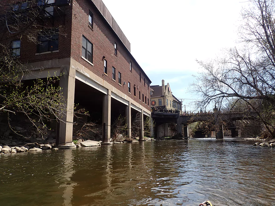
Entering “Tosa Village”
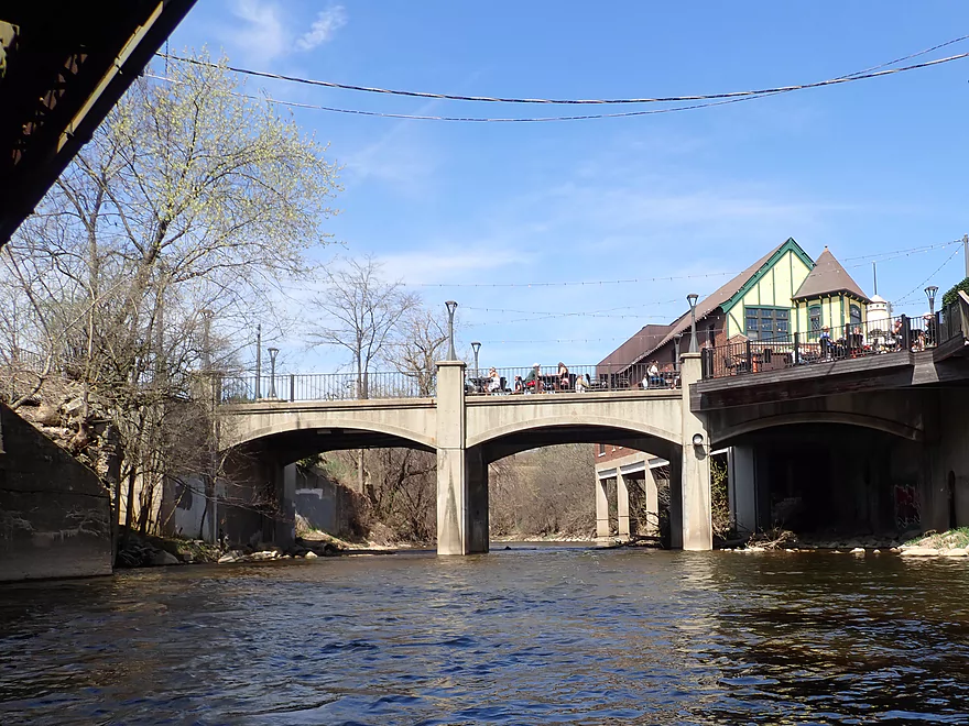
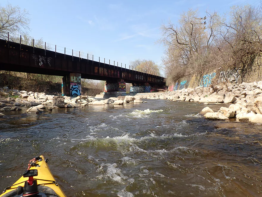
Bridge has dining tables on it!
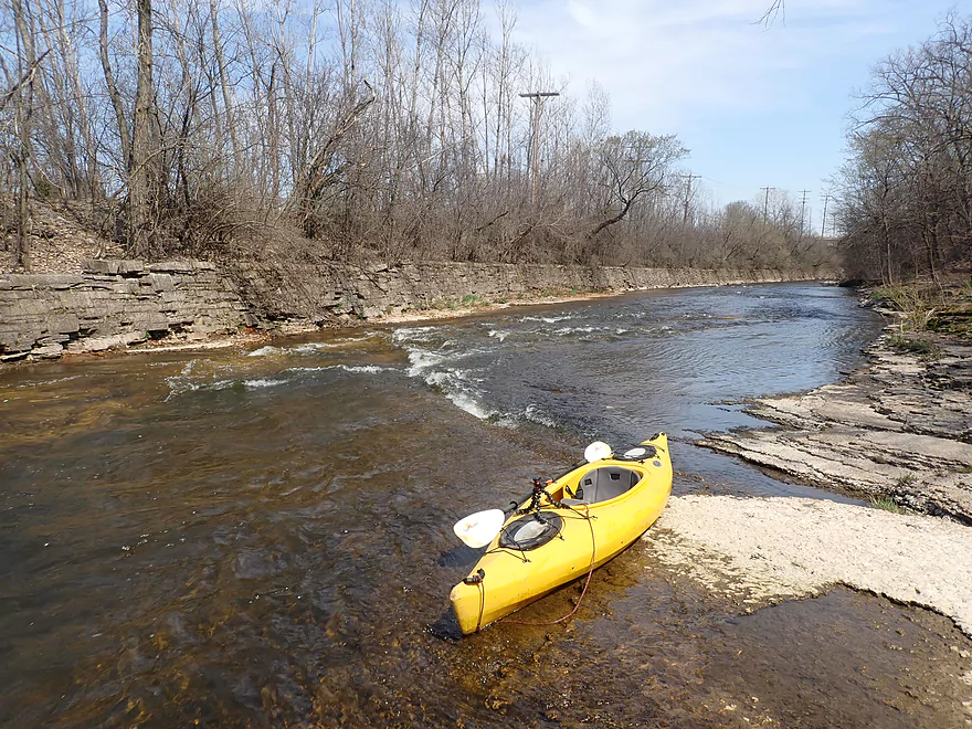
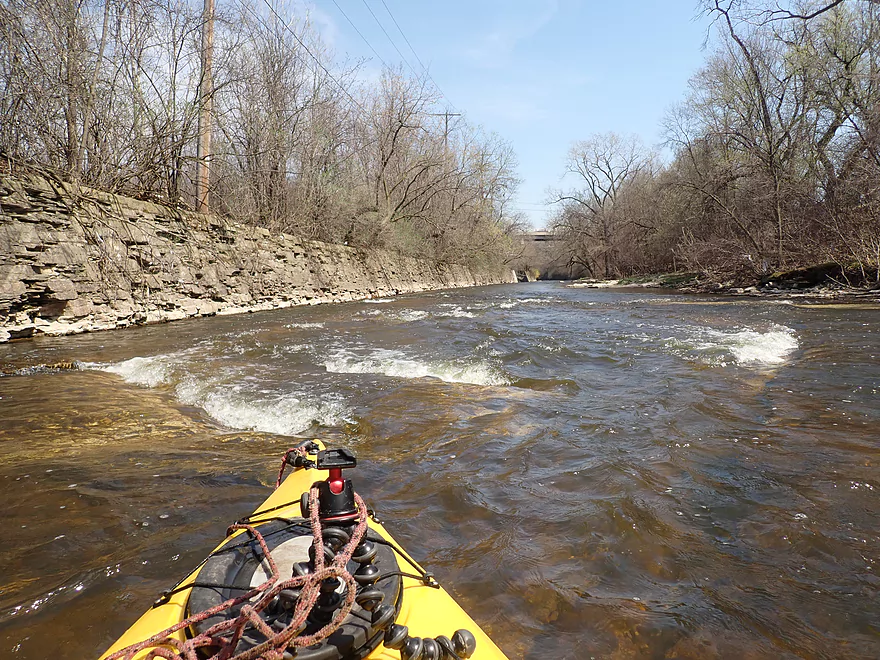
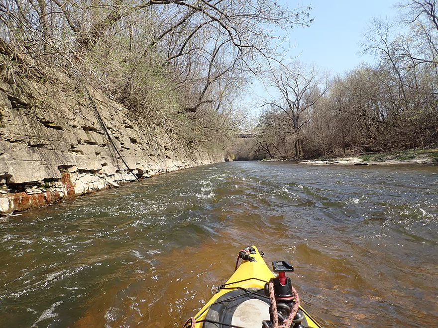
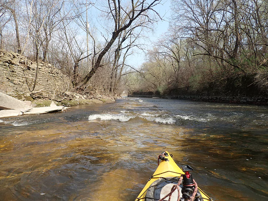
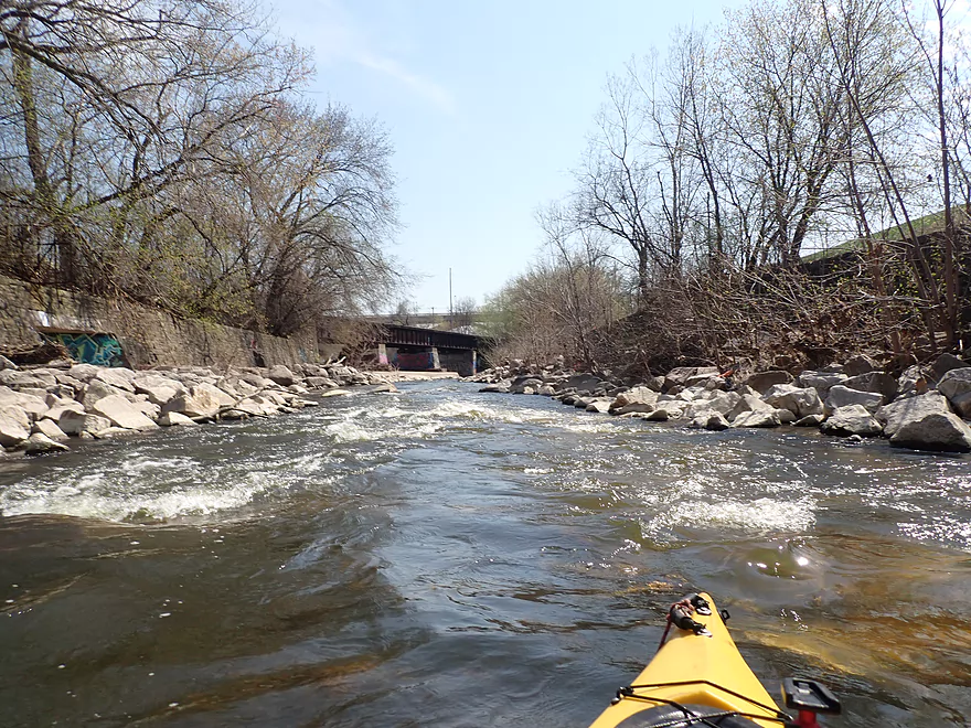
Rapids starting to get stronger
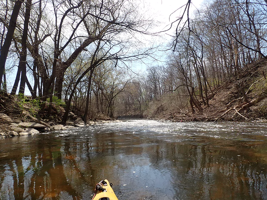
Going through a cool stretch
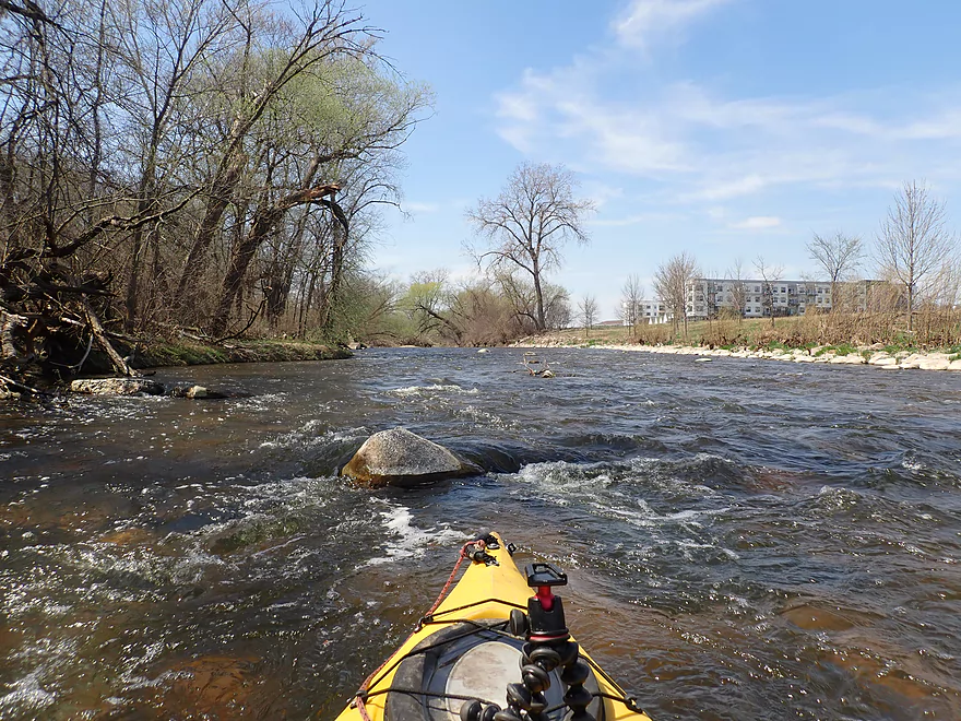
Some rocks to dodge, but overall fun rapids
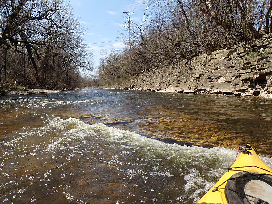
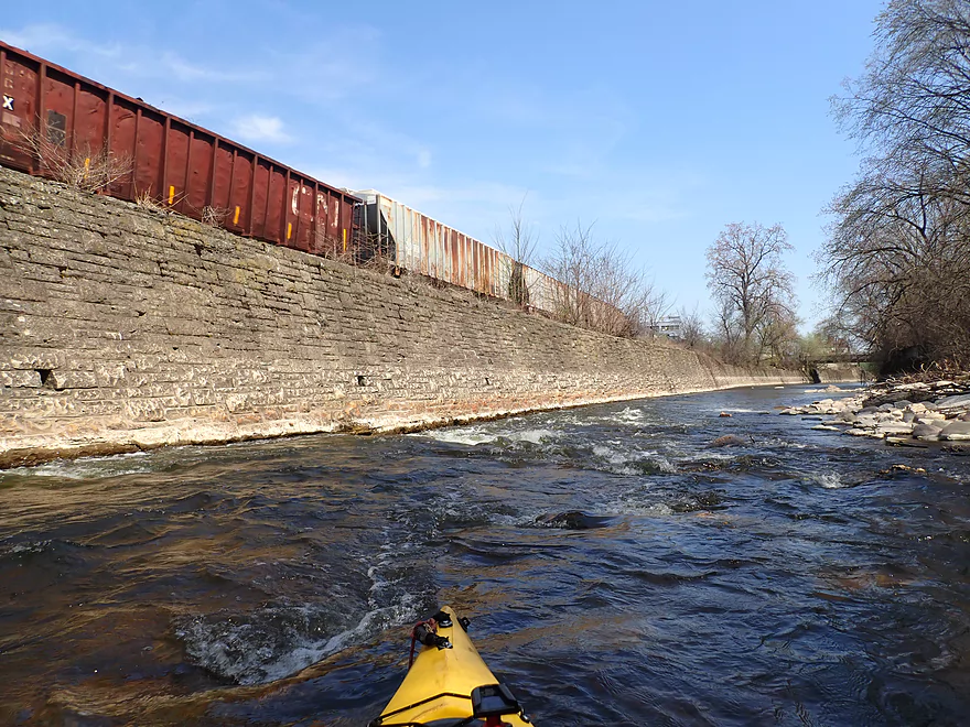
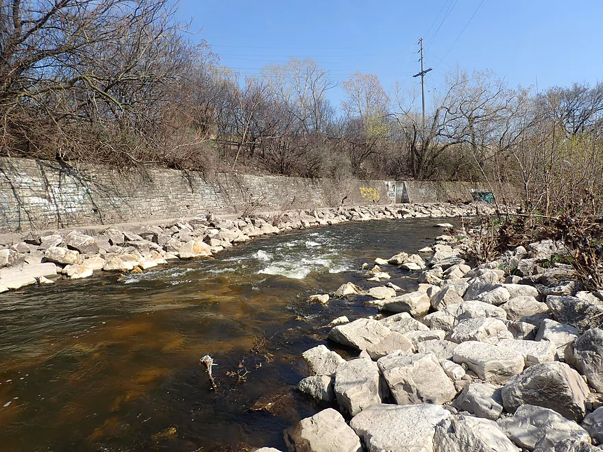
An impressive brick wall
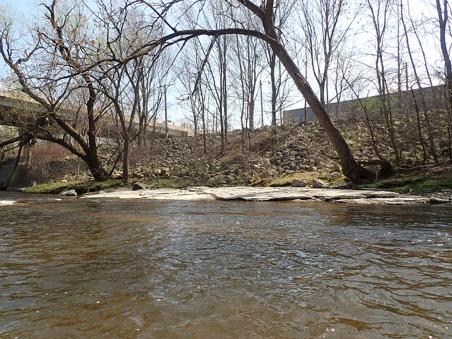
Coming up on Hart Park and another pedestrian bridge
Reverse view
View from below the bridge
…And above
River opens up after that
But stays fast and scenic
70th Street
This all still part of Hart Park
Some small but nice boulder gardens

Now in the Jacobus Park area
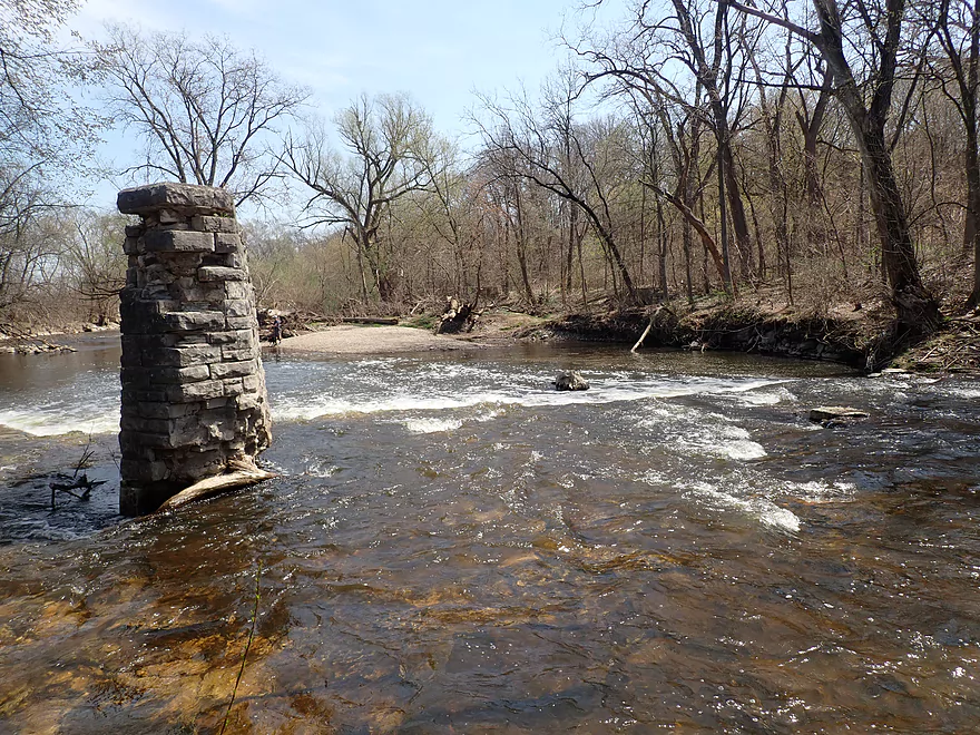
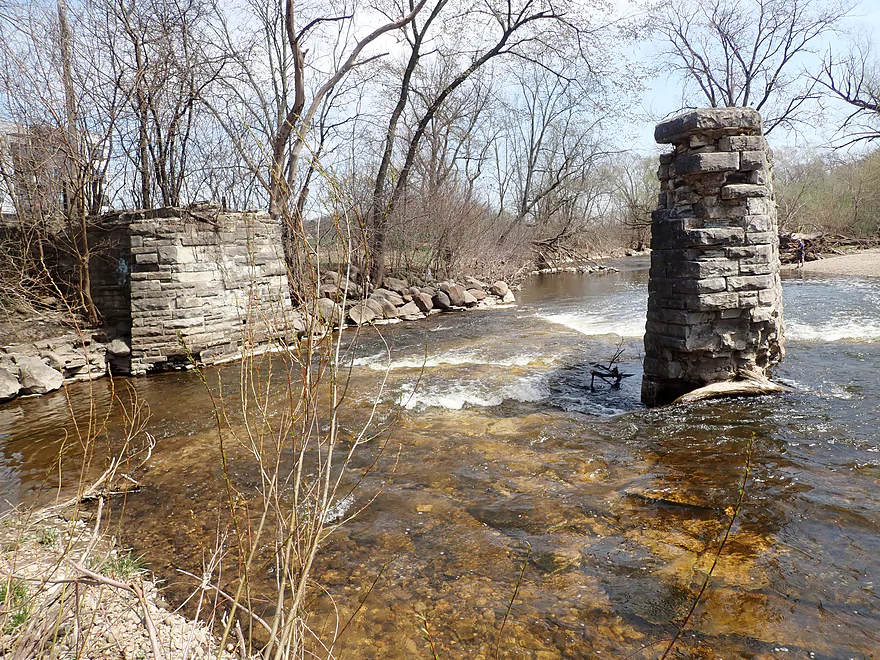
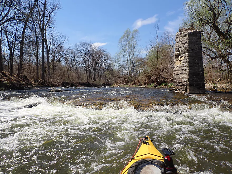
Remnants of a washed out bridge–there is a ledge here
North side is less steep but requires tighter turns
Reverse view
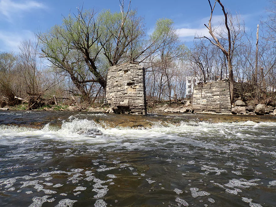
Only two pylons remain…the third was recently destroyed by a flood
The area upstream and just downstream from Jacbous is maybe the shallowest of the entire river
Careful navigation is needed to avoid hitting rocks on these shallow rapids
This really reminded me of the Upper Black River
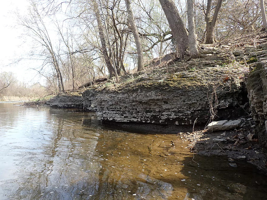
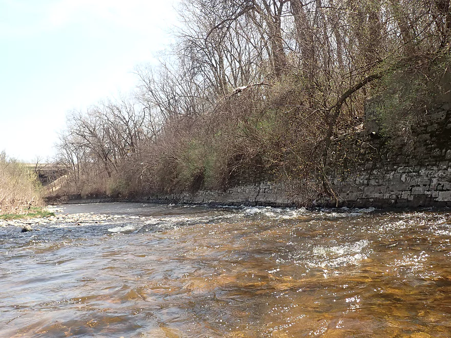
Small limestone outcrops
Interesting geology with the slanted exposed bedrock
The rapids on this stretch were great fun
Hawley Road (we are now officially in Milwaukee)
A natural bedrock ramp might make this a good access
Red-tinted clarity really showed off the bedrock
River starts to speed up
One of many small standing waves
Paddling on the sun
These are babies…but in high water, kayakers will surf big waves here
Getting passed by a Canadian Pacific
Some of the rapids flowed into the retaining wall
Cool wall curvature (Doyne Park is to the right)
Worst strainer of the trip (can portage on left)
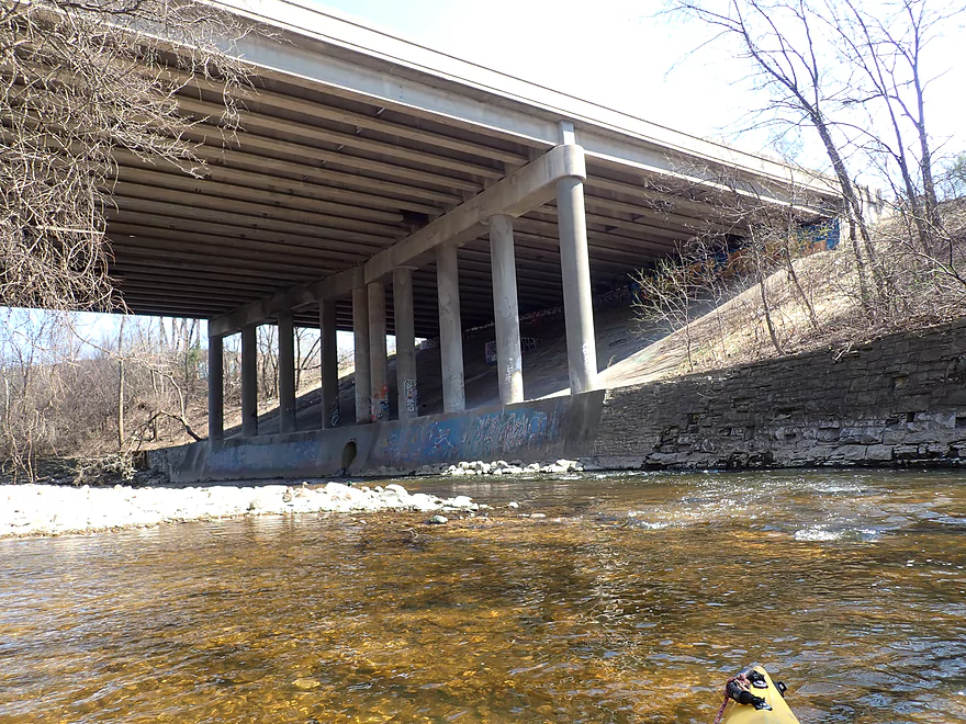
Stadium Freeway
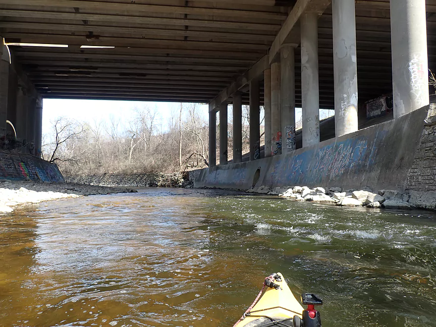
Impressive bridge columns
Coming up on Class 3 rapids (should have scouted from the left gravel bank)
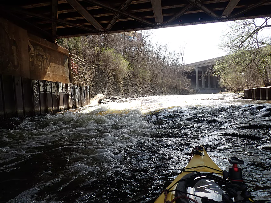
A steep, high-volume drop…I got a lapful of water here
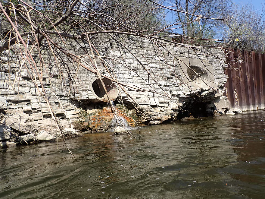
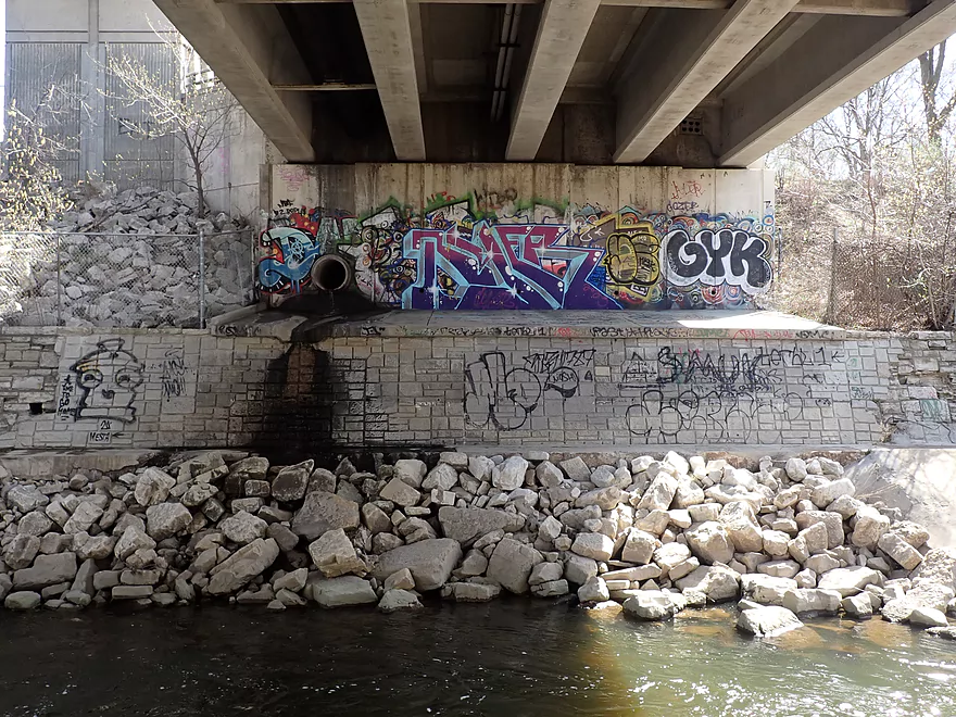
One of many stormwater outlet pipes…not all were so innocent
Coming up on 45th Street
This the start of the major remediation
Best part of the entire trip!
Remediation extends over 4000′ and contains many rapids
This is a very fast stretch
The river bottom here used to all be flat concrete
Remediation has accidentally turned this part of the river into a Class 2 whitewater park
A paved trail system parallels the river here
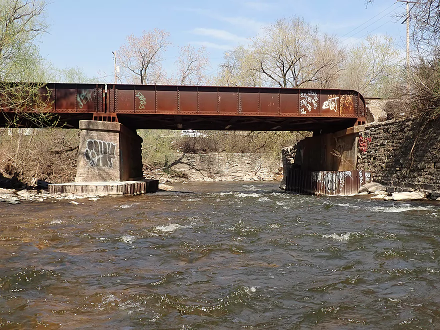
Stronger rapids by the second railroad bridge
Remediation team did a great job of adding meanders, pools and riffles to the river
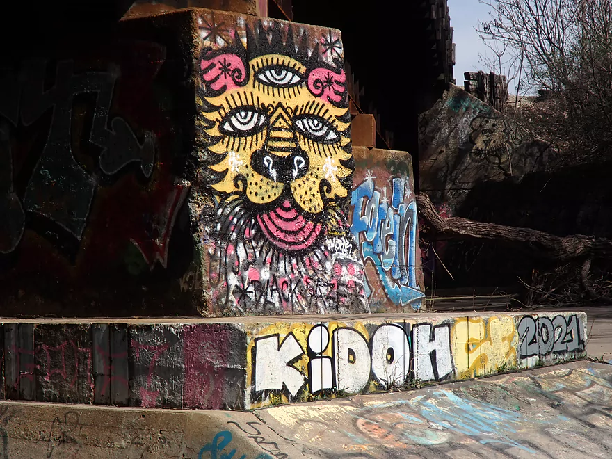
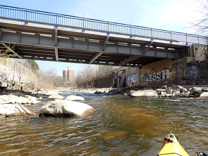
Some of the graffiti was actually good
Reverse view from the adjacent pathway
Still more rapids
Impressive arches under Wisconsin Ave
Taking out under the bridge
Graffiti art with diffraction spikes!
A known issue on the Menomonee
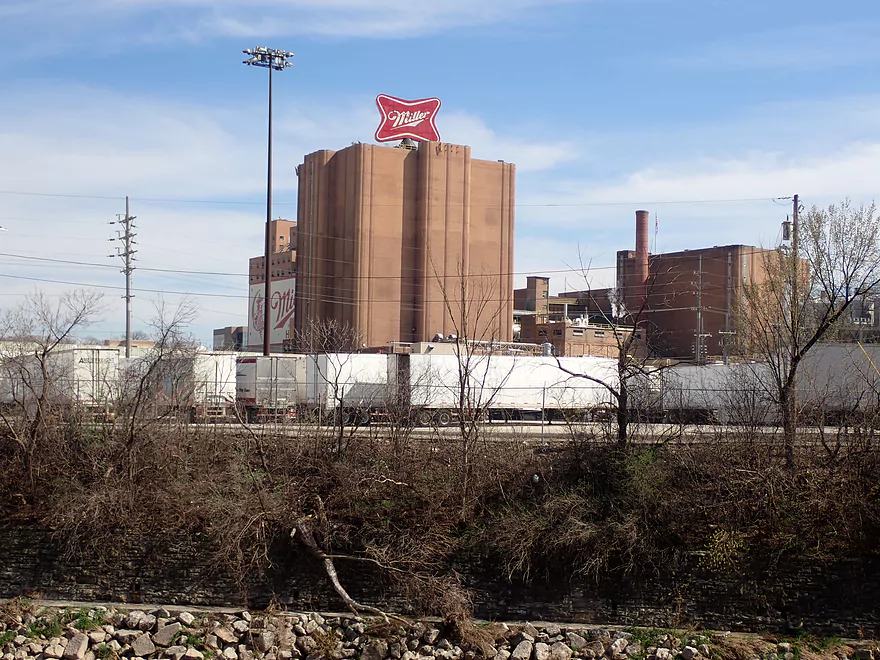
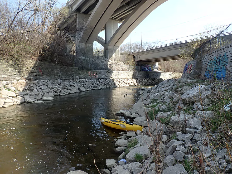
Ending the trip at the Bluemound Road access and in sight of the looming Miller Brewery
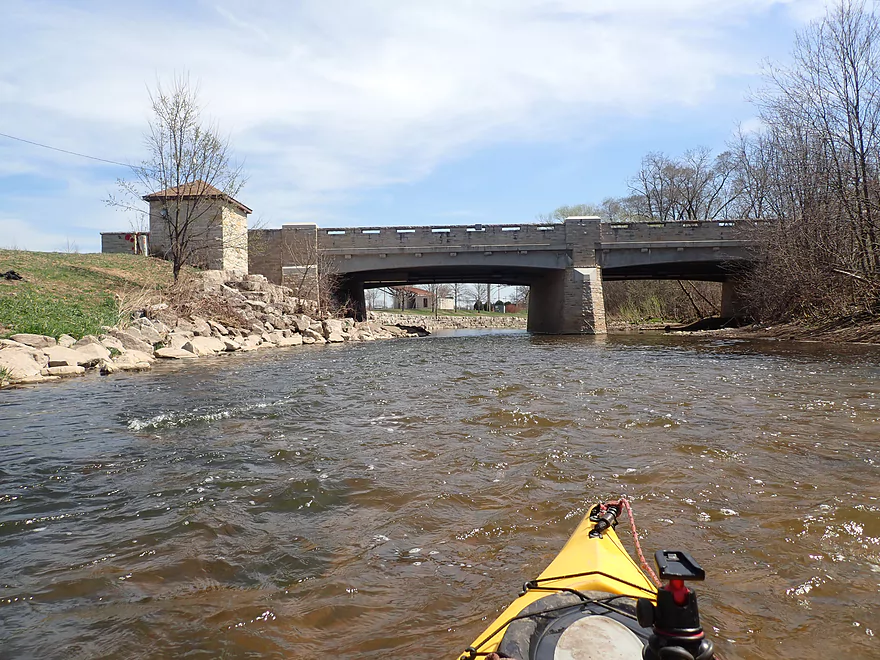
Menomonee River – Hoyt Park

The Menomonee is a fast urban river that flows through the Milwaukee metro area. In recent years, it has experienced several cleanups, remediation projects, and concrete removal. In many ways it is a completely different river now compared to a decade ago and is finally a relatively kayak-friendly river (although with caveats). For starters only paddlers with life-jackets and prior Class 2 whitewater experience should paddle it. Because of some tricky situations and fast rapids, it is not a beginner’s paddle, but should be great for anyone with some Class 2 whitewater experience.
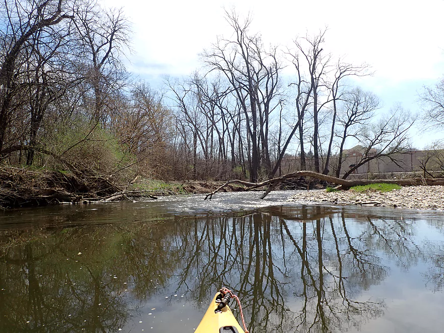
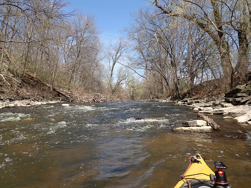
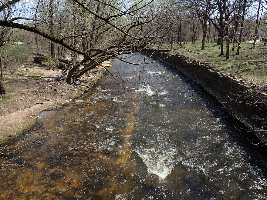
There are many put-in options, but I opted to start at Hoyt Park in Wauwatosa, which is a nice stretch of the river. A long wooded corridor flanks the river for much of the park’s length. The Oak Leaf Trail runs parallel to the Menomonee along the park and is popular with hikers and bikers. Roughly five years ago, MMSD removed five river barriers in Hoyt Park (several sewer crossings and small dams). The primary intent was to help fish, but as a side-bonus it has made this stretch more navigable for kayakers. All that remains of the old barriers are some minor rapids.
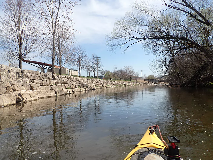
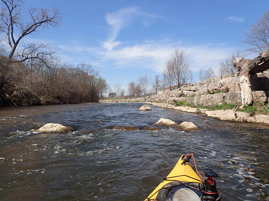
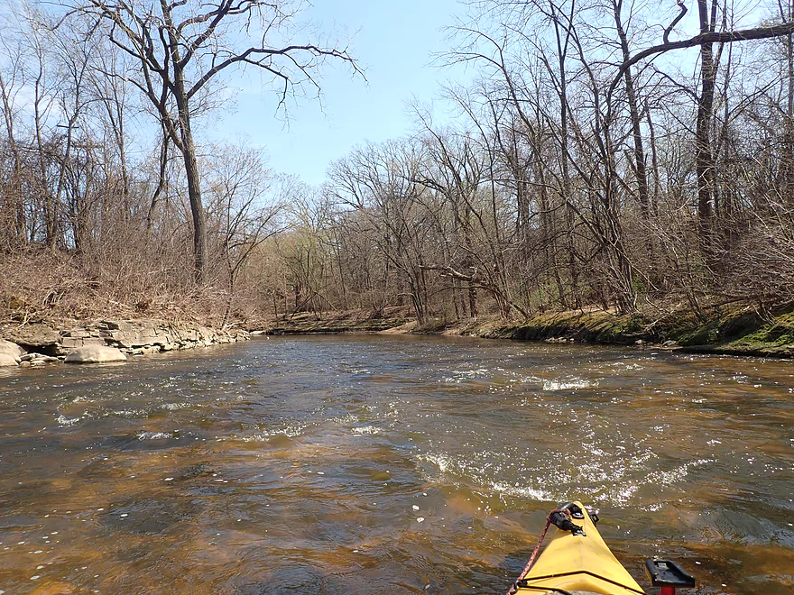
The river would continue through Hoyt Park for about a mile. I was impressed with the clarity, the Class 1 rapids, and the size of the gravel bars. This is likely somewhat atypical, as it hadn’t rained for a while and levels were on the low end. I would consider this a shallow run, but thankfully I didn’t experience any serious ground-outs nor did I need to walk any parts.
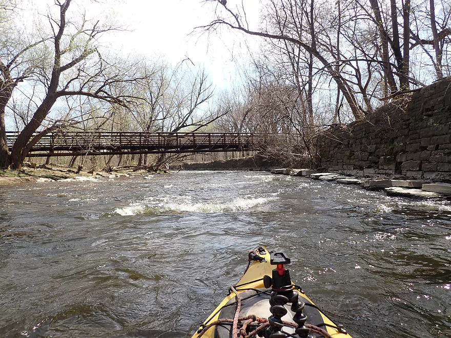
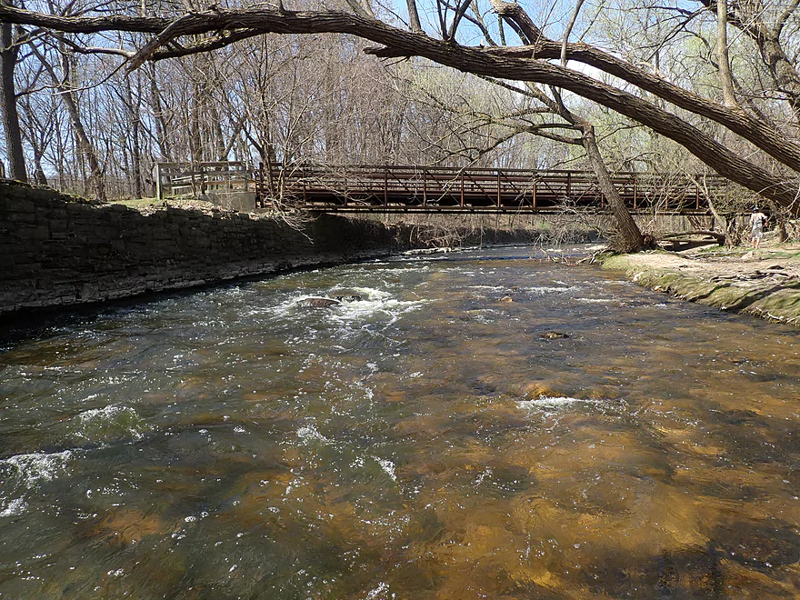
A second scenic pedestrian bridge marked the entrance into “Tosa Village”. This is a quaint restaurant/shopping district in Wauwatosa that has a European vibe. One of the bridges actually had tables on top and diners who watched as I paddled directly under them.
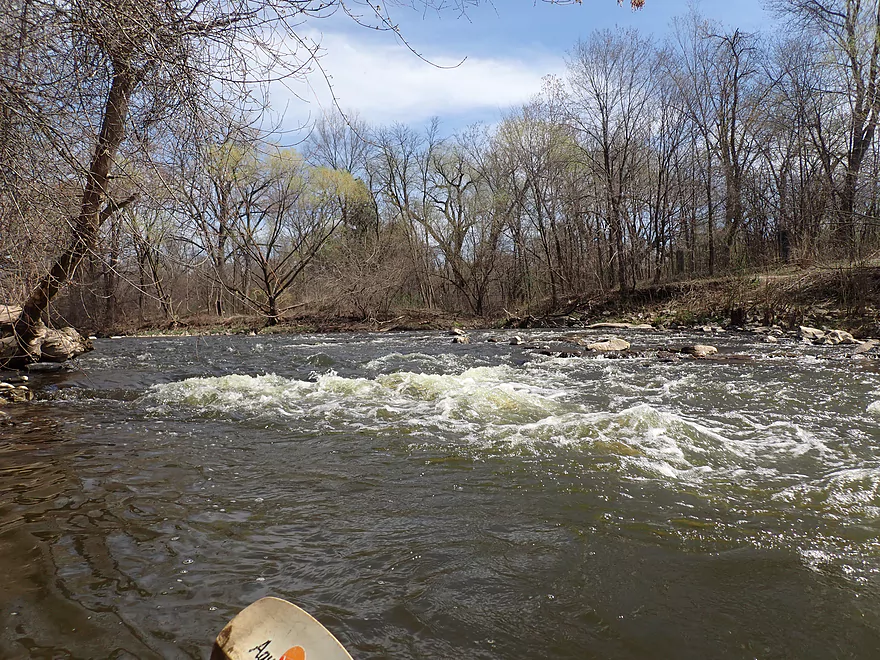
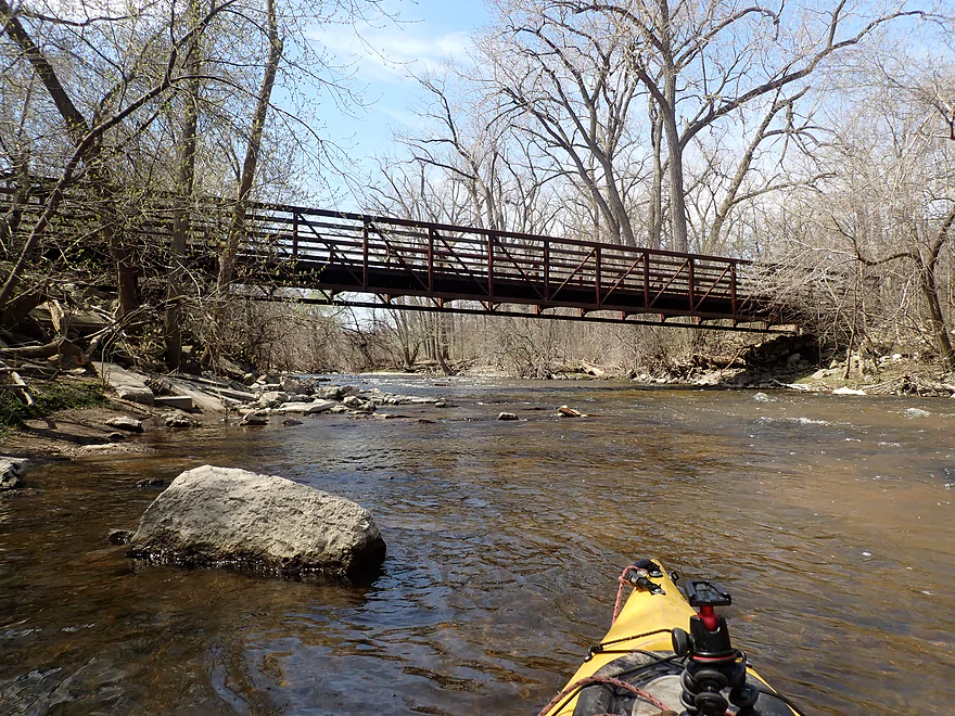
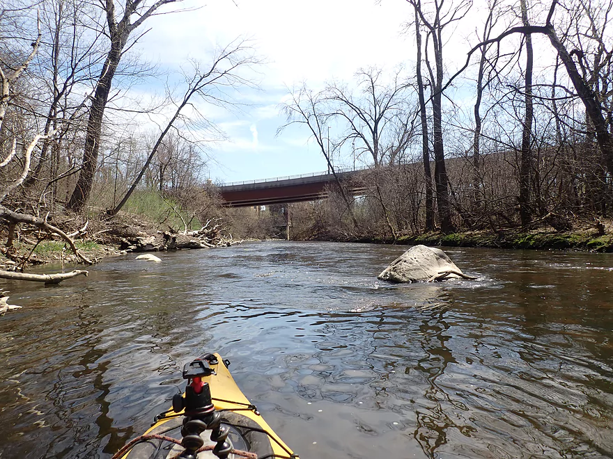
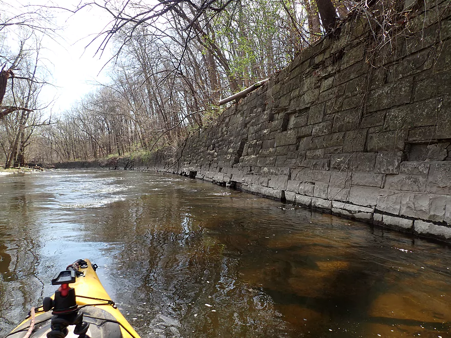
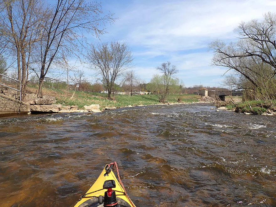
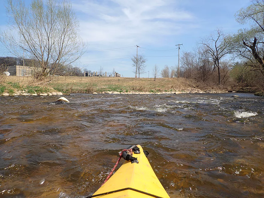
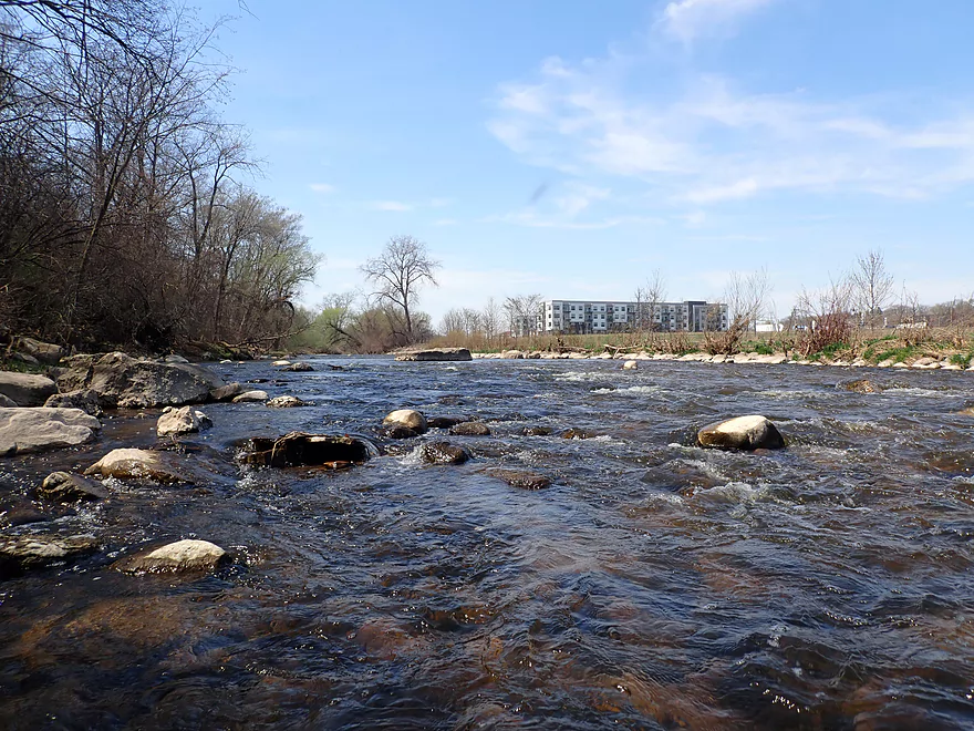
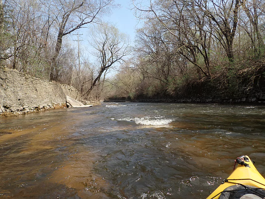
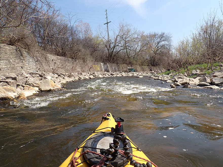
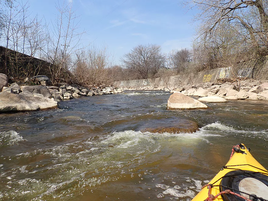
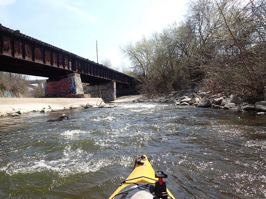
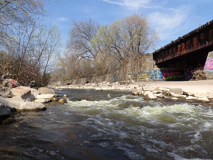
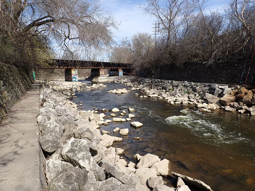
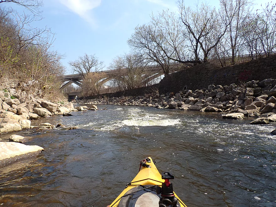
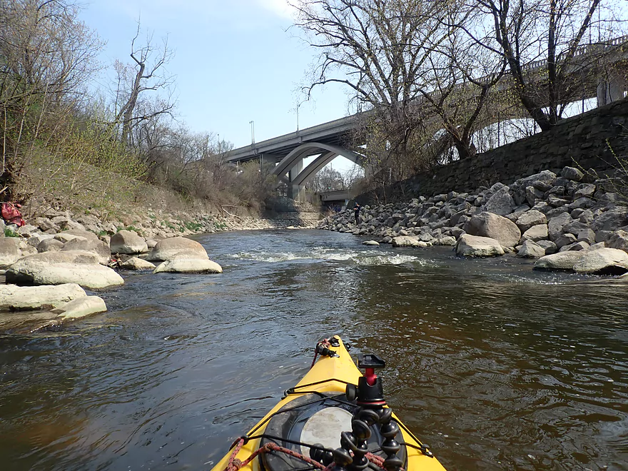
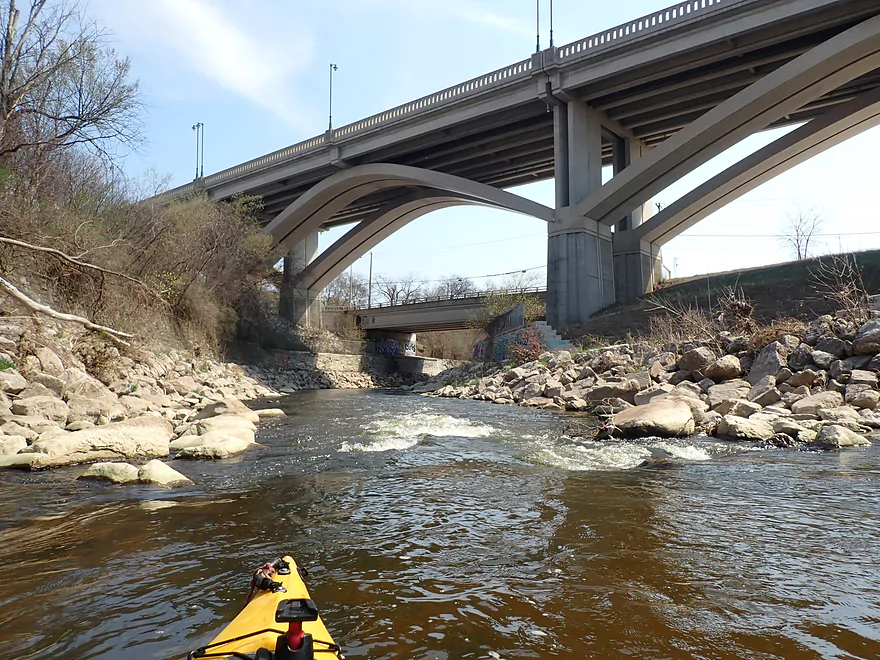
Following the third Oak Leaf Trail bridge, I entered Hart Park. Here the rapids became stronger and careful navigation was required to get around the rocks, but I didn’t think it was too bad. The banks were wooded and surprisingly scenic, and at times it felt like paddling up-north. Along the western shore was a long retaining wall built of brick. The old brick bridges/tunnels/walls are a treat to see as they are well crafted and much more attractive than modern cement. After the river makes a slow sweeping left turn it plunges under Oak Leaf Trail bridge #4. Here there were strong Class 2 rapids with small standing waves, but I thought these were plenty manageable and fun.
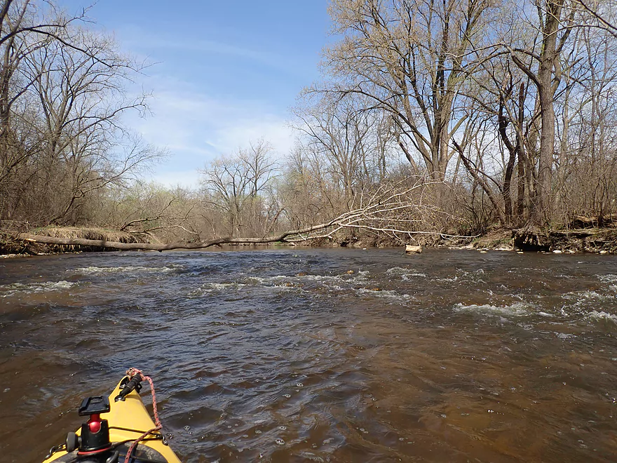
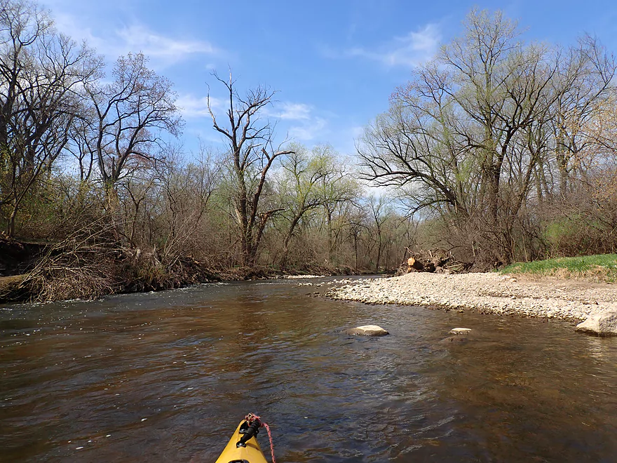
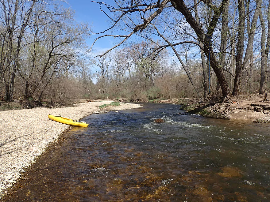
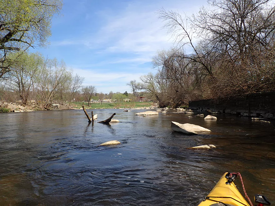
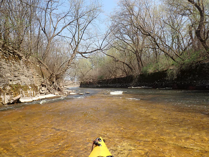
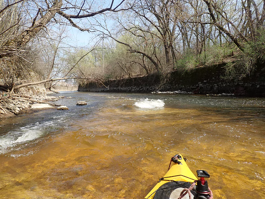
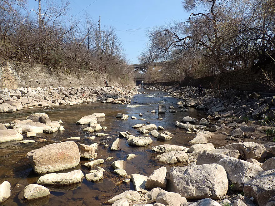
Between Hart Park and Jacobus Park is one of the more open and shallower stretches of the river. But it’s also very attractive, and the combination of the rapids and boulder gardens reminded me favorably of the Upper Black River.
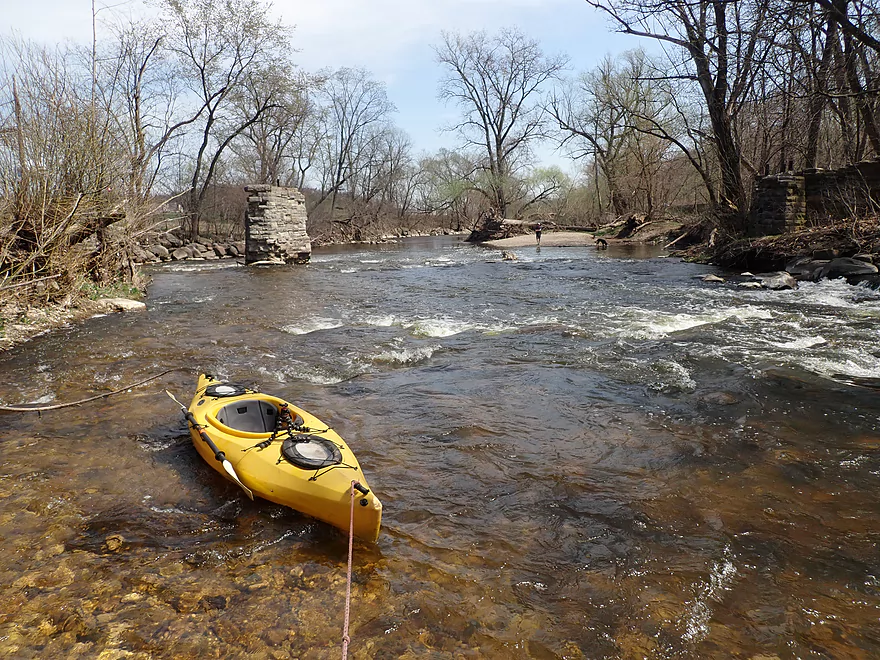
In Jacobus Park I came upon a pair of old bridge pylons. American Whitewater had warned of a tree blocking one of the channels, but thankfully this wasn’t an issue. It appeared that high water not only flushed the tree downstream but partly destroyed a third bridge pylon. There does remain a one-foot ledge in the bridge area that kayakers will have to go over. The left side has a more gradual slope, but requires tighter turns, while the right channel is more steep and direct. Personally I chose the right channel and that worked out fine.
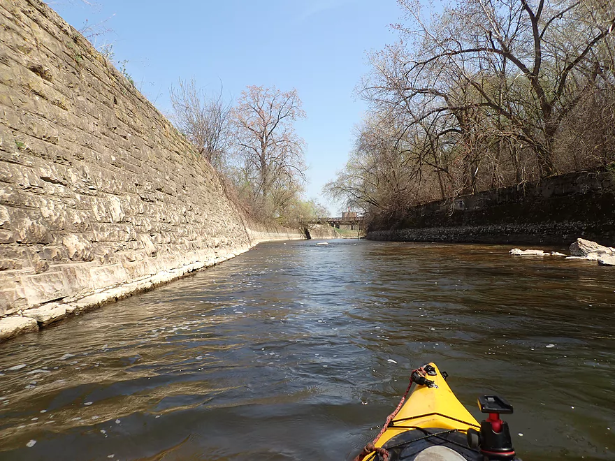
So far this was a pretty good trip, but the best part wouldn’t even start until after Jacobus Park. Here the shoreline on both banks was hemmed in by rustic brick walls (and a brief limestone outcrop). The river flowed very fast over flat, slanted bedrock. This resulted in many small standing waves that were super fun to paddle though. What made this even cooler was that the clarity was surprisingly good (thanks in part to shallow levels and the afternoon sunlight), and I could consistently see the smooth rock bottom of the river as I rolled over the waves. The combination of clear, red-hued, fast water over bedrock really reminded me of Robinson Creek (which is high praise).
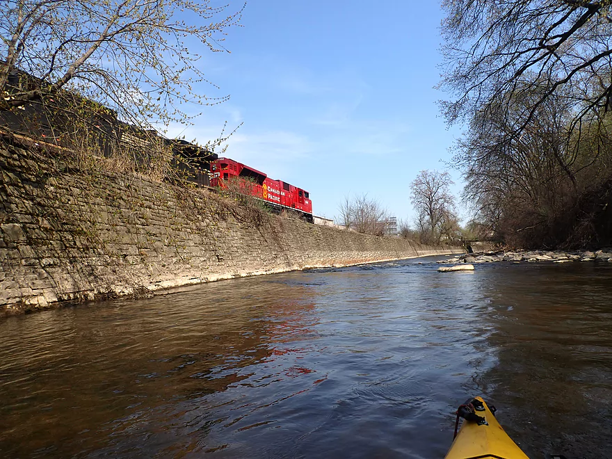
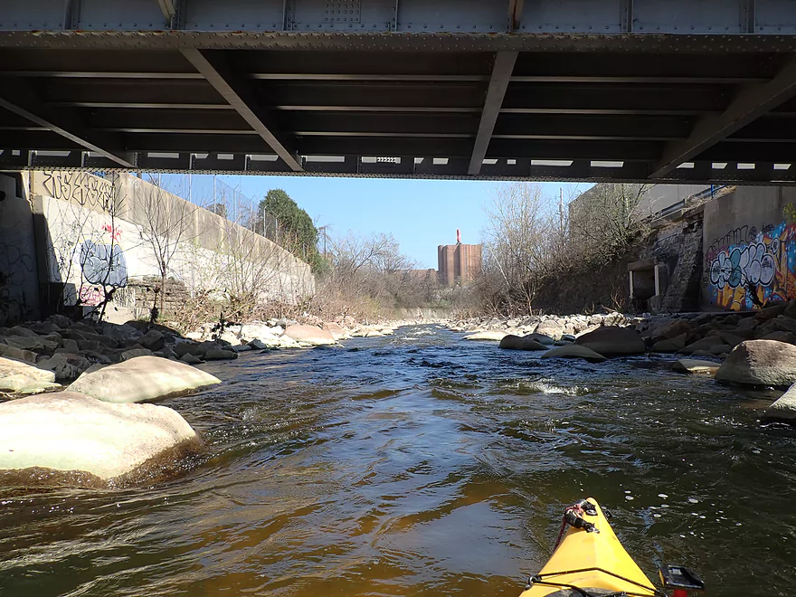
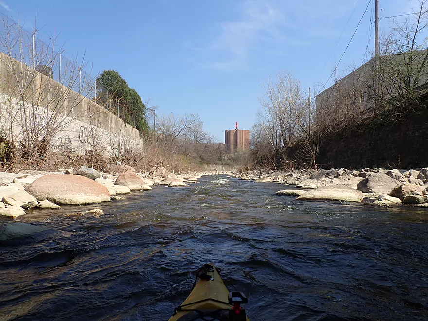
Following the Hawley Road bridge, the river opened up again somewhat. Here I was passed by a Canadian Pacific just a mere 20′ to my left. Following a tricky strainer that I should have portaged, I passed under Hwy 175. This was a tall and massive freeway bridge with impressive pillars. At the base was some urban graffiti. Normally I’m not a fan of this, but the graffiti on this trip seemed unusually sophisticated and colorful…some was actually good.
Soon after Hwy 175, I would encounter the strongest rapids of the trip. Under a railroad bridge there was a large Class 3 chute. I probably should have scouted first via the adjacent gravel bar, but I made it through ok albeit I got a lap full of water from a large standing wave at the bottom.
Along much of the Menomonee are elevated culverts and outlets. Most are supposed to be storm-water drains and should have been dry (it hadn’t rained in a while). But some weren’t, and from my research meant this they likely contained some raw sewage leaks. The Menomonee does suffer from high coliform counts (more on this later). But I think you’re mostly ok as long as you don’t kayak after a big rain and avoid exposing open sores to the water. In many ways the Menomonee is to Milwaukee County, what Badfish Creek is to Dane County. Both are not the cleanest or most natural of rivers, but they are both fast, clear, and excellent paddling experiences if you are willing to look past their links to large urban sewage plants.
The last half mile, starting from 45th Street, turned out to be the very best part of the trip. The river below 45th Street used to have a flat concrete base. But this was deteriorating and an impediment to spawning fish (and recreational kayakers, although some paddlers did enjoy the high speeds created by the combination of the flat concrete and steep grade). Roughly five years ago, MMSD ripped out 1000′ of old concrete and remediated this stretch with quarried rocks. The work has since been completed and while not perhaps the most literal restoration of the river (there didn’t used to be that many boulders!), it looks fantastic and fish can now migrate upstream. The fill was designed with slight meanders, pools, and riffles to give fish a chance to “catch their breath” before heading further upstream. It wasn’t intentional, but this has resulted in a fantastic whitewater run for paddlers with some of the best Class 2 rapids I’ve ever run.
The massive arched Wisconsin Ave bridge, huge Miller sign, and noisy trucks loading Miller beer were a sign I was nearing my take-out. Just under Wisconsin Ave and off of Bluemound Road, the remediation crew had torn down a stretch of retaining wall to access the river. With construction done, it’s been turned into a public space. The original plan for the area was to actually construct a proper access ramp on the west shore, but it appears they haven’t completed this yet (hopefully it is still on their to-do list). Until then, you have to climb up on the rocks to get out which isn’t ideal but is doable.
I could have continued further downstream past “Miller Park” and maybe down to Lake Michigan, but I decided to save that for another trip. A separate remediation project completed a year later worked on restoring the Menomonee from Hwy 18 to the ballpark. Unfortunately this was done by a separate construction company and they didn’t do as good of a job with the meanders/pools/riffles (it’s a less interesting straight shot). But it’s still a nice stretch of restored river that I look forward to doing in the future.
In summary this was a fantastic trip. Everything (rapids, scenery, boulders, and urban landscapes) turned out better than expected. I was especially happy that my “low” 109 CFS run was actually viable, as I had anticipated needing to walk and boat drag some stretches. The remediation work was fantastic, and I suspect this will spur future interest in the river. Special thanks to American Whitewater, Mike Dollhopf, and Timothy Larson for their intelligence on the river which made planning this trip possible.
Sights included several large fish (likely carp), one crayfish, and ducks. The highlight was a duck who got swept down some rapids but seemed to handle them pretty well. Since remediation, salmon have returned to the Menomonee River which is great news. You should be able to spot these spawning in October.
Lime Kiln Park: A trail network leads past preserved lime kilns, three small waterfalls, and incredible rock formations/dells along the Menomonee River. This is likely the most scenic stretch on the entire river, so why don’t more kayakers paddle it? Whitewater paddlers used to during high water, but sadly logjams have sealed the entrances and exits to the main canyons. Hopefully locals band together to clear them out. This has a lot of potential and could be Milwaukee area’s version of Pewit’s Nest. Note, there is a second Lime Kiln Park located in nearby Grafton with the same name, but I’m actually referring to the park in Menomonee Falls. The city was named after the waterfalls in the park.
- Google 360 View of Dells #1
- Google 360 View of Dells #2
- One of the waterfalls
- An insanely high whitewater run through the dells
- American Whitewater’s report on Lime Kiln Park with an ominous warning about the logjams
Annunciation Greek Orthodox Church: This was one of Frank Lloyd Wright’s last works and is located in nearby Wauwatosa. The building exterior is gorgeous.
Wauwatosa’s Magical Murals: There are a number of impressive wall murals located by North Avenue.
Tosa Village: This is a quaint European-themed restaurant/shopping district that paddlers will pass near Harmonee Ave. Highlights include a brick road, suspended lights, European architecture, and a pedestrian bridge with dining tables that overlook the Menomonee River. In some ways it seems cheesy, but it’s still cool and it has some nice restaurants.
Hoyt Park: You can leave your car in the main park parking lot and launch via the south shore. Here there is a faint trail system and several suitable bank locations for launching. This is an ok access, but you do have to drag your boat 280′ across a playground to reach the river.
Alternate Put-ins: Note for more access options not listed below, see the overview map.
- Hartung Park (2.5 miles upstream from Hoyt): This should be a decent access. Park on the shoulder of Menomonee River Parkway and hike west to launch. This upstream leg is decent with multiple rapids.
- Tosa Farmers Market/Harwood Ave (1.4 miles downstream from Hoyt): Downstream from the railroad bridge there are public parking lots and suitable access points on both sides of the river.
- Jacobus Park (2.4 miles downstream): You can launch by the old bridge. Shoulder parking is available on Honey Creek Parkway. Launching this far downstream would leave some nice legs off a trip, but if you only want to focus on the best rapids, this might be a good option.
West Bluemound Road Access: This is a relatively new access created by the recent river remediation efforts. It’s my understanding that to get the heavy equipment and rock fill into the river, they punched a hole in the old retaining wall and added an access off Bluemound Road. With remediation done, this is now a defacto public launch site that is popular with fishermen. The current moves pretty good and the shoreline is a bit rocky, so it’s not an ideal take-out, but I thought it was doable. Just watch your balance. A proper launch ramp was initially planned at this location and still may be built in the future.
Note, finding this location on your GPS can be tricky because it is covered up by elevated Hwy 18. You have to get on the lower Bluemound Road (not Hwy 18) to access the landing.
Alternate Take-outs: Note for more access options not listed below, see the overview map.
- Jacobus Park (1.6 miles upstream from Bluemound): Park on Honey Creek Parkway and launch by the old bridge. This might be a preferred take-out for those wanting to avoid the stronger downstream rapids. However the leg between Jacobus and Bluemound is one of the best stretches on the entire river.
- Three Bridges Park (1.7 miles downstream from Bluemound): A small parking lot is available north of the river by the Hank Aaron State Trail bridge. You can launch on either the north or south shores where there are established launch areas. Why take out here? From Bluemound to Three Bridges is the last of “ruggged Menomonee”. After “Three Bridges Park” the river slows, widens, loses most gravel/boulders, and becomes more developed/industrial.
- Harley Davidson Museum Pier (2.6 miles downstream from Bluemound): There is a pier south of the museum where kayakers put in and take out.
-
Harbor View Plaza (3.6 miles downstream from Bluemound): You should be able to shoulder park on Greenfield ave and use the pier on the Kinnickinnic River to take out. This bonus leg would be attractive to paddlers who want to see the Third Ward, the impressive retractable bridges, the Hoan, and the Port of Milwaukee which could have big ships in it.
Bike Shuttle – Bluemound Road to Hoyt Park: 3.9 miles with 121′ of ascent. This was a nice bike shuttle mostly along the paved Oak Leaf Trail. Note for those wanting a longer paddle trip ending near Lake Michigan, you can partly use the Hank Aaron Trail which parallels the lower Menomonee.
Uber/Lyft/Taxis: There are plenty of rideshare options in Milwaukee. You could easily do a “car drop”. Just lock your boat at the put-in site. Then drive to the take-out, park, and pay somebody to drive you back to the put-in. This way you simply paddle back to the take-out where your car is waiting.
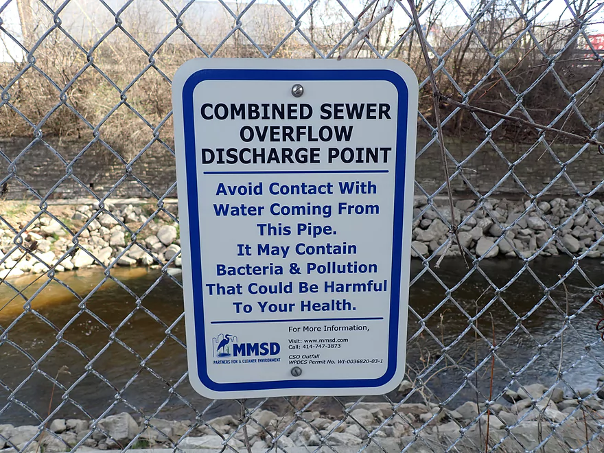
Bacteria and Coliform: The Menomonee and its main tributaries (Honey Creek and Underwood Creek) are plagued by sewage discharges. This has led to high coliform counts ranging from 2k to 20k cells per 100ml. Spikes have been recorded up to 160k/100ml which is extraordinarily high (the standard for beaches is 235/100ml). The worst outbreaks occur after heavy rain storms. Because MMSD combines some wastewater with rain water, this can overwhelm its treatment centers which in turn are forced to dump untreated waste into local rivers including the Menomonee. Knowing when a “Combined Sewer Overflow” event will happen is important and you can monitor current treatment capacity here. Personally I would be leery of kayaking on the river after a heavy rain (or a few days thereafter).
Unfortunately even during “dry periods”, the Menomonee suffers from some sewage pollution. As you paddle the river, you’ll notice a number of outlet pipes coming in from the sides located roughly 5-10′ above your head. If there isn’t rain, then these should be dry. Most of the outlets were indeed dry during my trip, but a few were wet with minor discharges. This is likely a sign of pipe leakage and/or illicit wastewater dumping from upstream communities.
For more details I highly recommend reading this Milwaukee Riverkeeper report. The short of it…stay off the river during/after a big rain. And even if there hasn’t been a recent CSO event, you should avoid exposing sores/wounds in the open water and should shower after a trip. Generally speaking, I suspect the river is “clean enough” during low water, but you should still be careful (the same could be said for many other rivers).
Logjams/Fences: None. Although major logjams have been known to appear on this stretch, so stay vigilant.
Strainers: There were several strainers on the trip. Most were not too serious and could be portaged if preferred, but they might be troublesome in high water. I’ve documented and included video time stamps of the strainers I encountered:
- 0:43 – Low tree – Pretty easy to paddle around.
- 1:17 – Bankside brush – Current pushes you into it but with strong strokes it can be avoided. Would be an easy portage via the adjacent gravel bar.
- 1:38 – Low tree – Pretty easy to dodge, but there is fast current and this could be a pain in high water. Would be a super easy portage.
- 2:48 – Tosa Village pedestrian bridge – The fast current will push you into a downed tree, but I thought it was pretty easy to dodge.
- 10:52 – Doyne Park strainer – This was the worst one. The current is fast and flows in a narrow channel directly into a brush and a wall. I got faceful of leaves and whacked my paddle hard against the wall. The good news is this is a super easy portage via a gravel bar on the north bank.
Rapids: Note, I’m not listing all the rapids I encountered, just what I thought were most major. The class ratings are my subjective opinion and based on 109 CFS. These rapids become much stronger and more dangerous at higher levels. Advanced whitewater paddlers (who know how to eskimo roll and have dedicated whitewater boats) will prefer big water (say over 400 CFS) and will likely prefer the scouting information from American Whitewater which focuses on high water advanced trips. Locations of the major rapids can be seen on my trip map. Definitely wear your life jacket on this river.
- 0:06 – Class 1-2 – Rubble Rips: Not too difficult at low levels.
- 0:43 – Class 1 – Second Rubble Rips. This is mostly not too bad, but it is preceded by a tree and then a bankside strainer that must be dodged. You can portage this via the adjacent gravel banks.
- 1:45 – Class 1 – Wave Train: Very scenic area with a large gravel bar preceding it.
- 3:04 – Class 2 – Hart Park Rips: Very scenic rapids. There are some irregular rocks that take sharp maneuvers to avoid but I didn’t find this too difficult.
- 4:22 – Class 2 – Bikeway Bridge Rapids: These were surprisingly strong and formed some small waves. They were however super fun and seemed pretty safe.
- 5:13 – Class 1 – Skate Park Rapids: A scenic stretch of wider and shallower rapids.
- 6:23 – Class 2 – Jacobus Bridge Pier: The remnants of a washed out bridge create rapids here. The north end falls over several small ledges and isn’t bad, but does require tight turns. The middle stretch has a steeper ledge but is shallower. I didn’t find this too difficult, but trees have been known to accumulate in this spot.
- 8:09 – Class 2 – Doyne Park Waves: This is part of a longer 1500′ scenic stretch that includes many small waves formed by the fast current flowing over the slanted bedrock. It’s very cool and fun. In high water, huge waves can form which serious whitewater paddlers enjoy playing in.
- 10:35 – Class 1-2 – ARF/UAW Rapids: This is mostly straightforward. In very high water you may have to worry about banging your boat into the wall.
- 11:32 – Class 3 – Railroad rapids: Strongest rapids of the trip. This is a high volume drop over a decent ledge. You can scout/portage via the gravel bank on the left side. Try to avoid the rock at the bottom and try not to hit the wall on your right. Portage if you’re not comfortable running.
- 12:02 – Class 2 – Remediation Rips: From 45th Street to Bluemound Road (0.3 miles) is a stretch of heavy remediation. The new fill (mostly quarried rock) creates fantastic and scenic rapids that are a lot of fun.
Milwaukee Traffic: Honestly, driving I-94 through the Milwaukee metro area felt more harrowing than my kayak trip or bike shuttle! If you’re not familiar with Milwaukee freeways they are unpleasant with tight elevated on/off ramps, confusing interchanges, suicide merges/exits, and left-hand off-ramps. Many drivers aren’t considerate in letting you make required lane merges despite long turn signals. I witnessed two major wrecks and passed through several traffic jams. If new to the area, studying your directions from Google Street View ahead of time wouldn’t be a bad idea. Rush hour and Brewers games are the worst times to be on the freeway.
Closest Gauge: Menomonee River @ Wauwatosa
Trip Depth: 109 CFS or 2.3′
Navigability Estimates: Note there are many differing opinions on what the right paddling depth is for the Menomonee. I did it at 109 CFS which I was warned was too low and would require walking, but I never once had a serious hang-up (although I did hit a number of rocks in the rapids). In my case I have a shallow drafting boat and am good at navigating through shallow rapids, so others may require higher water. The most shallow stretch is between Hart Park and Jacobus Park which can be easily scouted ahead of time. The following is my very rough depth guide based on my personal experience and what others recommend. Always use your own judgement. Also regardless of levels, definitely wear your life jacket for any trip on the Menomonee.
- 0-60 CFS: Too shallow.
- 61-100 CFS: A very shallow depth (and common depth in the summer). Expect some walking of the shallow stretches. Only remotely possible as a run if you have a shallow drafting boat.
- 101-150 CFS: Most sources will warn you this is too shallow, but if you have a flat bottom boat it’s a great target range as the water clarity will be good and the rapids won’t be too fierce. I never had to walk my boat at 109 CFS and was happy with my flow rate.
- 151-250 CFS: Likely a good target range for rec paddlers, although a few strainers and rapids will need special consideration. You should have prior experience with Class 2s before doing this leg.
- 251-400 CFS: This is likely the upper bounds for rec paddling and should only be attempted by experienced paddlers.
- 401-600 CFS: At this point some of the rapids and waves will be strong. Not recommended for rec paddlers IMO, but it is suited for whitewater paddlers who know how to eskimo roll and have special boats. For them this is actually on the low end of their preferred range.
- 601-800 CFS: River is fairly strong. Only suitable for advanced whitewater paddlers.
- 801+ CFS: Only suitable for expert whitewater paddlers who are familiar with the river.
More information on access points can be obtained by opening up the overview map.
- Upstream from Fond Du Lac Ave: The river is likely too small and congested to be run.
- Fond Du Lac Ave to Schoen Laufen Park: 2.2 miles. At times very small and flowing mostly through a golf course. Maybe 2-4 logjams.
- Schoen Laufen Park to Maple Road/Willow Creek: 0.7 miles. Maybe 1-2 logjams. Seems nice.
- Maple Road/Willow Creek to Rivercrest Drive/Burger King Parking Lot: 1.6 miles. Maybe 4 logjams.
- Rivercrest Drive/Burger King Parking Lot to Grand Ave: 0.5 miles. Generic suburban paddle.
- Grand Ave to Mill Pond Park: 0.8 miles. Maybe 1 logjam. Looks like a nice stretch although there is a dam and impounded water at the end.
- Mill Pond Plaza/Dam to Arthur Ave: 0.5 miles. An incredibly scenic stretch with fantastic dells and many Class 2 and Class 3 rapids. Sadly this leg has major logjams. Americanwhitewater.org warns against running this stretch. If you insist on running it, do it when water levels are low so you get around the strainers and scout on foot first through Lime Kiln Park. Here’s an incredible high water kayak run of this leg. This would be a stunning trip if it was ever cleared of logjams.
- Arthur Ave to Riverside Park: 0.4 miles. Maybe 1 logjam and brisk current.
- Riverside Park to Rotary Park: 0.9 miles. A nice prospect through Rotary Park with boulders and good current.
- Rotary Park to Rivers Edge Park: 0.7 miles. Maybe 3 logjams.
- Rivers Edge Park to Good Hope Park and Ride: 2.6 miles. Maybe 5 logjams.
- Good Hope Park and Ride to Hwy 175: 0.5 miles. Maybe 5 logjams.
- Hwy 175 to Frontier Park: 3.0 miles. Maybe 6 logjams.
- Frontier Park to Webster Park: 1.6 miles. Ok wooded prospect, with maybe 2 logjams. A massive cluster is visible from satellite just after Hwy 41.
- Webster Park to Currie Park: 1.6 miles. Stretch contains a mix of woods and a golf course but should be nice. Maybe 3 logjams including two significant ones which can be seen from satellite view.
- Currie Park to Hartung Park: 0.6 miles. Some boulder gardens. Current should start to pick up. Currie Park is likely a turning point in which the river becomes significantly more interesting for all remaining legs up to Lake Michigan.
- Hartung Park to Hoyt Park: 2.5 miles. A good prospect with rapids.
- Hoyt Park to Bluemound Road Access: 4.1 miles.
- Hoyt Park to Red Store Lot: 1.1 miles. A good leg with attractive pedestrian bridges and fun Class 1 rapids. In high water, the rapids will become Class 2.
- Red Store Lot to Tosa Farmers Market: 0.3 miles. A gentrified and attractive stretch by downtown Wauwatosa. Includes a bridge with dining tables on it that overlook the river.
- Tosa Farmers Market to Hart Park/Oak Leaf Trail Bridge: 0.4 miles. Scenic leg that includes multiple class 2 rapids. A very long brick retaining wall on the west shore looks really cool. Leg ends with super fun Class 2-3 rapids under the Oak Leaf bridge.
- Hart Park to Jacobus Park/Old Bridge: 0.7 miles. River opens up more with attractive boulder gardens, Class 1-2 rapids, and impressive brick shoreline embankments.
- Jacobus Park to Hawley Road: 0.5 miles. A fantastic leg. River flows fast over flat bedrock (ala Robinson Creek). Many Class 2 rapids and very scenic with one limestone outcrop. Attractive brick walls on both sides of the rivers. Small standing waves are fun to paddle though…at high flows, the waves become very big here.
- Hawley Road to Bluemound Road Access: 1.1 miles. Likely the best leg on the entire river, but also has the strongest rapids including a definite Class 3 under the railroad bridge and many class 2s. Super scenic with more “bedrock rapids” and rustic brick retaining walls. Past N. 45th Street heavy remediation work has totally remade the river into a fantastic Class 2 whitewater course that snakes through rocky banks. Most fun rapids I’ve ever experienced.
- Bluemound Road Access to Three Bridges Park: 1.7 miles. Still some rapids but most start to peter out as the river approaches Lake Michigan. This leg goes past Miller Park and features some significant remediation work.
- Three Bridges Park to Harley Davidson Museum Pier: 2.6 miles. River loses almost all current and flows through a more industrial stretch and under many bridges. Still a somewhat interesting part of the river but for different reasons.
- Harley Davidson Museum Pier to Bruce Street Boat Ramp: 1.1 miles. A scenic stretch at the junction of the Milwaukee River. Sights include the Third Ward, several impressive retractable bridges and the Hoan Bridge which displays a light show at night.
- Bruce Street Boat Ramp to Harbor View Plaza: 0.3 miles. A short trip up the Kinnickinnic River to access a better landing (Bruce Street can be crowded). Scenery is more industrial but still interesting and can include big ships.
Trip Map
Overview Map
Video
Photos Size:
Good news! Cleanup work completed on Oct 22nd 2023 has cleared all logjams from Capitol drive to the Tosa Village.