
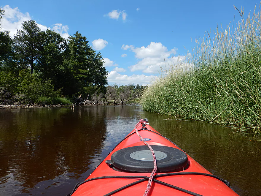
Plover getting a little compressed upstream from my put-in…
Below the dam is Jordan Park Rapids (not on main channel)
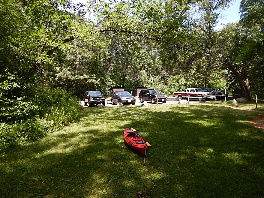
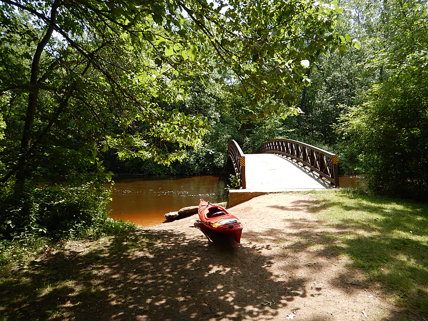
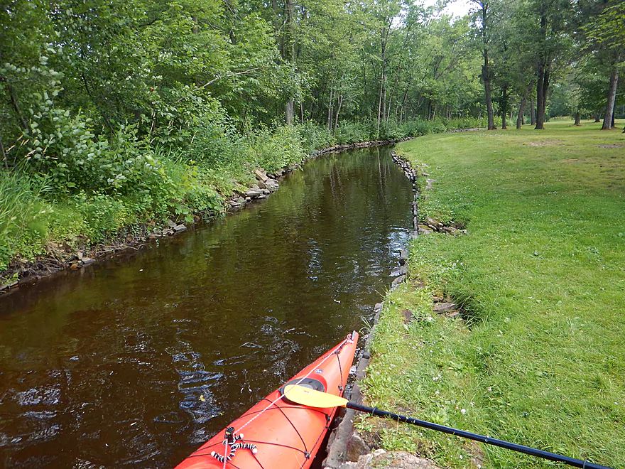
Good put-in downstream of Jordan Dam
Small hike from car to launch
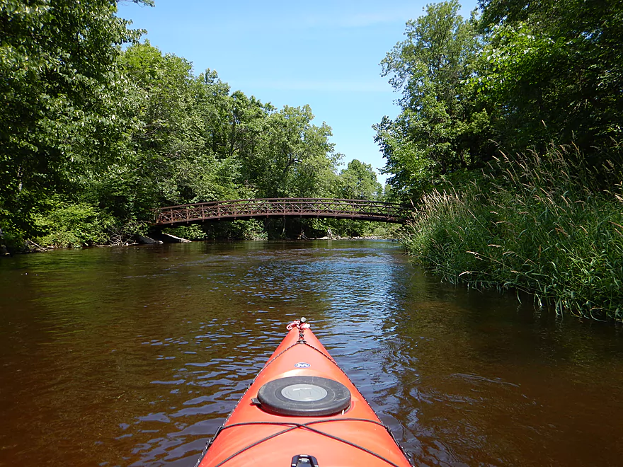
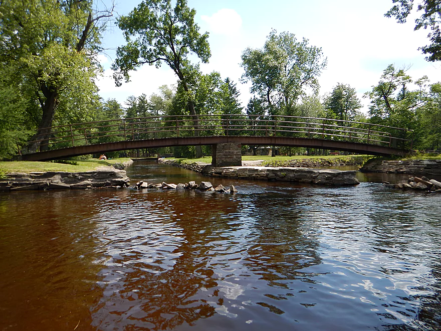
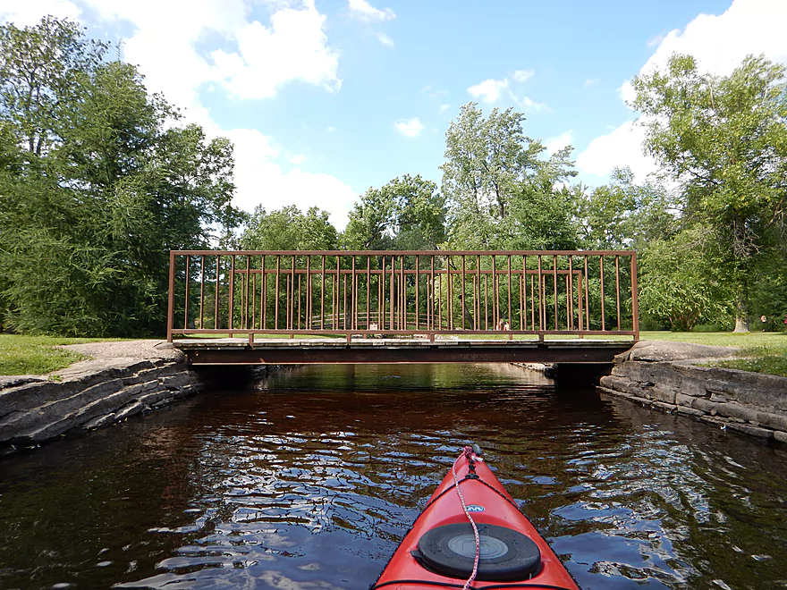
Scenic walk bridge
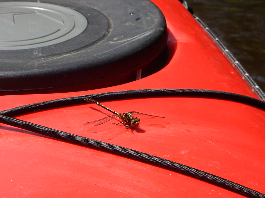
Friendly dragonfly
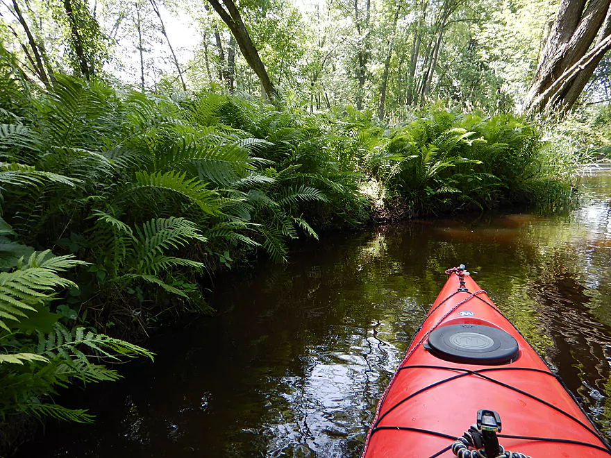
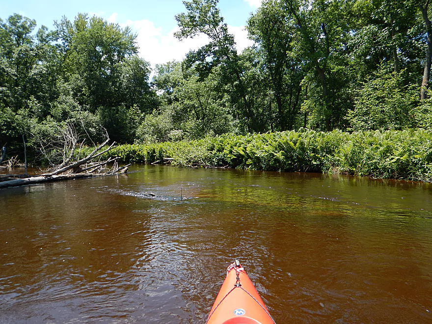
Great fern beds on the river
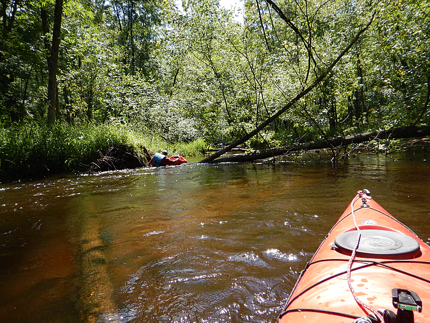
One of multiple islands…choose your channel carefully!
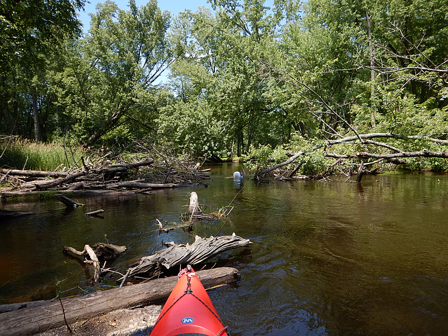
Partly cleared logjam with inner tube stuck in middle
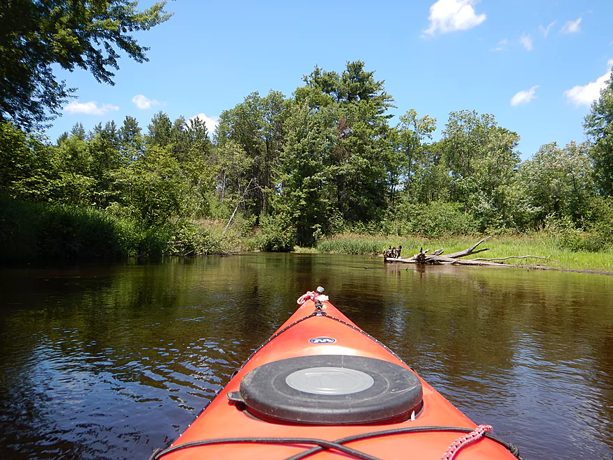
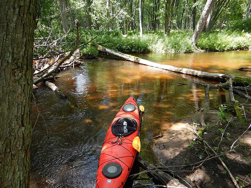
Lot of debris to paddle around
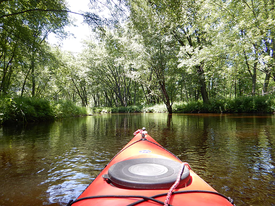
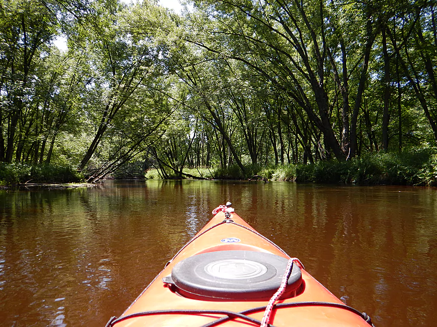
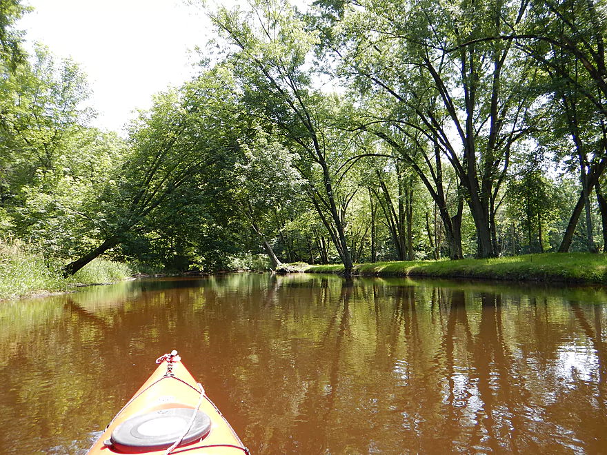
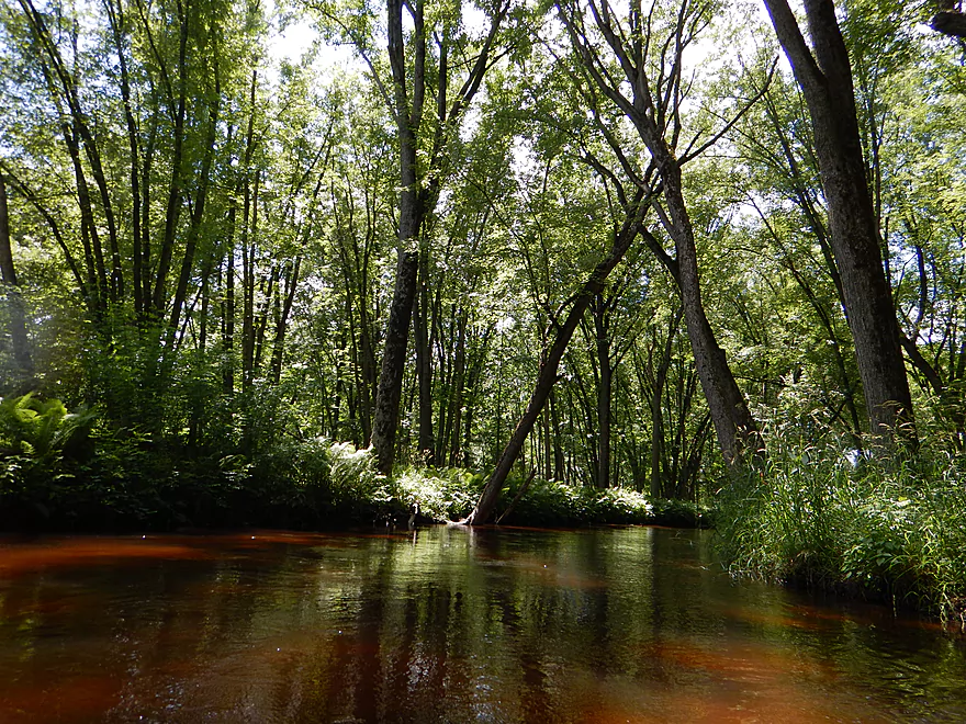
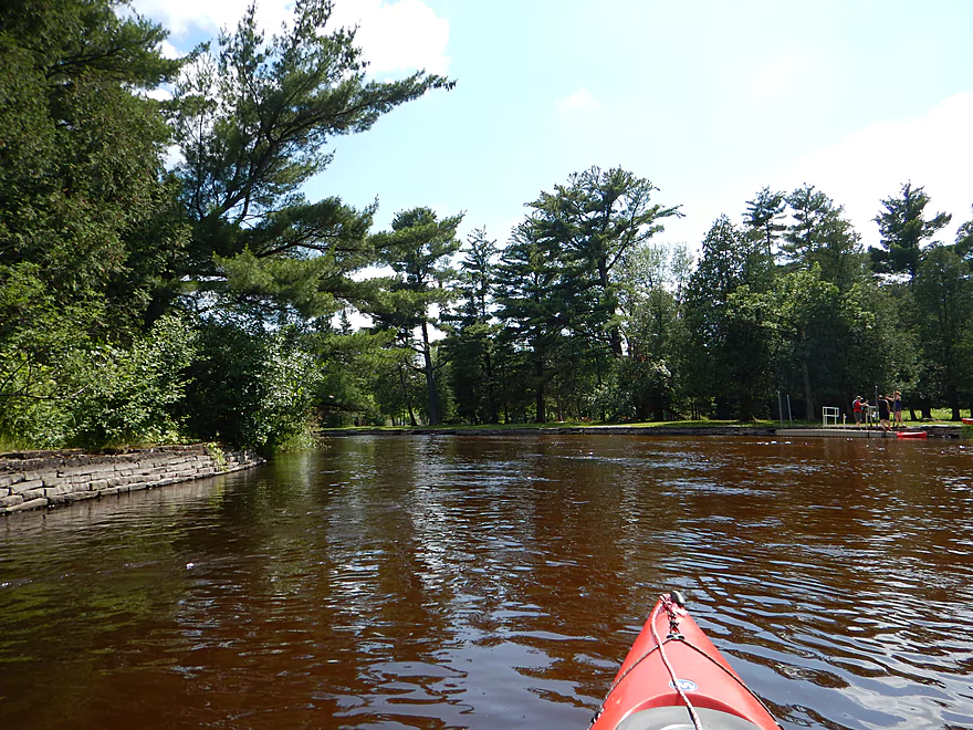
Attractive tree canopies
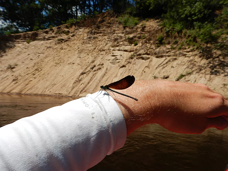
Friendly damselfly
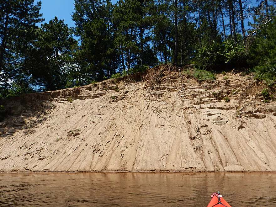
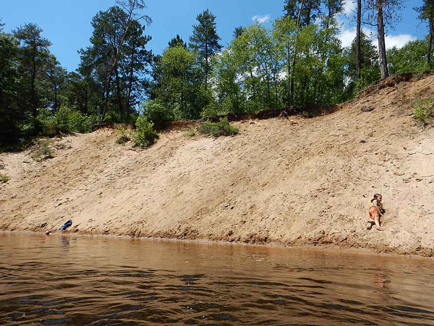
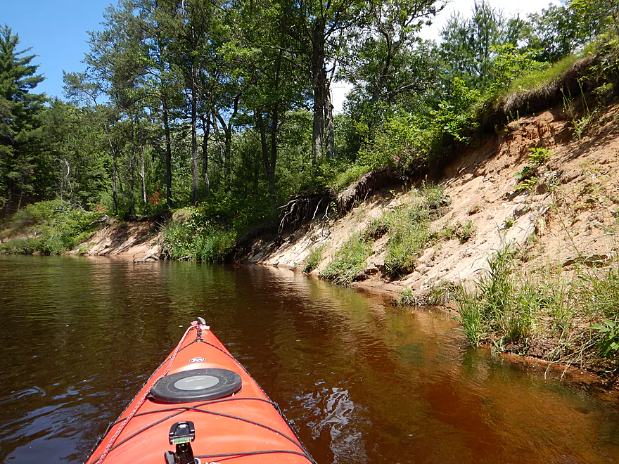
Very large sand bank
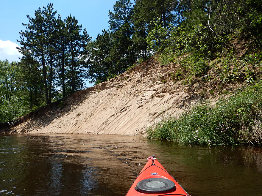
Reminded me of the Eau Claire River
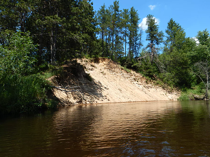
Second and separate large sand bank
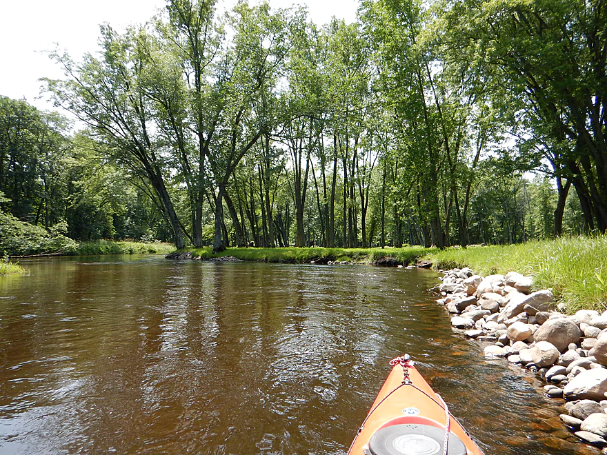
Quite majestic
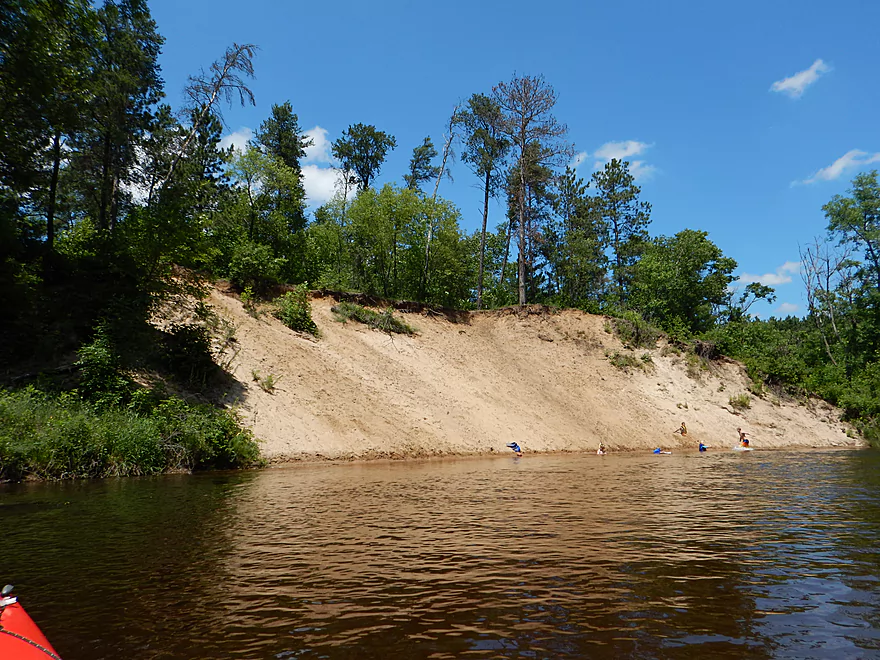
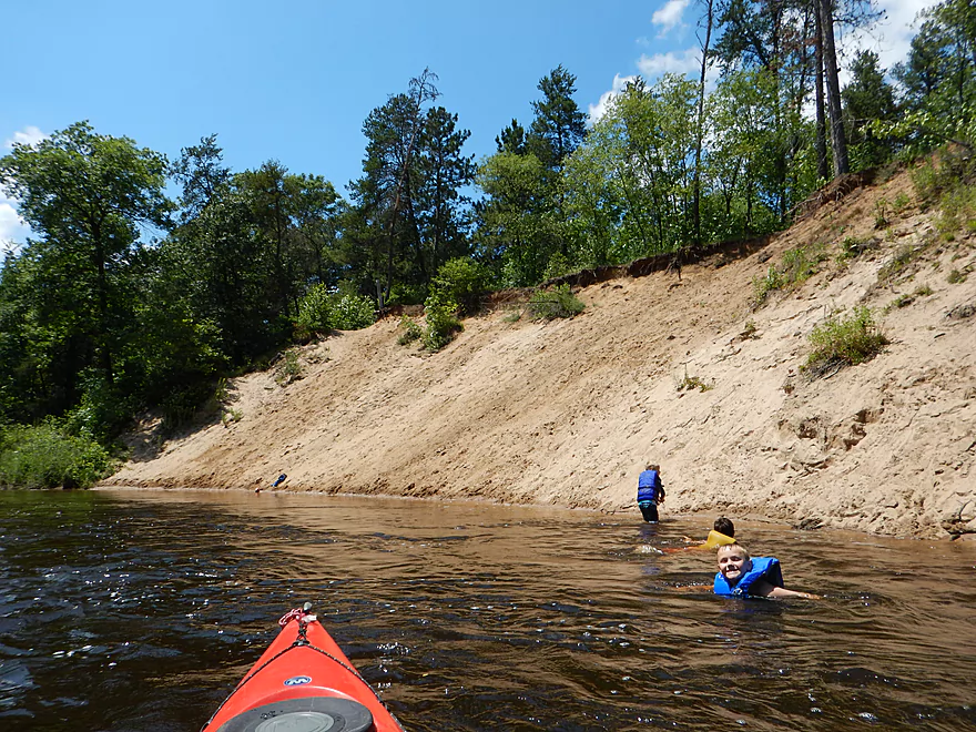
Kids having fun eroding the bank
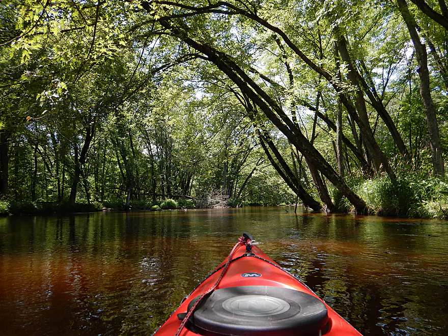
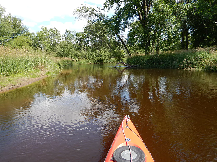
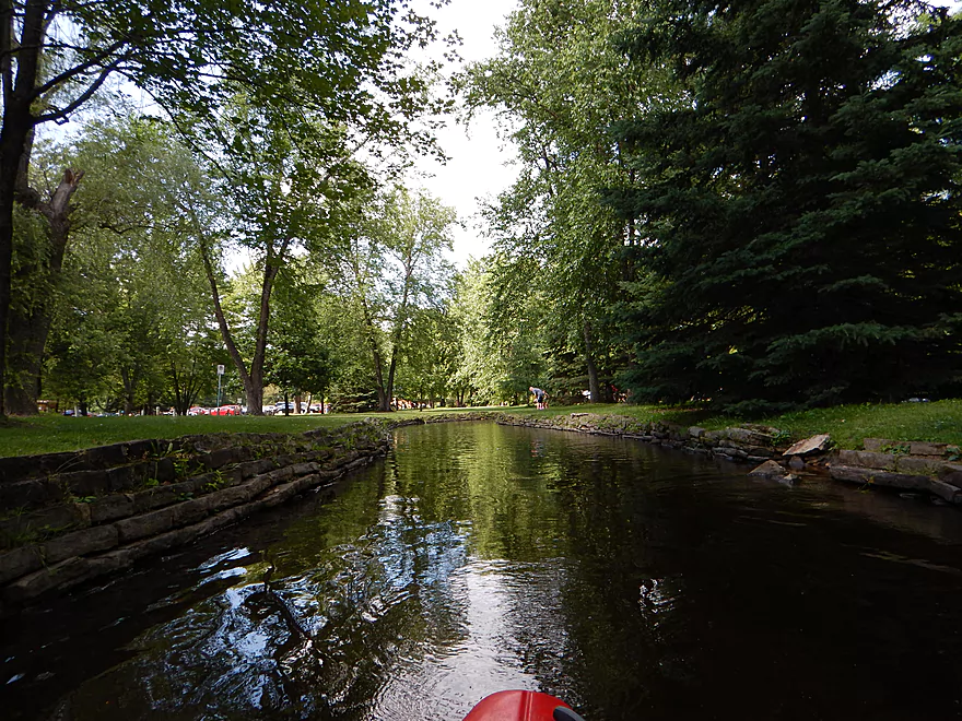
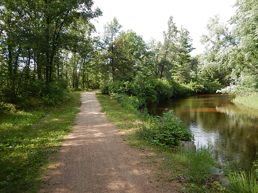
More forest paddling
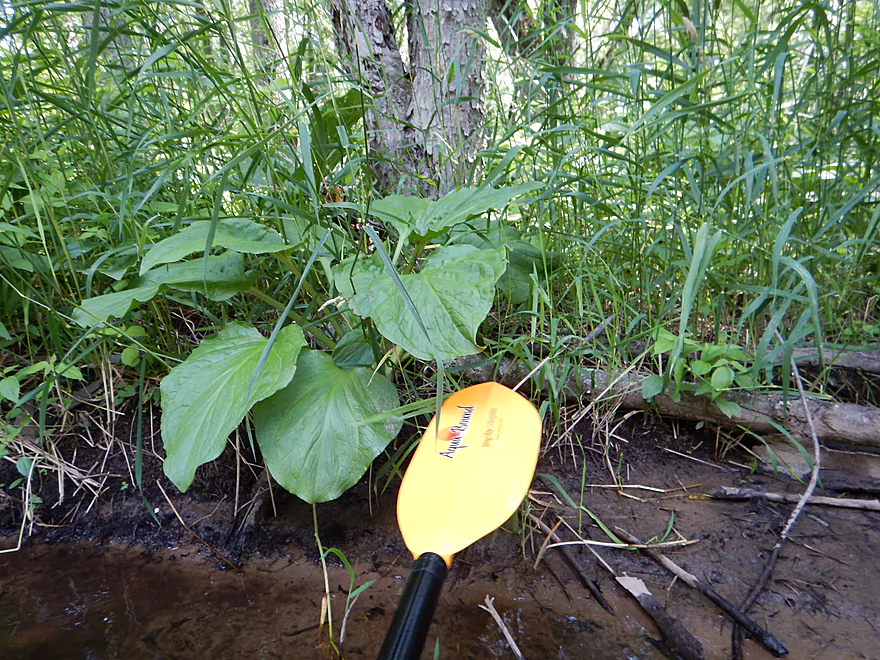
Giant skunk cabbage leaves
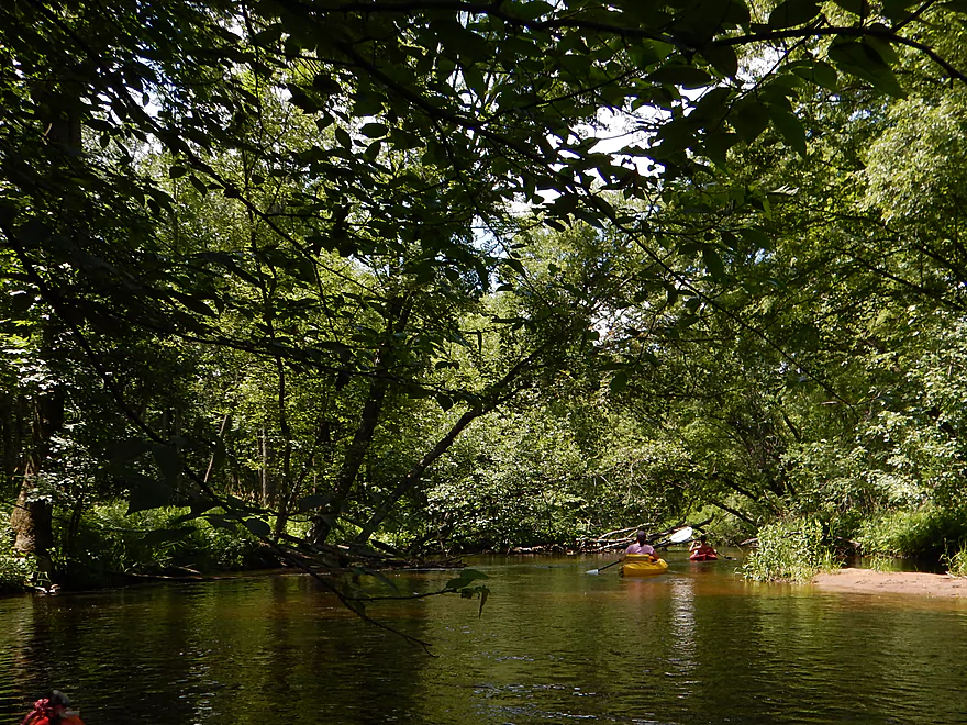
Two of many people on the river
Checking out a minor island channel
Only portage of the trip
4th of July Angelica (kind of looks like fireworks…)
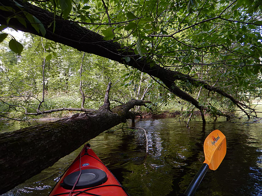
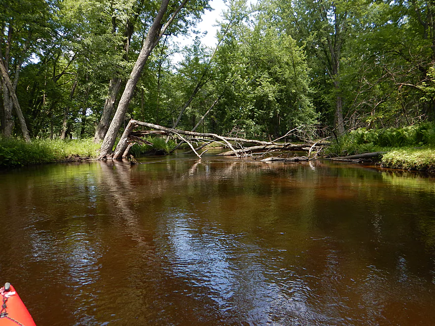
Other paddlers portaged this…I ducked under by the camera
Kayaker down! He was okay…I ducked easily on the right.
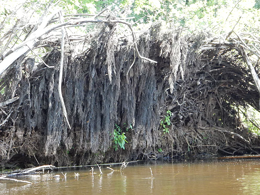
Nice roots
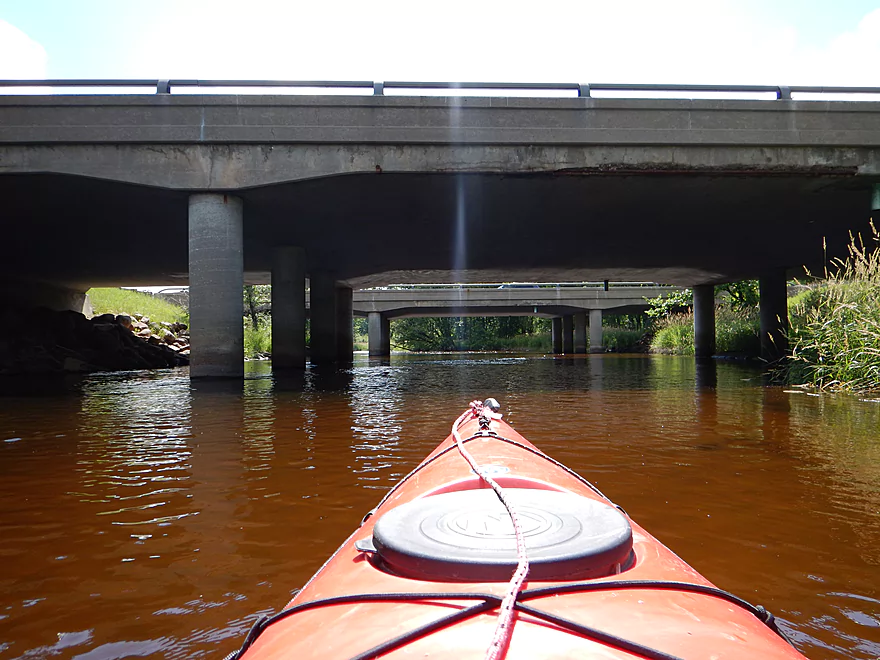
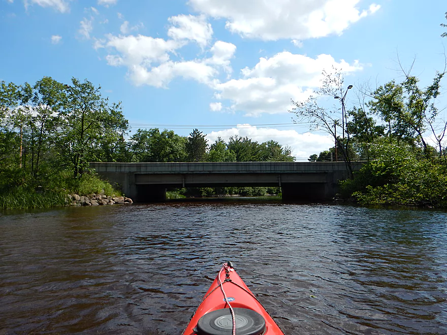
I-39 bridges
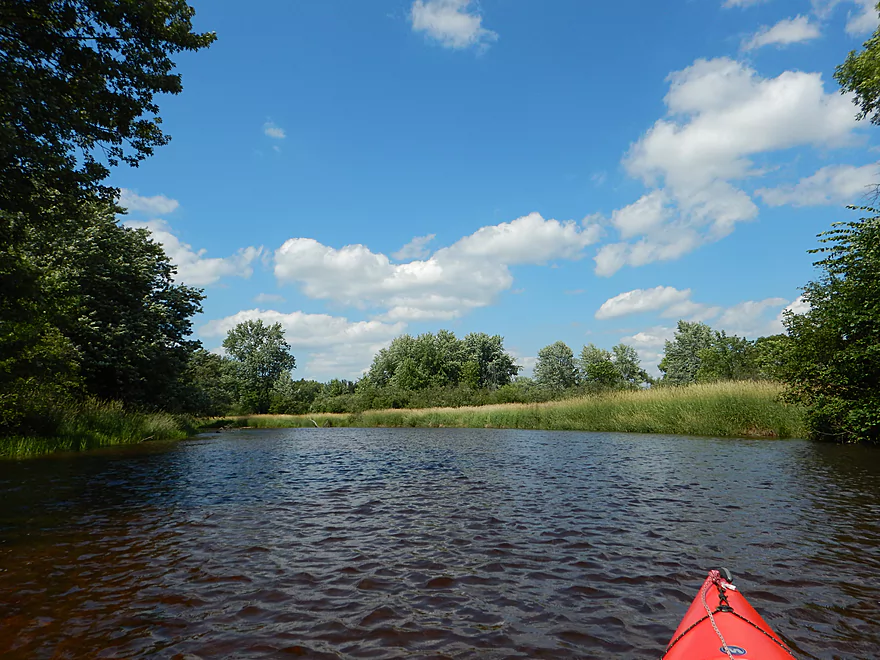
Things open up between the bridges
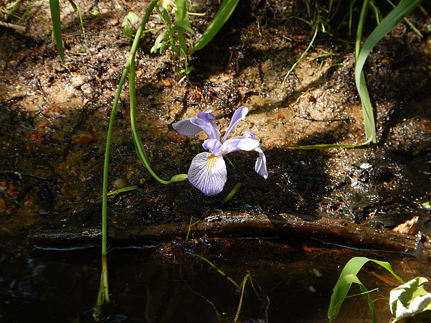
Blue flag (wild iris)
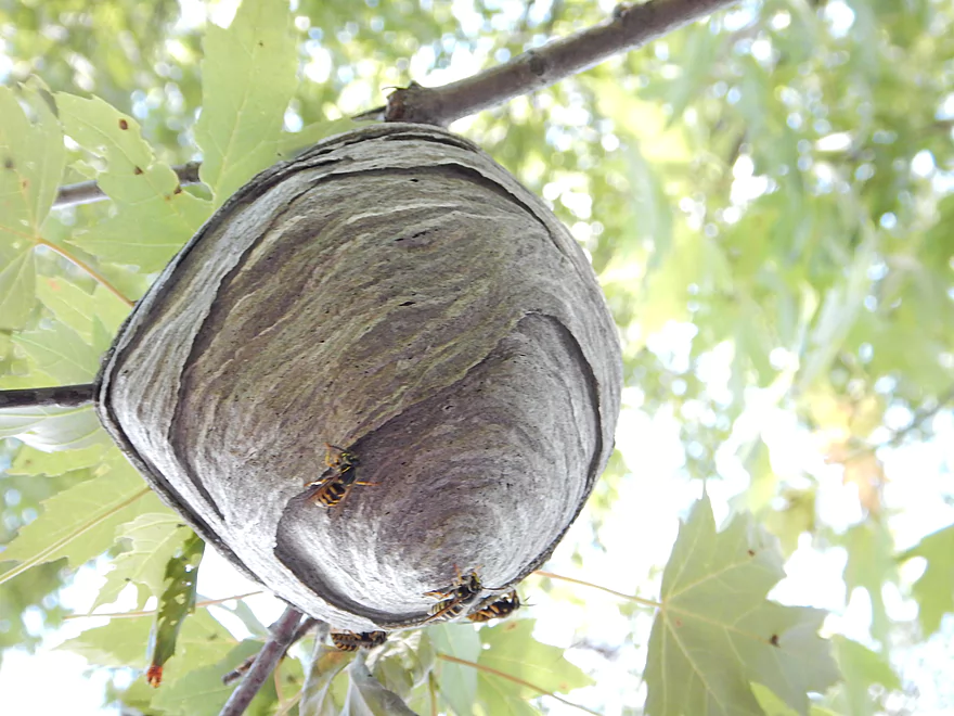
Paper wasp nest and inhabitants
Main Street/Hwy 66
Nature Treks Livery take-out
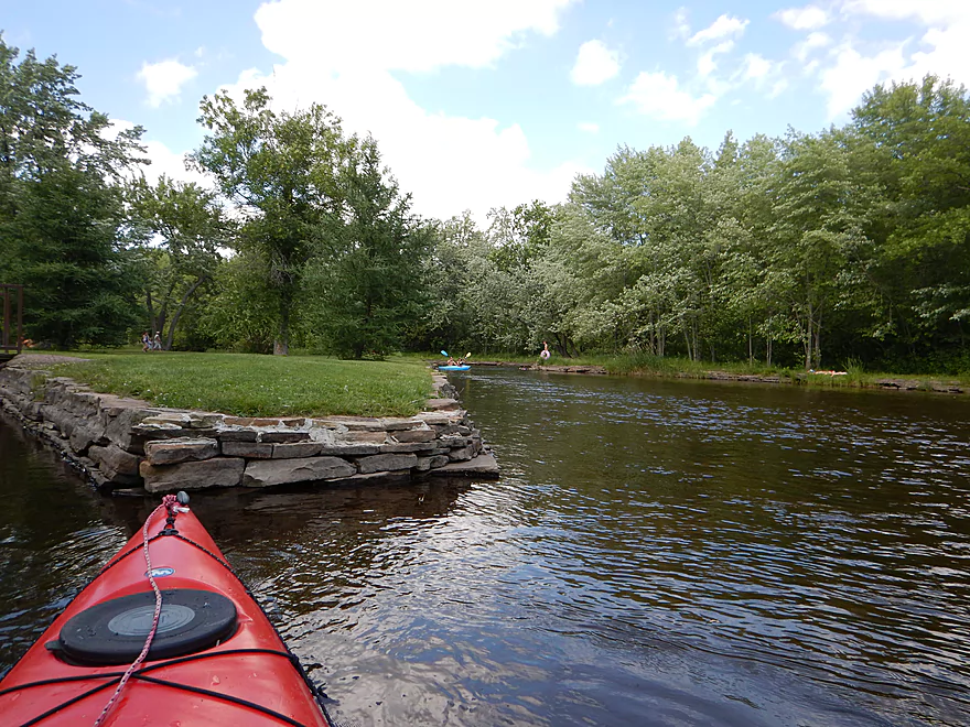
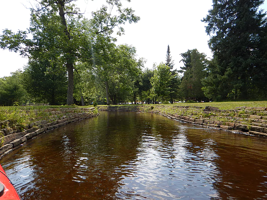
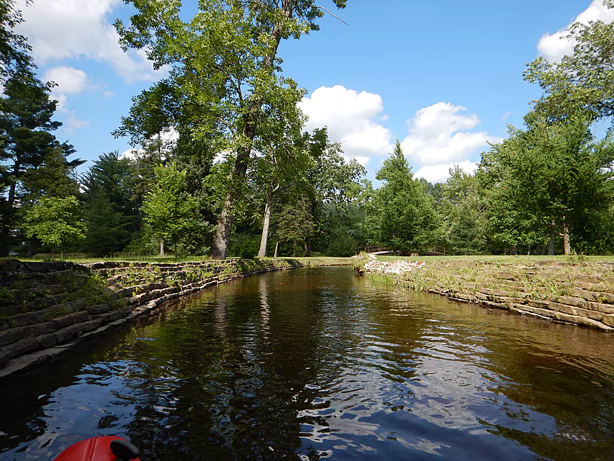
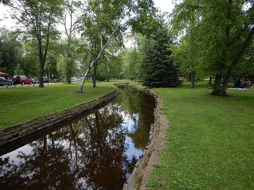
Several of Iverson Park’s canals
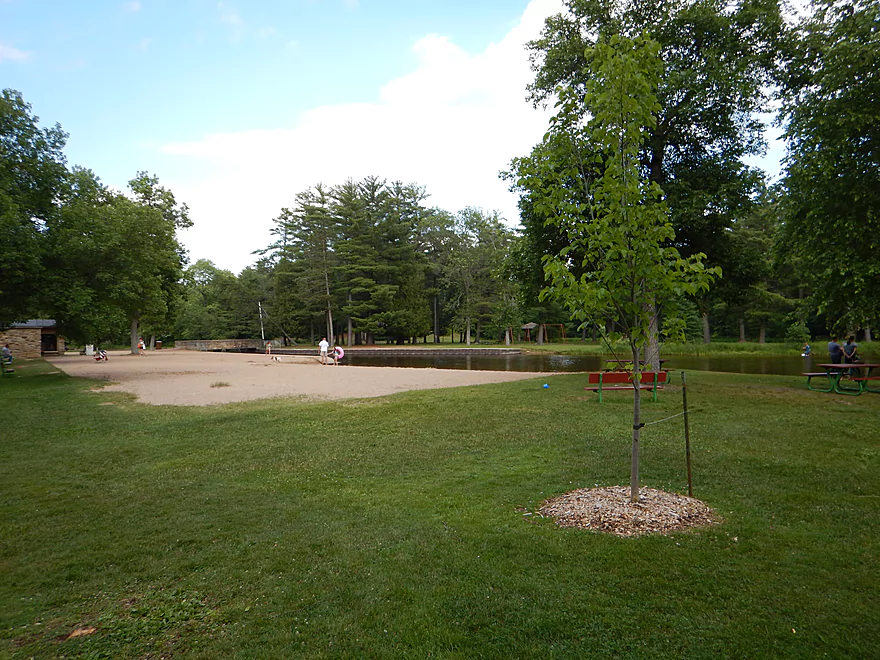
Picture of the beach (most people take out here)
Definitely fun to explore
In a side canal now
Main channel on right
Not all canals are navigable!
This one is though
Very scenic
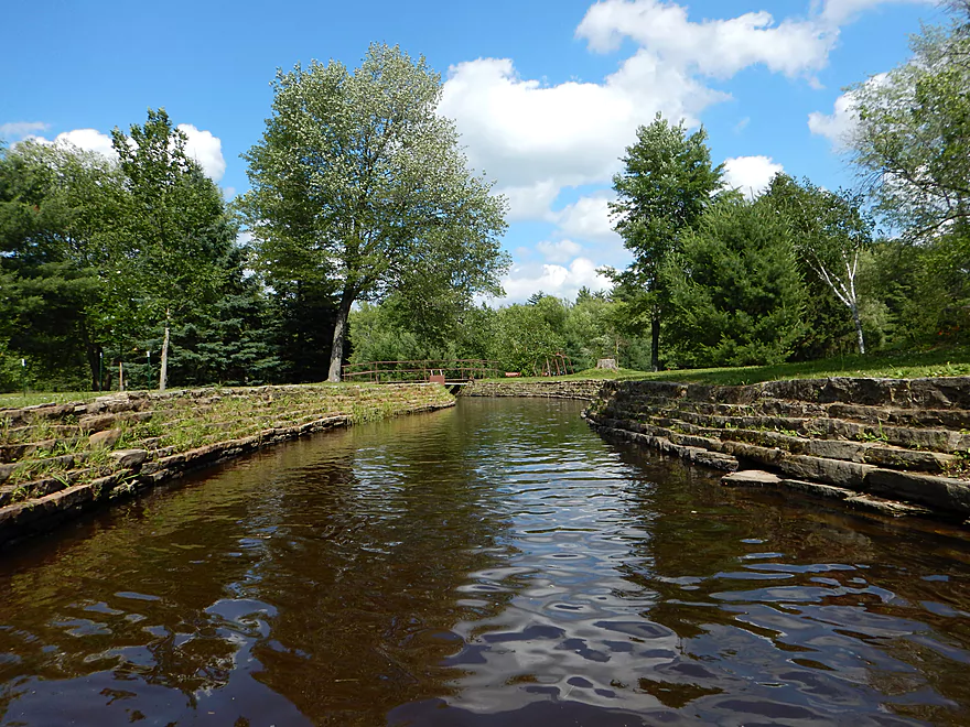
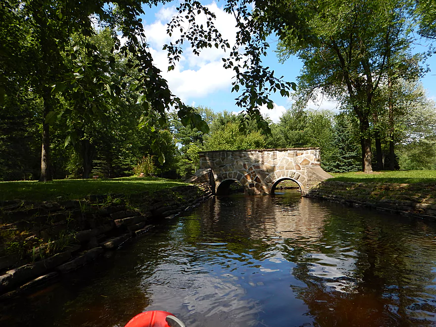
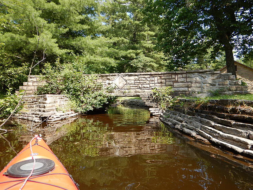
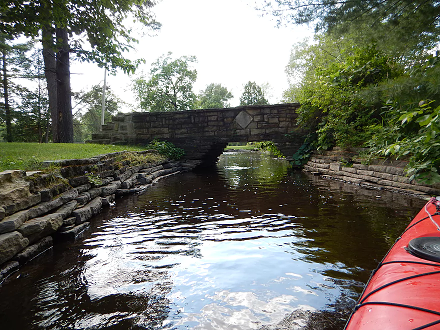
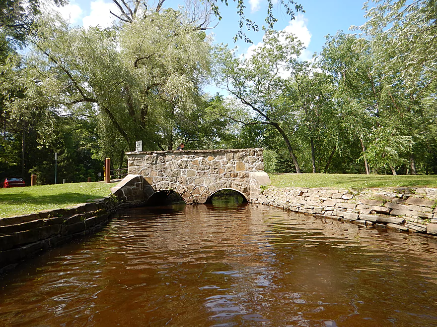
Attractive stone bridges
Very tight fit but doable
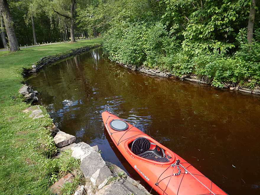
My take-out
Away from the crowds, close to parking and perfect
Time to pick up my kayak in Iverson Park
Bike shuttle trail goes by the Plover
Plover River

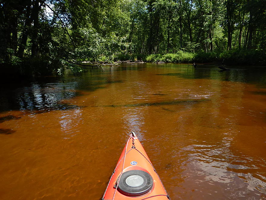
The Plover is a popular small river that flows southwest before emptying into the Wisconsin River at the city of Stevens Point. There are multiple sections of the river that are navigable for paddlers–the upper section being more rocky and “up northy,” with nice boulder gardens, and the southern section, which is more like the Wisconsin River, with hardwood forests and a sandy bottom. For this trip, I wasn’t in the mood for surprises, so opted for the most popular section of the Plover, which starts maybe 12 miles from the mouth and ends ~4 miles shy of the Wisconsin.
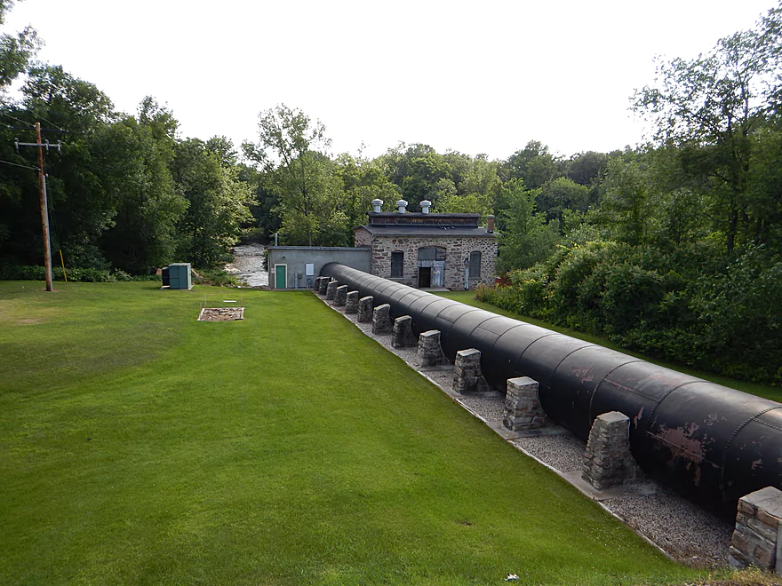
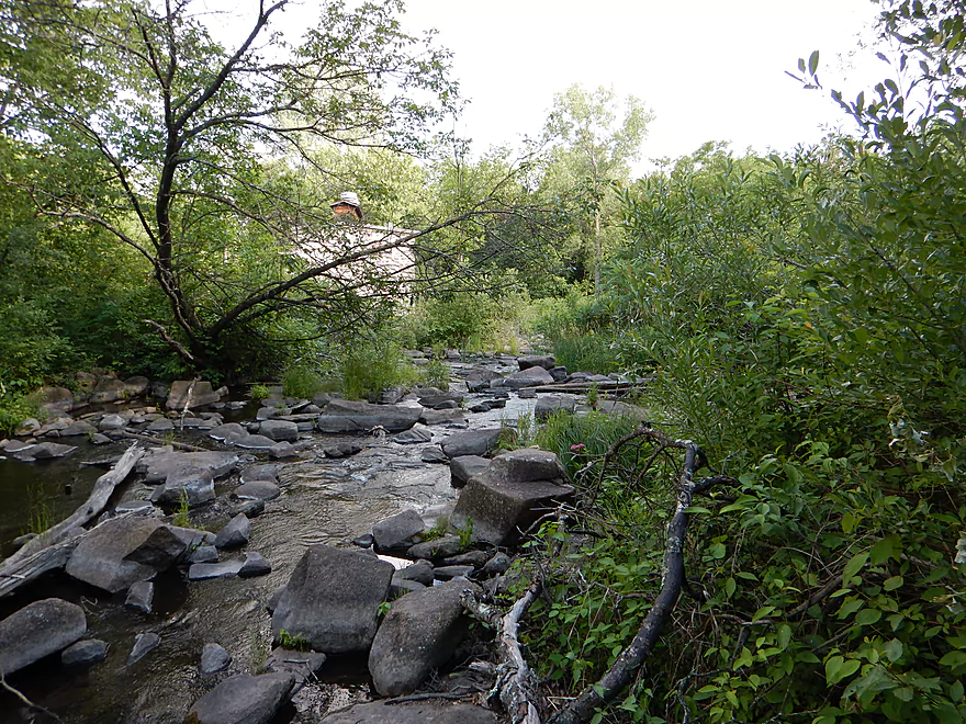
Because of the dams, you’re not left with too many trip options for the Lower Plover. Downstream of Jordan Lake/Jordan Dam there are two public access areas–one just by the dam on the east bank (more on this later) and one a bit further downstream on the west bank by a pedestrian bridge. I (like apparently everybody else) used the west landing, which is a tad tricky to find. The road leading to the access is not clearly marked nor labeled as an access and you’ll have to drive around before you find the main parking area (all marked on the map). The landing itself is very nice, with great parking, outhouses, and a nice launch area by the pedestrian bridge. Only downside is you’ll have to drag your kayak a ways to get to the launch area (but this is minor, as it’s mostly grass). At the put-in, you’ll see a brief glimpse of the dam on your left and a rocky spillover area on your left which is referred to as the Jordan Park ‘Rapids’. Notice the quotes? It’s way too shallow and rocky to run even in high water. There is, however, a legit class 1 riffle on the east bank which you can run if you put in by the dam instead.
You’ll encounter a lot of people on this river. After the Kickapoo, this was one of the busiest paddle rivers I’ve experienced. Most paddlers were considerate, but more than a fare share were noisy beyond belief. The tubers (as usual) were the worst. You could hear their belching contests and hyena laughs from a fair distance. Also annoying was a blasting radio from one of the canoers…I’m really of the opinion that electronically enhanced noises should be prohibited on publicly navigable waters. So that was all unfortunate. It didn’t help that it was the 4th of July weekend or that most of the river users were heavily drinking. If you paddle this river, just be mindful there could be people issues and you may want to choose an unorthodox time to run this section.
Getting back to the river itself… One thing I was a bit nervous about was the depth and the river being too high given the rain we had last week, but for the most part the depth was fine. There were areas in which the river’s “grass line” was underwater, but the banks themselves were never close to being underwater. The depth was perhaps a little higher then I prefer, which hurt the water clarity. There were still some pretty clear sections of the river, but it would be a lot cleaner at lower flow levels. For the trip’s depth, I used the Waupaca Gauge…not great, but this should give you a rough idea of where the Plover is at. The current was a far contrast to the 1′ per mile White River I did last week and had some zip…but wasn’t that pushy (for the most part). While this section runs practically through the backyard of Stevens Point, you would hardly know it. I only saw two houses, and much of the corridor is heavily wooded. In the last mile you’ll hear I-39, and Iverson Park is very packed with people. But other than that (and the humans on the river), this actually feels, ironically enough, like a remote trip.
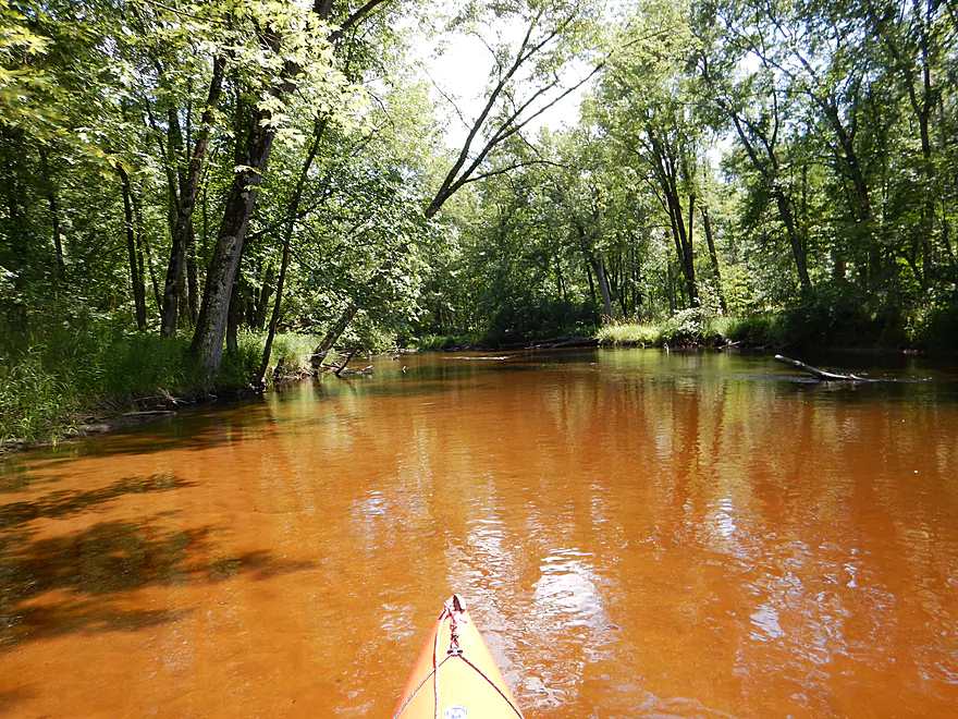
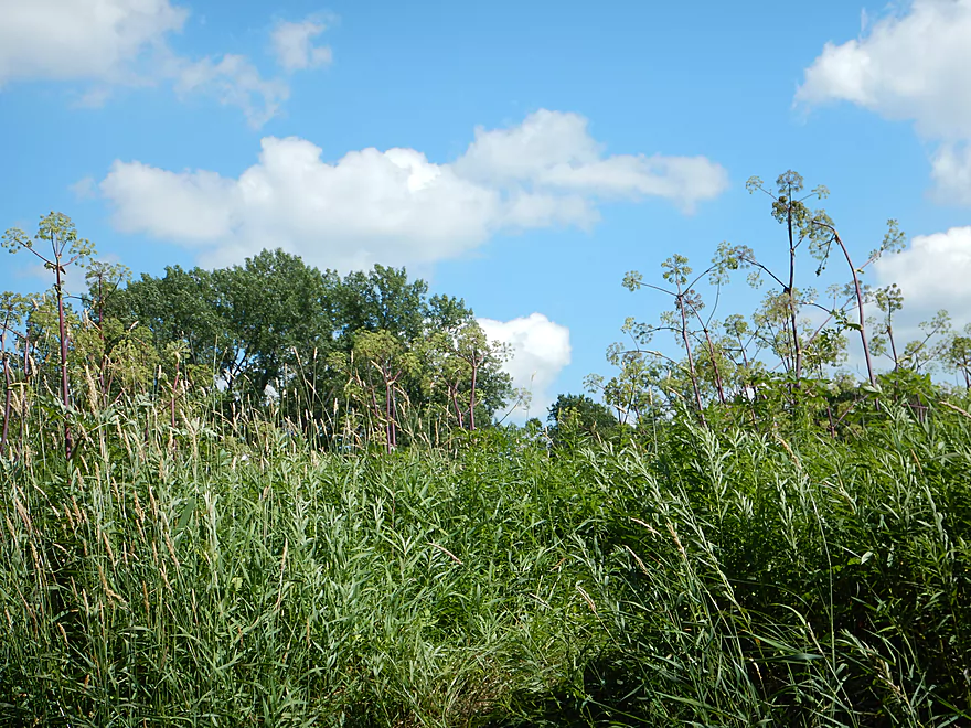
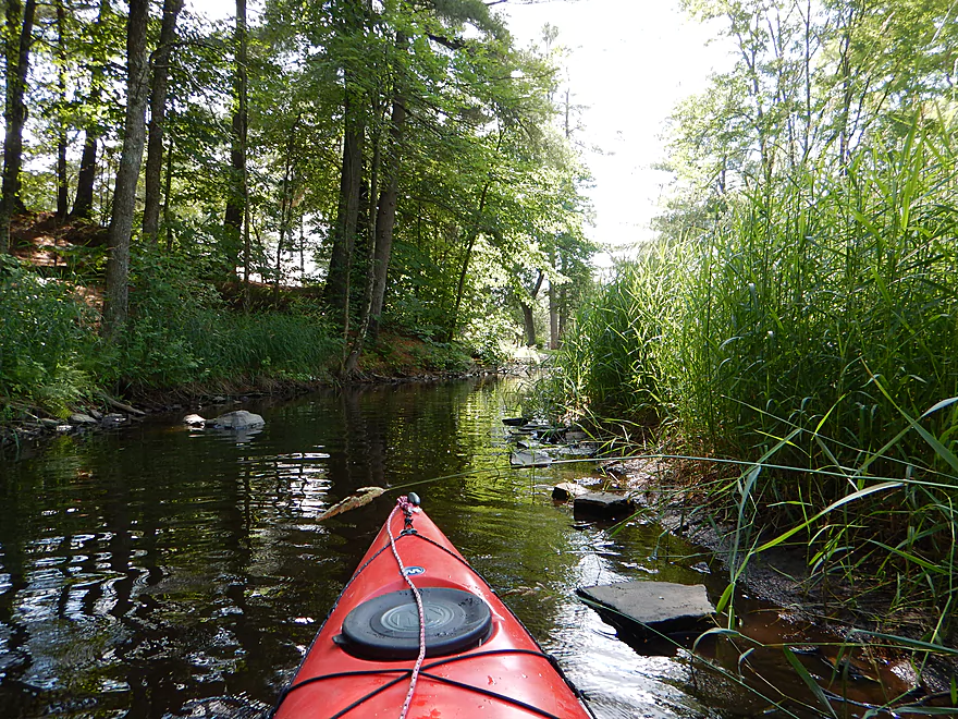
One of the more striking aspects of the Plover is the bankside vegetation. You have large thick fern beds, a lot of wildflowers, big green leafy plants, and wonderful tree canopies overhead. One of the highlights of the trip was the large sand banks that reminded me of my trips on the Black River and Eau Claire River. There are some nicer, smaller sand banks you’ll see here and there…but the best will be two massive hillsides of pure sand running straight into the river. Very cool!
Besides the people…the only other downside to this trip will be the deadfall. For the most part, this isn’t a problem. Much has been cleared out by the locals and presumably the local livery service. In fact, some of it adds a little character to the river, and it is (at first) kind of fun to paddle around the downed trees to find that one hole through the maze. But the closer you get to I-39, the worse the jams get, and the river is probably due for a fresh cleanup. There are multiple instances where there will be some tough “duckers” and “hoppers,” which I handled easily enough, but those not experienced with this type of thing may be frustrated. I never had to portage once from the main channel, but…there are several large islands on the river and I rolled the logjam dice on a smaller island channel and got burnt with a portage-necessitating logjam (easy enough though). Stick to the bigger channels and you’ll be fine. I shouldn’t guarantee this, though, as with different water levels the “hoppers” and “duckers” could be completely different and some may be impassible at higher/lower depths.
For the most part, this is a pretty safe river…but there was one instance which was a good reminder of why you always want to wear your life jacket and to always treat down trees in current with respect. An older kayaker had attempted to “hop” over a partially submerged log in fast current. While the log “stuck” the bow, the stern was free to swing around in the swift current. You never want to be sideways in current, as the boat will “dam” the water. This is what happened–his boat filled and in he went. He was fine, as he was wearing his life jacket and could stand in the chest-deep water, but he had a tough time unpinning his kayak from the logjam. Ultimately, he rescued his kayak and he (and his party) were fine. I avoided his “hop over” section by easily ducking under the same tree on the right bank (to the amazement of his party). I would later overhear him complaining to the livery take-out person over why all this deadfall hadn’t been cleaned out (I didn’t think it was too bad but “mileage” varies).
After Hwy 66, most boaters will take out with the local livery almost immediately on their right. This is a shame, as they’re missing the best part of the river! This last stretch of river flows through Iverson Park…a topnotch local park that rivals many state parks IMO. The park breaks the river into multiple sub-channels with attractive stonework protecting the banks and artsy stone bridges spanning the canals. It’s definitely worth it to check out these little waterways. The main take-out will be a large beach on the main branch of the Plover. I debated this as a take-out, but it would have required a decent amount of kayak dragging to reach the parking lot. A much superior option (that few use) is to follow the main west canal through the park and take out close the south parking lot. Few park here, while the north parking lot is a circus full of people and kayaks. I might have been the only kayaker to actually take out here and it was perfect! The other nice thing about taking out on the canal is getting to paddle a decent stretch of it, which is very cool. There are 2-3 low-hanging bridges, and I had to get on my back a bit…but, all in all, they were easy to duck under (in my book). Others may disagree…guess you could always portage them. The water is deceptively deep in these canals and the take-out will require a deep-water or “dock” exit. There are lots of videos on youtube on how to do deep water exits if this has you concerned (or you can just take out on the beach).
In the canal was one of the wildlife treats of the trip. After I passed some locals crayfish fishing….I came across a crowd who were feeding hotdogs to two GIANT snapping turtles. I’ve never seen turtles this large in Wisconsin before and was a bit leery about getting too close (snappers can take off fingers). I “snapped” a bunch of pictures, but most did not turn out (tough day for photography)…you’ll just have to take my word on how impressive they were. The locals knew all about these turtles and apparently one was five years old. I suspect the snappers have become used to begging by poking their noses out of the water for hotdog treats and probably aren’t too fiercesome. There wasn’t too much else in the way of wildlife on the trip (perhaps scared away by all the other people). One other painted turtle and a large softshell turtle. That and a very nice paper wasp nest. Thankfully, there were little in the way of parasites….but one of the snappers had two large leeches on his head, unfortunately.
If you don’t car shuttle, you will have to either bike shuttle or use the local livery. In many ways the local livery is perfect, with a large operation hubbed right in Iverson Park. However…the previous time I had used this livery (for a different river) I was “stood up” when it came to our agreed upon meeting place and time set earlier. With no cell phone, I found a gas station and called the business to finally get me. When he took me to my requested put-in, he saw a fishermen…thought I might upset him and said he would put me in a different location instead (not what I asked for). And this was (I’m pretty sure) the owner I dealt with. Perhaps this was a fluke and perhaps you would have a more positive experience with the company. The company is called Nature Treks and their phone number is (715) 254-0247.
My preferred option is to bike shuttle. There are multiple paths to choose from. The city of Stevens Point has many nice bike trails and the “Green Circle Trail” can be used for a good portion of a shuttle. It’s a nice trail away from the city and traffic with occasional views of the Plover River, but much of it is crushed limestone (not as bad as gravel roads, but not as nice as pavement). Finding the trail among the city streets can be tricky, but there are “Green Circle” signs that kind of lead you on like Zelda breadcrumbs. I do recommend a map and GPS though. Hwy 66 is a busy 4-lane road, so I recommend using the lights at Sunset Ave. to cross (all on my map). With all its curves and little hills (that probably make Green Circle a terrific ski trail in the winter), I’m not sure I would use this again after an 8+ mile kayak trip. A faster route would be to take Green Ave. to 66. Hwy 66 is busy, but has good shoulders for the most part (around the I-39 underpass is not great, otherwise this should be a good route). Do note that the Green Circle Trail overlaps a police shooting range and the authorities do shut down the trail from time to time during target practice. I assume they wouldn’t do this on a weekend…but don’t know.
As far as alternative trip options, I am not sure… I believe there is a logjam further downstream of the canal I took out on. The main channel should be logjam free, but soon after Iverson Park the river becomes a flowage due to another dam. Shortly thereafter would be the mouth on the Wisconsin. As far as alternative put-ins go, I believe a far superior option would be to launch at the dam, which is just a few hundred feet upstream of my put-in. A lot less people here, a smaller hike to the landing, and you’ll get to run a little riffly section. No bathrooms here (the other put-in and the take-out do have facilities), which is the only downside. If you put in here, you’ll probably want to bike shuttle on Brilowski Road going back…doesn’t seem like a bad option but you do want to be careful to avoid Hwy 10 and to find the hidey bike trail at the end (see map).
For more information about the Plover River and other paddling options, I highly recommend checking out the website: http://paddlingtheplover.wordpress.com
All in all, this is a trip I do recommend. Just don’t paddle during the 4th of July weekend…paddle when low (for the water quality), paddle in the summer (for the vegetation), and be mindful of snags.
And, just one quick little side-story here before I wrap things up. There is a river just south of the Plover that also flows west and empties into the Wisconsin River near Stevens Point and is called the “Little Plover.” Sound kayakable? Well…not exactly. It probably used to be, but thanks to the plethora of high pressure wells in the area, the river has practically dried up. There is a USGS gauge on the Little Plover that lists the flowrate at about 2.5 CFS’! That is microscopic, and most creeks are bigger than that. So what caused this dry-up that occurred in roughly 2005 and placed the Little Plover on a nationally endangered river list? I’m not an ecologist…but I think the answer is easy enough to figure out. As you drive up into Portage County on I-39, you will see one center pivot irrigation system after another after another… Practically every field has one, and they’re constantly running. So, I’m blaming the potato farmers! For a more scientific and historical look at the Little Plover River, with before/after pictures of the great dry-up, check out: http://www.friendsofthelittleploverriver.org.
- Paddlingtheplover.wordpress.com: An informative blog about the Plover River.
- Paddling Southern Wisconsin by Mike Svob: A good guide book in general, but specifically a good resource for upper part of the Plover River.
Detailed Overview
- Legion Memory Park to Konkol Road: (1.8 miles) Scenic, narrow, shallow creek with perhaps a few logjams.
- Konkol Road to Townline Road: (1.3 miles) Probably a mediocre but doable prospect.
- Townline Road to Bridge Road: (1.4 miles) A creek prospect that should have scenic woods and a few boulder gardens. Townline Road should be ok for access.
- Bridge Road to Esker Road: (0.7 miles) Narrow, wooded and rocky, this is a good prospect. Probably some rapids and a few logjams. Should be ok put-in access.
- Esker Road to Hwy 153: (6.4 miles) A fantastic trip reviewed in Oct 2016.
- Esker Road to Plover Road: (1.5 miles) Pleasant section with a nice boulder garden.
- Plover River Road to Kristof Road: (2.7 miles) Best section on the entire river. Very scenic, with 3 Class 2s and many boulder gardens.
- Kristof Road to Hwy 153: (2.3 miles) Good section with no noteworthy rapids, but pleasant and scenic.
- Hwy 153 to Pinery Road: (5.0 miles) A great trip reviewed in June 2016.
- Hwy 153 to Bevent Drive: (2.7 miles) Five star segment and 2nd best leg on the entire river. Scenic with several small rapids.
- Bevent Drive to Pinery Road: (2.3 miles) Pleasant section but not as scenic as upstream parts.
- Pinery Road to Shantytown Drive: (4.9 miles) A medium trip reviewed May 2018.
- Pinery Road to Hwy J: (2.8 miles) Starts wide and uninteresting but gets better with narrow corridors of firs, white cedars and white pines. Section includes a small boulder garden and several low farm bridges.
- Hwy J to Shantytown Drive: (2.2 miles) A peaceful section with many conifers relatively undeveloped banks and good current.
- Shantytown Drive to Hwy Y: (5.2 miles) The river slows and widens here, with maybe a third of the trip being a flowage/marsh (looks pleasant). Shantytown Drive is a good launch option.
- Hwy Y to Bentley Road: (1.3 miles) A tweener section between the flowage and river that includes a dam portage. Hwy Y is a poor launch option with difficult parking.
- Bentley Road to Hwy K: (3.4 miles) The river narrows here and this is a popular section. Good shoulder parking at Bentley Road (lot of cars park here).
- Hwy K to Jordan County Park: (5.3 miles) Ok prospect reviewed Jul 2017.
- Hwy K to Sharonwood Lane: (4.7 miles) A less traveled, narrow, wooded section on the upper part and an open grassland paddle in the second part where the old flowage was. Be careful about running the old dam remnants. There are nice boulder gardens above and below Sharonwood Lane. Hwy K is an ok launch, but has very poor parking (most cars were literally parking more on the road than on the shoulder).
- Sharonwood Lane to Jordan County Park: (1.0 miles) Gorgeous boulder garden below Sharonwood and perhaps an abandoned whitewater slalom course. Most of this is lake paddling though Jordan Pond. Sharonwood Lane is small but ok for access.
- Jordan County Park to Jordan Dam/Jordan Park: (0.5 miles) Paddle west of the lake, then portage under the Hwy 66 tunnel. You then have to drag your boat 600+ feet to get past the pipeline and into the water. Not recommended.
- Jordan Park to Iverson Park: (8.0 miles) A good prospect previously reviewed July 2014.
- Iverson Park to Lower Whiting Park: (2.5 miles) Mostly open flowage paddling that is probably uninteresting.
- Lower Whiting Park to the Wisconsin River: (1.2 miles) Mostly big flowages. Probably not a good prospect.
Trip Map
Overview Map
Video
Photos Size:
Hi,
I am a resident of the village of Hatley. I am developing a website for the village and would like to quote some of your content from this page and link to this article. Would this be OK?
Thank you!
Mike Heinrich
Yeah, that is fine.
Webmaster’s update…I’ve heard recently that there are two logjams on this stretch that will have to be portaged.
Update…as of June 2022, this section has been cleared of logjams.