
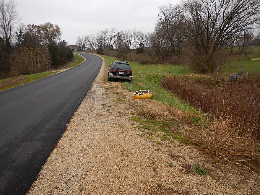
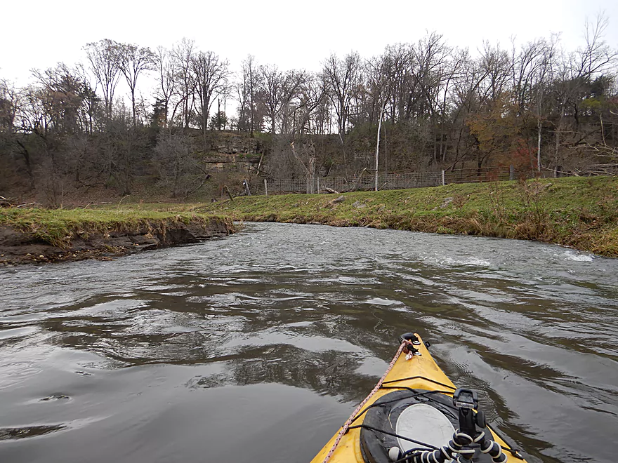
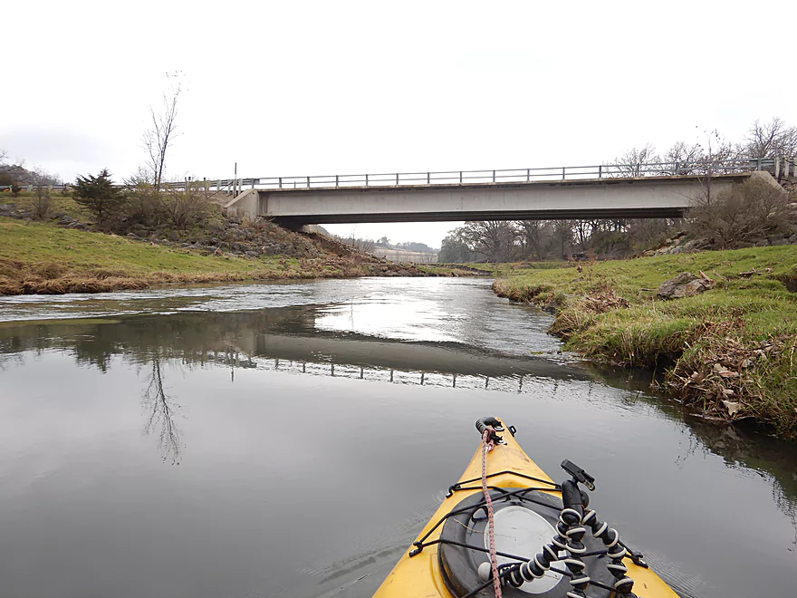
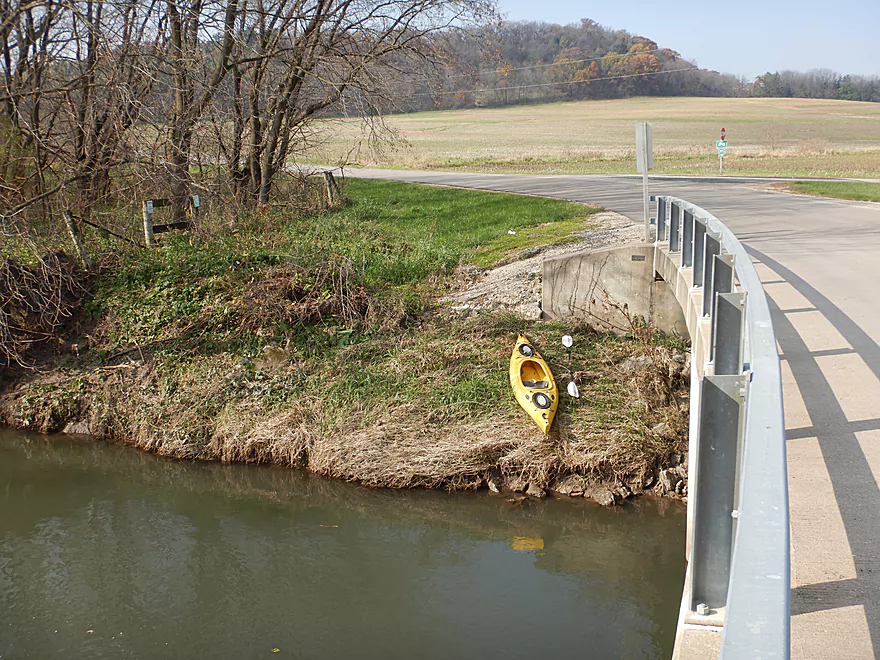
Starting the trip at Mt Ridge Road
Decent access option
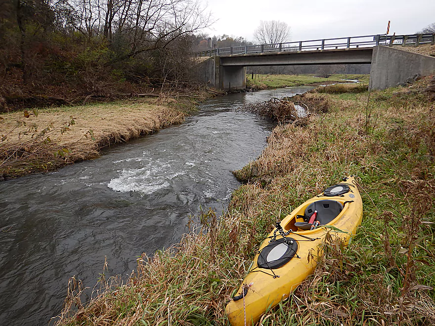
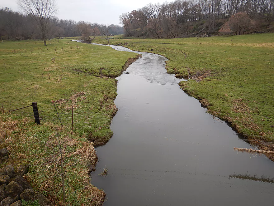
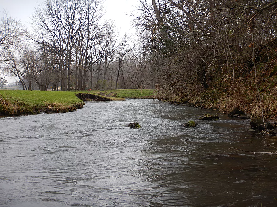
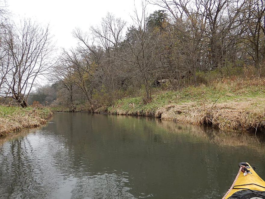
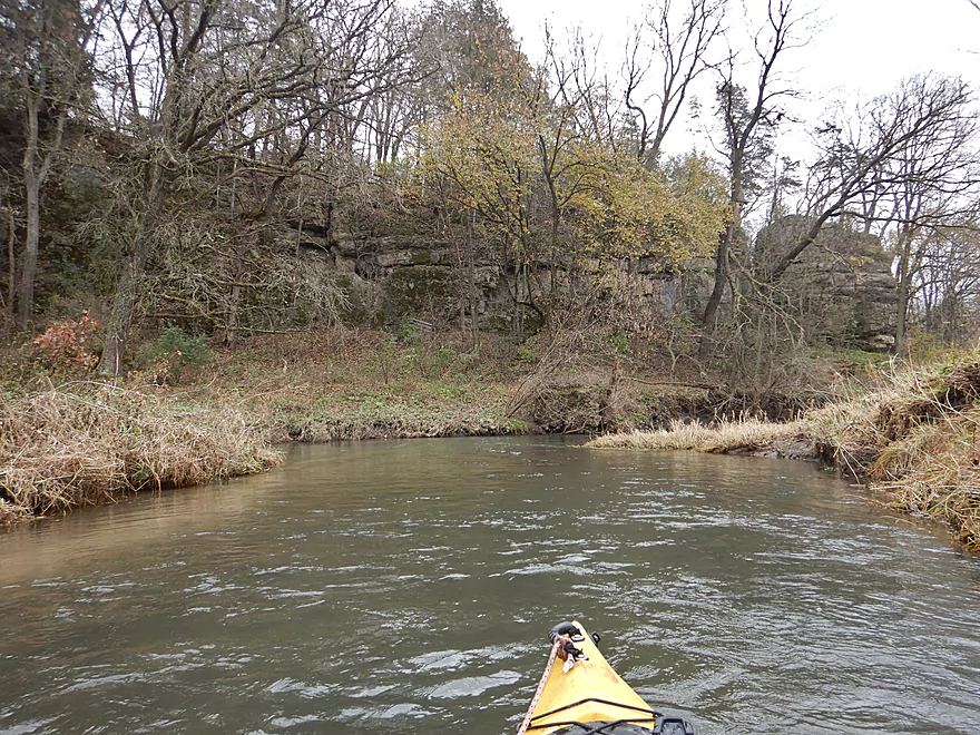
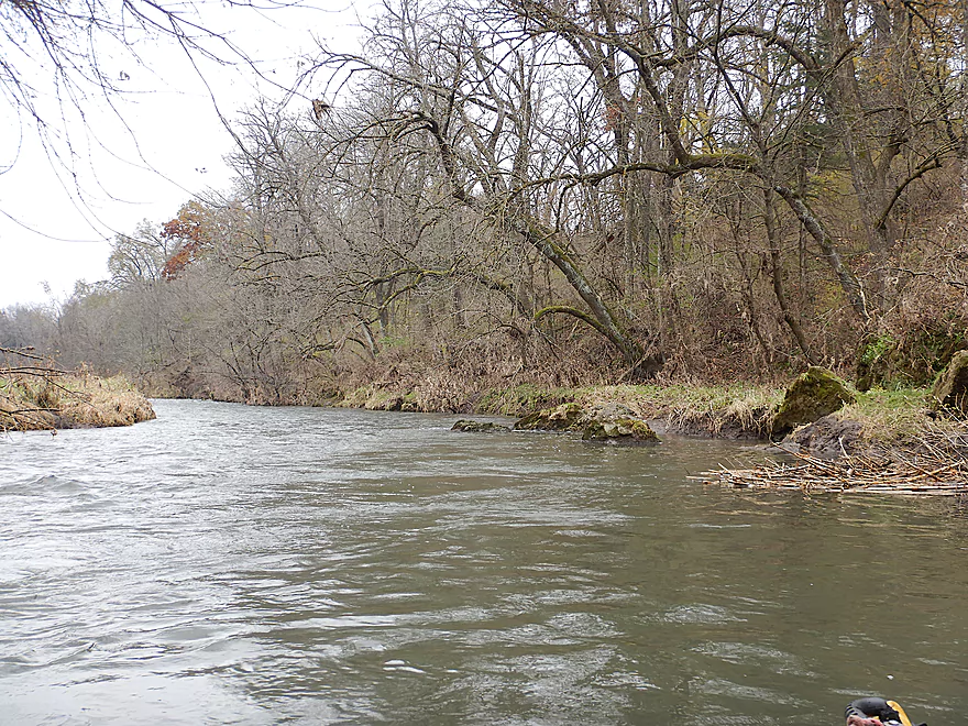
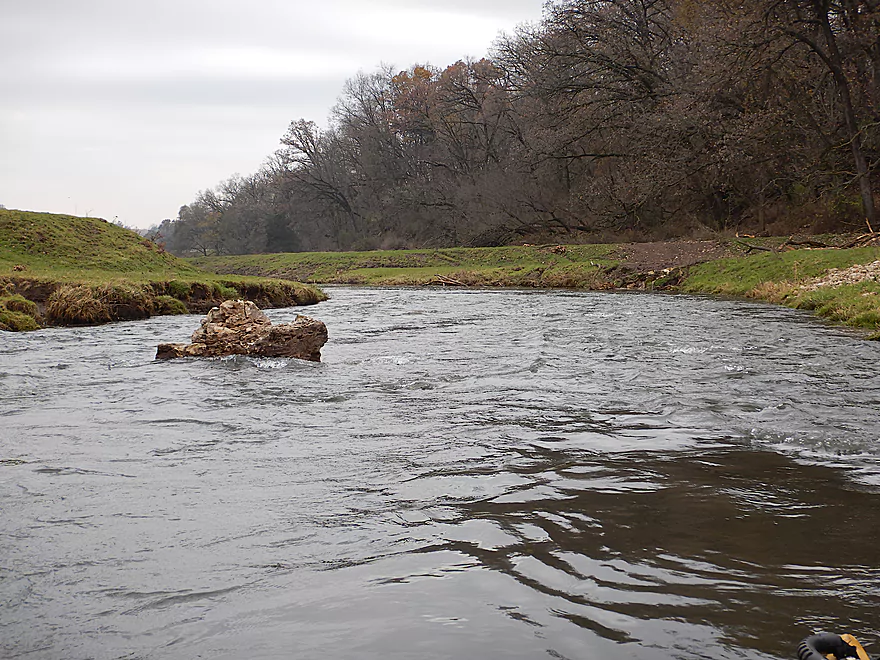
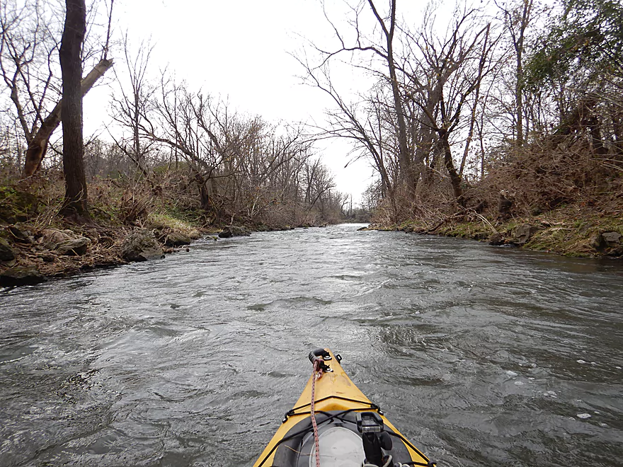
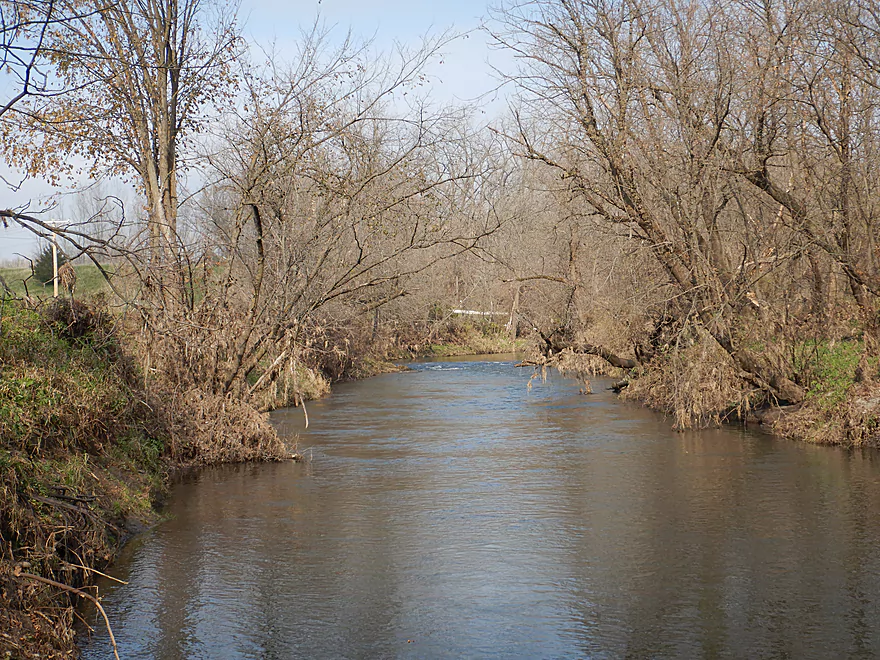
Scenic view upstream
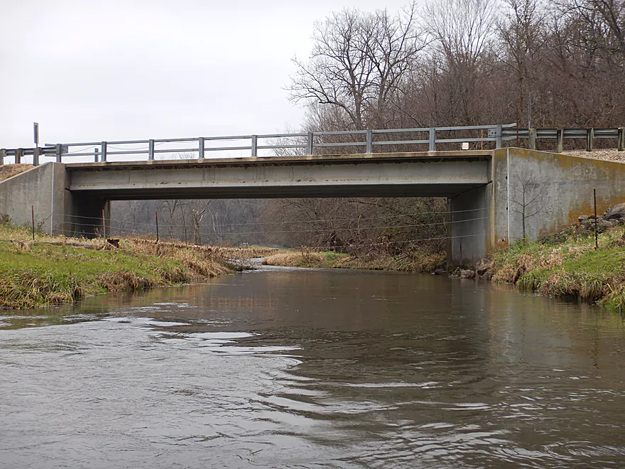
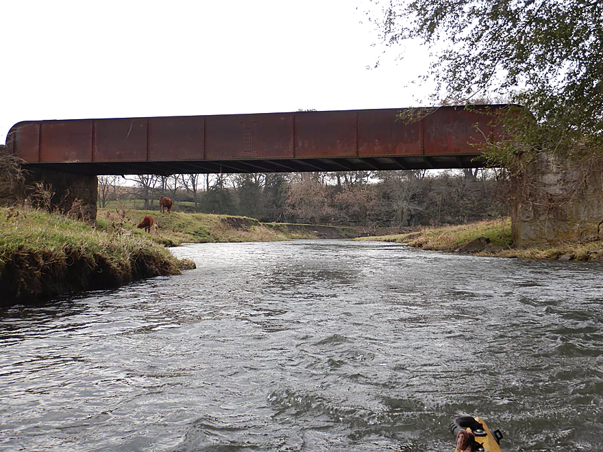
There is a fence by the bridge…but is super easy to get under
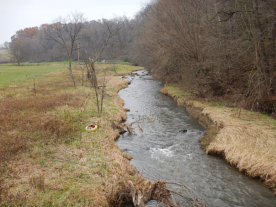
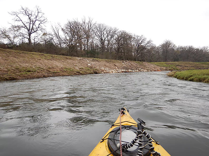
View downstream from the bridge…lot of pasture
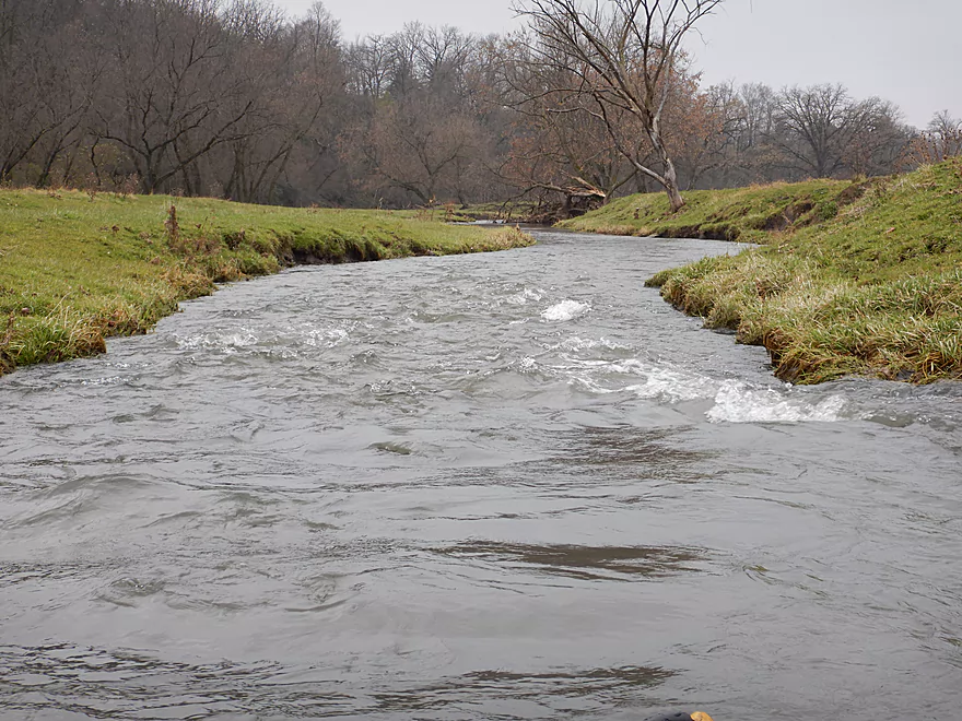
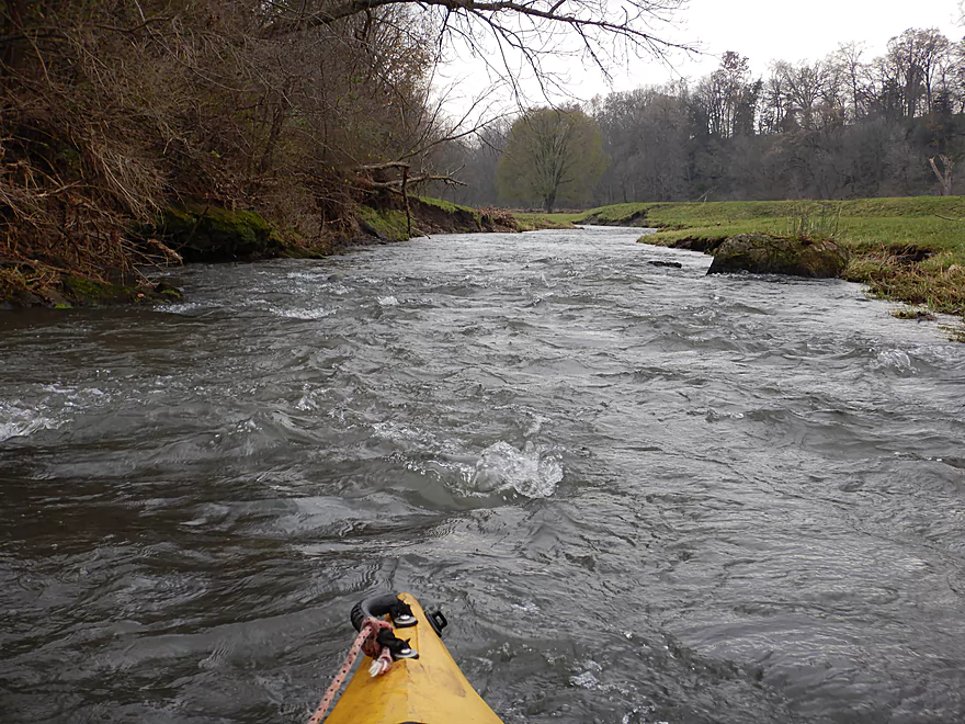
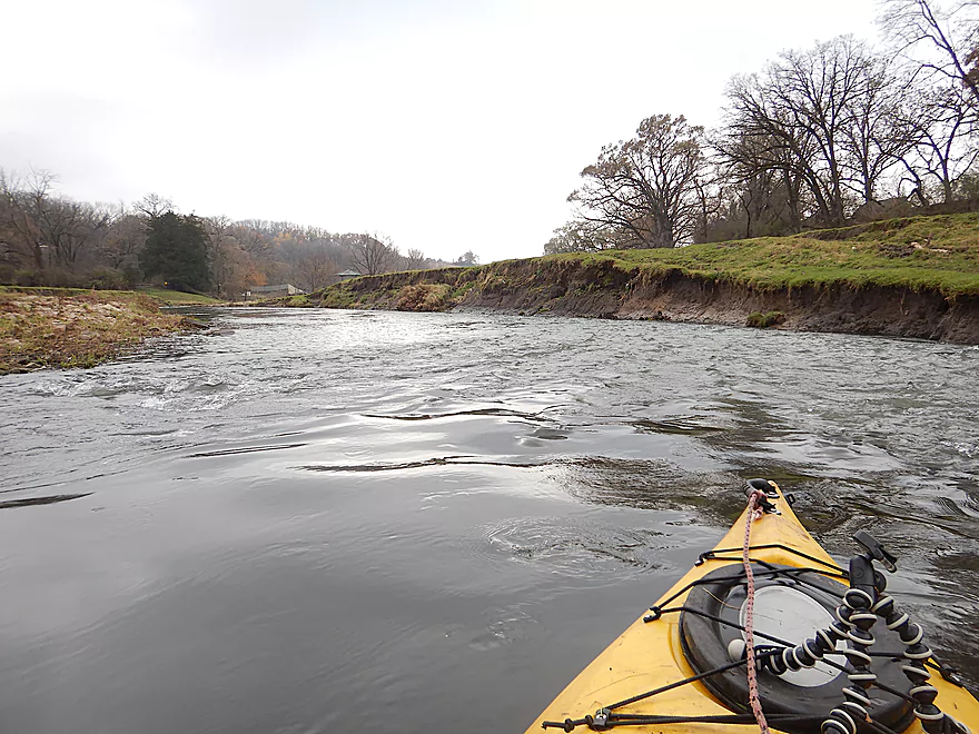
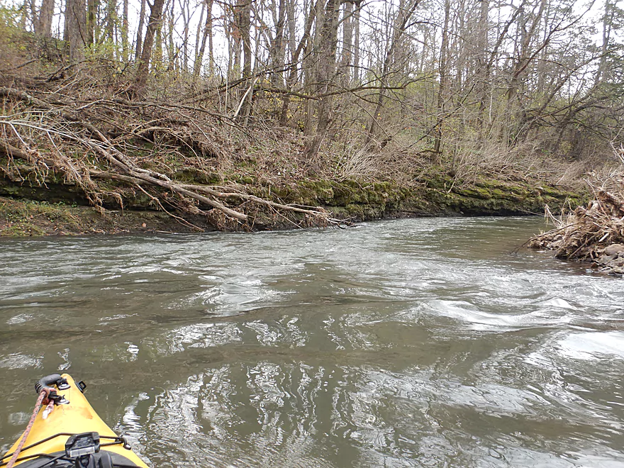
The Jones Branch is fast
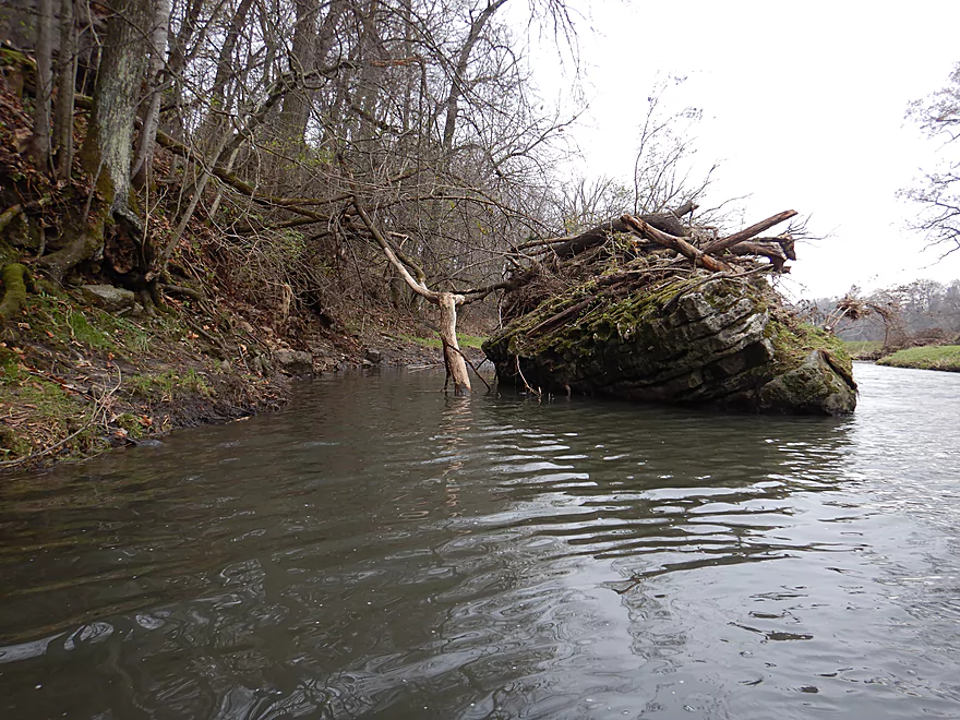
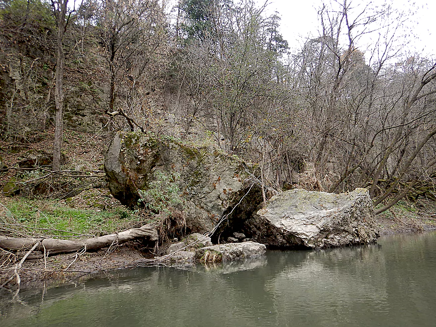
Looks like a sunken ship
Grass grazed so short, it looks like a lawn
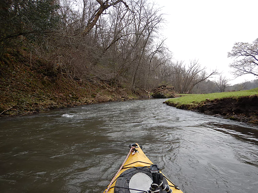
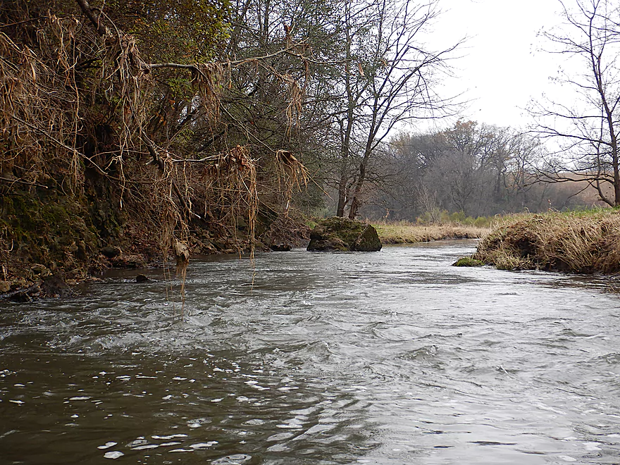
I had to stay on my toes to dodge strainers
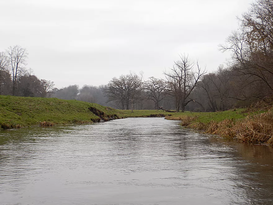
Very scenic country
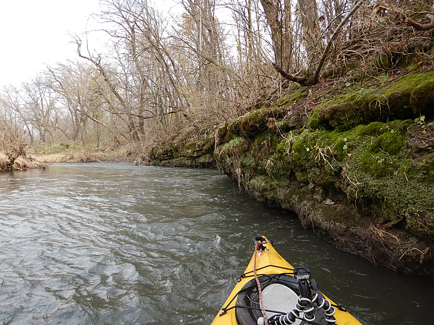
Coming up on a ridge
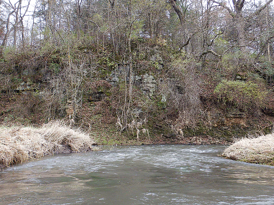
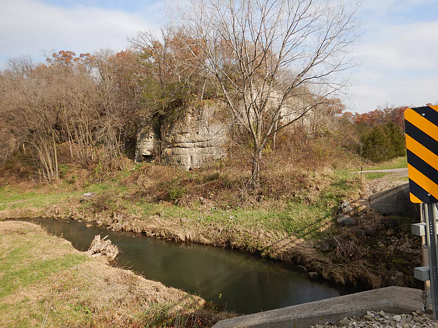
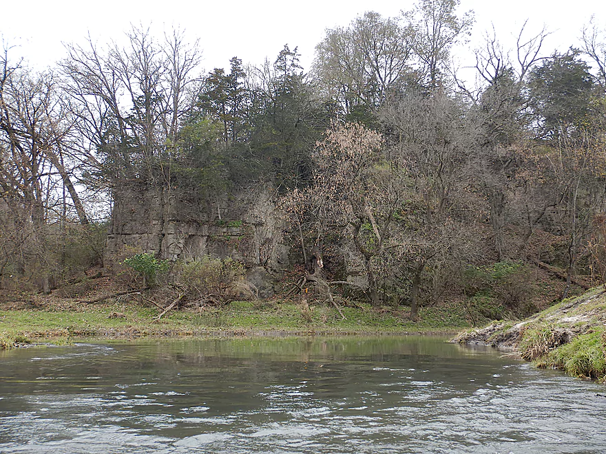
The first outcrop of the trip
Surprising number of boulders in the river
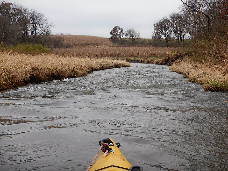
The banks were mostly pasture, but there was some corn
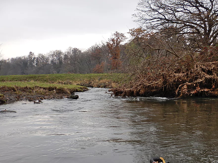
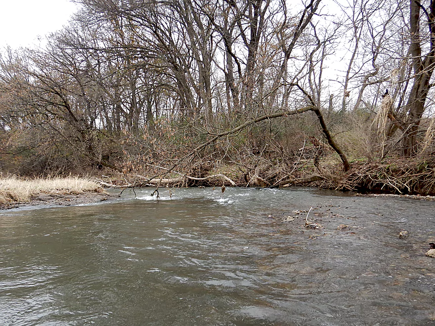
Now paddling upstream on Borah Creek
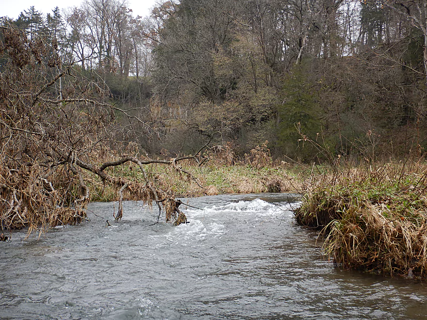
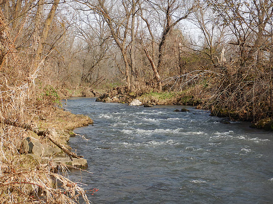
I turned around at these rapids
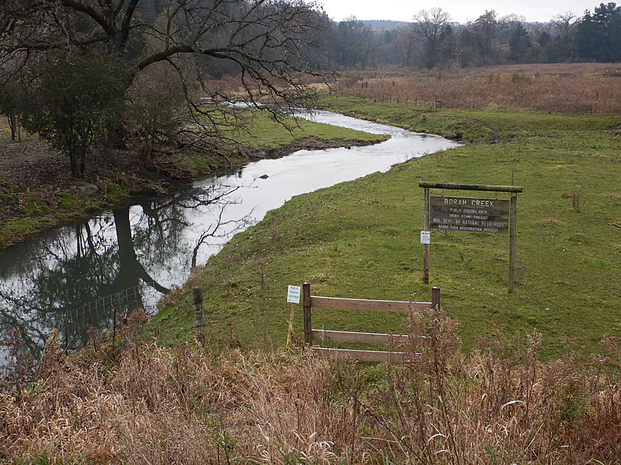
Just a bit further upstream is a public fishing access
Scenic area
Paddling back downstream on Borah Creek
Dodging some tricky strainers on the Grant River
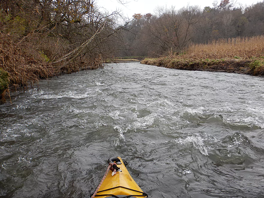
Despite Borah doubling the river, it stays fast
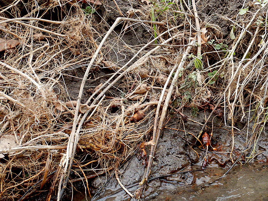
Wild tubers….might be edible
Would have been really scenic in the fall
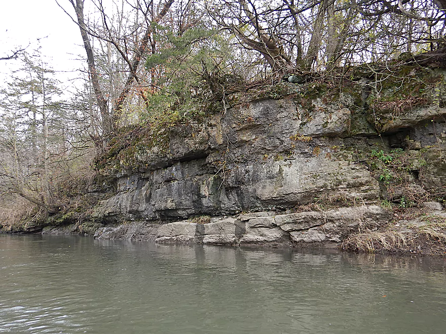
Sad to see some of the outcrops being destroyed by erosion
Part of a much longer ridge
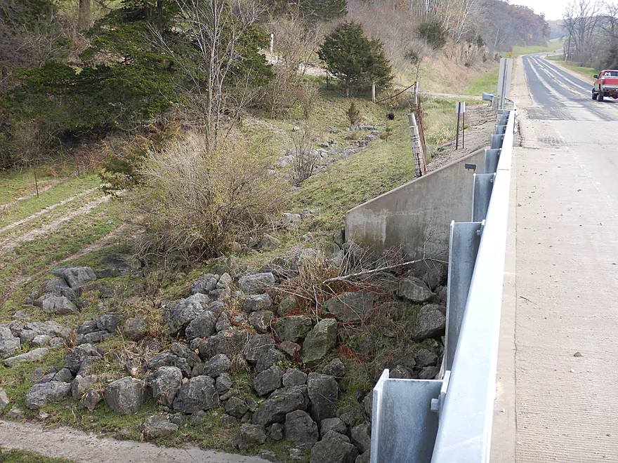
This section has had some recent reconstruction work done
Likely done on behalf of trout
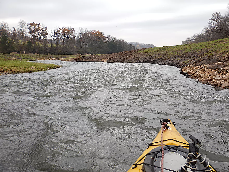
Riprap was everywhere
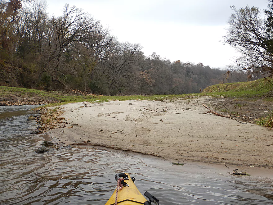
Surprise sandbar
Pretty ugly now…but should look better next summer
Hwy K
A public fishing area…but an annoying fence to deal with
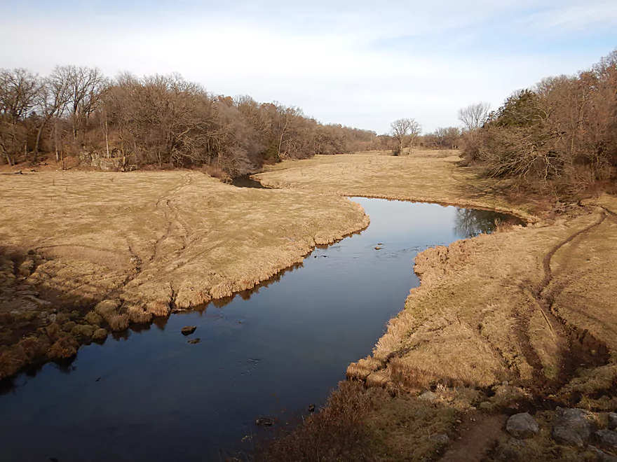
View from the bridge
Coming up on some badly eroded banks
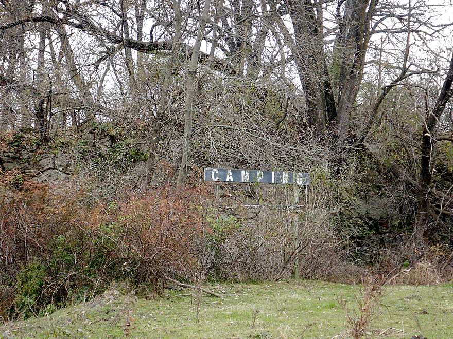
A campground in the middle of nowhere
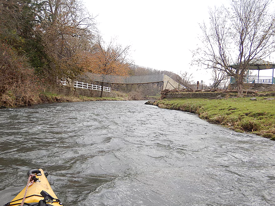
Entering Klondyke Park
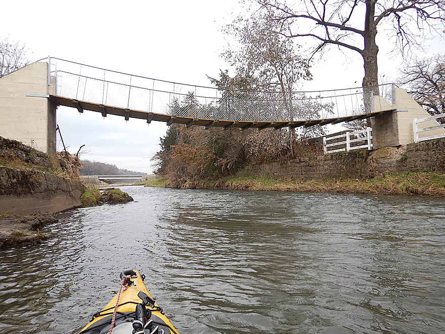
Nice suspension bridge
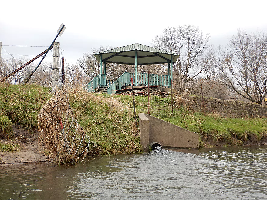
It connects to Klondike Springs
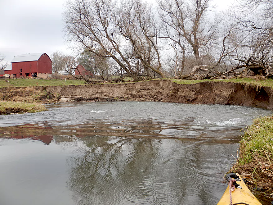
More erosion problems
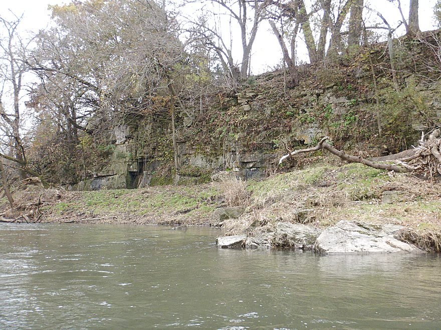
But also more outcrops
The only cows of the trip
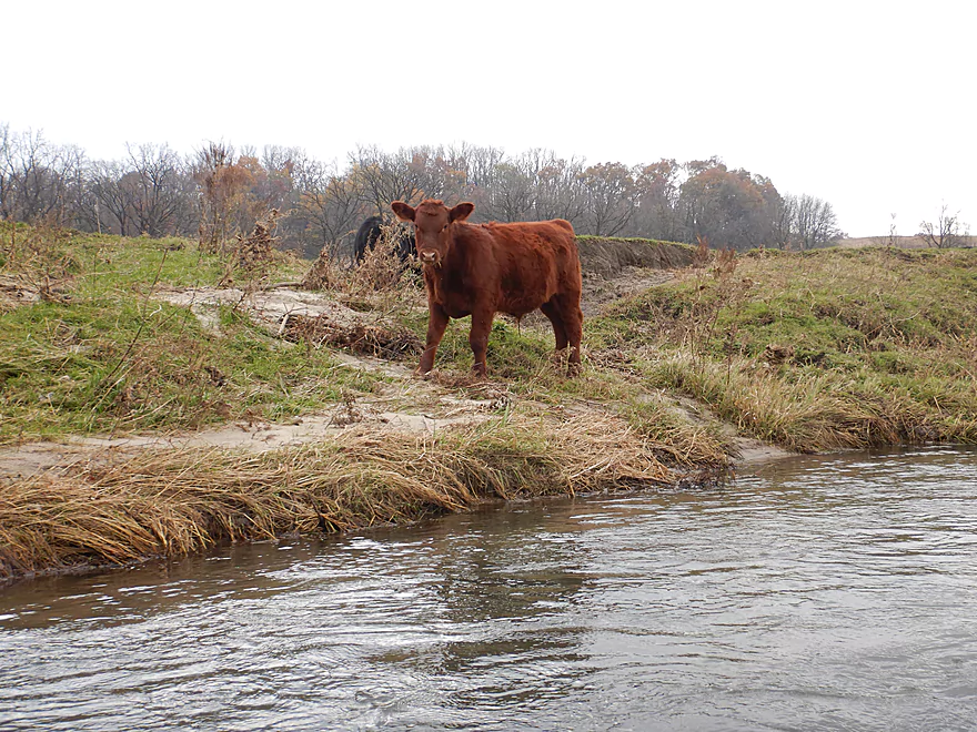
The reddest cow I have ever seen
Entering a nice wooded section by Quarry Road
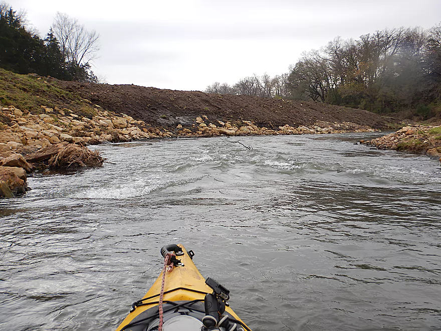
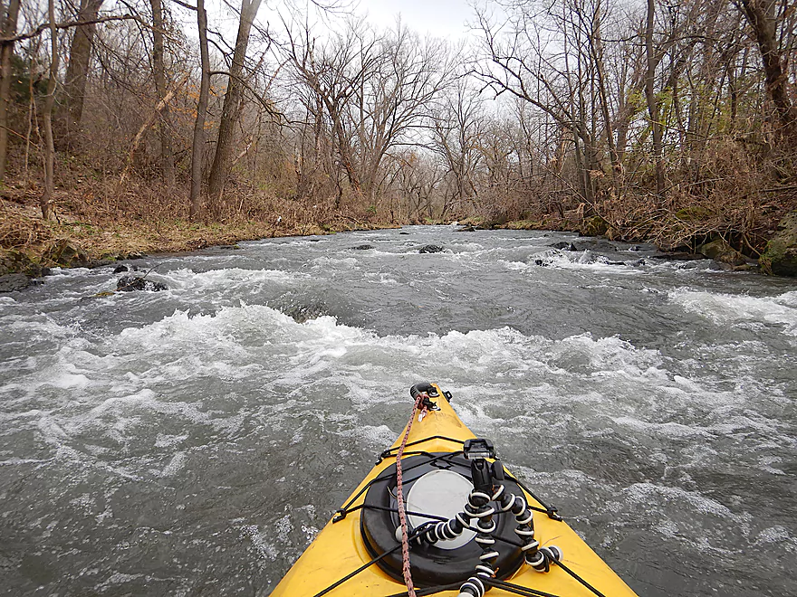
The start of the longest and best rapids of the trip
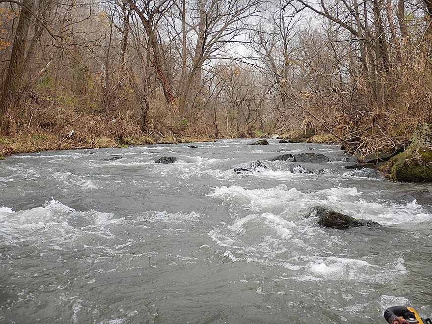
Lot of fun…these are Class 2
View from the bottom
Couple more minor riffles after that
Current flowing fast into a small outcrop
Looking back
This was followed by a much larger outcrop
Taking out at Pine Knob Road
Grant River – Rogers Branch

I started the trip at Mt. Ridge Road where the Rogers Branch was no more than a small creek. The put-in overlooked a scenic part of the creek which was rocky and surprisingly fast. After I paddled under the bridge, I encountered a cow fence (super easy to get under). This signified the start of open pasture, which had few trees and grassy banks clipped short by grazing cows.
The first mile (prior to Borah Creek) was extremely narrow and fast with countless light rapids (very fun!). There were strainers to dodge, but no logjams. Several scenic sandstone outcrops flanked the river and were easy to see through the leafless trees.
Soon I came to the mouth of Borah Creek which roughly doubled the size of the river. It is here that the Rogers Branch officially ends, and the Grant River begins. Borah Creek is a scenic and clear little driftless stream popular with trout fishermen, and my plan had been to paddle significantly upstream on it. Unfortunately I only got about a quarter mile upstream before I came across some rapids I didn’t feel like portaging so I turned back. I likely couldn’t have gotten too much further upstream as there is a low cow fence by Bluff Road that didn’t look circumnavigable.
Back on the Grant River I passed more outcrops, and while the current slowed a bit, it was still fast. Close to Hwy K, I encountered what looked like a construction scene with exposed muddy banks, tire tracks and disorganized boulder fill. It turned out this was trout restoration work designed to keep the river clean and fast. This was ugly now, but I assume in summer once bankside plants take hold, it will look much nicer.
Past Hwy K, I saw an odd sign in the middle of a cow pasture for camping, which was followed by “Klondyke Park”. I’m not sure what this park is…if it is public/private/easement land or whatever. But here there was a nice suspension walk bridge connecting the south shore to a spring house where Klondike Springs flowed into the Grant River.
Continuing on, I encountered a small herd of red cows and some more rock outcrops. The river then paralleled Quarry Road which was one of the only wooded parts of the trip, and a scenic and rocky stretch. I soon heard a loud noise and was surprised to find a decent set of Class 2 rapids. This was a fun stretch and a trip highlight. The main rapids were followed by a smaller set of rapids that bounced off a sandstone wall. Finally the river slowed and revealed a much larger sandstone outcrop…one of the nicer ones of the trip. Just downstream was Pine Knob Road, where I ended the trip.
In summary this was a gamble paddle that turned out surprisingly well. Despite the lack of logjams, I doubt many will try this stretch because of its small size, fast current, high water requirements, and short length. One way to make the trip longer would be to start at Hwy 61, which appears promising and is likely a trip I’ll do in 2019. Casual paddlers will be best served by paddling the Lower Grant, which contains some of the best water trails in southwest Wisconsin (more information about these below in the overview section).
Not much. Two eagles flying overhead, a great blue heron, one beaver slide, and a fish on Borah Creek.
A mixture of cornfields and pasture flanked the river, with occasional narrow strips of trees. Some areas had undeveloped meadows and riprapped banks likely created on behalf of trout fishermen. There were two pasture fences that were easy to duck under and I did encounter one small herd of cows.
I launched at Mt. Ridge Road/Borah Road which was a good access option despite some large riprap to walk over. The adjacent banks are public fishing easements, and trout fishermen do park here.
An alternate put-in 5.0 miles upstream would be Hwy 61/Rogers Road. This would be a small and narrow stretch, but has good potential and is on my to-do list.
I ended the trip at Pine Knob Road, which like most area bridges is part of a public easement created for trout fishermen. This was a scenic take-out (a rock outcrop is just upstream), but was a tad difficult. Here the banks are deceptively steep and the channel deep. The best option is to disembark directly underneath the bridge and that still isn’t easy because of the uneven boulders and mud.
An alternate take-out 0.9 miles upstream would be at Hwy K (also used by fishermen). But for paddlers, there is a fence separating the shoulder from the banks that would require hoisting your boat over (not fun). It’s a shame, as otherwise this would be a good access option with flat banks. Supposedly, paddlers do launch from Klondike Springs which is just downstream. But either way, you really shouldn’t take out at Hwy K, as the next mile is very scenic (two outcrops, Klondike Springs + the best rapids)
What about downstream take-out options? Well Hwy A is 2.6 miles downstream from Pine Knob and is a good bridge access. This would be a scenic section…but…I see about 10 logjams on satellite maps. Most are clustered in one section so maybe these could be super-portaged along trout trails…I don’t know. Not on my to-do list.
The bike shuttle is only 3.4 miles but very hilly with 318′ of climbing (I walked maybe a third of this route). Bluff Road unfortunately is used by area manure spreaders and can be messy.
Logjams: None! That was a surprise…
Fences: There are two (one by the put-in and one by Borah Creek). Both are super easy to get under even in high water.
Strainers: In the upper portion there are several tricky strainers overhanging some of the rapids. So definitely not a stretch for big boats. Portage anything that looks too difficult.
Rapids: This is a fast creek with many Class 1 rapids and several Class 2 rapids. The strongest and longest set of rapids are here near the take-out. Here is a video. During lower flow rates, these are likely tame and boulder gardens would be visible.
The following is a very rough guestimate based on a gauge located much further downstream.
- 0-100 CFS: Too shallow.
- 101-200 CFS: While a traditionally high depth, this too would be too shallow.
- 201-300 CFS: The upper portions would likely be shallow, but the lower portions should be good.
- 301-400 CFS: Likely doable with some bumpy areas in a few spots.
- 401-600 CFS: A very good depth. I did this trip at 586 CFS and the rapids were well padded.
- 601-700 CFS: Mostly a good depth, but some rapids and strainers might be a bit pushy.
- 701-800 CFS: Only suitable for very experienced paddlers.
- 801+ CFS: Likely too pushy. I’m not sure though.
And so concludes the 2018 paddle season. Thanks to those who contributed comments and feedback on Twitter, Facebook, Youtube and most importantly on the website itself. Special thanks to Scott and Eric for their guest reviews.
2018 was quite the ride. It got off to a very late start because March and April were unfortunately atypically cold. One of my early priorities had been to explore some brand new prospects I had spent a lot of time car and map scouting. Most of these paddling gambles turned out surprisingly well (eg Little Sugar, Dodge Branch, Hemlock Creek and Mineral Point Branch).
While many of these mystery paddles turned out great, Dickey Creek did not. That was clogged with logjams, including some of the worst I’ve faced and it was here I lost my paddle. But I still don’t regret that trip as it was quite scenic and was an excuse to get a newer and better paddle.
Early June was frustratingly wet and overcast, which are my least favorite conditions for paddling. A trick for high water paddling…is to simply choose segments much further upstream than what you normally would do. Conversely it’s a good idea to paddle larger downstream sections during dry periods. With this in mind, I used our wet June as an excuse to check out a trio of small creeks (Whitewater Creek, Upper Six Mile Creek, and Starkweather Creek) which all turned out to be unique experiences.
The end of June to early August were the best times this year for paddling and I got to explore a number of new prospects (Little Platte River, Beaver Creek, Lower Six Mile Creek, Upper Grant River) as well as some classics (Baraboo River, Lower Black River, Lower Milwaukee River).
Late August was unfortunately when we had our epic “100 year” floods, which were horrible for kayaking and buried many great water trails. Central Wisconsin fared slightly better with the floods, which justified trips to the East Fork and Waupaca Rivers (great trips!). It also justified a unique trip to the Illinois River which, while not five stars, was a cool experience.
September was still a wet month with persistently high river levels. Only southeast Wisconsin fared decently (Oconomowoc River and Root River were both good trips).
October is typically one of my favorite times to paddle. No biting insects, usually good temperatures, few others on the water, spectacular color, and usually good conditions for photography. But this October was kind of a disaster for paddling… Not only was it unusually overcast and cold, but it was windy and wet, which really hurt fall color. All that said, Tainter Creek turned out to be a decent fall color experience (despite camera issues) and finally doing a review for Devil’s Lake was a lot of fun.
The 2018 season ended about 7 trips shorter than 2017, which just goes to show how challenging this year has been. Often I would have tabs for weather, depth, and my to-do list open…and it was often difficult finding workable prospects I hadn’t done. I’m not sure how area paddling groups schedule their trips so far in advance. I’m quite optimistic for 2019…as this appears to be an El Niño year. Typically this means that warm Pacific air will help block the Canadian Jet Stream from dipping down too often into Wisconsin. This usually means less rain and lower water levels. But you never know with global warming.
Some of my 2019 goals include more central Wisconsin paddles and finally returning up-north. If you have any trip suggestions for 2019, or feedback in general about the website, definitely let me know. Otherwise, I’ll see you next year.
Detailed Overview
- Pine Grove Road to Hwy 61: 2.1 miles. Very small and would need flood-like levels to be navigable. Likely not interesting with several fences, 3-4 logjams, and flowing mostly through cow pasture.
- Hwy 61 to Mt. Ridge: 5.0 miles. A rugged and small paddle that needs high water. Unfortunately there is a lot of mud and pasture to deal with not to mention a few logjams. However, there are many fun rapids and several scenic outcrops.
- Mt. Ridge to Pine Knob Road: 2.6 miles.
- Mt. Ridge to Hwy K: 1.7 miles. Narrow and fast with several rock outcrops. No logjams, but a few tricky strainers.
- Hwy K to Pine Knob Road: 0.9 miles. A neat section with more outcrops, a longer set of Class 2 rapids, and Klondike Springs.
- Pine Knob to Hwy A: 2.7 miles. Likely way too many logjams.
- Hwy A to Grays Mill Road: 0.7 miles. Maybe one downed tree. Mostly a simple farm field paddle.
- Grays Mill Road to University Farm Road: 3.4 miles. Maybe 2-3 downed trees and one set of rock outcrops. River gains significant volume in this stretch from tributaries.
- University Farm Road to Short Cut Road: 3.7 miles.
- University Farm Road to Slab Town Road: 1.5 miles. Very muddy and one noteworthy strainer, but also has a great series of limestone outcrops.
- Slab Town Road to Short Cut Road: 2.0 miles. Less muddy and with several sets of fun rapids, but has only one tiny outcrop and there is a logjam to deal with.
- Short Cut Road to Grant River Road: 5.5 miles. Great section with some attractive outcrops.
- Grant River Road to Hwy U/Blackjack Road: 6.2 miles.
- Grant River Road to Pigeon River Road(1st): 1.4 miles. Great stretch with some of the best outcrops on the river. Grant River Road is a bad access.
- Pigeon River Road(1st) to Hwy U/Blackjack Road: 4.8 miles. A good leg with a mix of sandstone and limestone outcrops. Outcrops aren't as common as other legs, but it's still a nice stretch..
- Hwy U to Camel Ridge Road: 6.0 miles. Good stretch with some nice rock outcrops.
- Camel Ridge Road to Chaffie Hollow Road: 3.2 miles. Very scenic section with good current. Features a waterfall and some nice outcrops. Very popular with tubers.
- Access note – The Chaffie Hollow Road landing is private. Get permission from one of the three liveries like “Y’Allbee Tubin” to use it, or take out under the bridge (the latter is not easy).
- Chaffie Hollow Road to Hwy N/Burton: 3.3 miles. I don’t know much about this section. Likely more open and less interesting…but likely some outcrops and light rapids.
- Access note – The landing at Burton is private. If you take out here, use the bridge instead.
- Hwy N to Great River Road: 8.5 miles. Should be a few nice rock outcrops, but the channel is much larger and muddier. Maybe 3 logjams. Take out at Hwy 133 on SE side…not an ideal launch area.
- Great River Road to Mouth: 1.6 miles.
- Mouth/Mississippi to Potosi Point: 1.2 miles. A short trip on the Mississippi before disembarking at Potosi Point.
Trip Map
Overview Map
Video
Photos Size: