
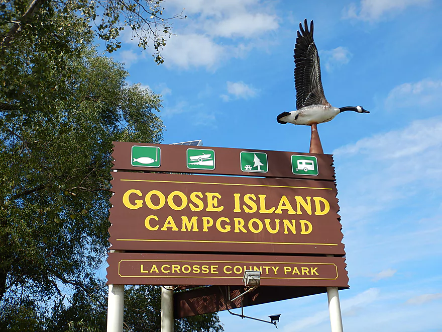
Welcome to Goose Island
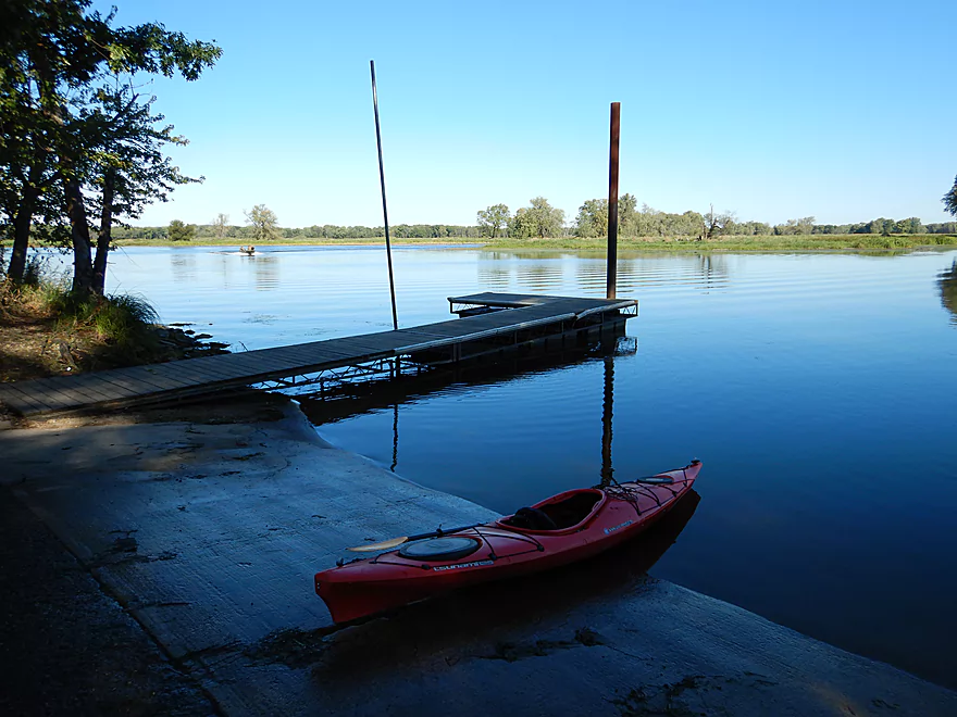
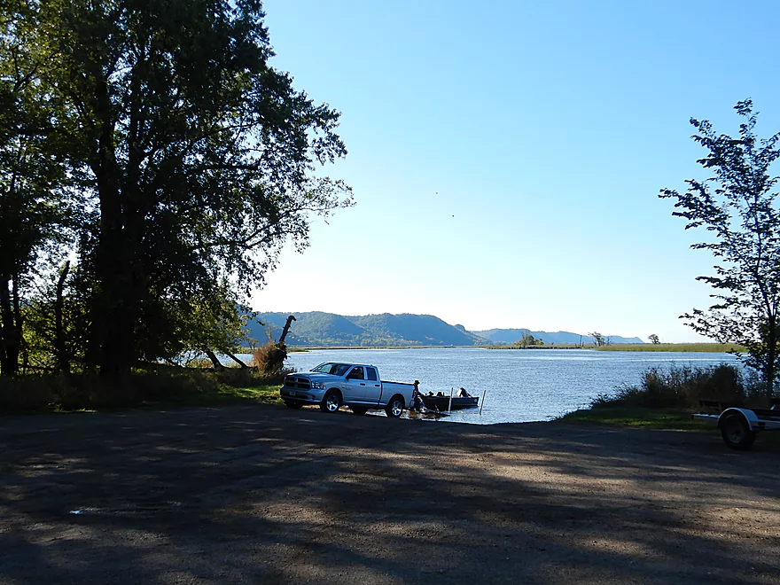
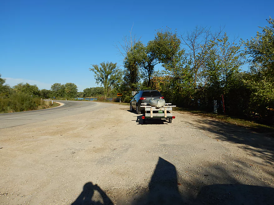
Launching at the north boat ramp
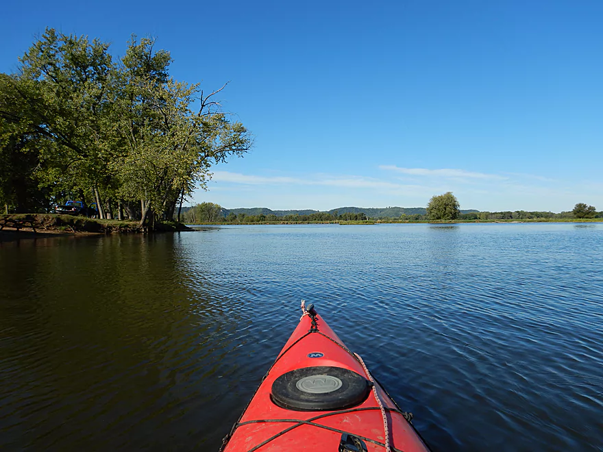
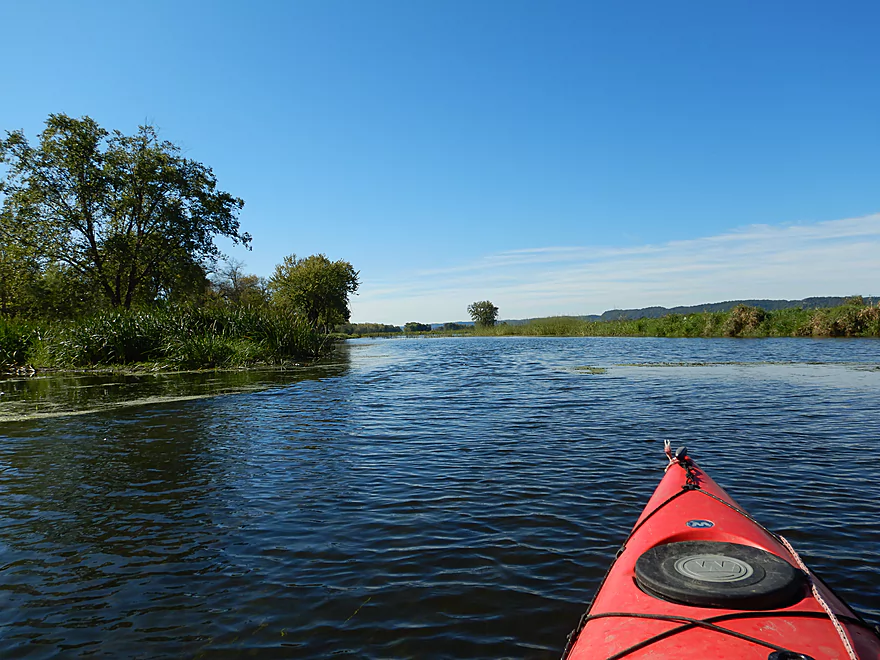
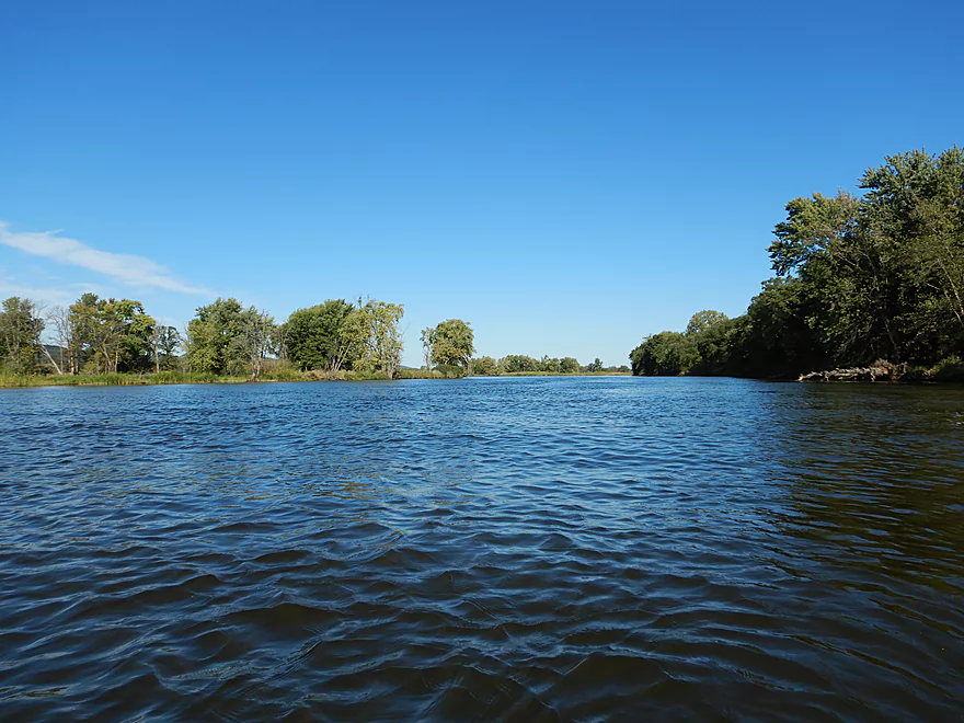
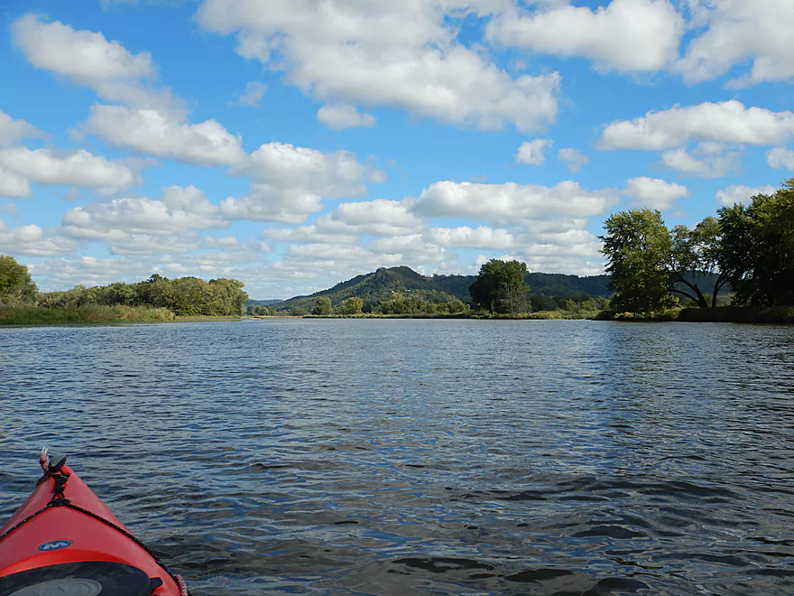
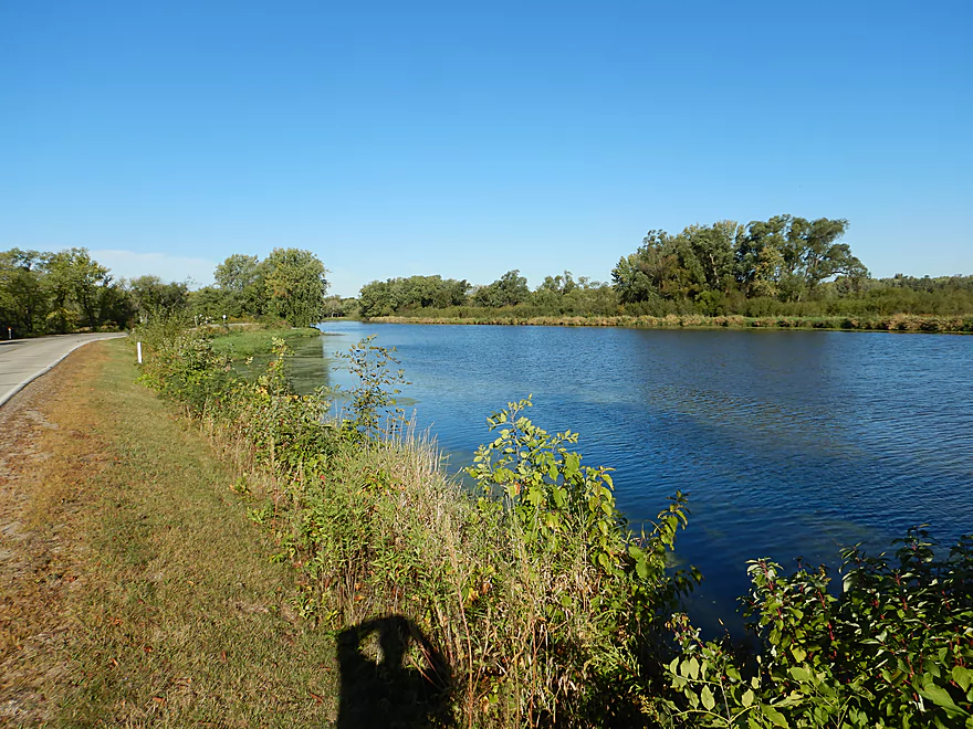
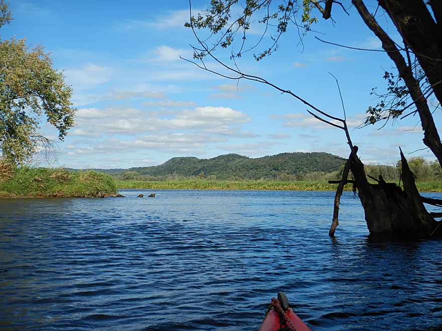
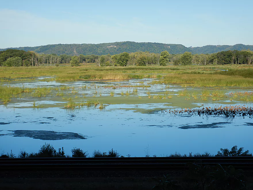
Very still water for the Mississippi
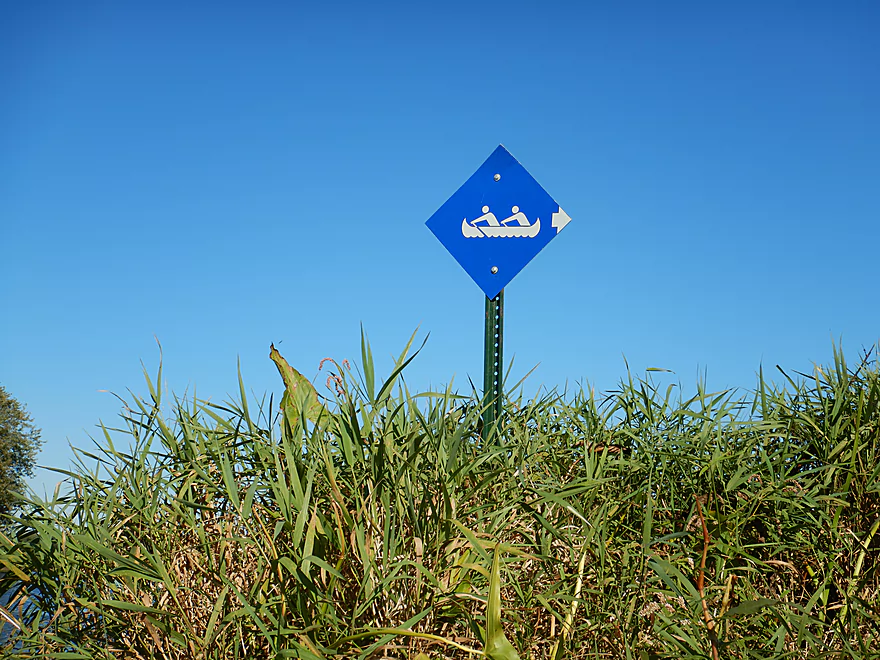
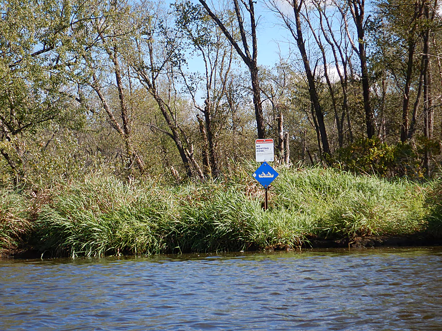
One of a handful of trail signs
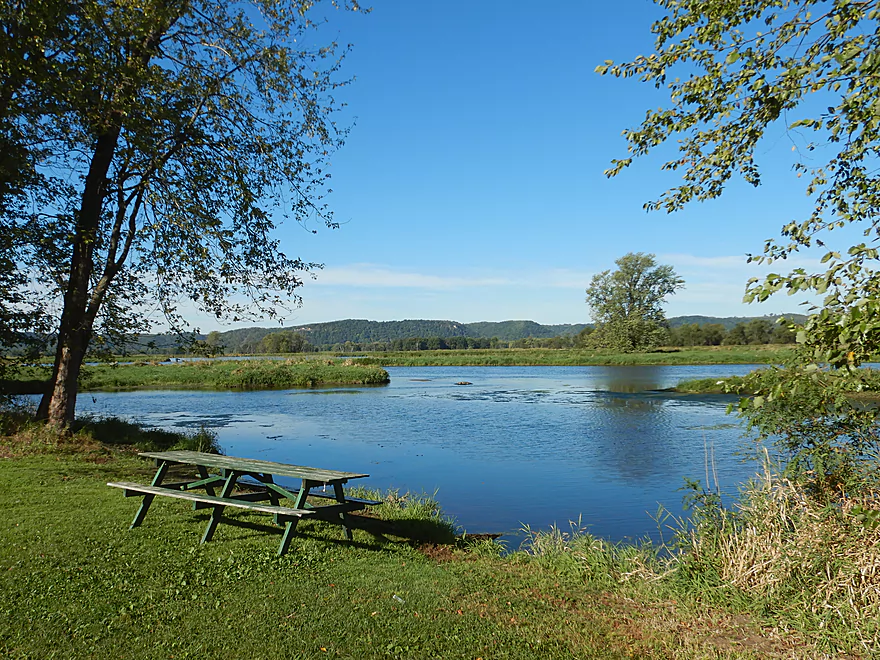
Some nice picnic areas along the west shore
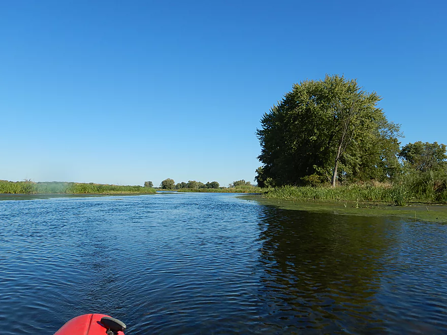
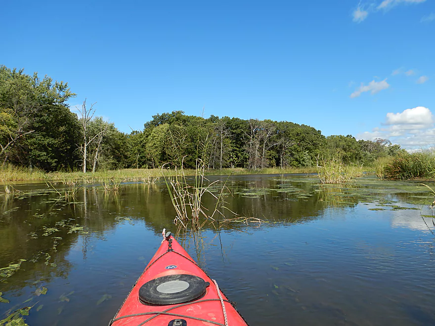
Paddling south on Wigwam Slough
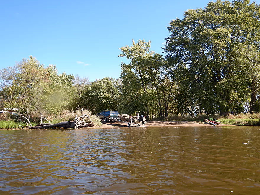
The western boat ramp
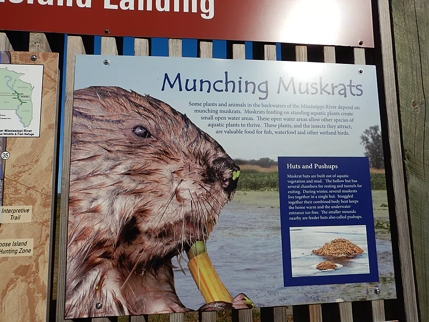
Love the close-up picture of the muskrat
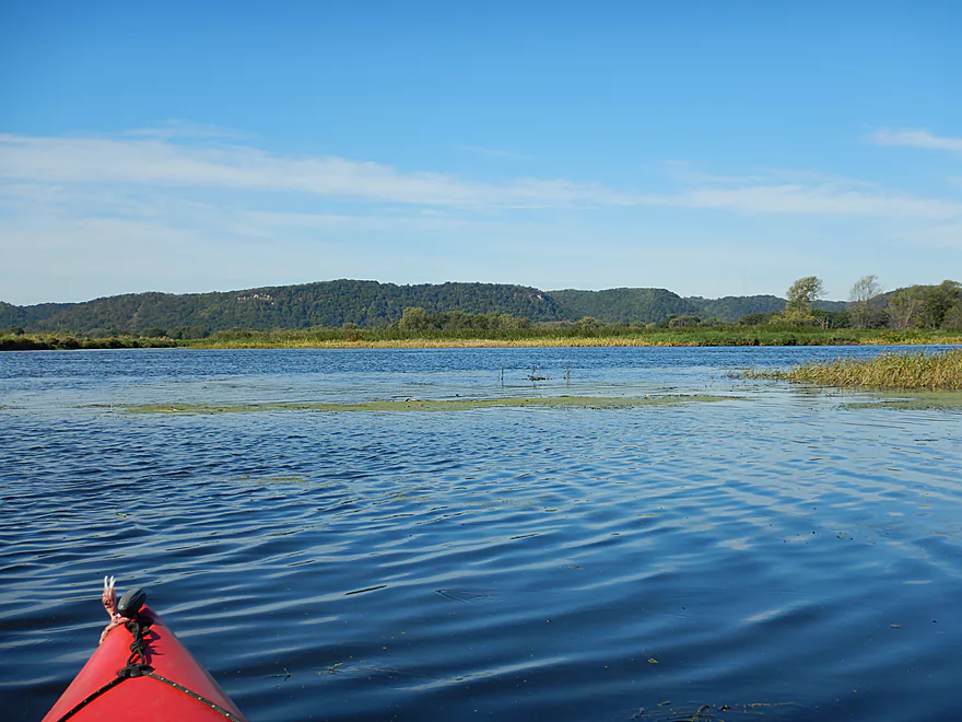
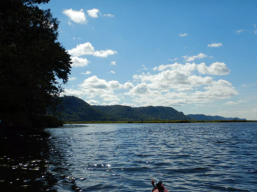
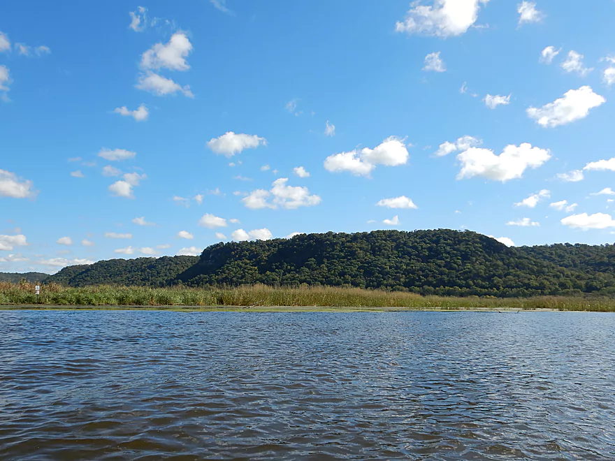
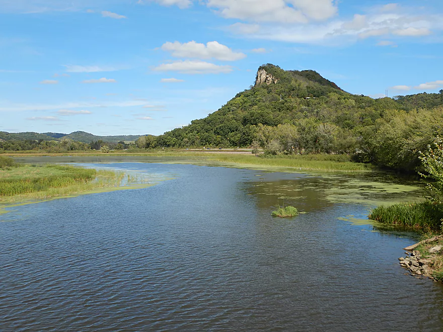
Bluffs along the Minnesota shore were quite scenic
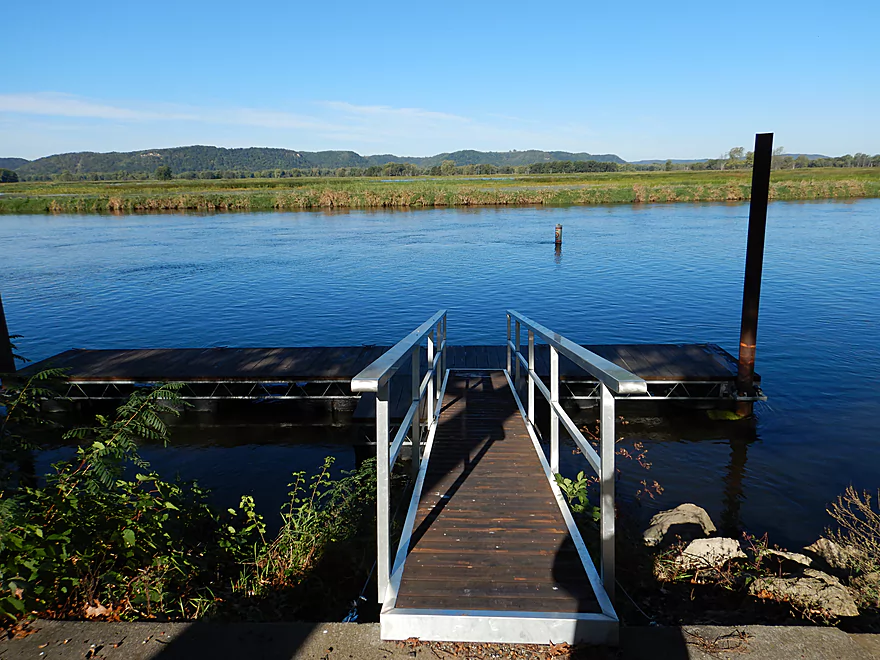
A public dock
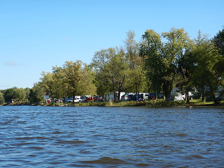
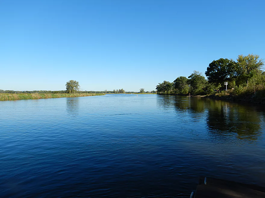
Paddling alongside a huge campground
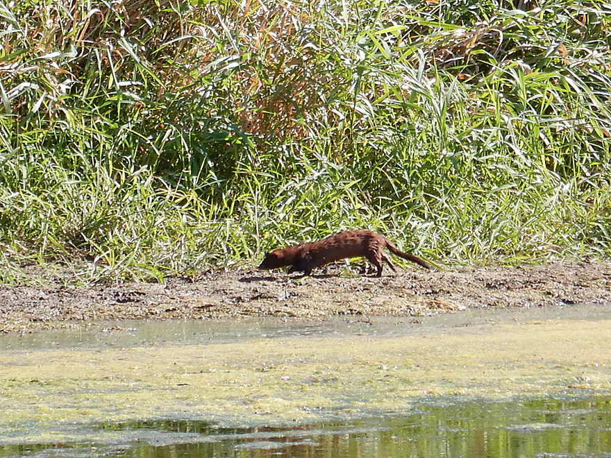
This mink swam like a dolpin
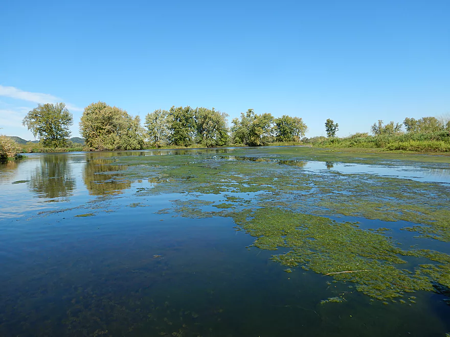
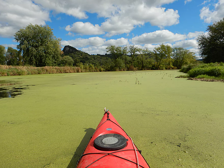
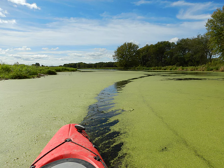
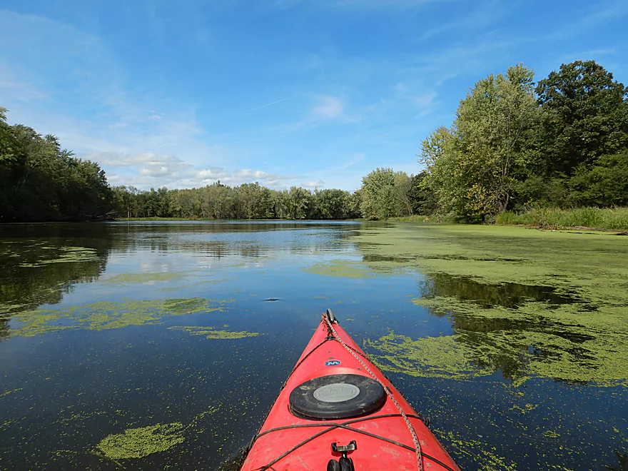
Some algae…mostly not bad though
The southernmost boat ramp
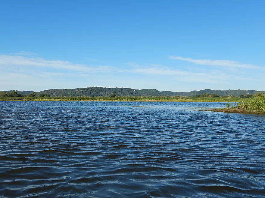
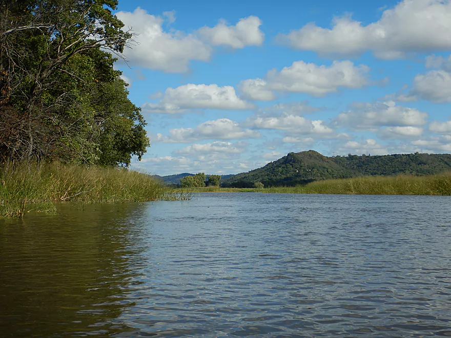
Another view of the Minnesota bluffs
Doing the canoe trail backwards…but that is ok
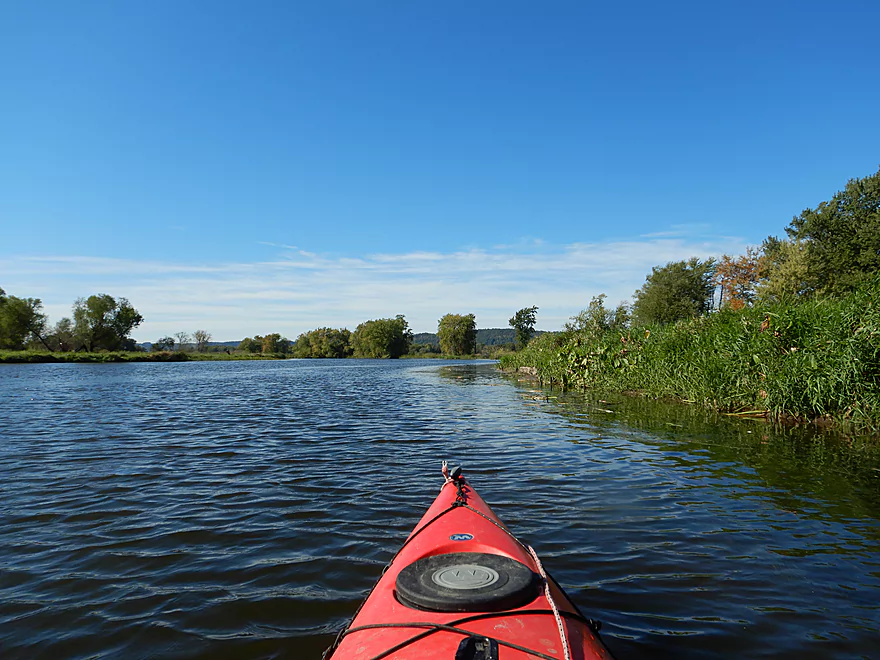
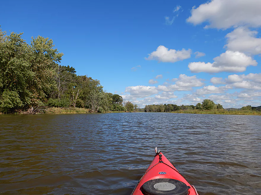
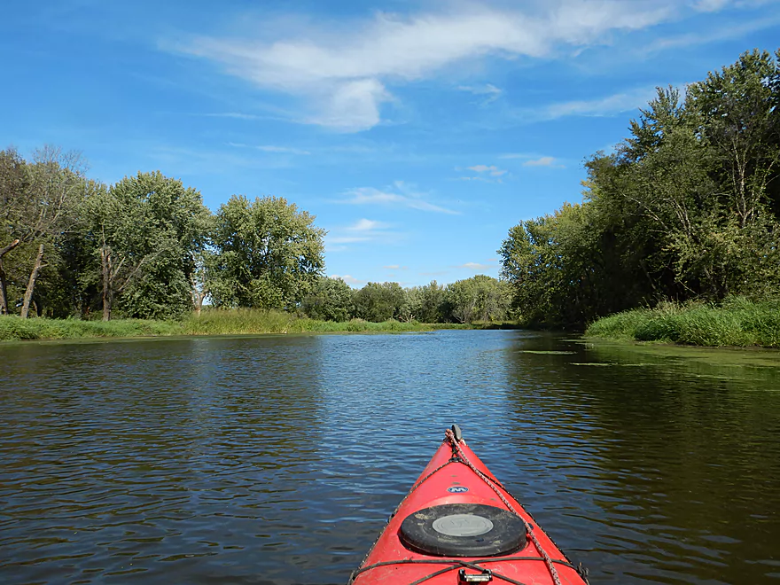
Approaching the Wisconsin side of the river
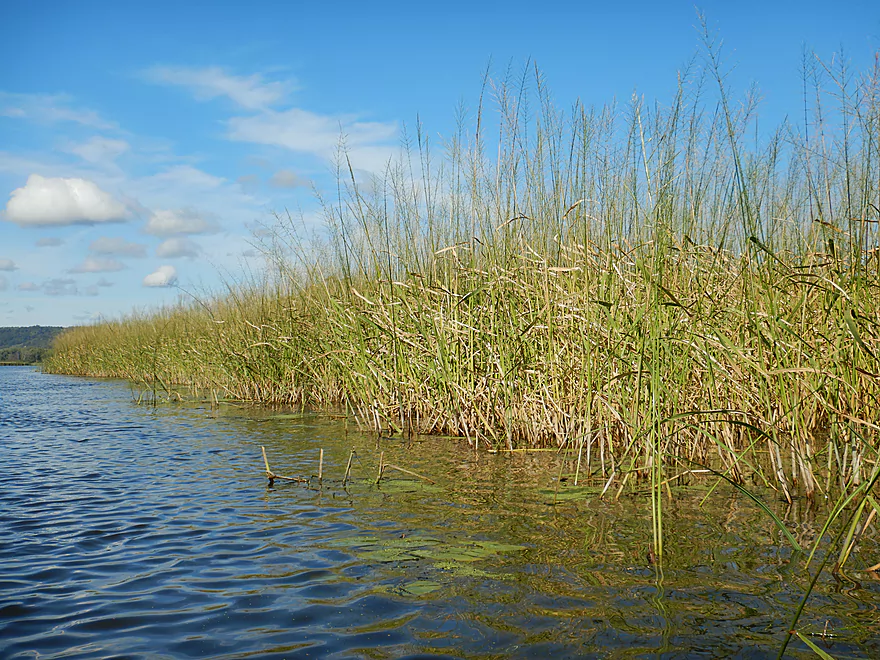
A huge wild rice field
Halfway point…now I am paddling upstream east of the island
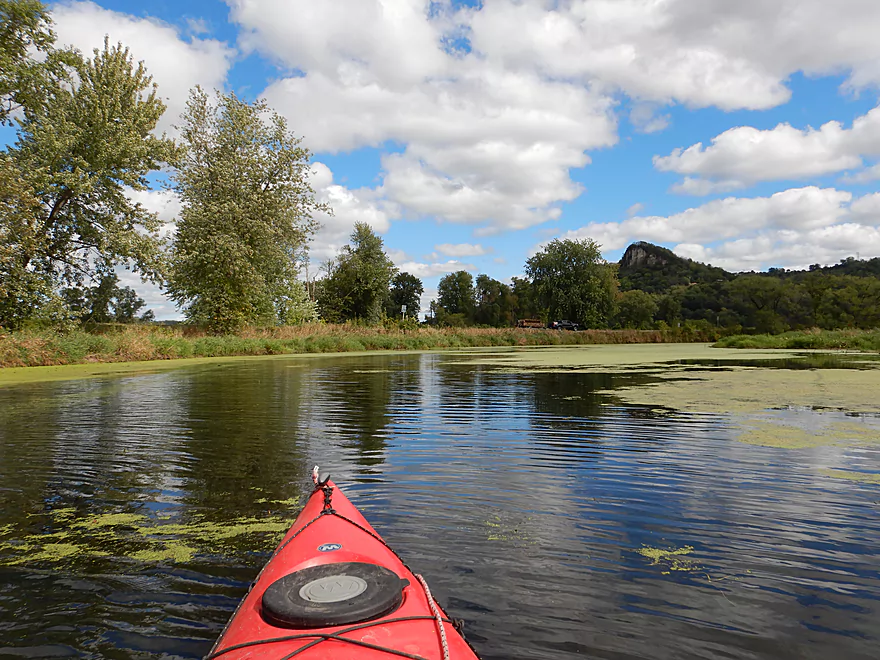
Wisconsin bluffs were as scenic as the Minnesota ones
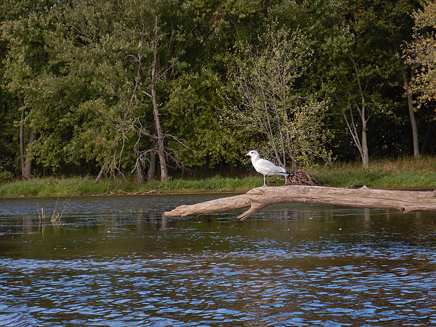
Gull balancing on one leg
I thought this was the main branch
It was not…
Creating duckweed trails
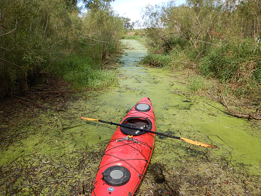
Getting a little lost and dead-ended
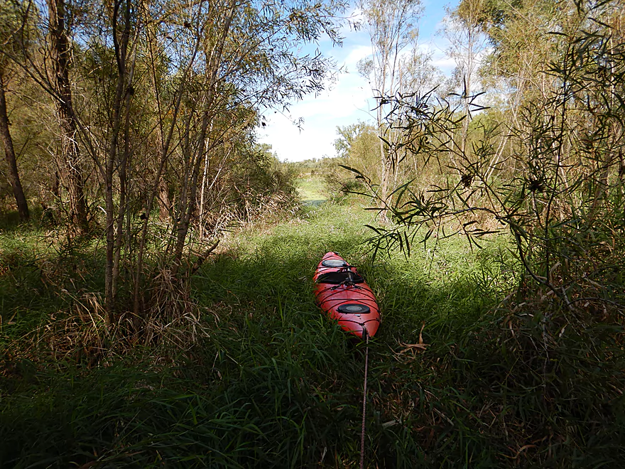
One of two portages (only because I got lost)
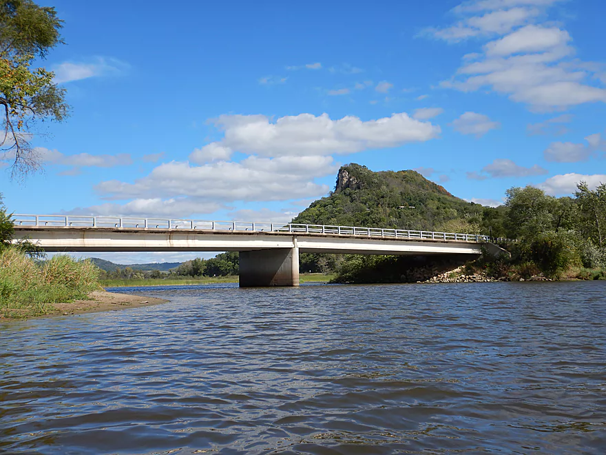
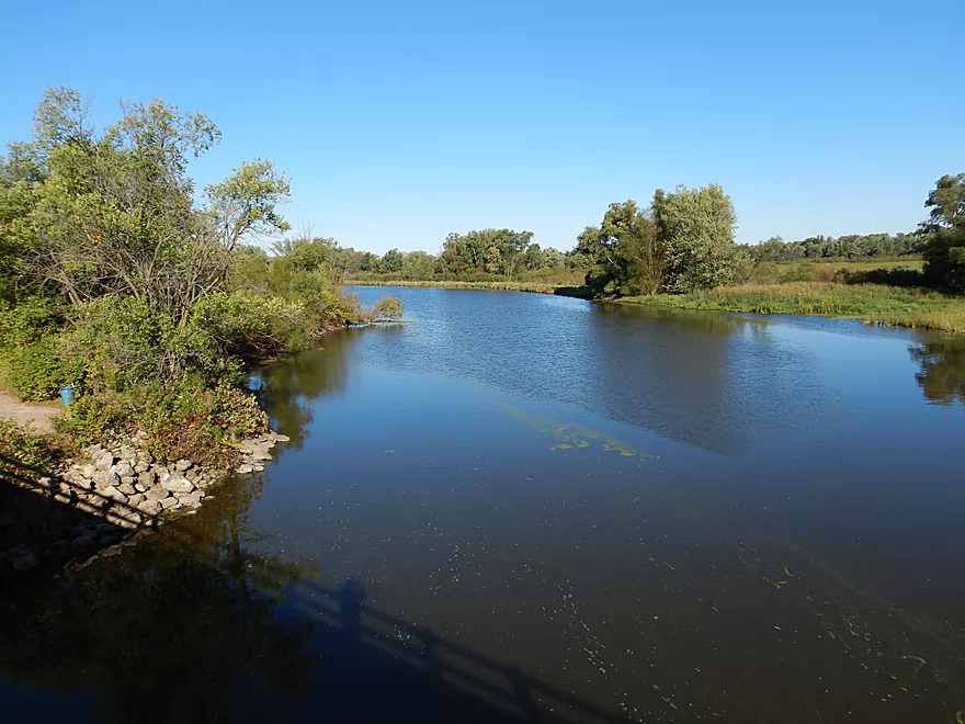
This bridge marks the entrance to the island
There is a canoe access area here
Fantastic bluffs
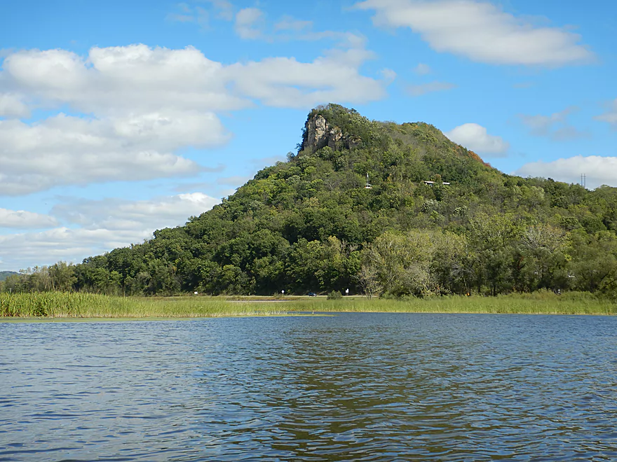
Close-up
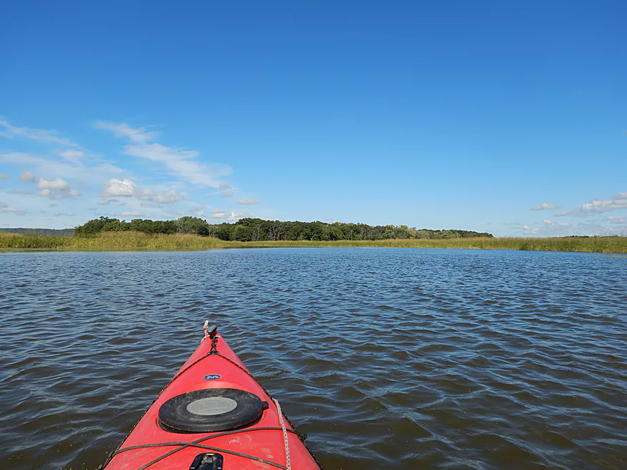
Now heading southwest along the island
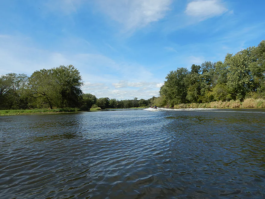
Some motorboats fly through these side sloughs

Lot of fishermen out that day
The channel splinters into several smaller sloughs
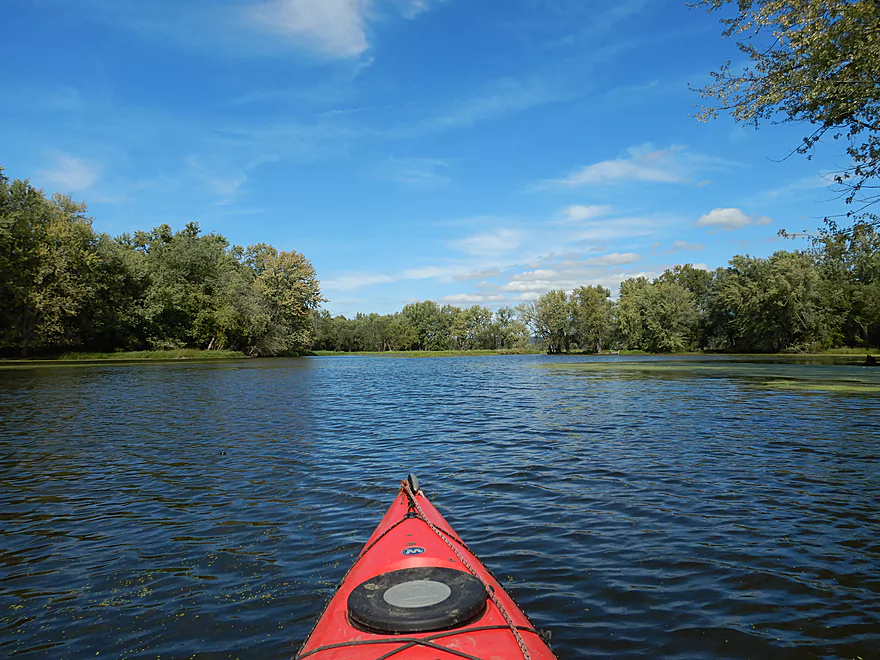
Rejoining the main slough
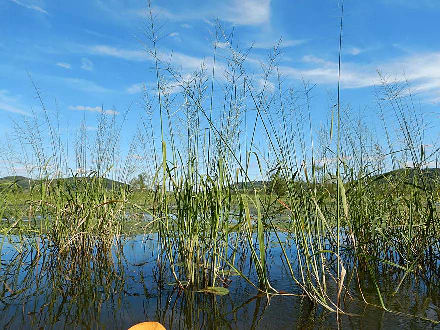
Much more wild rice
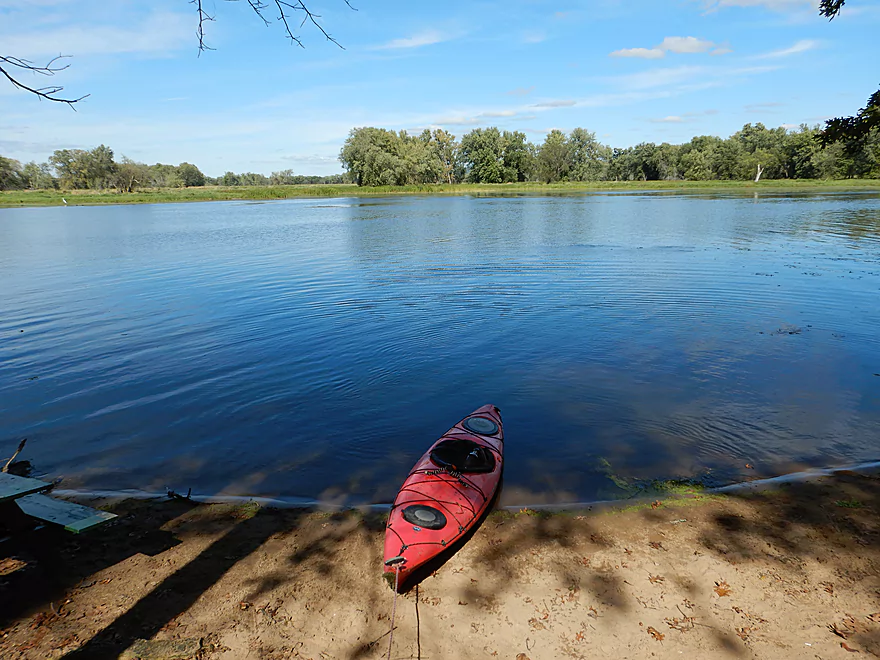
And back where I started
Checking out the Shady Maple Wildlife Overlook
Mississippi River – Goose Island

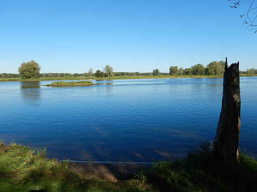
Just south of La Crosse, the Root River empties into the Mississippi and creates a massive archipelago of islands. The largest and most interesting of which is Goose Island, which you can actually drive out onto and camp on. Much of the island has been set aside for public use as as county park. Despite being on the Mississippi, it is quite sheltered from the main channel by a buffer of small islands, which gives this more of a lake/slough feel than a major river.
There is an official canoe trail that circumnavigates the entire island clockwise. For my trip, I chose to do it counter-clockwise to best time the wind and sun, but you can do this either way. There are a number of public accesses (see my map for more info). I chose the far northwest boat ramp, which was a good option.
My first impressions after starting the trip were how still the Mississippi was (not something you usually equate with big water) and how scenic the Minnesota bluffs were. Goose Island is extremely popular with outdoorsmen, and I saw my fair share of fishermen and hunters out on their boats (some sporting quite the camouflage). As I continued south on Wigwam Slough I passed the main campground, which is supposedly the largest county campground in Wisconsin. I’m not a camping connoisseur…but this type of campground wouldn’t be my first choice. Few trees, little privacy, high density and you set your tent or RV on pretty much an over-sized lawn. The campers seemed to like it though and it has a fantastic view of the Mississippi.
Continuing southeast, I lost the campers and the shore changed to mostly floodplain hardwoods. Here there was a nice trail system and I did see a few hikers. Power boaters fly though these side sloughs pretty fast, but they were mostly pretty easy to deal with.
As I approached the south tip of the island, I got a little nervous about missing my north-bound off-ramp. In high water, you can actually take a shortcut by paddling across the southern peninsula, but this wasn’t possible today. Instead I kept heading south where I encountered a huge wild rice field. Finally, I spotted the sneaky outlet and was able to start paddling upstream to finish the 2nd half of the trip on Running Slough.
Running Slough was pleasant with the highlight being the impressive bluffs along the Wisconsin side of the river. The channel here though is somewhat wide and unvaried, so while the scenery was nice, it was a bit repetitious. The big concern is getting lost (such as turning off onto Beier Lake by mistake). I was doing so good…when, after seeing cars cross the grade in the distance, I prematurely turned left and ended up paddling a dead-end slough a fair ways. Not wanting to backtrack, I portaged to the next pool…which also dead-ended. Not fun as that side slough was shallow and very mucky. Eventually I oriented myself and was able to drag my kayak over land to re-enter the water by the Hwy GI bridge (the entrance to the island).
This was the most scenic part of the paddle as a huge bluff with an exposed rock outcrop towered over the Wisconsin banks, quite reminding me of Brady’s Bluff from the Trempealeau River.
Continuing on, the channel was nice but nothing special. Islands frequently divide the water trail and can make it easy to get lost. Roughly speaking you want to hug the left shore but not enter Beier Lake. There are little blue trail signs but they are pretty much useless as they are not located at decision points (funnily enough Wyalusing and the Trempealeau had the same issues). Soon I rounded the north corner of the island and was back to where I started.
In summary, this was an ok trip but the channel and island itself were nothing special. Mostly simple floodplain forest and generic sloughs. What saved this from being a 2 star trip were the fantastic bluffs on both sides of the river and some unique wildlife experiences (a mink swam in front of my boat and I saw a large number of pelicans). If you do this trip, be warned that it is a long trip and should only be attempted by experienced paddlers in fast long boats. It would be doable in a canoe (if no wind), but would be a chore. Also be mindful that parts of the island shut down after camping season (April 15th to October 30th) and some roads and landings may not be available during these times.
Goose Island has three boat ramps and three additional areas for launching a canoe, so no shortage of options. If you imagine the island as a clock, I launched at 11:30 (far NW corner boat ramp). This was a very good access with good parking, no fees and outhouses are available about a block to the south.
There is a second boat ramp at “10:00” and a third ramp at “7:00”. Additional accesses are available 12:00, 2:30, and 3:00
If you find my clock analogies confusing…no worries. I posted all the landings on my map below or you can check out the official park map.
While La Crosse does have some rental services, I’m not sure they would go this far south.
Because this is a round-trip, there is no need to shuttle. If you were to convert this to a shuttle (say by starting at La Crosse or taking out at Stoddard), Goose Island itself would be very easy to bike on (nice and flat). Hwy 35 though is extremely busy and not bike friendly (it does have big shoulders though).
In some ways this is a pretty easy trip. No logjams, rapids, dams, or big waves (some powerboat traffic but not much).
You do have to be super mindful of wind direction and speed.
The other issue is getting lost, which is easy to do (trust me). Study the maps very carefully and bring along a GPS if possible.
Lastly, the current for the most part was pretty negligible. It does speed up at the south end of the island though (both sides), but was mostly not a big deal. Supposedly in high water the current gets much faster and can make for a very difficult round trip.
There is a nearby gauge on the Mississippi at Brownsville which will accurately reflect water levels. Below is my rough depth guide:
- < 30.5 CFS: A shallow depth common for late fall. The main water trail should still be plenty navigable.
- 30.6-31.5 CFS: A good depth. My trip was done at 31 CFS.
- 31.6-32.0 CFS: Starting to get on the high side. Should be doable, but the currents at the south end of the island could be strong.
- 32.1+ CFS: Likely pretty high and I suspect the currents might be too strong for a round-trip, but this might be a good depth for exploring the islands interior which should be at least partly flooded.
A mink, a few great white egrets, and a large number of pelicans. Goose Island is a great spot for wildlife and chances are good you’ll see something if you do a trip here. The water lilies can be fantastic as well if you catch them in bloom.
Detailed Overview
The Mississippi is both a blessing and a curse for paddlers. While rich in beauty and majesty, it can be problematic to paddle due to high wind, current, wakes, powerboats, and barges. The Upper Mississippi is frequently dammed and subdivided into “pools”, of which there are roughly 11 in Wisconsin. Generally speaking, just upstream of a dam the river is the least interesting (few islands, deep, monotonous, few sloughs, and a wide channel). But on the downstream side of pools there are often many sheltered islands and sloughs that offer unique paddling experiences.
For a list of Mississippi water trails see my overview map or use the bullet list below. Thanks to the US Fish and Wildlife Service for many of these suggestions. Check out their website for more details. Water trails are listed in order from north to south.
—
Chippewa River Trail: 6.8 miles. Chippewa River Landing to Tim’s Slough Landing. Basically the last part of the Chippewa River that connects with a slough on the Mississippi. Avoid in high water.
Nelson-Trevino Trail: 4.5 miles. South of the Chippewa River, Hwy 25 cuts across the river through a slough and over a grade. Many landings to pick from. Most paddlers venture south and then back north to one of the landings. The main water trail is roughly the biggest loop you can take south of Hwy 25 while remaining in the slough. Avoid in high water and high wind.
Finger Lakes Trail: 6.1 miles. North of the Zumbro River mouth, there is a sheltered collection of sloughs and lakes you can paddle. The main water trail skirts the south edge. In low water, some portages may be required. For a launch/take-out, use Pioneer Landing in Minnesota.
Halfmoon Trail: 5.1 miles. A scenic mix of sloughs, the main channel, and open marshlands, with a chance to explore two massive dredge piles. Note that timing is tricky: low water can dry out the interior channels, while high water makes completing the loop against the current difficult.
Verchota Trail: 11.3 miles. A long upstream paddle up the main slough then you double back mostly on the same trail. Use Verchota Landing for an access. Difficult because of its long length and upstream paddling.
Aghaming Trail: 6.7 miles. Start at the park in the main channel and float downstream until you find a gap in the slough which you can paddle upstream to explore. Turn back when done. Access at Latsch Island Park and Landing. Some upstream paddling in the main channel. Not usable in high water.
Voyageurs Canoe Trail/Perrot State Park: 6.5 miles. Your best bet is to do a one-way trip from Hwy 35 to S. Park Road. Very scenic. Completely sheltered from the main channel and is technically the Trempealeau River.
Long Lake Trail: 5 miles. A counter-clockwise circle through mostly backwater sloughs. Long Lake is mediocre and French Lake is boring and weedy. But the main channel is nice with good sandbars and bluff vistas. When in season, Big Marsh can contain scenic wild rice corridors.
Brown’s Marsh Canoe Area: More of a lake paddle and a way to experience Brown’s Marsh. Access at Lytle's Road.
Lake Onalaska Trail: Technically the last few miles on the Black River. Been on my to-do list for a while… Lytle's Road to Fred Funk Landing is 4 miles, while Lytle's to Mosey Landing is 8 miles.
Root River to Crater Island: This is mostly attractive slough paddling inside the vast Goose Island archipelago. It does include a bonus stretch on the fast Root River and some main channel paddling by Brownsville. The highlight is "Crater Island," a large man-made sand island.
Goose Island Trail: 8 miles. A nice paddle around Goose Island. Mostly simple sloughs but there are nice bluff views .
Reno Bottoms Trail: 3-14 miles. Put in on the Minnesota side and float down a long slough. Many intermediate take-out options. Access at Reno/Hwy 26 and New Albin. Some of the launches can be under water during high depths.
Blue Heron Trail: 9 miles. Located south of the Minnesota/Iowa border, this water trail features a fantastic labyrinth of islands and side sloughs. A trip highlight is being able to paddle up to the historic Black Hawk Bridge.
Ambro Slough: 8 miles. Very similar configuration to Wyalusing. You can paddle up the slough then downstream on the main channel if you wish. The upstream slough by Harper’s Ferry also looks interesting. Access is at North Ambro Road. 8.2 miles if you do a full loop on the main channel.
Yellow River to McGregor: ~4 miles. A scenic stretch featuring impressive river bluffs and a large arched bridge.
Wyalusing: 5 miles. A marked trail starts at the lower Wyalusing State Park landing, then weaves through bottomland before heading back to the landing. One of the neater areas on the Mississippi and it’s always fun to visit the park.
Johnson Slough: 6.2 miles. Just downstream of Wyalusing on the Iowa side is another nice slough to explore. Most launch at the landing, cut north through the slough, and then float back on the main channel. Some current to paddle against.
Jay's Landing to West Haven: 4.6 miles. This is a nice leg with many islands that protect paddlers from the main channel. Highlights include scenic bluffs.
Cassville Bluffs/McCartney Lake: 4.17 miles. There is a protected series of sloughs and islands on the Wisconsin side that features many scenic bluffs and outcrops.
Dubuque Water Trail: 9 miles. Start south of the dam by A.Y. McDonald Park. Float down the western shore by urban Dubuque, past the Mines of Spain to Massey Station Road. Easy to subdivide or to do round trip loops. For further information see the official webpage for the trail.
Trip Map
Overview Map
Video
Photos Size: