
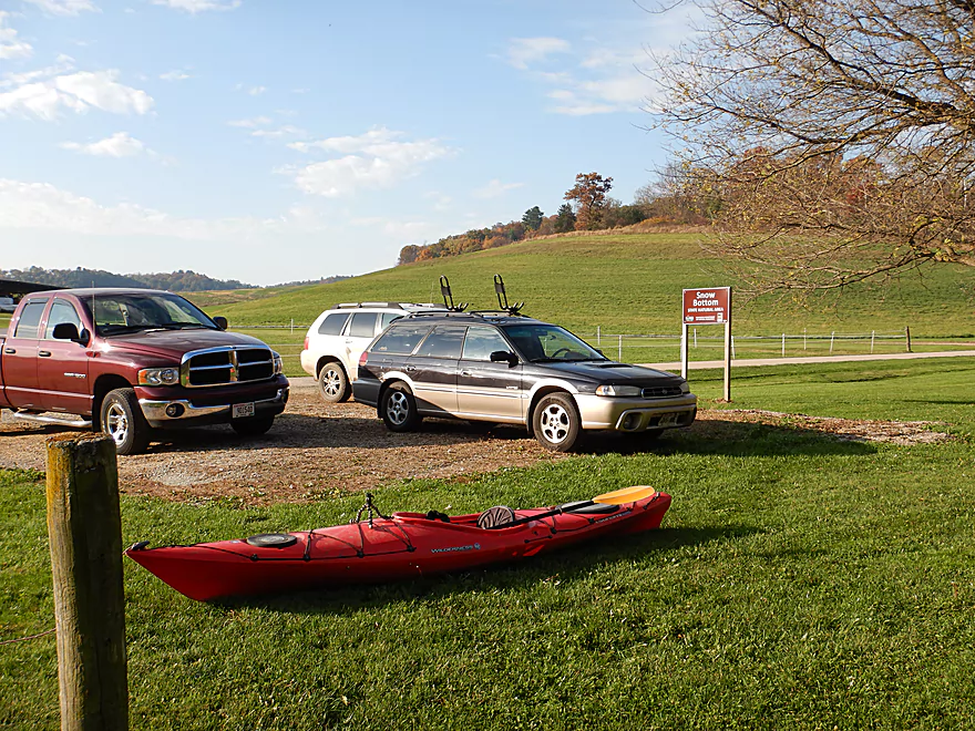
Snow Bottom SNA parking lot
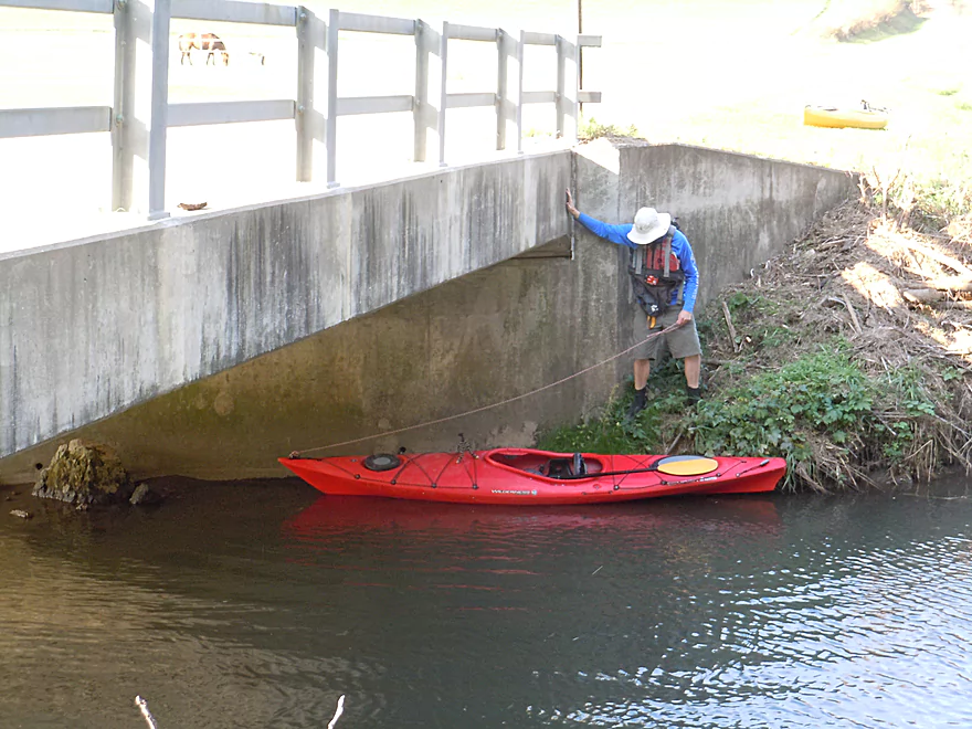
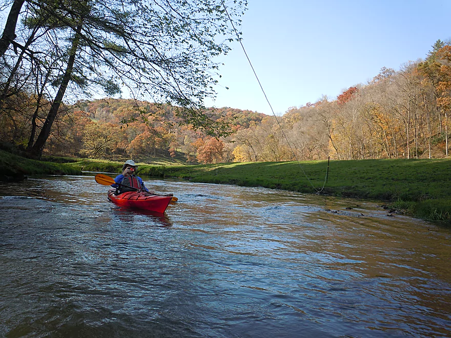
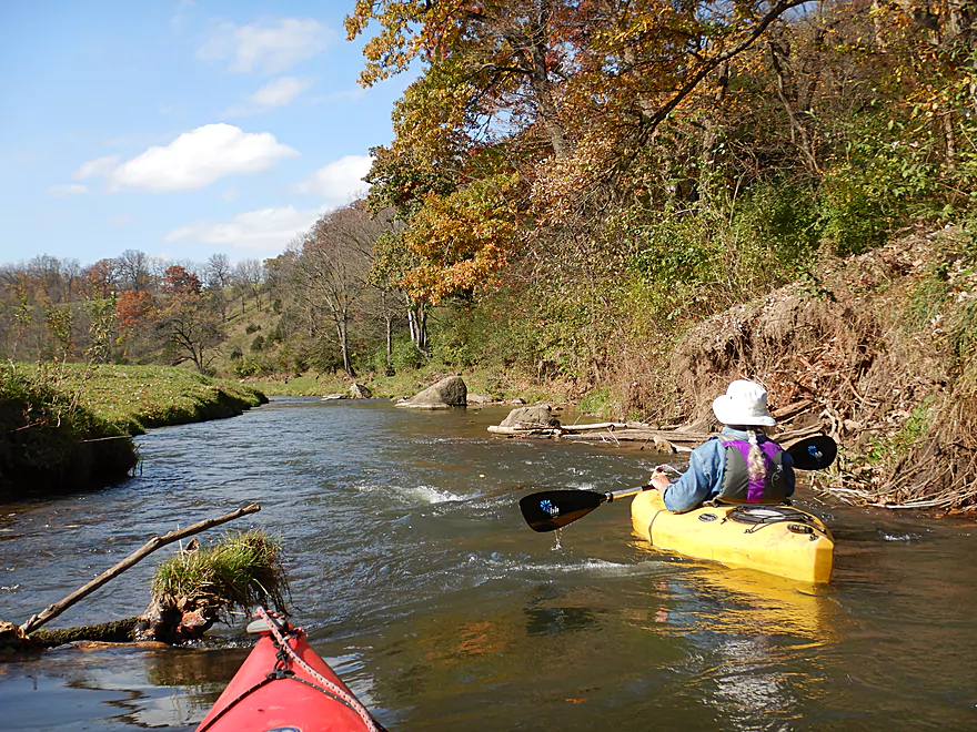
Launching under the Bowers Road bridge
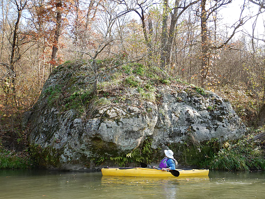
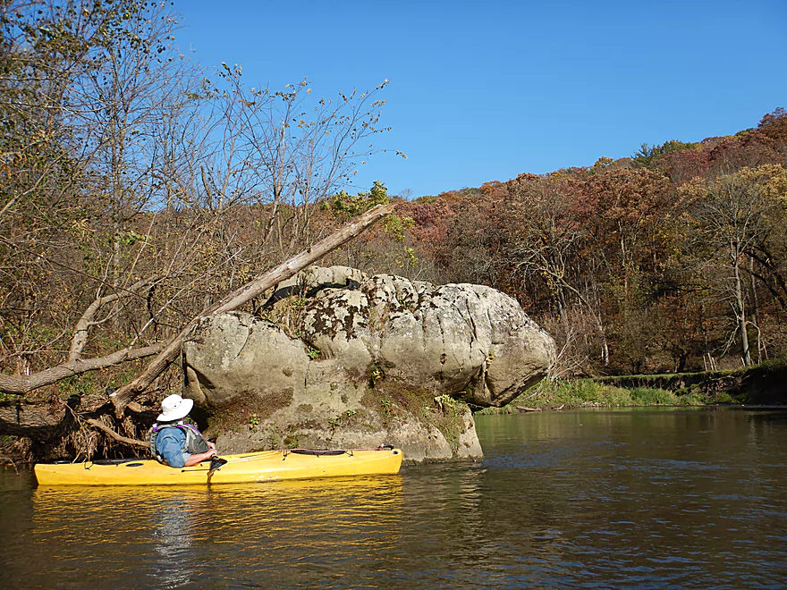
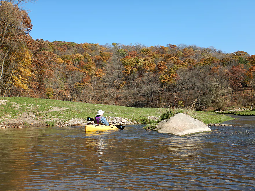
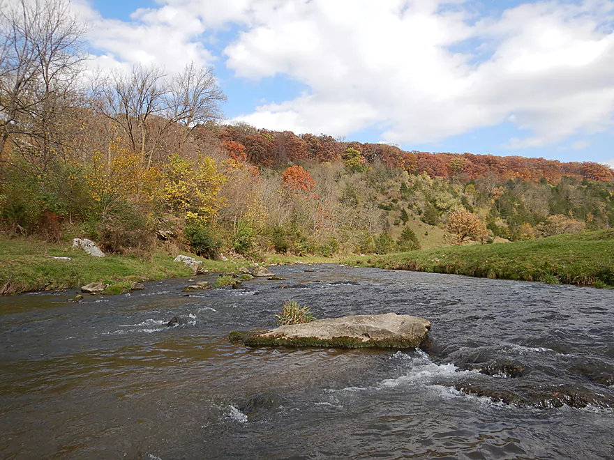
First boulder (this one is limestone)
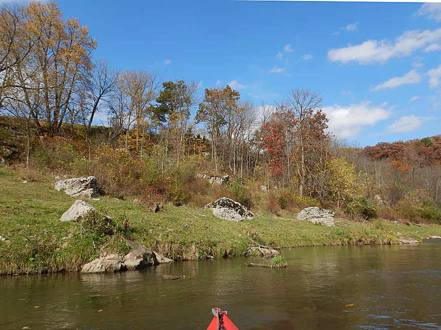
Another bankside boulder
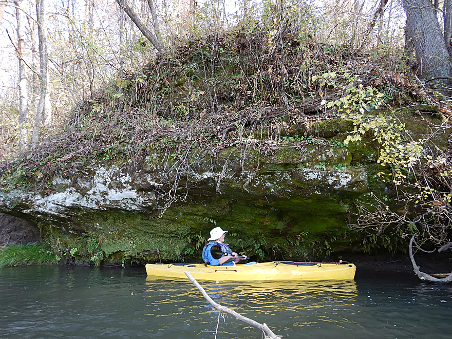
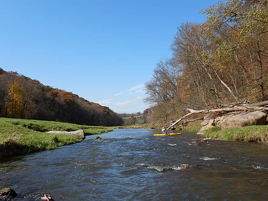
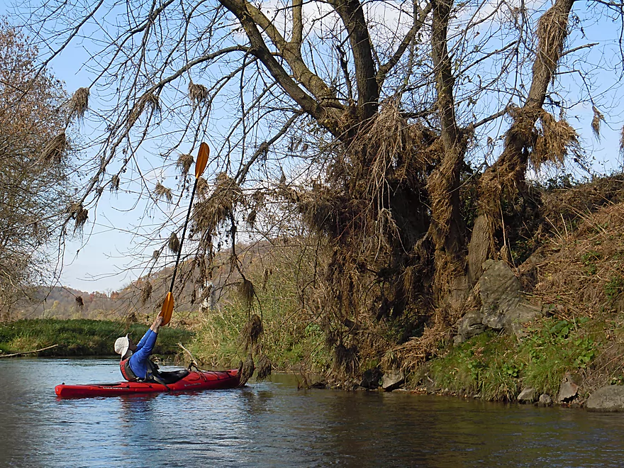
First of two phenomenal sandstone outcrops
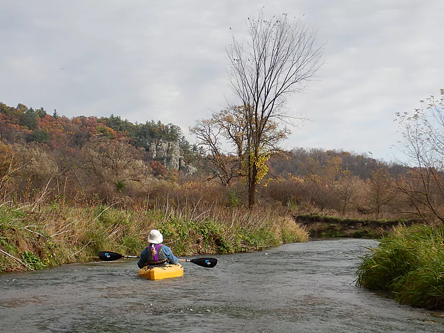
The second outcrop, just downstream from the first
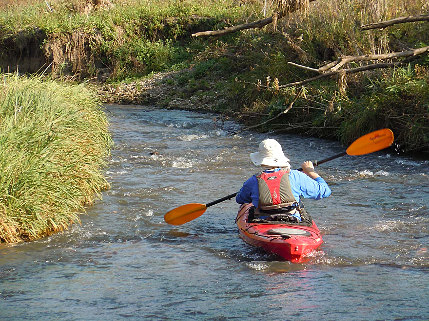
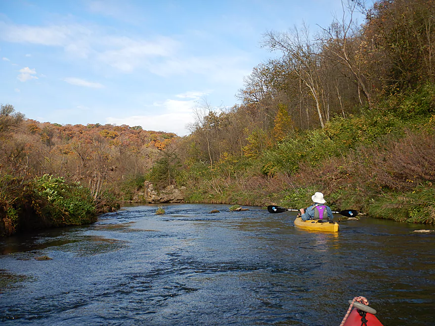
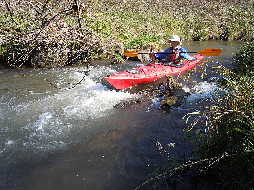
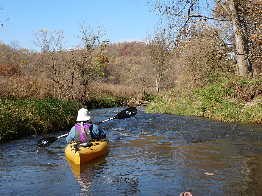
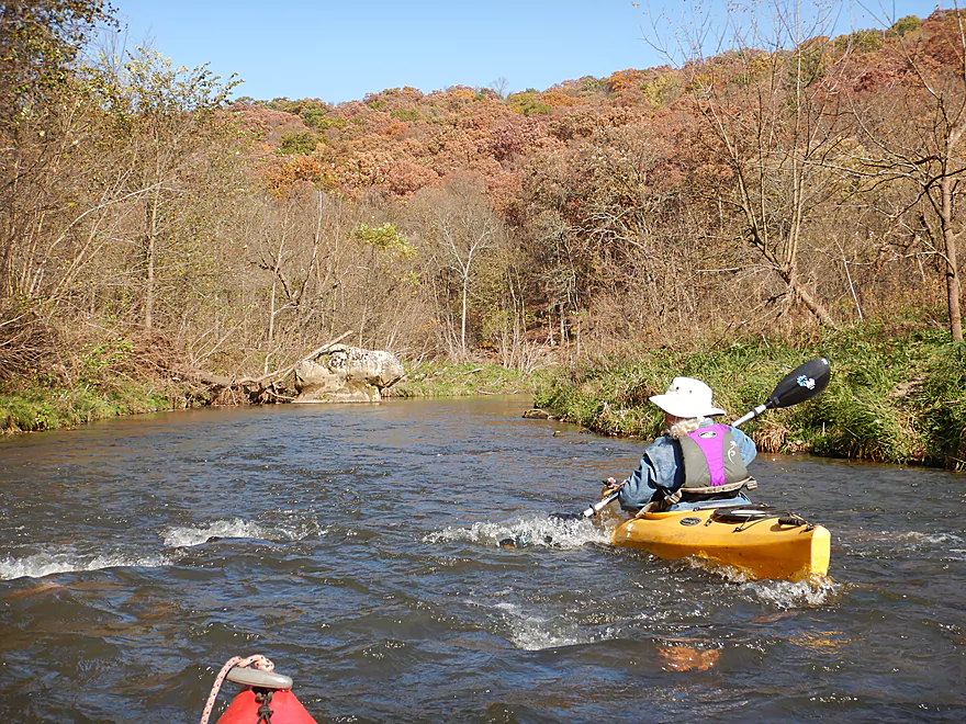
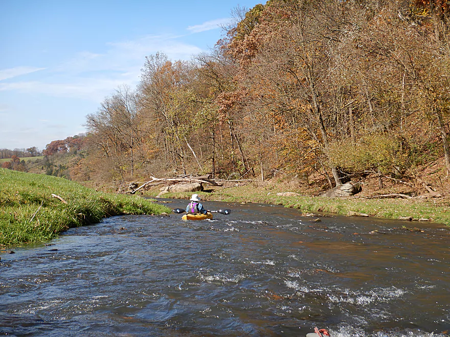
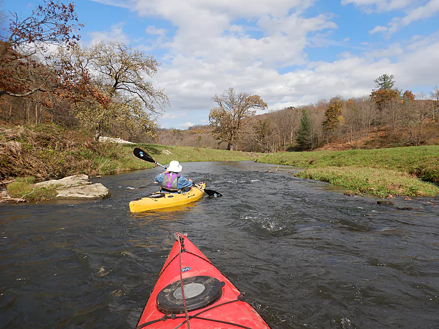
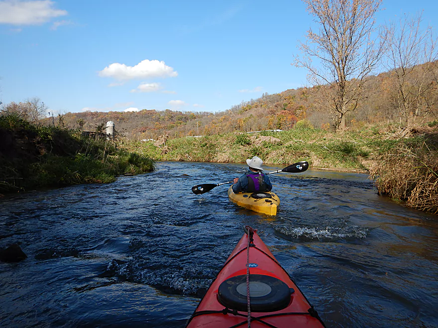
This is a fast river with many riffles
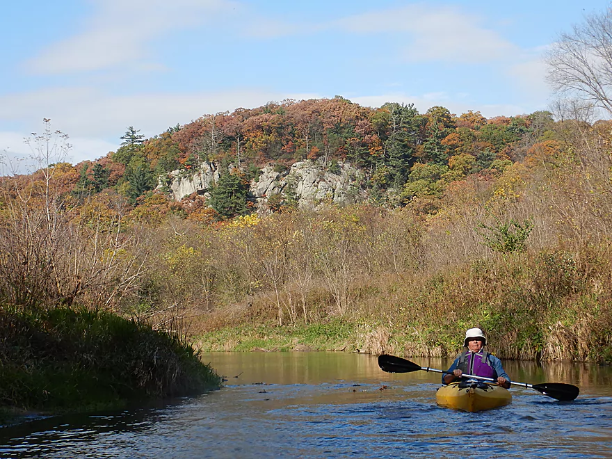
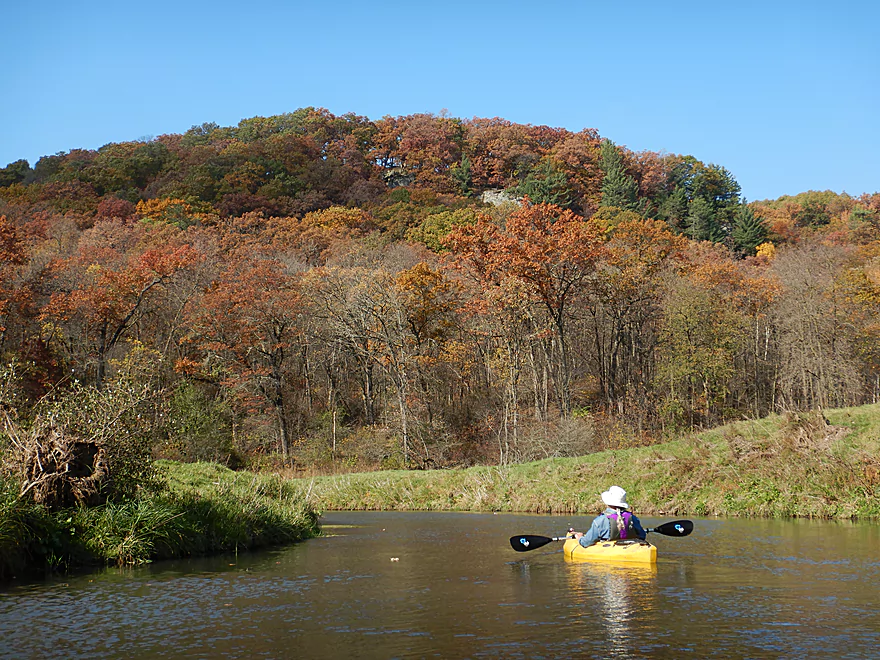
Looking back at the first bluff
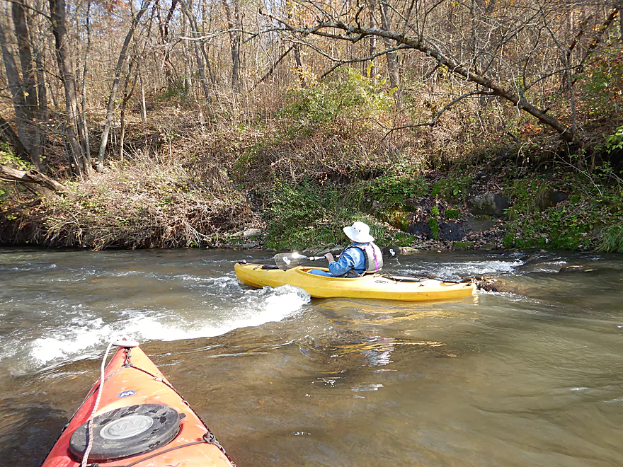
More easy rapids
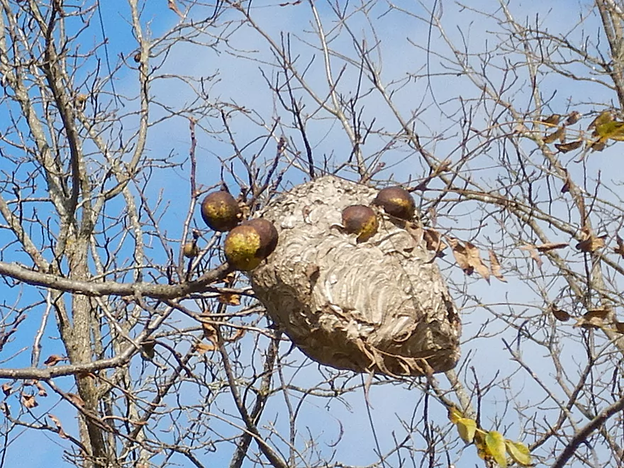
Wasp nest built around the walnuts
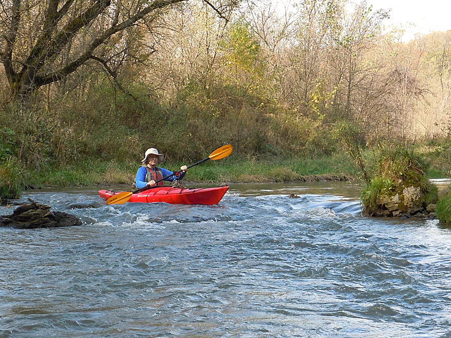
Small standing wave
Paddling over solid bedrock
A future cave in the making
The first boulder garden of the trip
Hitting rocks in the shallow rapids
Looks like a smurf hat
I think this is the boundary of the state natural area

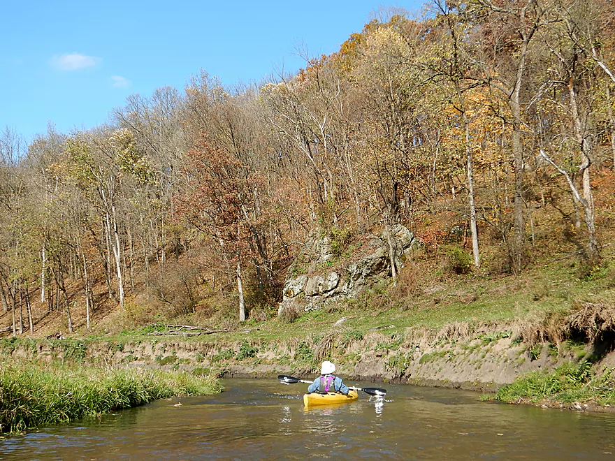
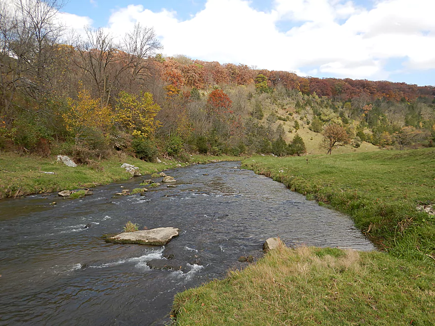
Still scenic
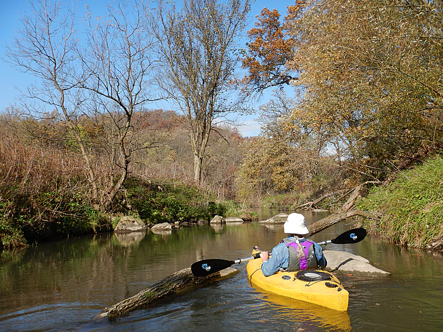
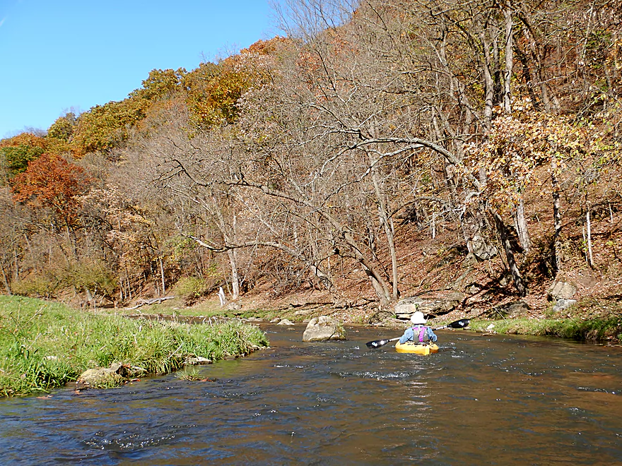
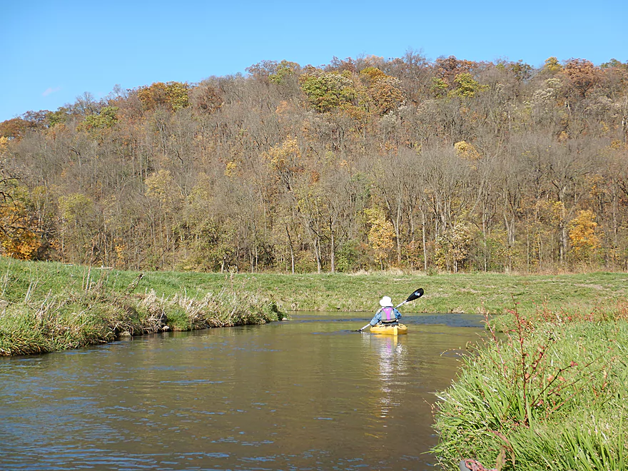
The narrow valley and steep hillsides were really cool
More distant outcrops (pines are good indicators of where the rocks were)
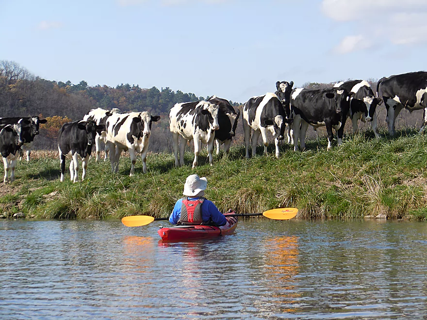
Looks almost like a lawn…just well grazed by cows
Waiting for the herd to pass
Cows were friendly…but a little destructive
White pines in southern Wisconsin are always a treat
All the fences were super easy to get under
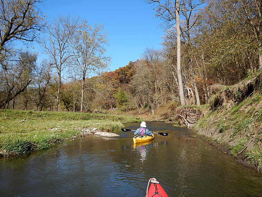
The entrance of Big Rock Creek
That limb shows the power of the floods
Not a river to go to sleep on
Just so scenic
Entering a surprise boulder garden
These are big boys!
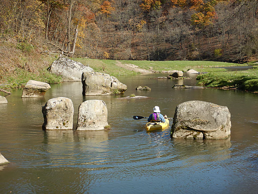
Deja Stonehenge
Some of the fall color was really good
Entering a huge horseshoe in the river
One of the fastest parts of the trip
The floods just bulldoze out the logjams
More great fall color
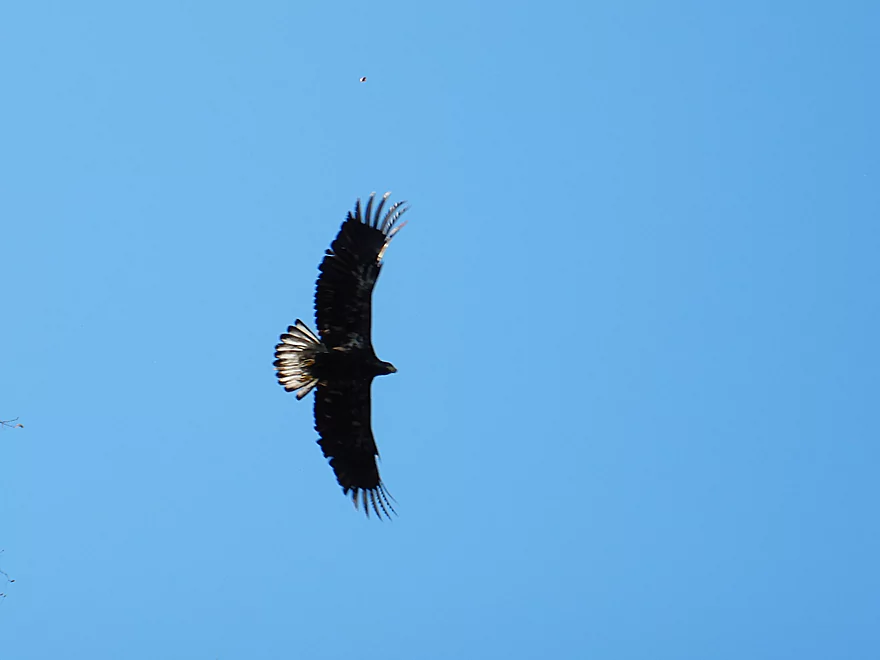
We saw a lot of eagles in Snow Bottom
More shallow rapids
Looking back
More boulder gardens
Paddling past a huge open hillside with scattered cedars
And getting grounded…
Wonderful scene
I have spent years trying to find this very spot
More great boulders
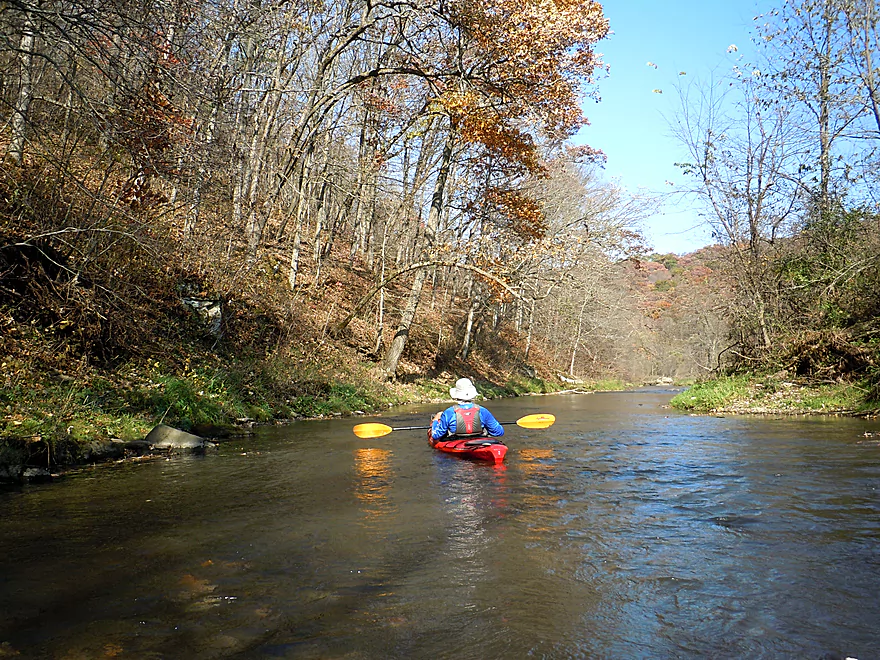
The river stays fast
Shucks…past peak by maybe a week
Another fence that is easy to duck under
Avoid this river when it is high
Some curious cows
On the home stretch…
Coming up on Shemak Road
Ok take-out upstream left
You can extend this trip by two miles to take out at Biba Road
Blue River – Snow Bottom

The Blue River is a driftless stream in Southwest Wisconsin that flows north and empties into the Wisconsin River near Muscoda. While popular with trout fishermen, it’s paddling viability was somewhat of a mystery. Earlier in the spring I did an exploratory trip on the far upper reaches (Bluff Road to Bowers Road) which turned out to be fantastic. As nice as that trip was though…I suspected that the immediate downstream leg that flowed through the Snow Bottom State Natural Area was likely even better and banked it for a fall color window…which finally arrived.
Snow Bottom’s namesake comes from trapped snow that tends to persist on the valley floor late into spring because of the narrowness of the valleys and the steep sandstone cliffs. The state protected portions are split into two separate parcels…one by Castle Rock Creek and the other just to the east on the main branch of the Blue River. Both consist of steep rocky valleys with scenery on par or exceeding many state parks. In fact the locals tried and tragically failed to convert part of the area to a State Park. Current access to the natural area is quite limited…with only one public parking lot, no proper trail system, and no overlooks (which could be amazing). Hopefully this changes in the future.
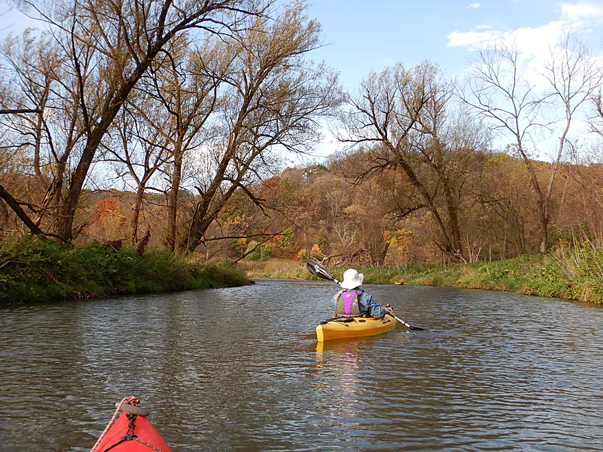
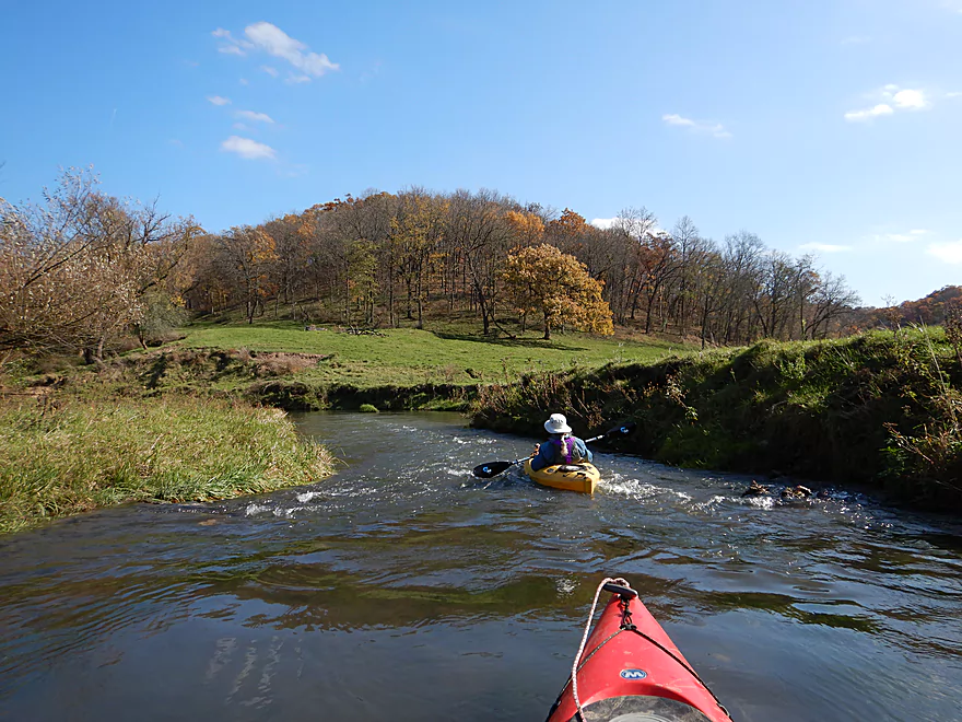
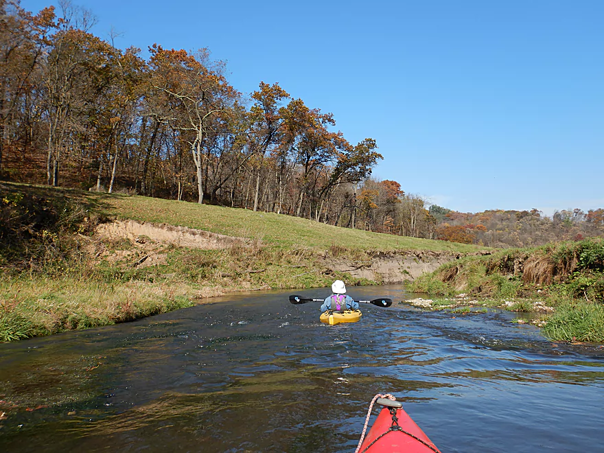
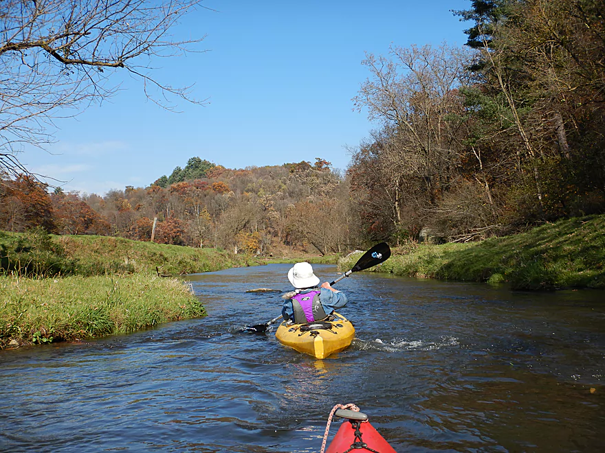
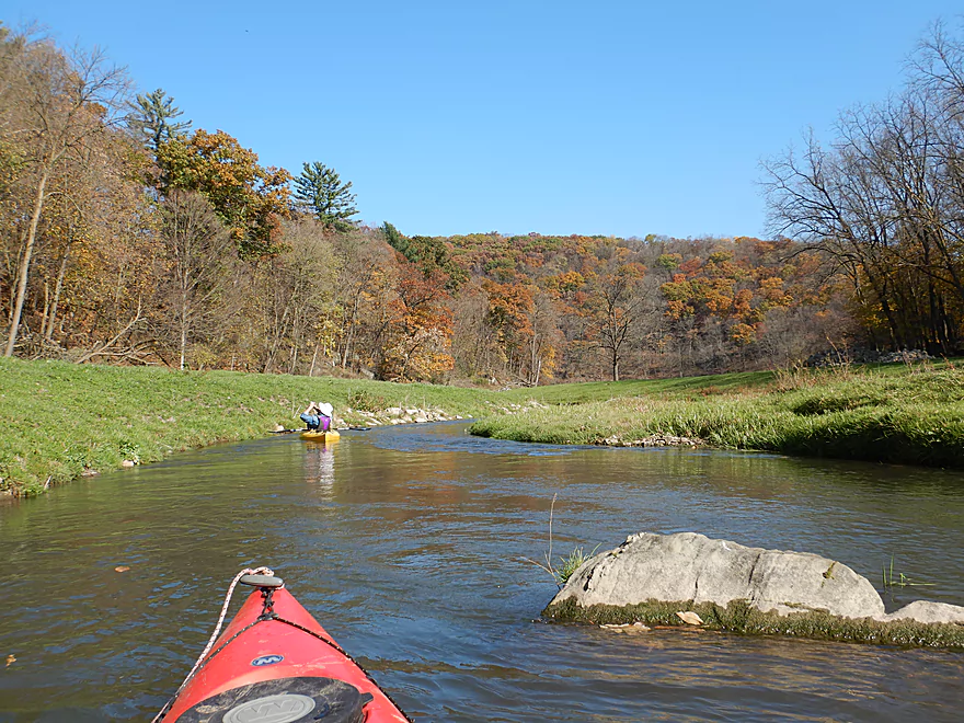
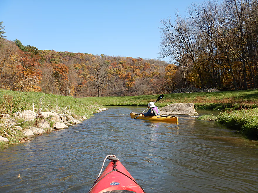
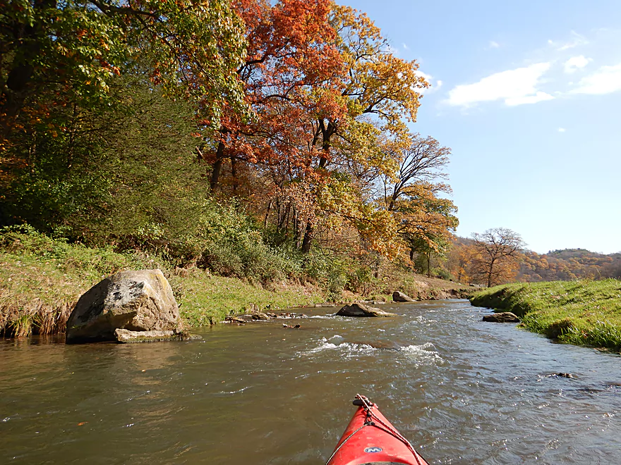
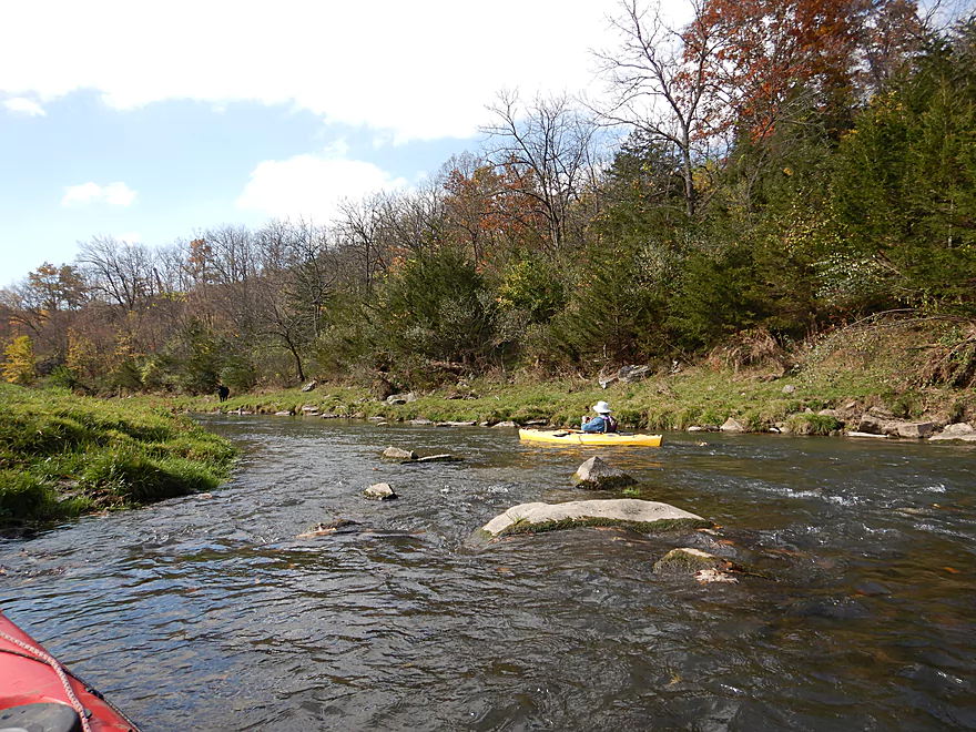
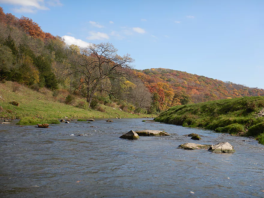
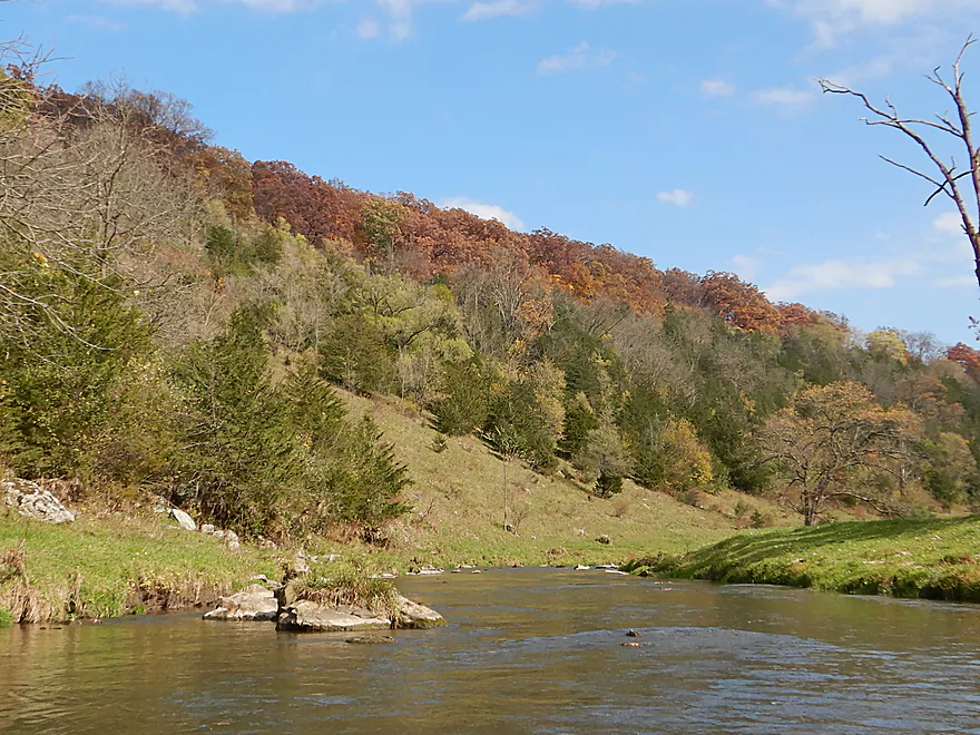
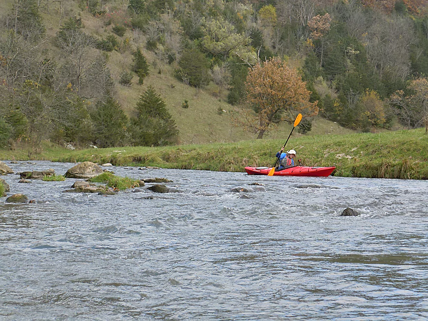
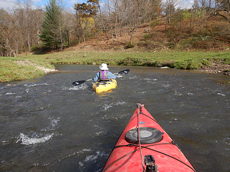
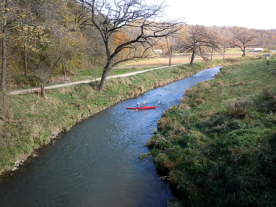
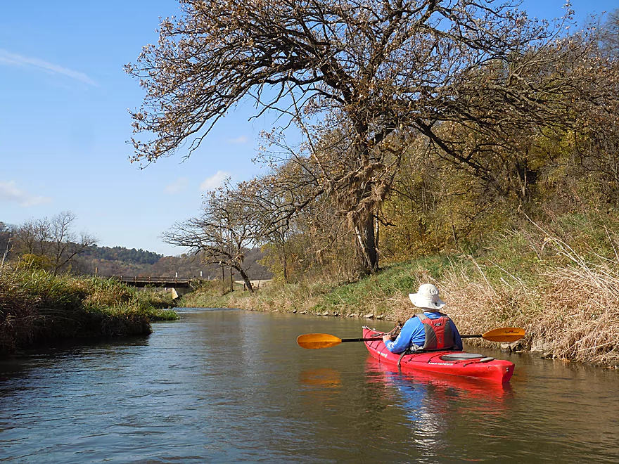
The trip started by Bowers Road which was a decent access option. The geology is at once fascinating, with a mix of limestone and sandstone that may represent outliers from the “House on the Rock” formations further up the Wisconsin River valley between Spring Green and Dodgeville. In the first mile the highlights were a pair of majestic 300′ high sandstone bluffs that towered over the valley. If ever there was a river equivalent to Devil’s Lake, Snow Bottom would be it, as it had a very similar vibe. After about a mile, the current starts to pick up with many light rapids, but none were too serious.
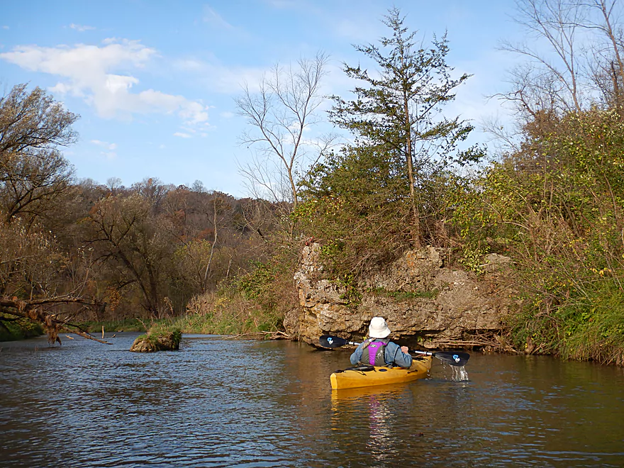
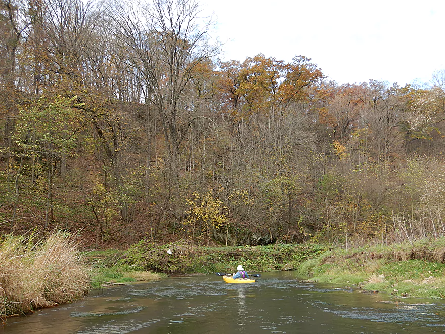
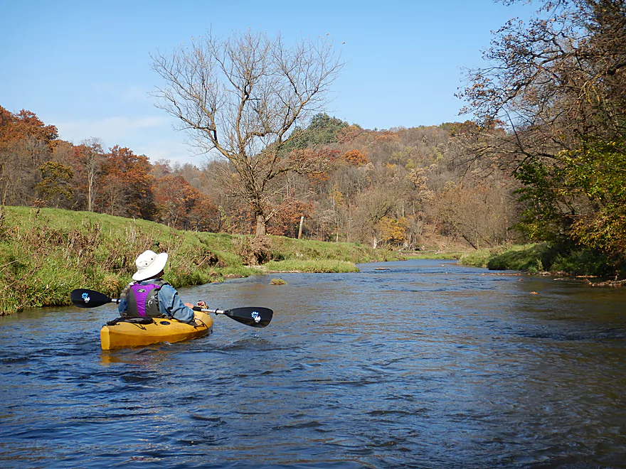
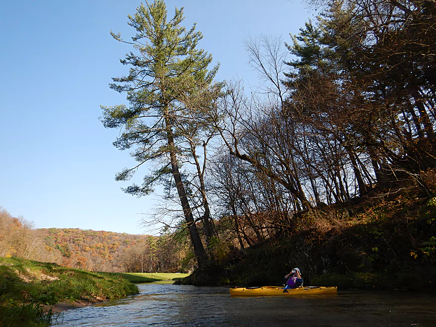
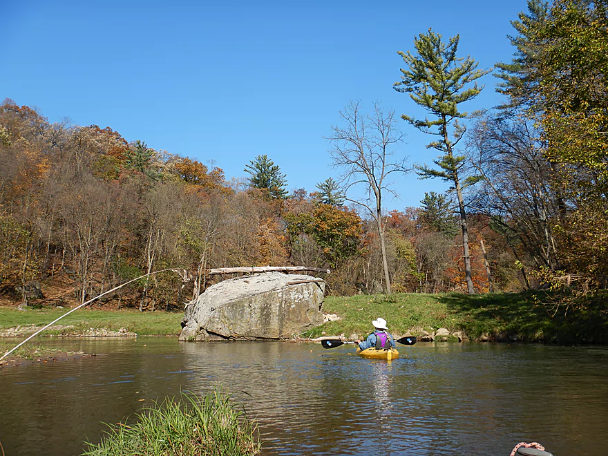
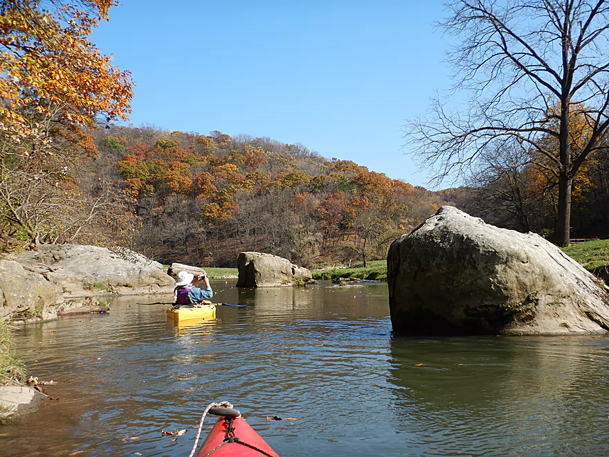
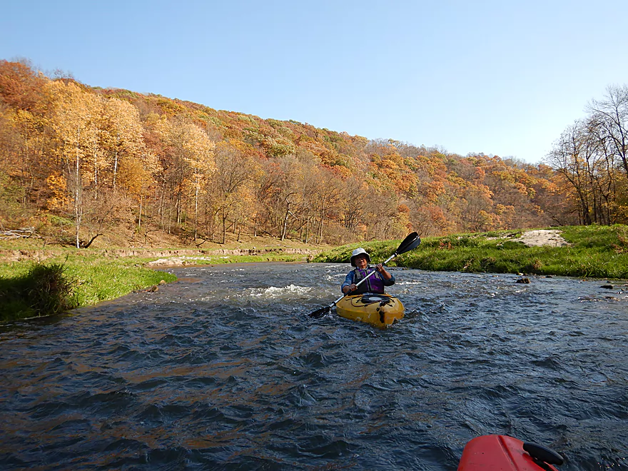
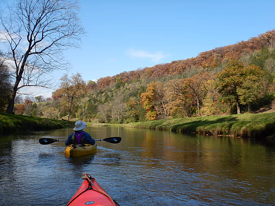
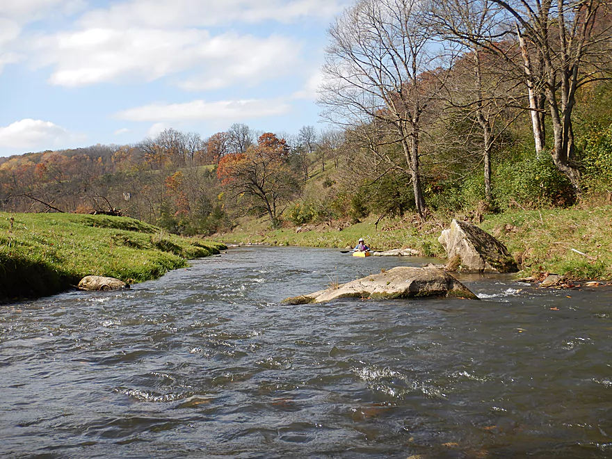
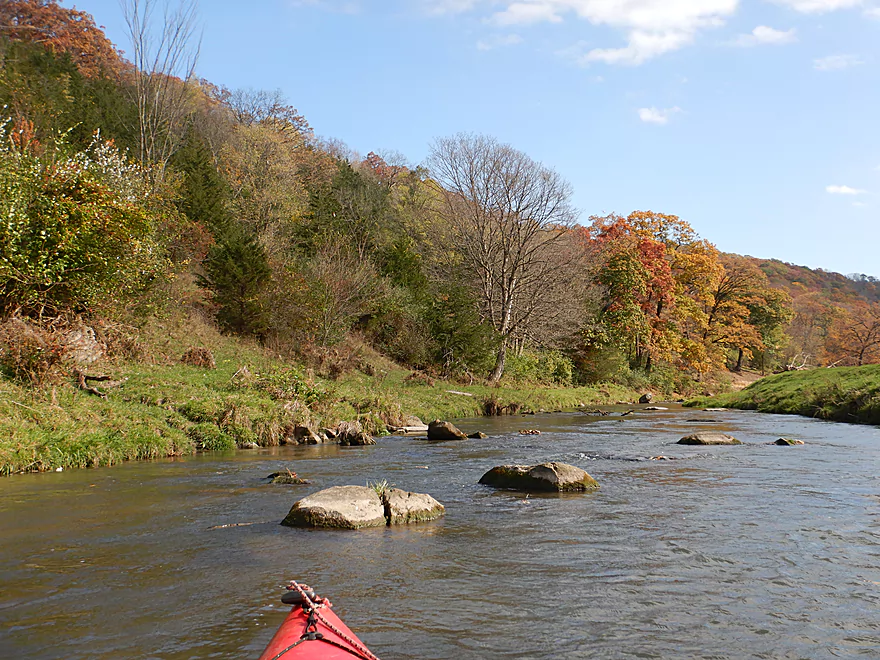
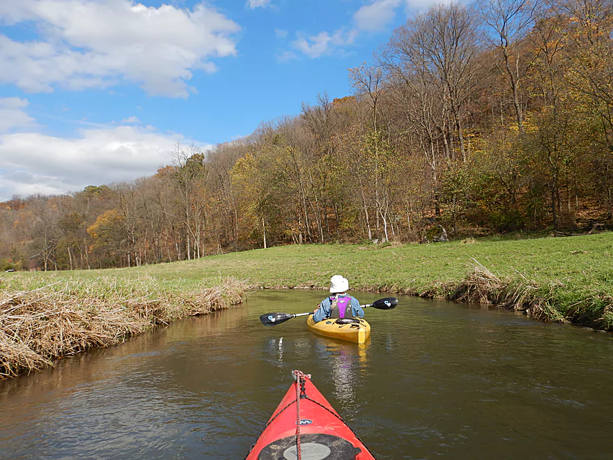
Soon the river valley narrows considerably and huge boulders dot the banks and the river channel. Paddling in these narrow and hidden valleys was quite the experience. Atop the sandstone bluffs were fantastic white pines, while the lowlands tended to have hardwoods. Snow Bottom can have AMAZING fall color…and it was good during our trip…but unfortunately we did miss peak color by one week. This is one of those trips that IMO justifies trying to time…ideally when it is sunny out, with few clouds, and in mid-October for best lighting and color.
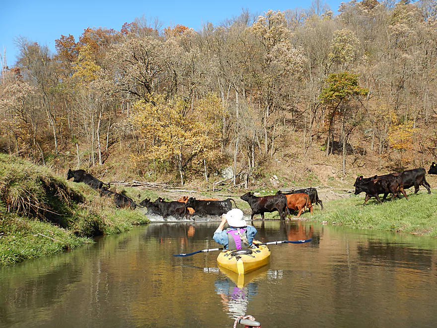
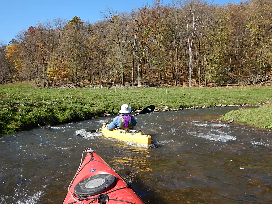
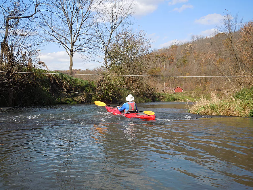
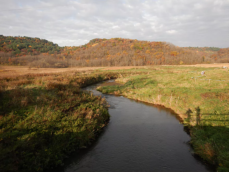
We later crossed our first fence marking a transition from the state natural area to private pasture. This actually wasn’t as bad as I feared. The subsequent fences were easy to duck under, and the many cows were somewhat friendly (although you could see how they were eroding the banksides). What was unique was once you got into cow country, the vegetation totally changed. The tall grasses and small trees were replaced by short lawn-like grass, which actually better allowed us to see the underlying rocks.
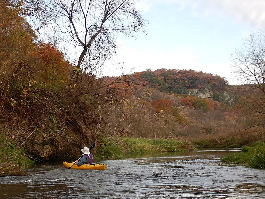
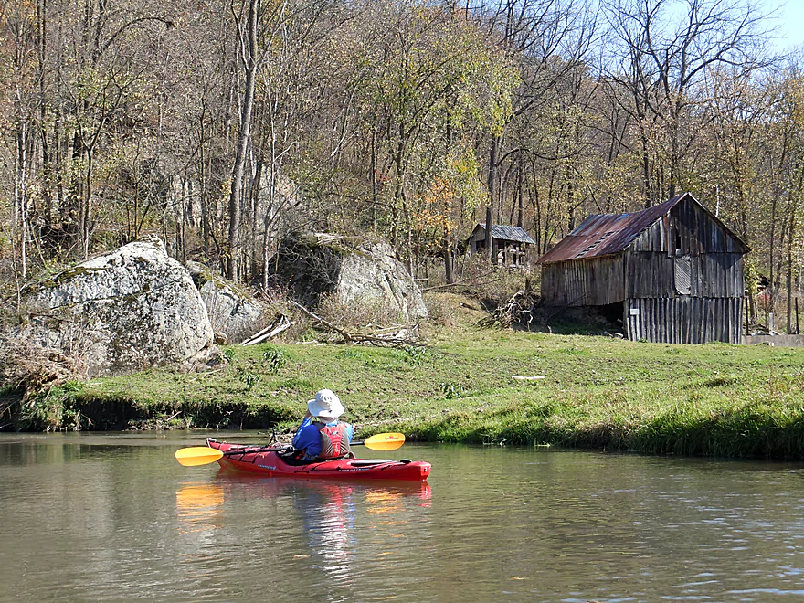
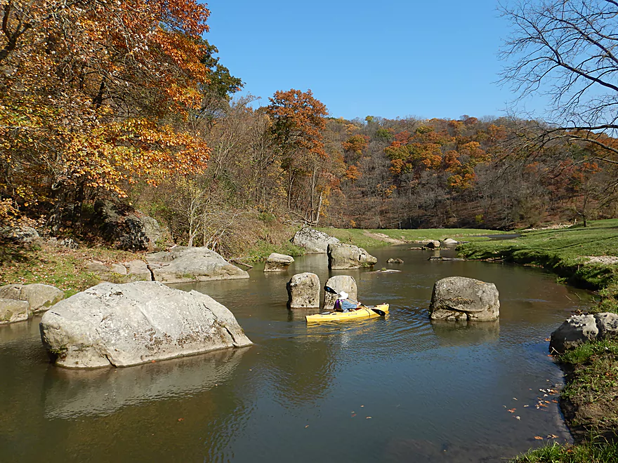
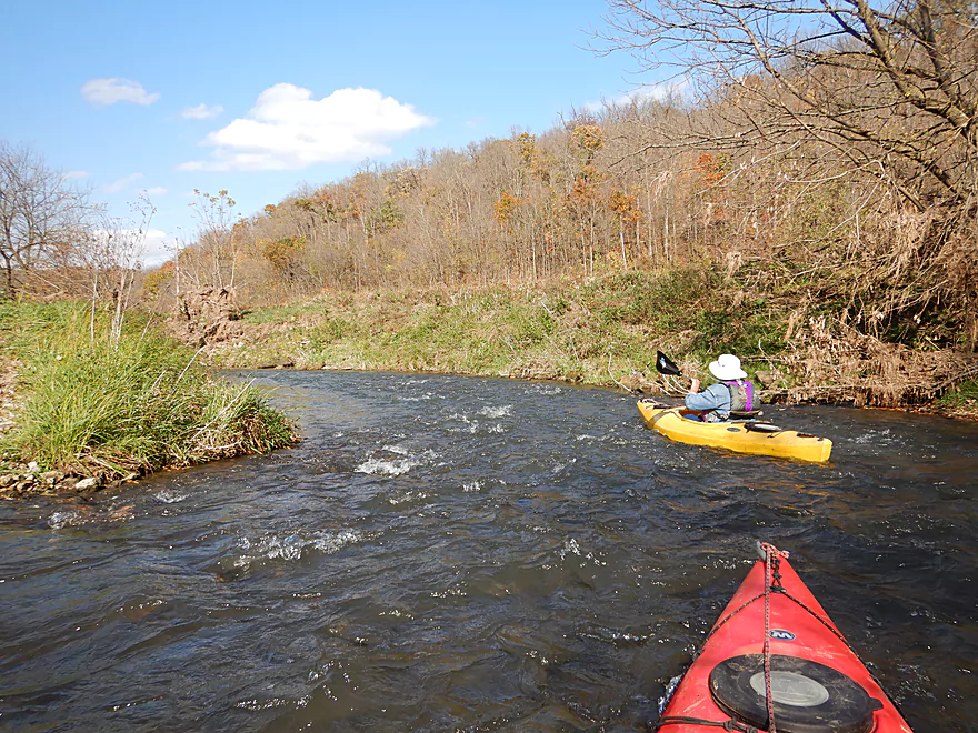
The highlight of the trip was at the confluence of Big Rock Creek. Here “big rocks” (as in 15′ high boulders) flank the confluence along an old rustic barn. The river then turns left and there is another massive boulder with an oddly placed tree limb balanced precariously at the top. A sharp turn right and there was the largest boulder garden I’ve ever seen on a paddle trip in Wisconsin. Many of the 6-8 main boulders were tall and somewhat narrow, which made me think of Stonehenge.
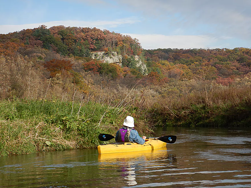
The river then speeds up to almost continuous riffles and takes a huge turn left along a massive horseshoe in the valley. At the cusp of the horseshoe is a steep west facing bluff that was fantastically scenic. In the middle of the horseshoe is a grassy pasture dotted with small boulders while being flanked on three sides by dry, steep, and rocky bluffs….like a scene you would see out west. Despite the fast current, I do advise looking behind you periodically so you don’t miss some of the best scenery.
This exact horseshoe bend had a somewhat personal significance for me as three years ago I came across an unlabeled internet picture of this exact location. It was so scenic I knew I had to paddle it, but the only clue was that it was in Grant County. After a lot of research and studying relief maps, I speculated it was Snow Bottom…and finally three years later during this trip, I was able confirm it was so.
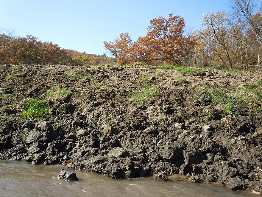
After the horseshoe valley, the river loses a bit of its magic. The valleys broadens and the hills recede, most of the boulders go away, and the dirt banks grow in size from upstream erosion. The river was still interesting though, with fast riffly current and curious onlooking bovines. The take-out at Shemak Road was plenty doable.
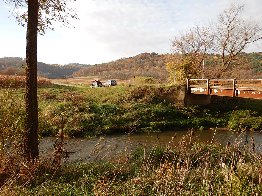
West of the Bowers Road bridge, this is a nice public parking lot frequently used by trout fishermen. You can launch immediately downstream of the bridge, but note the embankment is steep and a bit muddy. Alternatively, you can launch a couple hundred yards downstream by the limestone outcrop, which IMO would be easier. To reach this just hike a little northwest from the parking lot.
Shemak Road bridge is a doable but weedy take-out option. Park on the shoulder (by the public fishing signs) and you can take out just upstream (southeast) of the bridge.
You can continue 1.7 more miles to Biba Road which is also a decent access option. While this additional segment would likely be nice, I doubt it would be as good as upstream sections and would perhaps have 2-3 logjams.
I’m not aware of any local livery options.
The bike shuttle would be a tough 5.2 miles. No gravel roads…but very steep hills (440′ of climbing and 367′ of descent). If you walk your bike up the hills it might not be too bad. The nice thing about the shuttle though is it is very scenic. Personally I opted for a car shuttle.
Not a single logjam! Not even any major squeakers…it appears periodic floods do a good job of bulldozing the debris out of the water.
There are 4-5 fences (some electric), but all are high up and super easy to get under. With fences come livestock…but we only saw cows and steers…no bulls.
The current is quite fast with countless riffles and many Class 1 rapids. These are mostly pretty easy, but could turn into Class 2 rapids in much higher water.
This trip was run on the shallow side, which is common for the Blue River. Most of the river is plenty navigable, but the many light rapids were bumpy and quite shallow. Below is my depth guide based on the Platte River gauge.
- < 70 CFS: Probably too shallow to run.
- 70-100 CFS: Very shallow and could require getting out multiple times to get through the rapids.
- 101-165 CFS: Doable, but many of the rapids will be very bumpy and a few will have to be walked. This trip was done at 117 CFS which was ok and we had a great time…but a bit more padding would have been nice.
- 166-205 CFS: A good target range. I did my upstream trip at 186 CFS and didn’t have to get out once due to shallow water. You’ll hit a few rocks, but this is common with rapids.
- 206 – 250 CFS: Probably doable, but the higher water will smother some boulder gardens and character out of the river.
- 251+ CFS: I assume these are near or at bank breaching levels. Maybe of interest for professional whitewater paddlers but not for rec paddlers. High water paddlers should be warned that this river does flash flood.
A blue heron, an otter, and a flopping fish. The highlight were the 7-8 eagles which we frequently spotted along the trip.
This review marks the last 2017 entry for the blog. Hope you enjoyed the ride! Special thanks to my readers and those who followed the blog from social media. Extra special thanks to those who contributed comments and to the six contributors who wrote guest reviews. Much appreciated!
In summary, 2017 was quite the adventure. It got off to a great start when an unexpectedly warm February allowed for a super early start to the season. Unfortunately, this spring was extraordinarily wet and my plans were often cancelled or changed at the last moment. You have no idea… In a sense this was a good thing, as the high water forced me to consider more oddball prospects off the beaten path I otherwise wouldn’t have prioritized. Castle Rock Creek, Big Green River, Blue River, Willow Creek, Melancthon Creek, and Bridge Creek were all examples of last second amazing trips I pretty much only did because my “A” prospects were too high.
June continued to be a frustratingly wet month with high water levels (especially for southern Wisconsin), which forced me to change many more plans…but also provided an excuse to finally explore the Mississippi and some Iowa streams. July was a big milestone for me as I updated my waterproof camera to the Nikon W300, I got a color correct monitor for photo editing, and it marked the point in which many of the high rivers and creeks finally started to come down. I was finally able to return to southeastern Wisconsin and do some classic paddles like Turtle Creek, Token Creek, and Koshkonong Creek, which were long overdue. Fittingly, the best paddle of the entire year was the last paddle, as Snow Bottom was exceptional. Unfortunately 2017 was a La Nina year which resulted in this season being wrapped up roughly 3 weeks earlier than last year.
Few if any regrets for the 2017 season. Paddling the Beaver Dam River at high levels was a regret. Having my boat get swamped on the Big Green River was a regret. Live and learn. Only a couple of trips were true disappointments. The Rock River was a little bland, and the Little Maquoketa was just so muddy. The Big Rib, which I had planned on doing for a few years and had high expectations for…turned out to be a disappointing 3 stars. But almost all my other exploratory paddles…remarkably turned out exceedingly well. Very fortuitous, as it often doesn’t work like this.
I’m definitely looking forward to resuming the blog in early 2018 and hope you’ll stay tuned. Some future goals for the website include improving the comment system (which I know has given some of you grief) and to include more and better maps. There are definitely a number of paddling prospects I’m looking forward to doing next year, including some of this year’s prospects that I didn’t get around to doing…like the Lower Black, Lower Milwaukee, Upper Waupaca, Lower Sheboygan, Upper Yahara, Upper Eau Claire, and Crawfish. Another goal is to return to the deep north, which I’ve neglected for two years. Lastly, one of my goals is to revisit some of my older and painfully outdated reviews that are in critical need of newer pictures, video, and maps (eg Pine, Baraboo, Kickapoo…).
The goal of this website was to be more than just a one-man show, and I hope that readers will continue to add comments and trip submissions. I also take paddling requests…some great suggestions (like Willow Creek) were recommended to me from readers.
That’s all for now. See you in 2018.
Aaron – Webmaster
Detailed Overview
Blue River – Main Branch:
- Upstream of Blue River Road: Likely not practical for paddling.
- Blue River Road → County Road I: 1.4 miles. Mostly clear of logjams, but shallow and would require high water to be navigable.
- County Road I → Bluff Road: 0.9 miles. Nice section that goes through a small woods. Maybe 1 or 2 jams. In hindsight, I wish I had done this. A shallow section but looked just doable when I scouted it during my first trip.
- Bluff Road → Bowers Road: 4.1 miles. Five star trip.
- Bluff Road → Snowbottom Road: 2.4 miles. Fantastic section through driftless valleys with many light rapids.
- Snowbottom Road → Bowers Road: 1.6 miles. A good section through a small woods, then through an open area reminding me of the Platte River.
- Bowers Road → Shemak Road: 6.6 miles. One of the best paddles in Southern Wisconsin with massive boulders, fun rapids and scenic driftless hills.
- Shemak Road → Biba Road: 1.7 miles. Mostly open farm country paddle. Maybe 2 logjams.
- Biba Road → Hwy G: 5.0 miles. Maybe 15-20 logjams.
- Hwy G → Forest Road: 8.0 miles.
- Hwy G → Studnika Road: 1.0 miles. Nice open stretch with an attractive bluff. There are two noteworthy logjams, with one needing a portage. Castle Rock Creek adds significant volume to the Blue River. Note Studnika Road is not a suitable access.
- Studnika Road → Forest Road: 6.7 miles. Nice leg through open pasture and bluffs. There are a couple of downed trees, but I was able to sneak past them without portaging.
- Forest Road → Hwy 133: 6.3 miles. Maybe 3 logjams. The river is wide enough here you might be able to squeak past most of these. Hwy 133 is a busy road with long guardrails, which would make this take-out annoying, but I think it should be doable from the SE side.
- Hwy 133 → Wisconsin River: 1.0 miles. Maybe 6 logjams. This is floodplain forest now.
- Wisconsin River – Cross Slough: From here you can paddle a mile north to reach the Port Andrews Boat Landing. Alternatively, you can paddle down Cross Slough for 3 miles which is like a mini-river and might be a unique paddling experience.
—
Castle Rock Creek (aka Blue River – Fennimore Branch):
- Upstream of Hwy Q1st: The creek is probably too small to run.
- Hwy Q1st → Homer Road: 0.5 miles. Very small. A simple cow pasture paddle that probably isn’t special. Homer Road is not a great take-out…small, near a home, and a nasty pit bull chased me when I tried to scout this bridge.
- Homer Road → Hwy Q2nd: 0.3 miles. Simple open section through overgrazed and eroded banks. The second Hwy Q bridge is a decent access used by fishermen, but there is nowhere to park.
- Hwy Q2nd → Church Road: 0.4 miles. Paddle goes by a steep hillside and quarry. Maybe some interesting geology.
- Church Road → Hwy Q5th: 3.1 miles.
- Church Road → Hwy Q3rd: 1.2 miles. A nice open pasture section with many riffles, but one I-beam to portage.
- Hwy Q3rd → Hwy Q4th: 1.1 miles. A neat section with many rapids that goes by Cedar Cliff.
- Hwy Q4th → Hwy Q5th: 0.7 miles. Shallowest part of the creek during low water. Some neat geology in this section with more great rapids and a spectacular view of Castle Rock. Hwy Q5th is a doable take-out but does require some dragging to get past the guardrails. Many hikers park by the bridge before climbing Castle Rock.
- Hwy Q5th → Witek Road: 7.3 miles. River flows through a massive hidden valley flanked by steep hillsides. Includes the western unit of Snow Bottom State Natural Area. While mostly open, the river does have three logjams that must be portaged. After Snow Bottom, the river loses most woods, gains a lot of mud, and flows through farm country.
- Witek Road → Neff Road: 3.9 miles. A farm pasture paddle with likely a number of downed trees (maybe 7 portages).
- Neff Road → Hwy M: 1.9 miles. Mostly open farm pasture paddle. Maybe one logjam.
- Hwy M → Confluence with Blue River: 3.8 miles. Maybe 3-5 logjams.
Trip Map
Overview Map
Video
Photos Size:
After doing the stretch upstream, which was way cool, I can’t wait to do this one. Thanks for the great pics!
Appreciate the comment! More of the Blue River actually might be navigable…might try to explore the headwaters next spring. If you do Snow Bottom, consider leaving a comment letting readers know the latest conditions of this stretch.
Just found the website this year and this was my first paddle using your guides. CFS was 162 which was pretty good but we scrapped the bottom a little bit in the rapids. No portages were required. Had an amazing trip, the bike shuttle was fine except for one hill that we walked. Thanks for the guide.
Appreciate the feedback Matt. The Blue River is one of my favorites…that one hill on the bike shuttle is pretty brutal though.
I just paddled the Blue River with a group of 24 on June 21, 2019. We put in at Snow Bottom Road which has an adequate parking lot. We put in just below the bridge. We took out at Shemak Road for a trip of 8.2 miles which took us about 4.5 hours to complete. The Platte River gauge was 320 CFS. Comparing the original post of 117 vs ours of 320 may not provide a reliable water gauge level for the Blue River. The water depth was adequate for this paddle, however I would not care to do it at a lower level. An additional 3 inches would have been ideal. We had one logjam to portage, cleared out a couple of other trees and had a couple of limbo trees. Overall we had a great time on this paddle. Wild Parsnip is everywhere, avoid this plant! I could submit a couple of photos for reference as well.
Appreciate the updates. It does appear paddlers do prefer high flow rates when it comes to Snow Bottom. If you could share your pictures that would be great! Maybe upload them to an online service and I could insert the urls into your comment?
Did the blue river yesterday (8/29) and a 172 CFS. Was sufficient probably 70 percent of the way but there was stretches that were leaving me wanting higher water levels. Other than a few cows later in the trip, one tree that was down (easy paddle to the side or under) crystal clear water and great weather. No fences, just 4 ribbons across the river that are high up and easy to get under.
Thanks for the update.
For those trying to paddle the Blue River from these upper areas to it’s mouth, you will have problems with “log jams” in the lower areas plus it does not end on the Wisconsin River but flows into a slough where, if the water is high enough, you can paddle to the Wisconsin River. I’ve tried paddling up the Blue to the Wisconsin highway 133 bridge but the log jams are not passable unless one exits their boat on a log then pull the boat over the logs. The bank is too high so it’s not possible to exit ones boat to go around the logs.
Yeah, logjams on the lower Blue are major issue unfortunately.
Just did this with 4.68 ft 220 cfs on the Platte River Rockville gauge. A little bumpy, but very doable. There was one tree down that required portaging and one barbed wire that was a little low to paddle under. A couple other wires/ribbons too but visible and easy to paddle under. Great trip!
Appreciate the update!