
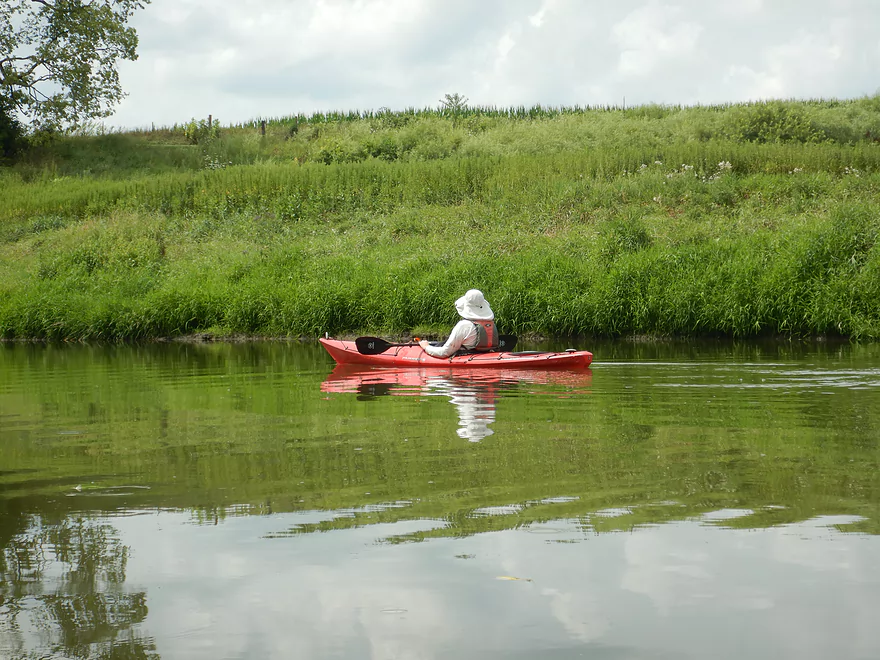
Put-in at North Freedom Park…great launch!
A local canoe and kayak business uses this landing for pickups and launches
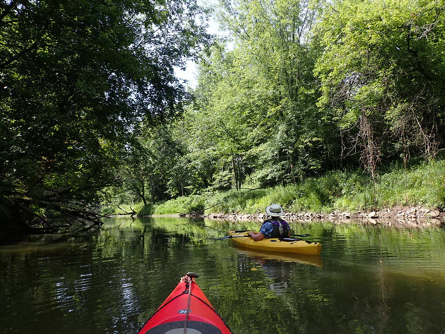
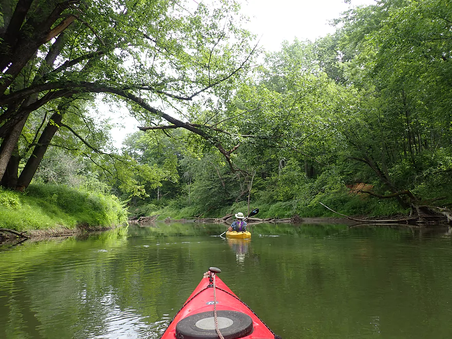
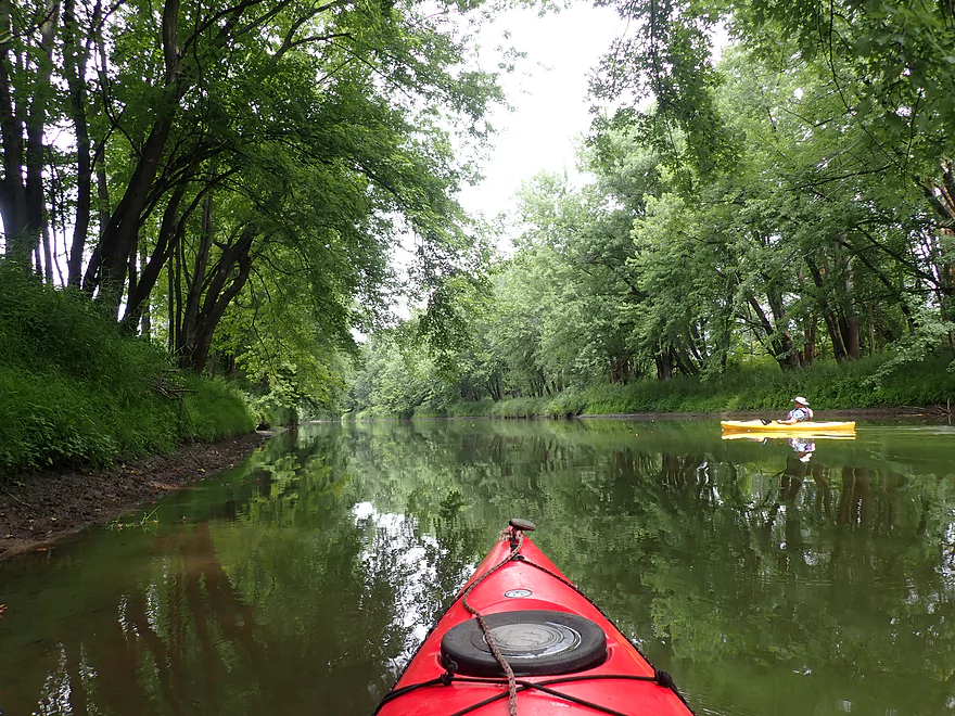
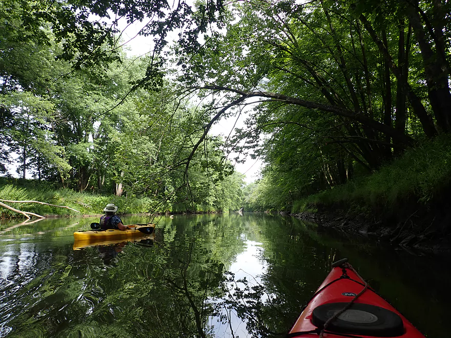
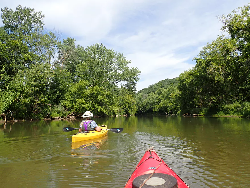
First half mile had some nice wooded banks
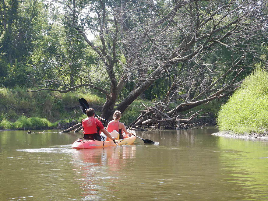
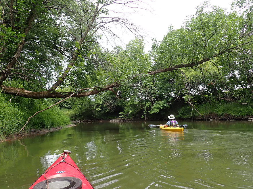
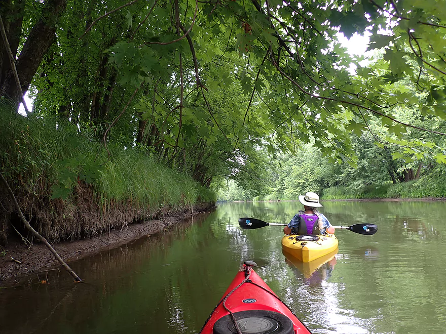
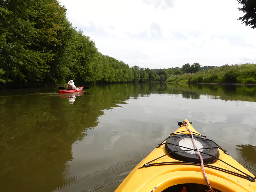
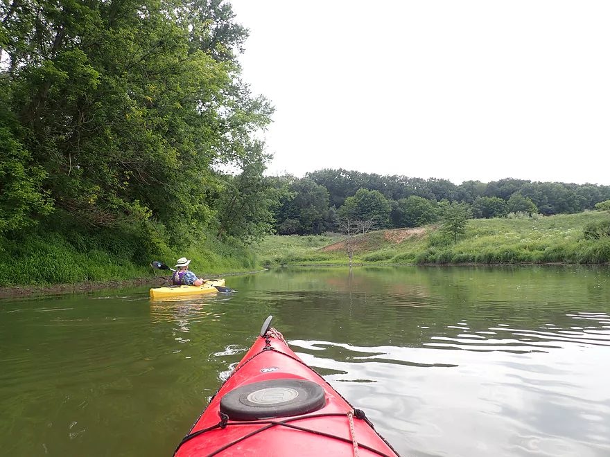
Getting passed by a tandom
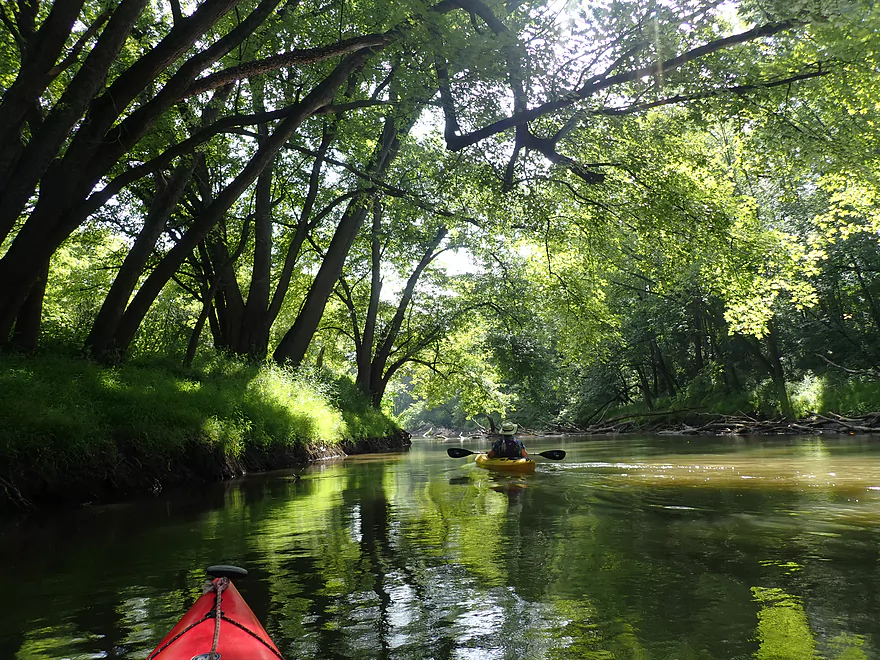
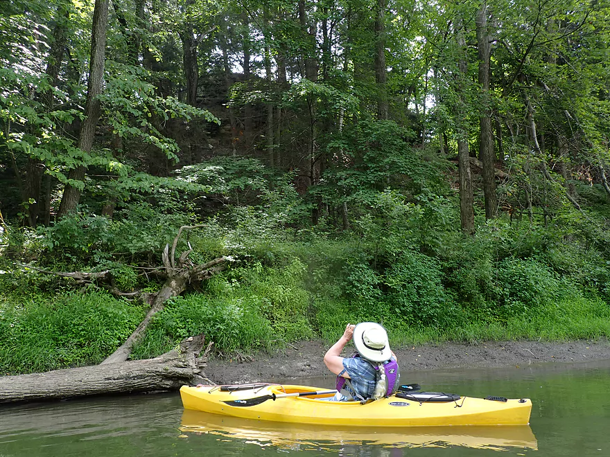
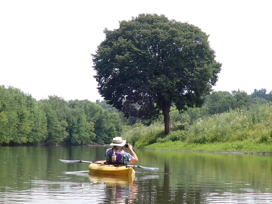
Some nice shady tree canopies
No logjams on the trip…the Baraboo River Friends have been clearing them out
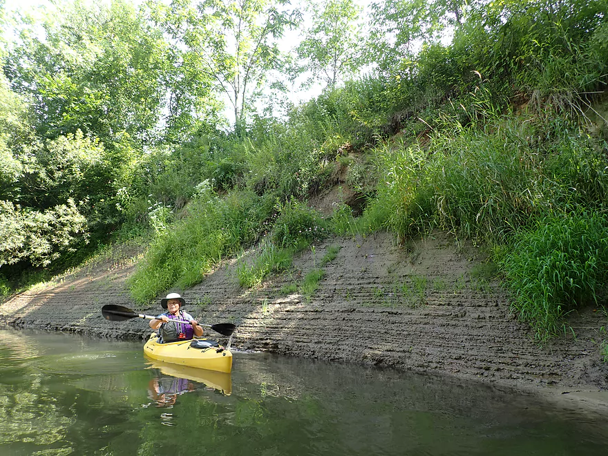
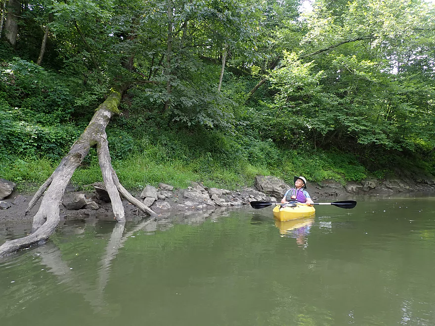
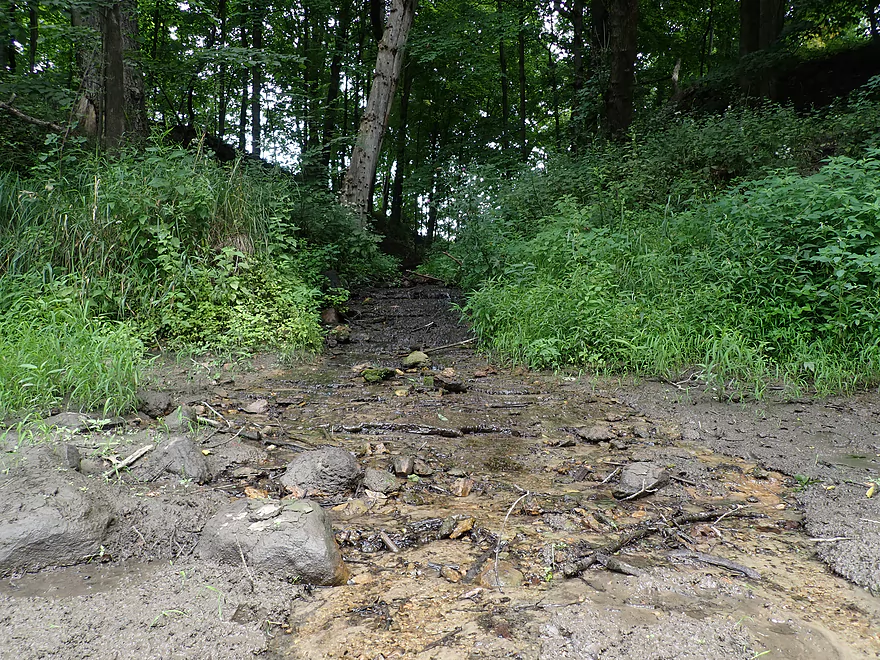
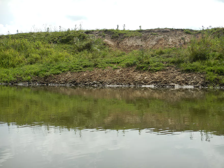
A mud bank with unique layering
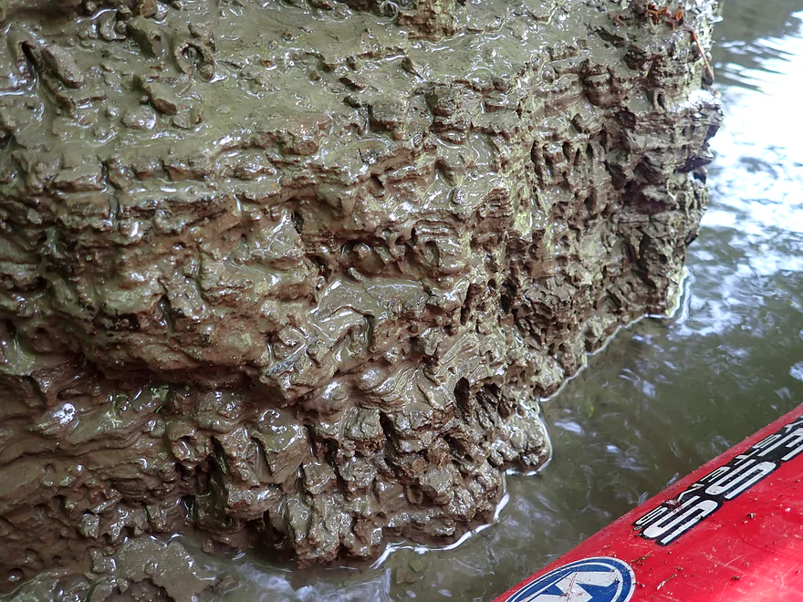
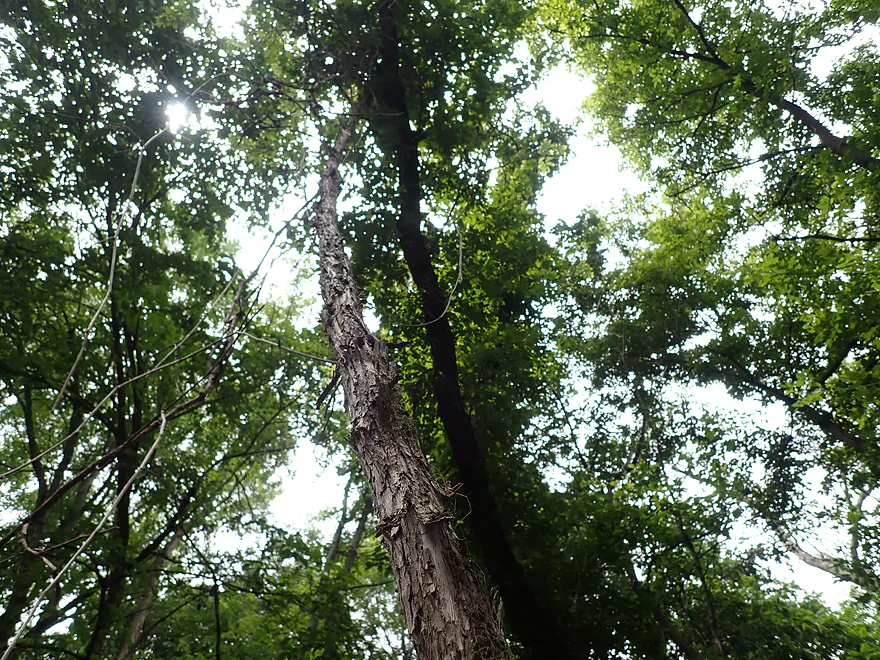
Interesting texture
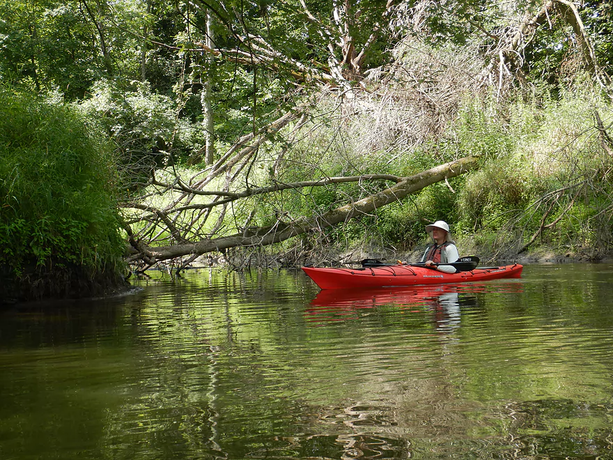
Mouth of Seeley Creek…full of deadfall, just like the rest of the creek
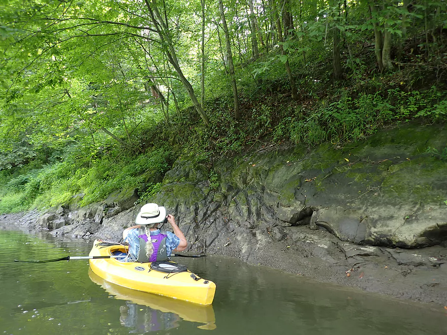
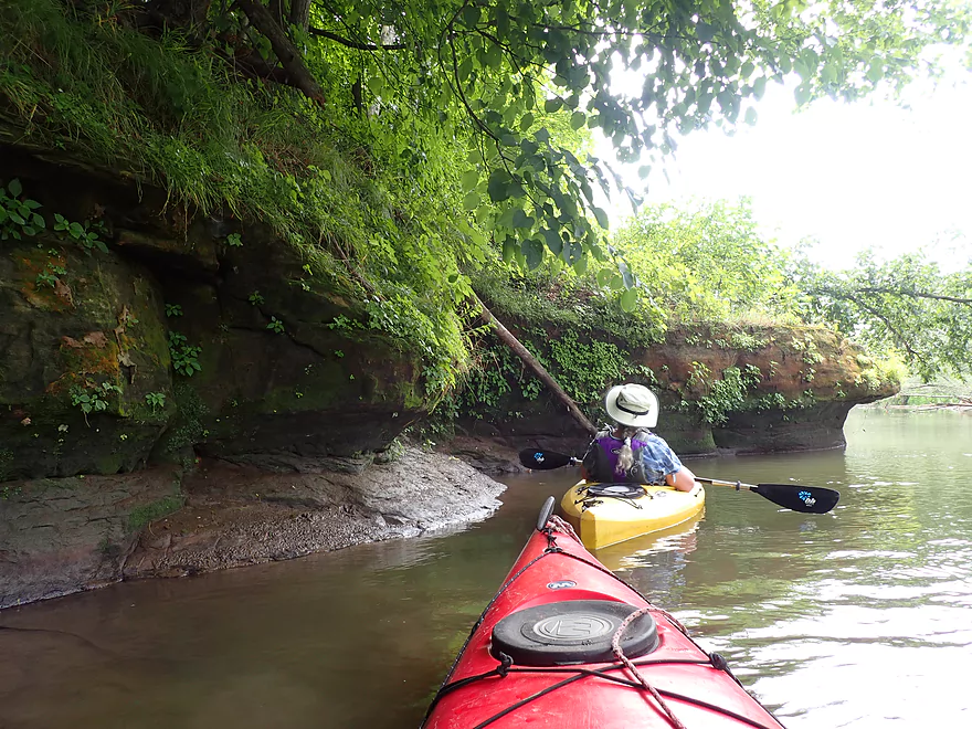
Interesting erosion patterns on this sandstone
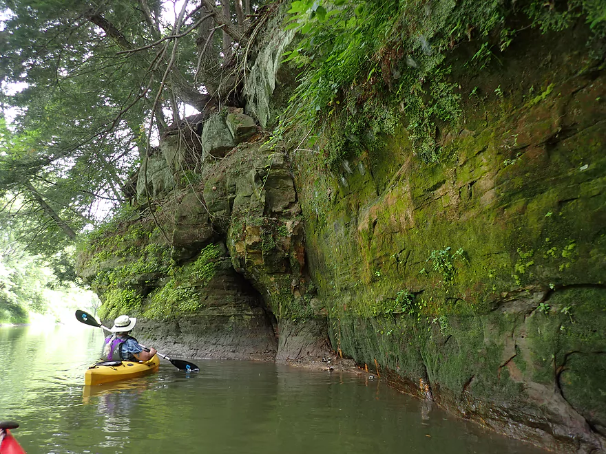
A nice rocky shore
With some hidden outccrops
This one was not so hidden
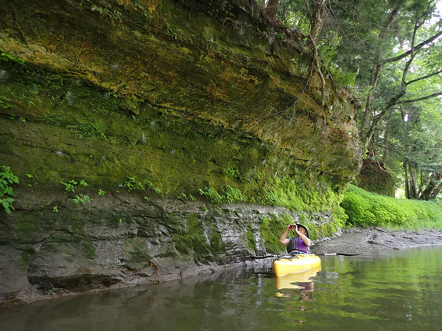
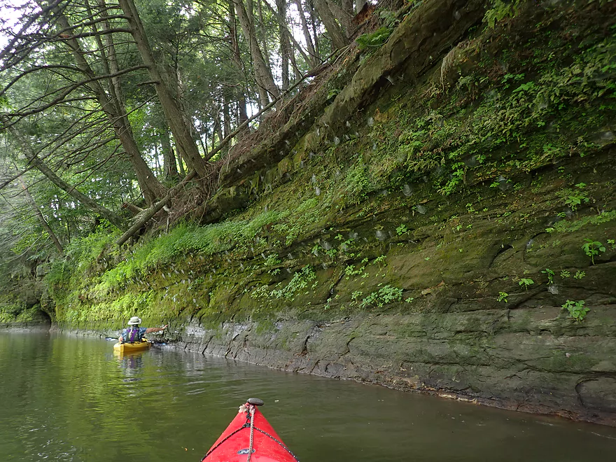
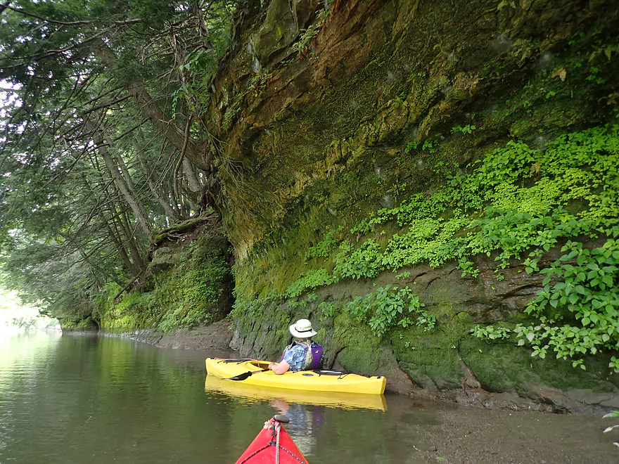
Fantastic cliff
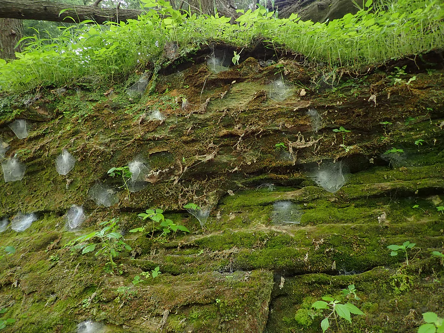
With some interesting spider webs
This is a very long cliff
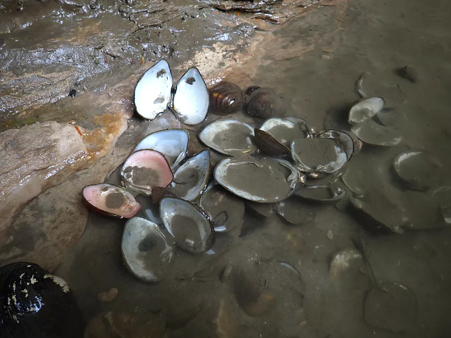
Someone was snacking on clams
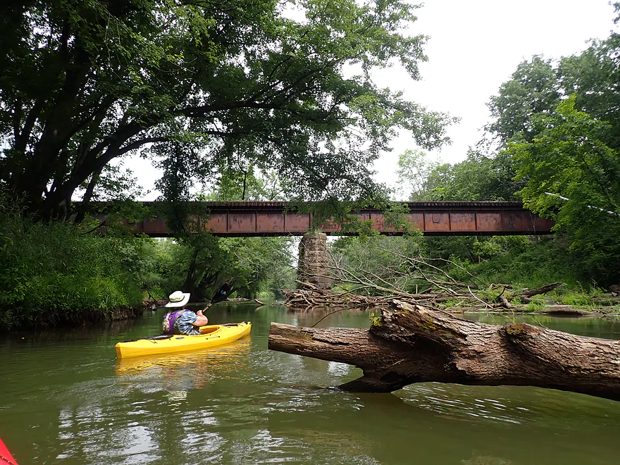
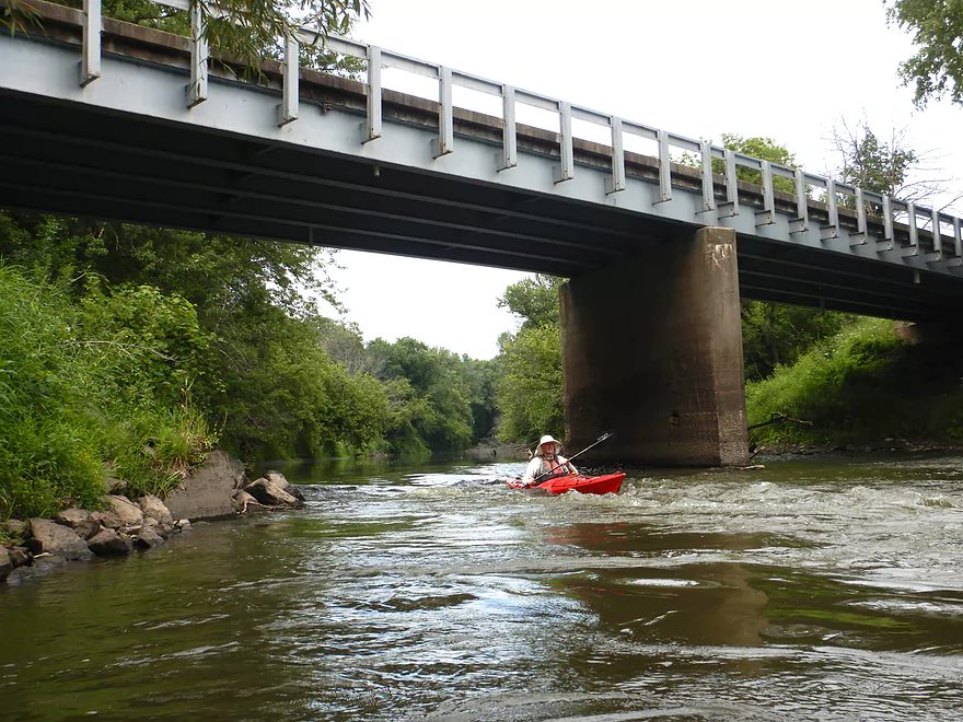
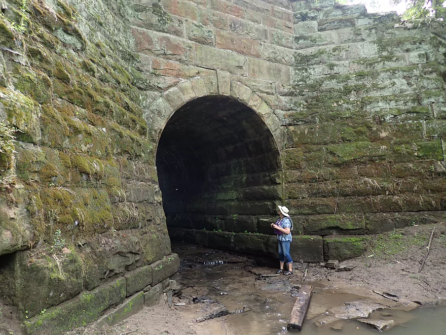
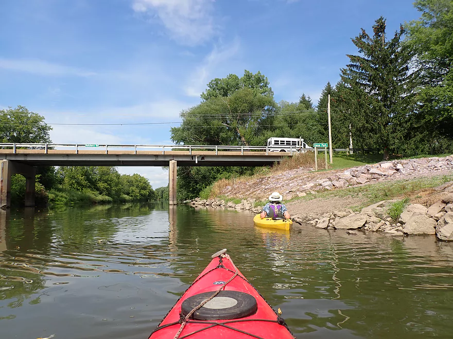
Approaching a historic railroad bridge
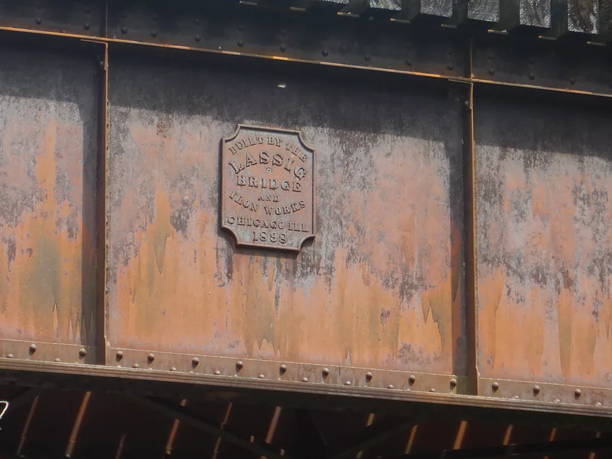
Built in 1898!
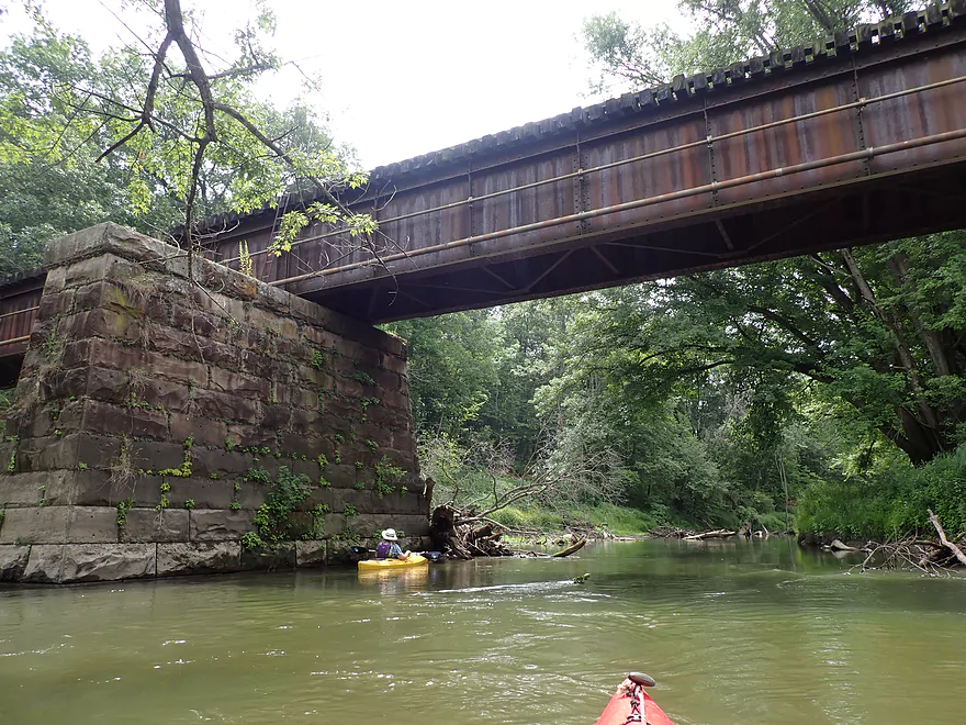
Fantastic stonework…they don’t build them like this anymore
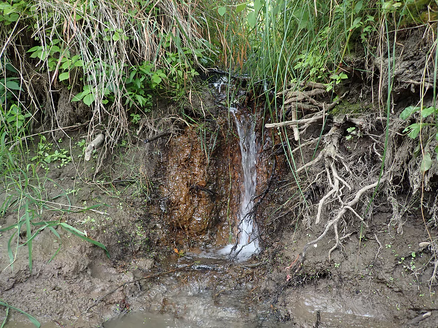
There were a number of springs along the banks
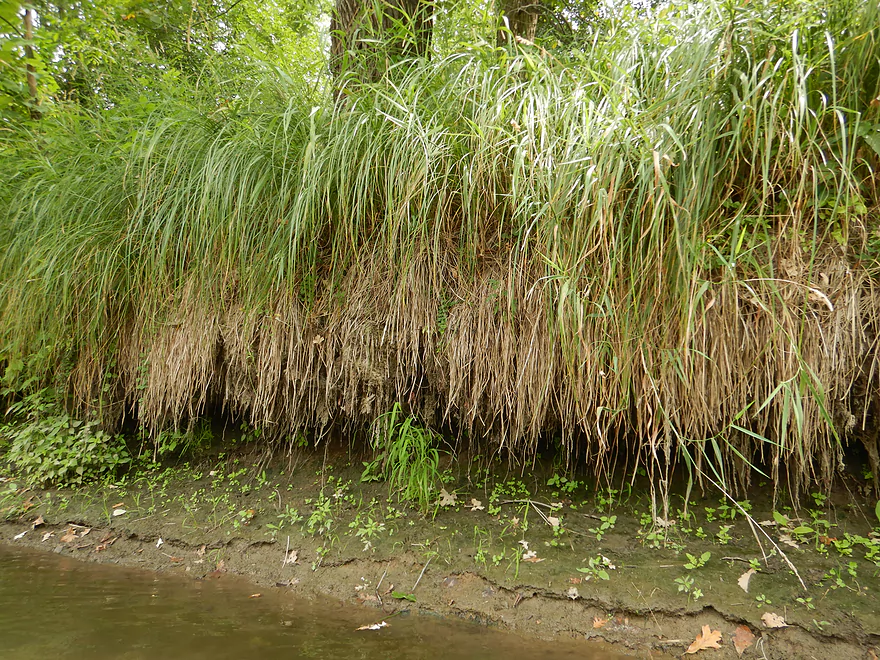
A hedge of sedges
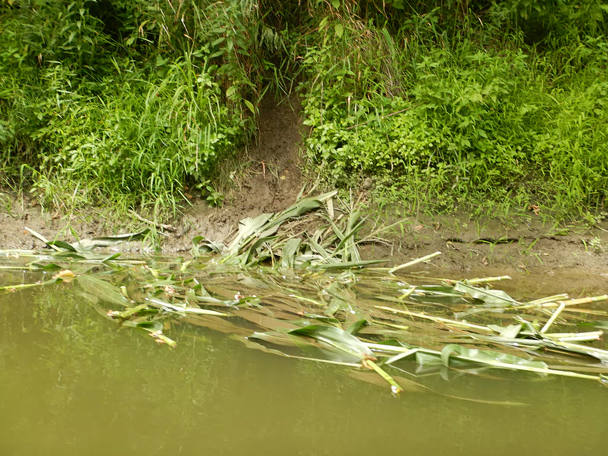
This was a common sight…cornstalk snacks dragged to the river by beavers
Next two miles were long and slow
A ginormous grapevine
An unusual rocky ledge
A spring or small creek falling over exposed bedrock
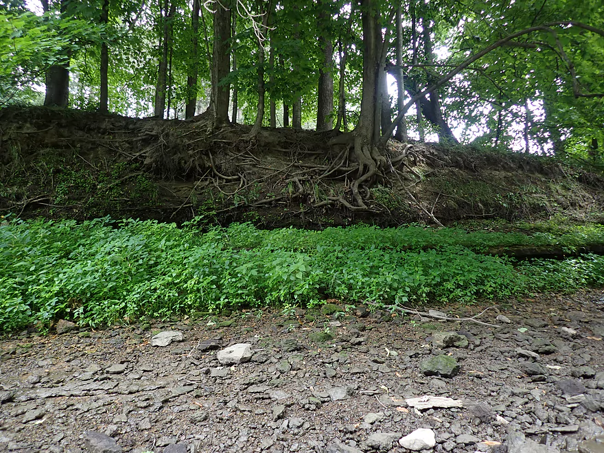
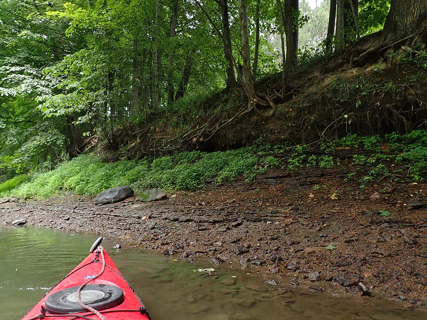
Exposed roots
Interesting geology
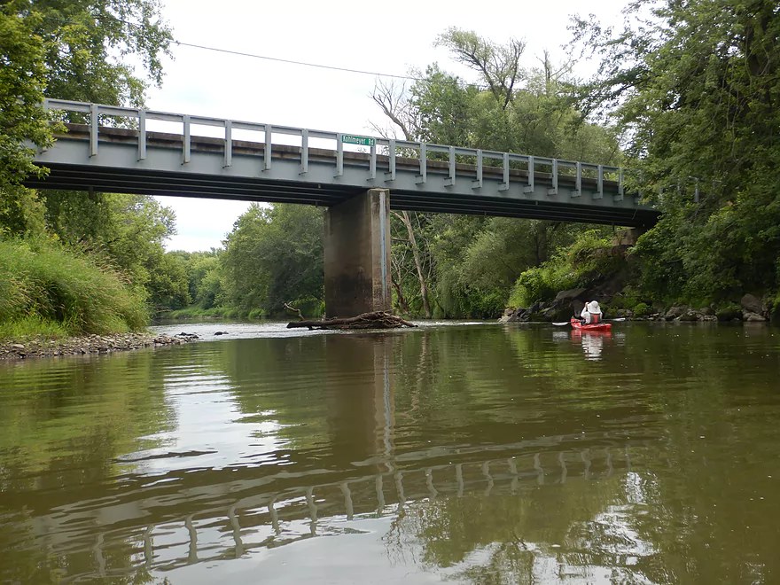
Kohlmeyer Road
Fun Class 1 rapids under the bridge
Paddling another long, slow stretch
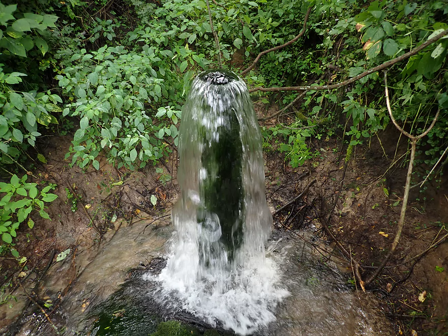
This was a surprise…a high volume artesian well next to the river
Another outcrop
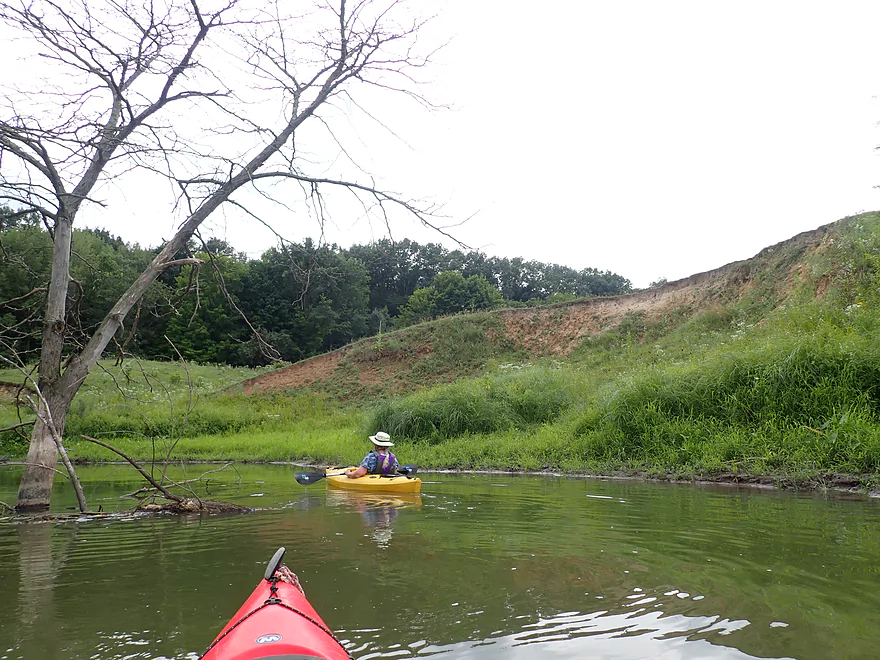
Banks start to open up
Some pasture next to the river
Lone elm tree
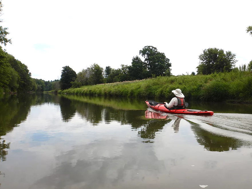
More “lake” paddling…kind of boring
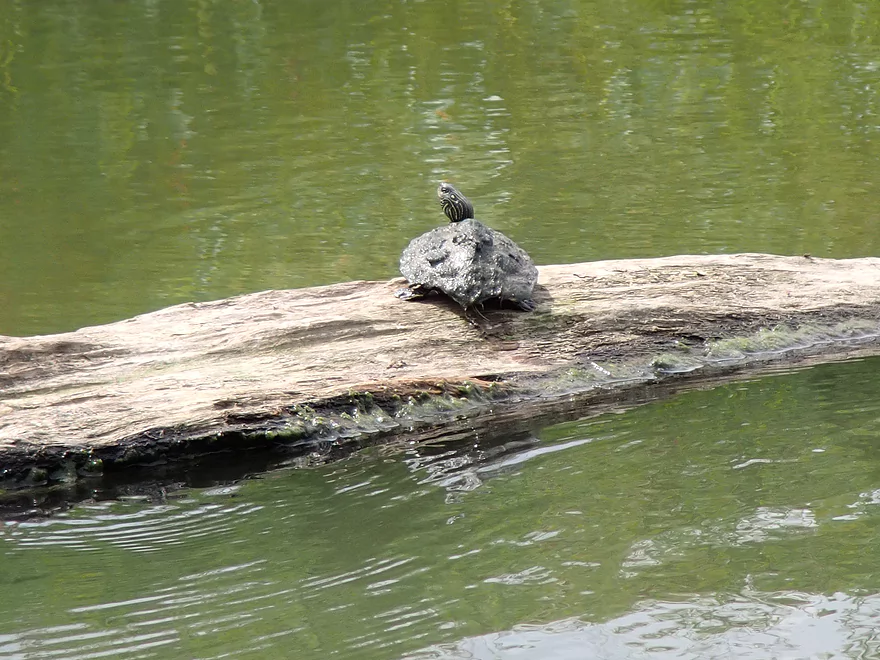
A muddy-looking map turtle
Exposed sand bank
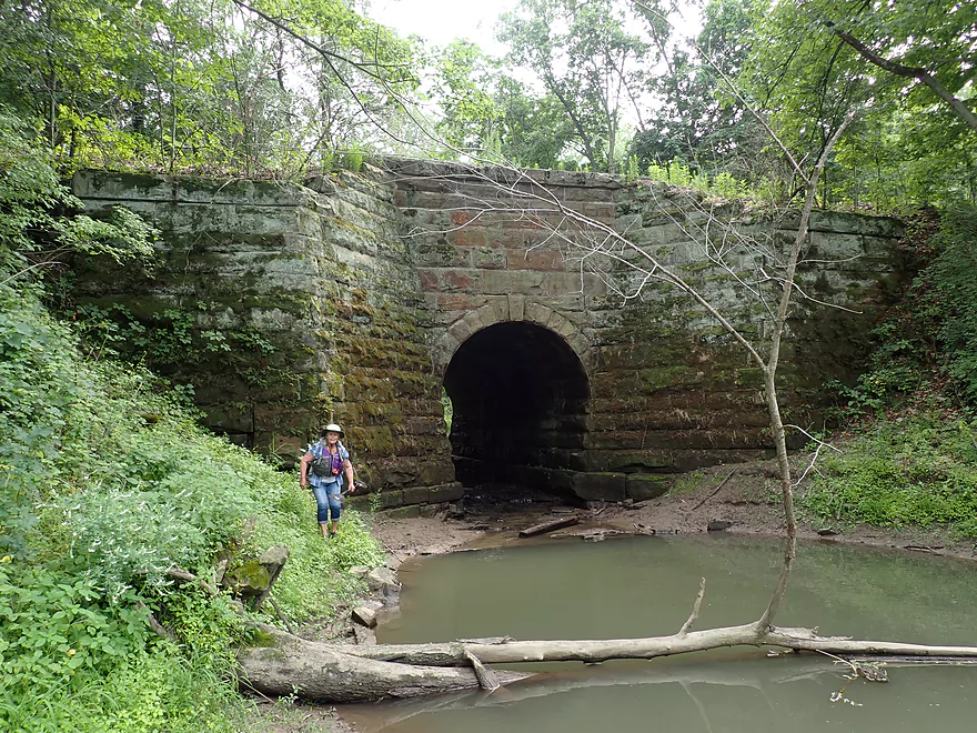
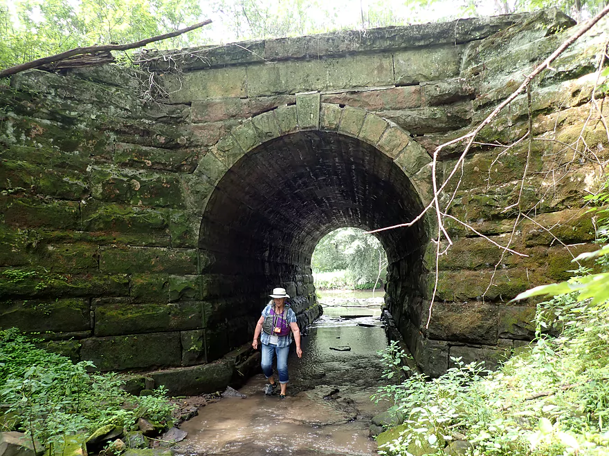
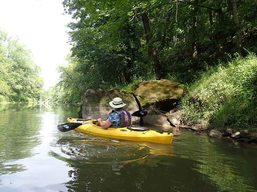
Surprise stone railroad bridge over Hoot Owl Creek
Entering the “Mines of Moria”
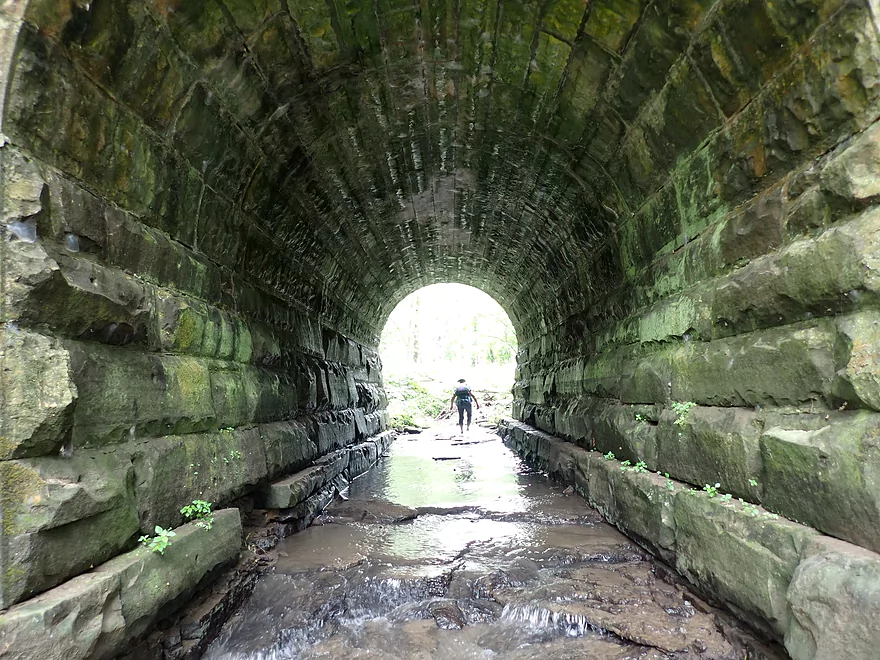
You can actually wade through the tunnel…very scenic
When the river is very high you can kayak through the tunnel
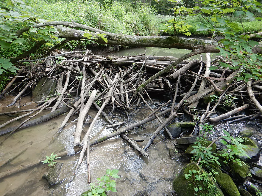
A beaver dam on the other end
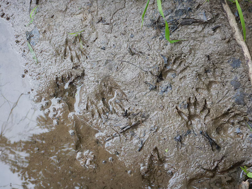
Coon prints in the mud
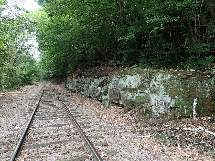
The nearby railroad runs through a scenic stretch of the Baraboo Hills
More open/slow paddling
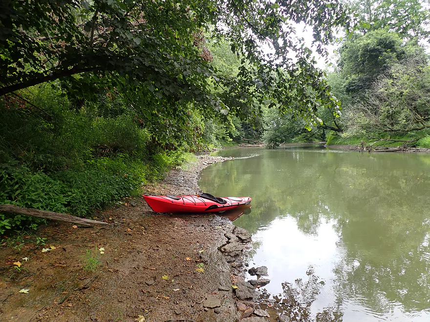
Taking out at Giese Park
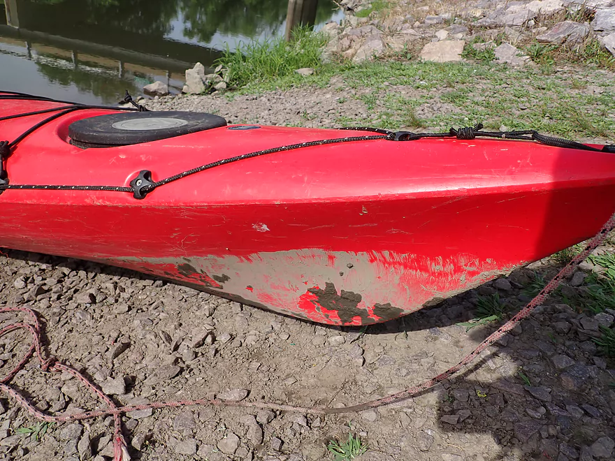
Expect your boat to get dirty on the Boo
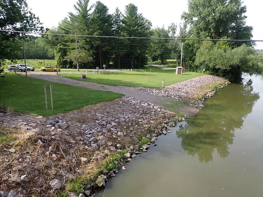
The take-out is very nice
Baraboo River – North Freedom

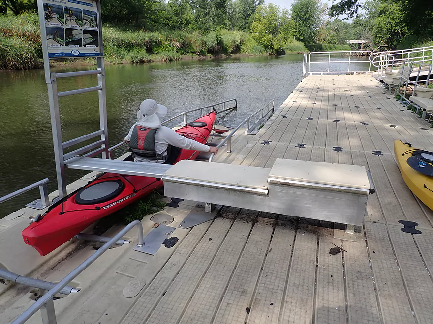
This trip began in North Freedom, a small town about 5 miles west of the city of Baraboo. A city park right adjacent to the river makes a great place to launch. It has parking, picnic shelters, and restrooms, but handiest of all is its large floating canoe and kayak launch. Drag your boat onto the rollers, grab the bars, pull, and you are effortlessly on the water.
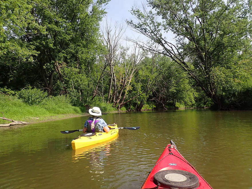
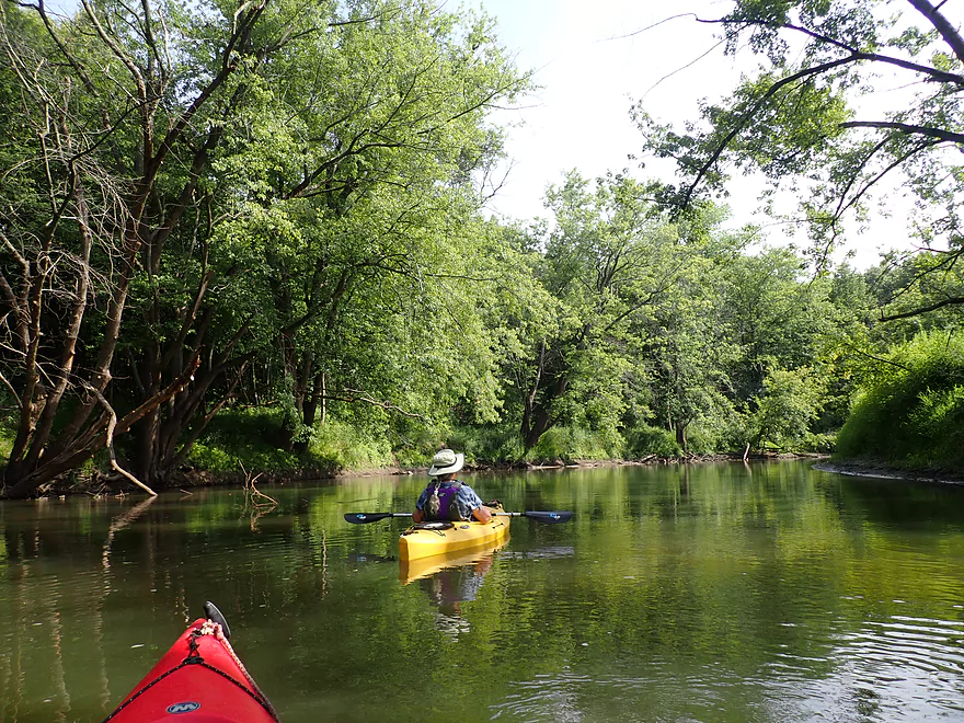
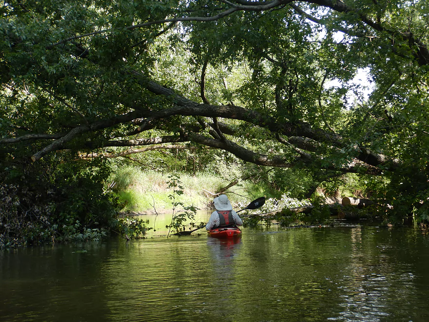
After that it’s classic “Baraboo”: turbid water, muddy banks, and lots of deadfall. The good thing is, the river is so wide for most of this segment logjams are never an issue. And the river is so deep, you never have to worry about grounding. It’s an easy paddle.
The bad part is, it is not always an exciting paddle. There are long, straight sections, almost no rock formations, only one set of rapids, and no sandbars. Forget about pulling up on shore for a break—an almost continuous border of glistening, black, shoe-sucking mud is always waiting to change your mind.
This segment of the river is, in fact, so wide and slow (the Baraboo drops only 150 ft. over its 120-mile length), it often feels like paddling on a reservoir. But, there are a few things that are unique (even fantastic), and they make the paddle an otherwise worthwhile trip.
The river right after North Freedom was winding and wooded, with some current—it was a pleasant paddle. About two miles into the trip, Seeley Creek enters on the right, but is somewhat obscured by fallen logs. There were a few small rock formations after that, but these were mostly hidden and hard to see.
A little further along we came upon the first of the trip’s highlights: a long and beautiful sandstone outcrop very reminiscent of the Kickapoo (nothing hidden about this!). The outcrop had a brow of hemlocks hanging over the water and a surface decorated with green mosses and evenly-spaced white cobwebs.
The river becomes somewhat straight after this and passes under a very old railroad bridge with beautiful stonework pylons–built, according to a plaque, in 1898 (they definitely don’t make them like this anymore). This is still a live rail line, so when we heard a distant train whistle, we thought a train would pass overhead. When it didn’t, we realized it was probably the train from North Freedom’s Mid-Continent Railway Museum and paddled on.
This rail, by the way, is the old “400 Line”–named for the number of miles (and also minutes) it took a train to go from Chicago to Minneapolis. The section west of Reedsburg has been turned into the “400” State Bike Trail, but the section east of Reedsburg continues to carry trains through Rock Springs, North Freedom, and Baraboo.
About a third of the way into the trip the river makes a very large horseshoe bend to the north, traveling some distance before heading back south again. At the top of the “Big Loop,” we encountered the trip’s only rapids–an easy Class 1 under the Kohlmeyer Road bridge. After so much flatwater paddling, it was a welcome change of pace. After that, however, the river seemed to get even slower and wider and became less wooded.
What is amazing about the Boo along the whole stretch from Wonewoc to Baraboo is its incredible and consistent depth—it is mostly one large mass of moving water. Except for the rapids at Kohlmeyer Road, frequent paddle drops were never under 4 ft. and usually 5-6 or more feet deep—enough for sharks, Loch Ness monsters, or (even worse) motorboats.
Coming back south on the Big Loop we encountered our second trip highlight: a huge artesian well! Just across the river from a boat-shaped rock jutting into the water we heard the sound of rushing water and followed a “stream” about 20 ft. up the right bank to a 4-foot high, 10 inch-wide iron pipe rising vertically from the ground. Water gushed from the top. It was super-clear, hand-numbing cold, and inviting.
We were cautious to drink the water at first, but found out later it is the real deal. The famous Rock Springs, just five miles away, used to gush from a large pipe, too, but has since been mostly diverted by a bottling plant. This “new” spring had significantly more volume and tasted better.
The river finally comes back to just a half mile from where it started its long detour north and makes a sharp left before continuing its eastward journey. The rail line that we passed under earlier also rejoins the river, paralleling it closely for a short distance. This is where we encountered our third highlight: a fantastic stone railroad bridge.
The bridge spans the mouth of Hoot Owl Creek, which flows through a 50 ft.-long tunnel with a 15 ft. high Roman-style arched ceiling. The bridge’s huge stone blocks are covered with moss, giving it a rustic “Lord of the Rings” look (kind of like the entrance to the Mines of Moria—or in this case, Hoot Owl Hollow).
Access to the tunnel is tricky because of the mud and slippery ground, but the inside of the tunnel is a gem and there is an entire beaver dam and pond on the other side. At higher water levels, you can apparently paddle right into the tunnel.
The final leg of the trip was more open and straight (probably from early farm dredging) and less interesting. Fields were a little closer to the river, but overall the trip was quite private and secluded, with few signs of people.
Although this stretch didn’t show many signs of humans, it is apparently a favorite spot for beavers. There were well-used beaver runs on just about every bank. “Felled” cornstalks (beaver snacks) frequently floated on the water. This valley seems to have a history of heavy beaver use. It is perhaps no coincidence that the nearby Reedsburg high school teams are known as the Beavers.
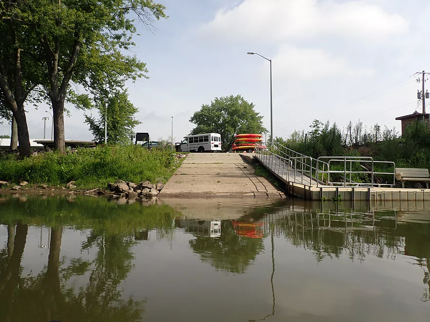
Our take-out was at Giese Park, which is just a small town park with a couple of picnic tables and an outhouse. Years ago the park was only a mowed area between the road and the river. Now the river bank is lined with rip-rap and boasts a gravel-topped landing. Oddly (since the river here is so deep), a sign prohibits motorboat entry. The park is a major put-in and take-out spot for the Baraboo Canoe and Kayak Company.
In summary, for people who just like to paddle, this is an easy and out-of-the-way trip. For experienced paddlers who have glided over crystal clear water, skirted glacial boulders, and charged down foaming rapids, this is a bit humdrum. The highlights are what make the trip, along with the two nice parks that give the experience such an easy beginning and end.
North Freedom Park: This was an excellent public launch and boat landing. A $3 fee is required to use the launch, but there are no entrance forms to fill out…so you’ll likely ok not paying. There is a floating dock with a kayak launch, which is super fun to use. Bathrooms and picnic tables are available behind the parking lot.
Alternate Put-ins:
- Kohlmeyer Road (4.3 miles downstream of my put-in): A doable but steep bridge access. North Freedom is a much better access.
Giese Park: This is a good public canoe/kayak launch. Parking is free and an outhouse is available (but is in poor shape).
Alternate Take-outs:
- Kohlmeyer Road (4.3 miles upstream from my take-out): A doable but steep access. Taking out here/early means you miss out on the artesian well and historic railroad bridge/tunnel.
- Haskins Park (3.5 miles downstream from my take-out): Kind of a simple stretch. Highlights include a few rock outcrops, an extremely tall road bridge, a few rapids before you enter Baraboo proper.
Bike Shuttle: 5.1 miles with 33′ of ascent. This is a reasonable bike route.
- Rapids: Almost none. There is a set of Class 1 rapids under Kohlmeyer Road that is very easy to run.
- Logjams: None. There is quite a bit of deadfall along the river, but the river is too wide to be obstructed. Friends of the Baraboo River has assisted in removing many logjams from the river.
- Strainers: Not many. The river is generally cleared out and open. In high water when the current is fast, you may want to be mindful to stay away from downed trees/branches.
- Mud: It’s kind of everywhere…prepare to get a bit dirty. I advise wearing appropriate aquatic footwear that can get muddy in case you need to get out.
The Baraboo River actually has a number of gauges, including one conveniently located at Rock Springs. According to this gauge I did the trip at 7.5′, which is a bit on the low end but plenty navigable. This stretch was consistently deep and I doubt it ever gets too low to run. Because I lack historical information on the Rock Springs gauge, I made the following estimates based on the Reedsburg Gauge instead (trip done at 325 CFS).
- 0-150 CFS: Very low levels. River will be plenty manageable. These levels could reveal some logjams.
- 151-250 CFS: Average levels and a good target range.
- 251-350 CFS: Above normal levels, but manageable for kayakers with decent boat control
- 351-450 CFS: High levels with some pushy spots.
- 451-550 CFS: Very high levels…perhaps only for expert paddlers.
- 551+ CFS: The river at these high levels will likely be too muddy, too pushy and have too many tricky strainers for an enjoyable paddle.
- 2008: A devastating flood from the Baraboo River causes a lot of damage.
- 2014: A volunteer tragically slips and is run over by a moving train.
- 2015: The museum sadly auctions off some of its prized possessions including some trains. The official line was that this was needed to finance a new steam train, but I suspect there was more to this.
- 2018: Another major flood hits and destroys $250,000 worth of property. Thankfully because of advanced warning, many of the rail cars were moved to higher ground and were saved.
- 2020: The museum shut down for 2020 as a reaction to Covid-19. Later the museum reopened in May of 2021.
Detailed Overview
- Nutmeg Road to Hwy PP: 6.2 miles. Flows by the historic Elroy-Sparta Trail and is mostly open, but there are a few logjams. This is a narrow small stretch that will need very high water to be runnable. There are scenic outcrops on this stretch….maybe 3.
- Hwy PP to 2nd Main Street: 1.6 miles. Maybe 3 logjams.
- 2nd Main Street to Franklin Street: 0.9 miles. Maybe 1-2 logjams. Trip starts at a scenic covered bridge and on Class 1 rapids.
- Franklin Street to Hwy 82(South of Lincoln Street): 0.5 miles. A good stretch that is mostly open and has maybe one outcrop.
- Hwy 82(South of Lincoln Street) to Schultz Park: 0.6 miles. Maybe 2 logjams.
- Schultz Park to Hwy 82(South of Snyder Road): 4.0 miles.
- Schultz Park to Hwy 82(North of Lumsden Road): 0.6 miles. One outcrop, one logjam portage and a few tight fits.
- Hwy 82(North of Lumsden Road) to Hwy 82(South of Snyder Road): 3.4 miles. Three outcrops, three significant logjams and several tight fits. A section with good potential but needs cleanup work.
- Hwy 82(South of Snyder Road) to Hwy W: 1.9 miles. Maybe 2-3 jams…think this is doable though.
- Hwy W to Hwy 82/Union Center: 1.3 miles. Good prospect by the golf course with maybe 2 outcrops. Maybe 1-2 logjams.
- Hwy 82 to Hwy FF Landing/Wonewoc: 7.1 miles. A great section with one of the largest rock outcrops on the river.
- Hwy FF Landing to Wayside Park: 2.9 miles. There used to be a lot of logjams here. I think it might be doable…maybe 2-3 major portages.
- Wayside Park to Kalepp Road: 4.5 miles. An uninteresting part of the river with weedy, muddy banks. But…there are three fantastic sandstone outcrops.
- Kalepp Road to N. Dutch Hollow Road: 5.3 miles. One logjam portage with several “hoppers” and “duckers”. There are some outcrops but most are recessed and away from the river. Mud and downed trees are a bit unsightly, otherwise a pleasant paddle.
- N. Dutch Hollow Road to La Valle: 3.8 miles. Second best section on the entire river with great rock outcrops.
- From La Valle to Lake Redstone: 3.6 miles. One of the more underrated sections of the Boo, which I really liked.
- Lake Redstone to Monument Park/Reedsburg: 9.0 miles. Supposedly kind of boring, but the logjams should be cleared out.
- Monument Park to South Park: 1.4 miles. Spanning the length of Reedsburg, this should be a nice section mostly free of jams.
- South Park to Golf Course Road: 4.7 miles. Maybe 4-5 logjams. Probably one too many. Should be 1-2 small sandstone outcrops. Golf Course Road might not be a good access.
- Golf Course Road to Hwy 136(by Beth Road): 3.6 miles. Maybe a few jams. Likely mostly floodplain paddling and probably uninteresting.
- Hwy 136(by Beth Road) to Hwy 136(by Ableman’s Gorge): 6.0 miles. Maybe some outcrops at the end, but mostly uninteresting paddling I suspect. Likely several serious logjams with difficult portages because of the high muddy banks.
- Hwy 136(by Ableman’s Gorge) to North Freedom Boat Launch: 8.2 miles.
- Hwy 136(by Ableman’s Gorge) to Rock Springs Boat Launch/Firemen’s Park: 1.3 miles. One of the most scenic parts of the entire Baraboo River. Highlights include a steep gorge, riverside boulders and scenic outcrops.
- Rock Springs Boat Launch to North Freedom Boat Launch: 7.1 miles. This is a nice paddle, but with some downed trees to dodge and one to portage. Highlights include historic railroad bridges, scenic outcrops, and seeing the railroad museum from the river.
- North Freedom Boat Launch to Giese Park: 7.4 miles.
- North Freedom Boat Launch to Kohlmeyer Road: 4.3 miles. Stretch starts nice as the river naturally curves and has many shade trees. There is a scenic long outcrop after Seeley Creek. River becomes boring after that except for a scenic railroad bridge and a few rocky banks. Kohlmeyer Road isn't a great bridge access.
- Kohlmeyer Road to Giese Park: 3.1 miles. Some longer and less interesting stretches. There is however a unique large volume artesian well, and a historic railroad tunnel you can wade under.
- Giese Park to Gander Outdoors: 2.9 miles. A pleasant but simple farm country paddle. Highlights include the Skillet Creek bridge, the towering Hwy 12 bridge, and a rock outcrop upstream of Hwy 12.
- Gander Outdoors to Glenville Landing: 4.9 miles. A fantastic stretch through the heart of Baraboo with many light rapids.
- Gander Outdoors to Haskins Park: 0.6 miles. A good stretch with some fantastic rapids upstream of Hwy 136.
- Haskins Park to Maxwell-Potter Conservancy: 3.3 miles. The best section on the entire river with many rapids.
- Maxwell-Potter Conservancy to Glenville Landing/Hwy 113: 1.1 miles. A pleasant stretch, but lacking in rapids.
- Glenville Landing to Luebke Landing: 5.1 miles. A pleasant trip, but a little boring at times. I would rate this as one of the more uninteresting sections of the Baraboo. On the plus side it had no logjams (as of 2023) and remains plenty navigable even during big droughts.
- Luebke Landing to Hwy 33: 3.5 miles. This might be one of the better legs on the Lower Baraboo.
- Hwy 33 to Wayside Park: 8.0 miles. A stretch I’m curious about.
- Wayside Park to Hwy U: 3.9 miles. Simple but pleasant short section flanked by busy interstates.
- From Hwy U to the mouth: 5.3 miles. The final leg running through floodplain forest.
Notable Baraboo River Tributaries:
- West Branch of the Baraboo River: For the most part, too many logjams, but the flowage by Hillsboro is navigable with scenic outcrops by the dam.
- Dutch Hollow Lake: A heavily developed lake and popular with locals. Not as great as Lake Redstone but still nice. Dutch Hollow Creek is likely too shallow to run, but it (and the bike trail) goes past a fantastic and huge exposed rock face.
- Hemlock Slough: A nice little lake paddle with many rock outcrops and attractive hemlocks.
- Little Baraboo River: For the most part too many logjams. However the small flowage by Cazenovia Memorial Park is navigable and there are small outcrops both below the dam and on the northwest corner of Lee Lake.
- Lake Redstone: Definitely a fun paddle with fantastic red rock formations, a swimming beach, and a spillway waterfall.
- Big Creek: You can’t get too far upstream because of logjams, but there is a nice outcrop by Hwy F and this can be combined with a trip on the north side of Lake Redstone.
- Narrows Creek: There is a neat section by Weidman Memorial Park with boulders and light rapids with I believe nearby outcrops downstream. Unfortunately there are likely too many logjams. I did partly paddle a nice downstream portion from the mouth on the Baraboo before I hit a logjam and turned back.
- Seeley Creek:
- Hwy PF to Seeley Lane Boat Landing: 3.6 miles. A mix of creek and flowage paddling. Ok…maybe 2 logjams.
- Seeley Lane Boat Landing to Freedom Road: 1.7 miles. Probably too many logjams on this section.
- Freedom Road to Mouth: Neat stretch of the creek, but some logjams.
- Skillet Creek:
- From Gasser Road to Pewit’s Nest: Gorgeous, but filled with logjams.
- Pewit’s Nest: Stunning scenery, but the ledges are likely too steep and narrow for kayaking. Best experienced as a hike.
- Pewit’s Nest to Hatchery Road: A bit of nice geology, but likely small with several logjams. Neither endpoint is a great access.
- Rowley Creek: A scenic creek, but shallow and with hostile locals.
- Leech Creek: From Hwy U to Tritz Road would be 2.5 miles. Likely open and an easy paddle, but uninteresting because of the artificial channelization.
- Long Lake: A very slow creek that empties into the Boo close to the Wisconsin. There could be serious logjams by the mouth, but the upper sections are plenty navigable and are paddled by locals.
Trip Map
Overview Map
Video
Photos Size:
We paddled the North Freedom to Giese Park section on July 5, 2025, Rock Springs river gauge height 9.7 ft. We paddled this in 2.5 hours but we didn’t stop along the way. Suprisingly we encountered no other paddlers besides our group either on the river or at the put in/take out. The solitude was nice and there were a lot of birds, kingfishers, kingbirds, sandpipers. The highlight is the sandstone bluff on the right bank. Hemlock trees and ferns. We scared up an immature bald eagle in that section which flew ahead of us for a few hundred feet. Very cool. We saw and adult bald eagle flying while doing our shuttle so I imagine they probably have a nest in that area. There were a fair number of strainers, often in succession which you have to weave around and pick your path carefully, but we didn’t have to get out and portage around. There are very few places where the banks are low or shallow sloped enough to land and get out of your boat. The take out at Giese Park, while shallow sloped, is that slippery clay with some rip rap rock mixed in. Doable but not easy. You slip on bank. You can judicously walk on the rocks.
It’s an underrated stretch! Thanks for the comment.