
Welcome to Ableman’s Gorge
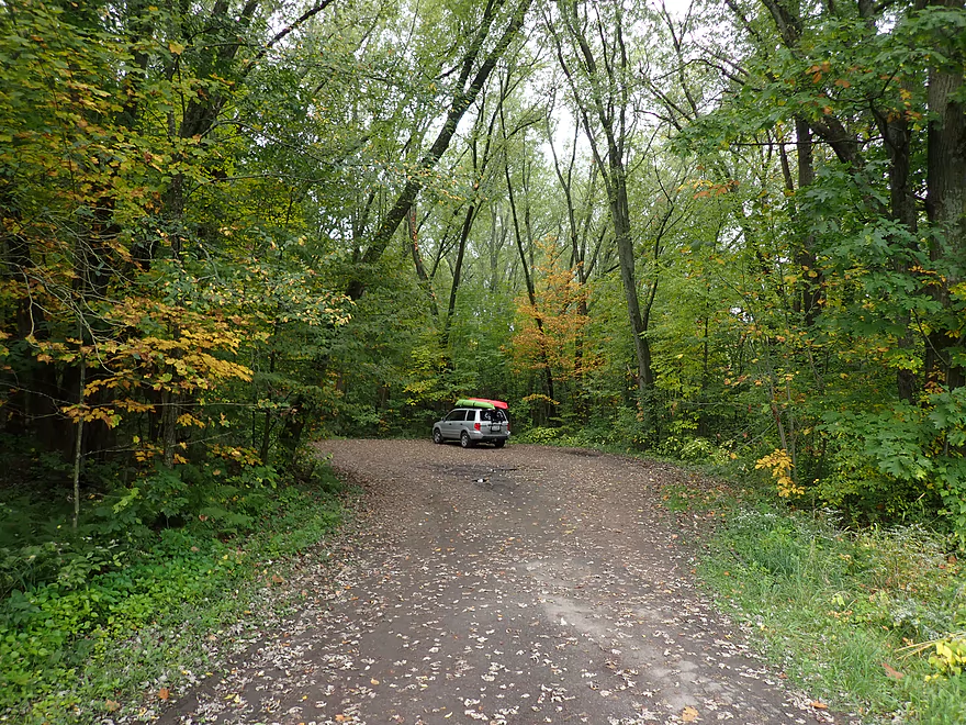
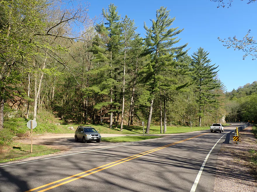
Starting the trip at the Hwy 136 pull-off
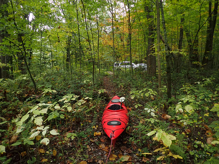
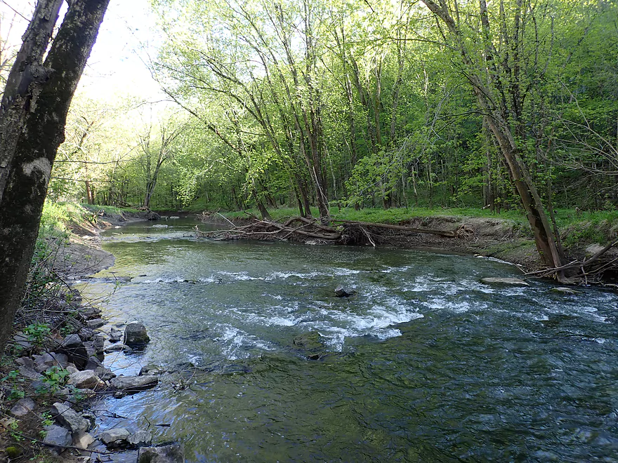
A dirt trail leads to the water
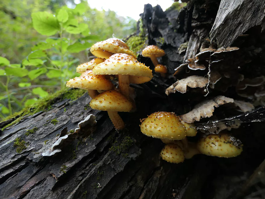
Scalycap mushrooms
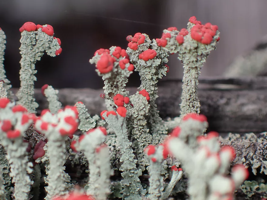
These are known as “British soldiers”
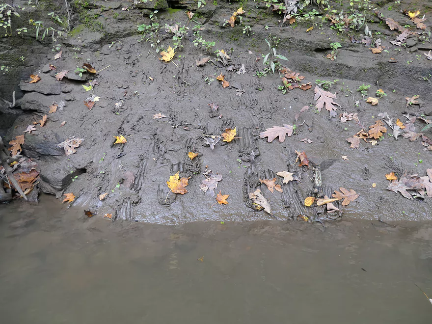
Kind of a muddy put-in area
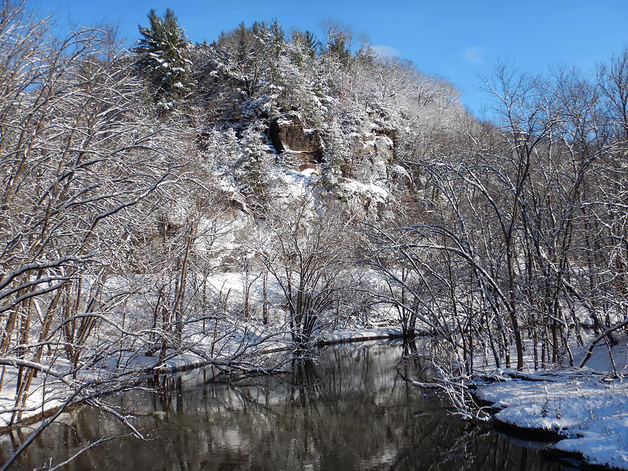
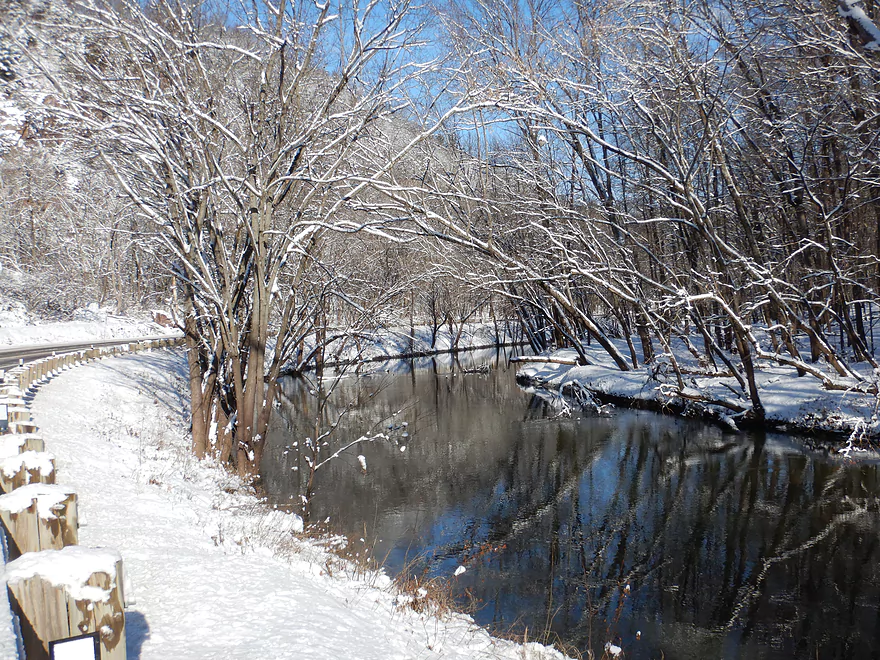
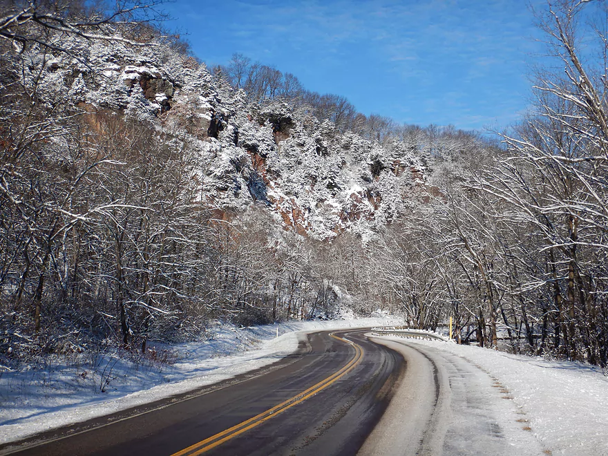
First trip outcrop is scenic (winter picture)
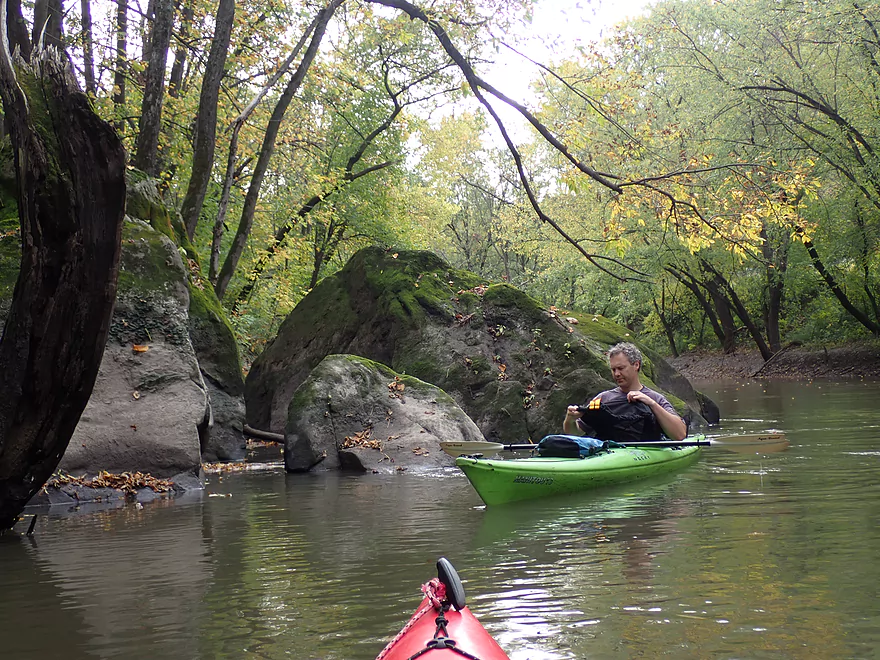
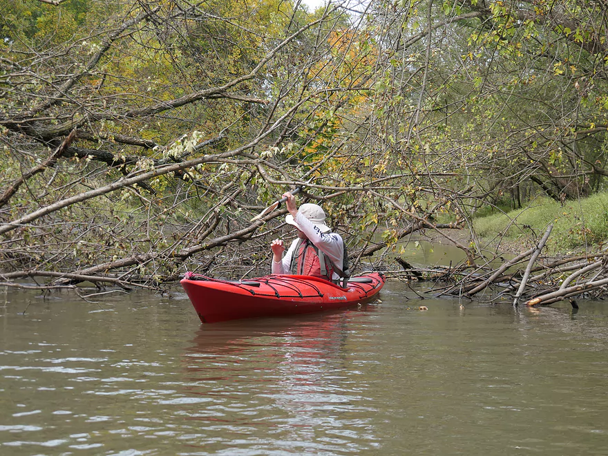
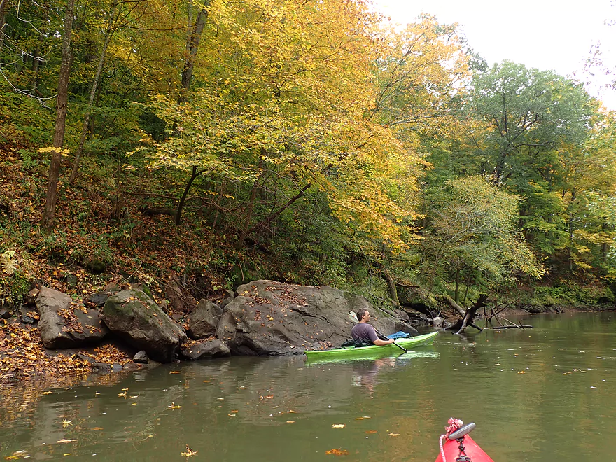
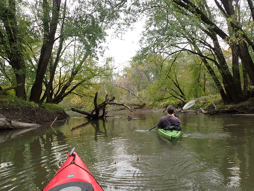
Boulders that have tumbled down the gorge
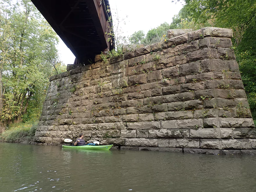
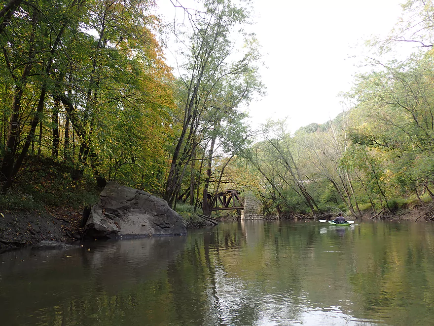
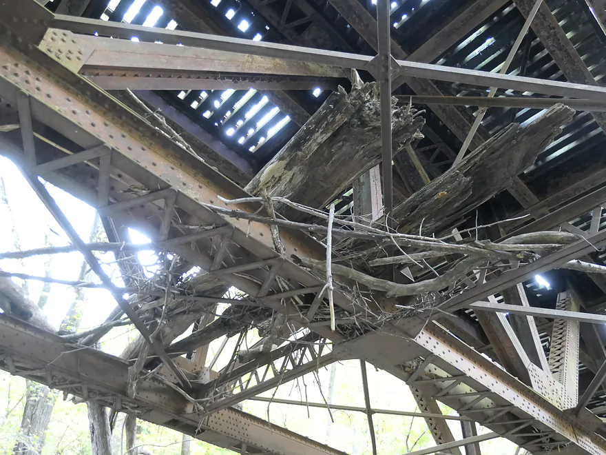
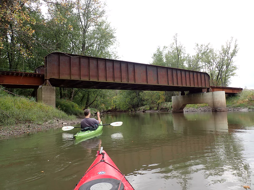
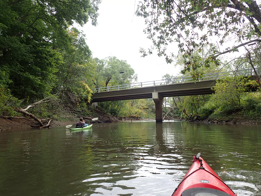
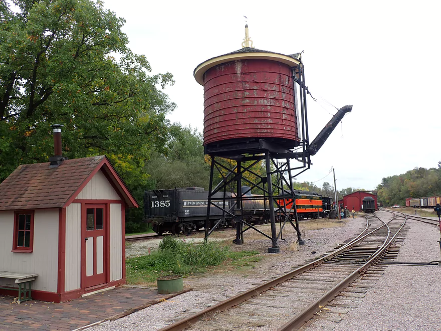
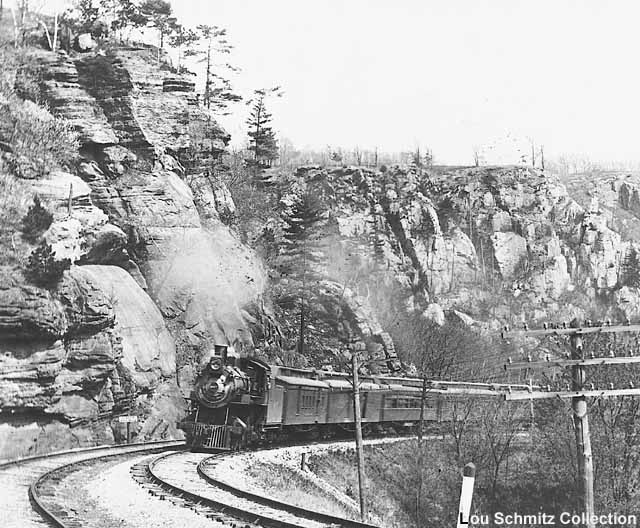
A historic railroad bridge
More “bank boulders”–these are quartzite
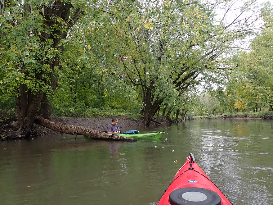
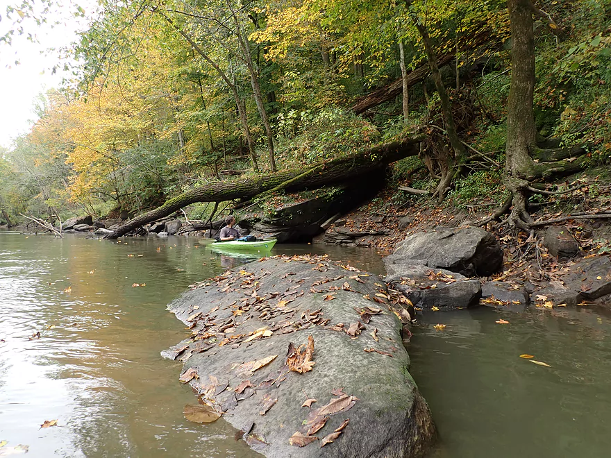
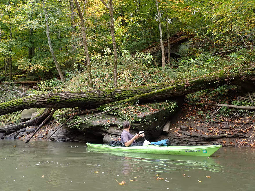
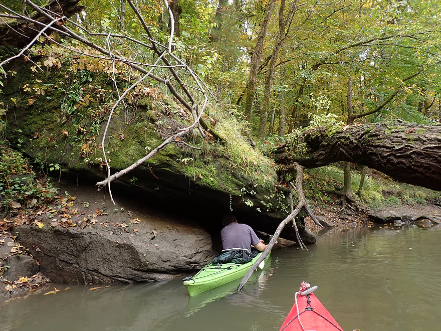
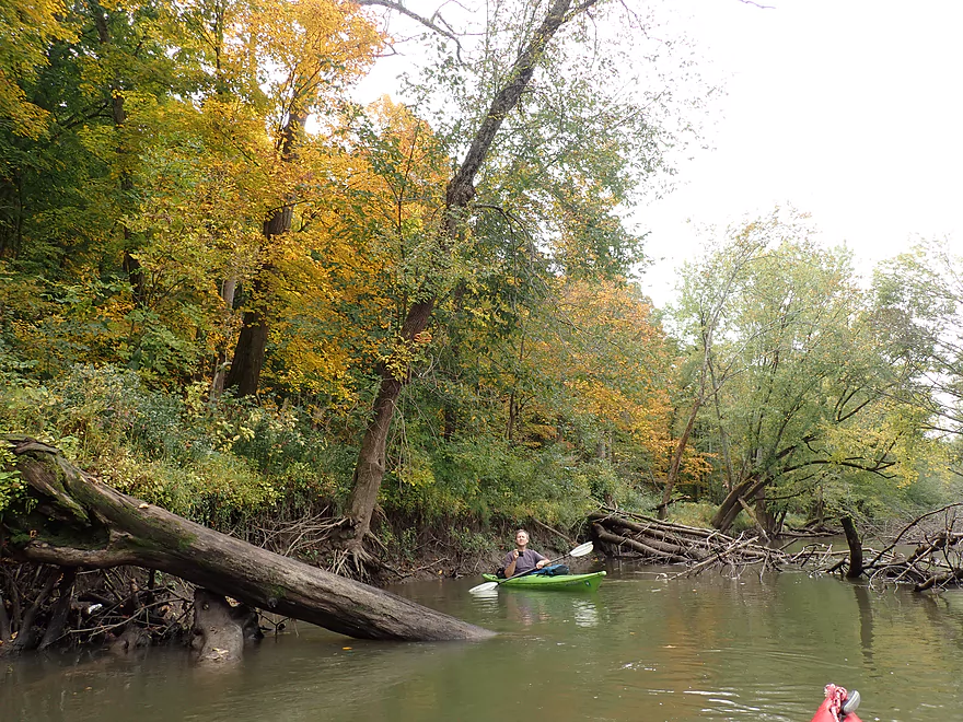
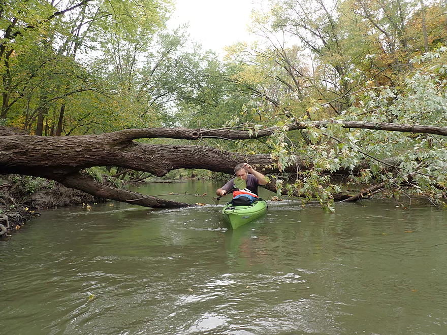
Some downed trees but navigable so far
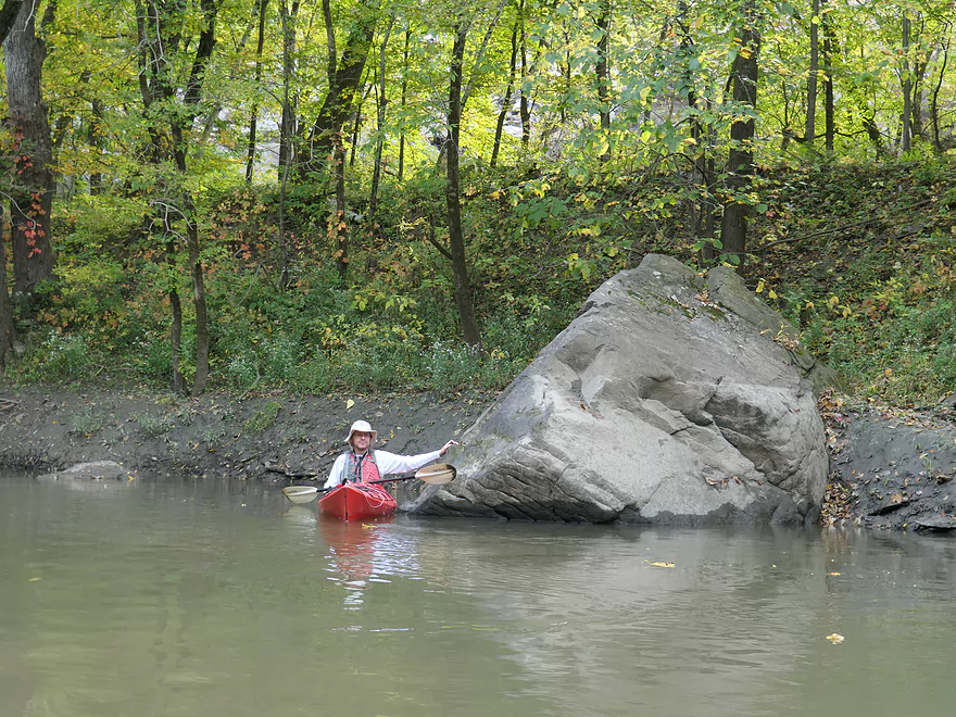
One of the largest boulders of the trip
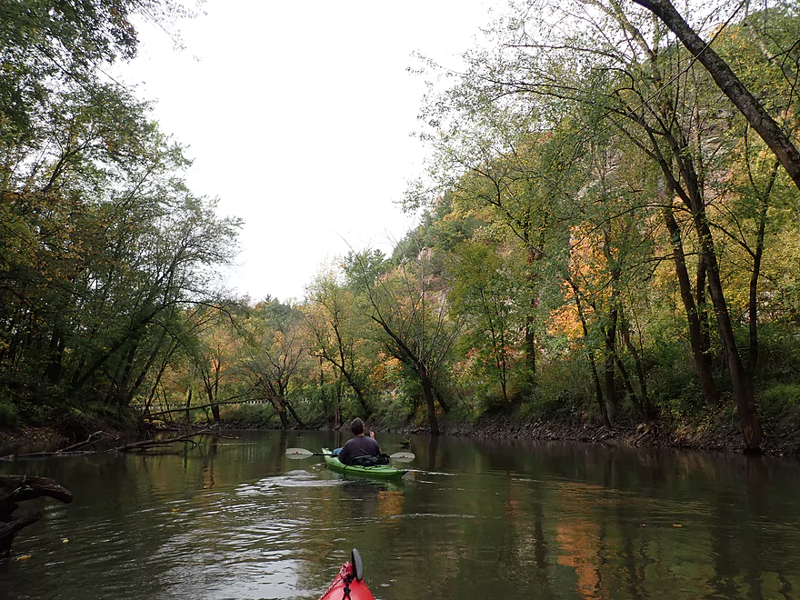
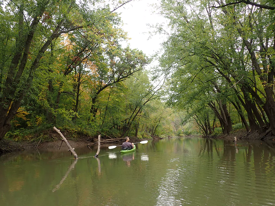
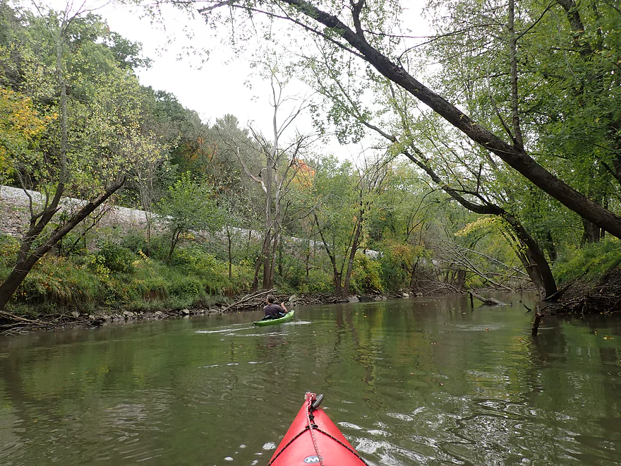
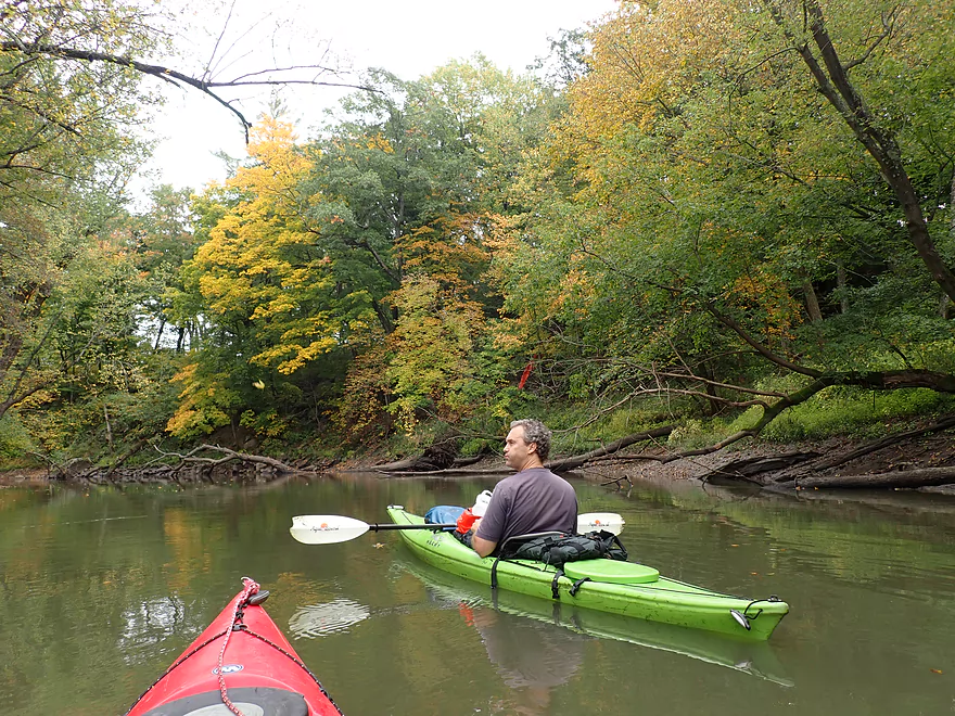
The Upper Narrows: western gateway to the Baraboo Hills
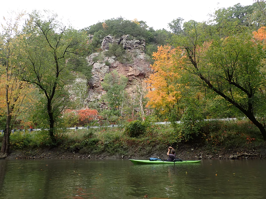
Another cool outcrop
Reminds me of Devil’s Lake
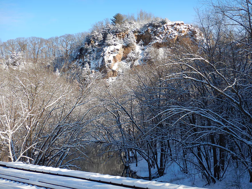
Even more scenic after a snowfall
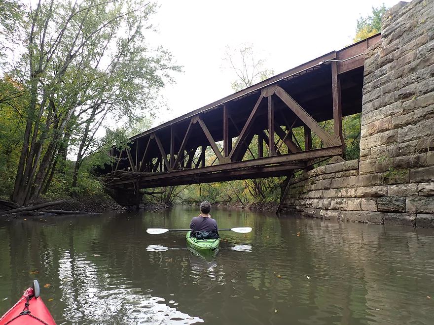
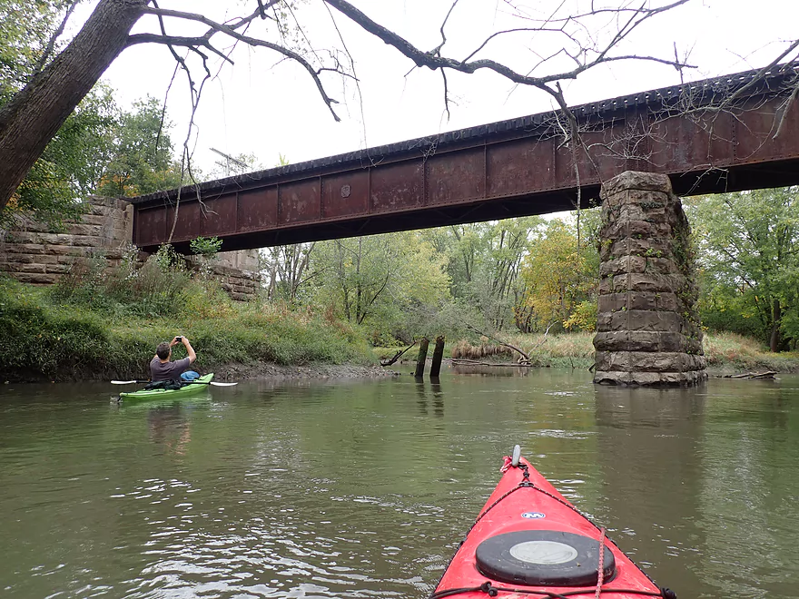
Another nice iron and stone railroad bridge
The Baraboo River is known for its mega floods
Same part of the river…pictured in winter
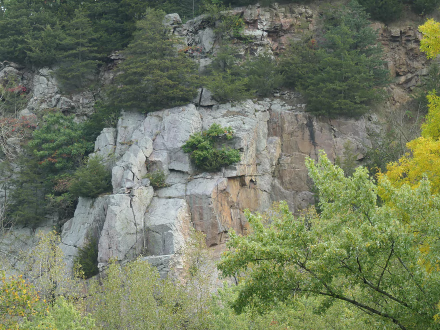
Outcrop #3
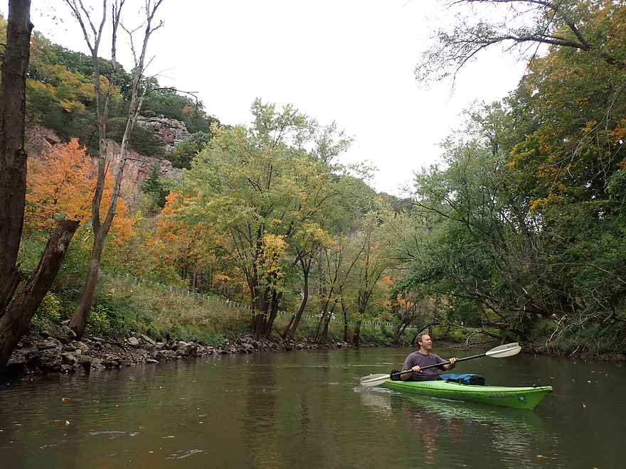
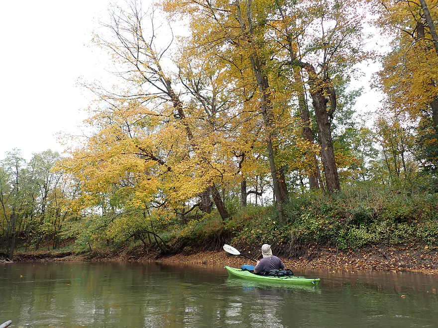
Some ok fall color
The outlet of the famous Rock Springs artesian well
An alternate access by River Street (in poor condition)
Some serious mud deposits
A loud grain elevator and railroad loading station
We are out of the Rock Springs gorge and into lowland farm fields
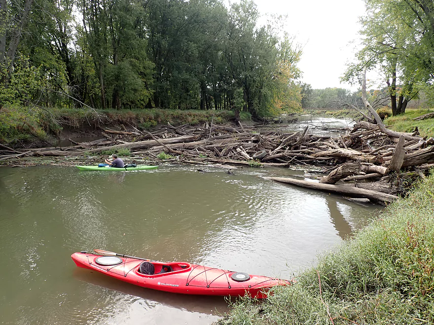
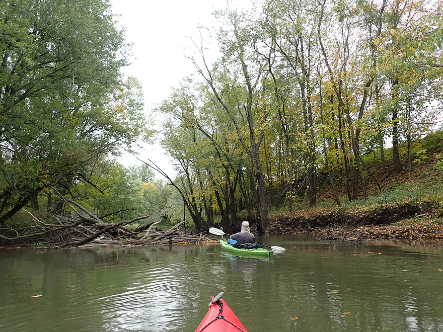
One huge logjam
If super determined you can hop through
You can tell this logjam is quite old
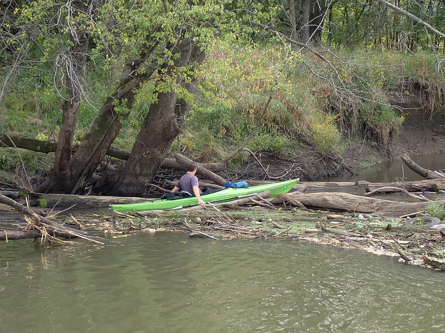
My only logjam portage of the trip
Another logjam…but this was minor
Coming up on another gorge
Attractive outcrop
This raccoon tried to get out
A quartzite boulder garden
Very cool
Almost room to sneak through
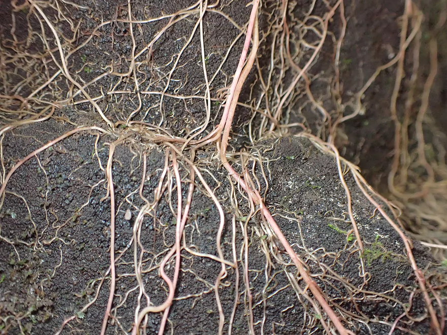
Exposed plant roots
Super scenic
Another jam…this was easy to thread through
Exploring a side creek
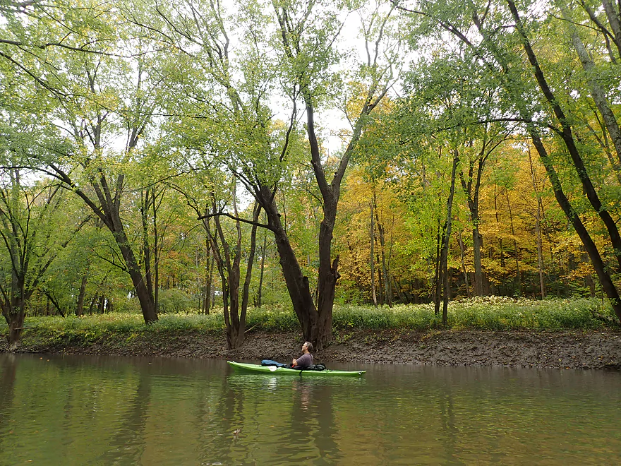
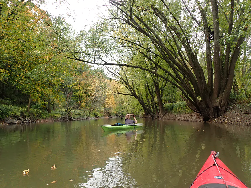
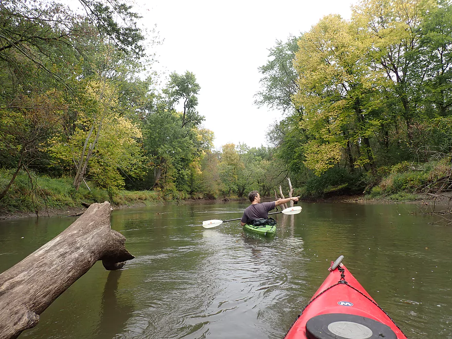
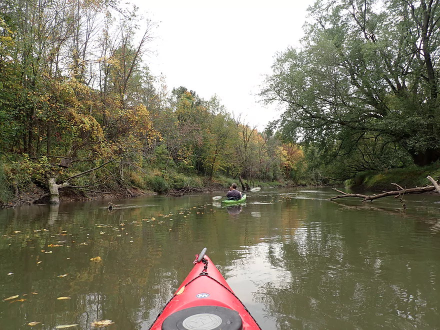
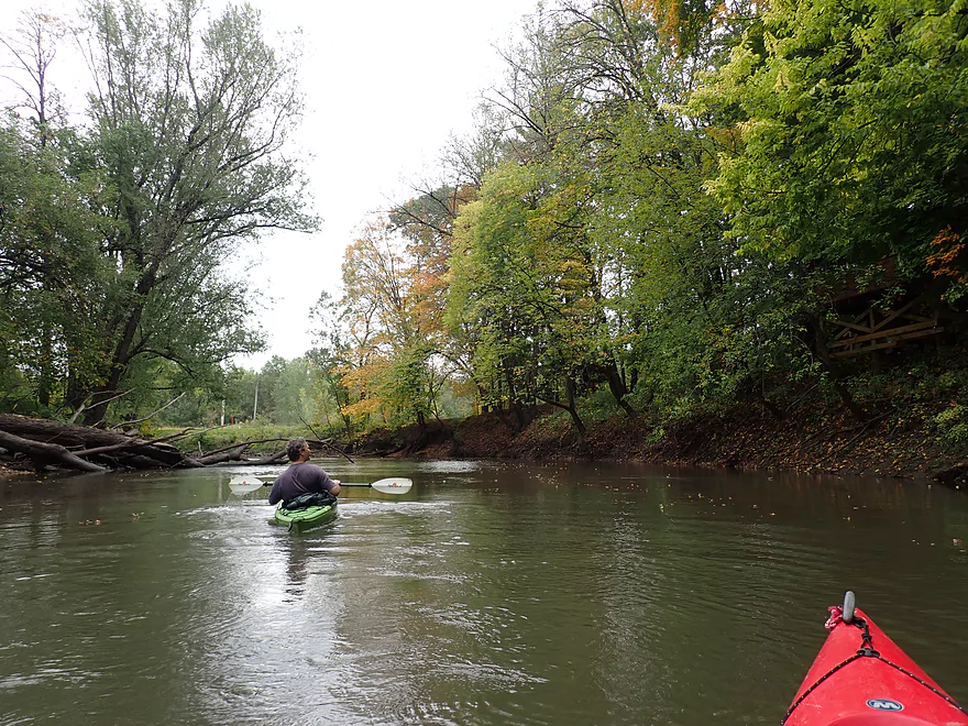
This is a good stretch for fall color
The nearby rail line…in many ways this reminded me of Devil’s Lake
Taking a snack break
Another easy logjam to sneak through
Fanantistic boulders and outcrops are hidden by leaves on the right bank
Another great outcrop
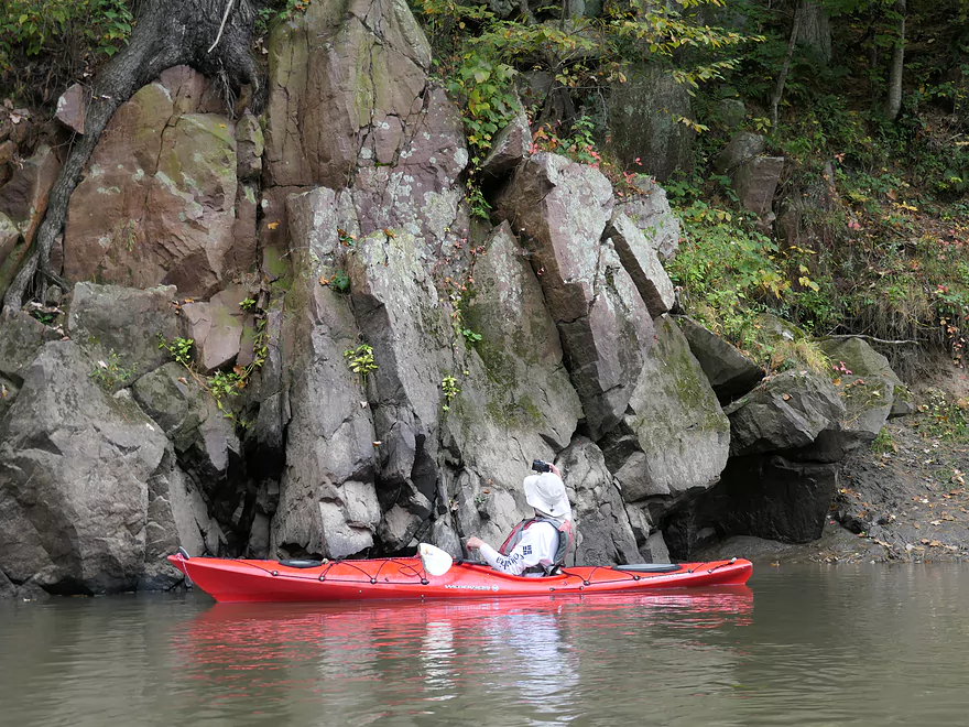
Quartzite was a change from the usual limestone and sandstone along most Southern Wisconsin rivers
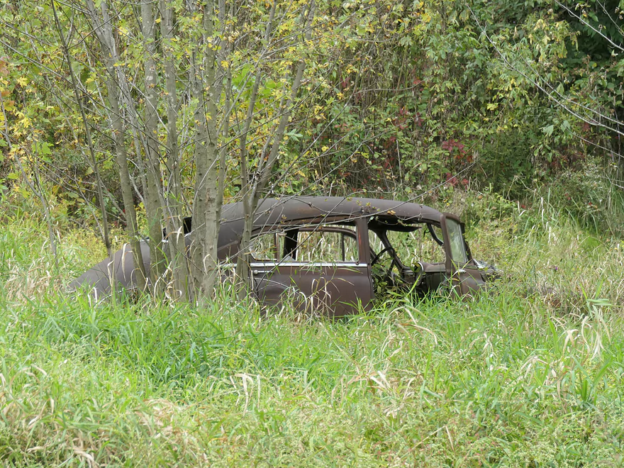
This car has been here a while
We’re now out of the second gorge and doing more lowland paddling
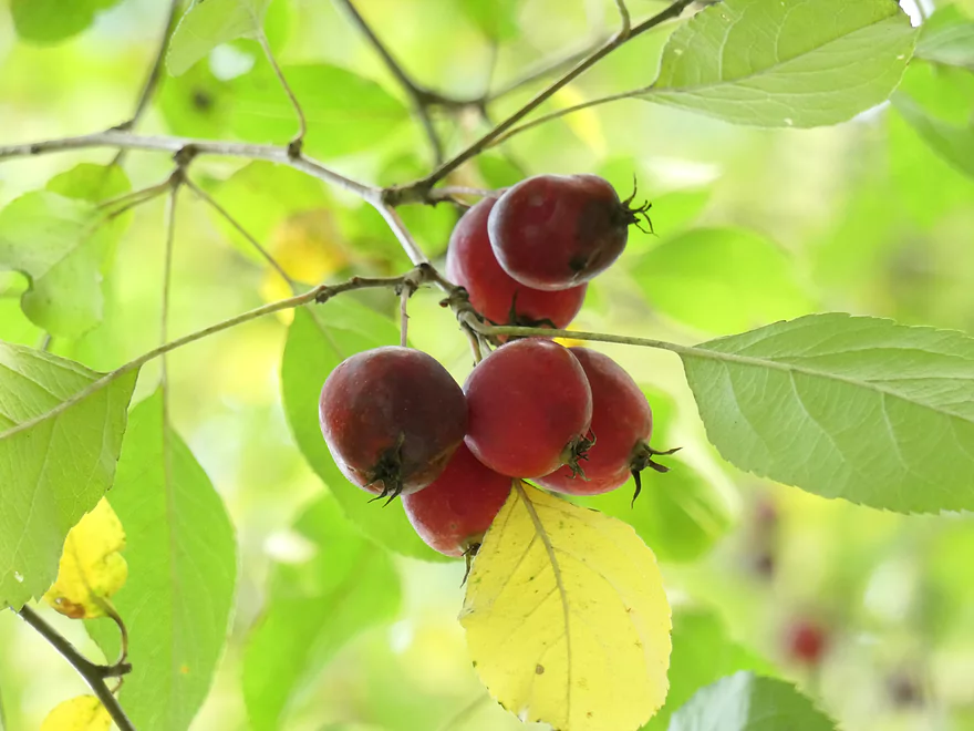
Tasty crab apples
The second half of the trip wasn’t as interesting…but did have some good color
Another historic railroad bridge
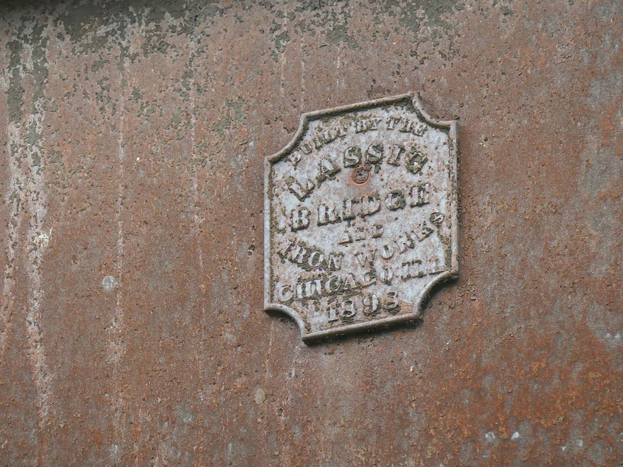
This (and the other bridges) were built in 1898!
A newer bridge connects the “Quartzite spur” (now the Mid-Continent Railway line) to the main line
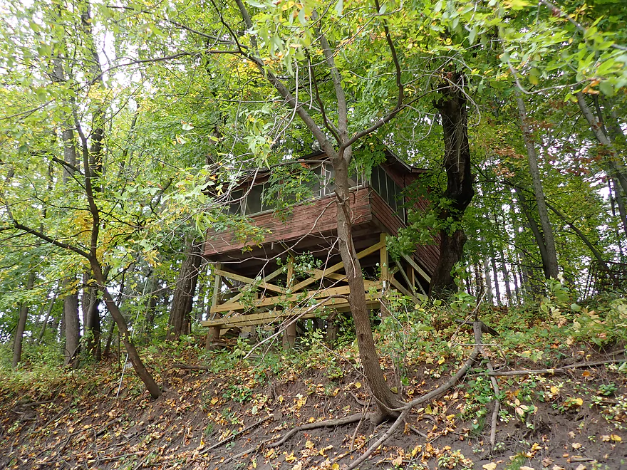
A cabin on stilts (this area was heavily flooded in 2018 and 2008)
Diamond HIll Road
Another hilly section of the river
Great tree canopy
The famous Mid-Continent Railway Museum
A caboose hiding in the weeds
Some riverside yard work
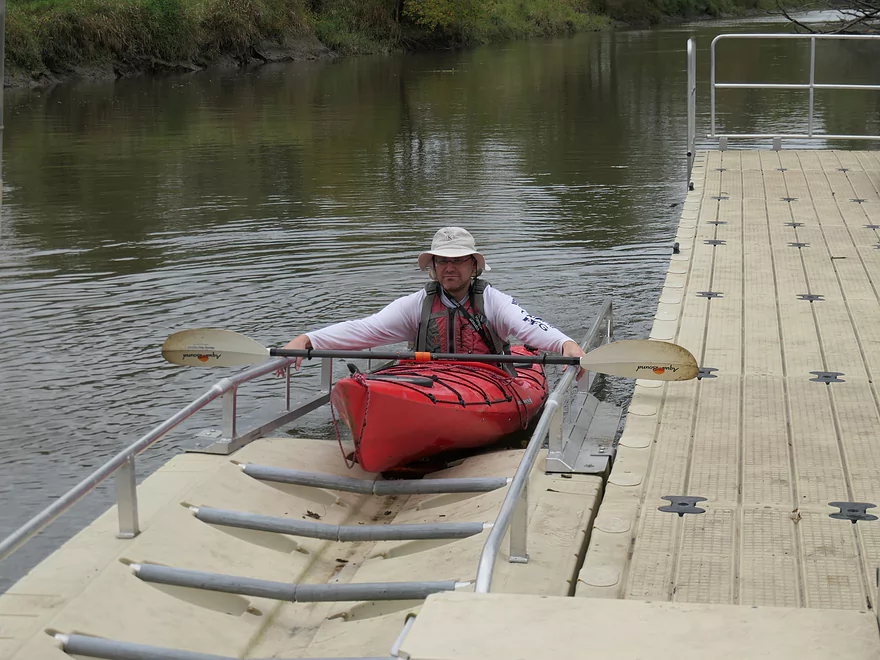
Great take-out at North Freedom Park
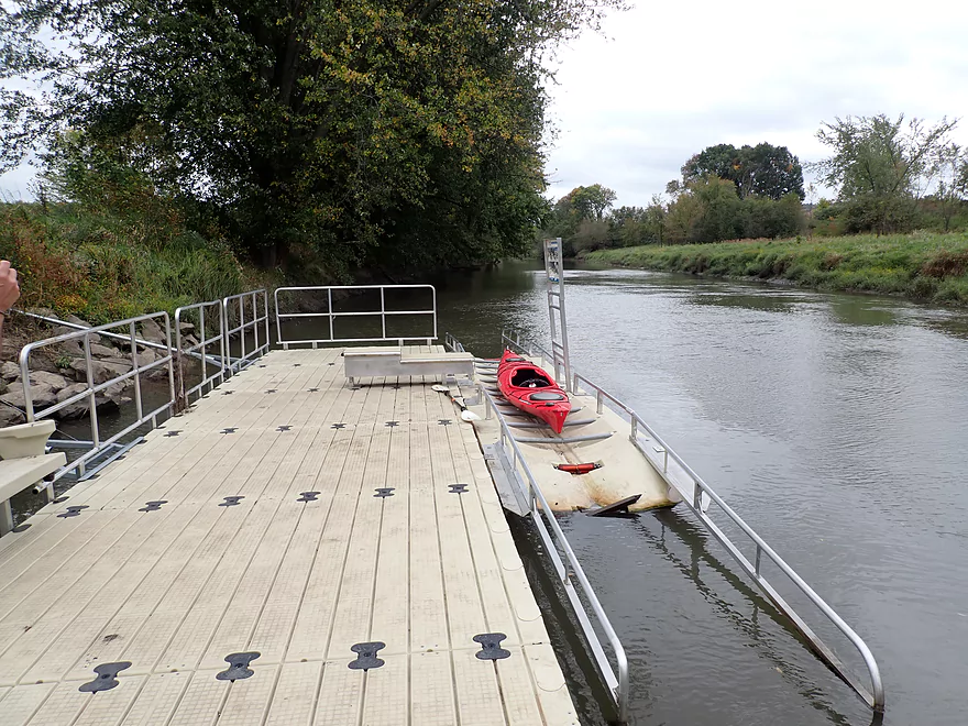
Part of a much larger floating pier
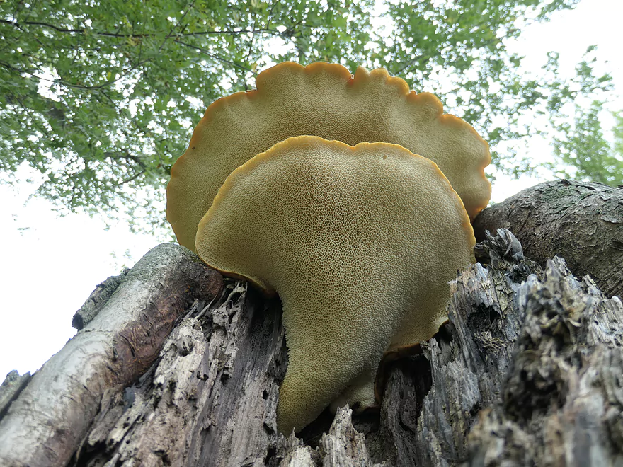
A polypore mushroom–they have pores instead of gills under their caps
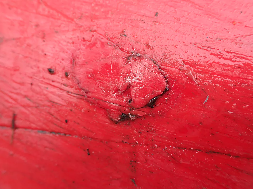
This little leak gave me a lot of grief during the trip
Checking out the Mid-Continent Railway Museum after our trip
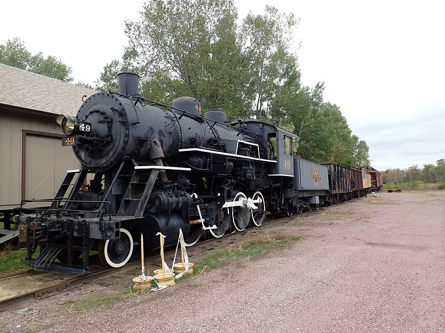
An old steam engine–very cool
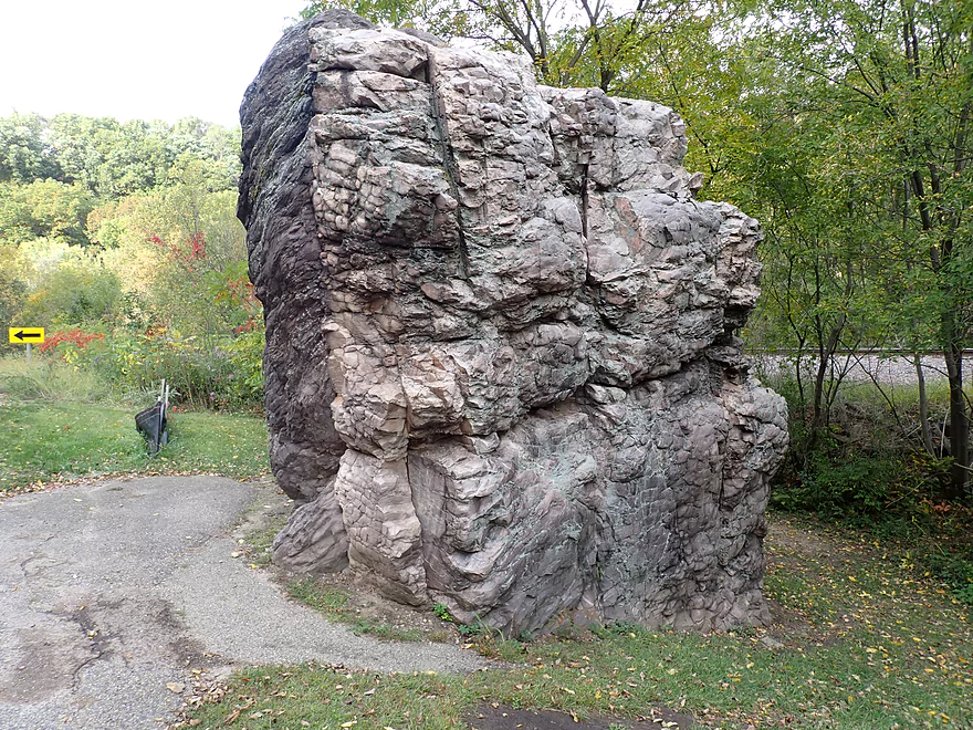
This is the famous Van Hise rock
…and the famous Rock Springs artesian well
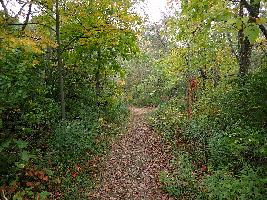
I highly recommend hiking the trails in Ableman’s Gorge
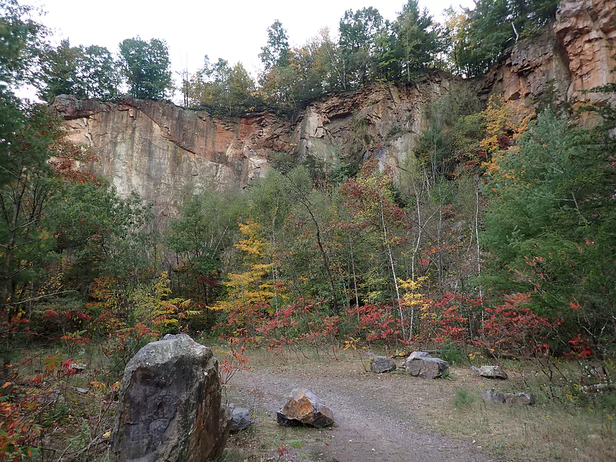
Site of an old quarry
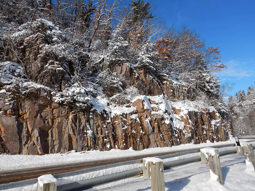
Some impressive cliffs
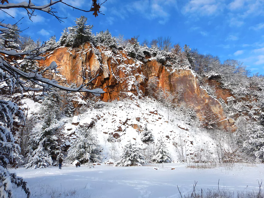
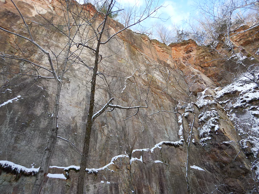
Which are even more scenic after a snowfall
Additional winter pictures of Ableman’s Gorge
Terrific area
Checking out nearby Wiedman Memorial Park
Narrows Creek cuts through a gorge here…future paddle
Baraboo River – Rock Springs

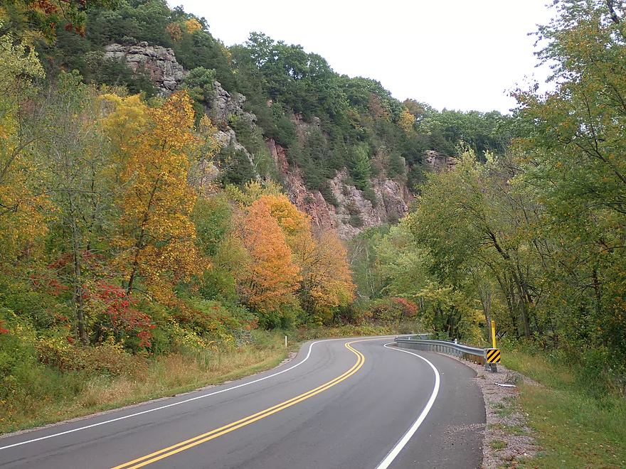
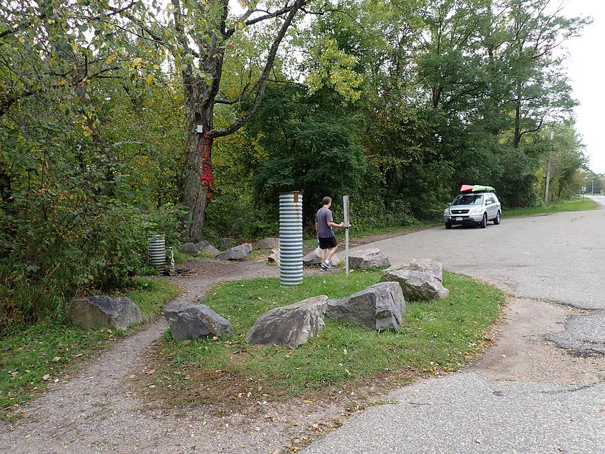
There are countless segments on the Baraboo River that are good for paddling…but perhaps the most scenic is from Rock Springs to North Freedom. Most who do this leg start from the official Rock Springs launch which is located just downstream from the town. This is actually a mistake as the preceding mile is the highlight of the trip. Not wanting to miss the famous gorge, we instead launched just upstream of Van Hise Rock. By the bridge there was a nice parking area and a trail that led to the water. The shoreline was a bit muddy, but we managed to launch ok.
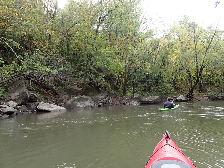
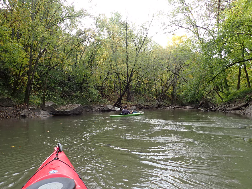
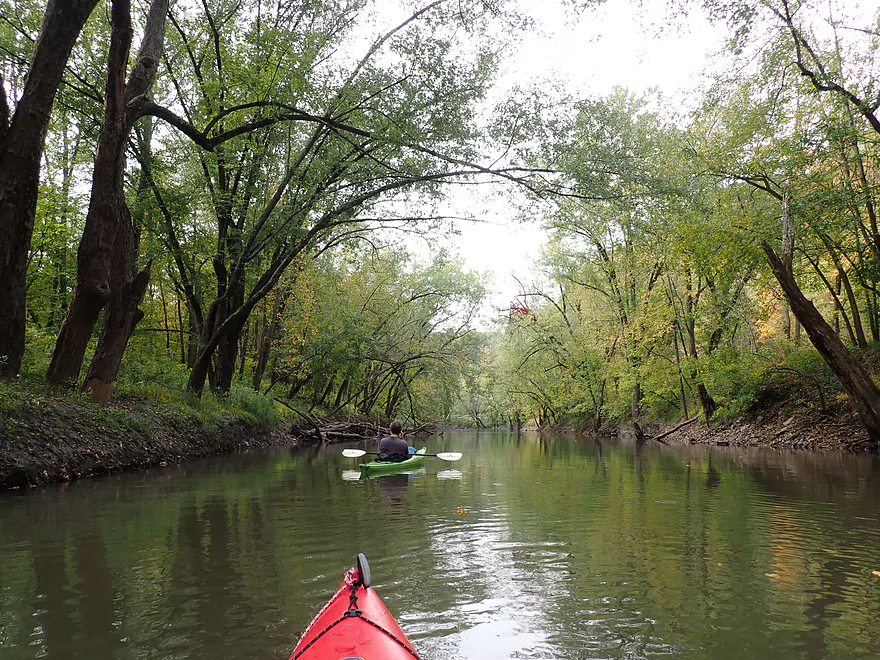
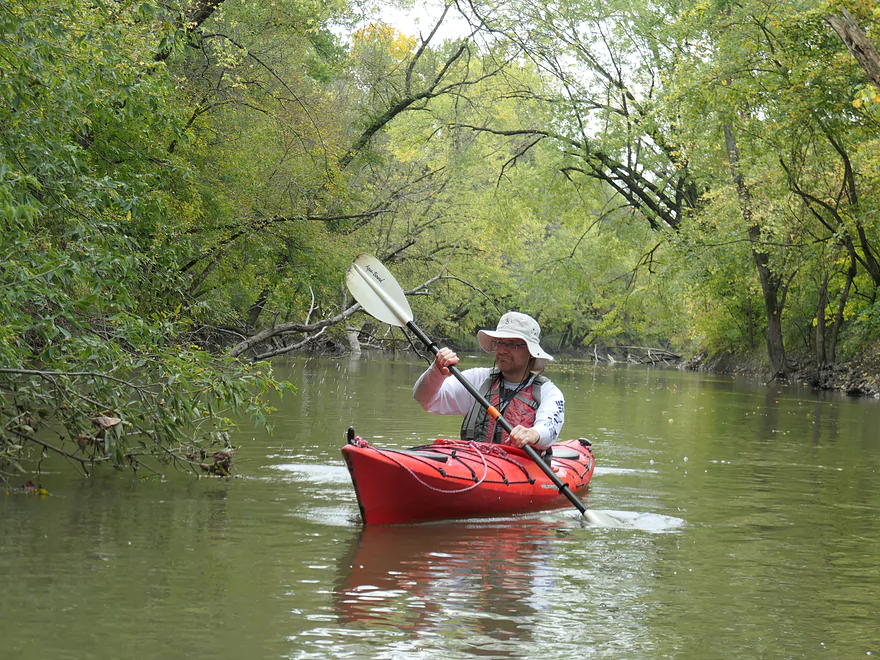
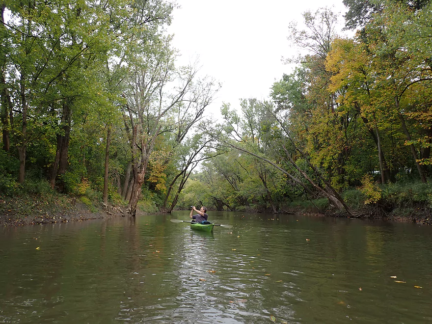
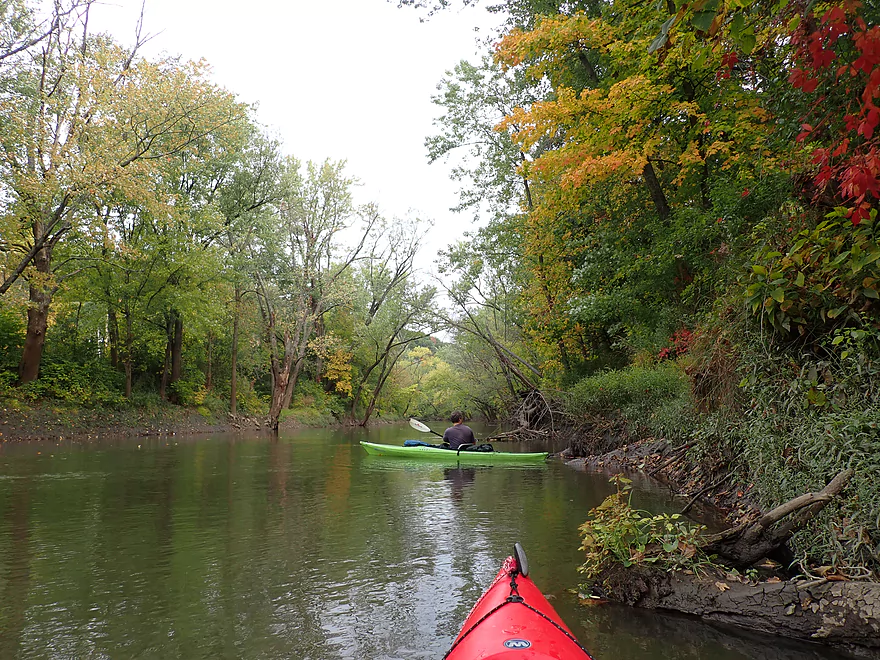
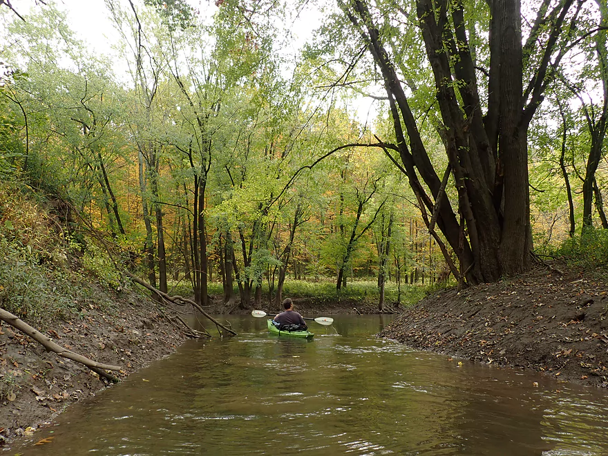
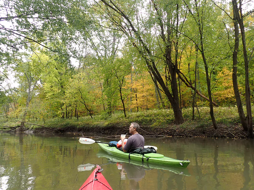
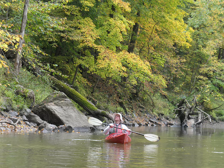
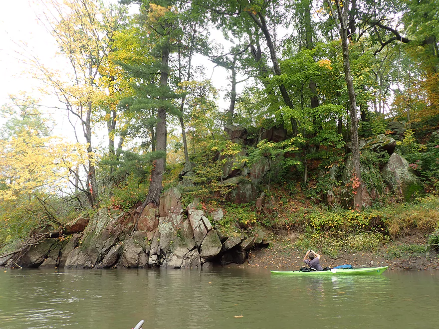
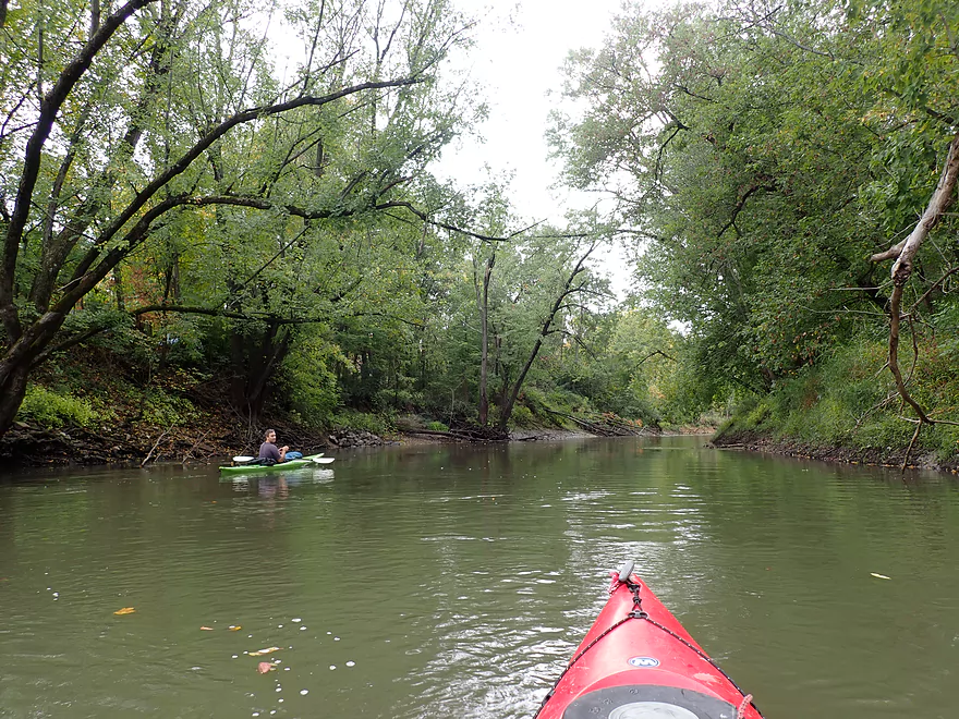
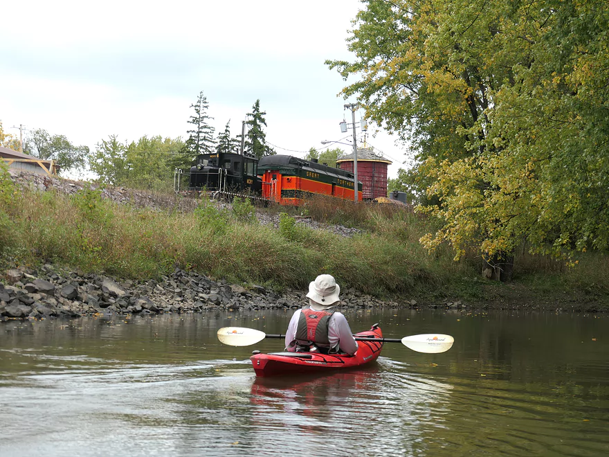
After we passed under the Hwy 136 bridge, we entered the heart of “Ableman’s Gorge”. Here the Baraboo river flows through a quartzite canyon. Mining has reduced its splendor, but the gorge is still a neat part of the river to paddle through. It starts with an outcrop just after the highway bridge. After that, the river turns sharply left and passes under a historic 1989 railroad bridge which is supported by attractive stone pillars. Sprinkled along the shoreline were large quartzite boulders that had tumbled down from the adjacent talus slopes…somewhat similar to Devil’s Lake. You can’t see the full extent of Ablemen’s Gorge from just the river, but we did see two additional outcrops that were very scenic. Paddlers should occasionally look behind them, as that sometimes offers the best vista of the gorge.
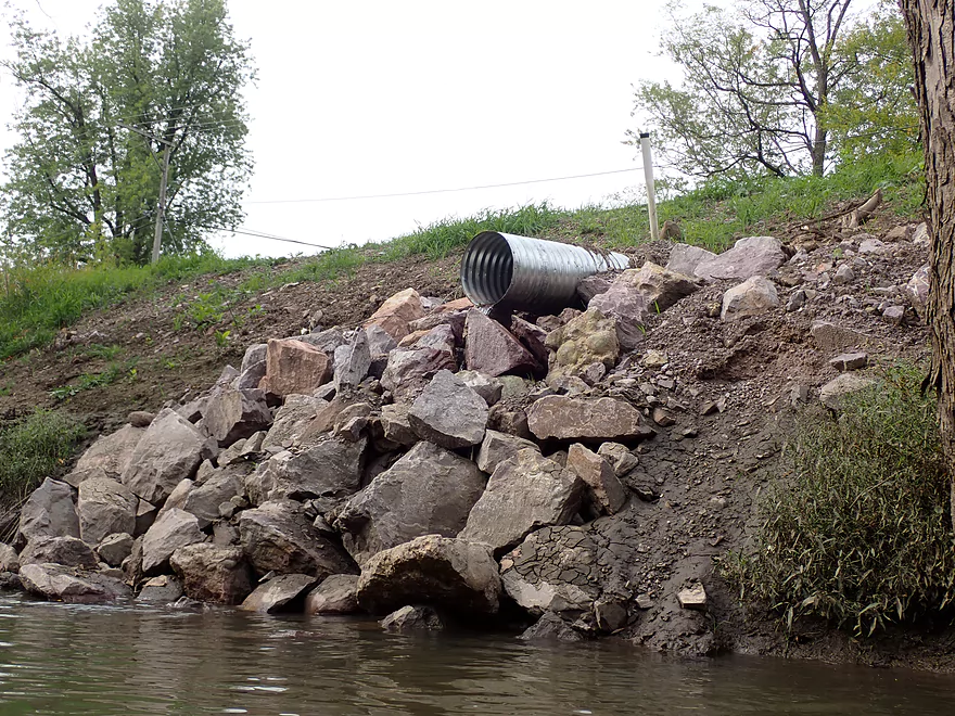
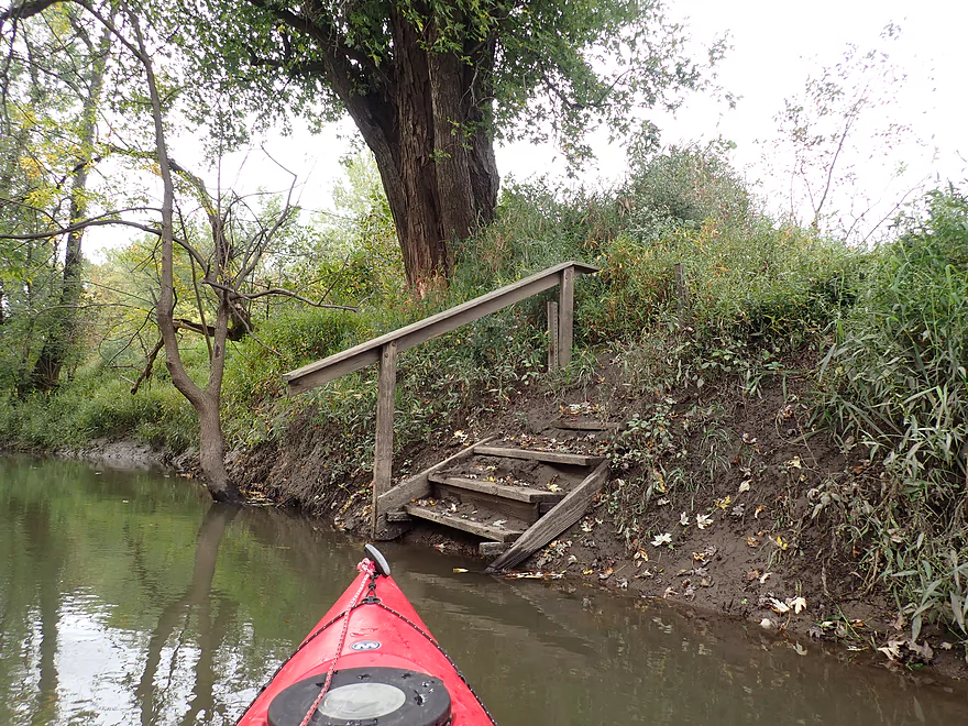
Past the artesian well, the gorge started to fade. Narrows Creek joined the Baraboo from the right and this was followed by the old canoe launch on the south side of town. I don’t think it’s used often…the access stairs are partly buried under mud.
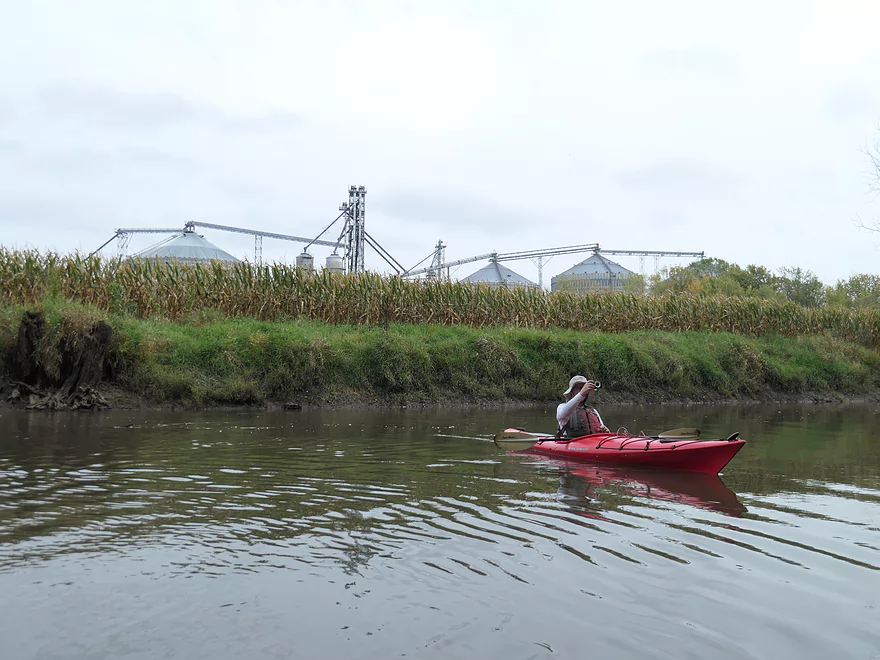
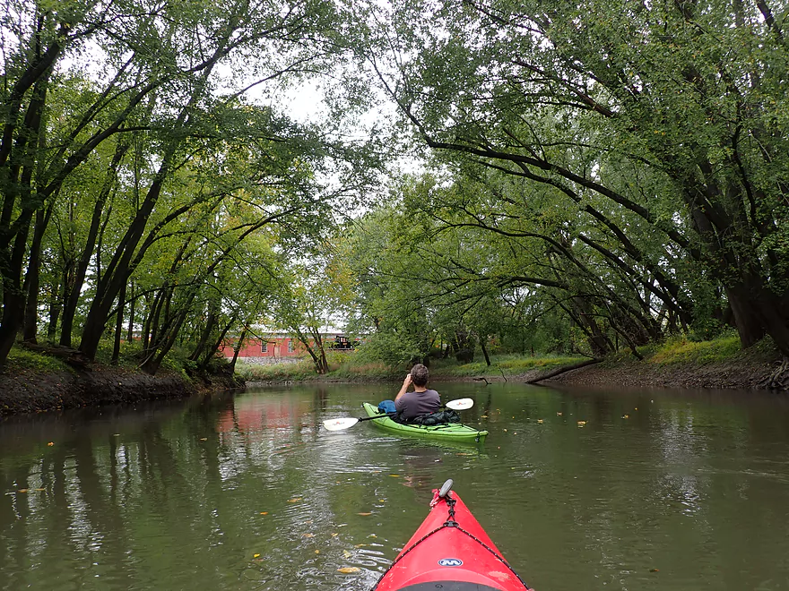
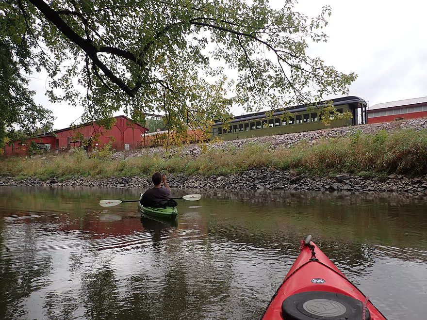
For much of the trip, a railroad paralleled the river. At one point in history, this was THE artery between Chicago and the Twin Cities, and saw a lot of traffic. After an alternate rail line was built north of the Wisconsin River, the “Baraboo Hills” line fell into disuse. Today it dead-ends in Reedsburg. The Rock Springs section does see occasional rail traffic including ore cars that ship quartzite out of the Pink Lady Quarry. There’s also a major grain depot south of town where grain cars load up. While you can only partly see this from the river, you can fully hear it as this depot is quite noisy.
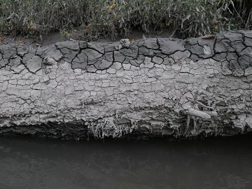
We soon came to a monster-sized logjam that looked ancient. It would be our only portage of the trip…which was ok, but a bit muddy. The Baraboo is one of if not the muddiest rivers in Wisconsin. Mud was everywhere, which was one of the few downsides to the trip.
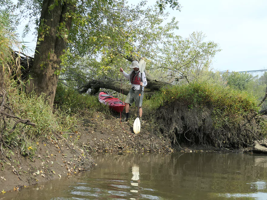
It was here I attempted to “fix” a leak in my boat. My previous patch job received damage from hitting rocks and had sprung a pinhole leak. My boat was taking in about a cup of water every 5 minutes. Thankfully I had my bone sponge with me, and I was able to drain the cockpit periodically. Given how the mud would stick to the paddles…I decided to apply it to my pinhole leak. This actually worked to a degree and helped make the remaining part of the trip more enjoyable.
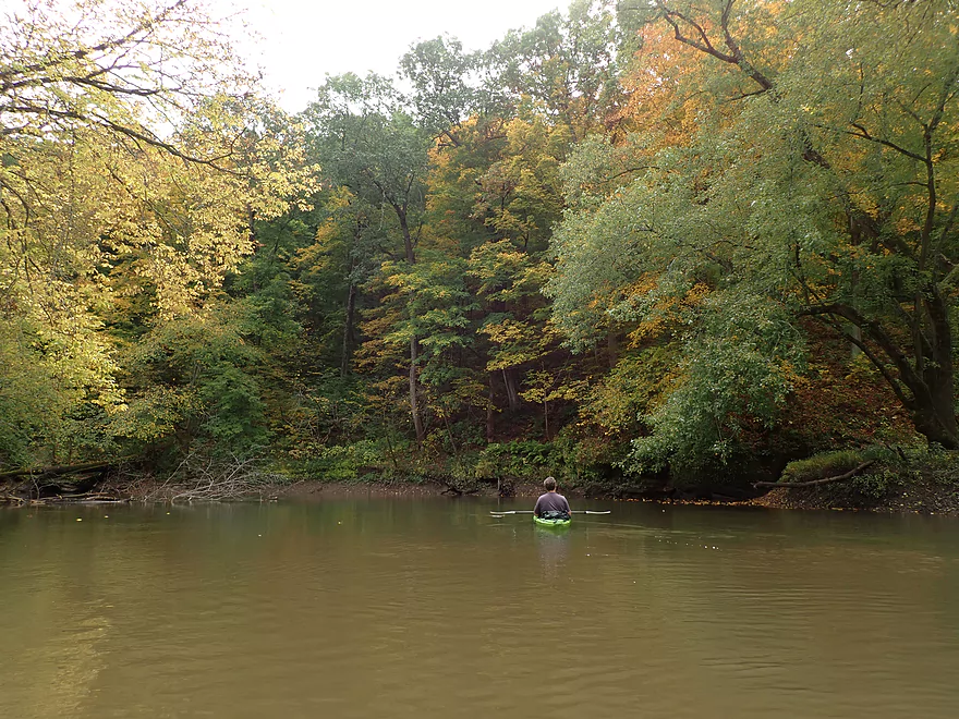
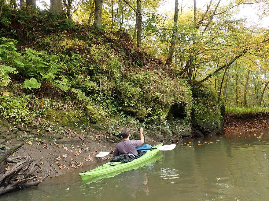
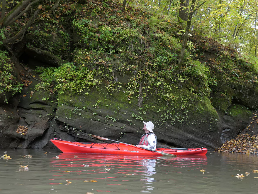
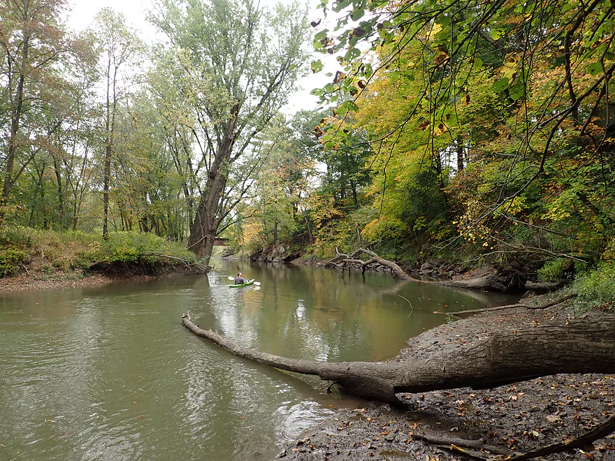
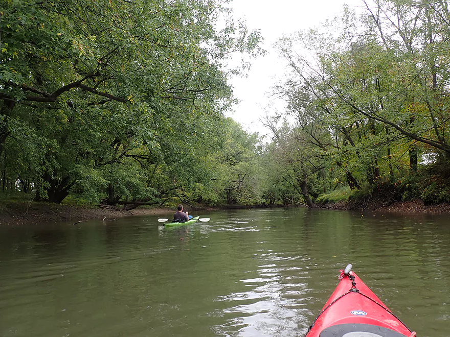
Shortly after the mega-logjam, we encountered our second gorge. Here the river is constricted by two steep hills which form an attractive ravine. This would be the second highlight of the trip and featured several scenic outcrops and boulders. This even more so than the first gorge reminded me of Devil’s Lake (a geological cousin located 8 miles to the east). Many of the rocks and talus slopes were hidden by leaves, so this might be a good paddle to do in March. There were a number of maples in the ravine which provided very good fall color.
Following one last outcrop and another historic railroad bridge, the river valley opened up into flatter terrain. The second half of the trip wasn’t nearly as interesting, but was still pleasant and attractively wooded.
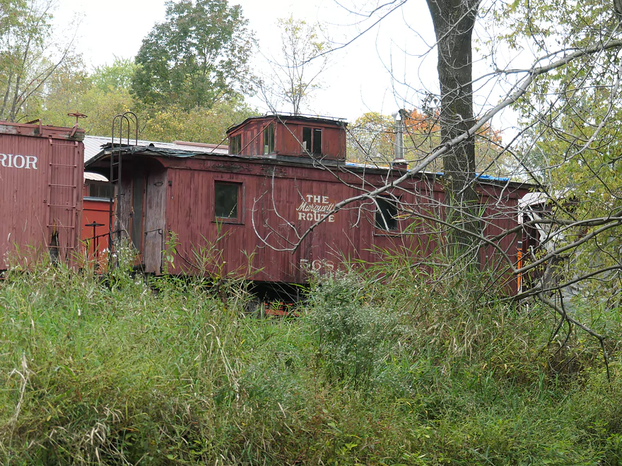
Close to North Freedom we could see historic rail cars and engines hiding above the banks. This was part of the Mid-Continent Railway Museum which is a popular tourist attraction.
The final stretch through North Freedom was a bit more hilly and scenic than the previous few miles. We took out at North Freedom Park which has a great public access. It’s unique feature is a handicap kayak launch which sits atop a large floating pier. Getting out is super easy…you just pull yourself forward with the handrails and your boat will slide along rollers and onto the dock. No need to get muddy or wet.
Hwy 136: Note, Hwy 136 crosses the river multiple times. The bridge where we put in is just upstream of Van Hise Rock. Here there is a convenient (and scenic) pull-off with parking lot that allows hikers to explore the local trails. A small dirt trail leads from the parking lot to the water. The only problem with this put-in option is that the banks are steep and muddy. Your best bet is to launch directly under the bridge itself. Hopefully in the future a proper kayak launch will be installed here.
Alternate Put-ins:
- Hwy 136 North Bridge (0.9 miles upstream of my put-in): This would be a viable bridge access and launching here would allow paddlers to explore a short but additional stretch of Ableman’s Gorge. There may be a logjam or two on this leg though.
- Firemen’s Park (1.3 miles downstream of my put-in): This is the official canoe launch of Rock Springs and is located just across from the gas station (CJ Rock-N-Stop). Note…the launch is in bad shape and mud has partly buried the main access ladder. It’s a doable access, but tricky with just a bit too much mud. Regardless, I can’t recommend this launch, as it would mean missing out on the previous mile and the gorge.
- Narrows Creek Launch (1 mile downstream of my put-in). This launch is actually on Narrows Creek here and is a decent access option (the Baraboo River is just downstream). Unfortunately there is a logjam where Narrows Creek meets the Baraboo (easy to scout). Also if you launch here, you miss out on the upstream gorge which is super cool.
North Freedom Canoe Launch: This is an excellent public launch and boat landing. A $3 fee is required to use the launch, but there are no entrance forms to fill out…so you’ll likely ok not paying. There is a floating dock with a kayak launch, which is super fun to use. Bathrooms and picnic tables are available behind the parking lot.
Alternate Take-outs:
- Kohlmeyer Road (4.3 miles downstream of my take-out): A doable but steep bridge access. This leg after North Freedom is more open, but pleasant with the highlight being a long outcrop.
Bike Shuttle: 4.8 miles with 75′ of ascent. Although I car shuttled, this wouldn’t have been a bad bike shuttle. You do want to shuttle north of the river as the south route has a 151′ high hill to deal with.
- Fences/Rapids: None.
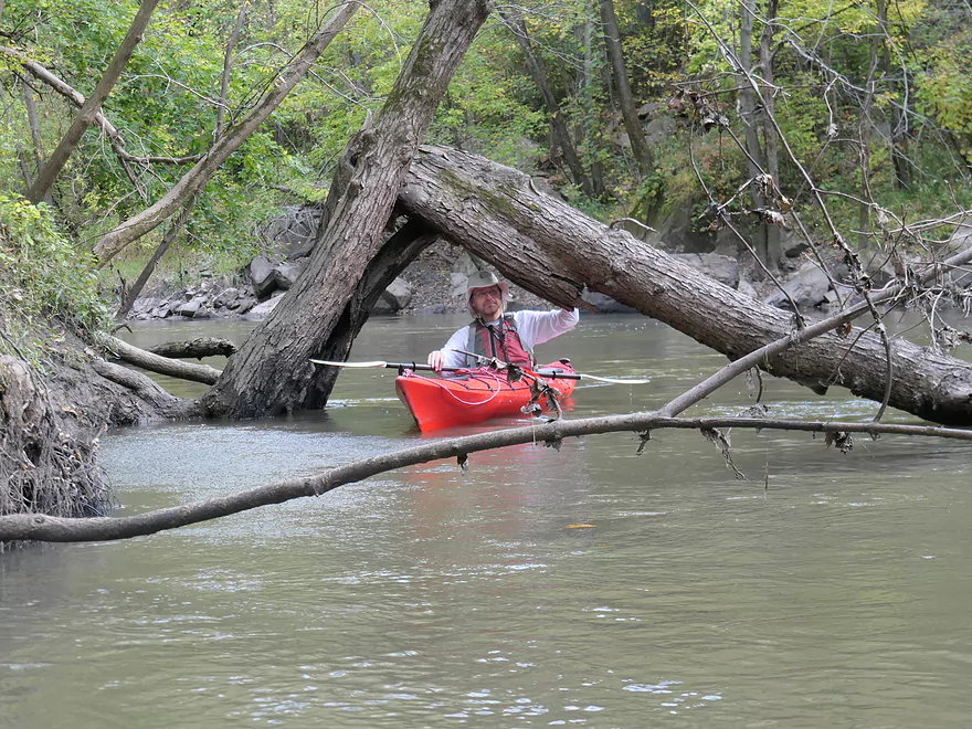
- Logjams: There are a handful of logjams, but most are relatively easy to sneak past. The only exception was a huge logjam about a mile downstream from Broadway Street. That had to be portaged, but aside from a bit of mud it wasn’t too difficult. A drainage ditch offered a convenient re-entry point. Note, this section of the Boo is somewhat volatile…I’ve seen wind storms create sudden logjams…and then a short time later a flood will bulldoze them clear. So even though my trip only had one portage, yours may have more.
- Strainers: There are a handful of branches to dodge. For the most part the current wasn’t too bad, but this leg can be pushy in high water. Kayakers who do this stretch should have some degree of boat control.
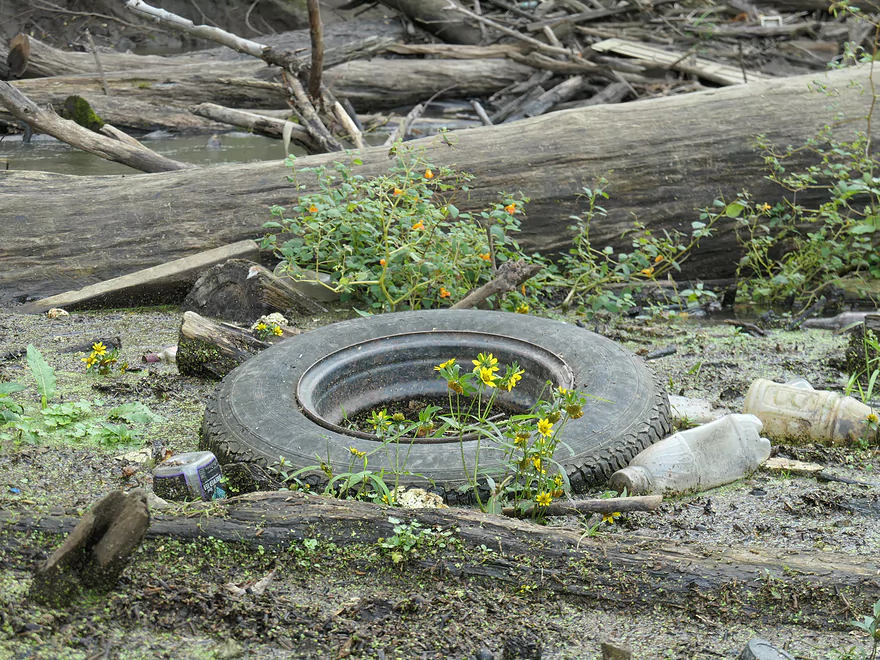
- Mud: It’s kind of everywhere…prepare to get a bit dirty. I advise wearing appropriate aquatic footwear that can get muddy in case you need to portage.
The Baraboo River actually has a number of gauges including one conveniently located at Rock Springs. According to this gauge I did the trip at 9.51′, which was above normal but plenty manageable. Because I lack historical information on the Rock Springs gauge, I made the following estimates based on the Reedsburg Gauge instead (trip done at 325 CFS).
- 0-150 CFS: Very low levels. River will be plenty manageable. These levels could reveal some logjams.
- 151-250 CFS: Average levels and a good target range.
- 251-350 CFS: Above normal levels, but manageable for kayakers with decent boat control
- 351-450 CFS: High levels with some pushy spots.
- 451-550 CFS: Very high levels…perhaps only for expert paddlers.
- 551+ CFS: The river at these high levels will likely be too muddy, too pushy and have too many tricky strainers for an enjoyable paddle.
- 2008: A devastating flood from the Baraboo River causes a lot of damage.
- 2014: A volunteer tragically slips and is run over by a moving train.
- 2015: The museum sadly auctions off some of its prized possessions including some trains. The official line was that this was needed to finance a new steam train, but I suspect there was more to this.
- 2018: Another major flood hits and destroys $250,000 worth of property. Thankfully because of advanced warning, many of the rail cars were moved to higher ground and were saved.
- 2020: The museum shut down for 2020 as a reaction to Covid-19. The hope is they will reopen on May 8th, 2021.
- Picture of the wall (already damaged by the quarry) before it was further lowered.
- Picture of a train backdropped by part of the original wall
- Picture looking upstream at part of the original gorge
- Picture showing how the gorge used to be part of a plateau. Also shows the damage (light colored rock) to the rock face created to make room for the railroad.
- Many additional original gorge pictures can been seen from the Reedsburg Public Library’s Flickr Collection:
Detailed Overview
- Nutmeg Road to Hwy PP: 6.2 miles. Flows by the historic Elroy-Sparta Trail and is mostly open, but there are a few logjams. This is a narrow small stretch that will need very high water to be runnable. There are scenic outcrops on this stretch….maybe 3.
- Hwy PP to 2nd Main Street: 1.6 miles. Maybe 3 logjams.
- 2nd Main Street to Franklin Street: 0.9 miles. Maybe 1-2 logjams. Trip starts at a scenic covered bridge and on Class 1 rapids.
- Franklin Street to Hwy 82(South of Lincoln Street): 0.5 miles. A good stretch that is mostly open and has maybe one outcrop.
- Hwy 82(South of Lincoln Street) to Schultz Park: 0.6 miles. Maybe 2 logjams.
- Schultz Park to Hwy 82(South of Snyder Road): 4.0 miles.
- Schultz Park to Hwy 82(North of Lumsden Road): 0.6 miles. One outcrop, one logjam portage and a few tight fits.
- Hwy 82(North of Lumsden Road) to Hwy 82(South of Snyder Road): 3.4 miles. Three outcrops, three significant logjams and several tight fits. A section with good potential but needs cleanup work.
- Hwy 82(South of Snyder Road) to Hwy W: 1.9 miles. Maybe 2-3 jams…think this is doable though.
- Hwy W to Hwy 82/Union Center: 1.3 miles. Good prospect by the golf course with maybe 2 outcrops. Maybe 1-2 logjams.
- Hwy 82 to Hwy FF Landing/Wonewoc: 7.1 miles. A great section with one of the largest rock outcrops on the river.
- Hwy FF Landing to Wayside Park: 2.9 miles. There used to be a lot of logjams here. I think it might be doable…maybe 2-3 major portages.
- Wayside Park to Kalepp Road: 4.5 miles. An uninteresting part of the river with weedy, muddy banks. But…there are three fantastic sandstone outcrops.
- Kalepp Road to N. Dutch Hollow Road: 5.3 miles. One logjam portage with several “hoppers” and “duckers”. There are some outcrops but most are recessed and away from the river. Mud and downed trees are a bit unsightly, otherwise a pleasant paddle.
- N. Dutch Hollow Road to La Valle: 3.8 miles. Second best section on the entire river with great rock outcrops.
- From La Valle to Lake Redstone: 3.6 miles. One of the more underrated sections of the Boo, which I really liked.
- Lake Redstone to Monument Park/Reedsburg: 9.0 miles. Supposedly kind of boring, but the logjams should be cleared out.
- Monument Park to South Park: 1.4 miles. Spanning the length of Reedsburg, this should be a nice section mostly free of jams.
- South Park to Golf Course Road: 4.7 miles. Maybe 4-5 logjams. Probably one too many. Should be 1-2 small sandstone outcrops. Golf Course Road might not be a good access.
- Golf Course Road to Hwy 136(by Beth Road): 3.6 miles. Maybe a few jams. Likely mostly floodplain paddling and probably uninteresting.
- Hwy 136(by Beth Road) to Hwy 136(by Ableman’s Gorge): 6.0 miles. Maybe some outcrops at the end, but mostly uninteresting paddling I suspect. Likely several serious logjams with difficult portages because of the high muddy banks.
- Hwy 136(by Ableman’s Gorge) to North Freedom Boat Launch: 8.2 miles.
- Hwy 136(by Ableman’s Gorge) to Rock Springs Boat Launch/Firemen’s Park: 1.3 miles. One of the most scenic parts of the entire Baraboo River. Highlights include a steep gorge, riverside boulders and scenic outcrops.
- Rock Springs Boat Launch to North Freedom Boat Launch: 7.1 miles. This is a nice paddle, but with some downed trees to dodge and one to portage. Highlights include historic railroad bridges, scenic outcrops, and seeing the railroad museum from the river.
- North Freedom Boat Launch to Giese Park: 7.4 miles.
- North Freedom Boat Launch to Kohlmeyer Road: 4.3 miles. Stretch starts nice as the river naturally curves and has many shade trees. There is a scenic long outcrop after Seeley Creek. River becomes boring after that except for a scenic railroad bridge and a few rocky banks. Kohlmeyer Road isn't a great bridge access.
- Kohlmeyer Road to Giese Park: 3.1 miles. Some longer and less interesting stretches. There is however a unique large volume artesian well, and a historic railroad tunnel you can wade under.
- Giese Park to Gander Outdoors: 2.9 miles. A pleasant but simple farm country paddle. Highlights include the Skillet Creek bridge, the towering Hwy 12 bridge, and a rock outcrop upstream of Hwy 12.
- Gander Outdoors to Glenville Landing: 4.9 miles. A fantastic stretch through the heart of Baraboo with many light rapids.
- Gander Outdoors to Haskins Park: 0.6 miles. A good stretch with some fantastic rapids upstream of Hwy 136.
- Haskins Park to Maxwell-Potter Conservancy: 3.3 miles. The best section on the entire river with many rapids.
- Maxwell-Potter Conservancy to Glenville Landing/Hwy 113: 1.1 miles. A pleasant stretch, but lacking in rapids.
- Glenville Landing to Luebke Landing: 5.1 miles. A pleasant trip, but a little boring at times. I would rate this as one of the more uninteresting sections of the Baraboo. On the plus side it had no logjams (as of 2023) and remains plenty navigable even during big droughts.
- Luebke Landing to Hwy 33: 3.5 miles. This might be one of the better legs on the Lower Baraboo.
- Hwy 33 to Wayside Park: 8.0 miles. A stretch I’m curious about.
- Wayside Park to Hwy U: 3.9 miles. Simple but pleasant short section flanked by busy interstates.
- From Hwy U to the mouth: 5.3 miles. The final leg running through floodplain forest.
Notable Baraboo River Tributaries:
- West Branch of the Baraboo River: For the most part, too many logjams, but the flowage by Hillsboro is navigable with scenic outcrops by the dam.
- Dutch Hollow Lake: A heavily developed lake and popular with locals. Not as great as Lake Redstone but still nice. Dutch Hollow Creek is likely too shallow to run, but it (and the bike trail) goes past a fantastic and huge exposed rock face.
- Hemlock Slough: A nice little lake paddle with many rock outcrops and attractive hemlocks.
- Little Baraboo River: For the most part too many logjams. However the small flowage by Cazenovia Memorial Park is navigable and there are small outcrops both below the dam and on the northwest corner of Lee Lake.
- Lake Redstone: Definitely a fun paddle with fantastic red rock formations, a swimming beach, and a spillway waterfall.
- Big Creek: You can’t get too far upstream because of logjams, but there is a nice outcrop by Hwy F and this can be combined with a trip on the north side of Lake Redstone.
- Narrows Creek: There is a neat section by Weidman Memorial Park with boulders and light rapids with I believe nearby outcrops downstream. Unfortunately there are likely too many logjams. I did partly paddle a nice downstream portion from the mouth on the Baraboo before I hit a logjam and turned back.
- Seeley Creek:
- Hwy PF to Seeley Lane Boat Landing: 3.6 miles. A mix of creek and flowage paddling. Ok…maybe 2 logjams.
- Seeley Lane Boat Landing to Freedom Road: 1.7 miles. Probably too many logjams on this section.
- Freedom Road to Mouth: Neat stretch of the creek, but some logjams.
- Skillet Creek:
- From Gasser Road to Pewit’s Nest: Gorgeous, but filled with logjams.
- Pewit’s Nest: Stunning scenery, but the ledges are likely too steep and narrow for kayaking. Best experienced as a hike.
- Pewit’s Nest to Hatchery Road: A bit of nice geology, but likely small with several logjams. Neither endpoint is a great access.
- Rowley Creek: A scenic creek, but shallow and with hostile locals.
- Leech Creek: From Hwy U to Tritz Road would be 2.5 miles. Likely open and an easy paddle, but uninteresting because of the artificial channelization.
- Long Lake: A very slow creek that empties into the Boo close to the Wisconsin. There could be serious logjams by the mouth, but the upper sections are plenty navigable and are paddled by locals.
Trip Map
Overview Map
Video
Photos Size:
There has been an update on the logjam situation on the Baraboo River:
“Starting last year and continuing this spring, the Friends of the Baraboo River hired Straight Up Logging to clear out jams in three sections of the river. Local canoe/kayak liveries had already cleared the stretches from Union Center to Wonewoc and from North Freedom to Baraboo in recent years. Last year and this, thanks to generous grants from Sauk County, the Friends of the Baraboo River was able to hire Straight Up Loggin’ to clear passages through more jams in stretches previously not cleared. The work started last fall between Rock Springs and North Freedom and between the Sauk County line by Wonewoc to La Valle and was finished up this spring. Straight Up is also clearing from La Valle to Reedsburg this month, opening up new paddling opportunities on the Baraboo River. ”
https://friendsoftheboo.org/logjamreport
Hi, has anybody done this trip recently? Wondering if there’s any log jams anymore. And I wish that the reviews had dates I had said this before and you said you may be able to rectify that lol.
Thanks for the heads up about the dates. There was a bug that in the templates that sometimes hid these. I think this should be fixed now. As for the status of Rock Springs to North Freedom…I’m not sure. I suspect there are 1 or 2 logjams that will have to be portaged.
We checked this sections suggested put ins above Abelman’s gorge at the Hwy 136 bridge and Fireman’s Park in Rock Springs on July 5th, 2025. Rock Springs river gauge height of 9.7 ft. Both put ins were clay banks about 4 or 5 ft high at a 45 degree angle and slick. Water depth below the bank over 3 ft deep. It is not physically feasible to launch from those locations. One would slip down the bank into the river and lose your boat. There is boulder rip rap below the Hwy 136 bridge and you would injure your ankles trying to carry boats across it. The gorge is beautiful but you can see much of it from the road.
The “Boo” is really high now and this likely makes the Rock Springs access points much more difficult to use which is a shame.
Thank you about the Rock Springs information.I thought it was entertaining,funny and beautiful. It is more than i expected.Much detail.Thank you.I will keep watching.Please have a great day.