
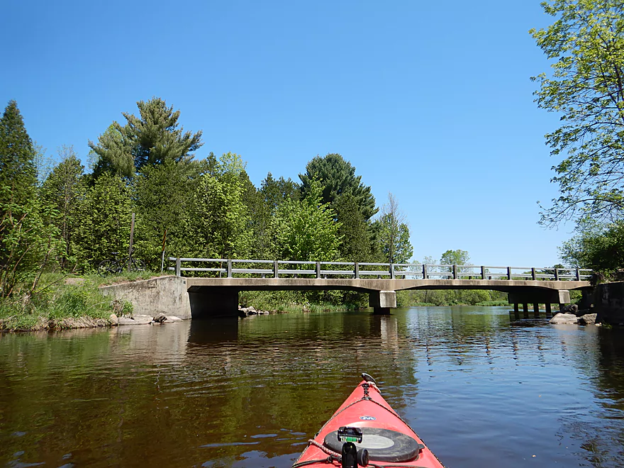
Putting in at Pinery Road
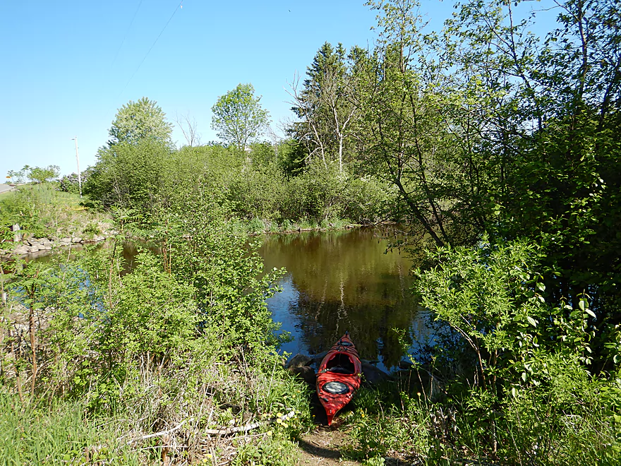
Nice launch area…poison ivy is all gone
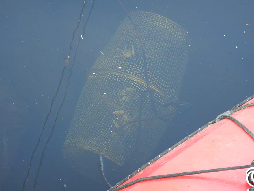
A trap bustling with live crayfish
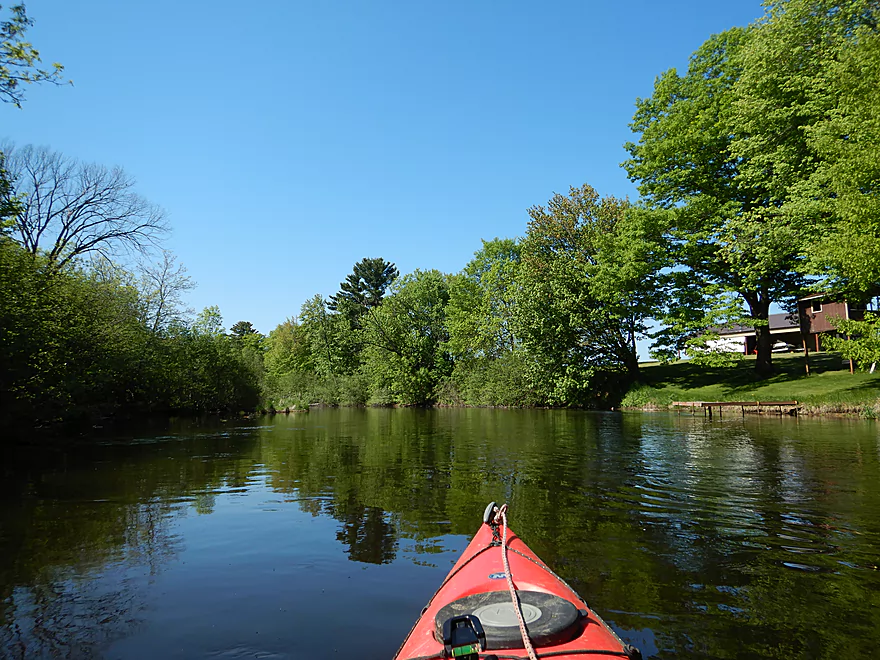
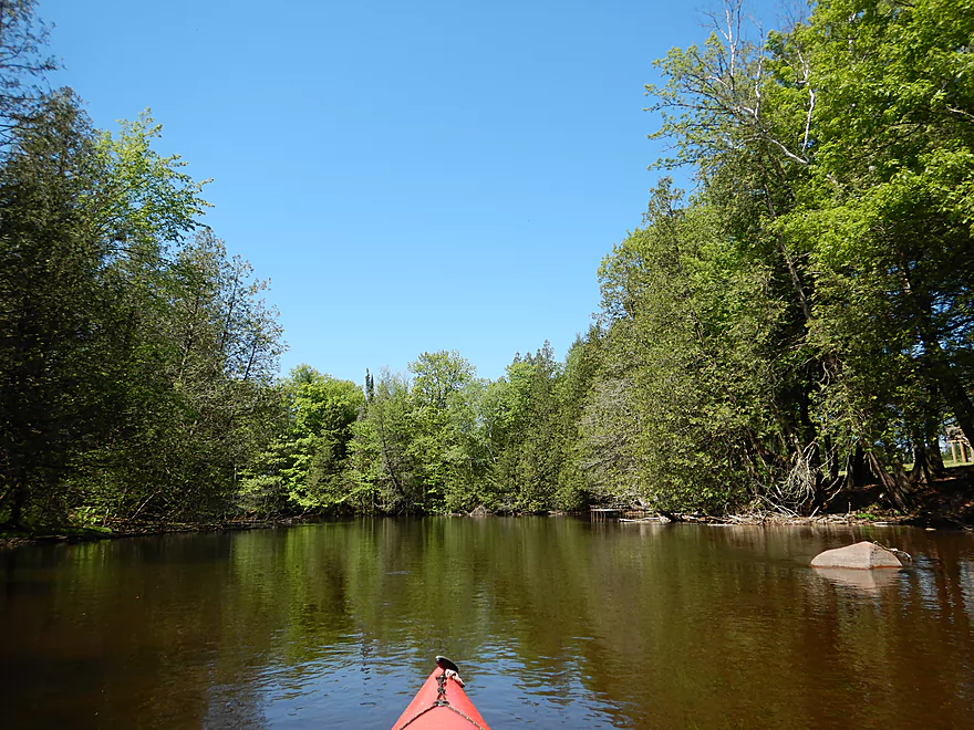
Nice serene stretch
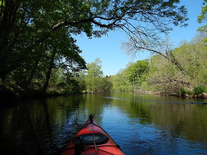

There were countless white snail shells
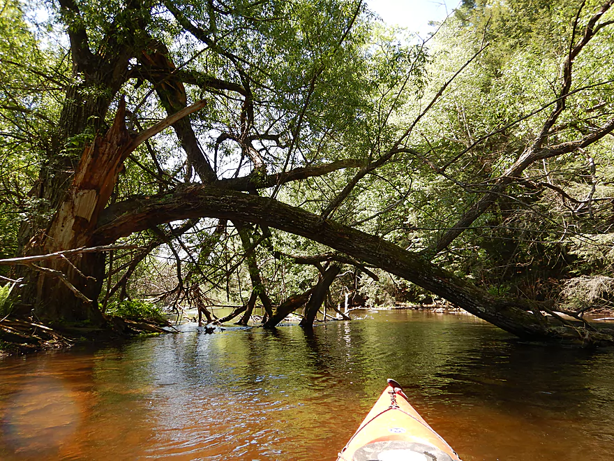
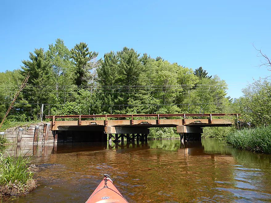
One of several low farm bridges
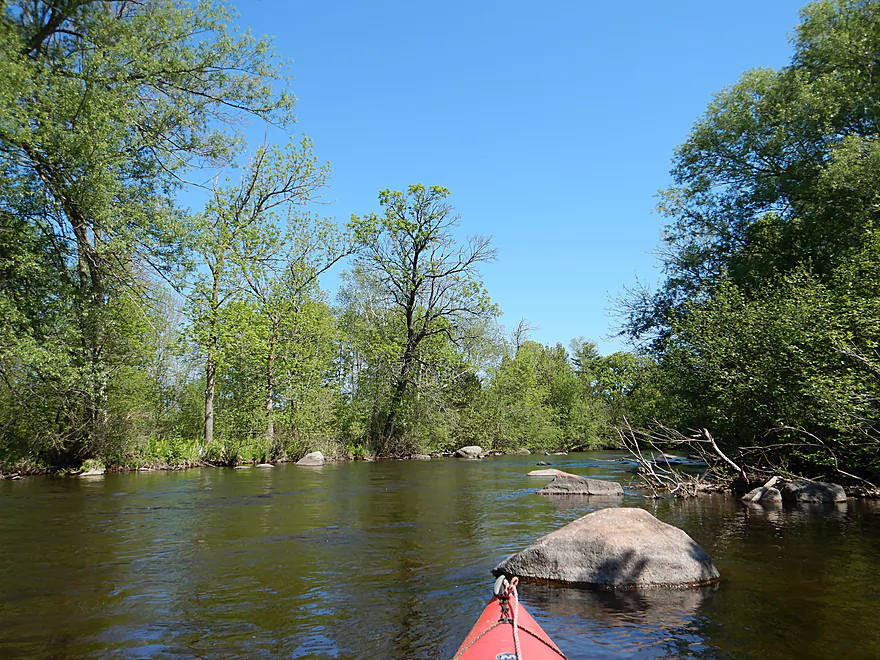
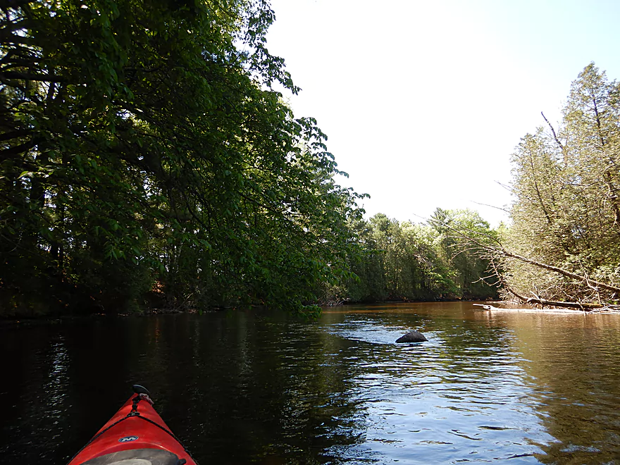
Coming up on a boulder garden
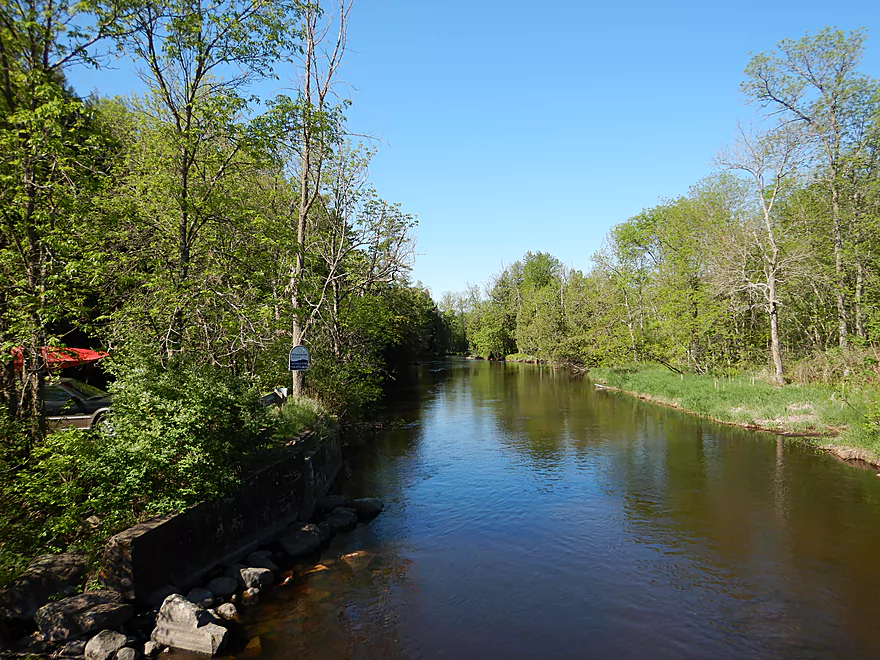
Reverse view
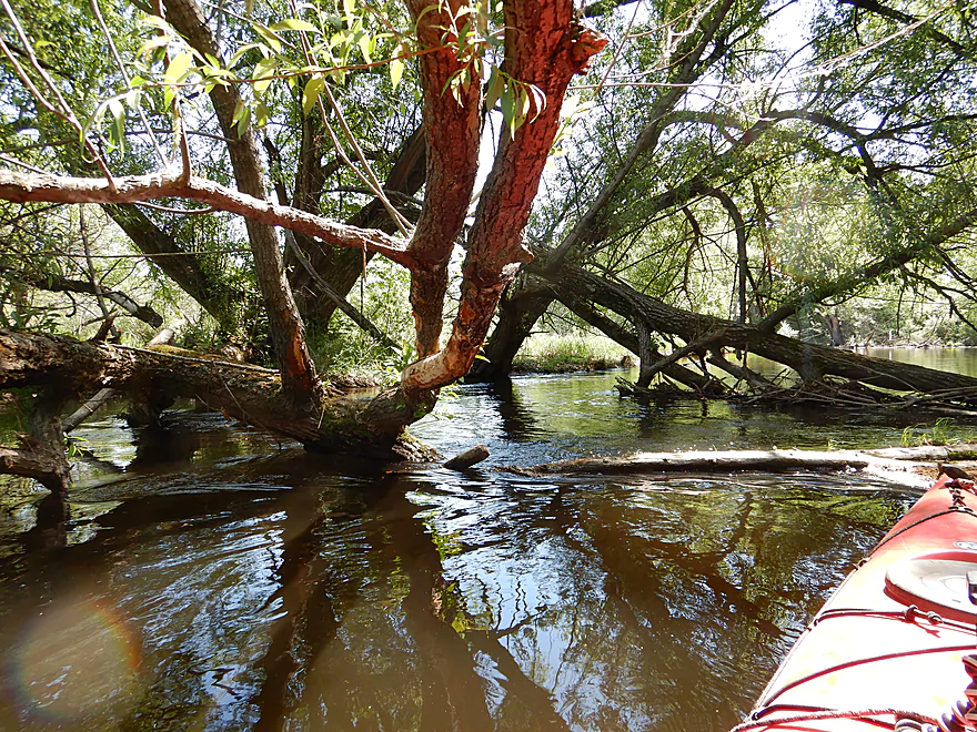
Only logjam…I was able to hop over
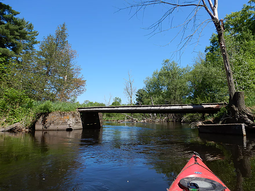
Another farm bridge
Some tidy banks
This section had some deadfall…but was tolerable
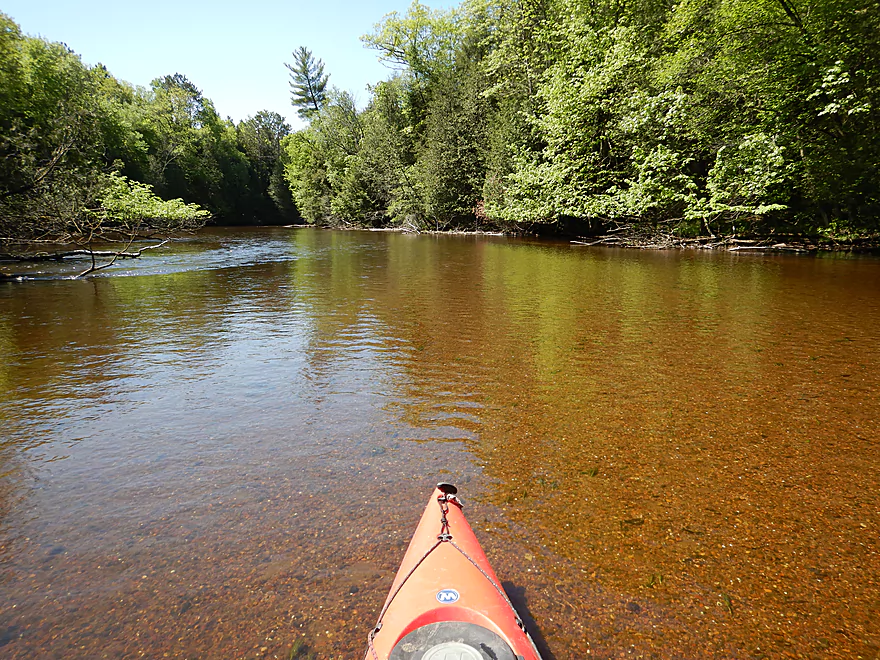
Great water clarity
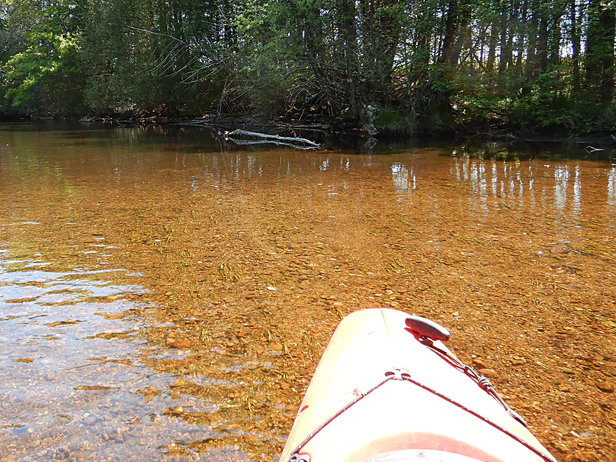
Attractive pebble substrate
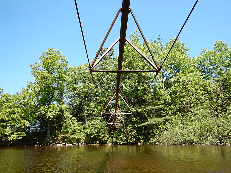
A surprise pivot pipe on the Plover
Hwy J is an access option
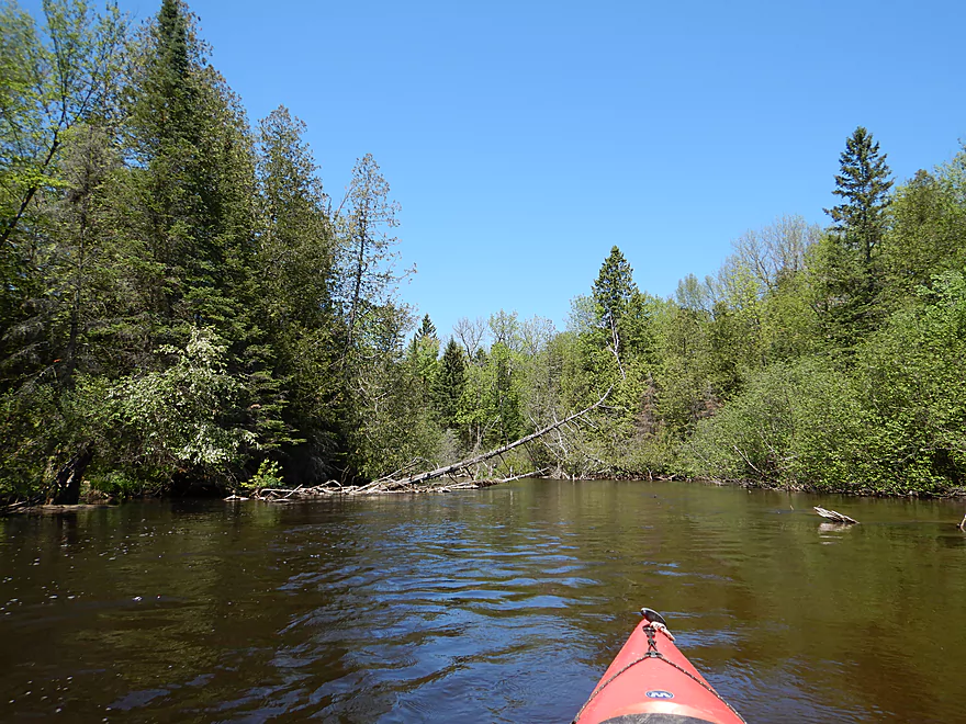
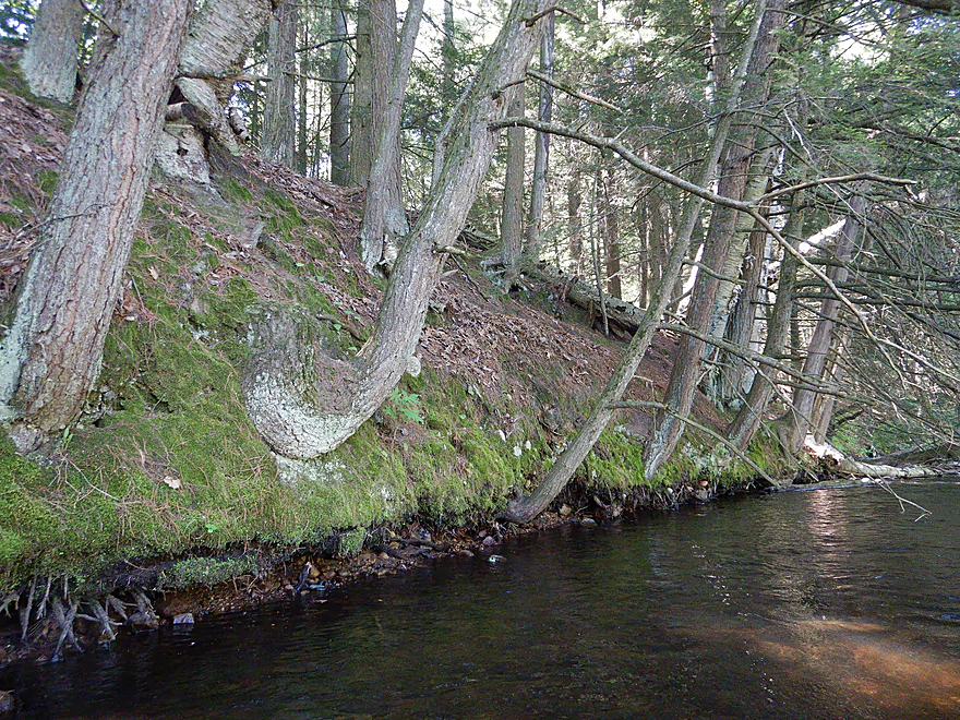
Many more conifers in this section
Feels like up north
Also reminded me of upstream segments of the Plover
The riffles were pretty tame
Shantytown Drive
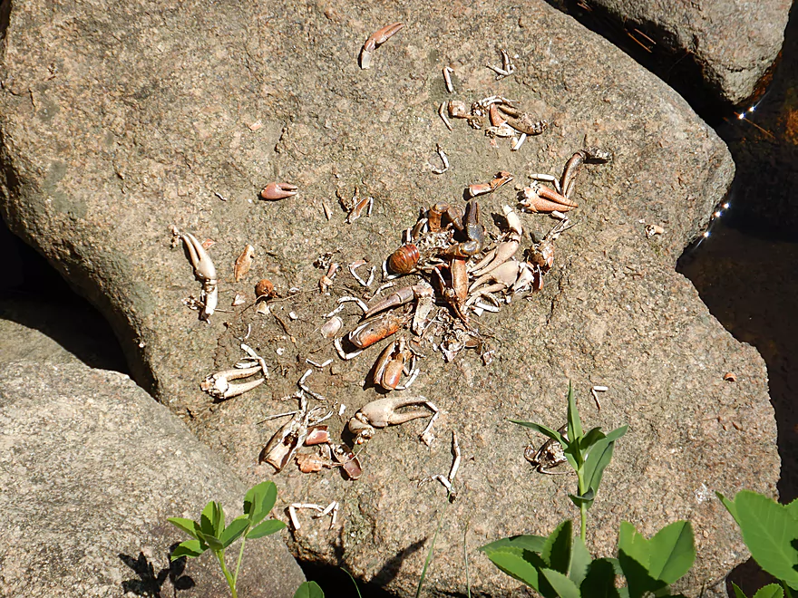
Where some animal had quite the feast
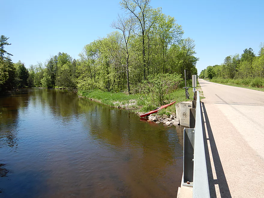
Decent take-out
There is actually a proper landing on the left
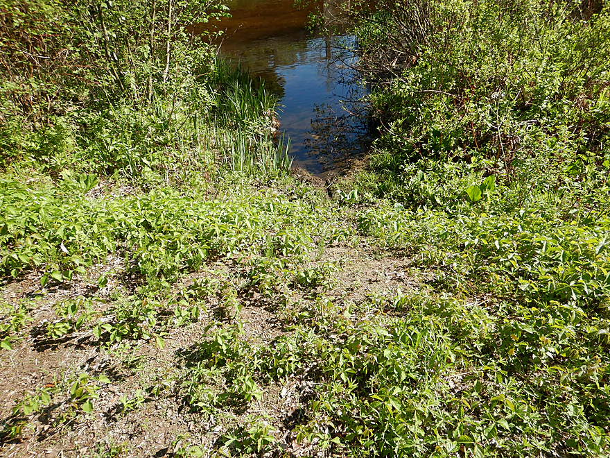
But that has too much poison ivy
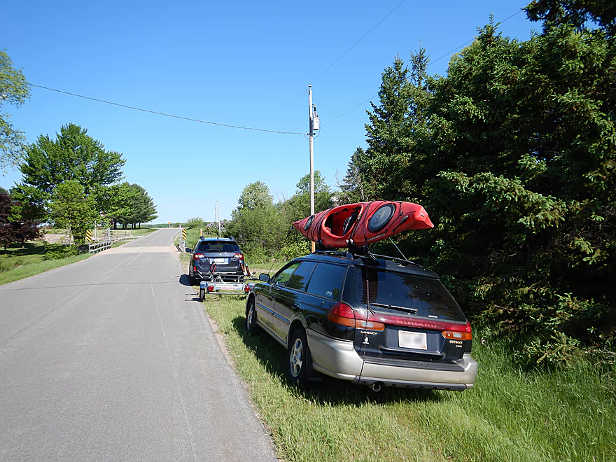
Plover River – Pinery Road


The trip started at Pinery Road. This was familiar territory as it was my take-out from a 2016 trip. How things have changed… Two years ago hardly anybody used this landing and it was infested with poison ivy. Since then the landowner had cleared out the ivy and there was evidence this is now a popular access with paddlers (I was the fourth car to use it just that day).
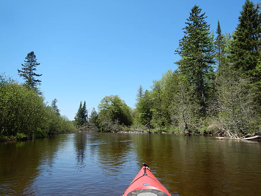
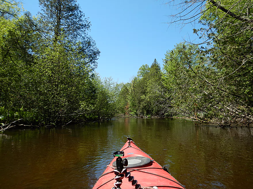
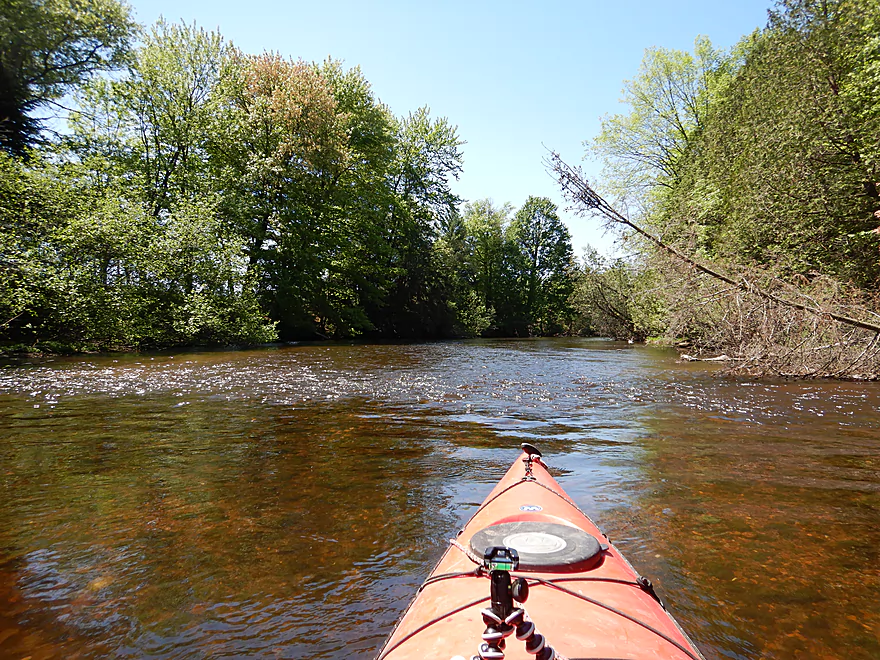
The first ‘half’ of the trip spanned from Pinery Road to Hwy J, and honestly started on a weak note (as in two stars). The channel was just very broad and simplistic, while generic hardwoods populated the banks. But the trip would become much better and more varied. Some of the highlights included the clear water, the lack of mud, a nice gravel substrate, and a massive field of white glittering snail shells. Zipping over these little white shells in the clear water was somewhat analogous to the starscape screensaver or the Enterprise zipping through space.
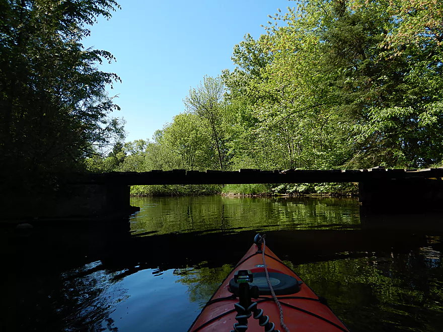
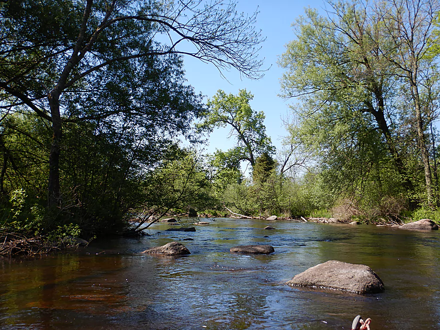
While the entire trip was almost entirely undeveloped, there was a short stretch by a farm which featured several low bridges. Soon after was one of the trip highlights in a small but nice granite boulder garden. While not in the same league as upstream boulder gardens, it was still cool and fun to paddle through. This was followed by some minor deadfall and one noteworthy logjam that I was able to hop over. The major deadfall had been cleaned out by a local I talked to two years ago, and that was very much appreciated.
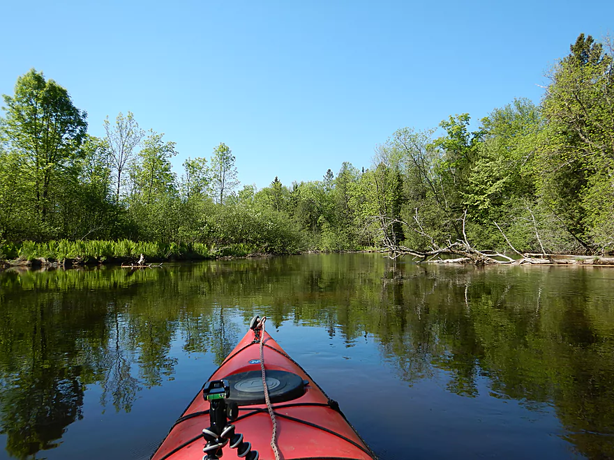
From here, the river actually became much more interesting. The channel narrowed, the bends became tighter, and conifers replaced the hardwoods. I’m not an expert on conifers, but I believe saw hemlocks, firs, cedars, and white pines… a combination you rarely see on southern Wisconsin rivers and was very scenic. Along the banks I would see occasional alders, ferns, and skunk cabbage. It reminded me somewhat of my upstream Plover trip at Esker which was one of my all-time favorite trips.
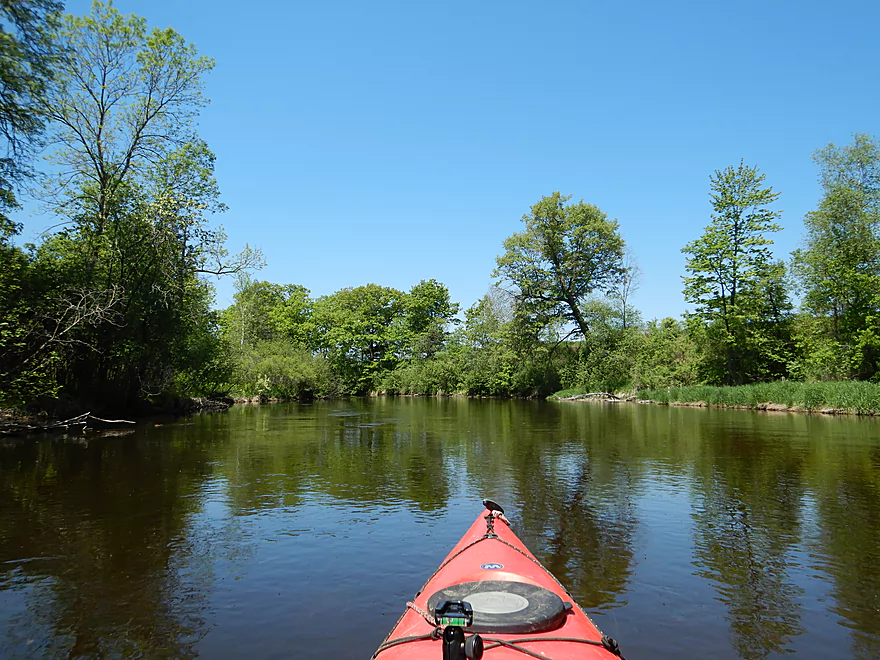
Following an oddly placed pivot pipe suspended over the river, I came across Hwy J which was the “halfway” point in the trip. Paddlers could certainly take out here if they wished. From here to the next bridge at Shantytown Drive (my take-out) was 2.2 miles. No jaw-dropping scenery here or anything special, but it was pleasant with more pines, firs, hemlocks and little development.
In summary this was a trip that started weak and uninteresting, but definitely got much better later on and felt like an up-north paddle. Is there anything special about this stretch? No…not really, but if you are a local or Plover fan looking for a new adventure you will enjoy it. Plover newbies will actually want to start on one of the more more interesting upstream sections instead, such as Esker Road to Kristof Road.
The put-in at Pinery Road was very good.
An alternate upstream put-in would be Bevent Drive. While this is a good access option (the shoulder east of the bridge), the additional 2.3 miles aren’t anything extraordinary.
The take-out at Shantytown Drive appears to be a public canoe access area and was nice. But it has some poison ivy issues…so what I (and most paddlers do) is to launch west of the bridge (across from the landing) which was easy to do.
An alternate upstream take-out would be Hwy J. This would shorten the trip by two miles, but omit a pleasant stretch.
An alternate downstream take-out would be Bentley Road. That would add 6.5 miles to the trip and likely also be nice, but it would contain a lot of flowage paddling (and one dam portage). Bentley Road is popular and good access option.
There is a kayak rental and livery in Stevens Point in Nature Treks (715-254-0247), but I don’t know if they would come this far north.
The bike shuttle was pretty easy…only 4.2 miles, paved, little traffic and no notable hills.
For the most part this was a safe, easy stretch suitable for longer kayaks, canoes and beginners. There was only one logjam, which I was able to hop over. If you prefer, it would be an easy portage.
The current, while never super fast, seemed surprisingly brisk. I counted no rapids and maybe two riffles. There were a few instances in which swift moving water flowed by strainers, but if you are paying attention these shouldn’t be an issue.
There were three somewhat low farm bridges. I was able to get under all with no problem, but in higher water or for those in higher floating boats, these may require portages.
The Plover River doesn’t have a gauge, but the Eau Claire River does and that should be a decent analogue.
- 0-100 CFS: These would be low levels, but really I think this segment would always be navigable.
- 101-125 CFS: A good target depth for water clarity.
- 126-150 CFS: A bit above normal but still a decent depth. My trip was done at 130 CFS and the channel averaged 1-2 feet with only two really minor shallow spots.
- 151-175 CFS: Ok depth but not as scenic.
- 176-210 CFS: Getting on the high side and some of the strainers and bridges may become annoying but should be doable.
- 211-250 CFS: Pretty high and might be close to bursting the banks. Would not be as scenic and the strainers/bridges would likely be too annoying.
- 251+ CFS: Maybe flood conditions (don’t know for certain though).
Some of the highlights included an eagle, many deer, 4-5 decent sized fish, many mosquitoes (and dragonflies hunting them), a great blue heron and several clams. At the put-in somebody had a crayfish trap that was swarming with live crayfish. In contrast at the take-out there was a pile of crayfish skeletons where something (likely a raccoon) had a big feast. The highlight of the trip were these vast fields of white snail shells which were a unique sight.
Detailed Overview
- Legion Memory Park to Konkol Road: (1.8 miles) Scenic, narrow, shallow creek with perhaps a few logjams.
- Konkol Road to Townline Road: (1.3 miles) Probably a mediocre but doable prospect.
- Townline Road to Bridge Road: (1.4 miles) A creek prospect that should have scenic woods and a few boulder gardens. Townline Road should be ok for access.
- Bridge Road to Esker Road: (0.7 miles) Narrow, wooded and rocky, this is a good prospect. Probably some rapids and a few logjams. Should be ok put-in access.
- Esker Road to Hwy 153: (6.4 miles) A fantastic trip reviewed in Oct 2016.
- Esker Road to Plover Road: (1.5 miles) Pleasant section with a nice boulder garden.
- Plover River Road to Kristof Road: (2.7 miles) Best section on the entire river. Very scenic, with 3 Class 2s and many boulder gardens.
- Kristof Road to Hwy 153: (2.3 miles) Good section with no noteworthy rapids, but pleasant and scenic.
- Hwy 153 to Pinery Road: (5.0 miles) A great trip reviewed in June 2016.
- Hwy 153 to Bevent Drive: (2.7 miles) Five star segment and 2nd best leg on the entire river. Scenic with several small rapids.
- Bevent Drive to Pinery Road: (2.3 miles) Pleasant section but not as scenic as upstream parts.
- Pinery Road to Shantytown Drive: (4.9 miles) A medium trip reviewed May 2018.
- Pinery Road to Hwy J: (2.8 miles) Starts wide and uninteresting but gets better with narrow corridors of firs, white cedars and white pines. Section includes a small boulder garden and several low farm bridges.
- Hwy J to Shantytown Drive: (2.2 miles) A peaceful section with many conifers relatively undeveloped banks and good current.
- Shantytown Drive to Hwy Y: (5.2 miles) The river slows and widens here, with maybe a third of the trip being a flowage/marsh (looks pleasant). Shantytown Drive is a good launch option.
- Hwy Y to Bentley Road: (1.3 miles) A tweener section between the flowage and river that includes a dam portage. Hwy Y is a poor launch option with difficult parking.
- Bentley Road to Hwy K: (3.4 miles) The river narrows here and this is a popular section. Good shoulder parking at Bentley Road (lot of cars park here).
- Hwy K to Jordan County Park: (5.3 miles) Ok prospect reviewed Jul 2017.
- Hwy K to Sharonwood Lane: (4.7 miles) A less traveled, narrow, wooded section on the upper part and an open grassland paddle in the second part where the old flowage was. Be careful about running the old dam remnants. There are nice boulder gardens above and below Sharonwood Lane. Hwy K is an ok launch, but has very poor parking (most cars were literally parking more on the road than on the shoulder).
- Sharonwood Lane to Jordan County Park: (1.0 miles) Gorgeous boulder garden below Sharonwood and perhaps an abandoned whitewater slalom course. Most of this is lake paddling though Jordan Pond. Sharonwood Lane is small but ok for access.
- Jordan County Park to Jordan Dam/Jordan Park: (0.5 miles) Paddle west of the lake, then portage under the Hwy 66 tunnel. You then have to drag your boat 600+ feet to get past the pipeline and into the water. Not recommended.
- Jordan Park to Iverson Park: (8.0 miles) A good prospect previously reviewed July 2014.
- Iverson Park to Lower Whiting Park: (2.5 miles) Mostly open flowage paddling that is probably uninteresting.
- Lower Whiting Park to the Wisconsin River: (1.2 miles) Mostly big flowages. Probably not a good prospect.
Trip Map
Overview Map
Video
Photos Size:
Hi! Thank you for sharing this information! We did this stretch in a 13 foot canoe. The water was low so we had to portage around the major log jam, however, it was through a patch of stinging nettle! (Wear jeans, maybe?) We rinsed our legs in the water and it stopped itching after a while. The bridges and some sort of pipe were deceptively low and the water was very low so make sure you are nimble enough to lay down quickly and get back up to keep paddling. It was beautiful and fun, but would have been much easier in a single kayak. We saw bald eagles, herons, Kingfishers making vertical dives, ducks, clams, and a few tires in the water. We checked the weather before we left (around 10:30am) and it wasn’t supposed to storm until 3pm. It stormed a half hour in so we pulled ashore by some cedar. That made for a much more exciting trip than I anticipated! I guess you never know what to expect. Lol!
It’s too bad to hear about that logjam. In late summer doing portages can be difficult because the banks can be so overgrown. Sometimes it helps to whack a path clear with your paddle. Hopefully somebody will clear out that jam in the future.
As for the rain, that can actually make a trip interesting. I’ve paddled in the rain and it is actually cool seeing and hearing the droplets fall around you.
Good idea about the paddle! It was thundering so we paddled in the rain for a bit, but thought it best to get out of the metal canoe with possible lightening.
Hi. We are new and have very basic kayaks. From Menards, 10′ Viper. We are looking for some new places to kayak in Central Wisconsin and have been reading your site. Read your review of the Plover River at Esker and it sounds great. But a little worried about the class 2 rapids with our kayaks. Wise or unwise to try? Thanks!
I suggest getting familiar with Class 1 rapids before attempting Class 2. Some ideas you may enjoy within a reasonable driving radius would include the lower Eau Claire, Crystal River, Waupaca River, Tomorrow River, Mecan River, Upper Dells and the lower Little Wolf (all reviewed on this site). With the Upper Plover, because water levels are so low, the rapids may be Class 1 and not Class 2…so they may be fine. But you may have to walk your boat in a few shallow areas.