
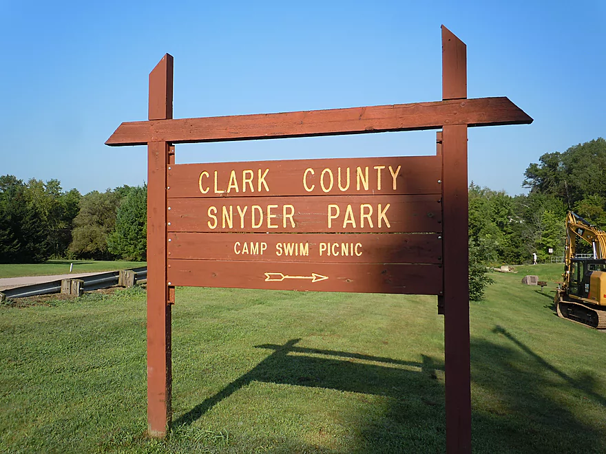
Starting the trip at Snyder Park
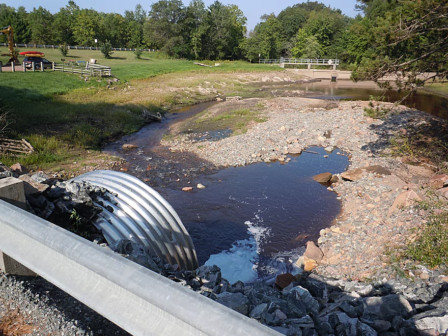
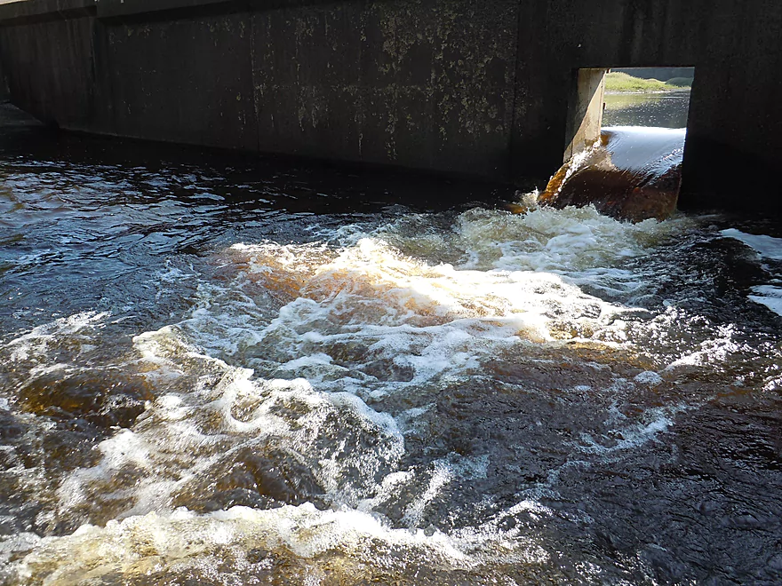
Snyder Lake has been temporarily drained…
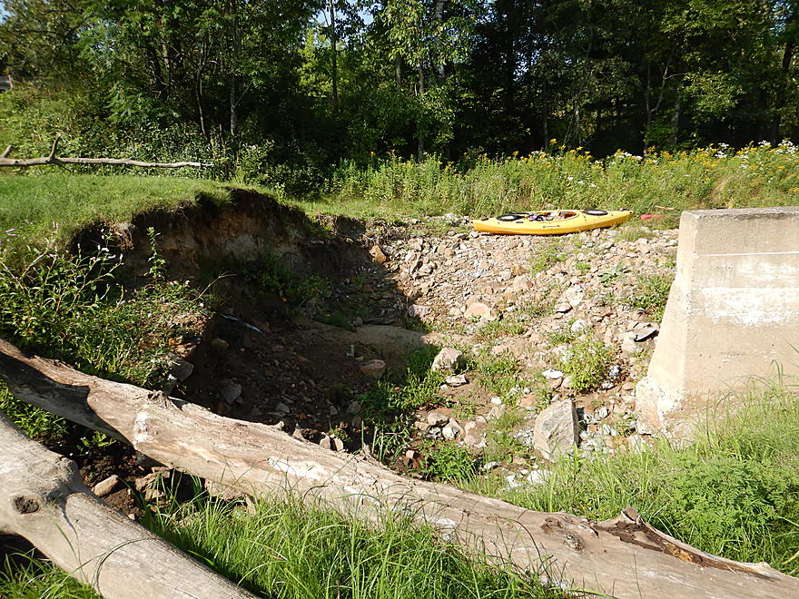
Because of 2016 flood damage
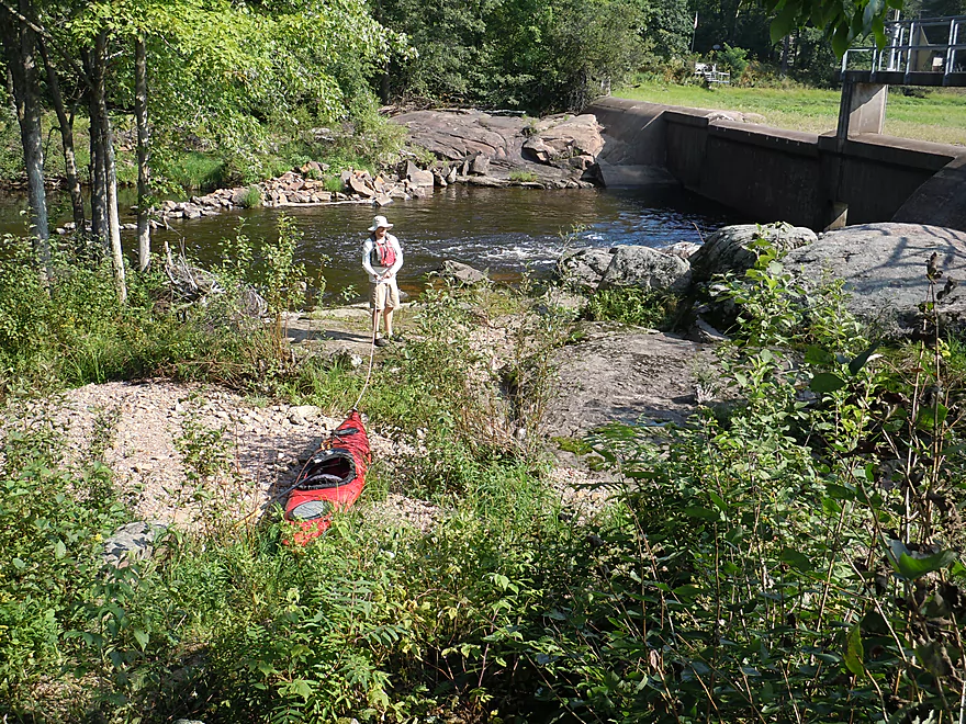
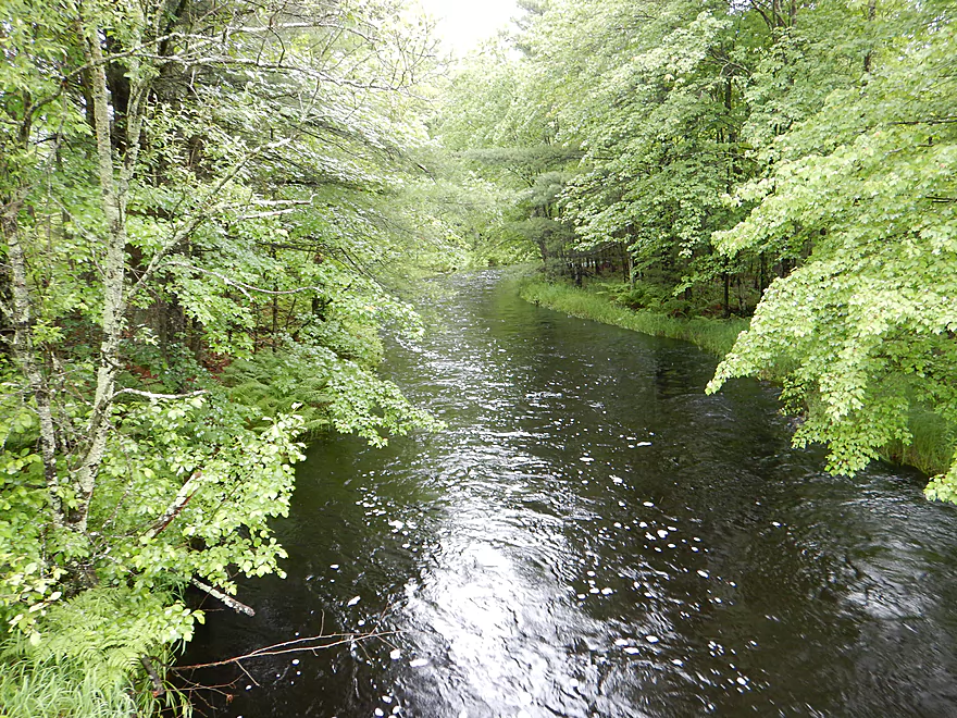
Nice access below the bridge
Was tempted to try to kayak through that
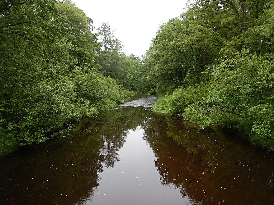
Picture during high water
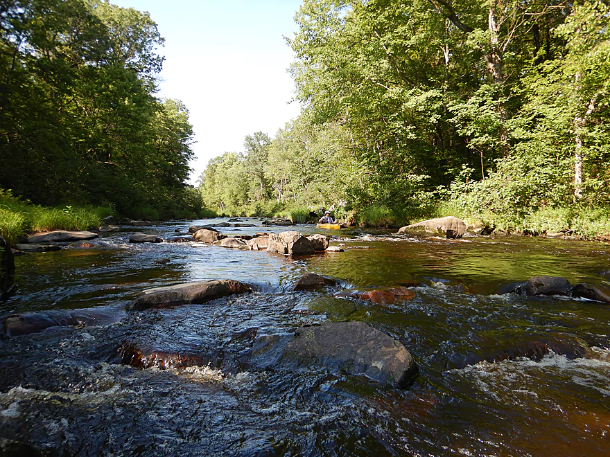
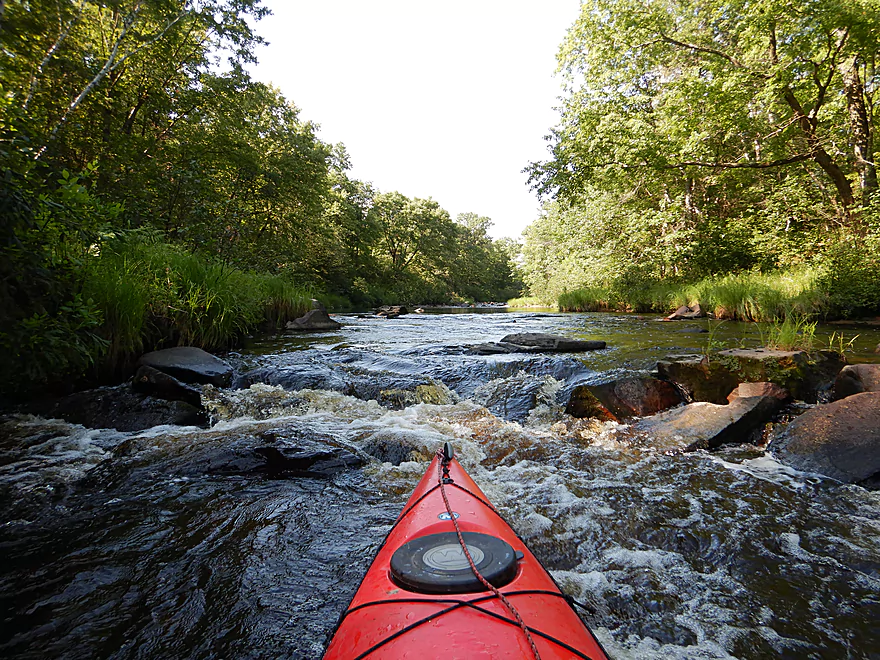
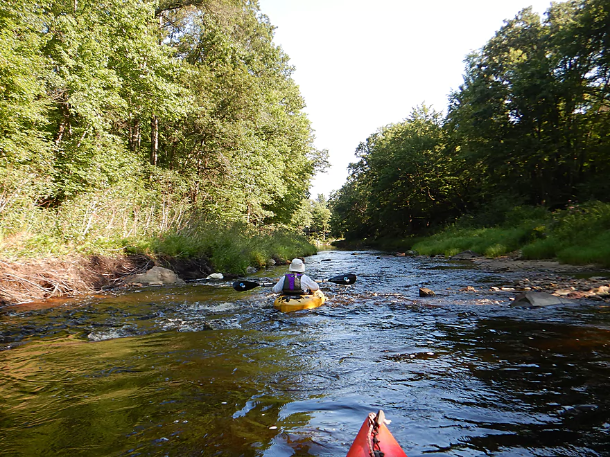
Some scenic rapids by Hwy B
But bumpy…
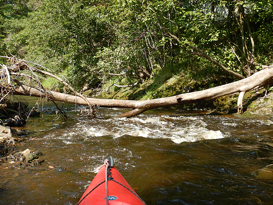
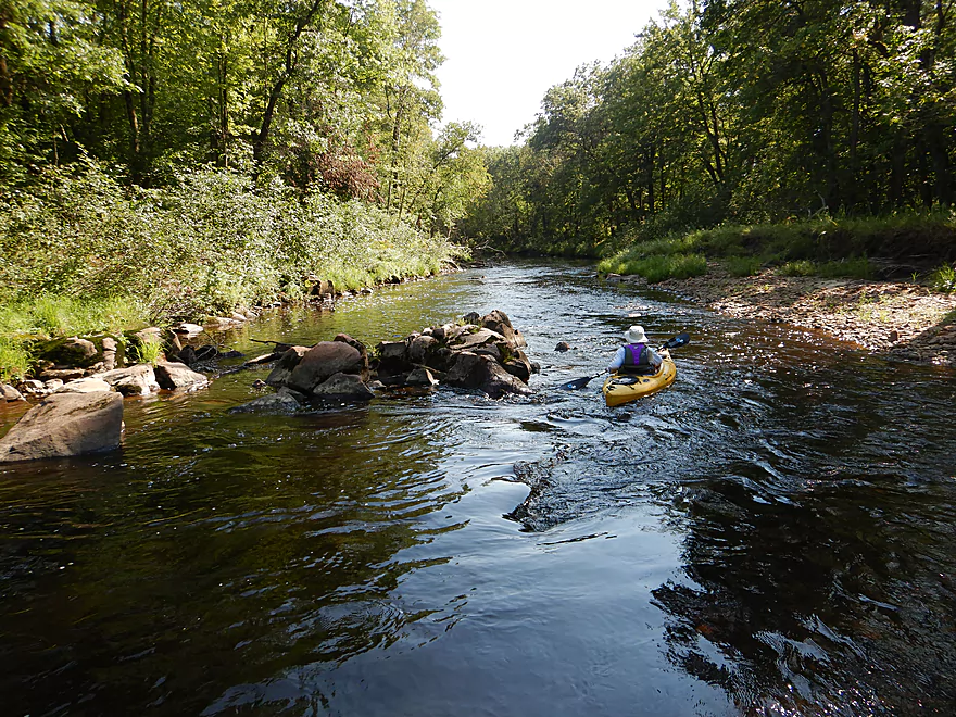
Tricky logjam/rapids combo
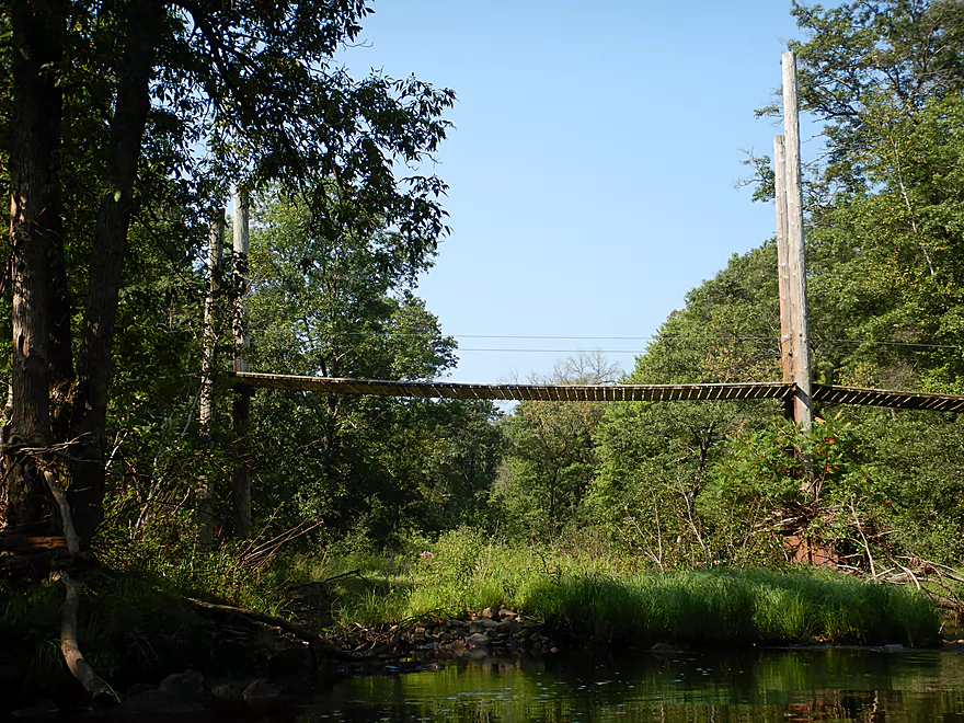
Easy portage under nearby suspension bridge
Coming up on Hwy B
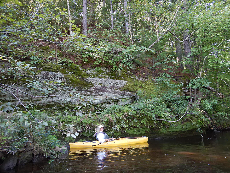
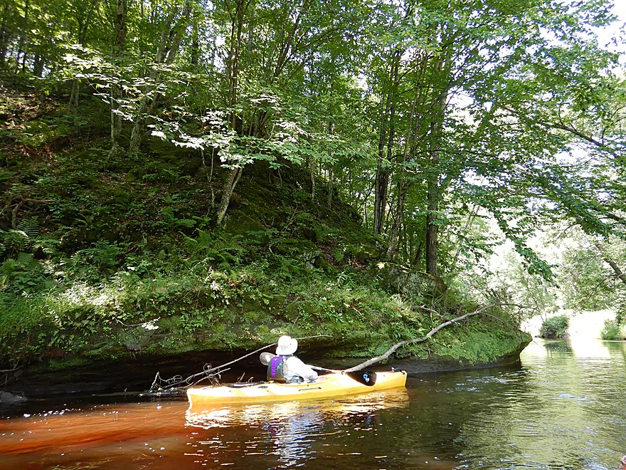
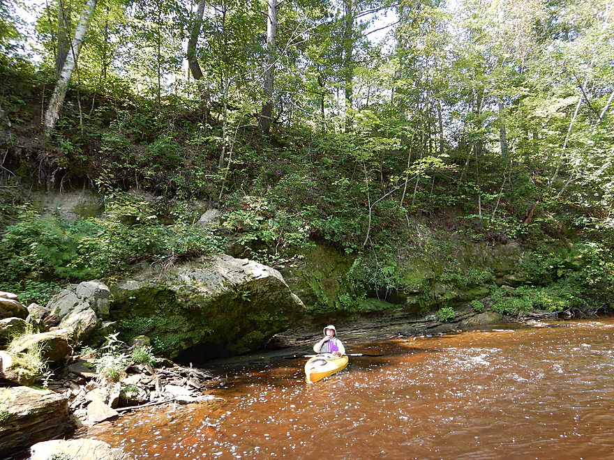
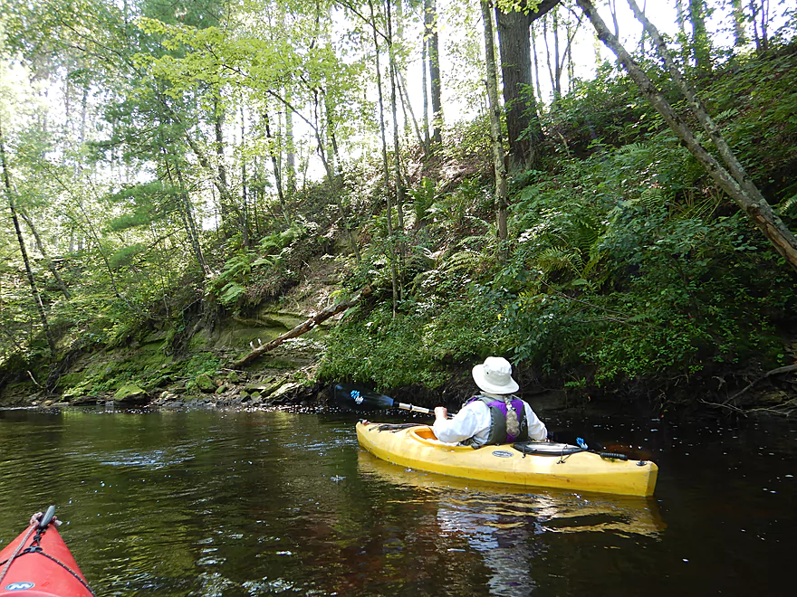
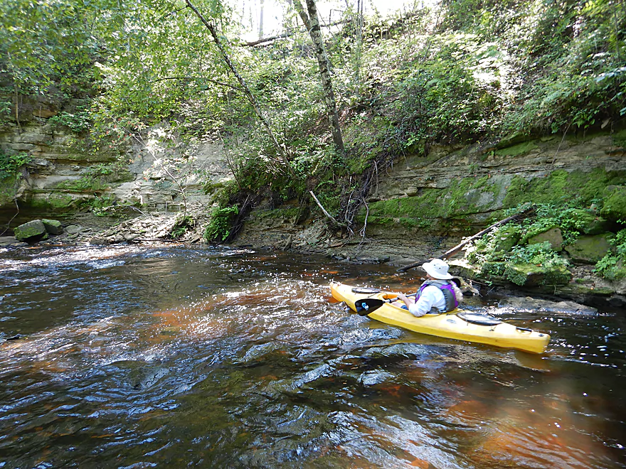
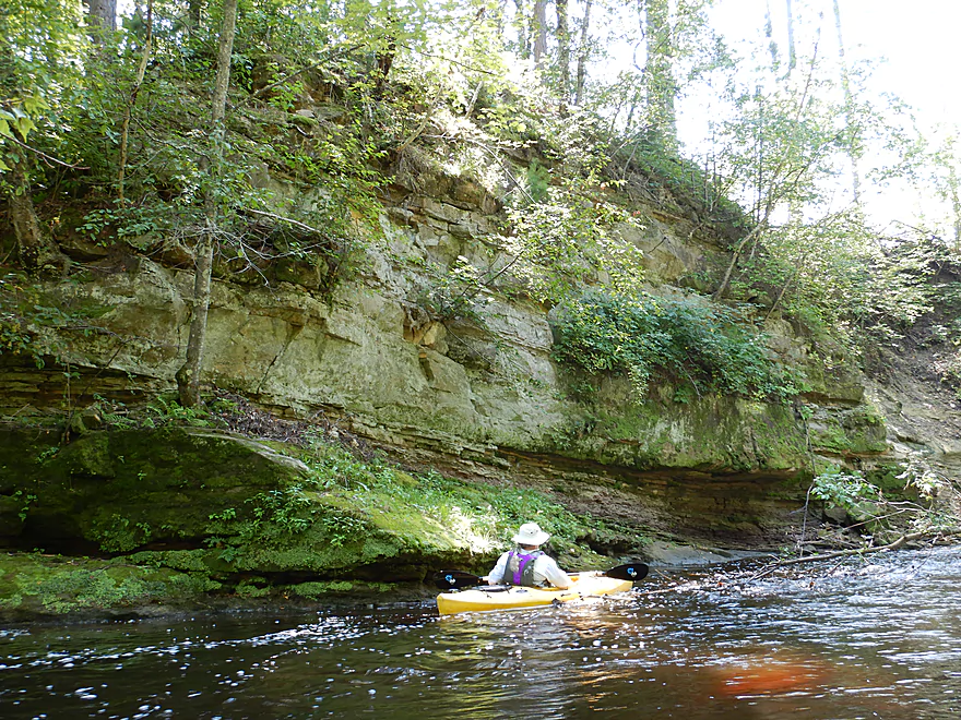
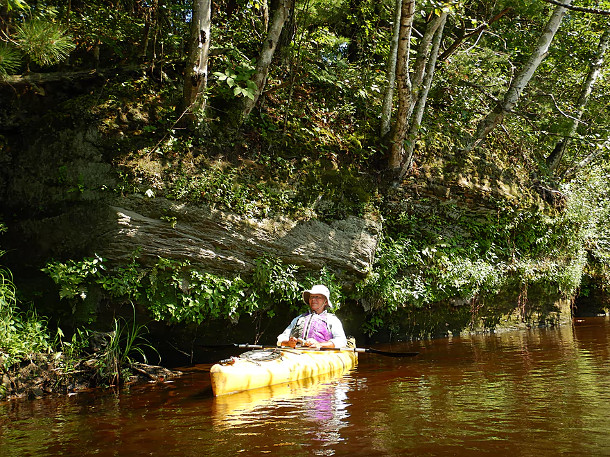
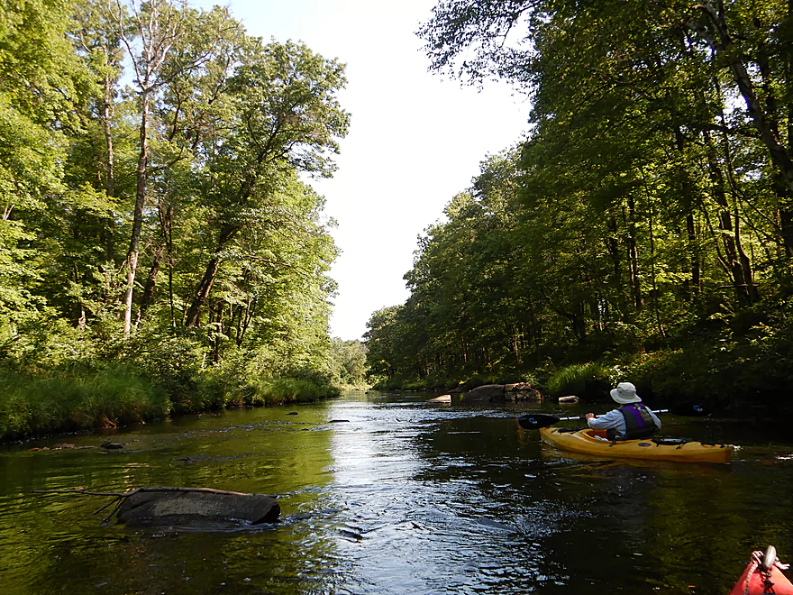
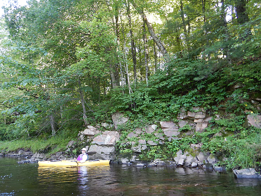
The first of many sandstone outcrops
Exposed bedrock reminiscent of Halls Creek
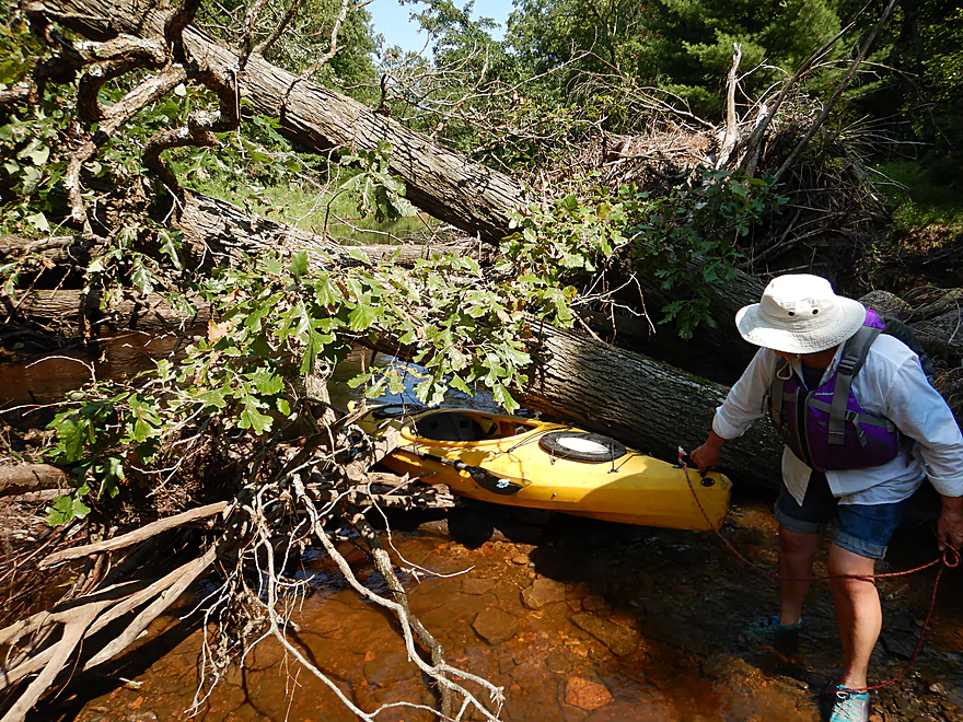
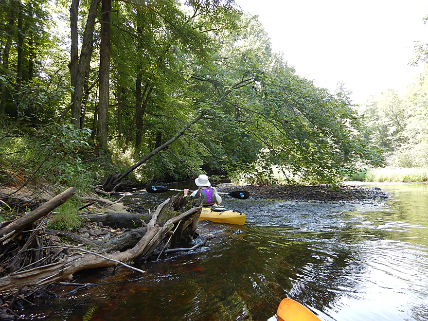
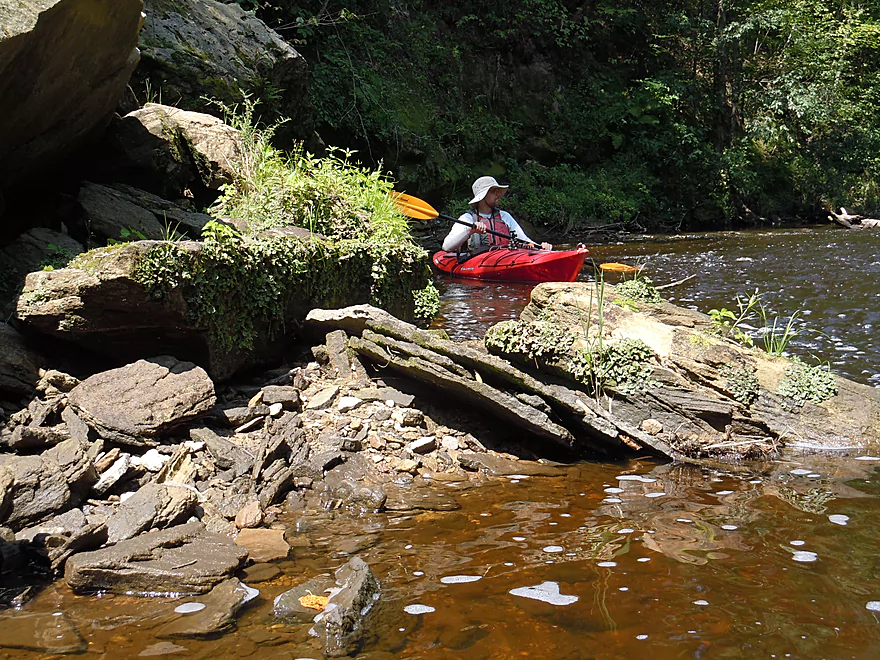
This logjam has to be portaged (easy)
Lot of ferns on the upper stretch
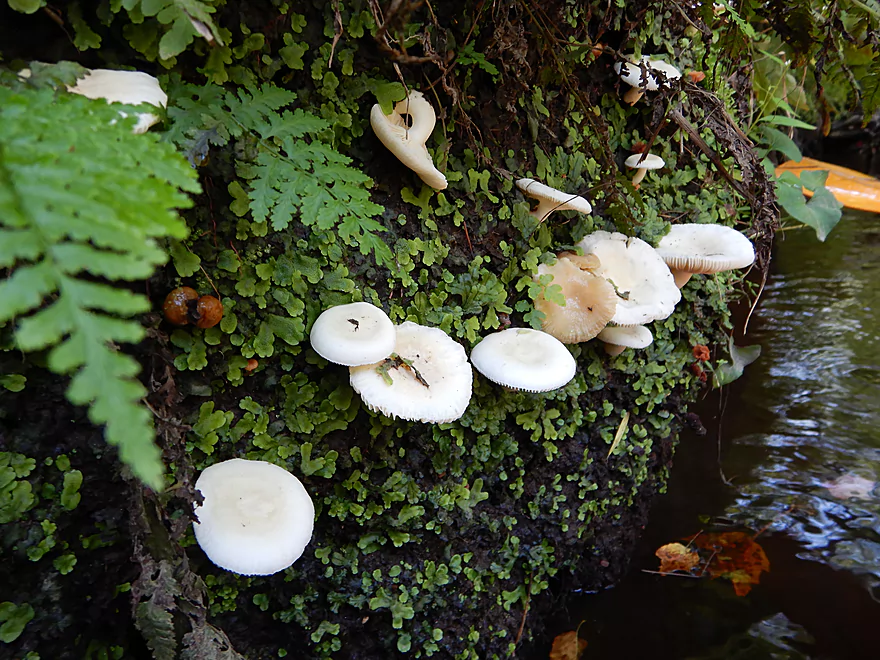
Mushrooms growing on the sandstone
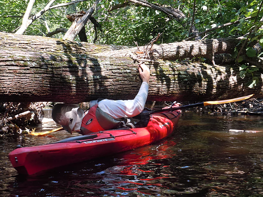
Just barely squeaked under this jam
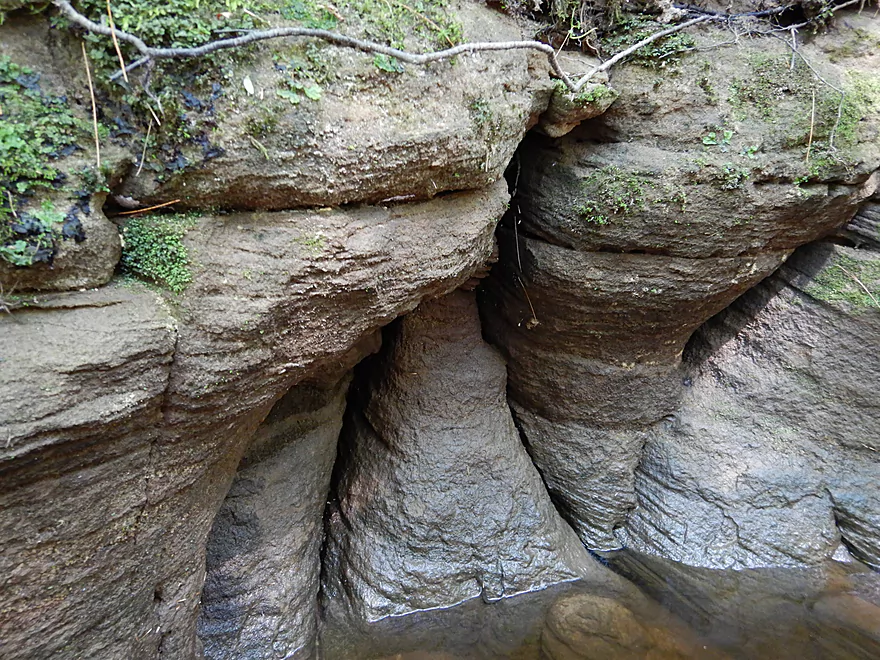
Interesting sandstone folds
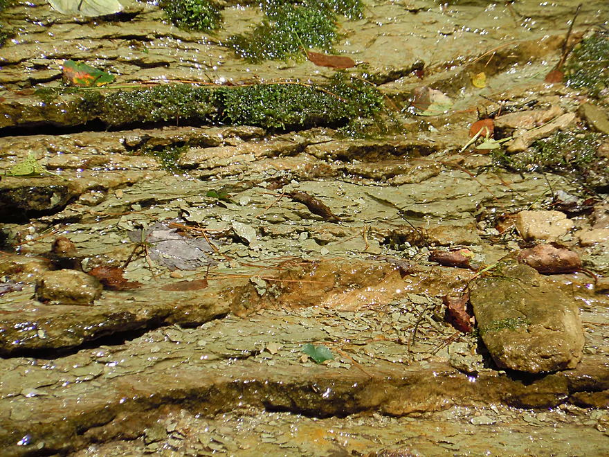
Spring water trickling over delicate sandstone layers
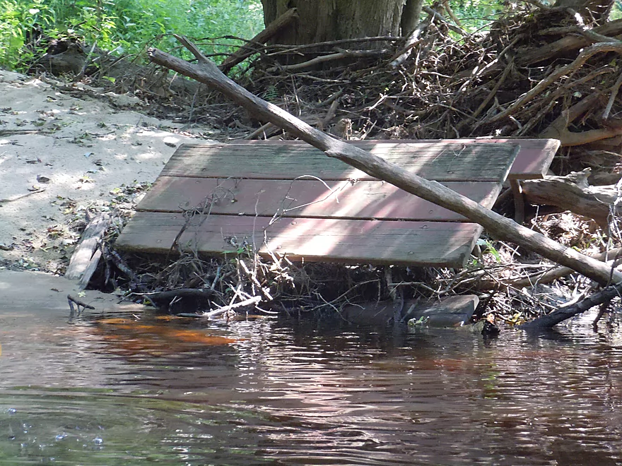
Yikes…I think this belongs in Snyder Park
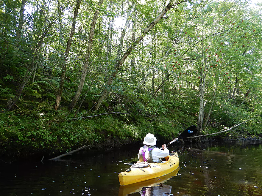
More great ferns
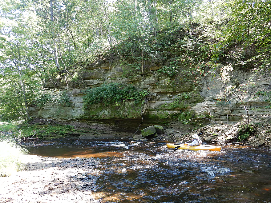
The 2nd best sandstone outcrop of the trip
It used to be larger…
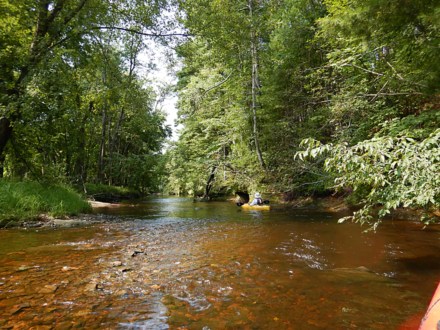
Coming up on the best part of the trip
Some fun little riffles…
That flow past a scenic bend
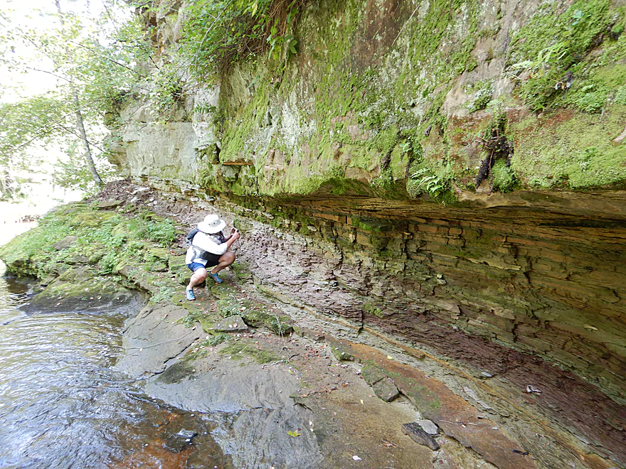
Really cool layer of pink shale
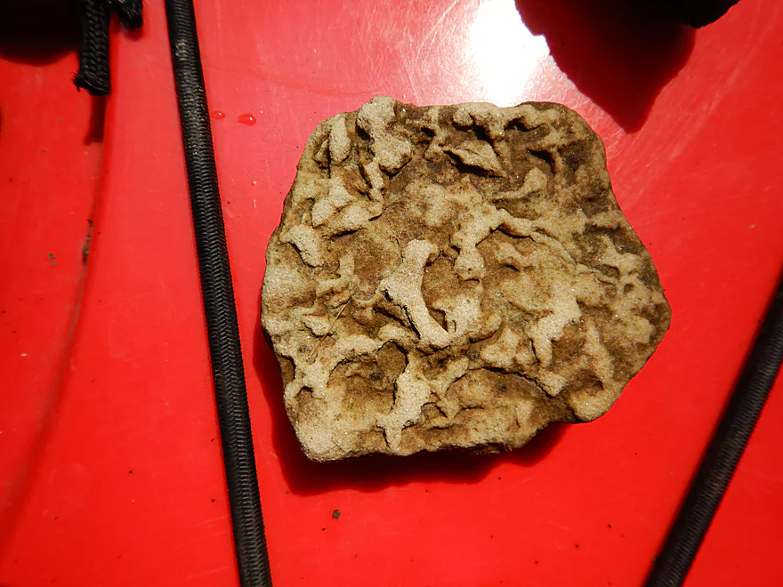
I think these are fossil imprints
Reverse view
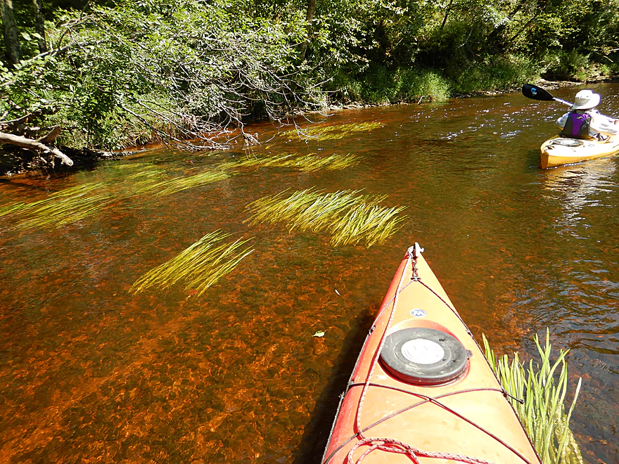
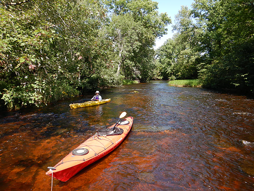
Great clarity
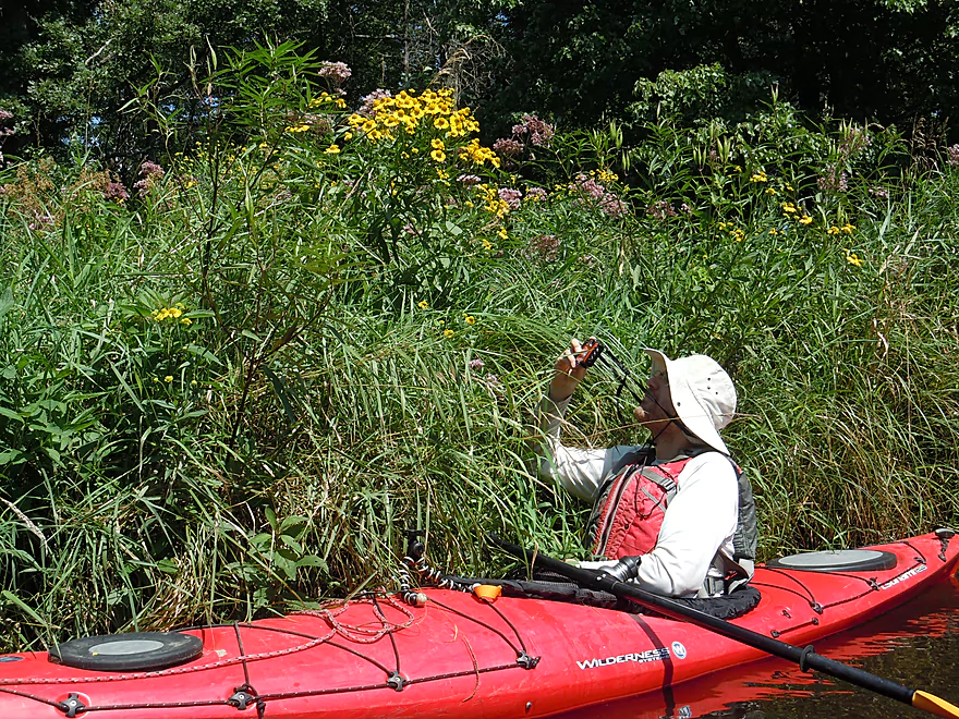
August is a great time for bankside wildflowers
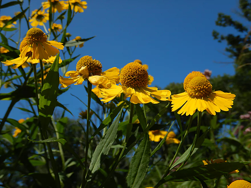
Ever scenic sneezeweed
Entering a nice oak savanna
Upper Wedges had several nice gravel bars
Another nice sandstone outcrop
Several sections had to be walked
At about this point, the creek transforms from sandstone to granite
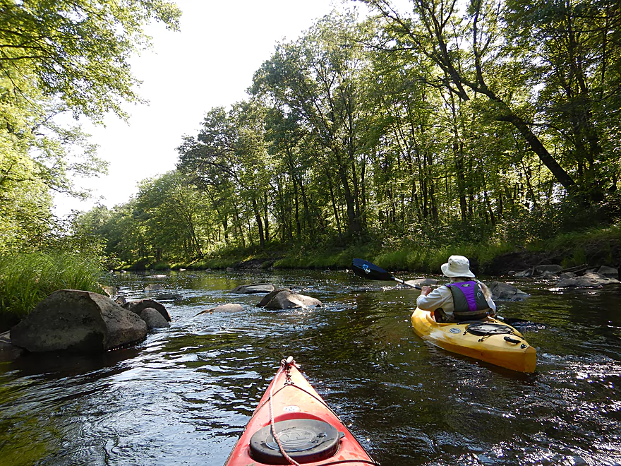
Coming up on the first boulder garden
Adding some scratches to my already beat-up boat
Entering another boulder garden
Very scenic
Some fun little rapids
The largest ledge on the trip
Just a little bony though
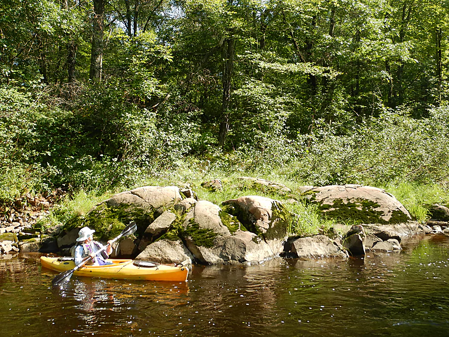
A granite outcrop instead of sandstone for a change of pace
Last of the rapids
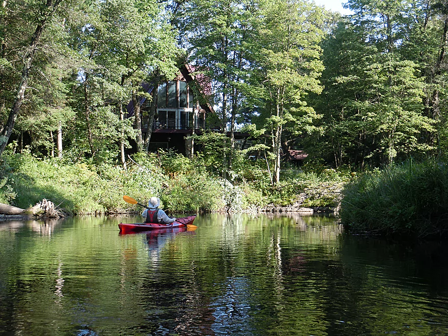
A mostly undeveloped creek…just the only home we saw
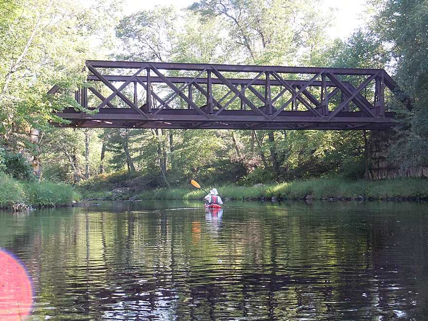
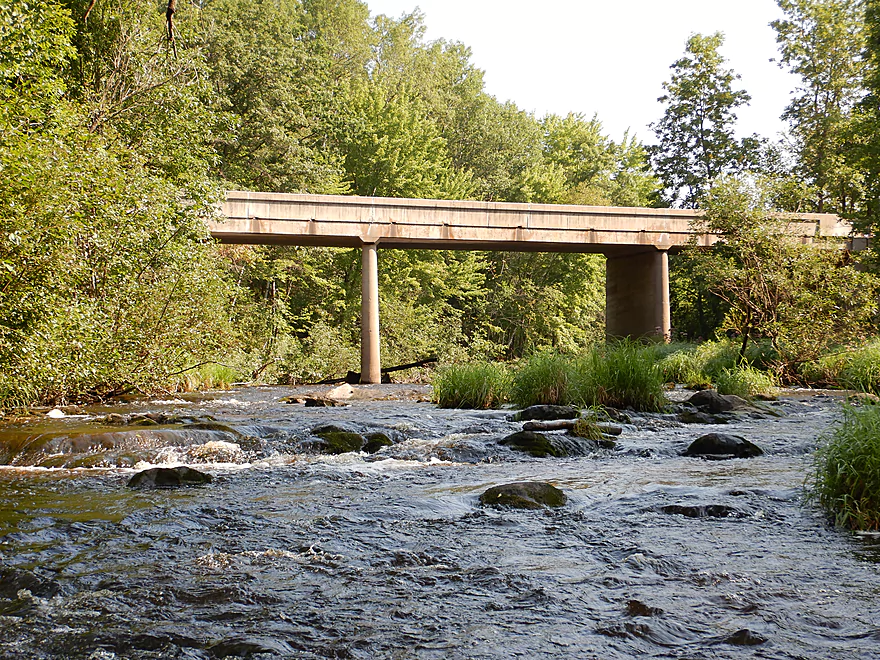
Scenic trestle by the take-out
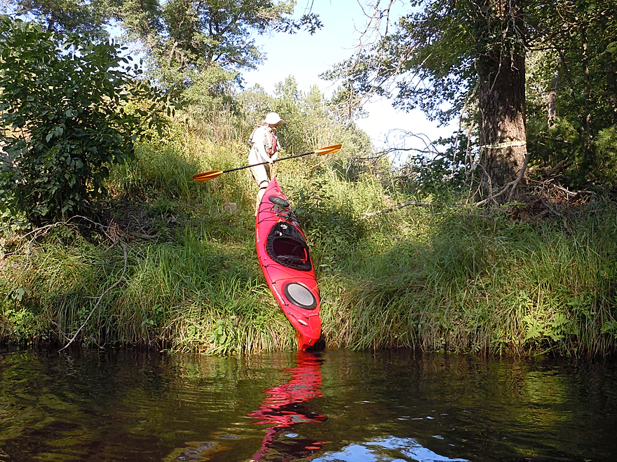
Steep but doable take-out by Middle Road
Scouting Chili Road (looks nice)
Scouting Five Mile Creek, which is another neat prospect
Wedges Creek – Snyder Park


The Black River has many super tributaries (Halls Creek, Robinson Creek, Morrison Creek, the East Fork, Perry Creek, and more). But one that is often overlooked is Wedges Creek, which is a large creek tributary coming in from the northwest between Hatfield and Neillsville. Two years ago this blog introduced readers to the final leg of Wedges, which was a great trip with fantastic granite boulder gardens and fun rapids. Clark County Conservationist Matt Zoschke informed me that the far upstream section was navigable as well which, coupled with seeing 4 kayakers on this stretch in Google Maps, got me excited to check it out.
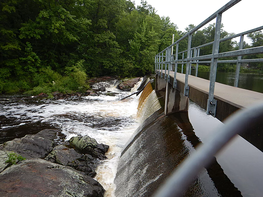
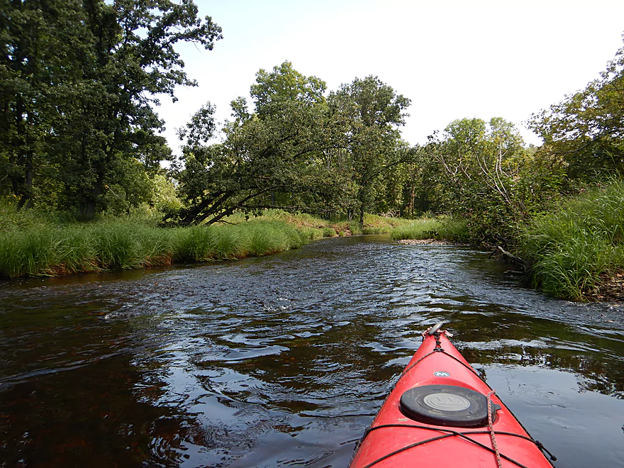
The trip started at Snyder County Park where it is quite manageable to launch below the dam. The interesting thing here was seeing the flood damage from the 2016 mega flood that pancaked much of the Black River area. The embankment flanking the dam had been completely breached, trees were lying where they weren’t supposed to, and it appeared the Arndt Road bridge had just been rebuilt after being washed out. The flowage (Snyder Lake) had been almost completely drawn down as a safety measure while the county waits to fix the dam.
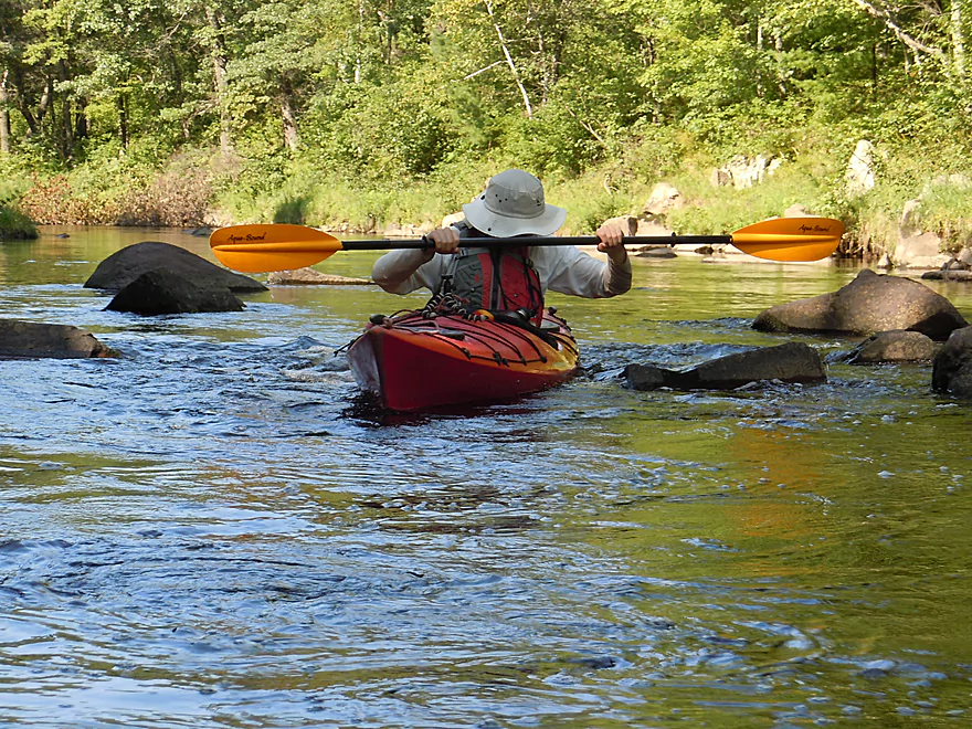
Following the scenic granite outcrops below the dam and the Hwy B bridge, the creek quickly descends over a series of rapids (which were quite bumpy). After a tall suspension foot bridge (and portage of a tricky logjam/rapids combo), the creek slows and widens. Under the Hwy 10 bridge you’ll see the first of 14-15 sandstone outcrops. For the most part, these weren’t too big and weren’t in the same league as Halls Creek (Wedges’ uber elite neighbor 5 miles to the south), but still they were a neat experience. The nicest and largest outcrop appears roughly halfway into the trip. Here you’ll paddle over some light rapids which funnel paddlers directly beside and then around a sheer sandstone wall. A very cool “calendar shot moment” and highly reminiscent of Halls Creek. At the base was a pink dolomite layer, some fantastic rock layering, and in the debris field there appeared to be some sandstone with ancient fossil imprints.
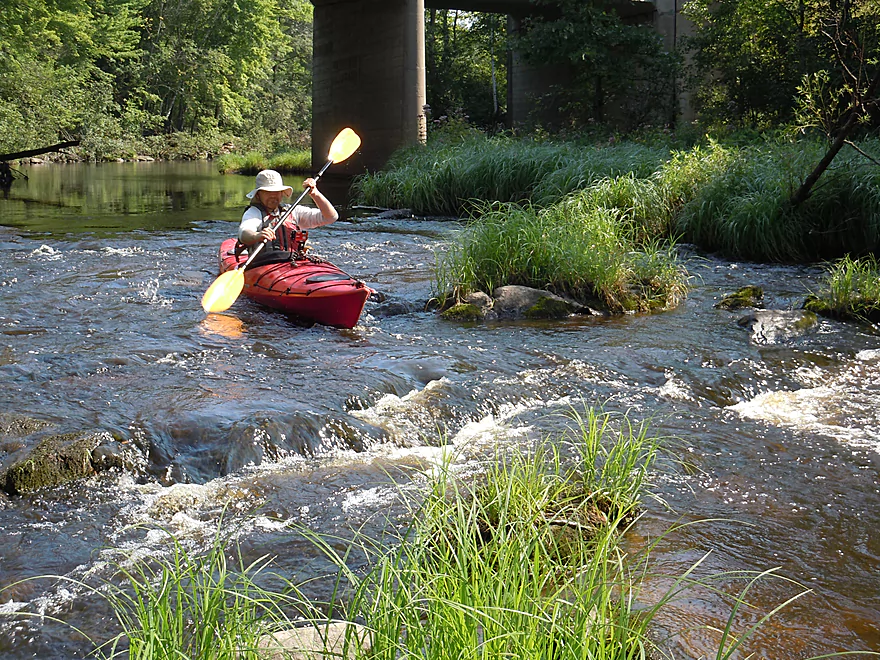
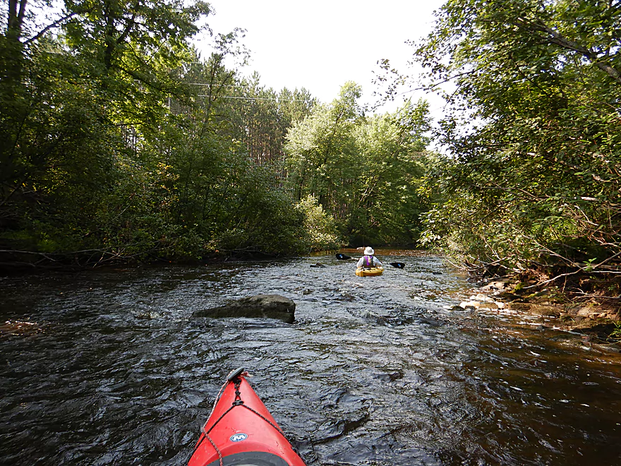
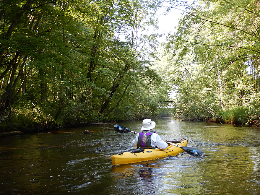
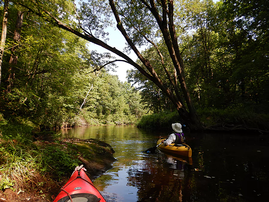
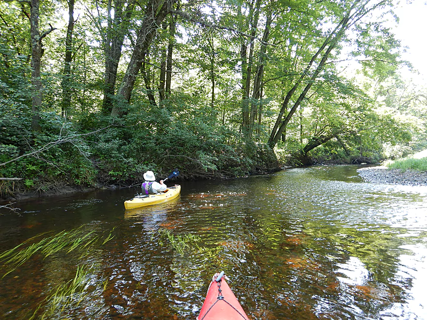
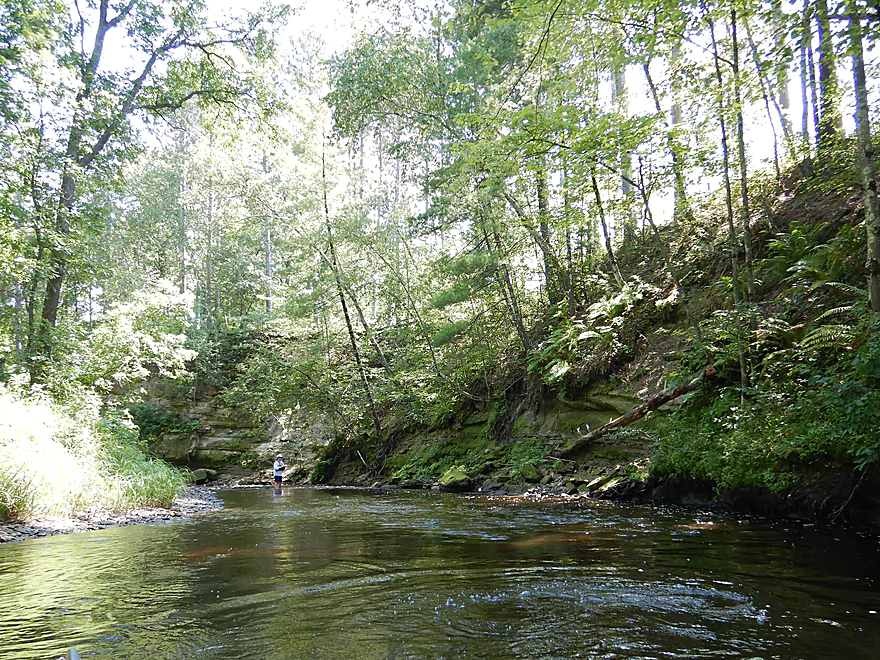
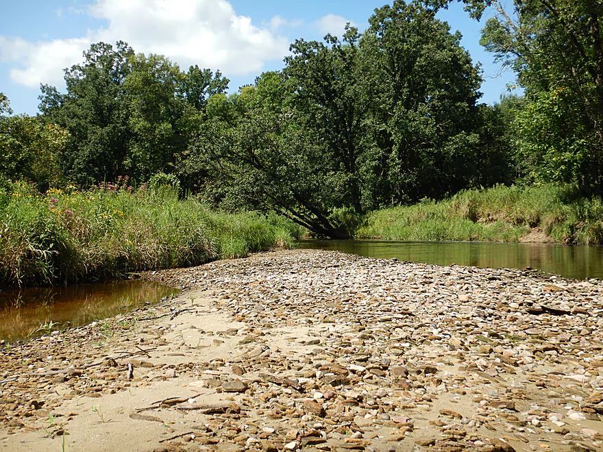
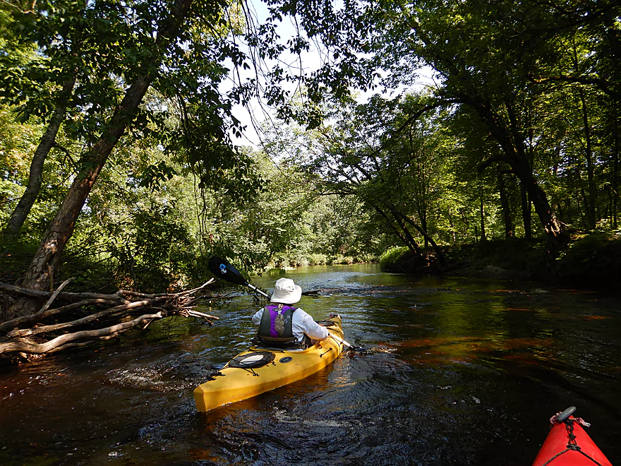
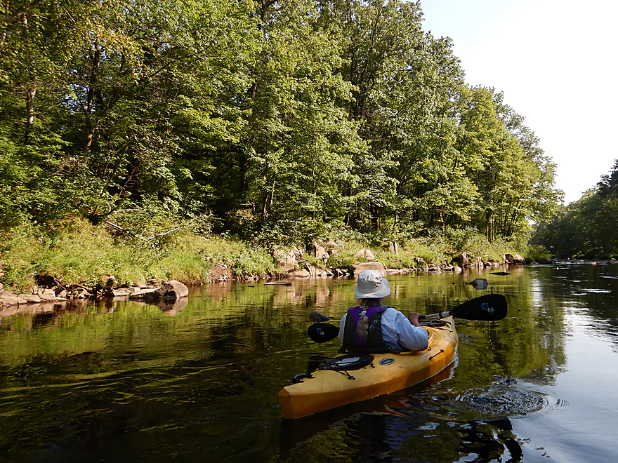
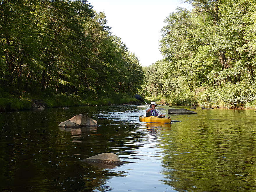
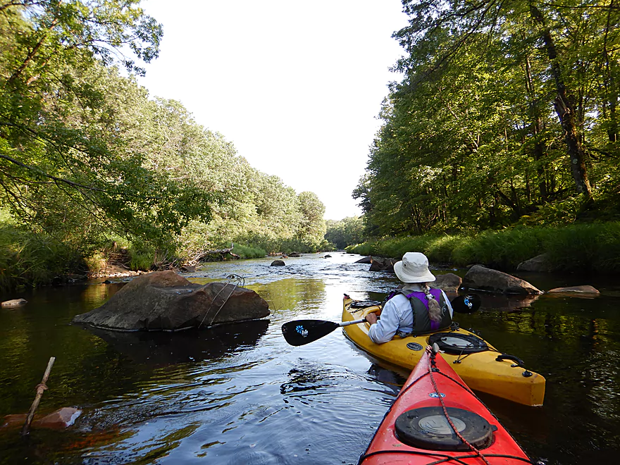
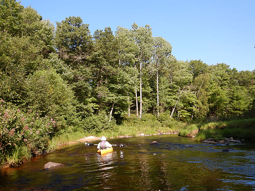
This was a great wilderness trip with little signs of human civilization (just two houses). Atop many of the sandstone outcrops were fantastic and huge white pines. This is still mostly a hardwoods trip though, but consisted of many red maple which would make it a fantastic October color paddle. Frequently along the banks, there were attractive colonies of ferns and wild flowers. This is mostly a clean creek with clear water stained red by tannins which showed off the sand and gravel substrate (and occasionally flat-as-a-floor bedrock). The water level was relatively shallow but easy to paddle and made for a very relaxing and peaceful trip.
Perhaps 60% into the trip, the creek changes dramatically. We lost our attractive sandstone outcrops, which were replaced by granite. While the first part of the trip was perhaps a poor man’s Halls Creek, the 2nd section was much more reminiscent of the East Fork or our previous trip on lower Wedges Creek. Here granite boulder gardens form along with a few noteworthy rapids, which were very scenic, but on the downside this was the bumpiest part of the entire trip.
In summary this was a great trip that was actually more interesting and scenic than lower Wedges, but I’m not going to give it five stars because of the number of scratches the creek gave my kayak. Go when it is higher!
The trip started at Snyder Park by Amdt Road, which was a good launch option. You can drag your boat over the grass and left past the embankment to launch off the granite bedrock below the dam. There is a nice public parking lot which is free, but no nearby outhouse.
We took out at Middle Road, southeast of the bridge, where there is a faint weedy trail that leads to the shoulder. Ok room for parking. This is actually a somewhat popular access option for paddlers…but mostly for putting in.
The Hatfield Sport Shop does do shuttles/liveries in the area, but I’m not sure if they would go this far northwest. You can call for availability: (715)-333-5009
For bike shuttlers, it is a mostly flat 4.4 mile trek east of the creek. But…it is almost all gravel. Some of it is light gravel that you can peddle around using the worn tire lanes, but at least 1-2 miles would require plowing over big rough gravel that wouldn’t be fun. But at only 4.4 miles, walking your bike over the rough sections might be worth it.
Another option is to shuttle west of the creek which would be 6.2 miles mostly on Hwy B (about 3 miles of paved roads and 3 miles of gravel).
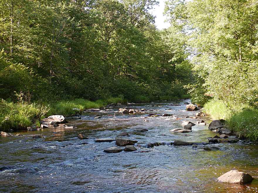
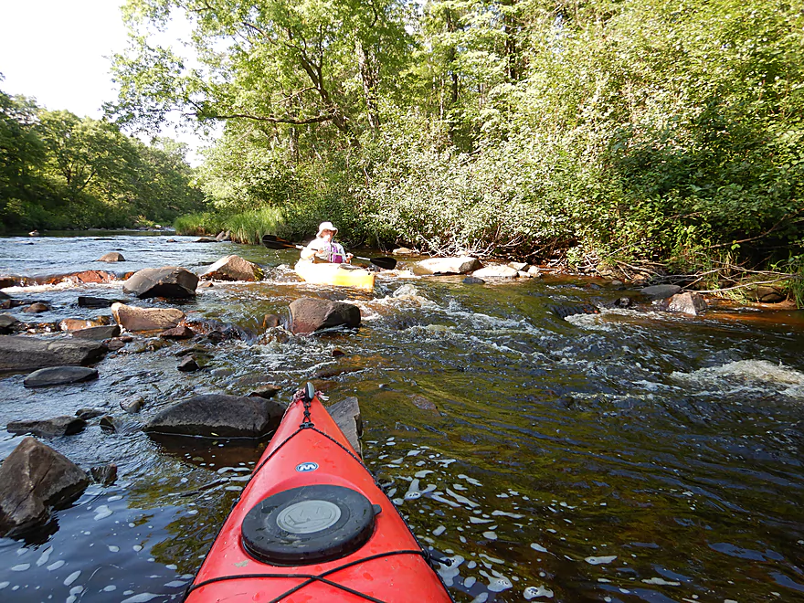
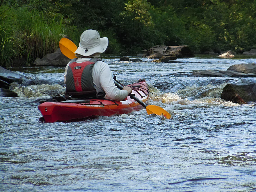
The current is mostly average, but there are a number of riffles and a few rapids.
One of the most noteworthy is downstream from the Hwy 10 bridge (making it easy to scout). At high water levels this is probably a Class 2. Note, these rapids are often shallow regardless of depth so don’t be too discouraged if they look bumpy.
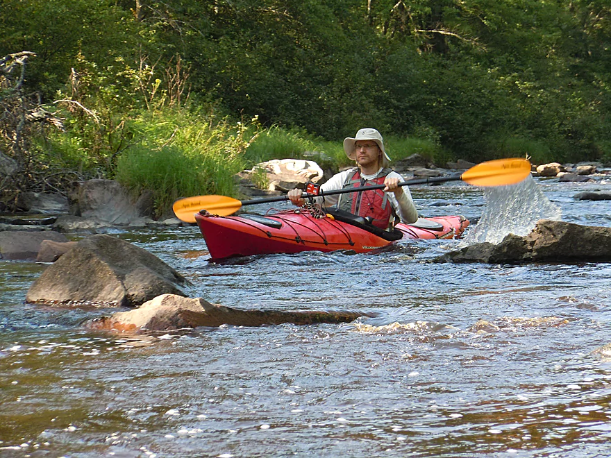
Shortly after this and by the suspension walk bridge, there is a downed tree directly over another set of rapids. This you must portage on the left/east bank (easy to do).
In the next mile (or so) there are two more logjams. The first you have to portage, but this is easy to do because of the gravel bottom and lack of mud.
The next logjam, we barely ducked under, but would be a doable portage if need be. Then that should be it for major logjams. Special thanks to the anonymous volunteers that have cleared much of this out.
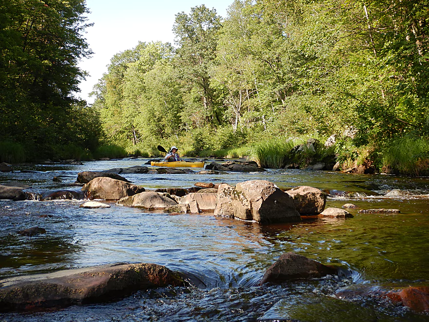
There are many additional riffles and a few low level rapids. The most noteworthy are in the last mile before the take-out. The first is a strong Class 1 or weak Class 2 that runs through a boulder garden. Doable and fun but requires some tight turns. The second follows shortly after and is likely a weak Class 2. The creek splits in two with chutes on either side. The left side is easier to run. In very high water, these constricted boulder gardens could be quite tricky and might rise to Class 3 levels.
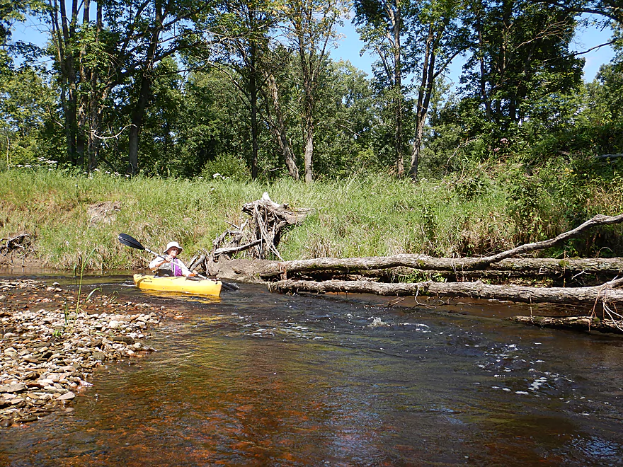
This is a shallow creek and we hit a lot of rocks and had to get out a few times to walk. We had a good time, but this was likely a bit too shallow. Interestingly enough this was deeper than my last trip on Wedges which was also shallow but not as bumpy (which means the upper section needs higher water). I was also able to confirm that the East Fork by the Black River is NOT a representative gauge and the best measure is really the Black River Gauge by Neillsville. Here is a completely rough flow rate guide based on that gauge:
- 0-150 CFS: This is too low.
- 151-200 CFS: Perhaps doable, but likely extremely bumpy.
- 200-250 CFS: Our trip was done at 230 CFS. Mostly a good level, but we did hit one too many boulders.
- 251-300 CFS: Likely a very ideal depth.
- 301-350 CFS: Likely an ok depth. Some of the boulder gardens might start to get submerged.
- 351-400 CFS: A doable depth…starting to get on the high side though.
- 401-500 CFS: The rapids probably start to get somewhat rough at this point.
- 501+ CFS: I suspect these are very high conditions and should only be attempted by very experience boaters.
Not much. Some clams, ducks, dragonflies, and quite a few mosquitoes. The early part of the trip was particularly lush with ferns, mosses, and liverworts. The pines were large and noteworthy but mostly were only present on the upper section and by sandstone bluffs. For the 2nd half of the trip, there were a number of oaks and a few oak savannas.
Detailed Overview
- Upstream of Chili Road: Not sure about these stretches.
- Chili Road to Snyder County Park: 5.8 miles. During spring run-offs you can run the section from Chili Road to Snyder County Park. Supposedly people have done this. Chili Road is a good put-in. When I scouted this on June 13th 2015, I actually thought it looked too high. Unfortunately this entails at least 4 miles of gravel biking. Likely some jams but should be scenic.
- Snyder Park to Middle Road: 6.4 miles. A neat section with boulder gardens and many rock outcrops. But low water can be an issue. Reviewed Aug 2017.
- Middle Road to Mouth: 4.4 miles. A nice section with only one sandstone outcrop, but some really neat boulder gardens and a few fun rapids. Reviewed Jul 2015.
- Black River Take-Out Options:
- Wedges Creek Mouth to Hwy 95: 1.4 miles. Kind of a wide, uninteresting section of the Black River but does include interesting dam remnants. Reviewed Jul 2015.
- Hwy 95 to Lake Arbutus Sports Grill: 1.1 miles. This section includes the Red Granite Rapids which are Class 3 and should be scouted beforehand. You can do this a bit from the Hwy 95 bridge, but you will get better views of the rapids from Reesewood Ave and/or Riviera Ave.
- Lake Arbutus Sports Grill to Lake Arbutus: 1.7 miles. An over developed flowage section that is still nice. Many take-out options on or just north of the lake.
- Further Upper Black River Options: See my Neillsville trip review which has a nice overview of the Black River.
Of note, Five Mile Creek is a significant tributary to Wedges that has also apparently been paddled and should be very scenic. This creek is very fast with a few boulder gardens but I doubt it has outcrops. It would be a 5.3-mile stretch from Hwy B to the mouth on Wedges (just above Middle Road, which would be a good take-out). I suspect this has more jams though. Bike shuttle would be mostly gravel outside of a short stretch on Hwy B, but only 4.2 miles.
Trip Map
Overview Map
Video
Photos Size:
Where exactly is mouth of the wedges
The mouth of Wedges Creek is on the Black River and is located just off Opelt Road. If you view the map, you’ll see the spot (where the little blue line joins the big blue line).
How is Wedges creek near intersection of county B across from the wildcat inn?
I’m not as familiar with that landmark, but I believe Wildcat is just west of Snyder County Park. Above the park of course would be a simple lake paddle. Downstream of the park, it can be a little rocky and shallow but it is pretty nice. The latter section is covered in this review.