
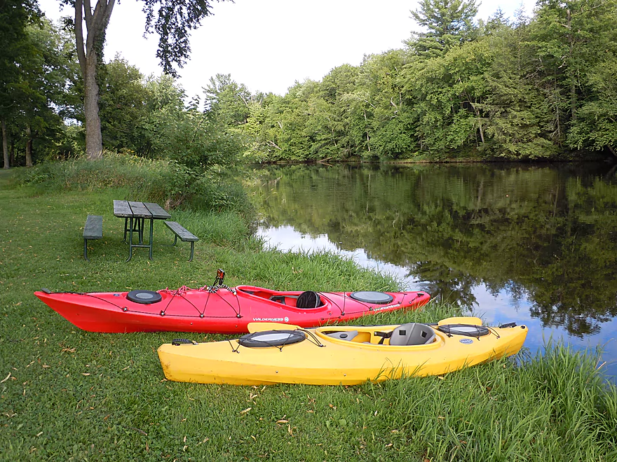
Fine put-in area
Right next to the dam
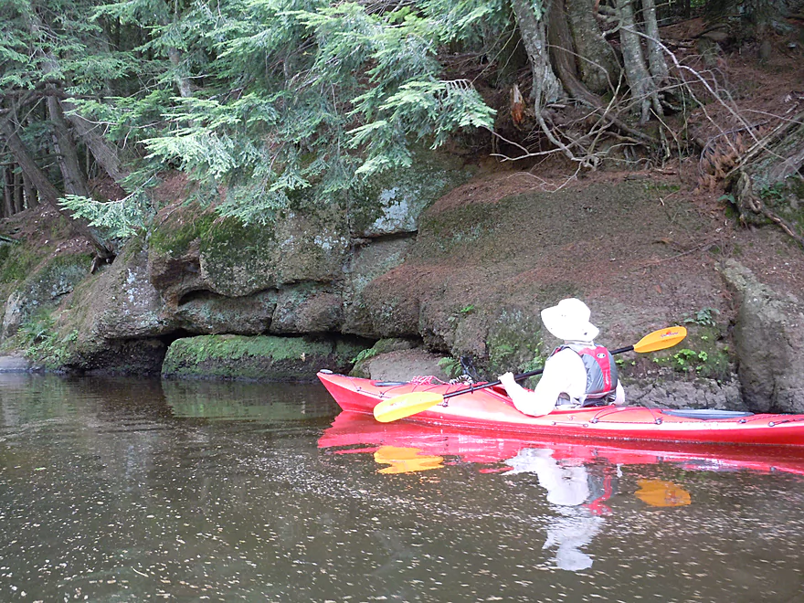
Teeter-totter Rock
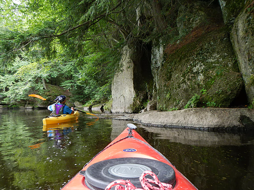
Entering the boulder garden
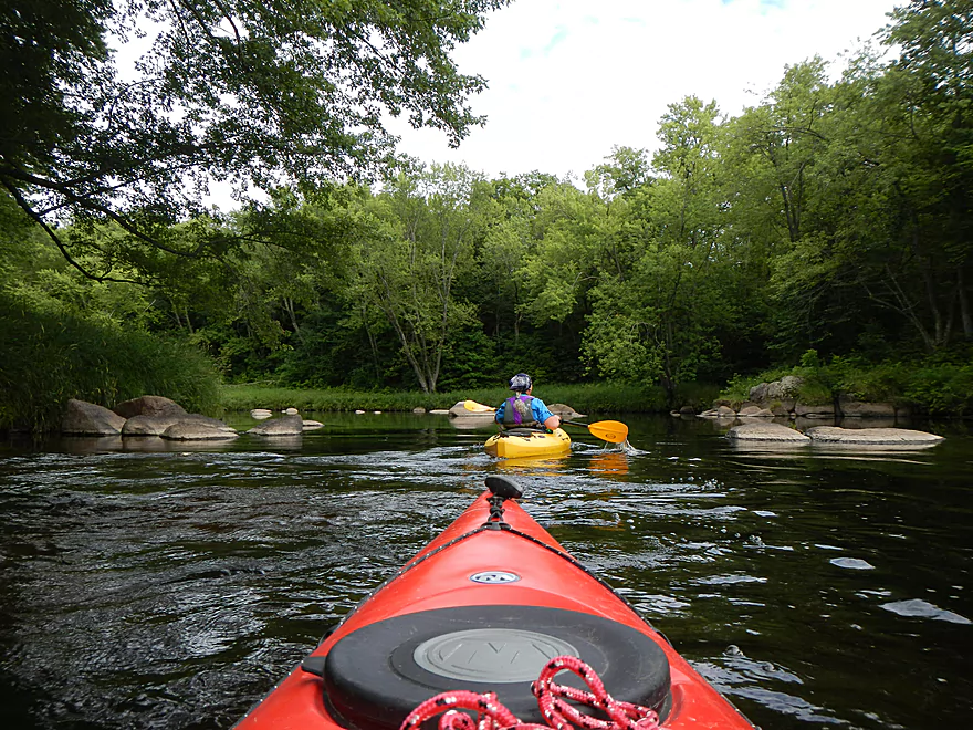
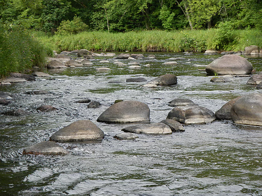
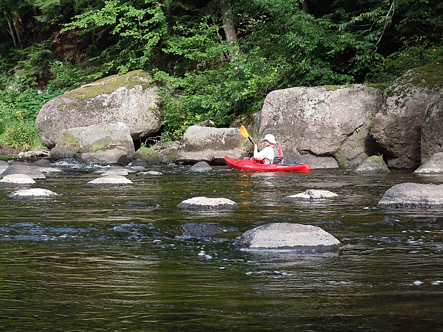
Like an asteroid field!
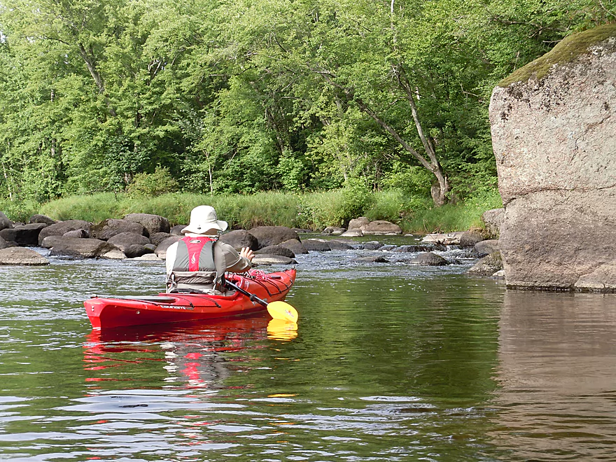
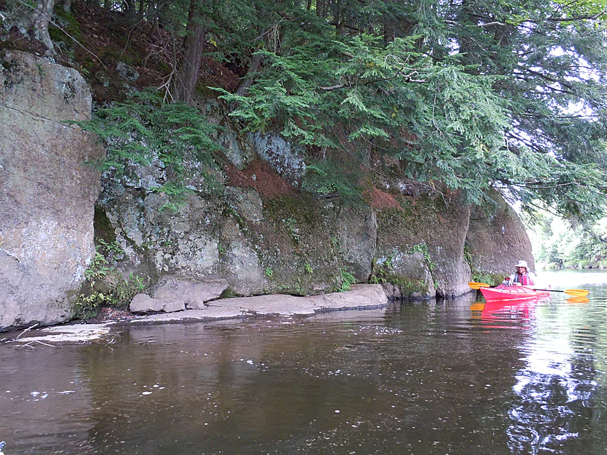
Returning back
Back at the park
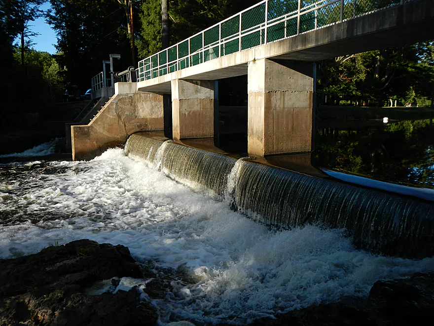
Dam that create the flowage
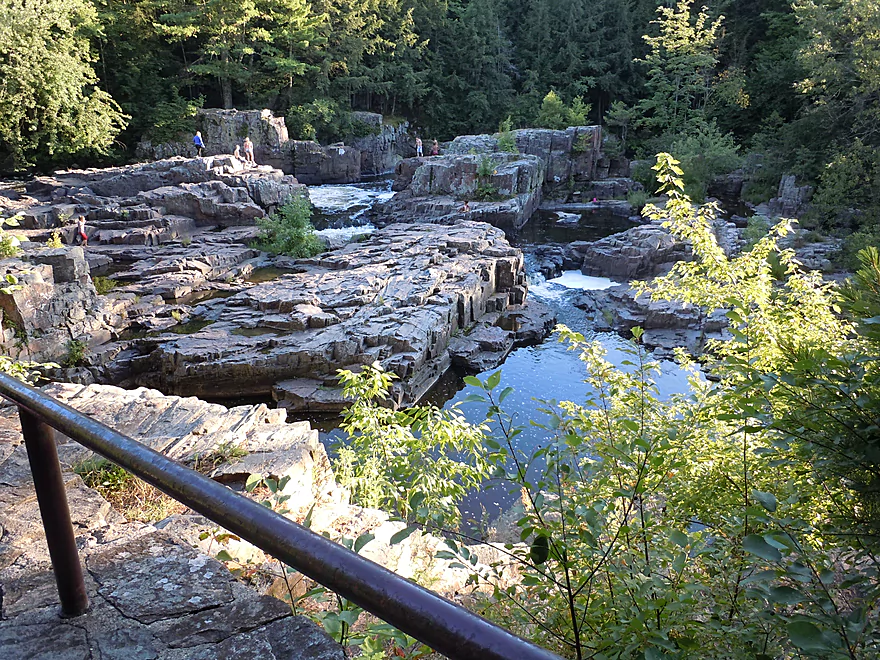
Checking out the famous dells
Ignored by the campers
Kids swam down this
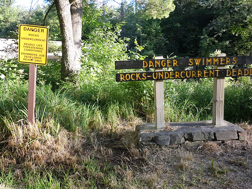
Is much more dangerous in higher water
Looking downriver
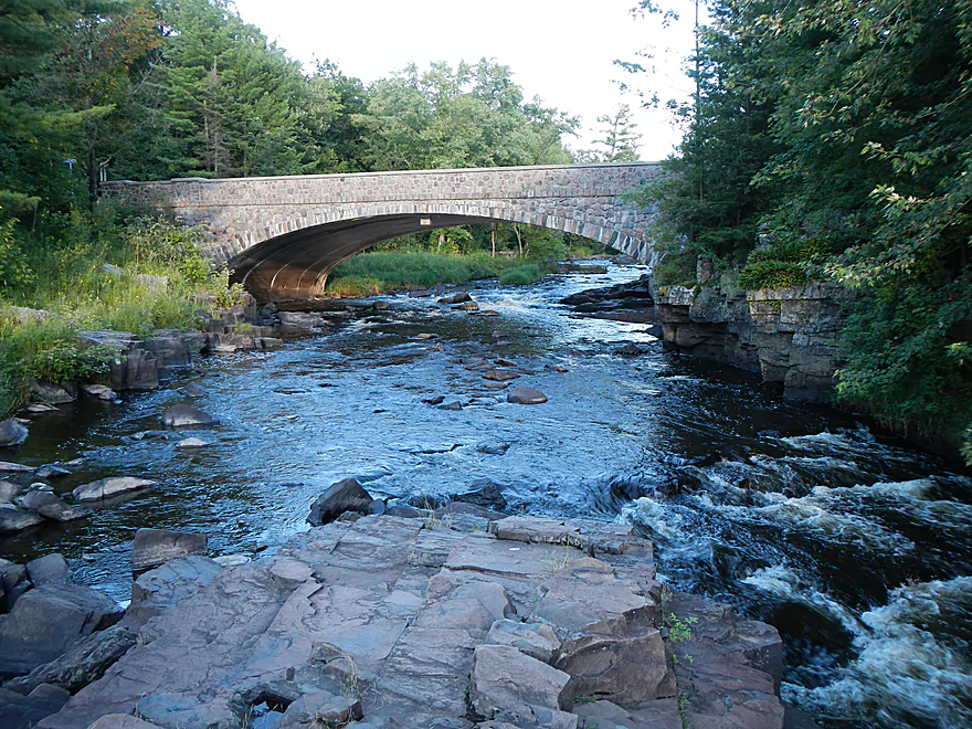
Bridge upriver of the falls
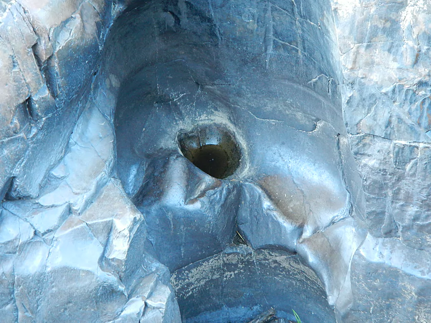
Cool hole created by the current
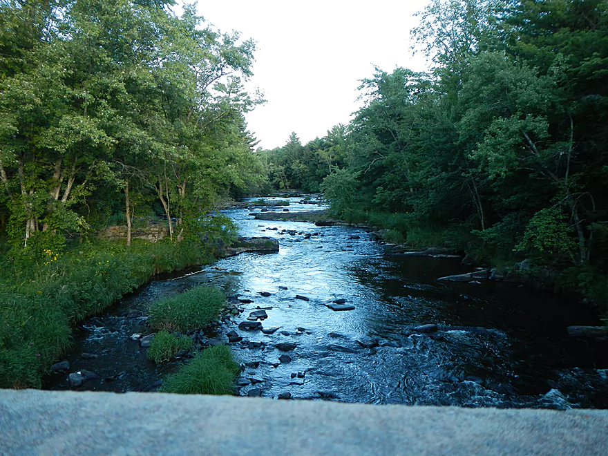
Looking upstream from the bridge
Trail between the Falls and the Dells
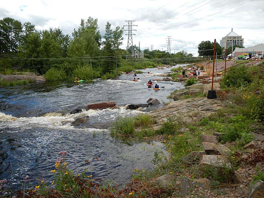
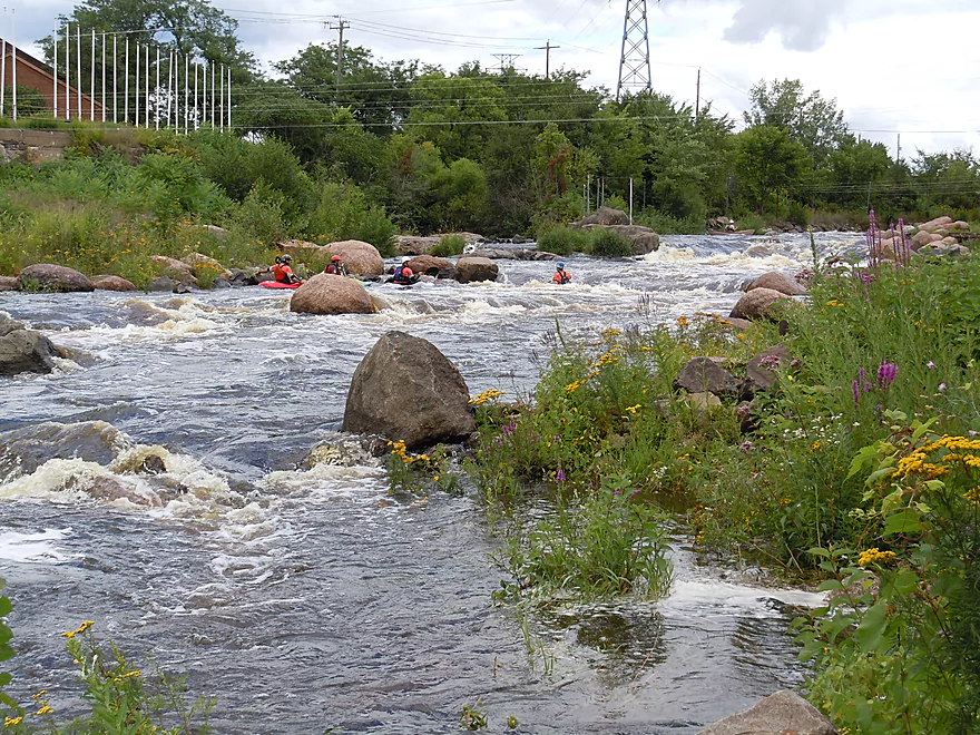
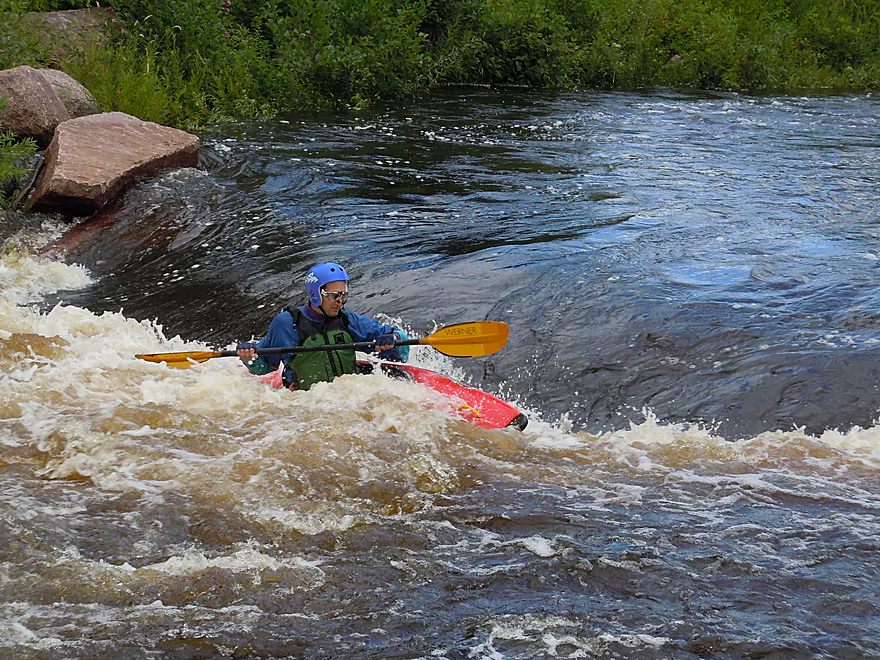
Wausau Whitewater Park
This was a release day
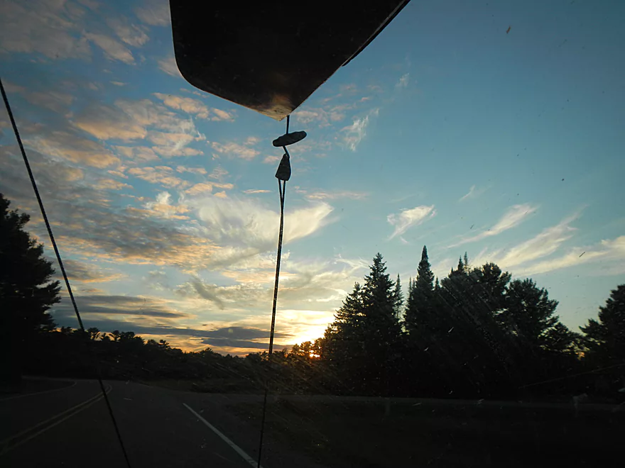
Driving home
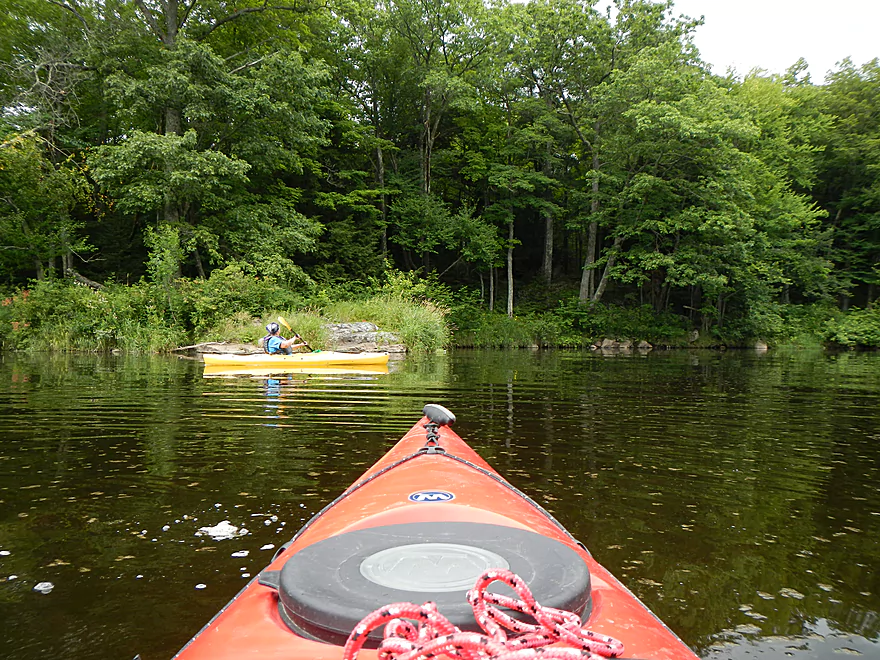
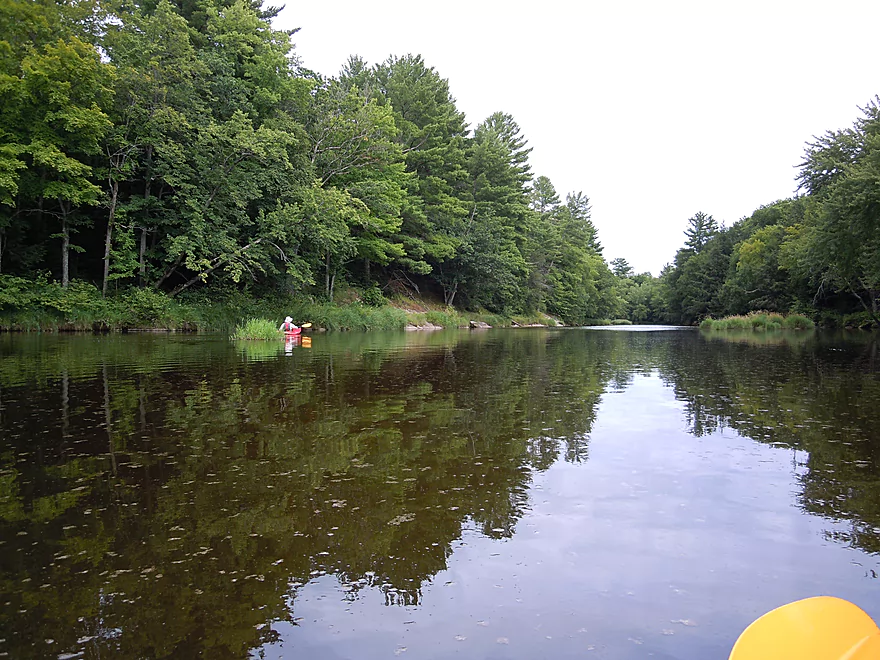
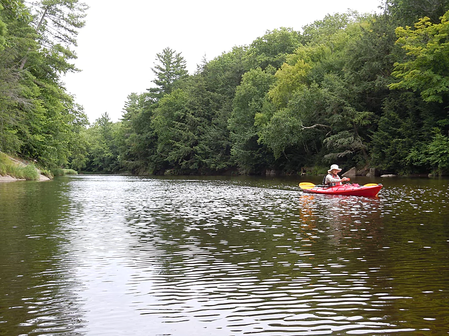
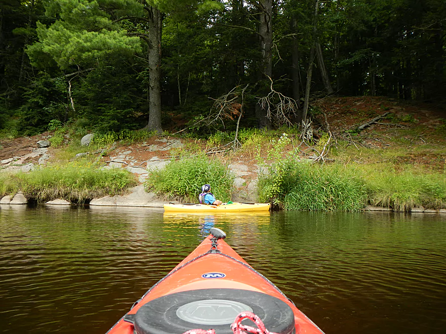
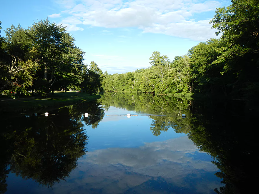
Upper Eau Claire Flowage

The initial plan for this trip was to paddle the Eau Claire River either 7 miles above Eau Claire Dells County Park or 7 miles below. (Note: Wisconsin has two Eau Claire rivers and this is the Wausau one…not the Chippewa River one.) At this time of the year, the Eau Claire runs very low, which can necessitate getting out to walk at sections and some bumping. I believe a group had run one of these sections just a little earlier at similar levels and had to walk ~500′. (acceptable in my book for a good river prospect)
Why run the Eau Claire when it is low? Because it has exceptional scenic beauty, but is much too dangerous at higher levels. At lower levels the river becomes a completely different animal…way safer, cleaner, with a prettier shoreline and nicer boulder gardens.
During this weekend, I was in Wausau Saturday morning for an unrelated commitment. The plan was in the afternoon to hit the Eau Claire River and, as a backup plan, to paddle the Big Rib River (also scenic, but more navigable during low water levels). If you look at a map, Wausau is located at (roughly) a trident of three rivers. The Big Rib comes in from the “left spar” of the trident. The Wisconsin is the middle spar and the Eau Claire is the right spar. Together (with the help of two flowage dams) they form the large Lake Wausau that resides in the middle of the city.
Things got interesting, however, when I stopped by the livery in Schofield to arrange a shuttle. While the operator had told me earlier in the week over the phone that he serviced both the Big Rib, Eau Claire and Wisconsin, his definition of a service area turned out to be pretty much Lake Wausau and a mile of either the Big Rib or Eau Claire before they hit the lake. This was bad. Big flowage paddling (to any paddler with discerning taste) is boring beyond belief. These sections, while okay by some standards, didn’t hold a candle to the upper sections reviewed by Svobb and others. The operator couldn’t be convinced to shuttle us further upriver (despite my offering more money).
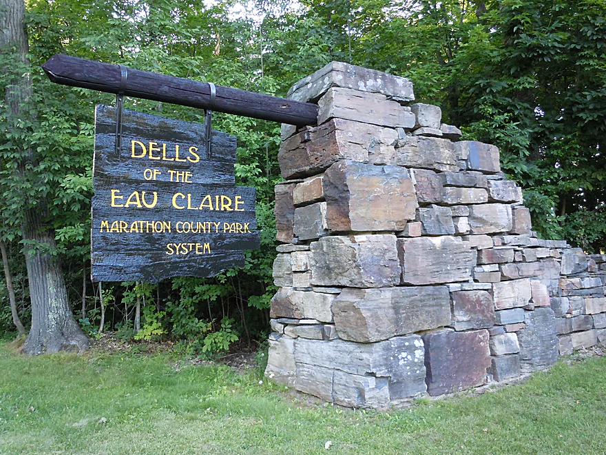
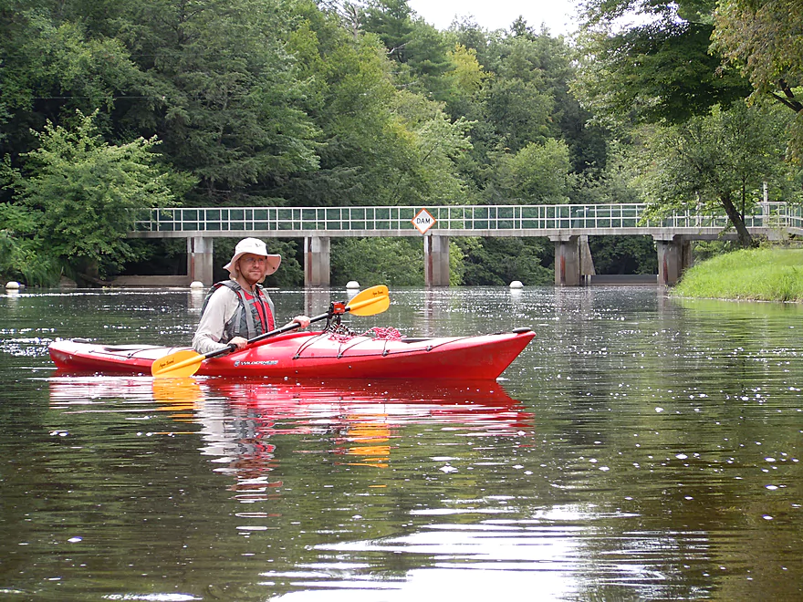
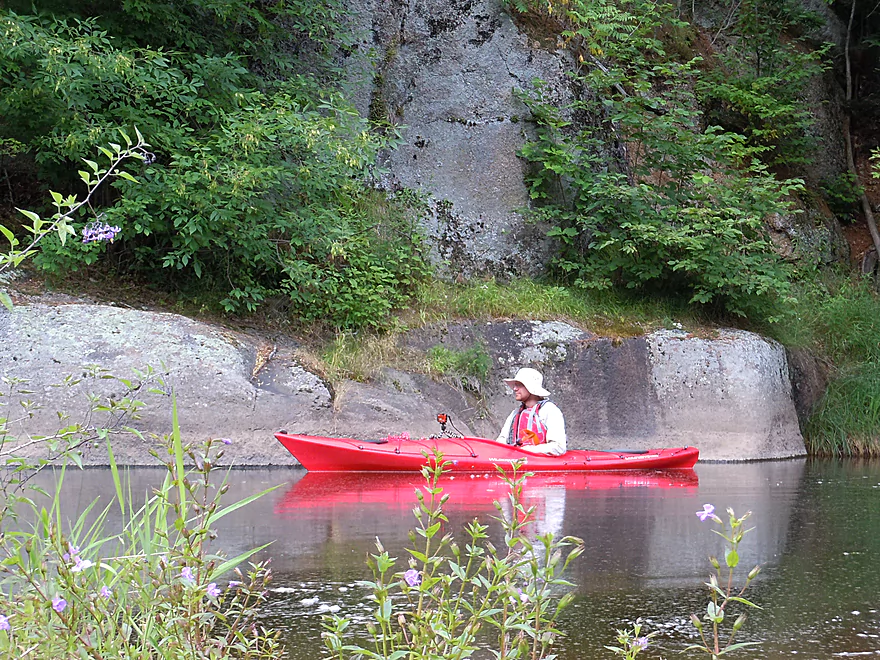
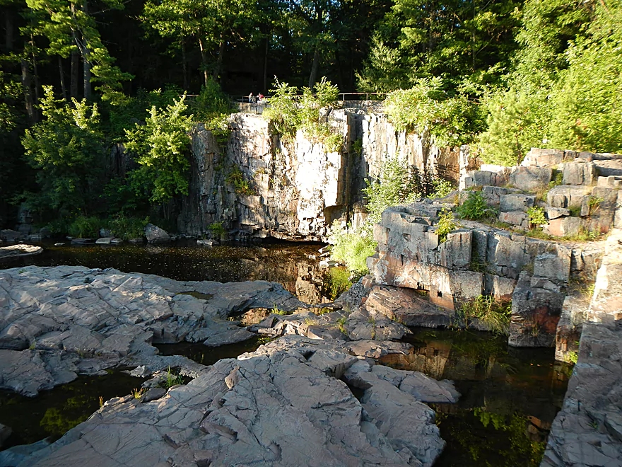
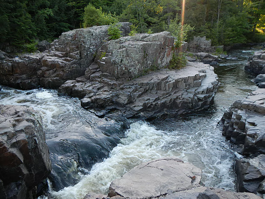
On that low note, we left and decided to at least salvage the day by going to the somewhat famous Eau Claire Dells County Park, which was at the heart of where we wanted to visit anyway. The park resides at the “Dells” where the water falls through some scenic drops flanked by attractive rock outcroppings. Just upstream of the falls is a small dam that creates a small swimming hole for campers, but I presume this is mostly for whitewater paddlers. My understanding is they do controlled releases to let whitewater boaters play through the main Dells area during the late summer/fall times when the river runs low. Just above the Dells and dam is a nice grassy picnic area where we had our lunch.
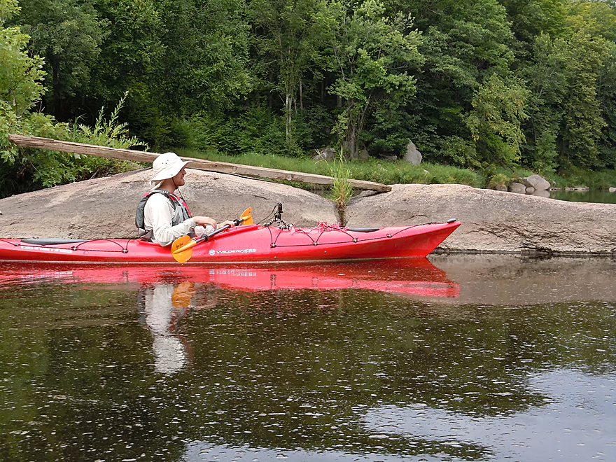
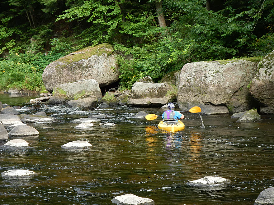
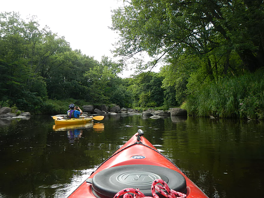
To our surprise, out of nowhere, a family paddled in from upstream and took out at the park where we had been eating. This was curious for multiple reasons. The little dam created a mini-flowage which I assumed would be boring. And once the flowage ended, the current would presumably make paddling upstream unfeasible. Talked with the family (nice people!) and they actually recommended this section, as they said it was very scenic with nice rock outcroppings and boulder gardens. One of the party members I actually recognized after talking with him. Turns out he is the famous (well, in kayak circles) Jake Stachovak who paddled Portage to Portage. And we’re not talking about just doing the canal like I did in a previous review…but paddling in the middle of winter down the Wisconsin to the Mississippi, into the Gulf, up the east coast, through the Erie Canal and into the Great Lakes, and back down the Fox. Incredible story that is documented on his website portagetoportage.com. It was quite the contrast to be with a guy who had so many challenges and would frequently paddle over 40 miles a day to a rec kayaker like myself who liked 5-10 mile segments and whose biggest issues consisted of finding helpful livery operators. Jake is a great guy who, besides giving me tips regarding the Eau Claire (he’s from Wausau), wrote down some great routes/highlights for the Far Upper Wisconsin River (there are sweet spots between the endless flowages that are good paddle prospects).
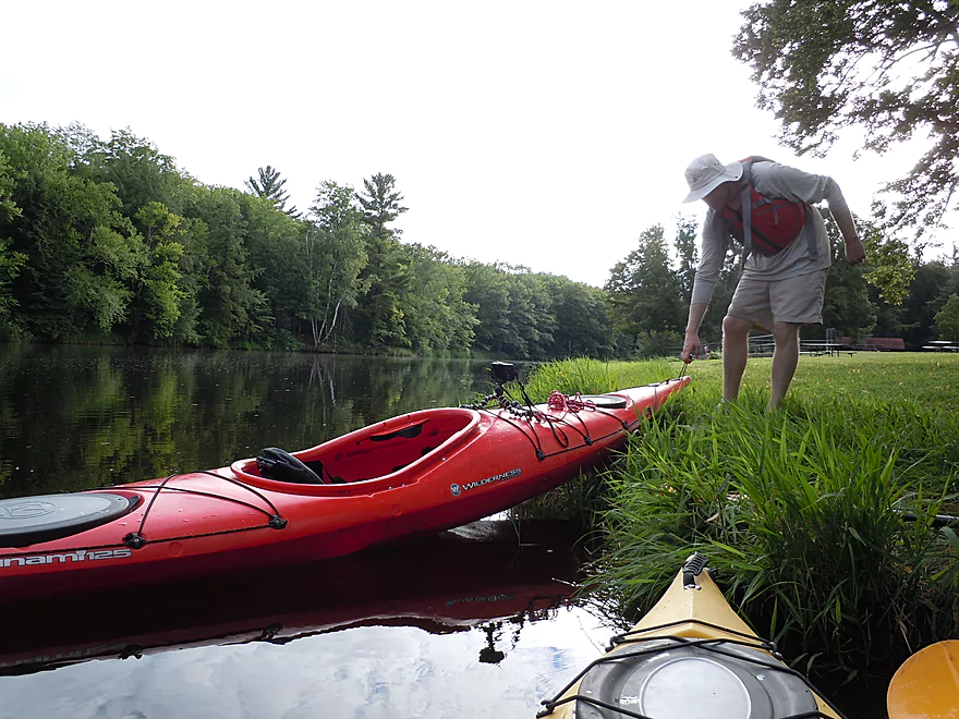
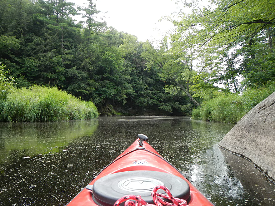
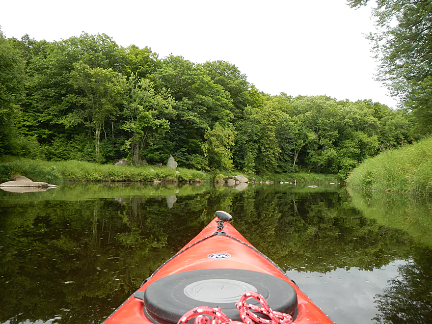
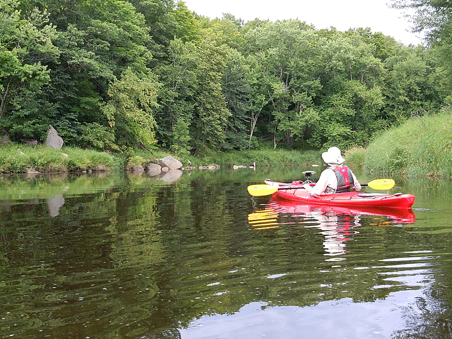
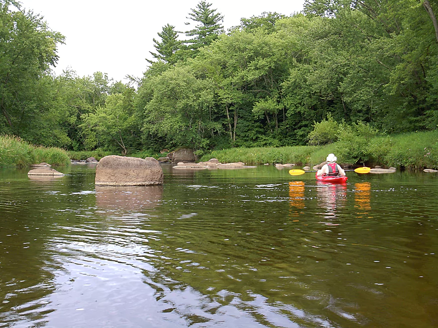
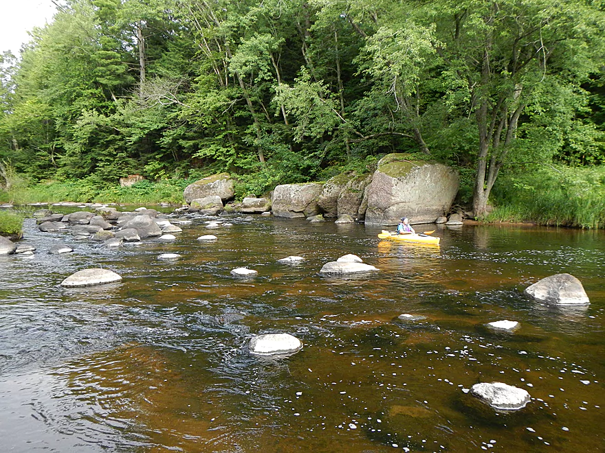
The section on this mini-flowage wasn’t long (just over 2 miles round trip) but that would be perfect, as we were going to try to drive back down to Southern Wisconsin yet and avoid moteling if possible. The park makes for a very nice launch area, with grassy banks to launch your boat, bathrooms, and public parking nearby. After you put in, there isn’t too much to explore “down-stream”. Just some noisy swimmers and the dam. During higher water, they lower the right gates and this forms a chute that you can run (don’t do this if you don’t have whitewater training). Despite the dam, the flowage doesn’t behave too much like a flowage (a good thing!). It stays narrow, but like most flowages, lacks much in the way of current.
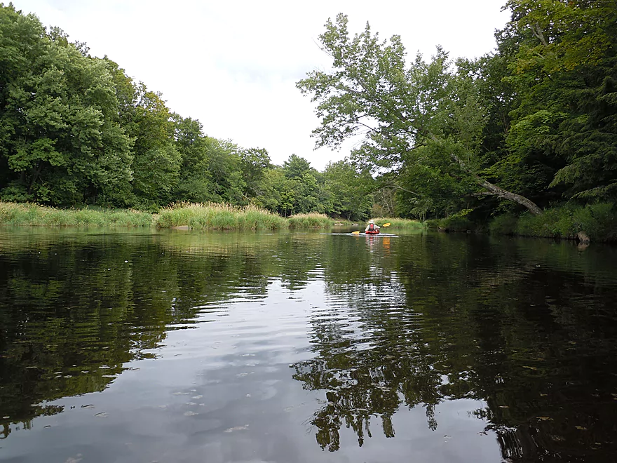
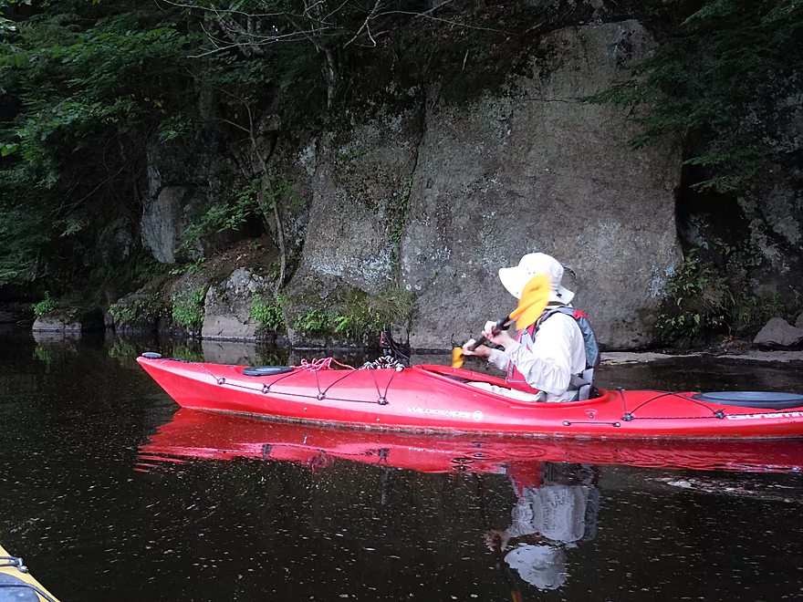
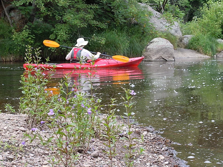
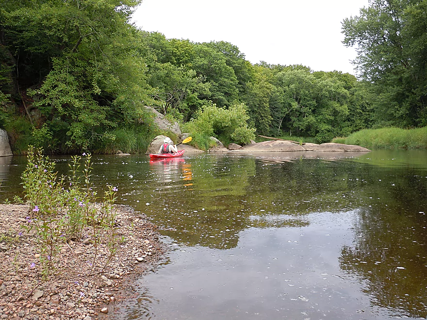
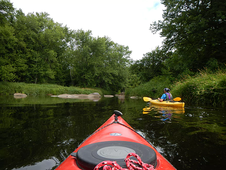
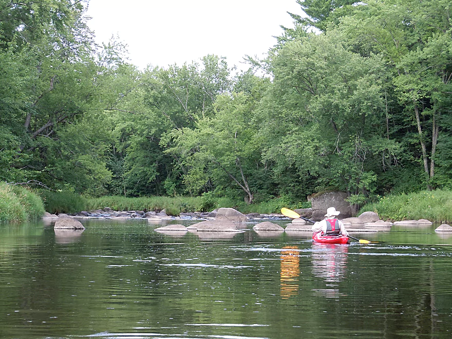
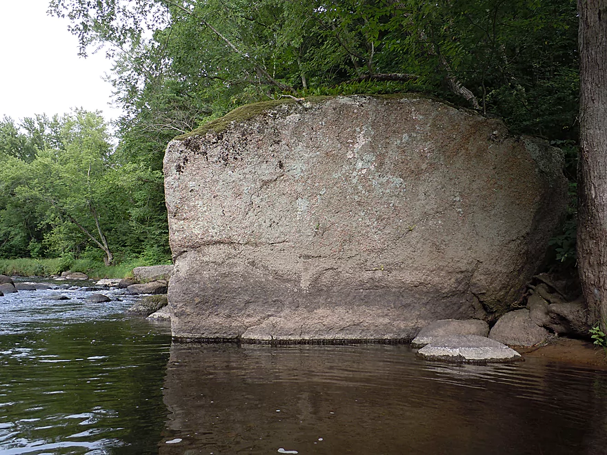
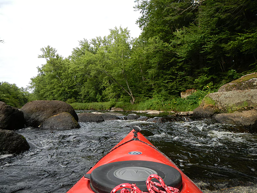
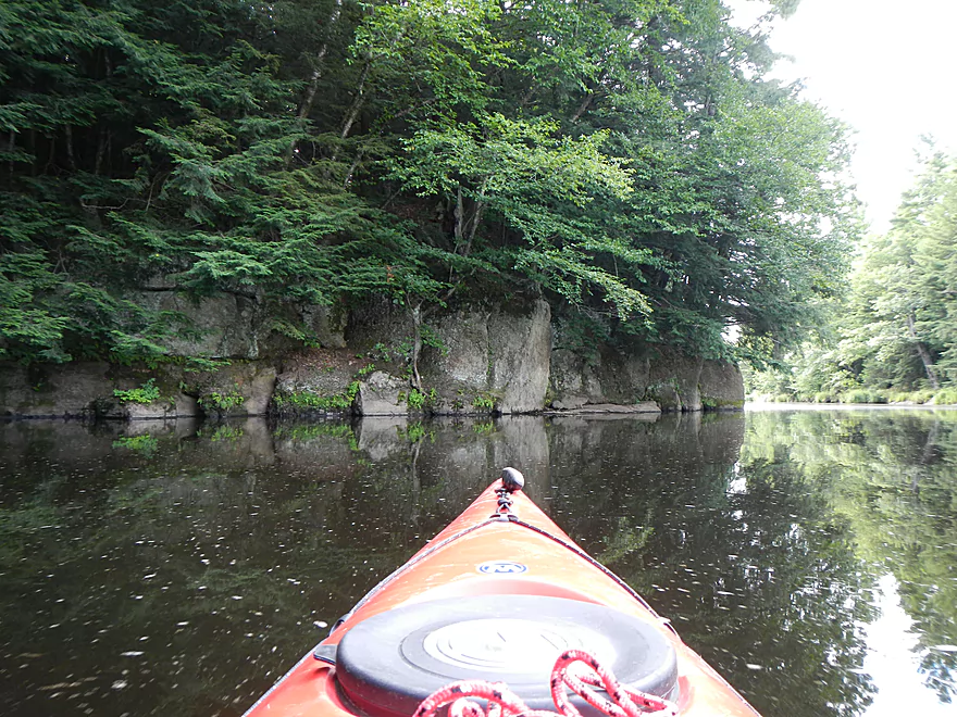
Paddling upstream, you’ll enjoy very clean water and attractive banks (for somebody who paddles the Baraboo, bank quality is always appreciated!). After a couple of bends, you’ll be greeted by very nice rock outcroppings and formations on the edge of the water. I suspect if the river was more consistent this would be a major tourist attraction, but most are scared off by talk of rapids or low water, which is a shame. Continuing past the beautiful bluffs, you’ll encounter a wonderful boulder garden in the middle of the river that is fun to paddle around. I likened it to a spaceship navigating through an asteroid field. After the major boulder field, you’ll encounter the “end” of the flowage. There is a small class I drop that makes going further upstream not possible. Well, it would be possible with a easy portage, but we decided to go just go with a short trip. From there we turned around, retraced out steps, and completed the loop.
Doing a loop, and short one at that, does not do a river like this justice. The advantage though is that it did not require portages for rapids or shallows and allows for taking in some of the highlights on the river. Ideally, a segment on the Eau Claire would be from Bear Lake Road to the park (in between bridges can shorten the trip), or from the park down to county Z–both widely reviewed and both roughly 7 miles. There are class 2 obstacles that can become dangerous during high water, so you’ll want to plan a trip like this very carefully A very nice map and guide is available at WisconsinTrailGuide.com. A nice depth guide is available at American Whitewater’s Website. Keep in mind that what whitewater kayakers want tends to be the opposite of what we (I assume that includes you) rec kayakers want. They just prefer enough water to pad the rocks. But, higher water is almost always more dangerous, dirtier, and less scenic (whitewater means spring paddling for many rivers, but the leaves frequently aren’t out by then). Plus, higher water frequently covers up a lot of the character a river can have as well as the shoreline.
Paddling low water isn’t too bad as long as you come prepared. Try to aim for ~5 mile segments instead of ~10 miles. Make sure you have adequate footwear for wading over rocks and a rope to tow the boat. Ideally, your kayak or canoe will have an open cockpit which makes getting into and out of it easy, as well as a flat, wide bottom and shorter length. V-bottom boats will scrape more and longer boats are tougher to manage around shallows. Make sure to read the river right….still water runs deep and away from inside bends. With preparation you can run a lot of shallow rivers that become completely different animals during August and September. The Upper Eau Claire Flowage (a name I made up) might be particularly nice to run in the fall because of the number of maple trees on the banks, which I presume would make it a good fall color trip.
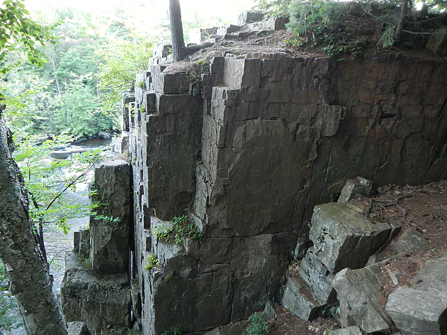
After the trip, we explored the dam, the Dells, and the trail system between the two. The trail system is very nice and was kind of deju vu of the Presque Isle River (located in Porcupine Mountain State Park). The trail system actually runs below the Dells and there are cool bluffs to explore down there, but we were running out of light and didn’t have a chance to explore that, so the pictures/video below don’t tell the whole story. In fact there are a number of scenic bluffs on the river outside of the County park (see the Wisconsin Trail Guide site for more info/pictures). I assume the trail system is mostly purposed for whitewater kayakers who want to portage back to the car after running either the dam or the Dells, as it might be a tad rough/long for bigger boats.
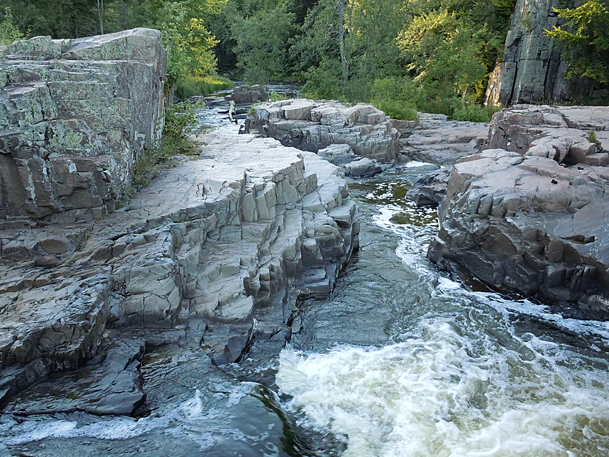
The Dells themselves are very cool. We went during low water, so not all the channels were open and the falls were quite tame. In fact there were kids (VERY noisy ones) playing in the falls and going down what is normally fierce and dangerous drops like water slides. Granted, what they did was dangerous without life-jackets, but it just goes to show how important water level is to this river. You can actually during low water get out on the rocks and I highly recommend this as it is very scenic. Again, make sure to also follow the trail system further downstream to take in the entire Dells/natural area.
On a somewhat unrelated but related note, we did check out the Wausau Whitewater Park before heading to the Dells. This “park” is a modified channel of the Wisconsin River, right in the middle of the city. Turns out that day was a release day (where the dam releases enough water in a small channel to create a nice whitewater run). The “river” (east branch of the Wisconsin) was packed with kayakers who were doing all sorts of fun tricks like flips. The largest group seemed to be comprised of paddlers from the Hoofers club at UW-Madison. The rapids looked fun and are open to the public, but from what I saw were above my current skill level.
Before being ridiculously dammed, the Wisconsin was actually somewhat of a whitewater river in many spots going down to even the narrows at Wisconsin Dells. So these releases kind of roll back the clock to how the river used to run (but cottage owners who sell time shares get quite upset that they lose some of their shoreline to these releases during tourism season).
Detailed Overview
Click here to see an overview of the Eau Claire River.
East Branch:
- Upstream from Wayside Park: The river this far upstream might be small and brushy, but should be mostly navigable.
- Hwy 45/Wayside Park to Cty I: 5.1 miles.
- Wayside Park to Cty B: 1.3 miles. Upstream from Cty C the river flows through an attractive residential area with a few nice boulder gardens. There is one logjam to portage. Downstream from Cty C the river is more brushy and less attractive. This is the weakest part of the East Branch IMO.
- Cty B to Bluebell Road: 1.7 miles. This is a nice wooded stretch with some alders, but also some pines and spruce.
- Bluebell Road to Cty I: 2.1 miles. This leg starts narrow and deep, flowing past mostly submerged boulders, then widens out and becomes more shallow. This is a solid stretch that is popular with trout fishermen.
- Cty I to Hwy 64: 6.1 miles.
- Cty I to River Road: 1.1 miles. This is brushy and IMO not that interesting with one major logjam.
- River Road to Cty H: 1.1 miles. A bit more open than the preceding stretch, but still brushy and not super interesting.
- Cty H to Spring Road: 2.0 miles. The first half is a bit overgrown, but the second half is really nice with some boulder gardens, attractive woods, and fun rapids.
- Spring Road to Hwy 64: 1.5 miles. More open and not as rocky as the previous sections, but nice with attractive meadows.
Main Branch:
- Hwy 64 to Cty Y: 2.7 miles. West Branch joins up, significantly enlarging the river. Thick woods and canopies crowd the river. There might be some logjams on this stretch.
- Cty Y to Hanson Road: 1.7 miles. A very dense and wooded section. Maybe a few light rapids but nothing major.
- Hanson Road to Hwy G: 4.3 miles. More dense woods and some light rapids. Possibly a logjam....otherwise should be a nice stretch.
- Cty G to Bear Lake Road: 3.0 miles. A good prospect, but I don't believe there are rapids.
- Bear Lake Road to Hwy 52: 3.6 miles. A great five star section with many boulder gardens and rapids (a few Class 2s and one Class 3).
- Hwy 52 to Dells of the Eau Claire Park: 4.1 miles. Really neat section with rapids and fantastic rock walls. Rapids are less serious than the upstream leg, but do include a Class 2 I believe.
- Dells of the Eau Claire Park to Cty Y: 0.2 miles. This section is called "The Ledges" and is typically Class 2, but is Class 3 in higher water. The dam should be portaged river right (there are downed trees in the water to contend with below the dam).
- Cty Y to Cty N: 6.6 miles.
- Cty Y to Cty Z: 2.0 miles. This starts with the famous Dells that should be portaged. There is a portage path (right/north) but it is steep. I recommend instead launching from either the south or north trails. After the Dells is a great section which includes very scenic rock walls and Class 2 rapids.
- Cty Z to Cty N: 4.6 miles. More flatwater, but still many rapids, including a Class 3 by Lower Dells Island. Badger Road is a steep but alternate access point.
- Cty N to Clubhouse Road (aka Edwin's Park): 3.5 miles. Pleasant, but I suspect this lacks any serious rapids. Popular with locals and the liveries.
- Edwin's Park to Ross Ave: 7.8 miles.
- Edwin's Park to Cty J: 4.1 miles. A nice section with a few rapids and boulder gardens. The Mountain-Bay State Trail pull-off is an alternate access option.
- Hwy J to Ross Ave: 3.7 miles. A great section with more rapids and boulder gardens.
- Ross Ave to Yellowbanks Park: 2.7 miles. I don't know much about this section...there are some rapids.
- Yellowbanks Park to Eau Claire River Conservancy: 2.7 miles. A narrow wooded section. Not sure if the Conservancy is accessible during low water.
- Eau Claire River Conservancy to the Brooks & Ross Dam (aka Drott Street): 1.5 miles. Probably boring flowage paddling. After the dam you are on the Wisconsin River (and another flowage).
Trip Map
View Upper Eau Claire Flowage in a larger map
Overview Map
Video
Photos Size: