
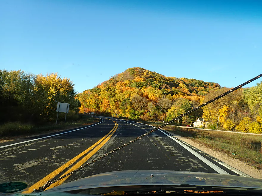
Scenic drive to the Turkey River
Welcome to Elkader
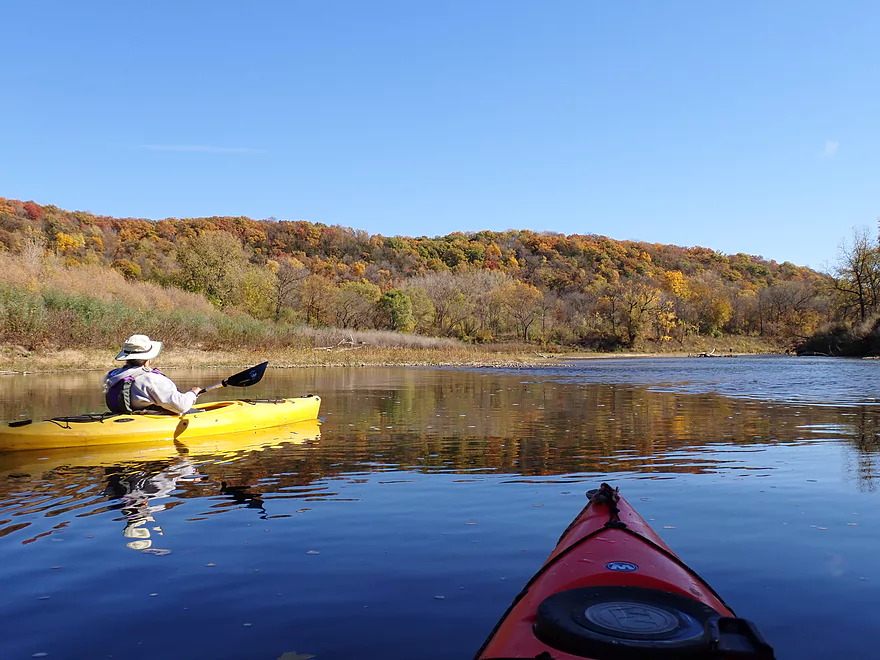
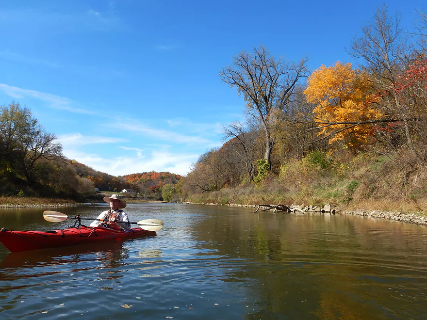
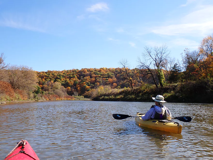
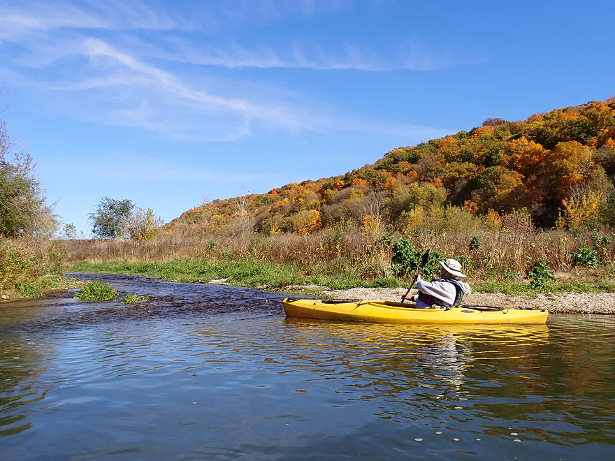
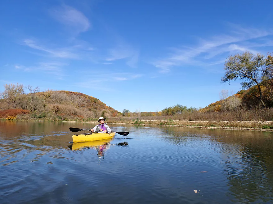
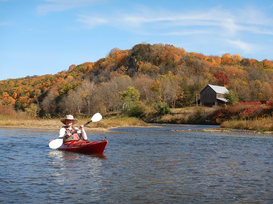
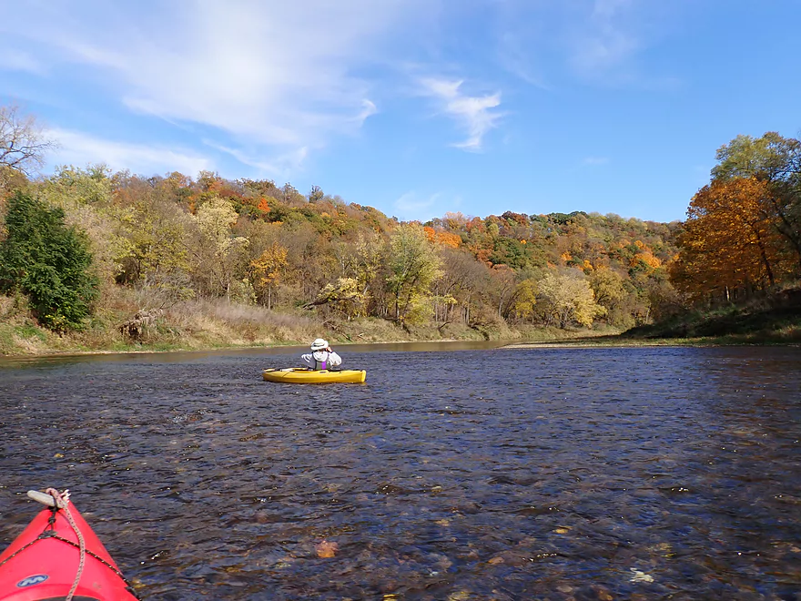
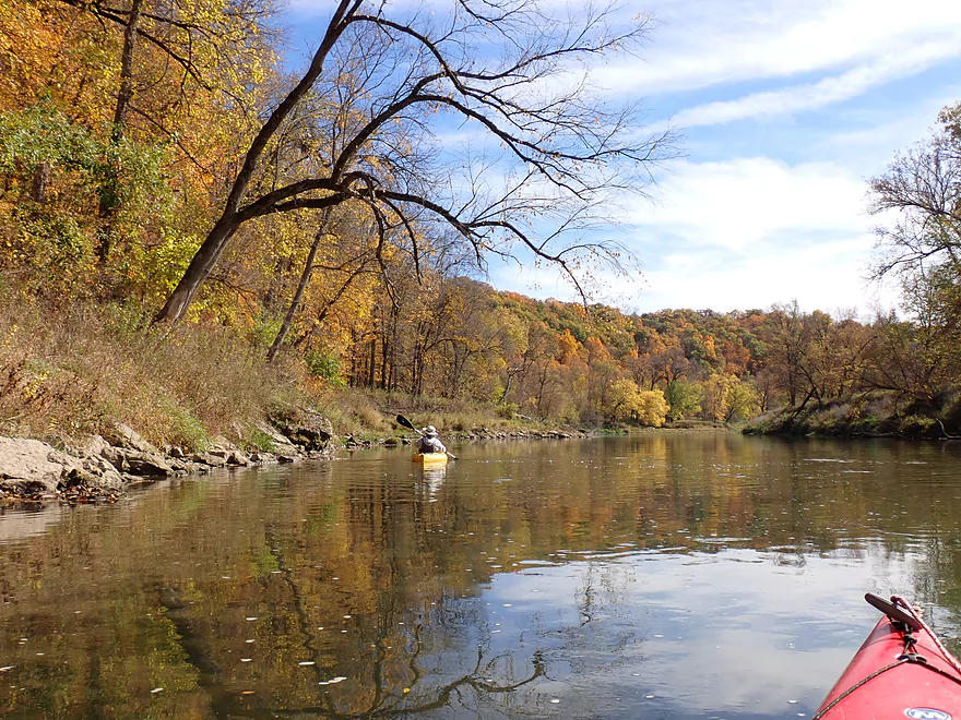
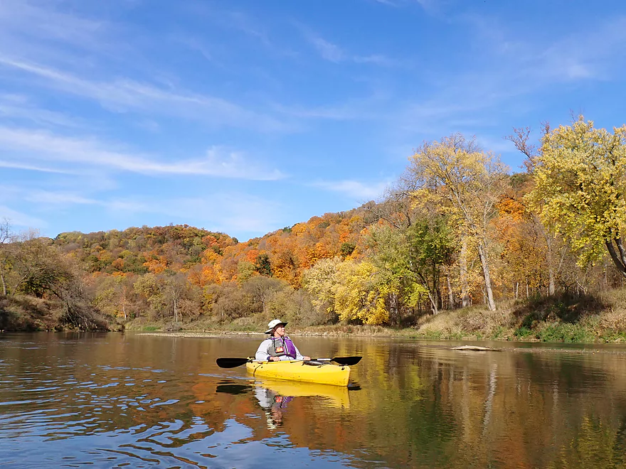
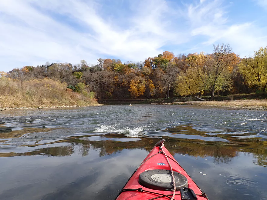
Where there was a lot of great color
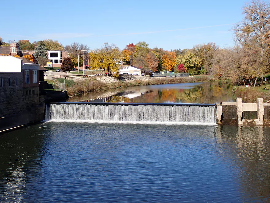
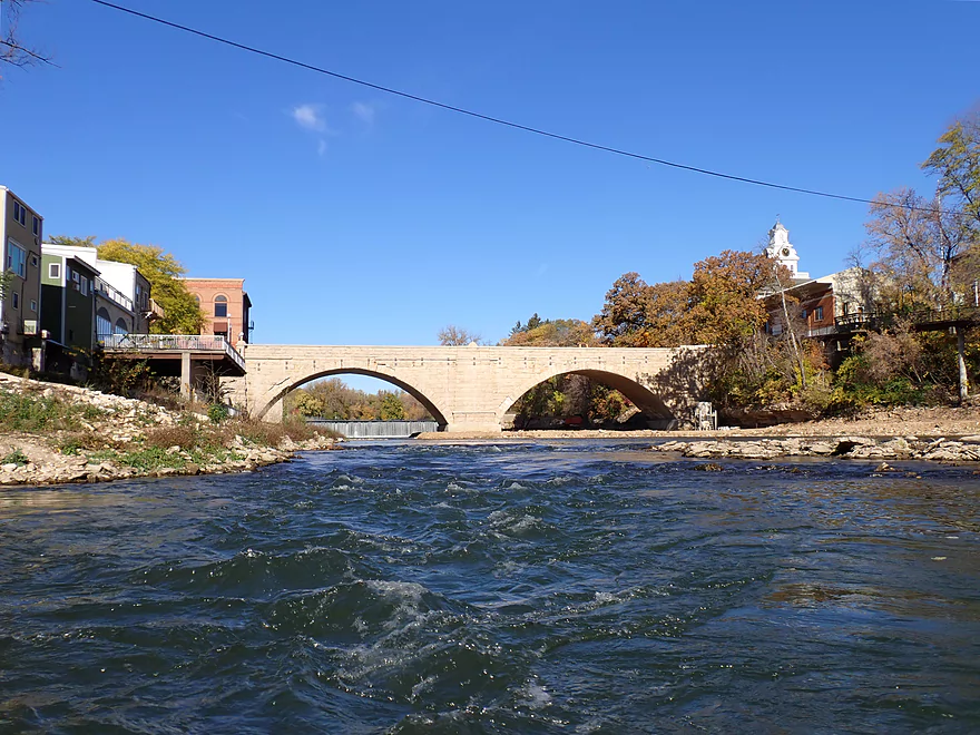
At the north end of town, the Turkey River is dammed
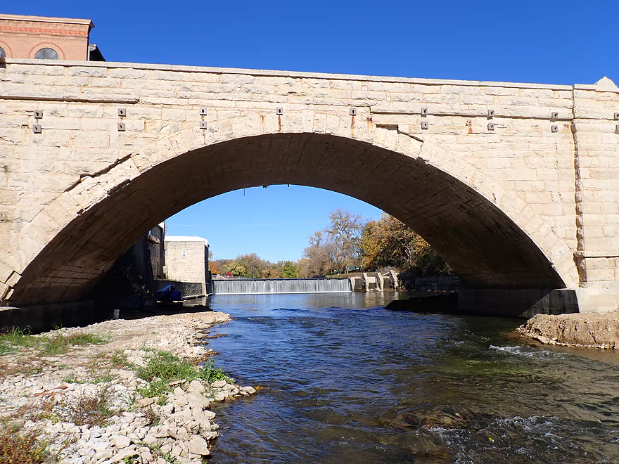
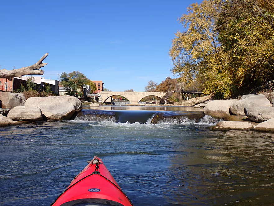
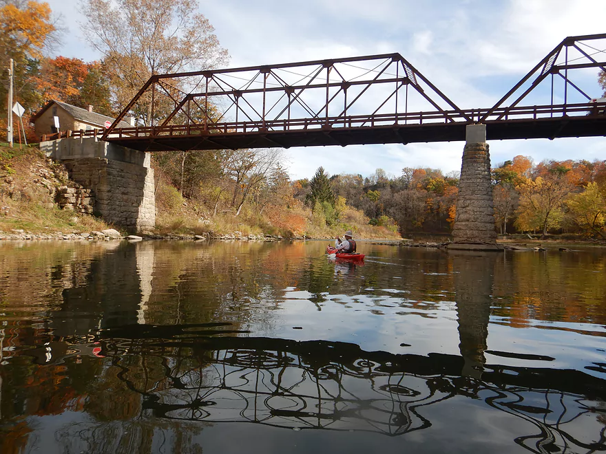
This is followed by a scenic stone arch bridge
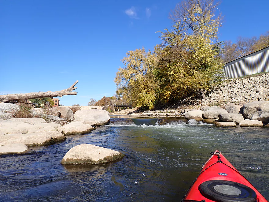
Which is followed by Whitewater Park, where we started our trip
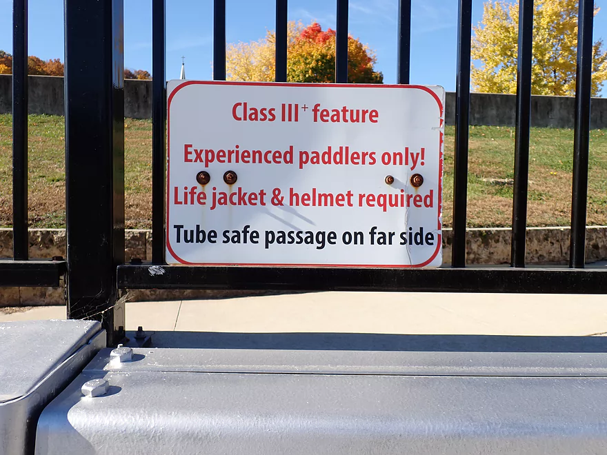
Sign warns of the rapids (only an issue if you run them)
Launching from the north end of the park
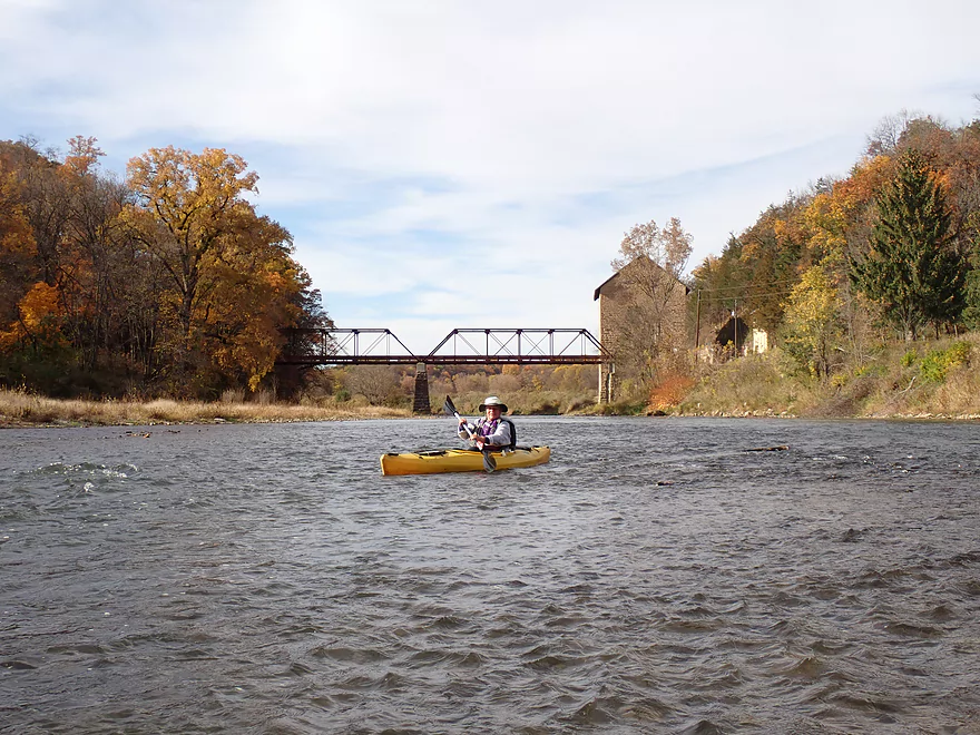
Heading upstream a bit to check out the Keystone stone arch bridge
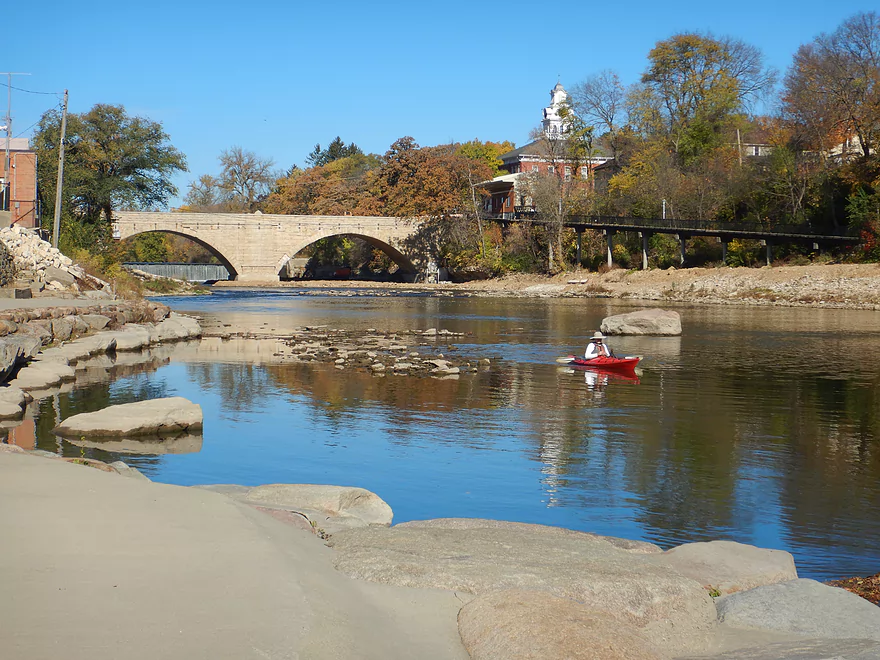
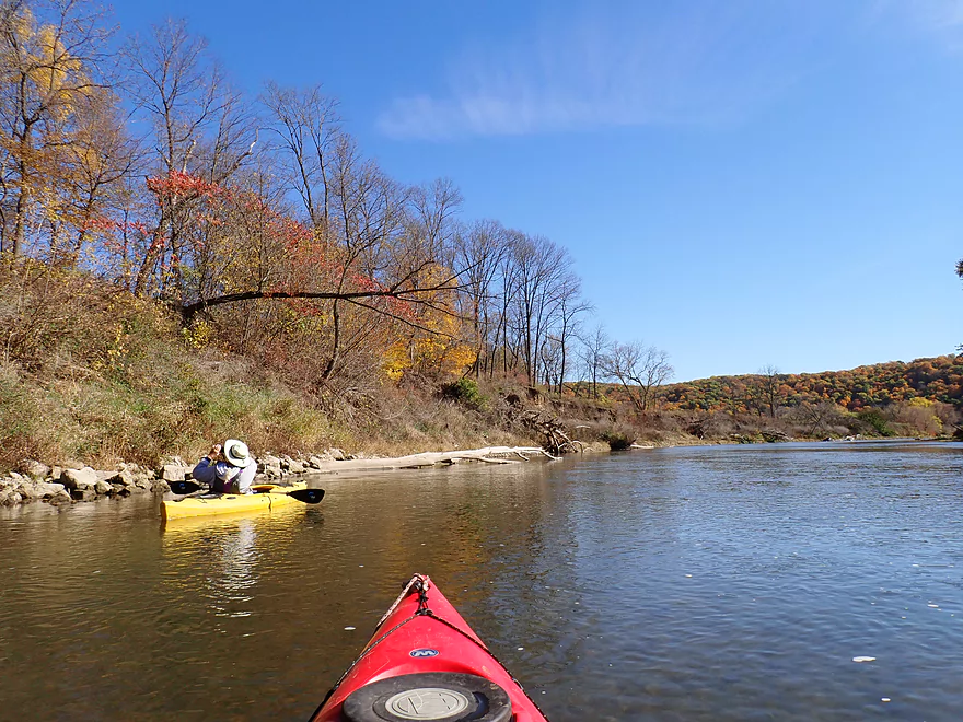
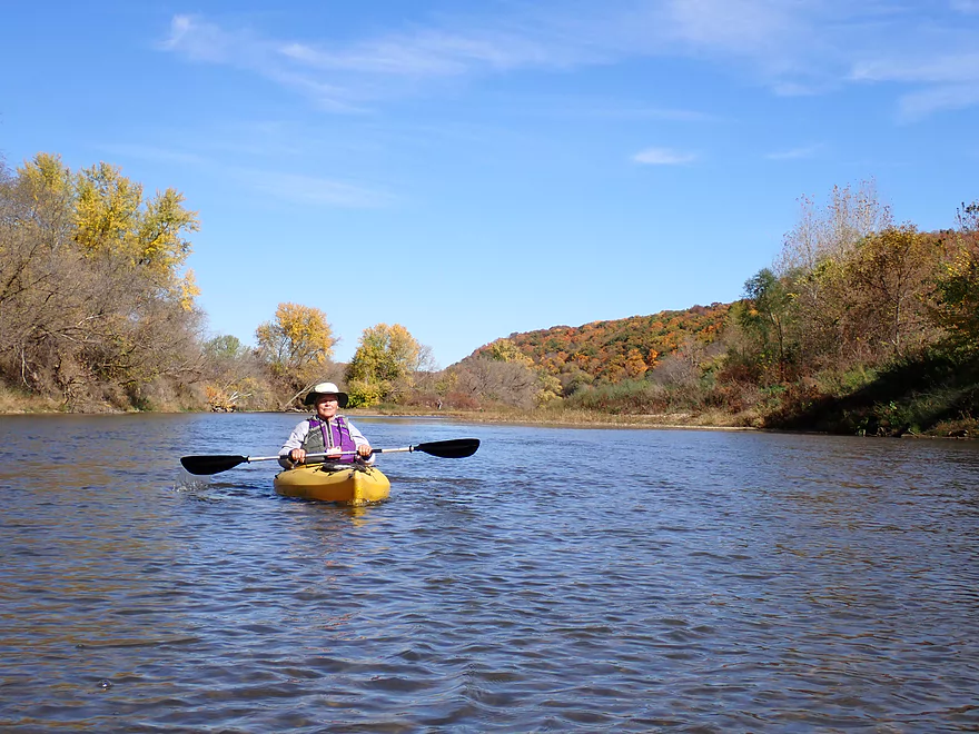
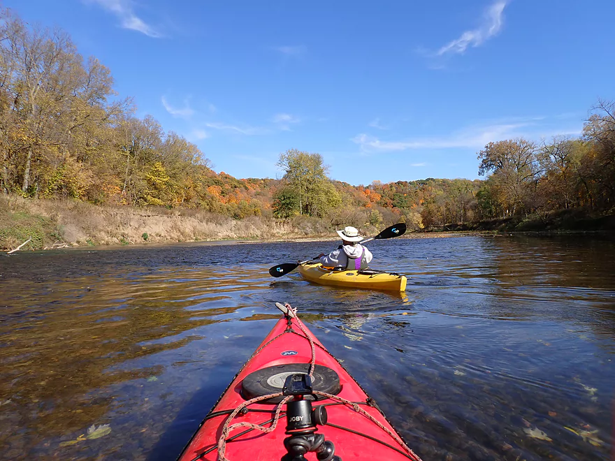
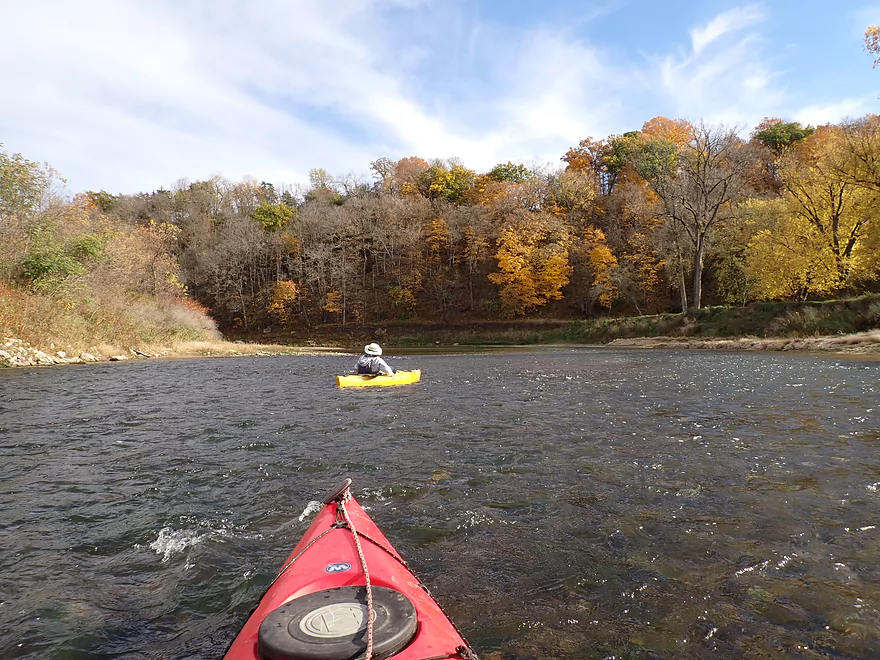
Returning to head downstream
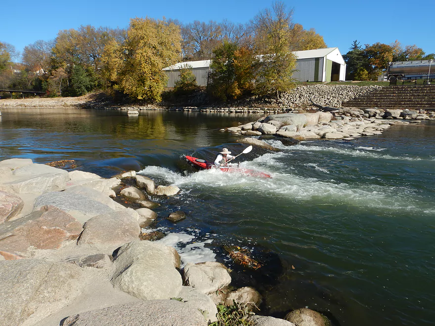
Running the Class 3 surfing ledge (I got wet)
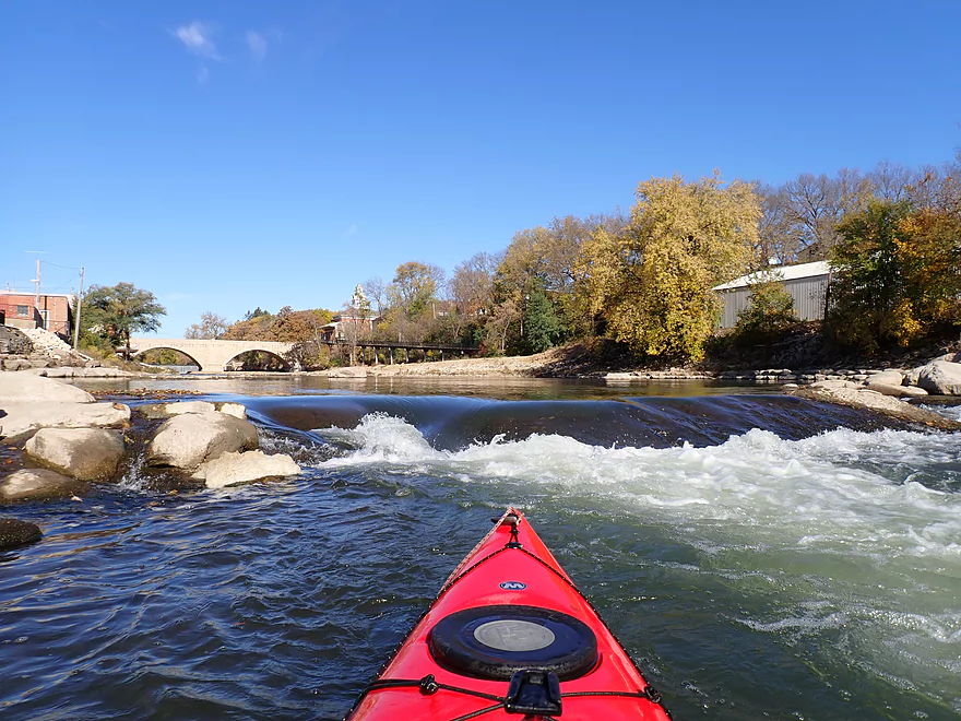
Reverse view…a decent ledge with a bit of a hole
The east end has an easier ledge for tubers and less-daring paddlers
This ledge is likely a Class 2
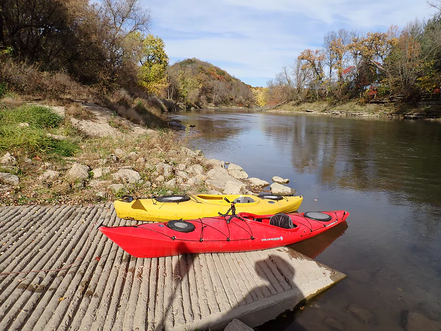
Alternatively you can avoid the whitewater and simply launch from the south end of the park
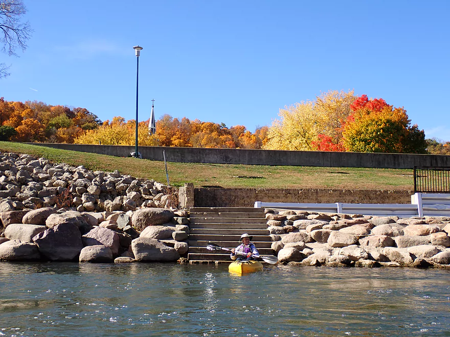
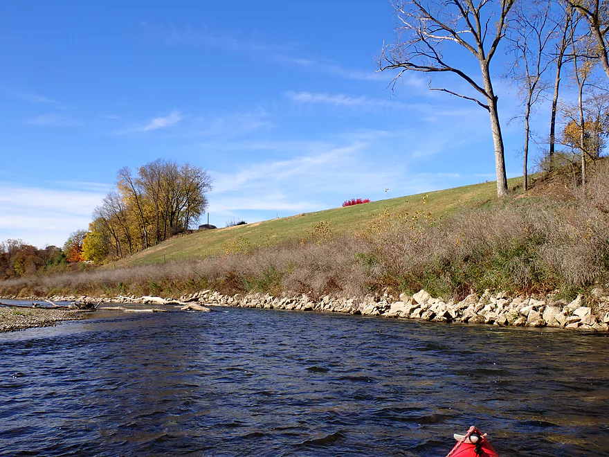
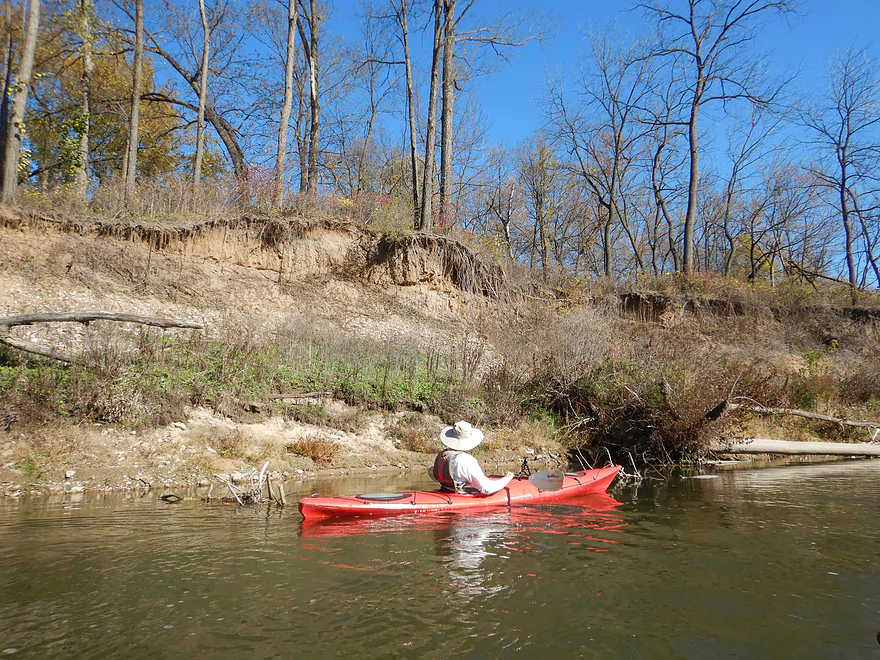
Impressive embankment…this was all under water during the 2008 flood
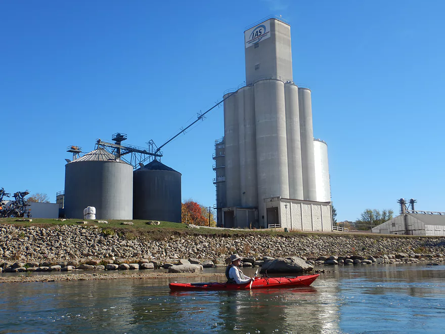
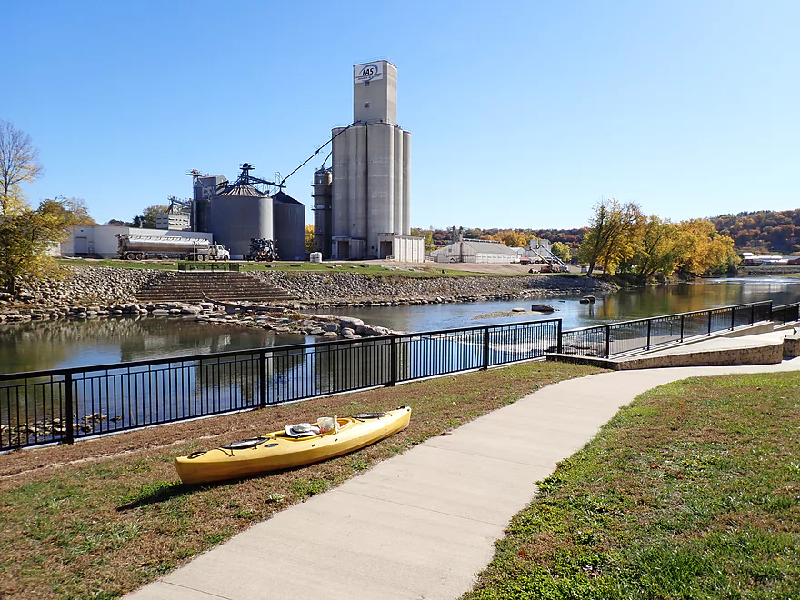
Paddling past a huge grain elevator
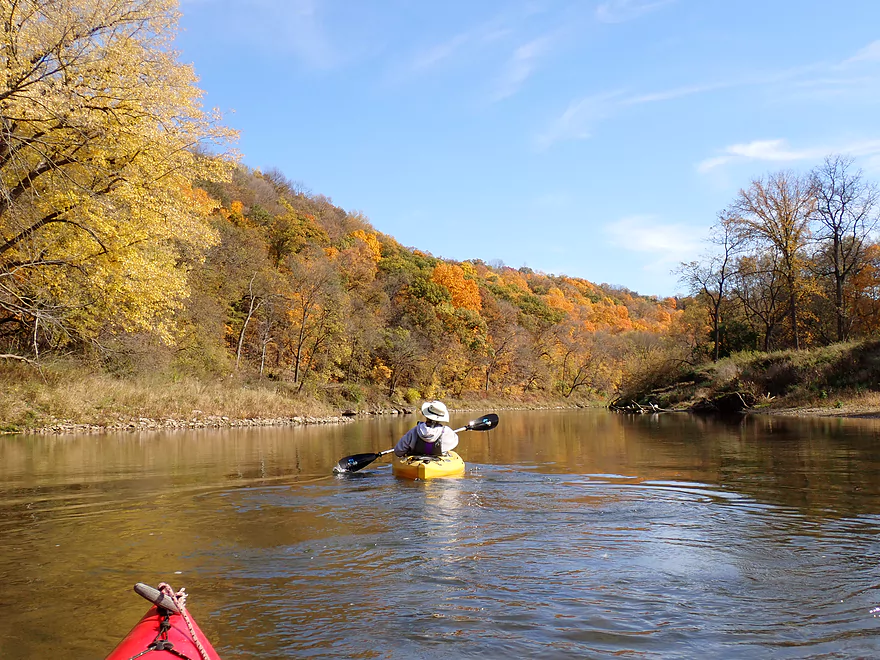
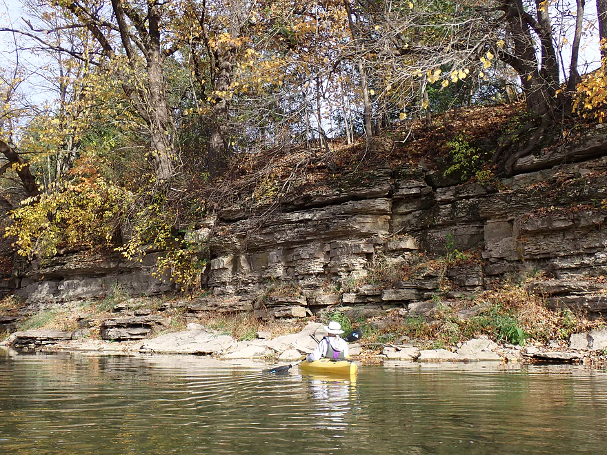
Scenic hills sandwich Elkador next to the Turkey River
Some shallow rapids next to Elkader City Park (where the local livery launches)
Fun but bumpy rapids
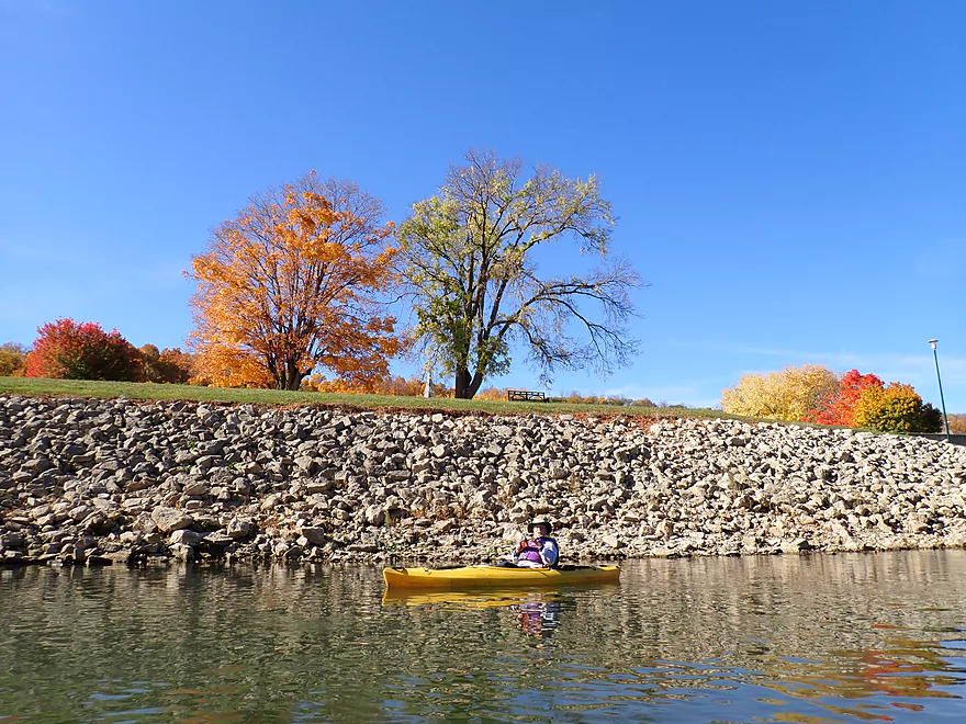
Another huge embankment
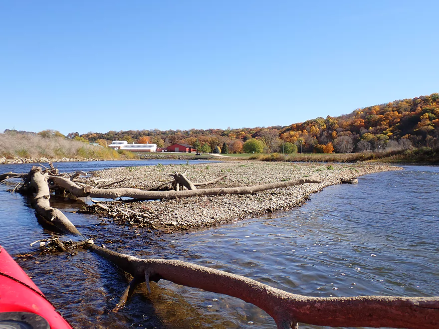
Reverse view…one of several gravel bars on the trip
Another one of the Driftless Area hills that surround Elkader
Hwy 13 is an access option via Turkey River Park
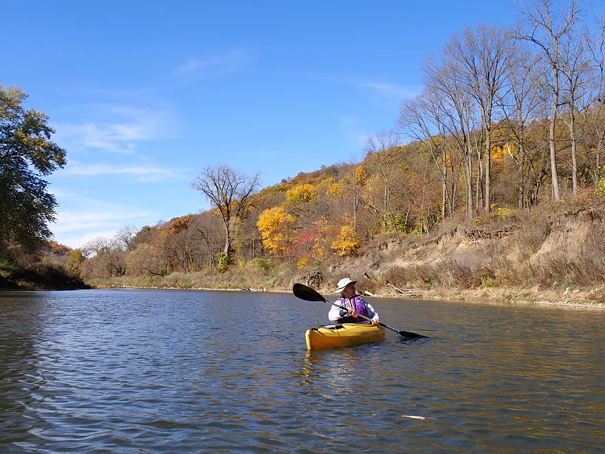
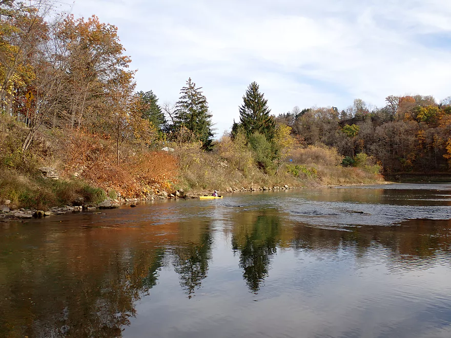
Nice peaceful stretch after the city
One of many light rapids
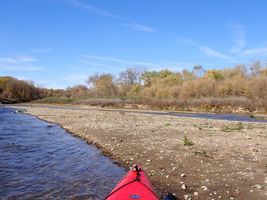
Another gravel bar
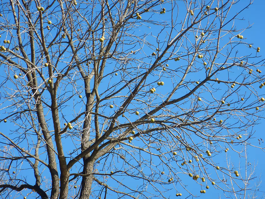
Walnuts are still hanging on to this tree
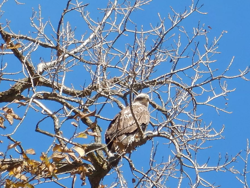
An osprey
River narrows by a constriction
Reverse view
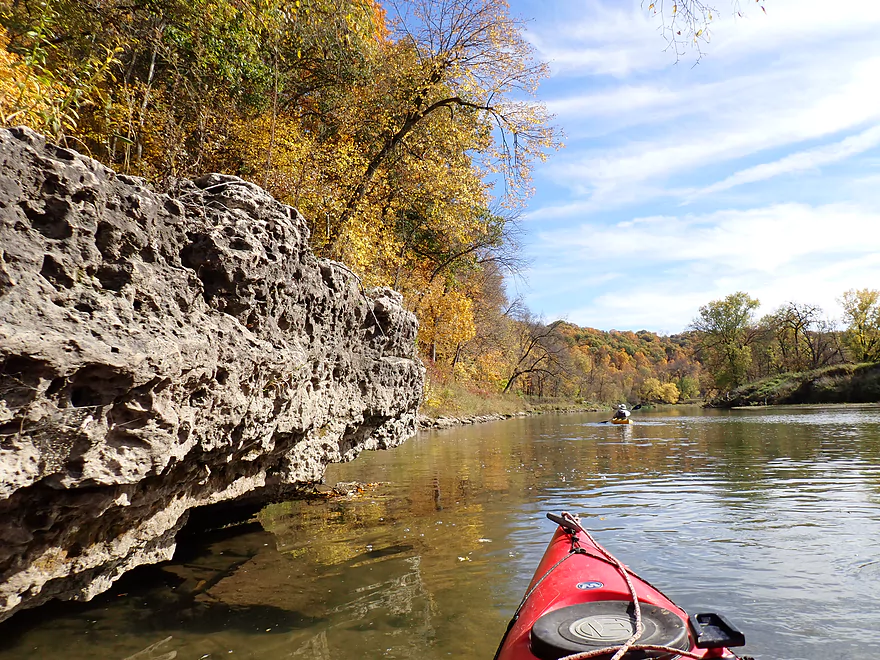
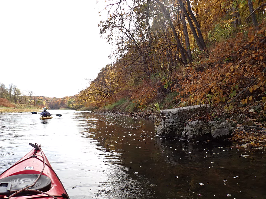
Rocky shoreline
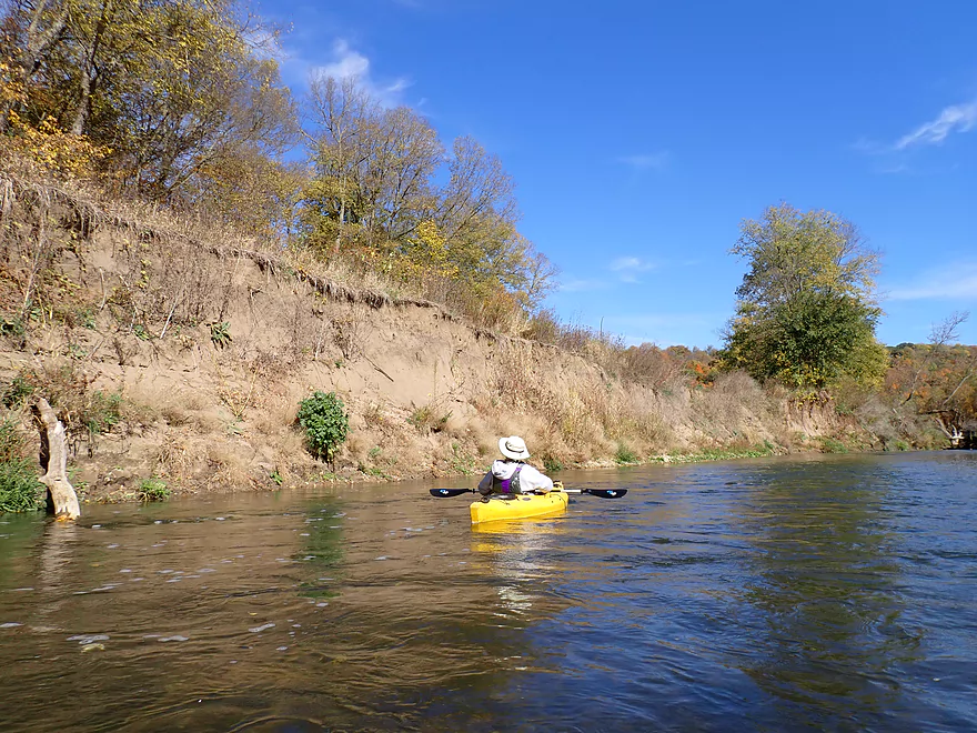
Sand and dirt banks
Paddling toward a massive bluff
Roberts Creek is a cool (literally) spring-fed creek
Reverse view of the Roberts Creek valley
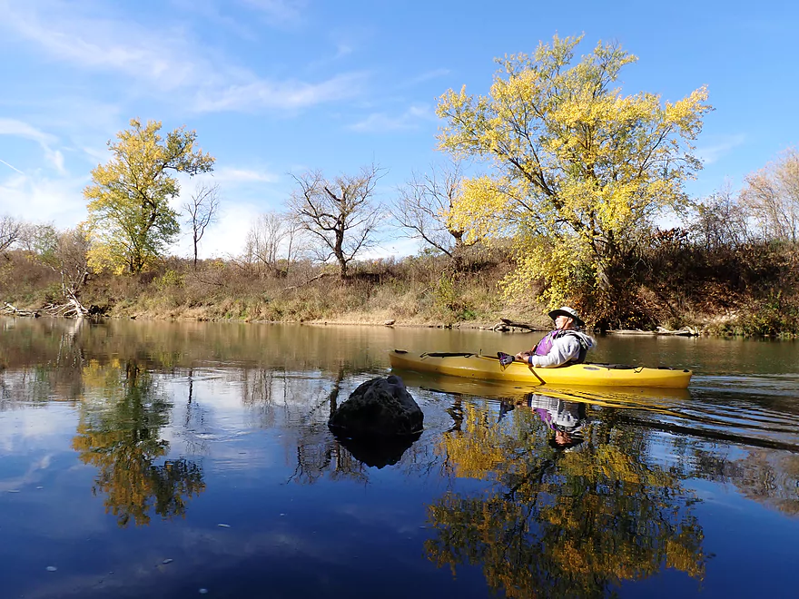
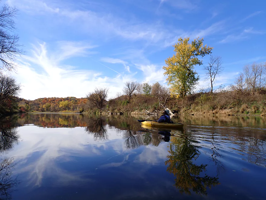
When the wind died down there were great reflections
Some shallow rapids around a small island
A very scenic stretch of the river
This is followed by another chute
Reverse view…bluff has an exposed outcrop toward the top
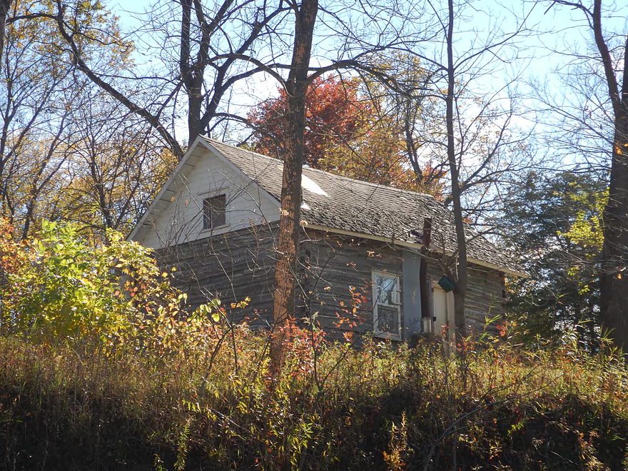
A rustic log house–part of an old farm
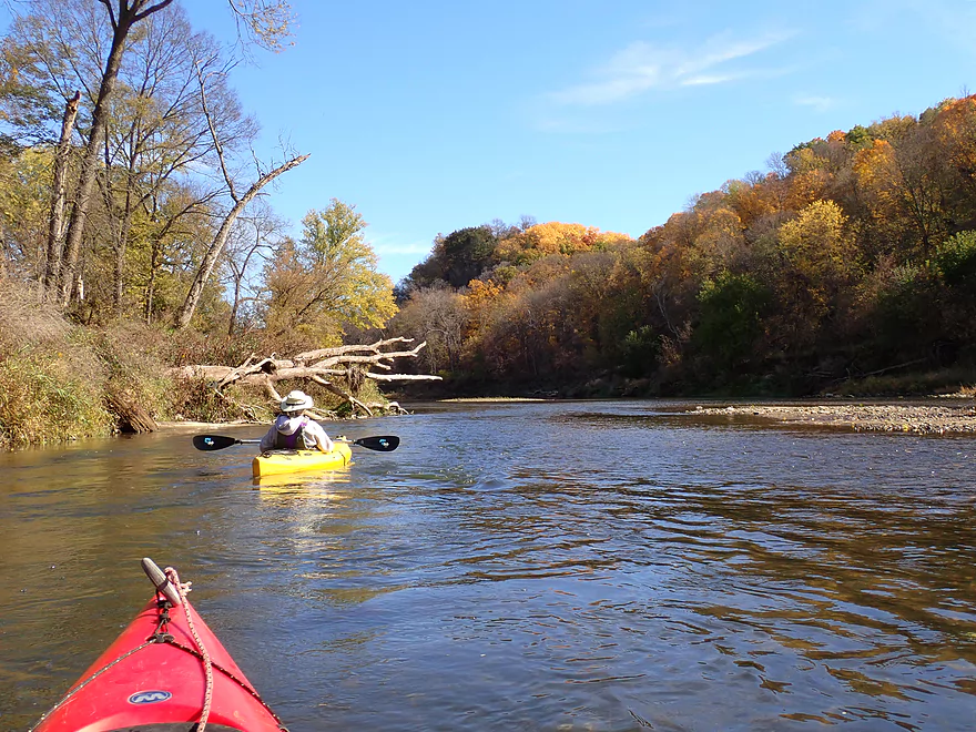
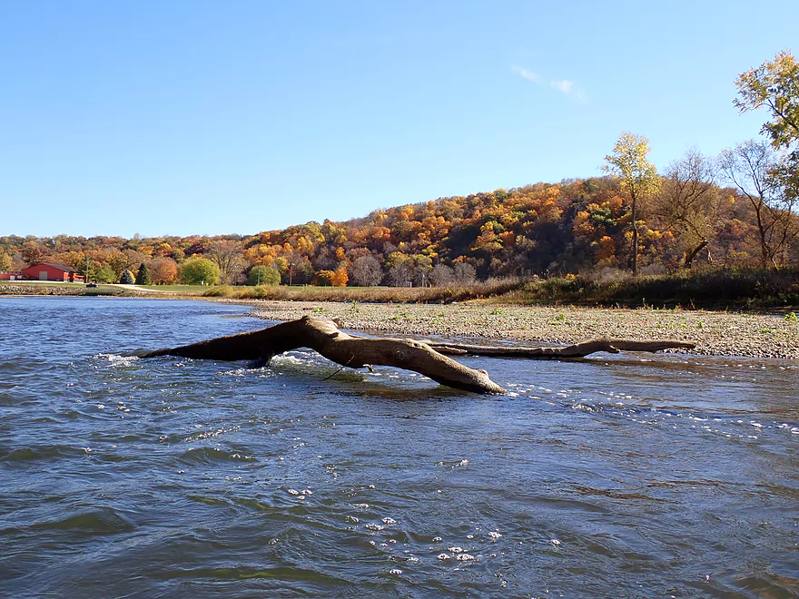
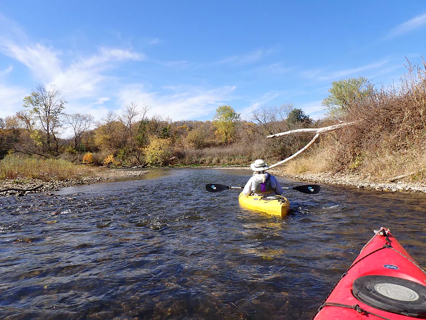
Logjams were never an issue
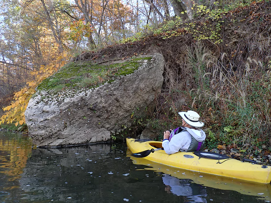
Huge limestone boulder
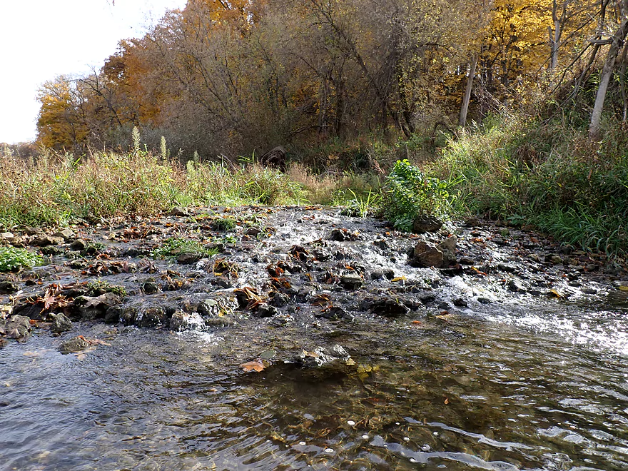
More shallow rapids
Banks were mostly low, but there were exceptions
Good clarity at times
Heading toward the best bluff of the trip
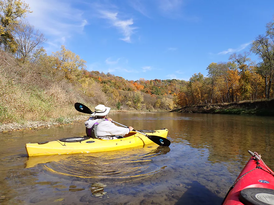
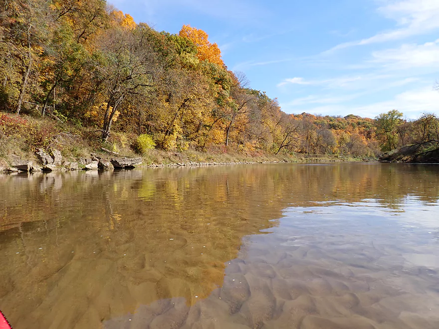
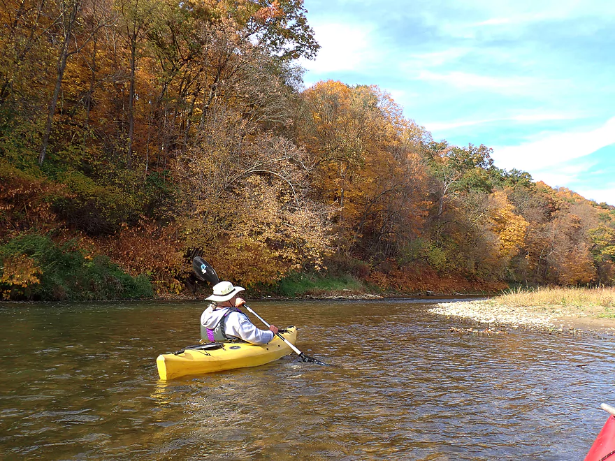
Great fall color
Underwater Sahara
Terrific scenery
Perfect fall color
Rocky shoreline
Reverse view
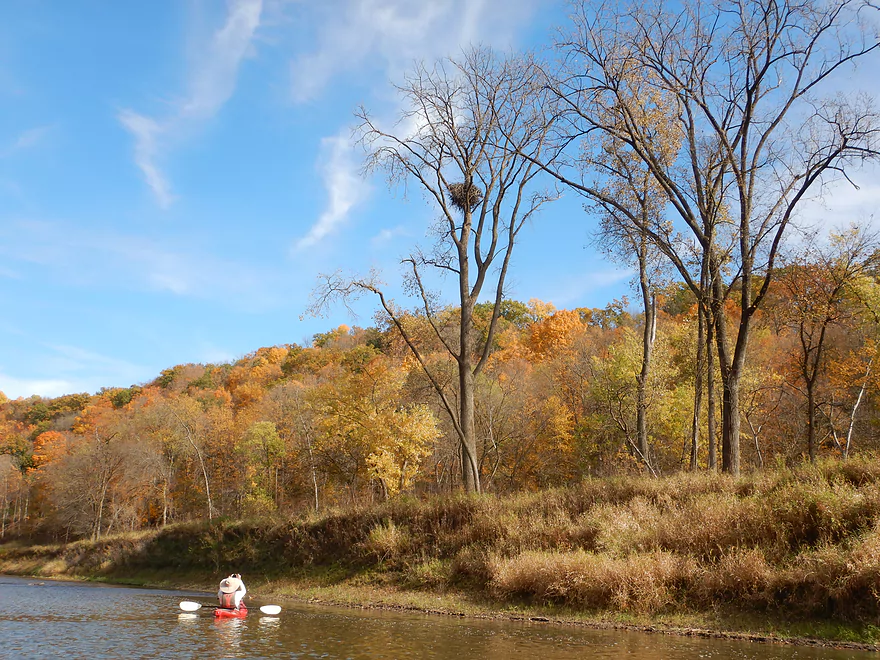
Large eagle nest…eagles were our constant companions on the entire trip
Paddling up against another bluff
Not as scenic as the previous bluff, but still nice
Another spring creek
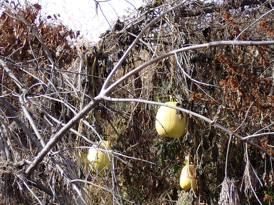
“Wild” pumpkins
Coming up on the best part of the trip
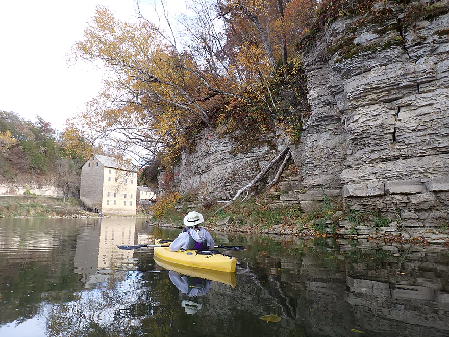
Upstream from the mill is a terrific series of cliffs (the dam was once located here)
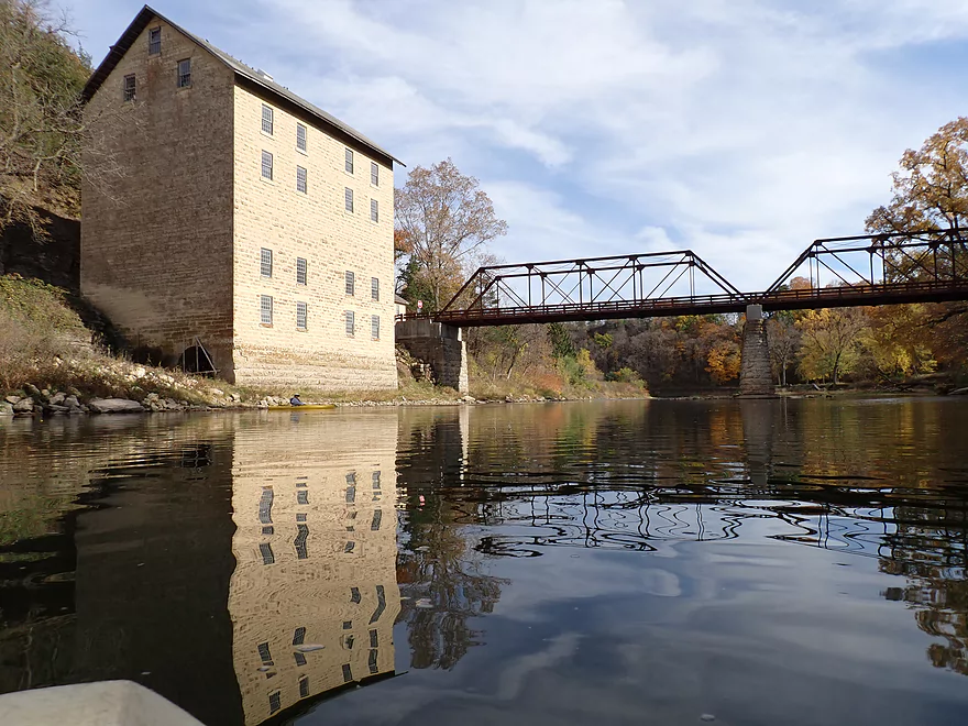
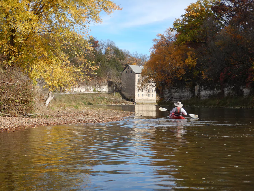
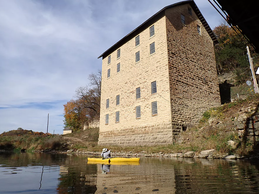
The famous Motor Mill
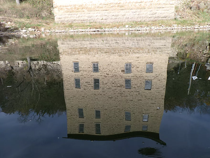
Motor Mill reflection
Reverse view of cliffs across from mill
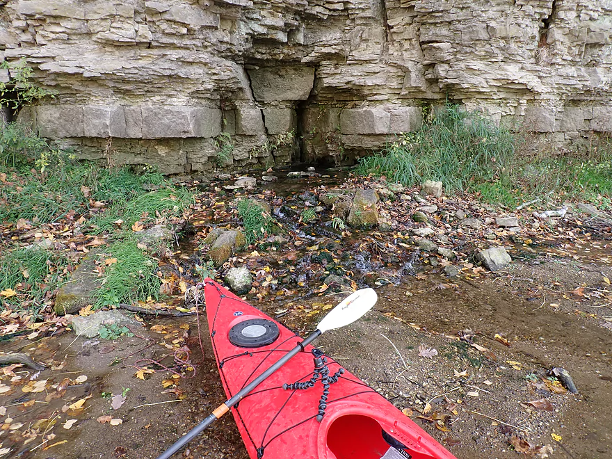
Neat spring at the base of the cliff
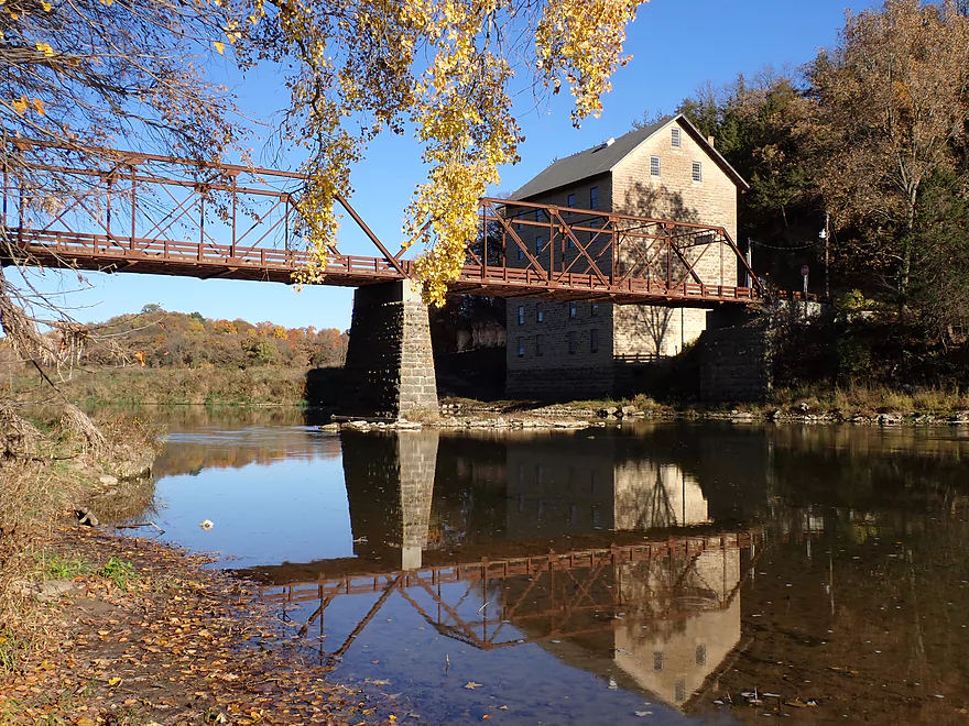
Rustic bridge crosses the river by the mill
Reverse view of the six-story mill
A trail system by the mill lets you get some better angles for pictures
Continuing downstream
More rapids
Another bluff
Last view of the mill and bridge
Final stretch
Another great cliff
Getting out at the Motor Mill Canoe Access/Landing
The landing is incredibly scenic
Turkey River – Elkader

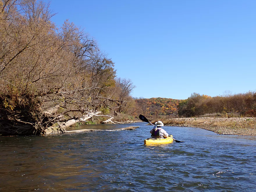
The Turkey is a popular paddling river located in Northeast Iowa. The trip this week was to do the stretch from Elkader to Motor Mill which is the most popular section of the river.
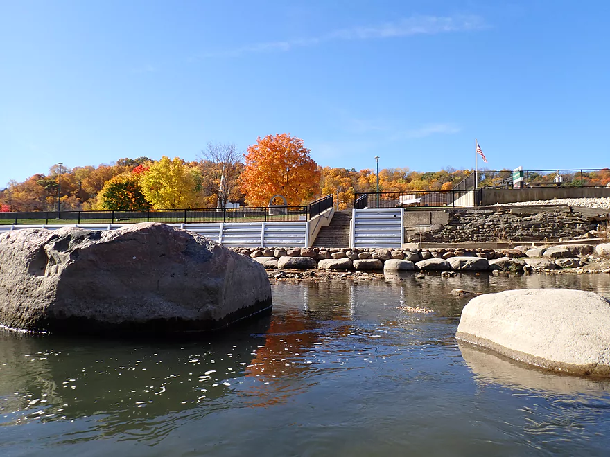
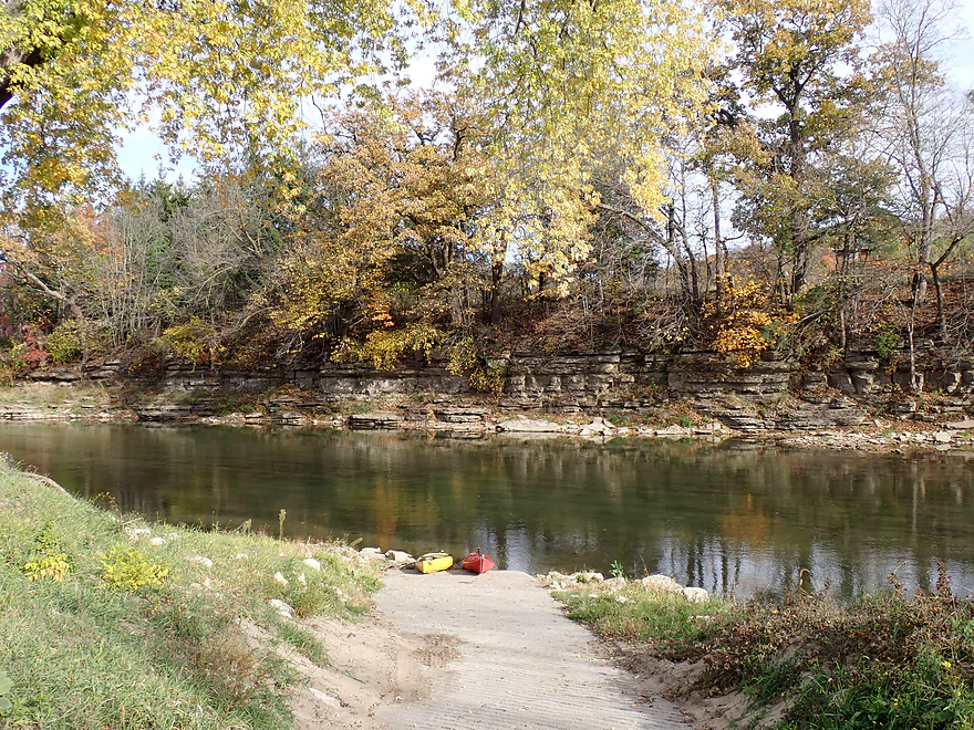
We started at the Elkader Whitewater Park, which is located just downstream from downtown Elkader, a dam, and a rustic stone arch bridge. The park is a beautiful developed area of the shore with paths, benches, and signs. Cement stairs lead down to the water where paddlers can launch above or below the main whitewater ledge.
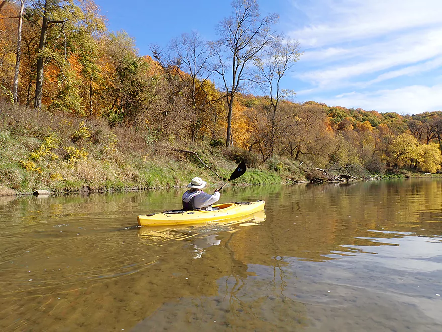
I launched on the upstream side of the ledge in order to check out a small boulder field and the stone arch bridge, and then doubled back to run the Class 3 ledge, where I was rewarded with a lapful of water (should have worn my skirt). The ledge is somewhat steep, as it is intended for surfing in whitewater boats. There’s actually an easier Class 2 ledge on the east side that tubers and beginner kayakers may prefer. Or again, for those that absolutely don’t want to risk getting wet, just simply launch below the rapids.
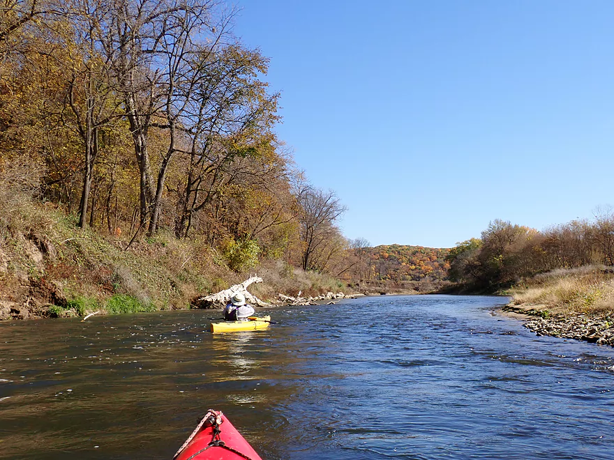
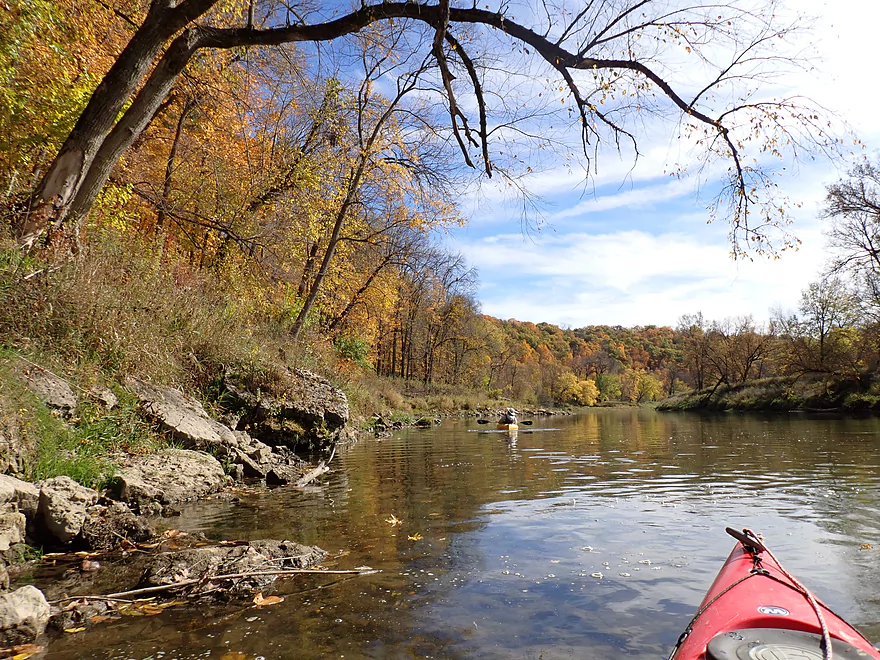
Following the whitewater park, the river flows away from the scenic bluffs that sandwich Elkader next to the river. On the east shore we saw a nice river walk (with people walking on it) and a ginormous grain elevator. About a half mile downstream we passed the launch area for Turkey River Rentals, the local canoe/kayak livery, which we used for our shuttle. Their preference is to start trips here (next to Elkader City Park), but we asked to be dropped off upstream at the more scenic Whitewater Park.
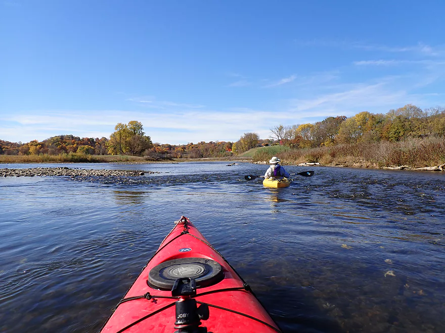
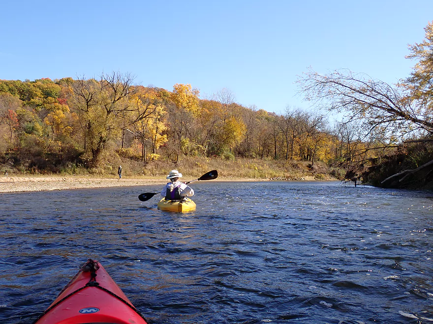
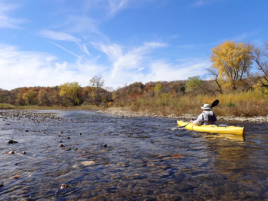
After the launch area, the river turned sharply west and tumbled down a series of light rapids. This would be the first of roughly 14 Class 1 pitches on the trip. These, like many of the other rapids, were a bit shallow and rocky (courtesy of the drought), but we were always able to bump down them without having to get out of our boats. The trip was plenty navigable even at these low depths, but just one more inch of water would have been nice to reduce some of the “poling” and “scooching” we had to do. The rapids would often fork around small islands, which required some skill reading the channel to find the deepest route.
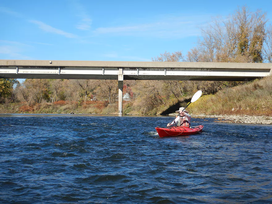
Hwy 13 and “Turkey River Park” sort of mark the end of the Elkader area. A sign on the bridge notes that the next take-out is not for 5.5 more miles. This is likely more a warning for tubers to get out here or face a very long day on the river (tubes are way slower than kayaks).
Following Hwy 13, the river cuts east through a scenic valley that was filled with terrific fall color. Rapid gunshots in the area were a bit disconcerting, but a nearby hiker informed us it was just the local sheriff’s department target practicing. The gun range is in a quarry, so shouldn’t be a hazard for paddlers. The hiker, by the way, had access to the river from the Pony Hollow Trail, a multi-use trail that borders the river for about a mile below the bridge.
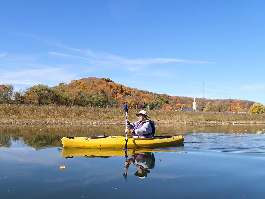
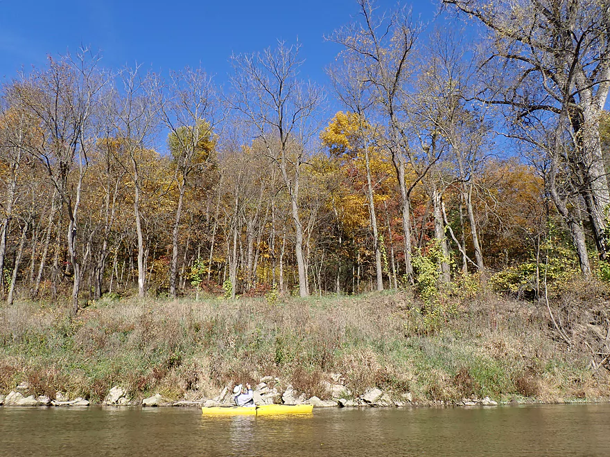
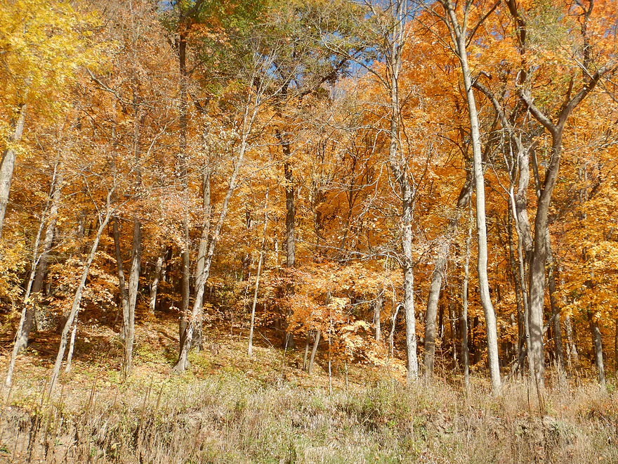
Iowa is known for its vast fields of corn…sometimes stretching as far as the eye can see. So it was a real treat to see high quality woods without visible cut-over areas or brushy undergrowth. Several key sections along the river are protected natural areas, which is terrific. The big wooded bluffs were parts of larger continuous corridors which form long deep valleys and were incredibly scenic. Many of the bluffs had sugar maple (the best tree for fall color), which lit up like Christmas trees when hit by direct sunlight. It was also great to see some ash turning a vibrant gold. Many of the ash trees in Wisconsin have been destroyed by the emerald ash borer, but apparently they haven’t found this pocket of Iowa (yet).
Another treat were the many eagles that accompanied us down the river for our entire trip. They were a mix of adults and immatures, so were obviously family groups. We saw one nest by the river further along in our trip, but suspected there was another nest closer to Elkader. The birds were surprisingly tame, probably because they are used to the many people that kayak the Turkey during the summer months.
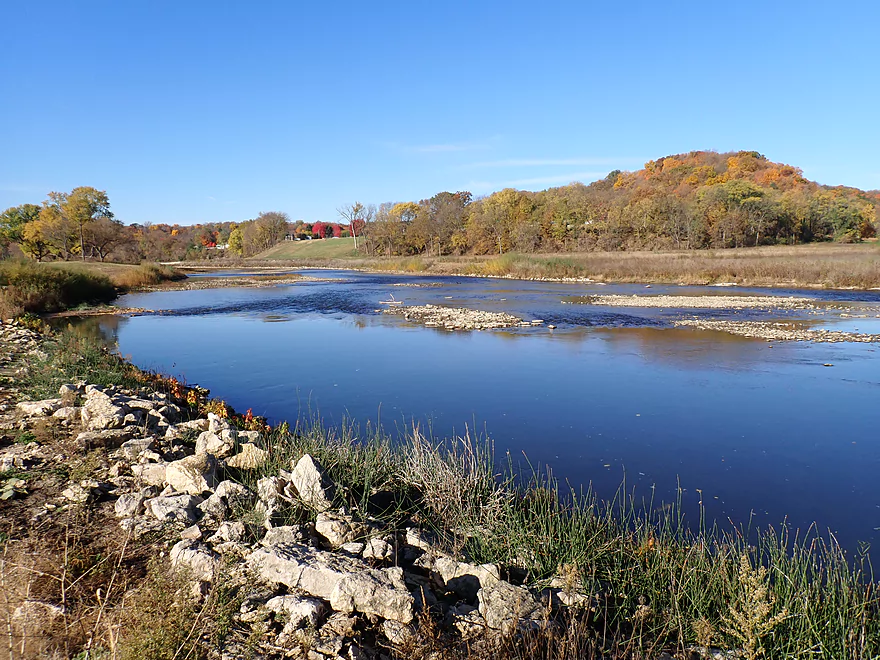
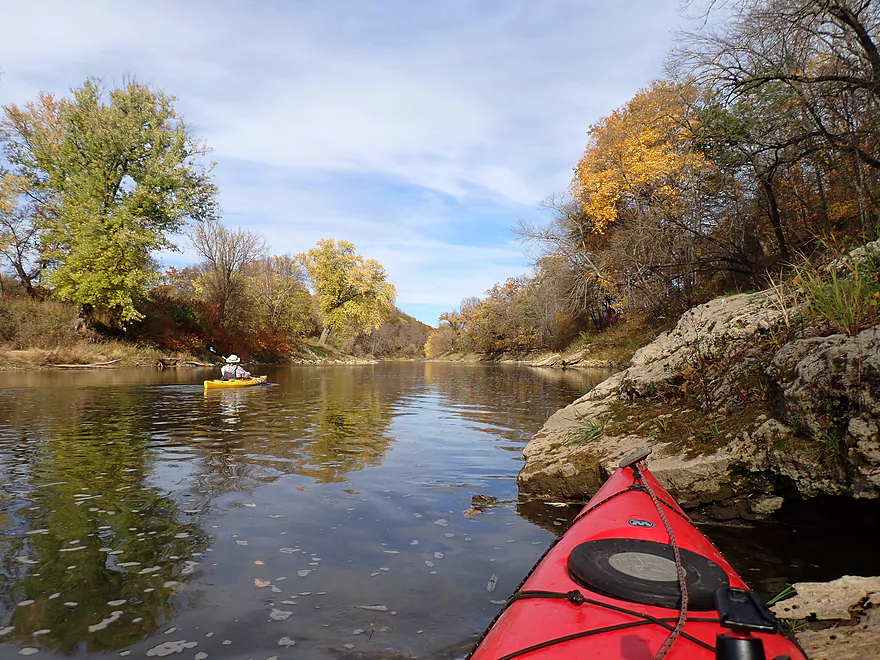
About halfway into the trip the Turkey entered another narrow and scenic valley with occasional big boulders dotting the shoreline. The river substrate was surprisingly clean and not as degraded as in other Driftless Area rivers. Fine gravel and sand were common and reflected a lot of light back to the surface through the clear, shallow water. There were even a few attractive sandbars and gravel bars.
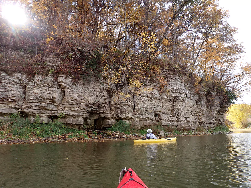
I expected more outcrops on the trip, but there were just 2-3. They were, however, quite nice, with the most impressive being located just upstream from the mill. At its base was the best spring of the trip. Springs are relatively common on the Turkey River and we did see a few on this trip. Often you could hear the springs long before you could see them. Spring water helps keep the river cold, clear, and relatively stable.
The river valley was almost entirely devoid of people. The summer kayakers were gone, there were no cornfields, no roads or car sounds, and only one set of old buildings. So it was a surprise to finally hear voices coming from around a corner. It turns out it was tourists taking pictures and hiking around the area’s historic Motor Mill. The old mill (built in 1869) is a famous landmark that is very striking for both its sheer size and beautiful limestone walls. (The 19th century name, by the way, refers to power and motion and not to modern motors.) Next to the mill is a one-lane iron trestle bridge which is also quite photogenic.
The concrete take-out (Motor Mill Access) wasn’t located by the mill per say (although you could get out there), but was actually a quarter mile downstream and around a sharp river bend. A fantastic limestone cliff backdropped the take-out and provided a nice closure to the trip. There is parking here and toilets across the road to the west. Paddlers on long trips can also pitch tents in the nearby campground (what used to be the little town of Motor Mill).
In summary this was a terrific trip with fantastic fall scenery and top-notch Driftless Area bluffs. The highlights were the bookends…Elkader and the whitewater park at the beginning, and Motor Mill, the cliffs and two springs at the end. Located just a half-hour drive west of Prairie du Chien, this is a reasonable trip for many who live in Wisconsin. On my future todo list will be to do the leg after Motor Mill which should feature even more and nicer outcrops.
Sights included many minnows, a handful of medium-sized flopping fish, ducks, one osprey, and many well-used bank trails (likely beaver). The highlights were eagles (adults and immatures) who seemed to accompany us for much of the trip.
Elkader Keystone Bridge: This is one of the largest twin stone arch bridges west of the Mississippi. It’s located just upstream from Whitewater Park and you can paddle upstream to go under it and see the “waterfall” (dam) on the other side. In 2022/2023 the bridge was been closed to repair cracks discovered in its foundation.
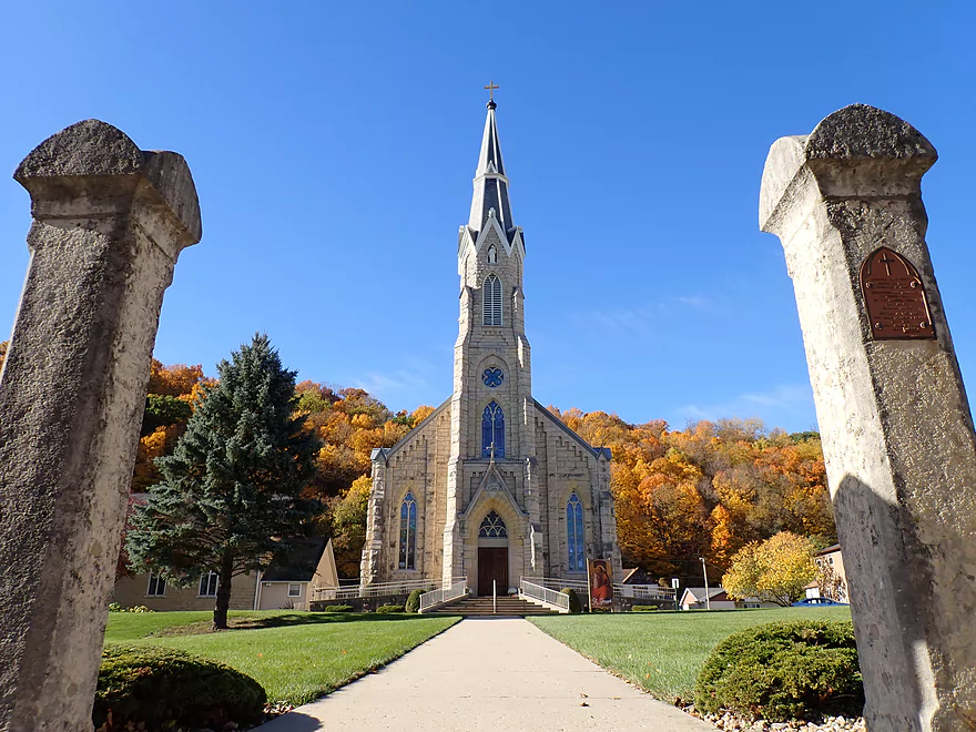
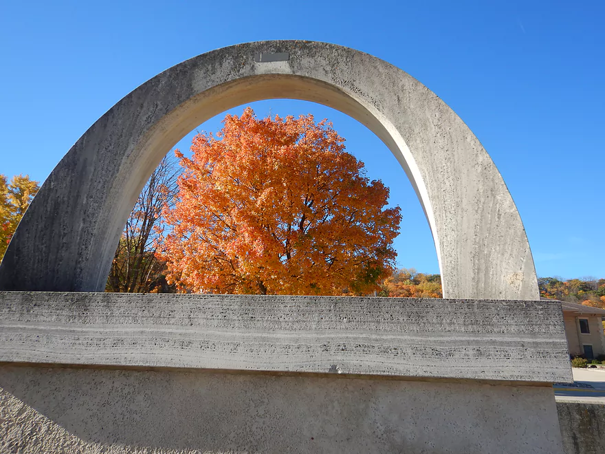
Downtown Elkader: Elkader is a historic town popular with tourists. It’s a great place to visit in late October as it is sandwiched between two large bluffs that can feature terrific color. During these times you would think you were in an Appalachian or New England town…not in Iowa! Highlights include:
- Elkader Opera House
- Historic Clock Tower
- St. Joseph’s Church
- Pony Hollow Trail
- Rural Heritage Center
- Whitewater Park
- Elkader River Walk
Big Springs Trout Hatchery: Located upstream from Elkader this is supposedly Iowa’s largest spring. Today it’s been engineered into a large fish hatchery. A small waterfall connects the springs/hatchery to the Turkey River.
Motor Mill Historic Site: This is a popular tourist attraction located 7 miles downstream from Elkader. The mill and a dam were originally located here because of a natural constriction in the river. Since then the dam has been removed (or washed out) and all that remains is the mill–which is quite photogenic because of its sheer size, fine rock work, and beautiful setting. The site is popular with photographers and there are trails by the river which offer varied angles for taking photos.
A second highlight by the mill is a scenic iron trestle bridge with wood floorboards and stone pillars. It is a one-lane bridge with stop signs at both ends. In 2008 a flood destroyed the original bridge. In a testament to historic preservation, an exact duplicate was built in its place. Not many communities would do this, but it’s great it happened as a modern concrete bridge would have looked really ugly.
A third highlight are the woods and trails that surround the mill. Much of this is part of Retz Woods State Preserve.
Also on the grounds are a historic inn, stable, cooperage, and smokehouse. Some of the buildings including the mill can be toured from the inside during special events.
Elkader Whitewater Park: This is a good public access, and is relatively new (created in 2014 as part of a lowhead dam removal). A trail leads from the parking area to the water where you can launch above or below the whitewater ledge. If you launch upstream, you can paddle up to and under the Keystone Bridge to see parts of downtown Elkader and the dam. The western ledge is Class 3 and should only be attempted by kayakers who know what they are doing, properly equipped, and who’ve scouted the area ahead of time. There is an easier Class 2 ledge on the east side.
Alternate Put-ins:
- Elkader City Park (0.4 miles downstream from Whitewater Park): The land across from the park is leased by Turkey River Rentals and is their main launch point. It’s not nearly as scenic as the access by Whitewater park though. Note also, this access may be exclusive to livery customers.
- Turkey River Park (1.1 miles downstream from Whitewater Park): You can launch from the park, but I wouldn’t recommended it as the Elkader Whitewater Park is just a more scenic way to start the trip. I believe Elkader tubers take out here though.
Motor Mill Landing: Located a quarter mile downstream from the mill, this is a nice (and scenic) landing which features a concrete ramp and parking area. An outhouse is available by the picnic area. If you park here, don’t block vehicles with trailers from turning around (this is a major pick-up/drop-off point for the canoe livery). Motor Mill Campground is across the road.
Alternate Take-outs:
- Motor Mill Galaxy Road Pull-off (0.3 miles upstream from Motor Mill Landing): I suppose if you really wanted to you could use the public pull-off west of the mill to take out. This is a bit weedy though and the downstream landing is a much better option. This is however a good put-in option for those going down to Garber and wanting to include the mill on their trip.
- Garber Access (12.9 miles downstream from Motor Mill Landing): The leg below the mill is very scenic with nice cliffs, but it is a long leg and better suited as a standalone trip and not an add-on to an Elkader trip.
Bike Shuttle – Motor Mill to Elkader Whitewater Park: 7.5 miles with 453′ of ascent. This would be a long, difficult, and extremely hilly bike shuttle. Unless you’re in top-notch bike shape I suggest simply paying for a shuttle instead.
Kayak Rentals/Shuttles:
- Turkey River Rentals: They provide both canoe/kayak rentals and shuttles. Reservations are highly recommended (call 563-245-3802). The main route they service is from the bank opposite the Elkader City Park to the Motor Mill Access, but they do service other trips on the Turkey River and even parts of the Volga River.
Current: River moves at a decent pace with a number of light riffles.
Rapids: There are roughly 14 pitches of Class 1 rapids. I considered most pretty easy. In shallow water some of these rapids can be a bit bumpy.
Note, you can optionally launch either upstream or downstream from the surfing ledge in the Elkader Whitewater Park. The west ledge is likely a Class 3 (depending on water levels), and you should have a skirt to prevent getting a lapful of water. There is a minor bit of recirculating current downstream from the west ledge. I think it is mostly safe, but you should scout this ahead of time and only run if it doesn’t look too sticky. It’s also a good idea to “boof” over holes and to maintain escape velocity speed.
The east ledge is easier (maybe Class 2) and I believe is what the tubers run.
Logjams/Fences/Livestock: None.
Shallow Water: The Turkey is somewhat drought resistant because of all its springs. When its neighbors (Volga and Yellow Rivers) are running too shallow, it should still be good to go. We did bump our boats on several of the rapids and in a few spots had to scooch, but we never had to get out of our boats and generally speaking it was plenty navigable despite the relatively shallow water.
Closest Gauge: Turkey River @ Elkader – Note there are webcams in Elkader which can also help you gauge river conditions.
Trip Depth: 177 CFS or 5.23′
Navigability Estimates: The following are very rough estimates. Always use your own judgement.
- < 100 CFS: Maybe too shallow.
- 101-250 CFS: On the low end. Some of the rapids will be bumpy and may need to be scooched. Quite doable in my book, but those with deep drafting v-bottom boats may prefer higher levels.
- 251-450 CFS: Maybe an average flow rate.
- 451-600 CFS: Above normal, but likely quite navigable. Water clarity likely won’t be as good at these levels.
- 601-850 CFS: Well above normal. Should be navigable, but the river won’t be as attractive.
- 851-1200 CFS: High water levels. Likely still doable but the river won’t be as scenic.
- 1201-1500 CFS: Extremely high water levels. Perhaps only suitable for experienced paddlers.
- 1501+ CFS: Maybe too high for enjoyable paddling. Probably dangerous at this point.
For a visual reference, see my overview map here. Not included is the Volga River which you can read about here. Special thanks to paddling author Nate Hoogeveen and the “Turkey River Recreational Corridor” website for much of this information.
Main Branch:
- Upstream from Big Stone Mills Park: The river seems navigable but I don’t know much more.
- Spillville to Eldorado: 25.4 miles. Few kayak the upper Turkey (north of Eldorado) so the following info is somewhat speculative.
- Big Stone Mills Park to Riverside Park: 0.8 miles. Nice leg though Spillville with good water clarity.
- Riverside Park to 160th Street: 5.4 miles. Probably a nice leg with good clarity, gravel bars, and woods.
- 160th Street to City Park/Fort Atkinson: 3.8 miles. A flatter and open stretch, but might still be a few cliffs.
- City Park to Hwy 24: 0.5 miles. A short open stretch through Fort Atkinson with a few riffles.
- Hwy 24 to 123rd Street: 6.5 miles. Likely a shallow, riffley stretch that is mostly open but still should feature a few cliffs.
- 123rd Street to Little Church Road: 1.4 miles. River flows mostly past open farm fields. Might be one stretch of bluffs/cliffs.
- Little Church Road Bridge 1 to Little Church Road Bridge 2: 1.5 miles. Could be several nice bluffs/cliffs on the east shore.
- Little Church Road Bridge 2 to Pheasant Drive: 1.1 miles. Mostly open farm fields, but maybe some nice bluffs/cliffs on the south shore.
- Pheasant Drive to Orange Drive: 1.3 miles. More open farm fields with maybe one nice bluff.
- Orange Drive to Eldorado/Little Turkey Confluence: 3.1 miles. River closely parallels Major Road. Likely a mediocre stretch.
- El Dorado to Clermont: 23.1 miles. One of the nicer parts of the Turkey River.
- El Dorado/Hwy 150/Little Turkey Confluence to Huntzinger Bridge Access: 7.0 miles. Good stretch with pines and limestone outcrops.
- Huntzinger Bridge Access to Great River Road: 1.9 miles. One nice bluff and a several attractive gravel bars.
- Great River Road to Ironwood Road: 4.2 miles. Good stretch with huge gravel bars and 100′ bluffs.
- Ironwood Road to Great River Road/Turkey River Access: 2.8 miles. Leg includes several huge wooded bluffs with cedars.
- Great River Road/Turkey River Access to Tessmer Canoe Access: 2.6 miles. Mostly open, but a few outcrops. There is a really nice, long outcrop just upstream from the Tessmer Canoe Access.
- Tessmer Canoe Access to Clermont Park/Dam: 4.6 miles. Close to Clermont the river is impounded/slowed by a dam. This leg is mostly open but features three decent outcrops.
- Clermont to Elkader: 25.3 miles. A less popular part of the river with fewer bluffs and outcrops.
- Clermont/State Street Access to Valley Bridge Access: 2.0 miles. Open riffly stretch. There is one nice bluff on the south shore. There is a fantastic set of cliffs below the dam.
- Valley Bridge Access to Gilbertson Park Access/Elgin: 2.7 miles. Very open stretch with huge gravel bars.
- Gilbertson Park Access/Elgin to Gilbertson Park Narrows: 1.2 miles. Open riffly stretch.
- Gilbertson Park Narrows to Cable Ave: 7.1 miles. Open flat stretch.
- Cable Ave to Big Spring Campground: 4.6 miles. Mostly a generic stretch that parallels roads. Likely several nice gravel bars.
- Big Spring Campground to Elkader Takeout/Sandpit Road: 7.7 miles. Decent prospect with multiple bluffs and outcrops. Springs by put-in have been converted to a fish hatchery, but a small waterfall remains. Last portion of the river is impounded by a dam.
- Elkader Takeout/Sandpit Road to Elkader Whitewater Park: 0.5 miles. A scenic leg through downtown Elkader. Few paddle this part though because it requires a very difficult portage around the dam. You can still explore part of this leg by backtracking from the Whitewater Park. By doing this you can see the stone arch bridge and the base of the dam.
- Elkader Whitewater Park to Motor Mill Access: 7.0 miles. One of the better and more popular trips on the river.
- Elkader Whitewater Park to Elkader City Park: 0.4 miles. Scenic stretch through the outskirts of Elkader. You can start above the main surfing ledge if you want to experience some Class 3 rapids.
- Elkader City Park to Turkey River Park Access: 0.7 miles. Good open stretch with a few Class 1 rapids. Whitewater Park is a more scenic put-in, but the bank by Elkader City Park is a preferred access for the local shuttle/rental company.
- Turkey River Park Access to Motor Mill Access: 5.9 miles. One of the best legs on the river. Highlights include scenic bluffs, fun Class 1 rapids, several limestone cliffs, springs, a historic mill, and good color in the fall.
- Motor Mill Access to Impala Road Shoulder: 11 miles. Great stretch with nice outcrops.
- Impala Road Shoulder to Garber Access: 1.9 miles. The Volga River joins up and significantly enlarges the Turkey.
- Garber Access to Mississippi: 24.9 miles. The river is larger and less interesting after Garber with fewer cliffs. There are still a few nice bluffs on this stretch.
- Garber Access to Osterdock Access: 8.6 miles. A more eroded stretch of the river. Highlights include some nice bluffs and a few light rapids.
- Osterdock Access to Hwy 52: 8.4 miles. Stretch with significant gravel bars. River is flatter here but there are still some nice bluffs.
- Hwy 52 to Railroad Access: 3.7 miles. Flat section with some big gravel bars.
- Railroad Access to Mouth on Mississippi: 1.7 miles. Short bit of bottomland paddling to reach the mouth.
- Mouth on Mississippi to Ferry Landing: 0.5 miles. Little bit of Mississippi paddling to reach an access by the Ferry.
Crane Creek: A significant and scenic tributary to the Little Turkey River. Google Maps incorrectly calls this the Turkey River.
- Upstream from U Ave: I’m sure the river is mostly navigable, but the terrain looks flatter and perhaps uninteresting. I don’t know much more.
- U Ave to Spruce Road: 3.1 miles. An excellent prospect with boulder gardens, steep bluffs and limestone cliffs. This is recommended by paddling author Nate Hoogeveen. There may be an electric fence on this stretch.
- Spruce Road to Gouldsburg County Park/Little Turkey River Confluence: 1.7 miles. This stretch will include a few nice bluffs, minor riffles and perhaps a fence to portage at the park.
Little Turkey River: Google maps incorrectly calls this the Turkey River.
- Waucoma Dam/Little Turkey River Campground to 275th Street: 3.5 miles. I don’t know much about this stretch. It’s likely relatively flat, shallow and wooded.
- 275th Street to Spruce Road: 2.1 miles. Likely a mediocre prospect with gravel bars and maybe a cliff or two.
- Spruce Road to Gouldsburg County Park/Crane Creek Confluence: 2.3 miles. Likely a good prospect with steep bluffs and likely multiple cliffs.
- Gouldsburg County Park to Rose Road: 1.6 miles. I think this is a less interesting stretch with degraded shoreline and pasture.
- Rose Road to Otter Road: 2.5 miles. A more scenic stretch with larger boulders, bluffs, and riffles.
- Otter Road to Douglas/Auburn Canoe Access: 3.9 miles. A mix of woods, open stretches, bluffs and riffles.
- Auburn Canoe Access to Eldorado/Main Branch Confluence: 4.7 miles. An ok, but less interesting stretch that flows through a wider valley.
Trip Map
Overview Map
Video
Photos Size: