
A long overdue trip at Lone Rock
Scouting a put-in option off the bridge
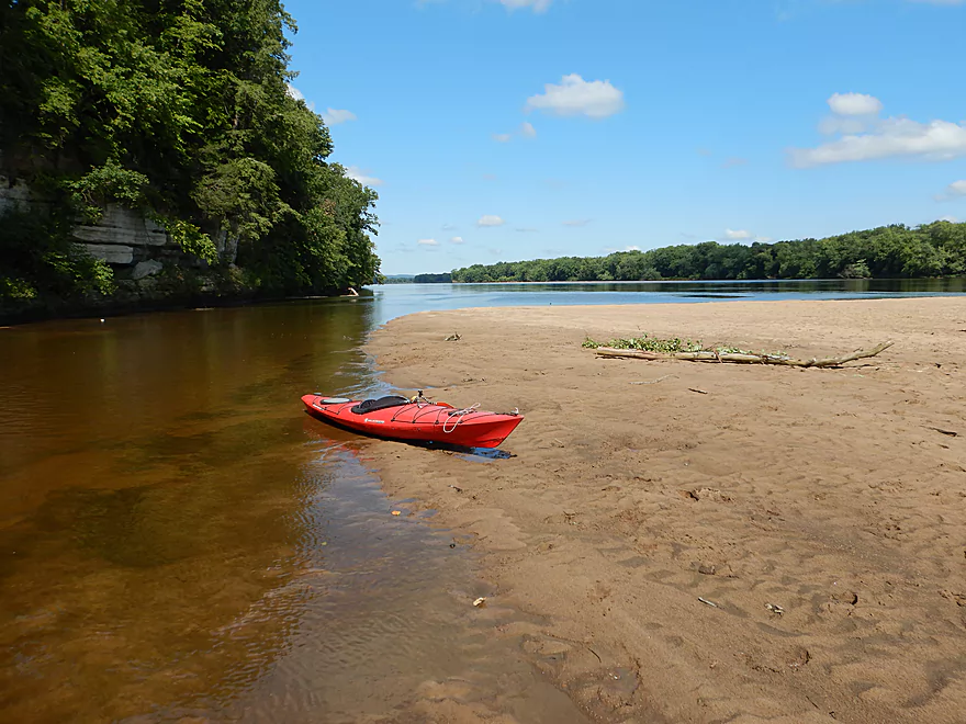
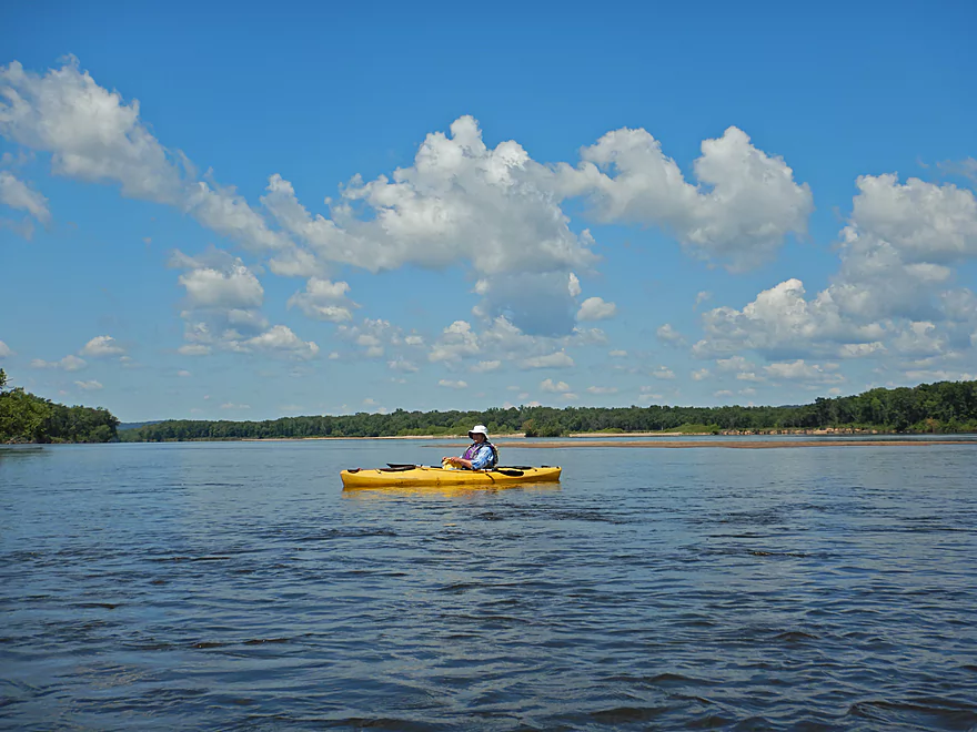
But instead started the trip at the Lone Rock landing
Very nice landing
It connects with Otter Creek which looks interesting
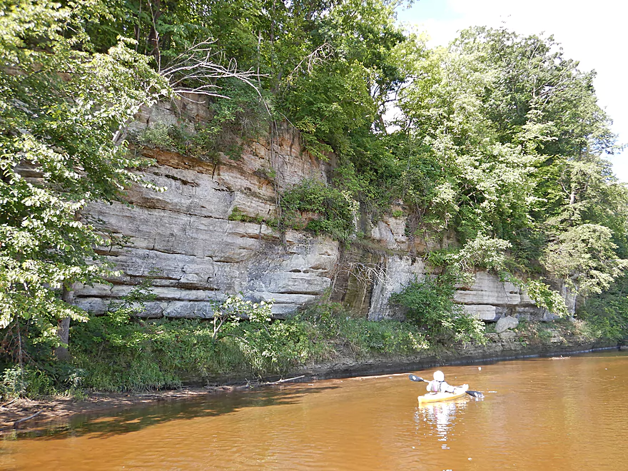
This hill was really blasted to make Hwy 130
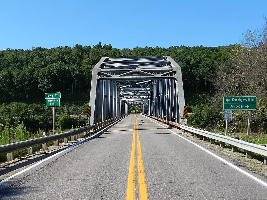
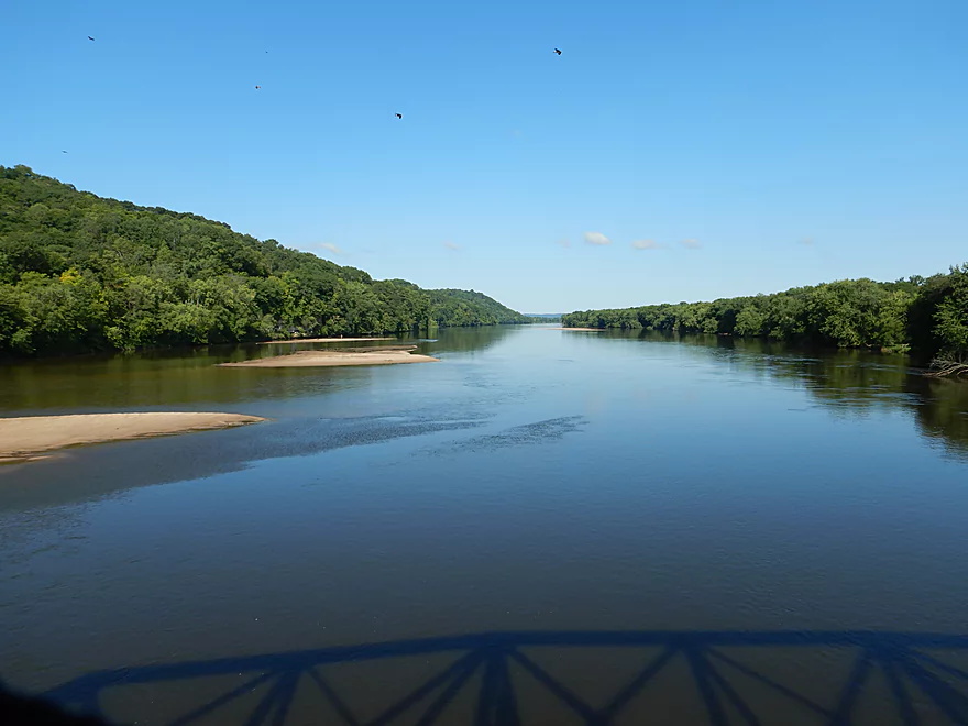
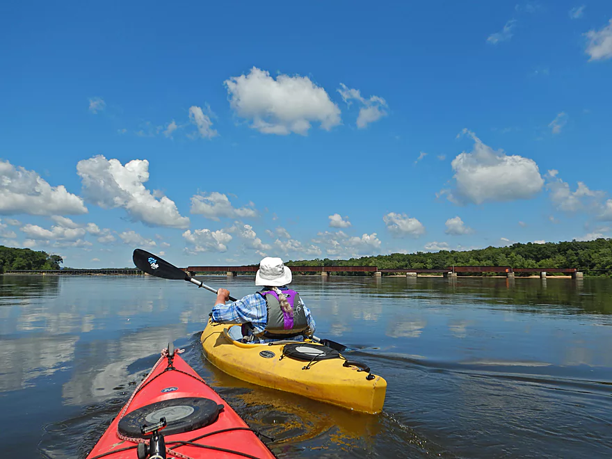
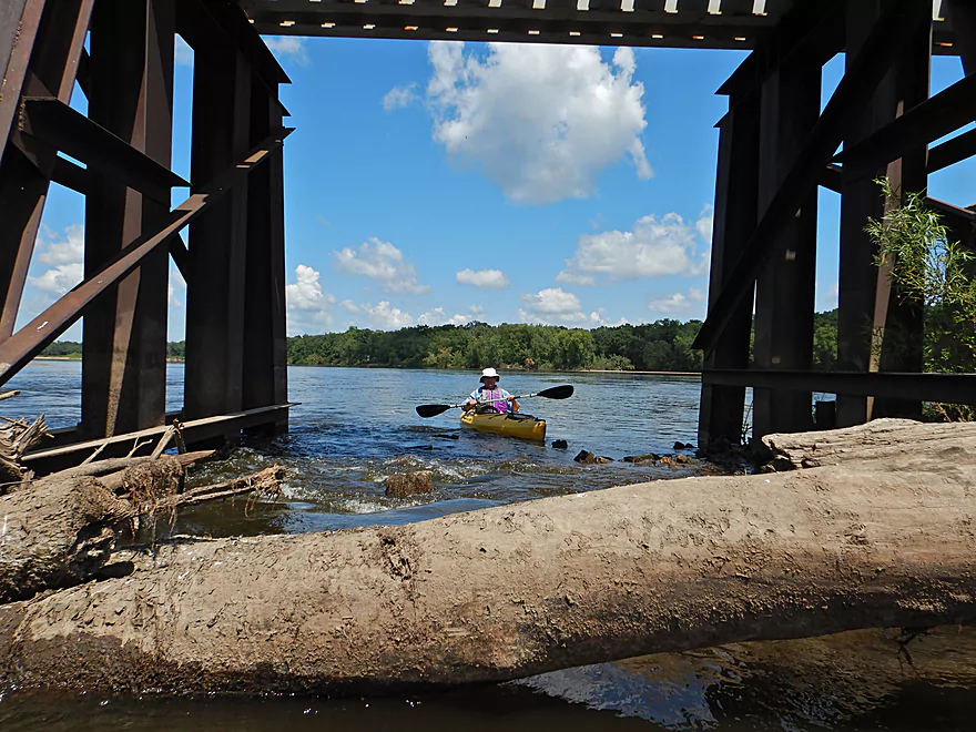
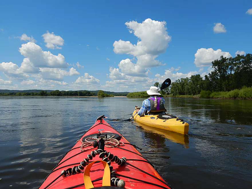
Approaching the scenic Hwy 133 trestle bridge
Wisconsin DOT wants to replace this bridge
Great view from up top
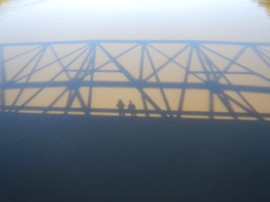
Cool shadows
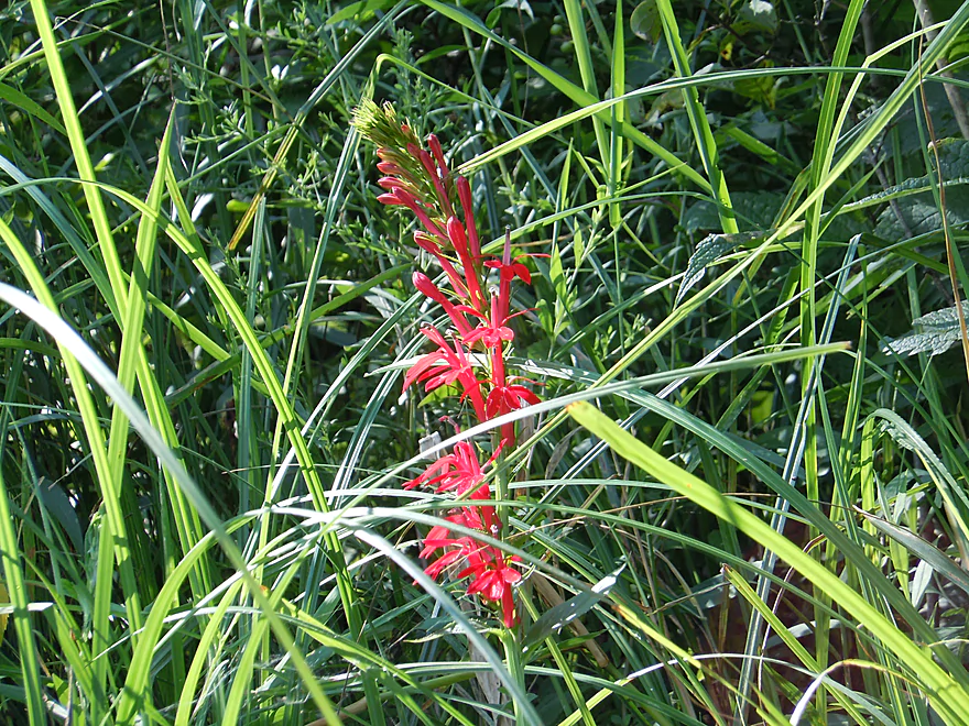
Cardinal flowers
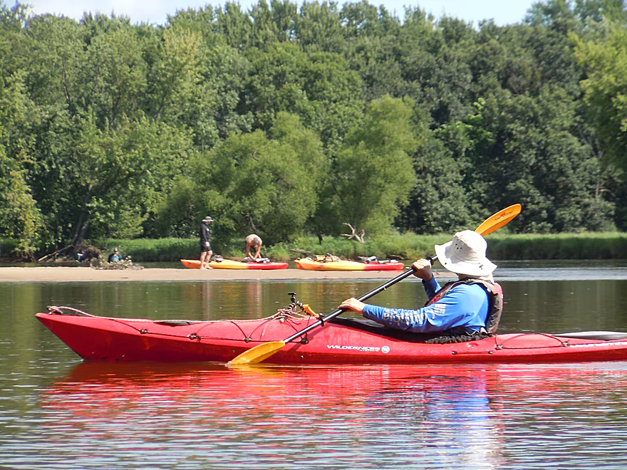
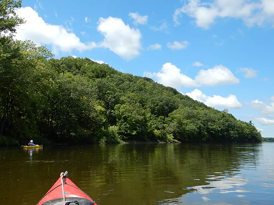
Only paddlers we saw…typically this is a busy stretch
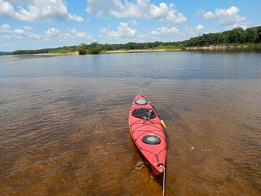
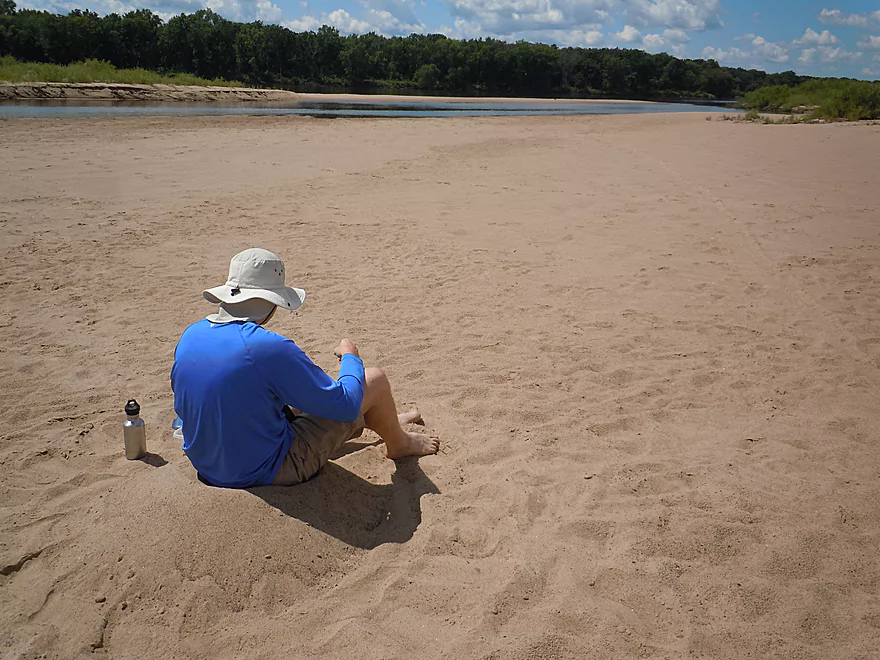
Taking a break on a sandbar…
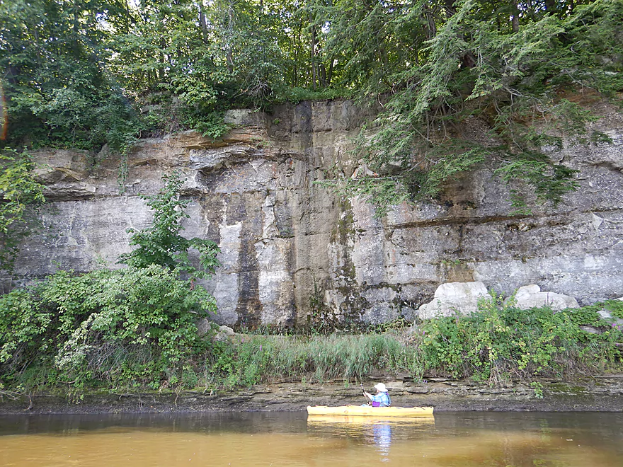
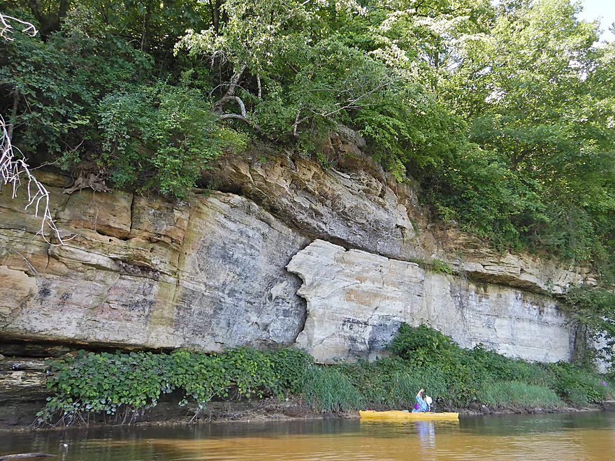
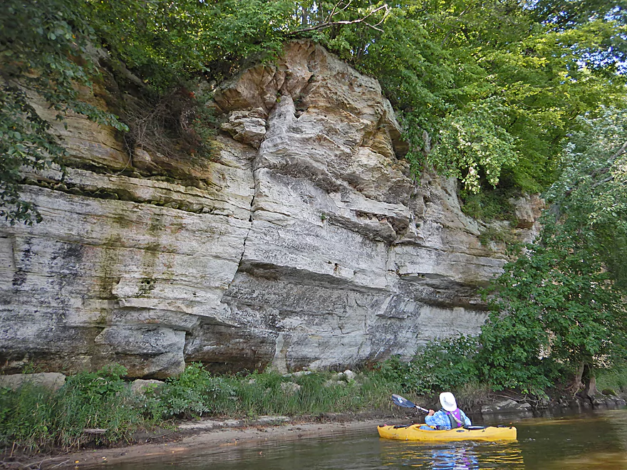
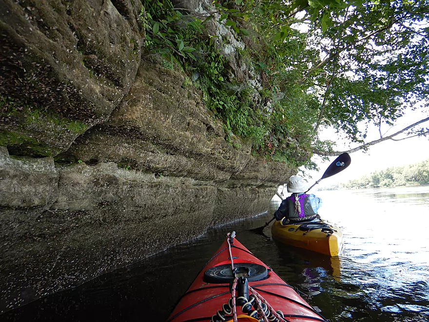
To take pictures of a really cool sandstone outcrop
Not visible, but the current is booking
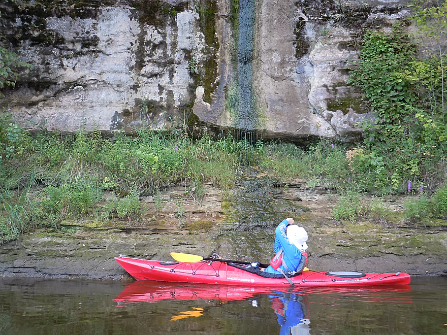
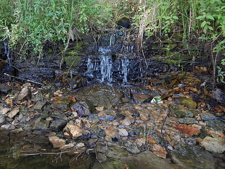
Fantastic mineral stains
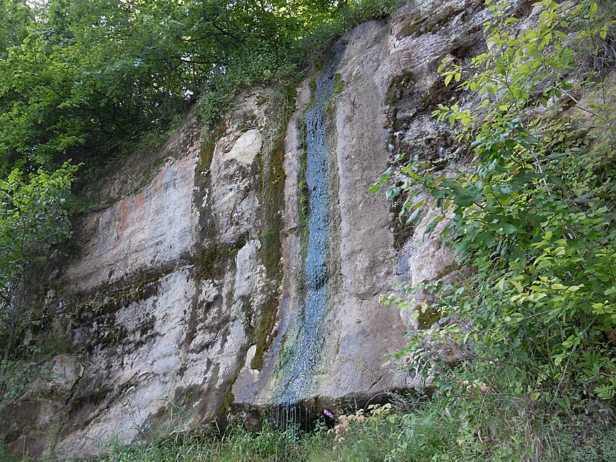
With a natural seep
This would be amazing during a rain storm
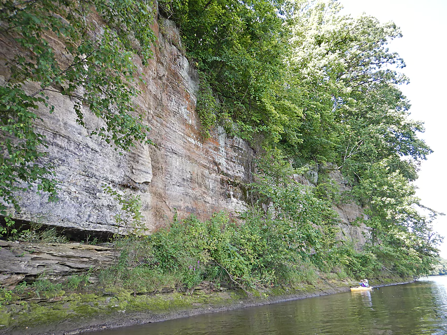
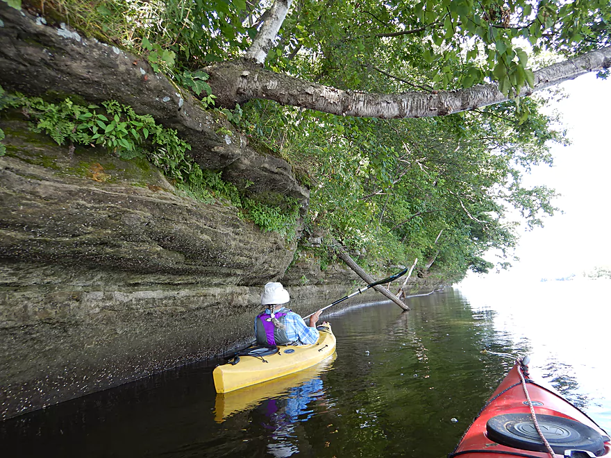
Some of these outcrops were huge
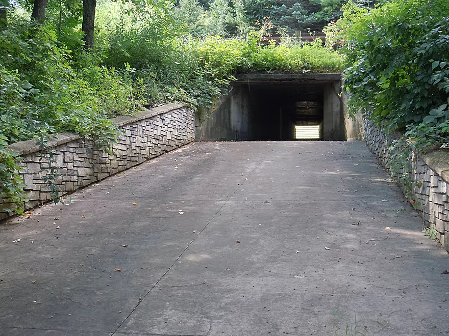
Curious…this flood tunnel has expensive decorative siding
Quite the crack
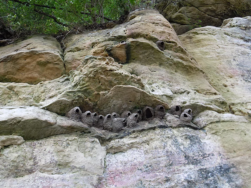
Some very raccoon-proof nests
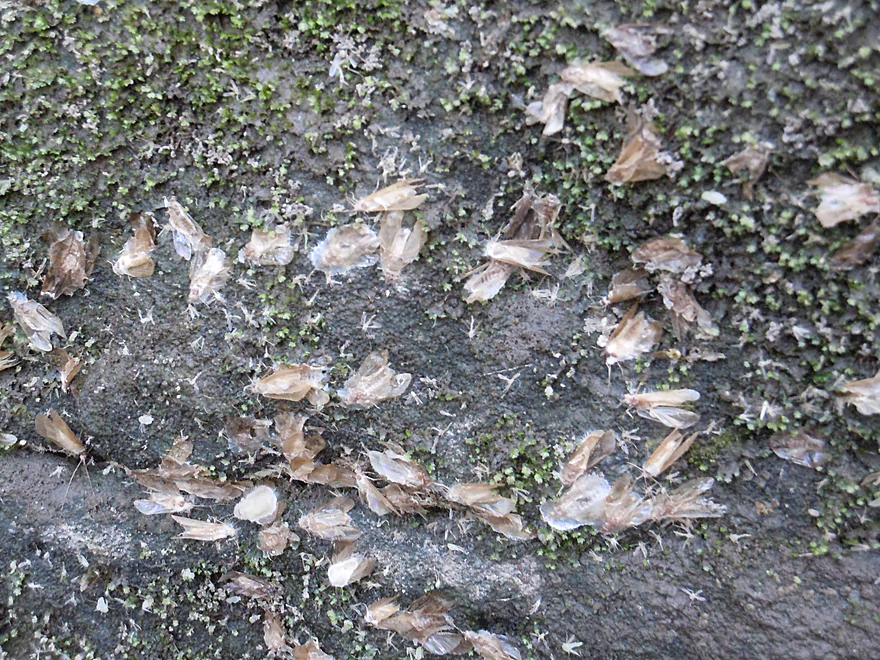
There were countless insect exuvia along the cliff
The outcrops just go on and on
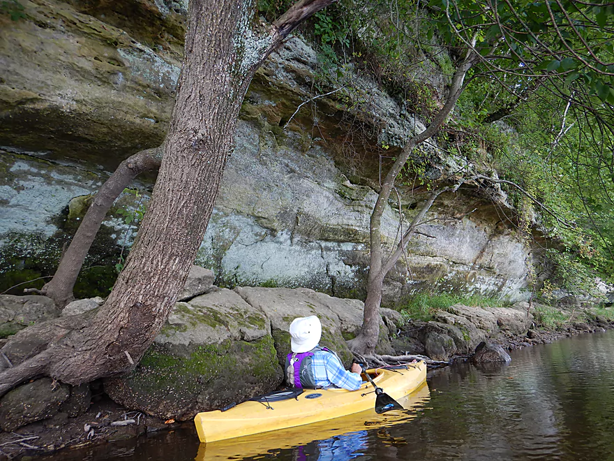
Bent trees learning to live with the rocks

An emerging katydid
Another natural seep
Was that the last of the outcrops?
Nope!
This is a really long one
Really cool
Hiding in the alcove
Deja-Dells
That is finally it for outcrops (for this section)
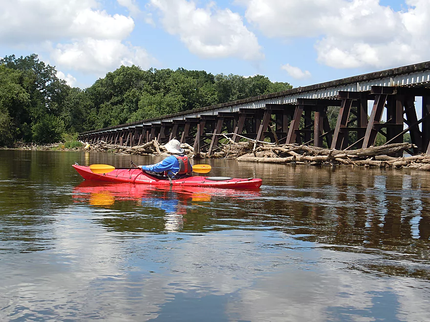
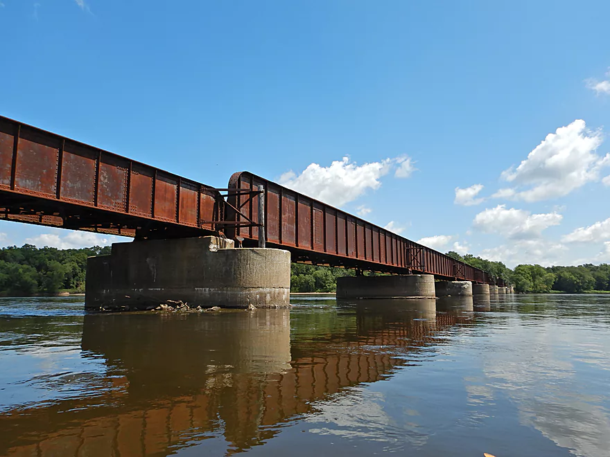
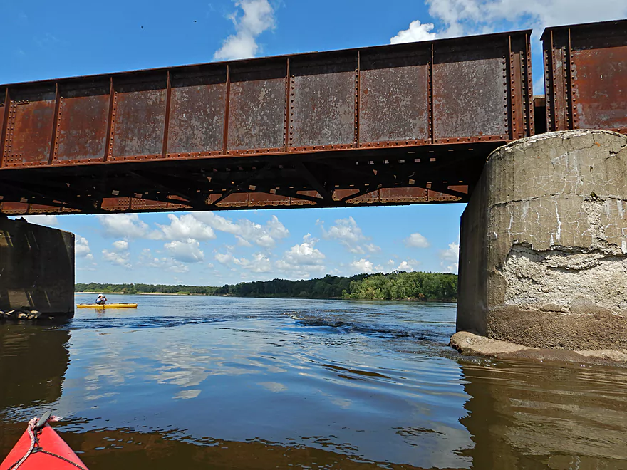
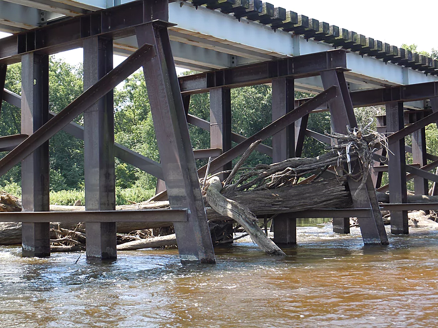
Coming up on the railroad bridge
That is stuffed with logjams
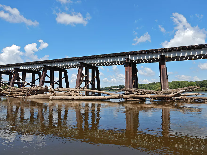
Quite the sight
Have to wonder if they endanger the bridge
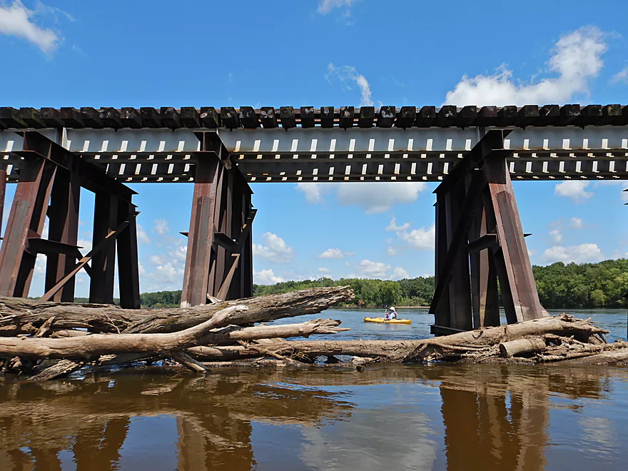
Rapids caused by the logjams
The right side is free from logjams
Just stay away from the pylons
Reverse view of some of the crazy logjams
Grounded on a future sandbar
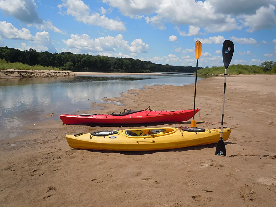
Time for a sandbar break
Looking back at the scenic bluffs
If no logs, you make do
Evidence this has been a popular pit stop
This particular sandbar was massive
Back on the road again
Clouds add a nice touch
One of several side sloughs
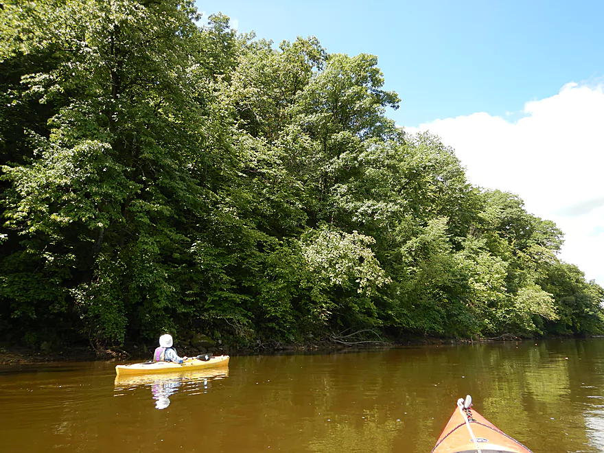
Paddling through a slow wide section
Coming up on a massive sandbar
It just goes on forever
Under the bluffs is the Avoca Prairie
Coming up on some sandbanks
This is part of the Gotham Jack Pine Barrens SNA
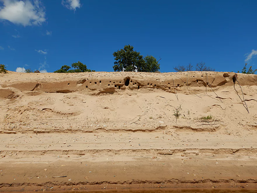
Which bank swallows call home
The sand banks stretch in a parabolic arc
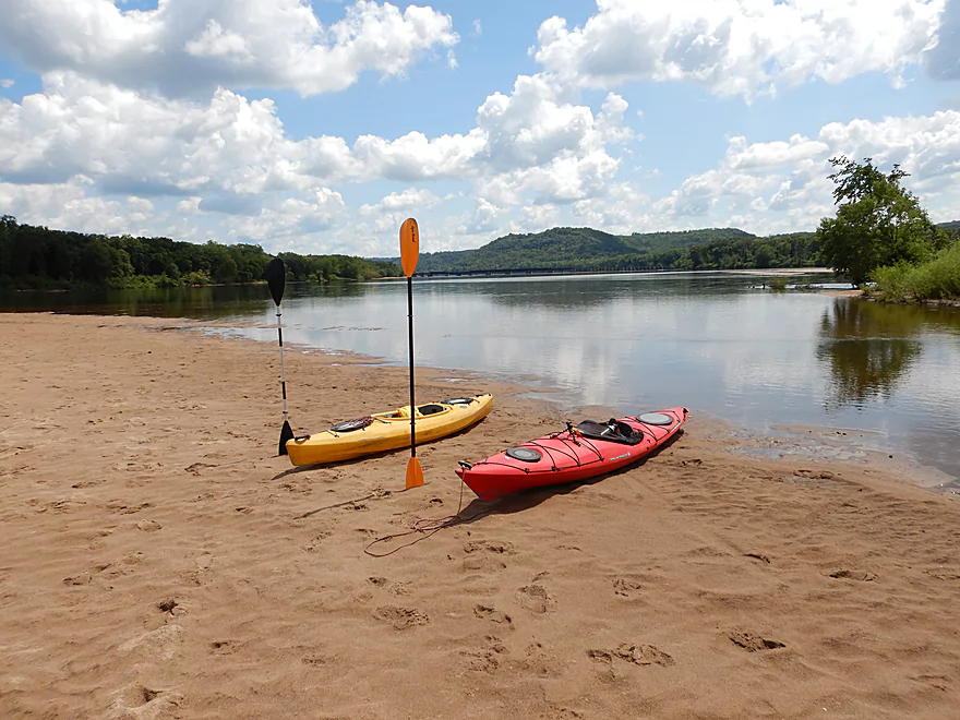
Getting out for a break
The sand banks are quite impressive
Downstream view
Continuing on to Gotham
Very badly eroded
Watch out for strainers
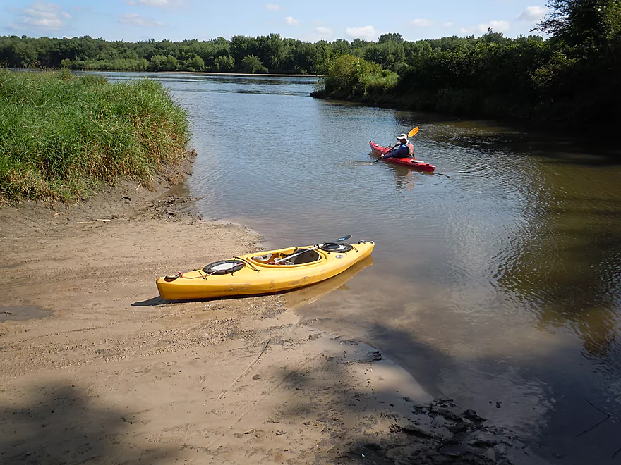
Taking out on the Pine River
Quite advisable
Nice idea…wonder how many people use these
Scouting Smith Slough (maybe a future trip)
The Lone Rock memorial
Scouting Long Lake
It does have some man-made rapids that would have to be portaged
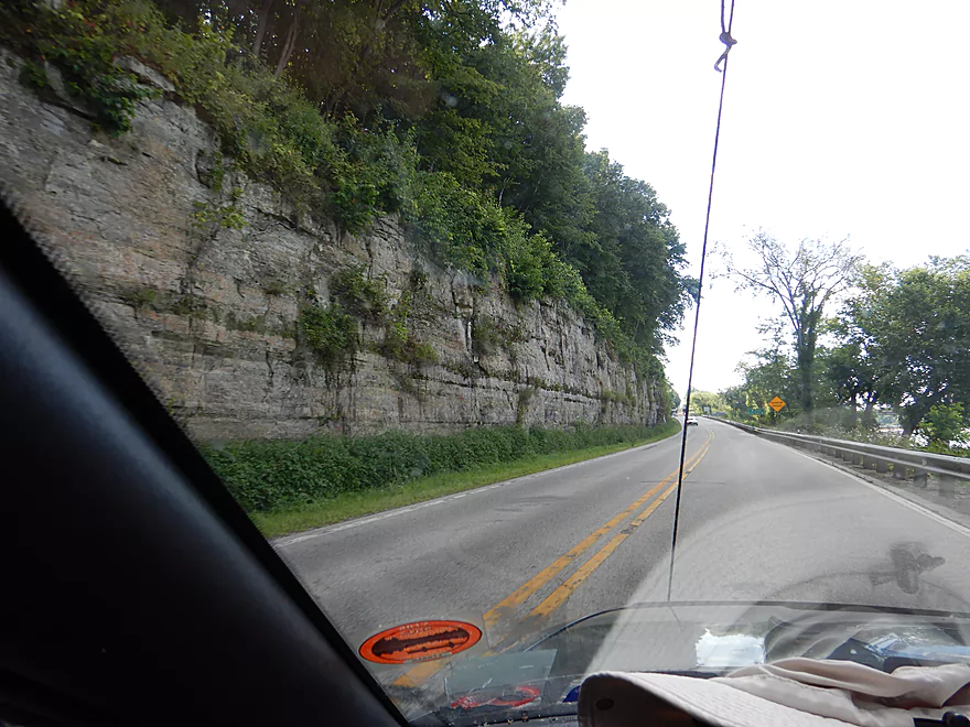
Scenic drive home
Wisconsin River – Lone Rock


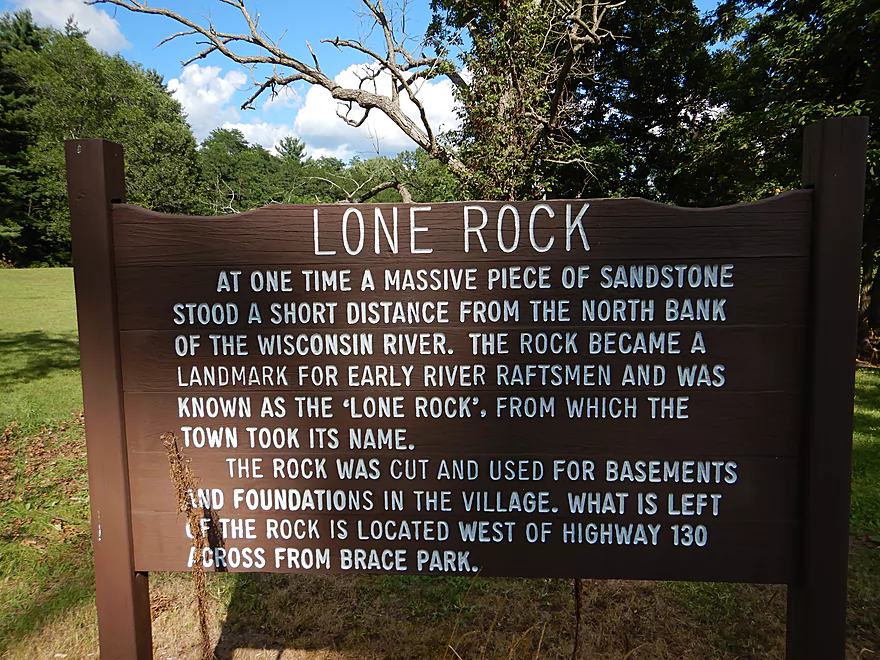
Known for its sandbars, bluffs, and islands, the Lower Wisconsin is the state’s most popular water trail, with the Lone Rock to Gotham stretch being perhaps the most scenic. It used to be more scenic though… At one point, there was a large sandstone tower along the river banks (hence the local town name). But the locals chopped it down to make basements and foundations for their homes. Sigh…
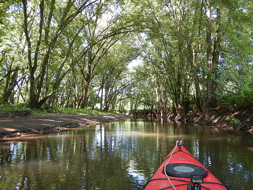
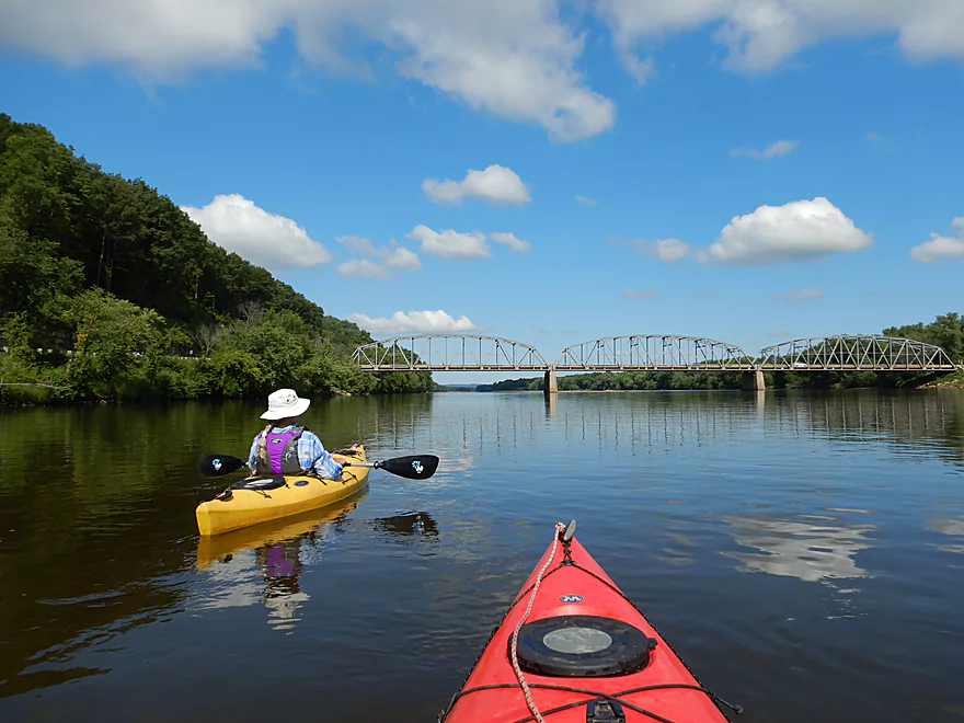
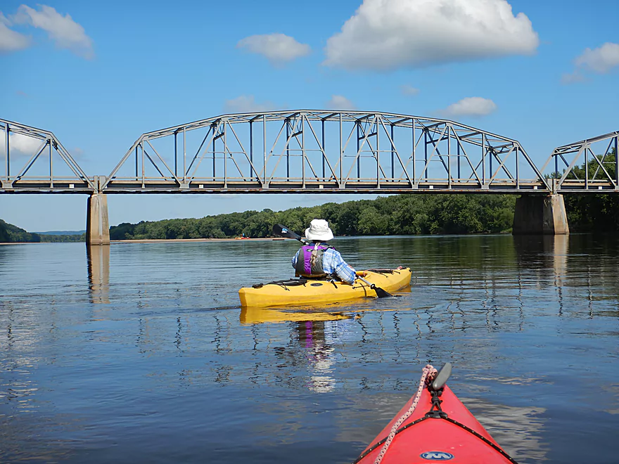
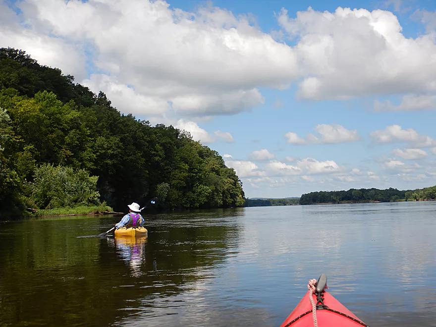
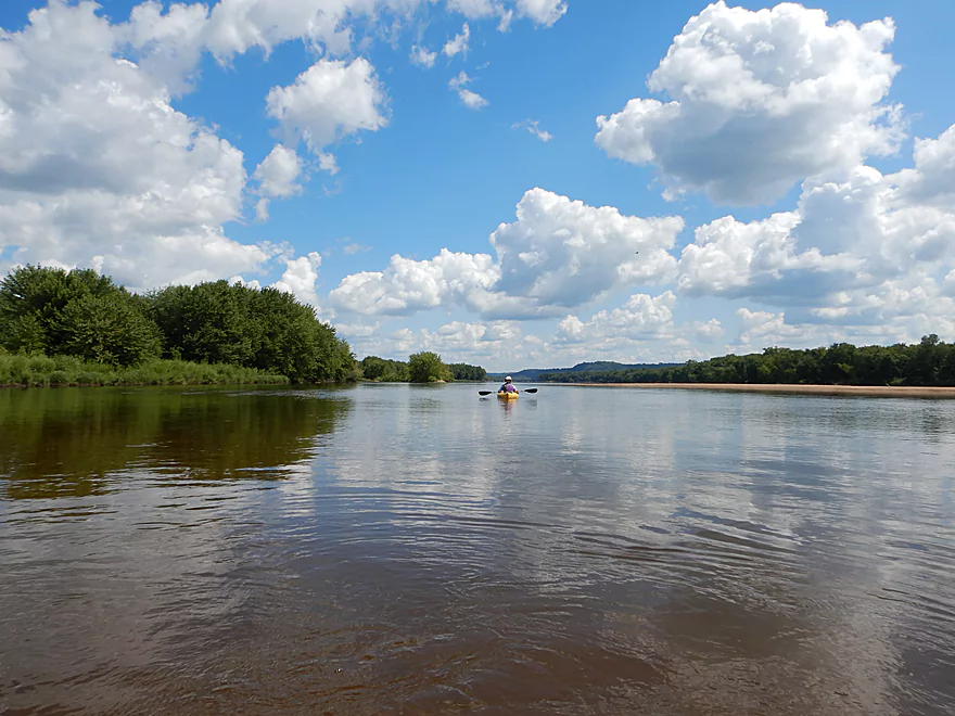
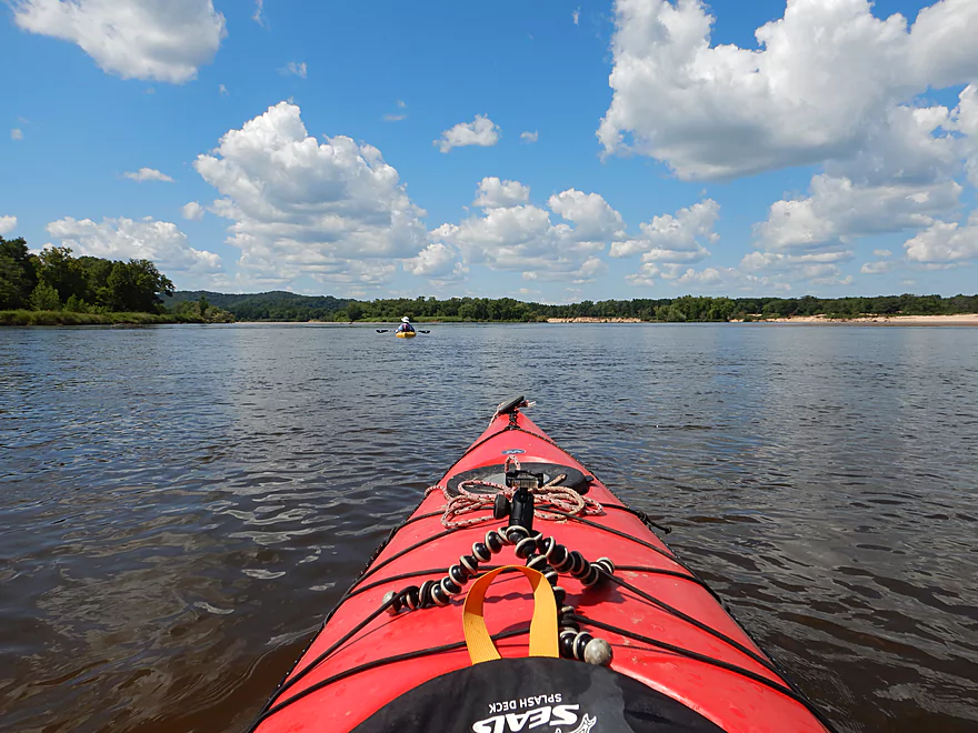
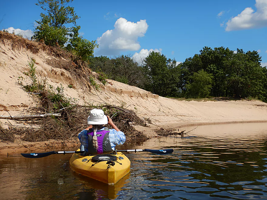
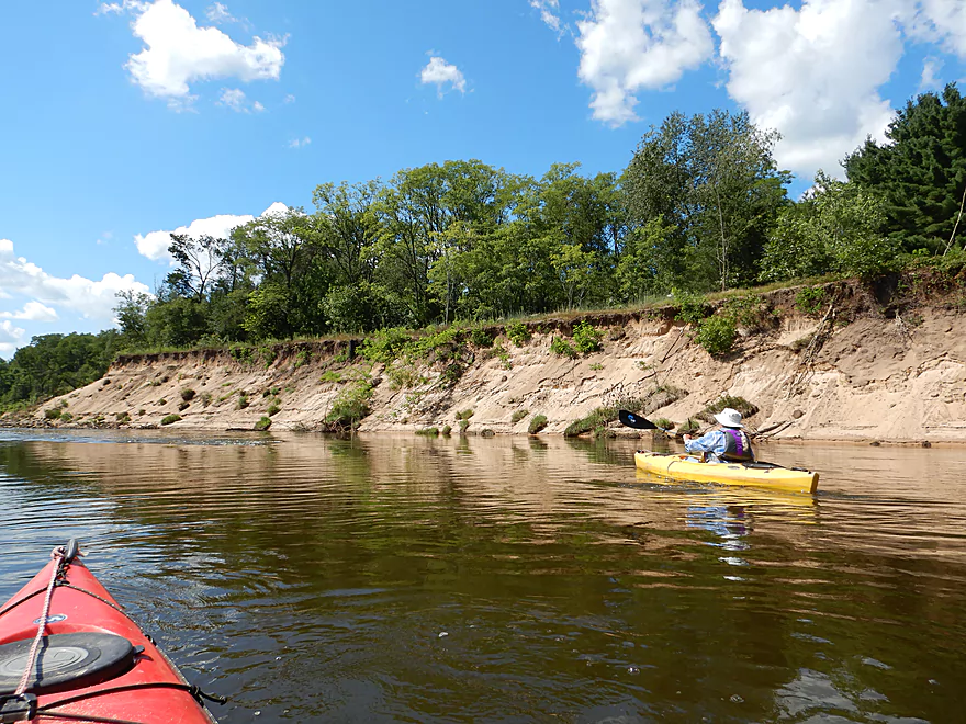
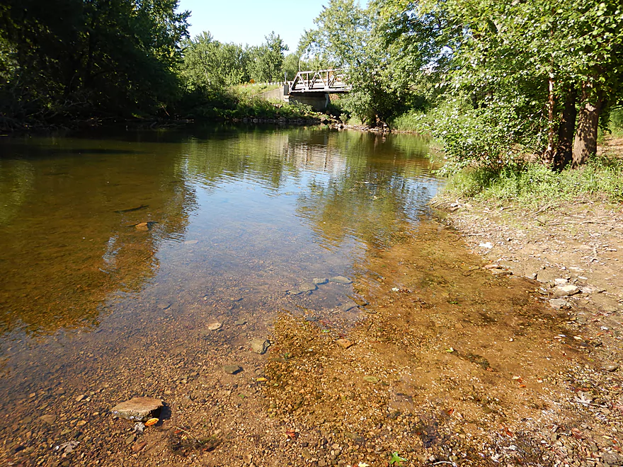
The trip starts on a public landing at Otter Creek just southeast of the village, where the river here is deceptively “small” (it has been split in half by “Long Island” which stretches for ~2 miles). You can see right away the exposed sandstone which the highway department blasted away to make Hwy 130. The road connects with the Hwy 133 bridge which is a scenic trestle bridge segmented into three parts and spanning two islands. Unfortunately our overzealous highway department wants to replace this bridge with a brand new one nearby which will likely further massacre the nearby hillside and scenic sandstone. Sigh…
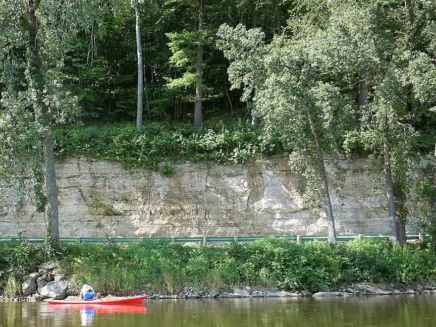
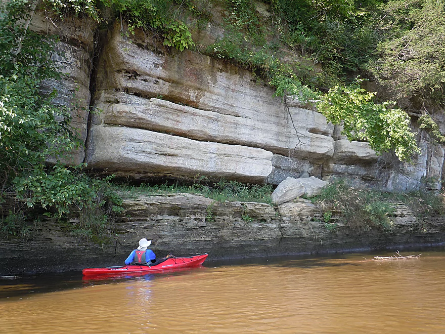
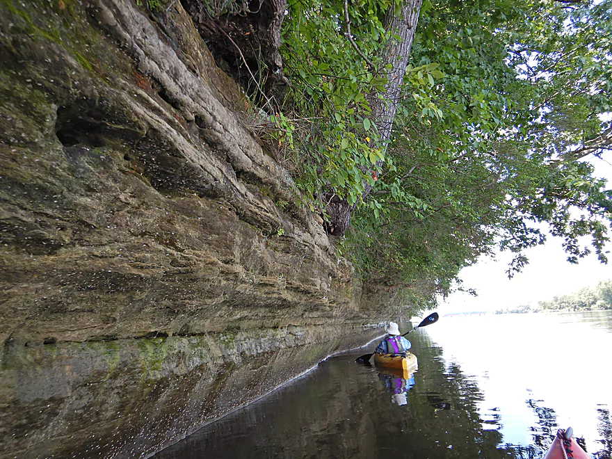
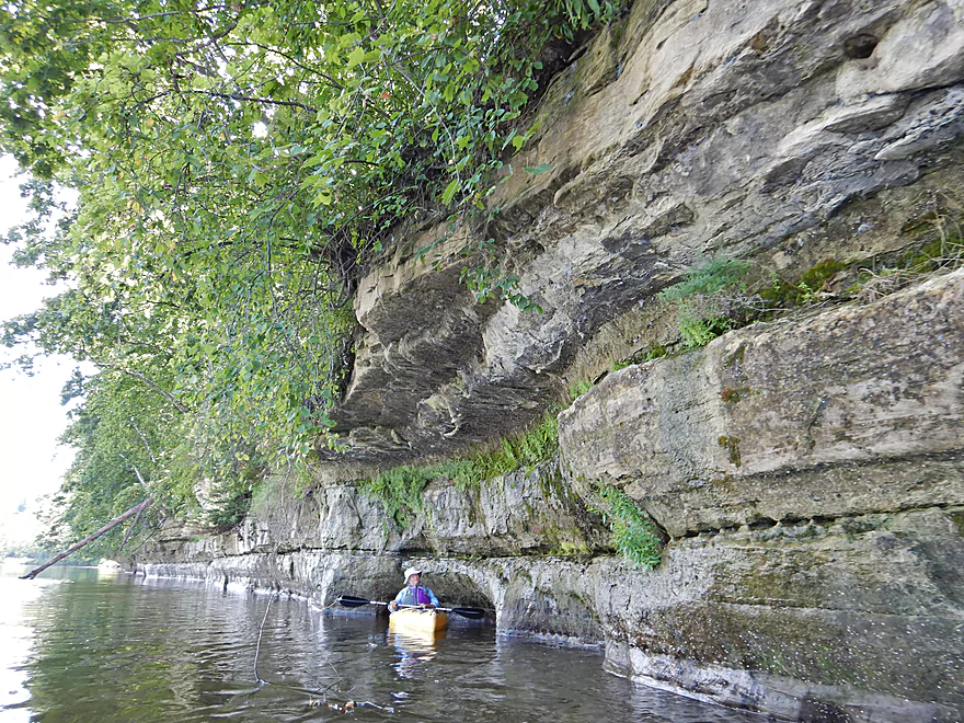
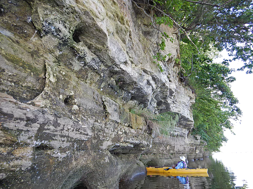
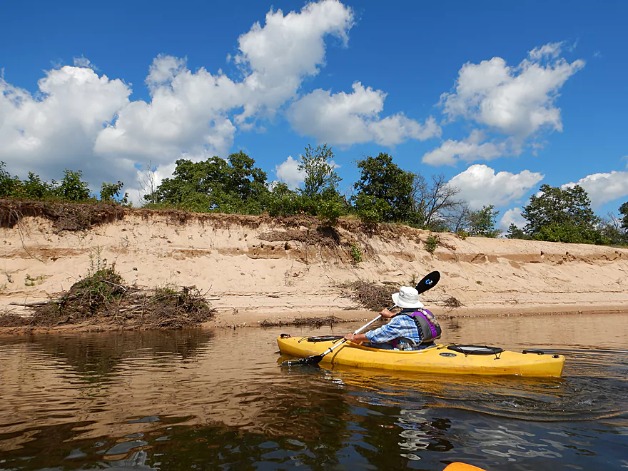
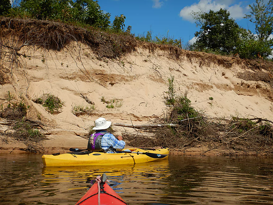
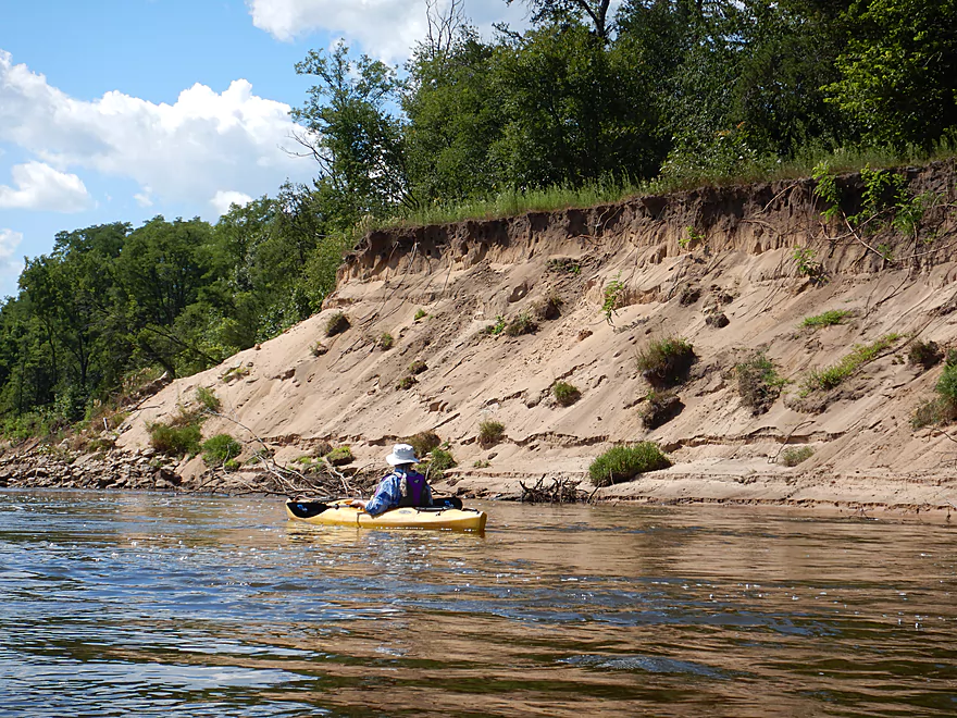
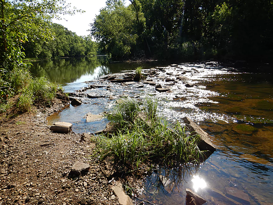
I highly advise hugging the left/south shore for the first part of the trip, as here there is a gorgeous 2.3 mile section of almost continuous sandstone outcrops, highly reminiscent of Wisconsin Dells. Attractive plant colonies and insect exuviae cover the rock faces. In several spots seeps flow over the sandstone revealing attractive mineral stains. These cliffs would be quite scenic during a big rain or as ice flows in winter.
After the sandstone outcrops end, you’ll come across a large railroad bridge. The left end is supported by a closely spaced grid of steel pillars stretching 400’…and in every gap were massive logjams with light rapids running underneath. Quite the mess…and in looking at satellite imagery this has gotten much worse recently. I have to wonder if at a certain point the clogged trees could threaten the entire bridge. The right side contains larger concrete pylons that are easy to paddle through, but the current is strong here with small standing waves, so be careful and stay away from the supports.
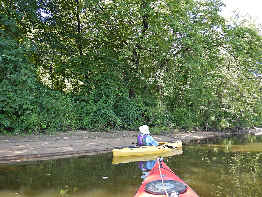
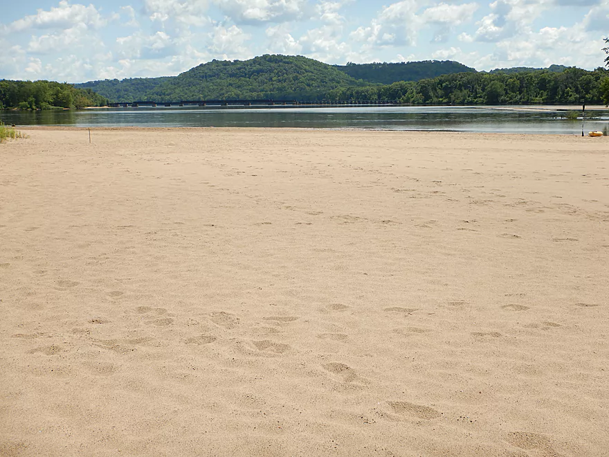
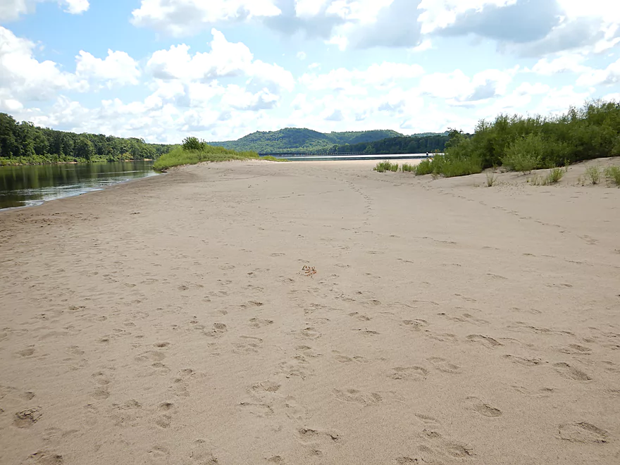
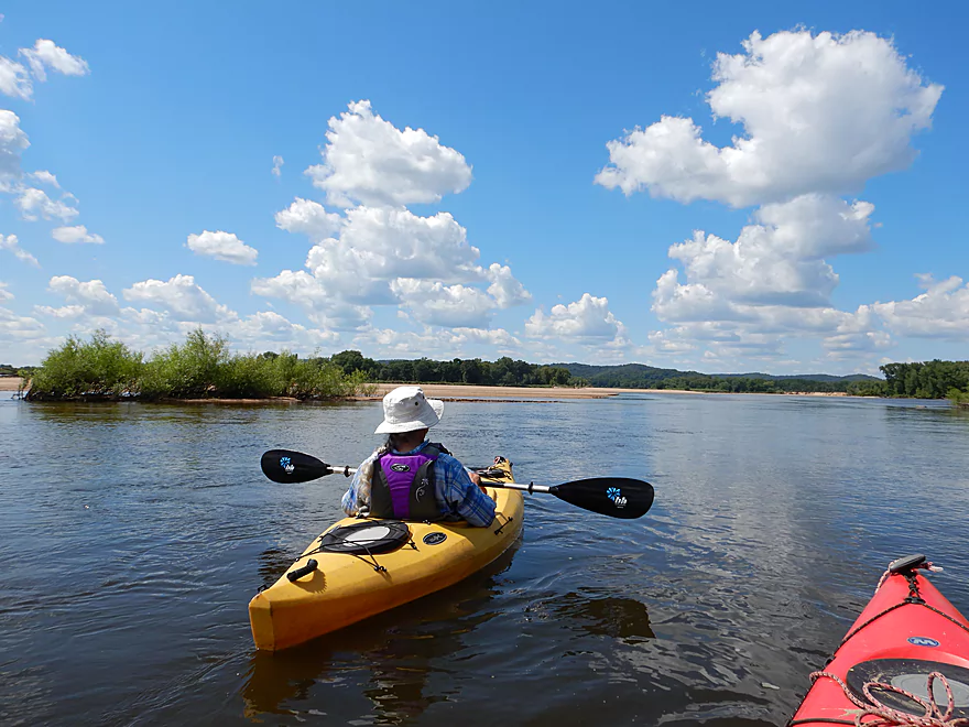
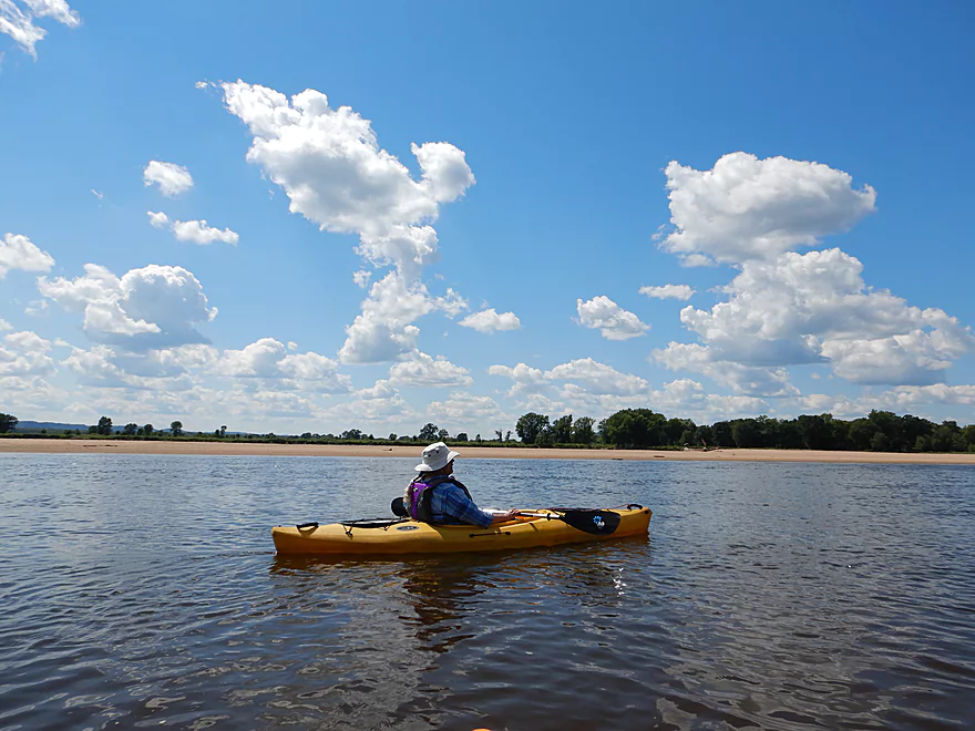
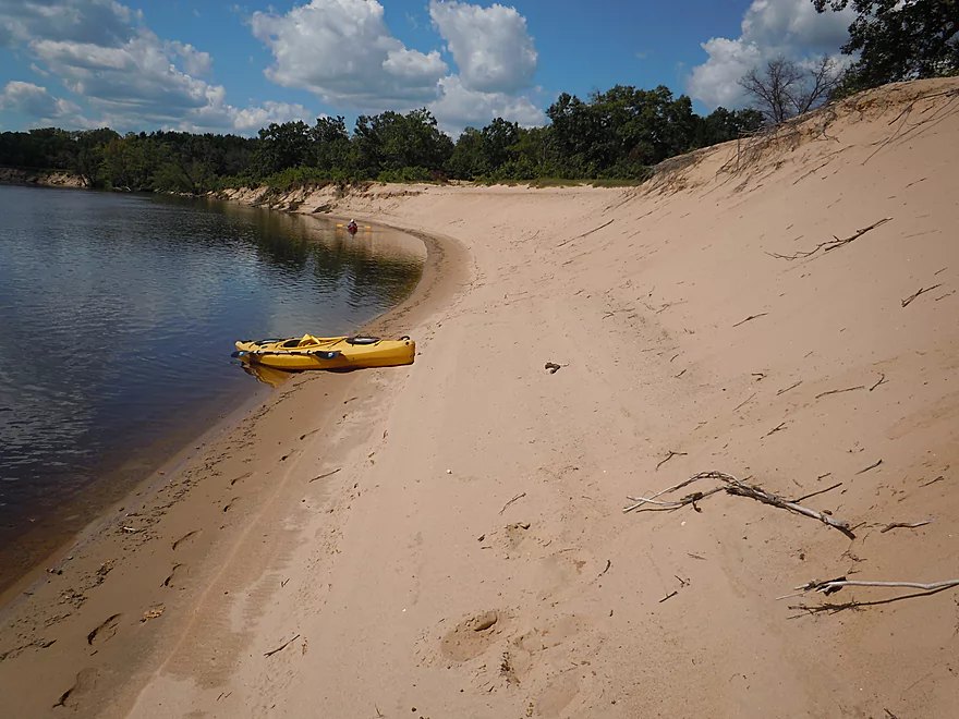
Downstream from the bridge is a fantastic sandbar (maybe 1000′ long) which we used for a lunch break. This whole segment is great for sandbars as there are many, including some really big ones. These are super popular with campers, but even if you don’t camp it is worth it to take a break on one. Unfortunately some sandbars can become crowded on summer weekends. A good trick is to go on a weekday (as we did) and you’ll have the river largely to yourselves. Or go during a football game…a great paddling trick for avoiding crowds!
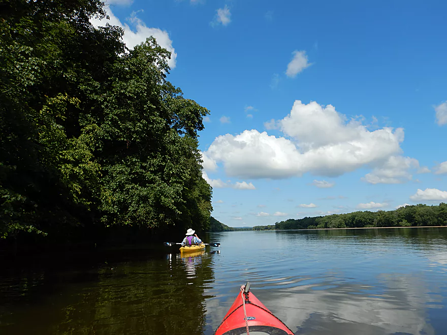
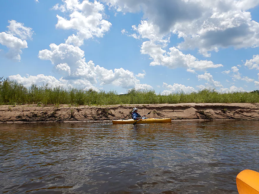
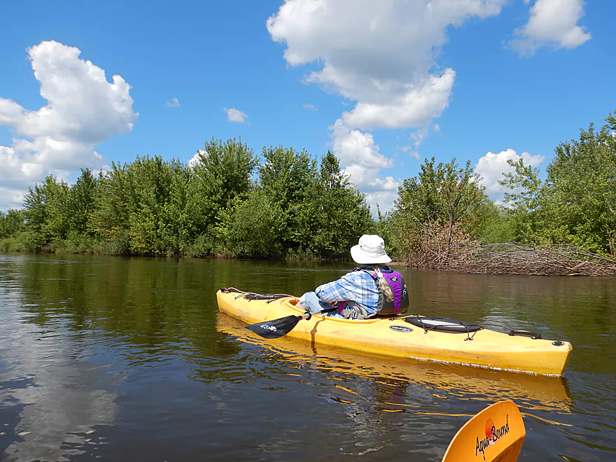
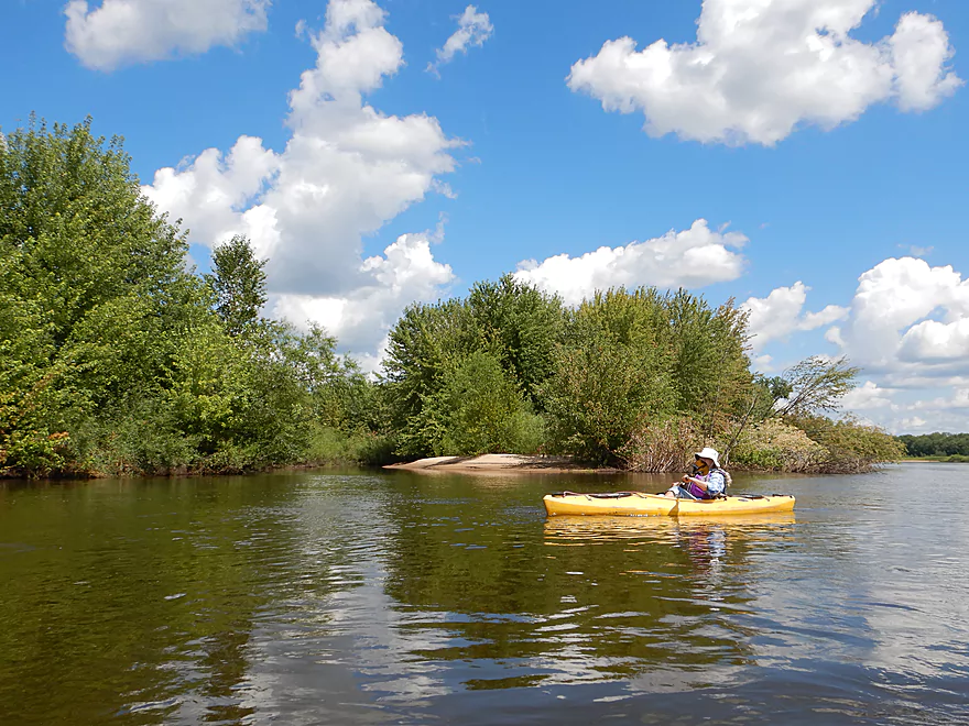
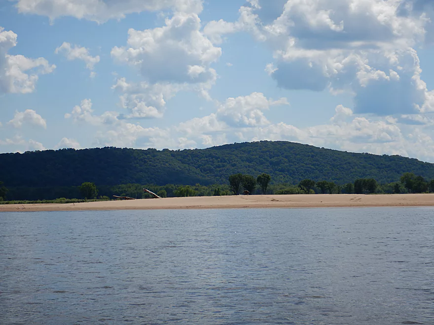
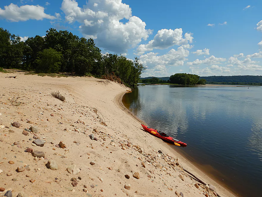
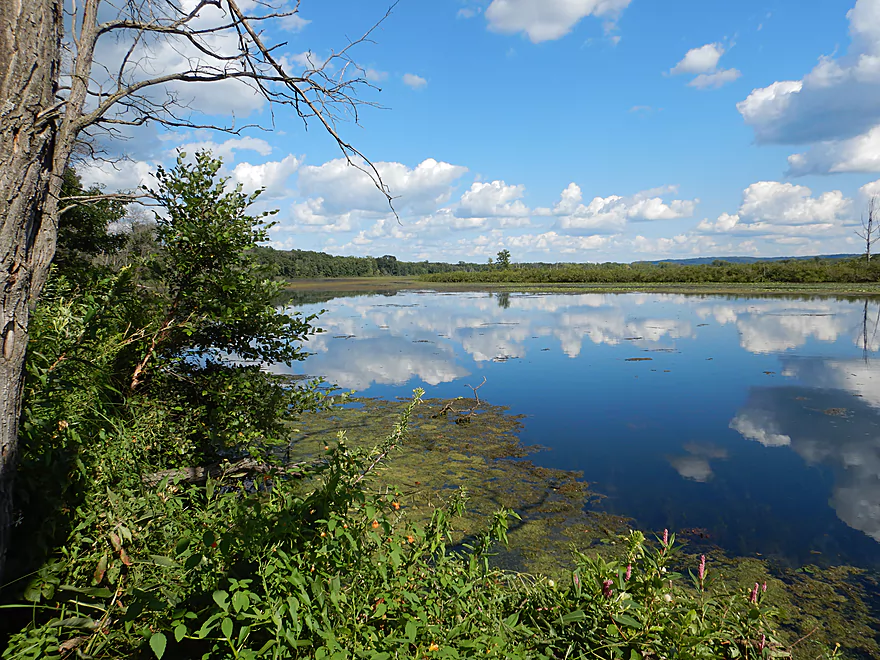
The river soon slows and widens. On the right bank there are several sloughs and islands that you can explore, while on the left bank rise impressive wooded bluffs. It was here that we were buzzed by a sightseeing airplane skimming a mere 30-40′ above the water (2:48 in the video).
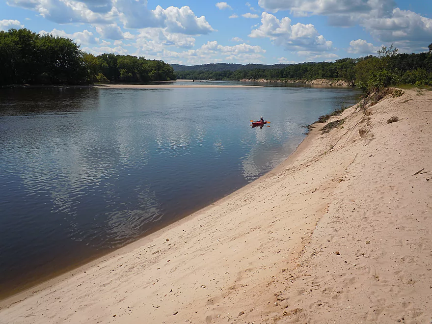
The river then turns north and after a massive star destroyer-like sandbar that wouldn’t end, we came across the Gotham Jack Pine Barrens. What is unique about this area are the large exposed sandbanks that stretch for a half mile and are quite the sight. The sandbanks turn in a parabolic arc to the west which you can see all the way from Gotham.
All in all this was a great trip with the highlights being the start and the end (the sandstone walls and the tall sandy banks). The only reason I didn’t give this five stars was that the river did slow somewhat and become less interesting in the middle portion. Special thanks is in order to the Lower Wisconsin State Riverway Board for its work in protecting this scenic corridor from development (it was a miracle that it was formed) and special thanks to Friends of the Lower Wisconsin Riverway for the education and public relations work they do.
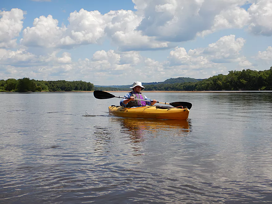
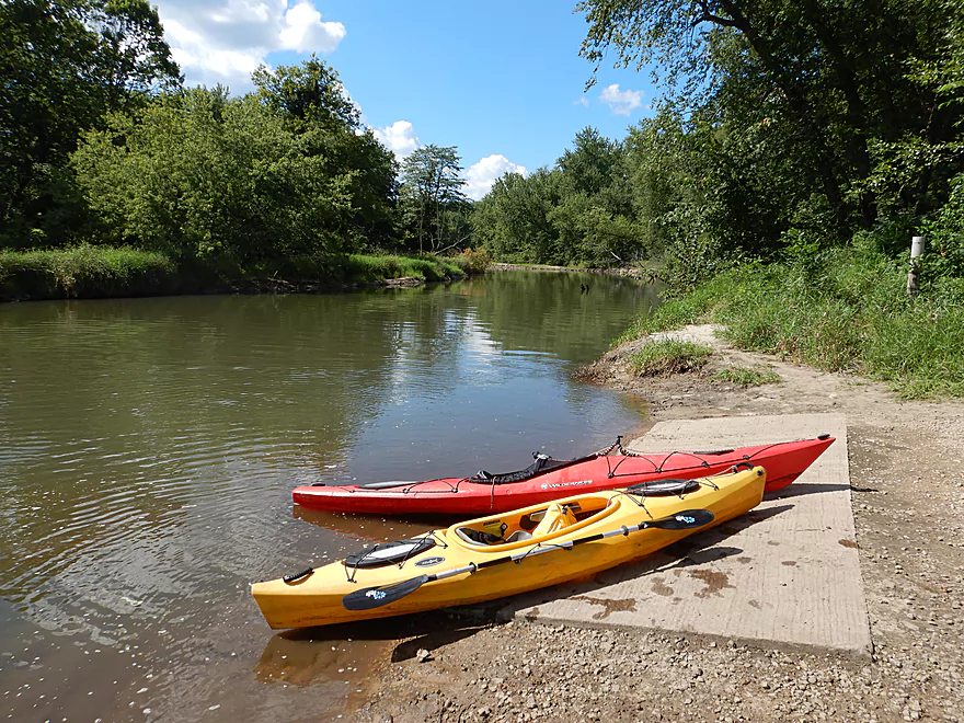
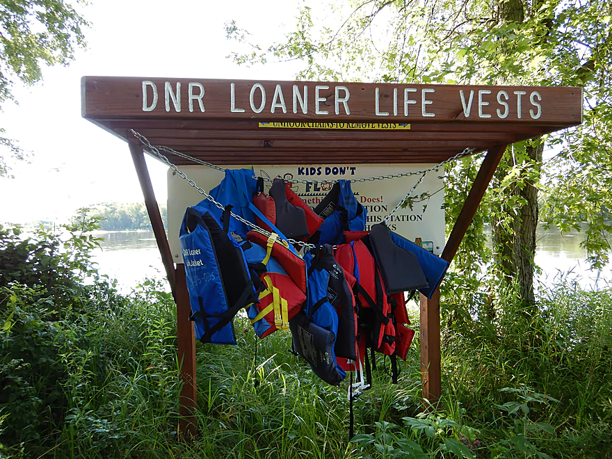
At the mouth of Otter Creek is the Lone Rock Boat Landing which is a great launch option. Parking is free, but there is no outhouse and it can be very crowded on summer weekends. This landing has public loaner life vests which is a thoughtful gesture.
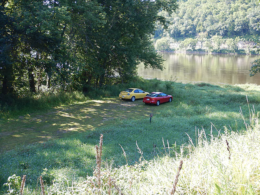
If you want a less crowded launch option, Lone Rock actually has 2-3 other launches you can use (all on Hwy 133). The best is a hidey drive south of Long Island and east of Hwy 130, which is much more secluded and inaccessible by powerboats (that’s a good thing).
A third option is Brace Memorial Park located at the top of Hwy 133. This is a nice option if you want to explore Long Lake or the north end of Long Island, but you will miss many neat rock outcrops if you launch this far north.
At the mouth of the Pine River is the Gotham Boat Landing (aka Buena Vista Landing). This is a great boat landing with free parking, but no outhouse. Loaner life jackets are available here as well.
The bike shuttle route is 8.7 miles, which seems long, but is relatively short compared to other bike/kayak shuttle routes for the Lower Wisconsin. On the plus side, there are no major hills to worry about and much of this can be peddled on the Pine River Trail. The section north of Gotham has been closed due to flood damage, but the route east to Lone Rock should be open and fine.
There are a number of livery and rental services for the Lower Wisconsin, and I highly recommend using my livery map to see all your options. Here are the closest services:
- Waz Inn: 608-583-2086 – 234 S. Oak St., Lone Rock, WI 53556
- River View Hills Canoe Rental: 608-739-3472 – 24678 State Road 60, Muscoda, WI 53573
- Wisconsin Canoe Company: (608) 432-5058 – E5016 US Hwy 14, Spring Green, WI 53588
- Wisconsin Riverside Resort: (608) 588-2826 – S13220 Shifflet Rd, Spring Green, WI 53588
- Traders Bar and Grill (aka Sandbar Canoe Rental): (608) 588-7282 – 6147 Highway 14, Arena, WI 53503
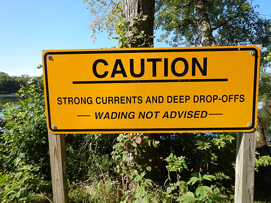
The Wisconsin River is one of the most dangerous rivers in the state, mostly because paddlers underestimate it. It is easy to go wading off the end of a sandbar and be sucked into a hole by a powerful undercurrent that you can’t see, and the river has claimed many lives. It is highly recommended to wear a life jacket on this trip. The 2nd safest thing you can do is to avoid the river at higher water levels when it is most unforgiving.
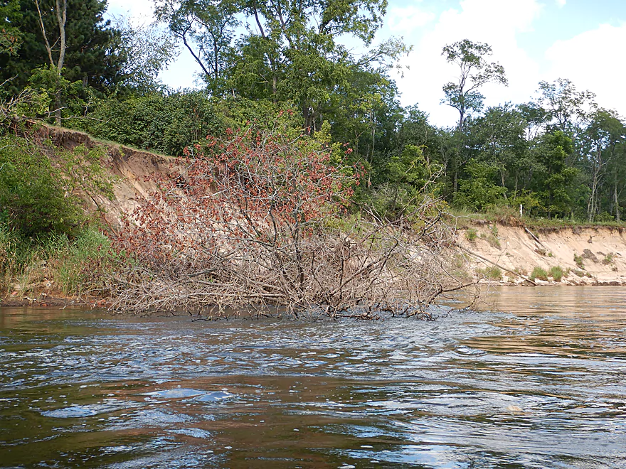
Be mindful of strainers that hang over some of the banks that can easily upend a boat.
One of the fastest flowing sections of the entire Lower Wisconsin is located in the three mile stretch from Lone Rock to the railroad bridge. In fact early raftsmen would even avoid tying up at Lone Rock because of the swift and difficult to navigate currents. But for the 2nd half of the trip, the river slows to a crawl.
The biggest hazard on the trip would be the railroad bridge. The left side is filled with logjams and rapids which you don’t want to get near. The right side by the concrete pylons has very strong current, eddies and even some small standing waves. Stay well away from the concrete pylons which can trap, pin and drown paddlers that get too close in high waters.
This has been a frustrating year for paddling the Lower Wisconsin as high water has frequently swallowed up the best sandbars. We did the trip at 8,950 CFS per the downstream gauge at Muscoda which was an ok depth but a smidgeon above average for this time of year. Here is my rough depth guide:
- 2,000-3,000 CFS: Very rarely does the river get this low. These levels would be a sandbar utopia. You might have to walk some sections but this would be easy to do in the clean sand.
- 3,001-5,000 CFS: Very ideal conditions. Great sandbars and the low levels tend to deter some motorboat traffic.
- 5,001-7,500 CFS: A common depth and ok conditions for sandbars.
- 7,501-10,000 CFS: Much smaller sandbars but still viable for camping. Again the trip was done at 8,950 CFS.
- 10,001-12,500 CFS: Only the tops of the largest sandbars will be available. Likely not ideal for camping.
- 12,501-15,000 CFS: You would be lucky to see any sandbars. Water quality will likely be very murky and dirty at these levels.
- 15,001-20,000 CFS: River will be very high, pushy in spots and likely not attractive for paddling.
- 20,001+ CFS: This is too high IMO.
As a general rule, the Wisconsin is the lowest in late summer and fall. Consider yourself lucky if you can paddle the river below 10,000 CFS prior to July.
One eagle, many turtles, two cranes, a molting katydid, some clams, many clam trails, and countless mayfly exuviae on the rock walls.
Long Lake/Bakken’s Pond: Located just south of Lone Rock, this slough is a navigable prospect. Bakken’s Pond features natural springs and connects with Long Lake which stretches for 1.5 miles. There are shallow rapids by Hwy 133 which are easy to portage. DNR Link.
Cruson Slough/Smith Slough: Both are large sloughs with numerous public access points, and have attractive marshes abundant with wildlife. Both are decent paddle prospects, but I don’t think they have a navigable link to the main channel. DNR Links: Cruson Slough / Smith Slough.
Marsh Creek/Avoca Lake: One of the more interesting slough prospects. Stretching for five miles, you can bypass 5 miles of the main channel, but it is likely narrow in spots with logjams. Most paddlers just do round trips. Here is a trip report from Rick Kark.
Avoca Prairie: Overshadowed by a large bluff, this natural area contains supposedly the largest tallgrass prairie east of the Mississippi. DNR Link.
Gotham Jack Pine Barrens State Natural Area: Sometimes referred to as Wisconsin’s Desert this really neat natural area features huge sandbanks along the river and unique species not often seen elsewhere in the state (like cacti, lizards, and earthstars).
Quick Overview
- Upstream of Stevens Point: I don't have information yet on these stretches.
- Stevens Point to Lake Petenwell: ~42 miles. This stretch in Central Wisconsin used to have many natural rapids, but most have been buried under 8 dams, some of which are now difficult portages. Despite this there is still some good paddling to be had in this region.
- Lake Petenwell: 14.9 miles. This is a large flowage lake that is challenging for paddlers because of frequent strong winds and big waves.
- Castle Rock Lake: 14.5 miles. Another large flowage lake that is likely too big for enjoyable paddling.
- Castle Rock Lake Dam to Lemonweir River: 9.4 miles. This pre-Dells leg isn't elite, but is a pleasant stretch.
- Lemonweir River to Indian Trails Landing: 21.7 miles. This includes the famous Upper Dells and Lower Dells which feature many scenic sandstone outcrops.
- Indian Trails Landing to Portage: 16 miles. This is an overlooked section sandwiched between the Dells and Portage. While the scenery isn't top-notch, it does have many sandbars and few people, which is a nice combination.
- Portage to Lake Wisconsin: 14.3 miles. This is a neat stretch of the river with many sandbars and cliffs, but the shoreline is very developed and motorboat traffic can be heavy on weekends.
- Lake Wisconsin: 14.5 miles. This is a challenging lake for paddling because of the huge and frequent waves created by motorboats.
- Prairie du Sac Dam to Port Andrews: 57 miles. This is the first half of the famous Lower Wisconsin Riverway. This is a super popular stretch for paddlers with the highlights being large sandbars, big bluffs, occasional cliffs, and fun side sloughs to explore.
- Port Andrews to Wyalusing: 40 miles. This is the second half of the Lower Wisconsin Riverway which has far fewer paddlers and sandbars. But the bluffs and sloughs are larger and more interesting.
Detailed Overview
- Upstream of Merrill: I don't have enough information yet on these legs to comment.
- Merrill Dam to Riverside Park: 0.5 miles. Might include some light rapids below the dam.
- Riverside Park in Merrill to Wisconsin River Forest Landing: 8.6 miles. A good prospect.
- Wisconsin River Forest Landing to Brokaw Boat Landing: 5.7 miles.
- Wisconsin River Forest Landing to Jesse Park: 1.4 miles. A terrific stretch with small boulder gardens, one set of Class 1-2 rapids, gravel bars and a nice sand bank.
- Jesse Park to Brokaw Boat Landing: 4.3 miles. A good stretch with scenic wooded banks and occasional gravel bars.
- Brokaw Boat Landing to Gilbert Park: 5.1 miles. River slows down and becomes hillier. This stretch is an ok prospect and goes past the old Brokaw paper plant that has been shut down. Paddlers must navigate Class 1 rapids and a 2' drop where the old Brokaw dam used to be.
- Gilbert Park to Wausau Boat Dock: 1.5 miles. An impounded stretch through Wausau. There are numerous alternate access options to choose from.
- Wausau Boat Dock to Oak Island Boat Ramp: 1.2 miles. A nice stretch that includes Barkers Island and Isle of Ferns Park. But the Wausau dam does require a portage. This stretch parallels the famous Wausau Whitewater Park.
- Oak Island Boat Ramp to Rothschild Dam Access: 5.8 miles. Likely mostly uninteresting flowage paddling. There are many alternate access options to choose from.
- Rothschild Dam Access to Zimpro Park: 1.0 miles. This might be a nice stretch.
- Zimpro Park to River Road Boat Landing: 7.6 miles. The first half of this leg is likely nice river paddling, but the second leg is probably just an uninteresting flowage.
- Chucks Landing/Mosinee Dam to Bean's Eddy Boat Landing: 2.8 miles. Likely a nice leg. You might be able to launch by the dam where there should be some nice rapids and boulders.
- Bean's Eddy Boat Landing to Seagull Boat Landing: 5.1 miles. Mostly uninteresting flowage paddling. Although there might be some nice sand banks on the eastern shore.
- Seagull Boat Landing to Dubay Dam Access: 5.3 miles. Mostly uninteresting flowage paddling.
- Dubay Dam Access to River Road Landing: 5.5 miles. This could be a nice stretch of river.
- River Road Landing to Old US 10 Landing: 2.3 miles. Likely an ok leg.
- Old US 10 Landing to Stevens Point Dam: 5.6 miles. Probably uninteresting flowage paddling. Many alternate access options closer to Stevens Point.
- Stevens Point Dam to Blue Heron Boat Landing: 4.2 miles.
- Steven Point Dam to Whiting Dam: 2.6 miles. Starts slow and uninteresting, but the river becomes very scenic after the Hwy HH bridge. The rock formations below both dams are very striking. Many alt access points.
- Whiting Dam to Kimberly Clark Dam/Al Tech Park: 0.6 miles. Incredible scenery with exposed bedrock and boulder gardens below the Whiting Dam. Some rapids, but nothing major. The Kimberly Clark Dam is a dangerous low-head dam and should be treated carefully.
- Kimberly Clark Dam to Blue Heron Landing: 1.0 miles. Class 2 rapids below the dam, but after that the river slows dramatically and splits into many sub-channels and islands. Round trips on this leg are possible. I chose the far western channel where there were some nice rocky stretches.
- Blue Heron Landing to Mill Creek Landing: 4.1 miles. Likely a mediocre paddle with nothing special. Galecke Park is an alternate access.
- Mill Creek Landing to Biron Dam North Gate: 7.6 miles. Mostly uninteresting flowage paddling. Several alternate access options on route.
- Biron Dam North Gate to Veteran's Memorial Park: 4.5 miles.
- Biron Dam North Gate to Biron Landing: 1.0 miles. Super scenic stretch by two islands with many granite boulders.
- Biron Landing to Legion Park: 3.0 miles. A nice stretch by Big Island. The west channel is more undeveloped...but the east channel has several scenic granite islands.
- Portage through Legion Park: 680'. A steep wall separates the park from the river but in two locations the wall is short enough to get over (see map). Paddlers may want to consider a longer portage to bypass some of the shallow rocky stretches by Legion Park.
- Legion Park to Veteran's Memorial Park: 0.4 miles. A scenic stretch that features a large boulder field and the powerhouse for a large paper mill.
- Veteran's Memorial Park to Port Edwards Landing: 3.8 miles
- Veteran's Memorial Park to Demitz Park: 0.8 miles. A pleasant stretch that includes Belle Island.
- Demitz Park to Ben Hansen Park: 1.2 miles. This leg goes by Garrison Island and Edwards Island. Lyon Park is located across the river from Demitz Park and is another access option.
- Ben Hansen Park to Port Edwards Landing: 1.8 miles. Above the Centralia dam there are several small but nice islands. Portage the dam on the left bank (follow the 1000' trail through the golf course). Below the dam there are scenic rock formations. Close to the Port Edwards dam are a few more scenic islands you can explore.
- Port Edwards Landing to Nekoosa/Riverside Park: 3.6 miles.
- Port Edwards Landing to Port Edwards Powerhouse: 1.3 miles. A half-mile portage is required (east bank). A very scenic boulder field is located below the dam. At high levels, the rocks are submerged and produce a half-mile stretch of rapids (some strong).
- Powerhouse to Moccasin Creek Landing: 1.8 miles. A generic wooded stretch that isn't super interesting.
- Moccasin Creek Landing to Riverside Park: 0.5 miles. During the Nekoosa dam drawdown, this stretch had nice boulder fields and rapids.
- Riverside Park to Hwy 73: 0.8 miles. An ok stretch of the river. There are scenic cliffs south of Hwy 73, but these are past the dam warning line. Hwy 73 is not a good access option.
- Hwy 73 to Point Basse Ave (Portage of the Nekoosa Dam): 1.5 miles. A difficult 1.5 mile portage through downtown Nekoosa. Don't try to portage the south bank. There is a steep hill, cliffs, and large Domtar paper mill fences to deal with.
- Point Basse Ave to Jim Freeman Memorial Boat Landing: 0.8 miles. A generic stretch going by historic Point Basse. If you're willing to backtrack to the dam, you can see scenic boulder fields (during low flows) and a few cliffs. Point Basse Ave is a somewhat speculative access, but it seems public and doable for launching.
- Jim Freeman Memorial Boat Landing to Plank Hill Small Boat Access: 2.0 miles. A generic stretch.
- Plank Hill Small Boat Access to 19th Drive Landing: 5.3 miles. Features two epic sand banks. The main channel has some minor sandbars. Several of the side sloughs can provide fun side adventures.
- 19th Drive to the Petenwell Dam: 14.9 miles. This is Lake Petenwell which is a large and challenging lake for paddling. Waves and strong winds are frequently an issue. But when calm there are nice sandbanks on the northwest shore, hidden sloughs, and large islands to explore. See the overview map for more info.
- Petenwell Dam to Ganter Lane Landing: 3.8 miles. This stretch isn't too impacted by dams and may have nice sandbars at low levels.
- Ganter Lane Landing to Castle Rock Lake Dam: 10.7 miles. Castle Rock Lake is likely too big (wind/waves) for enjoyable paddling. There are many alternate launch options along the shore.
- Castle Rock Lake to the Lemonweir River: 10 miles. An ok section.
- Lemonweir River Mouth to River Bay Landing: 7 miles. The first half of the classic Upper Dells.
- River Bay Landing to Blackhawk Island: 6.5 miles. Second half of the classic Upper Dells, known for its fantastic outcrops. Note, the Blackhawk Island landing is no longer accessible without special permission from the Upham Woods Outdoor Learning Center.
- Black Hawk Island to Wisconsin Dells Dam: 2.0 miles. More nice sandstone outcrops. You can take out at a public ramp off Indiana Ave or portage the dam and take out SW of the dam by a launch off Wisconsin Dells Pkwy/Hwy 12.
- Dells Dam to Indian Trails Landing: 6.2 miles.
- Dells Dam to Newport Park: 2.2 miles. This is the heart of the famous Lower Dells with many scenic outcrops. Unfortunately jet boats are a serious plague on this stretch.
- Newport Park to Indian Trails Landing: 4.0 miles. Features the famous "Sugar Bowl" formation and four super cool caves. The outcrops soon disappear and this stretch is mostly uneventful (but peaceful) big river paddling.
- Indian Trails Landing to Pine Island Boat Ramp: 9.8 miles. Few paddle this stretch as it isn't as interesting. But...it does have a good concentration of sandbars and few competing paddlers for them.
- Pine Island Boat Ramp to Portage/Hwy 33 Access: 6.0 miles. Not an elite section that is lacking in cliffs and bluffs. It does have good sandbars though.
- Portage to Dekorra Park: 7.7 miles
- Portage to Baraboo River/Thunderbird Road: 5.2 miles. A good section with great sandbars. Close to Portage there are few motorboats.
- Baraboo River to Dekorra Park: 2.5 miles. River splits around massive Lib Cross Island. West channel has nice sandbars. St Lawrence Bluff has scenic sandstone outcrops and includes a cave you can paddle into.
- Dekorra Park to James Whalen Memorial Park: 6.6 miles.
- Dekorra Park to Camp Rest Park: 5.1 miles. A terrific section with rock outcrops, large island deltas, hidden sloughs, and nice sandbars. Unfortunately this part of the river is popular with motorboats and jet skis which can be a plague. Multiple alternate access options.
- Camp Rest Park to James Whalen Memorial Park: 1.5 miles. Not a great section because of the open water paddling, powerboats and big waves. The west shore though does have nice outcrops.
- James Whalen Memorial Park to Merrimac Memorial Park: 4.4 miles. River turns into "Lake Wisconsin". Generally speaking this isn't ideal for kayaking as motorboat traffic can be heavy and waves can be surprisingly big. The most direct route is the north shore which has a few bluffs, but generally speaking isn't that interesting.
- Merrimac Memorial Park to Veterans Memorial Park/Prairie du Sac: 9.6 miles.
- Merrimac Memorial Park to Moon Valley Landing: 3.3 miles. Includes a lot of developed shoreline. The ferry, railroad bridge, and Moon Bay are highlights.
- Moon Valley Landing to Veterans Memorial Park/Prairie du Sac: 6.3 miles. Other than Moon Bay and the dam, this is a boring stretch. There are numerous alt access options on this route.
- Prairie du Sac to Mazomanie: 8 miles. An ok section of the Wisconsin but lacking in sandbars.
- Mazomanie to Arena: 9.7 miles. A great section with nice sandbars and scenic bluffs.
- Arena to Hwy 14: 8.0 miles. Good section with a high concentration of sandbars. One of the more popular legs on the Lower Wisconsin.
- Hwy 14 to Hwy 23/Spring Green: 2.2 miles. Neat mini-section with sandstone outcrops. Very popular in the summer.
- Spring Green to Lone Rock: 7.4 miles. Another fine sandbar/bluff section with some nice rock outcrops too.
- Lone Rock to Gotham: 8 miles. This stretch has super impressive rock outcrops and sand banks.
- Gotham to Muscoda: 7.6 miles. This leg includes more large sandbars and great outcrops. Bonus highlights include fast current and not seeing as many people.
- Muscoda to Port Andrew: 7 miles. A good stretch with many islands and sandbars.
- Port Andrew to Boscobel: 9 miles. Wooded islands start to get massive.
- Boscobel to Woodman/Big Green River: 9 miles and start of the less paddled stretch of the Lower Wisconsin. Far fewer sandbars from here to the mouth, but good bluffs and side sloughs to explore.
- Woodman to Millville: 7.7 miles. A good stretch with large bluffs and sandbars.
- Millville to Bridgeport: 5.3 miles. Huge islands, bluffs and sandbars are the highlight on this second-to-last leg on the Wisconsin River.
Bridgeport to Wyalusing (the mouth): 9 miles.
Trip Map
Overview Map
Video
Photos Size:
Hello! Wow! This is definitely the most helpful website i have come across. Thank you for making it so detailed. Unfortunately I am still unsure which trip may be best for my family. I was thinking the lower wisconsin river but then read about the currents. Perhaps you could advise me on which might be the best fit for what we are hoping to do? My husband and I would like to take our 2 daughters on a 1 night camping canoe trip. Their ages are 7 and 9. (Would wear life jackets though are good swimmers). We would probably want the 2nd day shorter than the 1st. Campground preferred but sandbar works too. We are from Northern Illinois (near Kenosha) so somewhere in a 1-3hr drive or so. We would like to use an outfitter where we leave our car at put in and they will pick us up at the end and drive us back to our car. Do you have any suggestions for me on which river or river camp spots would be best options for us? There are just so many! Thank you very kindly.
The best camping locations are subjective. My favorites are the sandbars and you can see where these are from a satellite map. The best region is Mazo to Lone Rock. There are countless ideas you could try. If you prefer a “proper” campground the following is a good option. Day 1: Arena to Trader’s Island Campground (8 miles – +16085887282…they can also shuttle you I think.) Then for day 2 you could do the campground to Lone Rock (9.5 miles).
I’d recommend these two outfitters.
For trips that end in Spring Green: https://thebestcanoecompanyever.com/
They have a “next 4 days” forecast on this page: https://thebestcanoecompanyever.com/conditions/
For trips farther downstream:
https://canoe-camping.com/
Traders seems to outfit the drinking and partying crowd more than the above outfitters, so their campground might be noisy?