
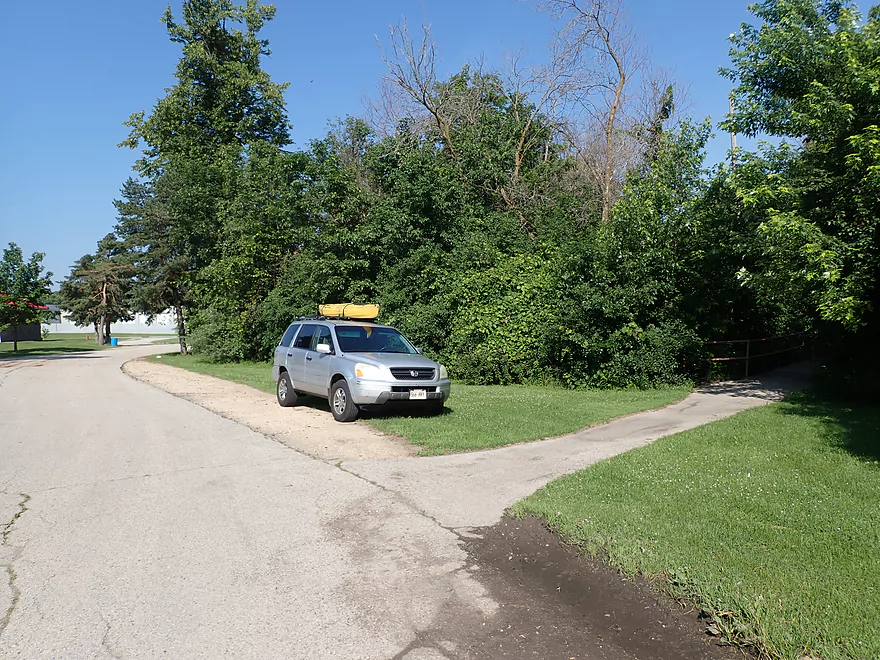
Starting the trip at West Side Park
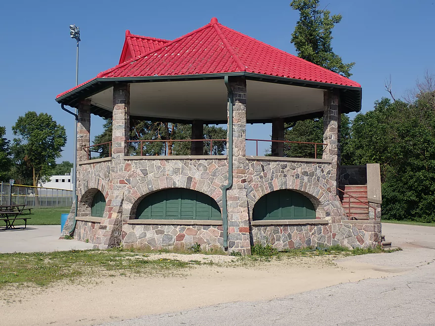
Where there is a cool gazebo
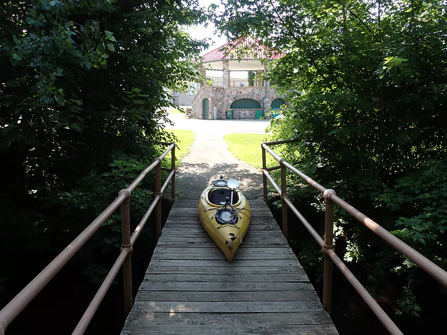
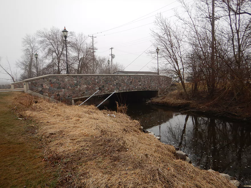
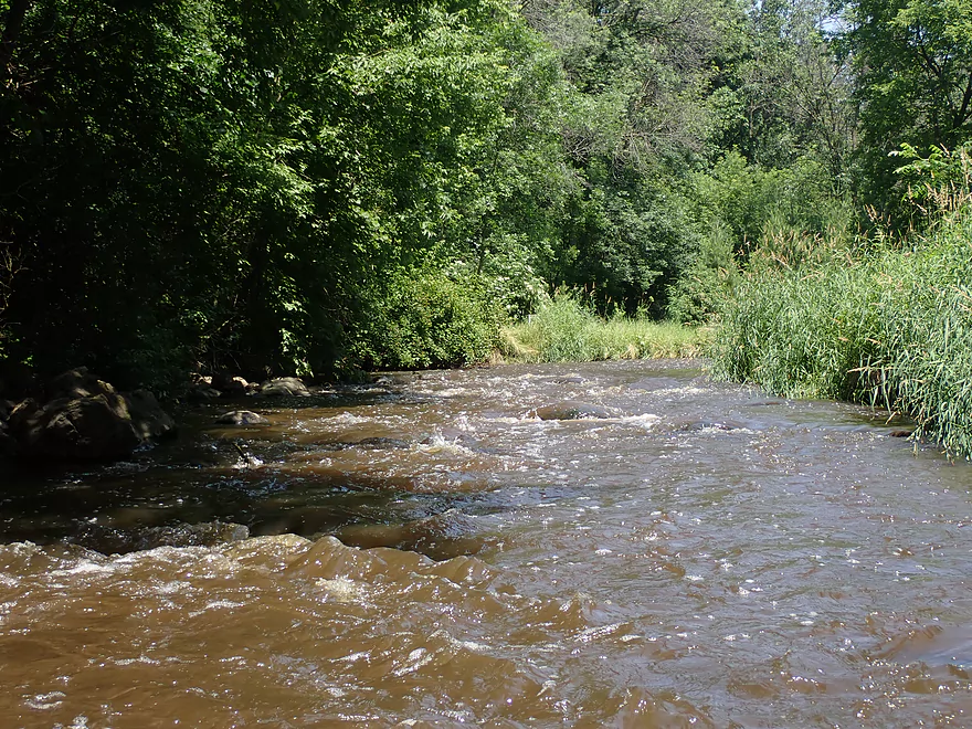
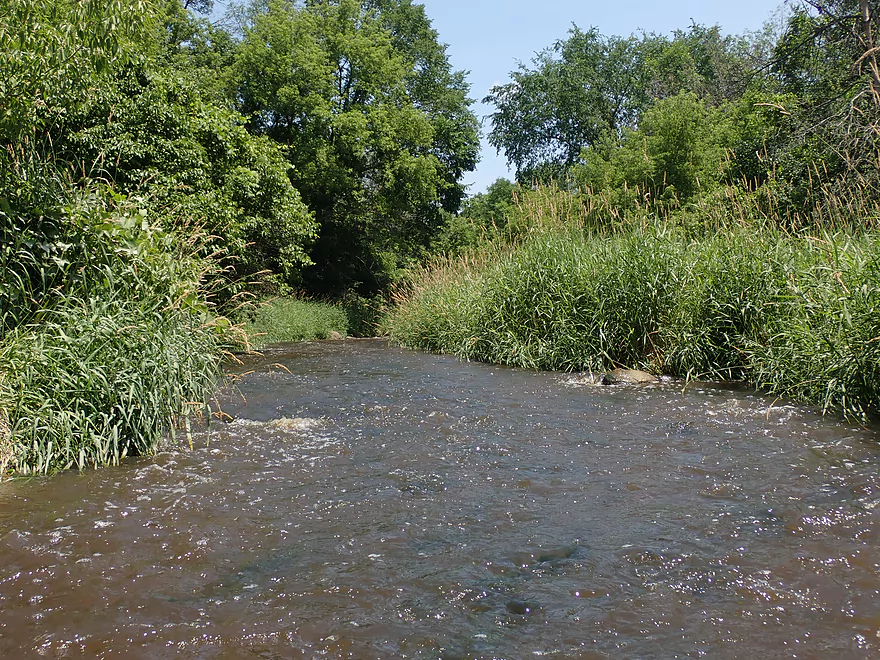
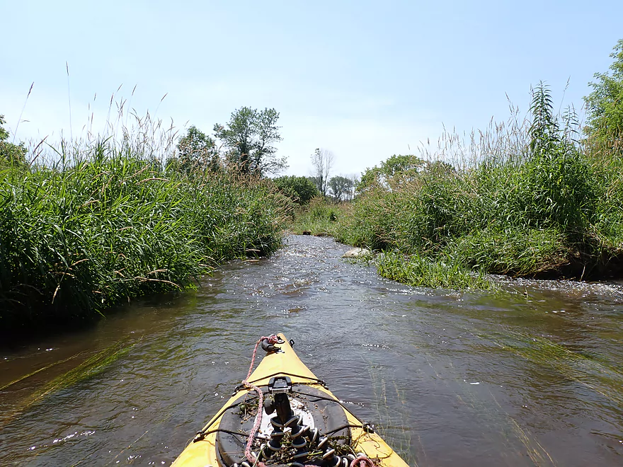
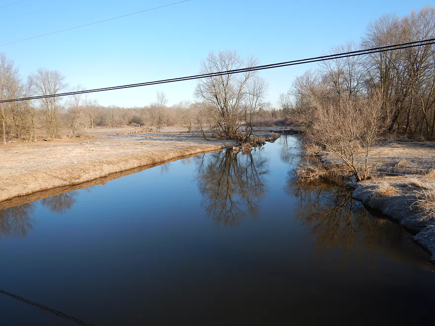
I put in by the pedestrian bridge
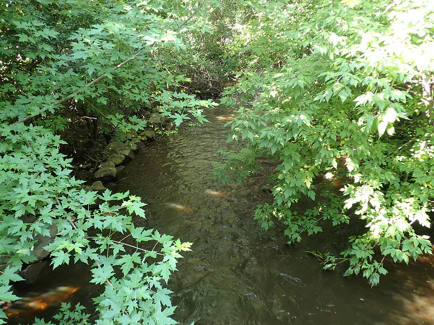
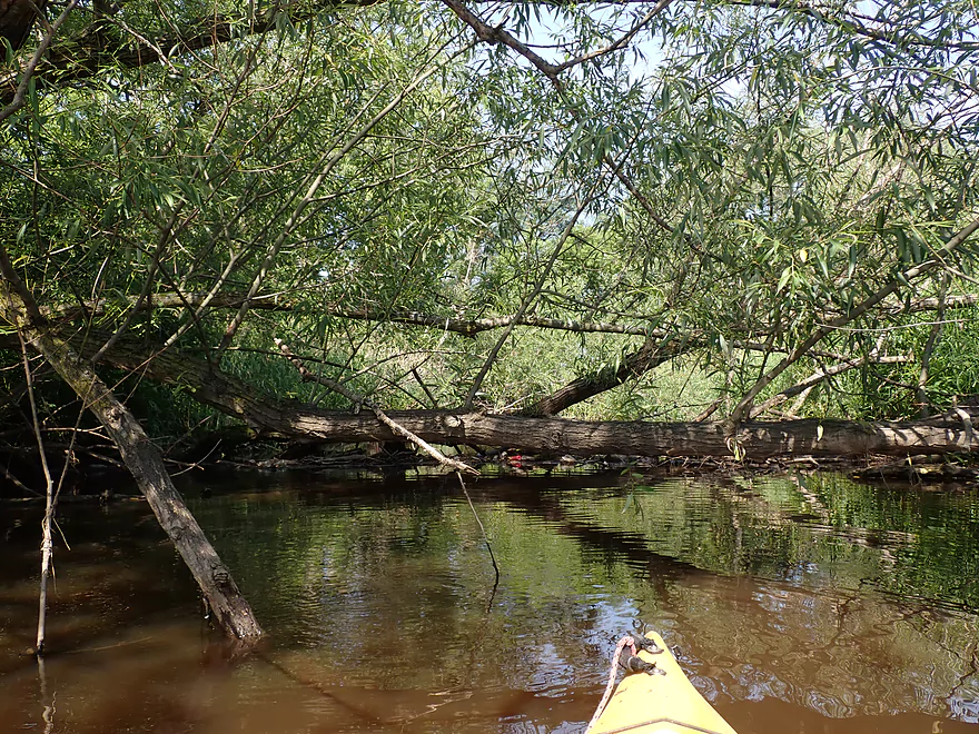
Things look very overgrown now
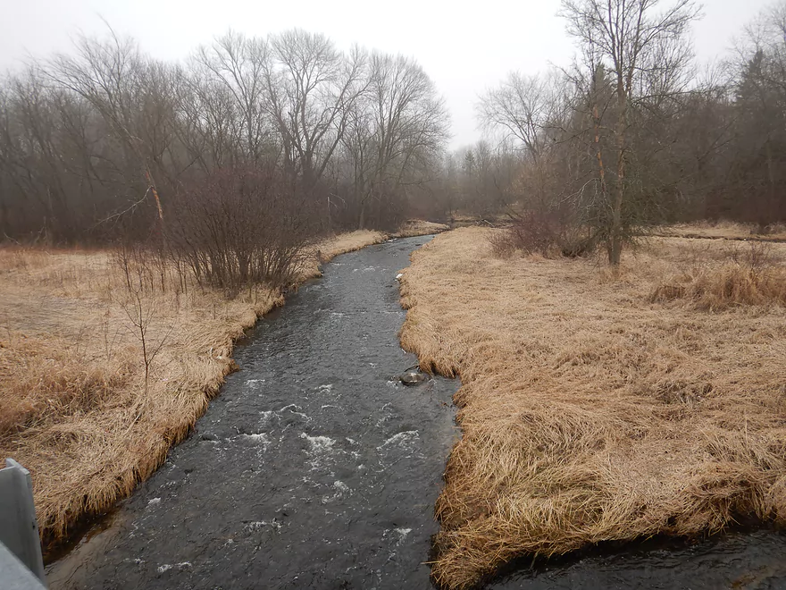
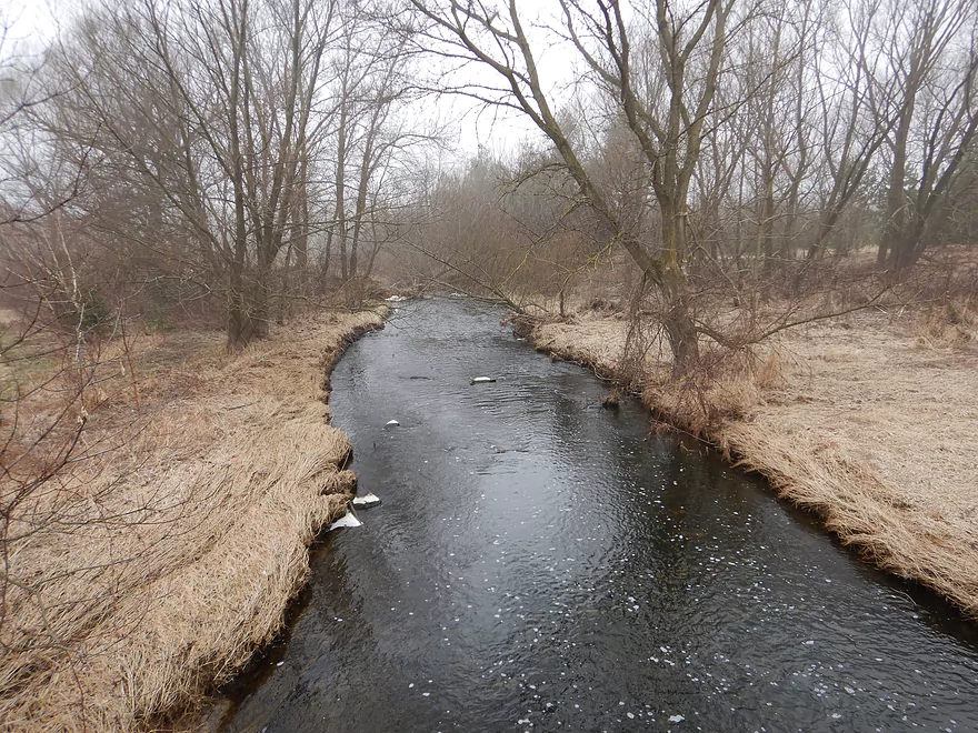
Looked very different during my April trip
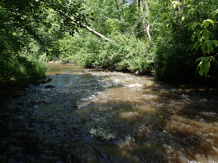
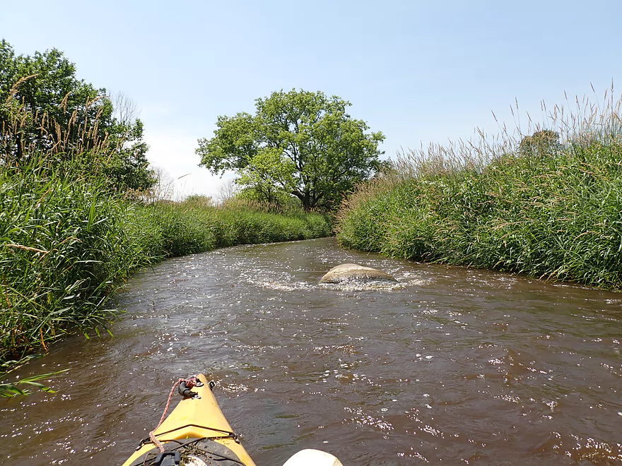
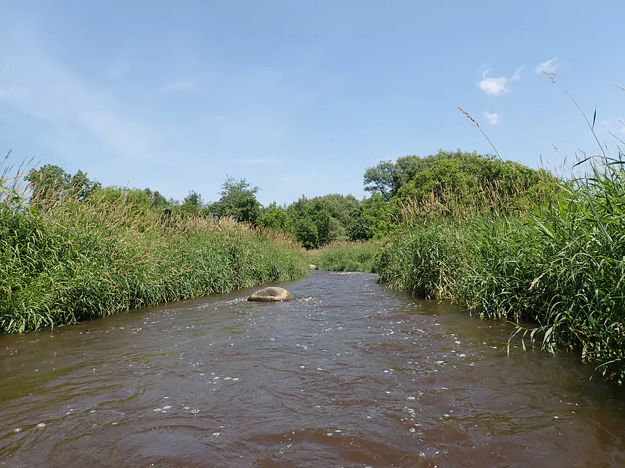
Still scenic
A better put-in would have been closer to Grant Street
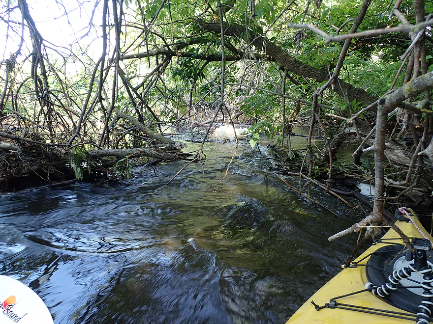
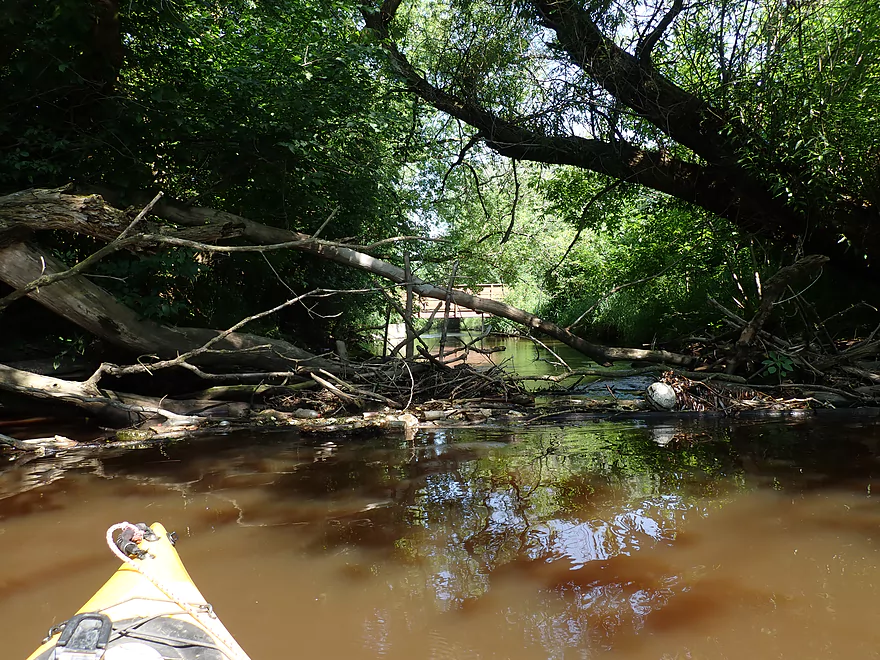
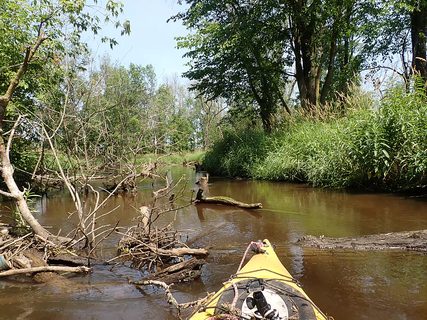
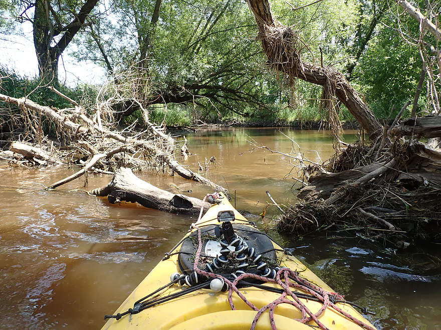
A surprising amount of deadfall
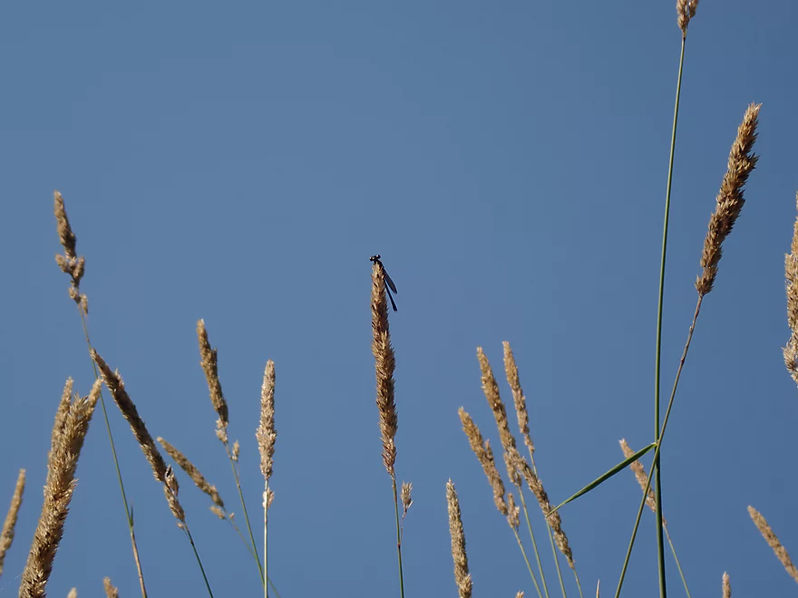
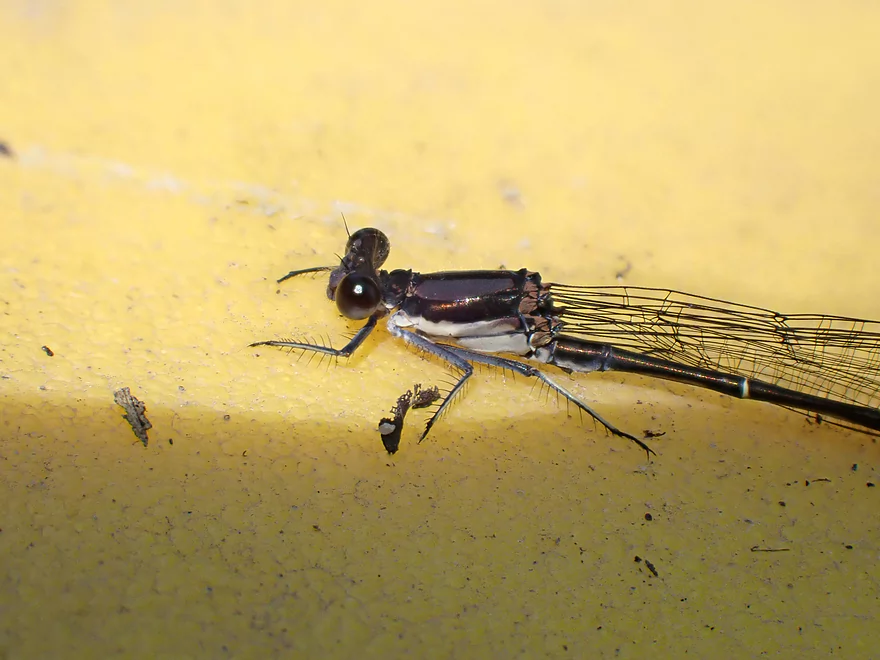
A damselfly looking on in amusement
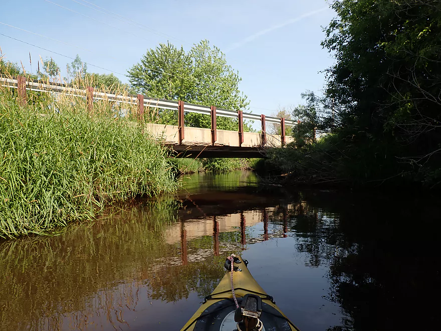
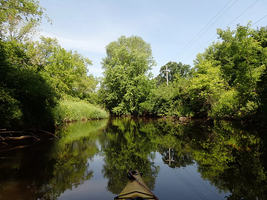
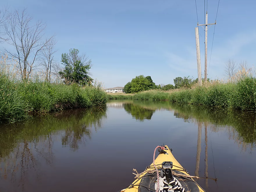
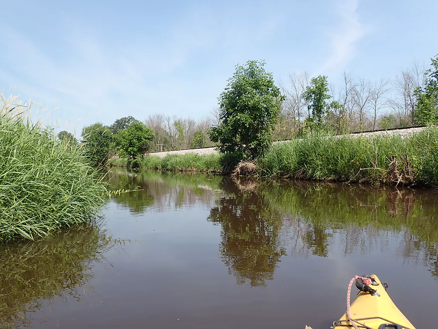
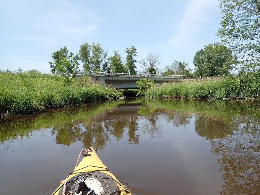
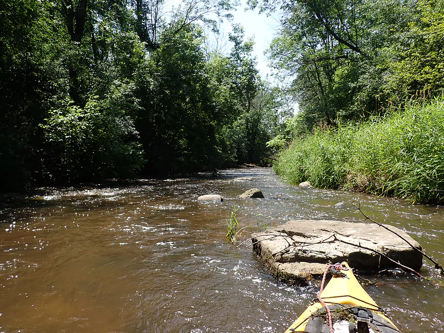
Coming up on Wacker Drive
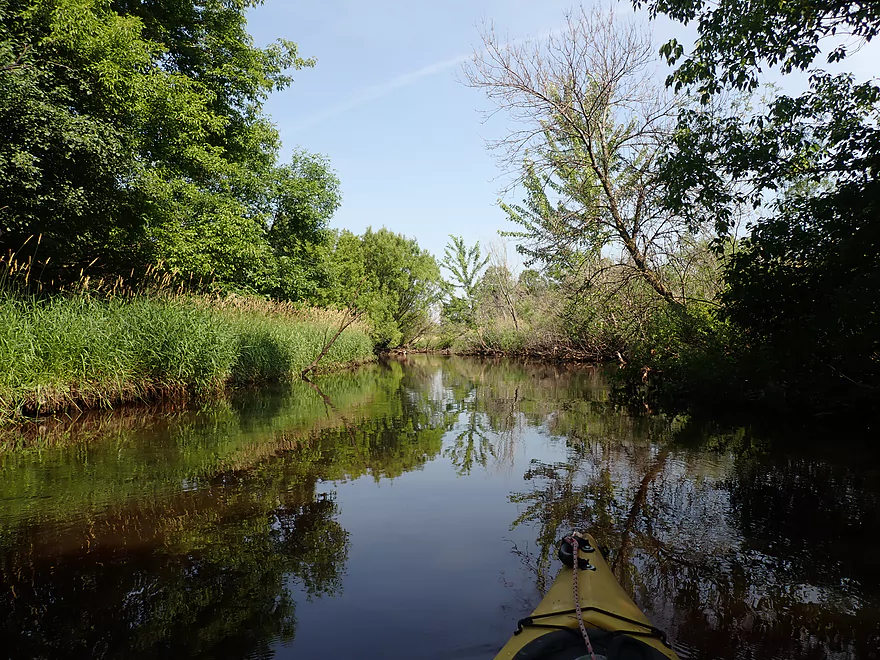
First mile was a mix of woods and grass
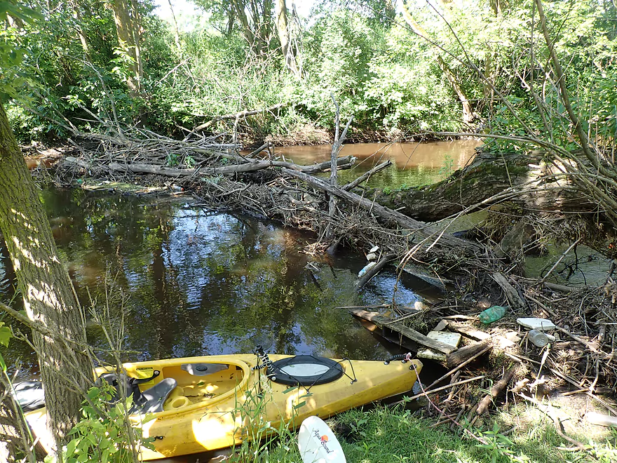
And logjams…this is portage #1 (easy)
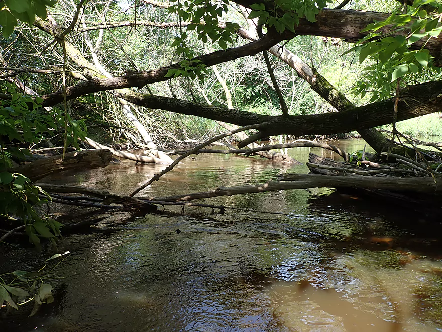
Followed by this mess which I rammed through
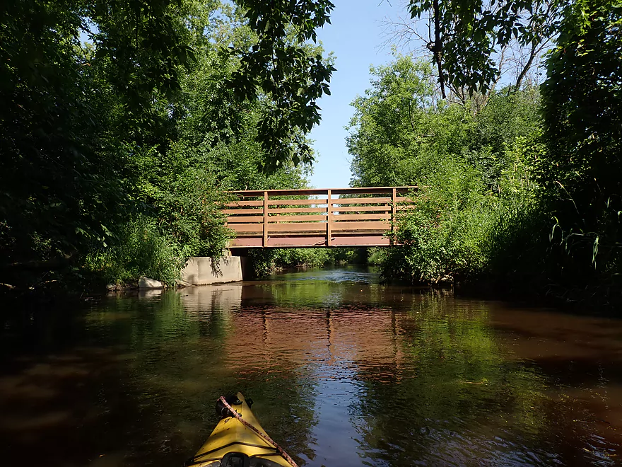
Nice little industrial park bridge
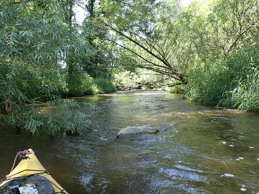
This trip was much less developed compared to my last trip
I got through that with a running start
Not ramming my way through that…portage #2
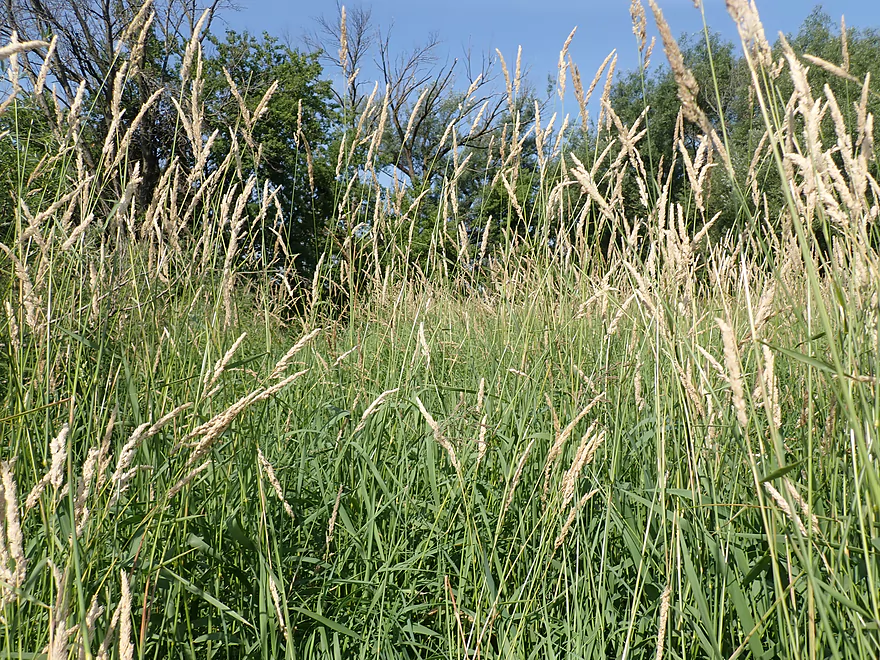
Tricky portage as the grass was taller than me
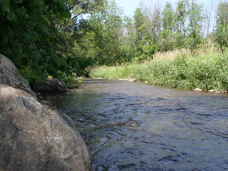
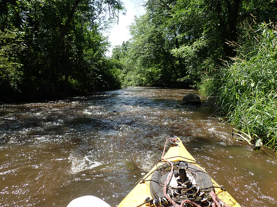
Scenic area though
Once I passed Walmart, I left most logjams behind
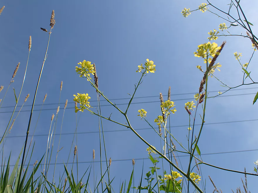
Black Mustard
Railroad tracks paralleled much of the creek
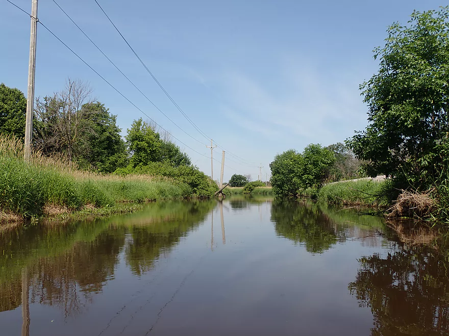
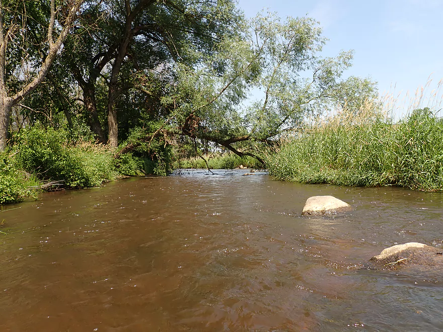
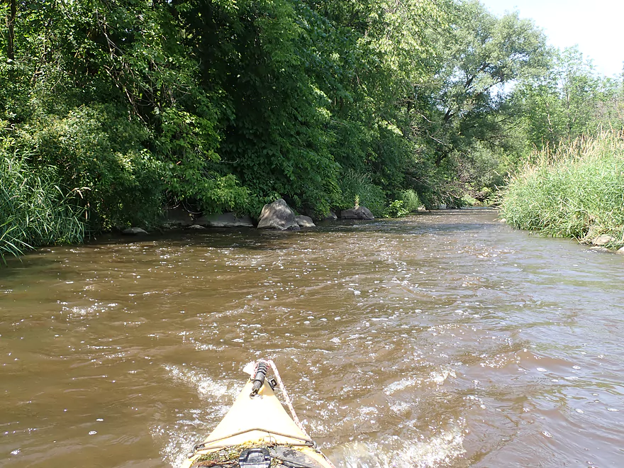
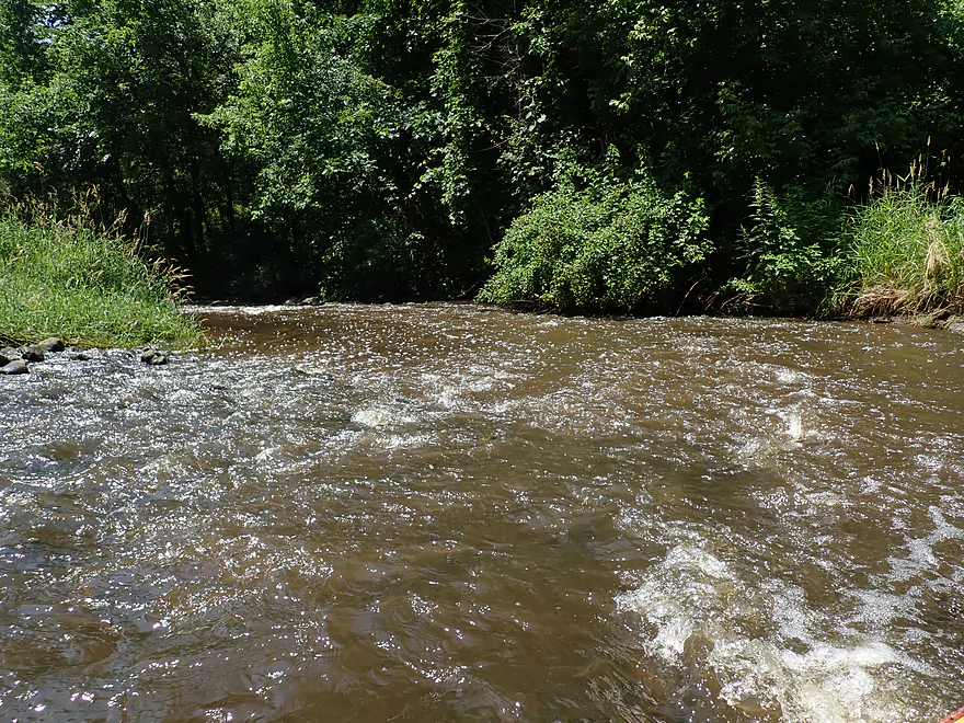
A nice open part of the creek
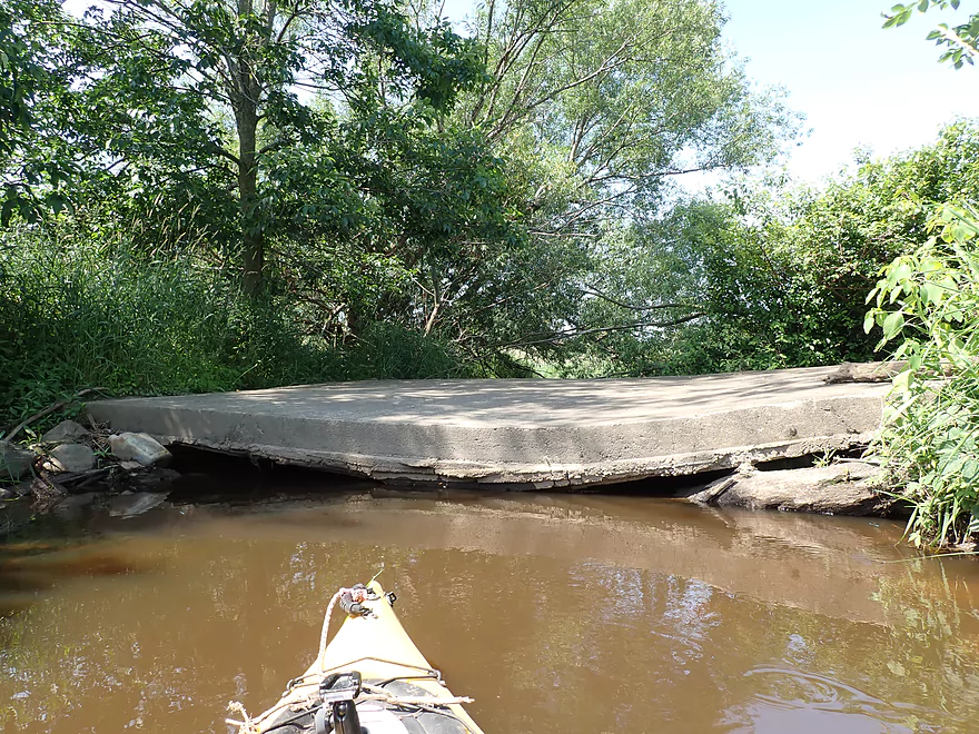
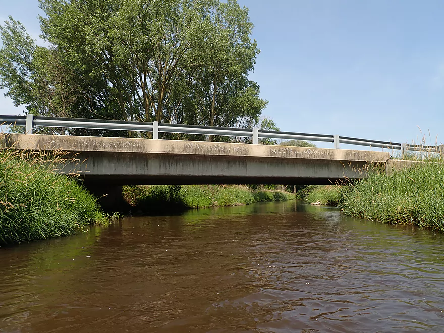
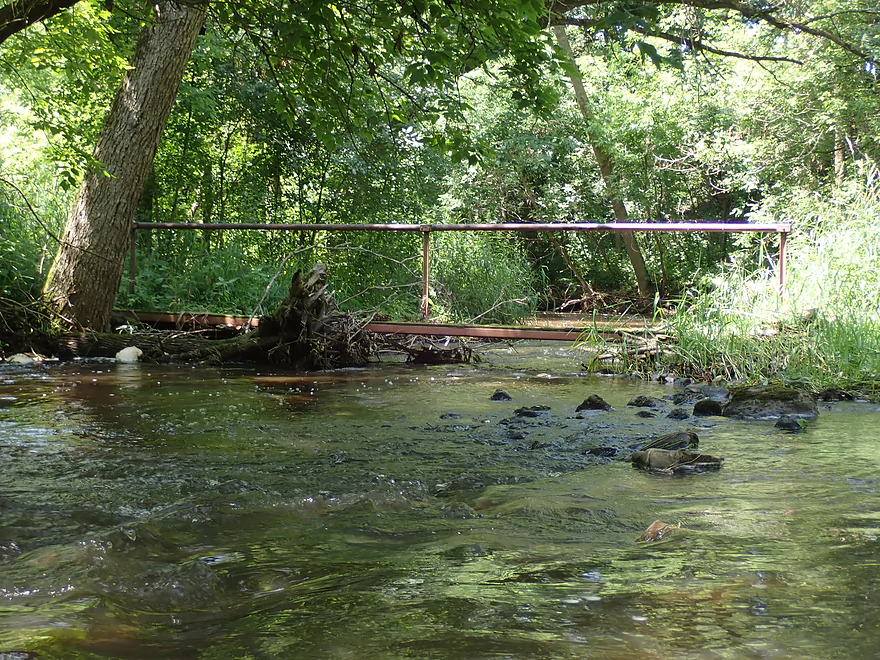
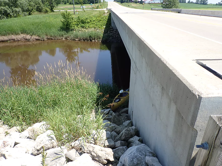
This bridge needs repair
Friendly hitchhiker
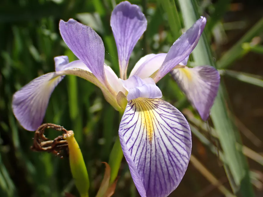
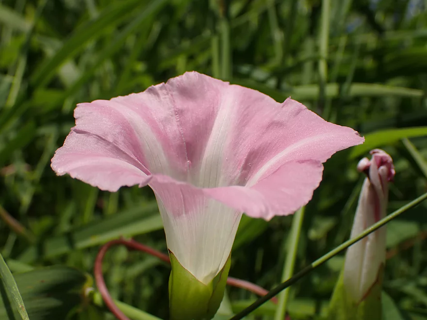
Blue flag
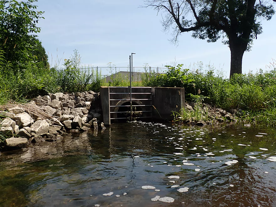
The septic plant marks the halfway point in the trip
Liberty Ave is likely an access option
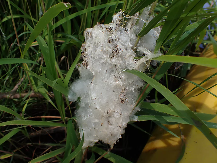
Interesting….looks like an exploded cattail
I start to see small boulder gardens after Liberty Ave
And small rapids
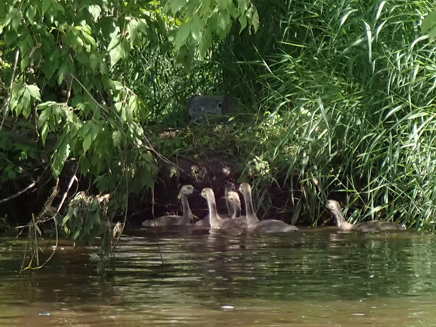
Gang of unruly teenagers
Still some deadfall although no more portages
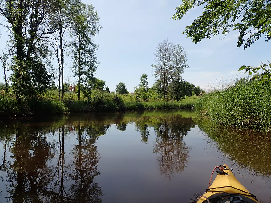
Nice reflections
Independence Ave is not a viable access
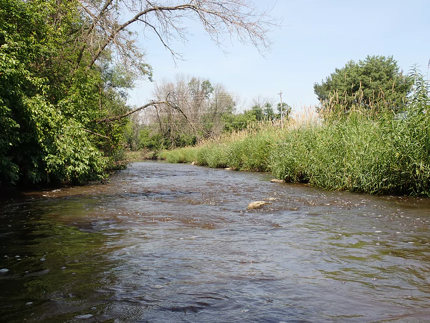
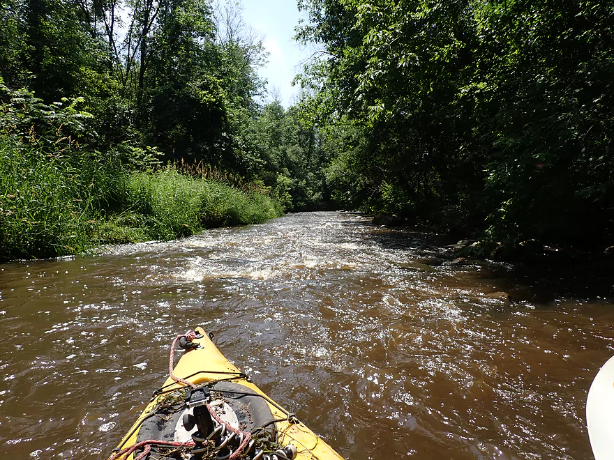
River starts to get interesting after that
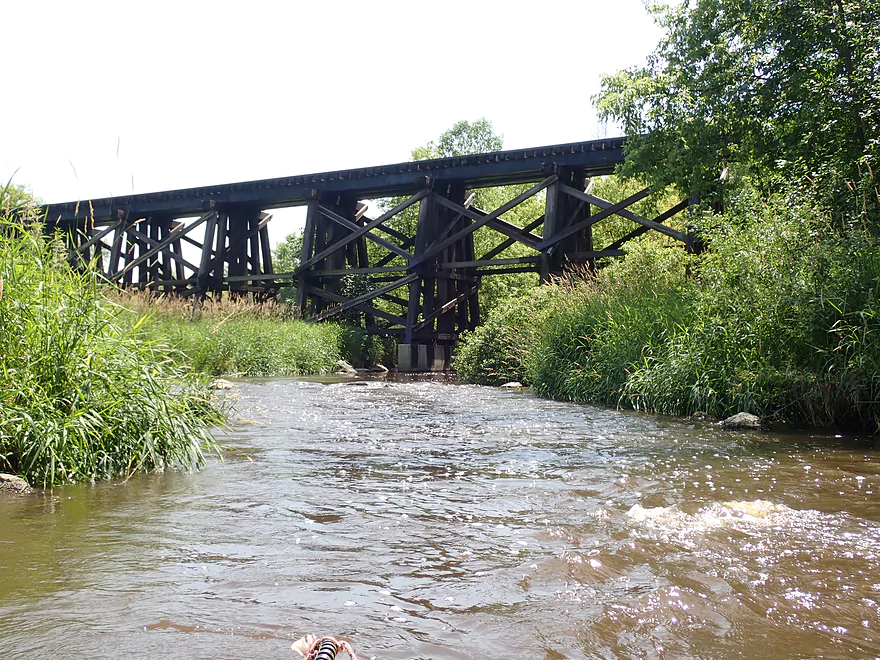
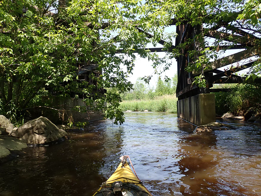
Attractive trestle
Current starts to pick up
Boulder gardens start to get bigger
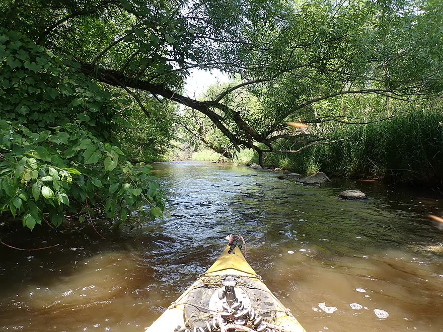
Woods start to return
More serious rapids (note the strainer on the right)
A shallow island
Taking a fast turn left
Zipping along
Some of the stronger rapids
Had to be careful to avoid the rocks
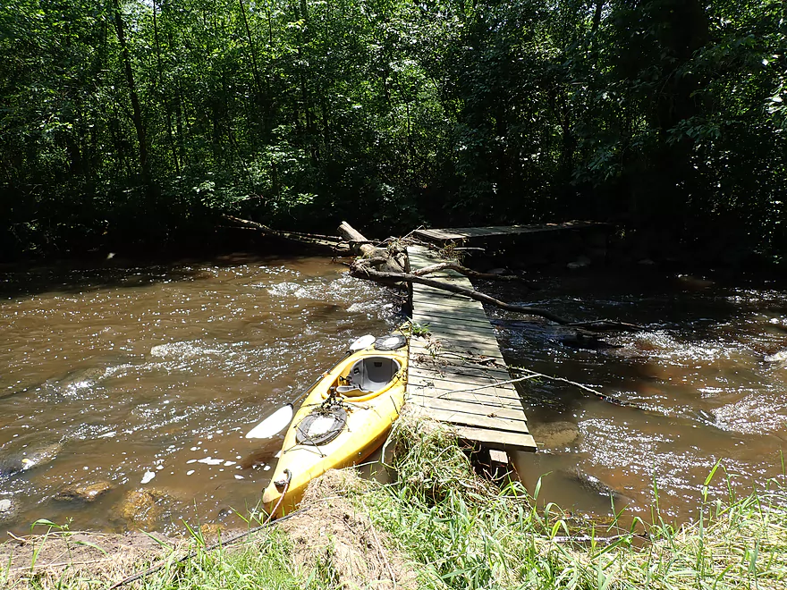
I had to portage this washed out bridge
Fun section
Another island with more fun rapids
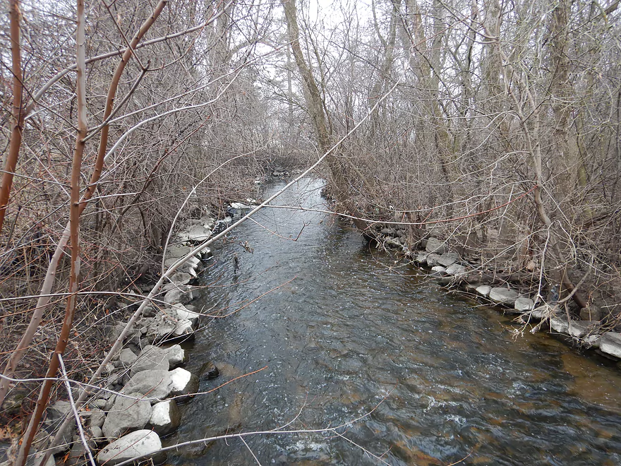
View from the Goodland Road bridge (April)
Honestly the creek was more scenic in April than it was in July
Current stays fast…I cut myself dodging that tree ahead
Some grassland rapids
Stretch between Goodland and Hwy 60 was pretty fun
And scenic
Last of the snags
Hwy 60 was a rocky take-out
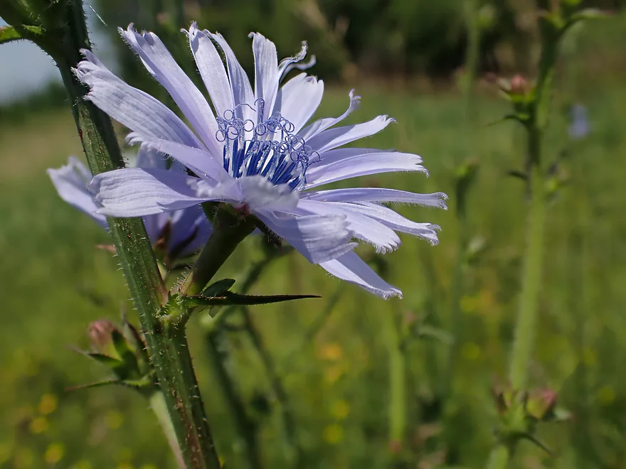
The always photogenic chicory
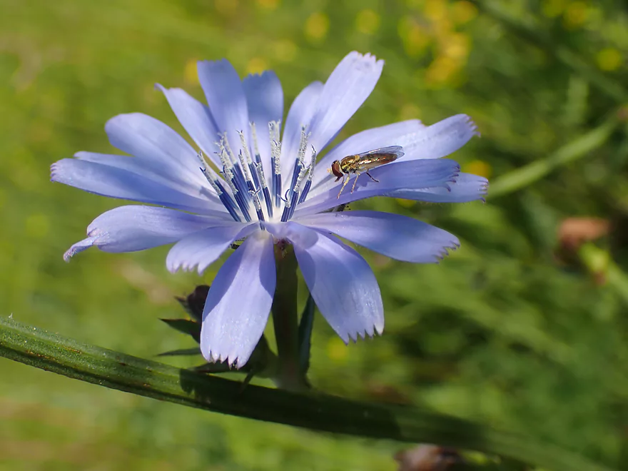
Which the hoverfly appreciates
Looking upstream (July)
Looking upstream (April)
Rubicon River – West Side Park to Hwy 60


A few months ago I did the upper Rubicon River from Hillside Drive to Wayside Park. That was a very nice trip, so this time around I planned to pick up where I left off…continue paddling the rest of the Hartford outskirts and take out at Hwy 60.
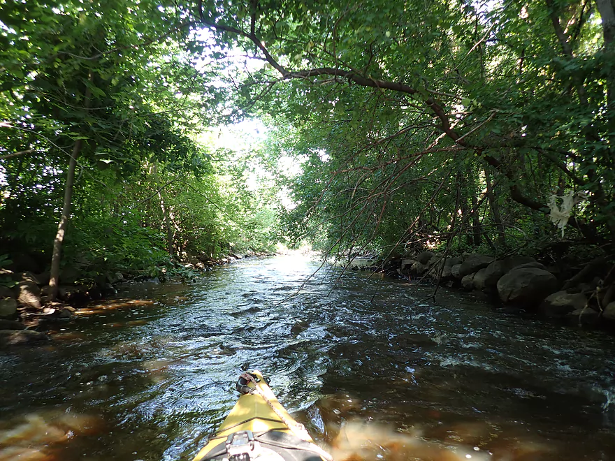
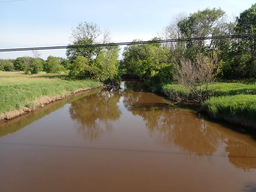
My first impression after putting in was how different the river was now. Before it was April, trees were bare and the skies overcast. Now it was July, sunny and the trees enclosed the creek like a jungle. The water also seemed muddier compared to my last trip and I thought there was more deadfall in the sections than I remembered.
I continued on past Wacker Drive which flows past Hartford’s industrial district…loud machine noises could be heard in the distance. There was a thin strip of woods that flanks the Rubicon here and a number of trees had fallen in. I was able to hop or duck under most, but it wasn’t always easy. Ultimately I did have to portage twice and interestingly there was a foot path by one of the logjams, which makes me wonder if somebody else had recently done this very trip.
At about the Walmart the creek opens up and loses the wooded banks. This was a simple section with grassy banks, but it was a relief to get away from those logjams.
Soon I came across Liberty Ave, which is roughly the halfway point in the trip and a possible access. The sewage plant dumps its effluent into the river and for the next mile or so, I could smell chlorine and see some laundry detergent bubbles in the water. On the plus side, there were now some surprise boulder gardens and rapids in the channel which were nice.
Following a scenic railroad trestle, the woods return and the next mile includes many rapids. These were mostly pretty fun, but at times tricky because of the tight turns and occasional overhanging branches. It wasn’t bad though. Following Goodland Road and a large island, the Rubicon lost its woods but this was still a fun section because of the fast current. I then ended the trip at the Hwy 60 bridge, which had a lot of rock fill to walk over but wasn’t a bad bridge take-out.
In summary this was kind of a disappointing trip on account of the deadfall and muddy water, and was not nearly as nice as my first adventure on the Rubicon. This stretch still has a lot of potential though as the last mile is very cool and if cleared out would be a great water trail.
2024-05-25 update from a reader: From Wacker Dr to Liberty Avenue there are now over half a dozen log jams that seriously impede paddlers. None were easy portages due to the thickets of vegetation and steep banks. Unfortunately, now almost the entirety of the Hartford section of the Rubicon is not worth paddling and is impassable with dead ash, willows, and boxelder.
Quite a few teenage geese not yet able to fly, one owl being chased by small birds, a great blue heron, some dragonflies, and a few duck families. Every so often I would see little bubbles and fish lips at the surface…I’m not if they were hunting insects or what…but I think they were carp. The highlight was the huge swarms of damselflies. The lowlight was the huge swarms of deer flies that occasionally were a nuisance.
West Side Park is a pretty good access with public parking. The best shoreline for launching will be closer to Grant Street, but I elected to put in upstream by the pedestrian bridge to rerun a nice section I did a few months back. While there was an outhouse here a few months back, it has since been removed.
There are numerous alternate upstream put-in options (see map for details). For example, you could launch 0.7 miles upstream by the dam/library/post office which adds a terrific stretch through downtown Hartford.
An alternate downstream put-in would be at Liberty Ave south of the sewage plant. From here to Hwy 60 is just 1.8 miles, but this is still an intriguing option as it bypasses most of the logjams and includes a nice rocky section of the river with a number of rapids.
Hwy 60 is a very busy road, but quite suitable as an access with plenty of room to park along the shoulder. You will have to get out on a rocky shoreline and then drag your boat up a rocky embankment…but I didn’t think this was a big deal. The northwest and southeast corners are likely the best spots to take out.
The bike shuttle is only 2.4 miles but it does run along Hwy 60 which has a lot of traffic. Shoulders are somewhat narrow and the drivers aggressive, so this isn’t the funnest of shuttles but about halfway through you can switch to a sidewalk which is nice.
Low Bridges: There is one washed out bridge by the rapids that must be portaged. This is super easy to deal with.
Logjams: I had to portage two logjams. The first was a super easy portage, but the second was a bit difficult as I had to wade through weeds taller than me. There are numerous other noteworthy hoppers, duckers, and squeakers. You can pretty much see where most of the logjams are via satellite view, but for the most part the worst section was between West Side Park and Walmart.
2024-05-25 update from a reader: From Wacker Dr to Liberty Avenue there are now over half a dozen log jams that seriously impede paddlers. None were easy portages due to the thickets of vegetation and steep banks. Unfortunately, now almost the entirety of the Hartford section of the Rubicon is not worth paddling and is impassable with dead ash, willows, and boxelder.
Current: Up to the sewage plant, the current is pretty slow. After the plant, the current speeds up considerably and there are a number of rapids in the final mile of the trip.
Rapids: Again, these are only present after the sewage plant. These are mostly shallow and bumpy Class 1 affairs but there are a few I would rate as Class 2 as they require tight turns to get around the rocks. There are a few strainers by some of the rapids as well.
The first half of the trip (up to the sewage plant) should usually be navigable. The second half of the trip has a number of rocky areas with light rapids and that will require more padding. I’m using the Bark River gauge as a reference but it may not be very accurate.
- 0-30 CFS: Likely too low.
- 31-40 CFS: Some of the rapids may have to be walked. There could be scenic boulder gardens at this depth.
- 41 – 50 CFS: I did the trip at 44 CFS which was fine for most of the trip. The rapids though were pretty bumpy.
- 51-65 CFS: Likely a decent depth. The rapids will still have some bumps.
- 66-80 CFS: Rapids should have good padding, but some of them will be difficult to maneuver because of the tight turns and occasional strainers.
- 81-95 CFS: Likely a tricky depth as the pushy current will make dodging deadfall difficult.
- 96+ CFS: Perhaps too high to run? I don’t know.
Detailed Overview
- Beach at Pike Lake State Park to Hwy 60: 1.1 miles. This is a large lake. The northern shoreline along the state park boundary might be nice.
- Hwy 60 to Hilldale Drive: 0.9 miles. Maybe 7 logjams. Very congested. Hwy 60 is a poor access option and poor dam portage.
- Hilldale Drive to West Side Park: 3.0 miles.
- Hilldale Drive to Willowbrook Park: 1.7 miles. Mostly an open and simple wetgrass paddle. There are several Class 1 rapids above the railroad bridge and several strong Class 1 rapids below it. One low walk bridge will have to be portaged.
- Willowbrook Park to Post Office/Library/Dam: 0.6 miles. Mostly open flowage paddling, but some light rapids by Willowbrook Park. The park area and its bridges are quite striking.
- Dam to Jordan Park/Rural St: 0.2 miles. A very scenic urban paddle through downtown Hartford.
- Jordan Park to West Side Park: 0.5 miles. Cool section. Very narrow and rocky with several light rapids. Mostly wooded, but goes by some industry. Some snags, but I didn’t have to portage. Note in 2023 a paddler reported multiple serious jams in this stretch. Taking out at Rural Street is now recommended unless you scout the downstream leg.
- West Side Park to Hwy 60: 3.5 miles.
- West Side Park to Wacker Drive: 0.2 miles. A short section through an industrial stretch. Some deadfall to dodge.
- Wacker Drive to Liberty Ave/Sewage Plant: 1.5 miles. Starts with a wooded section with a lot of deadfall and two logjams that have to be portaged. After that the river opens up. As of 2024 this stretch has filled in with logjams. It is not recommended.
- Liberty Ave to Goodland Road: 1.3 miles. A rocky section with multiple sets of rapids.
- Goodland Road to Hwy 60: 0.5 miles. Neat section with fast current.
- Hwy 60 to Pond Road: 1.9 miles. Maybe 7 logjams mostly in the first half. The second half of this leg looks really scenic though. Parking at Pond Road looks steep and difficult.
- Pond Road to Saylesville Road: 1.4 miles. Good prospect with a lot of rocks. Maybe one logjam.
- Saylesville Road to Resthaven Road: 2.0 miles. Interesting prospect that is very rocky. Maybe 3-4 logjams.
- Resthaven Road to Hwy P: 2.3 miles. Maybe 4-5 logjams. Very scenic.
- Hwy P to Jefferson Road: 2.0 miles. Maybe 5 logjams.
- Jefferson Road to Hale Road: 4.4 miles.
- Jefferson Road to Woodlawn Park: 2.6 miles. Slow, muddy stretch through mostly impounded and carp infested waters. Neosho Millpond features some motorboat traffic and shoreline development.
- Woodlawn Park to Neosha Dam Fishing Access: 0.3 miles. Short leg on the flowage. Portage is a bit tricky because of a guardrail and medium busy road.
- Neosha Dam Fishing Access to Hale Road: 1.5 miles. A great stretch with some light rapids, boulder gardens, and nice woods. 2024 update...After the dam, there are massive white poplar trees toppled over into the river forcing two difficult portages through a hunting stand in thick brush.
- Hale Road to Hwy EE: 5.6 miles. Maybe over 30 logjams.
- Hwy EE to Mouth on Rock River: 3.5 miles. Reviewed by Rick Kark (critically).
- Hwy EE to Pike Road Pull-off/Creek Bridge: 1.5 miles. Somewhat open, but still ~4 logjams.
- Pike Road to Rock River: 2.0 miles. Floodbottom forest. Maybe 20 logjams.
- Mouth to Elmwood Road: 0.3 miles. Short easy stretch on the Rock River.
Trip Map
Overview Map
Video
Photos Size: