
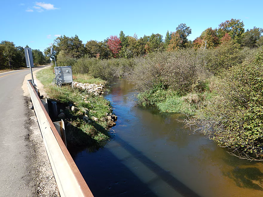
Nice bridge access at Hwy BB
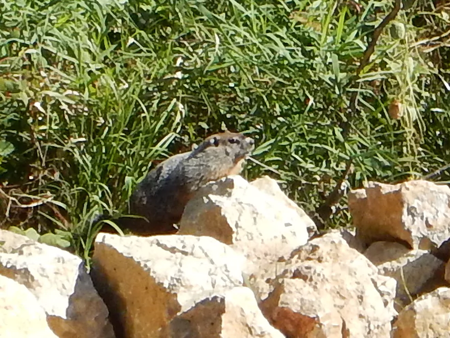
Friendly local
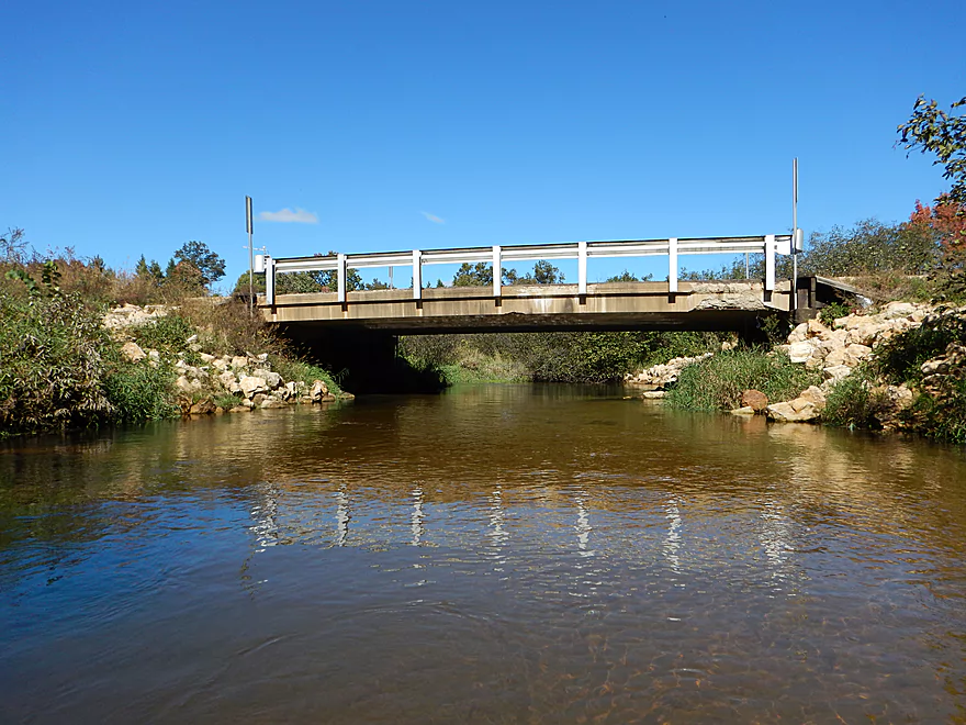
Same bridge…reverse angle
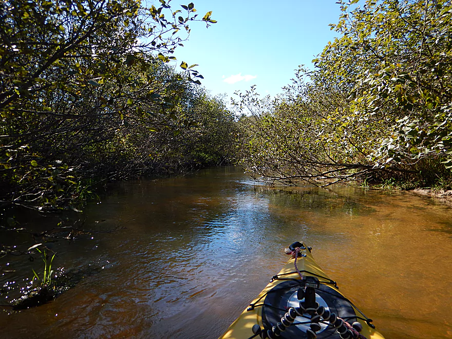
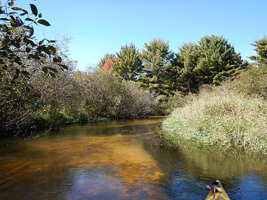
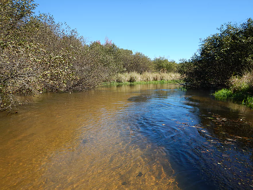
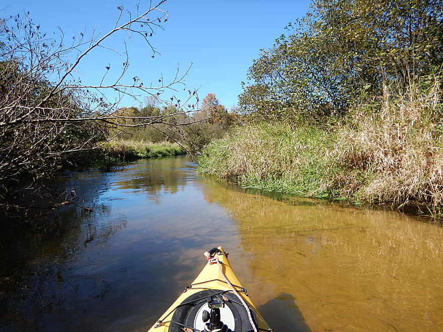
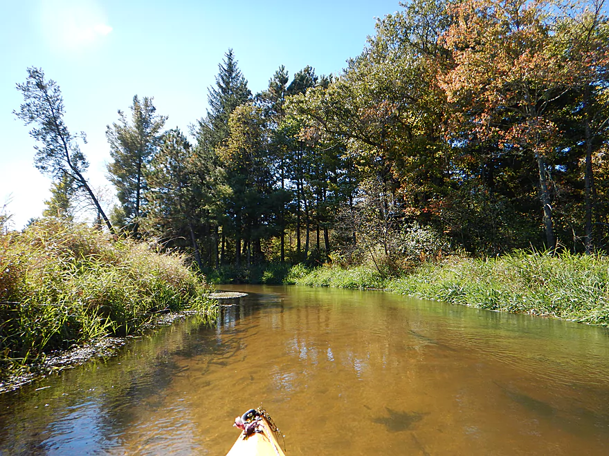
First half mile is tight alders
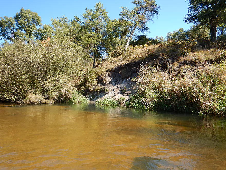
Nice sand bank
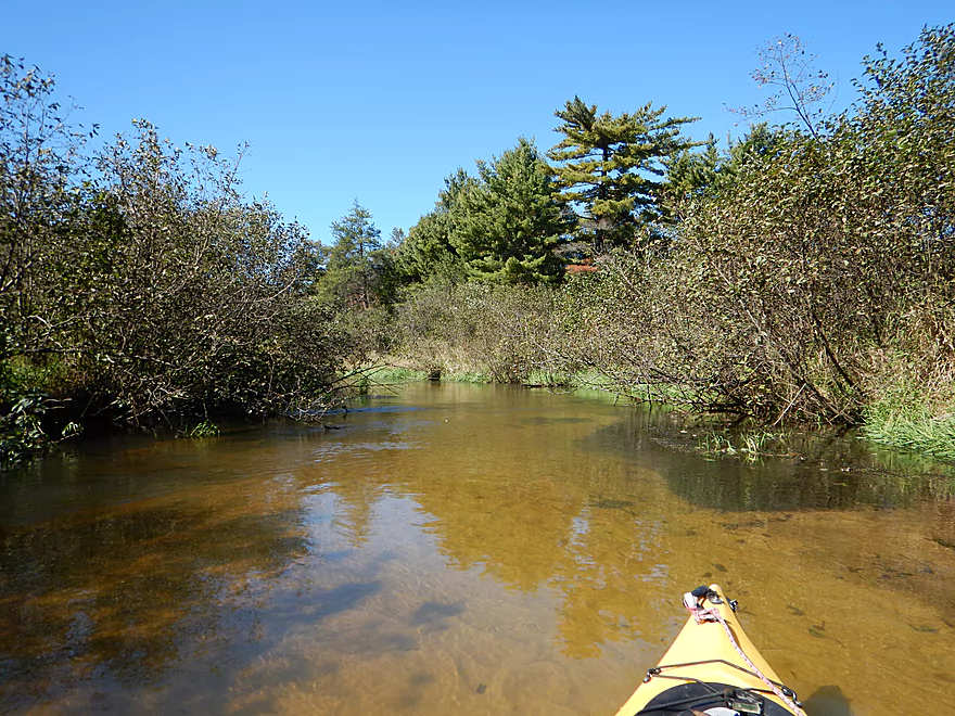
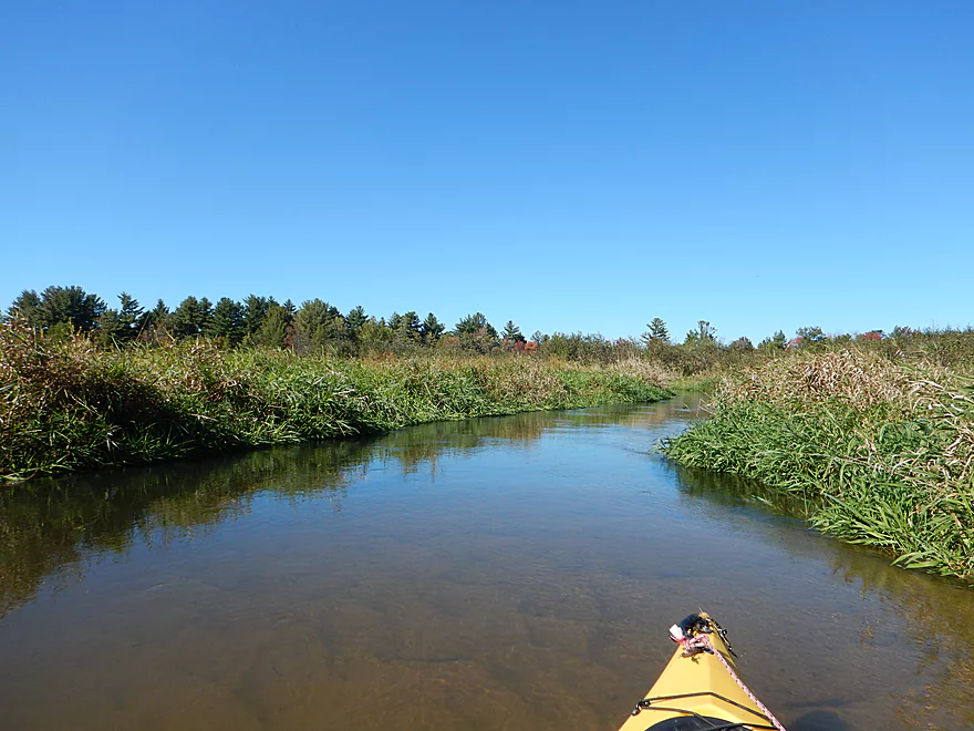
Alders starting to open up
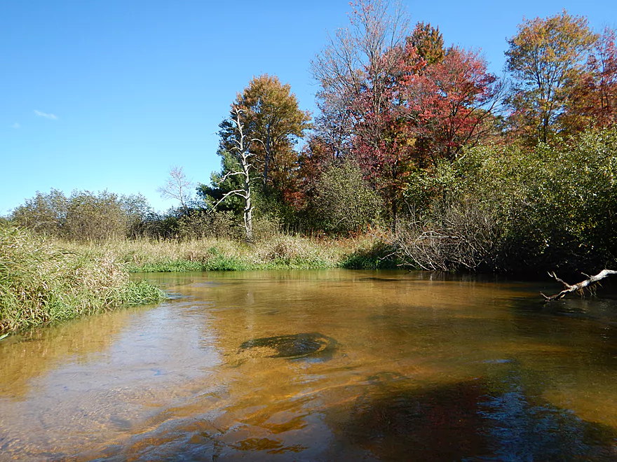
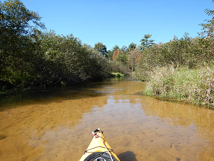
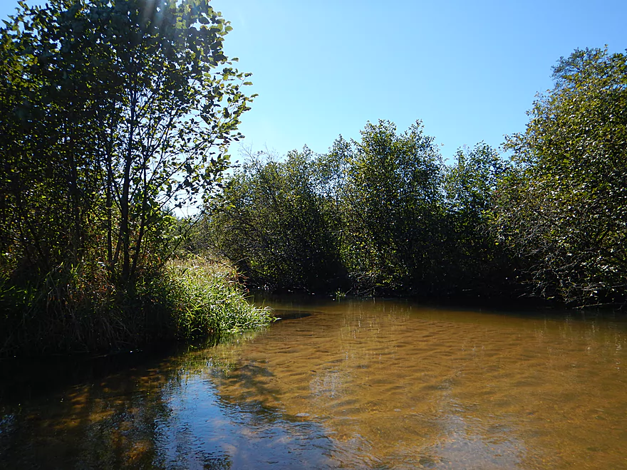
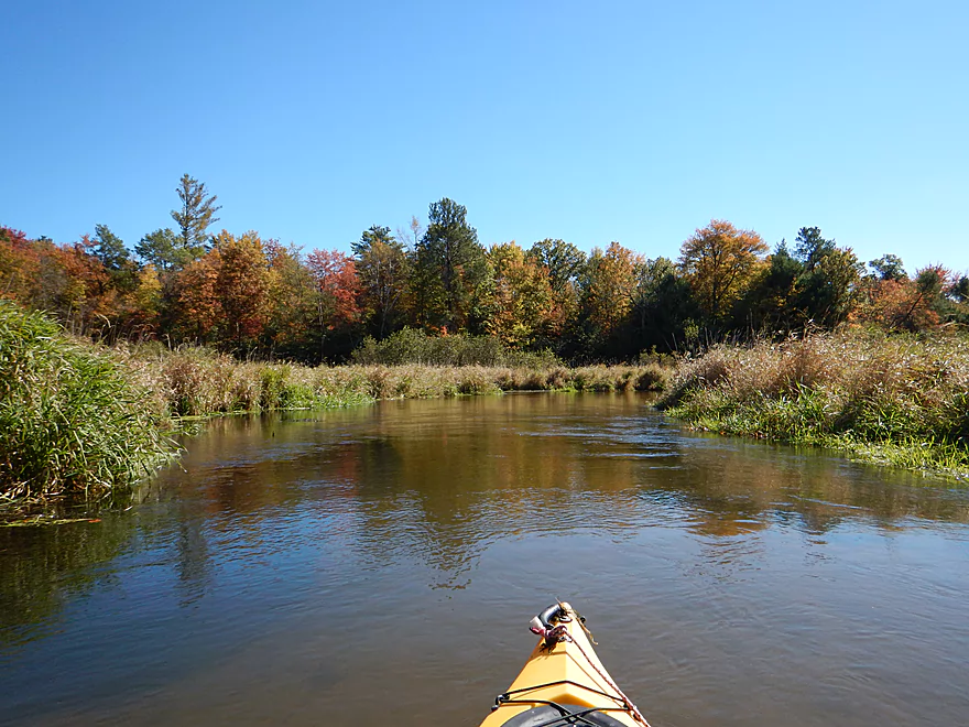
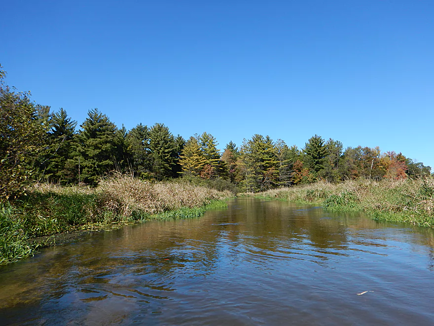
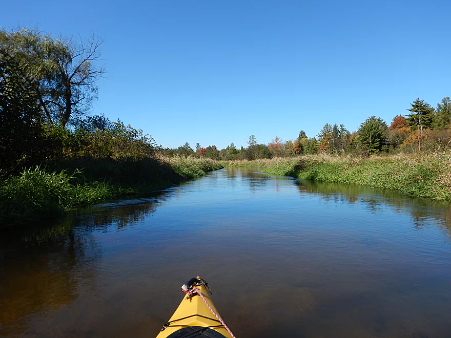
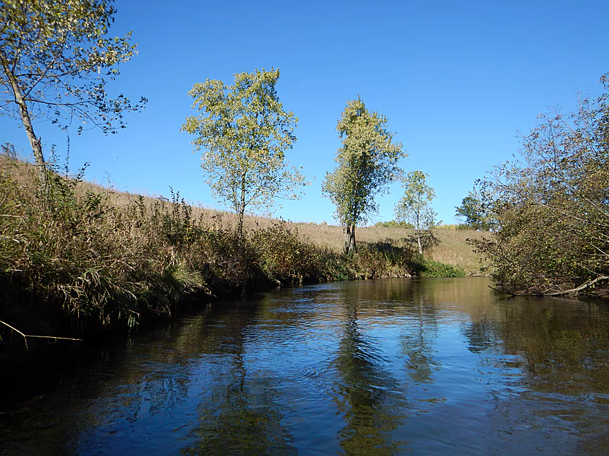
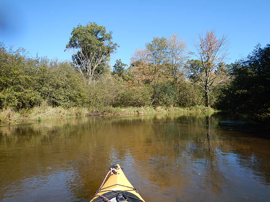
Colors just starting to turn
Some pondweed, otherwise not much for aquatic plants
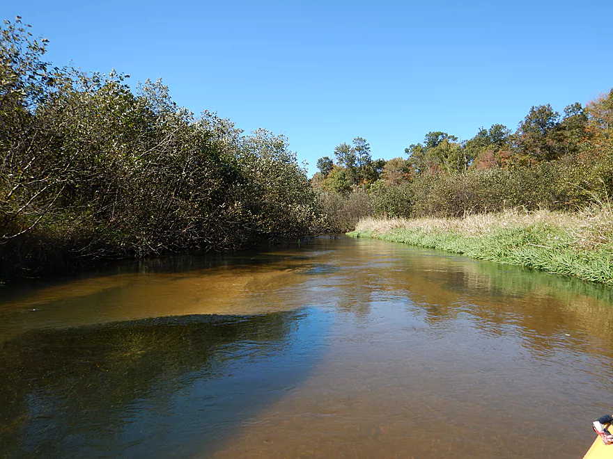
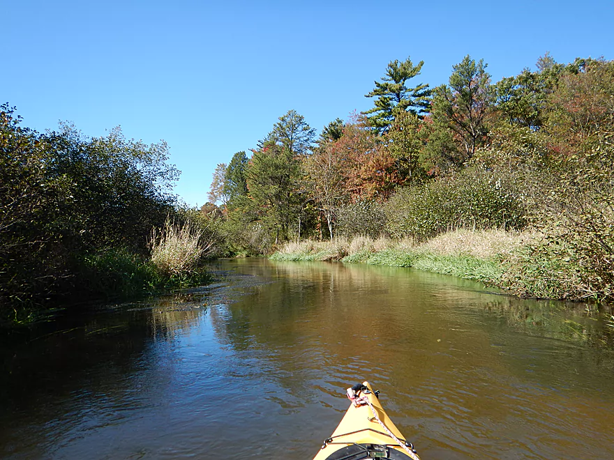
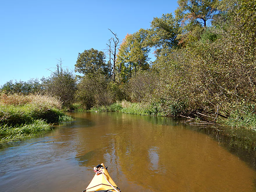
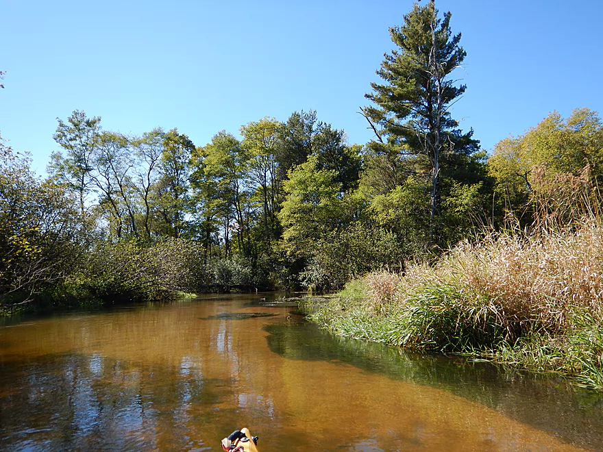
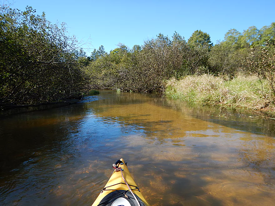
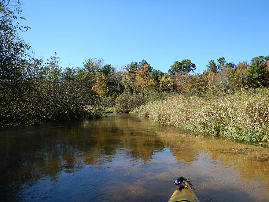
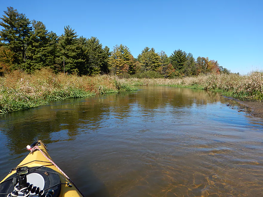
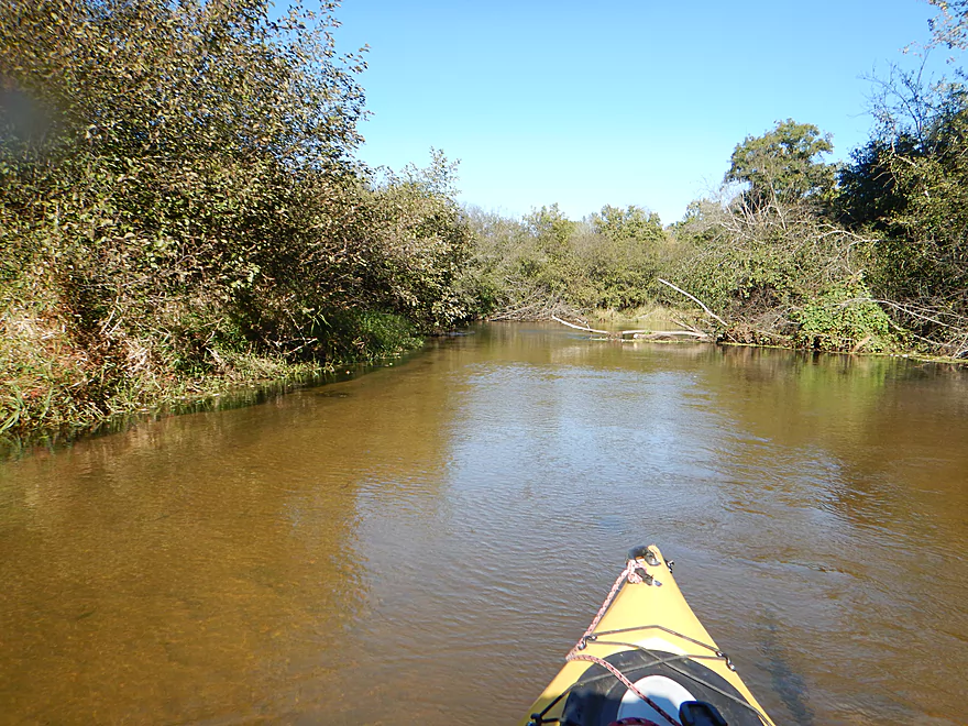
Typical scene…very nice
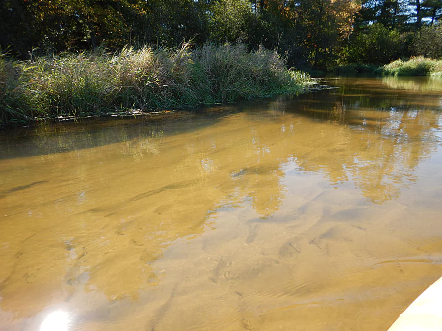
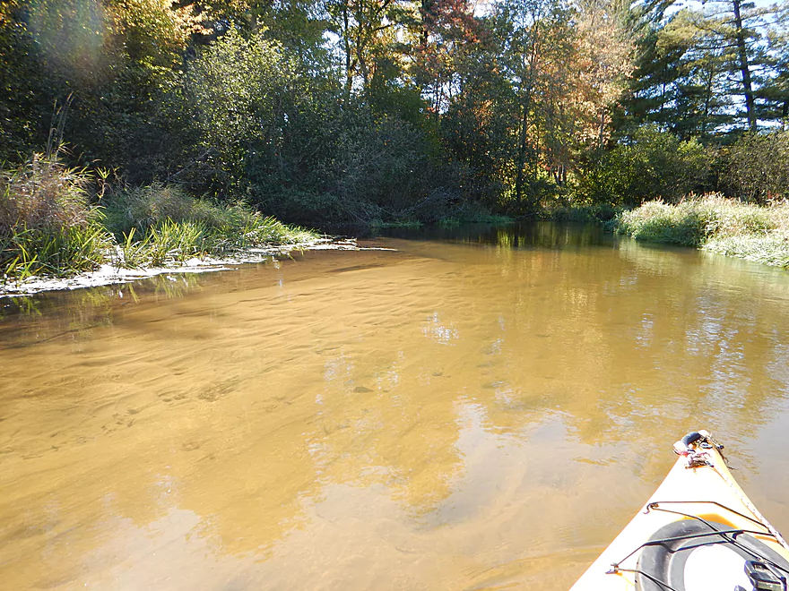
Underwater Sahara
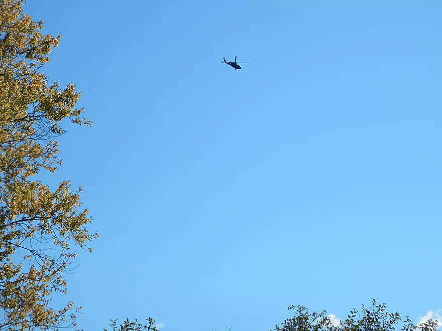
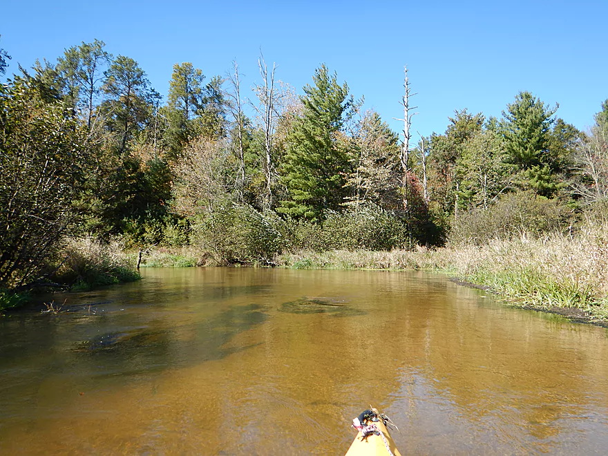
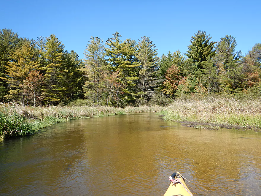
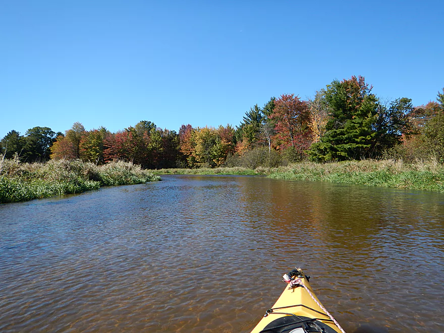
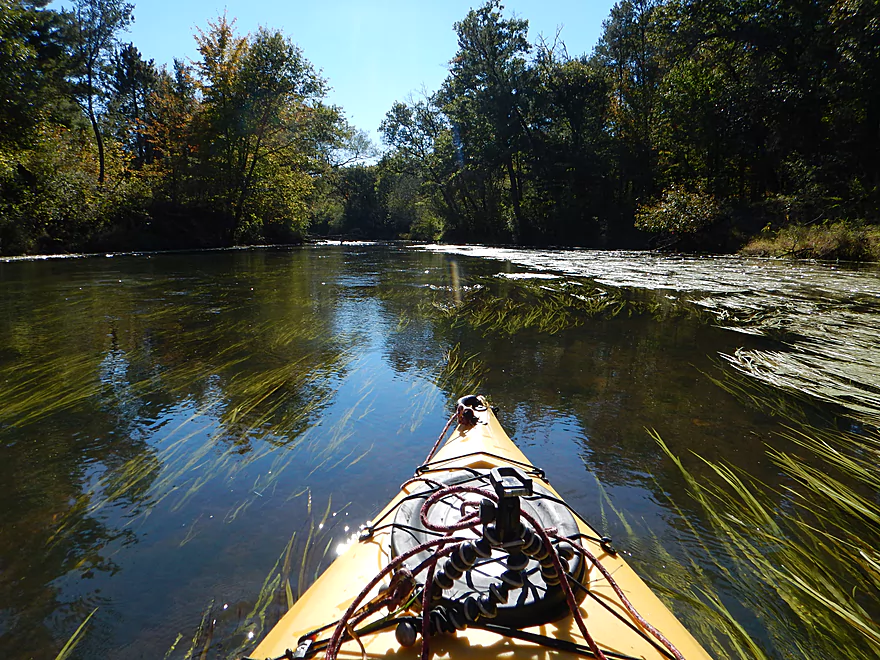
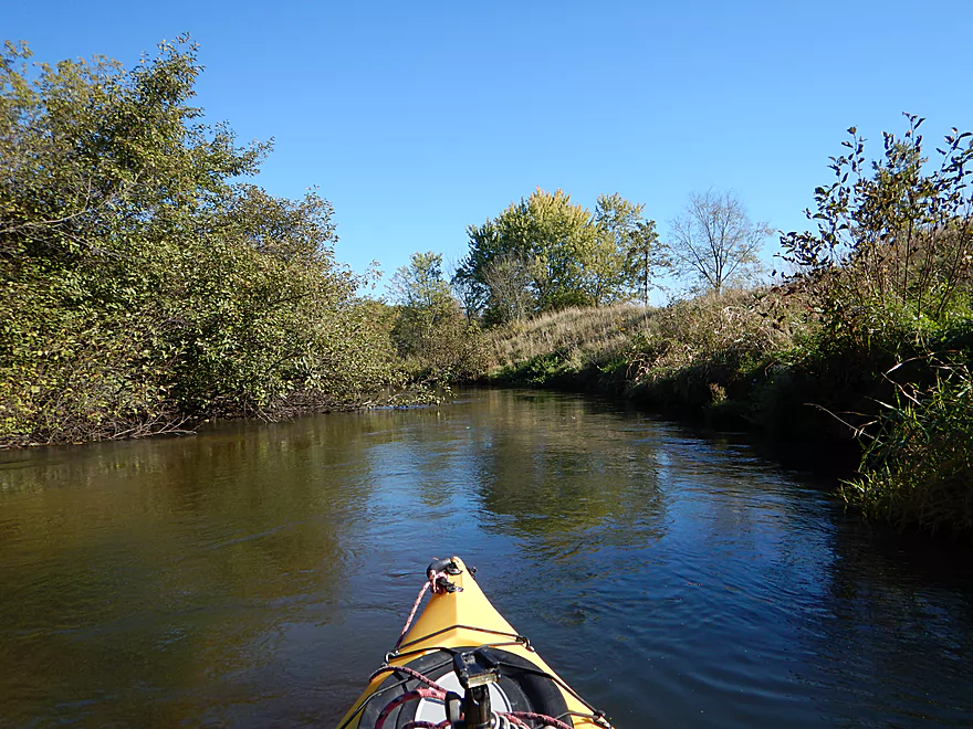
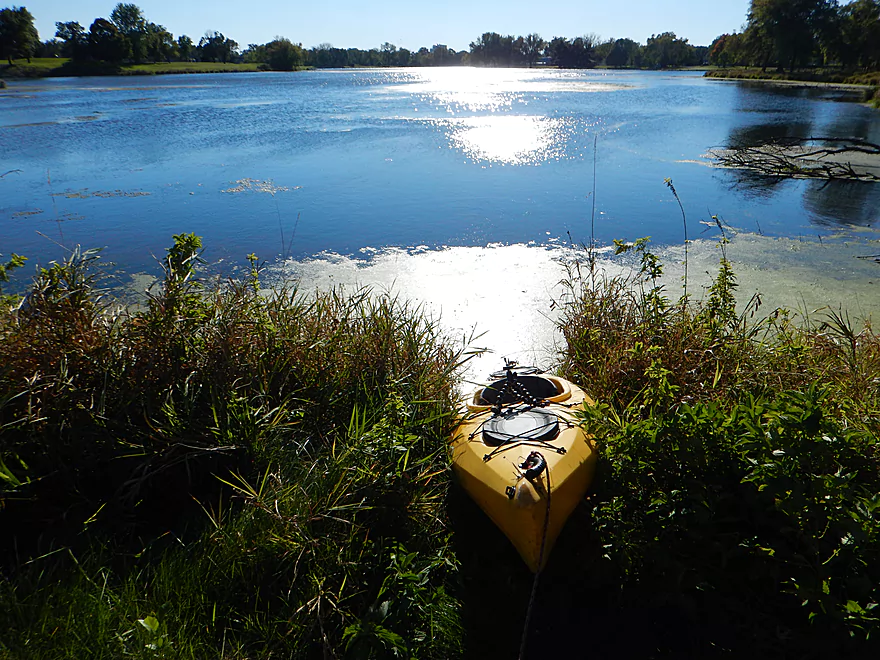
Half wondered if Fort McCoy was keeping tabs on me
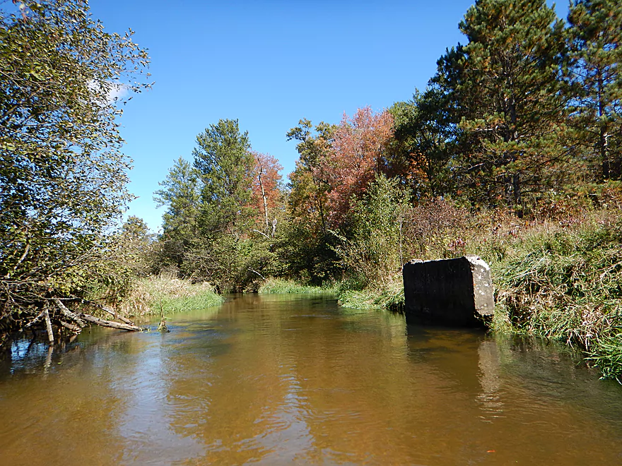
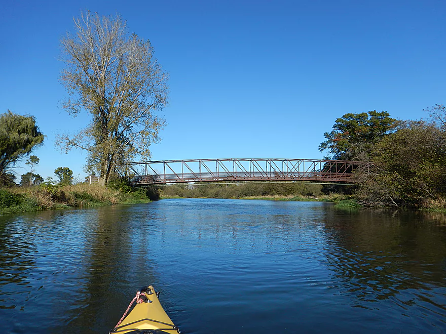
An old bridge
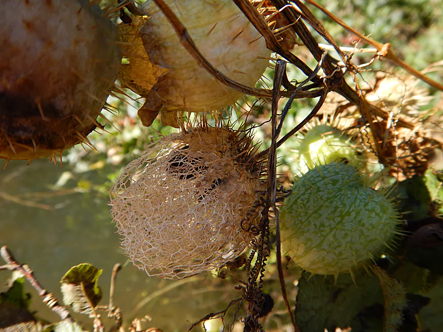
A wild cucumber skeleton
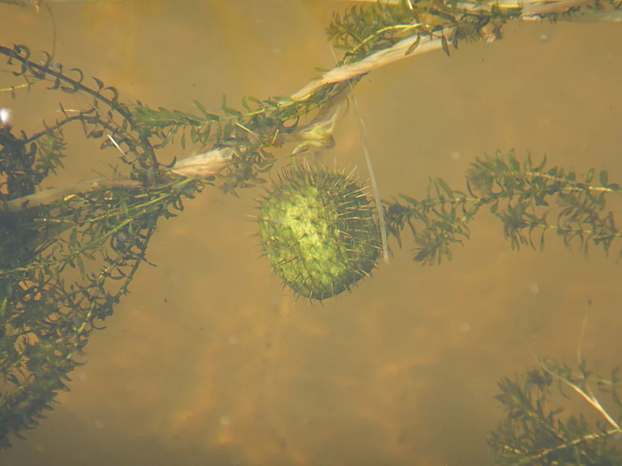
An underwater mine
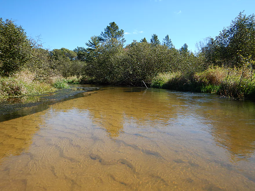
Really nice sand patterns
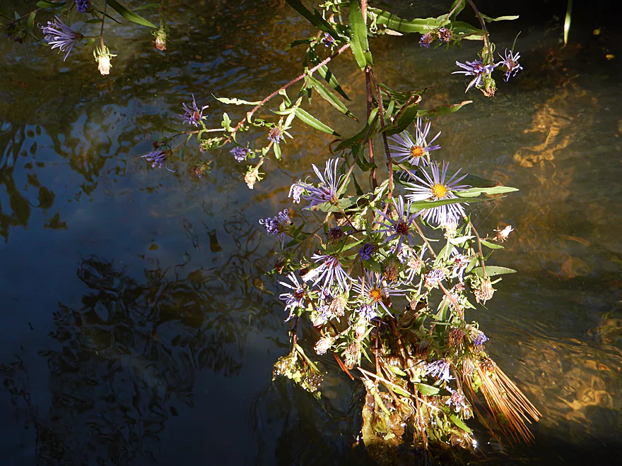
Lucky to have river flowers in October
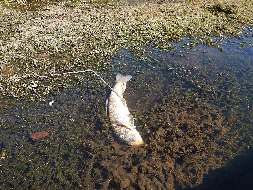
An eagle dropped this just in front of me
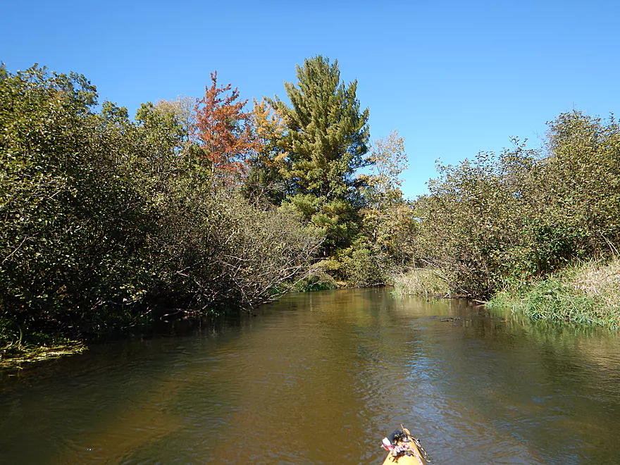
Color at times was nice
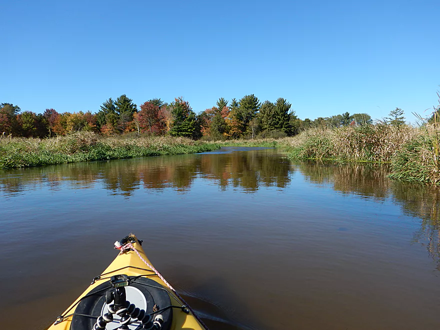
Some nice clusters of white pines
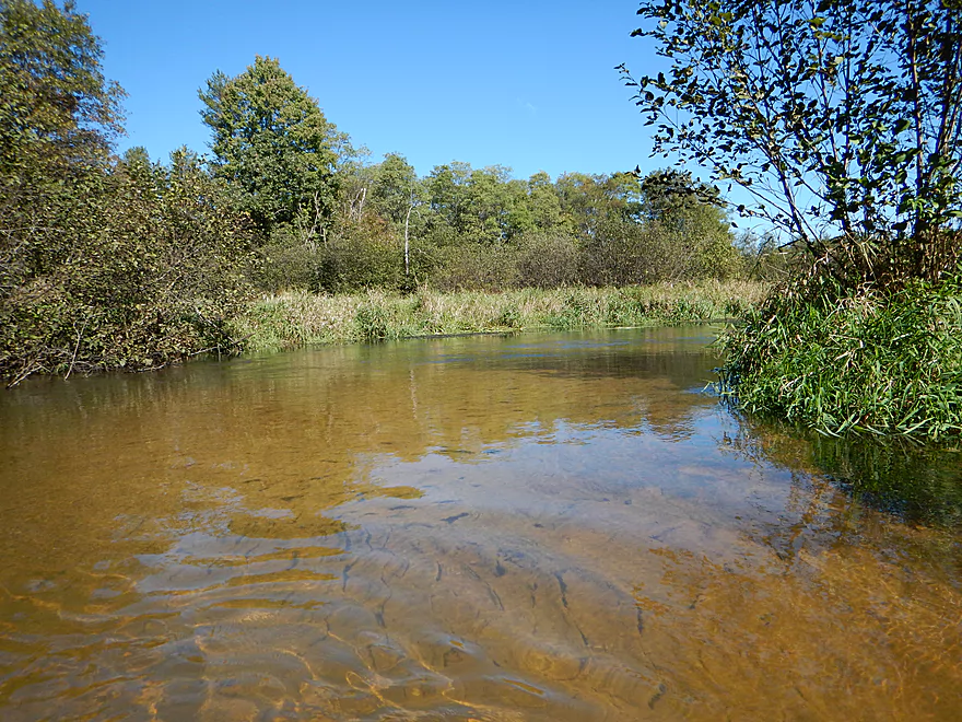
Such a clean river…
Angelo Pond is VERY silted in
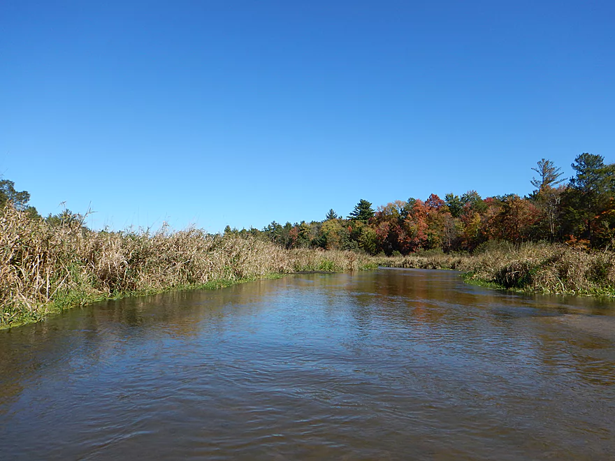
Starting to enter the flowage
And boring
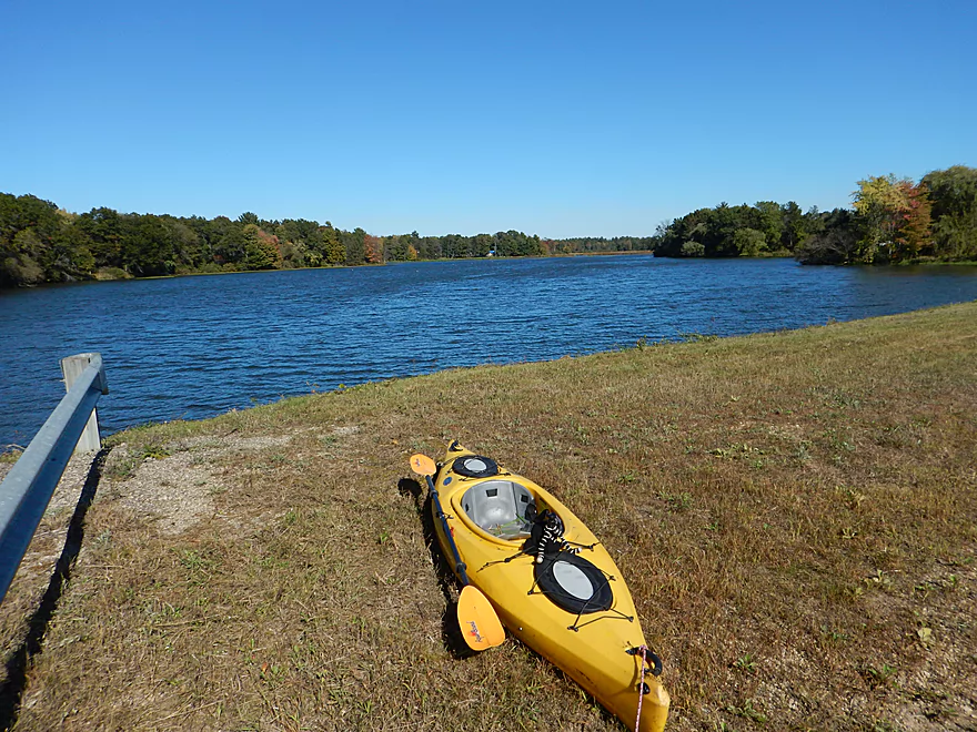
You can portage on either side of the dam
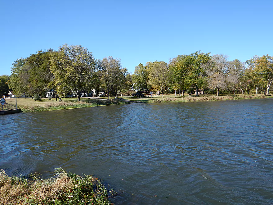
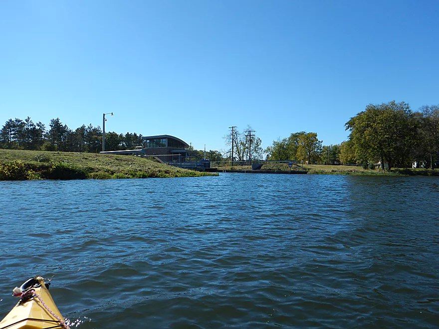
There is a public park north of the dam (great access)
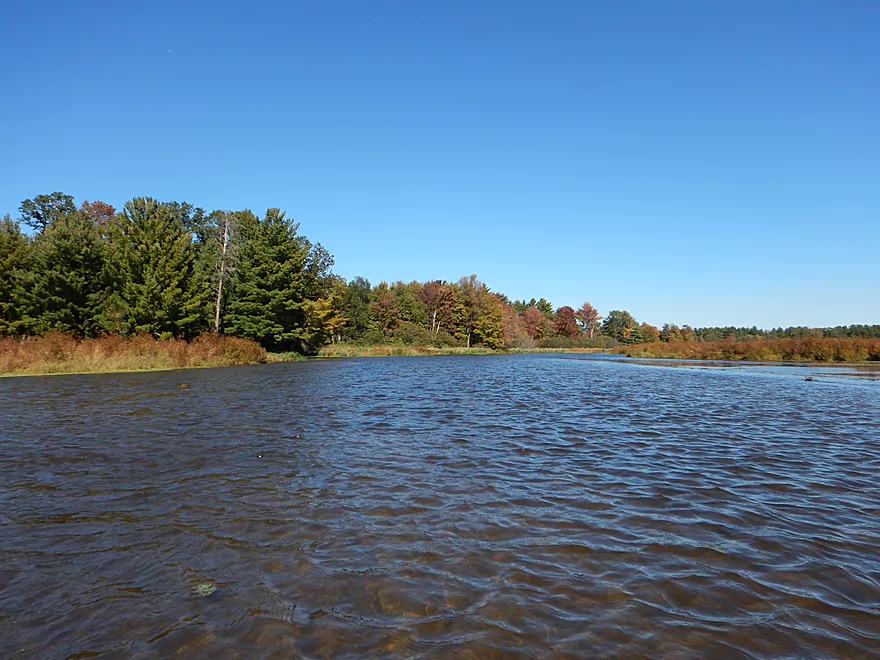
Looking back over the flowage
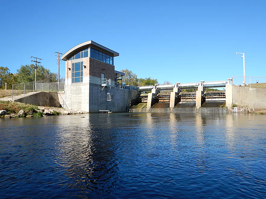
Newly renovated dam…huge waste of money
River is much bigger below the dam
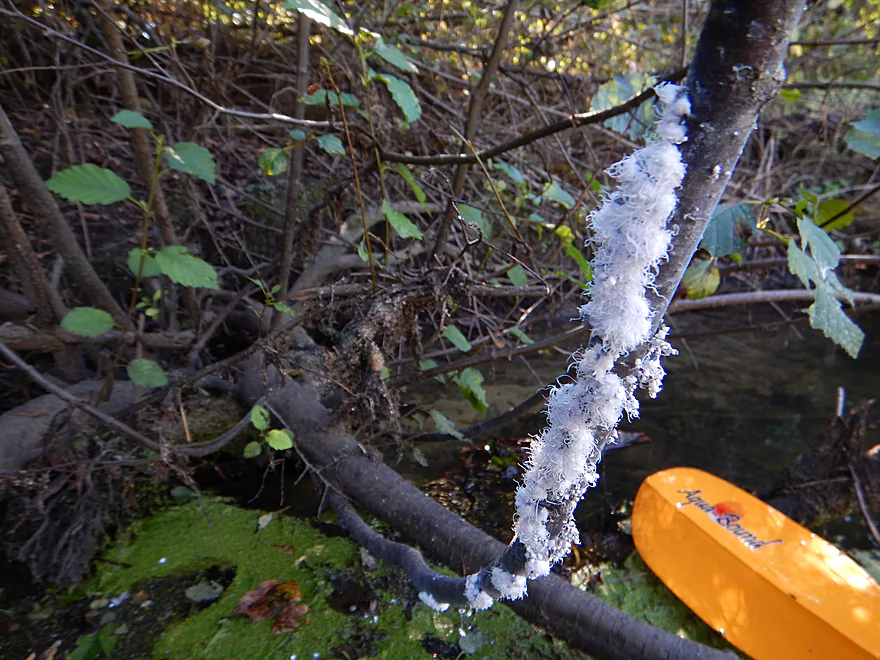
Woolly Alder Aphids (unique!)
Paddling along a dike
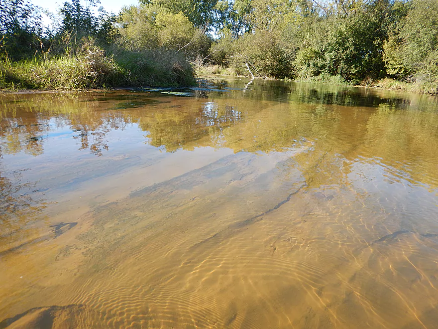
Still some nice water clarity
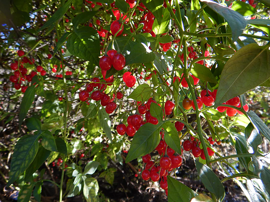
Ripe nightshade berries…try not to eat them
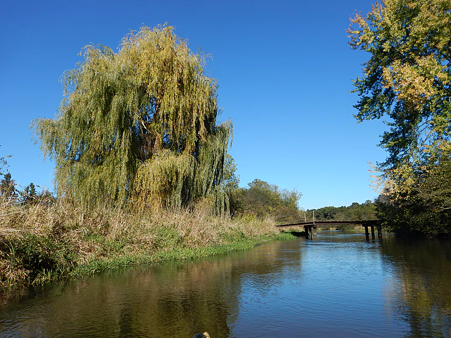
Cool scene with the weeping willow and bridge
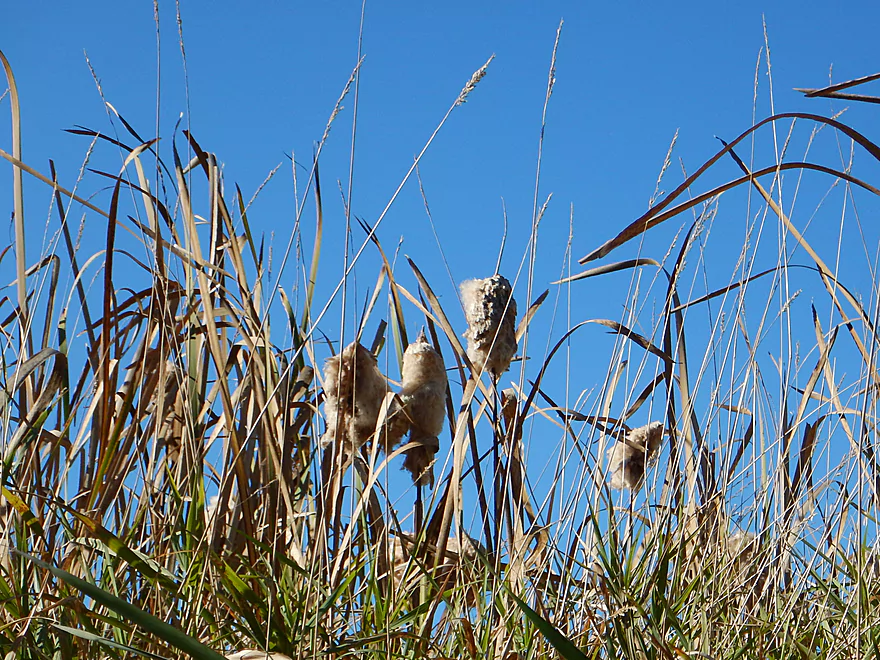
Molting cattails
Take-out just after the golf course bridge
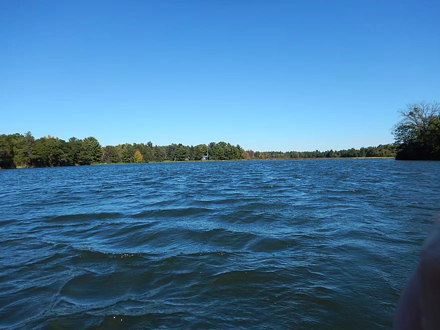
Taking out on flowage #2 (Perch Lake)
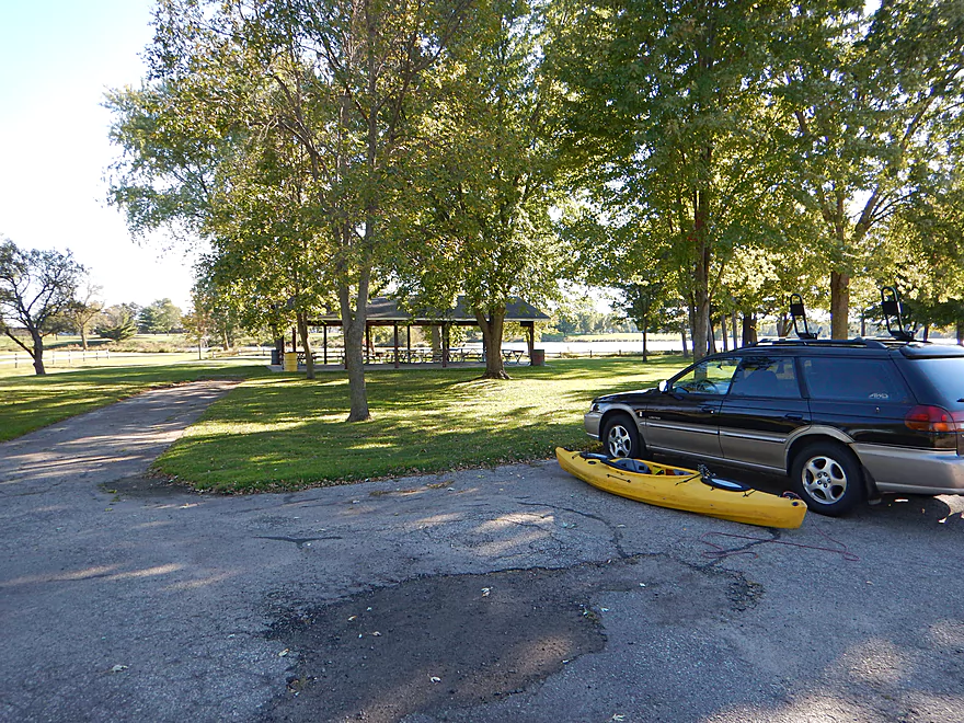
Good access by Memorial Park, but a hike to get to the car
La Crosse River – Fort McCoy


The La Crosse River is a pleasant prospect, with clear water and good current, that I’ve paddled twice before. Most paddlers start in Sparta for a 5-10 mile trip, which is a safe bet. In contrast, very few paddlers venture upstream of Sparta and I was interested to find out why. Nasty log jams? Bad scenery? Or was it just an overlooked sibling? Well, read on…
The put-in is at the edge of Fort McCoy, which is a massive and very active military base. Although there are fences and no trespassing signs in much of the area, the Hwy BB bridge appears to be open to the public. I did have a military chopper buzz directly over me while in the water, but ‘assume’ this was a coincidence and that they weren’t keeping tabs on me.
I had hoped the trip would be somewhat like Robinson Creek minus the sandstone because of the proximity of the two watersheds, but this mostly wasn’t the case. No sandstone. No ferns. Unlike Robinson, the upper La Crosse also has serious road noise for much of the trip (Hwy 21) which was surprising. However, they did share the same random booms throughout the day from training exercises at Fort McCoy
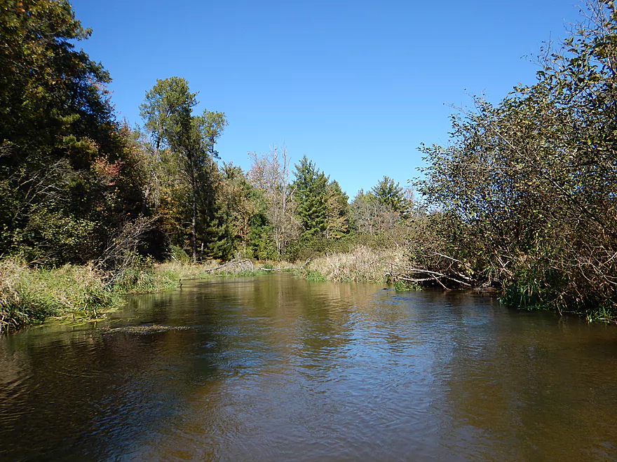
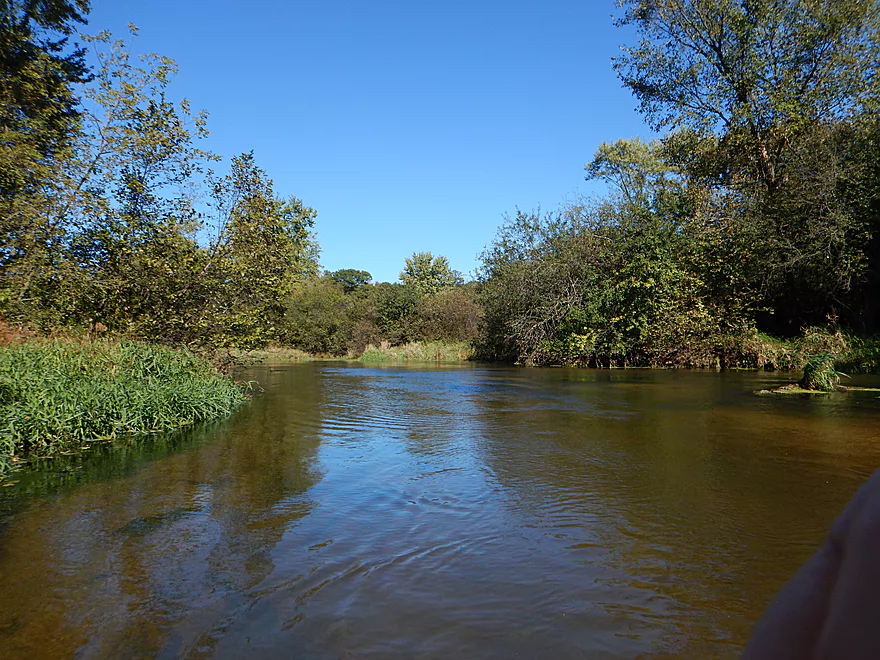
What the river REALLY reminded me of was White Creek and the Mecan River. Mostly because the current was fast (no rapids though), the water super clear, the substrate had very clean sand and there were many alders on the banks with occasional clusters of pines. At times the alders got so thick I had to do some quick maneuvers to avoid getting clotheslined, but it was never as obstructed as say White Creek or even the Mecan. After 2-3 miles into the trip, the river gets bigger and loses most alders, which are mostly replaced with wetgrass, hardwoods and pine. This was never a very wooded paddle though…mostly just alders or grass.
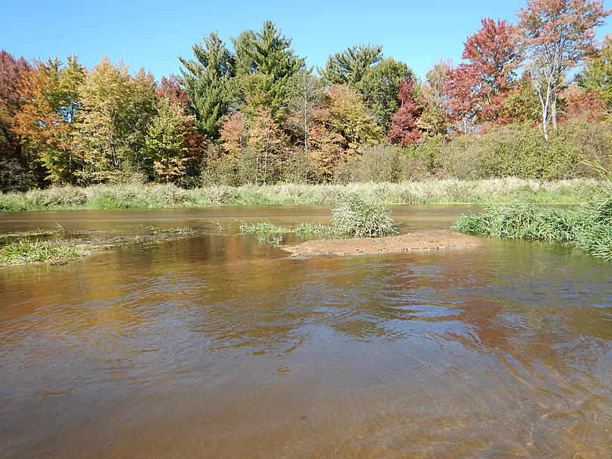
About two-thirds into the trip you’ll encounter Angelo Pond, an artificial flowage created by the dam at Hwy 21. Heavily silted in, this is the only shallow section you may have to walk, but you should be ok if you choose the far right channel. The grade under the lake is an impressive 16′ per mile, so the dam is probably burying some really nice rapids (under 8′ of sand sediment). The dam itself is easy to portage on your right (in the pictures I portaged left for better lighting). On the right bank is a local park, with outhouse and a nice ramp, which would make subdividing this trip very easy. The first half of the trip was definitely the better half, with clearer water, few houses, more twists and in general more of a wilderness feeling.
After the dam, the creek matures into a river. Not necessarily a good thing though. With the larger size, the clarity was not as nice nor were the banks as scenic. Still some nice spots, but the scenery was mostly messy hardwoods, a large dike and a golf course. What was strange here was how wide the river was for it being so far upstream. In fact it seemed wider than the sections below Sparta, which I verified from satellite images (not normal).
Soon you’ll paddle onto Perch Lake (your second flowage) where there are a number of take-out options. I’m not a fan of flowage paddles, so took my first off-ramp at Memorial Park. Fisherman’s Park at the dam would be a good option too.
So why only 3.5 stars if no log jams, super clear water, few houses, good wildlife and good current? It is indeed a solid prospect, but some of the scenery (while nice) was a tad repetitive (especially the alders), and the wider/slower section following the dam was just not as interesting as the upstream section. If you’re looking to do a first paddle on the La Crosse, I actually recommend Sparta to Hammer Road Bridge which is easily superior. Or better yet, if you are going to drive a bit to get to the area, do nearby Robinson Creek which is better than anything on the La Crosse River!
Hwy BB is ok for a bridge access. Good shoulder parking and a short distance to the water. Some rocks to drag your boat over, but it is all manageable. Hwy BB is on the border of Fort McCoy so there is a slight chance somebody might give you grief, but there are no fences nor signs at the bridge so I think you should be ok. All the same, I preferred to park my car in Sparta…
The take-out at Memorial Park is not obvious, as you have to pull your boat over some thick grass to reach the main park. You then have to tug your boat maybe 200′ over short grass to the parking lot…otherwise this is a good access with plenty of free parking and an outhouse.
I assume most paddlers would take out at the dam (Fisherman’s Park) or the launch off Park Drive, as both would require less walking…but more flowage paddling, which is why I opted for Memorial Park.
Ellistone Canoe Rentals services sections downstream of Sparta. They might service this segment as well but call in advance to verify: 608-343-5696 or 608-487-5114.
For bike shuttlers, it is a 6.6-mile trek that seemed to take forever. Not very large shoulders, but manageable. Hwy 21 is busy with truck traffic but at least is flat.
Not a single log jam nor any squeakers! Maybe two-thirds into the trip, you’ll encounter the dam at Angelo Pond which must be portaged, of course, and is easy to do on the northwest bank. There are some open sections, so do be mindful of wind speed and direction.
The local gauge at Sparta read 135 CFS for the trip….which is considered low. The gauge will shoot up to 155 CFS after a rain and maybe a couple times a month after a heavy rain get above 200 CFS. Because you want to do this trip for the clarity, I wouldn’t go too high…and in fact might aim for a low CFS. I would avoid this stretch over 155 CFS myself. On the flip end, I doubt the river ever gets too shallow to run…and I wouldn’t worry about that. The depth was frequently 2-4′ deep. Only exception was the Lake Angelo flowage which is heavily silted in and the only shallow spot on the river. Even if you have to walk here, it isn’t bad because of the clean sandy substrate.
A pair of cranes, great blue heron, an eagle fishing, an otter and many fish darting through the water. Highlight was a groundhog at the put-in who was relatively tame and used the rocks at the Hwy BB bridge for a den.
Detailed Overview
- Fort McCoy - Upper Leg: The river looks nice here, but this goes through the heart of military training grounds so is not likely suitable for paddling.
- Fort McCoy - Lower Leg: (2.5 miles) This is technically part of a Federal Army base. You can navigate the river, but only if you register with the Fort McCoy Natural Resources department and follow their rules.
- Squaw Lake Dam to Buckley Ct: (1.4 miles) Very interesting prospect with clear water, one small waterfall, and a few nice Robinson Creek style cliffs.
- Buckley Ct to Hwy BB: (1.1 miles) An ok prospect.
- Hwy BB to Sparta: (7.1 miles)
- Hwy BB to Angelo Wayside: (5.3 miles) Clean sandy water with little development. Ends in a small flowage.
- Angelo Wayside to Sparta/Fisherman's Park: (3.3 miles) Not as interesting...but ok. River widens and has more of a messy feel with more hardwoods.
- Sparta to Hammer Road Bridge: (5.4 miles)
- Fisherman's Park to Ben Bikin Park: (0.4 miles) Nice open stretch though Sparta with some rocks.
- Ben Bikin Park to Amundson Park: (3.5 miles) The most popular and best section on the entire river. Very nice with clean water and good current. As of 2024-04-30, a number of logjams have popped up upstream from Amundsen Park. Some portages will be required.
- Amundson Park to Hammer Road: (1.5 miles) A more wooded stretch. Includes a fun ledge to kayak over.
- Hammer Road Bridge to Hwy J: (5.6 miles) Likely a good prospect...but I bet it isn't as nice as upstream sections.
- Hwy J to 17th Ave: (6.8 miles) Mediocre prospect. Upstream sections are likely nicer.
- 17th Ave to Neshonoc Lake Dam: (6.6 miles) Half the trip goes through a slow flowage. The lake is nice as far as lakes go...but I suspect this is a relatively weak section.
- Neshonoc Lake Dam to Veterans Memorial County Park: (4.2 miles) An ok paddle with some fun ledges and a nice box canyon.
- Veterans Memorial County Park to Holiday Heights Launch: (8.4 miles)
- Veterans Memorial County Park to N. Kinney Coulee Road/I90 Bridge: (2.6 miles) A mediocre stretch with some sandbars and Class 1 rapids under I90, but mostly generic eroded banks that have been heavily straightened by the railroad. Road noise here is pretty loud.
- N. Kinney Coulee Road to Holiday Heights Launch: (5.8 miles) A good leg. Features include fast current, some sandbars, mostly open banks with some nice bluff vistas, and a few really nice sandbanks. Be mindful of strainers in fast current.
- Holiday Heights Launch to Mouth on Mississippi: (6.9 miles)
- Holiday Heights Launch to Hwy B/Earl's Landing: (2.2 miles) A more wooded stretch with mediocre floodplain trees. Train traffic is heavy in this area and chances are good you'll paddle under a moving train.
- Hwy B/Earl's Landing to Mouth/Riverside Park: (4.7 miles) This is a good leg. It's more open and has really nice views of the distant bluffs.
Trip Map
Overview Map
Video
Photos Size:
Great article. I paddled here 20 yrs ago, the bombs!!
. I got to relive it just now reading this. I thoroughly enjoyed this. Thank you.
Thanks for the comment.
Hi,I work for the Fort McCoy Garrison staff. I was excited to see this, and plan to paddle it. Don’t worry about being bothered at the put in. We actively encourage outdoor recreation on base. Just use our website to ensure your recreation doesn’t meet up with Soldiers training.
https://mccoy.isportsman.net/
Thanks for the clarification