
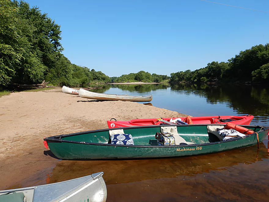
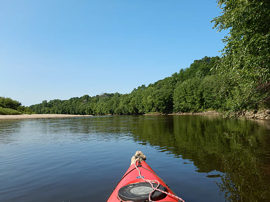
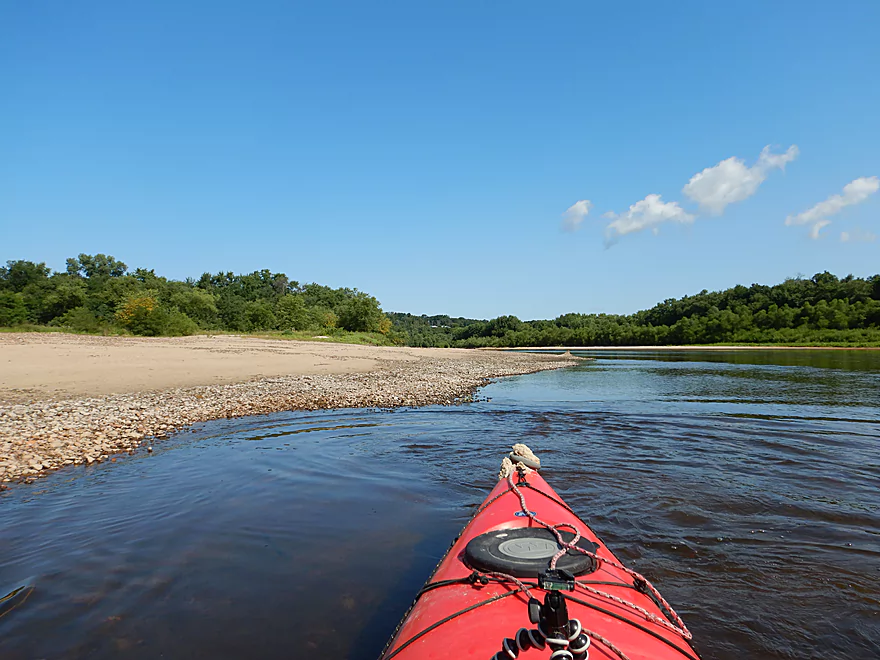
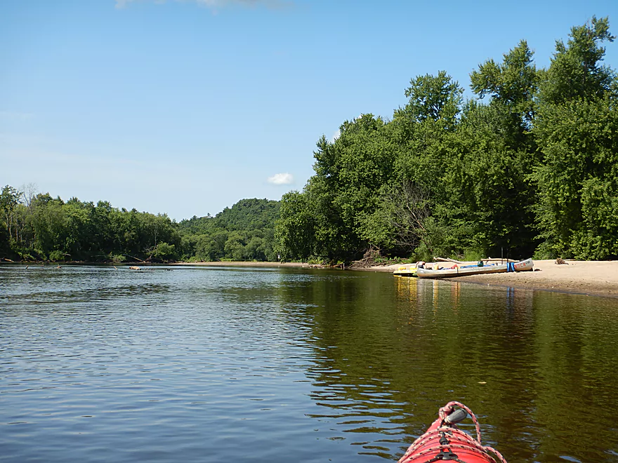
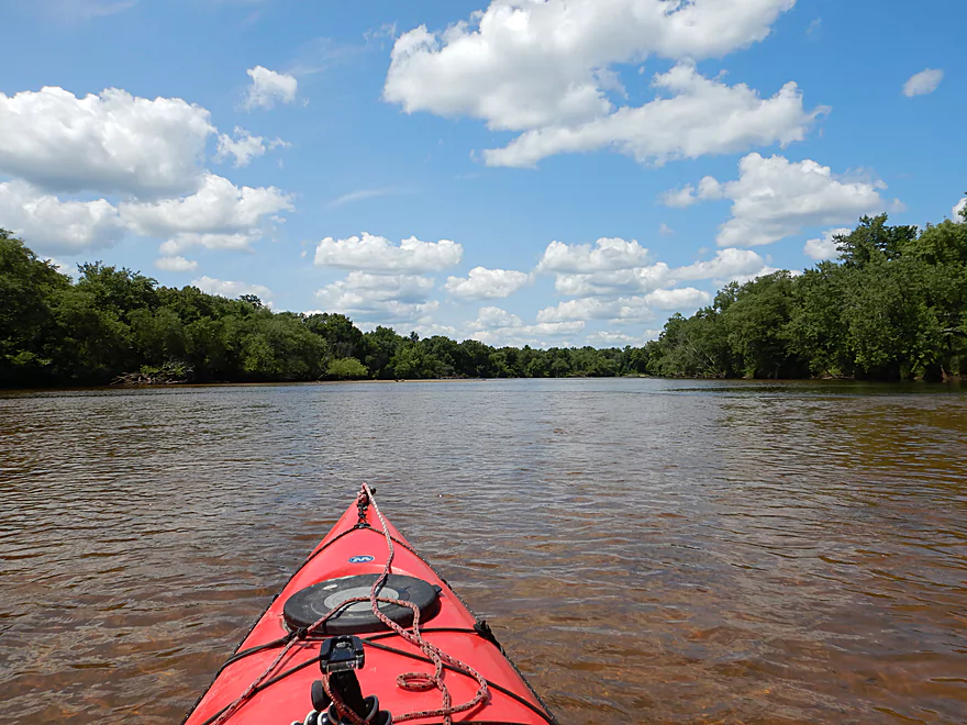
Starting the trip at the Melrose Landing
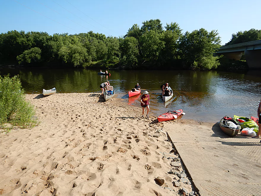
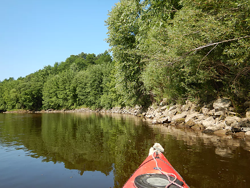
It was pretty busy…
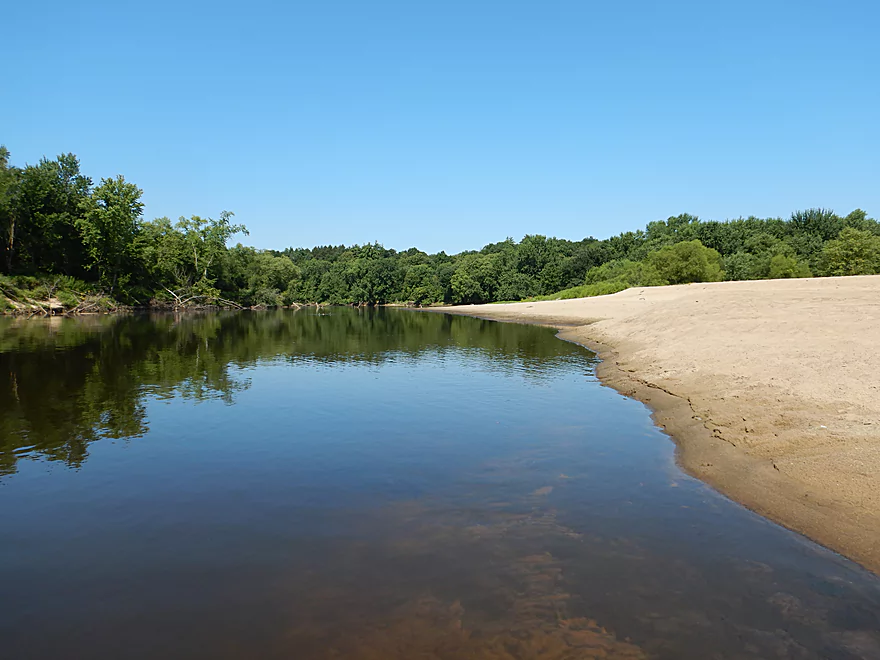
Great clarity with clean sand
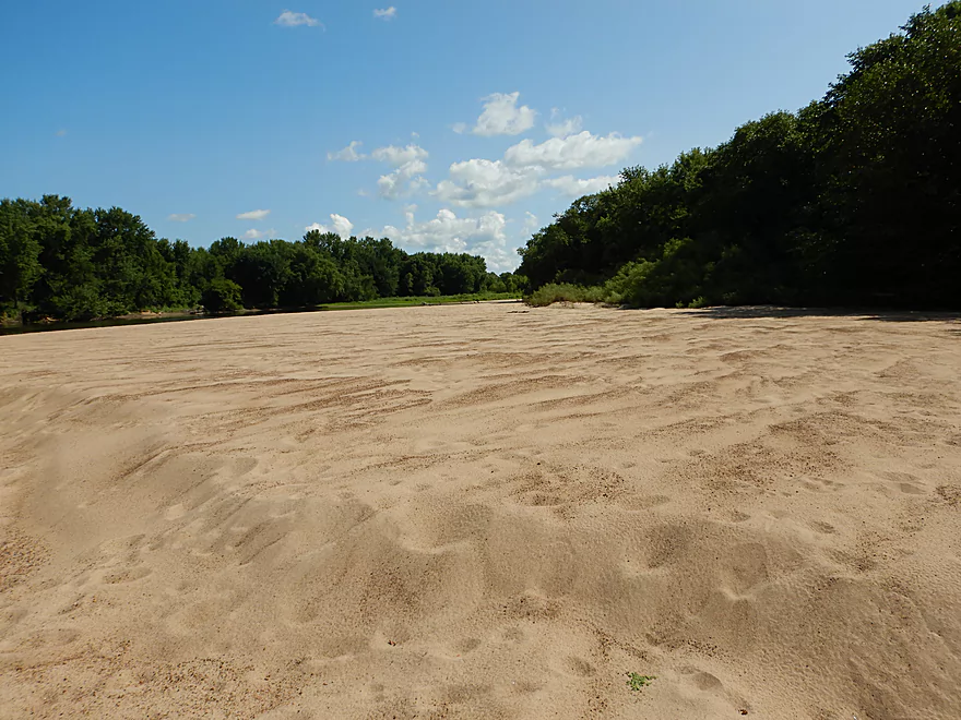
One of countless sandbars
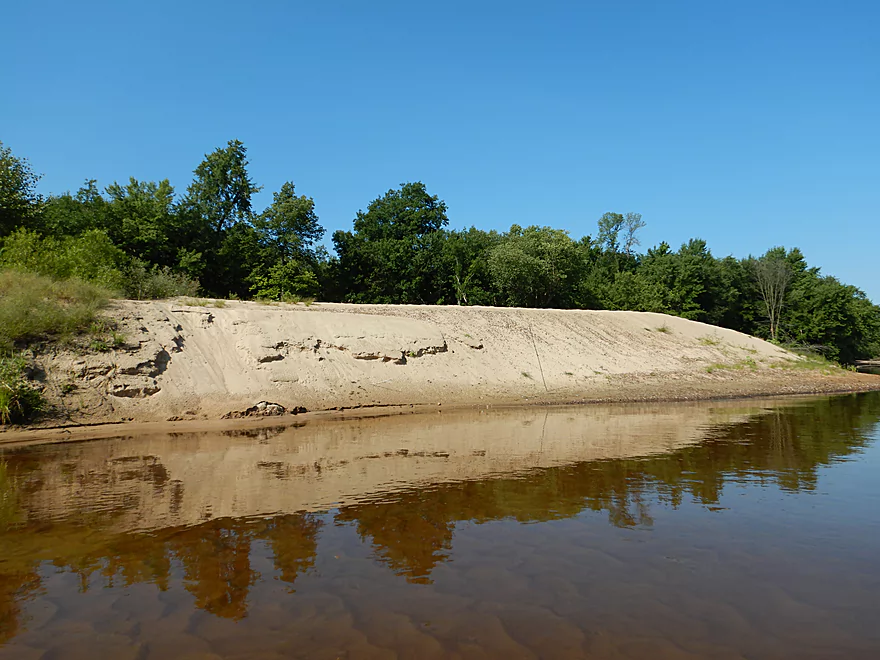
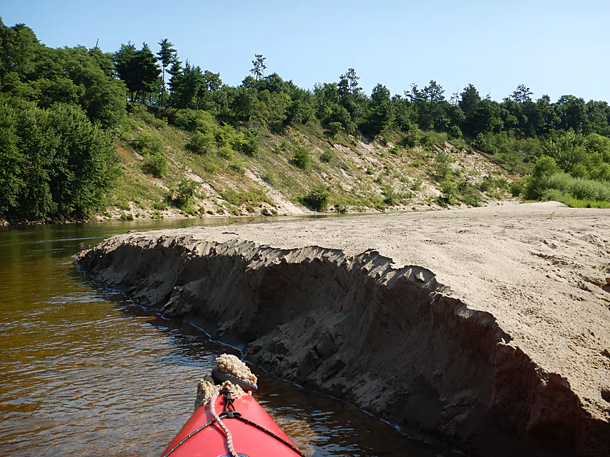
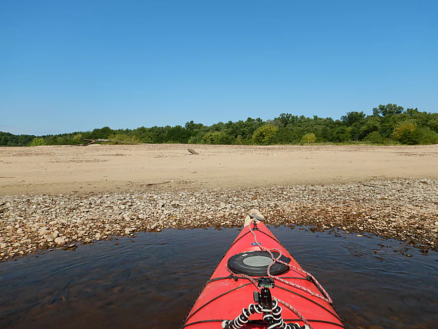
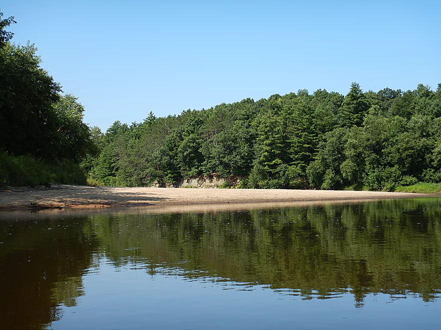
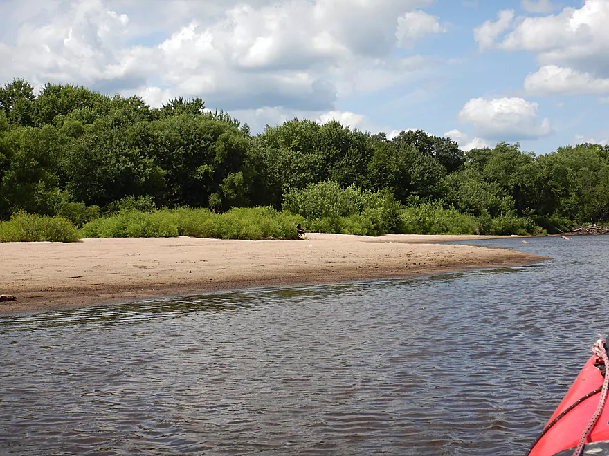
A large scenic sandbank
That has been degraded somewhat by foot traffic
Reverse view of sandbank
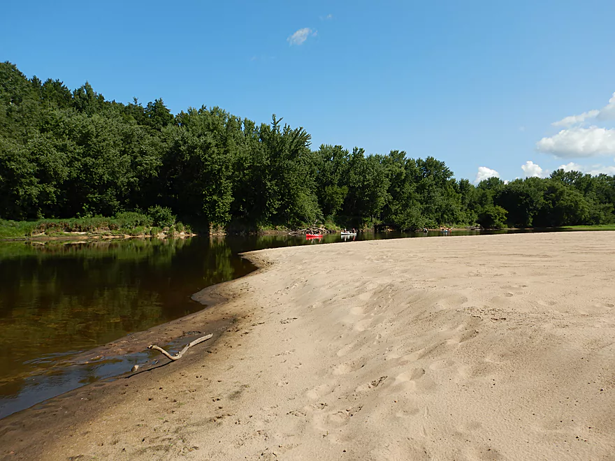
Just the end of a large 1000 foot long sandbar
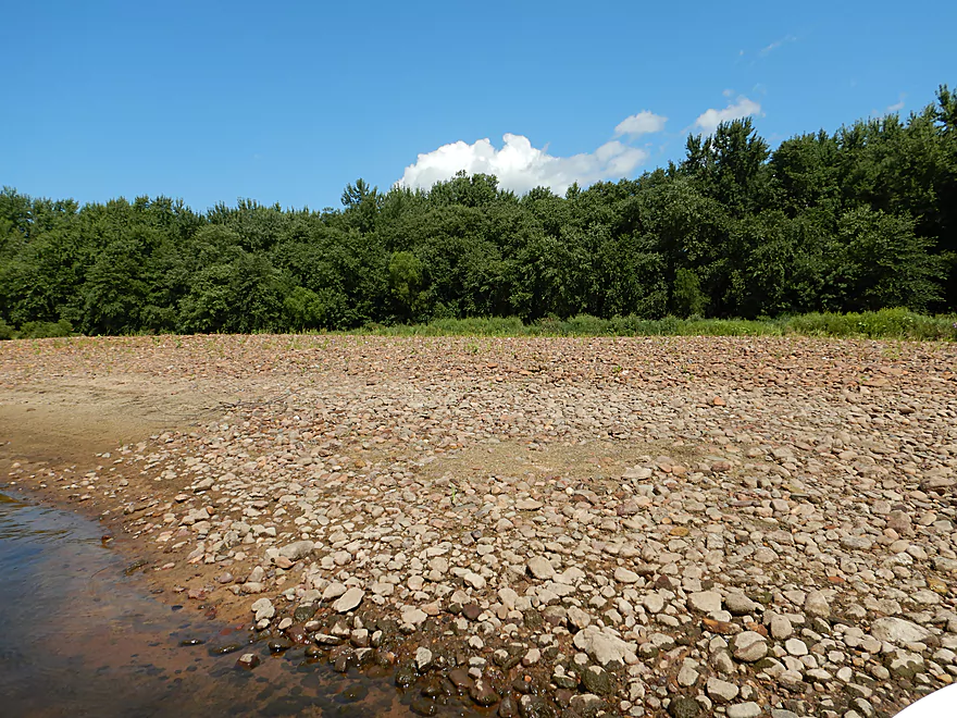
Some gravel, but not like you see on the Upper Black
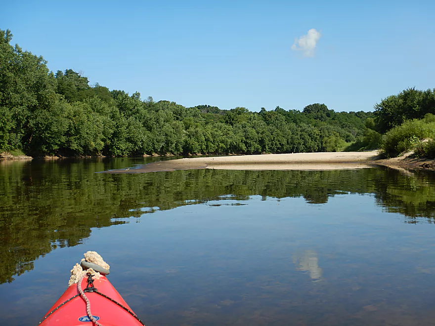
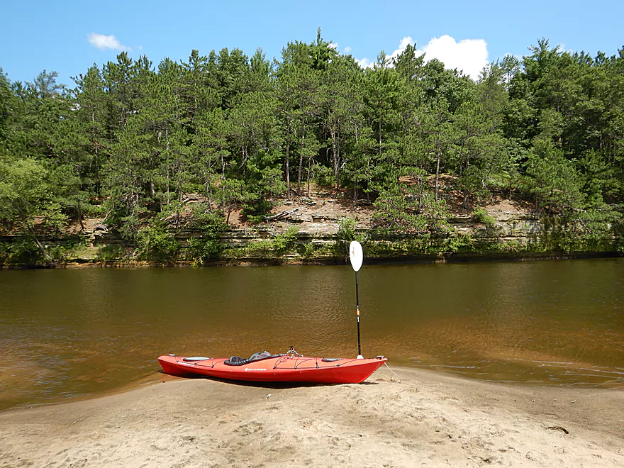
Another nice sandbar
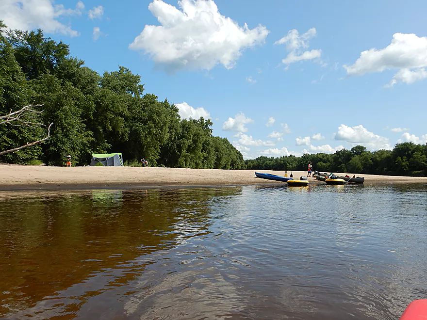
Getting out for a lunch break
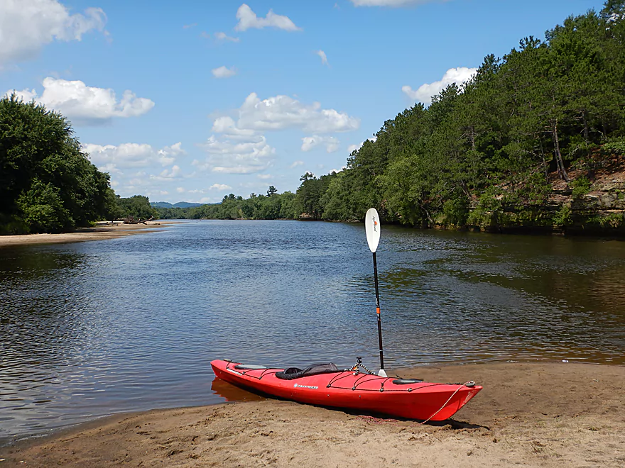
This would make a great camping spot
With a great view
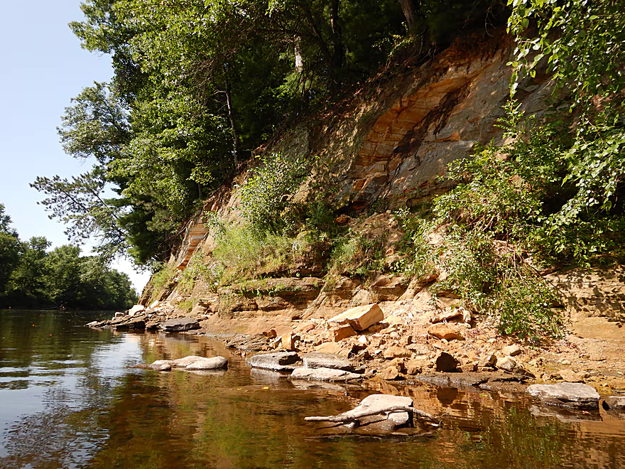
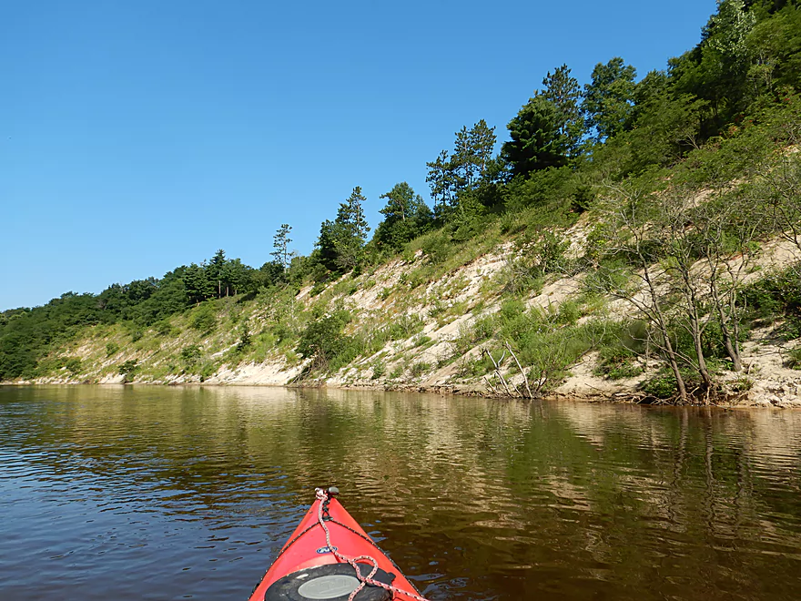
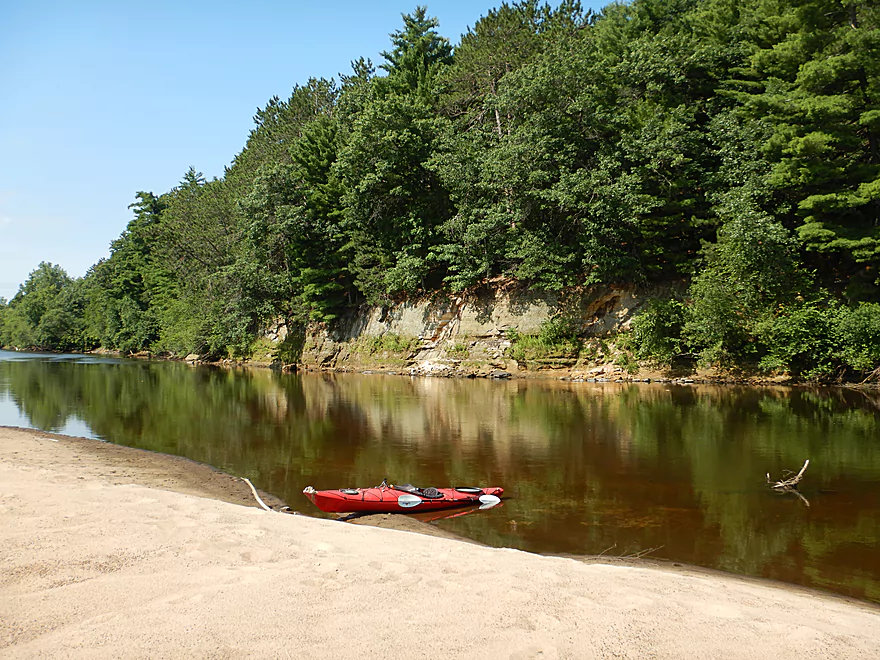
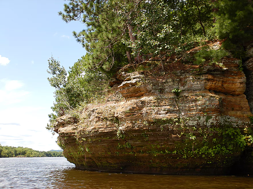
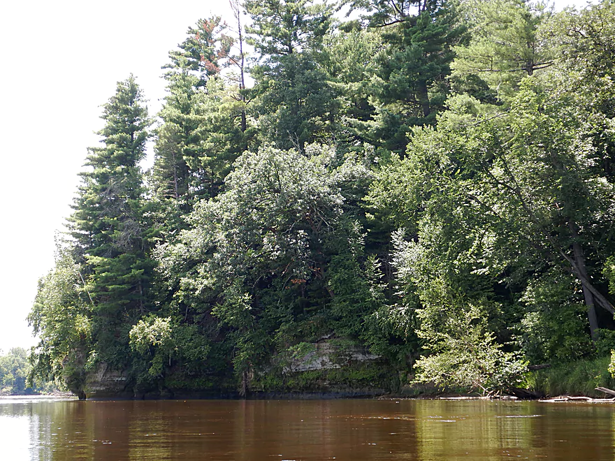
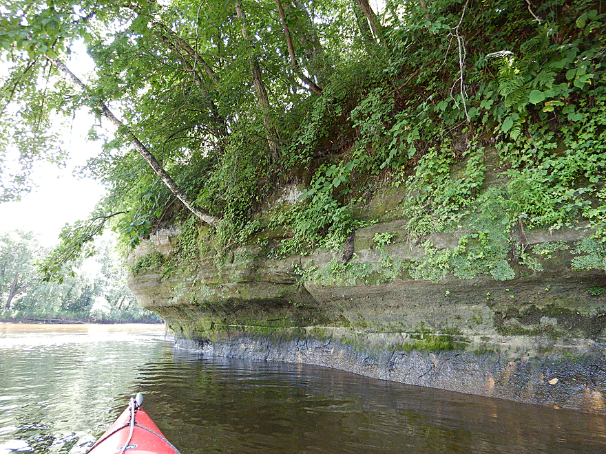
This is the first of three sets of sandstone outcrops
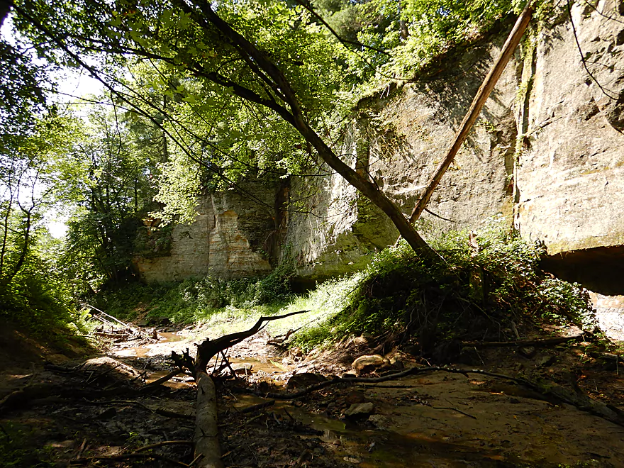
Which is followed by a hidden canyon
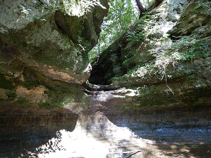
With a (dry) watefall at the end
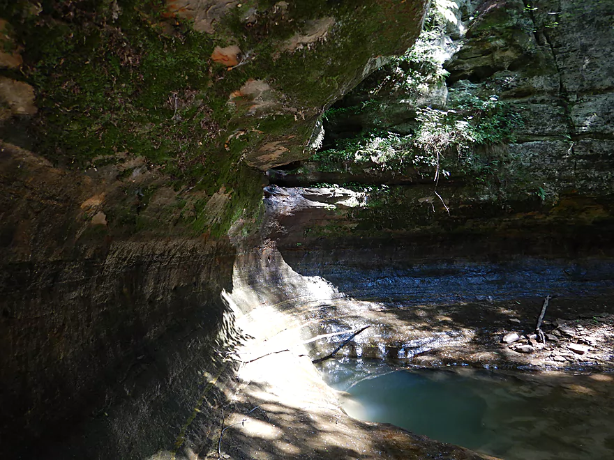
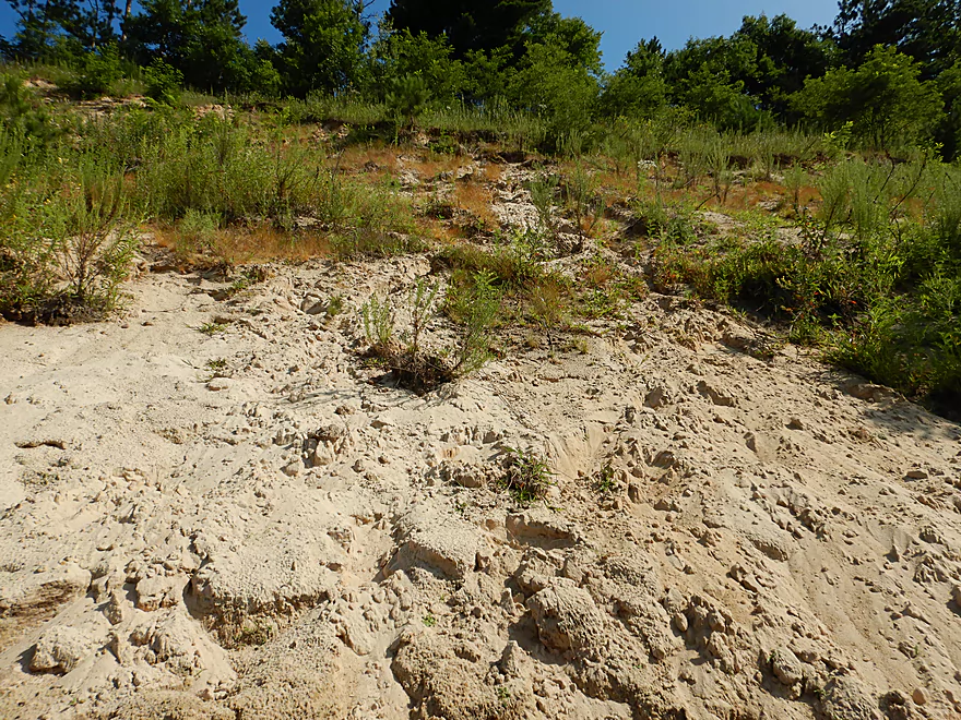
Cool bowl-like erosion
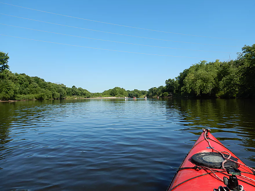
This is a great stretch for canoeing
And camping
One of the larger gravel bars
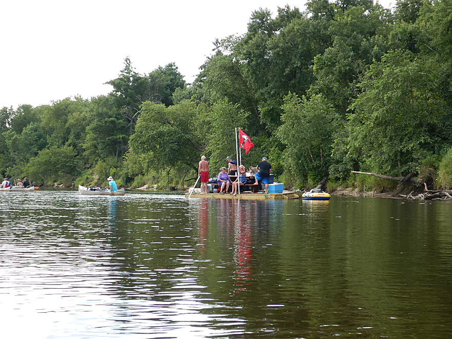
That poor canoer was towing that entire raft
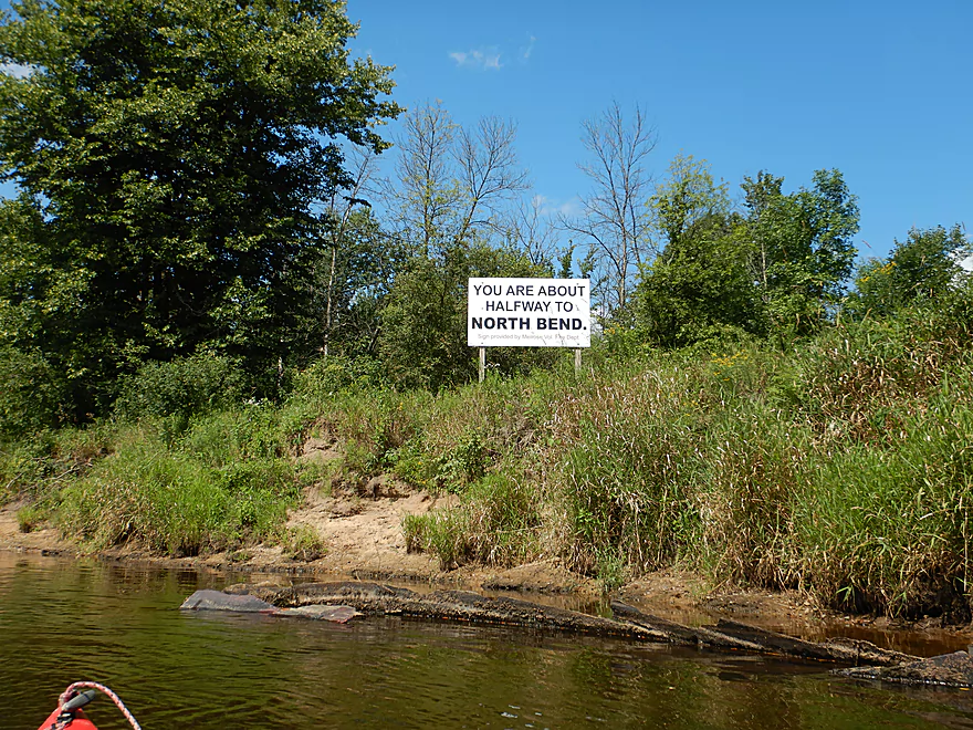
More like 40%…
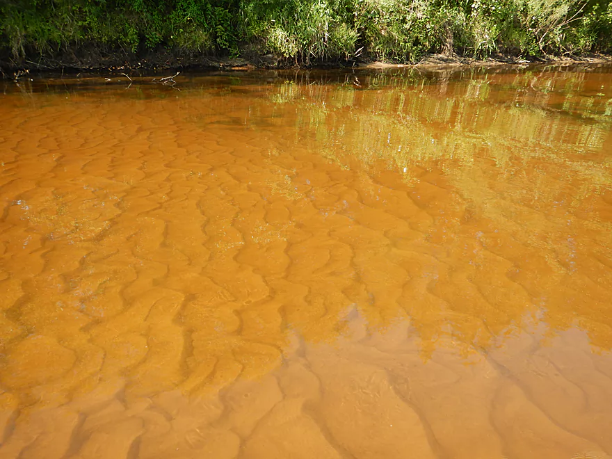
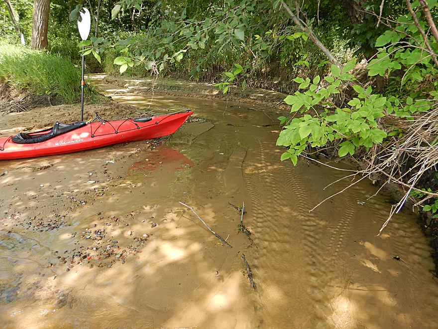
One of several crystal clear sandy creeks
Another great sandbar
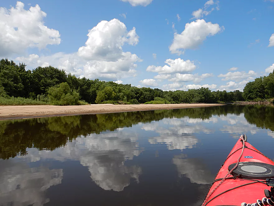
Cool cloud reflections
Still some good sandbars, but not as many and smaller
The second set of outcrops
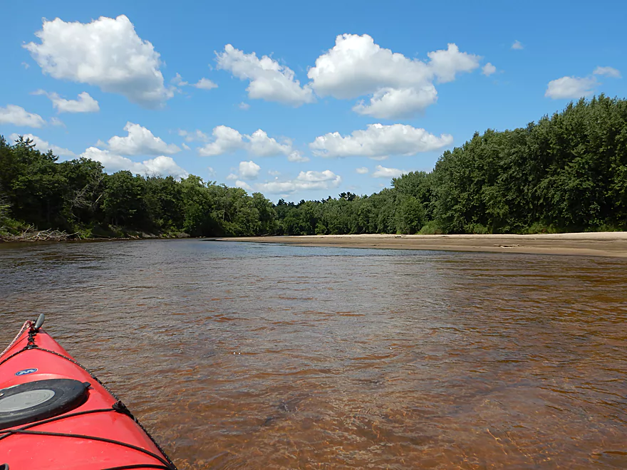
A scenic part of the river
Reminiscent of the Dells
One of my favorite tributaries
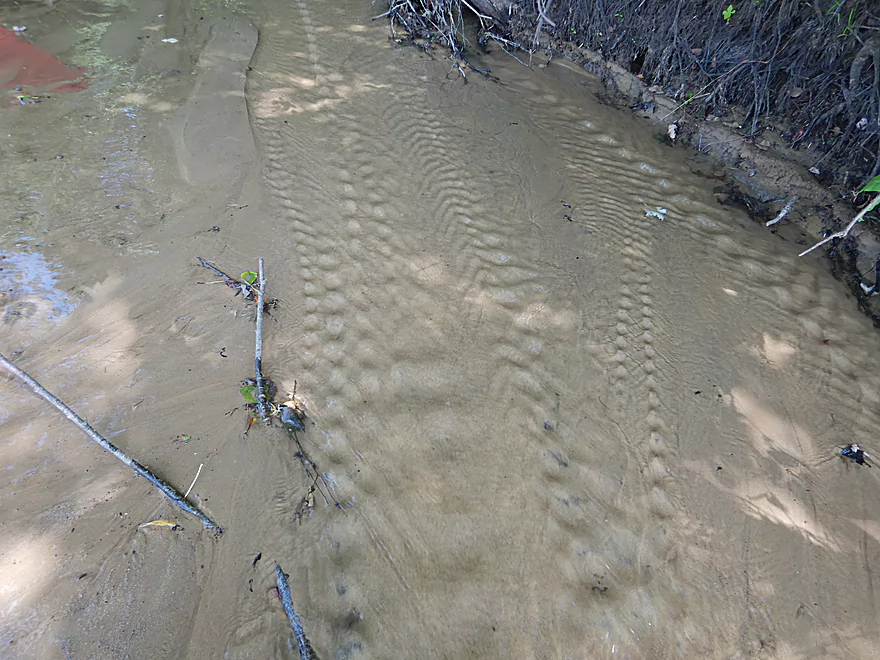
The current created unique tread patterns in the sand
The Black is a beast during high water
The third set of outcrops
Very nice, but tough to photo
Reverse view
Helpful island sign…if you go left you can miss the take-out
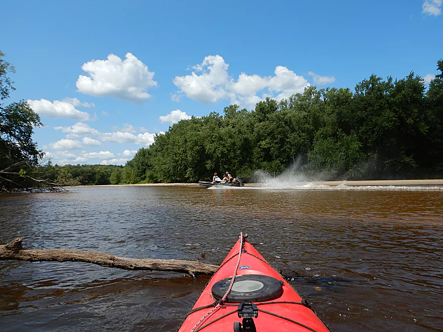
One of a few motorboats…the river was really too shallow for them
On the left is actually a huge half mile long island
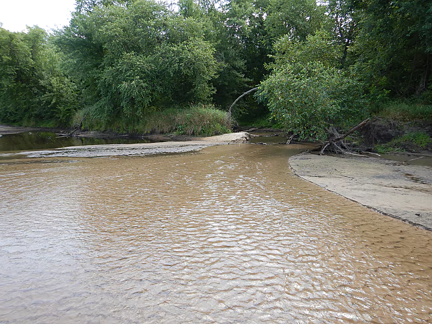
This last stretch was really shallow

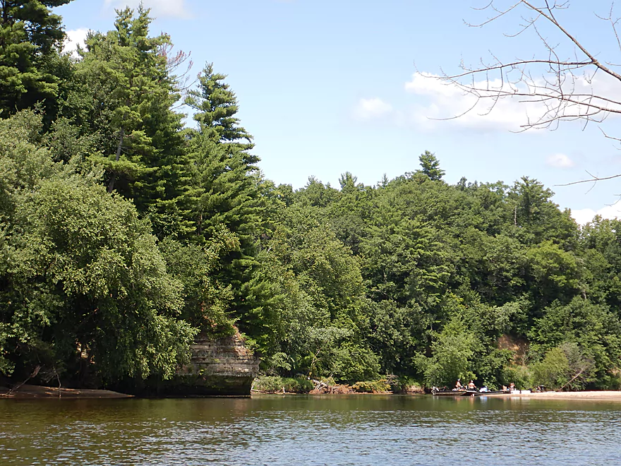
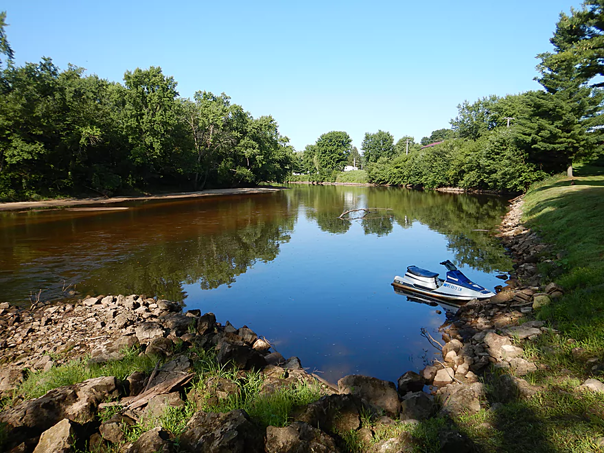
Taking out at North Bend
One last look downstream
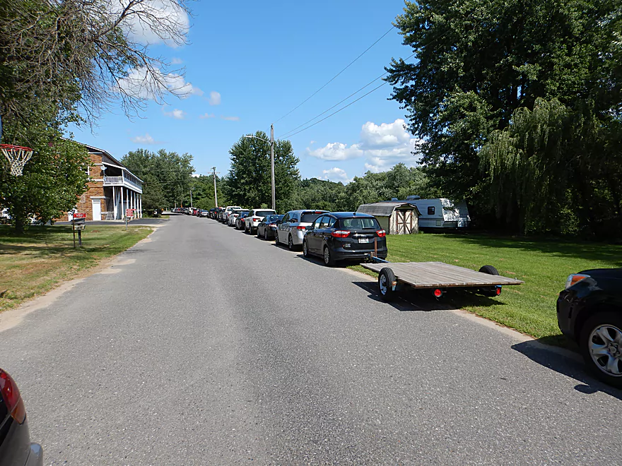
Paddlers have to park along the road when the main launch fills up.
A cool waterfall downstream of Hwy 54
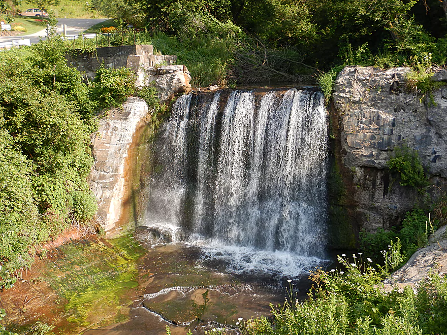
And famous North Bend Falls on the upstream side
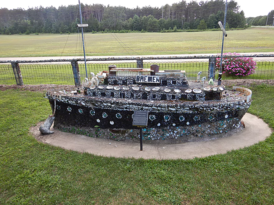
Checking out the Wegner Grotto on my way home
Black River: Melrose to North Bend

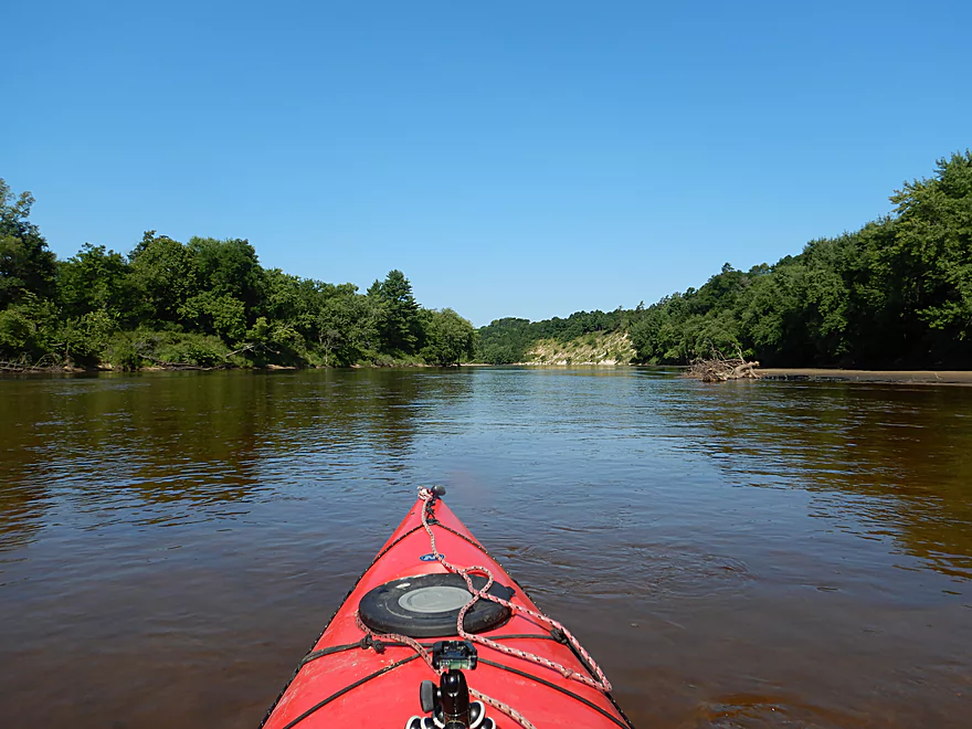
The Black River is a long tributary of the Mississippi located in Central Wisconsin. Many of its segments are navigable and one of my long-term goals has been to paddle them all. In recent years the river has been quite high which has made Upper Black trips viable, but Lower Black trips not so much (at least if you care about sandbars). This year (at long last) the Lower Black has been low and I made it a priority to return. My first idea was to do Irving to Melrose (famous for the Roaring Creek waterfall) but after not being able connect with the local livery service, I opted instead for a downstream segment from Melrose to North Bend which also seemed intriguing.
For this trip, I did hire a livery (there are few good bike shuttle options on the Lower Black). One of my surprises about the Melrose to North Bend route was how popular and busy it was. The shuttle driver informed me that during an earlier busy weekend they had 500 paddlers on the water! I did go as early as possible to beat the crowd, but I did witness my fair share of loud talking, stereos, cigarette smoke, and public intoxication. When paddling popular rivers remember to leave a small footprint and to keep your voice down as sound travels far over water. Paddlers preferring a little more privacy (or their choice of sandbars) can likely paddle during a weekday or in the fall during a football game.
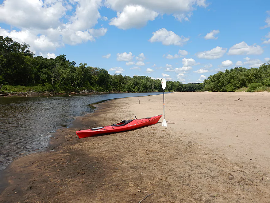
One of the more remarkable attributes of the trip was the shear amount of sand, surpassed perhaps only by the Lower Wisconsin. The substrate consisted of distinct wavy lines you could clearly see through the clean water, and there were large sandbars on many of the bends. I often get asked about paddling and camping combos but typically don’t have a great answer outside of the Lower Wisconsin. Well, the Lower Black is definitely a fantastic option if canoe camping is your thing. Just a warning though…don’t wait too long to pitch your tent as the largest and best sandbars occur in the first half of the trip (see satellite map). If you don’t camp, I suggest at least taking a lunch break on one (and perhaps even a swim) to complete the experience.
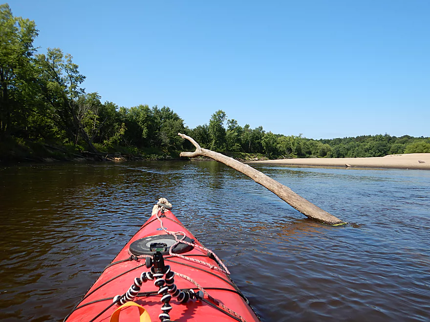
There are many individual highlights on this trip, with the first being a huge 80′ high sandbank you will see shortly after launching. It’s quite impressive, but unfortunately has been somewhat degraded from people walking up it. A couple of sandbars later, I came upon the first rock outcrop of the trip which was very striking. Often on the Black River you’ll want to be on the lookout for cool side creeks and waterfalls around these outcrops and, sure enough, there was a small canyon just downstream of this first outcrop (reminding me of the one from my Mason to Irving trip). The best part was at the end of the canyon where there was a large carved-out, bowl-shaped area with a “dry” waterfall. My livery driver did tell me that it would run after a rain, so just unlucky timing on my part.
The river stayed nice for the next few miles, with heavily wooded banks and few signs of civilization. I’m a slow paddler, but I was still passing many canoes and even a large pirate raft that was floating down the river. Shortly after I came across a sign telling paddlers they were halfway to North Bend (actually 40% but whatever…). This was put up by the local fire department, and between this, the signs I saw at the landings, and the warnings I got from the livery driver, I suspect some paddlers get into trouble underestimating the distance of this trip. It is a bit long at over 10 miles. Typically this is plenty doable but if you get a late start, use a slow boat, experience a headwind, or take a long sandbar picnic…you could find yourself paddling in the dark.
The second half of the trip just was not as interesting. The sandbar density and size went way down, and the banks took on a flood-bottom flavor with more mud and more dead and unhealthy trees. Some of the long, straight sections were a bit repetitive and not as interesting, which was why this trip didn’t get five stars. There are still highlights though… Often you’ll see these micro creeks feeding the main river which are crystal clear, very cold and leave exquisite patterns in the sand. There were also two more sets of sandstone outcrops which were fantastic. The third of which was flanked by a sandbar filled with partiers. As an obsessive river photographer this is awkward…I don’t want to take unwanted pictures of people but often they “photobomb” great scenes on the river.
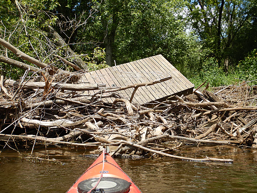
After the third outcrop, the river became much more shallow and I did get hung up in spots. Not the biggest deal, but a bit annoying. I was definitely having a better time than the motorboater I passed. A second motorboat passed both of us like we were standing still in water only a few inches deep. I’m not sure how he did this…perhaps the boat had a special planing device.
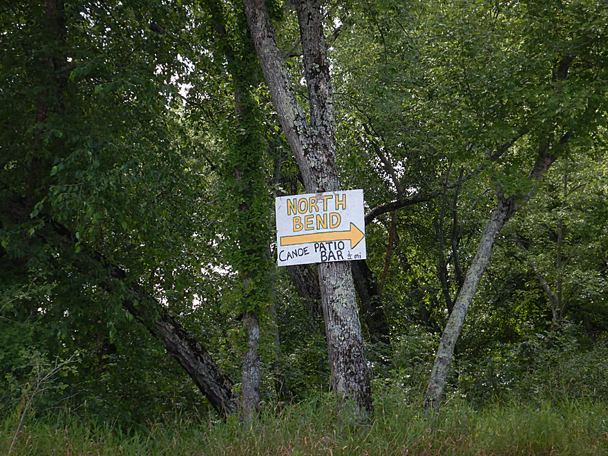
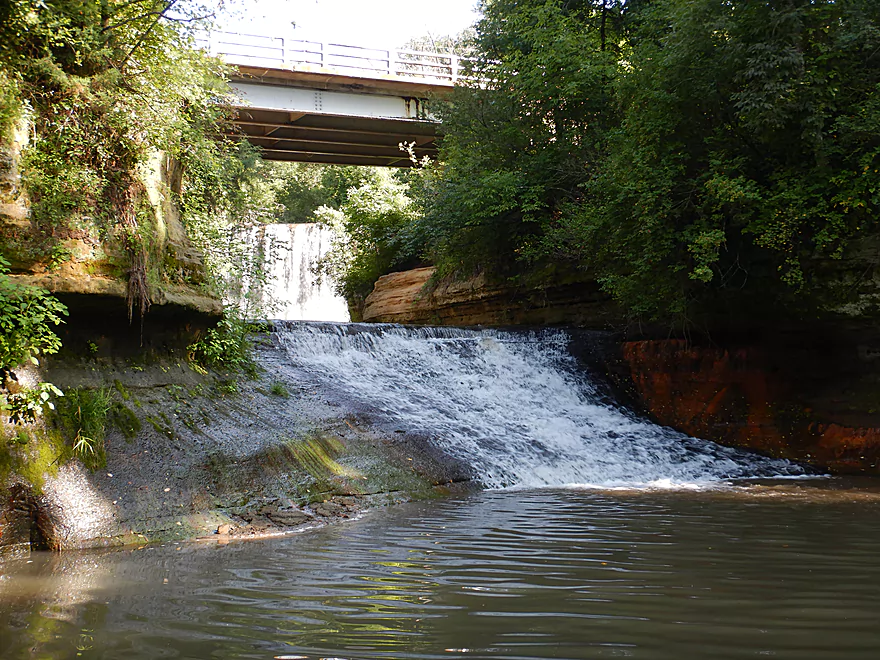
Near the end of the trip I came across a fork in the channel which was the start of a half mile long island. I highly suggest going right as this is the deeper channel, lacks the deadfall of the south channel and is the only way to access the first North Bend landing. A sign here guides paddlers who might be confused. The take-out is just upstream of Mill Creek which has two waterfalls I highly suggest checking out. You can’t paddle up this creek (too congested) but you can get a good view of both waterfalls by walking along the Hwy 54 bridge.
In summary this was a great trip very much reminding me of the Lower Wisconsin River and might be one of the better paddle-camp combos in the state. The only downsides were the people (well really the noise) and the occasional monotony in the second half of the trip.
There was an eagle carrying off some poor animal, a handful of turtles, and a large spotted fish at the take-out. Not much else…
For many of us “southerners” driving to the Lower Black means heading up Hwy 71 north of Sparta. Here you pass the Wegner Grotto (aka the “Glass Church”) which you may want to check out. Basically it is a public park filled with glass, shell and concrete sculptures…many with a religious bent.
The put-in was near Melrose where there is a public canoe landing southwest of the Hwy 108 bridge. This is a big hub for the three local liveries. Outhouses and a large parking lot are available, but on popular weekends this lot fills up forcing you to park along the shoulder of Hwy 108.
An alternate upstream put-in is at Grinde’s Canoe Landing (along River Road). This is a nice access option and the additional 4 miles should be scenic with several outcrops and sandbars…but because the main trip is long already, I advise not adding this unless part of a multi-day camping trip.
I took out in North Bend by the North Bend Canoe Rental livery. Note, while the landing and the rental business are in the same vicinity, the landing is indeed public. This is a very good access with public parking and outhouses. But…the parking lot is very small and frequently overflows, forcing many, many paddlers to park along North Bend Drive. Not the biggest deal…just will require a bit more walking.
An alternate downstream take-out is the public Hwy VV landing which would add 0.7 miles to the trip. This is an excellent option if you are not using a livery because it has a fraction of the traffic that the upstream landing does. Note, this landing can be easy to miss though… Once you see the Hwy VV bridge hang a sharp left and paddle a hundred yards up a side channel to reach the access. If you paddle past the bridge, you’ve gone too far.
The main bike shuttle would be brutal (8.2 miles and 279′ of climbing) and I do advise using one of the local liveries instead.
I chose North Bend Canoe Rental which is conveniently located near the take-out. This is likely the largest of the Lower Black liveries and only costs me $10 because I had my own boat. All in all a good option, but during busy days you may have to wait a bit for the next shuttle van to arrive. Advanced appointments are suggested: (608) 488-2147.
Another livery option located upstream and near the put-in is Black River Express Canoe Rental. I don’t know much about them, but they are a smaller operation. Advanced appointments are likely a good idea: (608) 488-7017.
A third livery is Lost Falls Campground. I’ve used them before and they are a good livery, but this time nobody picked up the phone, so I went with North Bend Canoe Rental. They are the furthest upstream of the three liveries and they may not be interested in shuttling paddlers downstream of Melrose (their main routes are in the Irving area). Call 715-284-7133 for availability.
The current varied…it was slow at times, but clipped along in select areas. There are no real hazards or rapids on the river, making this is a great stretch for beginners and canoers. There are strainers along the shore but they are easy to avoid. Take heed of the forecasted wind as a headwind of 10+mph could be brutal. Also do not start this trip too late in the day (especially if you have a slow boat or canoe) as it can take longer than expected and you never want to get trapped paddling a river at night.
I did the trip at 150 CFS per the upstream gauge at Black River Falls. A low depth, but great for sandbars. The following is a rough depth guide:
- 0-100 CFS: An extraordinarily low depth. Most of the river should be navigable, but you would have to walk a few stretches. Sandbars would be fantastic.
- 101-200 CFS: A great target range. Very good sandbars. Some shallow sections especially near the end of the trip.
- 201-300 CFS: Likely decent sandbars and enough padding to get over the shallows.
- 301-450 CFS: Sandbars would be much smaller.
- 451-600 CFS: Most sandbars would likely be submerged, but there would still be some. At this depth, the waterfalls from the side creeks should be very nice.
- 601-800 CFS: A high depth that likely smothers a lot of the river character. Likely navigable, but not as interesting.
- 801+ CFS: Probrably too high.
Quick Overview
Black River:
- Upstream of Hwy 73: Obscure sections of the Black with little known about them. Some legs will have logjam issues.
- Hwy 73 to Lake Arbutus: 48 miles. Good legs with a mix of rapids, boulder gardens and undeveloped banks. Only reason these legs don't receive more paddling traffic is because they're located away from population centers.
- Lake Arbutus: 3 miles. A scenic but challenging lake because of the waves.
- Hatfield Dam to Halls Creek Landing: 7 miles. Some of the best and most fun whitewater on the Black River.
- Halls Creek Landing to Black River Falls Dam: 6 miles. An impounded part of the river, but nice with cool cliffs.
- Black River Falls Dam to North Bend: 37 miles. This is the heart of the Lower Black and sees the most paddling traffic. No major rapids, but there are many scenic cliffs and creek inlets.
- North Bend to Mouth: 30 miles. This is the second half of the Lower Black. While not as scenic, there are still cool sandbars and sandbanks. Few paddle these stretches.
Noteworthy Tributaries:
- Robinson Creek: One of the best paddles in all of Wisconsin.
- Halls Creek: Also one of the best and with amazing sandstone walls.
- Morrison Creek: Very scenic creek with some fun whitewater.
- Wedges Creek: Great paddle with amazing boulder gardens.
- East Fork of the Black River: Some fun riffles and unique granite geology.
- Perry Creek: Shallow but a super scenic creek.
- Dickey Creek: A wonderfully scenic creek with fantastic sandstone…but too many logjams.
- Beaver Creek: Some fun rapids and amazing sandstone in Galesville, but logjams on the downstream portions.
- Popple River: A shallow whitewater river that is very nice.
- Arnold Creek: A pleasant tributary to Lake Arbutus with really nice reflections.
- Rock Creek: Many scenic boulder gardens, but usually this creek is too shallow to run.
- Roaring Creek: Very scenic creek with a great waterfall at the mouth, but might be a challenge to paddle.
- Vismal Creek: Super scenic but has a lot of logjams and is shallow. Requires very high water conditions.
- Plus countless small creeks that are too small to paddle but quite fun to explore by foot. If you know of viable paddling options, let me know! Am very curious to know more about Douglas Creek, Levis Creek, O’Neal Creek, and Crawley Creek.
Detailed Overview
Headwaters to Neillsville:
- Upstream of Division Drive: Likely too many logjams to be navigable.
- Division Drive to Sawyer Ave: (6.5 miles) Rocky and a few light rapids. Maybe 4 logjams.
- Sawyer Ave to Hwy 64: (2.5 miles) Rocky and a few light rapids.
- Hwy 64 to Bridge Road: (14.4 miles) Solid prospect reviewed by Mike Svob. Some Class 1 rapids and nice gravel bars. Intermediate access points at Bahnkes Ave and Hwy AT.
- Bridge Road to Hwy X: (6.0 miles) Little is known of this section…likely pretty simple.
- Hwy X to Colby Factory Road: (6.0 miles) Little is known about this section…likely some rapids and outcrops. Intermediate alt access points at Hwy 29 and Hwy N.
- Colby Factory Road to Popple River Mouth: (7.9 miles) This stretch has far fewer rapids than downstream legs with only a few minor rapids. It should still be pleasant though.
- Popple River Mouth to Reese Ave: (5.3 miles)
- Popple River Mouth to Warner Drive: (1.0 miles) This is a slower and less interesting stretch, but does include 4 Class 1's and scenic Hemlock Rapids which are Class 3.
- Warner Drive to Greenwood Park: (3.4 miles) A good leg with many rapids (3 Class 2's and 17 Class 1's).
- Greenwood Park to Reese Ave: (0.9 miles) A slower stretch with just 2 Class 1's. Part of this passes through the community of Greenwood.
- Reese Ave to Twenty Six Rd: (5.1 miles)
- Reese Ave to Sladich Rd: (0.7 miles) A mostly nondescript wooded stretch. The exception is Greenwood Rapids where an island splits the river. The right side is scenic, but the left side has fun Class 3 rapids.
- Sladich Rd to Willard Rd: (1.6 miles) A somewhat slow and relatively uninteresting leg. Highlights include one nice outcrop, a few gravel bars and a 400' stretch of Class 1 rapids.
- Willard Rd to Twenty Six Rd: (2.8 miles) A great leg with 10 Class 1's and 2 Class 2's. Highlights also include scenic boulder gardens and a few outcrops.
- Twenty Six Road to Hwy H: (5.0 miles) Multiple Class 1 & 2 rapids.
- Hwy H to Grand Ave/Hill Road: (8.0 miles) A great trip with several Class 2 rapids and scenic granite outcrops.
Note, for more details on the Upper Black, I highly recommend “Indian Head Rivers” by Michael Duncanson.
Alternate Black River Trips – Neillsville to Black River Falls:
- Grand Ave/Hill Road to Opelt Road Landing: (6.7 miles)
- Grand Ave/Hill Road to Hwy 10: (2.2 miles) Nice section with a handful of rapids. These are mostly Class 1 at lower depths, but strengthen to Class 2 during high flow rates.
- Hwy 10 to River Road Landing: (4.3 miles) Fantastic whitewater section. Maybe six Class 2’s and two class 3’s. Scenic boulder gardens and a few outcrops.
- Opelt Road Landing to Bryan Ave Bridge: (1.1 miles) Not sure there is anything special about this stretch.
- Opelt Ave Bridge to Hwy 95: (4.4 miles) Ok…nothing special.
- Hwy 95 to West Arbutus County Ramp/Hatfield Dam: (4.8 miles)
- Hwy 95 to North Arbutus Boat Landing: (2.4 miles) Includes a scenic gorge, boulder gardens and rapids including the Class 3 Red Granite Rapids. River slows after rapids.
- North Arbutus Boat Ramp to West Arbutus County Ramp: (2.4 miles) A large open water paddle on Lake Arbutus that can feature challenging waves on summer afternoons.
- Hatfield Dam to West/East Channel Confluence: 0.2 or 0.3 miles.
- West Dam to West/East Channel Confluence: 0.3 miles. There is a large boulder field and Class 2 rapids below the west dam. At the outlet of the west channel is a Class 4 drop. This is easy to scout and portage.
- East Dam to West/East Channel Confluence: 0.2 miles. Perhaps the most extraordinary rapids in the state with Class 4/5+ rapids. The action starts below the dam where steep granite banks narrow the river significantly and force it down deep chutes. The gorge starts with Class 2-3 rapids but ends with two significant drops. American Whitewater warns “between the dam and this point lie some serious drops which contain near inescapable boiling cauldrons at moderate to high flows”.
- Hatfield Dam Confluence/West Clay School Road to Powerhouse Road Landing: (3.1 miles)
- Hatfield Dam Confluence to Hwy K: (0.3 miles) One of the most scenic paddling areas in the state with massive granite outcrops. There is one set of Class 2 rapids.
- Hwy K to Powerhouse Road Landing: (2.8 miles) The first half mile by Hwy K is very scenic and contains one Class 3. The second mile is mostly flatwater. The third mile is almost continuous rapids and features one Class 3.
- Powerhouse Road Landing to Halls Creek Landing: (4.0 miles) Scenic section with a few Class 2 rapids and a steep ledge.
- Halls Creek Landing to Black River Falls Dam: (6.2 miles) Wonderful sandstone cliffs.
Alternate Black River Trips – Black River Falls to Mouth:
- Black River Falls Dam to Mason’s Landing: (4.7 miles) A great little section.
- Mason’s Landing to Irving Landing: (9 miles) A good section.
- Irving Landing to Lost Falls Campground (2.3 miles) A popular stretch. Highlights include a few small outcrops, two tiny waterfalls, several impressive sandbars, and one large sandbank. A side hike to Roaring Falls can be arranged. Note Lost Falls Campground is private and you must purchase a pass from them to use their access.
- Lost Falls Campground to Grinde Landing: (6.4 miles) A popular section with some nice outcrops and a waterfall by Roaring Creek. Wolf Creek may also have a cool slot canyon. The river splinters into multiple channels, some of which may be quite shallow in later summer. As of 2023, Grinde Landing is closed because somebody stole the owner's deer stand.
- Grinde Landing to Melrose Landing: (3.9 miles) A shorter section but with a really nice rock outcrop before Melrose Landing. As of 2023, Grinde Landing is closed because somebody stole the owner's deer stand.
- Melrose to North Bend: (10.1 miles) Likely the most popular stretch with the best sandbars on the river, three sets of outcrops, and a few waterfalls.
- North Bend to Hwy 53: (13.3 miles) Likely a nice paddle with sandbars, large sandbanks and maybe a few outcrops. Unfortunately it is very long.
- Hwy 53 to Hwy 35: (8 miles) A nice section with epic sand banks.
- Hwy 35 to Lytle Road: (4.0 miles) Goes through the Van Loon Floodplain Forest. This can be a shallow trip but features many nice sandbars.
- Lytle Road to Fred Funk Boat Landing (Mississippi): (5.0 miles) Multiple options because of the river delta.
Trip Map
Overview Map
Video
Photos Size:
Thank you for such a descriptive and thorough report of the river trips you took! What a joy to read and help me remember my countless trips on the Black River that are now a bit of a blur. Heading out today to do the Melrose to North Bend section, camping on a sandbar somewhere. Your information was so helpful in planning. Loved your pictures and video too! Nice work.
Thanks for the kind words! The Lower Black after being high all these years is on pace to be pretty low this summer…this should be perfect sandbar camping season.