
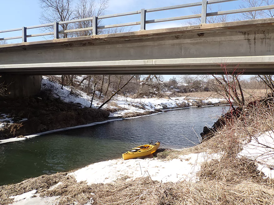
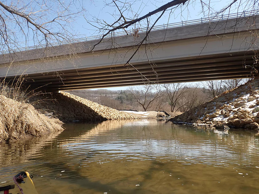
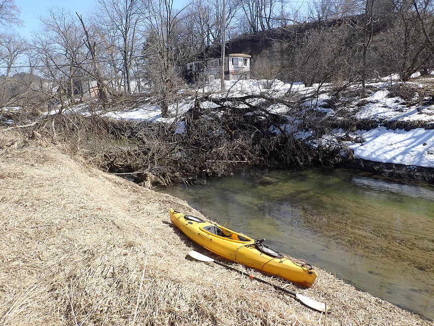
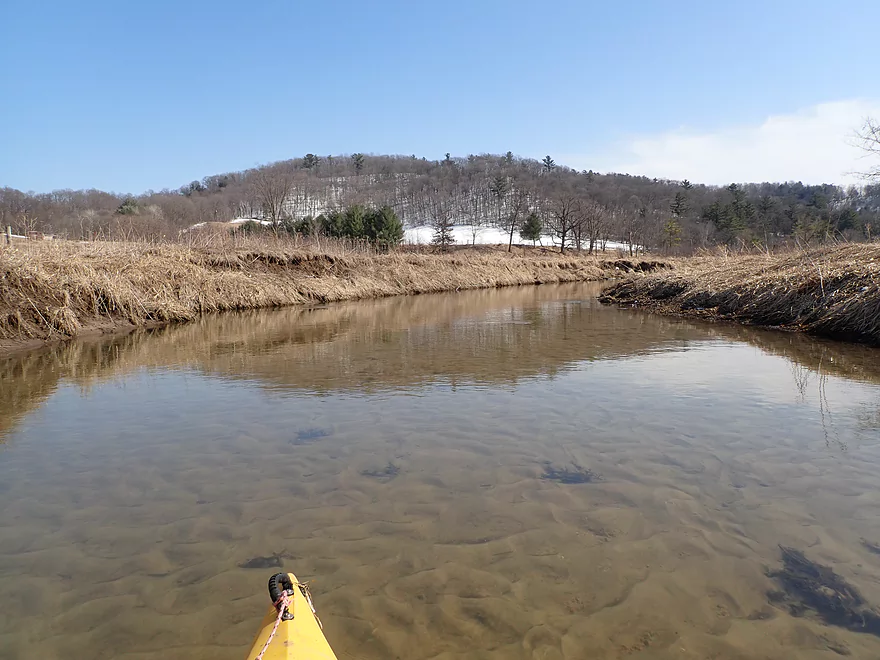
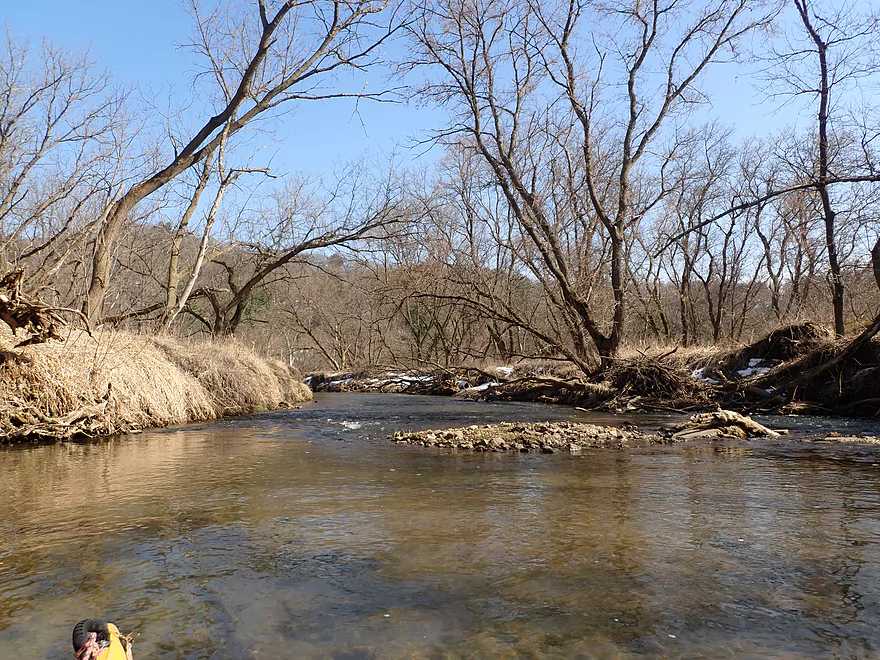
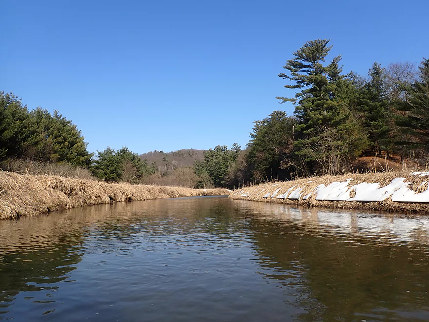
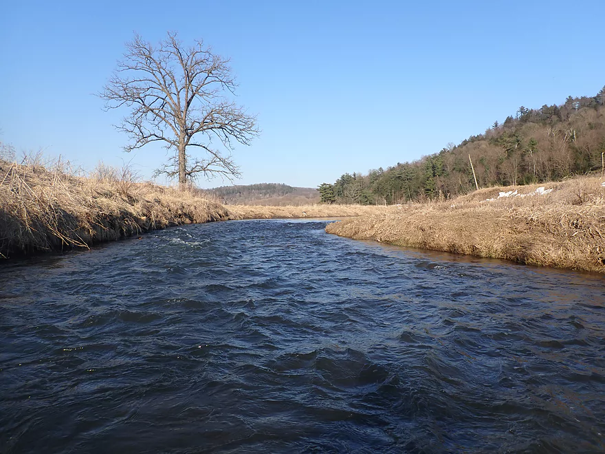
Starting at Keystone Road above Wilton
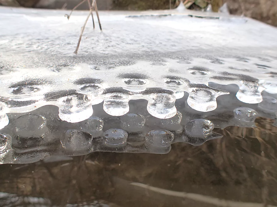
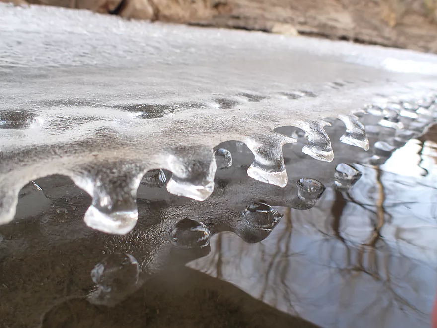
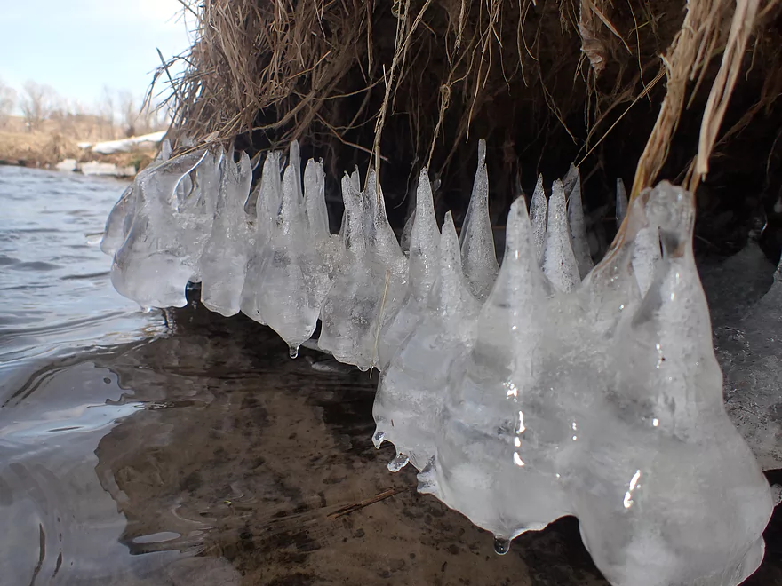
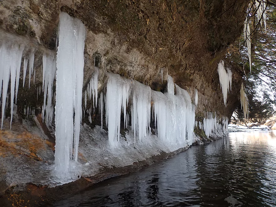
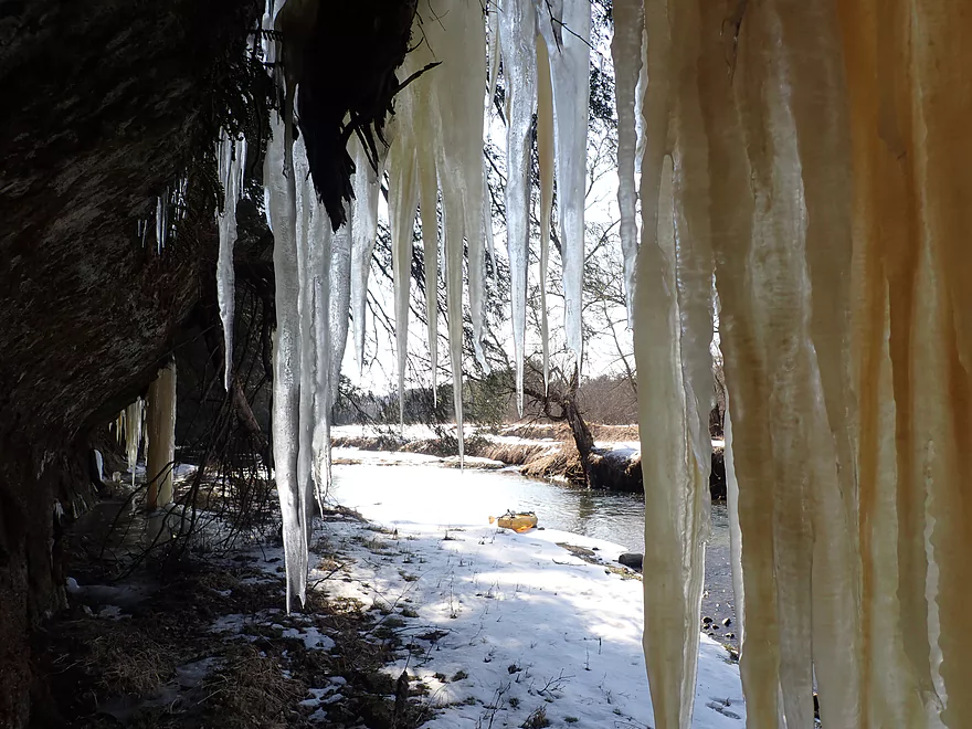
Great ice patterns on the shore
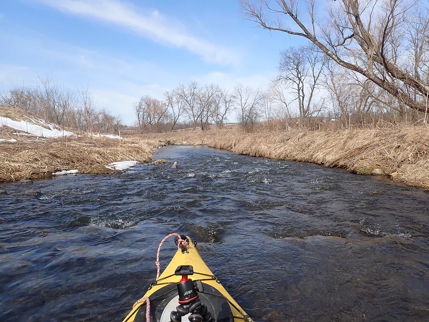
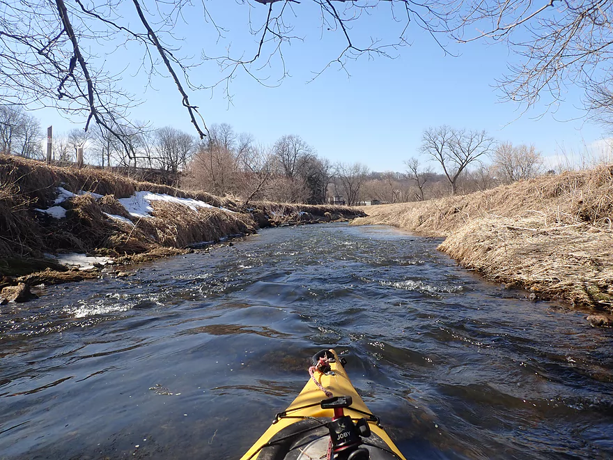
One of countless rapids
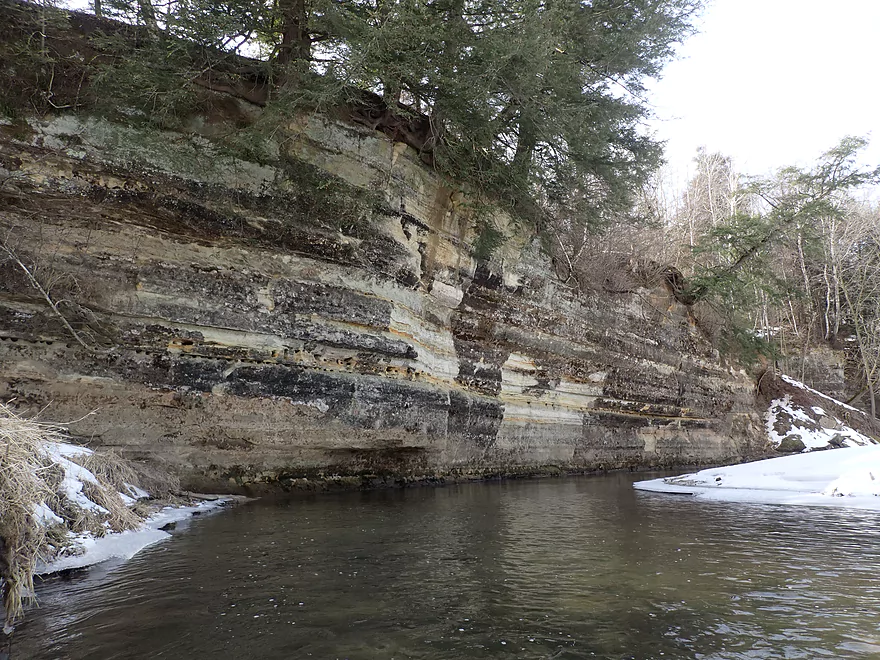
Second outcrop of the trip
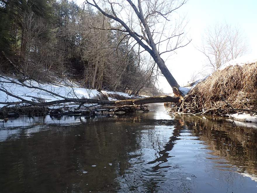
Horizontal pine
Fun rapids but could use more padding
Elroy Sparta Trail parallels the river
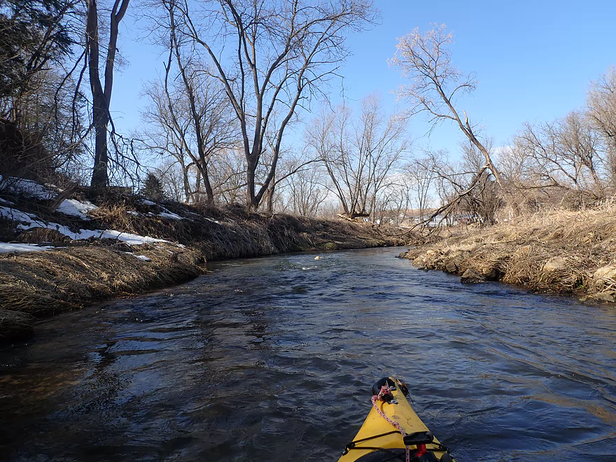
Entering a small woods
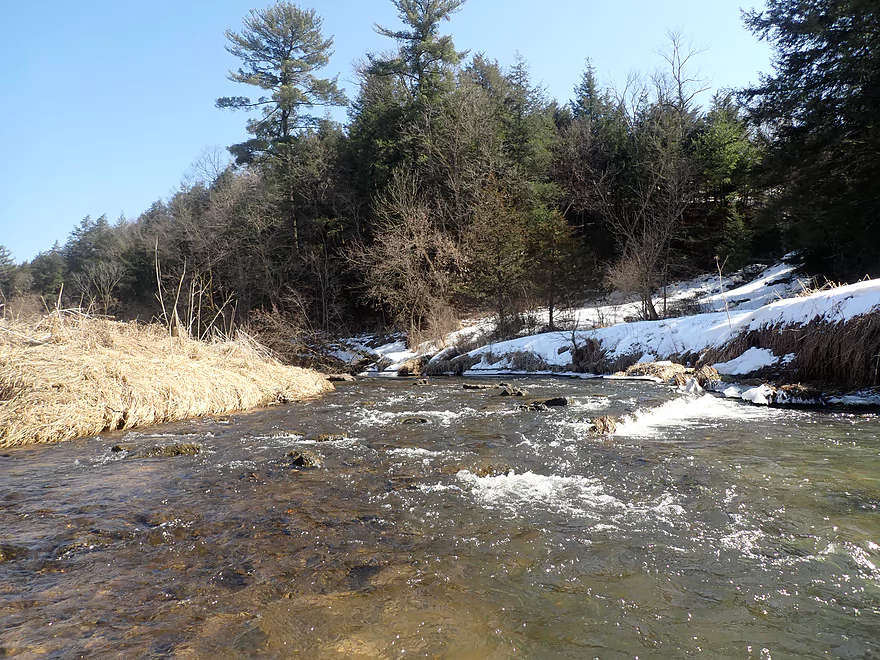
Only tricky ledge/rapids of the trip
Cattle (including one bull) blocking my way
Safe after I passed under the second barbed wire fence
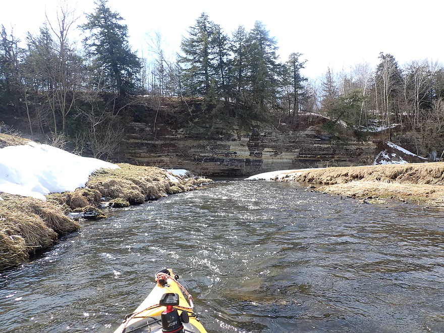
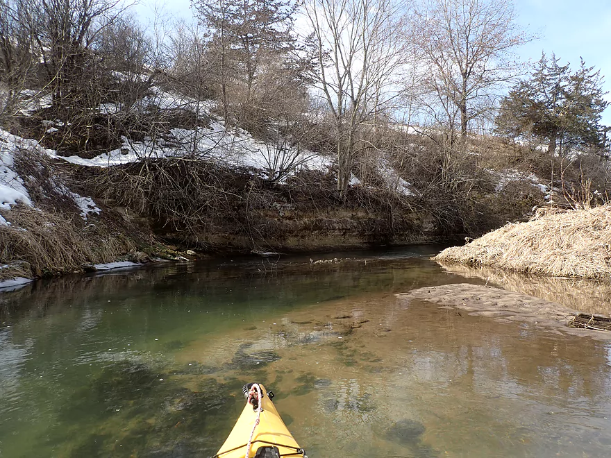
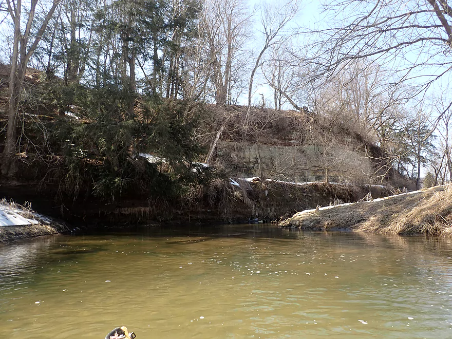
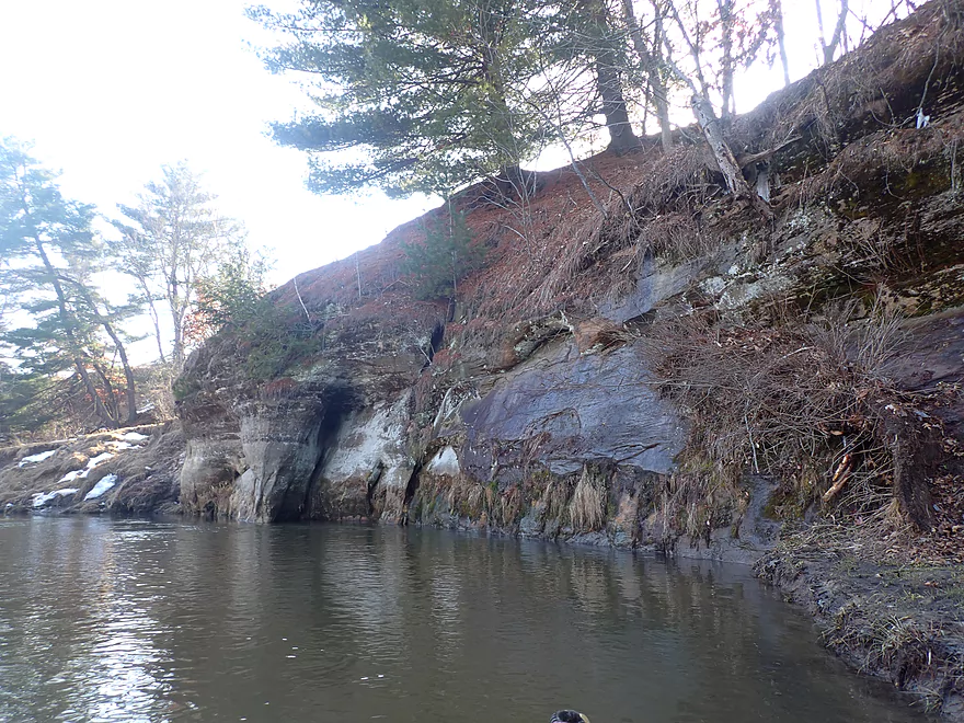
First major outcrop of the trip
Cool pattern
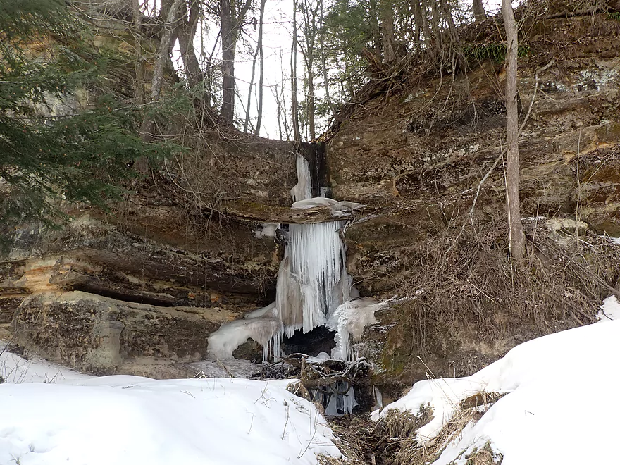
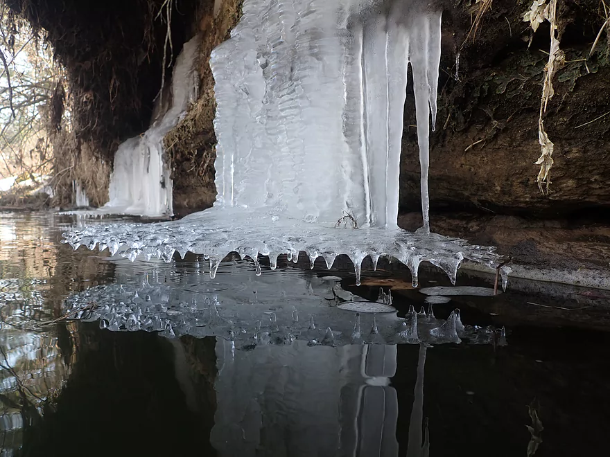
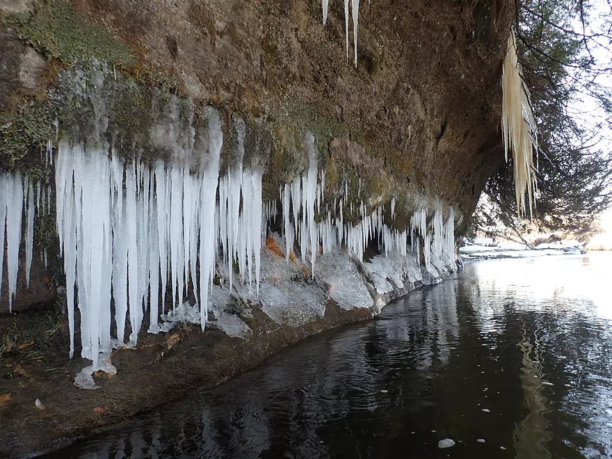
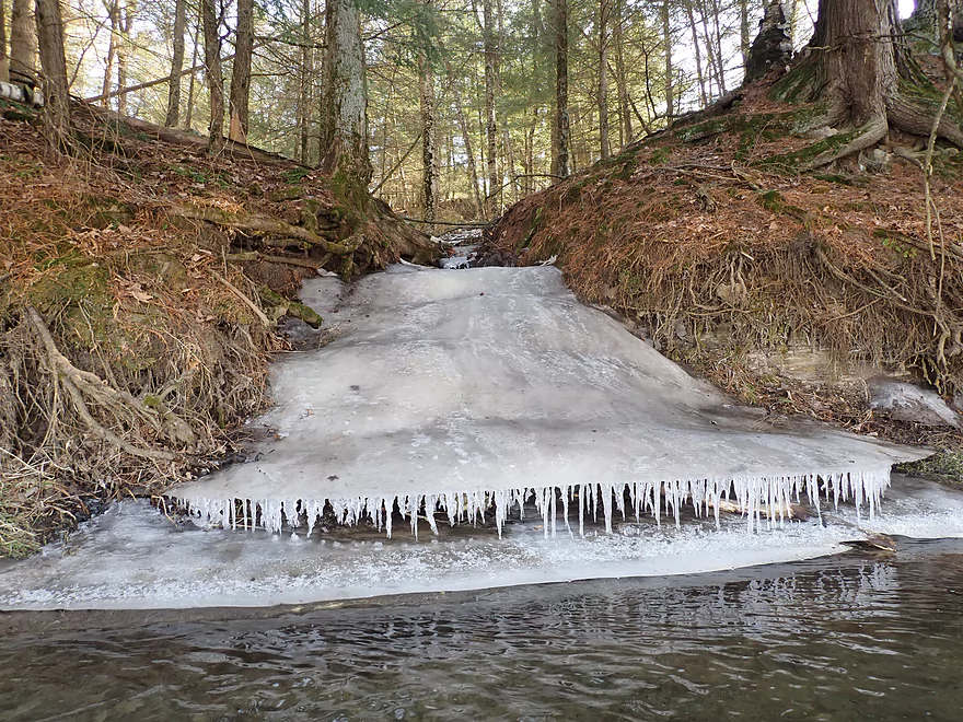
Frozen waterfall
Sun starting to come out
Elroy-Sparta Trail again
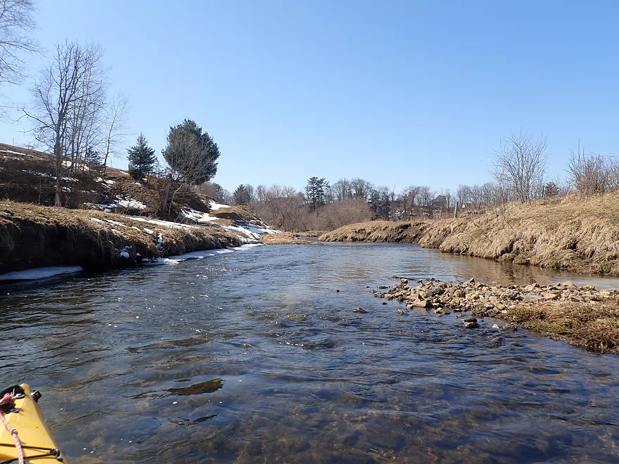
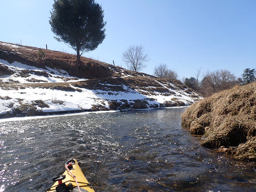
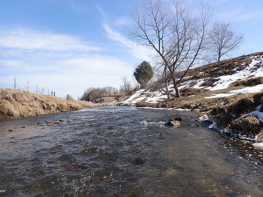
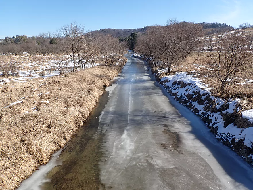
North-facing banks still had some snow
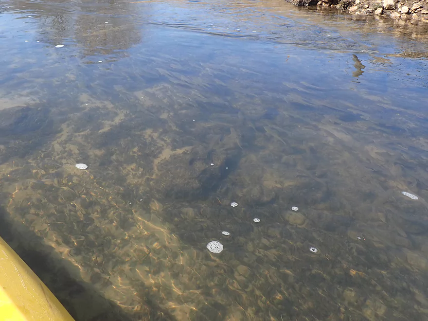
Countless fish (poorly pictured)
Good clarity
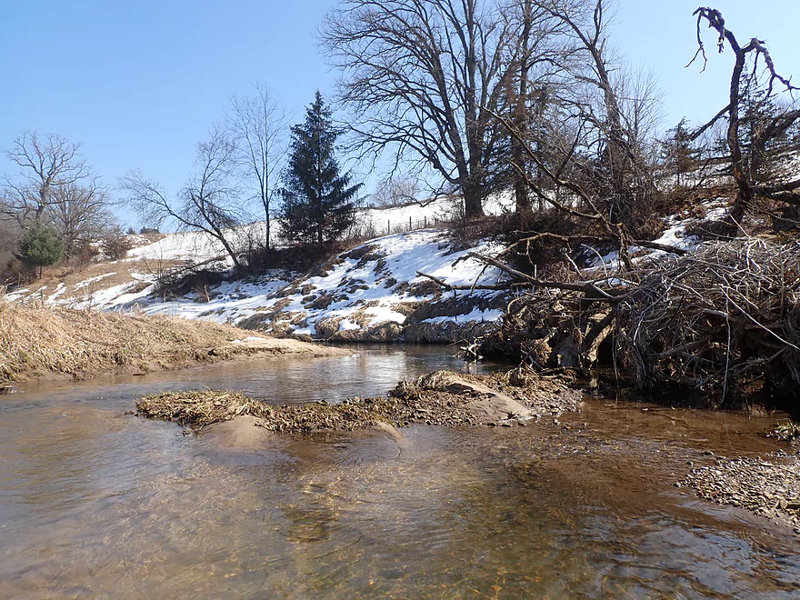
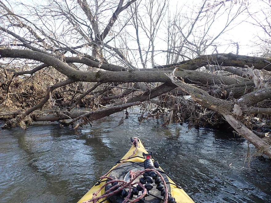
Portaging a dodgy strainer
Coming up on a long bluff
The shallowest part of the trip
Finally some nice ice
Hwy 71 could be a put-in for the determined
More smaller outcrops
Levitating ice
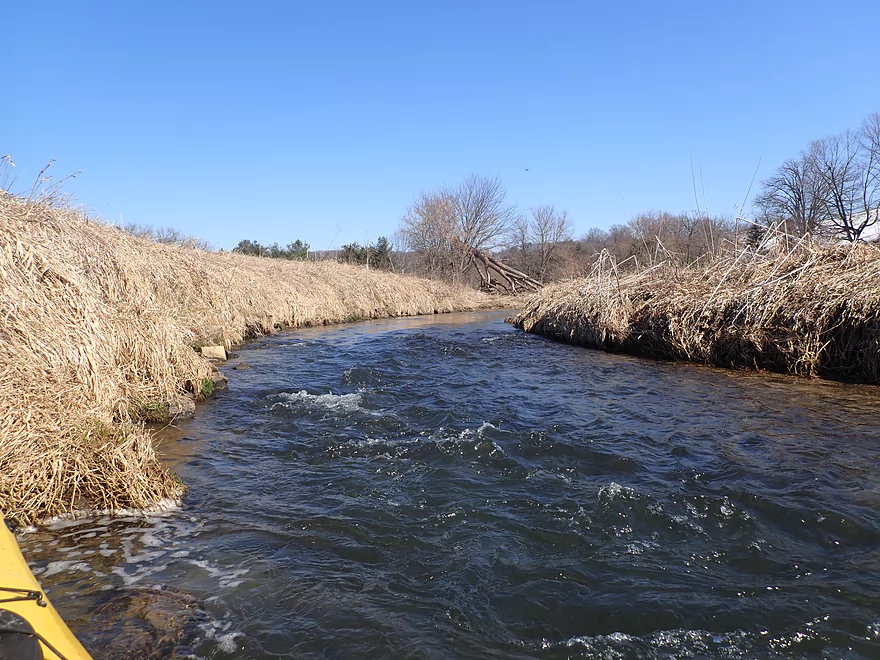
Clarity is fantastic on this stretch
Some hemlocks on the Kickapoo
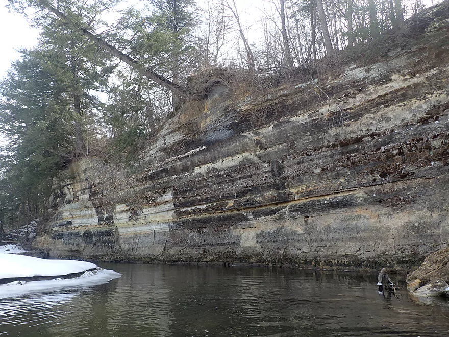
Coming up on a major outcrop
Iron stained ice crops
The north-facing cliffs had the best ice
So many sharp icicles
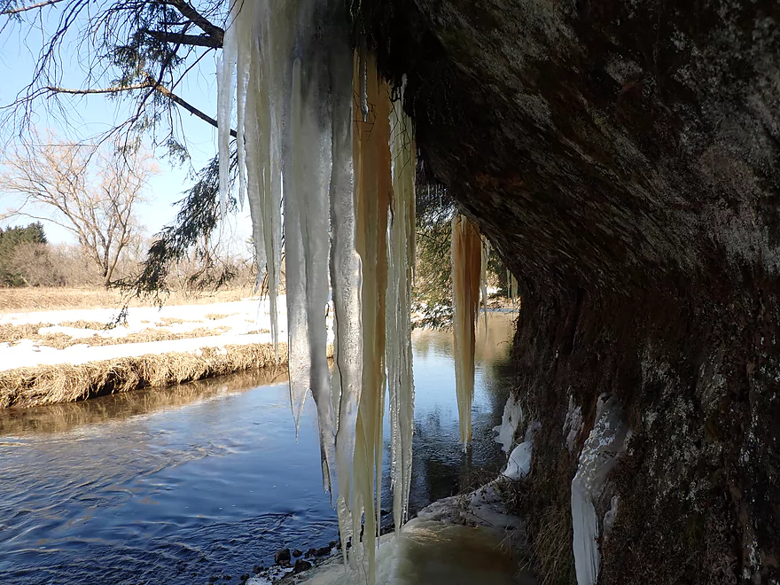
Reverse view
A low ducker
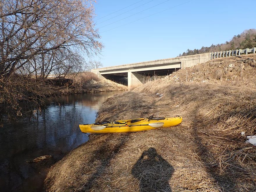
Passing the Wilton Campground (a possible put-in)
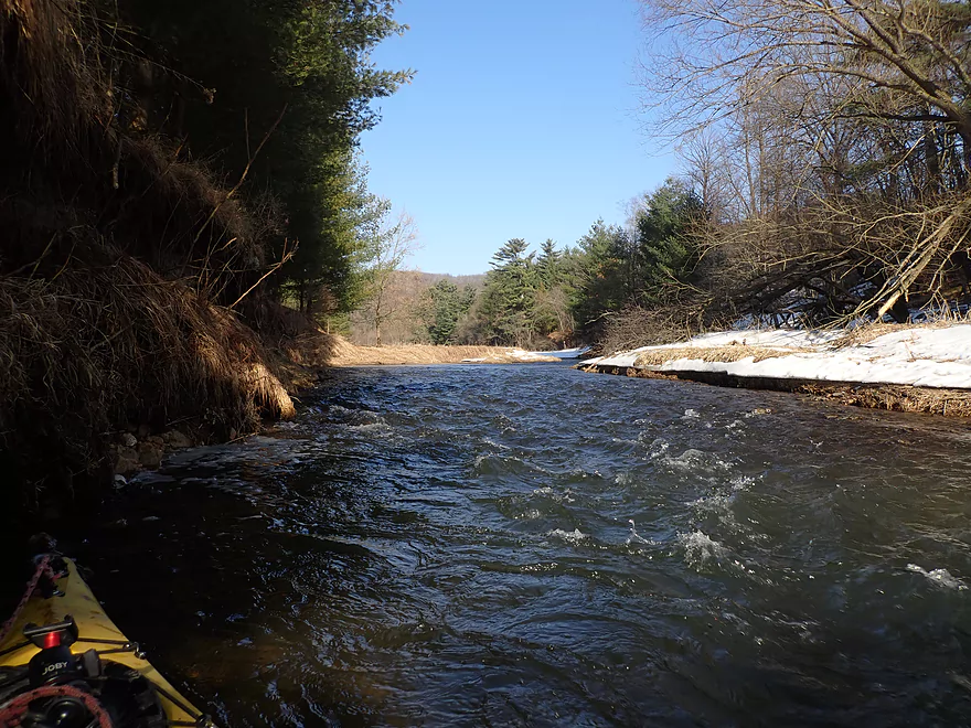
Rough rapids
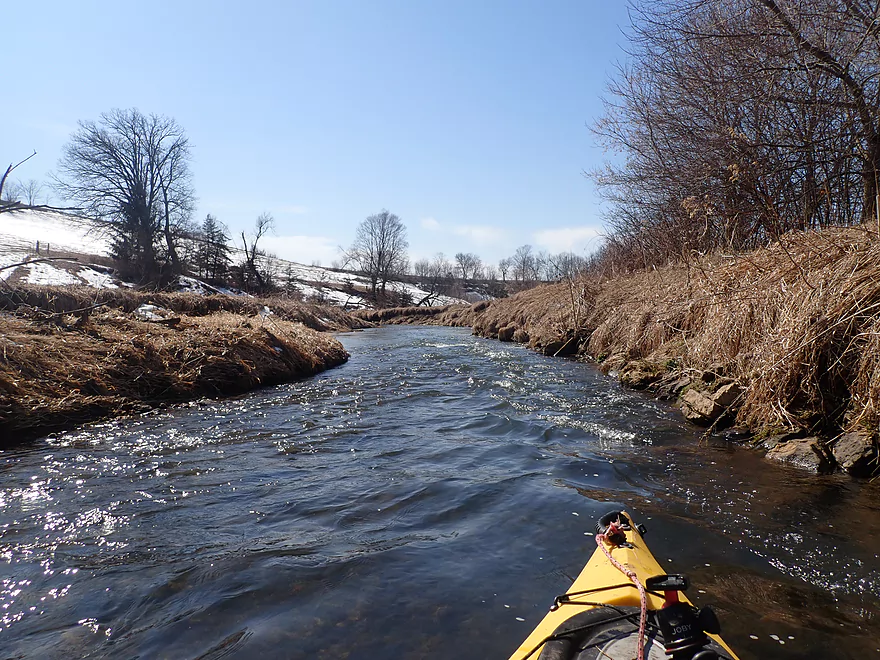
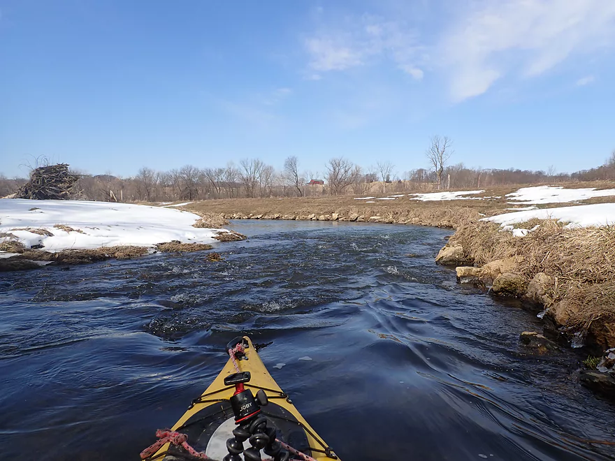
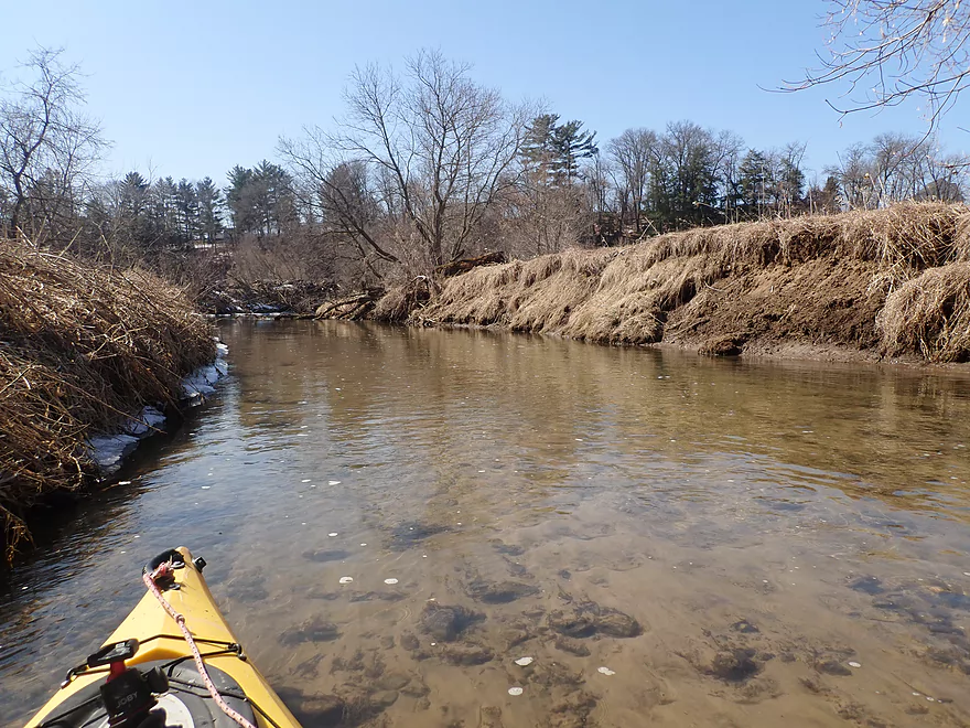
River opens up
Still a lot of snow
A stair-step outcrop
Paddling through the outskirts of Wilton
Portaging a large logjam by Water Street
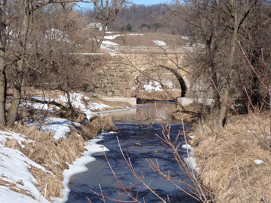
Water Street
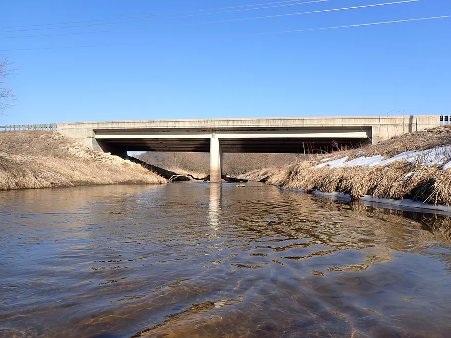
View from bridge (taken a month earlier)
Another small ice crop
Still good clarity
One of the messier, less attractive outcrops
Hwy 131
Distant hills are scenic
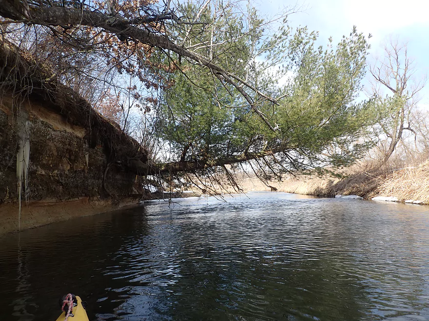
This would be a cool tree canopy in the summer
Entering pine country
Pine being evicted from an outcrop
Coming up on the third major outcrop
This one was my favorite
An ice pillow
Bottomless icicles show how the river has dropped
Neat pattern
Monster-sized icicles
Rust-stained ice on top and clear white ice on the bottom
Reverse view
Had to be careful not to paddle directly under these. One wrong move…
Getting out for more pictures
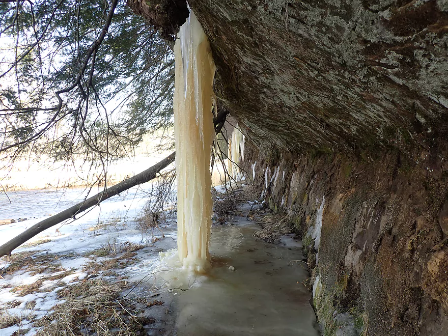
Frozen waterfall
Framed picture of the Kickapoo
The Kickapoo Ice Monster
Fun rapids
Leaving this nice pine stretch behind
Hwy 131 (again)
View from bridge (taken a month earlier)
Nasty logjam–I got filthy sneaking through
An ok outcrop
Black Valley Hills in the distance
Hwy 131 (again)
The fourth and last major outcrop
I saw this on my 2021 trip, but for this trip (2023) it had more ice
Cool scene
Lots of hemlocks and pines
Fun rapids to end the trip
Taking out at Hwy 131 (by Michigan Road)

View of the river from the bike shuttle
Scouting the river upstream of Keystone (some nice bridges)
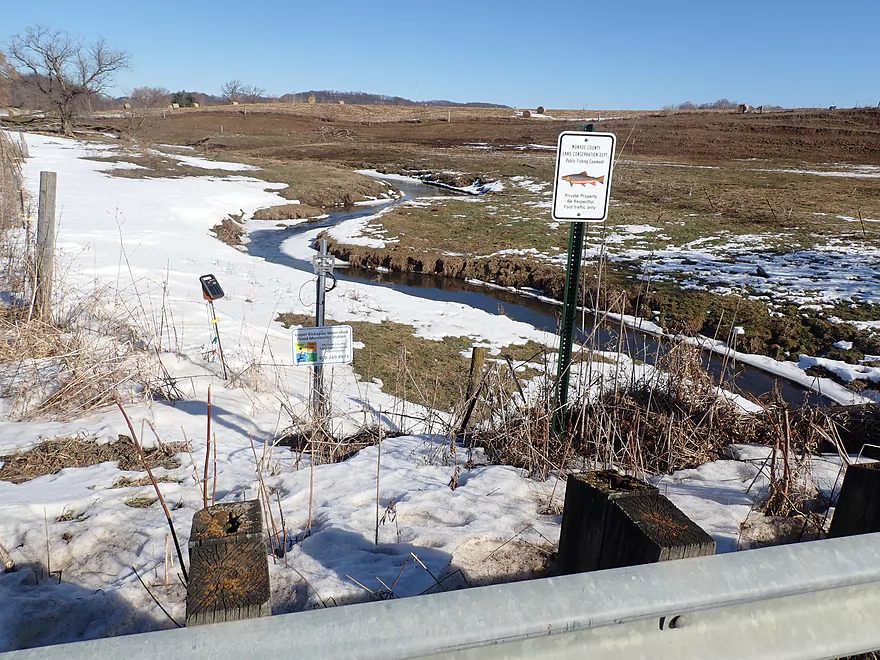
Paddlers could launch from Lincoln Ave (fish easement) but river here is maybe too small
Paddlers should consider checking out the Wildcat Mountain State Park Ice Cave
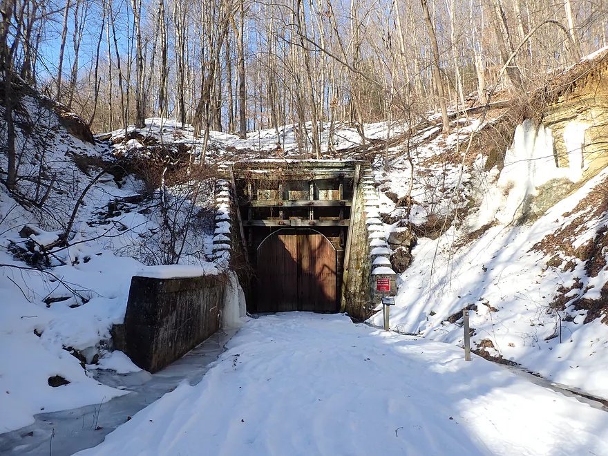
Or one of the three Elroy-Sparta Trail Tunnels (which are gated in winter to protect bats)
Kickapoo River – Wilton


Two years ago I did an obscure leg of the Upper Kickapoo by Black Valley. The trip turned out well and the highlight was the fantastic ice formations that flowed out of the many riverside sandstone cliffs. I had wanted to return to the Upper Kickapoo for another “ice paddle” in 2022, but conditions did not align (there are only brief windows in March when “ice paddles” are viable). But come 2023, a window opened up with an ideal combo of recent snowmelt and high temperatures, so I justified an unpaid day off work to check it out.
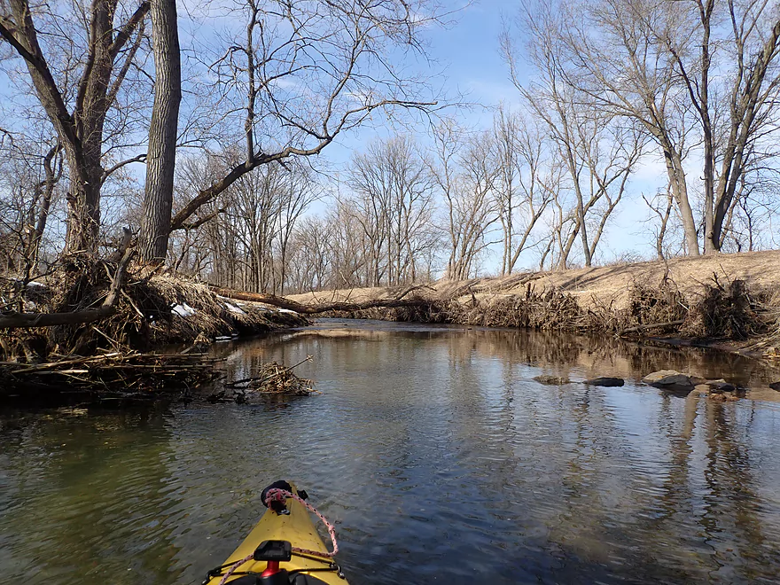
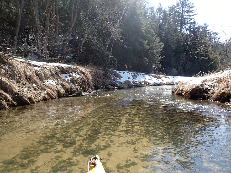
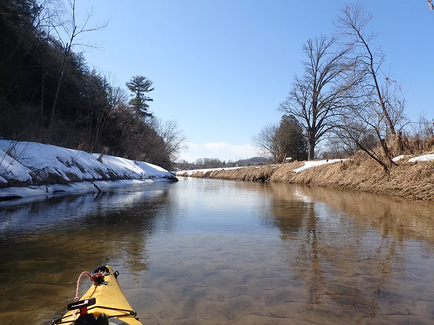
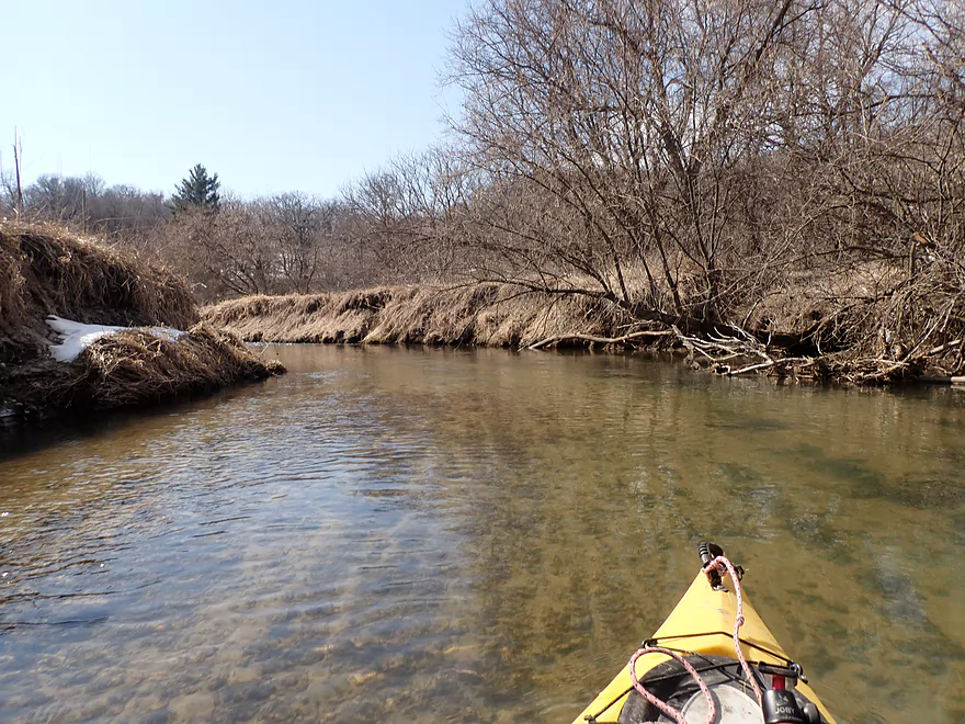
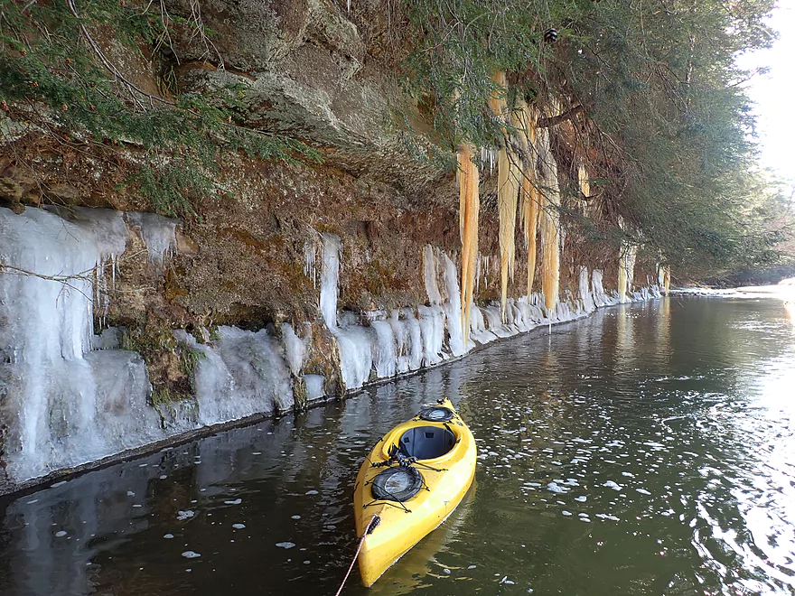
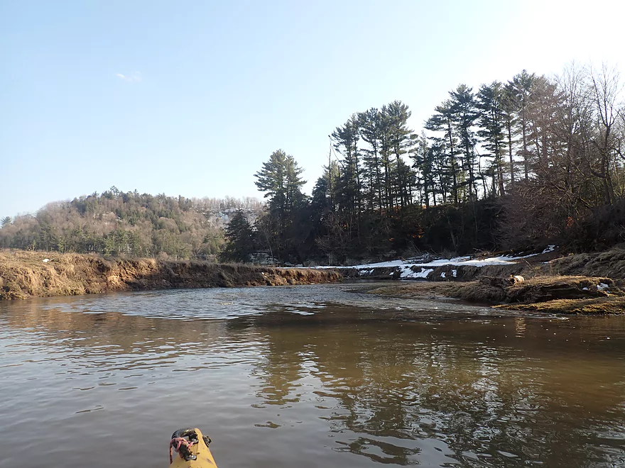
Things started on a good note. From Keystone Road you can already see two riverside outcrops. Below the bridge (and really, for much of the trip) shoreline ice would be in a state of partial meltdown and interactions with the changing river levels created exquisite patterns that were fun to photograph.
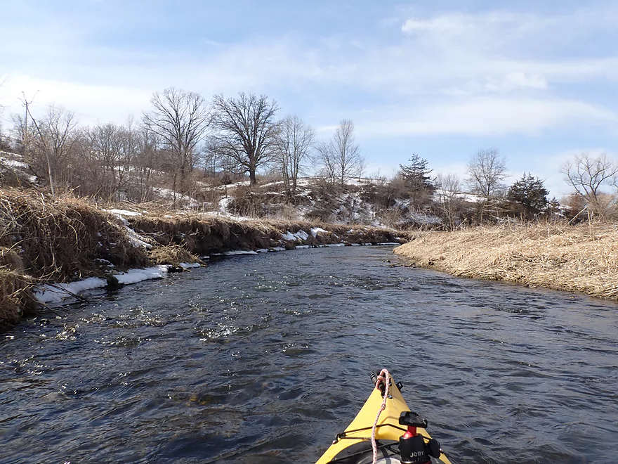
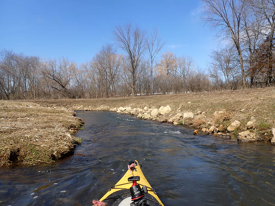
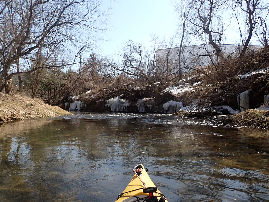
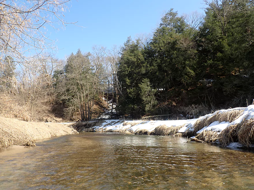
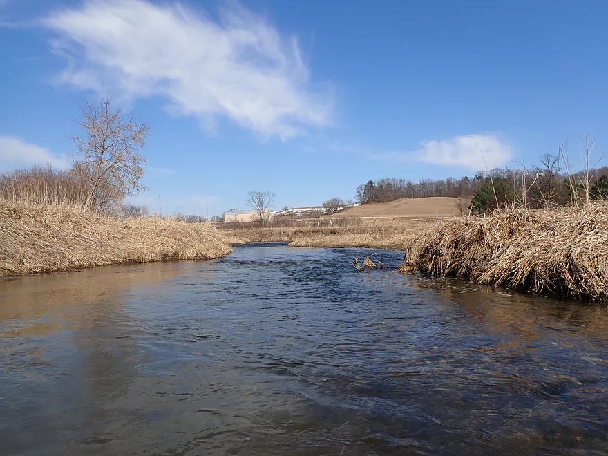
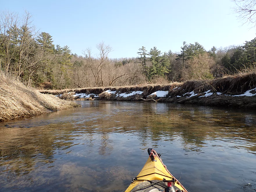
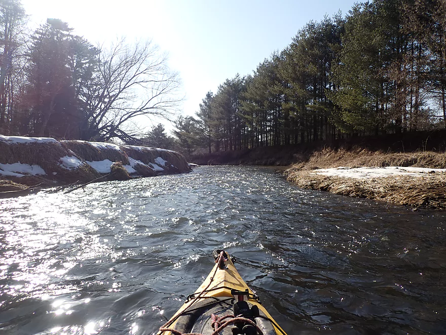
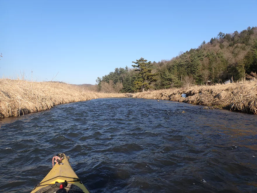
The first 1.5 miles of the trip were filled with many fun but shallow Class 1 rapids. For much of this leg the famous Elroy-Sparta Bike Trail paralleled the river. The water clarity here (and for the entire trip) was fantastic.
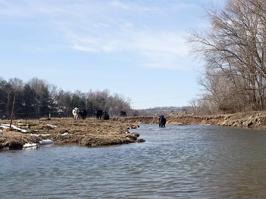
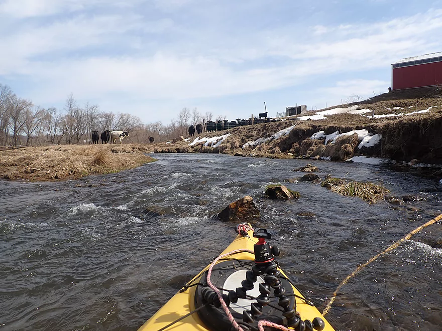
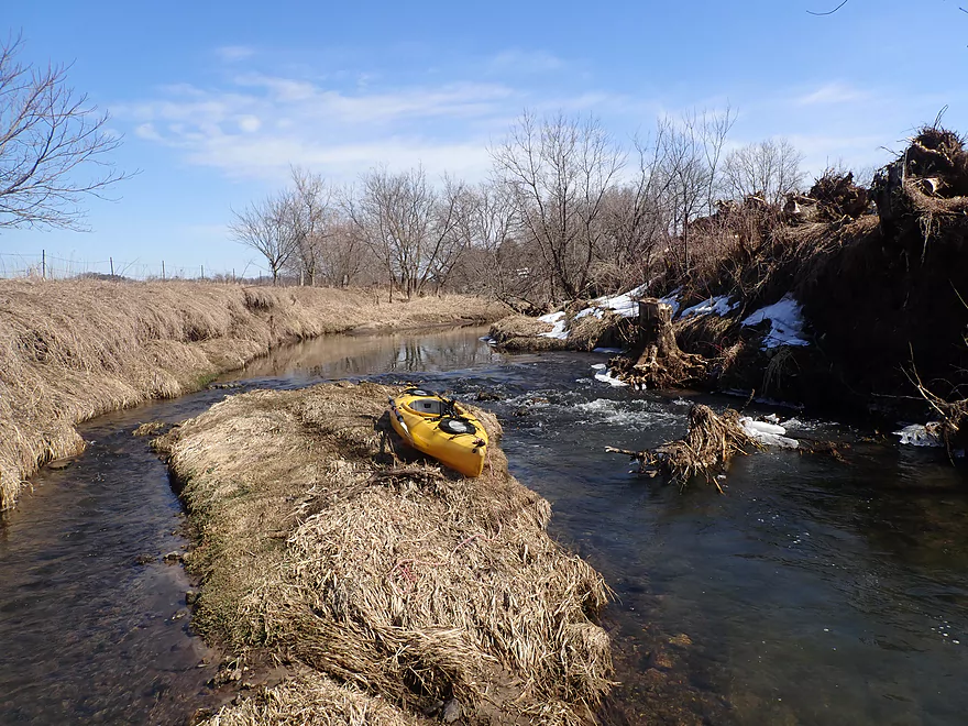
Past a washed-out farm bridge, things changed though. The terrain became scruffier as I entered more open pasture. Here bankside erosion became an issue. Ahead of me was a barbed wire fence, which I easily lifted over my head, and beyond that was a herd of cattle. Several were standing in the middle of the river, and the second was built like a bodybuilder on steroids. I groaned…it was a bull. Cows are generally friendly and I don’t worry about them on paddles. Steers you should be mindful of but generally aren’t a problem. But bulls are extraordinarily dangerous. I’ve encountered them before when kayaking, but usually I was protected by a high bank and the bull wasn’t in the water. What was worse was this stretch was extremely shallow, so I couldn’t maneuver easily. I could see a second barbed wire fence ahead, but I couldn’t reach it with the bull blocking the way and staring angrily at me. Thankfully something spooked the rest of the herd and the bull decided to follow them. I immediately paddled the 200′ needed and got under the second barbed wire fence just as the bull doubled back and started following me.
That wasn’t pleasant. Had I known there was a bull on this stretch of the Kickapoo, I wouldn’t have done this leg (and would have launched from one of the downstream Wilton access points instead). Something I could have considered in hindsight was to double back when I saw the bull and portage 2000′ around the farm along the Elroy-Sparta Trail, which wouldn’t have been fun. Hopefully the situation will improve in the future. Perhaps the DNR can bribe the farmer not to let the bull in the river (upstream and downstream easements have already been purchased). It isn’t ideal that cattle have free access to a river as they erode the shoreline and defecate directly into the stream. All those summer paddlers downstream of Ontario who take swim breaks are blissfully unaware they are partially swimming in manure from upstream pastures such as this.
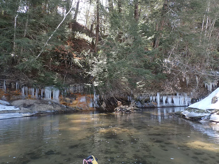
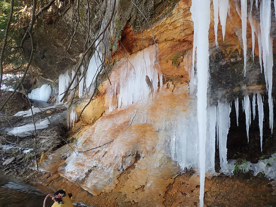
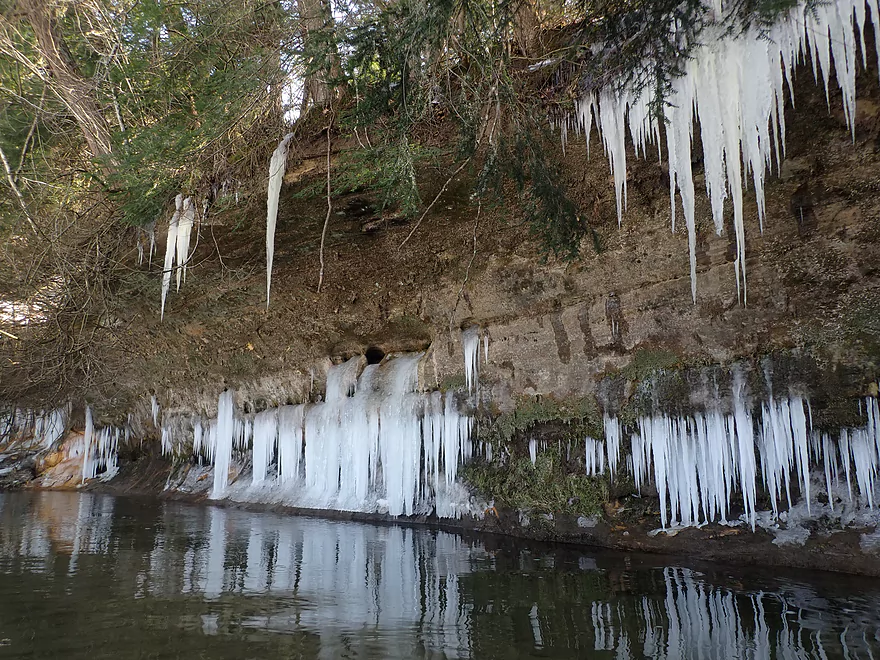
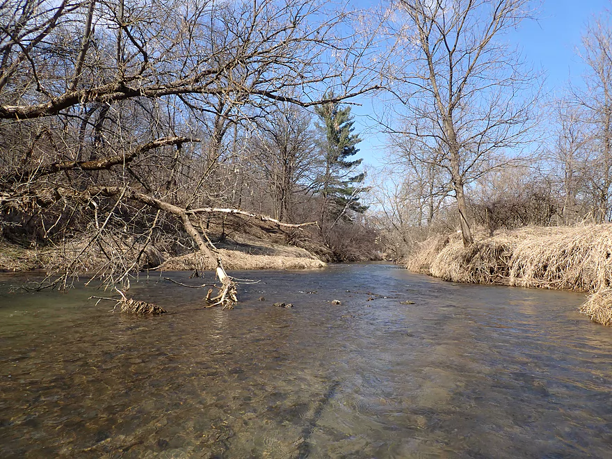
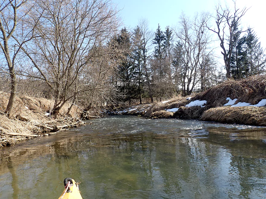
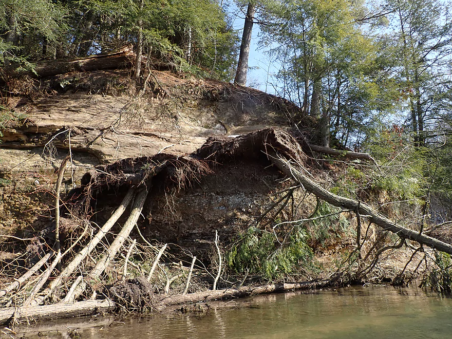
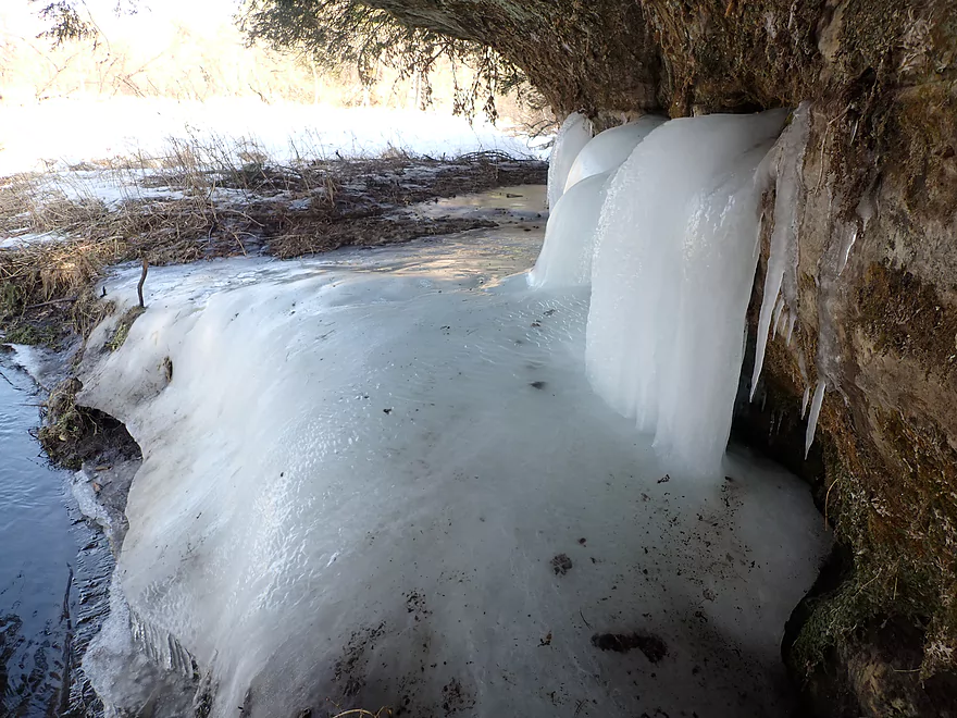
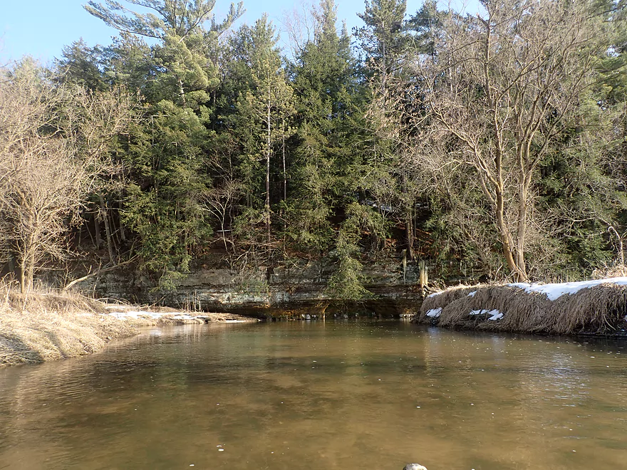
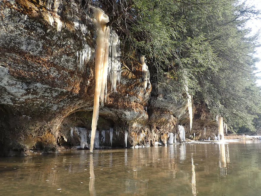
My reward for getting past the bull was a fantastic and huge north-facing sandstone outcrop. This was followed by a few smaller outcrops, smaller ice flows, and a frozen waterfall flowing out of a cliff which were all nice, but so far not as good as what I saw two years ago by Black Valley.
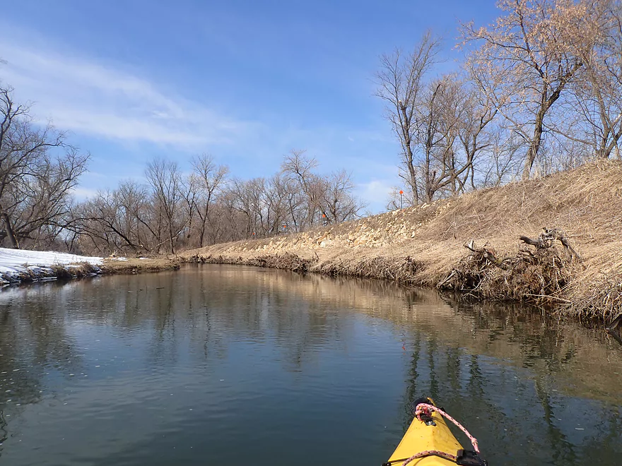
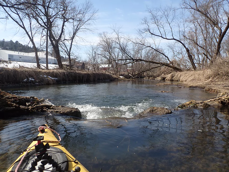
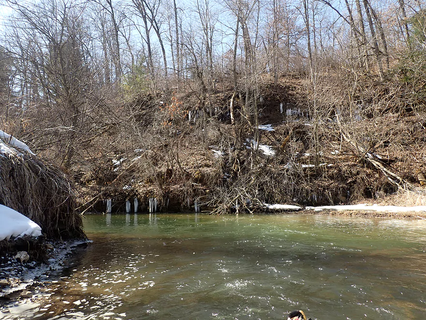
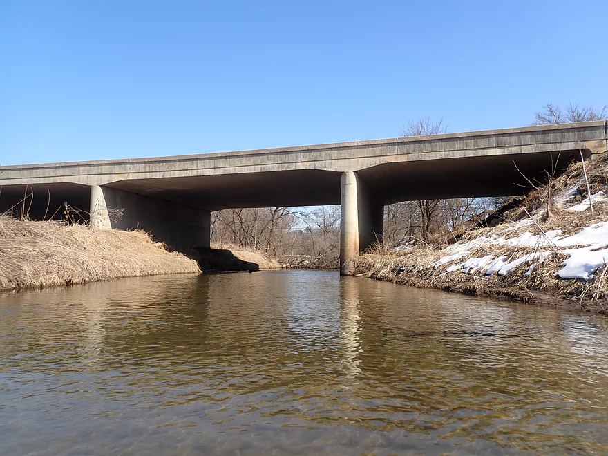
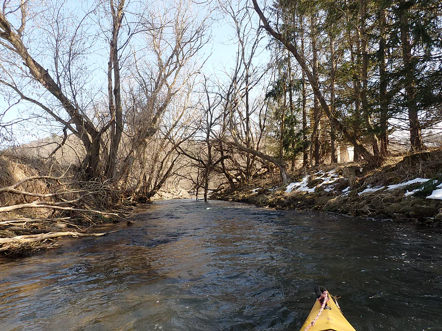
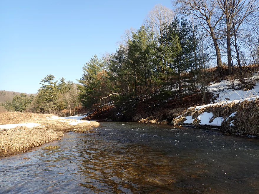
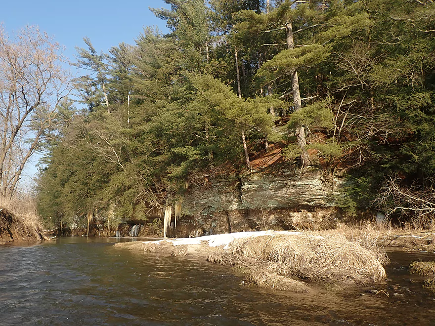
The upper leg of the trip was surprisingly clear of deadfall, but I did have to portage a tricky strainer just upstream from Wilton which was pretty easy. A long 2000’+ bluff marked the start of Wilton. Here the Kickapoo is redirected sharply south by the bluff. At the base were smaller outcrops and some better ice formations. Unfortunately this stretch was fairly shallow and bumpy.
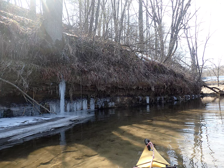
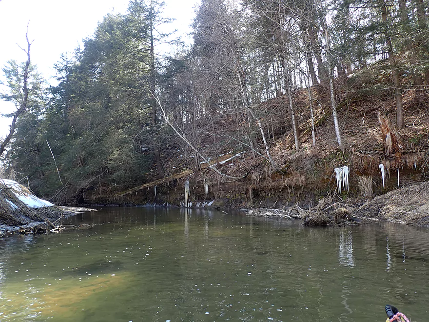
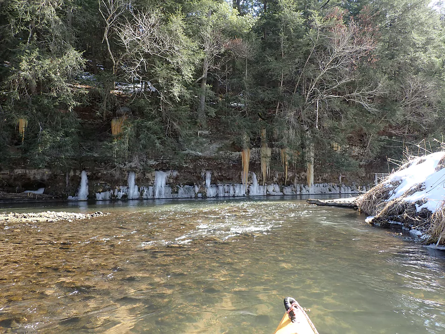
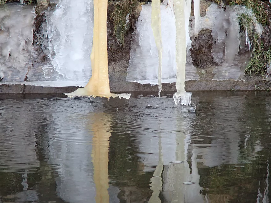
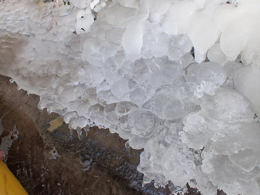
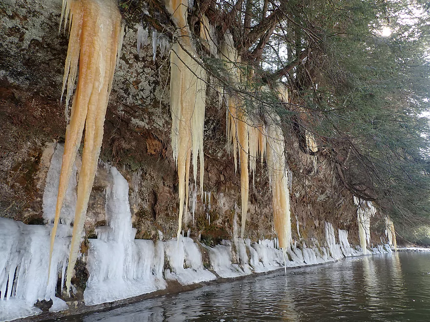
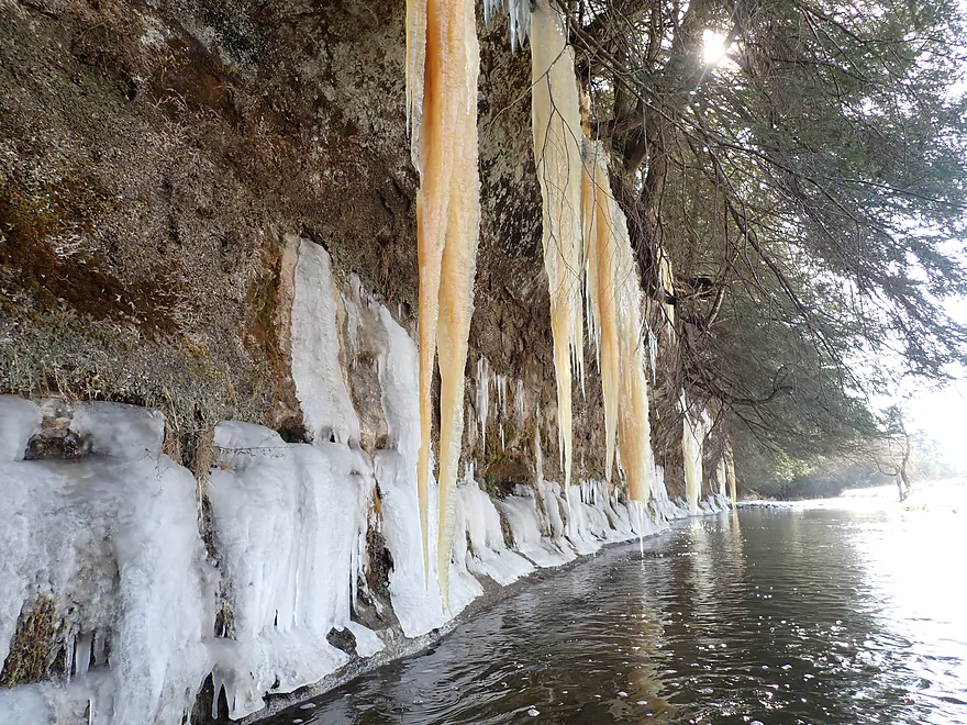
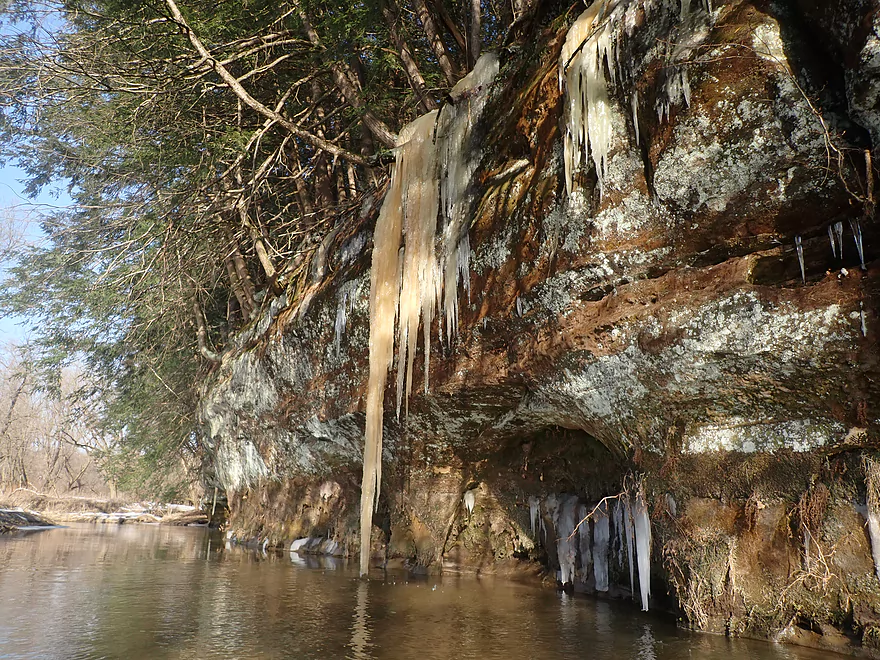
Past the Hwy 71 bridge there were some more smaller outcrops and some nice ice flows. Then the river opened up with incredible clarity. The river was redirected again this time sharply west. Here I encountered the second great outcrop of the trip and finally some fantastic ice flows. Monster-sized yellow icicles hung from the top of the cliffs, while smaller white ice sheets flowed out from cracks in the base of the sandstone. In spots the ice pooled to form round “pillows”. I initially regretted my trip timing and thought I had missed peak “seep week” by a few days, but this was likely not the case, as what I was seeing now was incredible and better than anything I had seen two years ago.
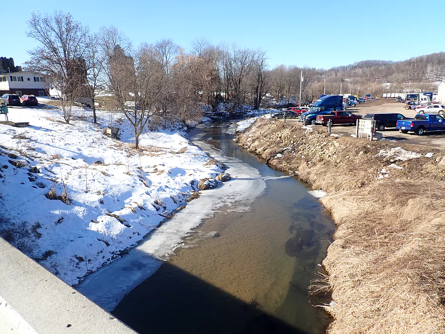
I passed the Wilton Campground/Library with conflicting emotions. This was my original planned put-in, before I opted for a longer trip at the last moment. Had I launched here, I would have skipped the bull, but I would also have also missed some great rock formations. Maybe as a compromise I could have launched from the Hwy 71 bridge, which had a huge embankment and long guardrail…but was barely viable as a put-in.
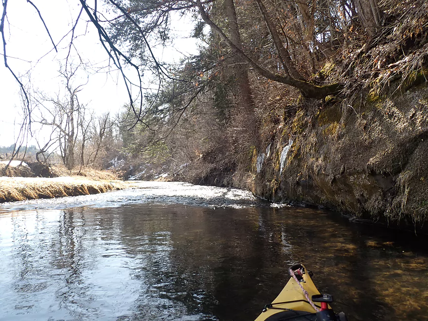
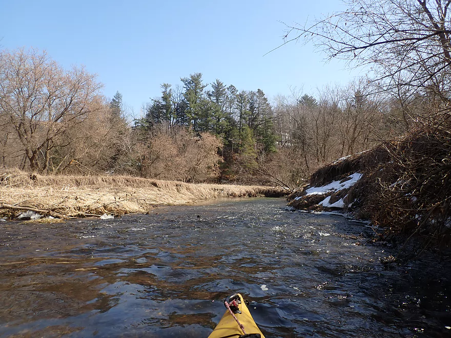
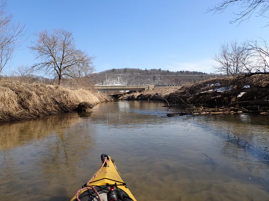
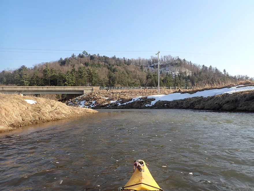
Past the library the river became a bit more scruffier but there were still a few more outcrops on this leg. By the Water Street bridge was the first major logjam of the trip which had to be portaged.
Between Wilton and Ontario, Hwy 131 crosses the Kickapoo many times. Generally speaking the river west of the road is rougher and less interesting, while the river east of Hwy 131 is more scenic and has bigger outcrops. Case in point: the west leg between the St. Paul Cemetery bridge and the Posey Creek bridge wasn’t that interesting with more beat-up banks and dead trees falling into the river. Despite this logjams weren’t much of an issue for much of the trip.
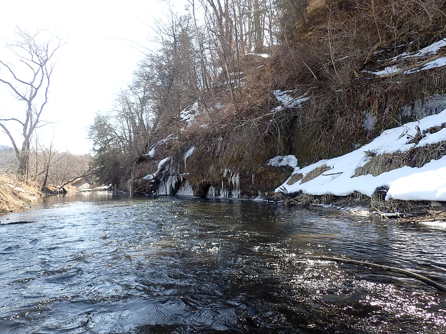
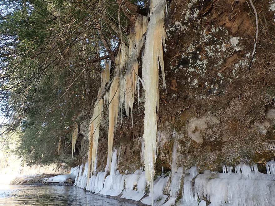
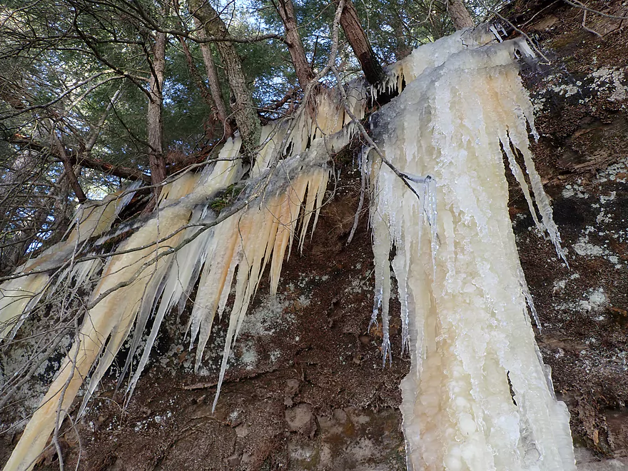
Past Posey Creek and another Hwy 131 bridge, the river became much more interesting and tidy, with a nice mix of open stretches, light rapids, and sections with cool tree canopies. Soon after the river is once again bounced west by a massive bluff. This was topped with scenic white pines and had my favorite rock outcrops of the trip. Ice was everywhere and some of the icicles that flowed from the sandstone were some of the largest I’ve ever seen.
After this eastern loop, I passed under Hwy 131 yet again to start another western leg which again for some strange reason was inferior. There were a few nice outcrops, but nothing major on the west side of the river.
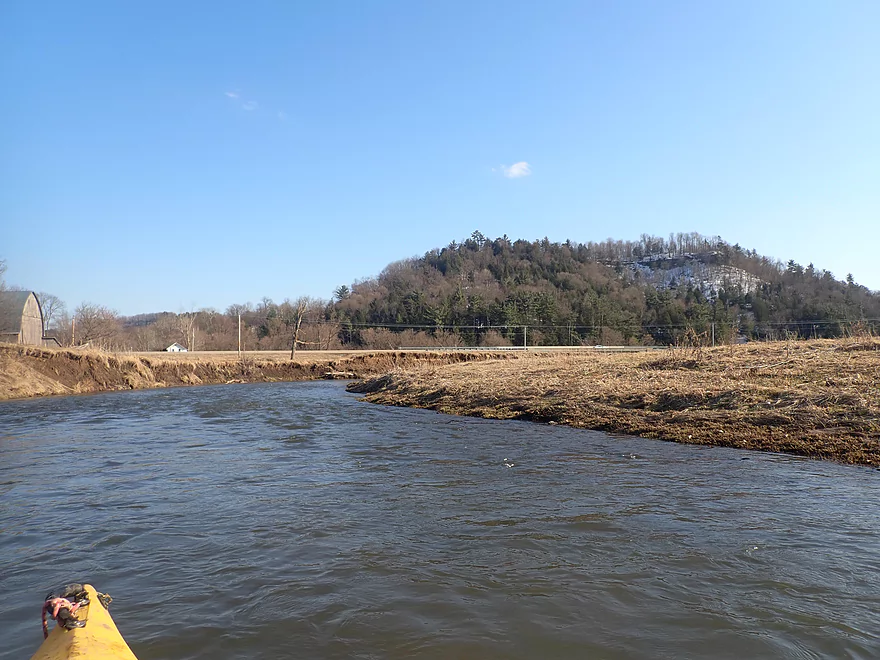
I soon approached Black Valley and what was my original put-in from my trip two years ago. The snow-capped “mountains” (hills) in the distance were really scenic from the river and inviting pines at the base suggested more outcrops. I wasn’t a fan of the Hwy 131 bridge here as an access from my last trip, so for this time around I decided to overshoot it and take out at the next bridge. I’m glad I did as it allowed me to experience the fourth major outcrop of the trip. This I had paddled past two years ago, but this time the ice was much thicker on the walls and more scenic. The trip ended with some fun rapids and a less than ideal take-out by Michigan Road.
In summary this was a great trip, but I can’t give it five stars despite the clear water, fantastic sandstone cliffs, stunning ice flows, and fun rapids. This is because of the bull on the upper leg and a few logjams on the lower leg (although they weren’t that bad). I’m not sure what to recommend about the bull. You can actually drive by the farm and see if the cattle are out on pasture before doing the trip. Maybe you could ask the farmer if they are out to pasture. Worst case scenario you could do a mega portage around the pasture on the Elroy Sparta Trail. I suspect most paddlers will simply put in at Wilton and take out later than what I did. The easier put-in in Wilton will be the library/campground, but launching from Hwy 71, while more difficult, would allow you to experience a scenic stretch of the river.
As for the ice flows these are tough to time. Typically March is the best time to see Kickapoo ice flows and they are fantastic all the way from Wilton to La Farge. But you want to make sure the river is open, enough snow has accumulated for good flows, and there hasn’t been extended warm spells that will wipe them out. Hikers can also experience great ice flows in the area. The easiest is the ice cave by Billings Creek which is super easy to access. More adventurous hikers can explore the Valley of the Ice which supposedly also has nice ice flows (but based on the pictures I think the riverside ice flows that you can only see from a kayak are still the best).
To answer the question of how far upstream on the Kickapoo you can paddle, Keystone Road might be it. Lincoln Ave and Lion Ave sure might be kind of viable as it appears they are part of a public fishing easement, but the river here is small, shallow, beat-up from open pastures, has maybe fence issues, and likely doesn’t have many outcrops (although there are some scenic rustic bridges). Continuing upstream, the watershed is stopped by a large hill that marks the divide between the Baraboo and Kickapoo watersheds, and you can’t go much further. A fantastic Elroy Sparta Trail tunnel connects these two watersheds. Kickapoo Springs located near the headwaters of the river is a state natural area, and might be worth checking out, but I suspect it is not navigable.
Sights included a few cranes, angry geese, what looked like a mink, and an apparent muskrat. The highlight was the surprising number of fish I saw including two massive schools.
Elroy-Sparta State Trail: This bike trail is famous for its three tunnels, two of which are located quite close to Wilton. In fact the largest tunnel is just a mile west of town and would be a fun side adventure to do after a paddling trip. The Elroy-Sparta Trail requires a state trail pass which you can purchase from the DNR or any state park. The exact location of all three tunnels is shown on Google maps. Unfortunately the tunnel I checked out (tunnel #2) was gated shut because apparently bats moved in and somebody didn’t want them to be disturbed.
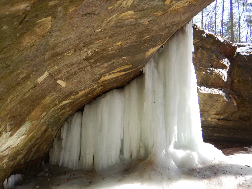
Ice Cave Trail: This is part of Wildcat Mountain State Park. In March a large amount of ice will overflow a sandstone alcove creating an impressive frozen waterfall (see main photo album).
Valley of Ice: Closer to La Farge there are a series of sandstone outcrops you can hike to which can produce attractive ice flows in early spring.
Kickapoo Springs: This is one of the primary sources for the Upper Kickapoo. I have not checked it out, but it seems intriguing. There is a DNR access area where you can hike to the springs.
Keystone Road: This is a decent bridge access. The banks are a bit steep by the river, but if you park closer to the Elroy-Sparta Trail crossing there is adequate shoulder space to leave your vehicle. However, because of a downstream bull, I’m not sure many will put in here, unless they want to risk it or attempt a long portage around the farm in question along the Elroy-Sparta Trail.
Alt Put-ins:
- Lincoln Ave (2.5 miles upstream from Keystone): River is small (likely too small for most paddlers) and more scruffy with fewer outcrops. Figure 1-2 logjams and 3 outcrops. Several of the Elroy-Sparta Trail bridges are quite scenic. High water will be required to do this stretch.
- Hwy 71 (1.7 miles downstream from Keystone): This is not an ideal access as the bridge is tall with long guardrails and a steep bank, but it should be doable for the determined. The advantage of launching here vs the downstream campground is you get to experience a few more nice outcrops including a really cool one east of Martin Warehousing.
- Wilton Library/Wilton Community Campground (2.4 miles downstream from Keystone): This is a nice public access option, although you do have to drag your boat ~250′ to the shoreline from the public parking lot.
Hwy 131 by Michigan Road: This is an ok take-out, but you do have to drag your boat up a steep embankment which isn’t fun.
Alternate Access Options: The Upper Kickapoo has oodles of bridges. In fact there is about one bridge for every river mile, so paddlers have an abundance of options to choose from. See the overview map for more options. The river downstream from Hwy 131/Michigan Road is attractive with many nice outcrops.
Hwy 131 to Keystone Road: 4.2 miles with 69′ of ascent. This is mostly an easy bike shuttle, but there are two mediocre hills to deal with. As a general rule the Kickapoo River is one of the better kayak/bike shuttles in the state because of its large number of bridges and its kayak distance/bike distance ratio is very favorable.
Rentals/Shuttles: There are a number of Kickapoo liveries, most of which are based in Ontario (just to the south). I’m not sure if any will service the river this far north, so call in advance to ensure availability:
- Kickapoo Wild Adventures: 608.337.4522 – 30352 State Hwy 131, Norwalk, WI 54648
- These guys are the furthest to the north, so may be the most willing to service the far upper Kickapoo.
- Drifty’s Canoe Rental: 608.337.4288 – Highway 33 & 131, North Ontario, WI 54651
- Fred Flasher’s Canoe Camping Trips: (608) 435-6802 – PO Box 114, Wilton, WI 54670
- Mr. Ducks Canoe Rental: (608) 337-4711 – 100 Main Street, Ontario, Wisconsin 54651
- Titanic Canoe Rental: 1-877-438-7865 – 300 State Highway 131, Ontario, WI 54651
Current: The river was pool and riffle, and overall moved quickly (significantly faster than the Kickapoo below Ontario).
Fences: There are a few fences here and there, but most were pretty easy to get around. The exception is on the upper leg (here) where a pair of low barbed wire fences are annoying but they can be lifted over your head. Between the barbed wire fences is open pasture and a dangerous bull.
The Bull: East of Wilton (exact coordinates) cattle have access to about a 300′ section of the river. Two barbed wire fences mark the start/end where the pasture intersects with the river. A bull is in this herd which makes this a dangerous situation. You might scout the area ahead of time (Hwy 71 overlooks this stretch) to see if the cattle are out to pasture. If you encounter the bull, I recommend backtracking to the washed out farm bridge. This is next to the Elroy Sparta Trail and you could attempt a long portage around the pasture (not fun). Some bull safety tips…try not to be too threatening and don’t turn your back on them. Sometimes simply clapping will get the herd to move away, but be careful not to do this too close to the bull. I suspect most paddlers will simply skip the Kickapoo upstream from Wilton because of the bull.
Logjams: Strictly speaking I only had to portage two downed trees. There were however other tight squeakers that were annoying to deal with. I’ve noted on the trip map the locations of all the major obstacles I encountered. In general the logjam situation was less serious than I anticipated but expect to get out of your boat a few times.
Rapids: There were countless Class 1 rapids. Most of which were pretty easy and the biggest concern was that water levels weren’t high enough for adequate padding.
Strainers: For the most part this wasn’t a problem despite the fast current, but I did note a few exceptions on the trip map that paddlers may want to portage.
Closest Gauge: Kickapoo River @ Ontario
Trip Depth: 8.76′.
Navigability Estimates: Note, I don’t trust the Ontario gauge as it is too far downstream and likely lags Wilton significantly. Case in point…I did this trip at 8.76′ (supposedly), yet this was much higher than my trip two years ago despite that then being at a higher 8.95′. I don’t know what to say…take the following estimates with many grains of salt. In general the upper legs are pretty shallow and you should wait for high water before attempting.
- < 8.7′: Maybe too shallow for the Kickapoo by Wilton.
- 8.7-8.8′: Most of the river will be fine, but many of the rapids will be quite bumpy. That might be a bigger deal for some compared to others. Clarity at 8.76′ was fantastic.
- 8.8-8.9′: Some shallow spots, but likely suitable for paddling.
- 8.9-9.0′: Likely a good target depth.
- 9.0-9.2′: A high depth and likely suitable for a trip. Some of the rapids might become a bit pushy.
- 9.2-9.4′: A very high depth suitable perhaps only for advanced paddlers.
- 9.4-9.6′: Only suitable for expert paddlers.
- 9.6’+: Perhaps too high for any type of kayaking.
Quick Overview
- Wilton to Ontario: 12 miles. This stretch is seldom paddled, but is cleaner and faster than downstream legs. Those willing to endure weedy bridge accesses and occasional snags will be rewarded with spectacular outcrops. A very underrated part of the river.
- Ontario to Rockton: 13.5 miles. This is the most popular section for kayaking on the river (if not the entire state). Highlights include many spectacular sandstone outcrops. This stretch can easily be subdivided. Shuttle services are plentiful, but this leg can get crowded and noisy during summer weekends.
- Rockton to La Farge: 11 miles. This is the second most popular stretch of the river. While the outcrops here aren’t as numerous as the Ontario leg, they do tend to be larger and more impressive.
- La Farge to Mouth: ~90 miles. After La Farge there are few rock outcrops and the river becomes much less interesting. The Lower Kickapoo is a generic hardwood floodplain that is at best a mediocre paddle.
- Tributaries:
- Kickapoo River – West Fork: While lacking the outcrops of the main branch and a bit shallow in spots, this is a very underrated river with many fun rapids.
- Billings Creek: I actually like this creek better than the main river itself. There are just as many outcrops, and the water and banks are much cleaner.
- Tainter Creek: While not very big and lacking in outcrops, it’s still a cool creek with very swift current.
Detailed Overview
- Upstream from Lincoln Ave: The river is likely too small and degraded by open pasture to have much appeal for kayaking. Although "Kickapoo Springs" (the primary source of the river and a public DNR area) might be interesting.
- Lincoln Ave to Keystone Road: 2.5 miles. The river is small here (likely too small for most paddlers) and more scruffy with fewer outcrops. Figure 1-2 logjams and 3 outcrops. Several of the Elroy-Sparta Trail bridges over the river are quite scenic/rustic. High water will be required to do this stretch.
- Lincoln Ave to Hwy 131 (East of Midge Road): 6.3 miles.
- Lincoln Ave to Hwy 71: 1.6 miles. Section includes five outcrops, including one really nice one. River is shallow here with many Class 1 rapids. There is one strainer that has to be portaged, but no other logjams. I encountered a bull on this stretch (here) which might be a deal breaker for most paddlers. You could possibly portage around the farm in question along the Elroy-Sparta Trail but it would be a long and difficult portage.
- Hwy 71 to Wilton Campground/Library: 0.7 miles. A nice stretch with ~3 mediocre outcrops and one really nice one. Water clarity is stunning here. There is a low tree that requires some tight ducking to get under.
- Wilton Campground/Library to Hwy 131 (by Posey Creek): 1.4 miles. Less attractive stretch but still ~4 mediocre outcrops. There is a serious logjam by Water Street that must be portaged.
- Hwy 131 (by Posey Creek) to Hwy 131 (by Mica Rd): 1.3 miles. A terrific stretch with scenic pine trees, several mediocre outcrops and one fantastic sandstone outcrop.
- Hwy 131 (by Mica Rd) to Hwy 131 (East of Midge Rd): 0.7 miles. More of a scruffy stretch, but still a few mediocre outcrops. The Black Valley hills in the distance are very scenic from this leg.
- Hwy 131 (East of Midge Road) to Hwy 131 (near Nicollet Ave): 4.1 miles.
- Hwy 131 (east of Midge) to Hwy 131 (by Michigan Ave): 0.5 miles. A good leg with one nice set of outcrops.
- Hwy 131 (by Michigan Ave) to Hwy 131: 0.6 miles. Another good leg with 3 outcrops. Some minor rapids, including a 4-6" ledge.
- Hwy 131 to Hwy 131 (by Nisswa Rd): 0.6 miles. One of the best legs on the Upper Kickapoo which features 6 noteworthy outcrops and terrific ice flows in February and early March.
- Hwy 131 (by Nisswa Rd) to Hwy 131 (by Nordale Ave): 1.1 miles. Not as scenic as other legs with messy shorelines and eroded banks. There are still a few nice outcrops.
- Hwy 131 (by Nordale Ave) to Hwy 131 (by Nicollet Ave): 1.3 miles. Another one of the Upper Kickapoo's best legs with ~6 outcrops, including a small natural bridge you can paddle through.
- Hwy 131 (near Nicollet Ave) to Ontario: 5 miles.
- Hwy 131 (by Nicollet Ave) to Hwy 131 (Oil City): 2.3 miles. Two long stretches of bluffs contain great outcrops.
- Hwy 131 (Oil City) to Hwy 131 (Kickapoo Wild Adventures): 1.4 miles. Terrific stretch with two major outcrops. One set of Class 2 rapids.
- Hwy 131 (Kickapoo Wild Adventures) to Ontario (Brey Valley Road Park): 1.5 miles. Three sets of outcrops.
- Ontario to Hwy 131/Bridge #4: 3.6 miles. A more open and flatter stretch of the Kickapoo. There are still 3-4 outcrops. This is THE most popular leg on the entire river.
- Bridge #4 to Bridge #7: 6.0 miles.
- Bridge #4 to Wildcat Landing: 3.1 miles. A super popular stretch and the most scenic on the Kickapoo. River flows past steep hillsides and many outcrops (at least 16).
- Wildcat Landing to Bridge #5: 0.9 miles. River opens up a bit, but still has three super sandstone outcrops.
- Bridge #5 to Bridge #7: 2.1 miles. A good stretch with seven major outcrops and one cave.
- Bridge #7 to Bridge #14: 7.7 miles.
- Bridge #7 to Bridge #8: 1.2 miles. From bridge #7 onward, the Kickapoo becomes much less interesting. There are still some good spots though. This stretch has maybe 3 outcrops.
- Bridge #8 to Bridge #10: 2.5 miles. A good stretch with 5-6 outcrops.
- Bridge #10 to Rockton/Landing #12: 1.4 miles. This stretch is more open, and less interesting. But there are still 3-4 mediocre outcrops.
- Rockton to P/Bridge 14 Canoe Landing: 2.4 miles. A scenic stretch with 5 noteworthy outcrops–three of which are huge.
- Bridge #14 to Bridge #18: 5.1 miles. A great stretch with a covered bridge and 5+ outcrops...several of which are huge (the largest on the river).
- Bridge #18 to La Farge: 4.1 miles. This is a more open stretch with just 2-3 outcrops. It's more open and less interesting, but not bad and includes a historic stretch past the uncompleted La Farge dam.
- La Farge to Hwy 131 (by Ski Hill Road): 6.8 miles. Nice section but with a few jams.
- Hwy 131/Ski Hill Road to Viola (Banker Park): 7.0 miles. Maybe 2 bluffs, but mostly open I think. Have been told there are 26 portages between La Farge and Viola, so beware.
- Viola to Hwy 131 - Bridge 1: 5.8 miles. Maybe one outcrop and 14 major logjams.
- Hwy 131 - Bridge 1 to Hwy 131 - Bridge 2: 4.3 miles. Maybe one outcrop and 13 major logjams.
- Hwy 131 Bridge 2 to Readstown Tourist Park: 3.0 miles. Maybe one outcrop and three major logjams. The river grows significantly with the addition of the West Fork.
- Readstown Tourist Park to Soldiers Grove: 6.9 miles.
- Readstown to Hwy 61: 3.1 miles. A surprisingly nice stretch with impressive hills and good current. On the downside there is a lot of tree debris although it is always avoidable. Hwy 61 is not a good access.
- Hwy 61 to Soldiers Grove: 3.8 miles. Not as good as the previous leg with fewer hills, muddier banks, and slower current, but still not bad. The highlights include a few impressive bluffs and two minor rapids in Soldiers Grove.
- Soldiers Grove to Hwy B: 9.0 miles. I doubt there are logjams, but I think this stretch would not be very interesting. The river flows through one of the wider flood bottoms on the river.
- Hwy B to Hwy S: 8.6 miles.
- Hwy B to Gays Mills: 4 miles. Fast stretch with some strainers. Bank quality is poor, but the bluffs are attractive. A dam in Gays Mills slows the last mile of this leg.
- Gays Mills to Hwy S: 4.6 miles. A pleasant but not elite leg with some nice bluff vistas.
- Hwy S to Haney Valley Road: 5.8 miles.
- Haney Valley Road to Taylor Ridge Road: 3.6 miles. Likely an ok prospect. Note, Taylor Ridge Road is aggressively fenced by the local farmer and would be a difficult access.
- Taylor Ridge Road to Steuben Landing: 5.0 miles. A good prospect with likely some nice bluffs. Note, Taylor Ridge Road is aggressively fenced by the local farmer and would be a difficult access.
- Steuben Landing to Hwy 179: 2.9 miles. A mediocre prospect.
- Hwy 179 to Plum Creek Landing: 11.8 miles. A good prospect with nice bluffs.
- Plum Creek Landing to Hwy 60: 6.7 miles. Starts uninteresting with fast current, but features some surprisingly nice bluffs and overall was a decent trip.
- Hwy 60 to Lowell Geitz Memorial Boat Landing: 2.7 miles. This stretch mostly lacks interesting bluffs but does feature wetgrass and floodplain forests as part of the Wauzeka Bottoms State Natural Area.
- Take-out options on the Wisconsin River:
- Lowell Geitz Memorial Boat Landing to Adiantum Woods State Natural Area: 2.5 miles. This is mostly a downstream trip on the Wisconsin River.
Trip Map
Overview Map
Video
Photos Size: