
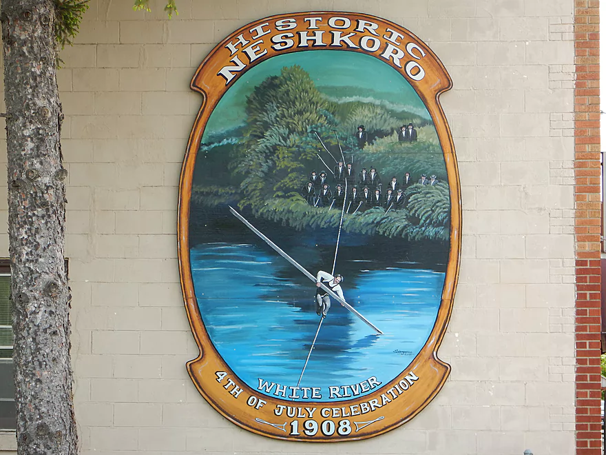
Neshkoro had some rebellious forefathers
Local park is a very good put-in
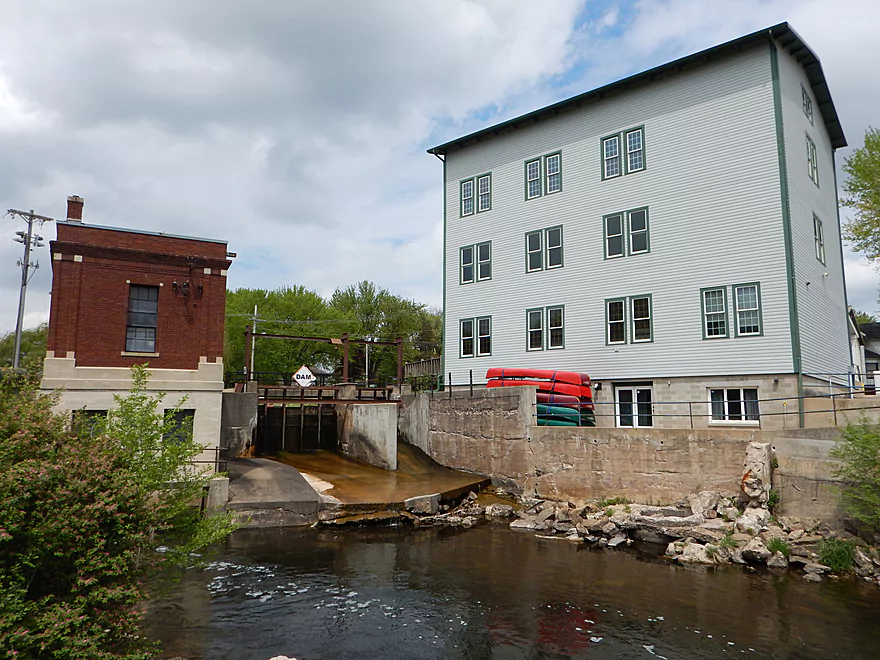
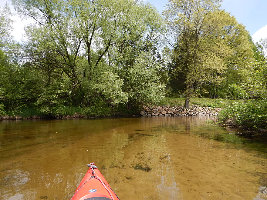
Stack of canoes by the dam
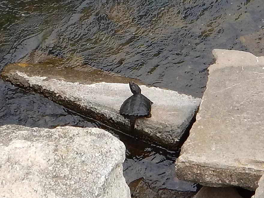
One of two snapping turtles I saw
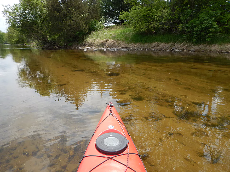
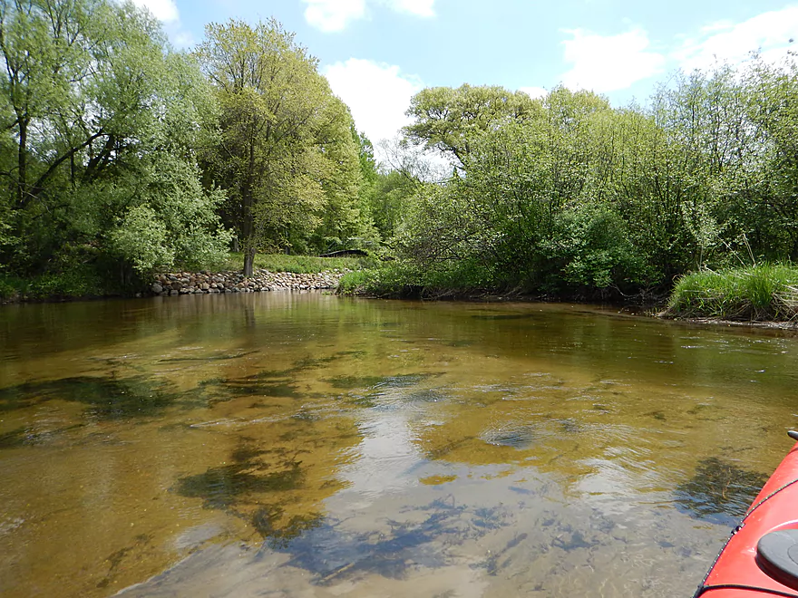
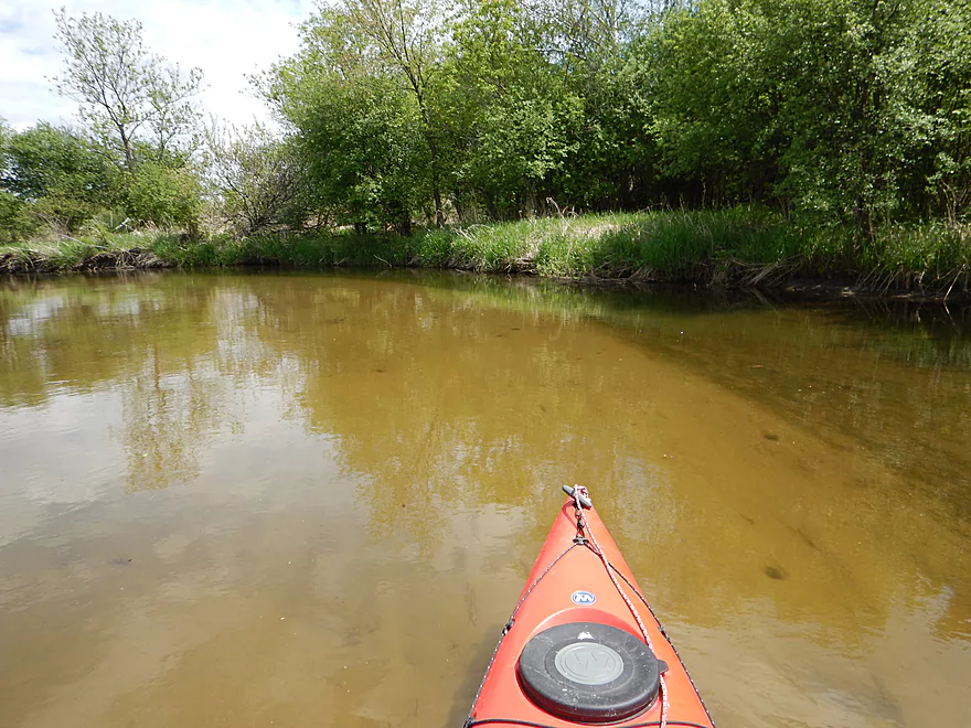
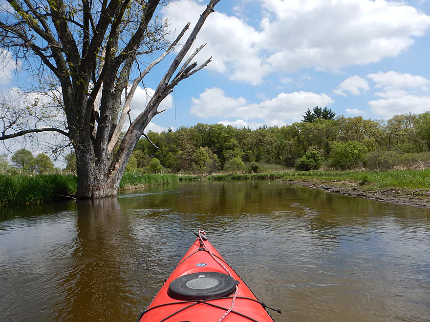
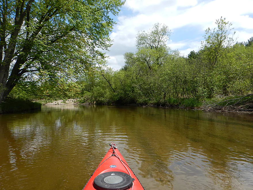
Beautiful red water and rocky substrate
Some fun riffles below the dam
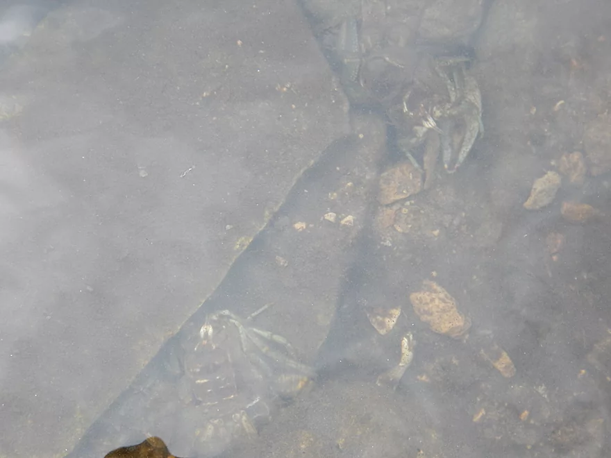
Saw a number of crayfish
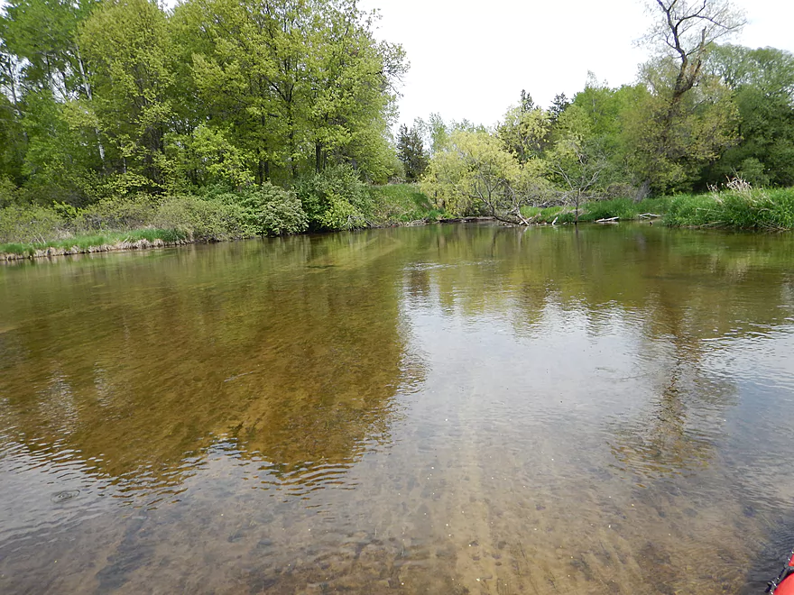
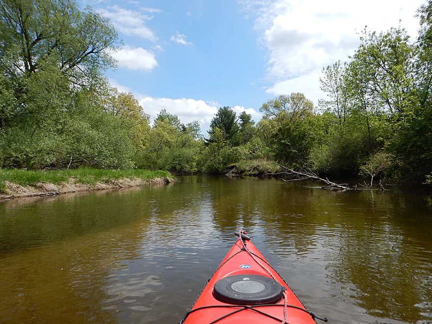
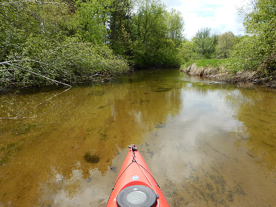
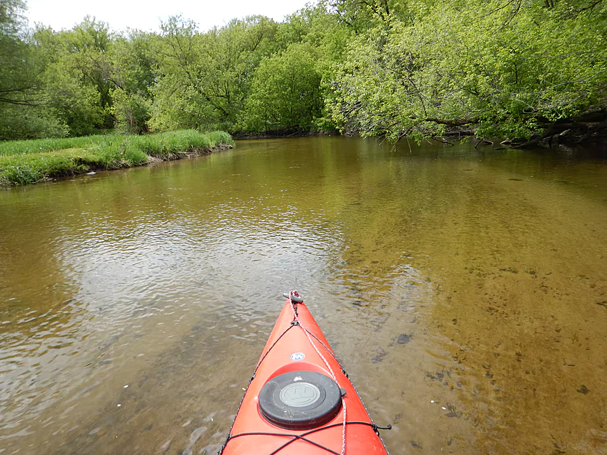
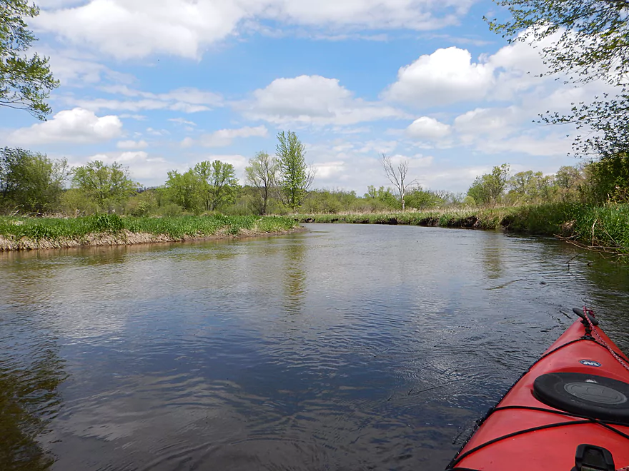
Gorgeous water
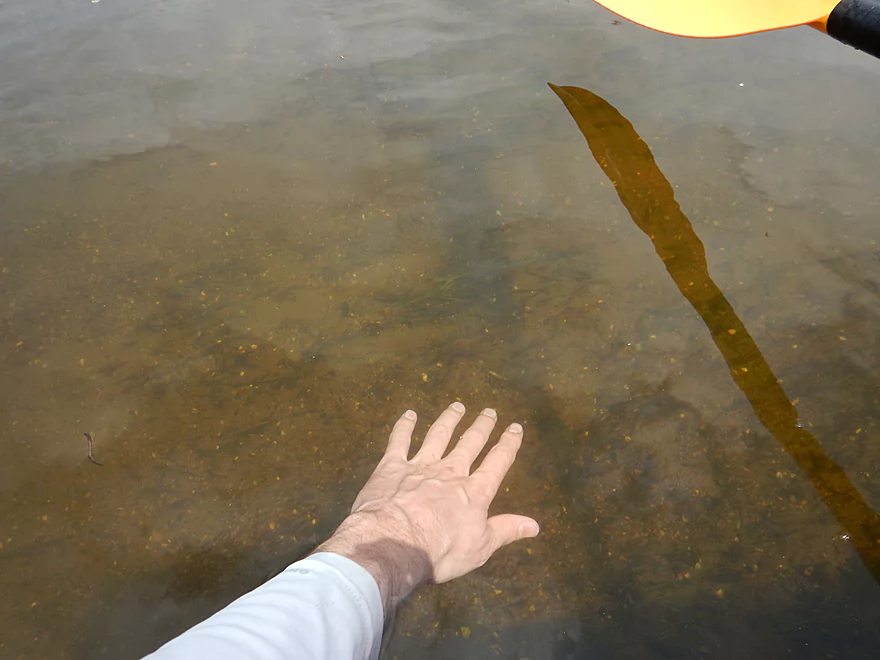
You can hardly tell my hand is underwater
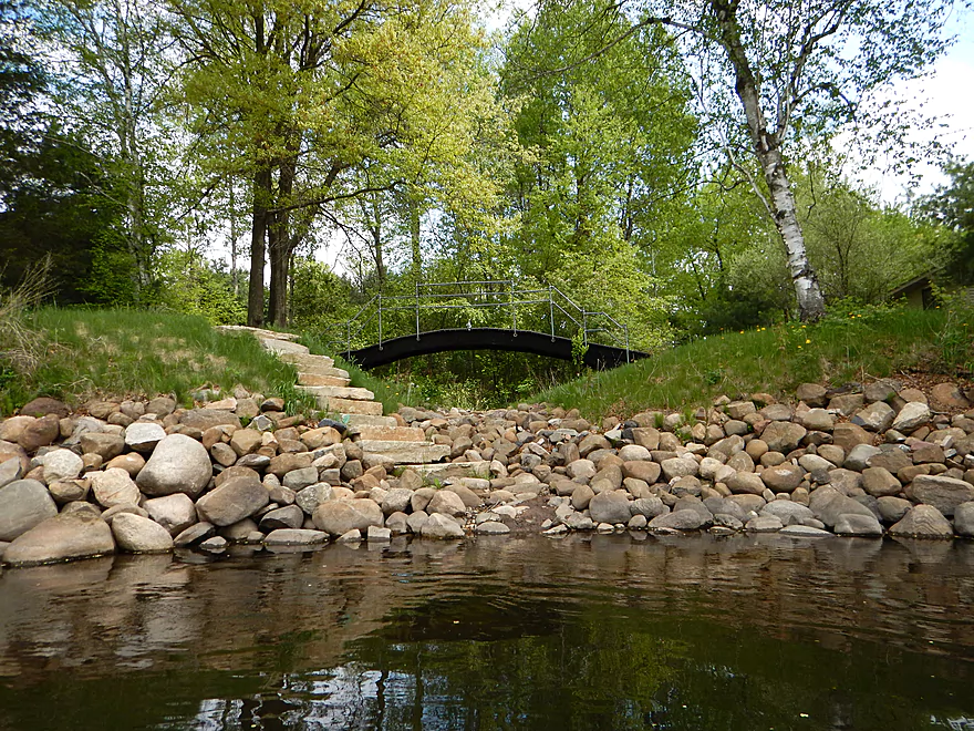
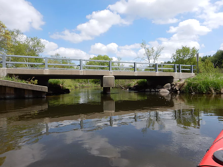
Bridge to nowhere
Interesting stratification
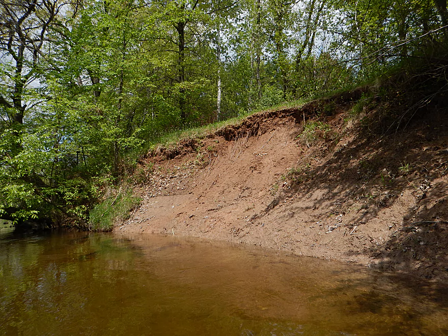
One of several clay banks
This does get well cleaned out
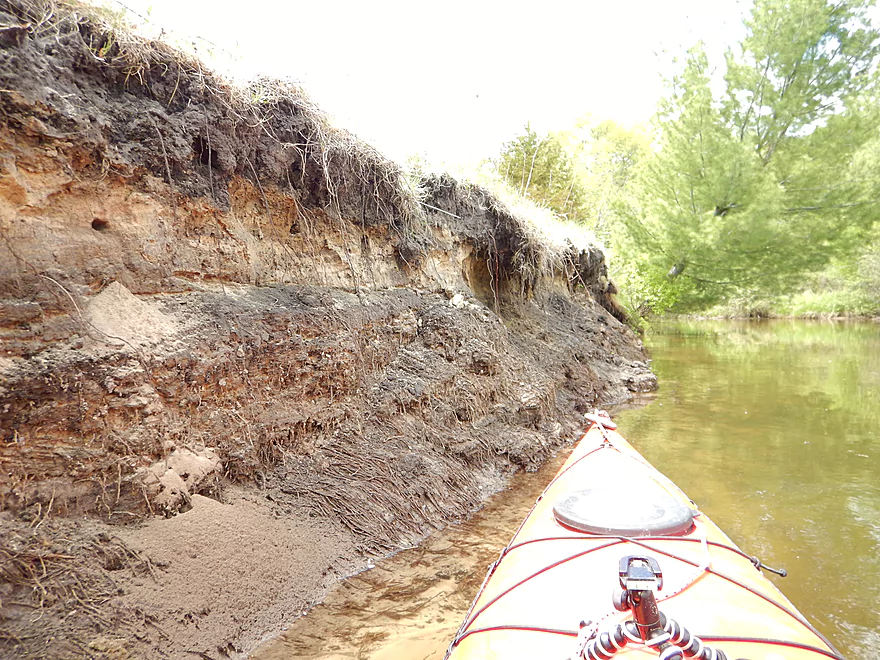
Quite the root network
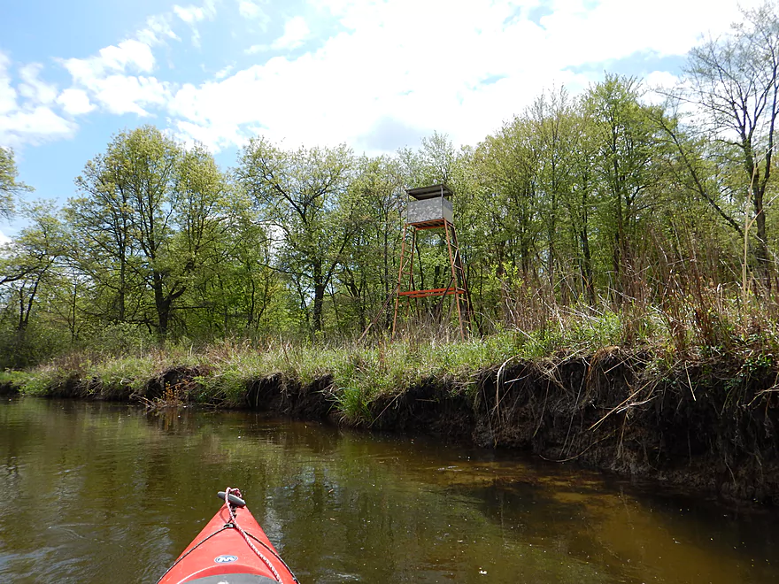
Several hunting blinds along the river
Almost picnic worthy
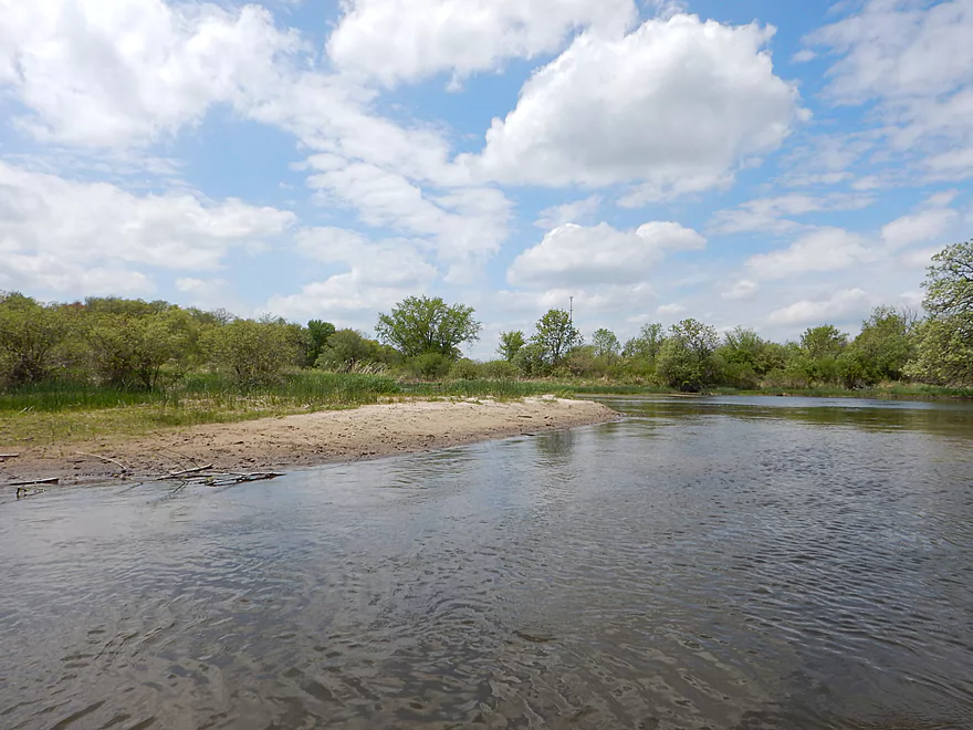
Paddling over the Sahara
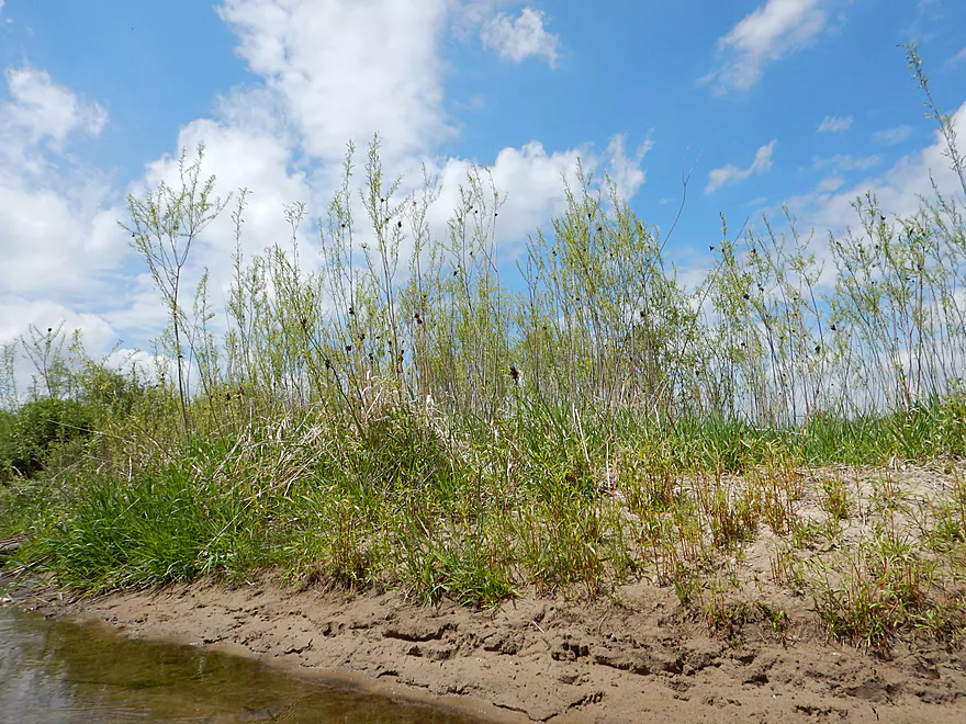
Young willows taking root on a sandbar
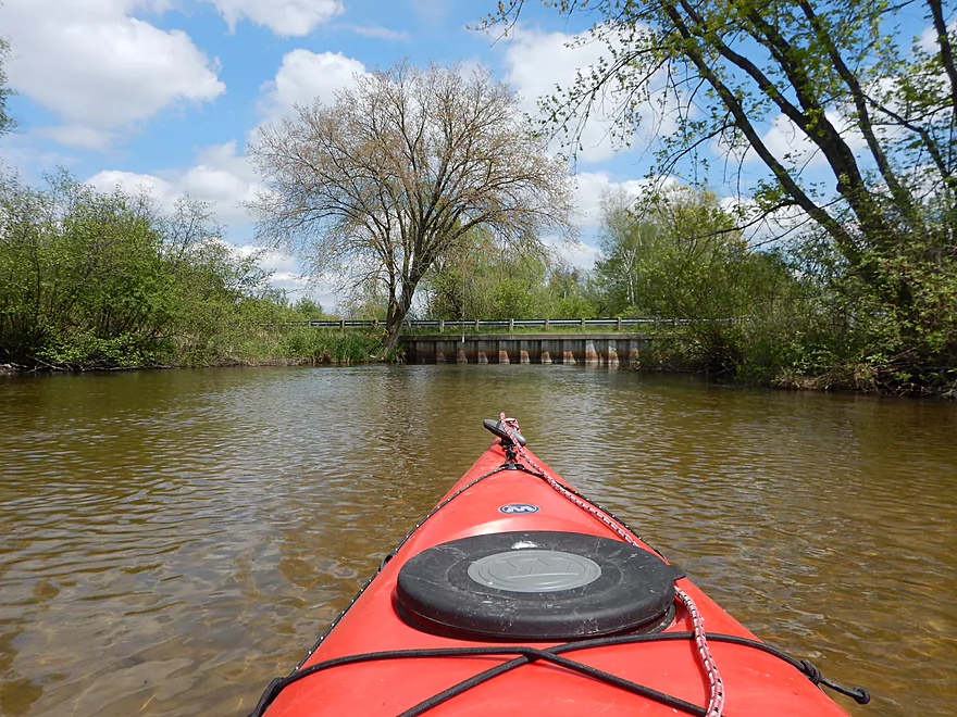
Coming up on Hwy 22
I put in here on a previous trip
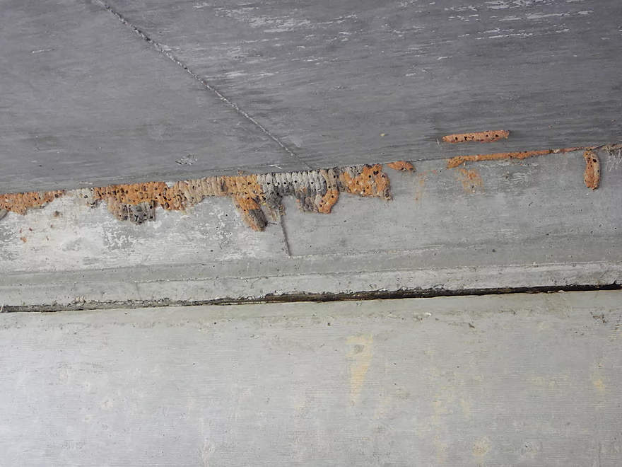
Curious color variations in the mud dauber nests
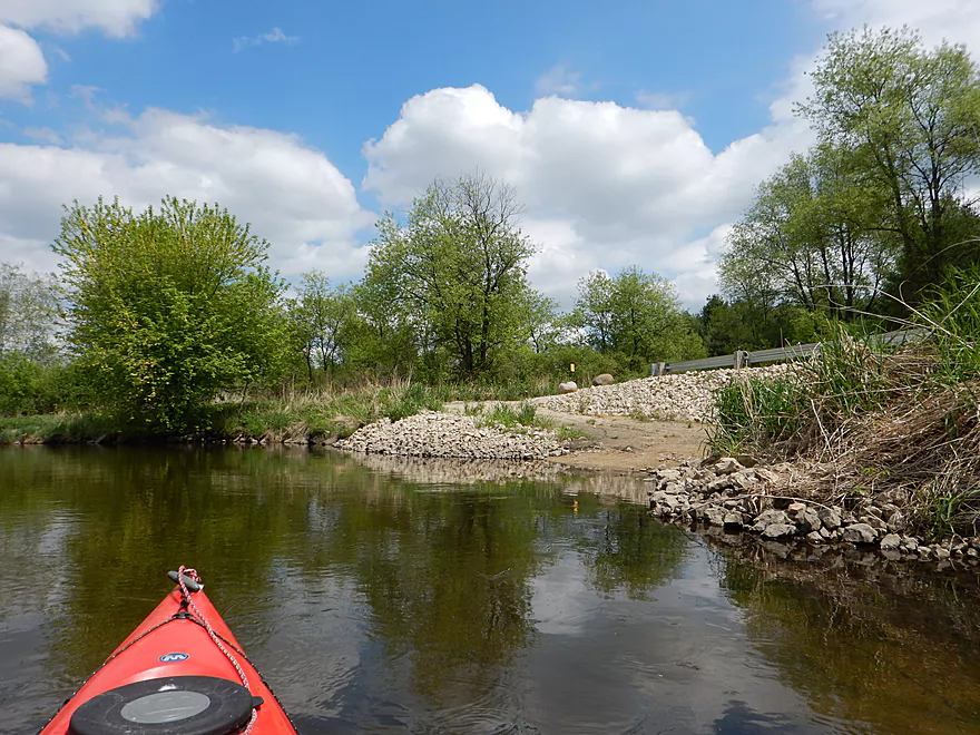
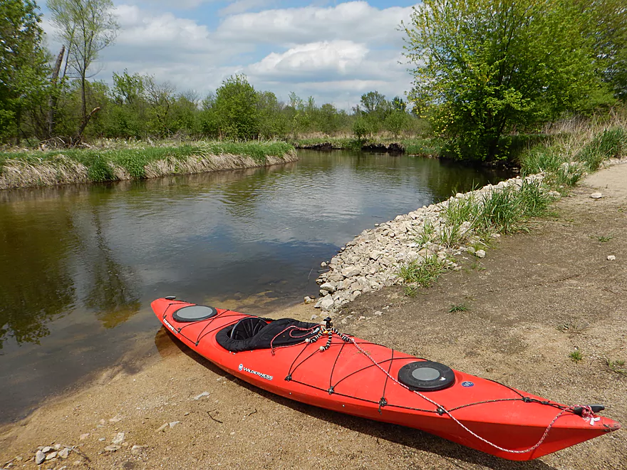
Very nice canoe launch just downstream from Hwy 22
Photos are always better with kayaks in them
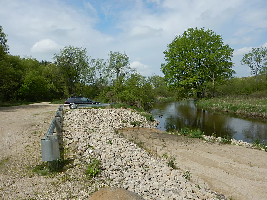
Great parking
Scouting the portage path at Hwy YY dam
Scouting the boat landing off of Pine View Road
White River – Neshkoro


Put-in:
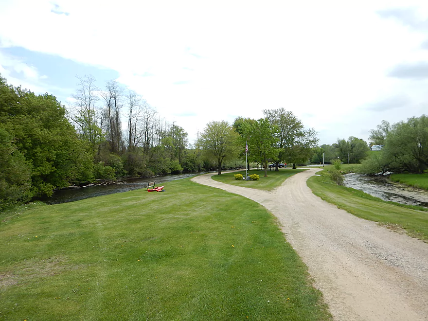
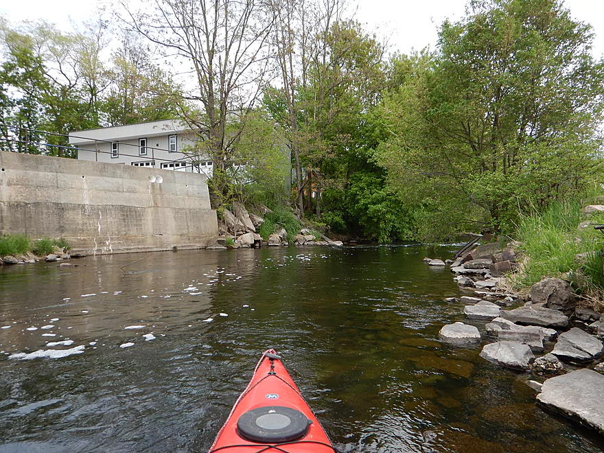
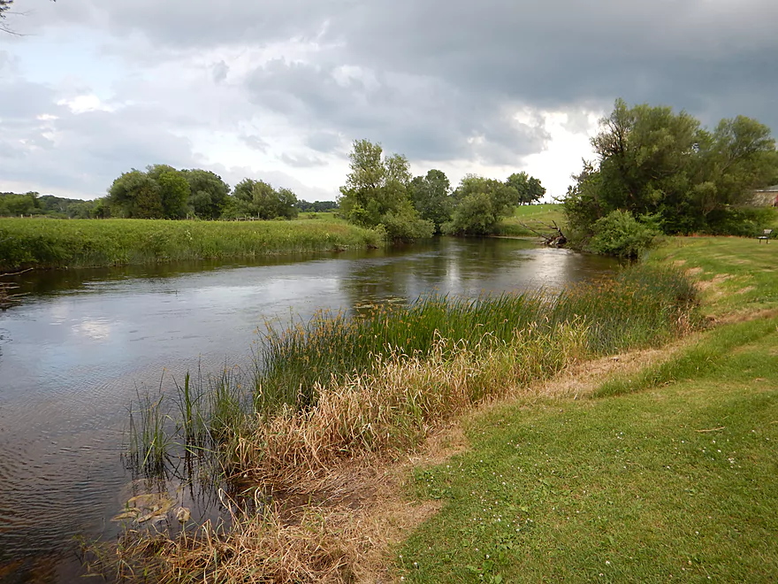
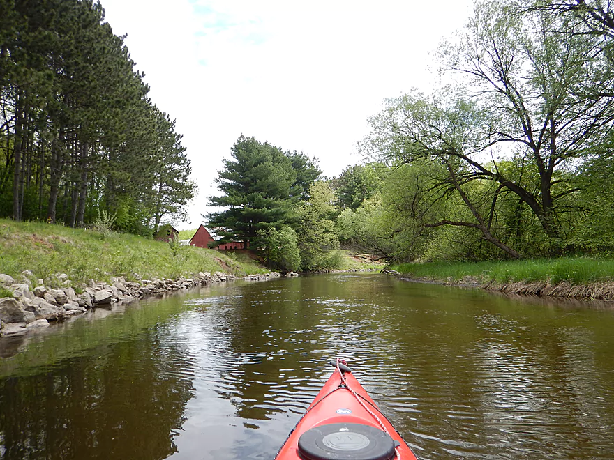
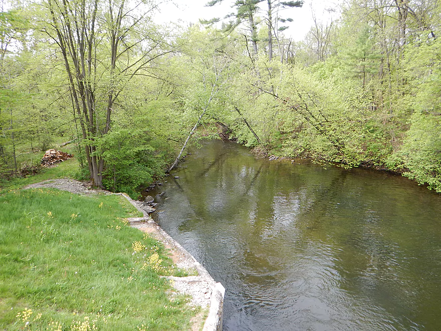
There is a public park by the Neshkoro Dam which makes for an easy put-in. Here there are class 1 rapids and crystal clear water with a wonderful red hue. If you put in close to the dam, you can run the rapids.
Take-out:
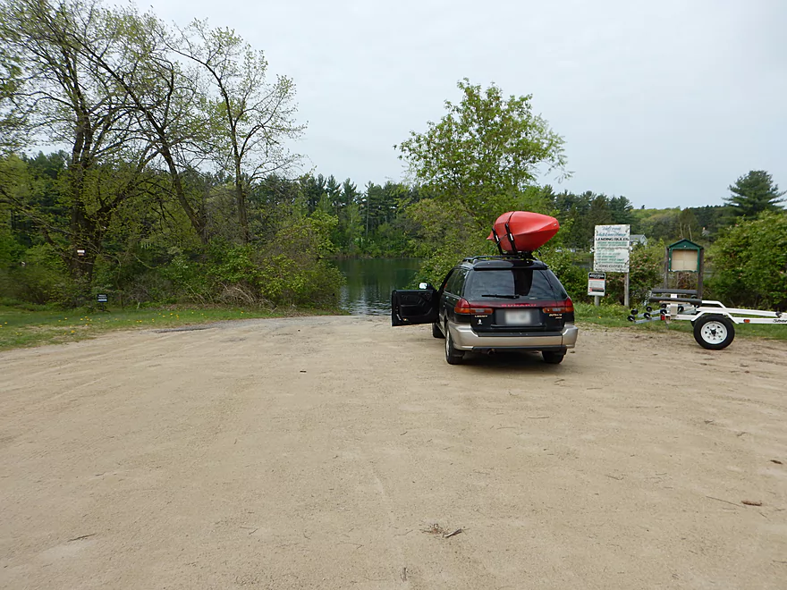
I made the mistake last year of using the 22nd Ave bridge for a put-in. That’s doable but not ideal. There is a proper landing just around the bend with superior parking and a launching ramp.
Shuttle Information:
Bike shuttle is 3.8 miles with some annoying hills. But manageable. I saw a lot of stacked canoes at the dam and wonder if somebody is starting a livery? If you know anything about this, leave a comment below and I’ll update the review.
Hazards and Log Jams:
None. Bumped into tubers last year who told me they cleared this section out with a Sawzall which is very much appreciated.
River Depth, Navigability and Current:
There aren’t any local gauges and I don’t trust the nearby ones. This is in part due to the two upstream dams and the watershed’s narrow profile (which means it drains faster than fat watersheds). The White was deeper than last year when I paddled it, yet was still probably at an average level. I doubt this river ever gets too small to run, but probably shoots up quickly after a heavy rain due to its small size. This is kind of a one-trick pony river in that you do it for the really cool clear water…so I suggest paddling it on the low side if possible.
It is rumored the Neshkoro dam operator does weekend releases to help out tubers (questionably legal, a possible cause of erosion and not needed IMO).
Current is slow but steady.
Substrate and Water Quality:
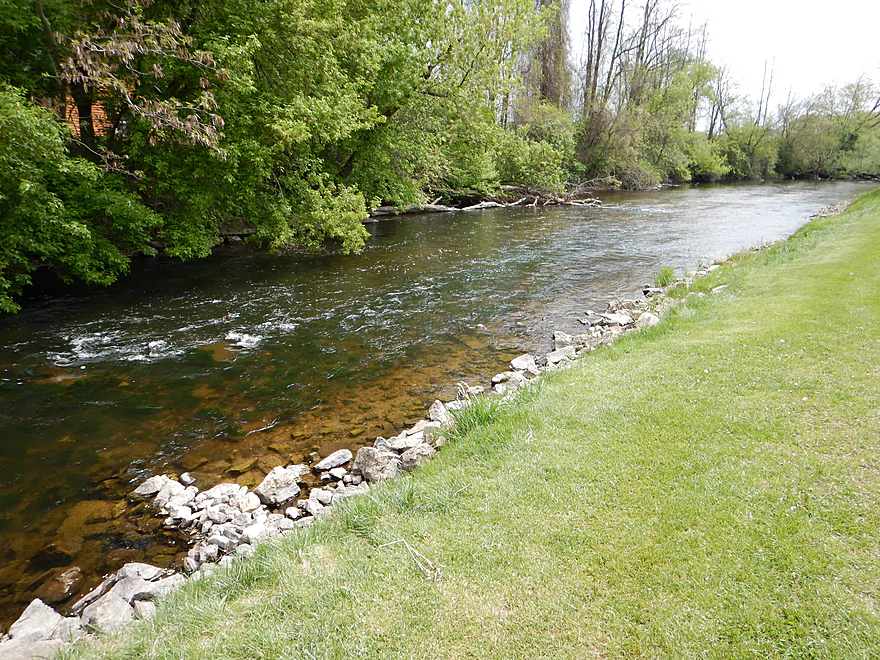
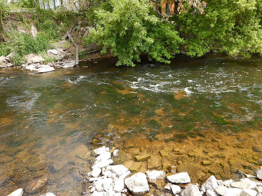
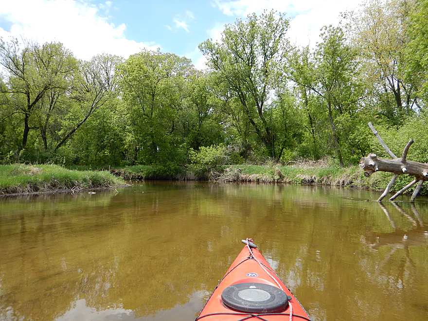
Fantastic rocky substrate to start the trip, but this quickly gives way to a mostly sandy bottom with some clay and silt. At times the sand/silt/clay stratify creating cool lines in the river. Water clarity was fantastic and the highlight of the trip. My video illustrates this better than the photos.
Wildlife:
Crayfish, clams, dragonflies, ducks, gar, a big fish I didn’t recognize, a couple of snapping turtles, many painted turtles, a muskrat (or beaver), mud daubers and surprisingly just a few geese (snapping turtles do eat goslings, so perhaps geese don’t like to nest here). The mud dauber nests were cool (as always). These parasitic wasps build their mud “organ-pipe” nests with mud and then stuff them with not-always dead spiders to feed baby wasplings. What was unique about these was the color variations…some wasps used more clay than others which created a cool color contrast (see picture below).
The Trip:
This wasn’t in the plans. I had a trip lined up in Southern Wisconsin, but cancelled because of forecasted rain. Instead I was going to do a trip up north (kayaking trick…if there is rain in the forecast find another spot in the state that doesn’t have rain). After 90 minutes driving up north, my car started misbehaving so decided to abort and return home. While driving back (at 30 mph), I saw Neshkoro directly on my route and decided why not, as it was a short trip and if my car was going to die, 6 or so extra miles wasn’t going to make a difference. I’m glad I did as it was a nice trip and my car did ultimately survive back to my place.
Last year I had done a stretch of the White River from 22nd Ave to Hwy D (just downstream from this segment). A mostly pleasant river with terrific water quality and abundant wetgrass. It was a frustrating experience though because a storm was rolling in (kind of like this trip) and I wanted to be off the water as fast as possible. This (and a tough pair of muddy log jams) probably jaded my view of what was otherwise a very nice river. This reviewed section is just 4 miles upstream of that section and is generally superior and more enjoyable.
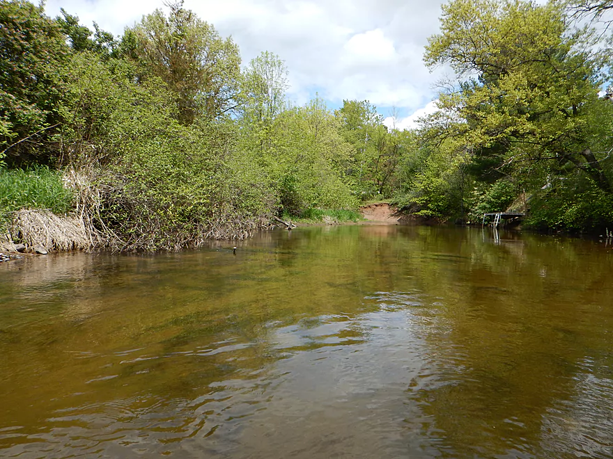
There isn’t too much to say about this stretch other than it was very peaceful and the water was so clear. Some houses, but this is mostly a wilderness paddle. The banks are much steeper here than downstream and there are some cool red clay banks along the river. Nothing super exotic, but all in all a nice pleasant river and trip.
Detailed Overview
Main Branch:
- Swamp Road to Wautoma Library: (1.94 miles) An interesting prospect with a few log jams. Unfortunately this is scheduled to be turned into a flowage in spring of 2017.
- Wautoma Wetlands Park to the Fire Department: (1.19 miles) A super scenic section but too clogged with jams. Reviewed here.
- Fire Department to Chicago Road: (0.8 miles) A good section with two down trees to circumnavigate. Reviewed here.
- Chicago Road to Cottonville Lane: (2.47 miles) A very nice section. Reviewed here.
- Cottonville Lane to Pine View Road Landing: (2.1 miles) Mostly open flowage paddling, which I assume is uninteresting.
- Pine View Landing to Czech Lane: (4.7 miles) A nice prospect on my to-do list, but will have some down trees and a dam to portage.
- Czech Lane to Neshokoro Dam: (2.64 miles) Probably uninteresting as this is mostly flowage paddling.
- Neshkoro Dam to 22nd Ave Canoe Launch: (3.43 miles) A very good prospect I review here.
- 22nd Ave Canoe Launch to Hwy D: (8.3 miles) A good section that I reviewed here. Liked the stretch, but found the log jams frustrating. Have been told that the main obstructions have been recently cleared out though.
- Hwy D to White River Road: (4.2 miles) A good prospect I had written off due to fear of log jams, but per Tim is mostly clear now.
- White River Road to Mouth on Fox River: (2.1 miles) Am unsure of this stretch and if log jams are an issue?
- Fox River Options After White River Mouth
- You can paddle 1.25 miles upstream to the White River Locks which is a great take-out option
- You can paddle 0.7 miles downstream to Huckleberry Lane where there is a small area for taking out (am not sure this is public or private though)
West Branch:
- Upstream of Hwy T: This leg may have too many logjams. A bigger concern is that the upstream bridge (13th Ave) has a very steep embankment so there really isn’t a good put-in option.
- Hwy T to Hwy 21: 2.2 miles. Very scenic leg with perfect clarity and a number of pine trees. On the downside it is a bit small and obstructed at times. Figure 7-8 logjams total, but it might be worth it.
- Hwy 21 to Cottonville Ave: 2.9 miles. Maybe 6 logjams, but a super scenic stretch with many pine trees. On my todo list.
- Cottonville Ave to Cottonville Lane: 5.0 miles.
- Cottonville Ave to Hwy 22: 2.2 miles. Great stretch with clear sandy water and nice pine trees. Two logjams and one log bridge, but manageable portages.
- Hwy 22 to Mouth on White River: 0.4 miles. Great stretch with more crystal clear water.
- Mouth to S. White River Rd: 1.4 miles. Very nice section with clear water. It’s much wider, deeper and more open that upstream legs. No logjams.
- Cottonville Lane to Pine View Rd: 2.1 miles. Mostly open flowage paddling, which I assume is uninteresting.
Trip Map
Overview Map
Video
Photos Size:
Looking at the map, I don’t see how the take-out can be on Hwy 22. What am I missing?
Hi Jean,
That is actually the correct marker. It might help to turn satellite view on. What they did was to construct a very small unmarked road from Hwy 22 to the landing…it is so short that it doesn’t get a name nor does it show up on google maps. You drive by the Hwy 22 bridge you’ll see the drive.
Aaron keeps calling it Hwy 22. the road is actually called 22nd Av. Google Maps has a misprint which subsequently caused Aaron to think its Hwy 22. Google maps says “state road 22.” this is NOT the road’s actual name. again, he means 22nd Av even if he doesn’t know it.
Sorry to double post. you mentioned you wondered if maybe the white river upstream of the flowage was navigable? hell yes it is! i do a ton of trout fishing all over waushara, marquette, and adams counties. i know the white river well. the portion between wautoma and the flowage is your best and most interesting float! probably you want to put in at the chicago Rd DNR land downstream of the chicago rd bridge. you could try upstream too to run under the bridge but be careful. Chicago rd is the southernmost road of the wautoma city limits. from here you can float to multiple locations. there is plenty of water for a kayak no problem. float all the way past the white’s junction with its famous West Branch and your first option to get out would be at the 2 swan flower pots you can’t miss. this is all dnr land and until last year an abandoned lodge stood on the empty lot behind the 2 swans. your next option to get out is not much further at the cottonville Av bridge. this is all dnr land too. your third option is to float the river all the way to the flowage which is just a couple minutes past the cottonville bridge then go to the public boat launch on the eastern shore of the flowage. if you leave out the section of the white river between chicago road and the flowage pond you absolutely are missing out on the most exciting stretch of the White.
The large number of canoes you speak of near he Neshkoro Dam are owned by Renewable World Foundation. We use them for school trips down rivers where the students learn about water resources. Sorry, not a livery.
Thanks Aneta for the feedback!
Can you give me more exacts on exactly where White River Neshkoro is located?
Here is an updated trip map that shows the put-in in green and the take-out in red: https://www.google.com/maps/d/u/0/edit?mid=12UKjvu-C6yABisPgpYZGVvvQhrE&usp=sharing
We put in by the Neshkoro dam and went to hwy 22. It was clear paddling with a nice current. We then decided to go on to highway D since the first part didn’t take that long. There are log jams and trees across in this area. We had to portage at one point. This is a beautiful part of the river, but it adds a little bit more adventure to the trip.
Thanks for the comment and update. Hopefully somebody will clear out those three jams in the future.