
The Conservancy is a neat park
With a fantastic tallgrass prairie hiking trail
And gushing springs
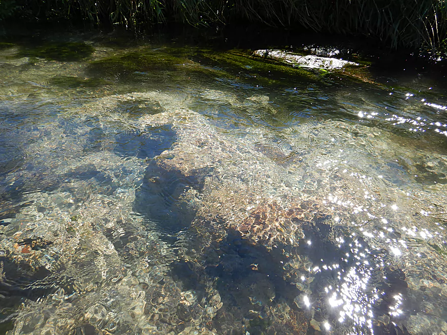
One of several crystal clear spring pools
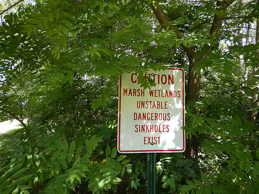
Be careful where you step
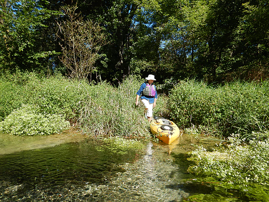
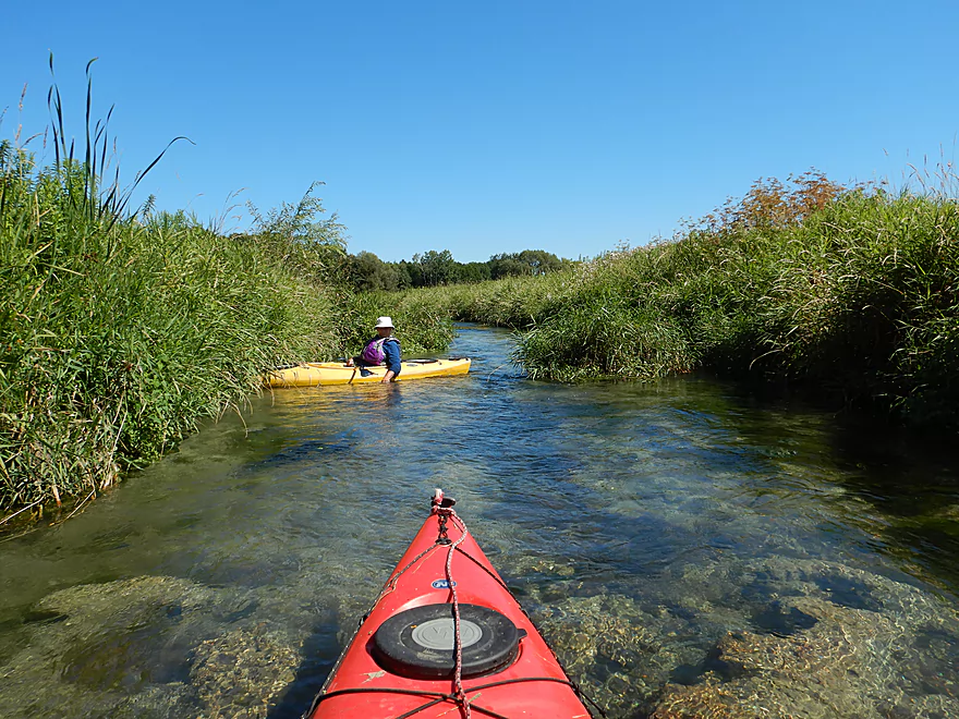
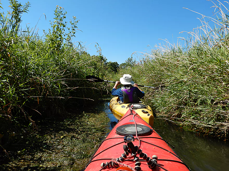
Launching from the largest spring pool
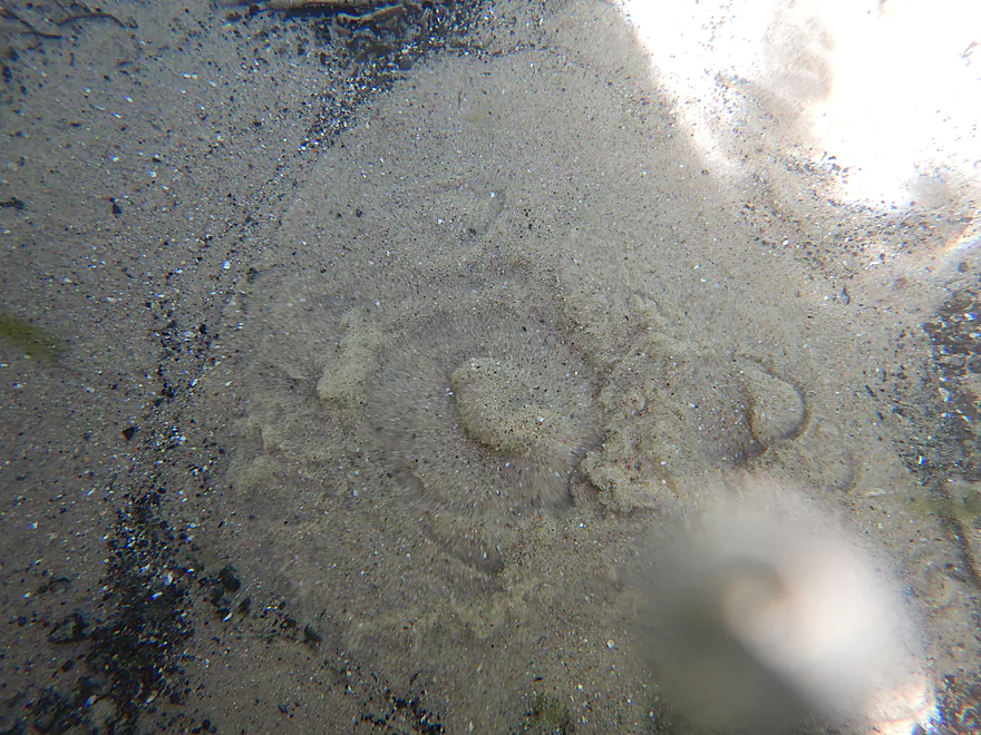
Filled with fantastic spring boils
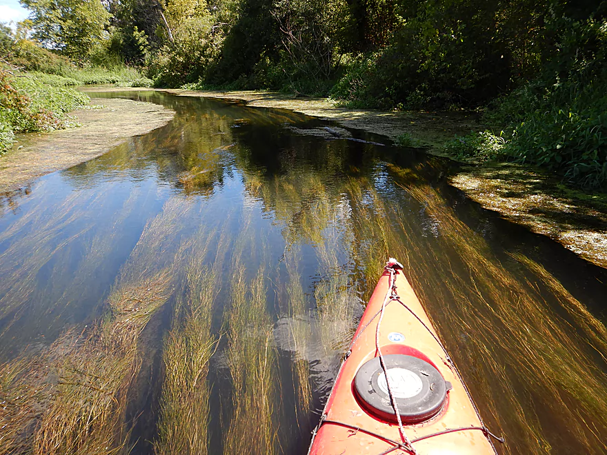
Stunning clarity
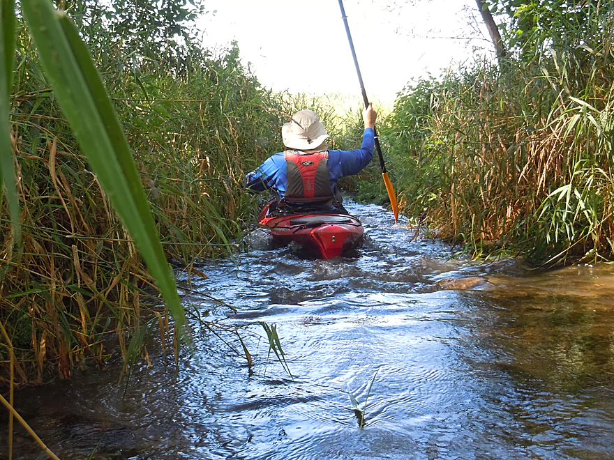
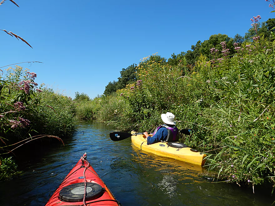
Paddling along a riffly chute
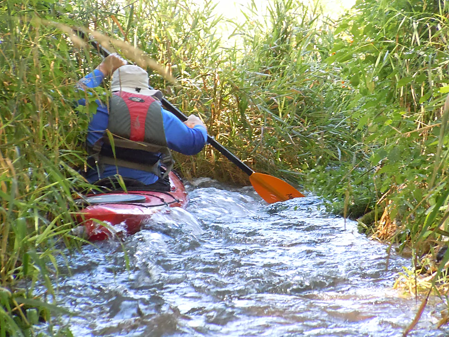
The rapids actually go through the grass
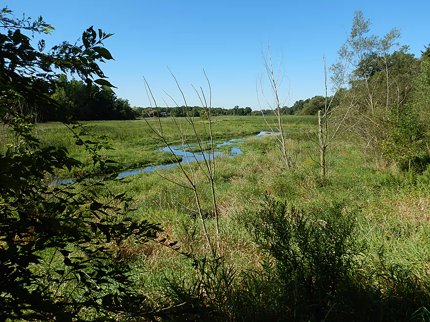
The start of the creek
Super scenic
So tidy…like potted plants
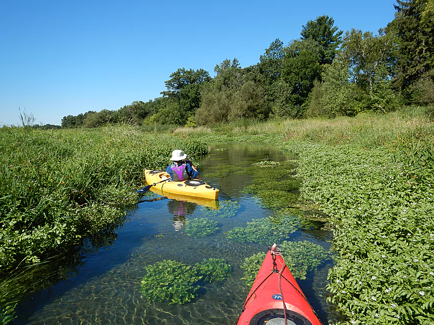
The creek is filled with neat plant life
An unsightly algae blob
Very peaceful
So much watercress
Paddling over clay substrate
A little underwater pottery
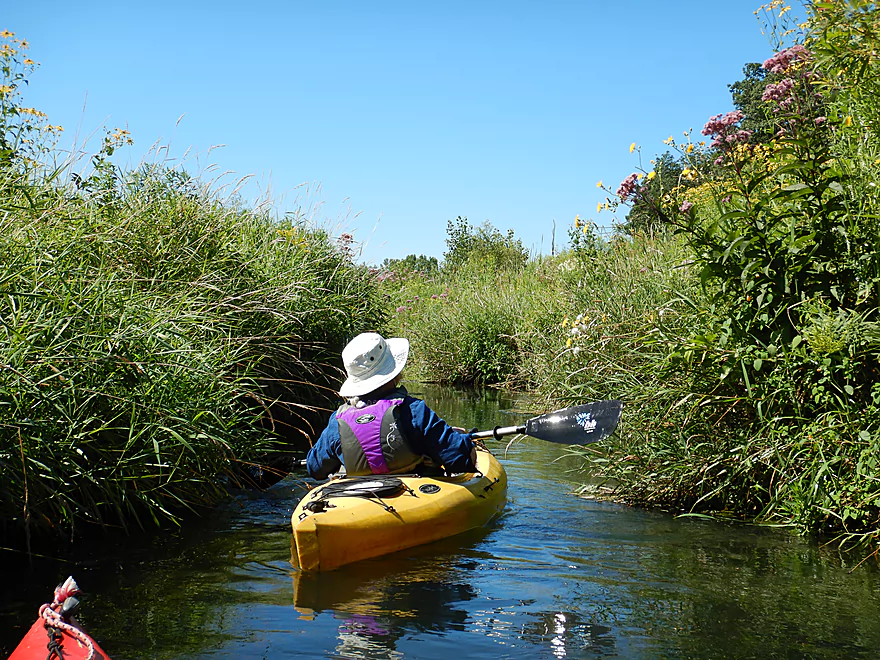
Cool narrow chutes flanked by wildflowers
Creek getting a little narrow
Only congested spot, but not a problem
Part of the public trail system connected to the Old Mill Site
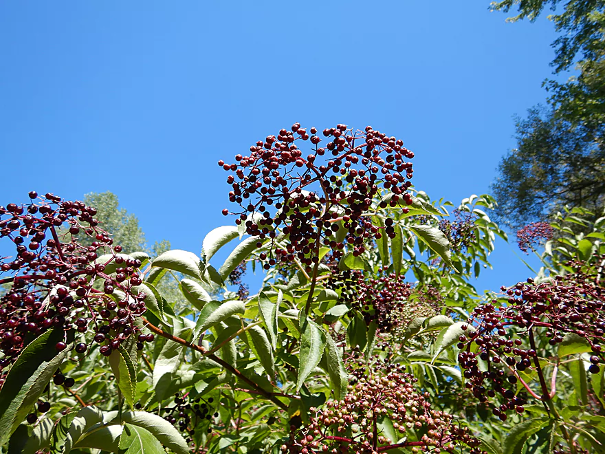
Elderberries actually are edible
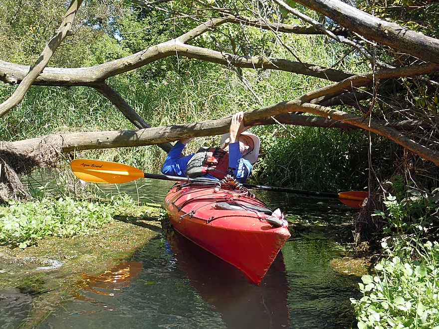
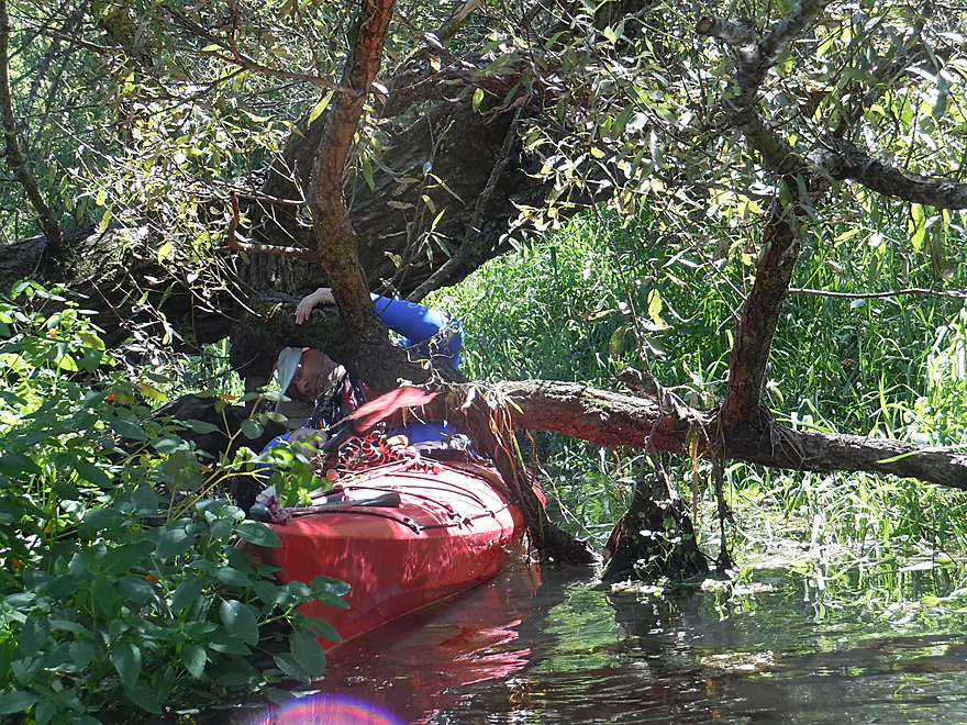
Some ducking required
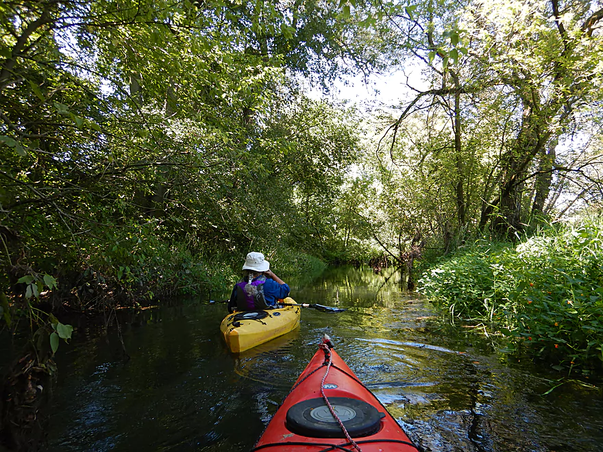
The marsh is replaced by thin woods
A second low branch
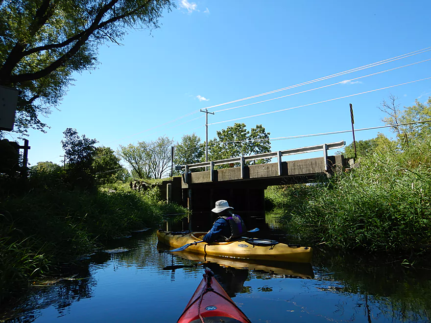
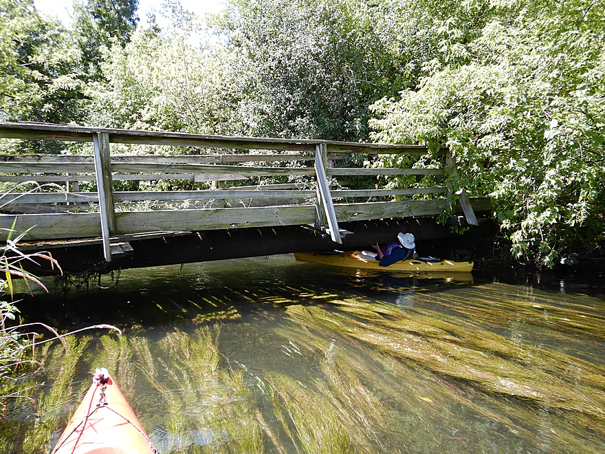
This is Portage Road where many paddlers start their trips
Deja Portage Canal
Acting as an algae ice breaker
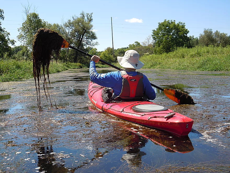
No fun to paddle through…but it did not last long

Neat section along Hwy 19
With fantastic flowing pondweeds
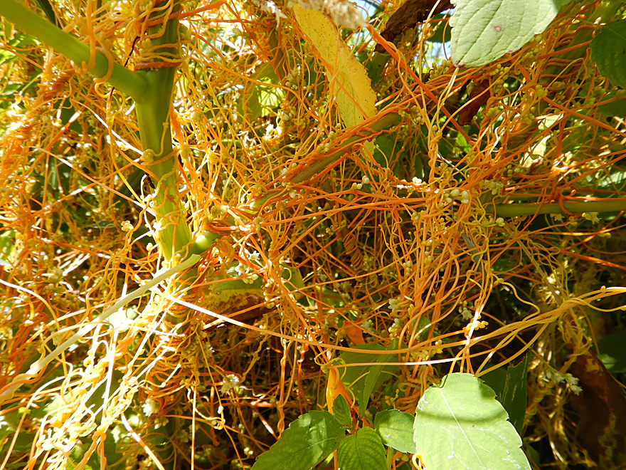
Dodder is a really cool parasitic plant
The new Hwy 19 bridge is a little low
Pondweeds that flow like hair
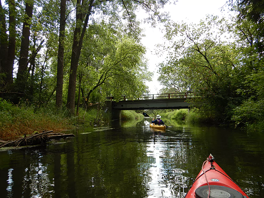
Quite the covered bridge
Attractive gazebo
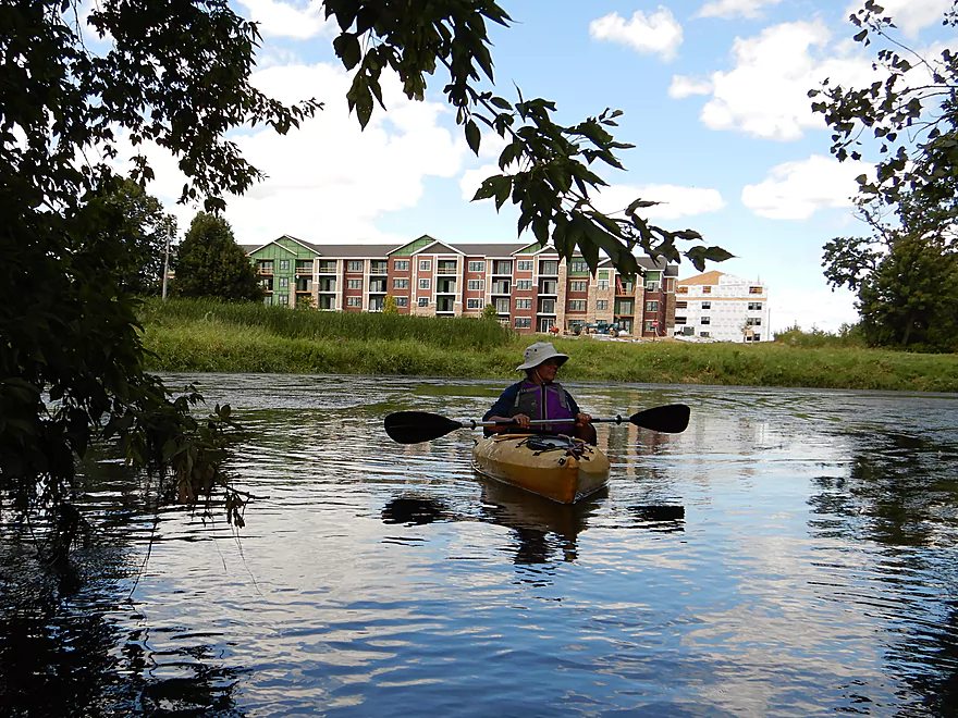
River opens up again
Still scenic
An extremely low bridge
A much more reasonable height
There has been a lot of terrific cleanup work on the creek
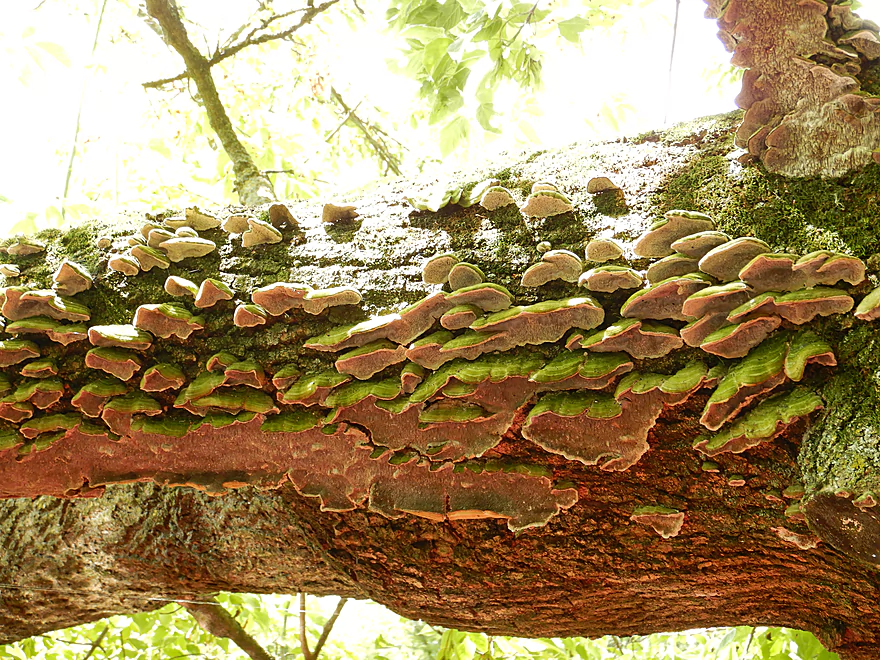
Some artsy fungus
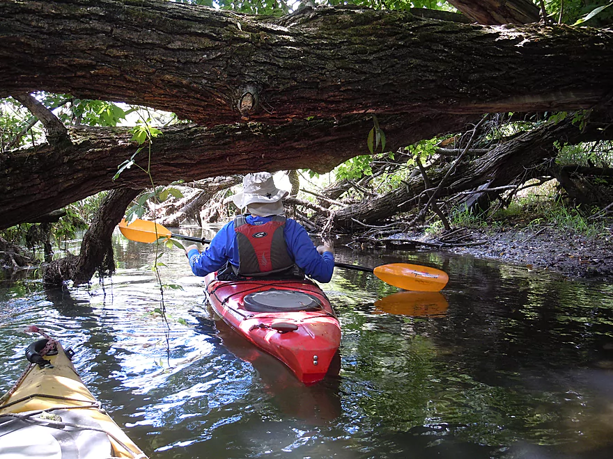
There were a couple of downed trees, but we never had to portage
Paddling under Token Creek Lane
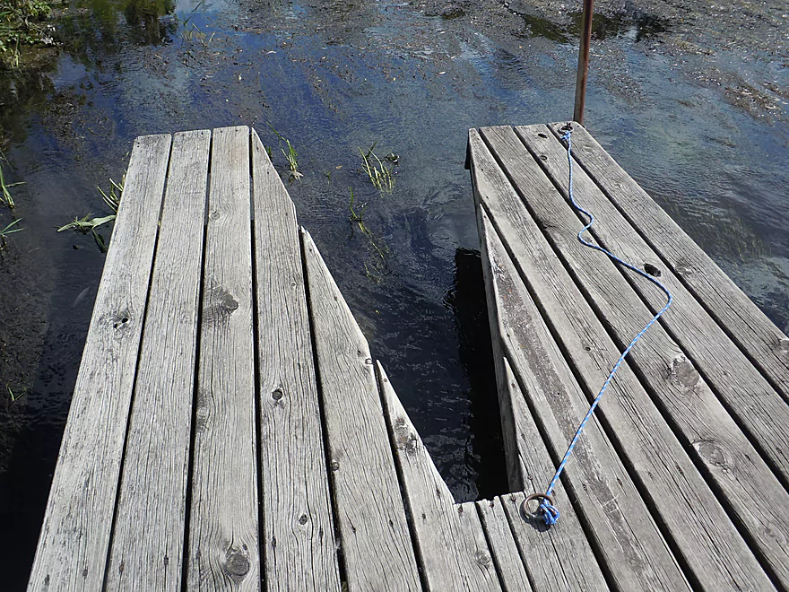
There is a nice access pier here at Token Creek Park
An unsightly crayon themed apartment
Somebody (mostly) removed a rock dam here
About to cross Hwy 51
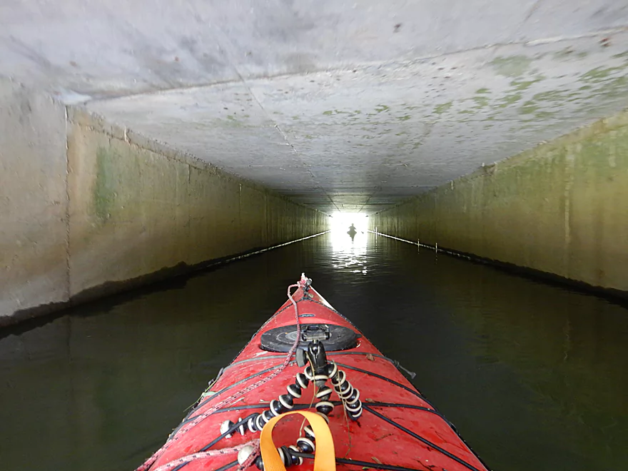
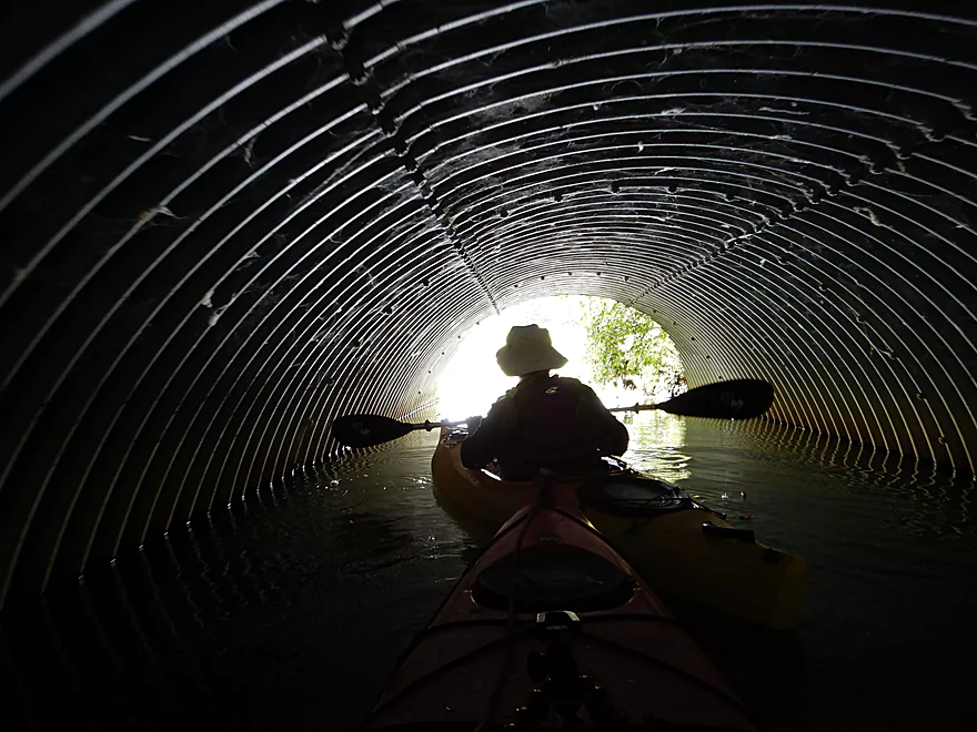
Tunnel paddling is always fun
Always a way through
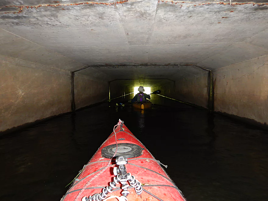
A 2nd tunnel…this time under I90
Approaching Daentl Road
Nice bridge take-out here
Token Creek


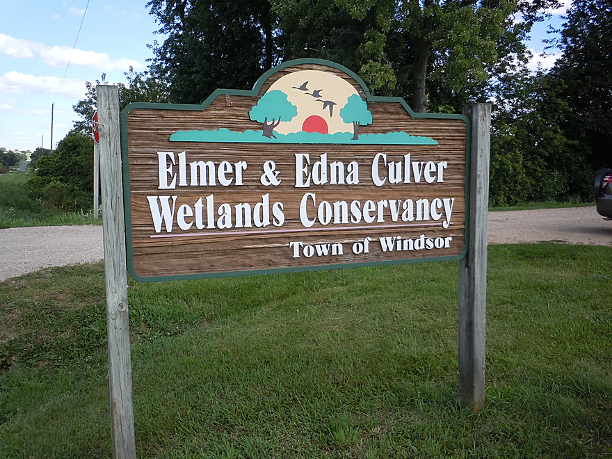
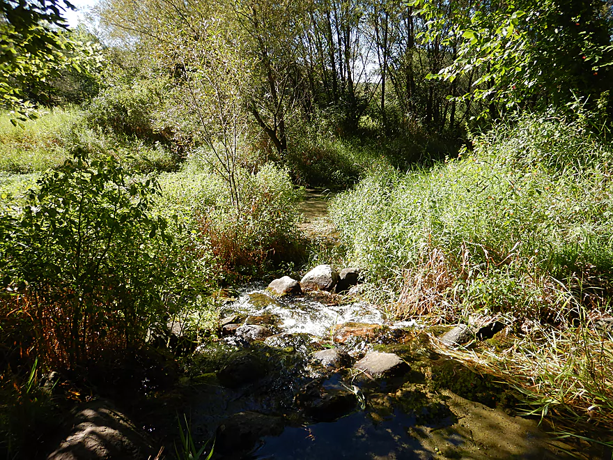
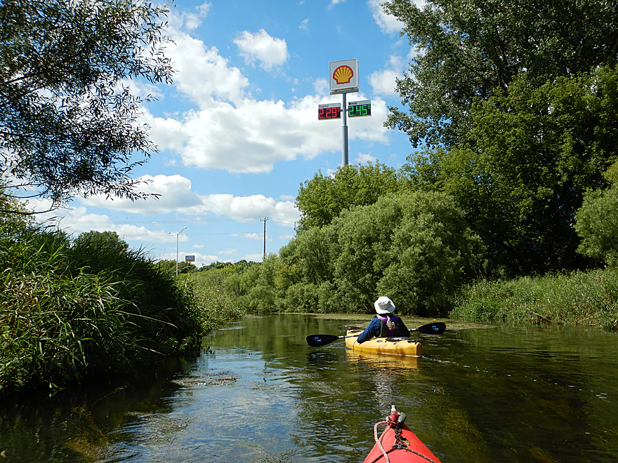
For our Token Creek trip, we started at the Elmer and Edna Culver Wetlands Conservancy. This is a neat park with a scenic tallgrass prairie and nice hiking trail system. But the best part was the 3-4 springs that form Token Creek. These aren’t minor springs either…but are the largest in all of southern Wisconsin and the reason that Token Creek is the single biggest tributary to Lake Mendota.
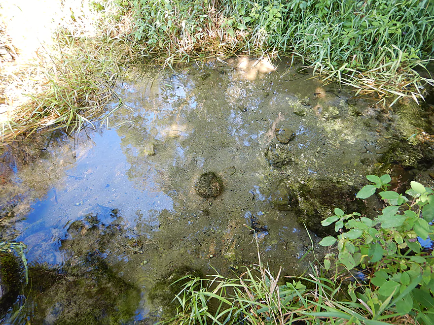
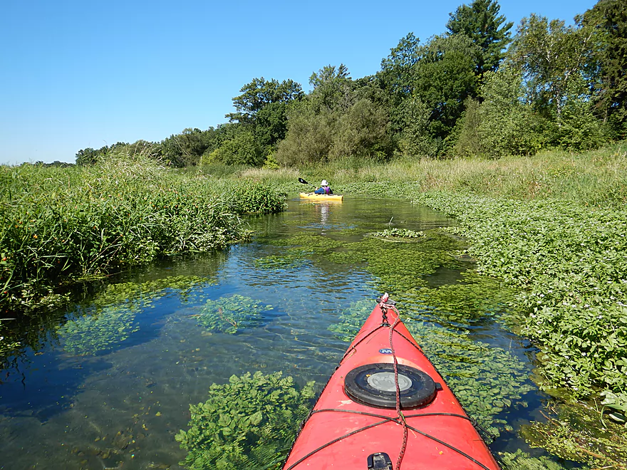
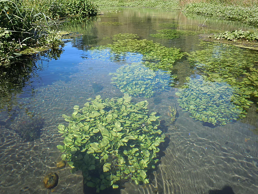
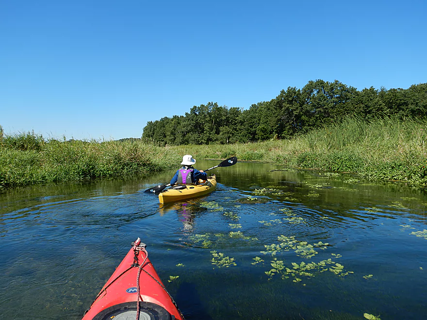
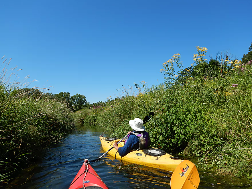
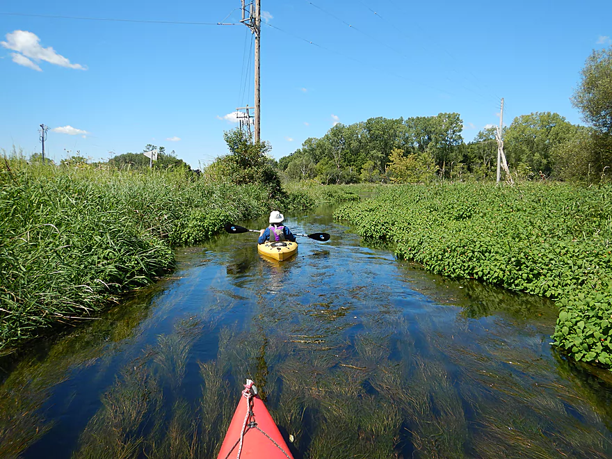
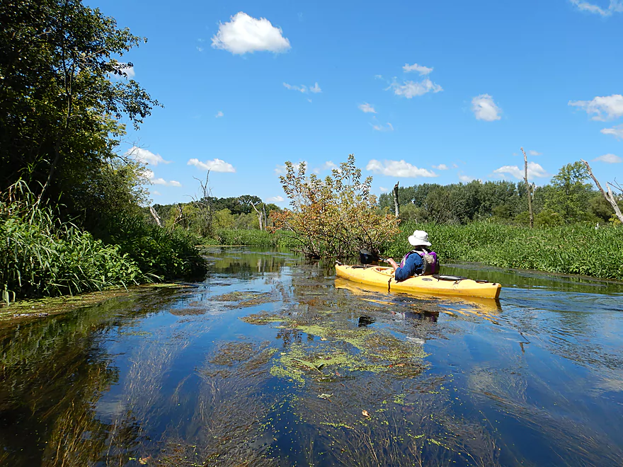
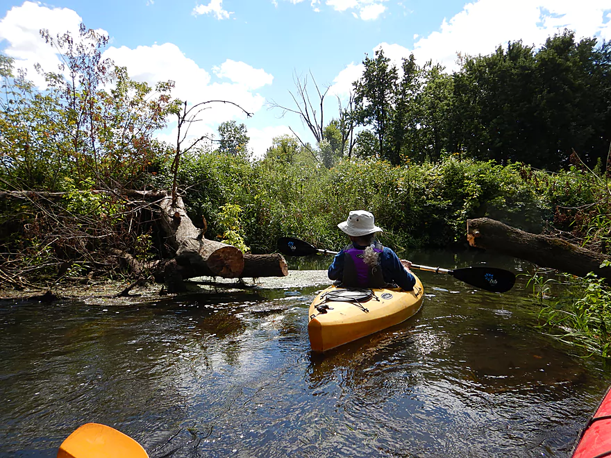
The put-in is a little unconventional, but we actually launched on the largest of the spring pools, which was easy to do. The springs here are gorgeous…crystal clear water and filled with “boils” (little bubbling sand volcanoes) spewing their cleanly goodness to create the creek. In spots you could see tidy clusters of watercress growing underwater like potted plants. I highly recommend doing a trip like this on a sunny day early in the morning for the best lighting.
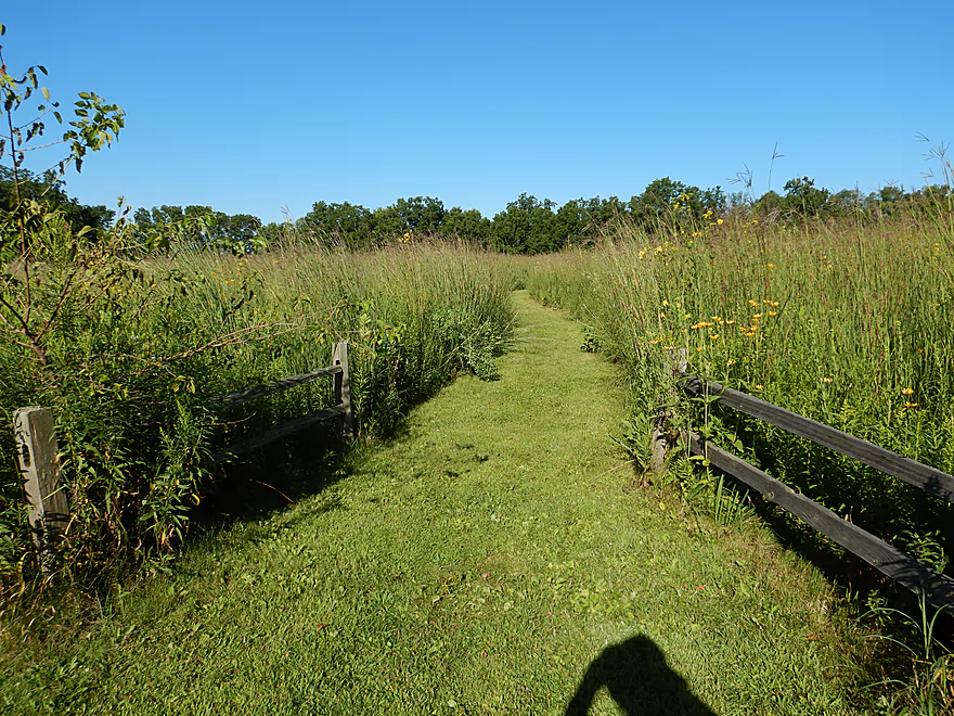
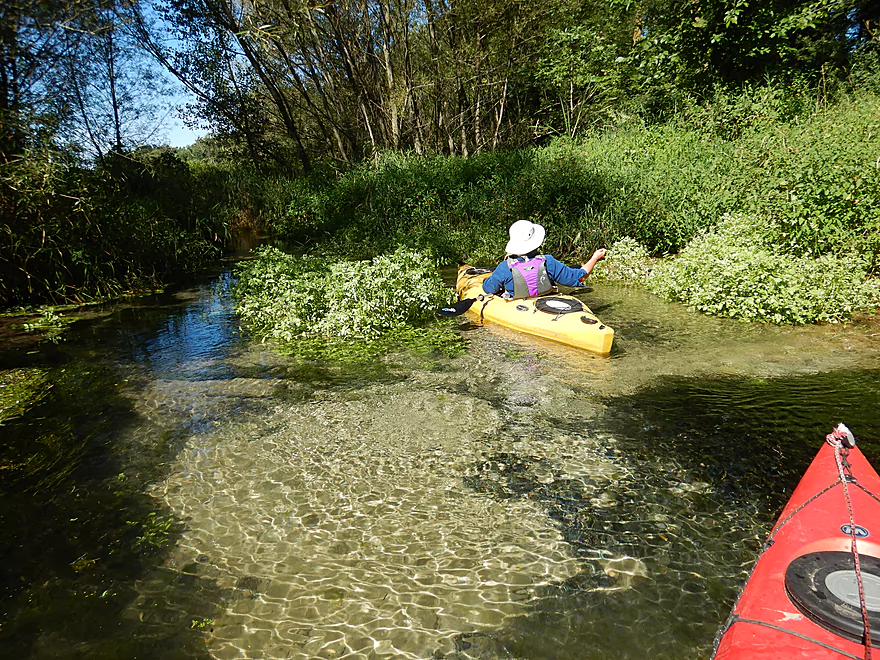
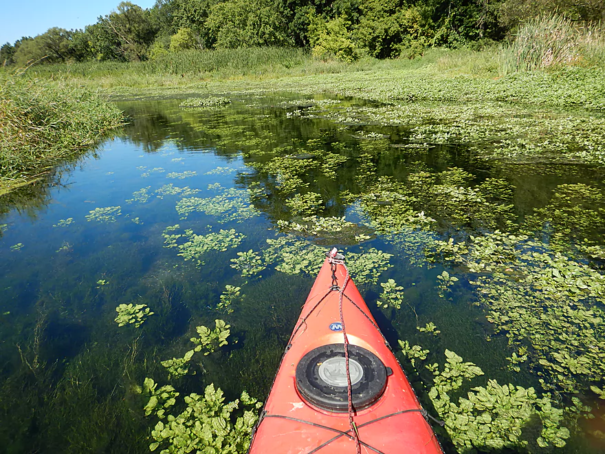
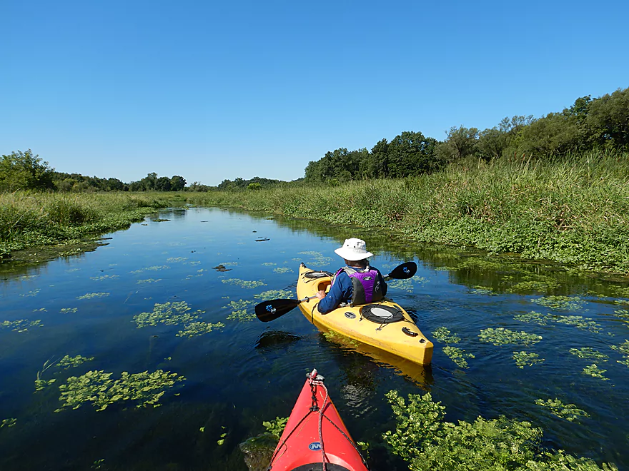
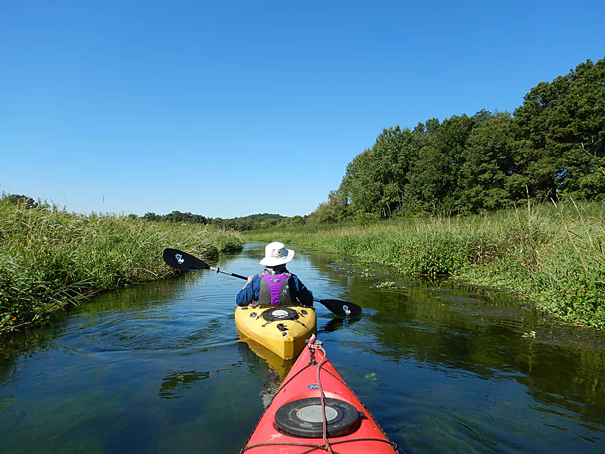
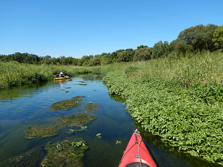
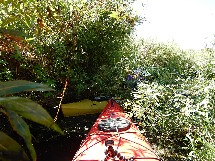
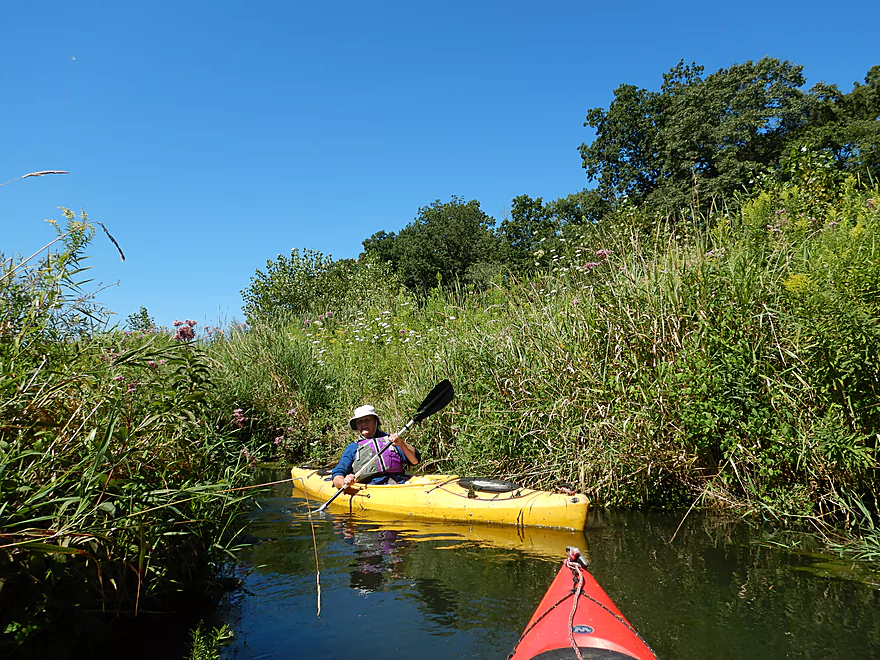
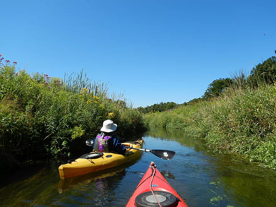
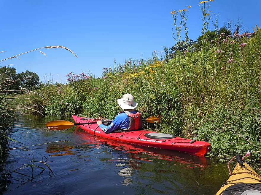
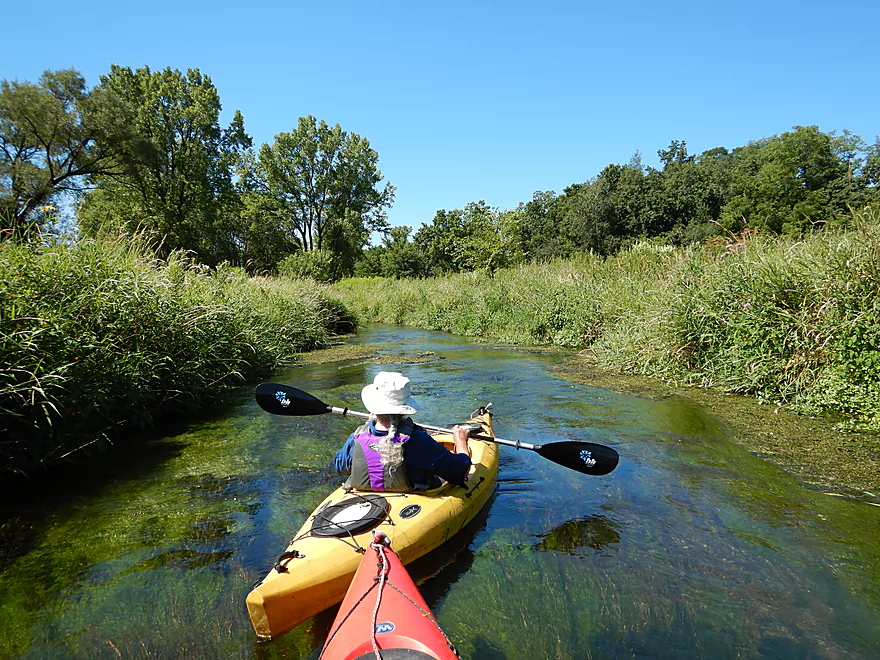
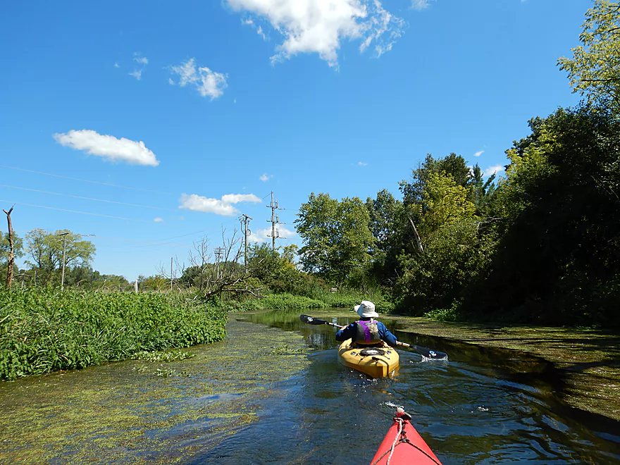
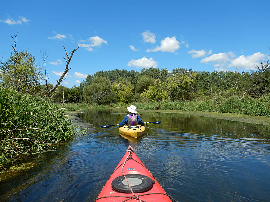
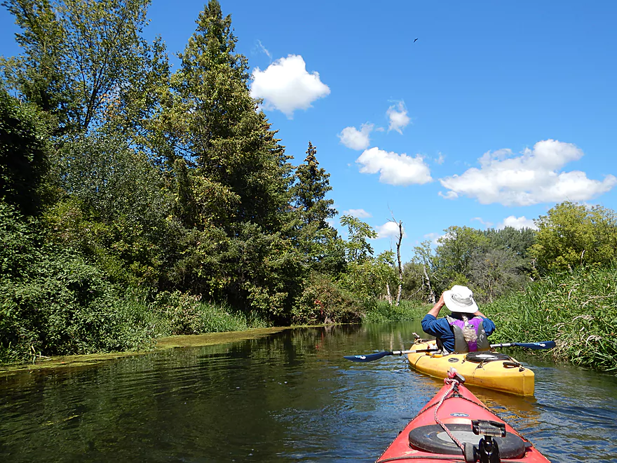
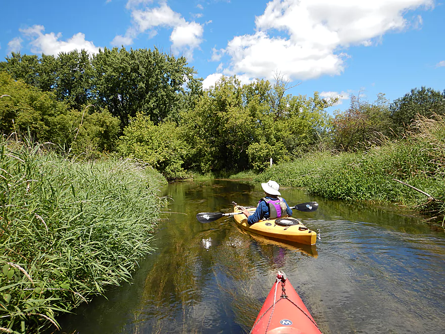
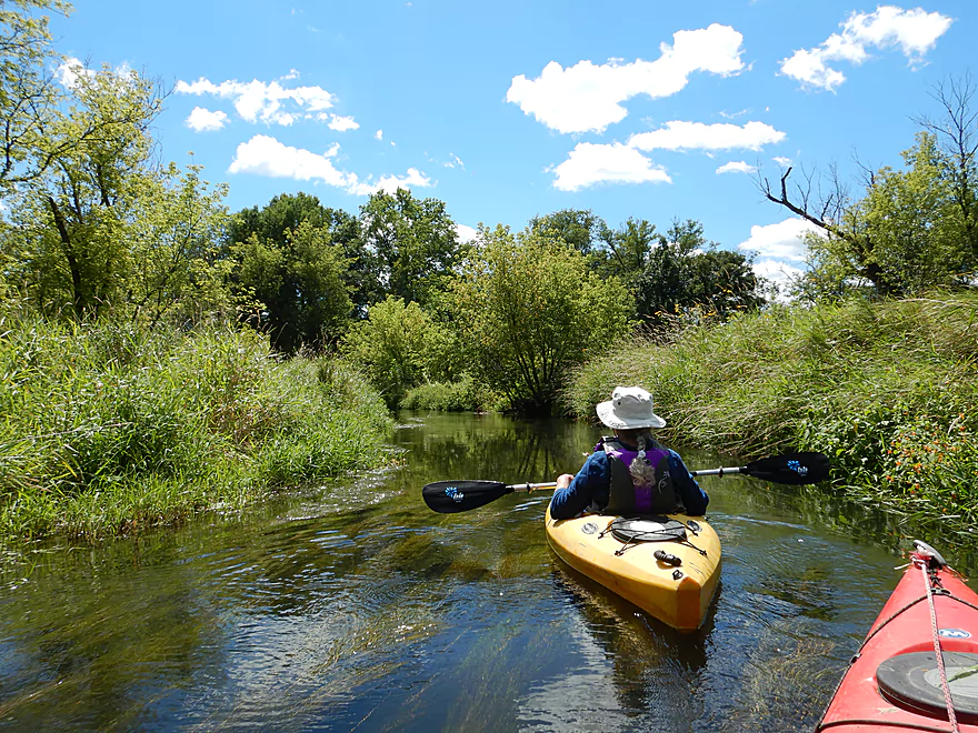
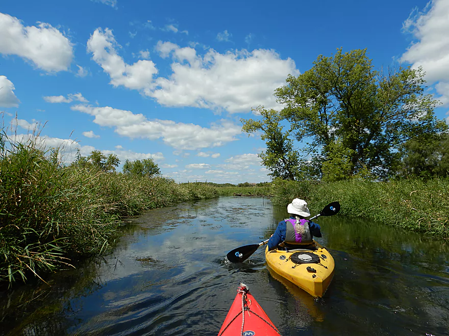
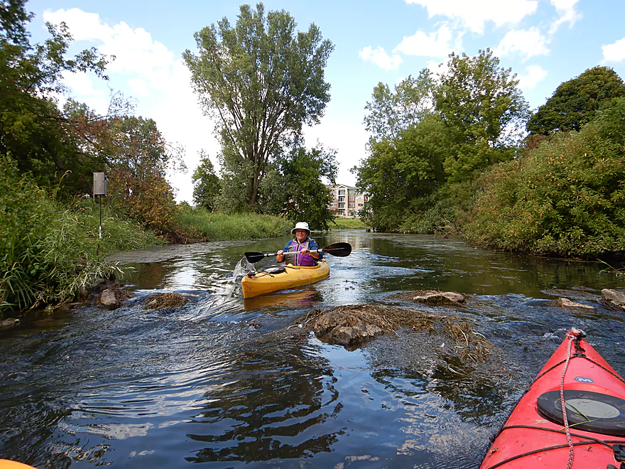
From the spring pool we paddled through a very narrow canary grass-lined chute and over some light rapids to reach the main channel. Here the creek widens and is soon joined by two other major springs gushing down the hillside. For the next mile the creek flows through an attractive marsh. The channel here is narrow, deep, clear, quick and flanked by tall attractive plants and flowers. At times it felt like you were paddling through a hedge maze (a good thing). This was the best part of the trip and by itself worthy of five stars.
This upper portion of the creek wasn’t always like this. This used to be a flowage created by a downstream dam. In 1994 the dam broke and a major restoration project was undertaken by conservationists to restore the creek to its native glory. Unfortunately, there was so much silt deposited in the marsh by the flowage, the restoration plan had to completely dig a new channel for the creek to reach the original layer of glacial deposits, which is one of the reasons this upper section is so straight. I highly recommend this article from CherokeeMarsh.org for more on upper Token Creek’s history.
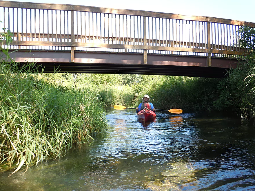
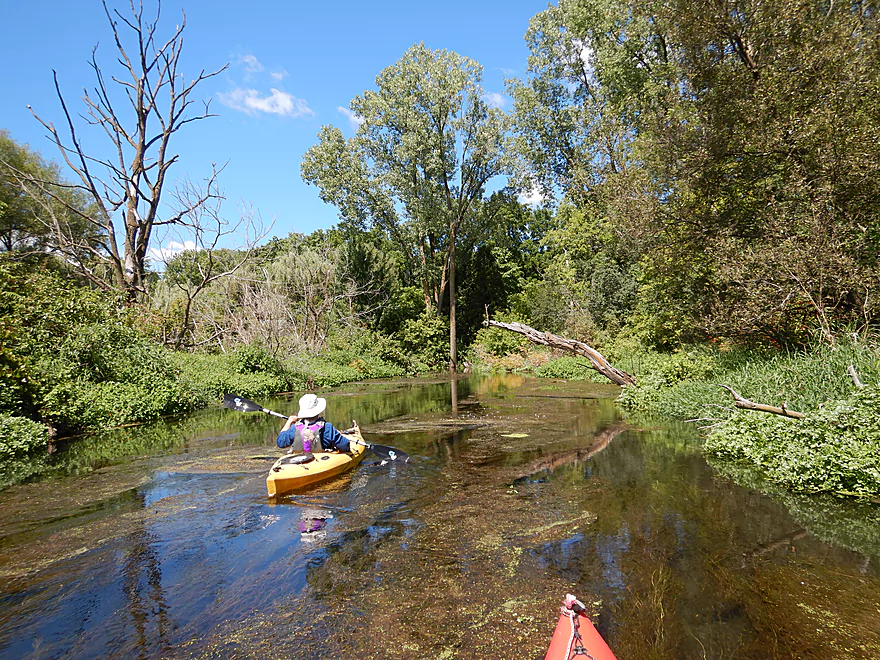
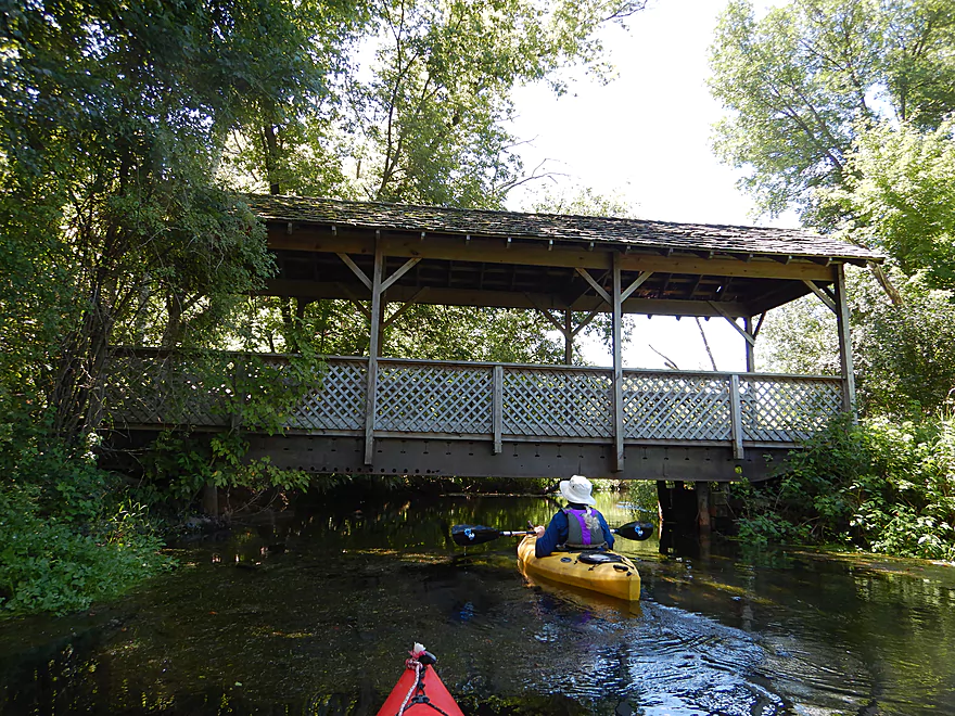
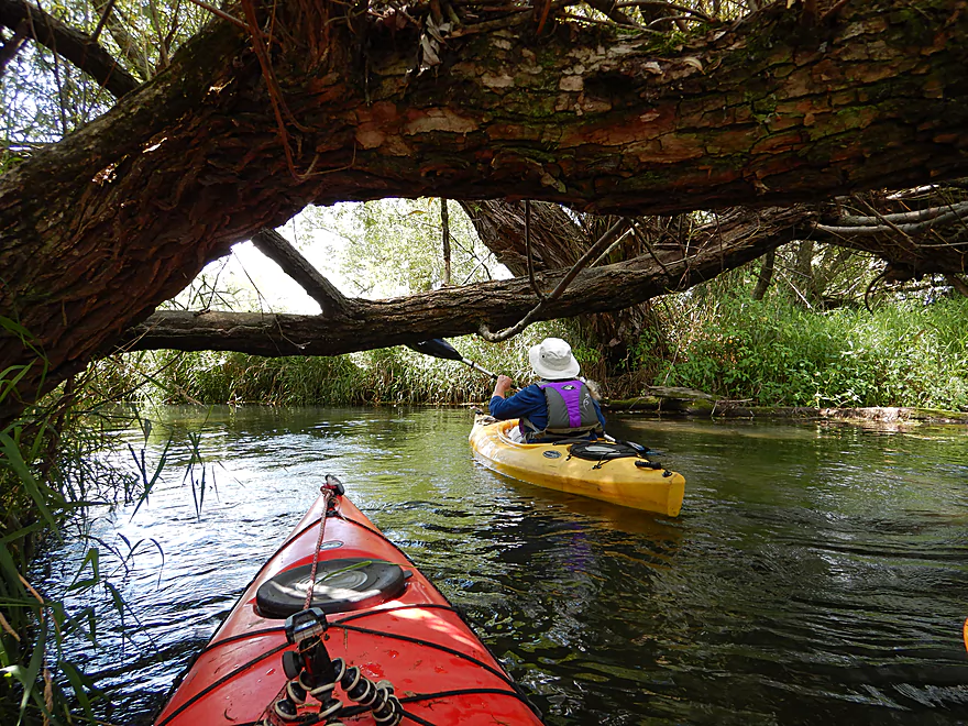
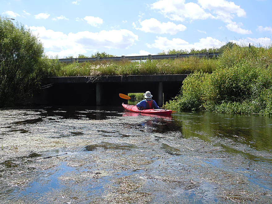
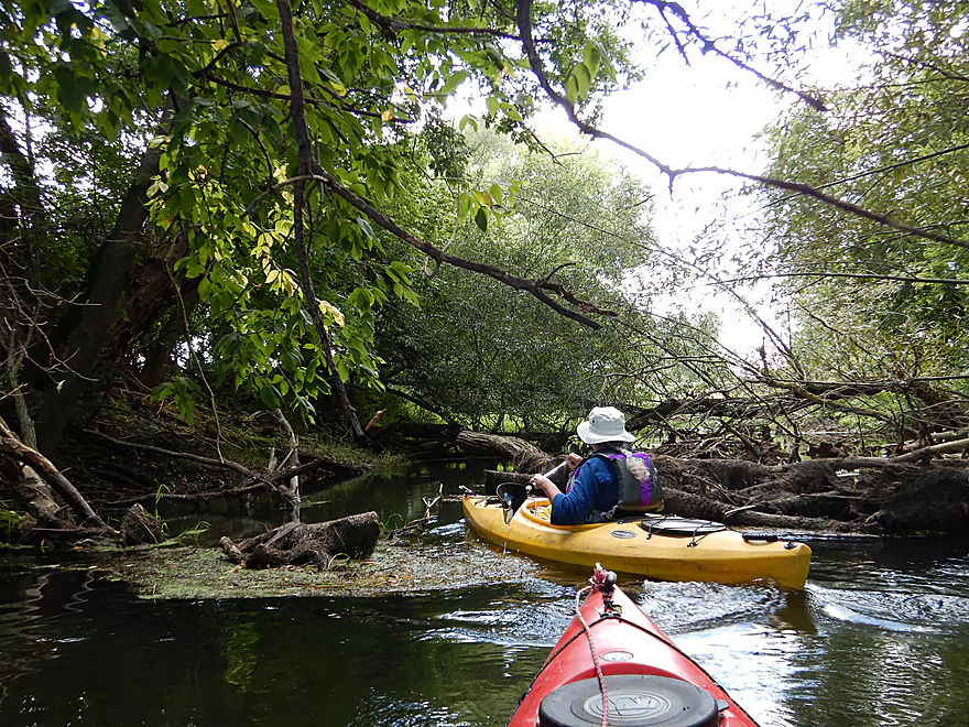
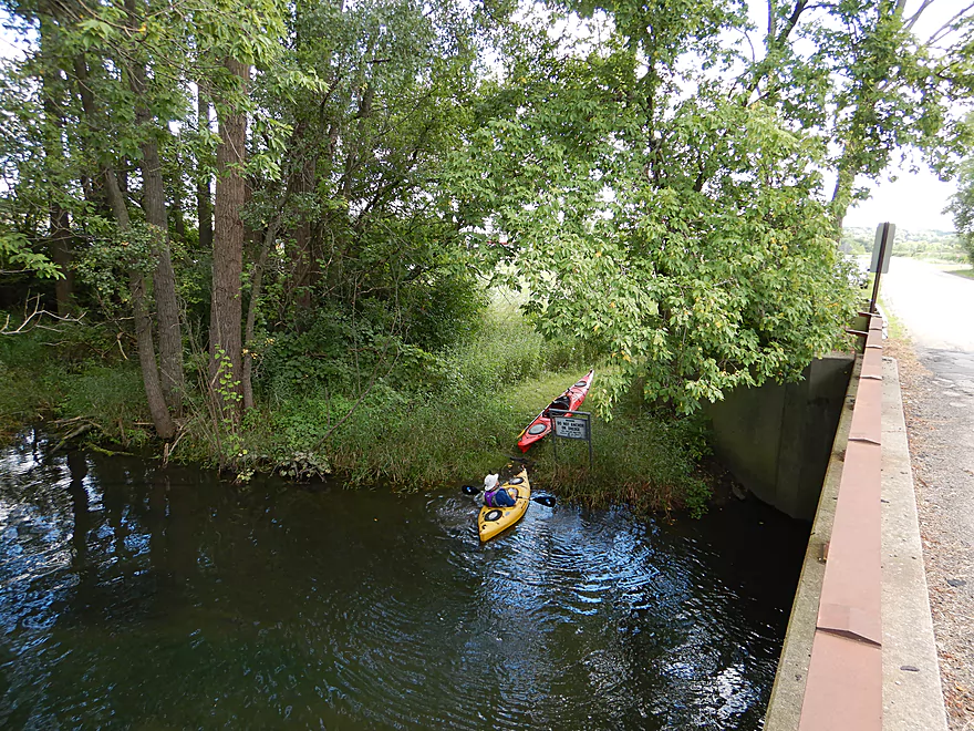
Close to Portage Road, we paddled under a hiking bridge that connects with a vast hiking trail system that goes around the marsh. Here woods finally enclose the creek but it is still a nice section. There were a few downed trees, but all were easy to duck under. Portage Road itself is actually a popular access used by most paddlers to start the trip.
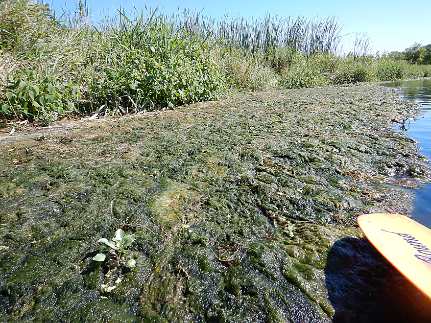
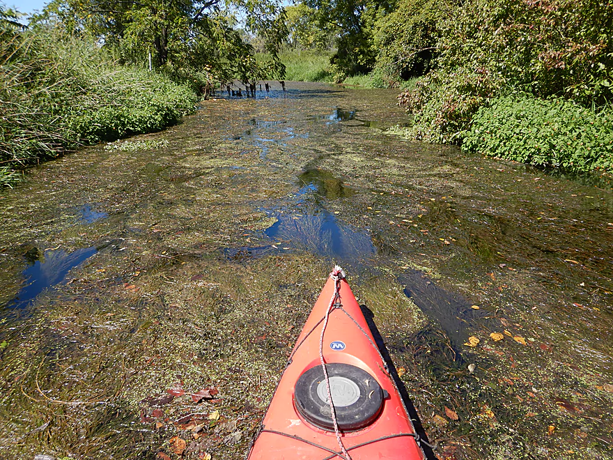
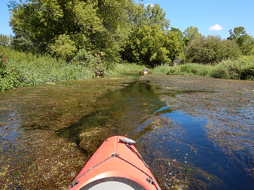
After Portage Road the creek’s character does change. Large mats of pondweed and algae constrict portions of the creek and require a little effort to punch through. I didn’t mind, but my kayak has a sharp bow well suited to cutting through algae. Other paddlers may prefer to do this stretch earlier in the season to avoid the occasional algae icebergs (there weren’t that many). The highway noise here was a little annoying and the new, low bridge for Hwy 19 was more than a little annoying, but all was manageable and this was still a nice part of the creek.
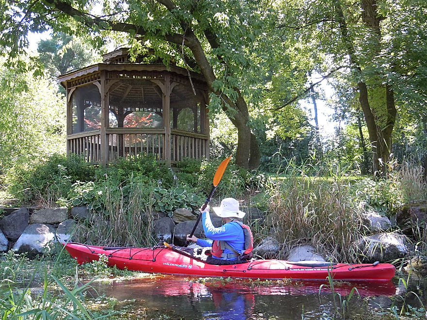
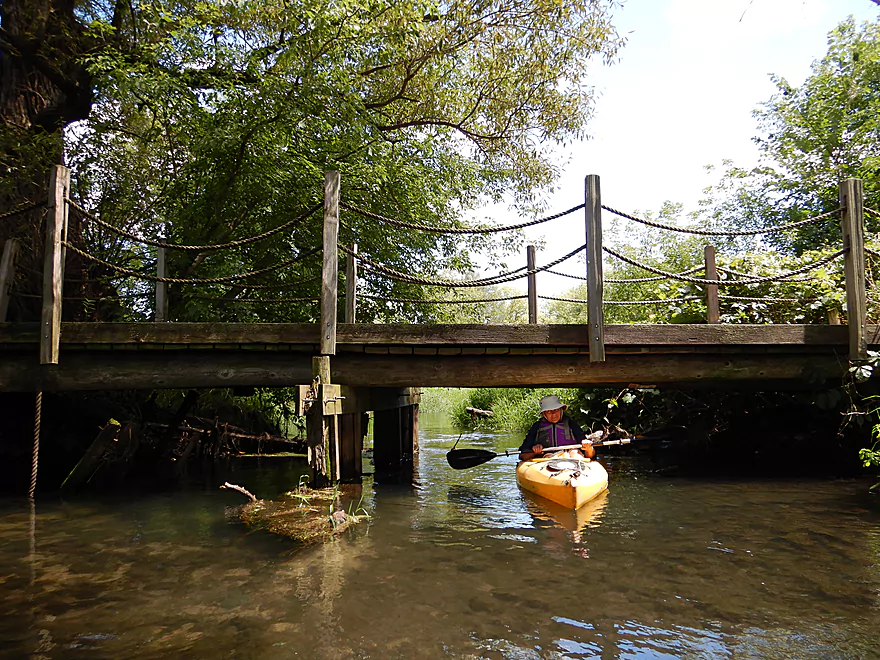
Following Hwy 19, the creek finally starts to meander and flows through a marsh filled with dead trees. Here we paddled past an attractive gazebo and covered bridge, and talked to the landowner who looked forward to paddling the creek. This was a nice section filled with swaying pond weeds reminiscent of the Bark River, but not as nice as the earlier headwaters segment. Along the way you’ll see fantastic cleanup work done for paddlers by Mad City Paddlers and Capitol Water Trails.
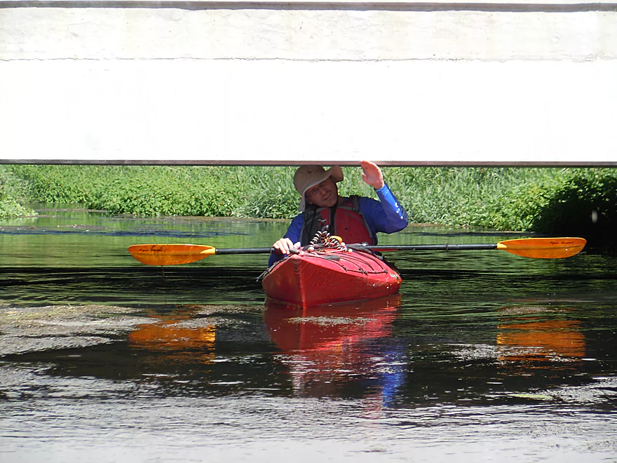
A couple miles in, we came across an absurdly low bridge that was difficult to get under (and dirty). It’s at this point that our enthusiasm for the creek waned… From here on the character changes as the water clarity becomes more turbid, invasive cow grasses replace the nice natural prairie grasses and flowers, and boxelders dominate the banks (the weediest and ugliest of river trees).
The next access option is at Token Creek Park, which would be a great spot to take out if you wish (there is even a V-shaped pier for paddlers to prop up their boats). Here the creek slows to form a small pond. A small rock dam had been placed here to trap silt for future dredging operations, but today little remains of this rock dam and it is easy to get through. We decided to extend the trip 0.8 more noisy miles to take out at Daentl Road. This allows you to paddle the creek through the park (kind of a mini-pond) and to paddle under Hwy 51 and I94 which form long creek tunnels.
This was one of those trips that started great (five stars) and ended on a weak note (2-2.5 stars), hence the 3.5 star compromise. The rule for this creek is pretty simple…the further upstream the better.
We launched at the Elmer and Edna Culver Wetlands Conservancy. From the main parking lot, hike down the southeast trail to one of the major springs where you can start the trip. While the park appears to be free, it has very limited hours (Apr 15 – Nov 15, weekends/holidays only, 8 am to 8 pm). An outhouse is available by the parking lot. There is also a nice trail system that runs along the marsh and through an attractive tallgrass prairie.
Most paddlers actually launch a mile later at Portage Road (which is a mistake as you miss the best part of the creek). The launch itself though is very nice with parking for a few cars. If the parking lot fills up, there is a trailhead parking lot northeast of the bridge which you can use instead.
Southeast of the Daentl Road bridge there is room to park on the shoulder and a small trail leads to the water. This is a good access option and where we took out.
Paddlers can take out earlier (0.8 miles) at Token Creek Lane (Token Creek County Park). This is a nice option with a parking lot nearby, but you must purchase a Dane County Park sticker.
Adventurous paddlers can instead continue 5.3 miles downstream to take out at Cherokee Park. This would likely be a less interesting paddle and half of this would be a marsh paddle.
I’m not aware of any local liveries.
The bike shuttle is a bit tricky because of Hwy 51 and Interstate 90/94, which technically you are not supposed to bike on. For bike shuttlers, I suggest taking out prior to both of these highways at Token Creek Lane (aka Token Creek County Park). This would be an easy 4.0 miles with no major hills. Some busy traffic on Hwy 19 but should be doable. If you absolutely want to take out at Daentl Road (0.8 more miles of paddling), then this will require a very indirect 7.2 mile bike shuttle.
There were no serous logjams on the trip. Several times we had to duck low to get under trees but were always able to get through. Large boats and canoes may have to portage though. Special thanks to Capitol Water Trails for the cleanup work they have done on the creek.
There are several low bridges to be mindful of. The new Hwy 19 bridge is quite low and gets lower on the downstream side. You can make it through in normal flows but could get stuck in higher water. Portaging Hwy 19 wouldn’t be fun. About a mile later is a dilapidated snowmobile bridge that is even lower. We barely fit under the right side and got sticky creosote on our hands. You can portage this on the left/east bank.
Lastly, there are multiple signs that warn of sinkholes by the springs (the first mile of the trip). Be very careful when launching by the springs and poke the ground with a paddle to make sure it is firm. Also assume any area with boils (those cool little volcanoes) could have quicksand and stay in your boat.
Despite there being little rain in the past three weeks, the creek was quite deep (maybe 3-4′ on average), and I would be surprised if it ever got too low to run. There are several low bridges, so I advise not going during high levels.
Unfortunately, Token Creek does not have a gauge. The Yahara River at Windsor gauge is right next door and is similarly sized, but drains much quicker so is only a rough guide. Here are my guesstimates:
- 0-15 CFS: Low conditions, but I think the creek should be navigable.
- 16-25 CFS: Average conditions. Good navigability and mostly good clarity. Trip was done at 27 CFS.
- 26-45 CFS: Above average conditions. Likely navigable and mediocre clarity.
- 46 – 55 CFS: Getting under some of the low bridges might be problematic.
- 56 – 80 CFS: Likely too high for enjoyable paddling.
- 81+ CFS: Very high conditions. Would absolutely stay off the creek at this point.
A turtle, several red-tails, many ducks, one blue heron, one green heron, and several other kayakers. The highlight was dodder which is a parasitic plant that feeds on other plants. It was quite common along the banks and looked like it was strangling its victims (very cool).
- Upstream of Elmer and Edna Culver Wetlands Conservancy: Not navigable. The springs are the start the creek. There is a smaller tributary from the south but that has too many logjams to be navigable.
- Elmer and Edna Culver Wetlands Conservancy to Daentl Road: 5.3 miles. Reviewed here.
- Elmer and Edna Culver Wetlands Conservancy to Portage Road: 1.2 miles. An amazing 5 star section with large springs, clear water, and a narrow swift channel though an attractive marsh.
- Portage Road to Token Creek Lane/Token Creek Park: 3.3 miles. Creek starts nice but towards the end becomes less interesting. There are several low bridges here that can be difficult to duck under in high water.
- Token Creek Lane to Daentl Road: 0.8 miles. Mediocre section. Highlights (or lowlights) are two long tunnels under noisy Hwy 51 and Hwy 132.
- Daentl Road to Cherokee Park: 5.3 miles. Probably a relatively weak section. Half of this would be on wide open Cherokee Marsh. As of 2023 there are roughly 8 major logjams downstream from Daentl Road.
Trip Map
Overview Map
Video
Photos Size:
I simply love this trip,I have done it 4 times in the past 2 weeks, I only do the part from the springs to the pond at Token Creek Park, so it only takes about 2 hours and is an easy 15 min bike shuttle. The whole trip takes less than 3 hours including loading and unloading so I can do it after work and still be home for dinner! The crystal clear pools at the top by the springs are my personal highlight but the rest of the trip is rewarding with an abundance of wildlife, plants and varied scenery. There are currently 2 small obstacles, one is a very low duck-under of a creosote soaked snowmobile bridge, and the other is an easy lift over and can be done without getting your feet wet if you are nimble and can balance on a downed tree. I highly recommend this trip if you are in Madison and are short on time.
Glad you liked the trip! Who would have guessed such a nice trip was this close this to Madison. Hopefully locals can work to clear out the remaining logjams in the future.
Just did this trip yesterday afternoon, 10/19, and was surprised with how different it was from all my previous trips. Low, slow and cloudy. It was an OK trip, but the water was nowhere near as clean and clear as before. I was surprised as I didn’t think the levels/conditions changed this much on spring feed creeks.
That’s interesting…maybe it was because this was an afternoon paddle in the fall. The sun angles would be much different and would significantly affect clarity.
I’ve almost always paddled it in the afternoon so I don’t think it was the sunlight, I suspect it was a combination of low water and dust from harvesting. I saw a mini dust devil in a soybean field that was being harvested on my bike shuttle. I may try it again on Monday
I just did the section from the Conservancy to the park,levels were very low (18 cfs/1.65 ft on Yahara at Windsor gauge) but the water was crystal clear so I was able to see the bottom for almost the entire trip. Saw lots of trout, turtles, crayfish and other wildlife. Other than a few shallow spots there were no obstructions on this section, and because of the low levels it was easy to get under all the bridges, even the snowmobile bridge that can be tricky at higher levels.
August 11, 2018
Thanks to the original post we just did this paddle from the springs to the park. We started at 11 AM, got out at 2 PM, and it was beautiful. The water was lower than the posted photos and it was easy to clear all of the bridges. We had to push through a few low spots and zig-zag around a bit, but it was great fun. It’s amazing to find a paddle like this so close to home. Thanks again for pointing it this out.
Thanks for the update! Good to hear the creek is navigable at lower depths. Upper Token Creek is really cool….definitely one of the Madison areas better hidden gems.
Checked out takeouts at Token Creek and Daentl Rd. The first is silted in at the dock. The second is muddy and weed infested. Put in at Portage Rd. is nice.
Six Mile has faced some serous flooding recently. Hopefully it isn’t too difficult to use either the park or Daentle Road now. I appreciate the update.
I paddled from Culver Wetlands headsprings to Hwy 19, then back up to to Portage Rd. I’ve paddled this stretch for about 14 years, and it’s been fascinating to see how it’s evolved.
Initially, there was a small drop at a head cut in the sediment from the drained millpond https://en.wikipedia.org/wiki/Head_cut_(stream_geomorphology)
As the creek cut down though the sediment in subsequent years, some tight meanders developed where my 9.5 ft. kayak would bump both ends while passing through. The banks were a few feet high, and looked like unvegetated black dried out mud.
Now the stream bed is sand and gravel instead of mud, and the banks are full of vegetation. Mostly reed canary grass, but butterflies and other insects were visiting Joe Pye weed and daisies today.
Near Portage Rd, there were some obstructions. I managed to sneak under over and around them without getting out of my boat, but portaging around them would have been easy.
Thanks Jon for the background and information. I think when the upper portions of the creek were rerouted, this did reduce downstream sediment which cleaned up some of the issues that occurred before. Nice to hear this is still navigable despite some ducking/hopping.
As of 21 Aug. 2019, only the northwestern-most tunnel under the interstate was free of debris and logs. Just upstream there’s a large tree across the entire creek. Water levels were a bit low (1.7ft. and 27 CFS on Yahara gauge at Windsor), which made for lots of pull-overs between Daentl and the railroad bridge.
Thanks Jon…I think I saw that logjam from the interstate. Hopefully it gets cleared out soon.
The gate at the Culver Wetlands appears to be locked all the time now, and there’s a sign cites a fine for accessing the water, even if you wanted to do the 300 yard carry to the headsprings: https://photos.app.goo.gl/7qDVUwgxRHjcc94aA
We put in at Portage Rd. instead, and had a leisurely 2 hr. paddle to Token Creek County Park. Pleasant, but I was disappointed to not be able to wade into the 50F springs to launch into the prettiest section.
That’s horrible…hopefully the park service will change their mind. Otherwise paddlers will likely have to put in at Portage Road and just head one mile upstream to see the springs. Thanks for the update!
Since the launch at Culver’s Springs is less accessible/technically closed, does anyone know if you can launch upstream at Highway C? Also, it appears there may be a public ROW from Arrowhead Trail (court) to the creek, though its not clear if there is a launch once you get to the creek.
Good question…hopefully somebody will chime in here with an answer.
Frank, I think I know the place/area you are talking about,and the creek is way to small shallow in that area and full of dead fall. I think it might be better to come in from the north off Meadowbrook Cir.It dead ends just to the east of the Conservancy land and there are trails there. I don’t know how easy it would be to launch from there, or how legal it is, but might be worth a try
A friend an I took advantage of an unseasonably warm Dec afternoon and paddled a short trip on Token Creek. While there were the usual obstacles to avoid, as can be expected on this section, there was only one complete blockage. This was due to a new beaver dam that has appeared since this summer. It is a nice sized dam, approx 2 ft tall,but is an easy portage on river left, we barely even had to get out of the boats and it was an easy otter slide back into the creek. We saw many deer as well as nice (8 point?) buck, a GBH, eagle, and a racoon sitting neck deep in the creek that let us get very close and never did run away ( sick? rabbid?). The right culvert at the park was clear and out trip ended just as the sun was setting. All in all a delightful trip made even better by joining a few members of Mad City Paddlers for bonfire at Token Creek Park after the paddle. Here is a video of the trip and some photos of the beaver dam. Here is link to a video of the trip https://www.relive.cc/view/vKv2nZKZKov
That’s a huge beaver dam! It will be curious to see if it survives spring floods. Great pictures and info as always.
Yep, and I wonder if whoever controls that part of the creek (county/state/private?) will leave it. I know trout fisherman aren’t too happy about beaver dams on “their” rivers. And a correct we went through the left culvert not the right…my mistake….so I don’t know if the right is clear.
I took advantage of yet another unseasonably warm day (a new norm?) to do Token Creek again and check on the beaver dam. the river was very low, and there were a few new obstructions, but nothing that required a portage. I did a bit of clearing, but there are still a few tight spots and place that require a bit of maneuvering to get through. Unfortunately, the powers that be, have removed the beaver dam, as there were signs of heavy equipment and the remains of the dam were in a pile on the bank. I usually take out at the landing on river left just past the park bridge, but this time I continued through the pond to the small dop after the pond. It was not runnable at these low levels but it a very easy to step out of your boat pull it over the drop and get back in. I continued downstream for a few hundred yards to a small slough on river left, which is about 200 ft from one of the Token Creek parking lots. I think this is a better option than Daentl Rd, as it is only a little shorter paddle but a much shorter shuttle and allows for a bike shuttle. Also you can now avoid biking on Hwy 19 by going through the new development on the northside of 19 using Williamsburg Way and Pederson Crossing Blvd. It does however, require back tracking on Portage Road.
It’s crazy how people really hate beaver dams…I think they are kind of cool. Appreciate the watertrail update as always.
Update on the section… Portage Rd to the County Park had two logjams plus several squeakers. Mad City Paddlers plans on clearing out this section in late June for their independence day paddle.
A logjam update from Jared: “MCP and CWT got most of the Portage Rd to Token Creek County Park stretch cleared today on Token Creek. MCP folks will finish clearing that section this Wednesday prior to our Independence Day Paddle and Picnic event. Currently you can paddle up and back from the park to the foot bridge. The water is actually too high to get under that and the highway 19 bridge right now, but hopefully levels will be down by Wednesday and Thursday to allow everyone to paddle all the way from Portage Rd to the park (or Daentl Rd) once we’ve cleared it. Note that there are still blockages on the lower Creek before it reaches the confluence with the Yahara. We hope to clear those soon. I hope everyone is finding some relatively safe water to paddle this weekend!”