
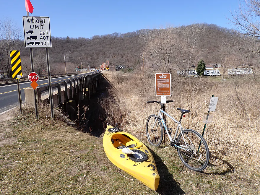
Starting the trip in Elba (Save the Stream sign)
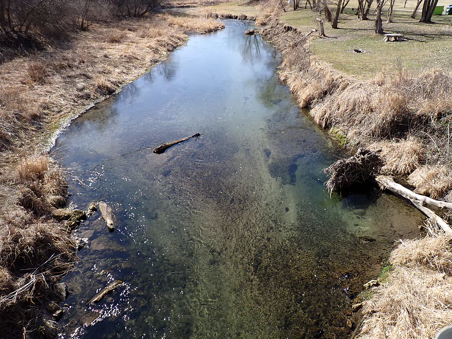
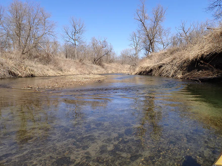
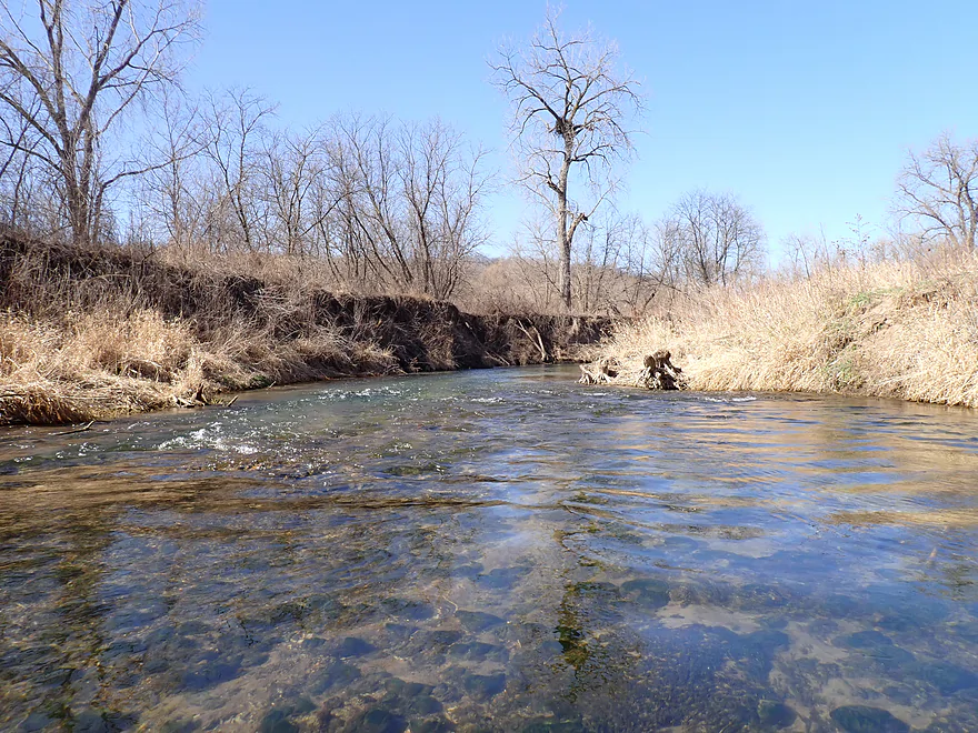
View upstream from bridge…neat color
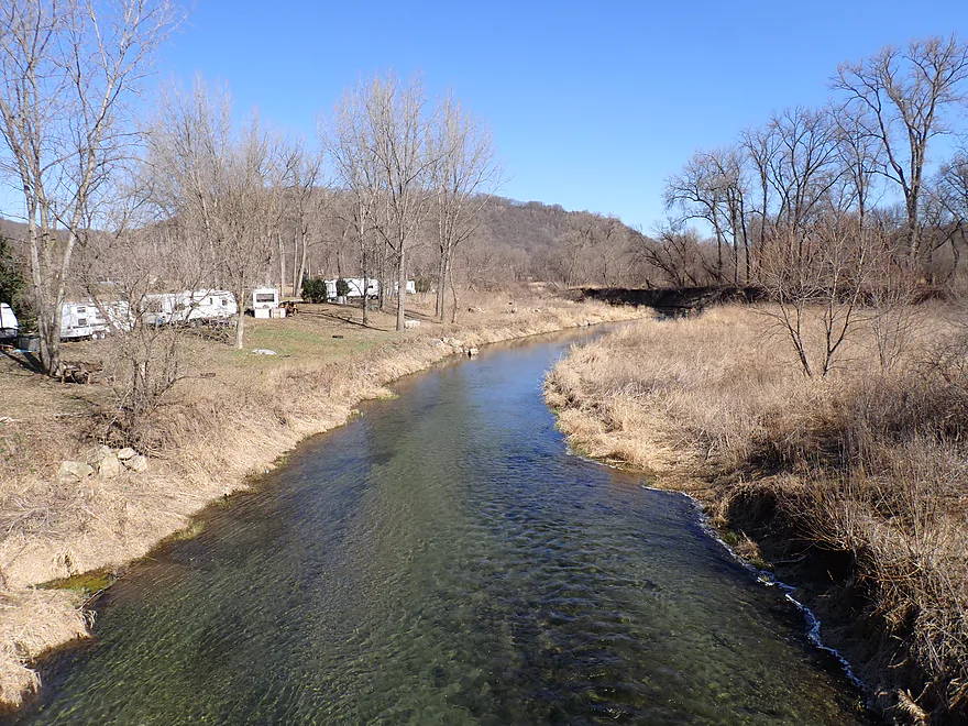
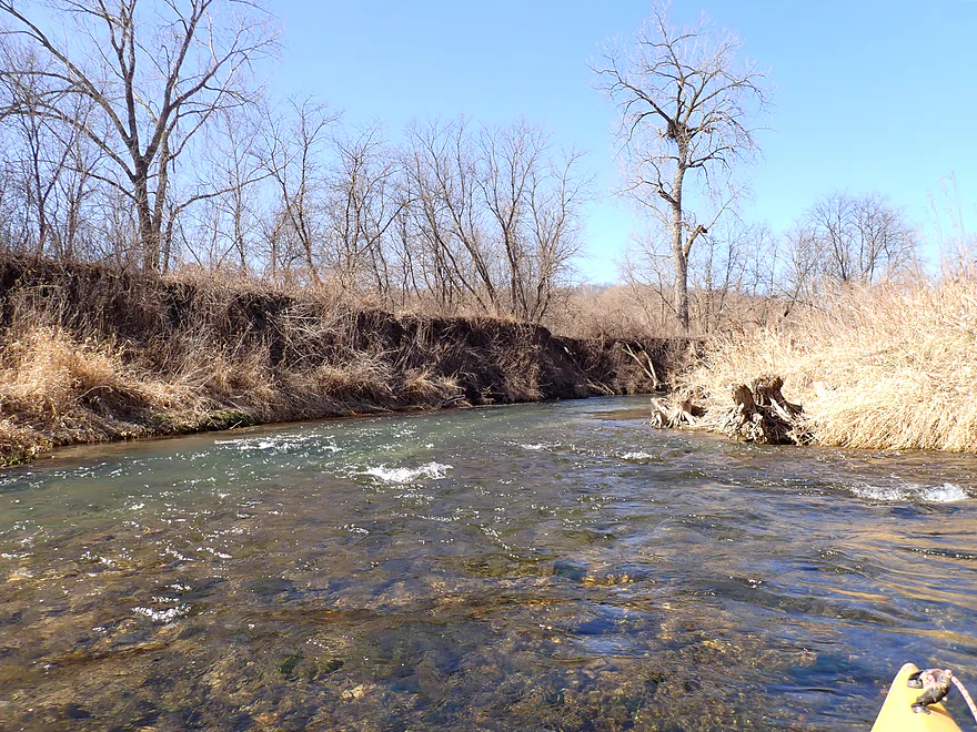
Downstream view is also scenic
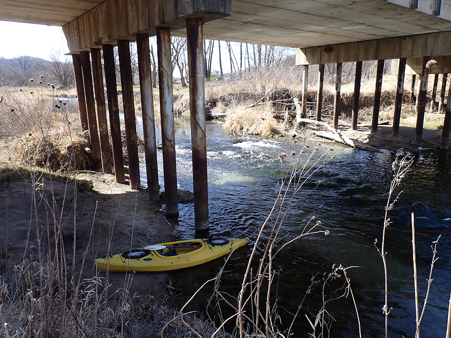
Good dirt access area below bridge by rapids
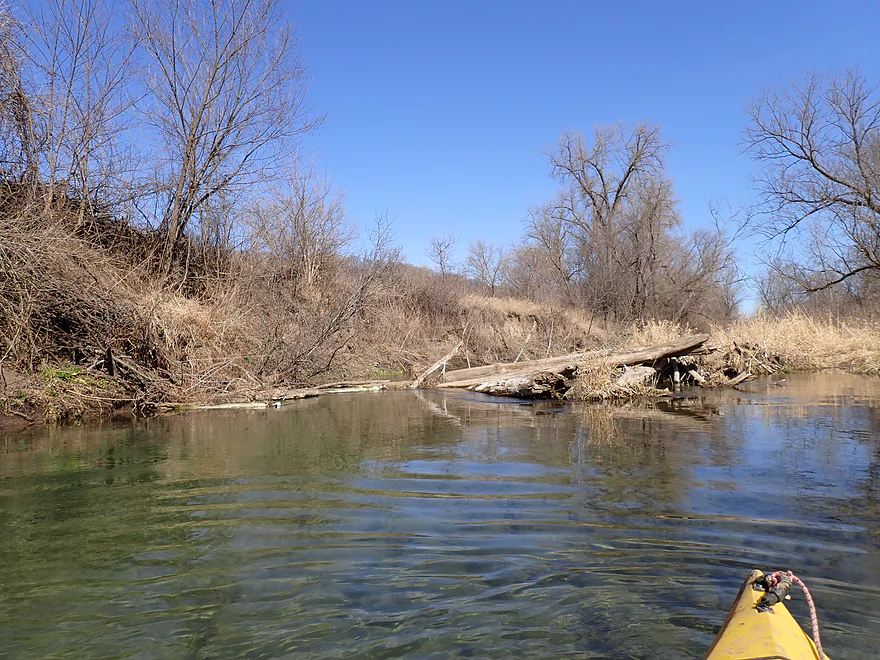
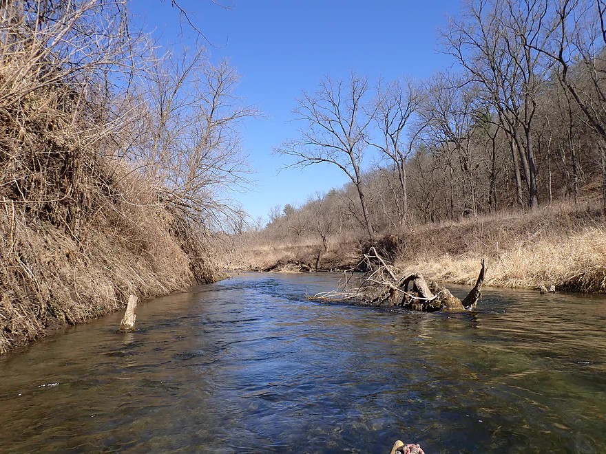
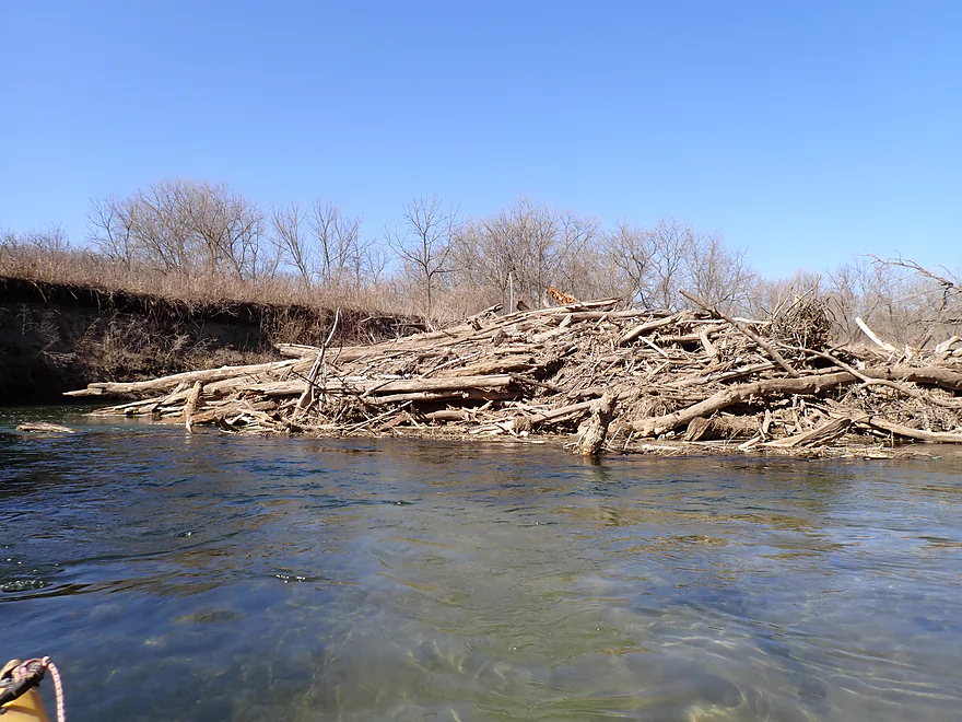
Only logjam of the trip
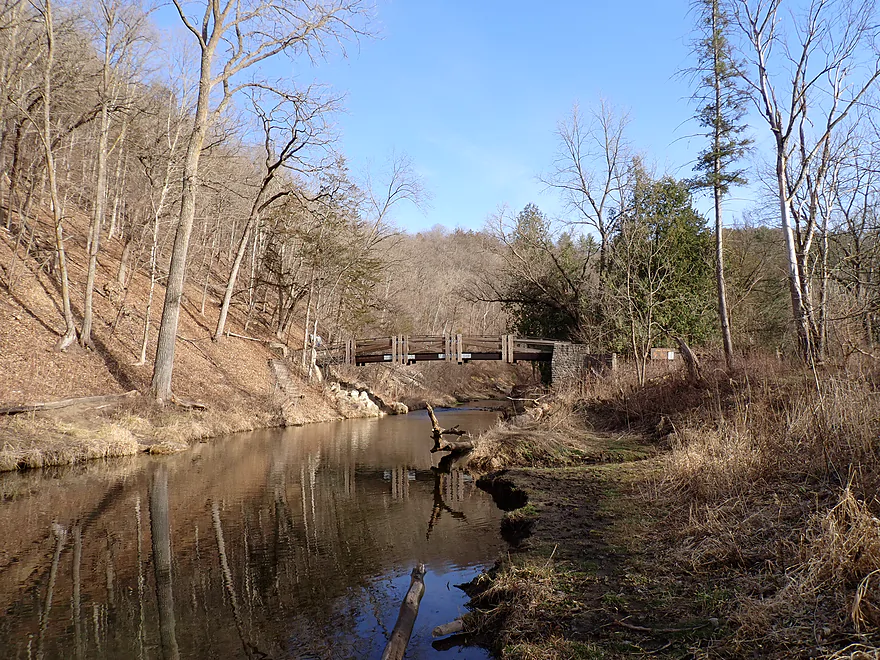
Super easy portage
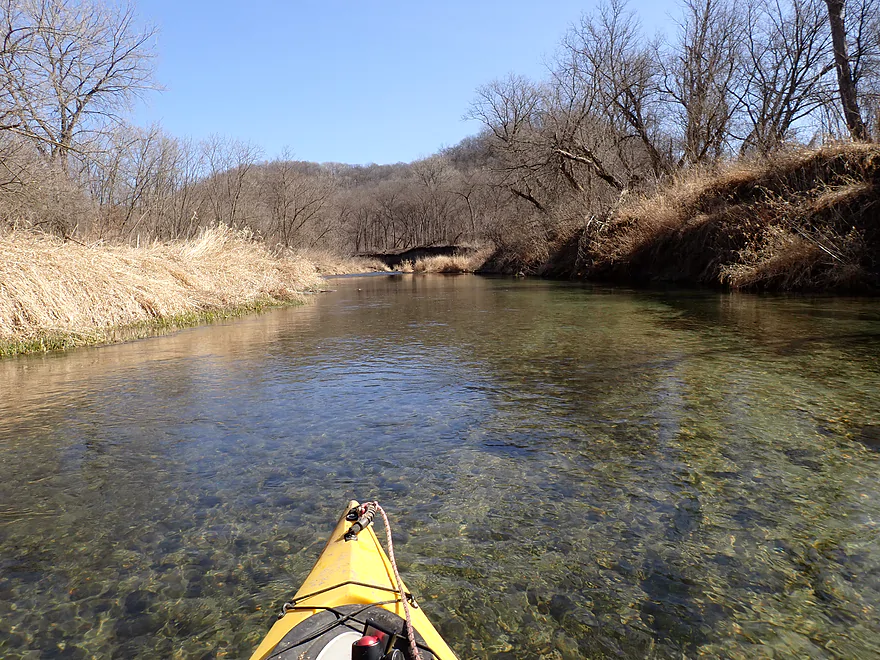
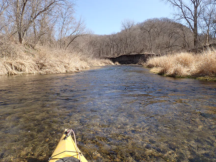
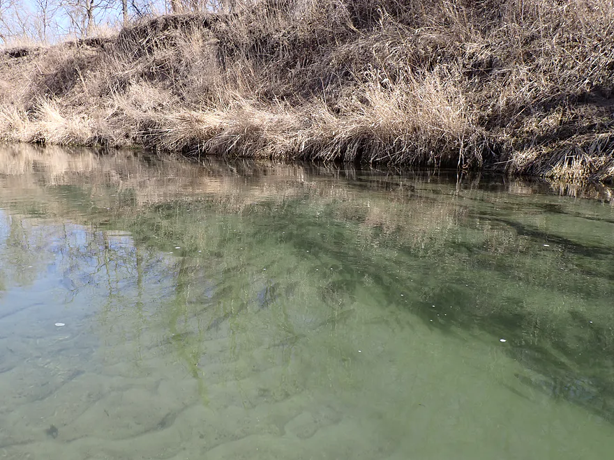
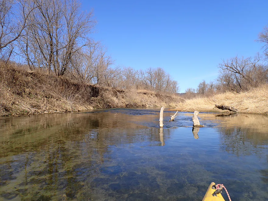
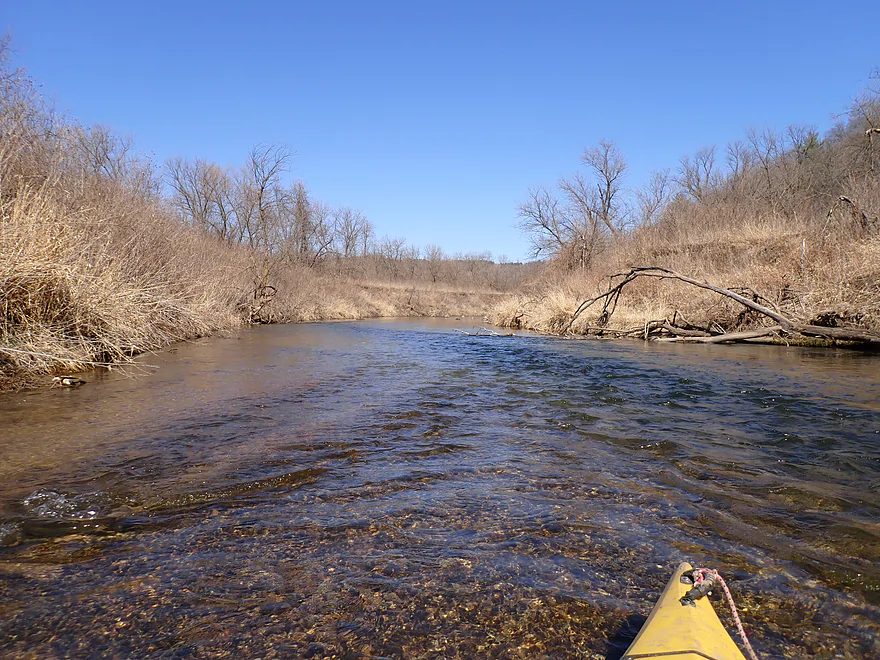
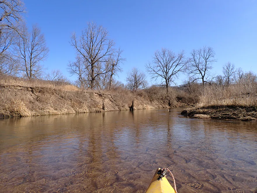
Clarity was incredible
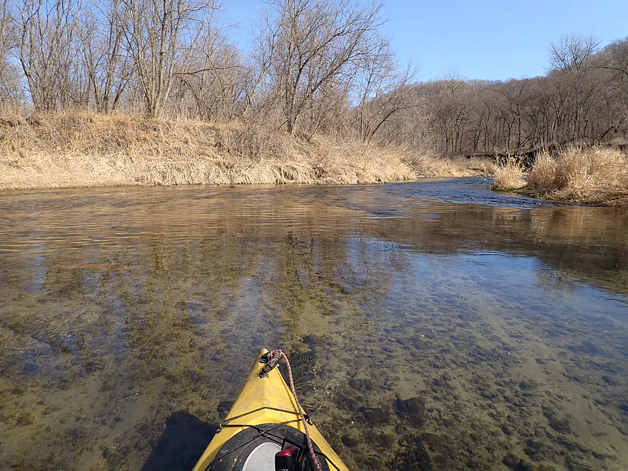
Substrate consisted of sand and pebbles
Fun riffles past a dirt wall
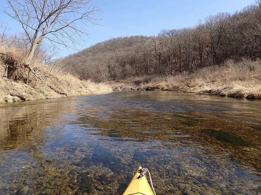
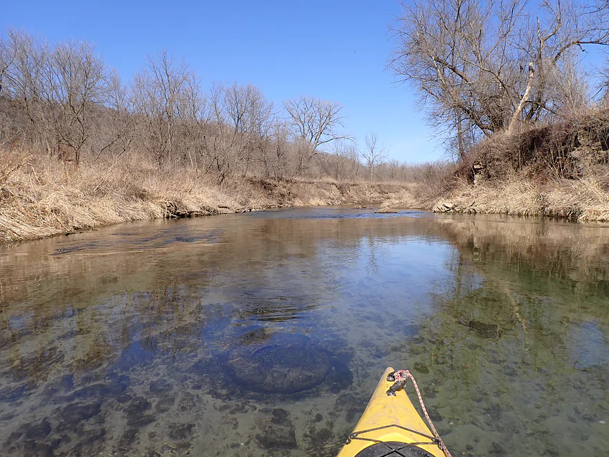
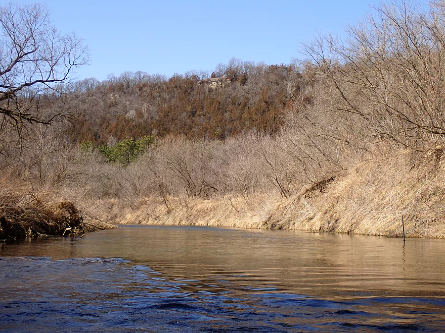
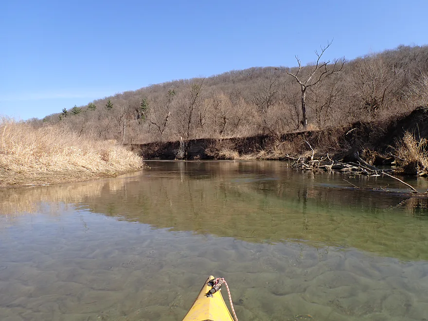
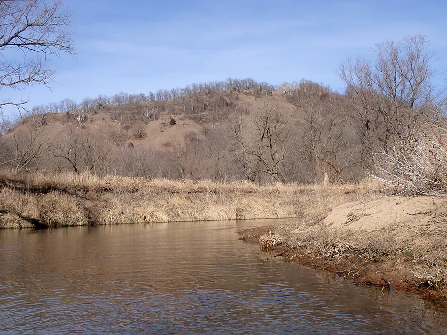
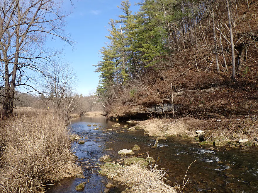
Paddling toward a large bluff
Neat substrate striations
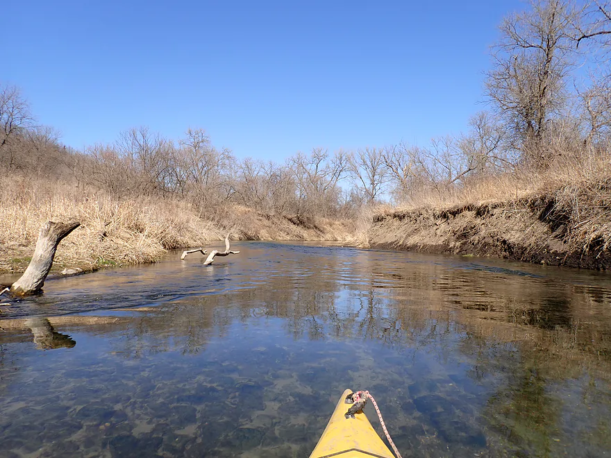
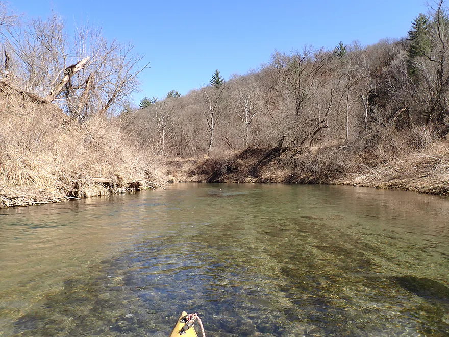
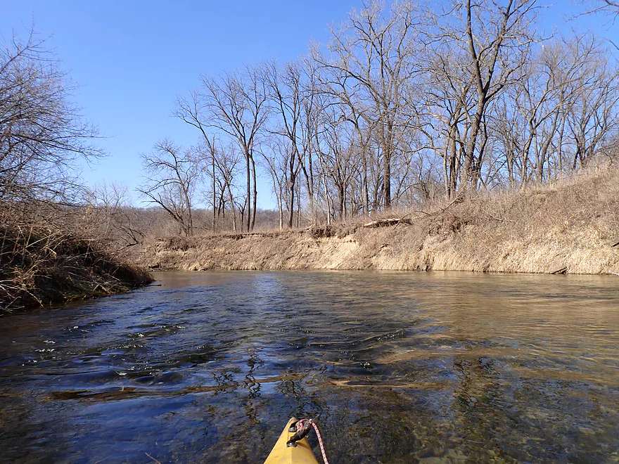
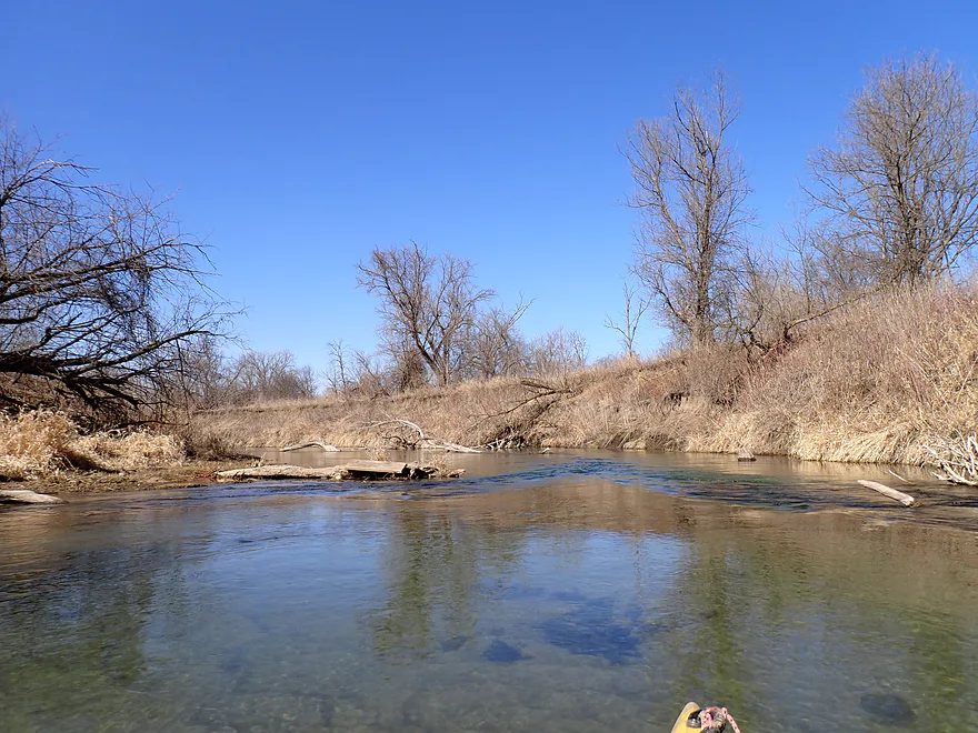
Some deadfall…but easy to get around
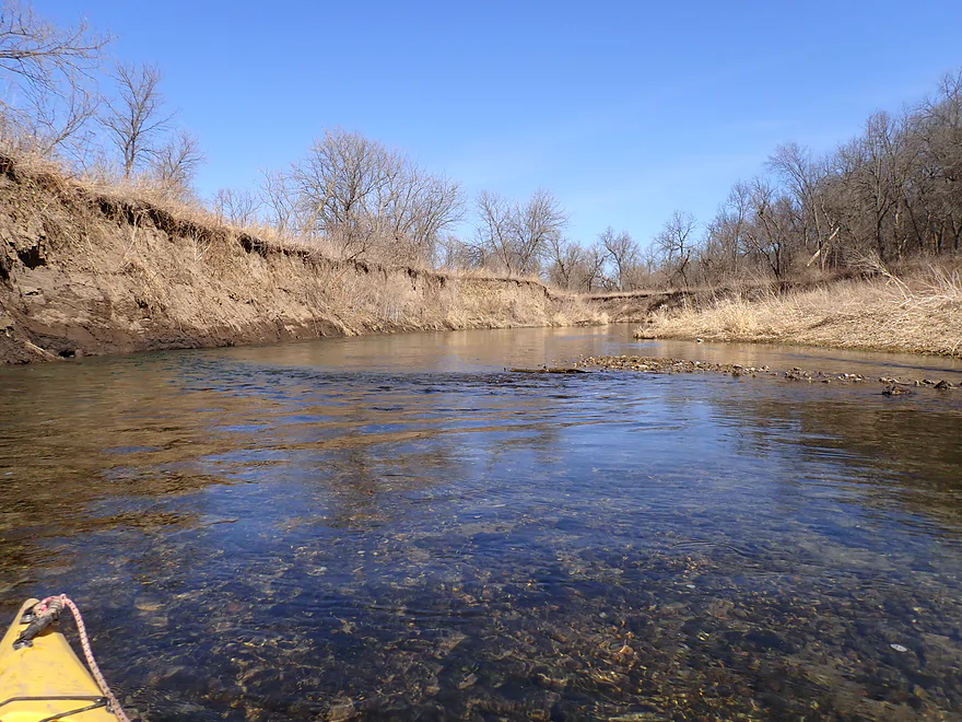
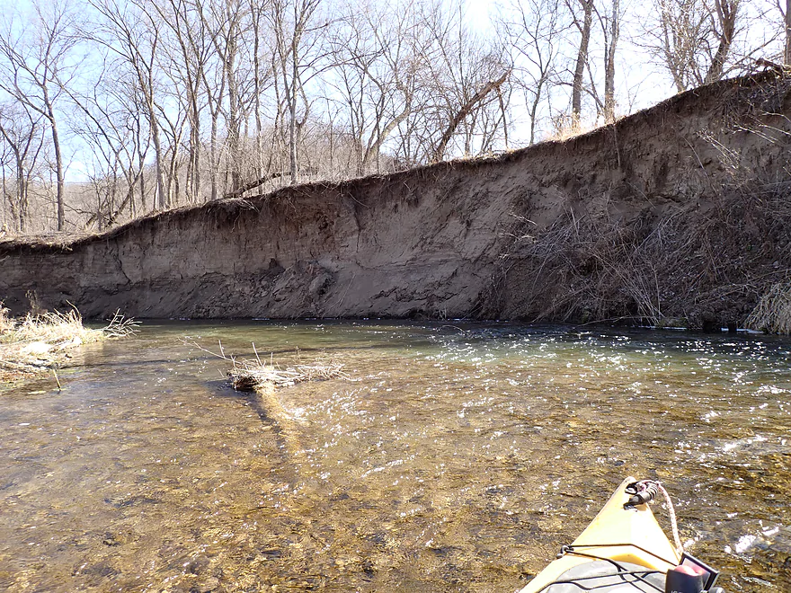
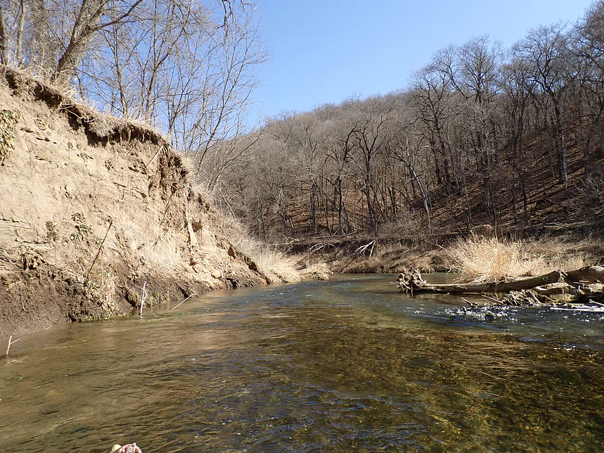
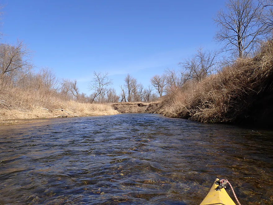
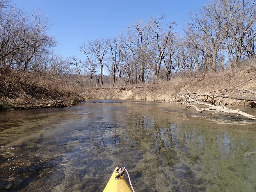
Eroded mud banks from decades of poor land use
Poorly pictured, but that is a HUGE school of fish
Tires in water produce 6PPD-quinone which is toxic to fish
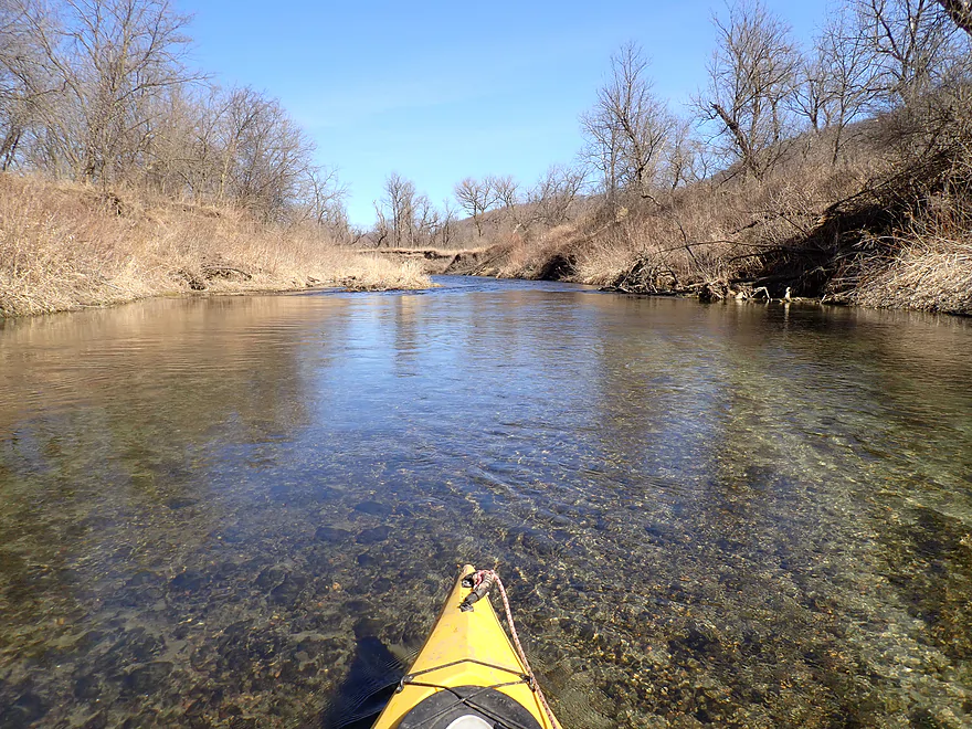
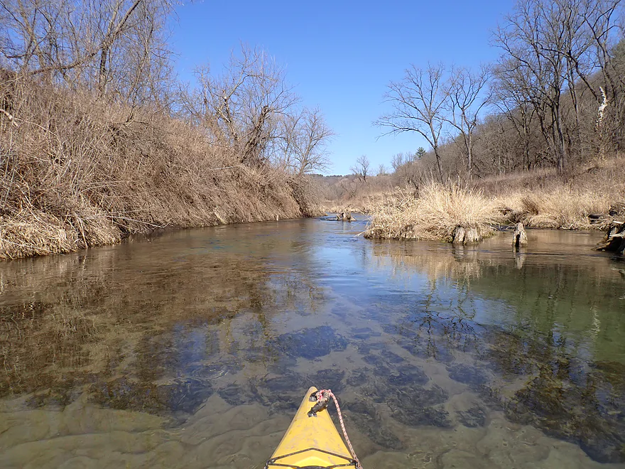
More fun riffles
No riverside cliffs on the trip, but there were outcrops atop some of the bluffs
Underwater sand patterns looking like the Sahara
Great to see some white pines on the trip
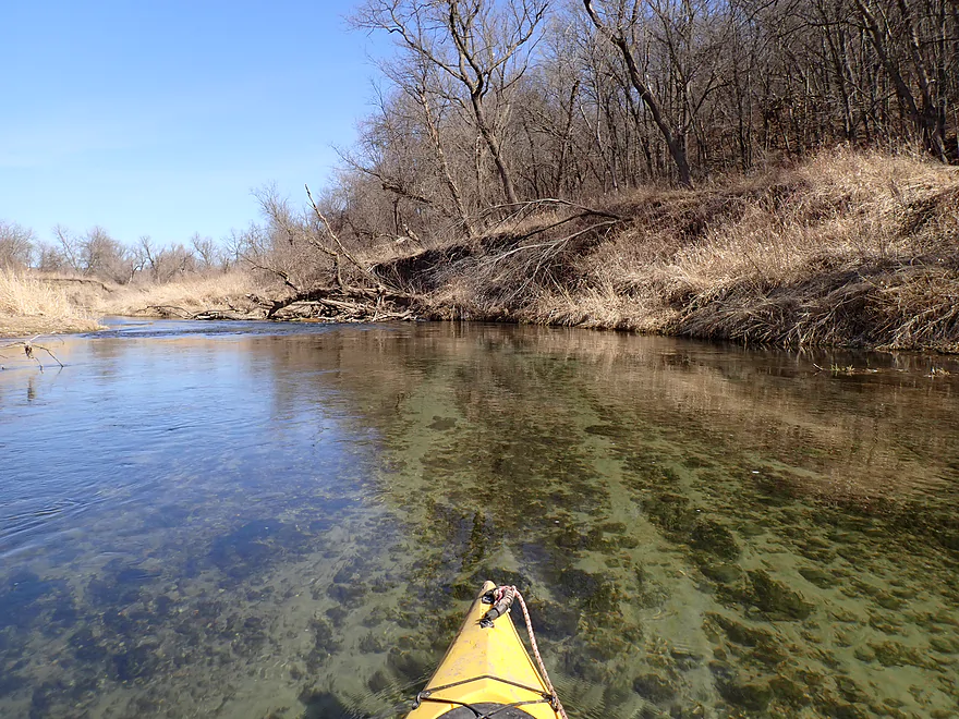
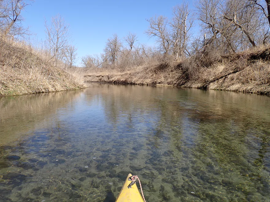
Most of the first half of the trip was this clear
One of several eagle nests along the river
Fun rapids
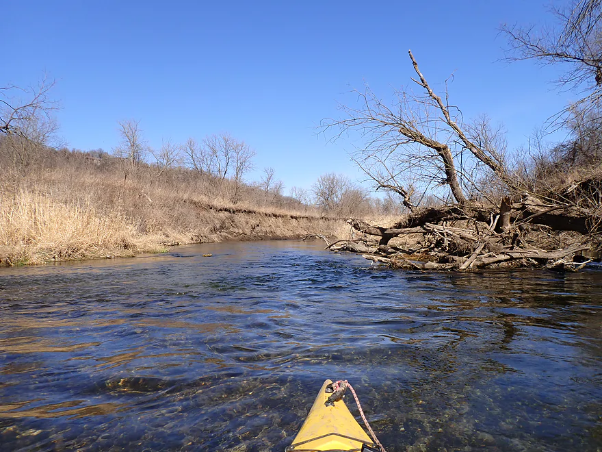
Massive logjam…but easy to paddle around

Heading toward a long, pine-topped bluff
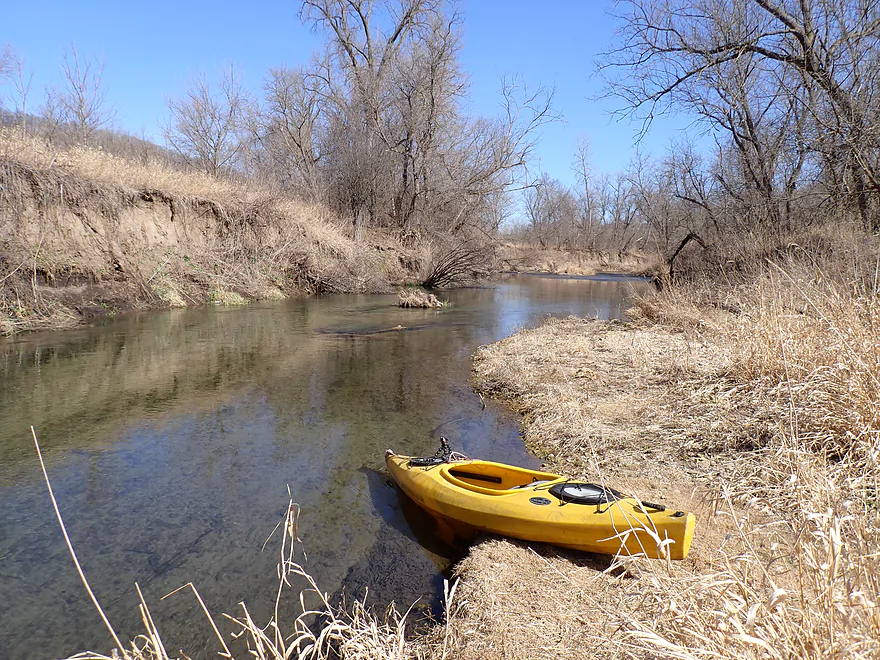
Getting out for pictures
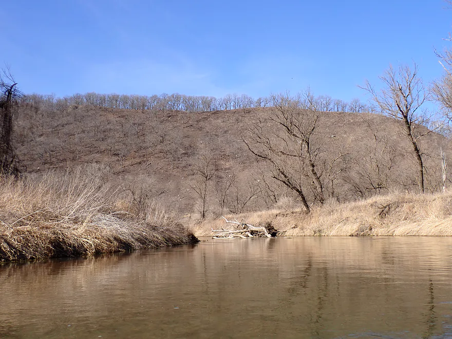
Approaching a very steep and exposed hillside
Very striking–this bluff is very likely burned to keep it open
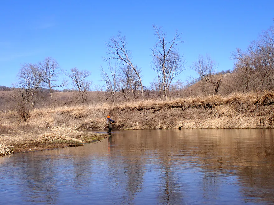
This fisherman was surprised to see me
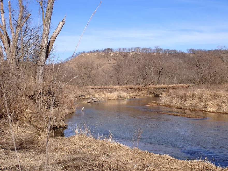
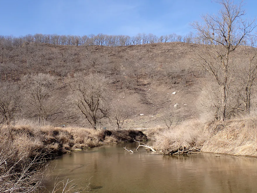
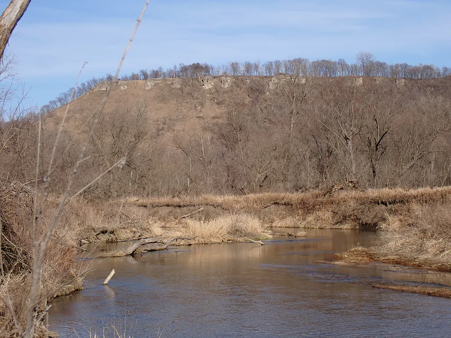
A line of exposed rock tops this scenic bluff
That white pixel in the top middle is a person
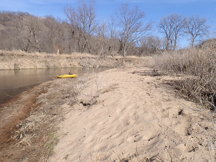
Taking a break on a really nice sandbar
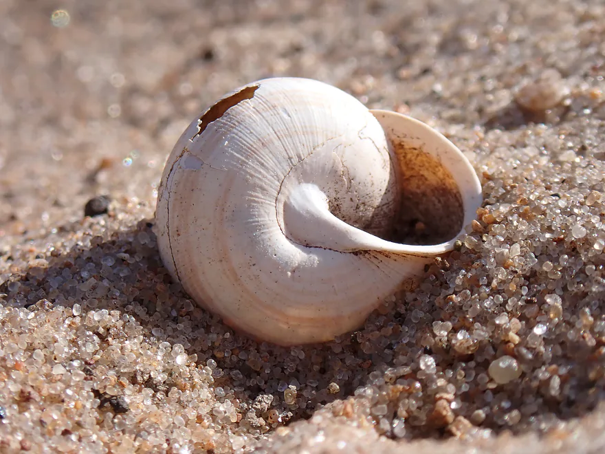
I saw several snail shells but nothing that was alive
The last great bluff of the trip
Taking out by Hwy 74 (that is the Hwy 30 bridge in back)

Good public landing (and scenic)
Scouting upstream at Whitewater State Park
Super scenic but looks a bit shallow for kayaking
Some of the fantastic palisades in the park
Whitewater River – Elba

The Whitewater River is a small river located northwest of Winona, Minnesota that winds its way through Driftless Country on its way to the Mississippi River. Three branches (North, Middle, South) join close to the city of Elba. The section downstream from Elba is recognized and recommended by several water trail guides including the Minnesota DNR. While not crazy popular, I suspect it gets a decent number of paddlers in the summer. In spring the river likely sees more trout fishermen than paddlers…but this is actually the best time to do a paddle.
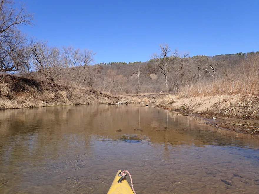
I started the trip at Hwy 26, which–while not being a formal landing–had a really nice shoulder for parking and a trail that led to the water. I was pleasantly surprised at how scenic the “river” (well, creek) was. Attractive rapids flowed under the bridge, water clarity was crystal clear, and the channel was back-dropped by an attractive bluff and fire tower.
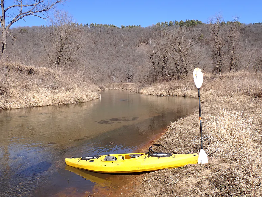
Shortly after launching, I did encounter a logjam, but it was a super easy portage. This proved to be the only obstacle of the trip, which was good news.
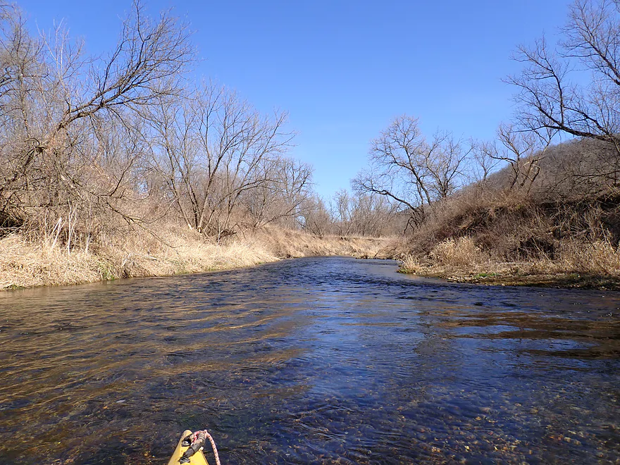
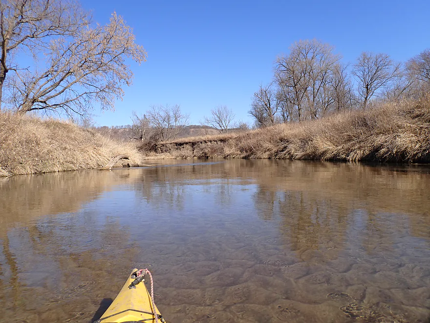
The first mile was a lot of fun. While there was never raging whitewater, there were countless riffles and the current was zippy. The spring-fed water was immaculately clear. I’ve done a lot of water trails with good clarity and this ranks near the top and was incredible.
One of the cool things about the clear water was how easy it was to spot and follow the HUGE schools of fish (some looked like trout). These tended to hang out in the deepest pools of the creek. An early settler account describes being able to stand on the bluffs overlooking the valley and “see the fish swimming in the river below.” A startled muskrat tried evading my kayak by diving ahead of me, but it was super easy to track him through the water. (I actually wasn’t chasing him, he just happened to be going in the same direction.)
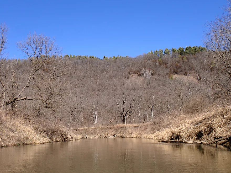
The South Fork joined the river about a half mile into the trip and nearly doubled its size. This changed the character of the river somewhat, but it was still riffley, clear, and attractive. One downside was the many high mud banks along the river–the result of decades of hillside erosion. While these sheer walls of mud were kind of artsy, they often fenced in and blocked views of the adjacent valley. The taller bluffs could still be seen and this included a really nice west-facing bluff in the first two miles.
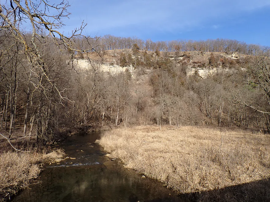
At roughly the halfway point in my trip, the river started to change. The channel widened, slowed, and became straighter…but the current still moved at a good clip (a nice river for lazy paddlers). The river scenery became less interesting…but the local Driftless Area bluffs became much more pronounced, cool looking, and would rank among my favorites I’ve seen on a kayak trip. Most were incredibly steep and ridged with some having exposed rock outcrops at the top. One even had a microscopic hiker atop its summit that I wouldn’t have seen had he been wearing a darker shirt.
What was remarkable was that several of the hills were “balding” and lacked significant tree cover. Some of these were goat prairies. The grassy areas with scattered trees are called savannas. Native tribes maintained these areas with fire, which the Minnesota DNR still does today. The prairies and savannas gave the bluffs a really cool look. I did take a bunch of photos but I don’t think they really reflect what it was like seeing them in person.
I ended the trip just short of the Hwy 30 bridge, where there is an official (but muddy) DNR access. I mentioned before that the put-in was scenic…well, the take-out was even more scenic and was backdropped by one of the larger bluffs and goat prairies.
In summary this was a great trip and one that I can recommend. What’s interesting though is it isn’t even the most scenic stretch of the river. The award for that goes to the Whitewater State Park leg (located about 4 miles upstream). I am interested in doing that stretch eventually but it looked crazy shallow and rocky…not really viable for kayaking at current water levels. Because the two strengths of this trip were the water clarity and bluffs, paddlers should be very careful to time a trip so they can most ideally experience both. You will want it to be sunny (not overcast), and water levels not too high for the best clarity. For the best bluff scenery, you’ll want to do a spring or fall trip when the grasses and leaves have died back to provide the best views. Here is video of a Whitewater River trip done in summer…it looked NOTHING like my trip. Everything is overgrown, hidden, and the water is murky. Honestly, summer paddles might be a 3-star experience while spring/fall paddles might be a 5-star experience.
Sights included two eagle nests, a muskrat, and one trout fisherman. The highlight was the sheer number of decent-sized fish (100’s!) located in the first two miles of the trip. The upper portions of the Whitewater River, including the portion that flows through Whitewater State Park (right above Elba), are designated trout streams and contain native brook, wild brown, and occasionally stocked rainbow trout.
Elba Fire Tower: This is a former fire tower overlooking the community of Elba. There is a public wayside off Hwy 26 where you can follow a trail up the hill (634 steps) and then ascend the tower (150 more steps), where purportedly the views are quite good (I was too tired to hike it). Warning, both the hill and tower are steep…you should be in good shape before attempting an ascent.
Its history is interesting. In 1933, the Elba Fire Tower was constructed to thwart local landowners from burning their hillsides to clear brush so they could graze livestock. Grazing of the hillsides contributed to the already-intense soil erosion and flooding in the valley. The tower was used until the early 1960s and then sat empty and began to deteriorate. In the 1980s, Elba residents heard rumors the tower was to be demolished and they mobilized to save it. They got it listed on the National Historic Register and a local Booster Club raised funds to rebuild it. The tower was re-opened in 1995.
Whitewater State Park: This is a popular and terrific park located along the Whitewater River. The highlights are the scenic river gorges and huge cliffs. A fantastic trail network provides the best way to explore the park (it’s typically too shallow to paddle). There are also facilities for camping and picnics.
Crystal Springs Hatchery: This is located just east of Elba on the South Branch of the Whitewater. The “life blood” of the hatchery are two artesian springs that deliver about 2,000 gallons of water per minute at a constant 48 degrees. This water is critical to the self-sustaining brown trout population in the South Branch.
Elba and the Whitewater River, like Coon Valley and Coon Creek in Wisconsin, were the poster children of the conservation movement in Minnesota. The steep bluffs so admired for their beauty today were the cause of enormous soil erosion in the 1800s from clear-cutting and poor farming practices.
Early settlers said the Whitewater River never left its banks except during the spring snow melt. Even after a spring cloudburst, the water would run high, but clear. Flooding first began in 1900. The deterioration and degradation of soils in the upland areas contributed to the valley experiencing its first land use related flood in 1900. Elba, which was once situated on high ground, survived only under the protection of dikes. Finally, in 1938 the Whitewater River flooded 28 times.
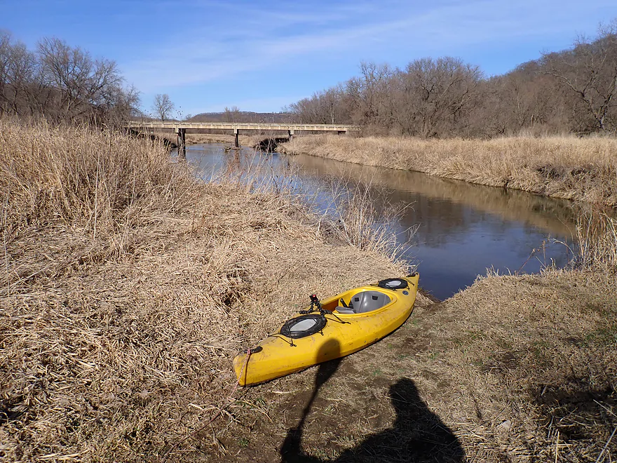
Hwy 26/E. Center Street: Located just east of the community of Elba, there was a great bridge access.
Alternate Put-ins:
- Hwy 74 (by Lost Arrow Campground) (1.9 miles upstream from Hwy 26): Don’t park by the campground, but instead along the eastern shore, where there is a public pull-off. This bonus stretch should have decent scenery, but I can see logjams (maybe four) from satellite. This should only be attempted by adventurous paddlers.
Shoulder Access (Corner of Hwy 30 and Hwy 74): Aside from a bit of mud, this is a terrific public landing created by the MN DNR. It’s also very scenic.
Alternate Take-outs:
- Hwy 74 Wayside 2 (2.3 miles downstream from Hwy 30): There appears to be a pull-off here. Adding this bonus stretch would include a few more scenic bluffs and nice sandbars.
- Hwy 74 Wayside 3 (3.3 miles downstream from Hwy 30): I believe there is a fishing access here you can use. This bonus leg would likely be a bit less interesting than the previous legs but should still be pleasant.
Bike Shuttle – Hwy 74 Landing to Elba: 4.7 miles with 36′ of ascent. This is a flat and very scenic bike shuttle. But…most of it is on gravel which is never ideal. Maybe 70% of the time I was able to pedal on a worn section of the road which wasn’t too bad. What was challenging though was when cars would pass and kick up huge clouds of dust. I had to use my shirt as a mask to prevent getting a lungful.
Fences/dams: None.
Current/Rapids: The current moves at a quick pace especially in the first half of the trip which makes the trip enjoyable. There are many light riffles, but nothing greater than Class 1. These are pretty safe, but might get pushy in high water.
Logjams: While there is deadfall in the water there is almost always an easy way around it. The only exception was a logjam near the start of the trip that had to be portaged. However this was super easy because of the shallow banks. There is a visible trail where other kayakers have portaged around the jam.
Closest Gauge: Whitewater River @ Hwy 30
My Trip Depth: 117 CFS or 693.230′
Gauge Guide:
- <100 CFS: The river usually never gets this low.
- 101-130 CFS: A below average depth, but should still be plenty navigable. River clarity will be best at these levels.
- 131-160 CFS: An average depth and a suitable target range.
- 161-200 CFS: A higher depth, but should be plenty doable. Clarity won’t be as good.
- 201-300 CFS: A high depth.
- 301-400 CFS: The river might become somewhat pushy and muddy at this stage. Maybe not ideal.
- 401-600 CFS: This might be a minor flood stage.
- 601+ CFS: Maybe major flood stage.
Click here for a Whitewater River Overview Map. Note many of the access points are along Hwy 74 which can be a bit confusing. I did try to label these carefully on the overview map.
Main Branch/Middle Fork:
- Cty Road 152 NE to Group Center Bridge: 6.2 miles. An intriguing prospect with steep bluffs and likely impressive cliffs. However this stretch is very rocky, shallow and may have logjams.
- Whitewater State Park: 3.4 miles.
- Group Center Bridge to South Picnic Area: 0.9 miles. Super scenic stretch with four impressive outcrops, including two very tall ones. Sadly this stretch is typically too shallow and rocky to run.
- South Picnic Area to North Picnic Area: 0.8 miles. A scenic stretch that hugs a steep west facing bluff and Chimney Rock. This stretch is typically too shallow and rocky to paddle.
- North Picnic Area to Hwy 39: 1.7 miles. This is the last stretch in the state park. This segment includes some classic cliff scenery, but it is very rocky and has some of the strongest rapids on the river. Still maybe only Class 2…maybe 3 in high water. This leg is typically too shallow to paddle.
- Hwy 39 to Hwy 74 by Lost Arrow Campground: 0.9 miles. This is a less interesting leg that lacks riverside cliffs. It’s still nice, but is narrow, rocky, and shallow.
- Hwy 74 by Lost Arrow Campground to Hwy 26/Elba: 1.9 miles. An ok stretch for scenery, but likely lacking cliffs. Satellite images suggest four logjams that would have to be dealt with.
- Hwy 26/Elba to Hwy 74 Landing by Hwy 30: 6.6 miles. This is a great leg and the most popular on the river for paddlers. Highlights include clear water and scenic bluffs. The confluence of the South Fork significantly increases the size of the river.
- Hwy 74/30 to Hwy 74 Wayside Access #2: 2.3 miles. This is a less popular stretch. Highlights might include a few small sandbars. I suspect there is one logjam that would have to be portaged.
- Hwy 74 Wayside Access #2 to Hwy 74 Wayside Access #3: 1.0 miles. Likely a simple leg. Should still be some good bluff scenery though.
- Hwy 74 Wayside Access #3 to Hwy 74 Wayside Access #4: 1.1 miles. This mini-leg has an unusually high concentration of major logjams…maybe 6.
- Hwy 74 Wayside Access #4 to 130th Ave: 5.7 miles. Maybe 3 logjams? This leg should have an impressive sandbank near the take-out.
- 130th Ave to Mouth on Mississippi: 1.0 miles. Last leg of the river flows through a small flood-bottom delta with scenic wild rice.
- Take-outs on the Mississippi: There are several options. You can head 3 miles north to get out at the 125th landing. Another option would be to head two miles south and get out at the Minneiska Access.
North Fork: The Youtube channel “Exploring Home | Minnesota”, documented the North Fork from Carley State Park to Whitewater State Park in a video here.
- Carley State Park to Elba Township 16 (1): 13.8 miles. A very scenic section with pine trees and many cliffs…some really nice. This stretch is shallow and rocky and wading may be required. Also logjams are a major issue…figure maybe 8 would have to portaged.
- Elba Township 16 (1) to Elba Township 16 (2): 0.3 miles. Maybe one major logjam and a huge sandbank.
- Elba Township 16 (2) to Whitewater Drive: 1.9 miles. Figure four logjams and a few small cliffs.
- Whitewater Drive to Hwy 74/Mouth: 0.4 miles. More of an open stretch, but maybe one logjam.
South Fork: The South Fork is somewhat unknown but has good potential and likely great cliffs and scenery. Unfortunately it too is rocky, shallow and has some logjams. But…it’s likely in better shape and is a better prospect than the North Fork.
- Hwy 37 to Lamberton Mill Road: 1.9 miles. A scenic stretch with a few attractive gorges, but the river will be rocky and shallow. Expect maybe 3 major logjams.
- Lamberton Mill Road to Hwy 112: 10.7 miles. Likely the most scenic leg on the South Fork with many cliffs, boulder gardens, rapids, and fantastic gorges. However this too is shallow, rocky, and has maybe 4 logjams.
- Hwy 112 to Hwy 37: 1.0 miles. A more open stretch, but it does contain one nice pine topped bluff. I think this leg has had bank work done for trout.
- Hwy 37 to Hwy 26: 1.6 miles. A bit more eroded, but a solid prospect. River closely parallels a long bluff.
- Hwy 26 to Mouth on Middle Fork (just downstream from Elba): 0.9 miles. A decent prospect.
- Main Branch Options: To reach a take-out, you would have to paddle a half mile upstream to the Elba bridge (tricky because of the occasional light rapids), or continue six more miles to the Hwy 30/74 access.
Trip Map
Overview Map
Video
Photos Size: