
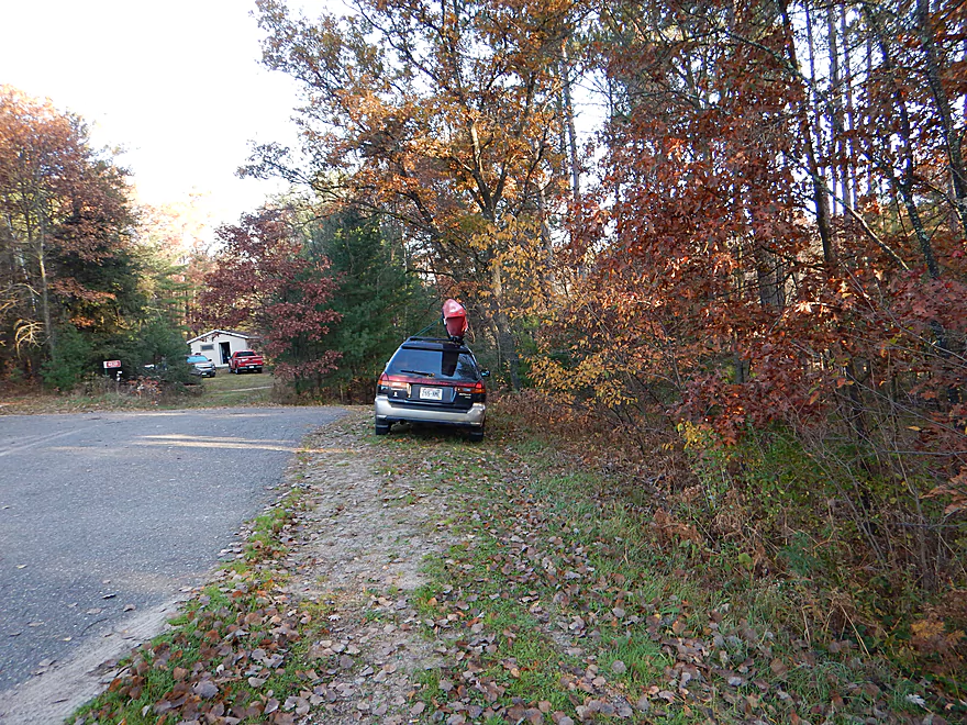
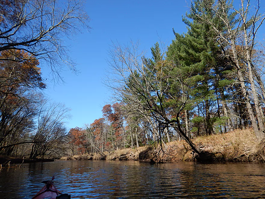
Putting in at Steponik Road
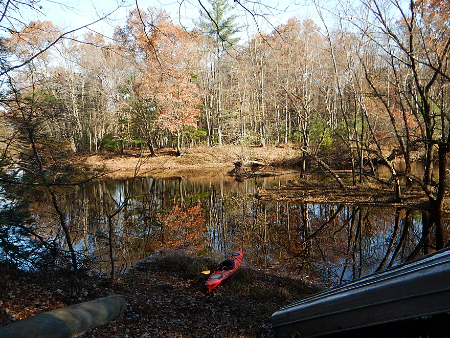
A small hidey landing is located here
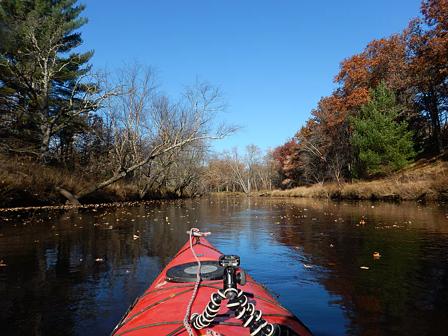
Good launching area
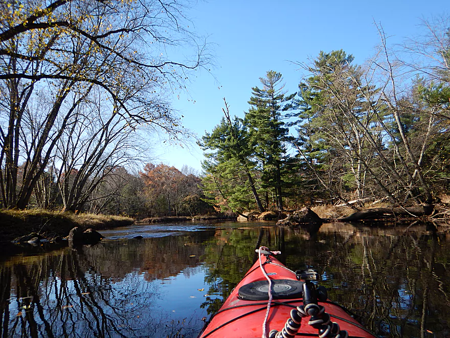
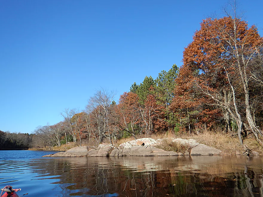
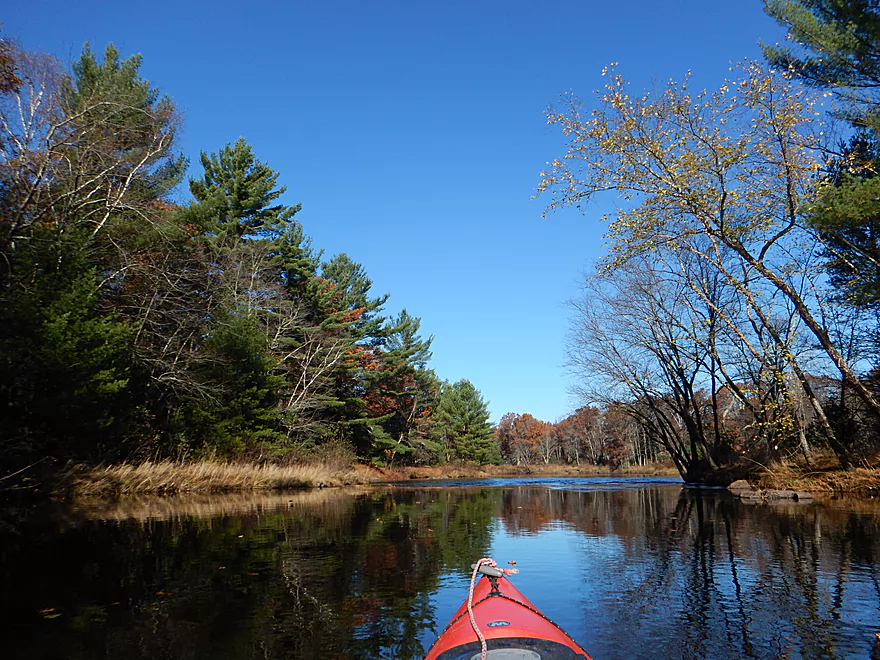
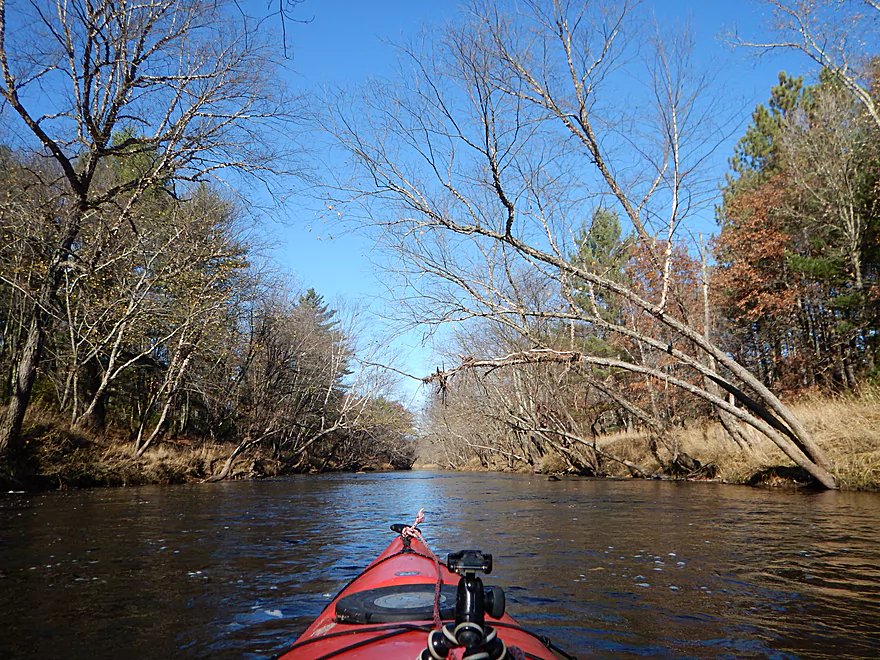
Scenic view by the put-in
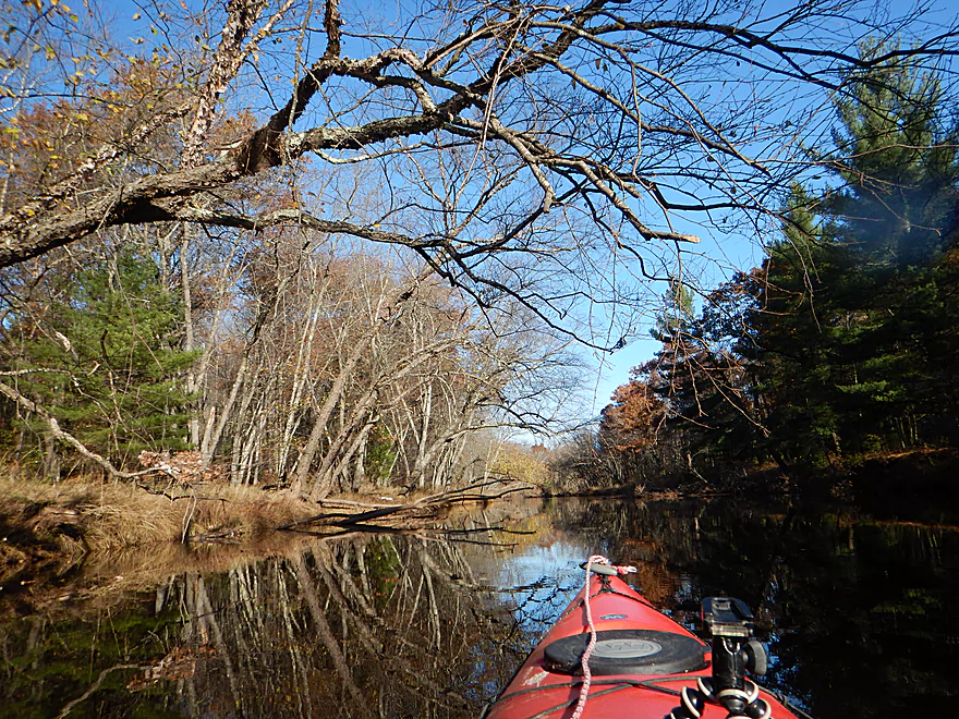
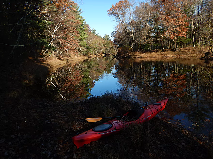
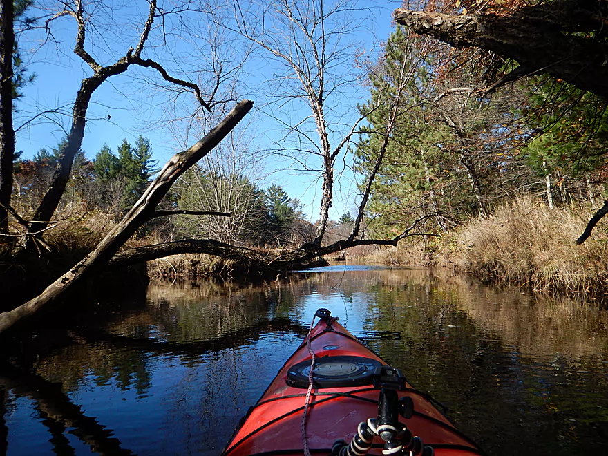
Very still water makes for many nice reflections
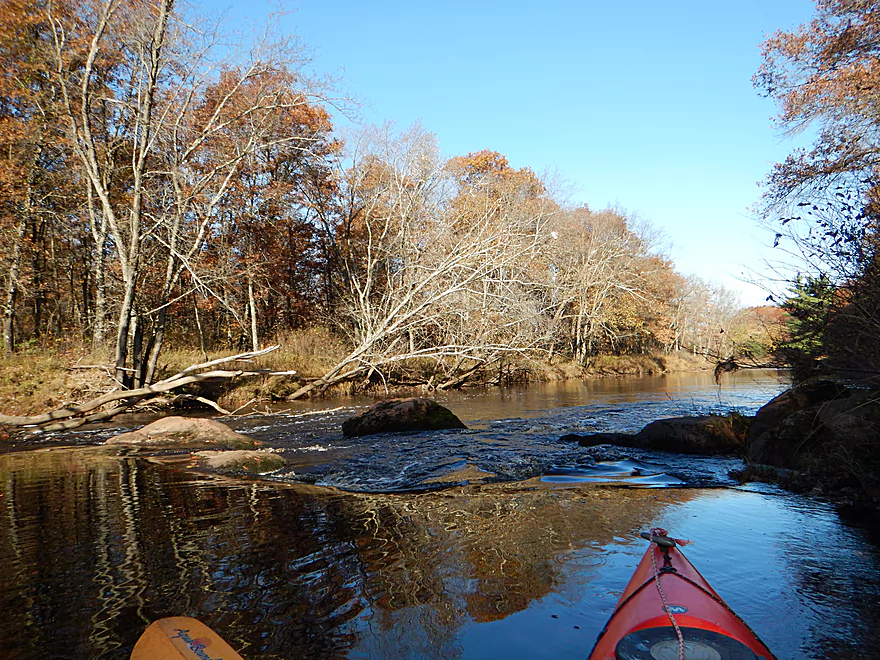
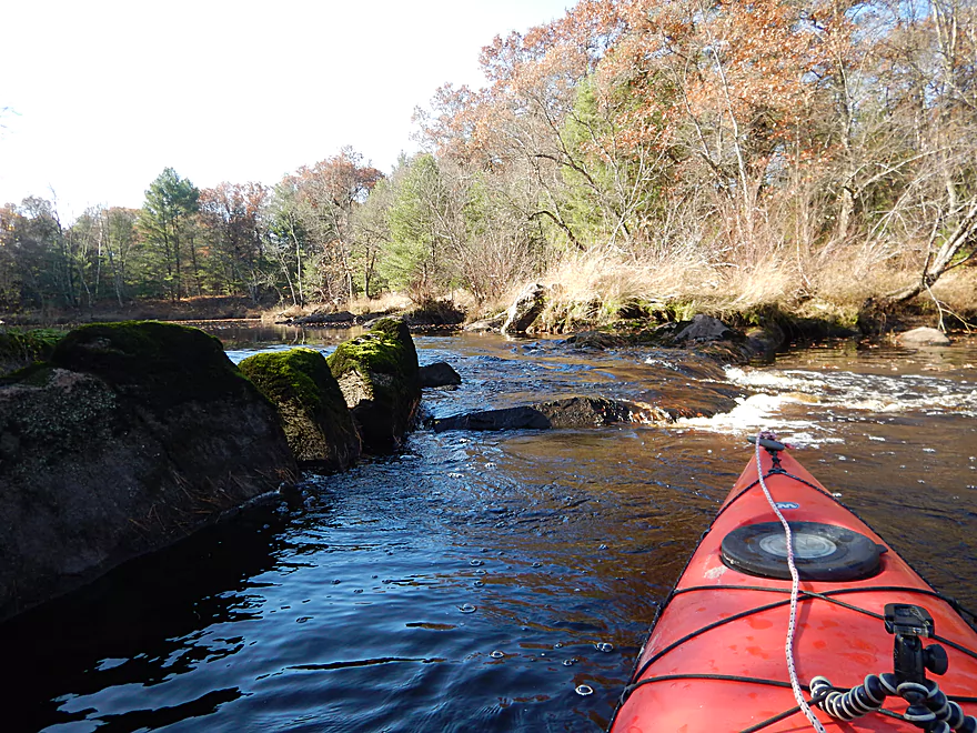
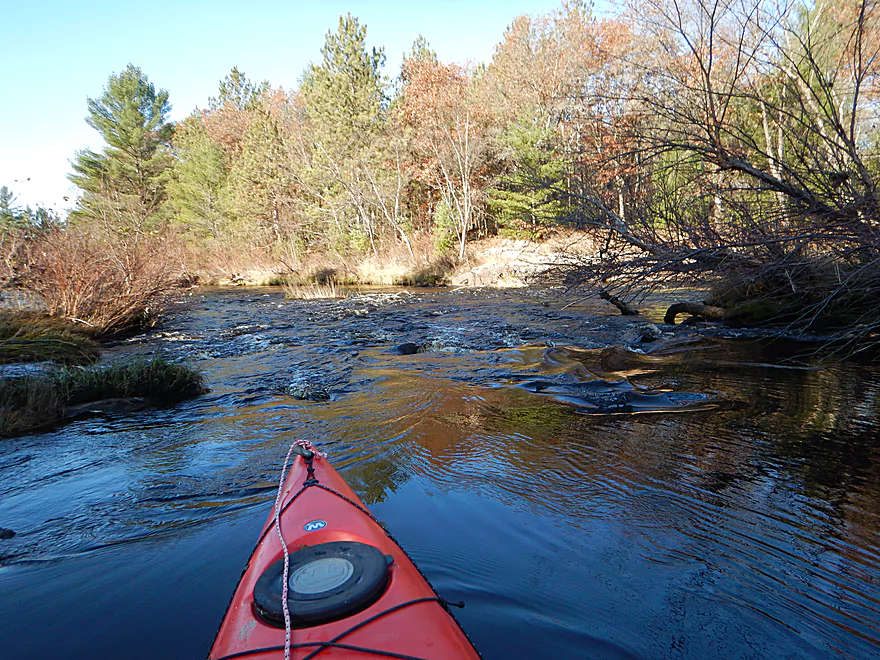
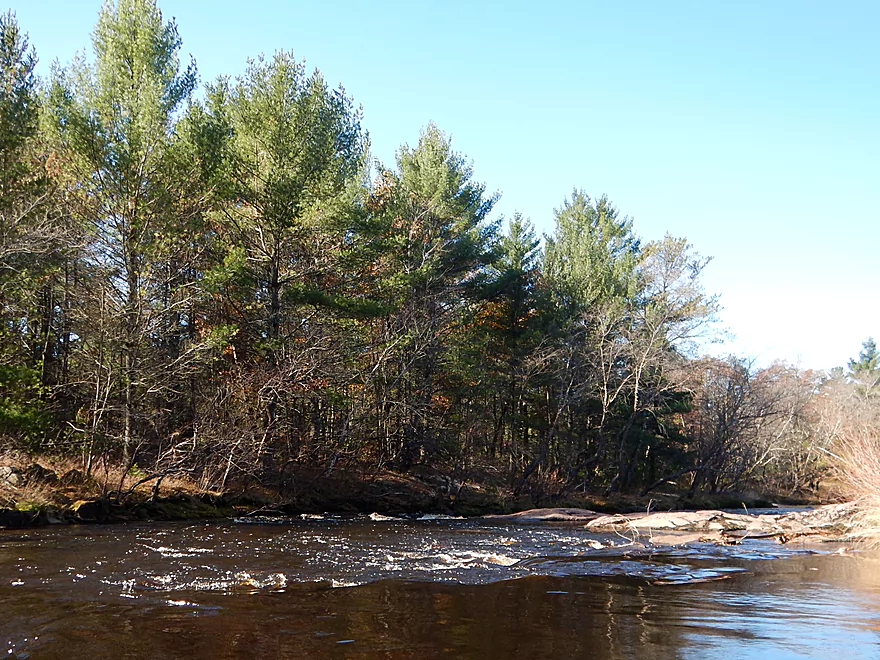
A couple of riffles break up the stillness
Pretty wimpy
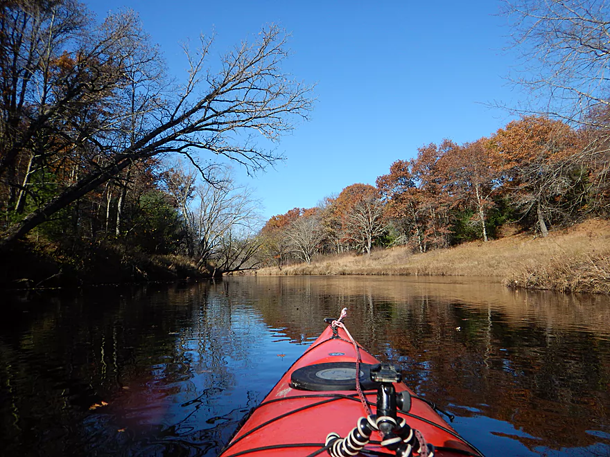
Lot of leaves on the water instead of on the trees
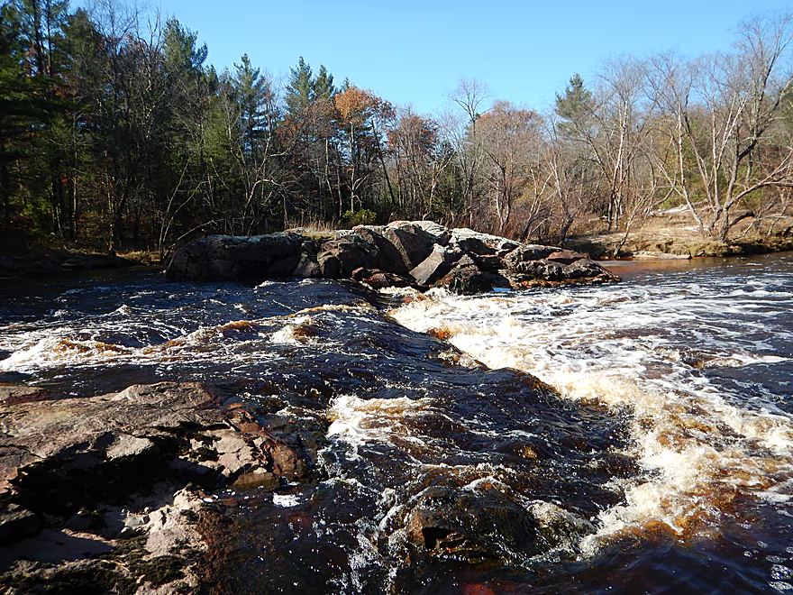
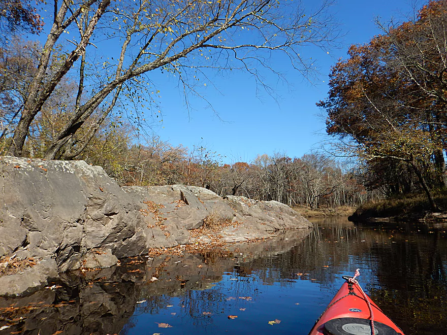
Granite locks
Only sign of civilization on the trip
You can see how high the floods get
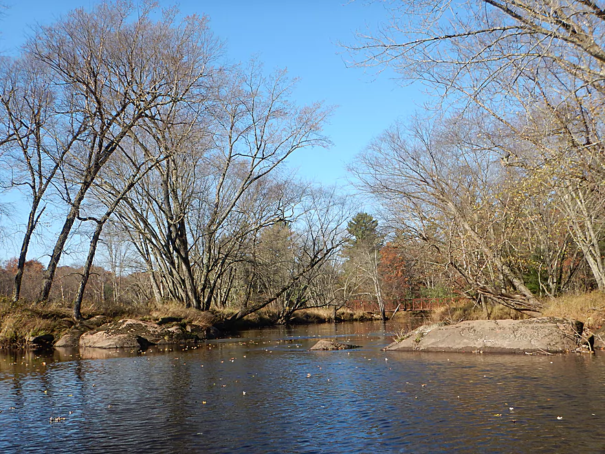
Scenic stretch of the river
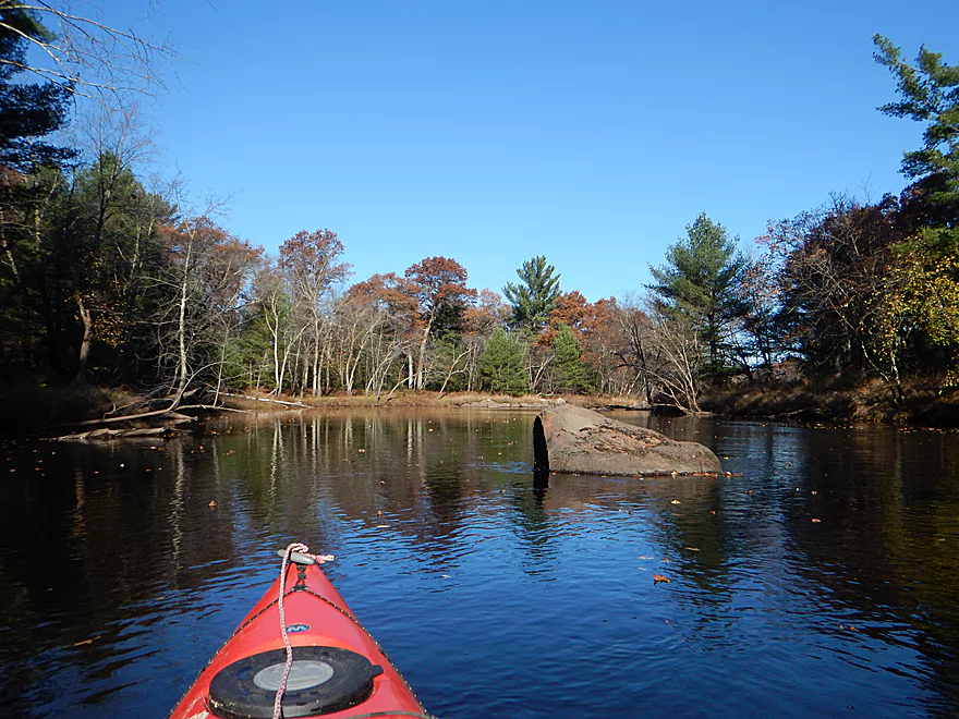
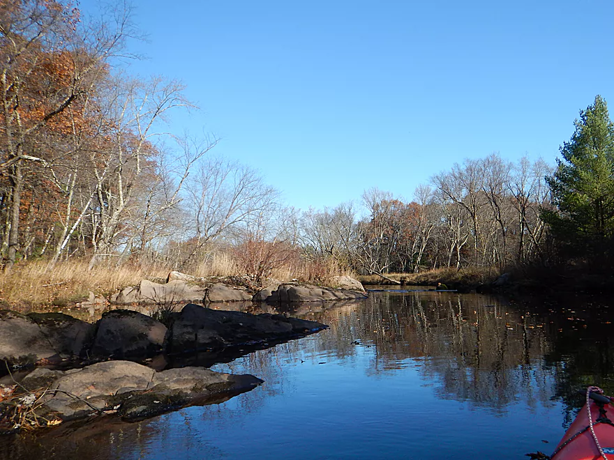
Lot of granite on the banks
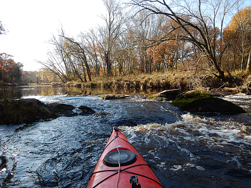
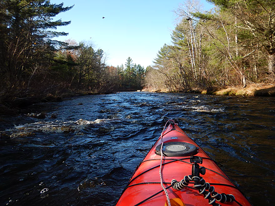
Some more weak rapids
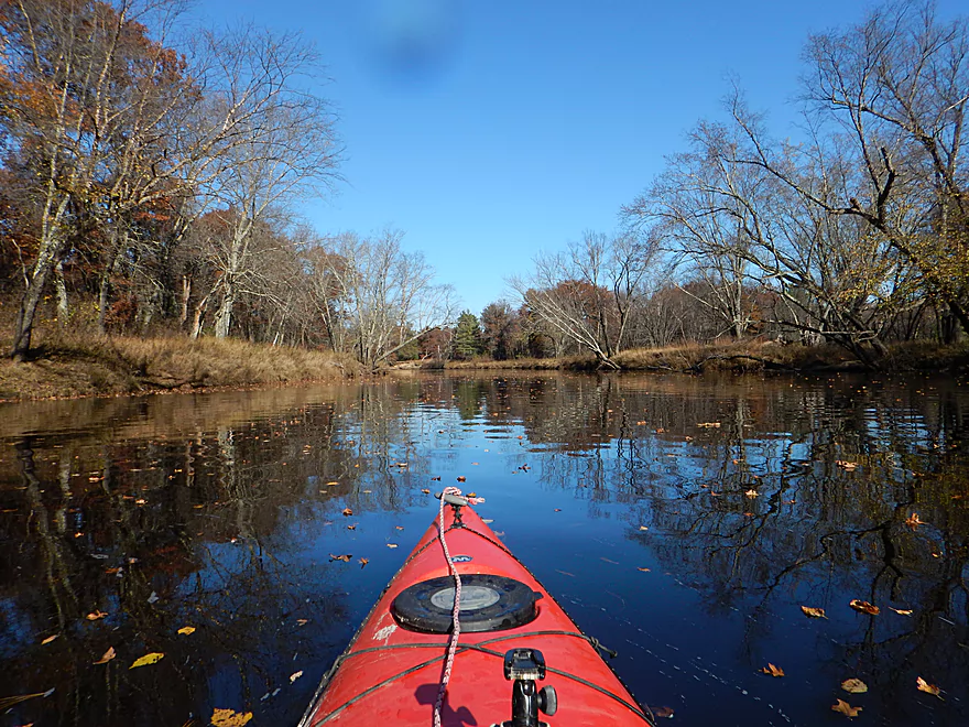
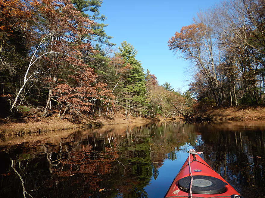
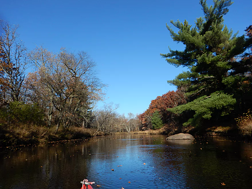
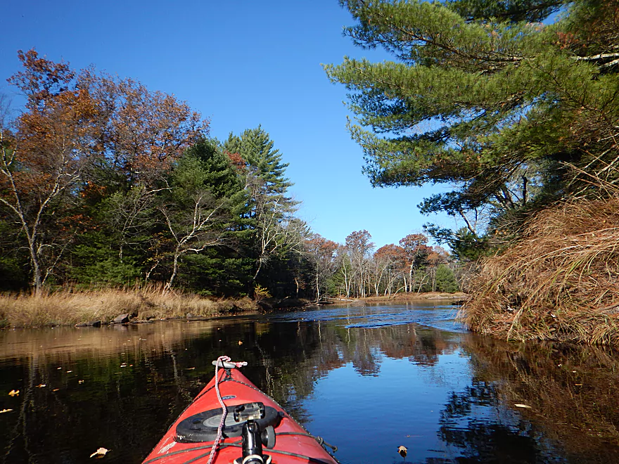
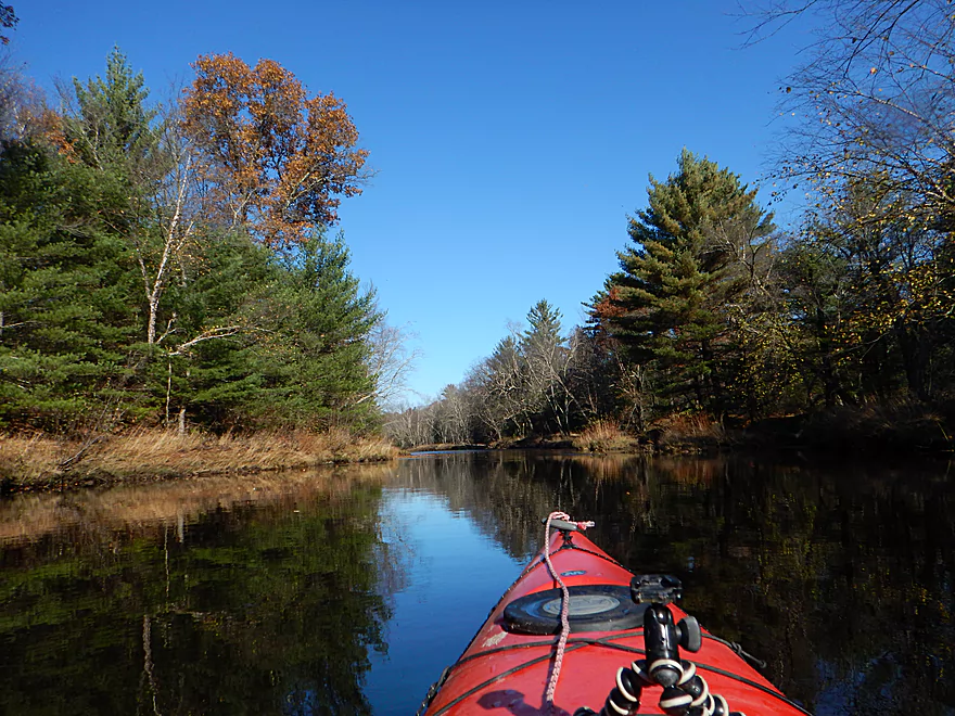
A surprisingly wide and slow river
Something is watching me from the sand banks…
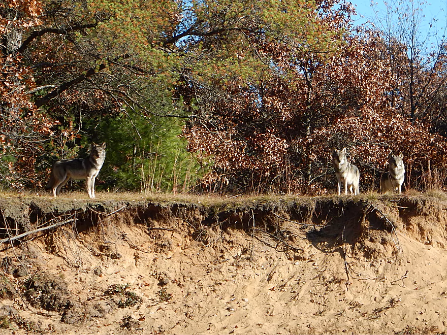
These aren’t coyotes…
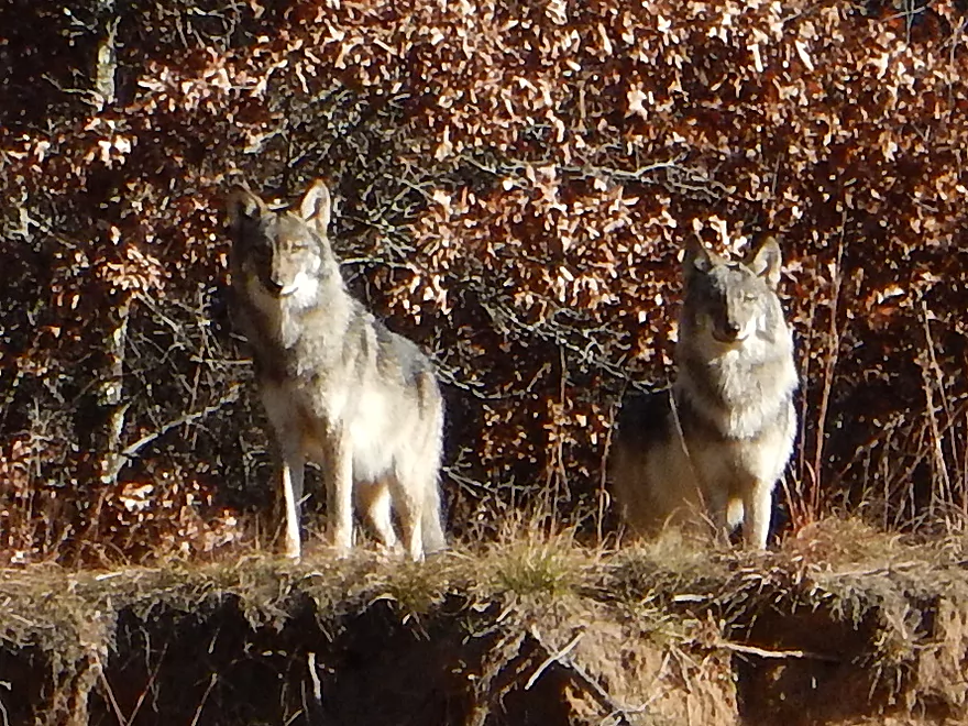
Part of a five minute staring contest
A good camping sandbar (lot of animal prints)
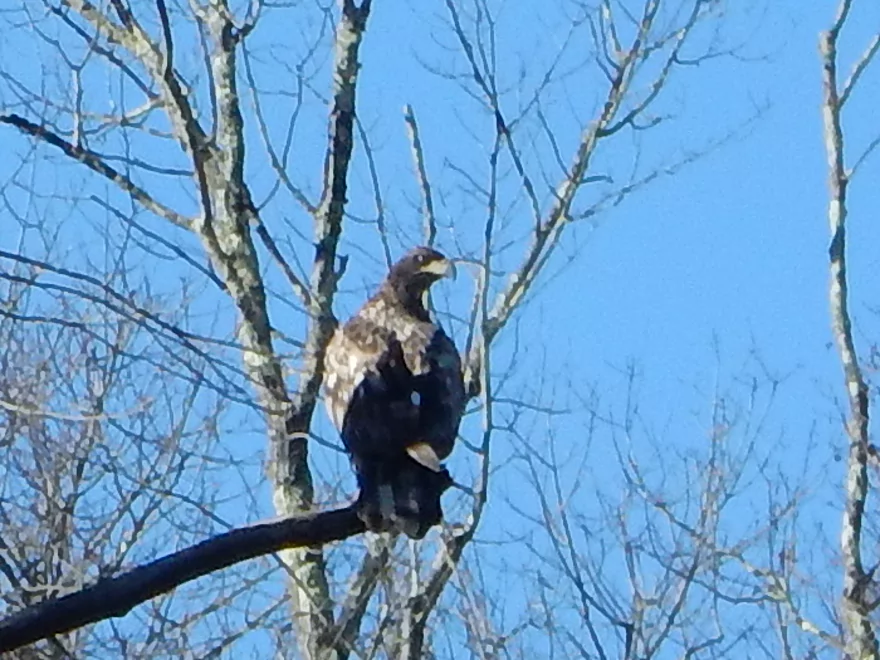
A grumpy looking immature eagle
More beautiful white pines
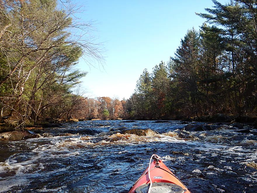
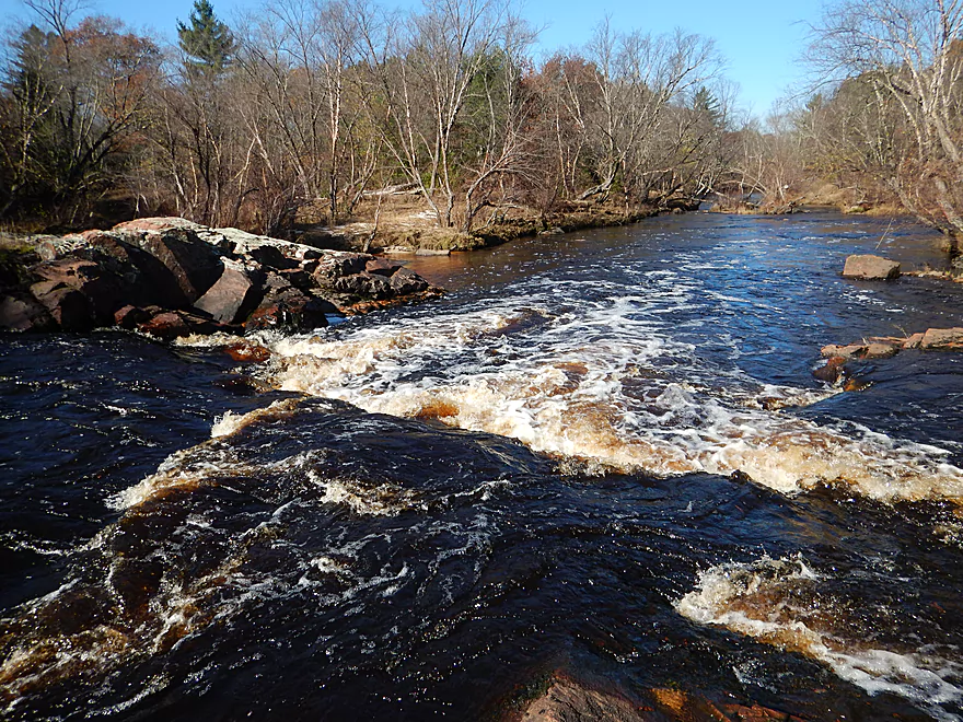
Walleye Rips (easy Class 1)
Is immediately followed by Whitetail Rapids
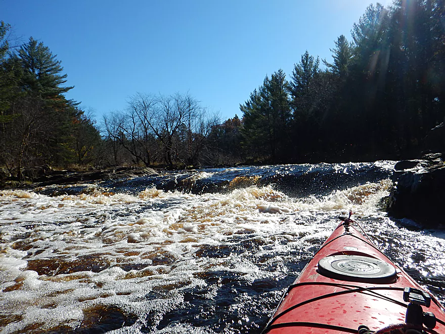
There is a Class 3 section at the end
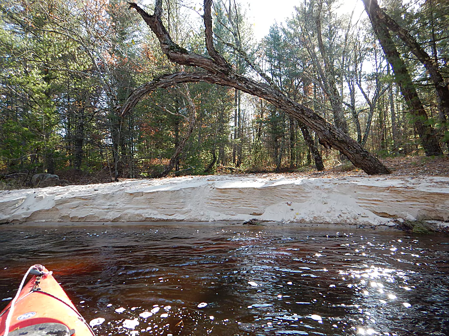
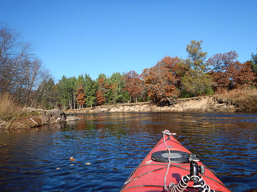
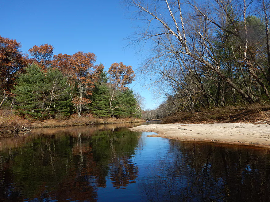
Such clean white sand
The river slows down with several small islands
Think carefully before committing to these Class 2 rapids on the left/south shore
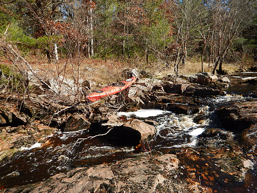
As you may miss the ability to portage on the north/right bank
And get swept over East Fork Falls
Typically Class 4
Reverse view
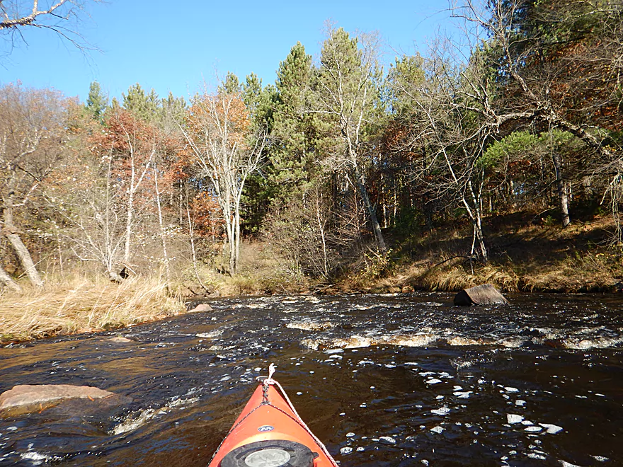
Some Class 1 remnants
No more rapids for the rest of the trip
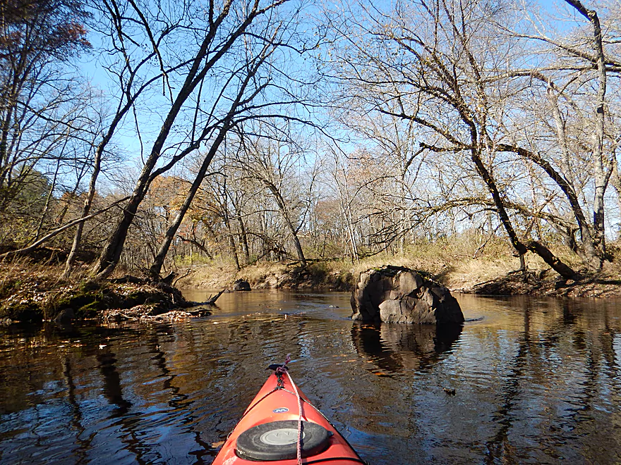
Attractive rock mound
Surprisingly large sand banks
Taking out at Pray Road
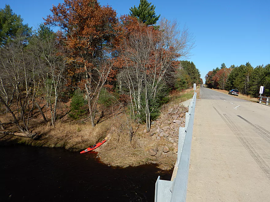
Good take-out option with shoulder parking
Black River – East Fork – Steponik


The East Fork is the largest tributary of the Black River. Most paddlers enjoy this river for a fast section between Overguard Road and Lake Arbutus that contains several fun rapids. Previously, I reviewed a section from Pray Road to Overguard which was very pleasant. For this paddle, I wanted to explore the next upstream section from Steponik Road to Pray Road.
The launch off Steponik Road is a bit obscure and close to a group of houses, but is certainly a decent option. The river makes a good first impression, with scenic tree-lined banks reflected over a serene and peaceful channel. Although honestly at times this river was a little too serene and peaceful, and it would have been nice to have more current. Much of the trip felt like paddling on a long lake because of the wide channel and lack of current. Very much reminded me of the Lemonweir River by New Lisbon (a neighboring watershed 36 miles to the south).
At times, a small set of rapids or a mound of granite will break up the monotony. Really though, I had expected more rapids and granite boulders for the trip and was actually disappointed on this account. One of the highlights was seeing a family of three otters, which is quite the rarity for paddling. Nearby there were two eagles circling overhead and you had to wonder if they were hunting the otters?
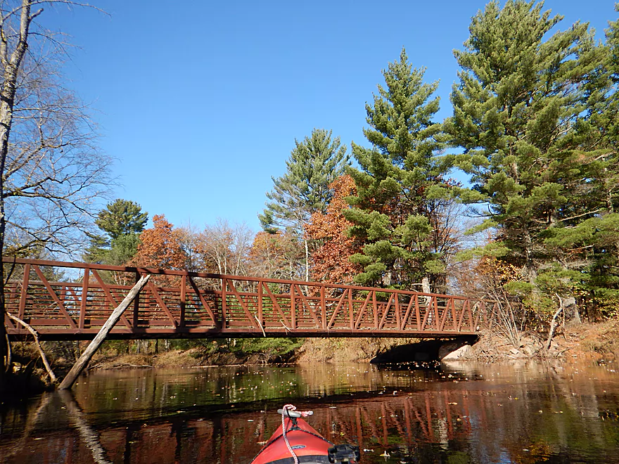
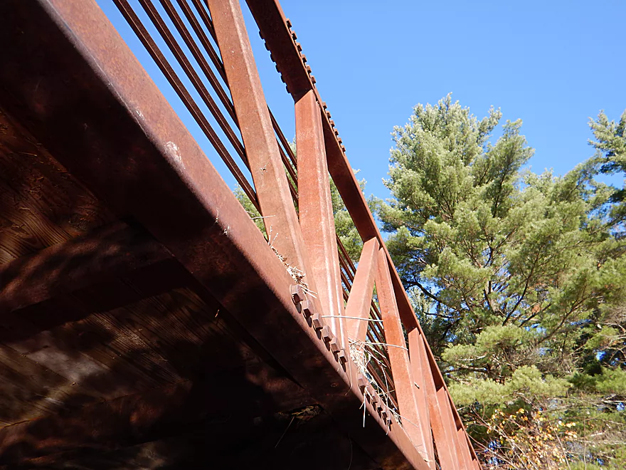
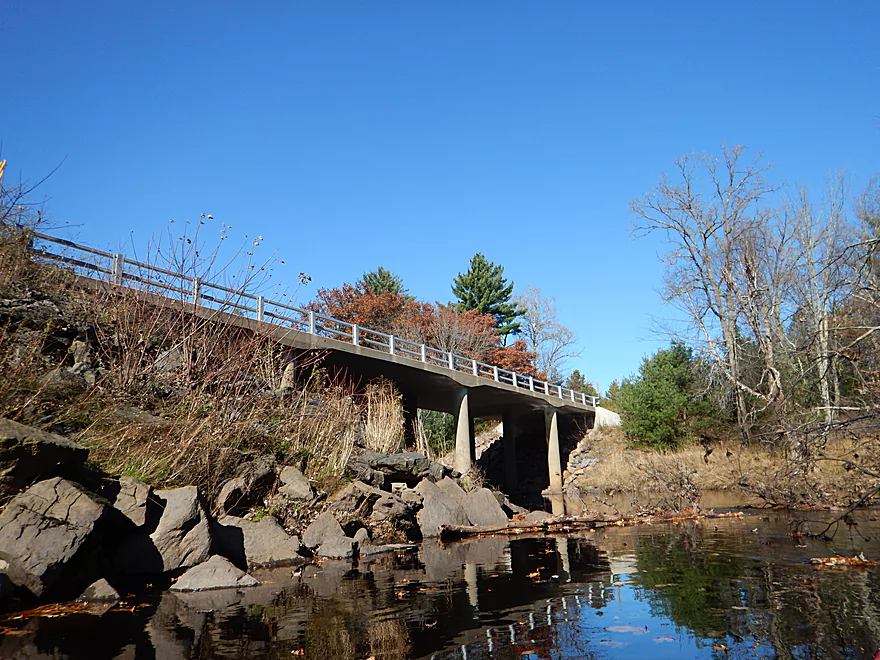
A few miles into the trip, you’ll pass a scenic granite chute and come across a snowmobile bridge. At my depth (892.46′), I was easily able to get under, but do note in higher water you will need to portage this. The snowmobile bridge was definitely built too low, and you can see a lot of debris lodged on the road from the last big flood we had a few weeks ago.
After the bridge, the river gets a bit more scenic with granite protrusions, but again not in proportion to what I expected (my last/downstream trip was better for geology sightseeing IMO).
Then things got interesting… Atop a sandy bank I came across three full grown wolves. They just stared and stared…(granted I did the same). They then retreated, only to come back to the shore for an even closer look. Honestly, this was disconcerting. Predators prefer prey with low profiles (which is an issue for a kayaker) and the pack had split up with one wolf sneakily flanking from the left. I knew I had a portage coming up on their side of the river and I was fighting a strong wind that would blow my scent in their direction. Eventually I scared them back, but wasn’t sure if they were tracking me, so I did pick up the pace quite a bit and took fewer pictures. Maybe I was just being paranoid…but the way they stared at me, initially followed me, and how they looked so skinny and hungry…made me feel like a short red deer.
After this the scenery stays good with more granite protrusions, some small sandbars (with many animal prints), and pines (always more scenic than hardwoods).
The main attraction for the entire trip is a short quarter-mile section that contains mostly rapids, including some doozies. If you do this trip, you do want to read the following notes very carefully. The rapids start innocently with a Class 1 set (Walleye Rapids). There is a granite protrusion on the north/right bank that lets you get out and portage much of this entire section if you wish (supposedly there is a portage trail nearby, but I didn’t see it). The river narrows and almost immediately after, the rapids pick up speed and end in a Class 3 ledge (Whitetail Rapids). Now typically Whitetail is Class 3, but at my lower depth, it was probably just a Class 2. The river then opens up in a calm bay before angling right…but do stay on your guard. Soon after there is a Class 2 on your left, and a small rocky island channel on your right. I advice hugging the right shore as much as possible. Here it is easy to take out and scout the rapids. If you take the left/main chute, it will be difficult to get to a portage spot in time before you get swept over East Fork Falls…the current is just that strong, and you would have to paddle all the way from the far left bank to the right bank.
I bumped my way through the tiny right island channel and then completely portaged East Fork Falls, which is a strong Class 3 or weak Class 4. If you run this, definitely scout it beforehand. It is a deceptively steep drop, especially on the left/south side. The right side has more of a slope, but there are more rocks to hit. There might be a small bypass channel all the way to the left/south, but I just didn’t have the ability to scout it. In higher water there would also be a bypass channel on the far right/north end, which I would recommend. After my portage there was one more set of Class 1 rapids to deal with, then that was it. The river then goes back to sleep with its paltry current and there will be no more rapids for the rest of the trip.
The remaining part of the trip was pleasant but not super noteworthy. Lot of beat-up hardwoods atop tall sandy and grassy banks formed by many floods. The channel is wide, straight, and slow. There are a number of downed trees in the water, but no logjams. On the plus side, there was no development, no agriculture nor industry.
In summary, this was a nice trip, but for a drive to central Wisconsin, you expect more (my previous trips on the Upper Plover and Upper Black were far superior). In fact, even my previous trip on the downstream section of the East Fork was better. As a general rule with the East Fork, the further west you go the more scenic the river becomes (geologically the river makes a sharp transition from sand country to the more interesting driftless portion of the state).
Off dead-end Steponik Road there is a nice grassy area for launching kayaks. It looks private because of the proximity to the nearby houses and the parked boats by the water, but you’re ok to launch here. Many other paddlers use this launch and I checked the DNR maps which indicate that this launch and everything east of the road is public forest. There is a small area for shoulder parking at the end of the drive you can use.
Alternatively, you could put in at the next upstream bridge (Knutes Road), but the local landowner is overly territorial and has been known to leave notes on cars parked by the bridge, so use Knutes at your own risk.
Supposedly there is a canoe access spot at the end of Borek Road, but I forgot to scout this so can’t confirm.
Good and popular bridge access at Pray Road. A small trail leads up from the water northwest of the bridge and there is plenty of shoulder parking along the road.
Pretty doable bike shuttle. No major hills, 5.8 miles, 42 minutes, and all paved. As a general rule, the sections on the East Fork downstream from Pray Road are pretty much no-go for bike shuttles because of the rough gravel, whereas all the sections upstream of Pray, are paved and fine for bikes.
I’ve been contacted by Todd who can assist with shuttling, as well as provide water level updates. You can reach him at wheeler54615@yahoo.com.
No logjams, which is always great.
The current is mostly very slow, with a handful of minor Class 1 rapids. There is a snowmobile bridge which you will have to portage in high water.
Two-thirds into the trip there is a quarter-mile section of rapids that is dangerous. It starts with Whitetail Rapids (Class 2-3), then there is a short lull…then a class 2 chute that can push you over East Fork Falls (supposedly Class 4). During the lull between the rapids, hug the right shore so you can make your portage off-ramp. Do not run the Class 2 chute on the left unless you know what you are doing. Definitely scout East Fork Falls before running or just portage it (as I did). This is detailed in the main write-up and on the map.
Video References:
- Walleye Rapids: 1:49
- Whitetail Rapids: 2:06
- East Fork Falls: 2:31
A popular belief with paddlers is that the East Fork frequently gets too shallow to paddle, but I haven’t experienced this personally (at least on the upper stretches). If anything, I doubt the upper parts ever get too shallow to run, although a few of the rapids might be a tad bumpy in low water. Here is a very rough guestimate of how navigable the river is based on the local gauge.
- 891′ to 892′: The river rarely gets this shallow and this stretch should be mostly navigable with perhaps some of the rapids being a bit bumpy.
- 892′ to 892.5′: A good target depth (my trip was done at 892.46′). The major rapids will probably be one class level easier.
- 892.5 to 893: A highish depth, but should be plenty doable.
- 893′ to 894′: Rapids are probably more noticeably difficult and pushy.
- 894′ and up: Probably only suitable for hardcore whitewater paddlers.
Several eagles, three otters, and three wolves. The wolves appear in the video at 1:10.
Detailed Overview
- River Road to Hwy 73: 1.8 miles. A small creek that might be runnable in high water. Jams shouldn’t be too bad.
- Hwy 73 to Hay Creek Road: 5.4 miles. Probably a feasible creek prospect.
- Hay Creek Road to Peterson Road: 4.3 miles. Probably doable as a creek prospect as it is more open, but there would still be some jams.
- Peterson Road to Hwy ZZ: 7.0 miles. Probably too many downed trees.
- Hwy ZZ to Knutes Road: 5.1 miles. Very narrow and wooded…downed trees are probably an issue. Best launch option probably SW of bridge.
- Knutes Road to Steponik Road: 5.8 miles. Probably a sandy slow section with no rapids and a handful of downed trees. You should be legal to launch by Knutes Road, but the local landowner doesn’t like outsiders. Supposedly there is an access option at Borek Road.
- Steponik Road to Pray Road: 4.6 miles. Ok section with several small Class 1’s, a Class 3, and a Class 4.

- Pray Road to Overguard Road: 7.4 miles. Good section with large granite boulders and one Class 1 rapid.
- Overguard Road to East Fork Campground: 4.5 miles. The last, best, and most popular segment on the East Fork.
- Overguard Road to East Fork Road: 2.3 miles. Scenic section of the river with four Class 1's and one Class 2.
- East Fork Road to East Fork Campround: 2.3 miles. Another good section of the river with two Class 1's and two Class 2's.
- East Fork Campground to Lake Arbutus: Simple flowage paddling. Lake Arbutus has about 9 landings to choose from.
Trip Map
Overview Map
Video
Photos Size: