
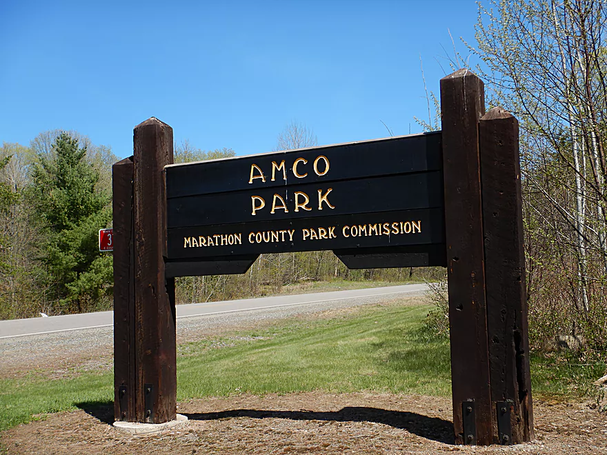
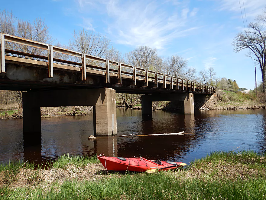
Welcome to Amco Park
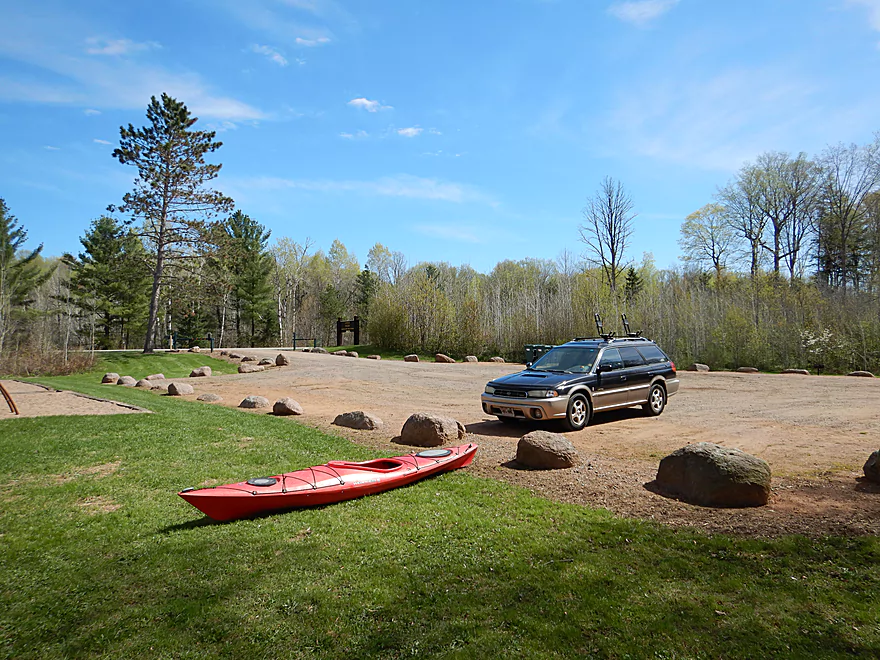
Very nice park and launch area
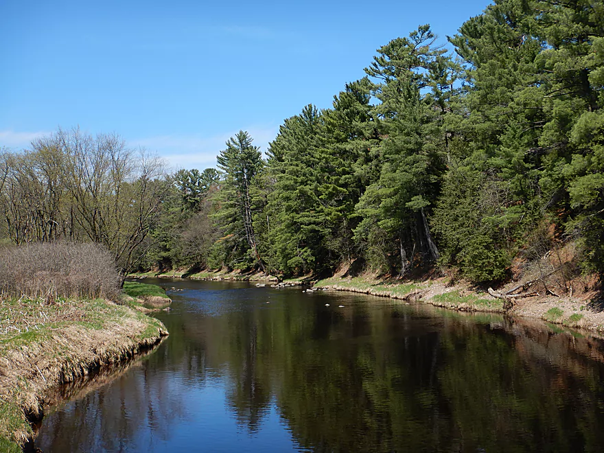
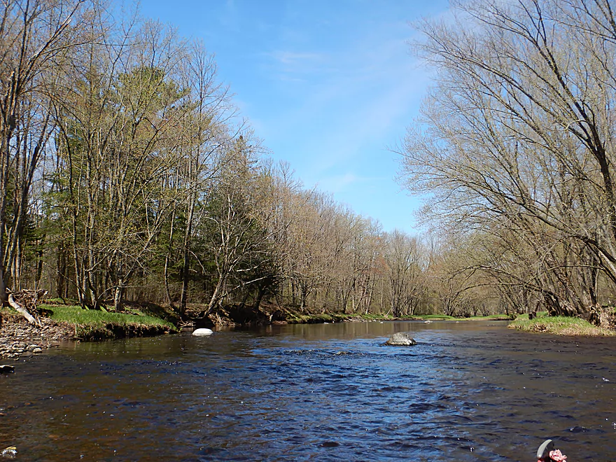
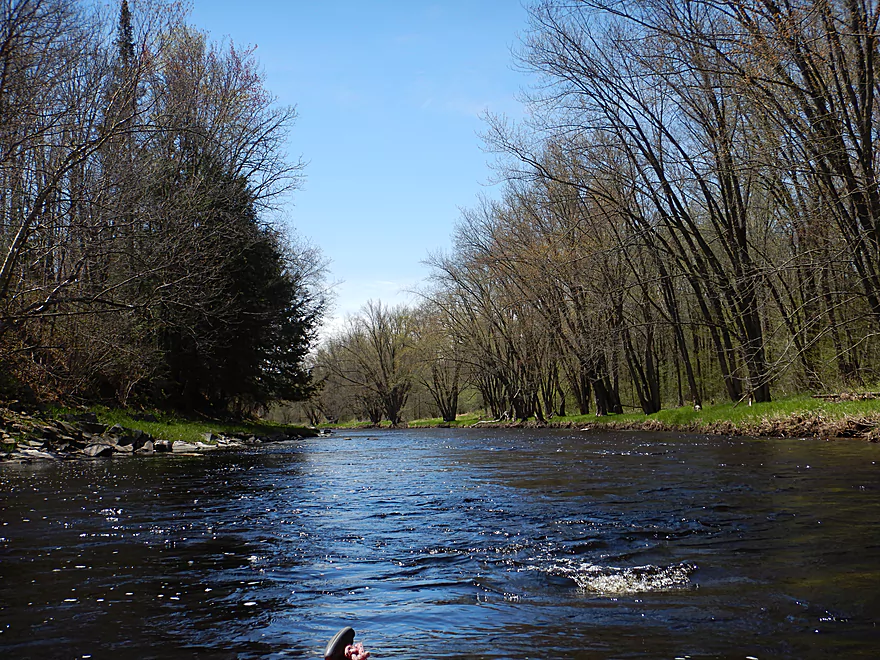
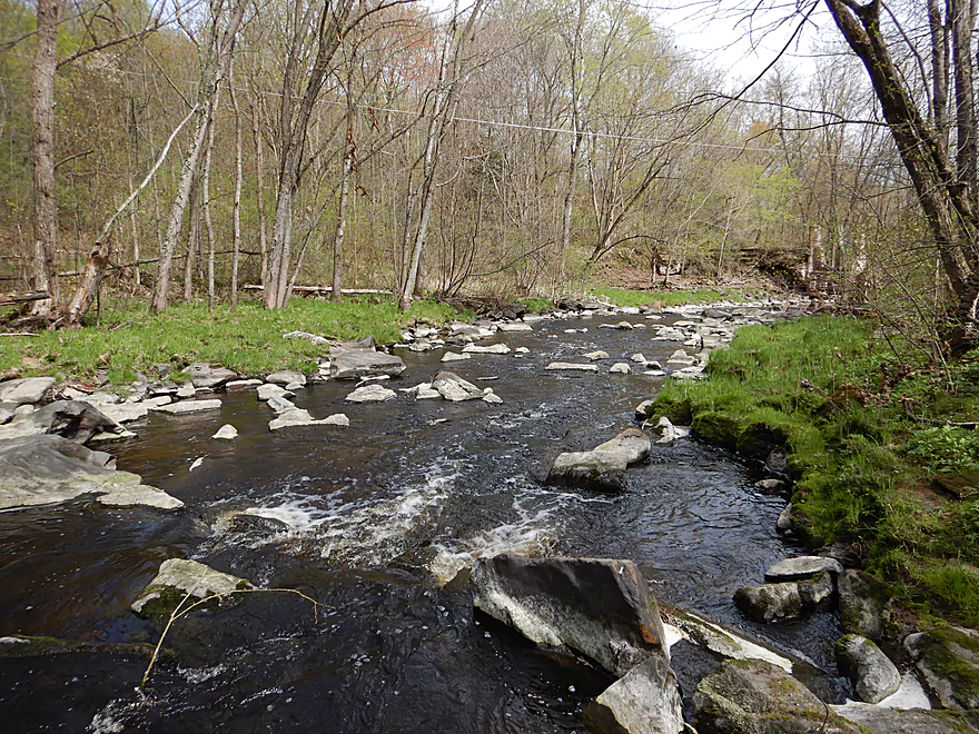
Scenic scene upstream of bridge
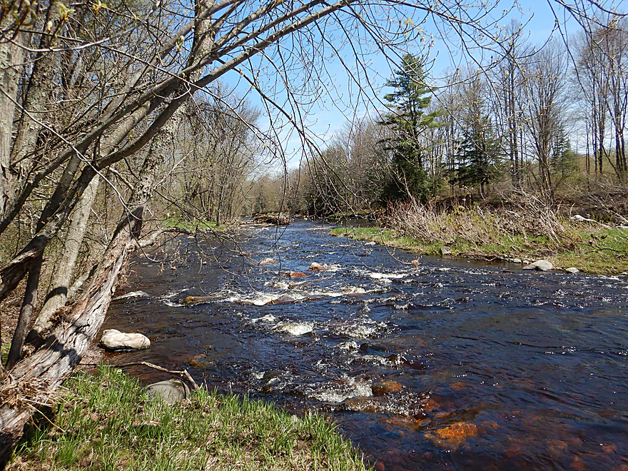
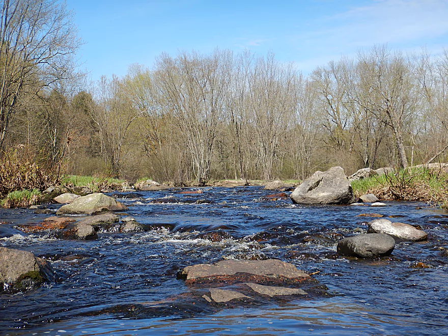
Some light rapids at the launch
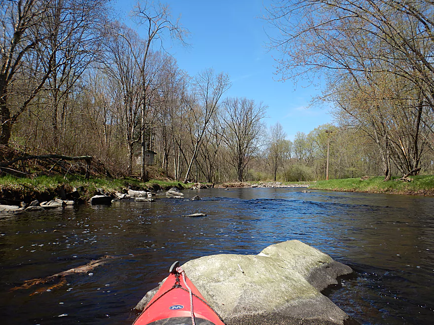
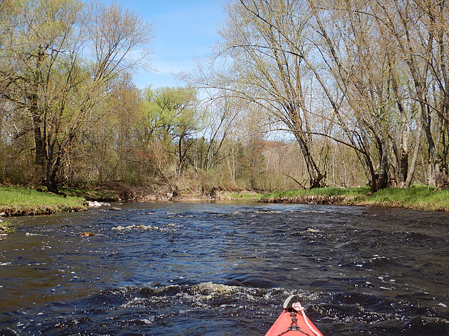
One of my favorite sections of the trip
One of many small riffles
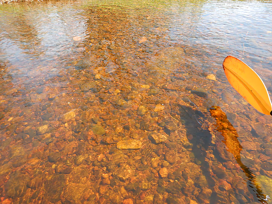
Good clarity
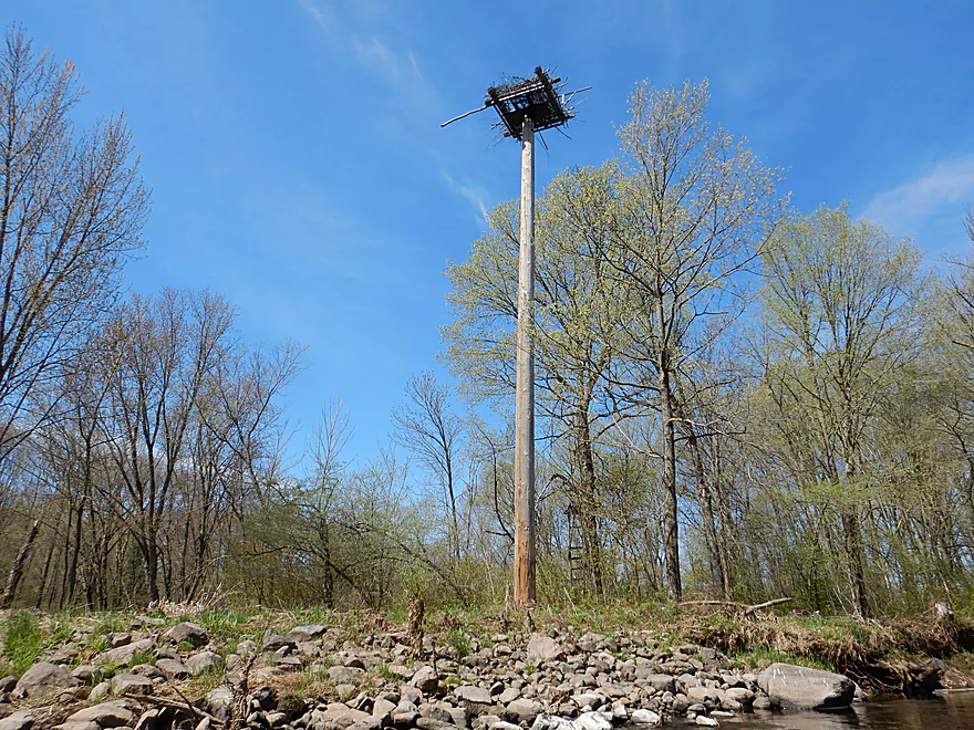
An osprey nest
Most of my shots are backwards-facing because of the lighting
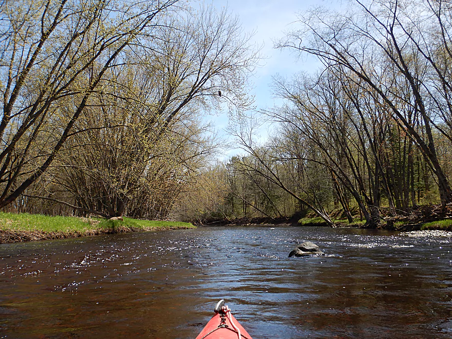
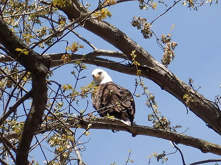
This eagle kept cranking his neck to keep an eye on me
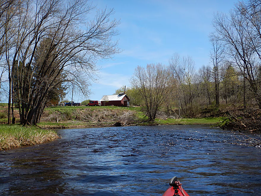
The only home on the river
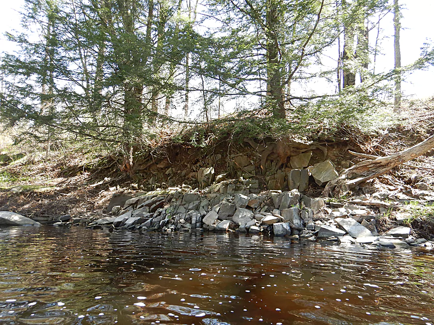
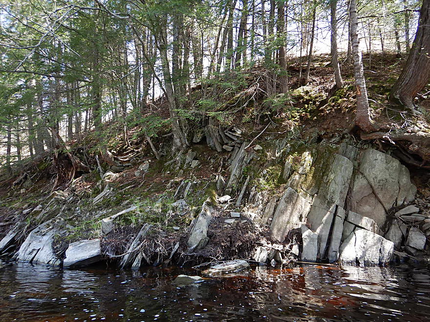
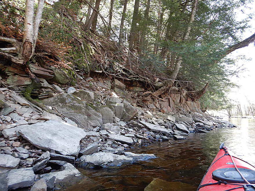
First of several small outcrops
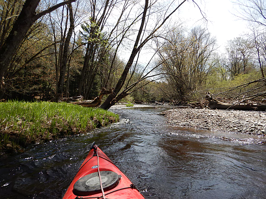
Current stays fast
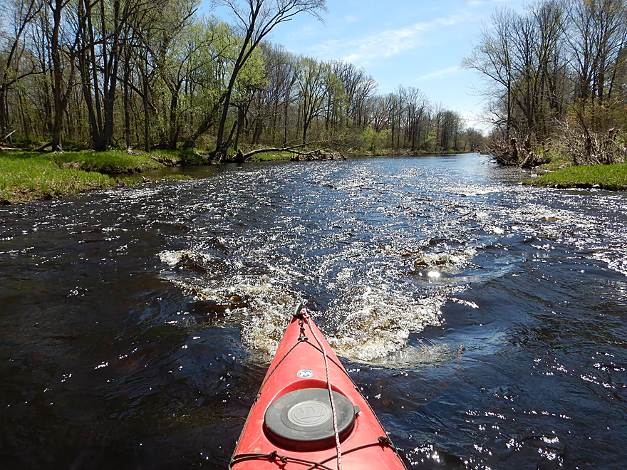
Nothing dangerous though
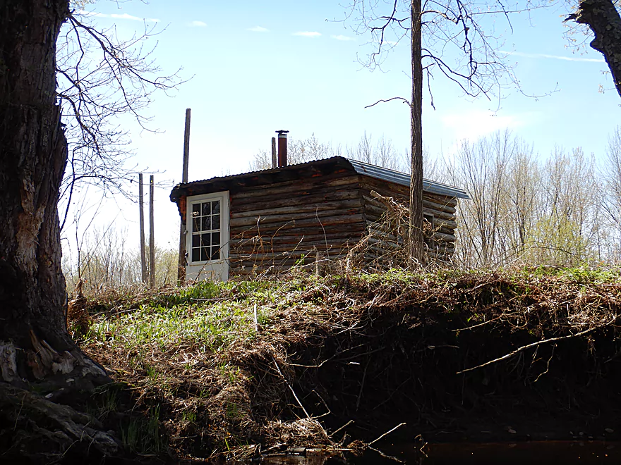
Rustic little cabin
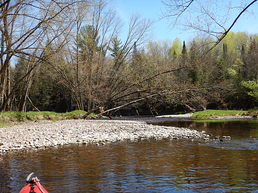
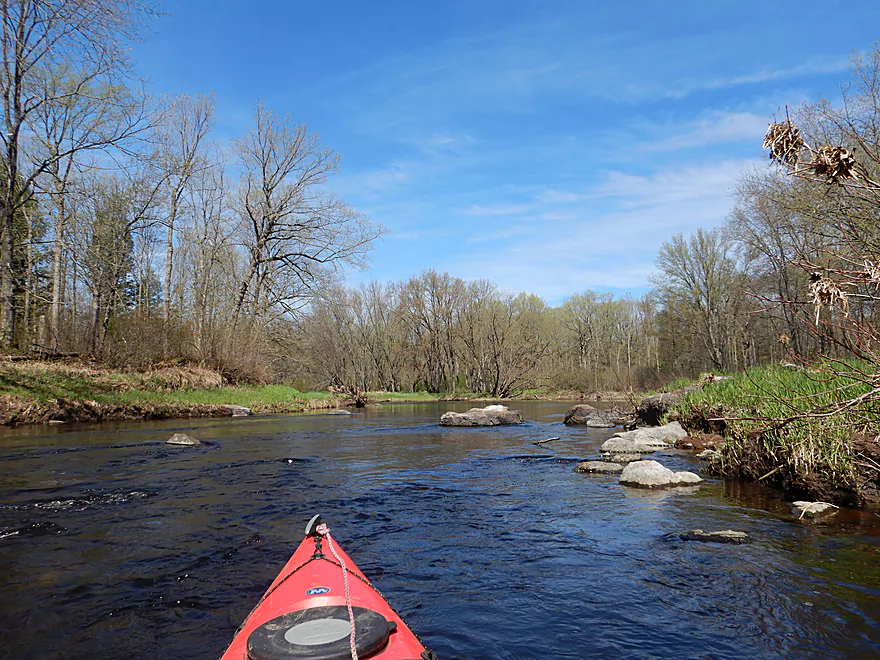
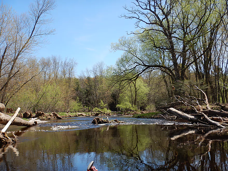
A number of nice gravel bars were on this stretch
Always a way through the trees
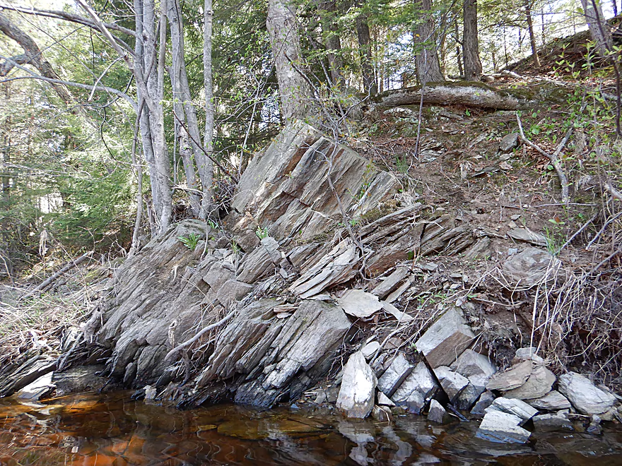
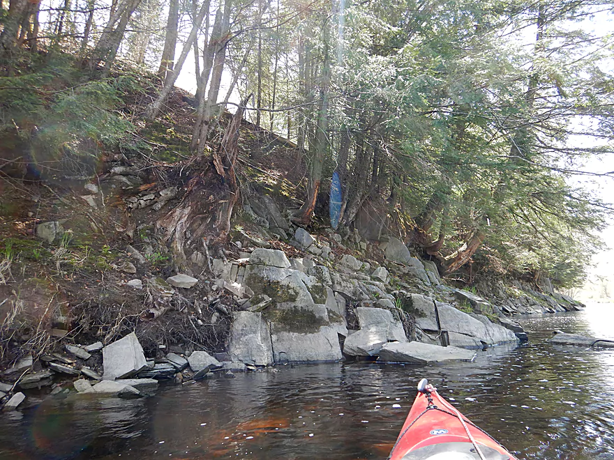
Another outcrop with interesting texture (maybe shale)
Blasam firs are always scenic
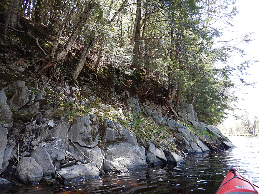
One of the nicer outcrops
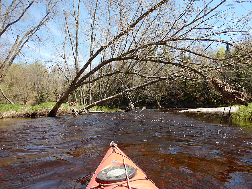
Some strainers but easy to avoid
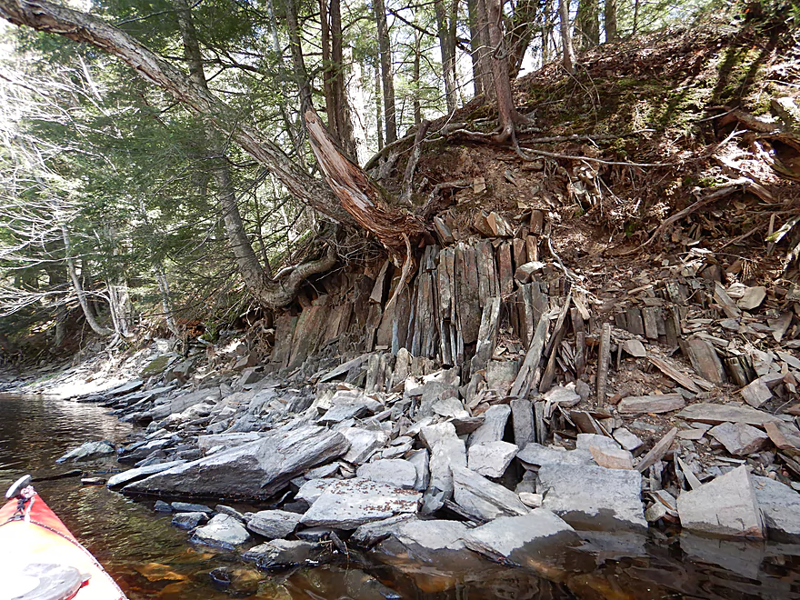
Like broken plates
This snowmobile trail leads directly into the river
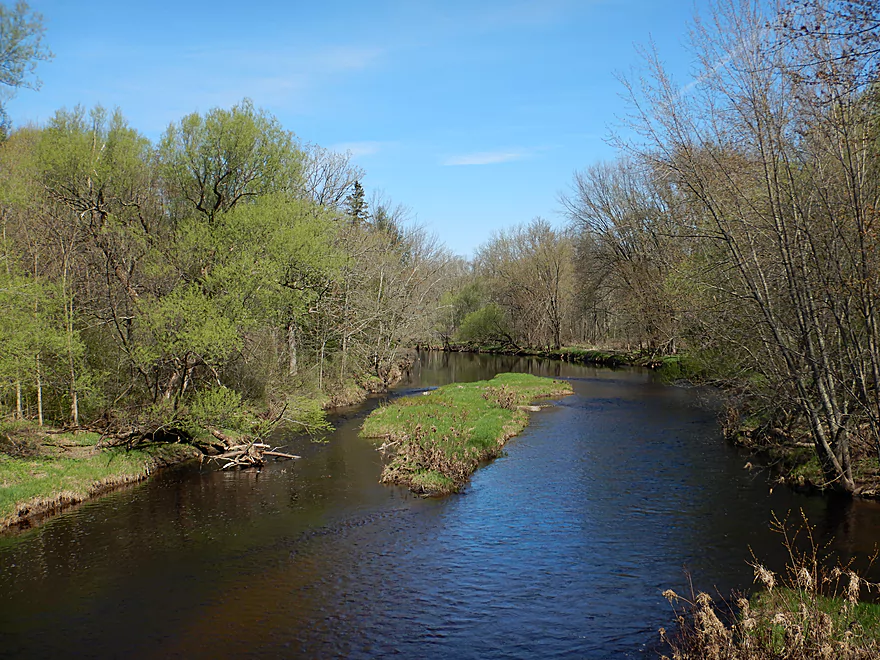
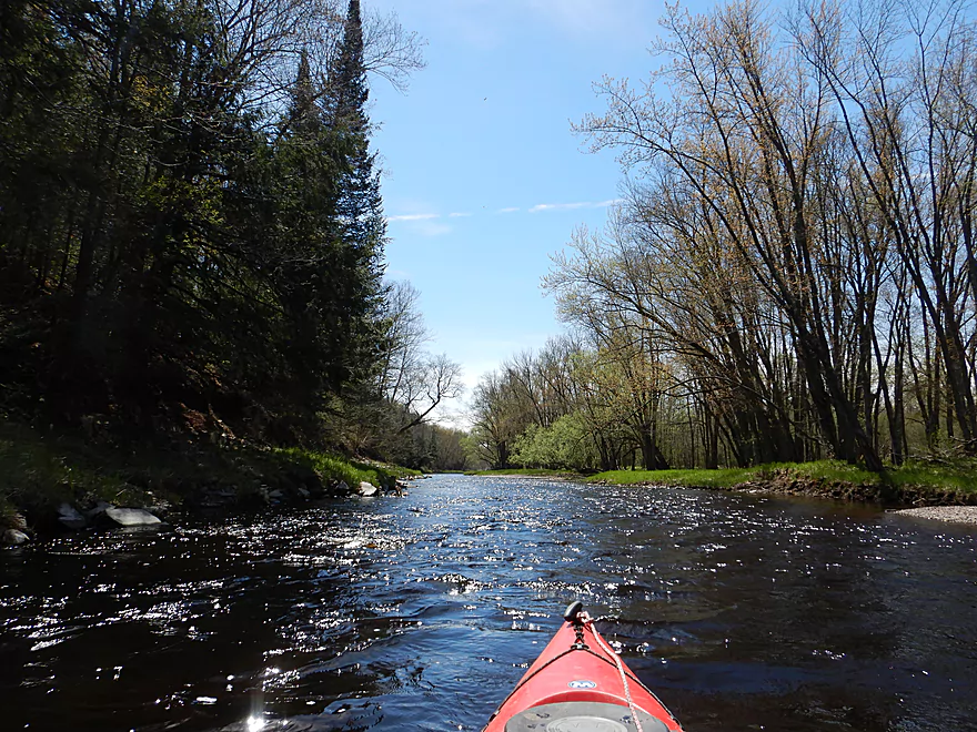
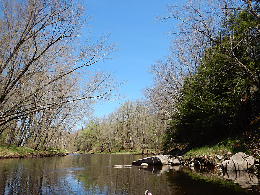
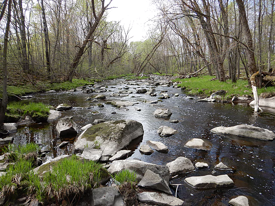
Looking upstream
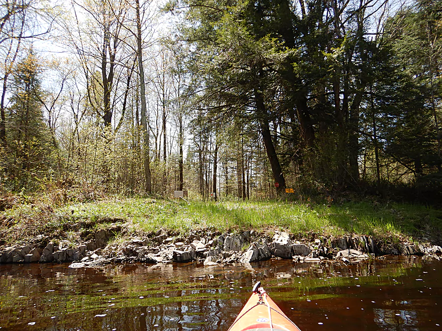
Ending the trip at Hwy A
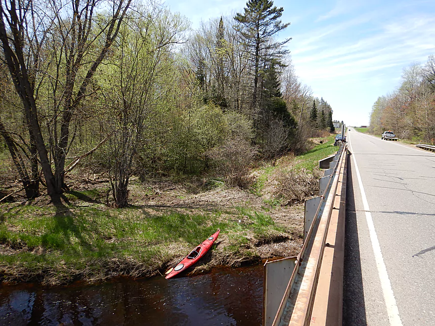
Good take-out option
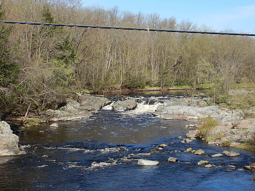
Scouting Big Falls
Looks pretty mean
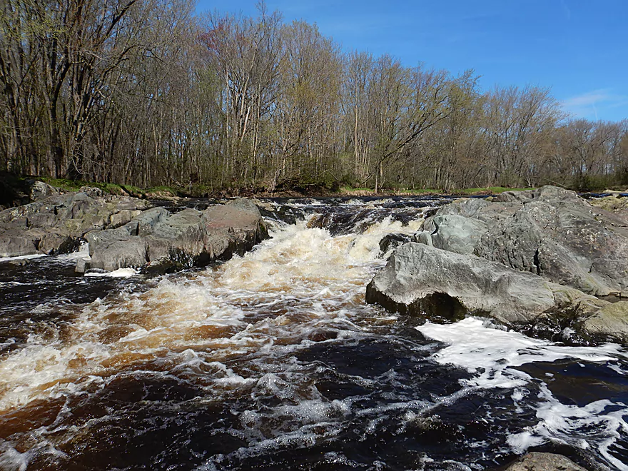
Scouting Black Creek
One of the rockiest streams I have ever seen
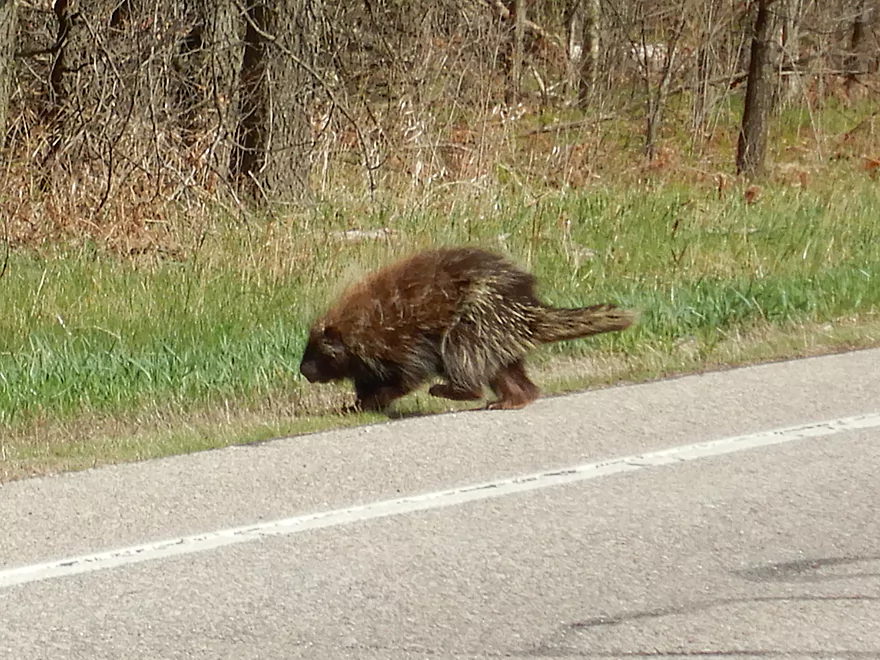
Nonchalant porcupine crossing the road
Big Rib River – Amco Park

The Big Rib is a classic paddle river located west of the city of Wausau. While not in the same class as some nearby rivers (eg the Eau Claire, upper Black, and Big Eau Pleine…) it still has some attractive parts and makes for a pleasant paddle. The Big Rib can be very scenic though and its two most photogenic sections are the dells and rapids located south of of Hwy 64, and Big Rib Falls off Hwy S. While I would have loved to paddle by either, I was not feeling well so opted for the much easier peddle/paddle of Amco Park to Hwy A.
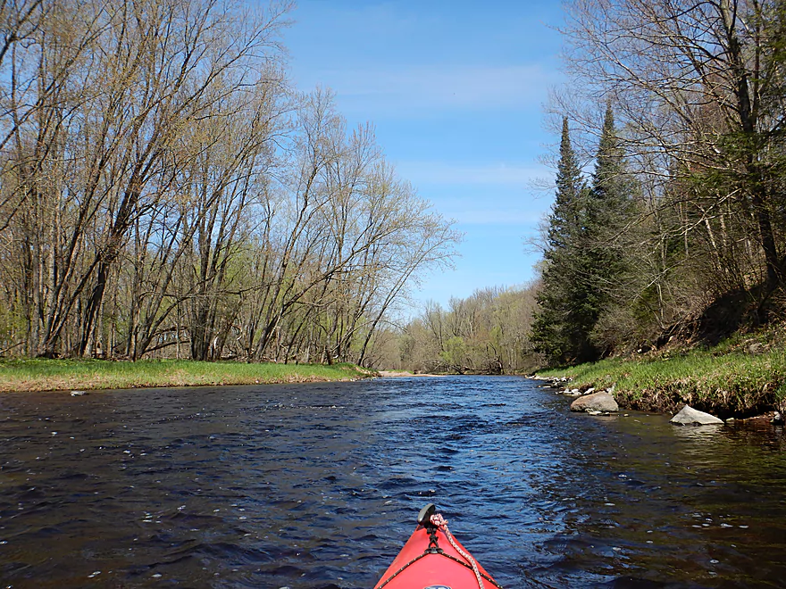
Amco Park was a terrific launch and a very scenic part of the river. In fact this little stretch (by the put-in) was my favorite of the entire trip. Here the river after passing by large exposed banks takes a sharp turn left and falls over a series of attractive Class 1 rapids.
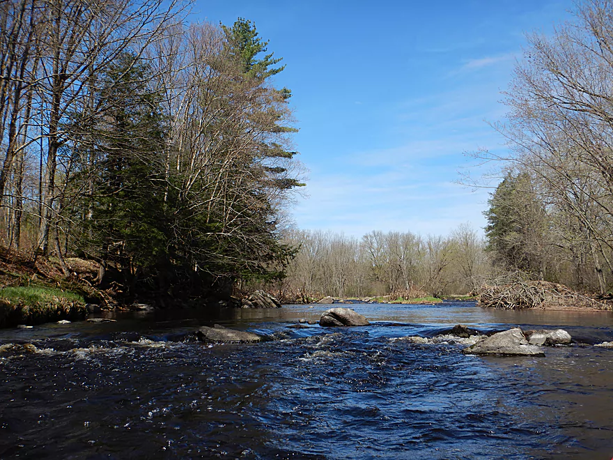
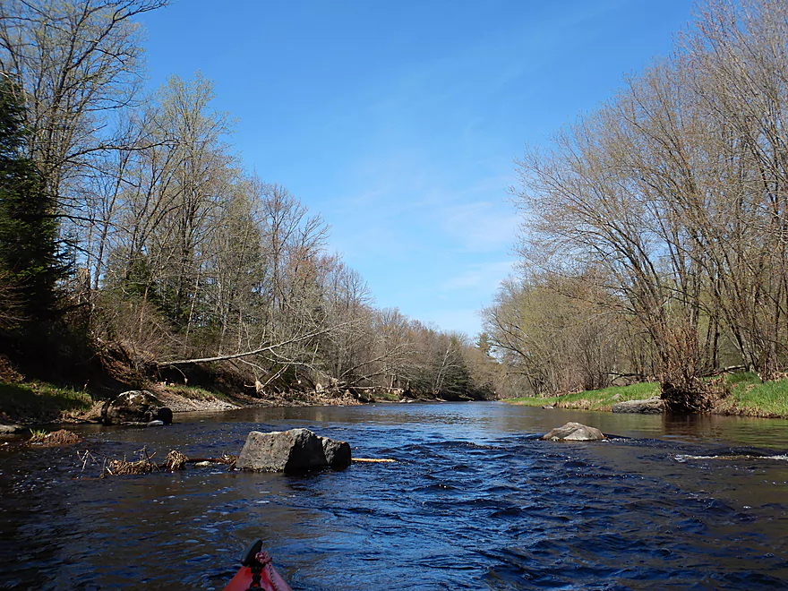
Part of what made this paddle unique was the lack of development (no farms and only one home). The banks were heavily wooded with mostly hardwoods, a few pines, and a scattering of hemlock and balsam fir. After having paddled so many small creeks, this seemed like such a big river but really only averaged 70′ in width. The water was clean and somewhat clear, while the river bed consisted of a nice gravel substrate. Something else that was ‘unusual’ (relative to the many southern rivers I usually paddle) was the lack of mud. There was very little of it and the banks were mostly low and at times rocky. Occasional gravel bars would appear in the channel reminding me of the Black River.
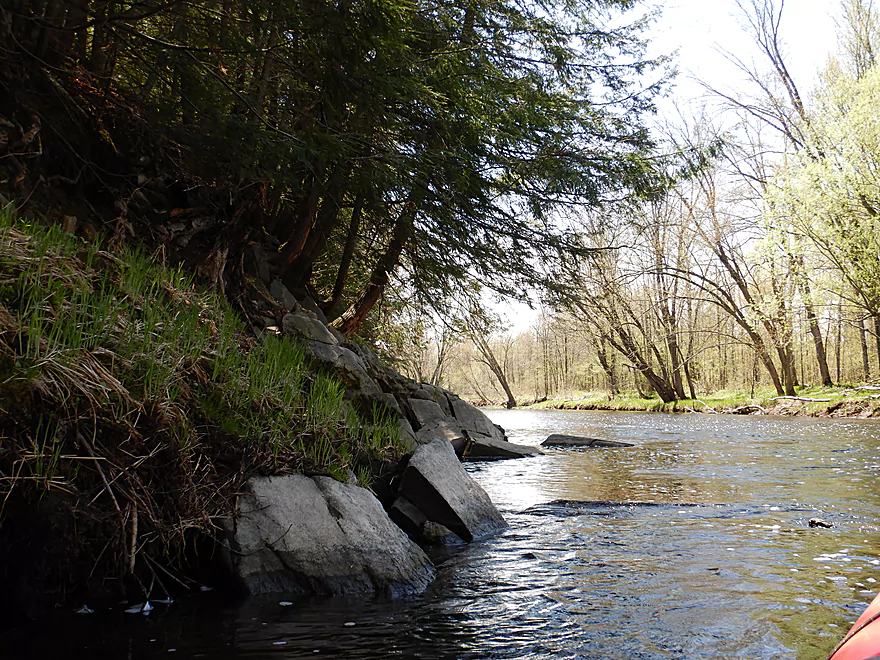
This stretch doesn’t have the geology of its upstream and downstream neighboring segments…but it does have some. You’ll occasionally see small boulders in the channel like little icebergs and there are a number of light rapids that you’ll get to paddle over. On three or four occasions, the river banks had exposed rock outcrops, which while never very big were scenic because their textured and crumbling nature.
In conclusion, this was a nice peaceful paddle perfect for paddlers looking for something simple and unchallenging. The scenery was pleasant…clean water, some outcrops and no development, but nothing jaw-dropping (like say the Eau Claire River to the east). This would be a good starter paddler for locals wanting to explore the Big Rib.
Amco Park is a great put-in option…no fees, good parking, easy launch site, public outhouses, and even picnic areas.
An alternate upstream put-in would be Silver Fox Road. This would add 3.3 miles to a trip and be a scenic section with light rapids…but a tough bike shuttle because of the poor roads.
Another alternate put-in even further upstream would be Hwy 64, which would add 8.3 miles to the trip. That would include fantastic scenery, Class 3 rapids, and a brutal bike shuttle.
Hwy A was a good bridge take-out option with a faded path usable for paddlers (downstream, river-right). Parking is not top-notch because of the steep shoulders, but you should be able to make do. You might be able to park on the nearby snowmobile drive.
An alternate downstream take-out would be Big Falls County Park which would add 7.7 miles to a trip. This would be likely a simple but pleasant stretch with the highlight being scenic Big Rib Falls at the end. The falls are likely Class 4 in difficulty and should only be run by experienced paddlers. The portage/take-out isn’t the easiest because of the rocks, but doable.
The bike shuttle route was mediocre…5.7 miles, no gravel and some small hills (180′ of climbing and 144′ of descent).
While there are paddle rentals and liveries in Wausau, I doubt they come out this far west.
This was a safe easy stretch well suited to beginners and paddlers in bigger boats (like canoes). The current was mostly brisk with off and on riffles and light rapids but nothing greater than Class 1.
No logjams and the channel was pretty much free of deadfall, but in a few cases low-hanging branches in fast current could catch unawares paddlers off guard.
I did this trip at 240 CFS per a nearby guage which is likely an average depth for late spring. Here is a rough depth guide:
- 0-100 CFS: A very low depth. Many of the riffles would likely be too bumpy to be enjoyable.
- 101-200 CFS: Some of the riffles would be bumpy, but I suspect this would be a plenty doable depth.
- 201-300 CFS: A common average flow rate and a good target range.
- 301-400 CFS: The river is above normal but likely still quite doable. Clarity would likely be poor.
- 401-500 CFS: This would be a pretty high level. Some of the snags could be difficult to circumvent at this depth.
- 501+ CFS: These are very high levels and not recommended for casual paddlers.
Not much…I did see some clam shells and paddled directly under an eagle. It kept turning its head at crazy angles to get the best view of me. The highlight was actually a porcupine I encountered on the drive home. It took its time crossing the road despite the nearby cars and didn’t seem afraid of anything.
Big Rib Falls – About 7 miles downstream is Big Rib Falls which you want to check out even if you don’t paddle it. There is a park (Rib Falls County Park) just to the north of the falls and from here it is easy to get out and climb on top of the massive granite outcrops to see the Class 4 falls. The best view actually might be from the Hwy S bridge to the east.
Black Creek – This is a noteworthy tributary to the Big Rib located about five miles southwest of Amco Park. It is one of the prettiest and rockiest creeks I’ve even seen. The best section flows by the community of Athens which consists of a two mile-long stretch of continuous boulder gardens. Unfortunately it is usually too shallow to paddle, but it is a fantastic whitewater river when it has enough water (500-800 CFS per the Big Rib gauge might be a floor). I’ve marked several access options on the overview map, but basically I think the best section would be from Iron Bridge or Erbach Park to Goodrich Street where the sanitation plant is. American Whitewater has a review of this creek.
Even if you don’t paddle the creek, you can still experience its best parts vicariously via a terrific mile-long nature trail stretching from Erbarch Park to Hwy 97.
Detailed Overview
- Upstream of Cty M: Likely navigable paddling, I just don’t know much more.
- Cty M to Lemke Drive: 4.5 miles. An unknown prospect…might be interesting. Could be some downed trees.
- Lemke Drive to Hwy 64: 4.6 miles. Pleasant, but not a special trip.
- Hwy 64 to Silver Fox Road/Greiner Road: 3.7 miles. Famous section that contains the dells, the most rapids and a tough section with Class 3 rapids. Likely 5 stars. Note, the bike shuttle for this section is poor. Reviewed by AmericanWhitewater.org, but note that their flow estimates are very aggressive.
- Silver Fox Road to Cty F/Amco Park: 3.3 Miles. A pleasant section with some light rapids.
- Amco Park to Cty A: 4.5 miles. Slower than upstream sections but pleasant and wooded with a few small outcrops.
- Cty A to Big Rib Falls County Park: 7.7 Miles. A great stretch and maybe the best leg on the entire Big Rib River. Highlights include attractive hemlocks, light rapids, boulders, and seven separate sets of gorgeous granite outcrops. This section ends with a bang with Rib Falls, which is very scenic.
- Big Rib Falls Park to Marathon Lion's Riverside Park/Hwy 107: 6.6 miles. Attractive stretch with exposed sand banks, small boulder gardens, gravel bars, and a handful of Class I rapids. The second half of the trip is more of a slower silver maple floodplain forest, but is still nice.
- Marathon Lion's Riverside Park to Sunnyvale Lake: 9.0 miles. Here the river flows through thick floodplain forest. There are no known rapids or rock formations, but the woods should be nice (especially in fall). Sunnyvale Lake is a speculative access: it is a man-made lake located by the river. You would need to portage the dike, and then paddle a third of a mile north on the lake to reach the beach and public park access.
- Sunnyvale Lake to Little Rib River Landing: 5.7 miles. A squiggly floodplain forest paddle with the highlight being massive sandbars. Technically speaking, the take-out is located on the Little Rib River (just a bit upstream from the mouth).
- Little Rib River Landing to Rookery View Park: 2.0 miles. Here the current finally dies (courtesy of the Rothschild Dam). This is still a nice wooded paddle. There are multiple take-out options on the Wisconsin River. Here is a really cool video taken during fall color.
Not listed are several of the Big Rib tributaries. The most interesting one is Black Creek, running from Erbach Park/Athens to Meridian Road (5.8 miles). This contains neat boulder gardens and rocky gorges but could also have unknown hazards. This creek has been paddled before, with the most popular section being a whitewater stretch by Athens per reviewer Rick Kark. Also reviewed by AmericanWhitewater.org. The Little Rib River should be partially navigable by the mouth as part of a round trip, but if you go too far upstream, you'll likely face logjams.
Trip Map
Overview Map
Video
Photos Size:
A friend and I did from Amco Park to Big Rib Falls Park on October 24th 2018 gauge height of 2.77. The river was a decent height, we scraped 5/6 times, were able to get under a fallen tree (wasn’t easy but current wasnt strong so it was doable), had to portage around a cluster of accumulated down fall in one spot (here if water would have been even 4 inches higher we could have gotten around it), and had to do some quick side to side maneuvering a couple times to avoid tree limbs hanging into our path. Was a very enjoyable trip for cold weather (I normally like a little more adventure but that increases the chances of getting wet and that’s no fun in the cold!!) There are a lot of areas that go around little islands and miraculously all our choices of sides to take didn’t lead us into any blocked paths!! I would definitely recommend this section to kayakers new to the sport as long as they are able to get in and out of their kayaks with ease, have the strength and paddle control to maneuver quickly when needed!! Obviously the river changes and can be a whole new experience with very little fluctuation of the water level and strainers can pop up out of no where!! Happy Paddling!!!??
Thanks for the comment! It sounds like you did a much longer trip than I did in taking out at Big Rib Falls Park…that latter section is definitely on my todo list.