
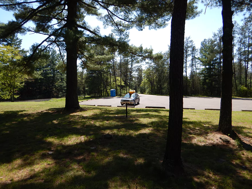
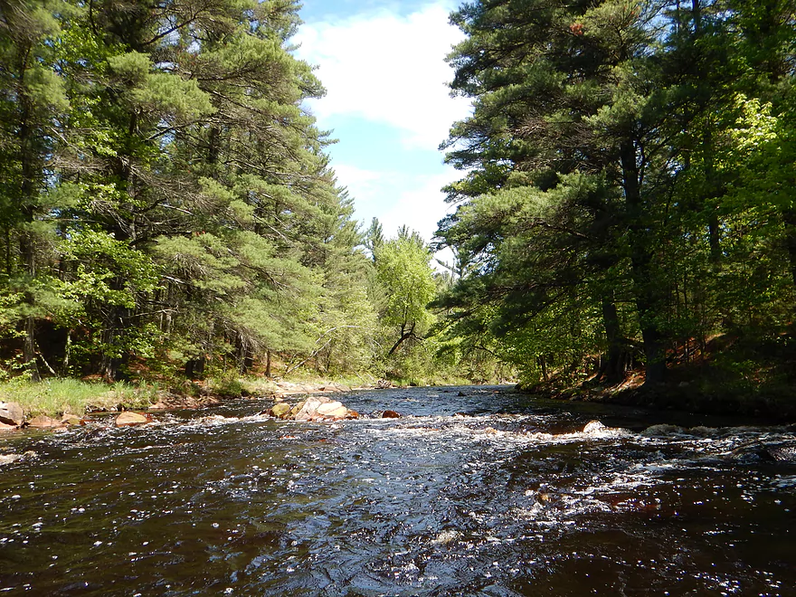
Cemetery Road put-in
Good launch
Ample parking
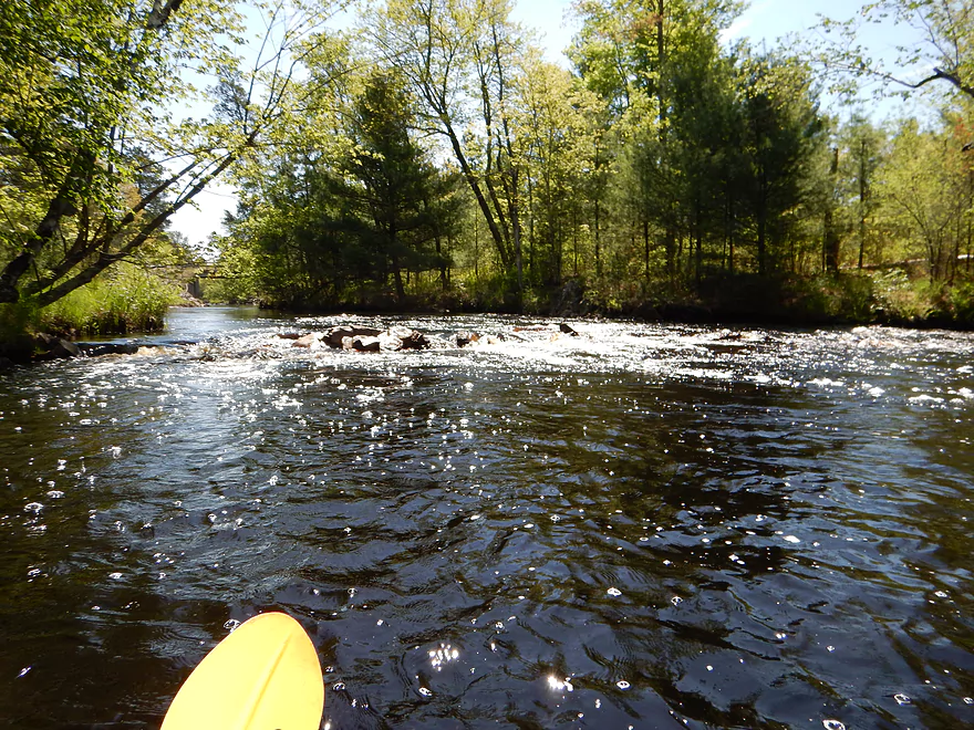
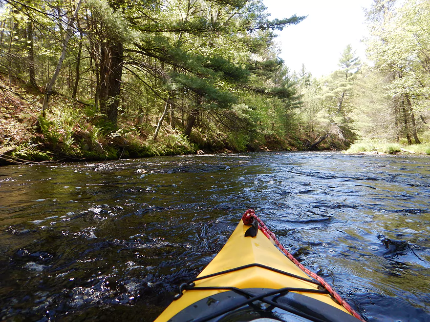
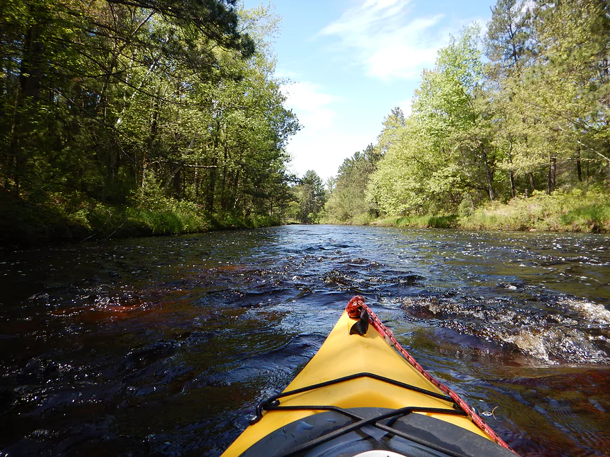
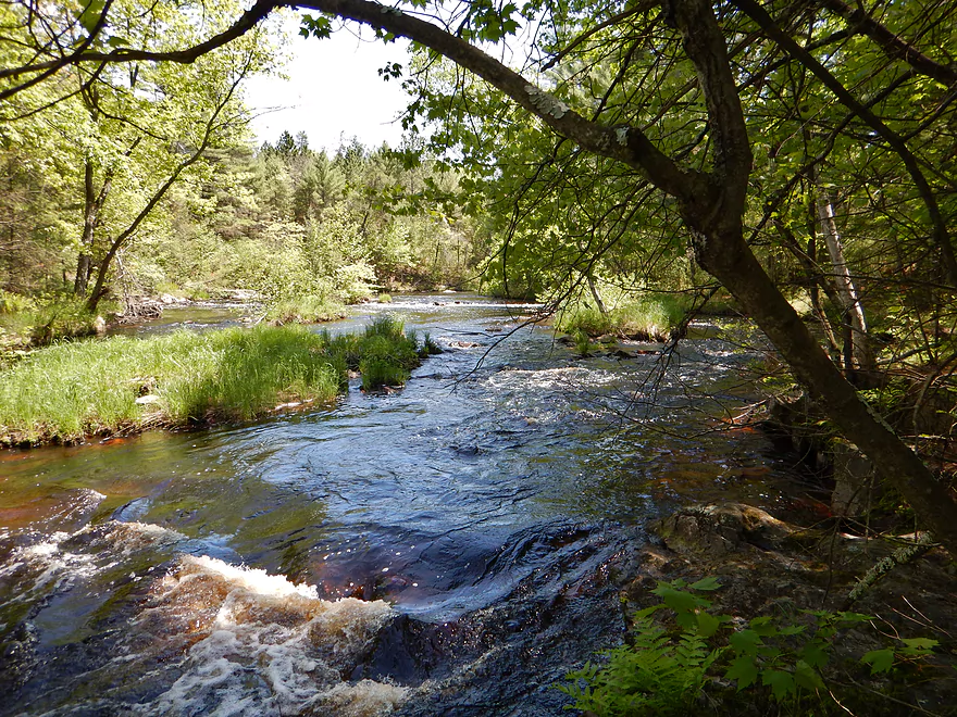
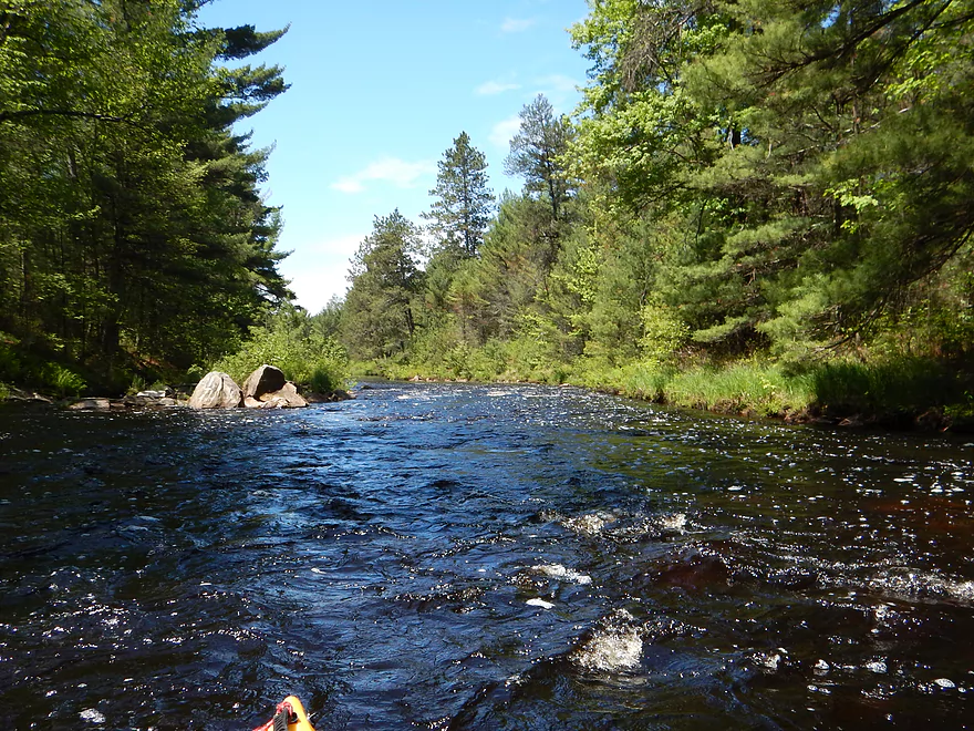
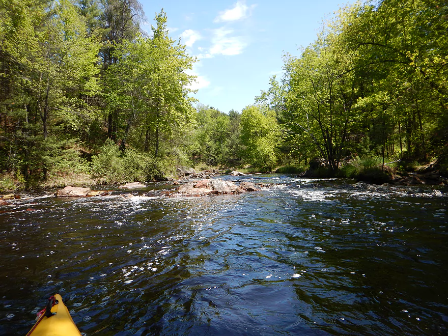
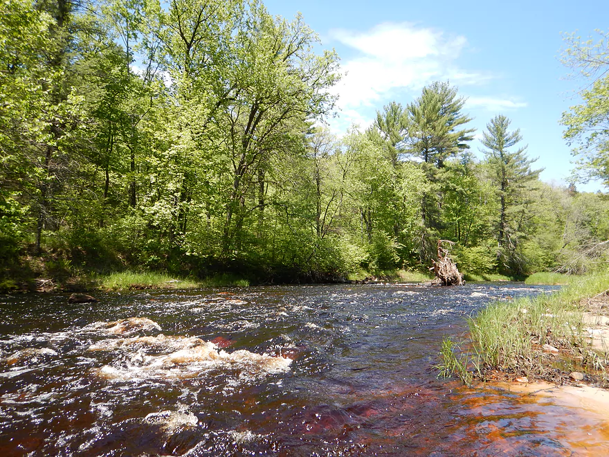
Rapids right off the bat
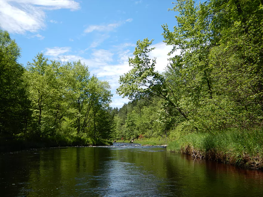
First few miles are the roughest
Random boulders everywhere
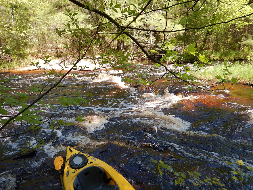
Easy to get stuck on the rapids
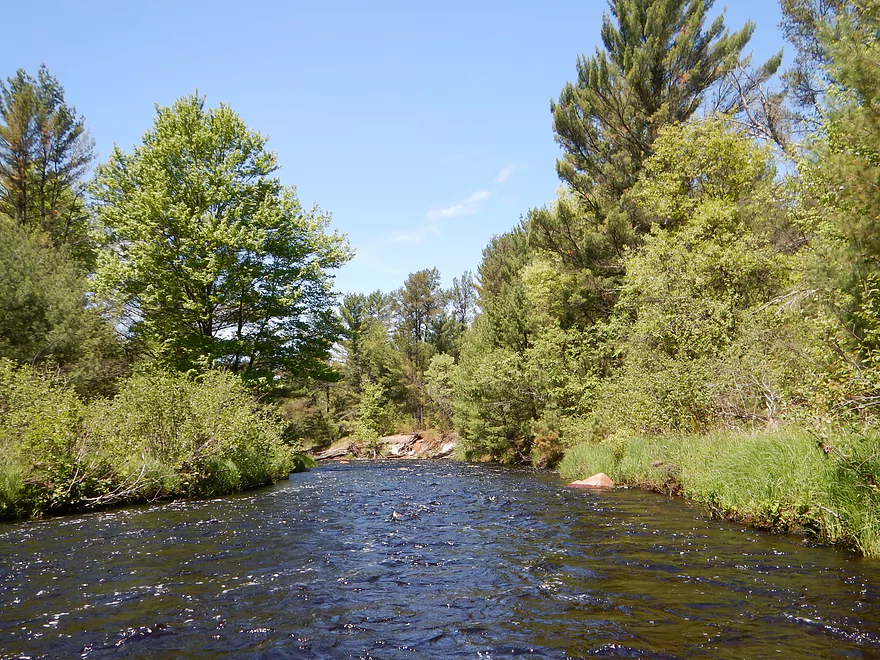
Alt put-in at Oxbow Park
A great launch option with good parking, paved roads and bathrooms
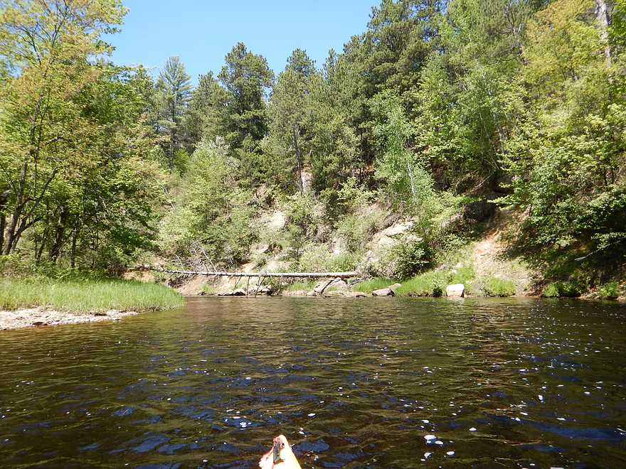
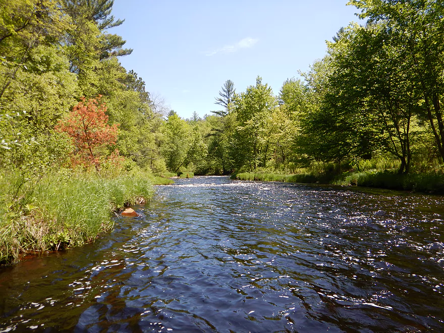
Split channel and class 2 rapids before the mighty class 3 rapids
Portaging south shore before class 3
Hug the shore, to avoid being swept over this beast
Reverse view of the class 3 run (bypass hidden on right)
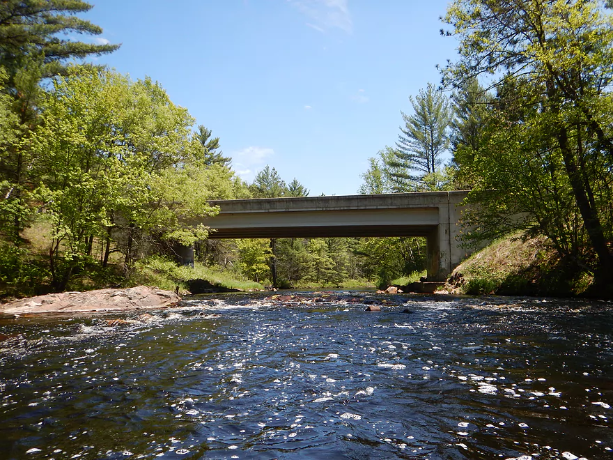
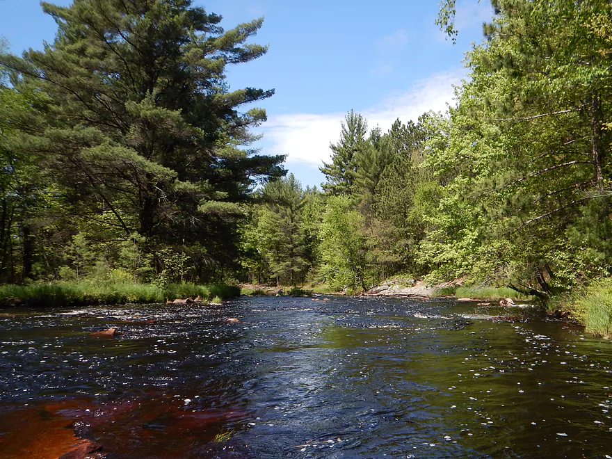
Hwy K bridge
Possible alt-landing…not great, but doable
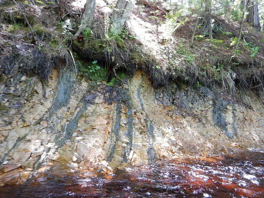
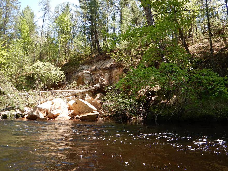
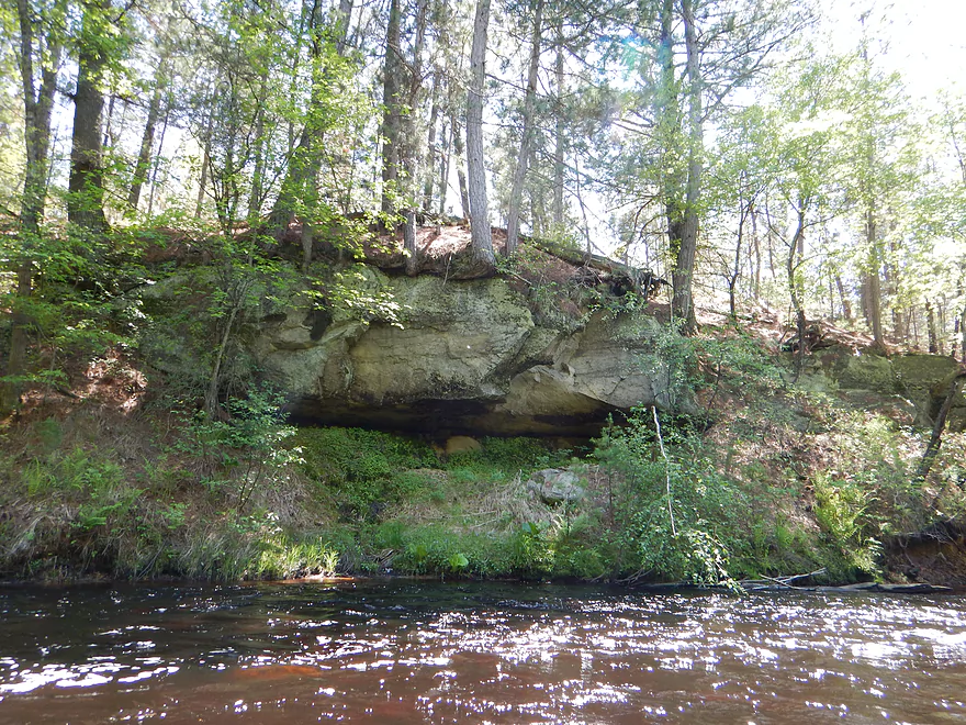
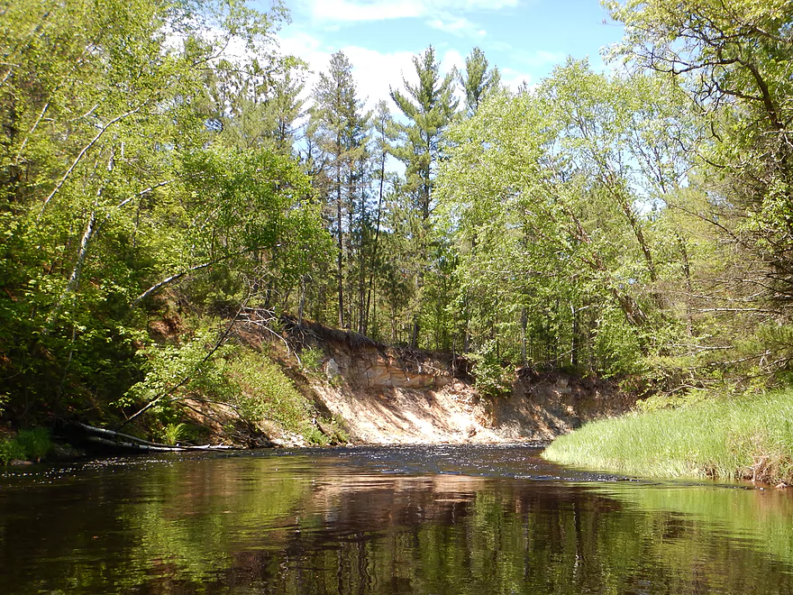
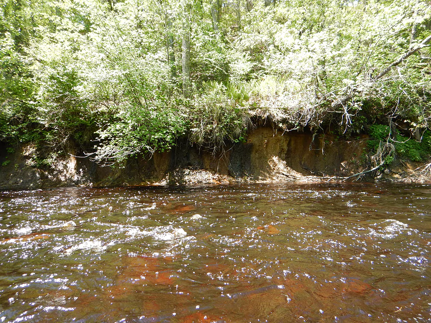
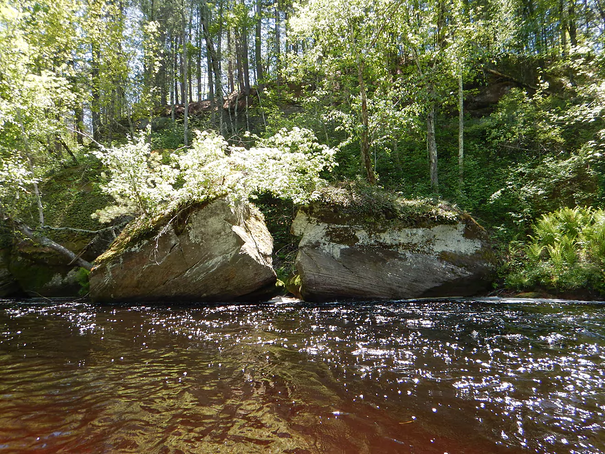
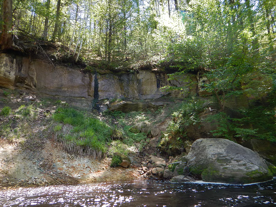
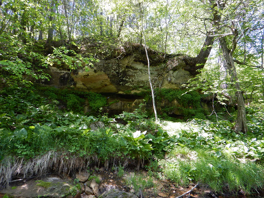
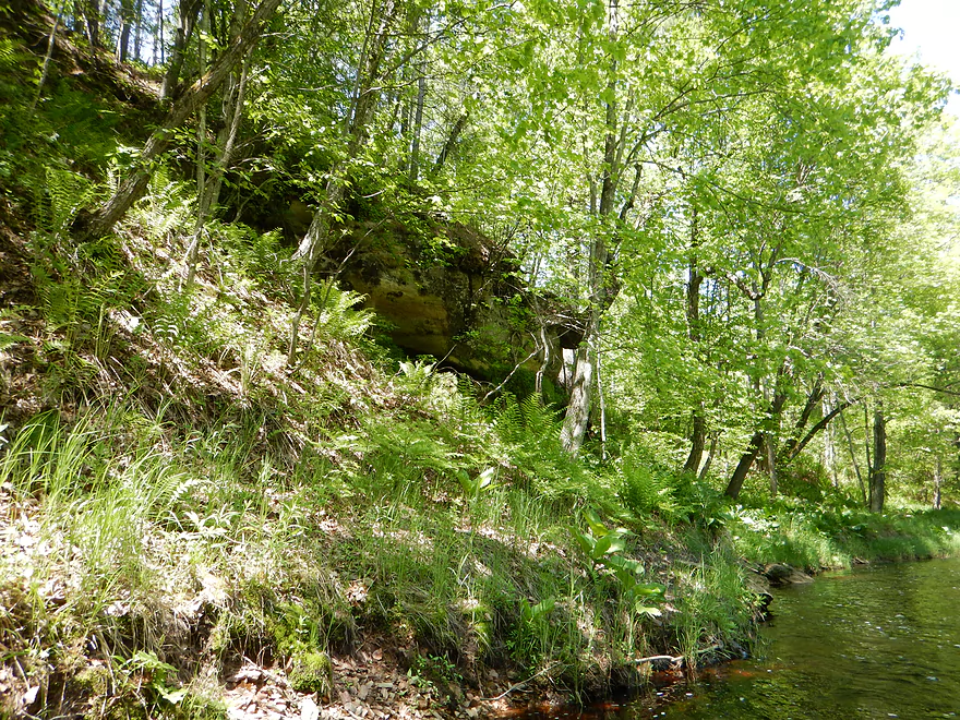
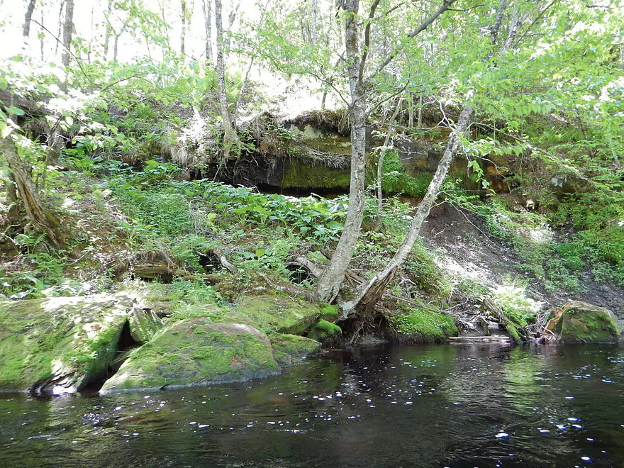
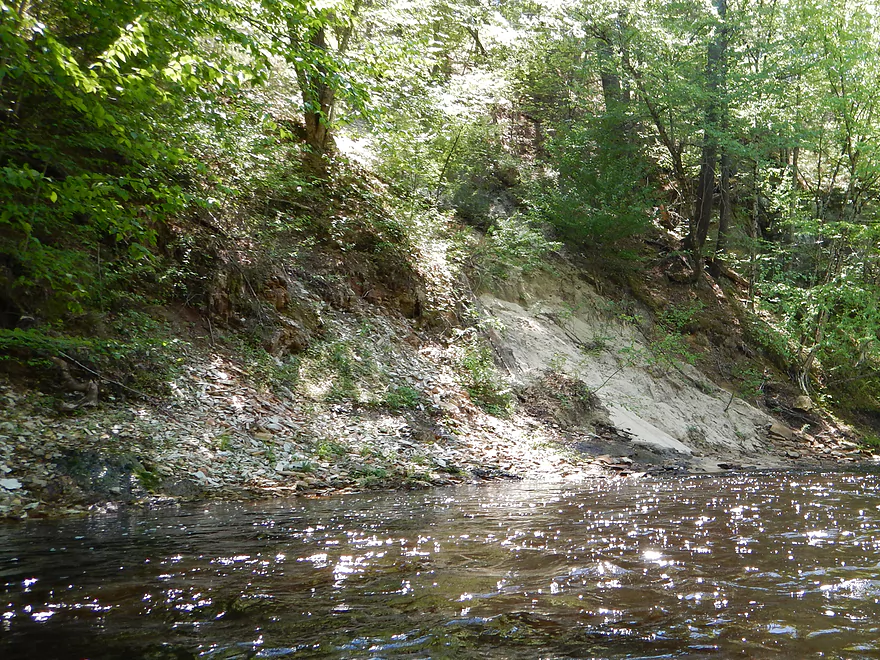
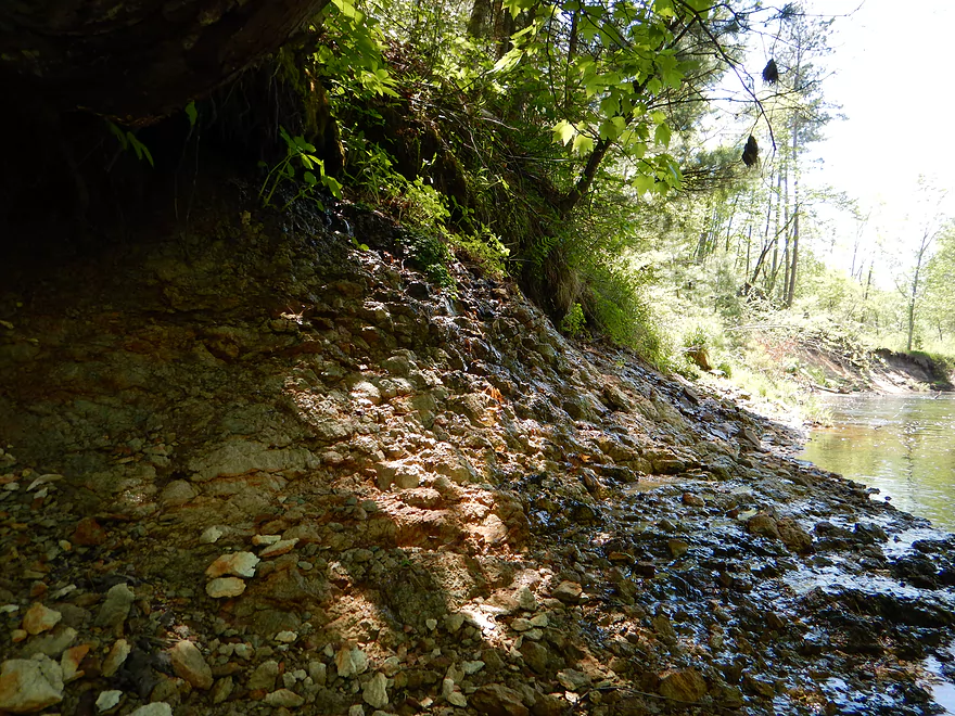
Cool rock stains
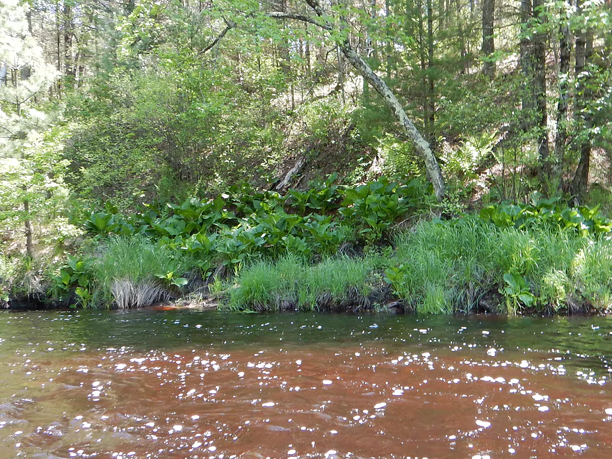
Attractive skunk cabbage colony
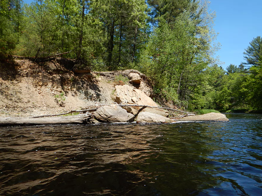
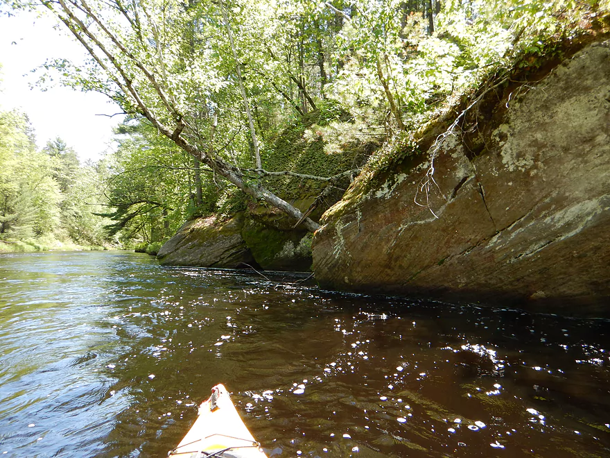
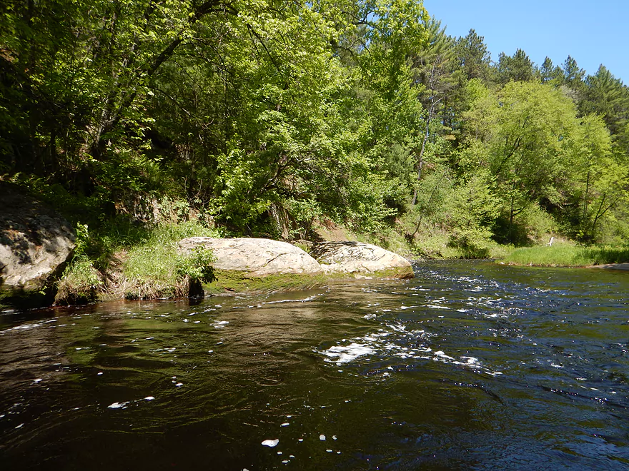
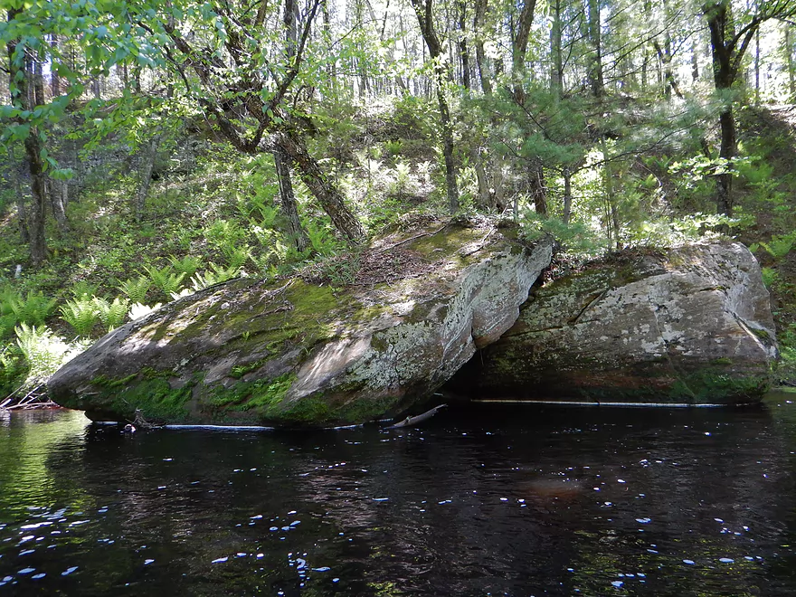
Viking hat boulder on the left
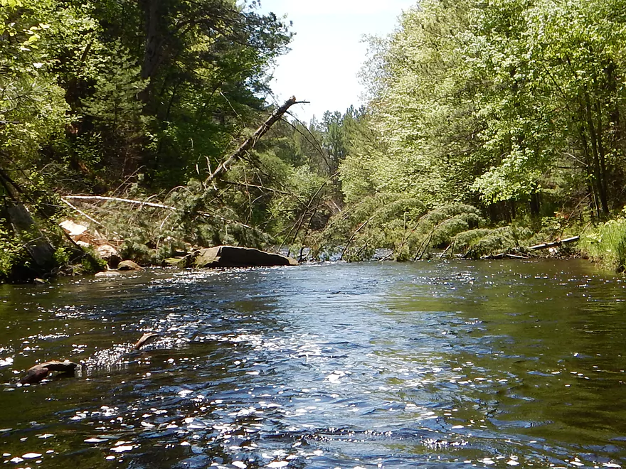
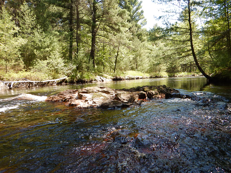
Log jam #1 of 3
Not fun in fast current
Jam caused by humongous rock slide
A salivating tick
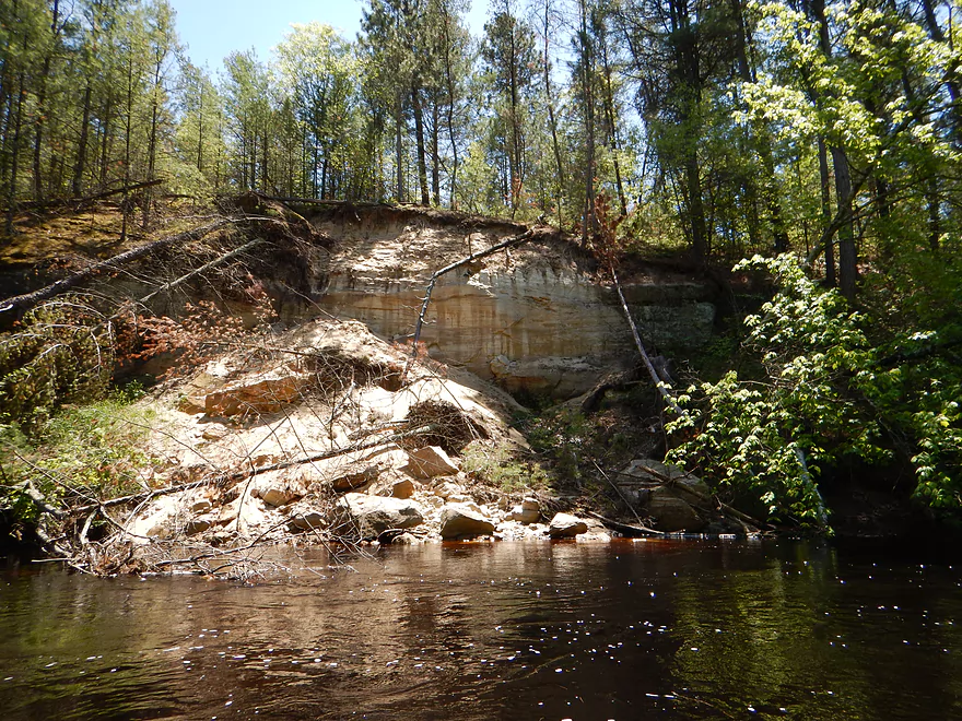
Another awesome rock slide and future Lower Black sandbar
Rapids are much calmer down here, but still feisty
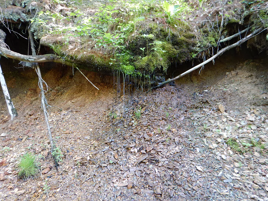
More weeping rocks (hard to see)
Snapped in two
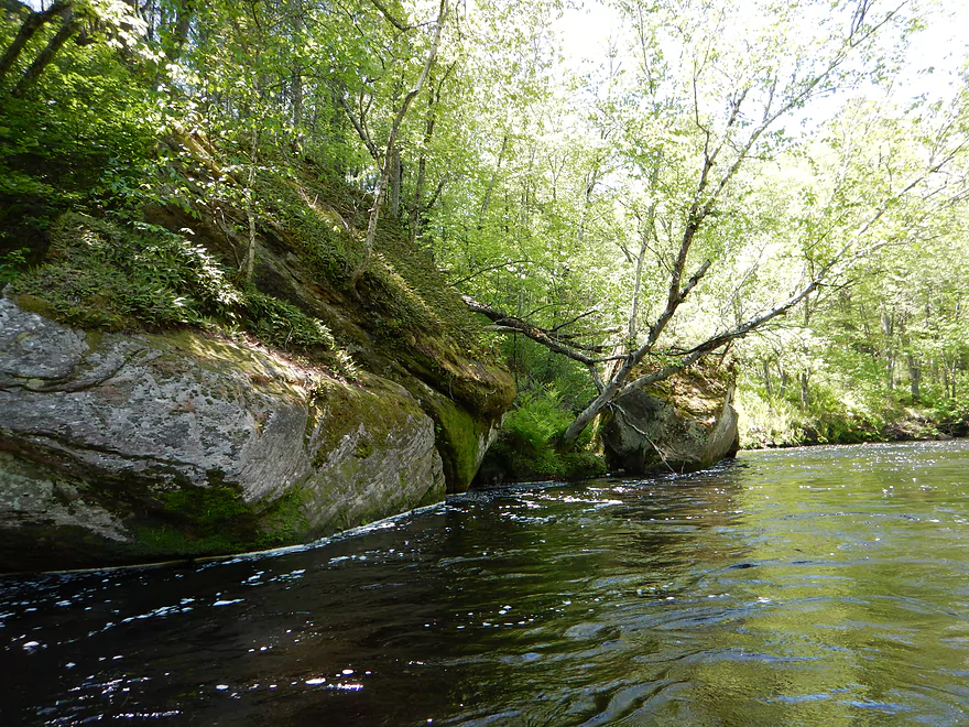
Leaning boulders of Pisa
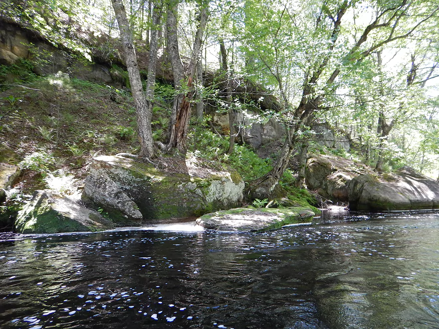
Nice plant ecosystem on the boulders
Unique ‘watercolor’ stains on the rocks
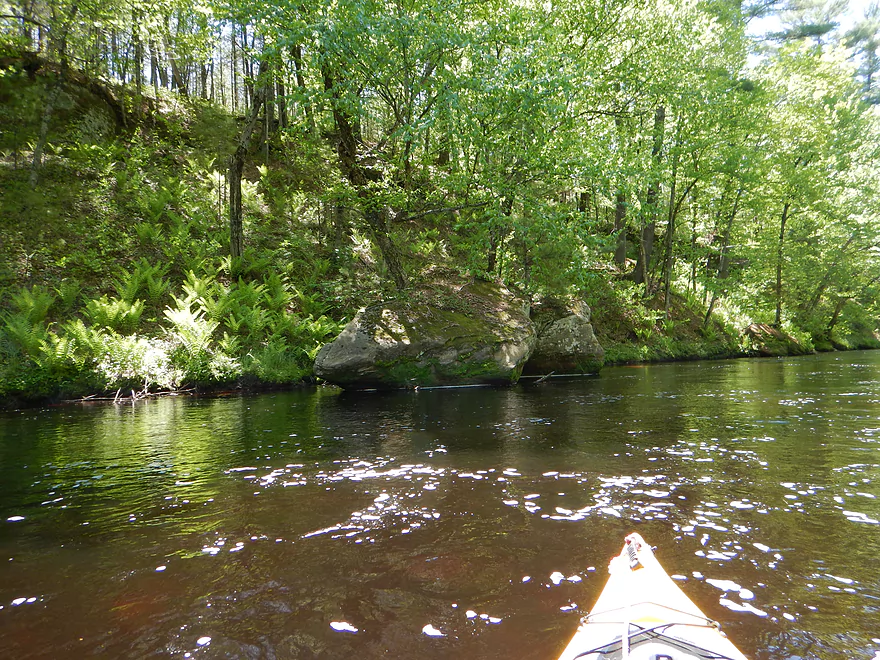
Trees growing out of a boulder

More terrific skunk cabbage
Lots of ferns on this trip
Great moss
Unique shale-like pile of rocks
A warty rock bank
Nice effect with the water running over
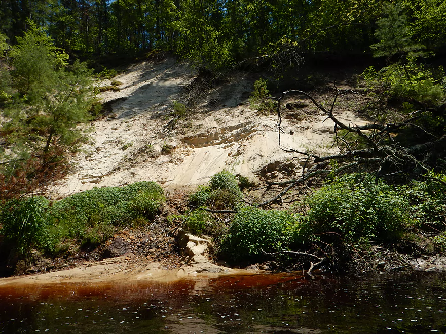
Epic sandbank
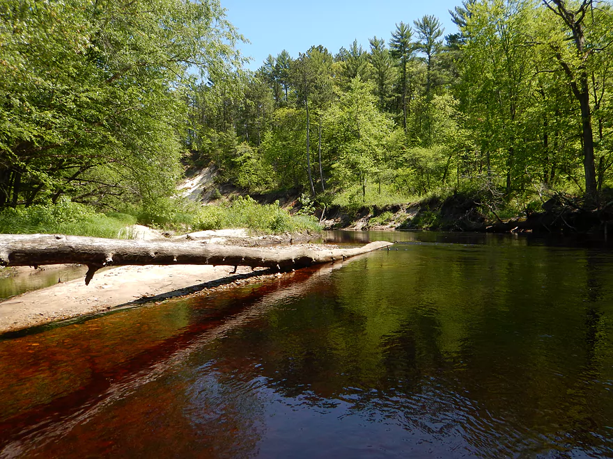
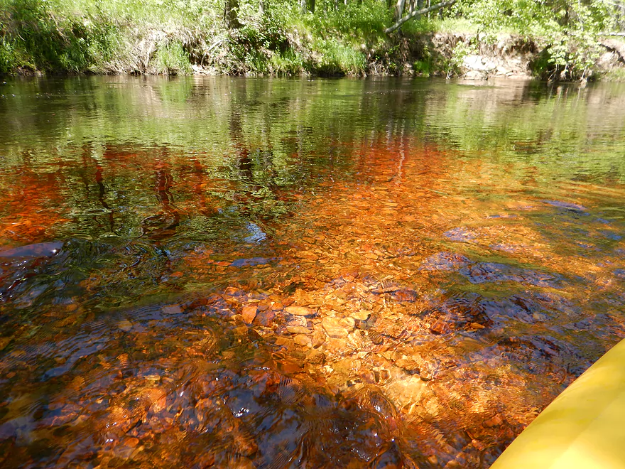
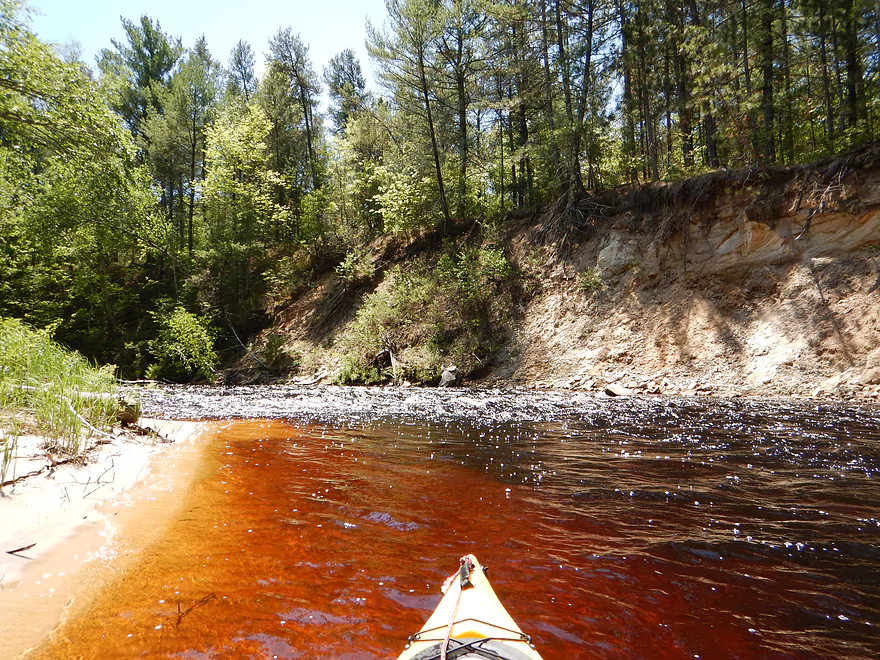
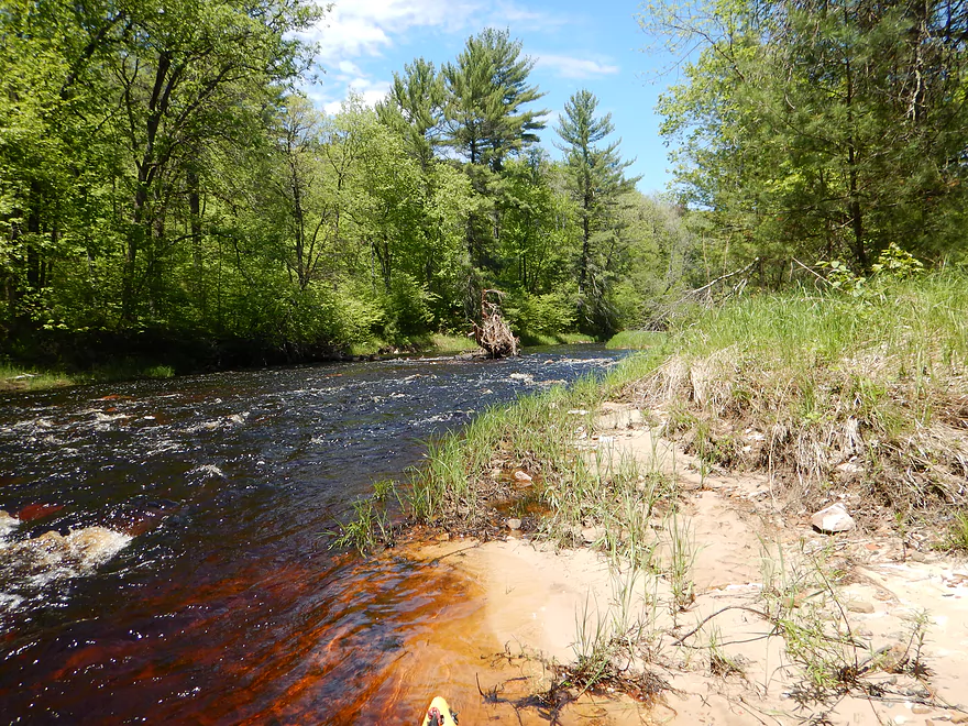
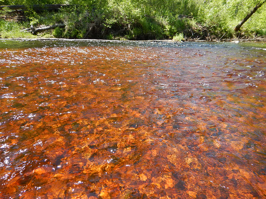
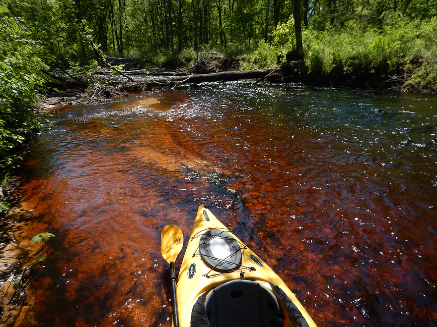
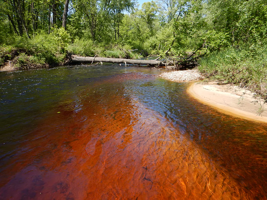
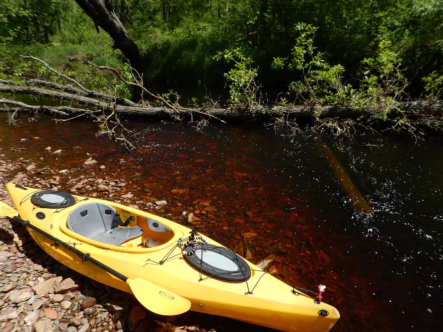
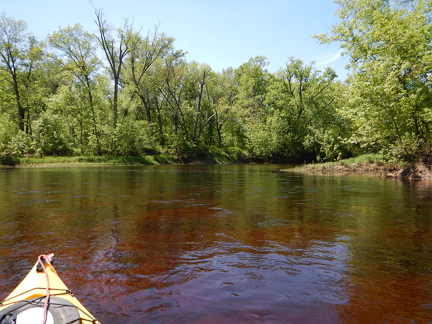
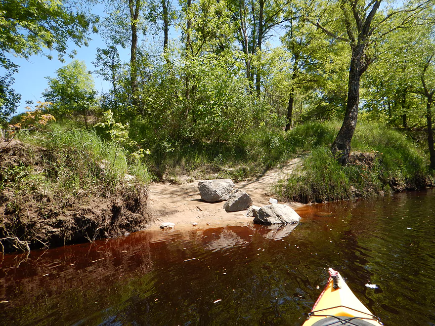
Striking root beer water
Log jam #2 of 3
Portage is not bad
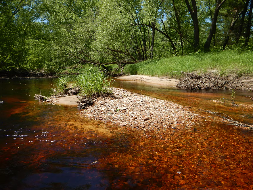
Nice gravel-bar
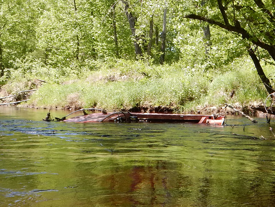
Somebody tried power boating in Halls??
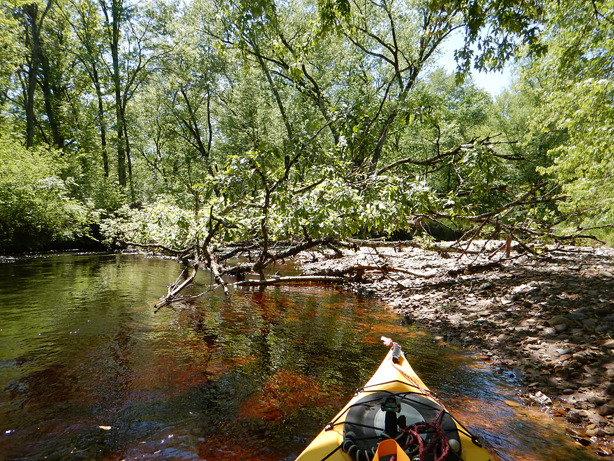
Log jam #3 of 3
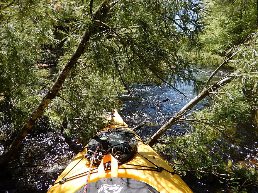
Super easy portage (not fun with half-skirt though)
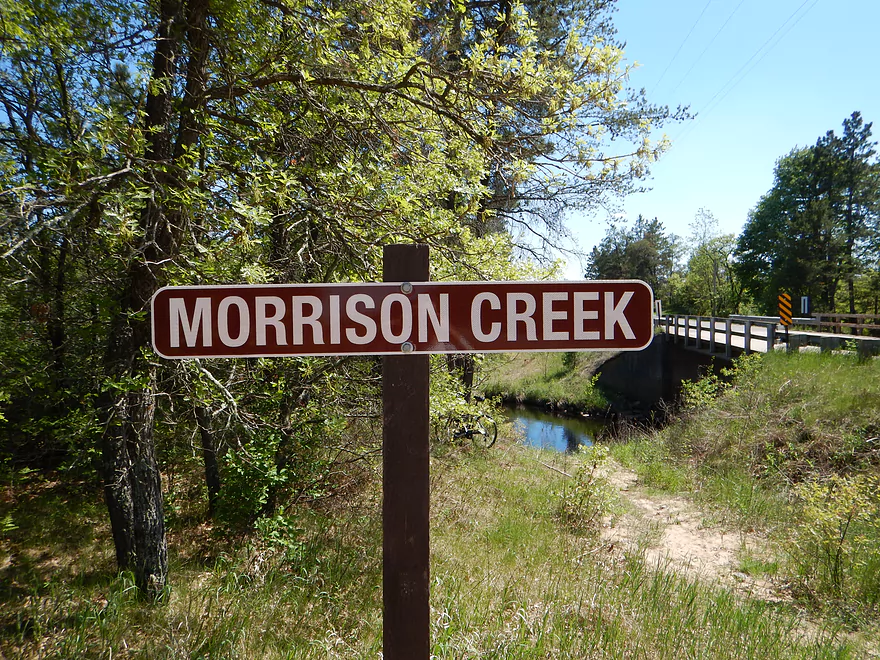
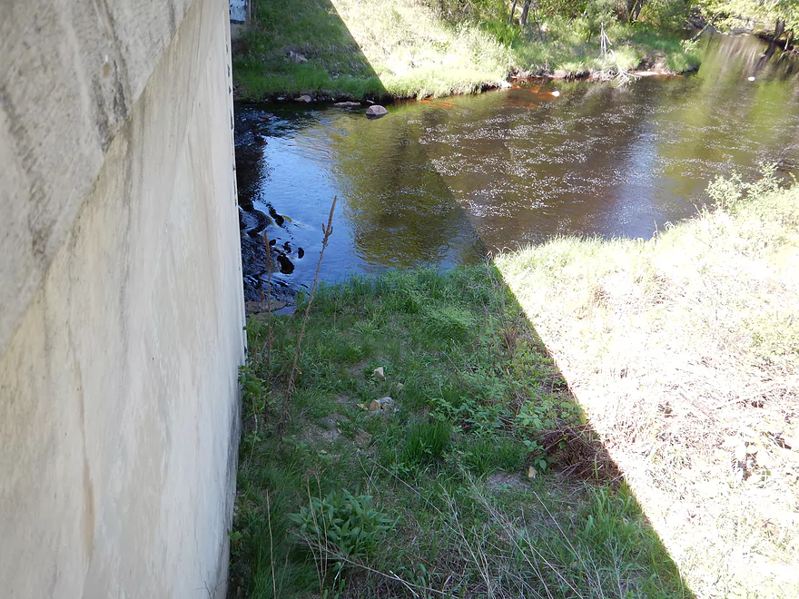
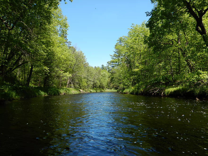
Halls meets the Black River
The Black River is only at half size because of a large island
This isn’t the landing! Silly mistake.
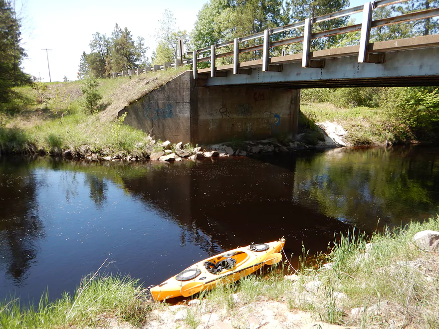
Proper landing marked by 3 rocks
Good pull-out area

Very steep drag up the hill though
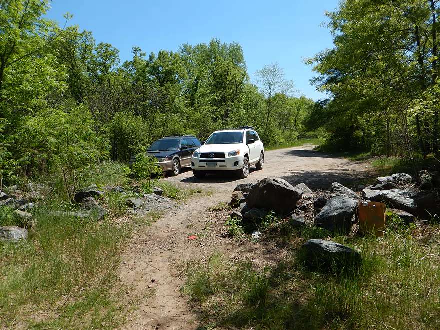
Parking and a fellow yakker!
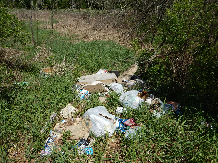
Garbage everywhere…

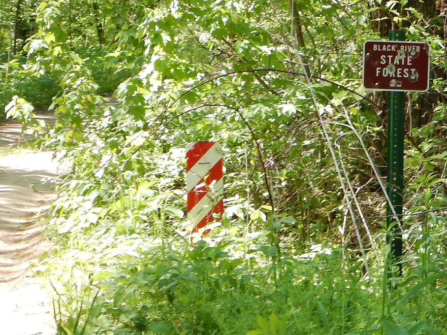
Sign showing that this access is public property (read write-up)
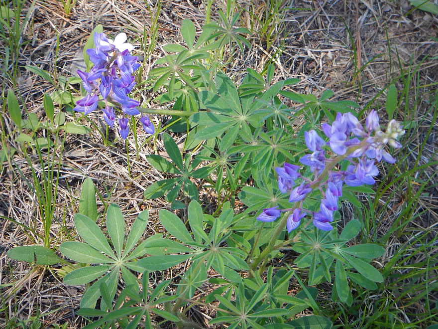
Wild lupines
Morrison Creek

A spectacular wilderness adventure through rapids, rock bluffs, massive boulders, wonderful plant life, clean water…and with not a single house in sight. This Black River tributary is not without its caveats though. This stream has possible access issues, an unpaved bike shuttle, the rapids were more serious than expected, and parasites were a drag.
Let’s get to the legal issues right off the bat here in case you’re the type who skims these write-ups. The Ho-Chunk are the native inhabitants of a good portion of Wisconsin and their modern day headquarters is located just northeast of Black River Falls by the mouth of Morrison Creek. You can read about their history at Wikipedia, which is quite interesting. While the bulk of Morrison Creek runs through Black River State Forest, a portion (close to the mouth) does run through Ho-Chunk territory. Federal law is very permitting of paddle access on most waterways, and Wisconsin even goes so far as putting navigation access in the state constitution. However, the Ho-Chunk operate as a separate nation and may have exceptions to close off navigable waterways under complicated Federal/Native American Law. I do not know and was not able to determine the legal status of running this creek. If you know more about this, leave a comment below and I’ll update the review for readers. Before running this creek, I do suggest contacting the Black River State Forest unit of the DNR and/or the Ho-Chunk nation to inquire about these matters, as many native tribes have very strict trespassing laws and independent judicial systems.
The other legal issue of importance is access to the take-outs and put-ins. I’ve marked three put-in options and two take-out options on the map below. Four of these are clearly public access and there is no legal issue with using these. However, the prime take-out location for Morrison Creek is located on the East Bank of the Black River just downstream of the mouth. When I planned this trip, I initially believed this was clearly a state access area. However, when I arrived and walked down to the landing, I met a Ho-Chunk fisherman who asked if I was native. I said no (my red beard should have been a give-away) and he then said that non-natives were not allowed there. Mind you, he did not see my kayak, so probably thought I was just another fisherman. I walked away and we didn’t have any further problems. When I got home, I double checked my research…and, to my best determination, the evidence showed I was right. Not only was the drive leading into the landing marked as State Forest Property (I took a picture), but cross-correlating a google map with the DNR’s Black River Forest map clearly showed that the drive and access was public. It could be that these maps are out-of-date? Or the Ho-Chunk have special fishing rights to these state forests and I was mistaken as a fisherman? I do not know. If you want to avoid this access (which has a rough one-lane road, garbage everywhere, and a steep pull-out area), then I suggest taking out a mile downstream on the west bank of the Black at the Halls Creek landing….a terrific public canoe access. More on this later…
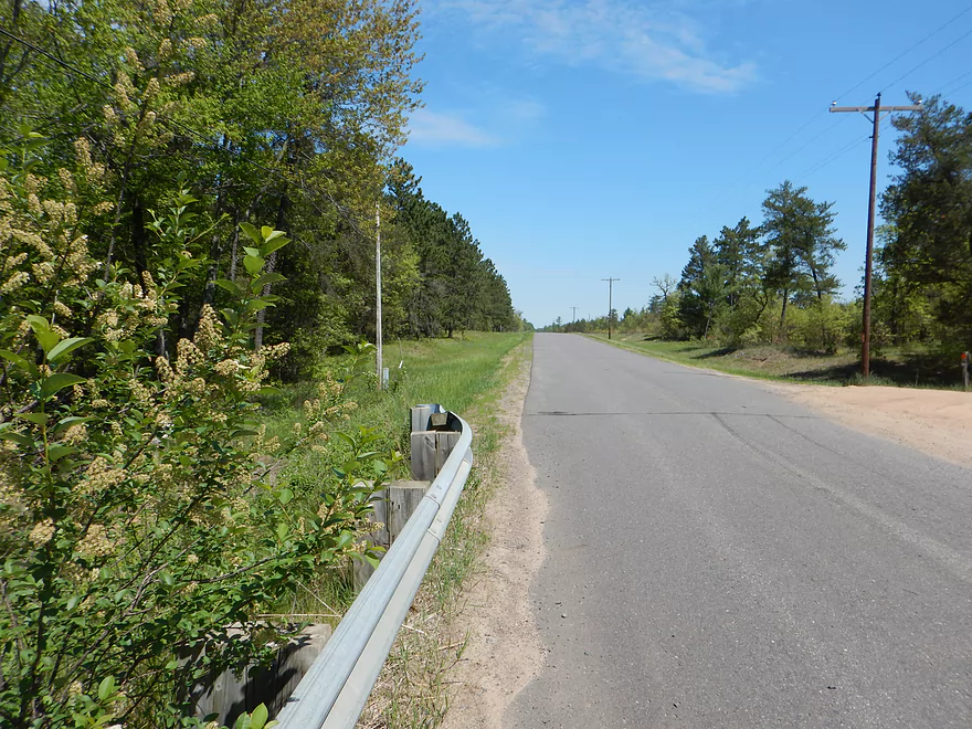
Issue #2 was the bike shuttle. You car shuttlers don’t have to worry about this! But those of us going solo don’t have livery options, so outside of hitchhiking, biking is our only bet. The most direct bike shuttle route is on Morrison Road and Karner Blue Road…but that is unpaved and was unpleasant for my hybrid Trek. This is an unfortunate reality for many “northern” Wisconsin rivers and especially tricky, as it is not always easy to determine ahead of time if a road is paved or not. Your best bet will be to shuttle to the south (all marked on the map) which will avoid all unpaved roads except access to the take-out. The ultimate preferred option would be to bike shuttle north and cross the Black River at Lake Arbutus and come back down to Halls Creek. Ten miles, yes…but should be all paved and should be well clear of Ho-Chunk property. Editors update and note…a recent comment from Austin (see bottom of page) informs me that Hwy E is not bike friendly (very busy with heavy traffic and poor shoulders). Peddle (to paddle) at your own risk!
After finishing my tough bike shuttle under a hot sun, I wasn’t in the best of moods. I had plucked some ticks off of me, wasn’t feeling 100%, it had been a long car drive, I was upset at being labeled an unwelcome non-native, and half-feared finding my car impounded when I paddled back to the take-out. This set the stage for Issue #3. The creek was deeper, faster, and rougher than I expected. I’m not a whitewater paddler. I had done Halls Creek last week and it was a wonderful paddle–perfect for rec kayakers like myself. I assumed this was Halls, Part 2. Wrong. This was a much bigger creek that was much faster (20′ per mile compared to Halls’ 10′ per mile…plus Morrison starts the first mile or so at 30′ per mile). The Neillsville gauge (not great, but best measure) was low at 3.77′. Whitewater kayakers like to run this at 5’+, so this should have tamed the tiger, so to speak…but the water was significantly faster and more pushy than I expected. In fact, Halls is supposed to be a whitewater creek with class 2’s…but practically every other rapids on Morrison was more significant than the greatest rapids I faced on Halls. Halls is peaceful…Morrison is not. Halls is a rocky gorge, with some rapids. Morrison is an intermediate whitewater creek with some rocky gorges. If you want to run Morrison as a non-whitewater paddler, do so in a short boat (my 10.5′ flat bottom Equinox was perfect). My 12.5′ Tsunami would have rolled multiple times. Also, run this in shallow water. (My depth of 3.77′ was actually perfect in hindsight). Does this mean you’ll hit more rocks? Yes…but it will be harder for your kayak to be turned sideways because the water will have less power to it. Plus, if you do go over, it means you probably won’t drown and can get out. At times, getting stuck is a good thing, as you’ll get the time to scout and even get around obstacles you would have normally been shoved into.
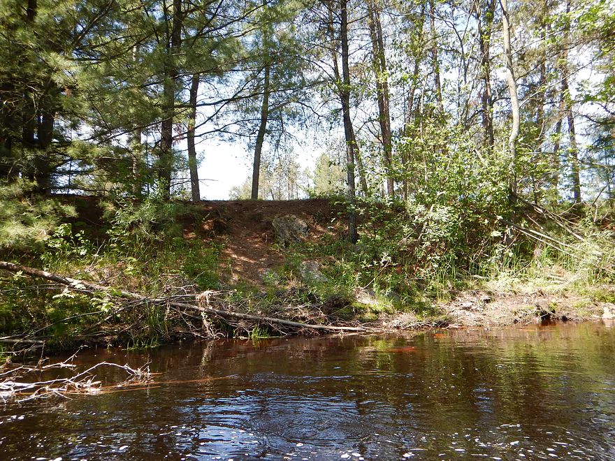
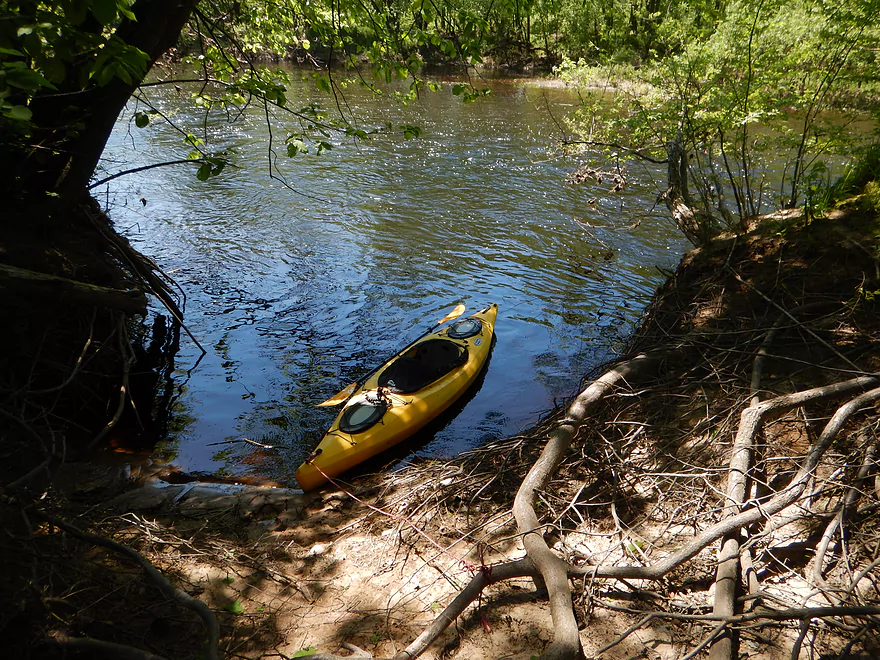
The put-in at Cemetery Road is good for bridge access–ample pull-off space, okay launch, and a small trail to the water. No facilities here though and ticks can be an issue in the tall grass.
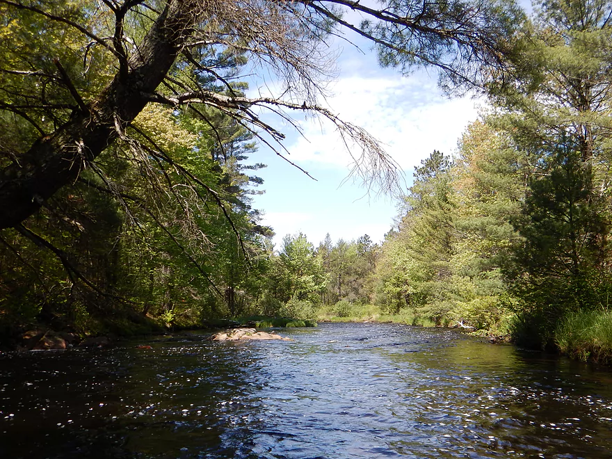
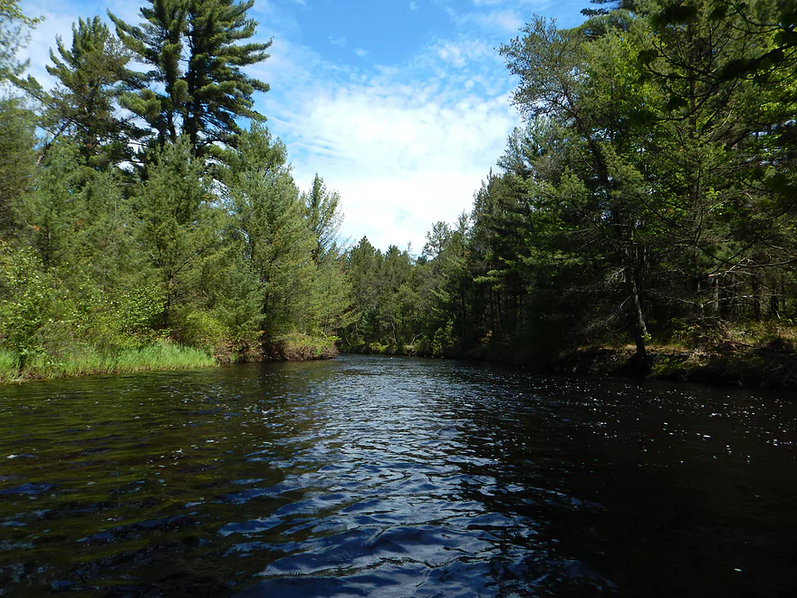
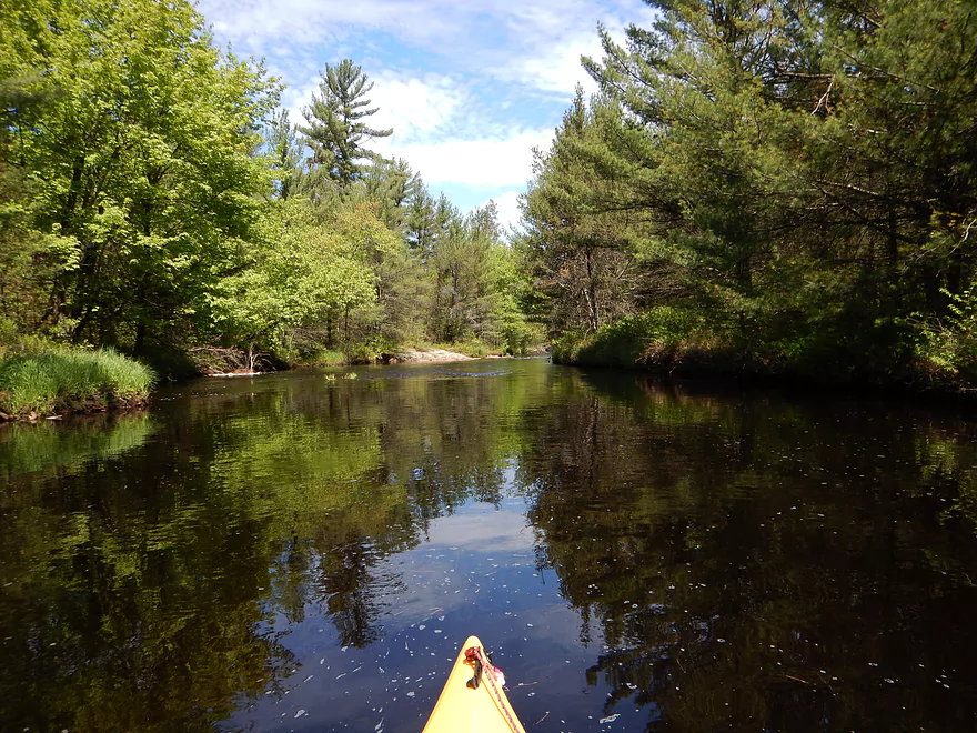
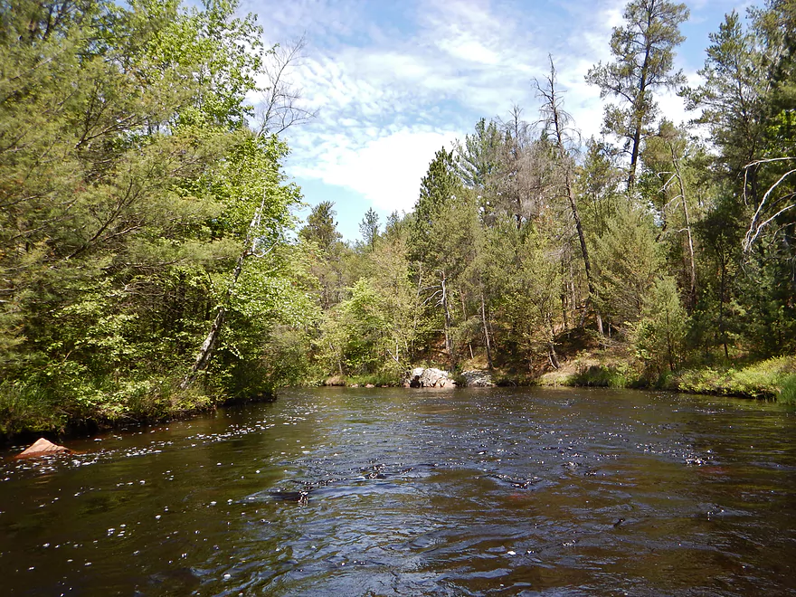
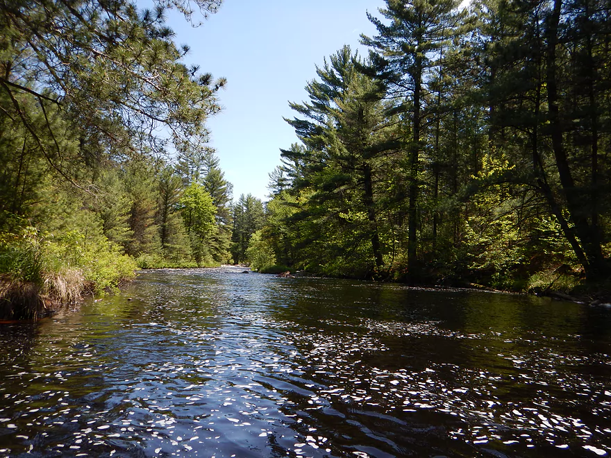
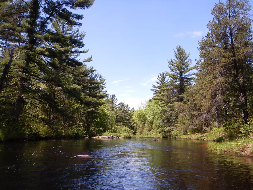
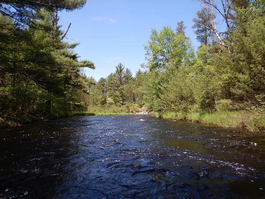
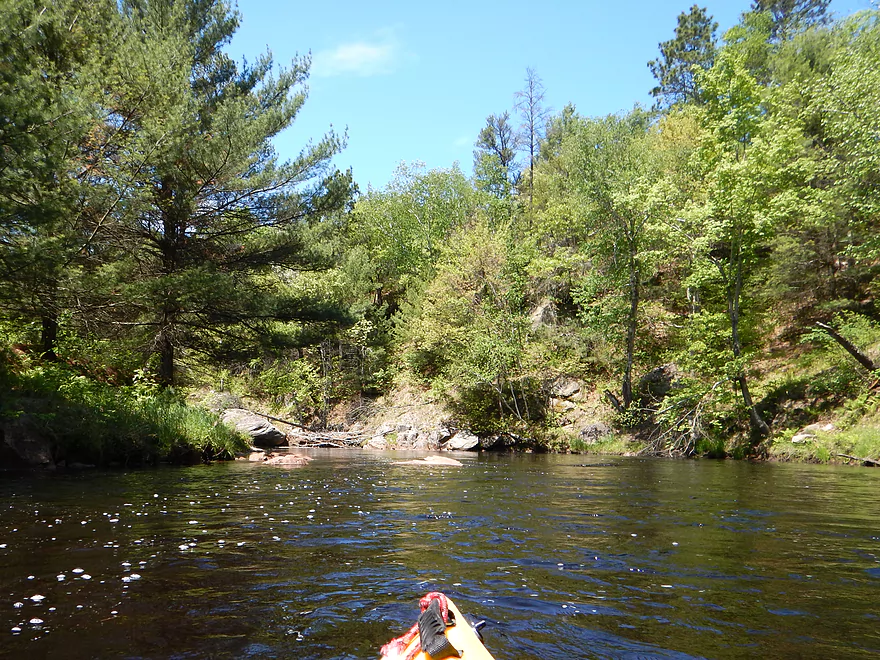
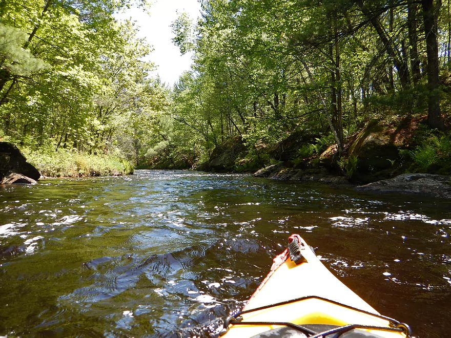
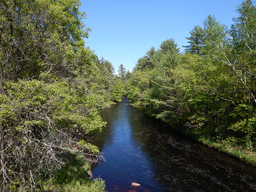
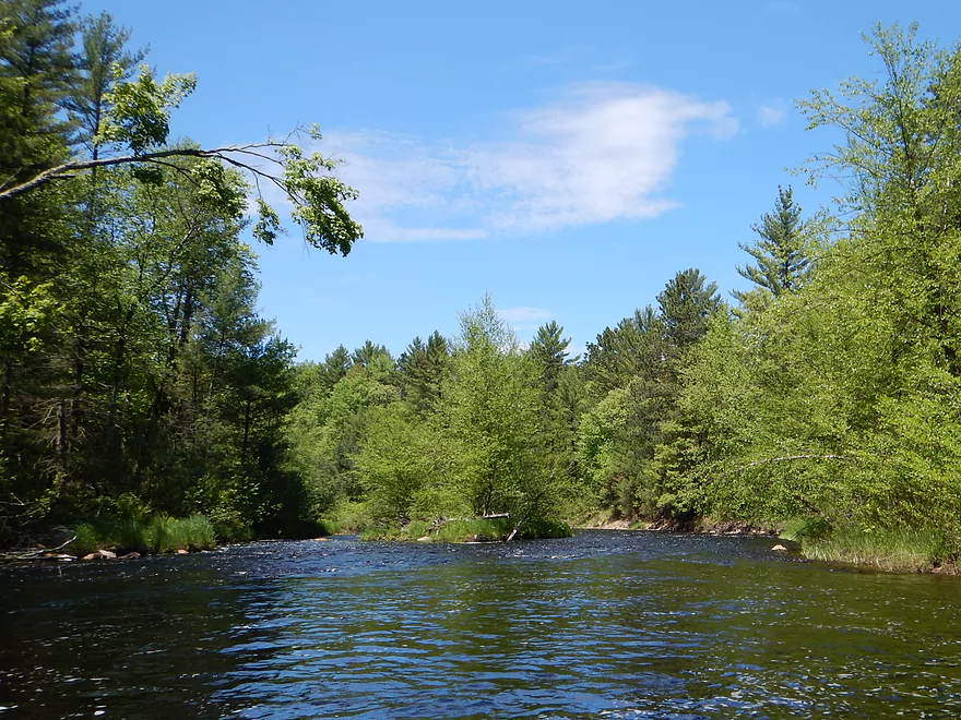
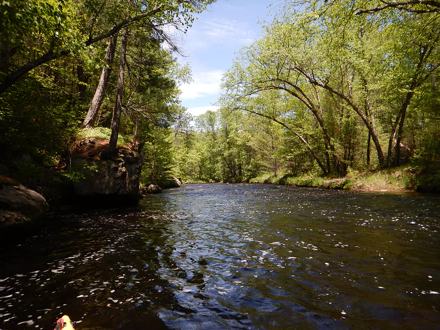
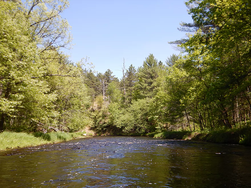
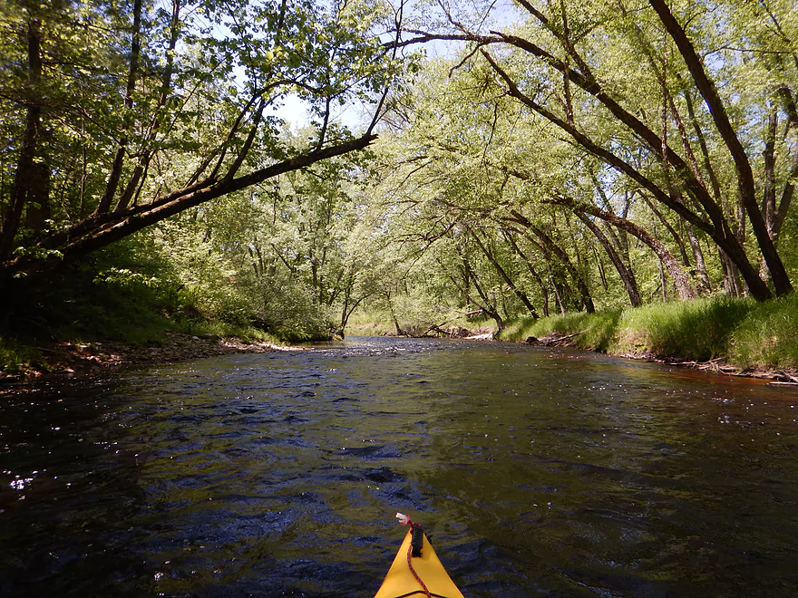
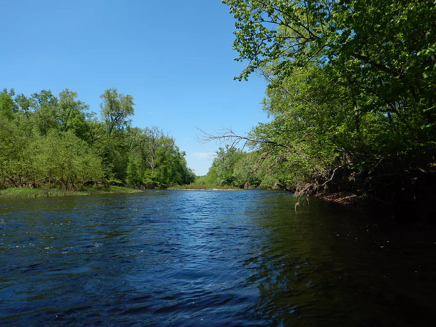
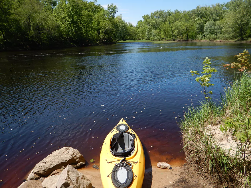
Let’s finally get to the creek itself. This is an absolutely fabulous creek that was IMO more scenic than Halls (which is elite in its own right). The water starts clean but black (not sure why) then will turn a fun transparent root beer color close to the mouth. There is little in the way of civilization. The bridges…some power lines…a noisy state ATV trail at the put-in…a noisy Ho-Chunk ATV trail near the take-out…and that was pretty much it. Don’t remember houses or any other development. The first couple of miles of the trip are the roughest, with multiple class 2’s, but the scenery is terrific. The rapids are striking, as is the bank quality and flanking pines. You’ll see random boulders on the shore, but not too much in the way of rock outcroppings (yet). After the first mile, you’ll pass the Oxbow Pond launch. Great access option if you want to avoid some of the rough stuff from Cemetery Road. Parking is terrific (and the drive paved for bike shuttles). There are facilities here and and not too much long grass for ticks to hide out in.
If you put in at Oxbow Pond launch, you still have some rough waters ahead. There are maybe two rapid runs after this…then a big turn that will prepare you for the worst on this trip. Basically, there is a tricky class 2 run that morphs into a class 3…and it can be difficult to spot the class 3 in time to portage. I’ve marked this on the map and here is a video @ 4:29 when I encounter this. Your best bet will be to study the maps and to stay left. Right might be an easier portage…but the left channel avoids most of the heavy class 2 stuff (minus one big drop) and gives you a limited option (that may be tricky in higher water) to get out in time to avoid the class 3. In fact…in hindsight, I think there was a small sub-channel that ran on the south side would have been a perfect detour of the class 3. There would be two drops on this detour, but not bad in small volume water. After seeing the class 3 from the downstream side, I was very happy I portaged them.
This will be the last class 3, but there will be more class 2’s ahead. A couple of whitewater pointers: Don’t use a long boat. Don’t use a v-bottom boat. NEVER get turned sideways. Avoid getting the bow stuck on rocks (that is how you get turned sideways….in slower water this is okay, but in fast water it can be an issue). If you get stuck on a rock, keep the boat pointing forward if possible. If not, make sure the current flows under the boat and not over it by angling the boat by shifting your weight. Sometimes it is best to back out of stuck situations instead of going forward. Avoid spots where the “current goes underwater”. That is very dangerous…if the current doesn’t keep flowing over the top of the water, it circulates and can keep you under if you roll. Also, always scout when possible…bring a rope for portages and aquatic footwear.
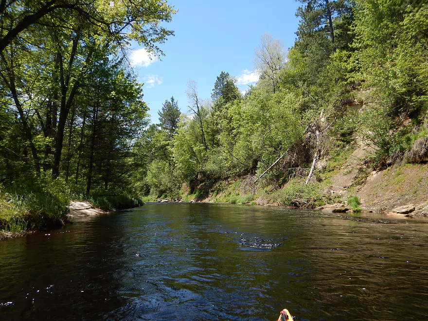
By the K bridge, most (not all) of the problem rapids are behind you. In fact there is a class 1 or 2 under the bridge. This would be an alt put-in (maybe makes for a five mile trip to mouth). Steep, not great parking, with poorly placed guard rails and fast traffic…it would be an option though.
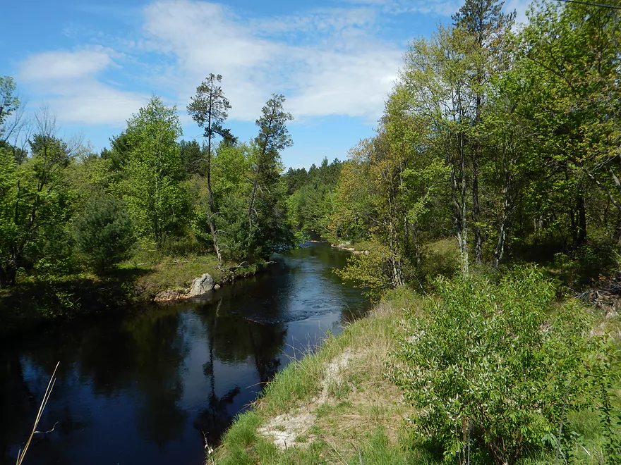
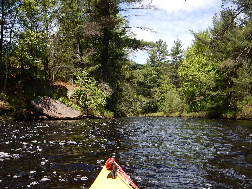
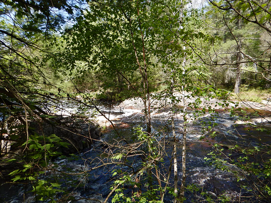
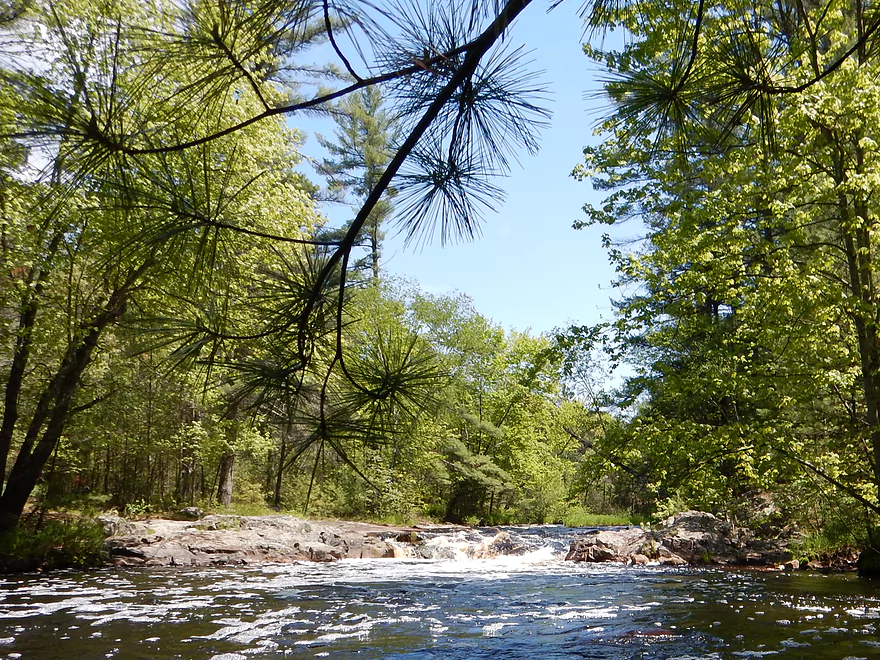
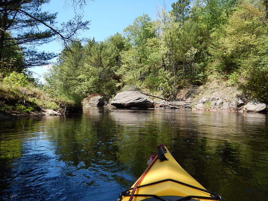
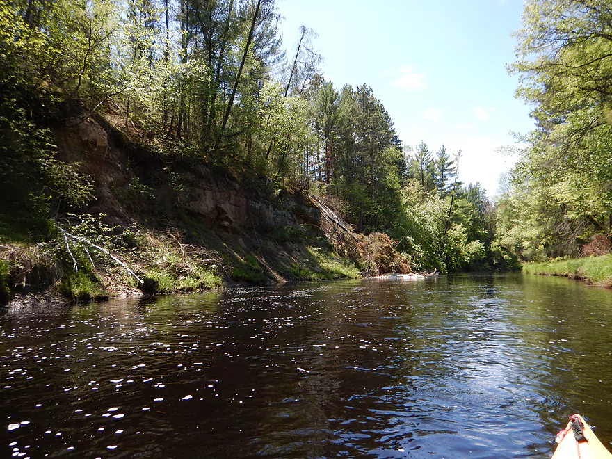
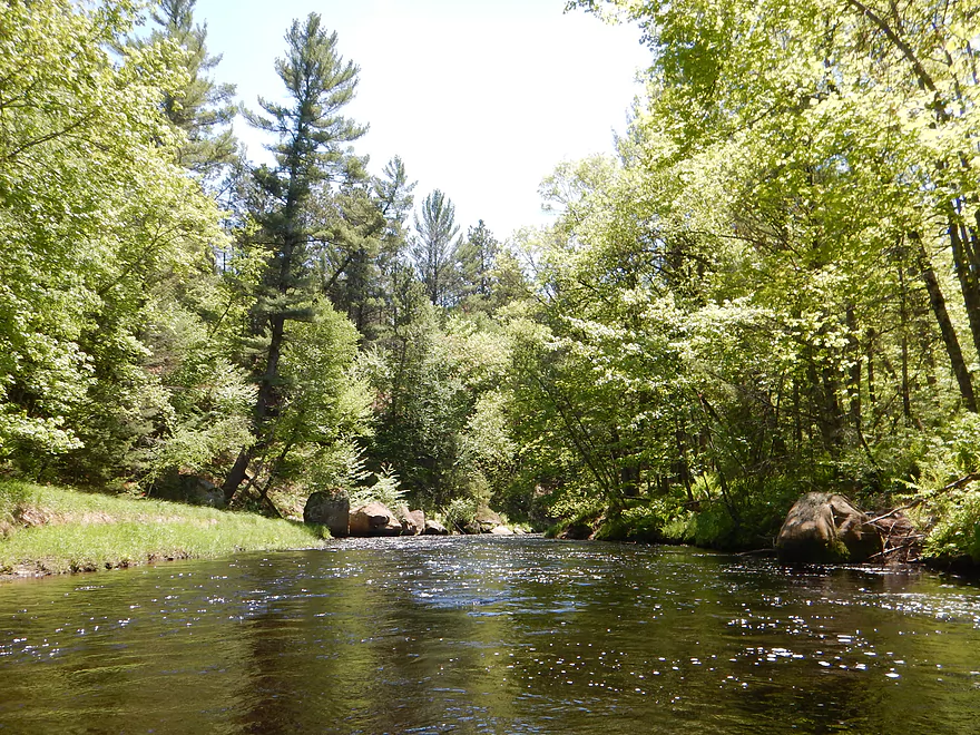
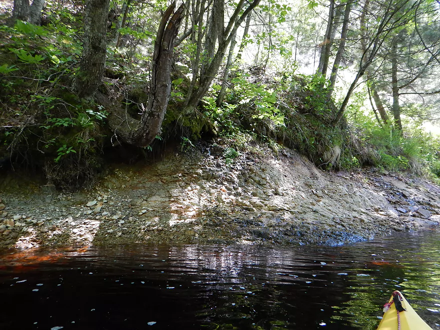
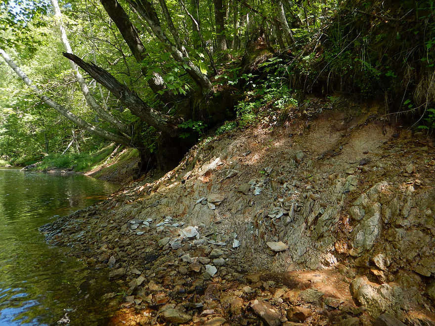
After K, the best scenery lies ahead for the next few miles–massive boulders on the banks, stunning rock walls, terrific sand banks and rock stratification in a carved-out creek valley. A terrific wilderness experience! The plant-life was lush and green (why you don’t run this in the early spring). Wonderful mosses growing on the seeps and micro-waterfalls. Terrific fern colonies and thick skunk cabbage patches. This was the highlight of the trip and was fantastic.
Wildlife wasn’t great on this trip. Saw what I thought was an eagle. Saw some dragonflies, clams, and the highlight was a porcupine. “Lowlight” were the mosquitoes…not super bad, but annoying at times…especially close to shore and where you weren’t moving fast.
The last few miles are “floodplains” and the nice sections pretty much go away…but for a floodplain it is still nice despite the hardwood deadfall that kicked out the nice pines. The water turns root beer red and the substrate consists of mostly sand or nice pebbles. The current is still mean, but this time there are half-submerged logs to dodge instead of rocks (rocks are preferable…trust me). There was a tough log jam halfway into the trip (see map) that had me ramming my way through a downed pine tree (not recommended). For this last section there were multiple downed trees and two necessitated portages. Some tough squeakers in fast current as well. These are tough because you are using your upper body to pull yourself through the limbs…but you lose balance and don’t have paddle control when you do this. Easy to be turned sideways, and here I took on a little water….but my terrific “fishing kayak” stayed upright (fishing kayaks are great stream runners!).
With this in mind, it was a relief to get to the mouth and into the Black River. After accidentally taking out prematurely (I hadn’t been able to properly scout the take-out because of the fisherman), I finally found the take-out on the left bank, marked by 3 rocks. I feared encountering another fisherman, a Ho-Chunk police officer, or to find my car impounded…but thankfully my first sight from the water was a Thule j-bar…a fellow yakker! And nobody else in sight, with my car in one piece. In whitewater circles this is actually a popular creek, despite its issues, and on this trip I ended up seeing three cars of yakkers doing this run.
In hindsight, I suggest not using this take-out. There is trash everywhere, obviously there was the issue with the fisherman (even if the maps show this to be state forest land), and the one-lane, rutty road to the launch can’t be healthy for your car’s (or your bike’s) suspension. Bike (or car shuttle) the 10 miles and take the bridge to the north to the Halls Creek landing to avoid unpaved roads and possible conflicts with the locals–maybe an extra mile paddling on the Black but not bad, with some fun class 1’s just above Halls Creek.
As for alternative options upstream of Cemetery, I don’t know. The creek looks easily navigable…but I have no idea about access points or dangerous rapids for the far upper Morrison.
A special thanks to Frank F. Piraino for his very helpful write-up about Morrison Creek (and the locations of the rapids) in “Small River Canoe Adventures of Wisconsin“.
Also, thanks to the gang at American Whitewater for their review of this hard-to-research creek. Definitely read it, but keep in mind this is written by and intended for whitewater paddlers with an overemphasis on dangerous (but fun for them) high water. I’m not sure I would run this higher than 4.5′ without whitewater gear. And 3.7′ for me was fine (but for them would have been too “boney”).
Click here to see an overview map.
- Potter Flowage:
- East End/Morrison Creek:
- East Turn-Around Point to Merlin Lambert County Park: 1.5 miles. Very scenic stretch with nice pines. The further upstream you go, the narrower and faster the Creek gets before you have to turn around.
- Merlin Lambert County Park to Dam: 1.2 miles. Mostly open paddling and not super interesting. However the lily beds on the north shore are attractive and there are inviting side gullies you can explore. This is a good lake to kayak for sunsets because of the open west end.
- South End/McKenna Creek:
- South Turn-Around Point to Larb Lane Landing: 1.7 miles. Attractive stretch of McKenna Creek with lots of pine trees. The further southeast you get, the better the scenery, but the creek does get progressively narrower until you have to turn around.
- Larb Lane Landing to Dam: 0.8 miles. Mostly open paddling and not super interesting, but the pines on the shoreline are really nice.
- East End/Morrison Creek:
- Potter Flowage Dam to Hwy 54: 7.4 miles. Not viable because of deadfall issues.
- Hwy 54 to Cemetery Road: 10.9 miles. Likely not as many rapids/boulders, but should still be scenic. First half is more marshy and the second half should be more rugged. Reviewed by Rick Kark who had a positive experience on it and described several outcrops. He said there were some logjams, but he didn’t seem to mind them…from satellite view the creek looks very open.
- Cemetery Road to Public Forest Access/Mouth on Black River: 7.4 miles.
- Cemetery Road to Oxbow Road Landing: 0.8 miles. Scenic stretch with nice pines, some Class 1-2 rapids, and a few small outcrops.
- Oxbow Road Landing to Hwy K: 1.4 miles. This leg is a bit more open but still scenic with many Class 1-2 rapids. There is a Class 3 ledge that should be handled carefully.
- Hwy K to Oxbow Road Landing: 5.2 miles. Last stretch has tamer rapids, but also much nicer outcrops. This is more wooded and 1-2 logjam portages might be required.
Morrison Creek Tributaries:
- Dickey Creek: A scenic creek, but just has too many logjams.
- Mollies Creek: This is a small creek and would be short 2 mile trip from Cemetery to K. But apparently American Whitewater did it and provided some really cool photos. I suspect there might be some logjams and a few Class 3+ rapids. If you’re willing to portage all this, it could be a scenic adventure but with possible challenges.
- Unnamed Creek (by Hwy 54 and the Correctional Center): From Dike 17 Wildlife area to Hwy 54 Upstream from hwy 54 is a series of canals and small flowages that might be a fun little adventure (but with possible obstacles). Downstream from Hwy 54, the creek is narrow and windy. Not sure the Correction Center is an access option, so Morrison Creek or Staffon Road might have to be your end-game options.
Trip Map
View Morrison Creek in a larger map
Overview Map
Video
Photos Size:
This is a very handy pdf map:
http://www.friendsoftheblackriver.org/images/files/fbr_halls_creek2.pdf
It shows a private landing near the Morrison Creek one, perhaps that fella mentioning trespassing had them confused…
Your blog is awesome! Did Hall’s Creek recently due your type up of it; the Miles Paddled Robinson Creek was also a major contributing factor(their site led me to yours)
Will comment more there(Halls Creek) since I did the lower section from where you stopped.
I do a lot of biking at Levis Mound. Excellent, destination worthy trails there, possible the best in the state. Can’t believe how oblivious I was to what the rest of the area has to offer until recent!
I would like to state something about bike shuttles though. Please take no offense. I’d would highly discourage biking along County E for any considerable length or duration. There is no shoulder and that road is crazy busy these days. It’s basically a state highway with how much Hatfield has blown up. Many vehicles are big truck/suv four wheeler types too that are inconsiderate to say the least(copious noise, fumes, aggressive driving, indifference to damaging large tracts of land, etc…) Just please use extreme caution on that road at least. I would say you’d be taking a serious risk with your life peddling that road on a Saturday especially!
Thanks!
p.s.
I will be looking into the access issue too btw. My uncle is a registered attorney in tribal court, is native himself(step uncle so i’m not), lives down there and would possibly know definitively himself or who would. I’d say it either has to do with fishing rights or a different nearby area/misunderstanding on where it applies to exactly(like those No Tress’ing signs on state land from your WI river/dells area account! WTH?!)
Thanks Austin so much for your comment! I’m not from the Black River area so really appreciate any clarifications you can provide on these matters. Anything you can find out legally about the Morrison Creek area, I would be happy to share on the website. You did Halls eh? You must have done it at a shallower CFS and I would be interested to know how that worked out. Feel free to post on that trip too and I would be happy to share whatever you found.
Glad to contribute! We used to bike from the Arbutus park down J to Levis(and back) but stopped due to traffic(there were other factors, like not staying or even being able to at the park due to no vacancy). Appreciate you not taking offense. Text can came across wrong and it seems like I’m being overly adamant or what not at times, so am glad you didn’t take it that way.
Your site is such a good resource I truly do feel indebted (MilesPaddled too!)
Will comment more on Halls there. Was definitely lower and just on the margin of doable… It ended up being one of the most splendid experiences I have ever had though! An absolutely gorgeous run and basically my notion of what a “perfect” run would be!! (with just a little more water, gauges were 3.9 ft at Neilsville, East Fork ~650CFS 6/8/14)
Many, many thanks for sharing that account and leading to my own unreal adventure there!!!
Cleanup work happened on Morrison Creek on Oct 7th, 2023. Many hazards/logjams were removed from the winter ice storm. To date, there may remain 2-3 significant logjams. The creek itself was too shallow to paddle on Oct 7th, but that’s to be expected this late in the season without recent rain. https://www.facebook.com/billy.sunday.1610/posts/pfbid0gnBr4ANMrUjExF4qYbU2KjgsjcjKDS77sGZoHpeejC8YtDcyY6WTZHFgEw5eFZF2l