
Starting the trip by the Manawa Library
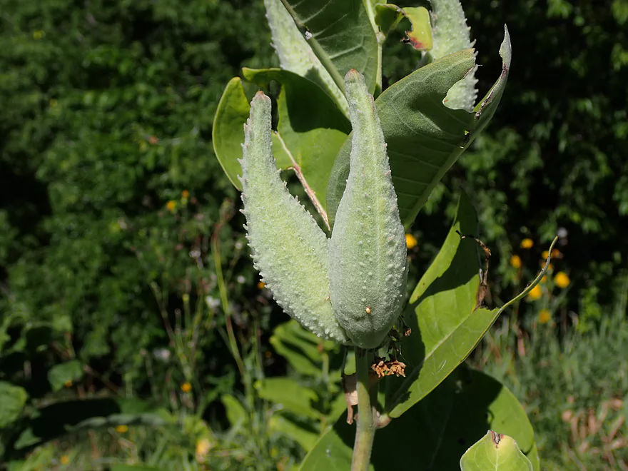
Milkweed
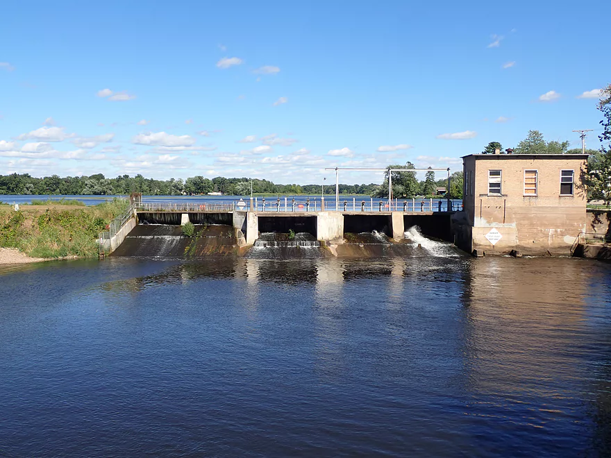
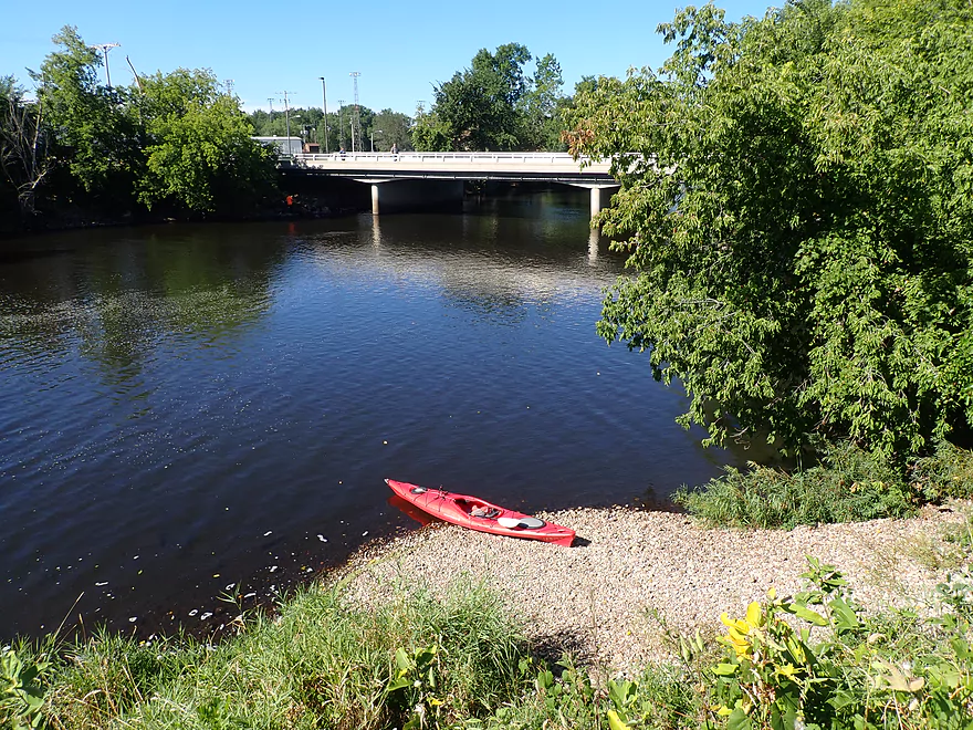
Put-in is just below the dam
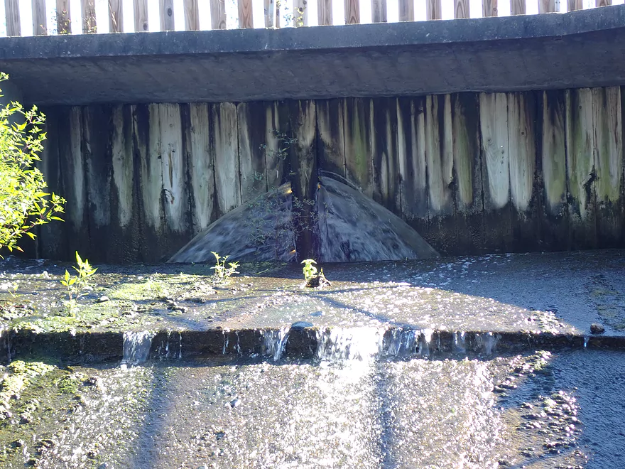
Which does not look like it is in good shape
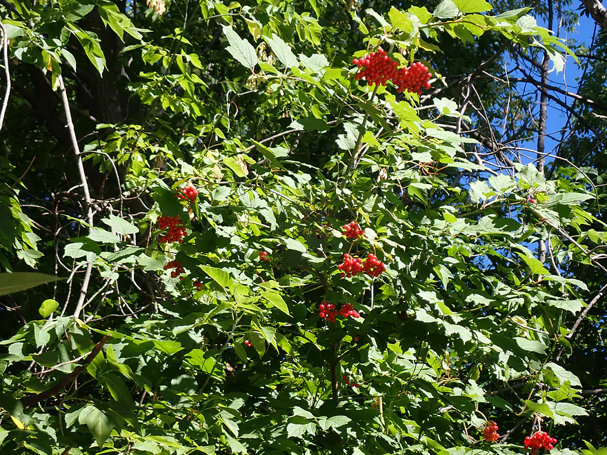
Highbush cranberries
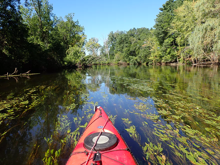
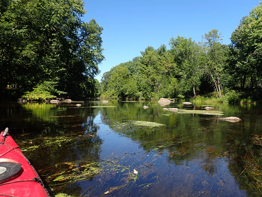
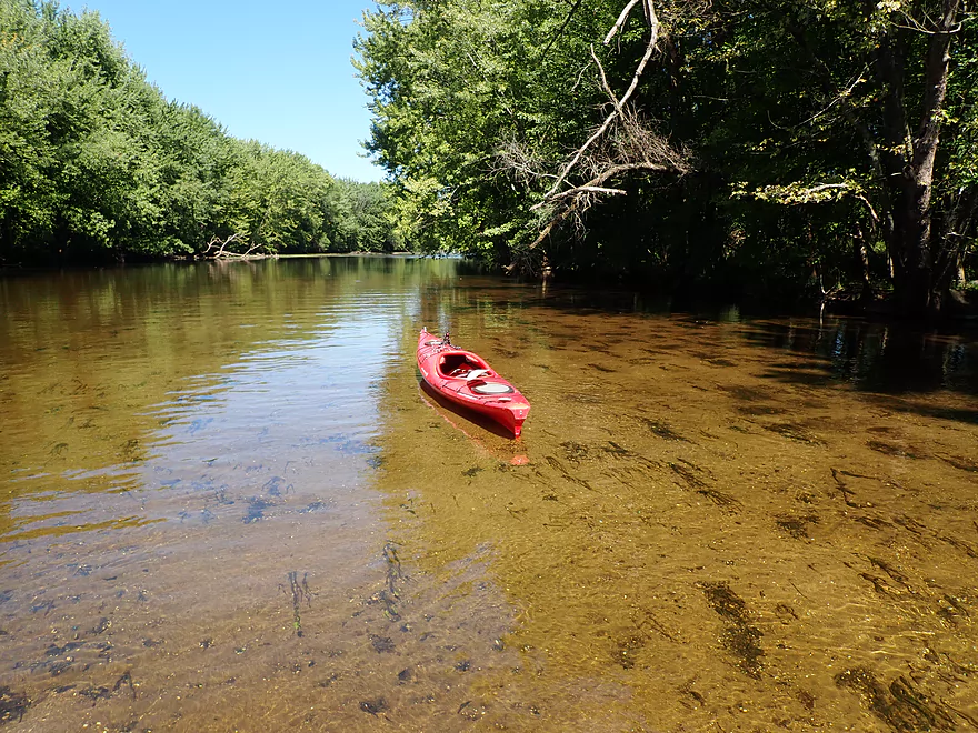
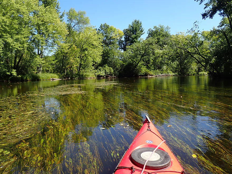
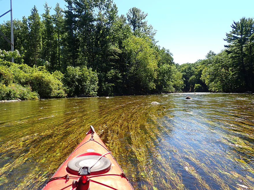
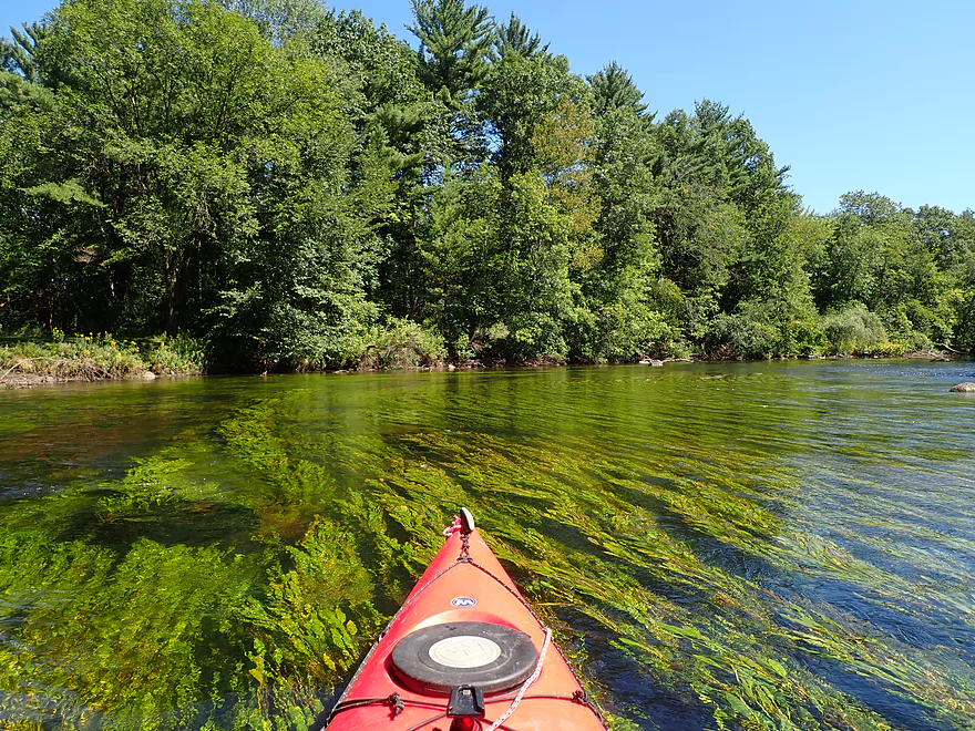
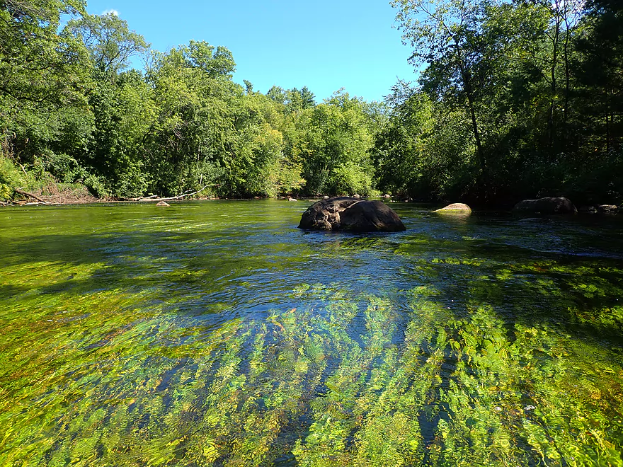
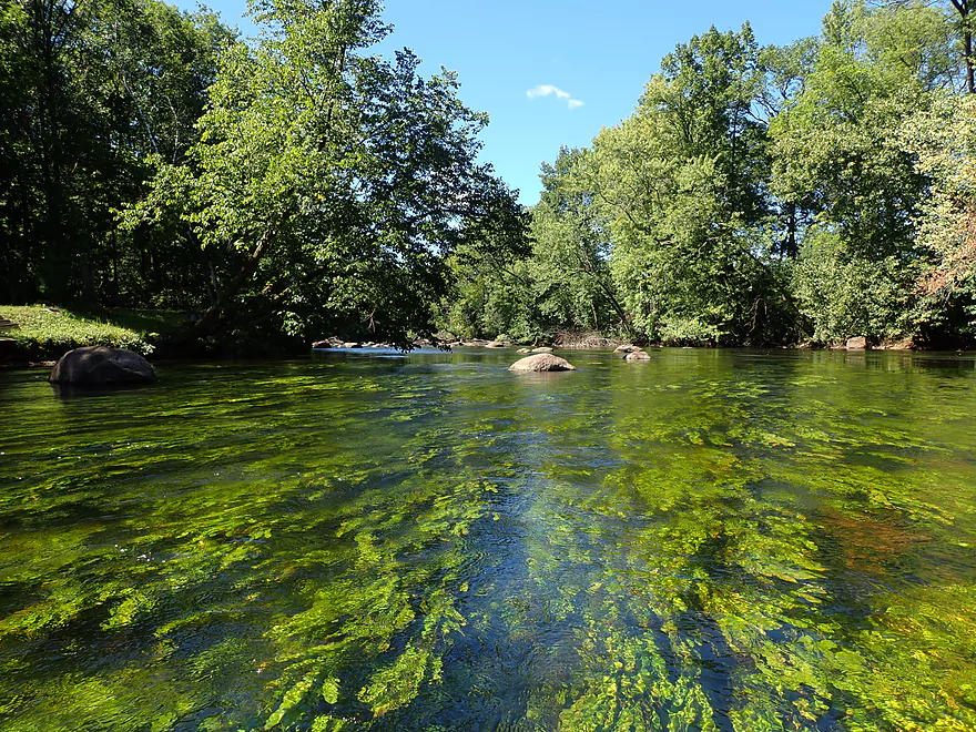
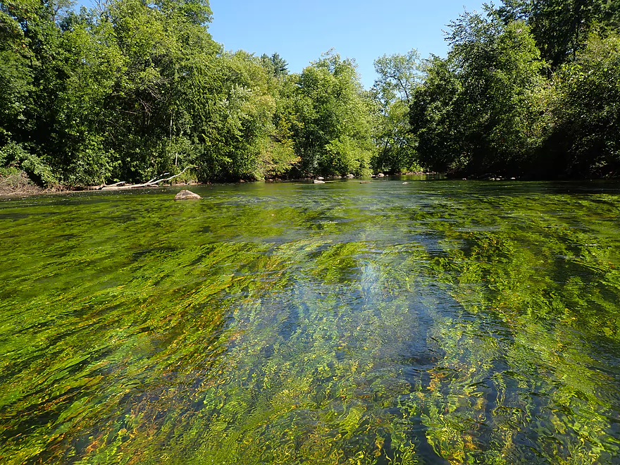
Large number of aquatic plants
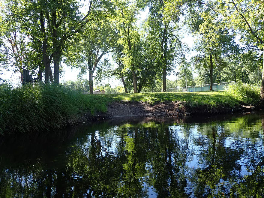
Nice early morning reflections
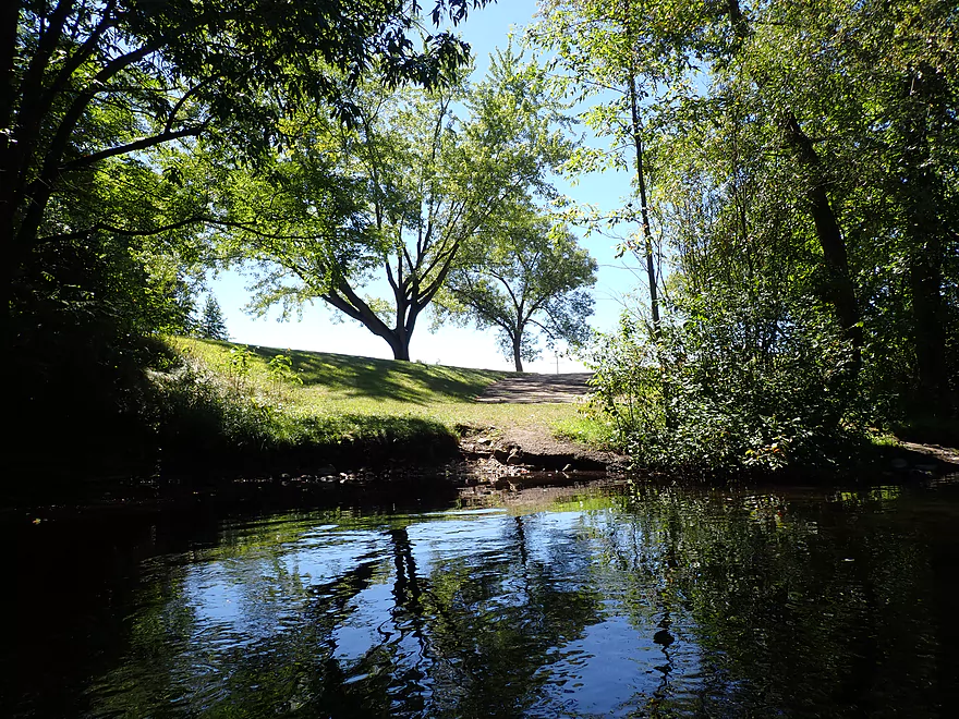
Lindsay Park is an alternate access
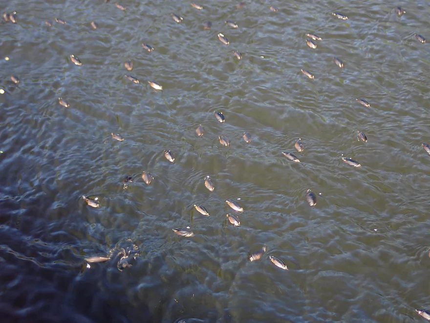
Ton of whirligigs on this trip
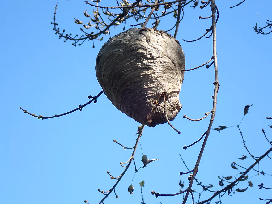
A bald-faced hornet nest
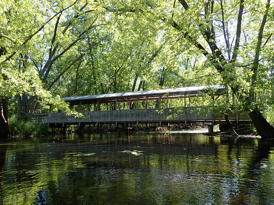
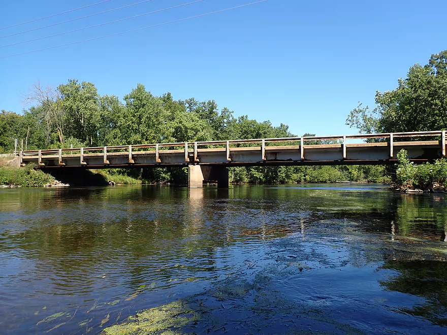
A covered bridge
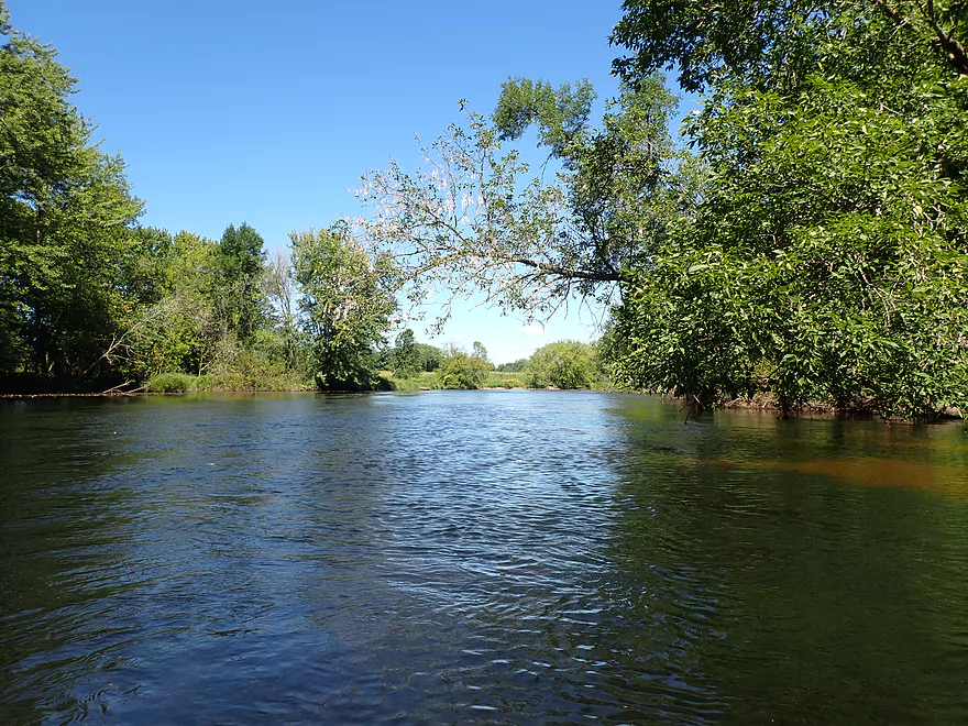
Scenery was ok…but a bit bland in the few few miles
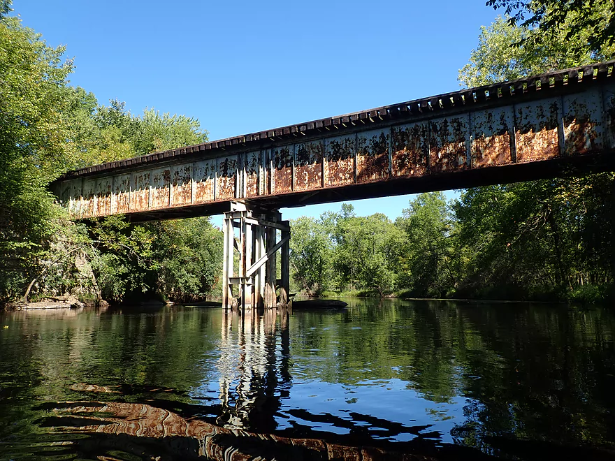
Railroad bridge
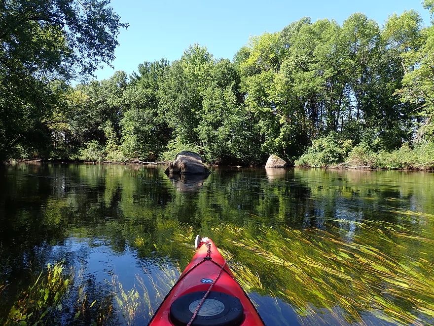
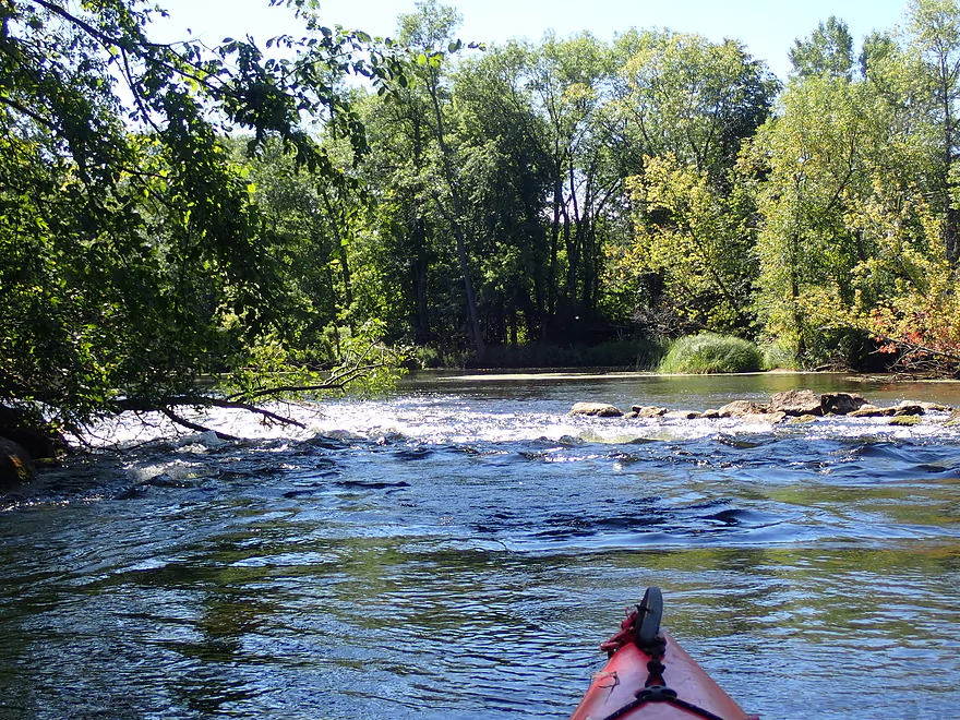
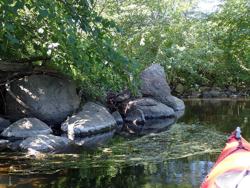
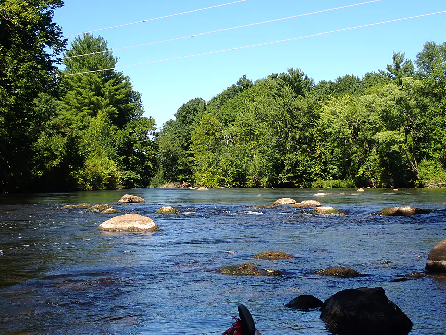
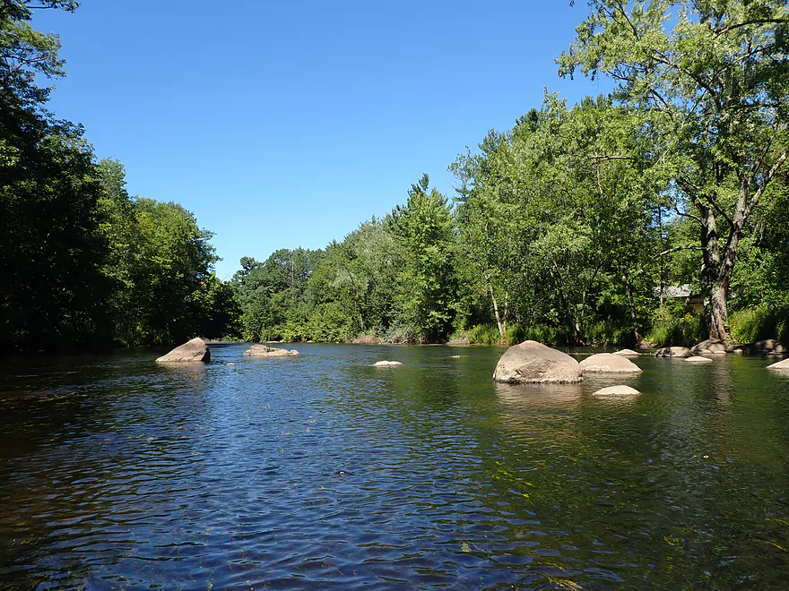
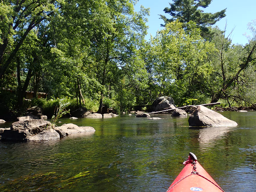
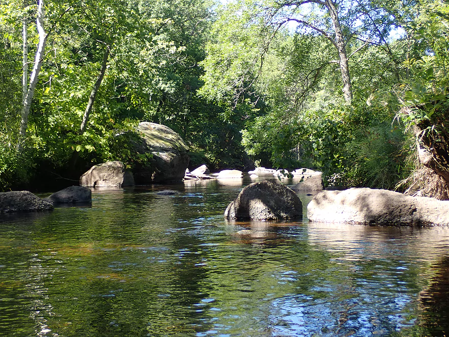
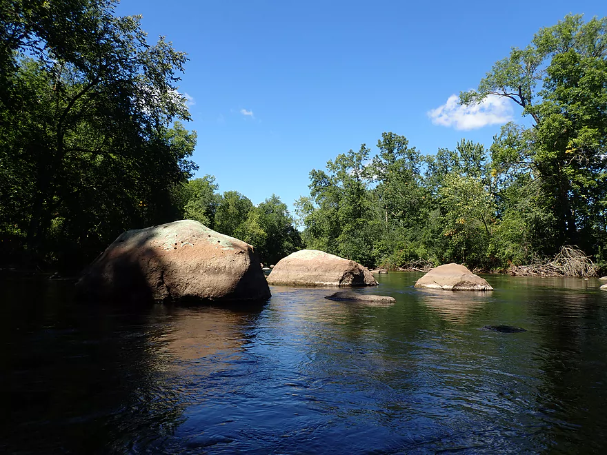
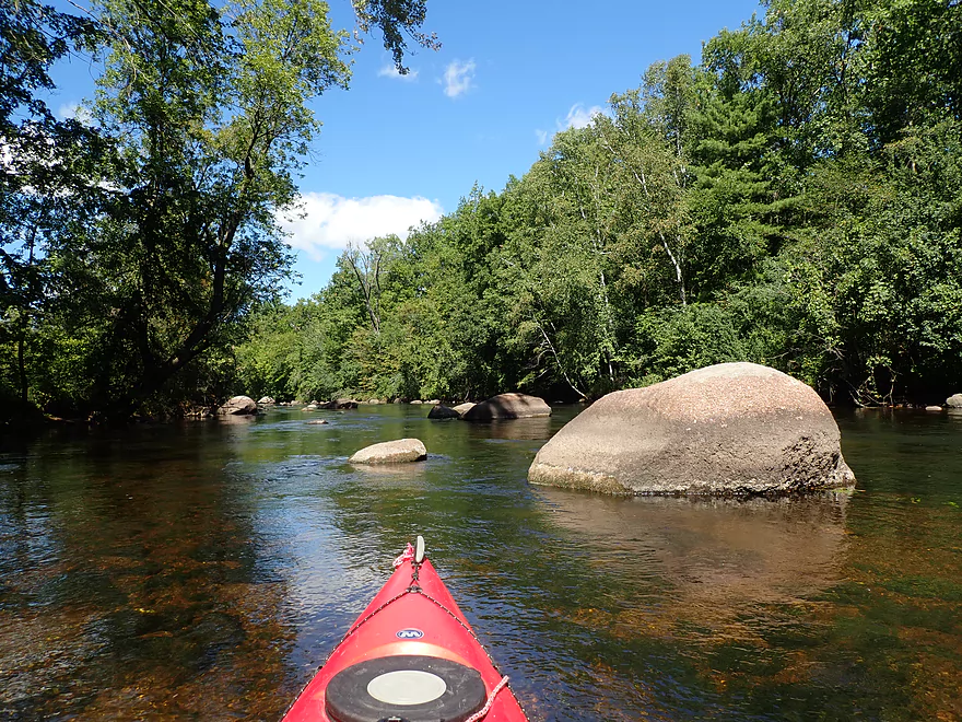
The first boulder garden
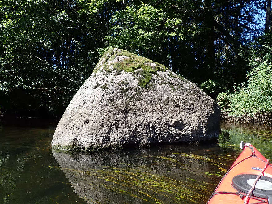
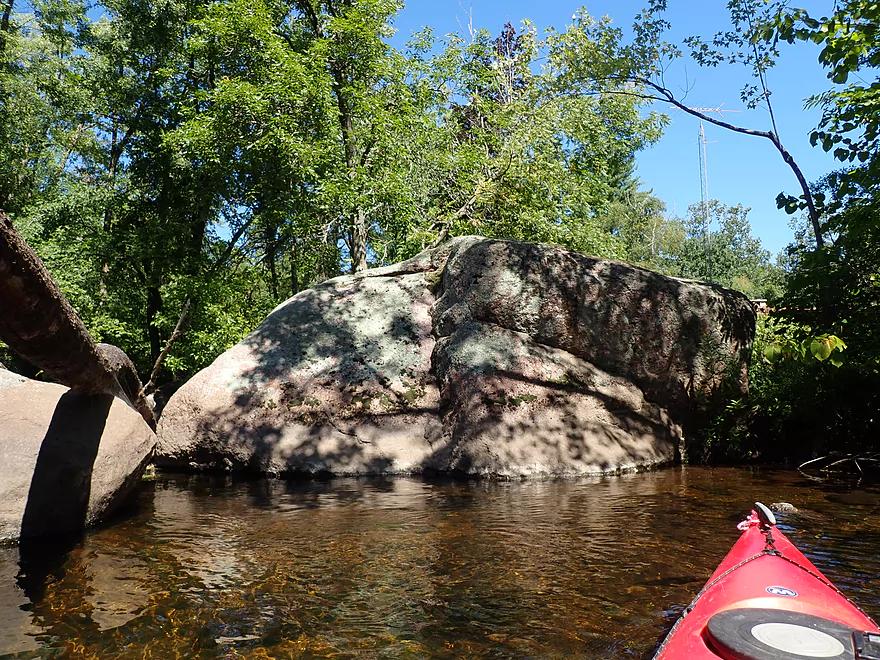
Some larger granite boulders

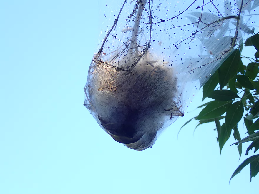
A tent caterpillar web
Hwy B (an access option)
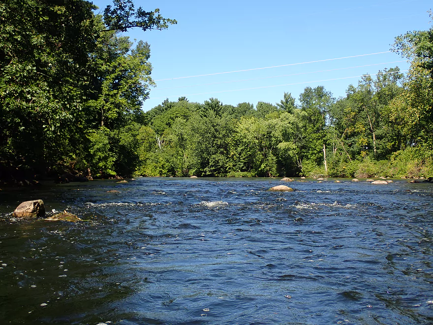
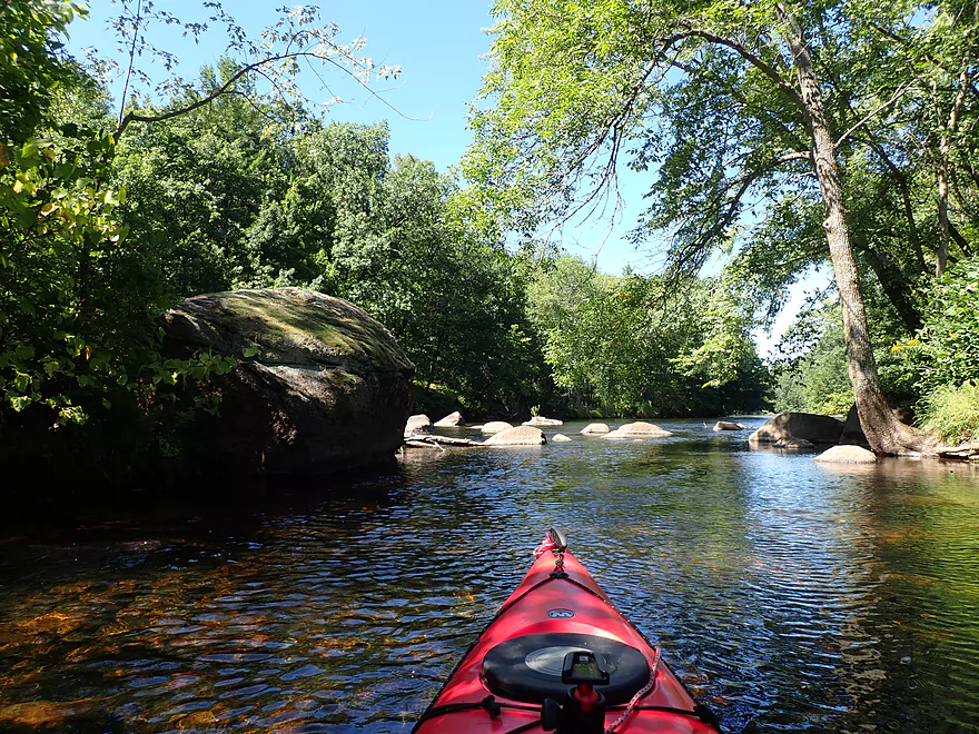
Another small boulder garden
A nasty strainer by these island rapids (east channel)
Checking the other side of the island…
Which thankfully had manageable rapids (west channel)
Bottom view of the strainer again on the east channel
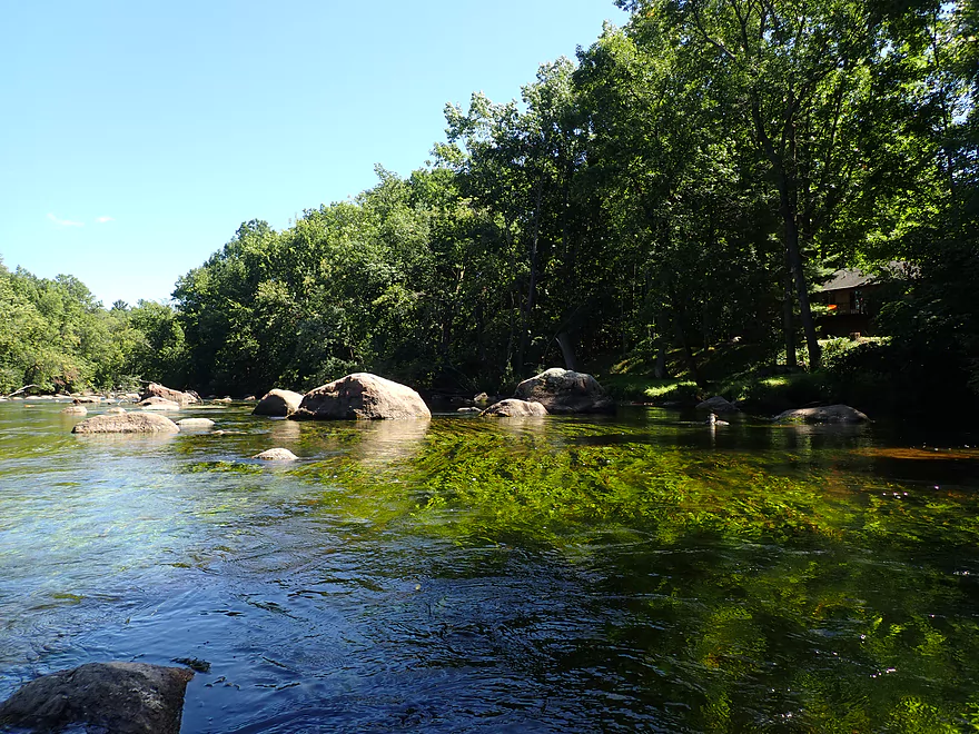
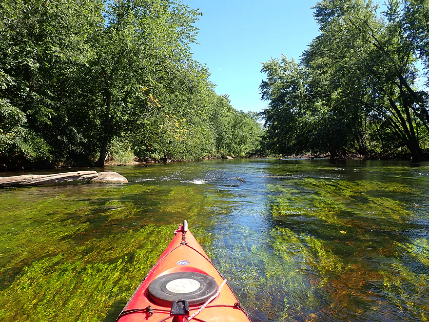
Good clarity in spots
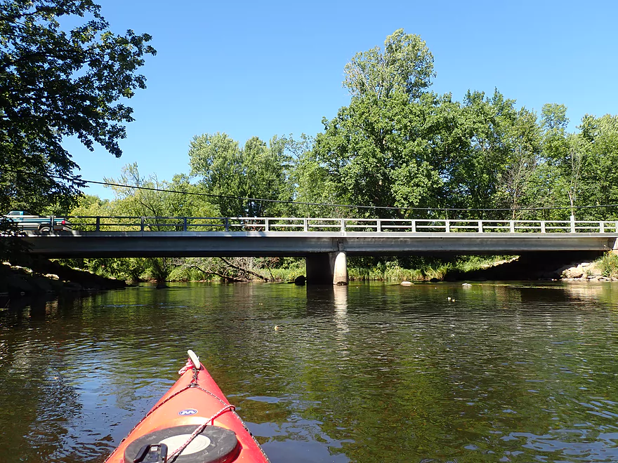
Hwy 110/22
Good public access here
More aquatic weeds
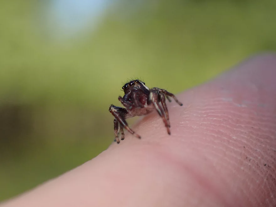
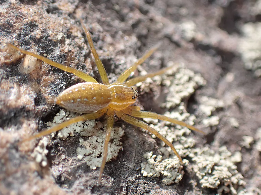
A friendly jumping spider
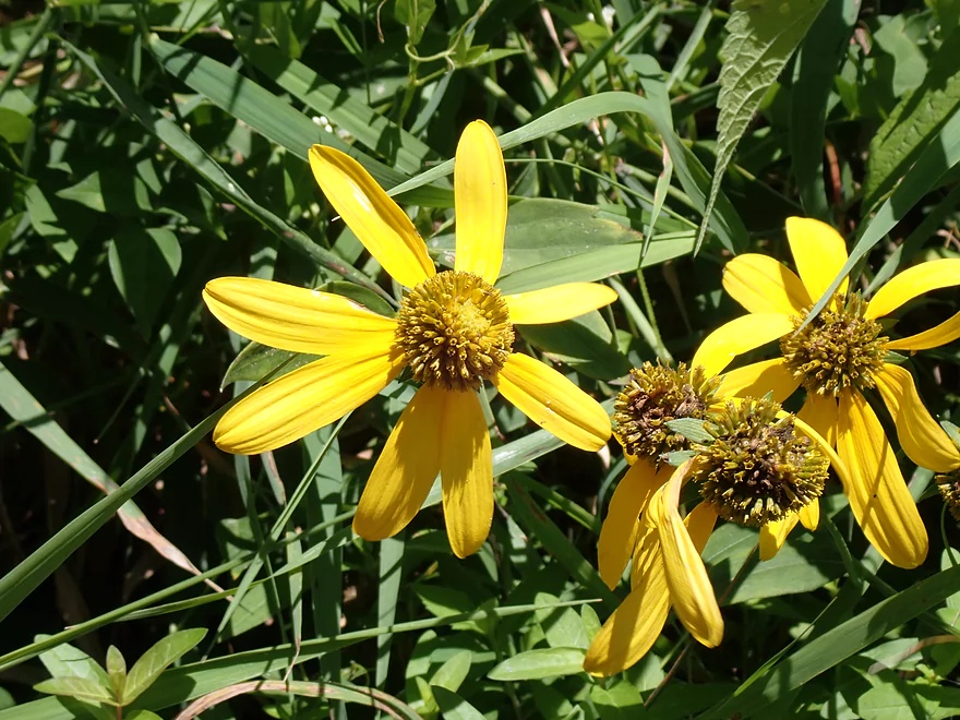
Cutleaf coneflowers
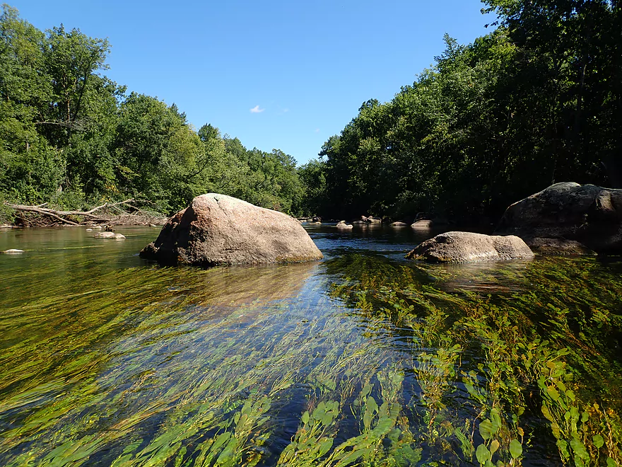
Cool how the plants curve with the current
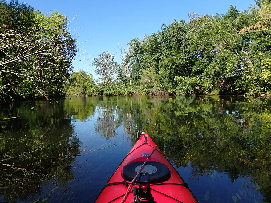
Another nice scene
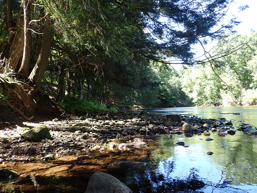
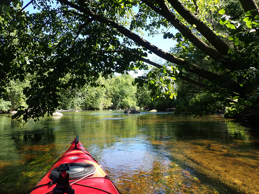
Attractive section with hemlocks
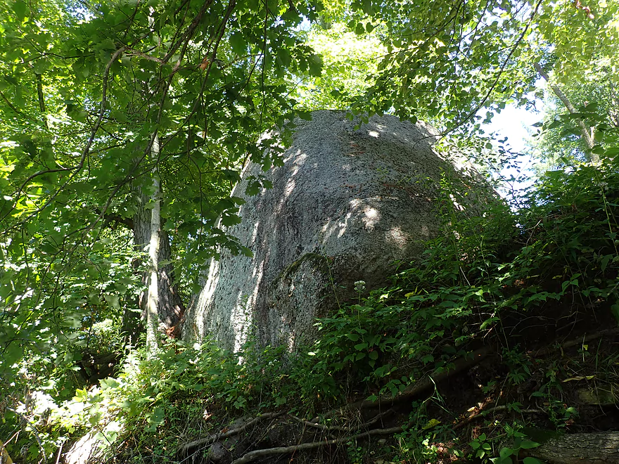
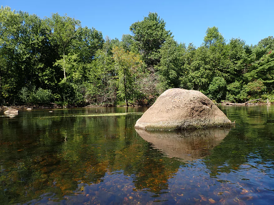
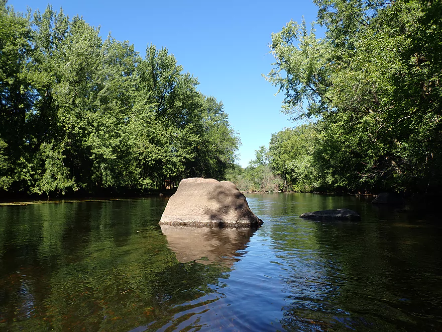
A huge glacial erratic
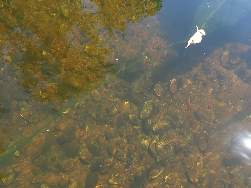
So many dead clams
Yet another boulder garden
A large block of granite
A six-spotted fishing spider
Exploring the side channel
Shallow but scenic
More flowing potamogeton (thick, but not a problem for paddling)
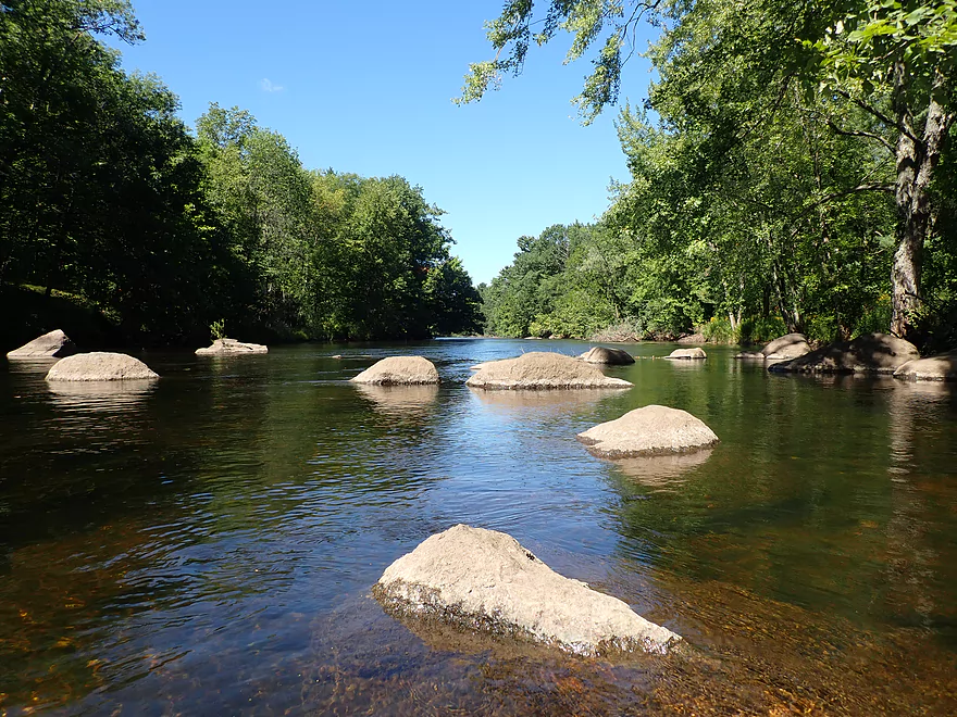
Start of the biggest boulder garden
Very cool
Cool how the potamogeton wraps around the rocks
Reverse view with clear water

Another nice boulder garden
On the homestretch
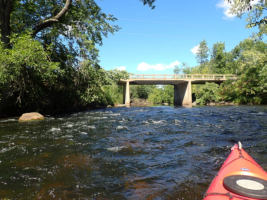
Bb bridge
Good access with public parking
Watching another kayaker run the rapids
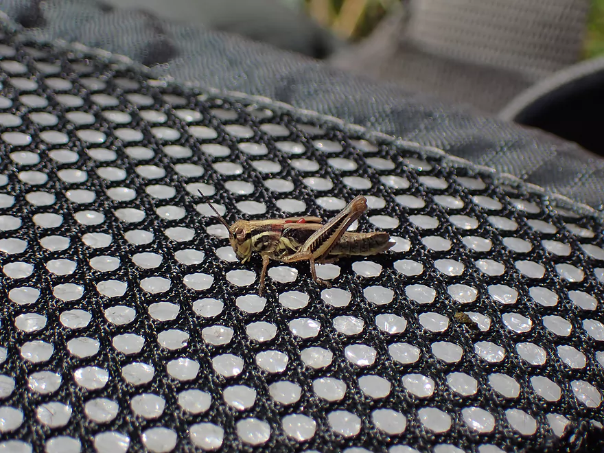
A grasshopper hanging out on my life jacket
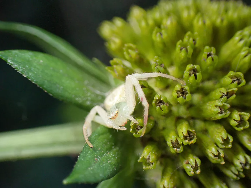
A goldenrod crab spider…they can change color to match the flower they are on
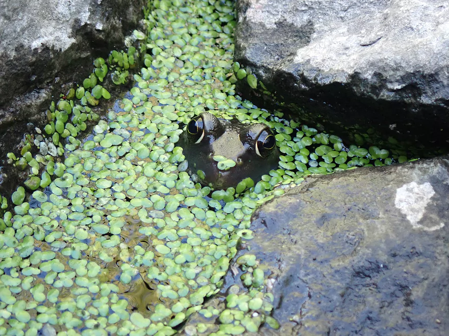
Spy frog
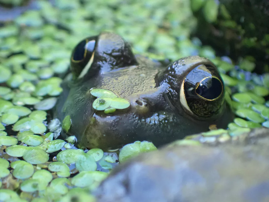
He thinks he’s so sneaky…
Little Wolf River – Manawa

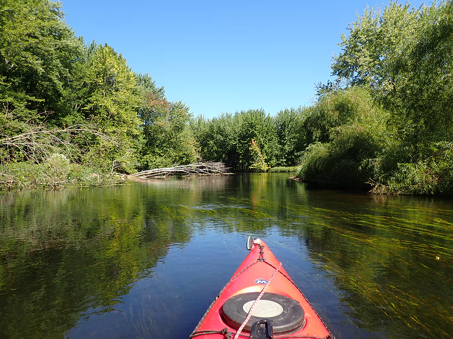
The Little Wolf is one of the great paddling rivers of Central Wisconsin. Most choose it for its famous rapids upstream of Big Falls, or go tubing by Royalton. I’ve paddled these two most popular sections in previous years…but for this time around I wanted to explore a more obscure stretch to see how it compared.
My trip started at the Manawa dam, where there was a public fishing access that worked great for launching. The dam itself was in poor shape…water streamed through leaks in the rotting boards. I would not be surprised if the dam failed in the next decade (even though its ‘rating’ is fair).
I soon passed Lindsay Park on my left which also had a nice public access. Here the Manawa wastewater plant emptied its effluent into the river…which unfortunately seriously hurt water quality. Aquatic weeds would be a common sight for the entire trip after that and especially for the next two miles.
The first two miles of the trip were honestly pretty disappointing. The current wasn’t great, the channel was wide and deep, there was nutrient-induced plant growth everywhere, and the banks while wooded were mostly filled with unhealthy flood-bottom trees. After the railroad though things become a bit more interesting and I encountered my first boulder garden.
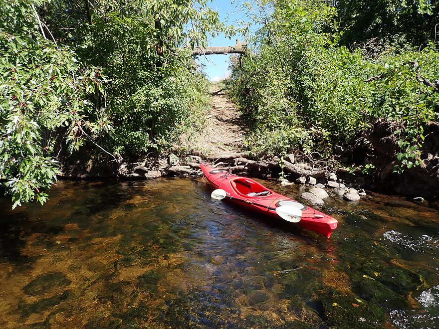
I soon came to the Hwy B bridge which didn’t have a dedicated landing, but was a decent bridge access (that in hindsight I maybe should have launched from).
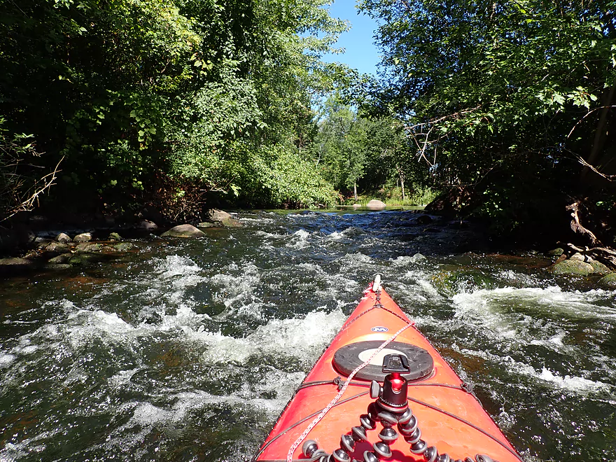
Soon after, I came to the first and only noteworthy rapids of the trip. An island split the river in two with the main channel flowing to the left. Unfortunately a downed branch created a nasty strainer here and IMO made this channel too dangerous to run. Fortunately…this island had another channel hiding on its other side. Here there were more rapids, but they were manageable and had a clean line through.
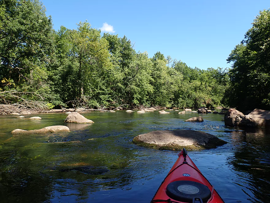
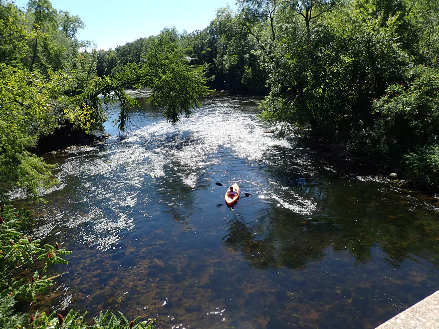
Finally the river became a bit more shallow to reveal some really nice clarity in spots. Typically the clarity would be even nicer, but I did this trip at levels that were a smidge above normal. Following a nice sandy stretch, I came to Hwy 22 where there is a terrific landing. I’m quite impressed with how Central Wisconsin has so many nice river landings that are public…something that just isn’t as common in Southern Wisconsin where I live.
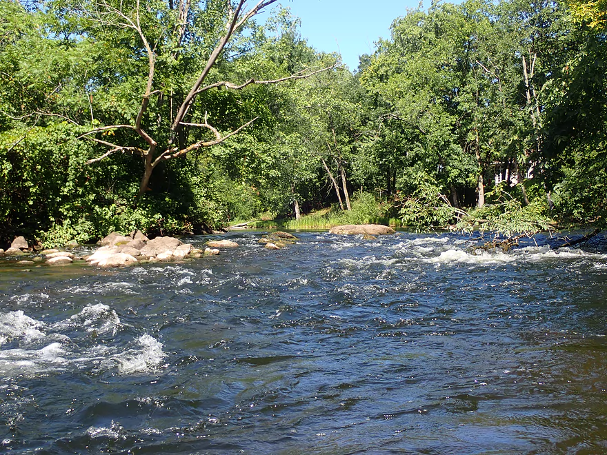
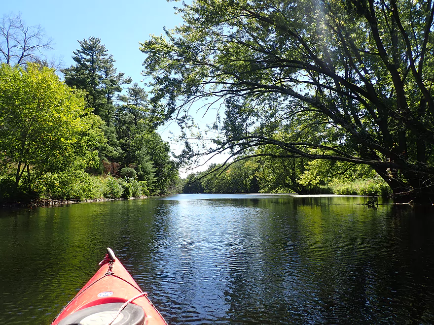
From Hwy 22/110 to Road Bb was the best part of the trip. Here the water was the most clear, the current the fastest, and there were a number of nice boulder gardens. There were still aquatic weeds (like potamogeton), but they were actually cool. These long stemmed plants would gracefully flow with the current and wrap around the big boulders in the river for a unique artistic effect.
I ended the trip at Road Bb which had some fun Class 1 rapids at the base and a nice access for taking out.
In summary, this was a trip that started a little slow and uninteresting (perhaps 3 stars) but thanks to the last few miles and some terrific boulder gardens climbed its way up to four stars. For most paddlers, I’m not sure I can recommend putting in at the dam as the first few miles were a bit boring. I do think paddlers will enjoy the stretch from Hwy 22 to Road Bb. But honestly…if you’re new to the Little Wolf you should do its best part first (Wolf River Road to Big Falls) or its second best part (Big Falls to Hwy 110).
Sights included painted turtles, a family of turkeys, two eagles, huge whirligig swarms, some fish (including some bigger ones), and many clams (most of which were dead). The highlight was seeing an osprey take off in front of me with a fish in its talons.
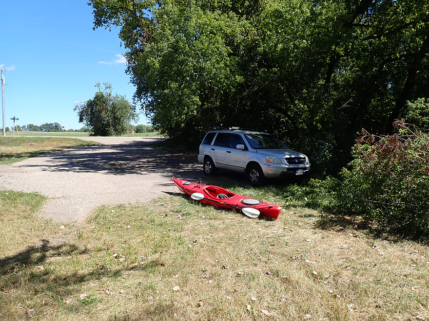
Manawa Dam (by the Sturm Memorial Library): There’s a public fishing path just east of the Sturm Memorial Library that leads to below the dam. All in all a good access with public parking…you can also access the upstream lake from here. There are no outhouses (unless of course the library is open).
Alternate Put-ins:
- Lindsay Park (900′ downstream of dam): There is a public launch in the park here…this is a good launch option.
- Hwy B (1.9 miles downstream of dam): There is no launch here, but it is a viable bridge access (NW corner). By launching here you can avoid the upstream stretch, which is a bit slow and weedy.
- Hwy 110/22 (2.8 miles downstream of dam): There is a nice public launch here. This is the start of a nice stretch…but honestly I would prefer launching at Hwy B as there is still some good scenery upstream of Hwy 110.
Road Bb: There is a good public access just downstream of the bridge, just don’t park in the fire lane. Note there is ALSO an access upstream of the bridge, but that is private…you want to use the one on the downstream side.
Alternate Take-outs:
- Royalton (3.5 miles downstream of Bb): A good stretch with fantastic boulder gardens. Use the landing downstream of the bridge…the one on the upstream side is for a private tubing company.
Bike Shuttle (Road Bb to Manawa Dam): 3.7 miles / 43′ of ascent. This was a pretty easy bike shuttle.
Shuttles/Liveries: There are liveries in the general area, but I don’t think any of them service this exact stretch of the Little Wolf. You can always contact them and ask.
- Big Falls Kayak Rentals: These guys do rentals/shuttles on the Upper Little Wolf. (715) 846-0078 – 197 N Main St Big Falls, Wisconsin, WI 54950
-
Wolf River Trips and Campground: These guys do rentals/shuttles on the Lower Little Wolf. 920-982-2458 – E8130 Flease Rd, New London, WI 54961
Rapids: There are a few minor Class 1 rapids. The only noteworthy rapids are some Class 2’s halfway between Hwy B and Hwy 22. The channel is split by an island with rapids on both sides. The east channel is blocked by a dangerous strainer and should not be run. The west channel is open and fairly straightforward to run.
Blastomycosis: This is a fungus that when inhaled can cause lung issues. In 2015 there was an outbreak on the Little Wolf that infected 59 people and caused one death. Transmission is usually caused by disturbing rotting leaves/wood which allow fungal spores to be inhaled. I suspect nearly all infected were on the lower Little Wolf and with tubers…not kayakers. Most infected show no symptoms. If diagnosed this can be treated with anti-fungal medication.
Nearest Gauge (Little Wolf @ Royalton): 1.46′. Note, USGS tragically stopped reporting statistics for this gauge in 2020 “because of budget cuts”. NOAA though stills report on this gauge…but only for the past four days and without CFS.
- 0-1.21′: The river rarely gets this low, but when it does paddlers can enjoy great clarity and pronounced boulder gardens. This stretch was pretty deep…but at low depths, you may have to wade 2-3 sections…not a big deal.
- 1.21′-1.5′: An average later summer depth good for paddling.
- 1.5′-1.8′: River is high…maybe pushy in spots but this stretch should remain navigable. Clarity might not be good at this depth.
- 1.8′-2.4′: A very high depth. Perhaps viable for paddling, but many of the attractive boulder gardens would be submerged.
- 2.4’+: Perhaps too high for paddling.
Detailed Overview
- Wolf River Road to Ness Road: (3.0 miles) Very narrow, heavily wooded, shallow in spots, and very rocky. Maybe 2 logjams. This is an intriguing prospect on my todo list.
- Ness Road to Wolf River Road: (2.5 miles) A good trip with clear water, boulders, and a few easy rapids.
- Wolf River Road to Big Falls Dam: (7.7 miles)
- Wolf River Road to Hwy J: (3.6 miles) Scenic section with some strong Class 2 whitewater. Good put-in.
- Hwy J to Big Falls: (4.1 miles) Also scenic and with whitewater, with perhaps a Class 3 by the Dells. Good launch by Hwy J.
- Big Falls Dam to Big Falls Powerhouse: (700') This is a steep chute of exposed granite that can create Class 4 rapids when it has sufficient water. But typically the dam penstock robs Big Falls of 99% of its flow. Access to the top of the falls is available from either the east or west shore.
- Big Falls Powerhouse to Kretchner Road: (4.4 miles)
- Big Falls Powerhouse to Little Falls Park: (1.7 miles) This is a good stretch with the highlight being a 2000' stretch of rapids.
- Little Falls Park to Hwy C: (0.3 miles) Features a Class 2 under a bridge, and then a 1500' stretch of boulders and Class 1 rapids. Hwy C isn't a great bridge access.
- Hwy C to Kretchner Road: (2.7 miles) Just below Hwy C is a series of rapids including a Class 3 that runs through a scenic gorge. After that the river slows down and becomes less interesting
- Kretchner Road to Hwy 110: (4.3 miles) A great leg with many scenic boulder gardens. Rapids on this stretch are mild and suitable for beginners. While nice, this leg isn't as terrific as Little Falls or Big Falls legs located upstream.
- Hwy 110 to Hwy 22/Symco: (8.0 miles) Unimproved bridge put-in but should be ok. This section likely has some deadfall issues (not sure how much though).
- Hwy 22/Symco to Manawa Dam: (5.9 miles)
- Hwy 22/Symco to Bridge Road: (2.0 miles) Looks like a nice section with some rapids and boulder gardens near Symco. Good put-in at Symco.
- Bridge Road to Manawa Dam: (3.9 miles) Likely a mediocre section with some flowage paddling at the end. Some of the flowage paddling can be avoided by taking out at Waupaca Park. Bridge Road is a good put-in.
- Manawa Dam to Road Bb: (3.9 miles)
- Manawa Dam to Hwy B: (1.9 miles) Honestly an uninteresting section with slow current and bland flood-bottom woods. Aquatic weeds are an issue (thanks to the Manawa Septic plant). River does get a bit more interesting after the railroad tracks and features a small boulder garden.
- Hwy B to Hwy 110/B: (0.9 miles) A good stretch with some boulder gardens and good clarity. There are Class 2 rapids by the "Rapid View" island.
- Hwy 110/B to Road Bb: (2.1 miles). A great stretch with several impressive boulder gardens and a few minor rapids.
- Road Bb to Hwy X: (7.6 miles)
- Road Bb to Royalton: (3.5 miles) Very good put-in. Nice clarity and boulders until the South Branch joins (almost doubling the river). Very nice boulder garden and rapids 2/3rds in.
- Royalton to Ostrander: (2.7 miles) After the brief rapids under Hwy 54/O, the Little Wolf goes back to sleep, with pleasant but monotonous scenery (the highlight being sporadic boulders). Finally, maybe a half mile prior to Ostrander Road, there is another set of rapids (Class 1) and an attractive boulder garden. Paddlers will have to deal with many tubers.
- Ostrander Road to Hwy X: (1.4 miles) Busiest tubing section probably in the state. Very nice boulder gardens and rapids at end. Public landing NE of Ostrander Road.
- Hwy X to the Mouth (Junction at Wolf River): (2.0 miles) Part of the Mukwa Bottomland Forest SNA
- Mouth to Dey Road/Shaw Road Boat Ramp: (0.8 miles) A short stretch on a now large Wolf River.
Trip Map
Overview Map
Video
Photos Size:
Warning…the Little Wolf dam at Manawa is on the verge of collapsing. Local officials are evacuating some of the low lying areas. Paddlers should definitely stay off the lower Little Wolf. https://www.facebook.com/photo?fbid=446137034969545&set=a.141092518807333 Update…the Dam has been breached. Video of the breach can be seen here: https://www.facebook.com/NBC26GreenBay/posts/pfbid05RNgkaJfqfDhM4YUkwFoez1iLZP5pmheDtohExuhnjzNLGx9xoiRK5WKLxviX61Xl