
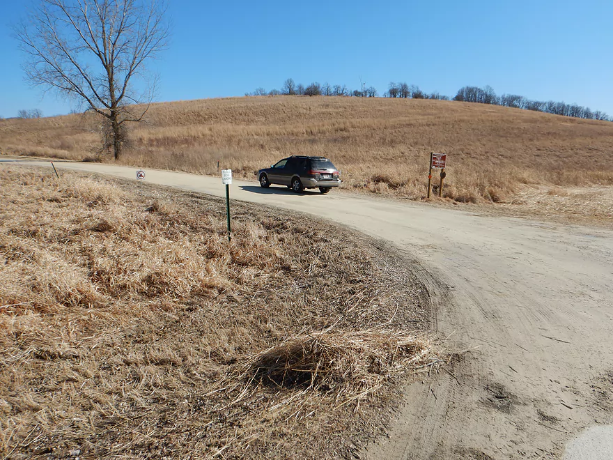
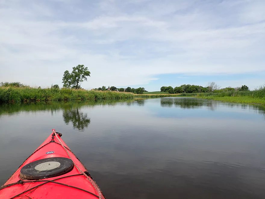
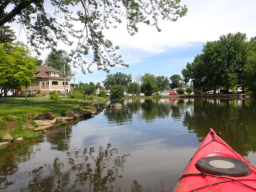
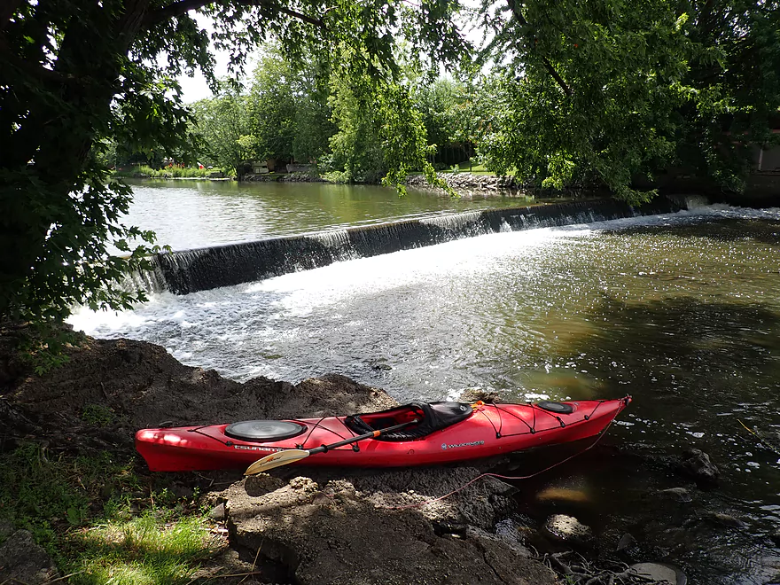
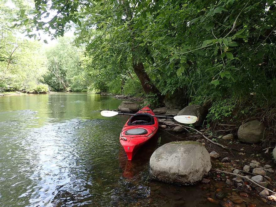
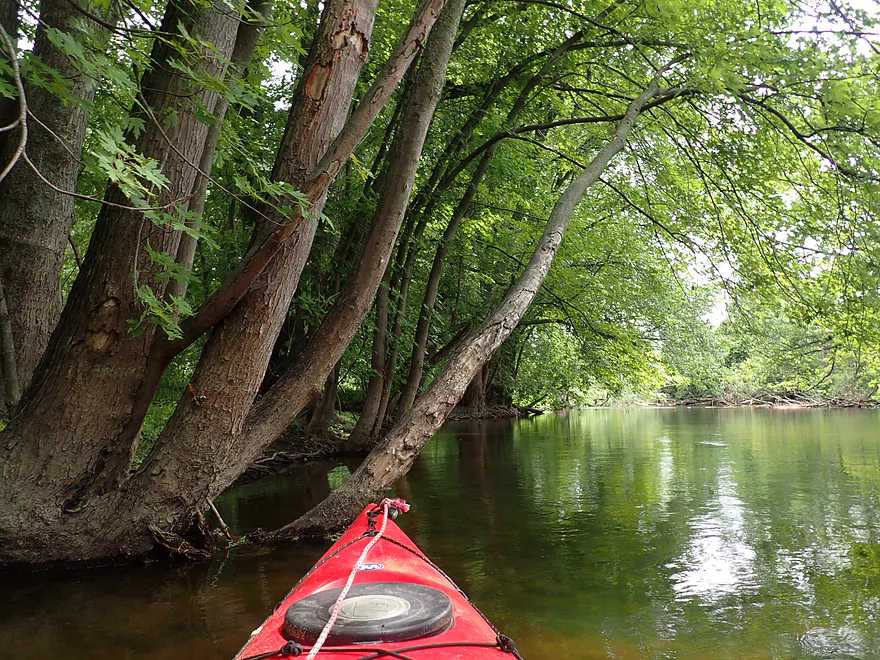
Starting the trip at North Pole landing which is behind a huge drumlin
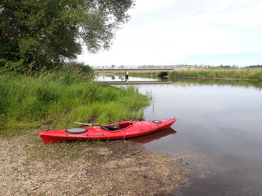
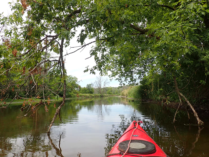
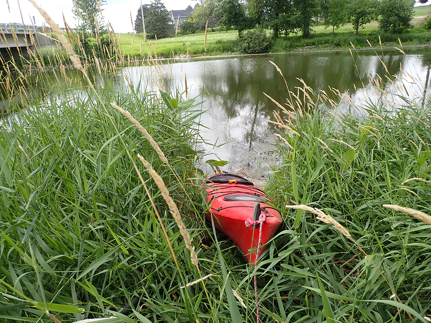
Nice launch
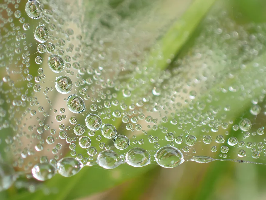
Morning dew
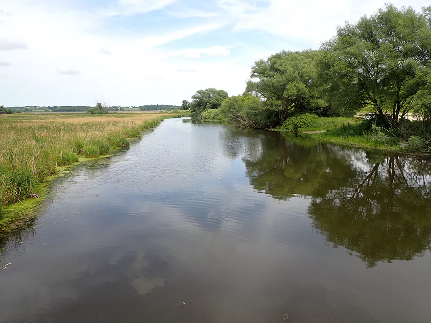
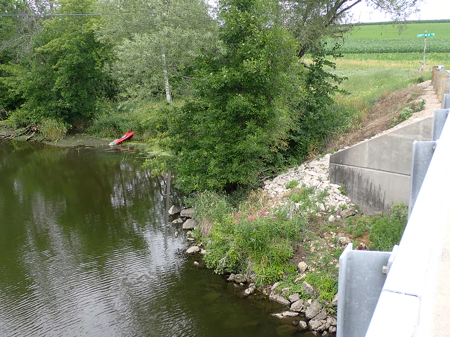
View from bridge
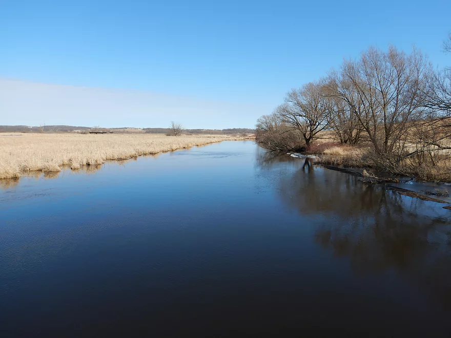
Same view, but spring
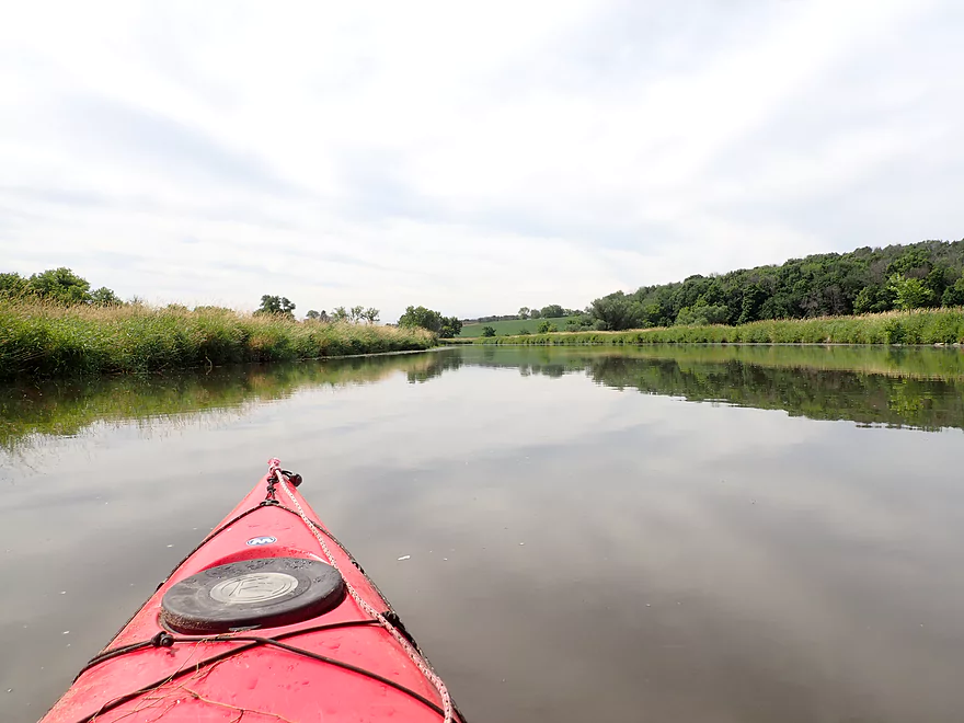
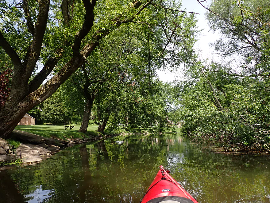
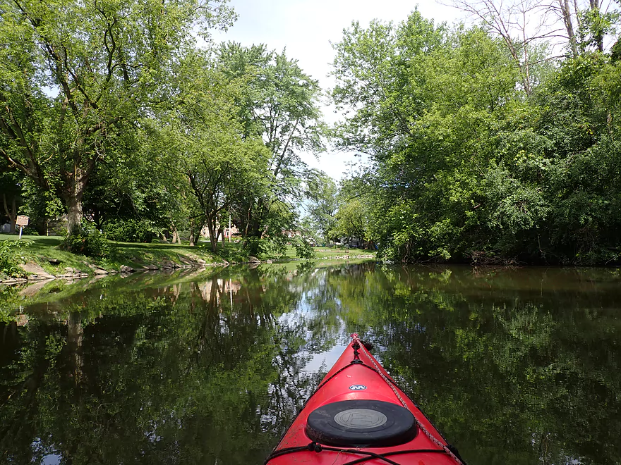
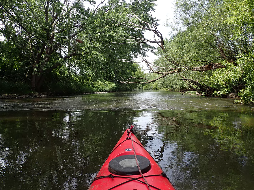
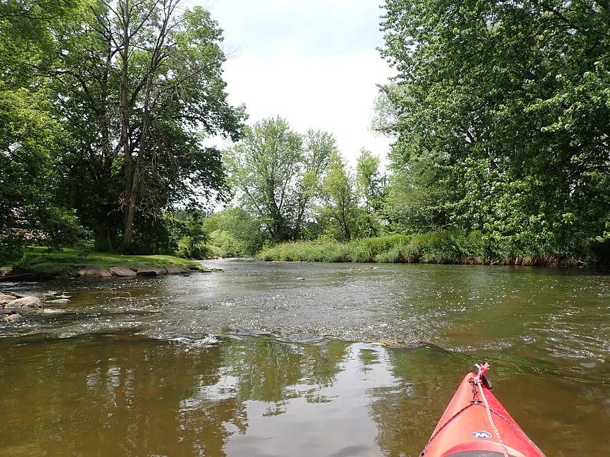
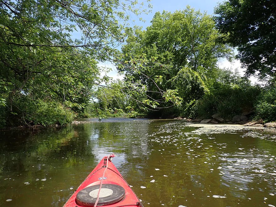
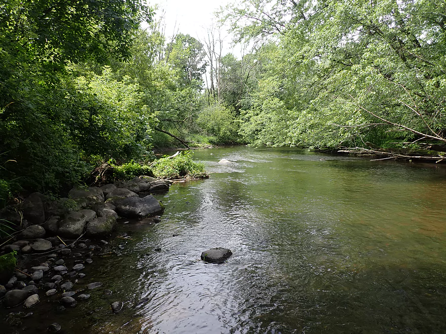
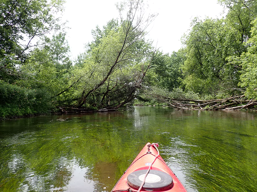
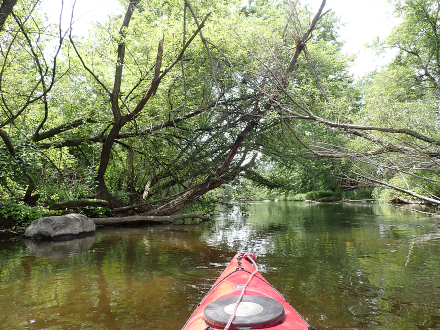
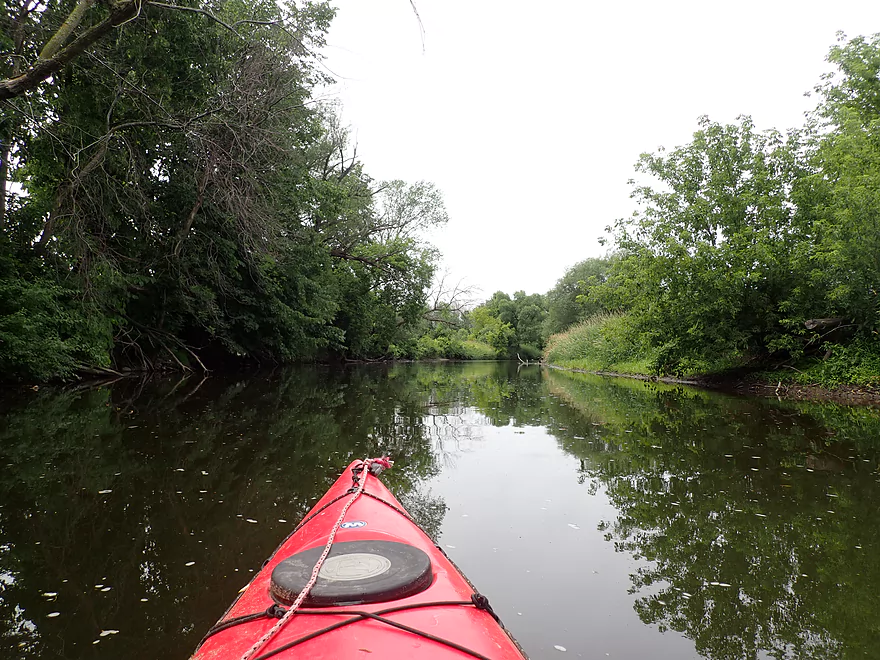
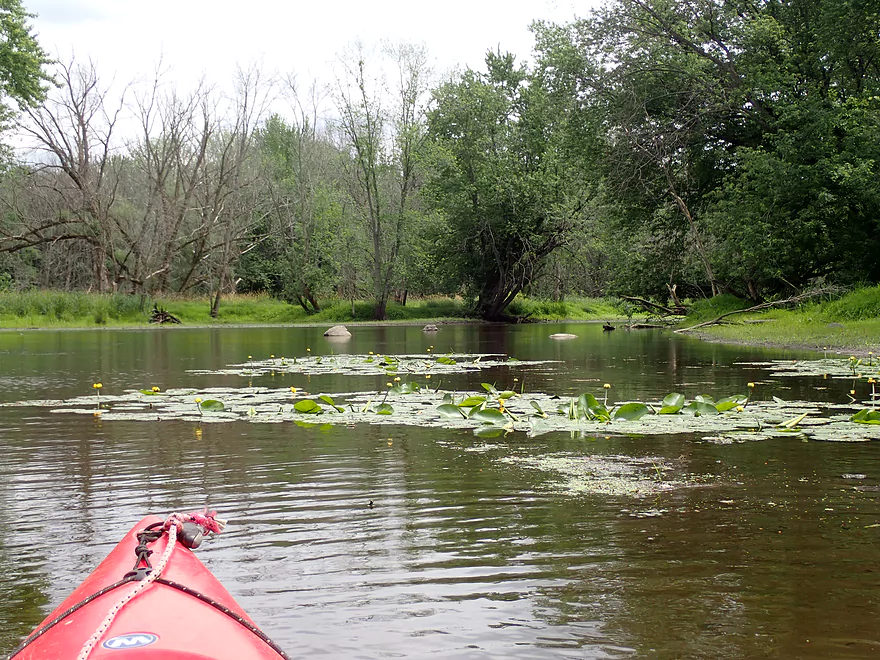
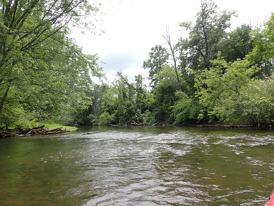
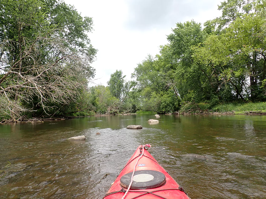
River starts wide and slow
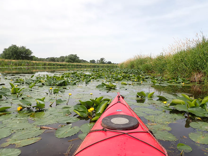
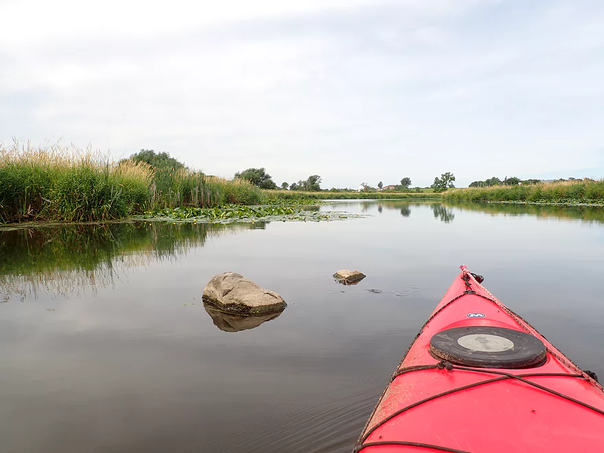
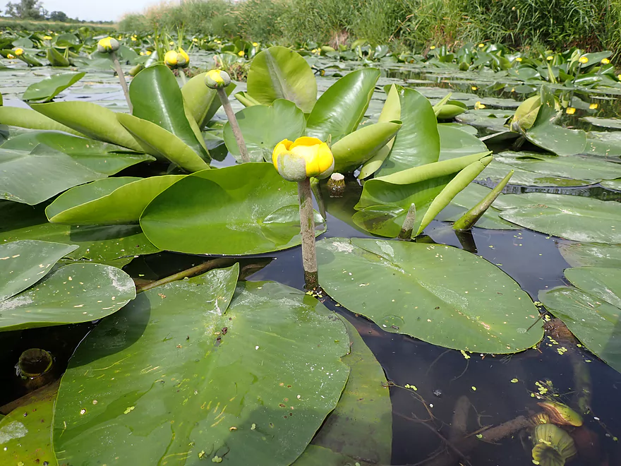
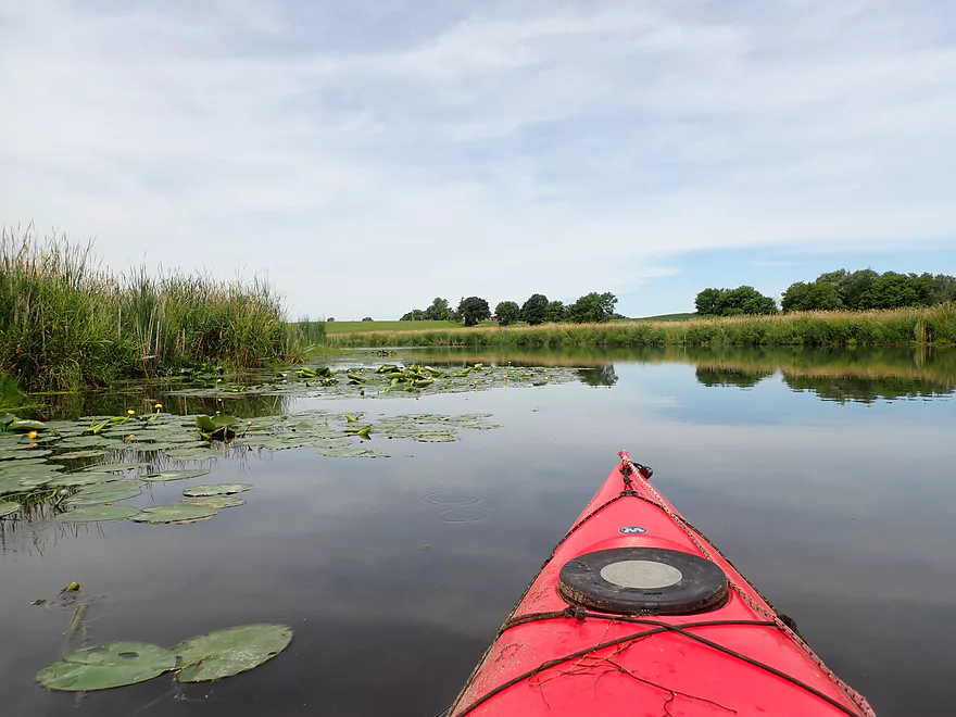
Attractive lilies
Slow current…this stretch can be done as a round trip
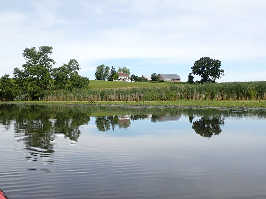
Farm on top of a drumlin
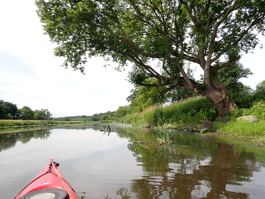
River is redirected sharply right here by as drumlin
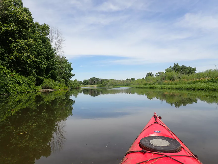
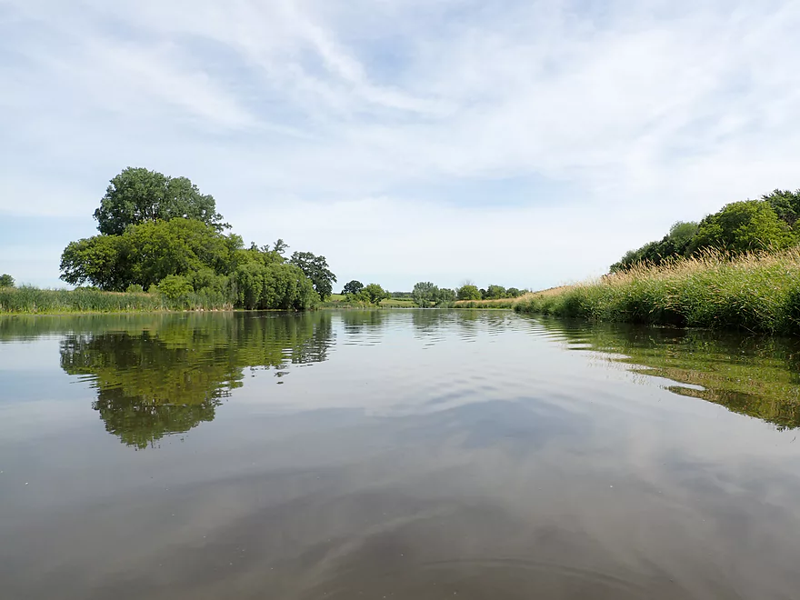
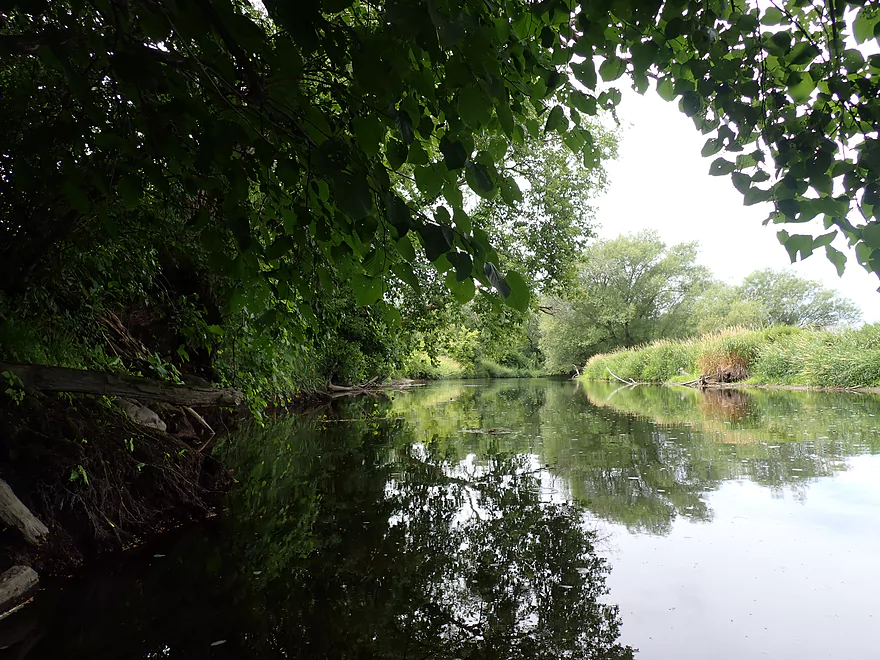
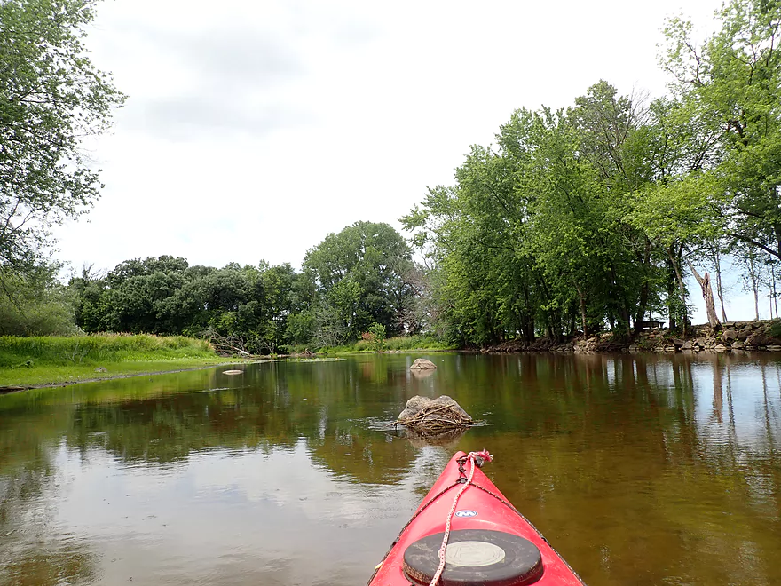
Photogenic reflections
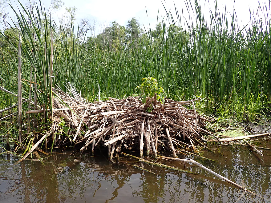
A muskrat lodge
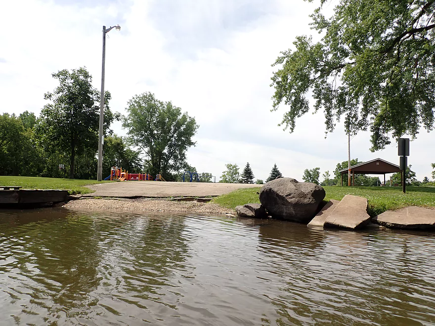
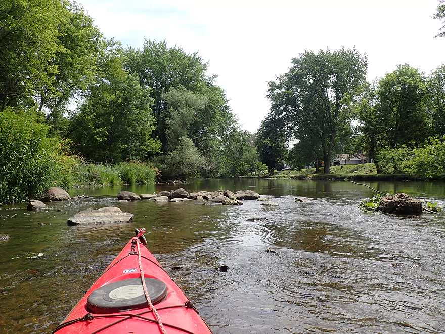
River Edge Park is a viable access
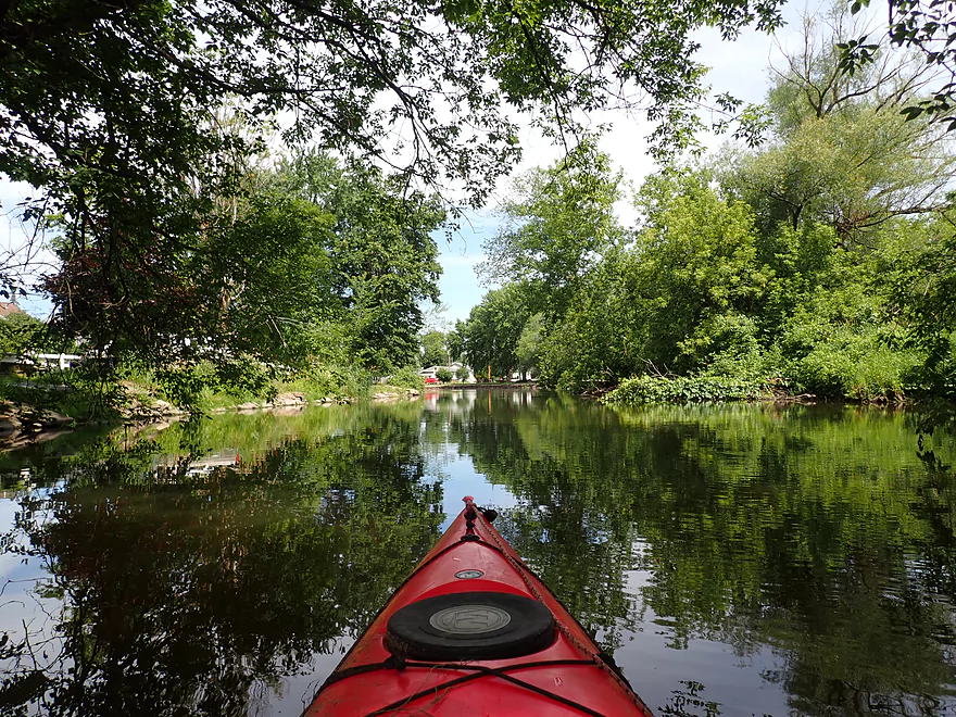
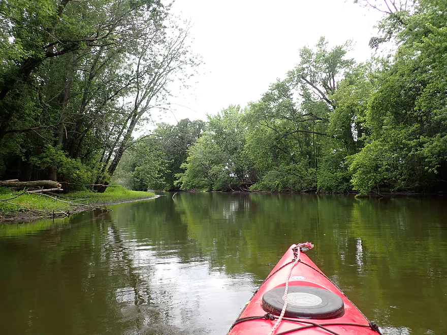
Paddling through the town of Theresa
Very nice
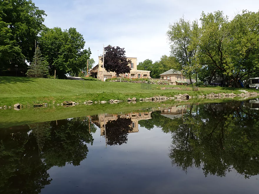
Most of the shoreline in town was neatly manicured and mud-free
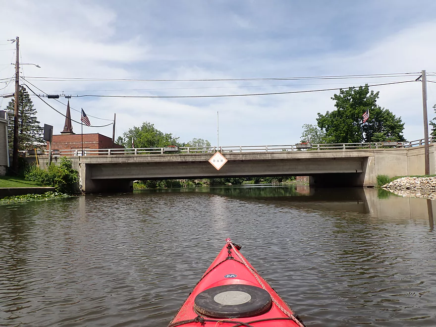
Hwy 175
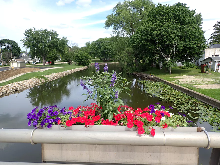
View from bridge
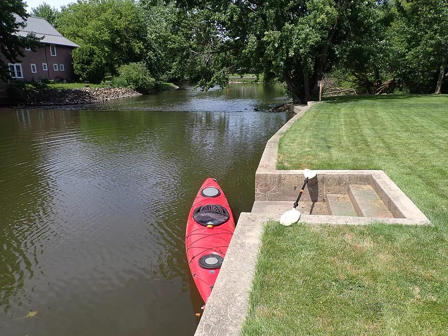
Portaging the Theresa dam
Bottom side
A number of light rapids after the dam
And rock bars
Looks like I’m not the first to kayak this stretch
One of the shallowest parts of the river
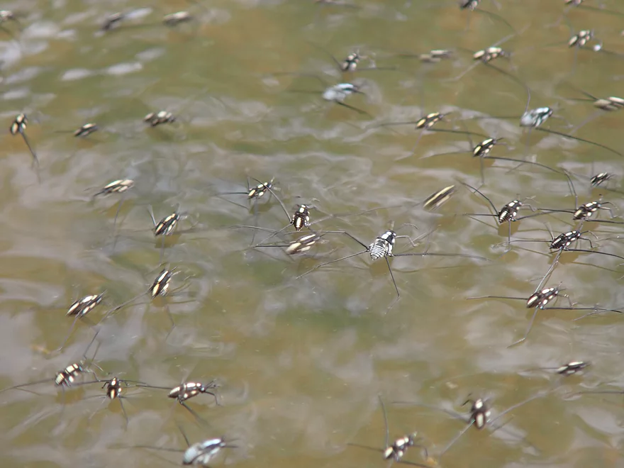
There were countless water striders
More riffles
River gets somewhat deeper after the sanitation plant
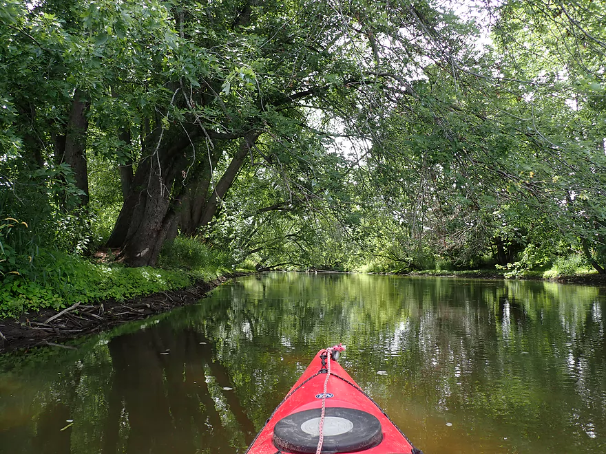
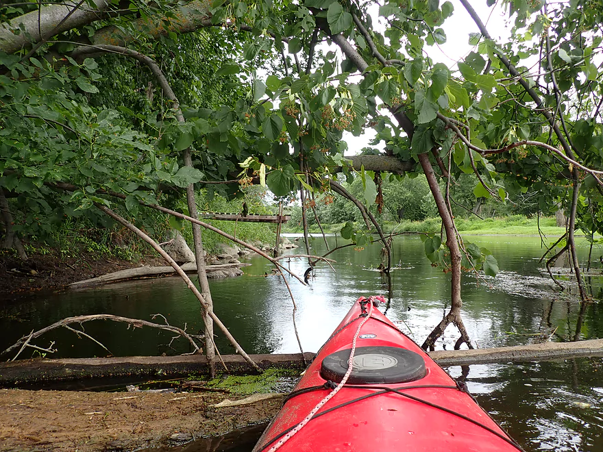
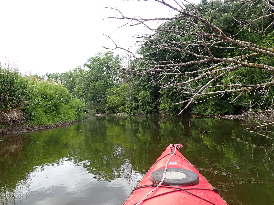
Entering a wooded stretch
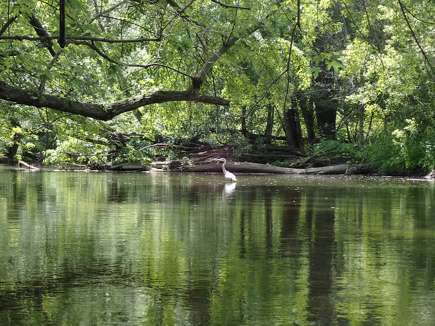
Great blue heron
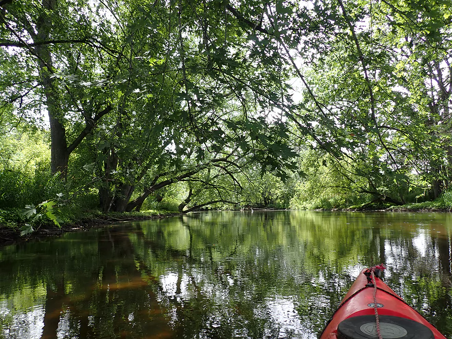
This scenic part of the river was sandwiched between two large drumlins
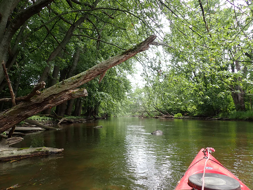
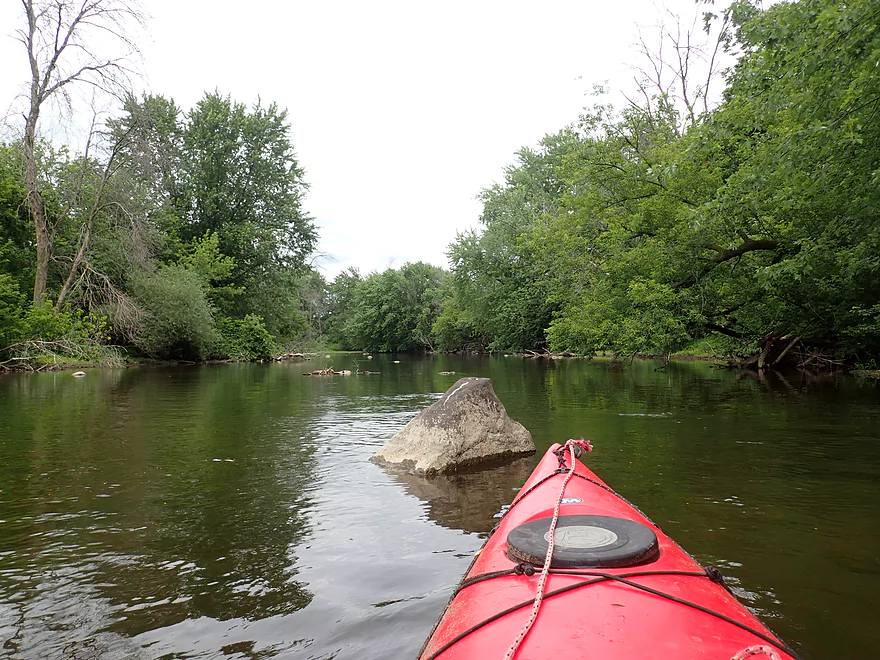
One of many glacial erratics
Ok clarity in spots
Many of the rapids were shallow
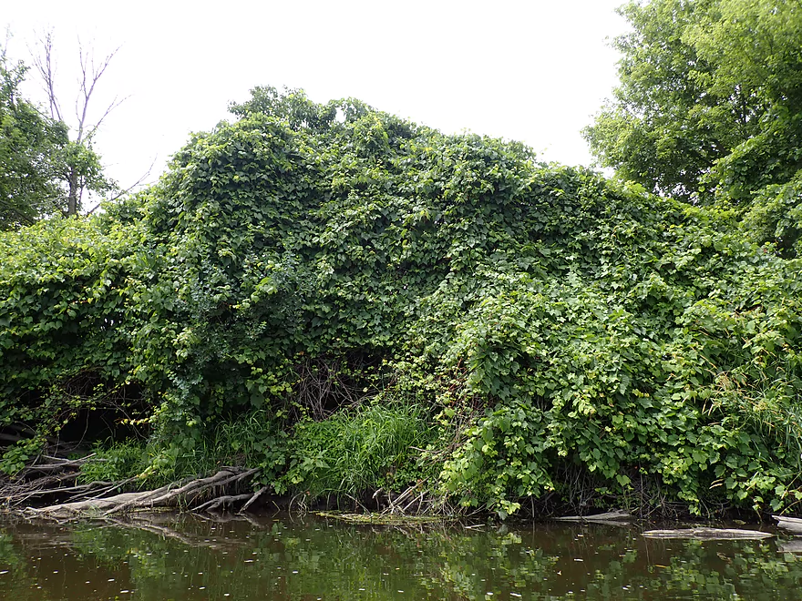
Huge collection of grapevines
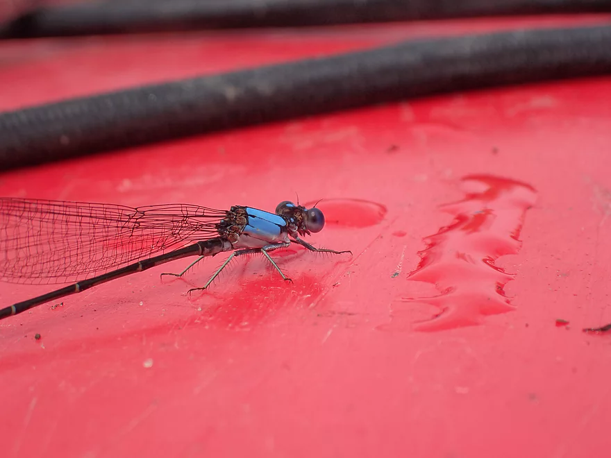
Damselflies were a common sight
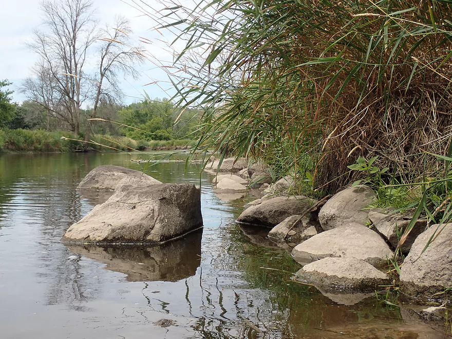
Rock River living up to its namesake
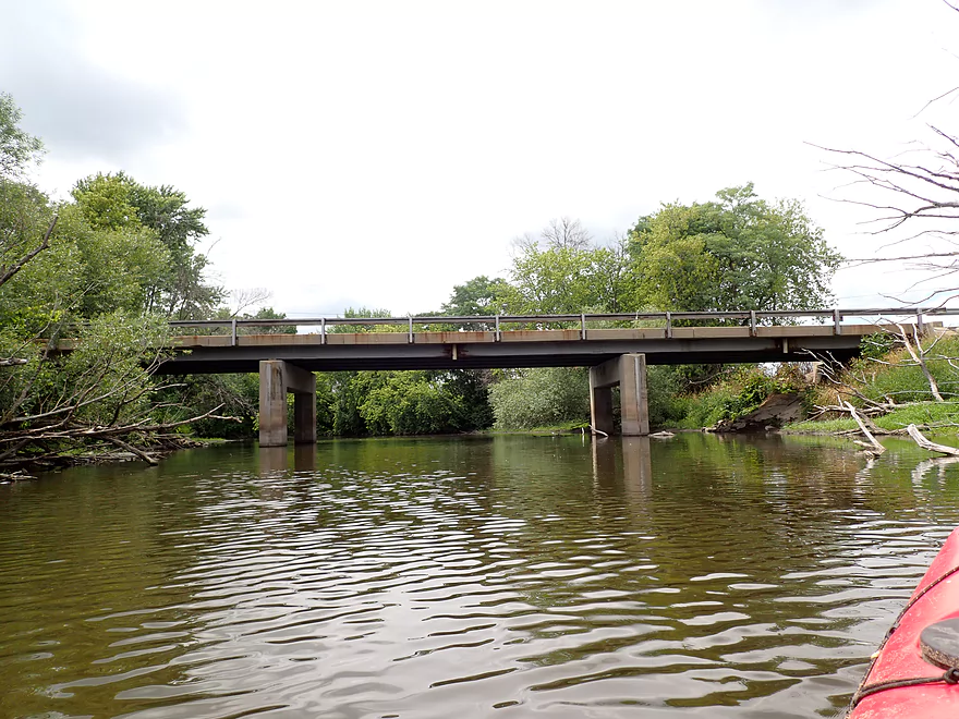
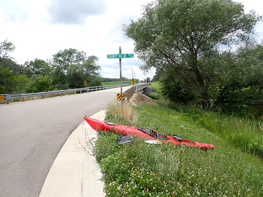
Hwy AY
Shallow spot
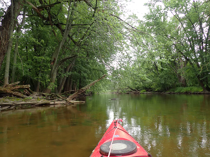
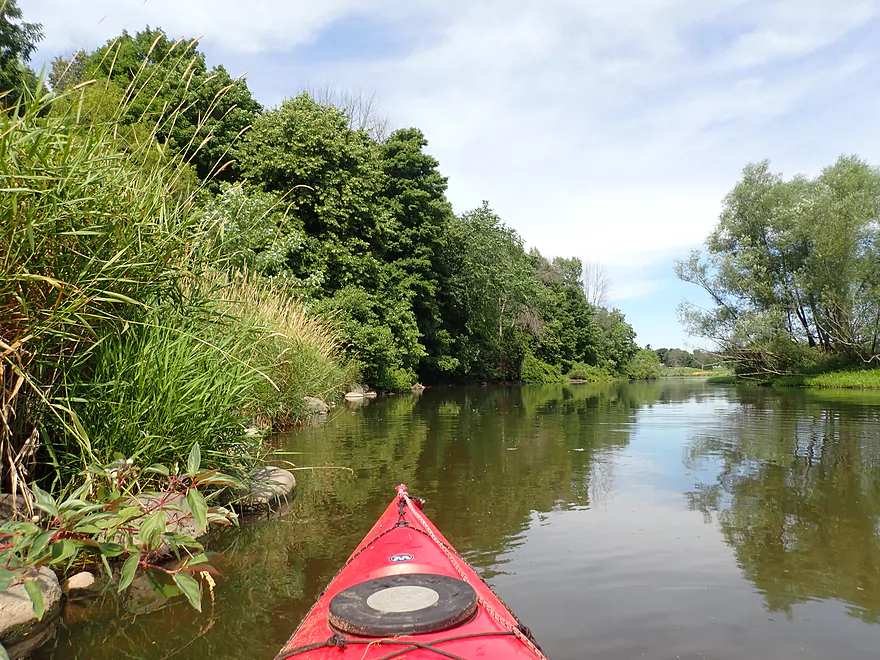
More nice woods
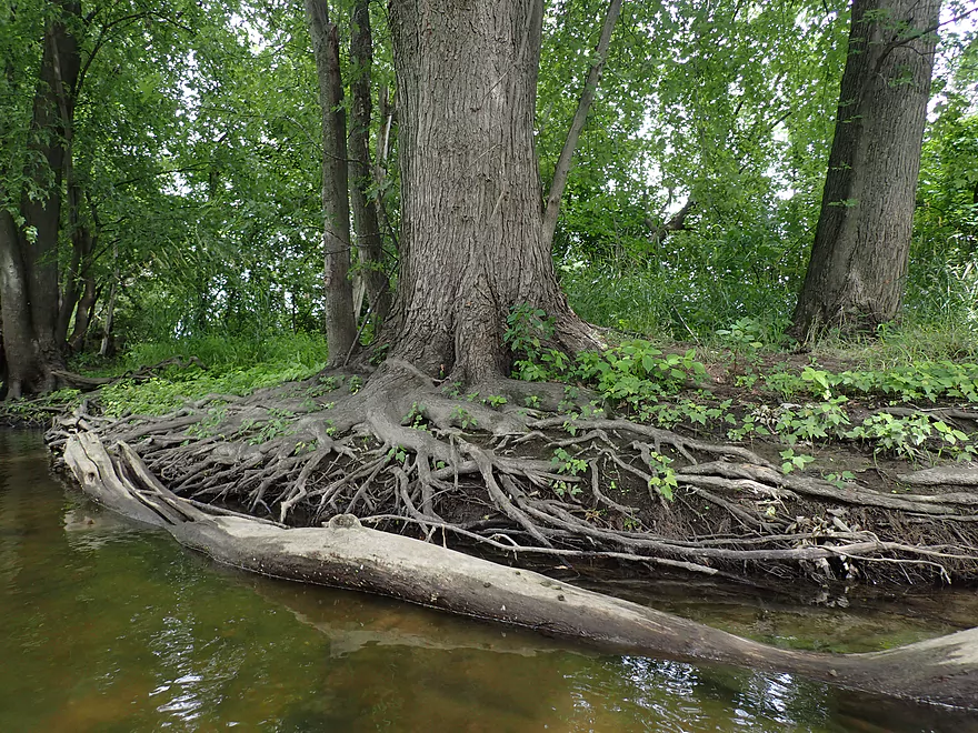
Exposed tree roots
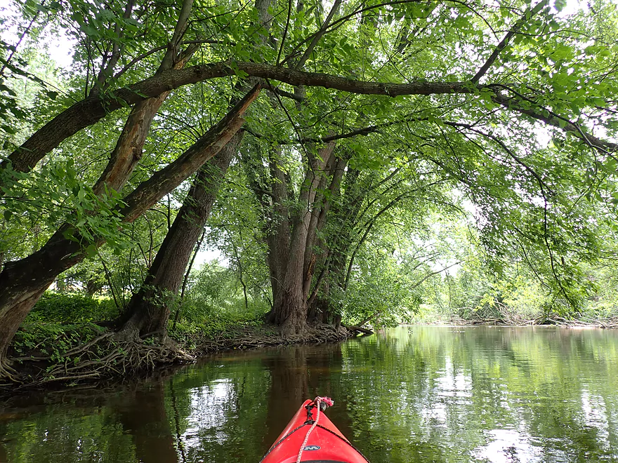
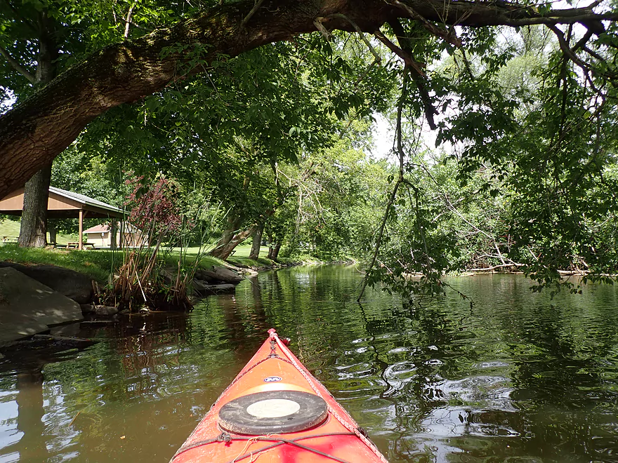
A shady trip
One last erratic
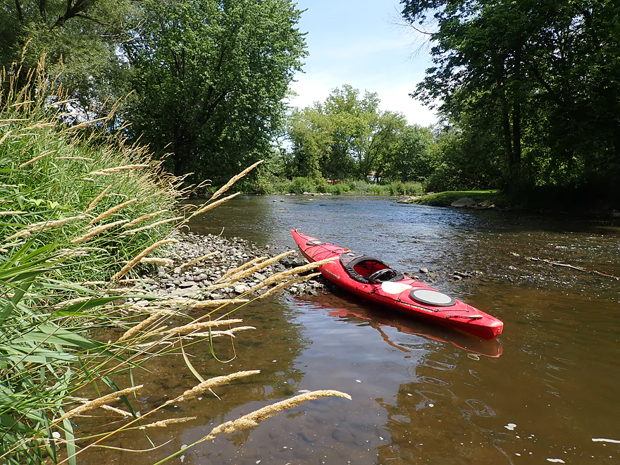
Taking out at Gill Rd
A bit weedy
Shoulder parking isn’t good but is doable
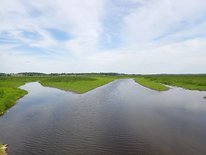
Scouting Theresa Marsh…future trip!
Rock River – East Branch – Theresa

Most Rock River paddlers either do its lower portions or Horicon Marsh. Upstream of Horicon, the Rock splits into multiple branches which despite being fairly obscure are actually more interesting IMO. My favorite of these is the “East Branch” which I had paddled twice before and was long overdue on my todo list to explore in more depth.
I started the trip at N. Pole Rd, where there is a fantastic canoe/kayak landing at the base of a large drumlin. This is serviced by a large public gravel parking lot that sadly few use. The launch area is just downstream from the Theresa Marsh State Wildlife Area. This could be thought of as a “baby Horicon Marsh” and I do want to eventually explore it in the future. Currently the marsh dam (located just upstream from N. Pole Rd) is wide open and the reservoir drawn down for “vegetation management” (likely to kill invasive cattails) and to perform dike repair. The marsh is scheduled to be dammed up again later in 2021.
The first mile (N. Pole Rd to River Edge Park) featured a slow, wide, and open channel. That may sound boring, but it was actually kind of nice. Highlights included some bankside marsh plants, waterlilies, and drumlins visible in the distance. This area of Wisconsin is famous for its drumlins (glacially elongated hills) and has the highest concentration of them in the entire world.
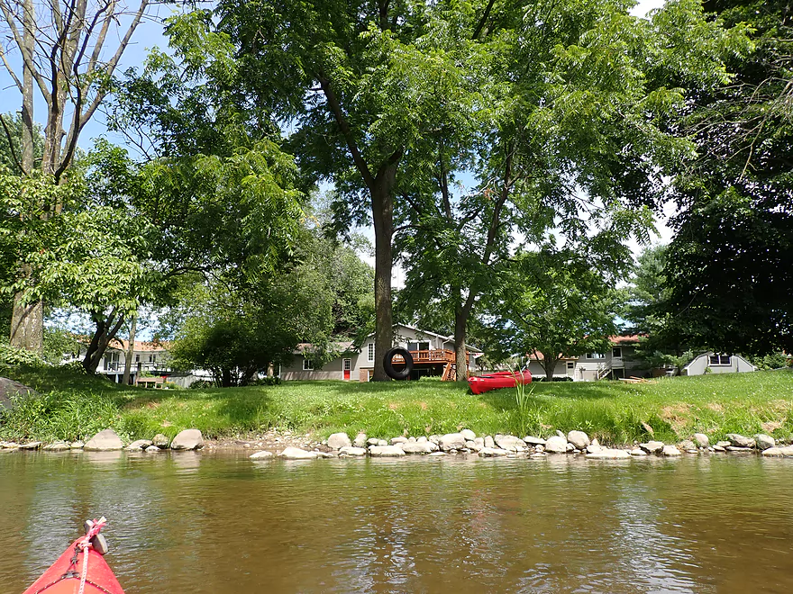
The next half mile (River Edge Park to the dam) flowed through downtown Theresa. Despite being an urban paddle this was really nice with old trees arching over the river and tastefully created embankments that protected the shoreline from erosion and mud. The dam required portaging which can be done on the right bank. The portage path is unfortunately through someone’s lawn, but state law says it’s perfectly legal to do this…either way I wouldn’t dawdle with your portage. Downstream from the dam there are public parks on both sides of the river and it was an easy reentry.
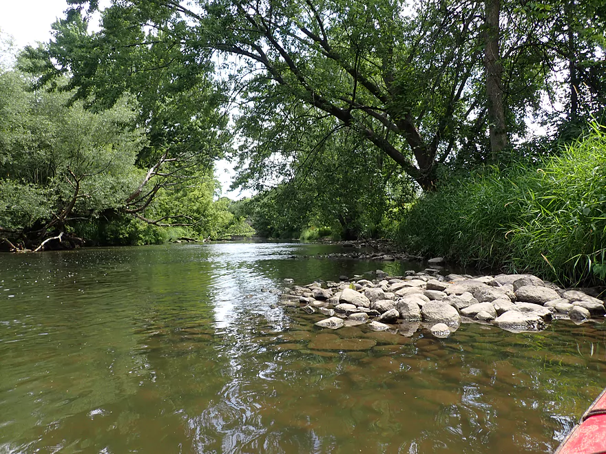
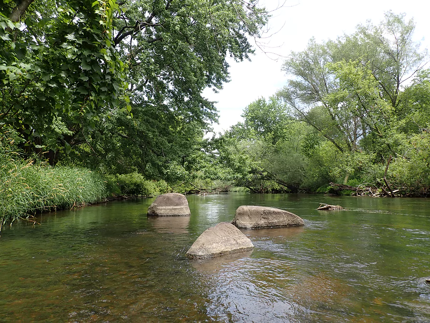
The subsequent half mile (dam to sanitation plant) was the shallowest part of the trip. Here the river flowed quickly past the last outskirts of Theresa and featured a number of minor rapids/riffles. For the Rock River this is a real treat, as the lower Rock has few if any rapids.
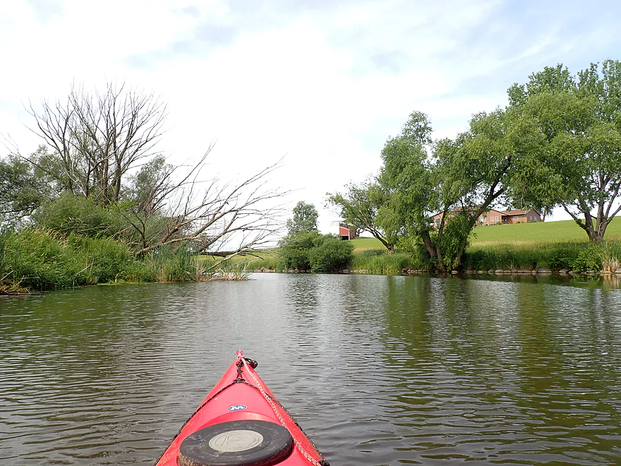
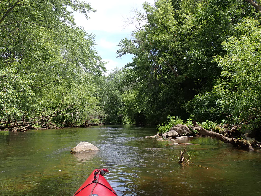
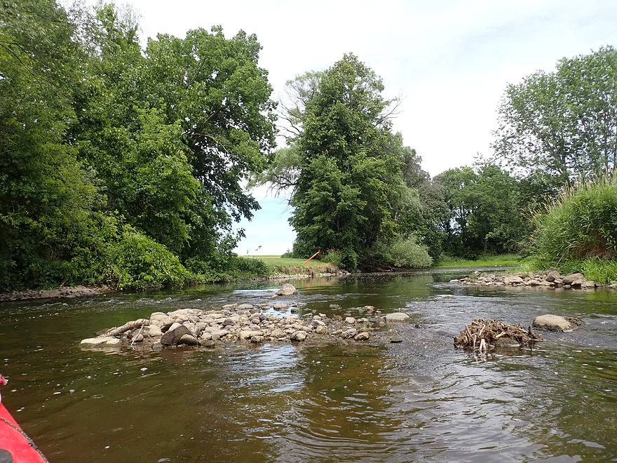
The next three miles (sanitation plant to Hwy AY) was a great part of the trip. For about a mile and half the river flowed between massive drumlins and over a surprisingly rocky substrate that featured several small boulder gardens. The Rock River was living up to its namesake! Despite this being farm country, there were nice woods positioned next to the river. Closer to AY the river valley opened up, the river slowed down, and things became less interesting.
On the downside there were 4-5 tires in the river. Scientists have recently discovered that as tires break down they release 6PPD which is quite toxic to fish and other small marine animals. Hopefully we’ll see more river cleanup efforts in the future to remove tires from our watersheds. Another disappointment was seeing the number of dead ash trees…this is the third Eastern Wisconsin paddle in a row in which I’ve seen massive ash tree carnage (courtesy of the emerald ash borer).
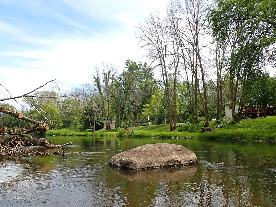
The last half mile+ (Hwy AY to Gill Rd) was a short leg, which despite encroaching farm fields, featured some nice woods. There were no logjams for the entire trip (had I realized this I would have done this trip long ago). I did see chainsaw work so I suspect locals keep this route open. The only downed tree had a gaping hole under it and was super easy to get through. I ended the day at Gill Rd which was a bit weedy, but was a doable bridge access.
In summary this was a good trip that I enjoyed. Because the current is slow above the Theresa dam, round trips on that leg are viable and something locals who aren’t into shuttling might consider. While I took out at Gill Rd, much of the East Branch downstream from there (and in fact all the way to Horicon) is great for paddling. Personally I would like to explore the Theresa Marsh (Hwy D to N. Pole) for a future trip which I suspect could be scenic and maybe even a nicer paddle than Horicon.
Sights included a great blue heron, a green heron, an eagle, many dragonflies, and clams. The most prolific animal though were the carp (common both above and below the Theresa dam). They are strange fish…not only are they atypically large, but they make strange noises and partially surface to slurp up pond scum. When spooked in shallow water they would shoot around like jet boats.
Ledge Park: This is a county park, but IMO rivals many state parks. The highlight is a scenic vista overlooking parts of Horicon Marsh.
North Pole Rd Landing: This is a great public landing that hardly anybody uses. Parking is plentiful, free, and the area is private.
Alt Put-ins:
- Ridge Edge Park (1.3 miles downstream from North Pole): This is also an excellent public landing. An outhouse is available in the park. I suspect this launch sees mostly round trips from paddlers heading upstream to the marsh or downstream to the dam.
- Theresa Dam/Park (1.8 miles downstream from North Pole): There’s actually public access locations both north and south of the dam…but the park south of the dam is much nicer with good street parking. Despite being a nice launch option, I suggest launching at North Pole Landing instead as the leg upstream from the dam is nice.
Gill Rd (East Bridge): This is not a great access but is doable. For starters the shoulders are steep for parking and you’ll likely have to park your car a couple hundred yards from the bridge. Then the banks are weedy and there is mud in spots. Although in hindsight I chose a bad take-out spot by the bridge and there were easier corners of the bridge to disembark from.
Alt Take-outs:
- Hwy AY: (0.7 miles upstream from Gill Rd East) I didn’t scout this bridge in depth. It seemed weedy but doable…likely same difficulty as Gill Rd (East Bridge).
- Gill Rd (West Bridge): 2.5 miles downstream from Gill Rd East) I didn’t scout this in depth, but think it would be a doable access. The first half of this bonus leg is boring…but the second half shifts north and is really nice (clear water, rocky, fast).
Bike Shuttle – Gill Rd to N. Pole Rd: 4.6 miles with 72′ of ascent. There are some minor hills, but this is mostly a pretty easy bike shuttle.
Logjams: None…there was one downed tree, but that was super easy to get under.
Current: Before the dam it was slow to non-existent. But downstream from the dam the river moved at a decent clip with a number of riffles.
Rapids: There were a large number of light riffles, but nothing serious.
Dam: The dam in Theresa must be portaged which can be done on the right/north bank. A concrete step has been cut into the retaining wall, so paddlers can do a dock style dismount. Note some paddlers are not comfortable doing deep water dock style dismounts, so having another paddler to help stabilize your boat while you get out might be helpful. This portage is across somebody’s lawn, but Wisconsin law allows you to legally portage a dam no problem. Re-entry is very easy below the dam.
Nearest Gauge – Rock River @ Horicon: Trip was done at 145 CFS or 6.67′. This gauge is downstream from several dams so may not be perfectly representative.
- < 101 CFS: Maybe too shallow.
- 101-200 CFS: 99% of the river would be navigable, but there will be a handful of ground-outs that required scooching or wading. I consider this worth it though. The shallowest part is a half mile leg between the Theresa dam and the sanitation plant.
- 201-300 CFS: A good target range.
- 301-500 CFS: A decent range, but some of the nice boulder gardens might be submerged and the clarity will likely be gone.
- 501-800 CFS: The river is likely muddy and loses a lot of its magic at this depth. It’s likely still practical for padding though.
- 801+ CFS: Maybe too high for enjoyable paddling?
Detailed Overview
East Branch:
- Upstream of Hillcrest Drive: I believe these portions are too congested to paddle.
- Hillcrest Drive to Hwy DW: 4.1 miles.
- Hillcrest Drive to Riveredge Park: 0.9 miles. Scenic stretch through the outskirts of Allenton with good clarity. However there are two major logjams to portage, and several minor logjams to squeak past.
- Riveredge Park to Hwy DW: 2.7 miles. An open stretch through wetgrass and a state natural area. One logjam needs to be portaged.
- Hwy DW to Hwy D: 5.5 miles. Outside of one nasty logjam cluster this is a pretty open creek paddle through a protected wildlife area that might be decent.
- Hwy D Wayside to N. Pole Rd. Launch: 7.3 miles. A good wetland paddle prospect through Theresa Marsh. Maybe 1-2 downed trees on the upper part.
- Kohlsville River: Note, the Kohlsville River joins the East Branch here, but it seems too congested with downed trees to be feasible.
- N. Pole Rd to Gill Rd(East): 6.0 miles.
- N. Pole Rd Landing to River Edge Park: 1.3 miles. Slow, open, and marshy channel. Nice though.
- River Edge Park to Rock River Street/Dam: 0.5 miles. A nice town paddle through the community of Theresa. One dam to portage.
- Rock River Street/Dam to Hwy AY: 3.5 miles. One of my favorite stretches on the entire Rock River. While shallow in spots, it is scenic with nice woods, small boulder gardens and multiple light rapids.
- Hwy AY to Gill Road(East): 0.7 miles. A brief wooded stretch that is a nice paddle.
- Gill Road(East) to Hwy 67/Dam: 8.3 miles.
- Gill Road(East) to McArthur Road/Fink Creek: 4.7 miles. Starts boring, weedy, and slow, but gets nice with clear water and rocks later on. Gill Road(West) may be a viable halfway access.
- McArthur Road to Hwy 67/Dam: 3.6 miles. A less interesting paddle through a flowage and downtown Mayville with numerous alt take-outs.
- Hwy 67 to Green Head Road Ramp: 6.4 miles.
- Hwy 67 to Hwy Y/Ziegler Park: 1.9 miles. One of the best paddling stretches on the entire Rock River with good current and small boulder gardens.
- Hwy Y to Hwy TW/Kekoskee Pond Ramp: 1.9 miles. A good stretch that includes a little bit of flowage paddling.
- Hwy TW to Green Head Road Ramp: 2.6 miles. An ok stretch as the river really slows and starts to turn into marsh.
- Green Head Road to N. Nebraska St. Ramp: 10.0 miles. The most popular route through Horicon Marsh known for its waterfowl.
South Branch:
- Upstream of E. Rock River Rd.: I suspect downed trees are too much of an issue for this to be navigable.
- E. Rock River Road to Hwy 49: 1.6 miles. Perhaps a cluster of downed trees in the middle and an electric fence upstream of Hwy 49.
- Hwy 49 to Waupun Park: 1.7 miles. Hwy 49 is not ideal for launching, but should be doable. A good prospect mostly through a golf course. Maybe 2 logjams?
- Waupun Park to E. Waupun Road: 7.2 miles. A good section.
- Waupun Park to Tanner Park: 3.1 miles. Great section though downtown Waupun. Alt access at Pine Street Park, Meadow View Park and Harris Mill Park.
- Tanner Park to Roadside Park: 3.2 miles. A pleasant paddle through a mixture of woods and open areas. A couple of logjam squeakers and one major portage.
- Roadside Park to E. Waupun Road: 0.9 miles. River widens, slows, and gets less interesting.
- E. Waupun Road to Dike Road: 10.0 miles. This is the northern unit of Horicon Marsh and is off limits to paddlers per National Wildlife Refuge rules.
- Dike Road to N. Nebraska St. Ramp: 5.6 miles. Am 80% sure you can drive on Dike Road from the east to launch in the ditch. Mostly a long straight canal paddle through Horicon Marsh with perhaps interesting side canals to explore. You can also launch in a west canal by Burnett Ditch Road. The city of Horicon marks the confluence of the South and East Branches of the Rock River.
West Branch:
It’s a neat prospect, but I suspect the logjam situation is too much (I could be wrong).
Main Branch:
- N. Nebraska St. to Legion Park/Dam: 0.9 miles. An ok section through downtown Horicon.
- Legion Park to River Bend Park: 1.1 miles. Simple river segment…probably nothing too special.
- River Bend Park to Lions Park: 8.8 miles. A large and probably uninteresting flowage. If you get permission to take out at Ox-Bo Marine, you can avoid much of the flowage paddling.
- Lions Park to Elmwood Park: 7.2 miles. Trip starts nice with a great boulder garden, but becomes less interesting as the current dies.
- Elmwood Park to Hwy MM: 4.4 miles. An interesting prospect recommended by Frank Piraino.
- Hwy MM to Harnischfeger Park: 6.9 miles.
- Harnischfeger Park to Kaul Park/Hwy CW: 5.1 miles. Nice section with more wooded banks.
- Kaul Park to Kanow Park: 5.7 miles. Nice prospect.
- Kanow Park to Hwy F: 5.0 miles. Mediocre prospect.
- Hwy F to Hwy P: 6.0 miles. This isn't an elite trip with slow current and no exotic scenery. But it is pleasant and one of the nicer legs on the Lower Rock.
- Hwy P to Dam1st/Front St.: 5.6 miles. Probably an uninteresting flowage paddle.
- Dam1st/Front St. to Dam2nd/S. 1st Street: 2.6 miles. Possibly a unique paddle through downtown Watertown.
- 1st Street to Hwy 26 Launch: 3.5 miles. Mediocre prospect.
- Hwy 26 Launch to Hwy B: 10.9 miles. The put-in is SE of Hwy 26 via Jefferson Road. This segment is more undeveloped, but is still probably not interesting with the highlight being I94.
- Hwy B to Lubahn Park/N. Watertown Ave: 4.1 miles. Probably uninteresting.
- Lubahn Park to Tensfeldt Park: 2.3 miles. Paddling through downtown Jefferson might be unique, but there is a dam to portage. Many alt landings in Jefferson.
- Tensfeldt Park to Klement Park: 4.2 miles. Probably an interesting tweener section between Jefferson and Fort Atkinson.
- Klement Park to Lorman Bicentennial Park: 3.1 miles. A weak prospect through downtown Fort Atkinson.
- Lorman Park to Hwy 26 Ramp: 3.3 miles. A weak prospect.
- Hwy 26 to E. Knudsen Road Ramp: 11.8 miles. Mostly boring paddling on Lake Koshkonong. Many other launches on the lake.
- E. Knudsen Road Ramp to Hwy M/Dam: 3.4 miles. Boring flowage.
- Hwy M/Dam to Hwy 14: 8.2 miles. Probably uninteresting.
- Hwy 14 to Century Ave/Dam: 6.4 miles. A trip through downtown Janesville with several dangerous dams to portage (reviewed by AmericanWhitewater.org). There are also many other launch options in Janesville.
- Century Ave/Dam to Happy Hollow Park: 7.8 miles. A very industrial section.
- Happy Hollow Park to Preservation Park Boat launch: 3.2 miles.
- Preservation Park to Wooton Park Boat Ramp: 3.0 miles. Start of urban paddling in Beloit. Numerous other launch options in Beloit proper.
- Further Rock River Trips: From here on, you are in Illinois. For further information see “Paddling Illinois” or Rockrivertrail.com.
Trip Map
Overview Map
Video
Photos Size: