
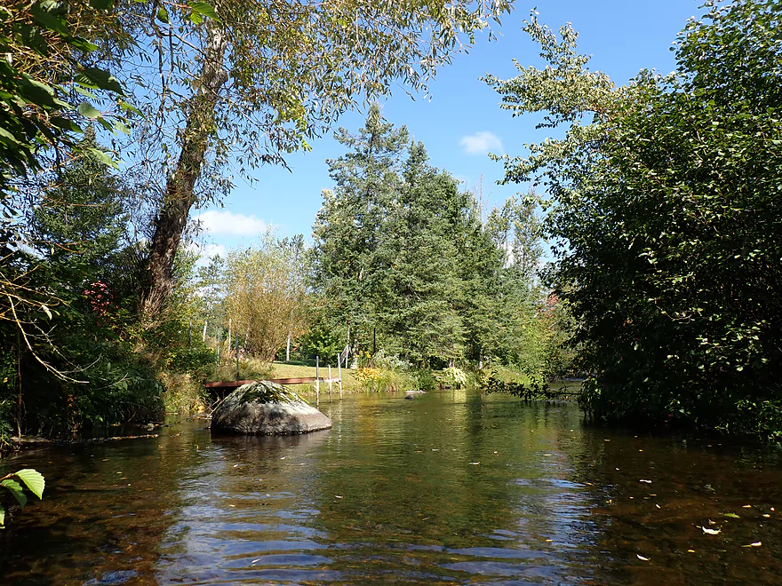
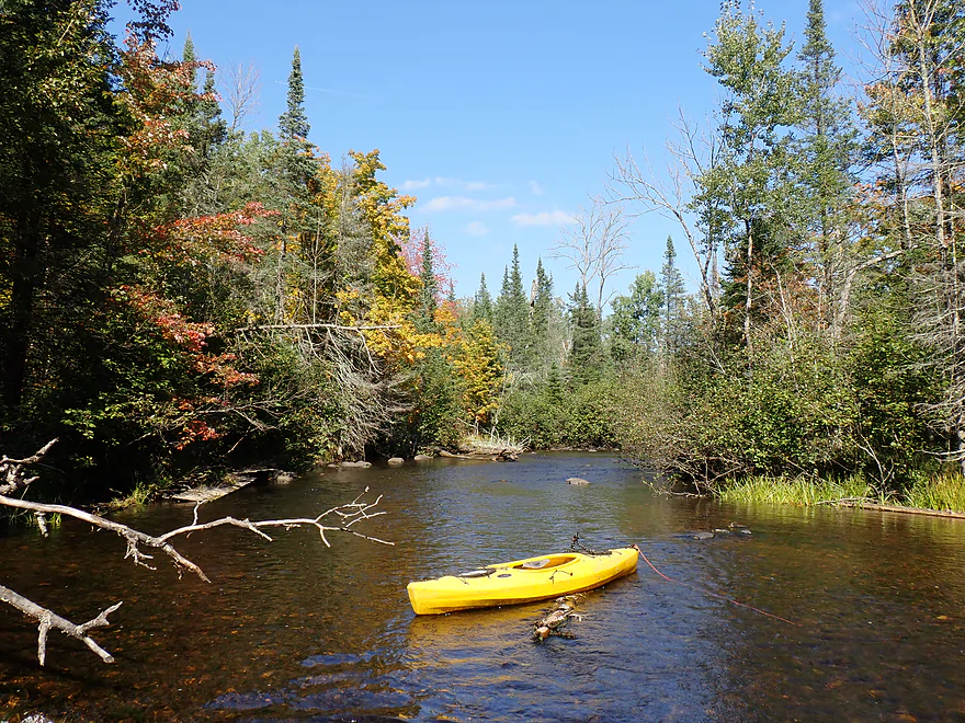
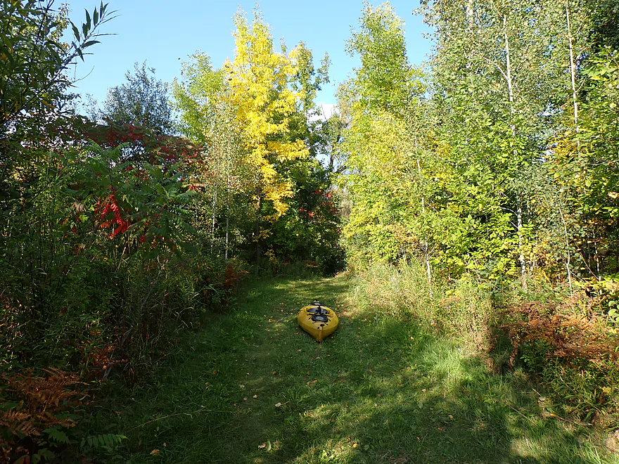
Starting the trip at Hwy A
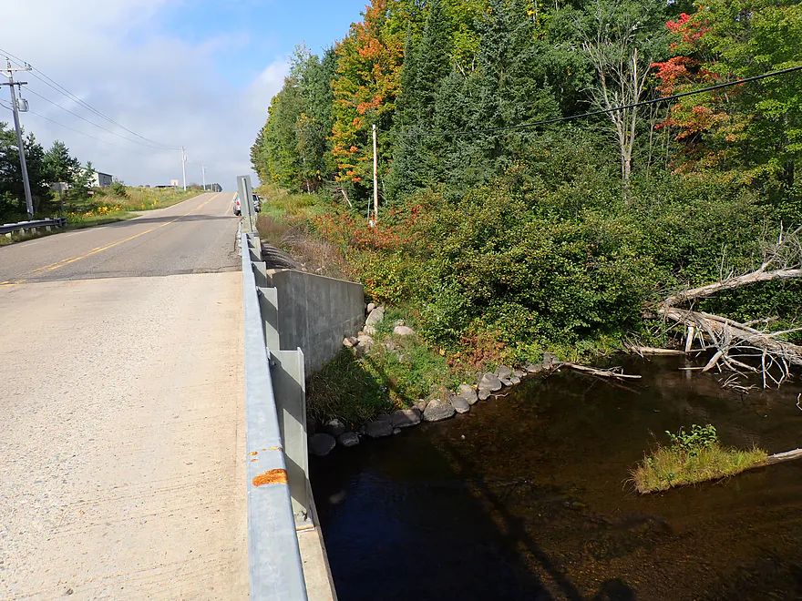
Ok bridge access, but a bit steep
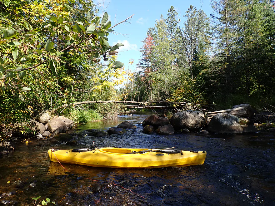
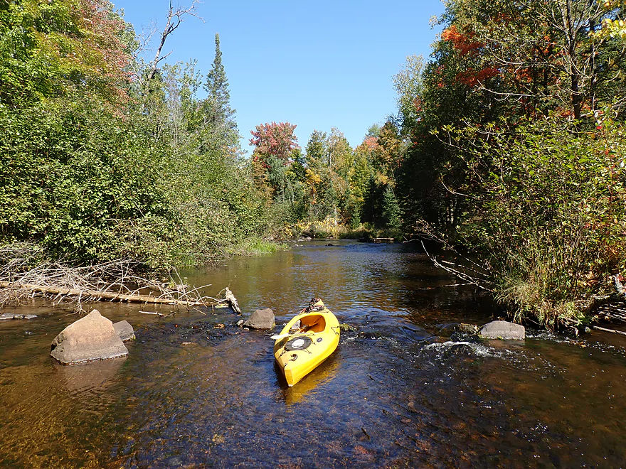
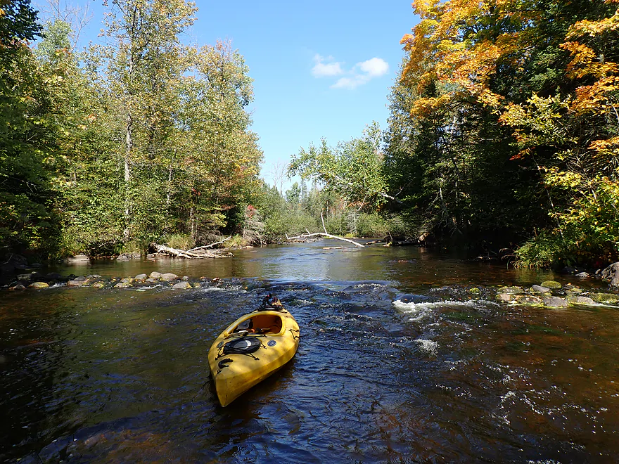
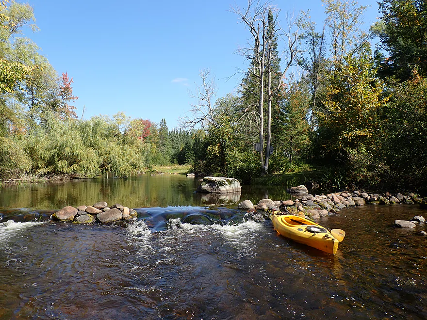
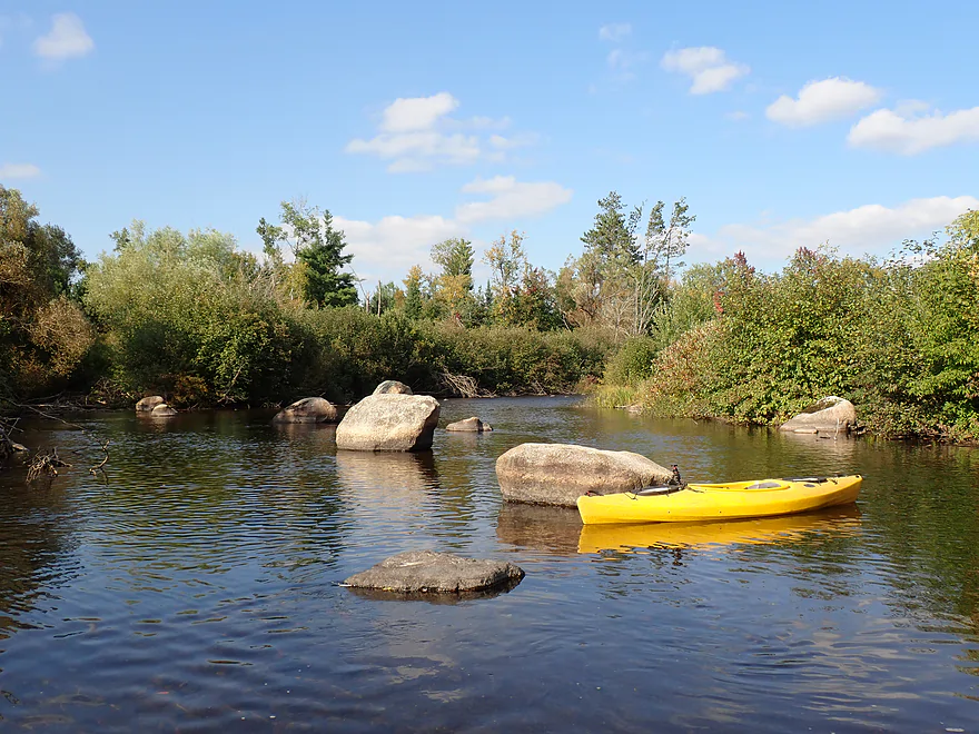
Congested rock pile
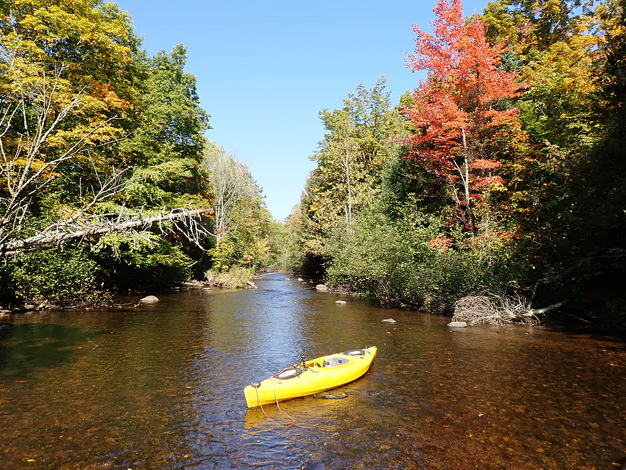
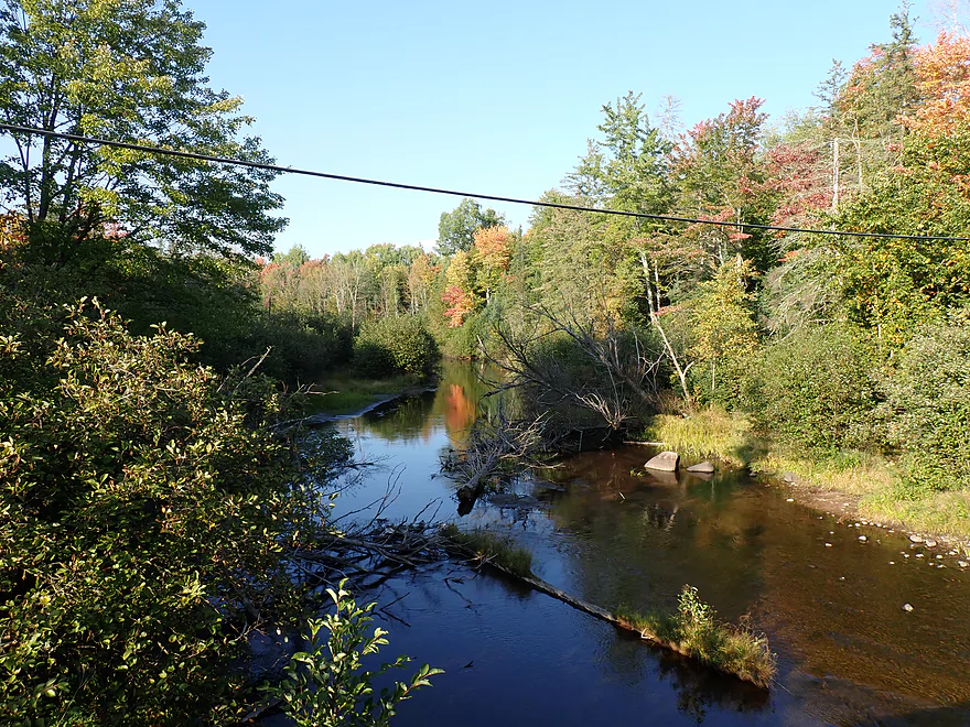
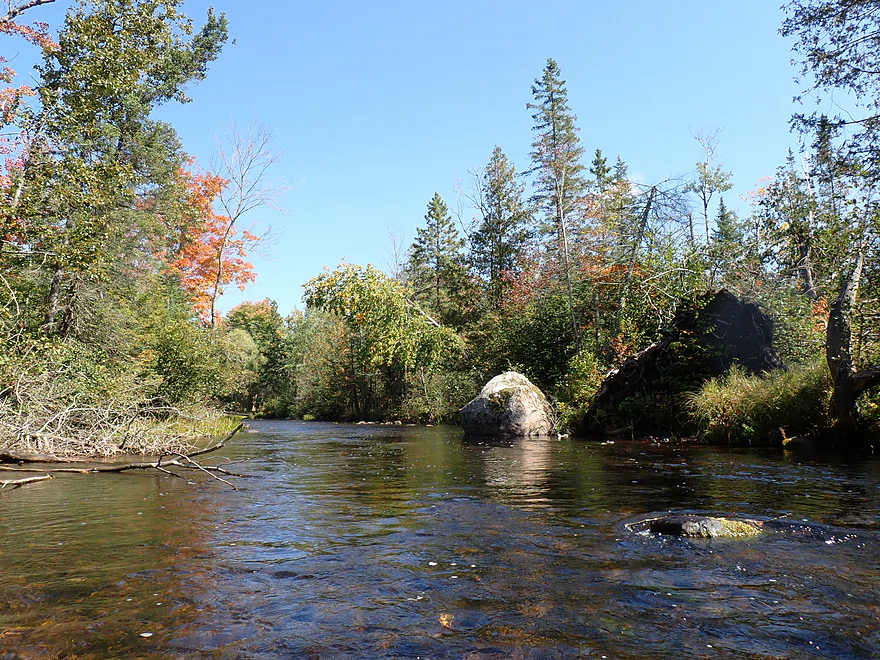
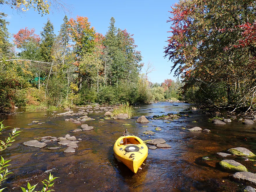
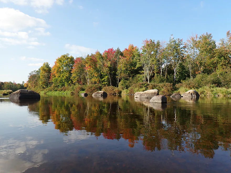
Nice fall color
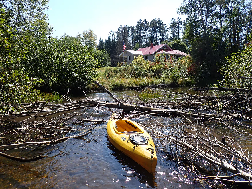
One of a number of logjams
There were a lot of little man-made “hobby” dams on the river
Portaging a low bridge
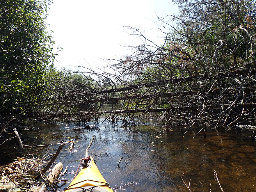
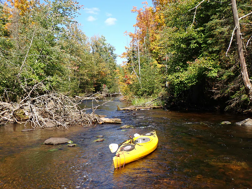
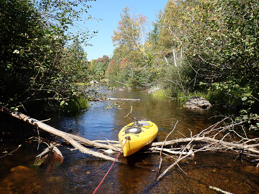
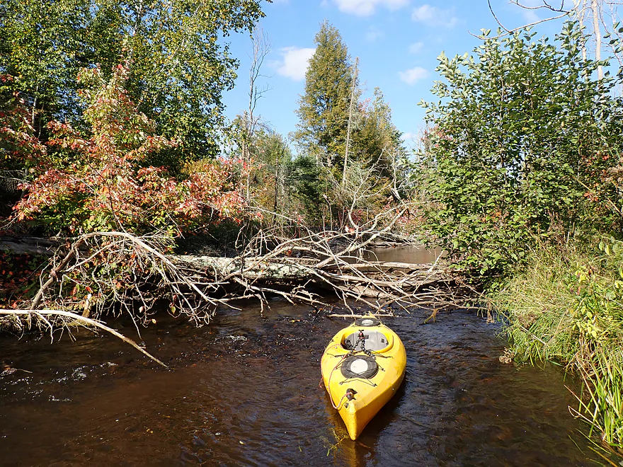
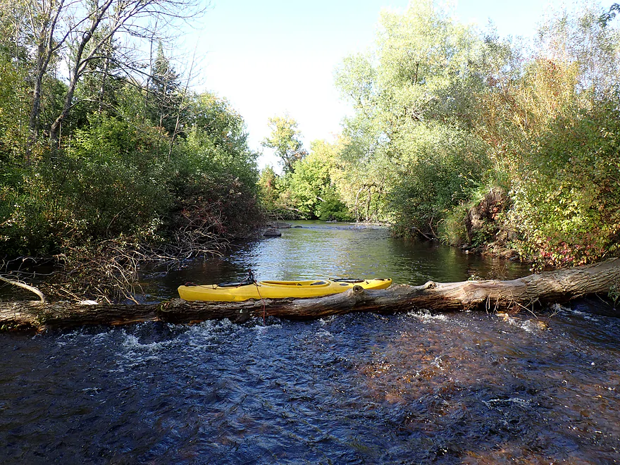
Nasty logjam
Poorly pictured, but here the East Branch joins up
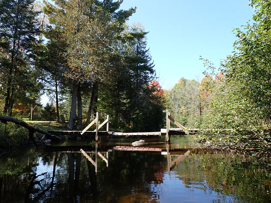
Cool walk bridge
Followed by another cool little bridge
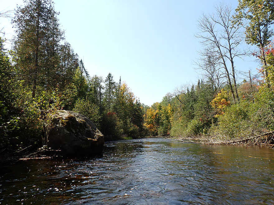
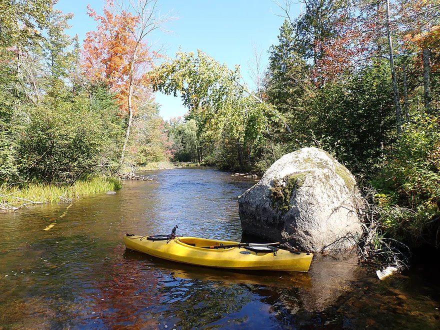
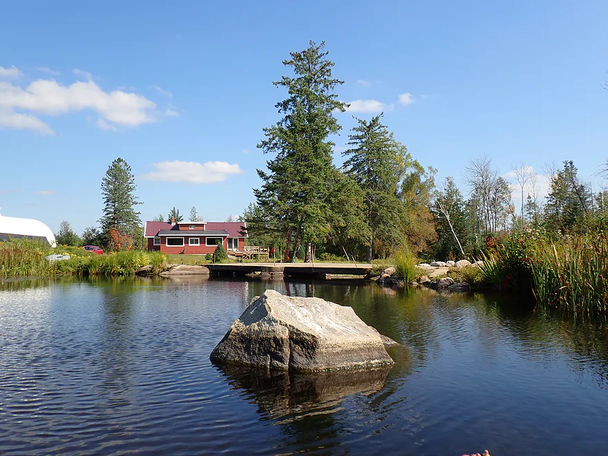
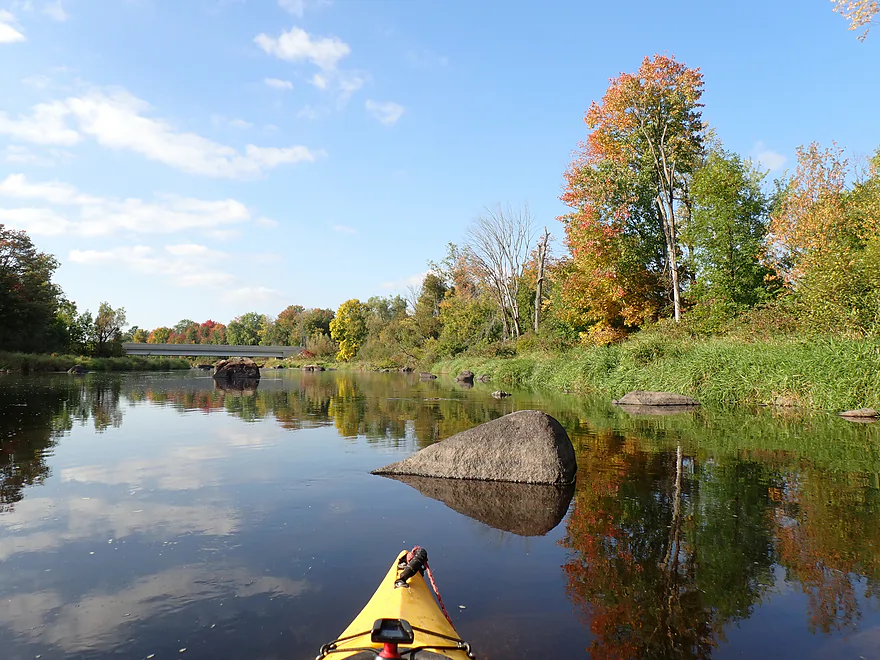
Nice boulder (a glacial erratic)
Some remnant white pines–the rest of the woods has been logged
A group of balsam firs poking the sky
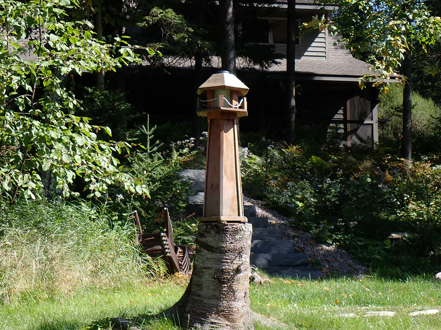
Cool decoration
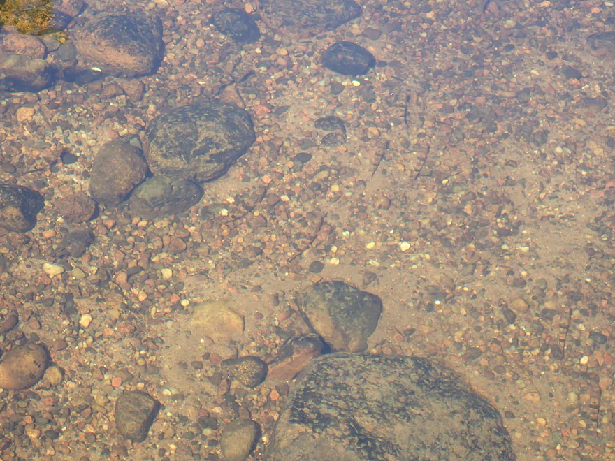
Terrifically camouflaged fish…can you find all 7?
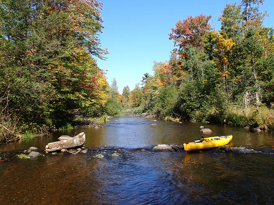
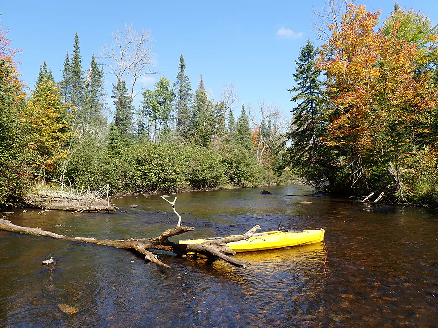
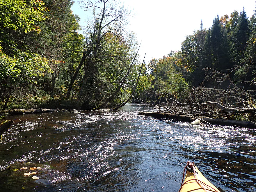
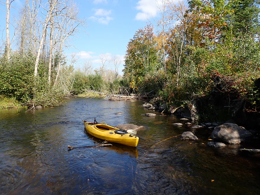
Most of the logjams were easy to wade over
This part has been logged
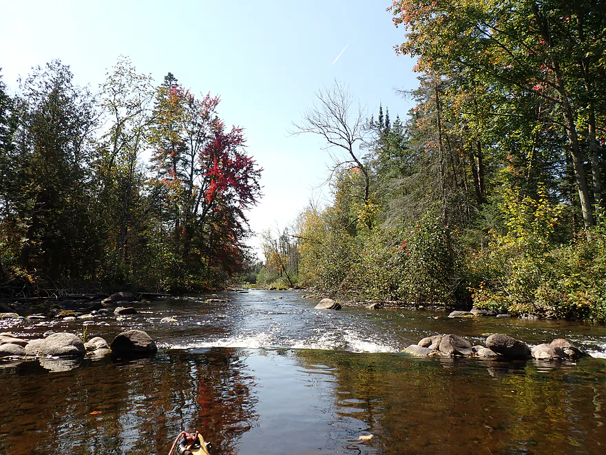
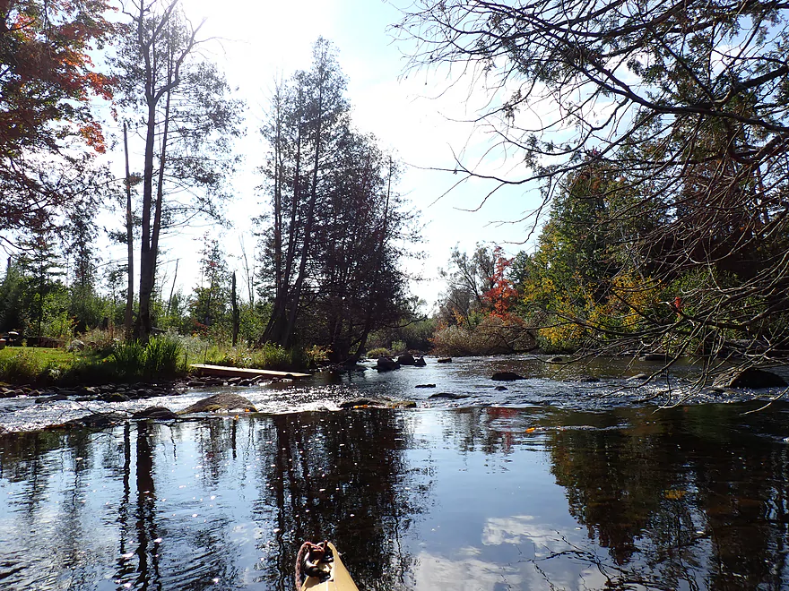
Fun little ledge
Reverse view
Parts of the river were very shallow
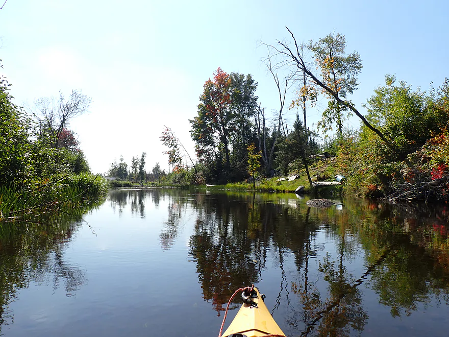
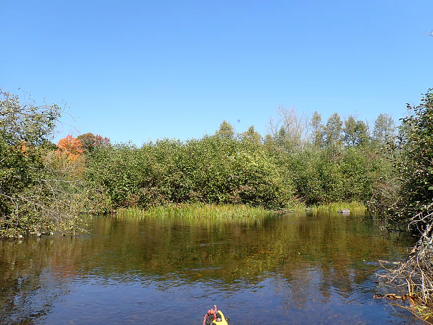
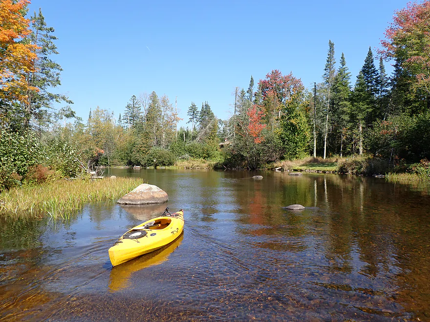
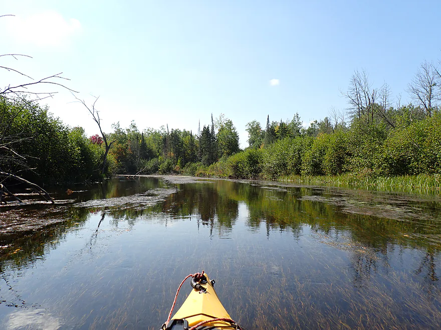
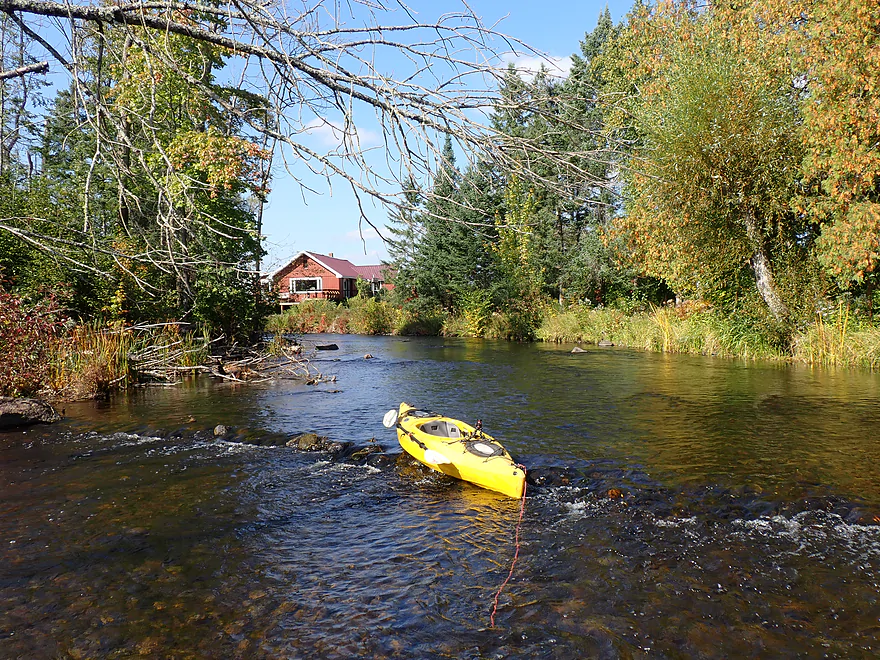
River slows into a millpond
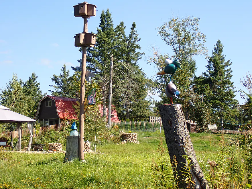
Some riverside decorations
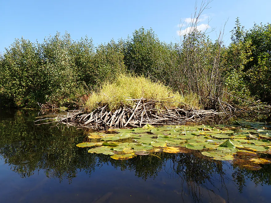
Beaver lodge
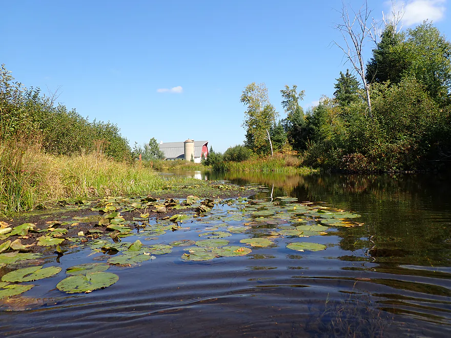
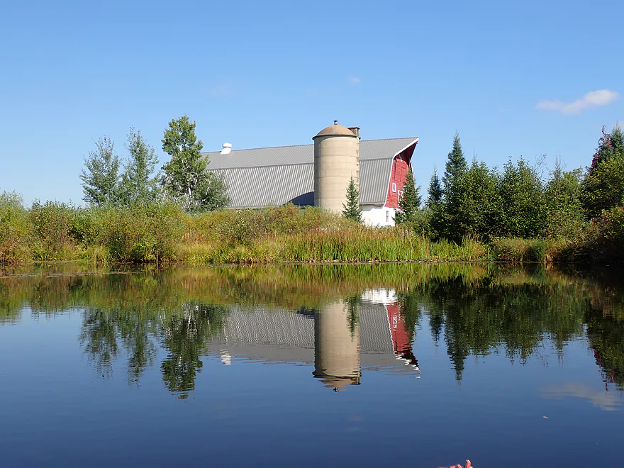
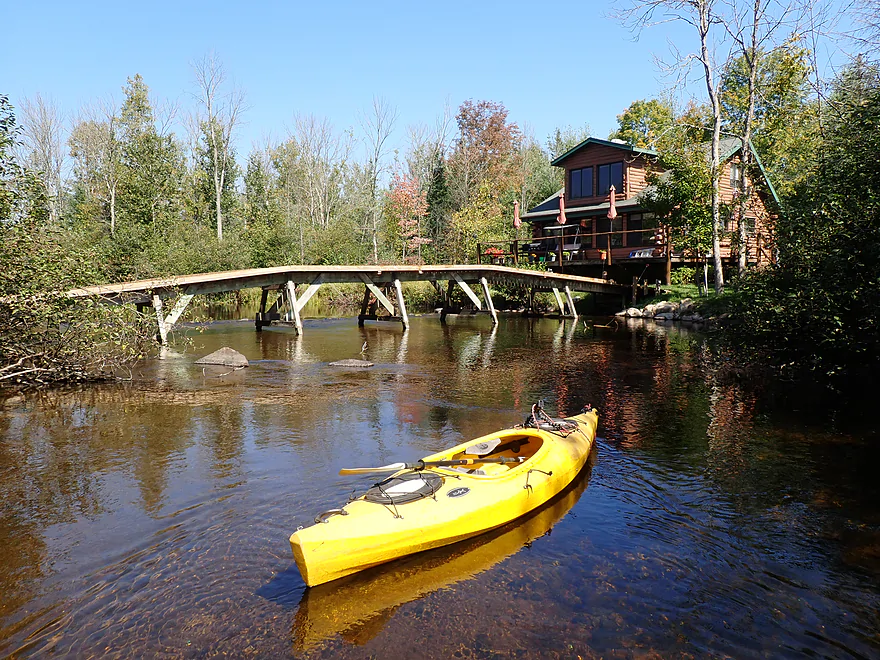
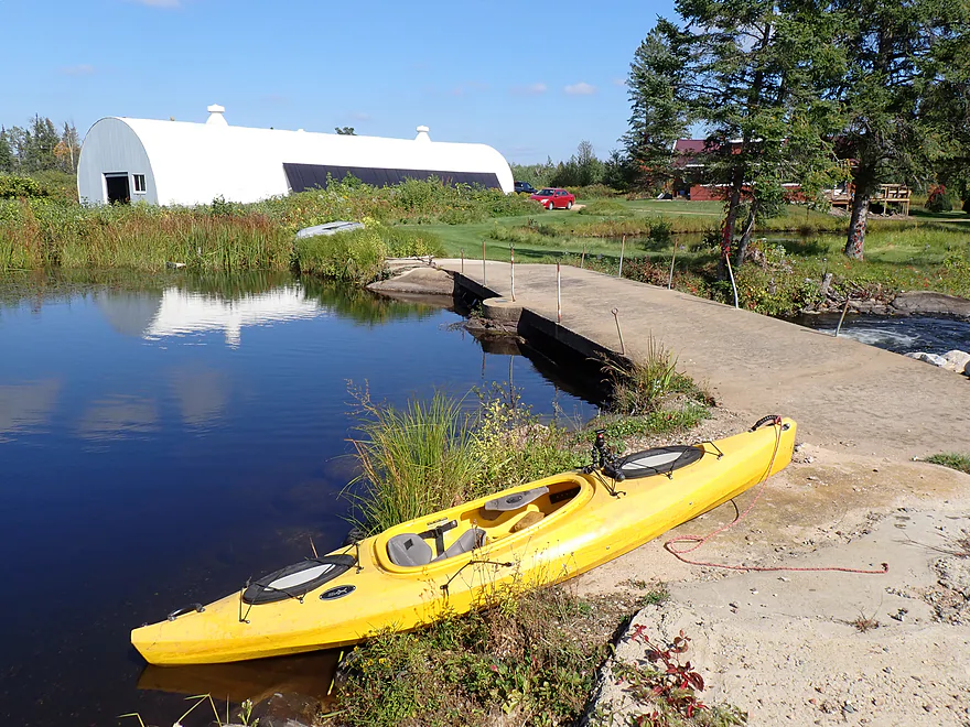
Cool barn
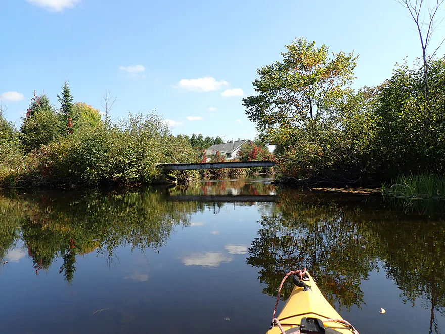
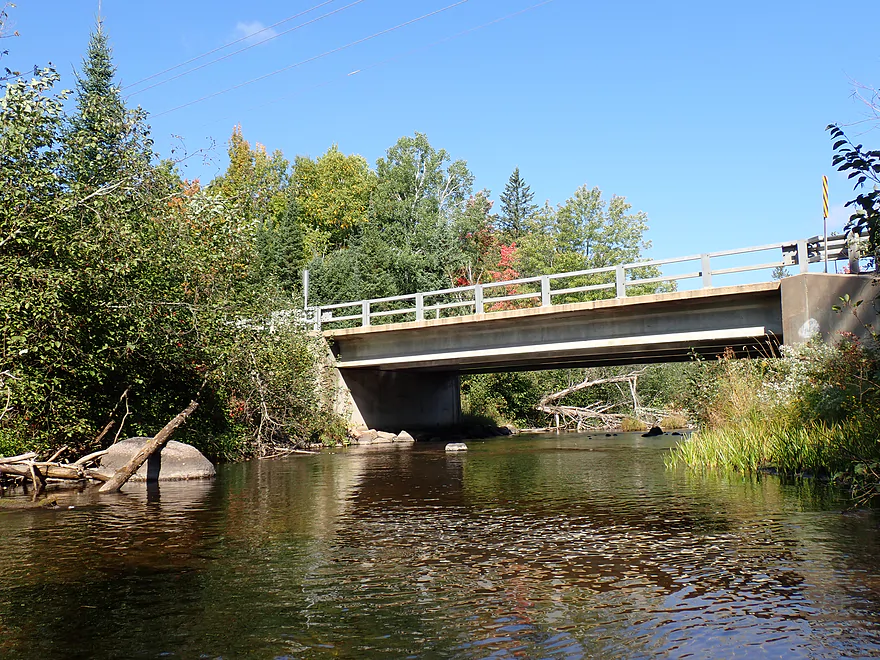
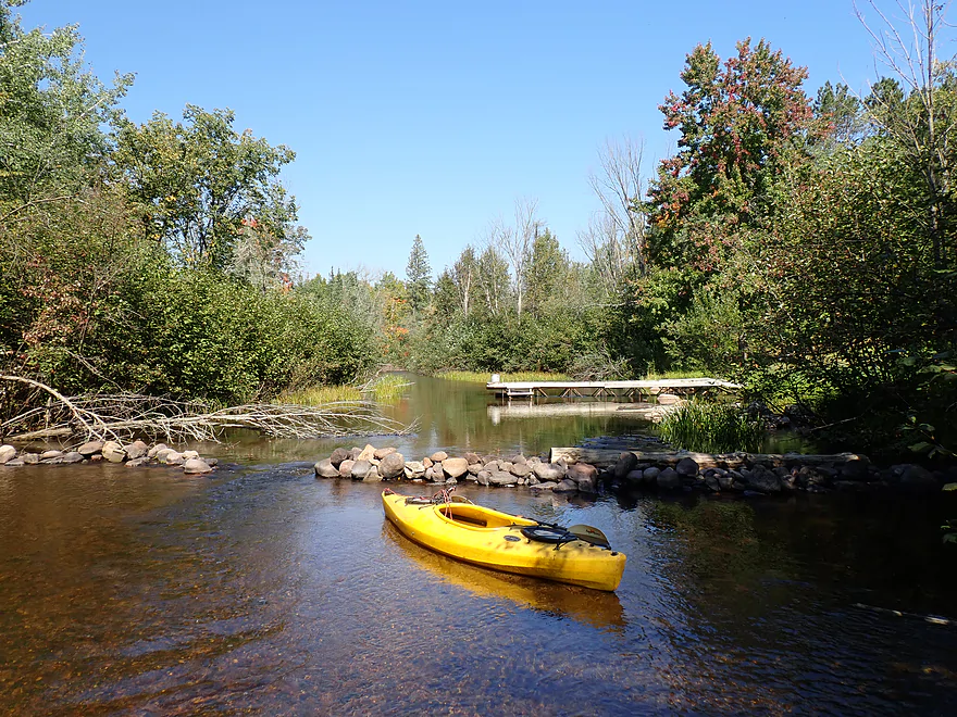
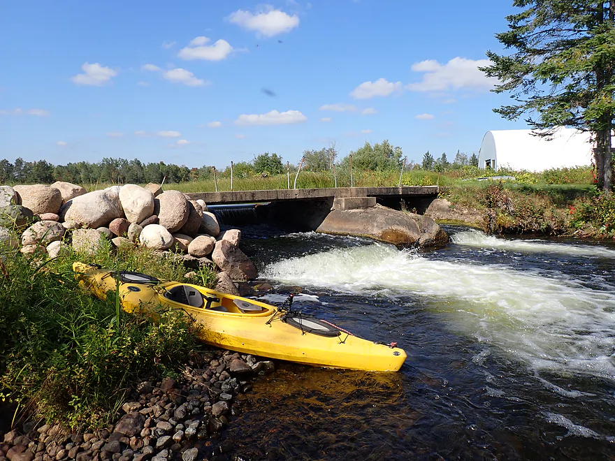
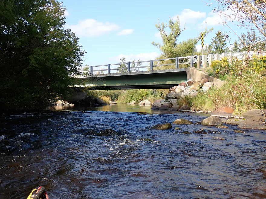
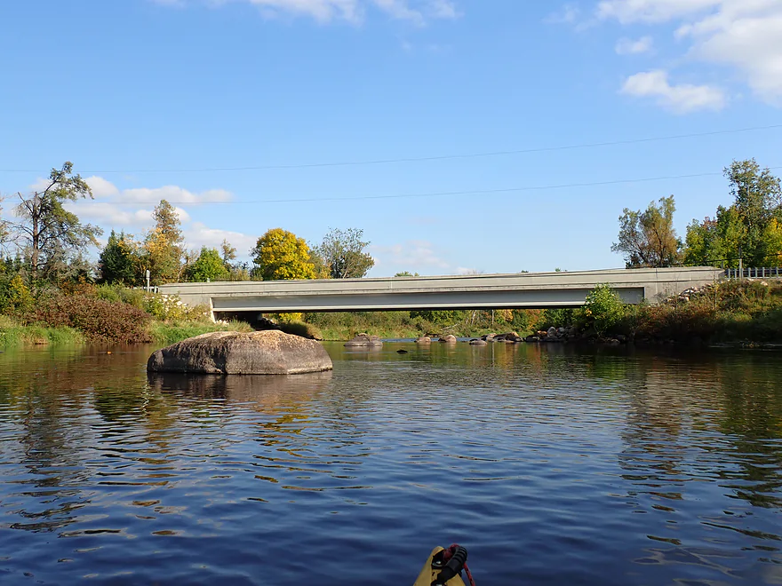
Approaching a bridge and dam
Easy portage
Side view
Bottom view
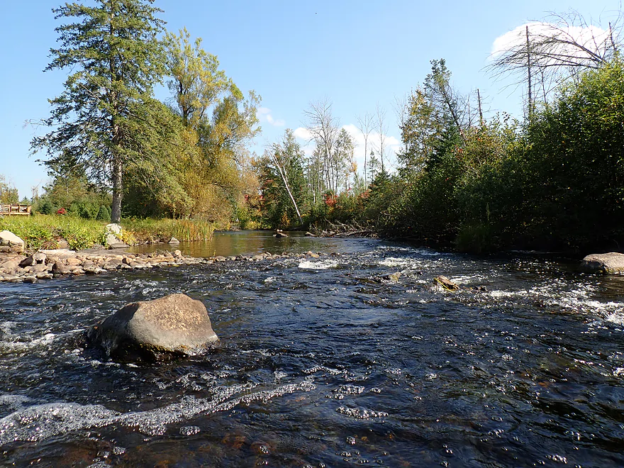
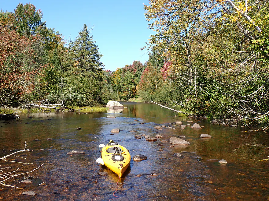
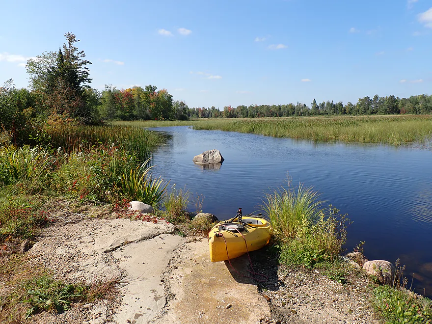
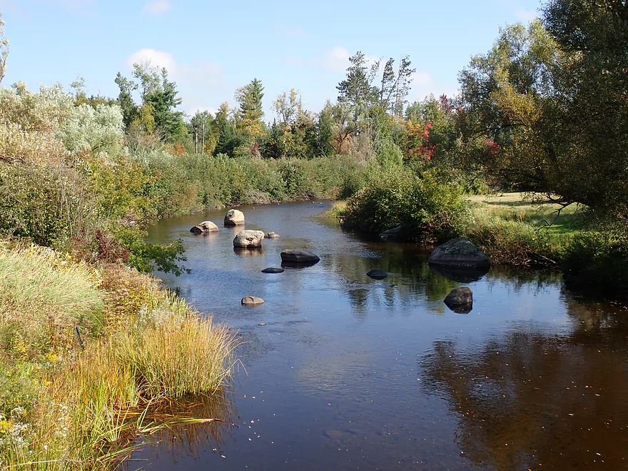
River returns to its rocky and shallow self
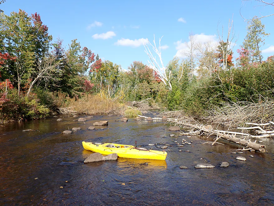
More logjams
One of the shallower parts of the trip
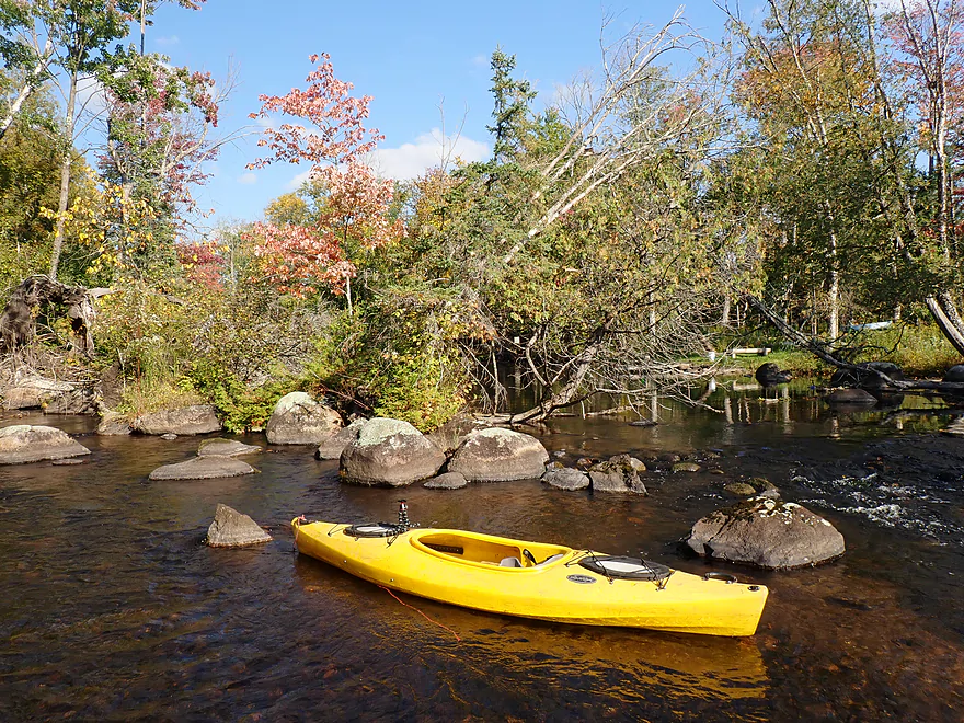
Boulders start go get bigger
One can get out at Hwy 55/52 by the town of Lily
View from bridge
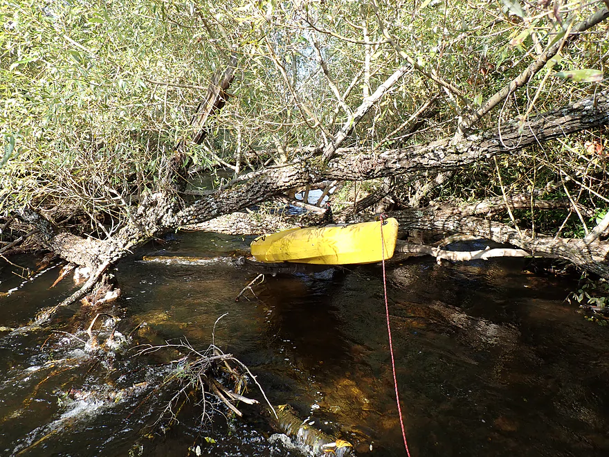
But I continued on…and faced this horrible logjam
And another jam
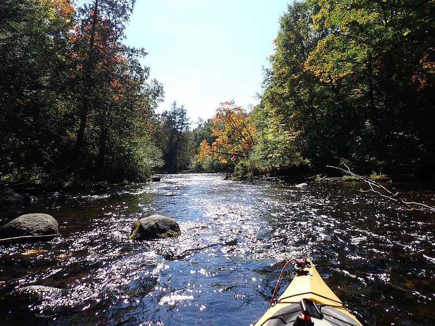
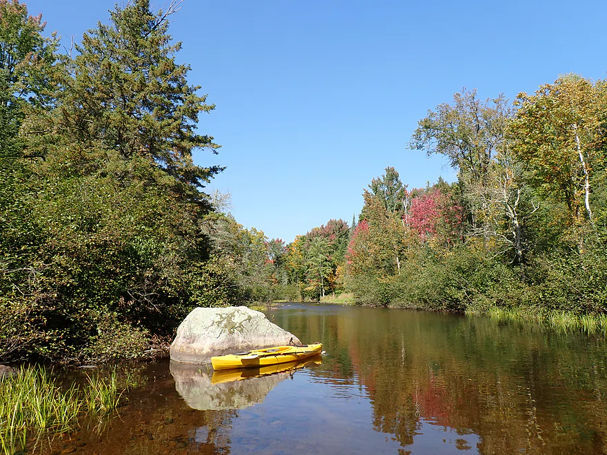
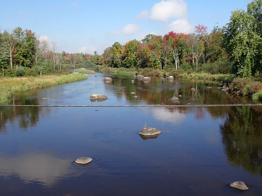
Finally on the Wolf River!
Reverse view of mouth
Downstream view on Wolf
Heading upstream on the Wolf to find my landing
Surprisingly nice fall color for early September
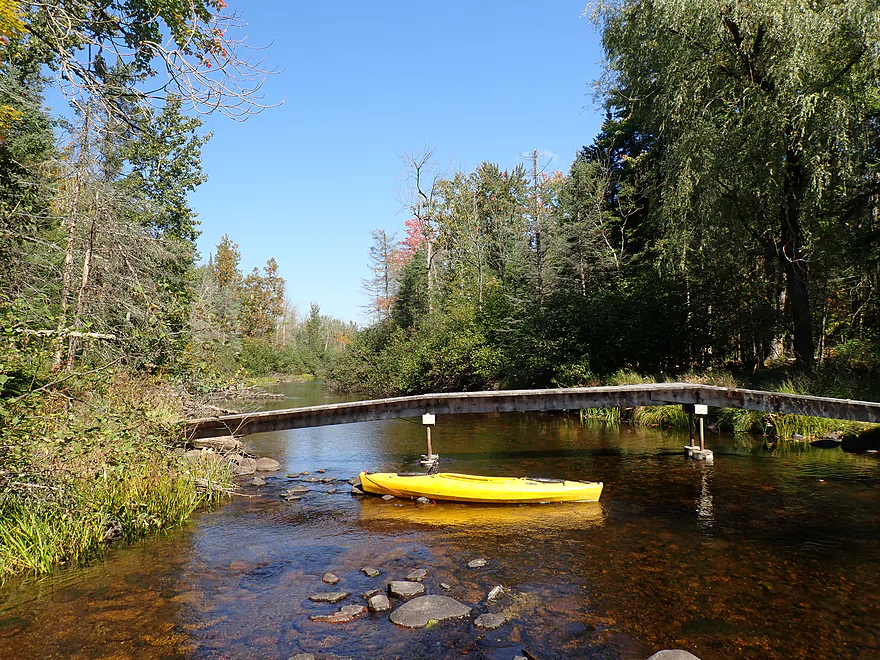
Hwy 52 (second bridge)
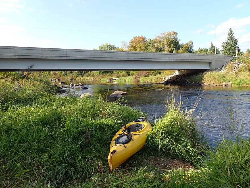
Decent public access
Trail leads to a parking area
View from the bridge
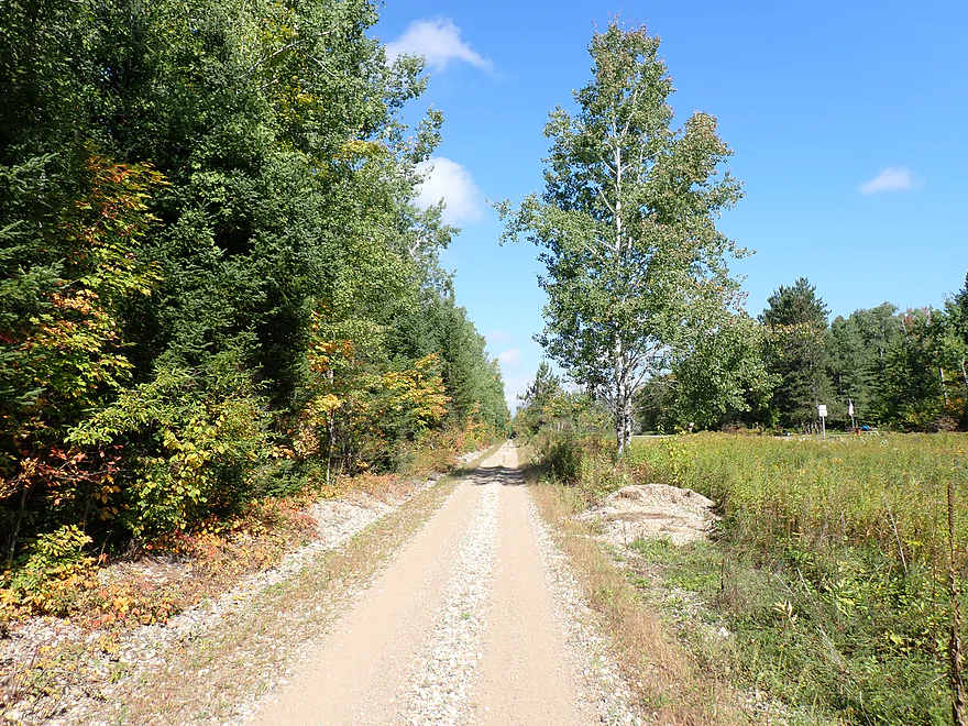
Bike shuttling to Hwy A on the Wolf River Trail
Lily River

The Lily is a small river (really a stream) that joins the Wolf River near the tiny town of Lily, Wisconsin. I got the idea to do it from a Rick Kark review who provided a favorable review of it. He described two put-in options…one was a short 4-mile trip starting from Hwy A, and the second was an even shorter 3-mile trip beginning from the East Branch of the Lily River off Hwy 52. Rick opted for the latter, but speculated the former would be a good stretch to do, so I went for the “longer” option.
I launched from the Hwy A bridge, which had a steep bank but was an otherwise ok bridge access and was scenic. Here the “river” was small (perhaps a bit too), but featured attractive woods with a mix of conifers and some white cedar. The first mile of the trip (before the East Branch confluence) proved to be a disappointment. The rocky channel was at times too shallow and downed trees were common. I lost count of the number of times I had to get out of my boat. On the plus side the channel was often rocky and shallow which made wading over the obstructions fairly easy (with a few tricky exceptions).
After a particularly nasty logjam I rounded a bend and to my relief finally saw the mouth of the East Branch. The confluence provided much appreciated width and depth to the river and from here on logjams became less common. In hindsight I really should have copied Rick Kark’s trip exactly and just started the trip on the East Branch.
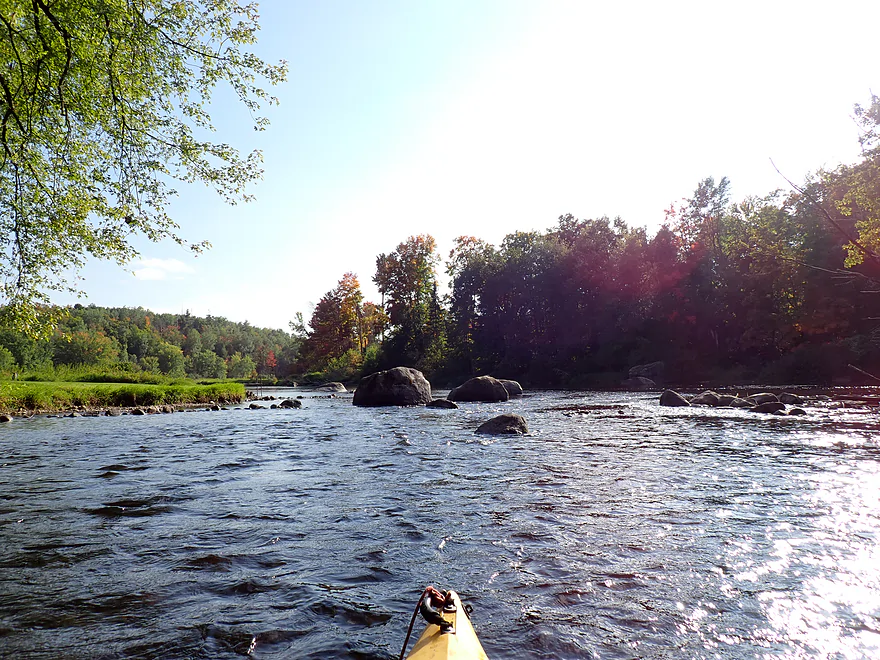
The next mile was my favorite part of the trip, with terrific up-north creek scenery. Often I got out of my boat, not for logjams or shallow water, but to take photos of the attractive fall color, pine-lined banks and small boulder gardens. The locals love building these cute little rock dams on the river and most weren’t difficult to scoot over.
This was followed by a half-mile stretch of impounded water. Here there was a brief marsh, small cottages and evidence of prior logging. Despite this, it was an attractive leg and a nice change of pace. The dam proved to be a relatively easy portage.
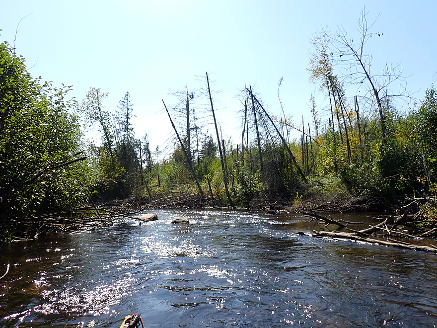
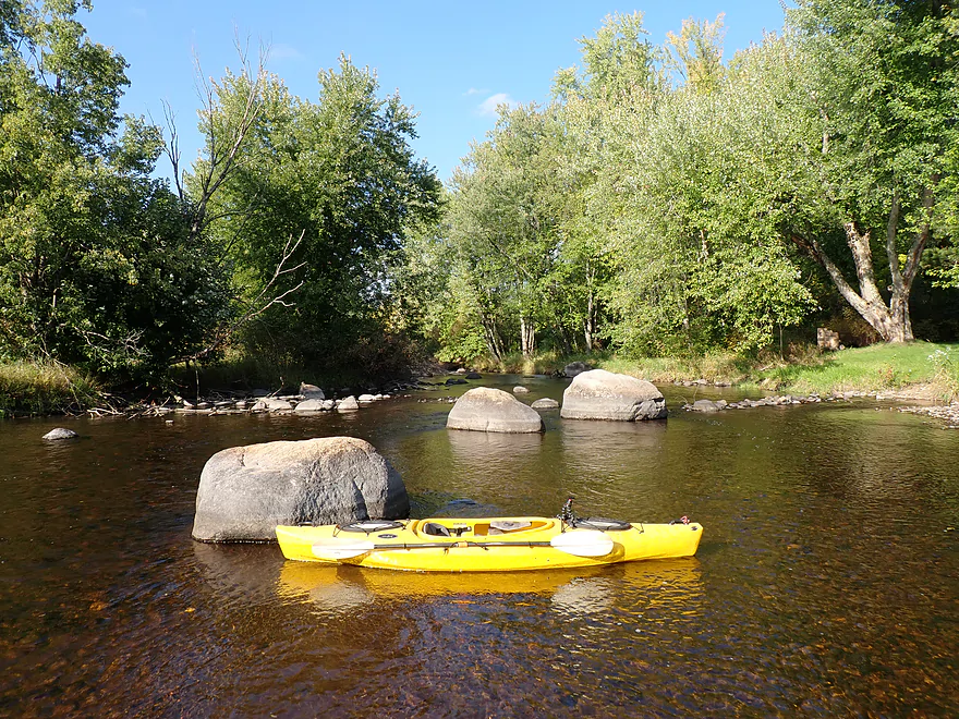
After the dam, the river flowed free again and boulder gardens once again became a common sight. But there were some challenging shallow parts that required me to get out. Rick Kark mentioned doing his trip after a rain, so I don’t think he faced the “bump-fest” I did. I’m also fairly sure he did this stretch when there was less deadfall. Following the dam there was a cluster of downed trees and evidence that strong storms or even a tornado had rolled though here. While the logjams (about 5) in this area were not difficult to get past, two of the logjams required somewhat difficult portages.
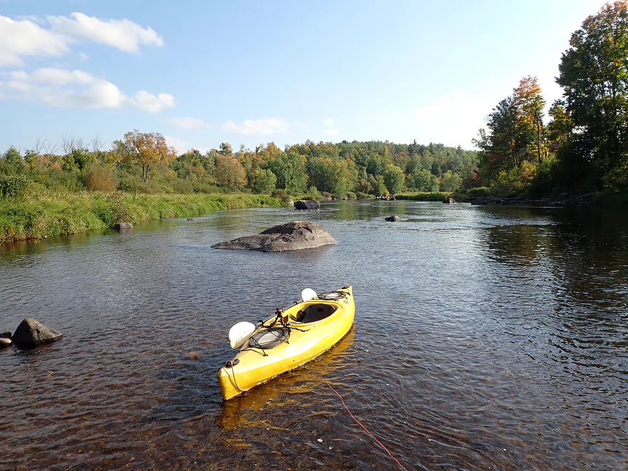
A nice series of boulder gardens led up to Hwy 55/52. I originally considered ending the trip at this bridge, but ultimately decided to leave my car on the Wolf River (not too far away). Unfortunately two more logjams (one of which was difficult and can be seen from the bridge) blocked access to the Wolf and required portaging. Finally, to my great relief, I was at last on the famous Wolf River…which was significantly bigger than the Lily. I continued a short way upstream to Hwy 52 and disembarked at a nearby public access.
In summary this was a disappointing trip, but it had potential. Three things have to change to make this trip work though: 1) You have to start from Hwy 52/East Branch, not Hwy A, 2) You have to go when water levels are higher, 3) You’ll likely need to wait for locals to clear out the storm-downed trees. Given the energy the locals put into constructing their little rock dams, removing a few downed trees shouldn’t be a problem. The river is scenic though and has good potential.
Honestly though…even if all three of these conditions were met…the famed Wolf River is just next door and for most paddlers will be the preferred paddle. The boulders are bigger, the rapids more fun, the wooded banks less logged, and there won’t be the shallow water issues of the Lily. My predominant thought as I paddled out onto the Wolf was wow, the fall color and scenery were surprisingly good and I wasted an opportunity to do that instead. Oh well.
Sights included dragonflies, one muskrat, a beaver lodge, a blue heron, and live clams (a rarity as most of the clams you find nowadays are dead). Small fish were not uncommon and included what looked like a school of trout and a huge school of carp.
Hwy A: This was an ok bridge access, although a bit steep. I don’t advise launching here though because of the immediate downstream logjams.
Alternate Put-ins:
- Hwy 52/East Branch Lily River (1.2 miles south from Hwy A): This would be an easy access along the open west shoulder. Technically this is on the East Branch, but it soon joins the main river in just a 1000′. This is a preferred put-in, as there are many logjams closer to Hwy A.
Hwy 52 – Wolf River: There is an excellent public access southwest of the Hwy 52 bridge. Note, this is technically on the Wolf River and will require portaging two final logjams on the Lily River and then doing an upstream paddle on the Wolf (about 1000′) to reach the landing. I doubt many Lily River paddlers will continue to the Wolf though because of the two logjams.
Alternate Take-outs:
- Hwy 52/55 – Lily River (0.5 miles upstream from the Wolf Landing): You can’t park northwest of the bridge because of a fire access, but you should be able to park northeast. This is the better take-out option, because of the downstream logjams.
Bike Shuttle – Hwy 52 to Hwy A: 4.1 miles with 62′ of ascent. This was a pretty easy bike shuttle. Note, Hwy 52 parallels a bike trail (Wolf River State Trail), but it’s just too torn up by atv and snowmobile traffic to be practical for a bike. The highway, despite being slightly longer, than the “bike trail”, is significantly faster. If the DNR wants to promote multi-use trails, they really need to pave them for protection. You can learn more about the trail here.
Logjams:
- Hwy A to the East Branch Confluence: There are many logjams on this stretch. Most are easy “wade-overs” but a few are a pain. Bypassing this stretch by launching from the East Branch is recommended.
- East Branch Confluence to Dam: This was the most open part of the trip with only a few minor downed trees that weren’t difficult to deal with.
- Dam to Hwy 52/Lily River Bridge: There is a cluster of downed trees below the dam. Two required somewhat difficult portages.
- Hwy 52/Lily River Bridge to Mouth: There are two logjams on this short stretch, one of which is somewhat tricky.
- Mouth to Wolf River Take-out: There are no logjams on this part of the Wolf River.
Bridges: There are a handful of local trail bridges that cross the river. Most are easy to paddle under, but two required easy portages.
Dams: There is one dam about 4′ high located roughly halfway into the trip. It was an easy portage. There are a number of amateur little rock dams on the river created by locals…these are fairly easy to get over.
Rapids/Current: The current moves at a good clip with multiple riffles and light rapids. None of the rapids are stronger than Class 1. However, in high water tricky strainers could develop around some of the downed trees.
Gauge: Wolf River @ Langlade
Trip Depth: 259 CFS or 7.67′
Navigability Estimates: This is just conjecture…always use your own best judgement.
- < 310 CFS: Unless you don’t mind getting out and wading a bunch, this will be too low. I grounded out countless times at 259 CFS.
- 311-450 CFS: Likely a marginal depth…shallow in spots, but likely doable for shallow drafting boats.
- 451-550 CFS: Likely a good target range.
- 551-700 CFS: A high depth. Note, several of the downed trees could morph into tricky strainers with fast current.
- 701-1000 CFS: A very high depth. Likely somewhat dangerous and only suitable for expert paddlers.
- 1001+ CFS: Maybe too high for even experts.
Click here to see an overview map of the Lily River.
- Upstream from Lily Lake: Continuing upstream the river flows through a marshy stretch and then flows out of the headwaters at Roberts Lake. I don’t know much about this leg, but suspect it might be small and sketchy.
- Lily Lake Boat Landing to Lily River Lane/Dam: 1.7 miles. This is an impounded stretch but is likely a nice Northwoods lake paddle. Round trips are viable.
- Lily River Lane/Dam to Hwy DD: 1.2 miles. Narrow and congested, I doubt this is a viable stretch.
- Hwy DD to Hwy A: 4.6 miles. Deadfall and congestion might be a problem on this leg.
- Hwy A to Hwy 52/Wolf River: 4.8 miles.
- Hwy A to East Branch Confluence: 1.3 miles. A narrow, shallow, wooded, and somewhat congested section. Not recommended unless it gets cleaned up in the future.
- Hwy 52 to East Branch Confluence: 940′. This is technically on the East Branch. Despite being narrow and filled with alders, it’s the preferred entry point for the Lily River as it will have less logjams.
- East Branch Confluence to Hwy 52: 3.1 miles. The best part of the river with good wooded scenery and boulder gardens. Parts are shallow though and there are some logjams to deal with.
- Hwy 52 to Mouth on Wolf River: 680 feet. There are two logjams to portage–one of which is difficult.
- Mouth on Wolf River to Hwy 52 Access: 1000 feet. A short upstream trek on the scenic Wolf River to reach a public access. Current is a bit brisk in a few spots but it should be manageable.
- Hwy A to East Branch Confluence: 1.3 miles. A narrow, shallow, wooded, and somewhat congested section. Not recommended unless it gets cleaned up in the future.
Trip Map
Overview Map
Video
Photos Size: