
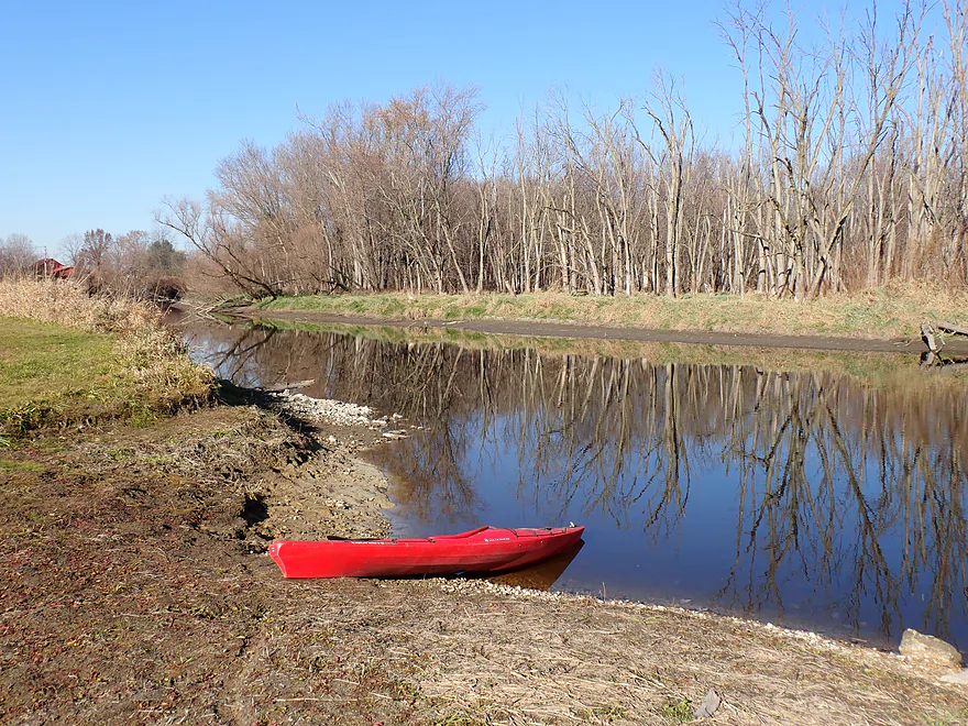
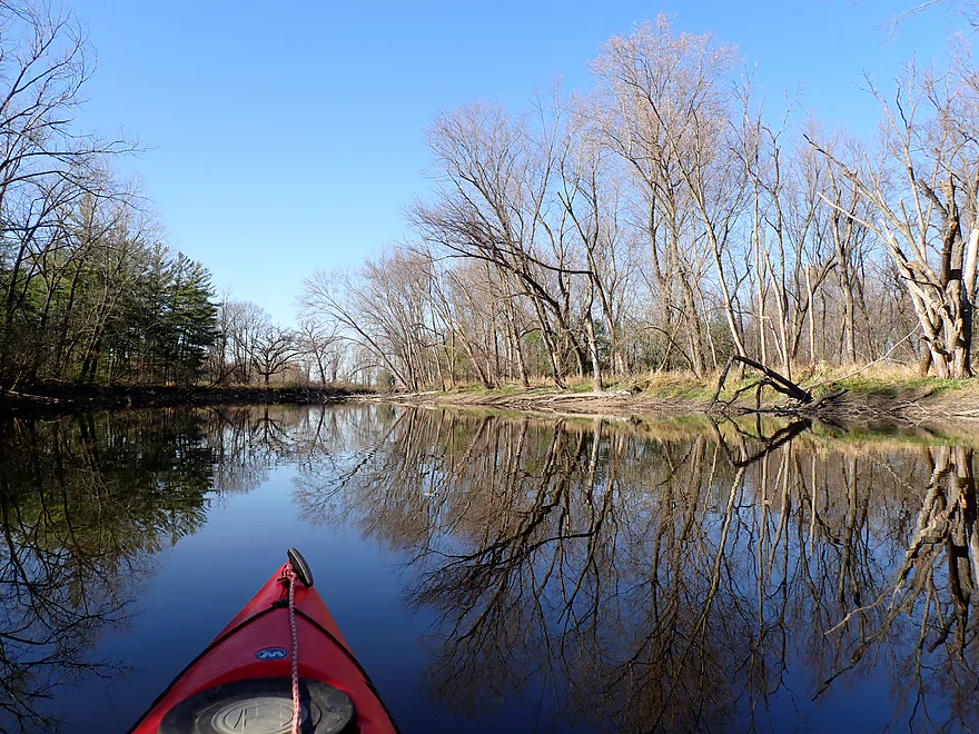
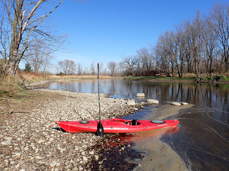
Starting the trip at Kanow Park

Great public access
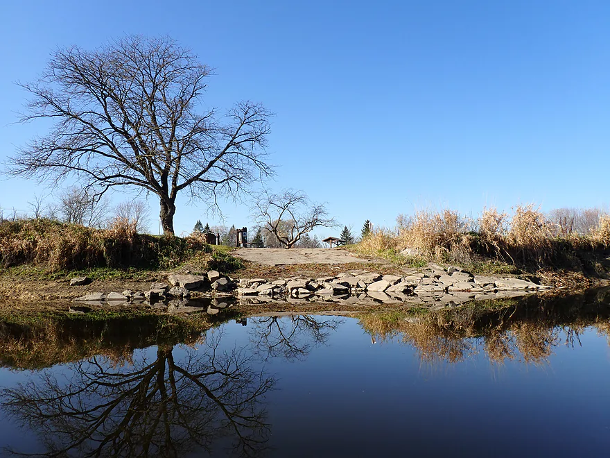
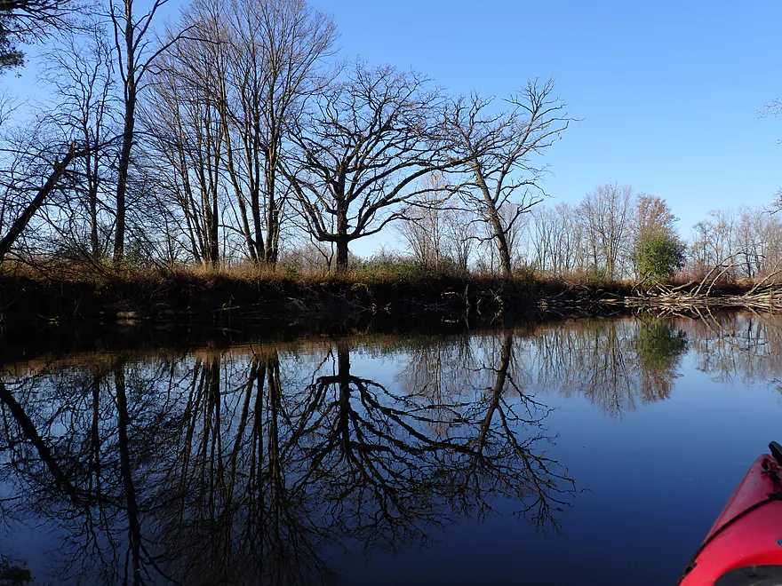
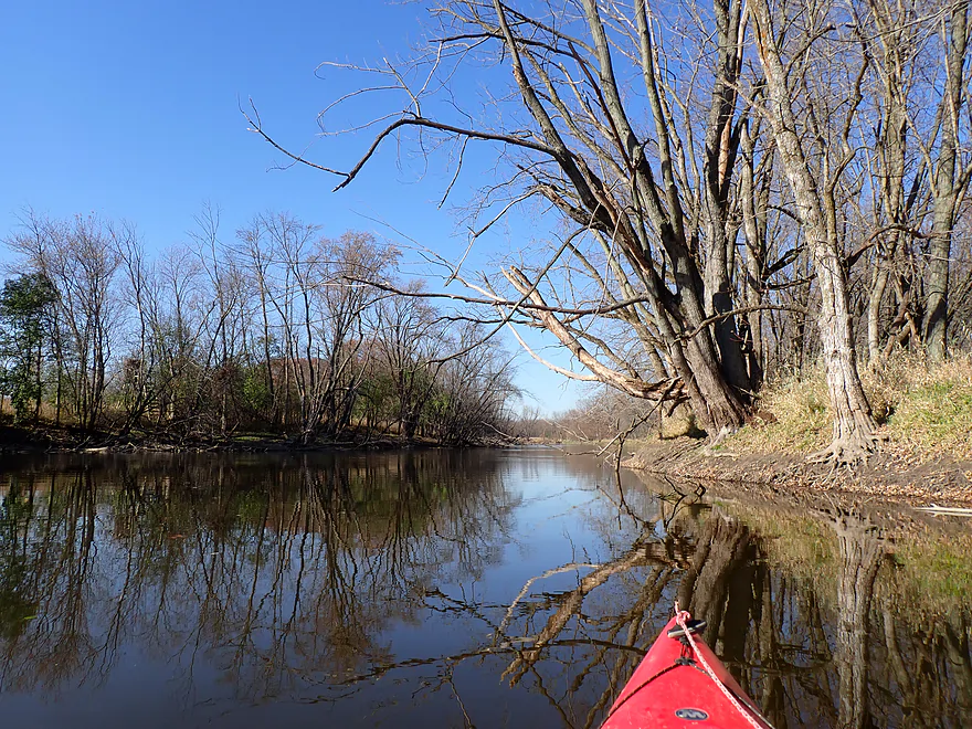
Park is flanked by a scenic river bend

Still a little color left
Rock River Road

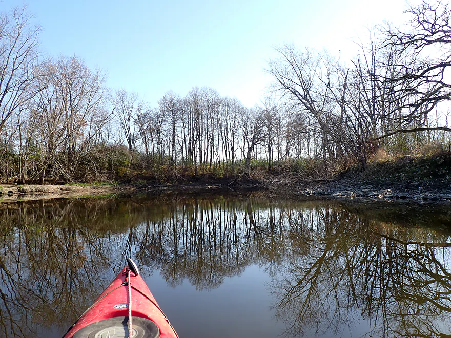
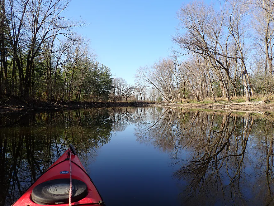
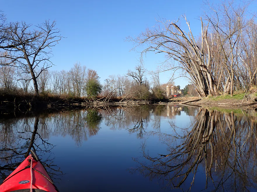
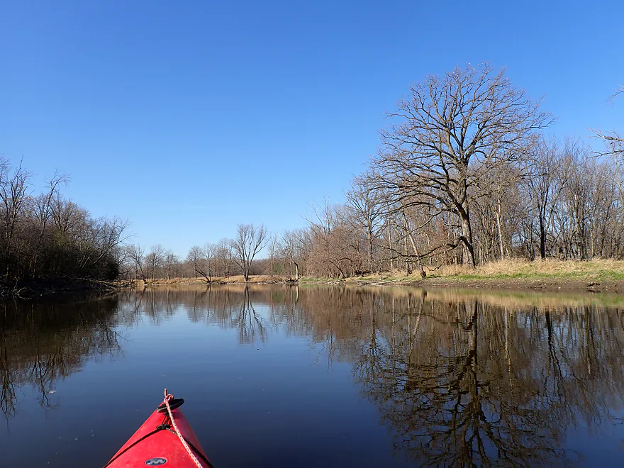
Approaching Wayside Park
Nice public landing
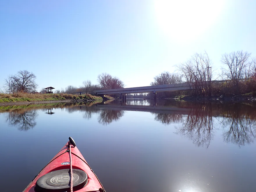
Hwy 16 was so noisy
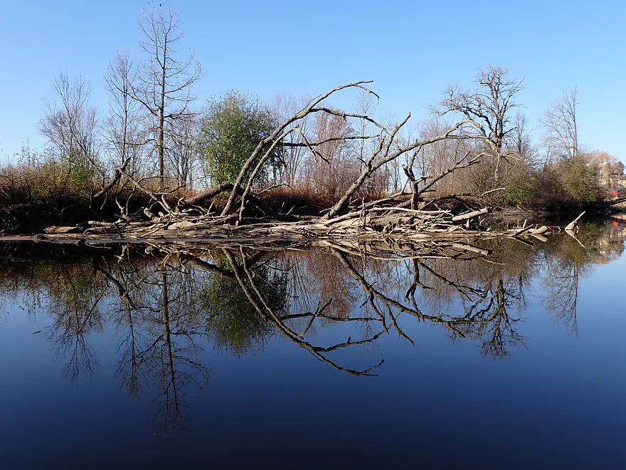
Huge tree limb sticking upside down in the mud
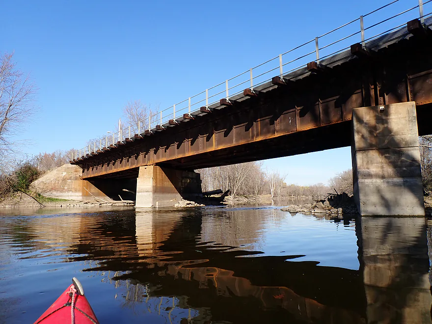
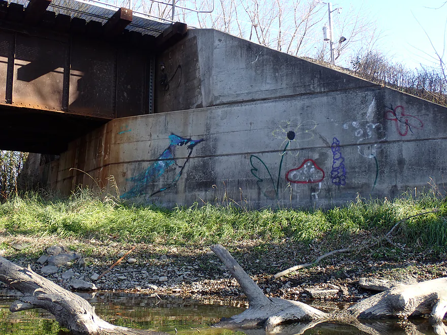
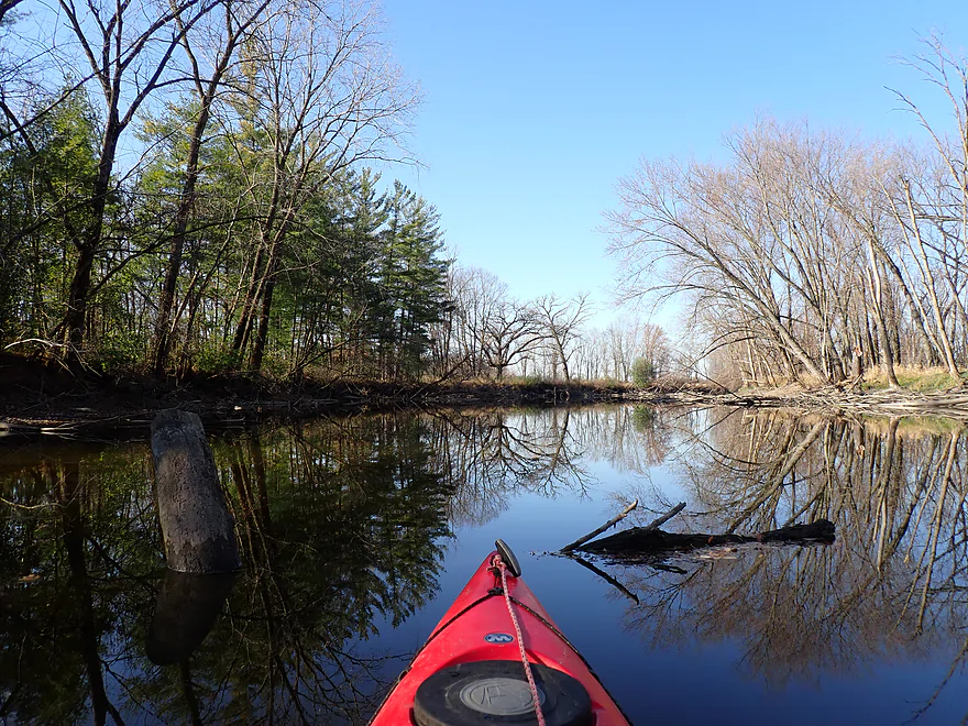
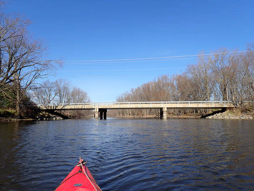
Railroad bridge with some micro-riffles
I’ve seen worse
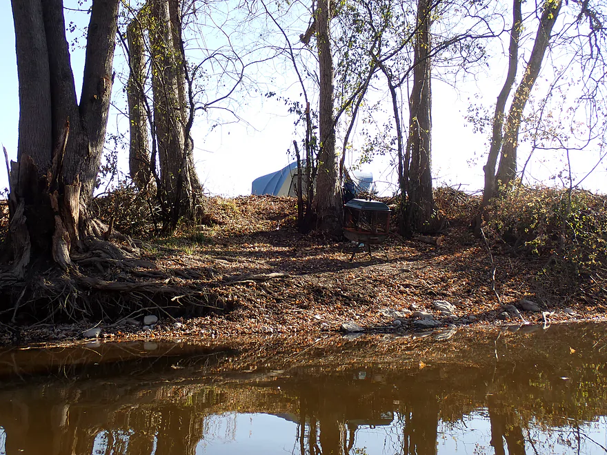
Random November tent on the Rock River shore
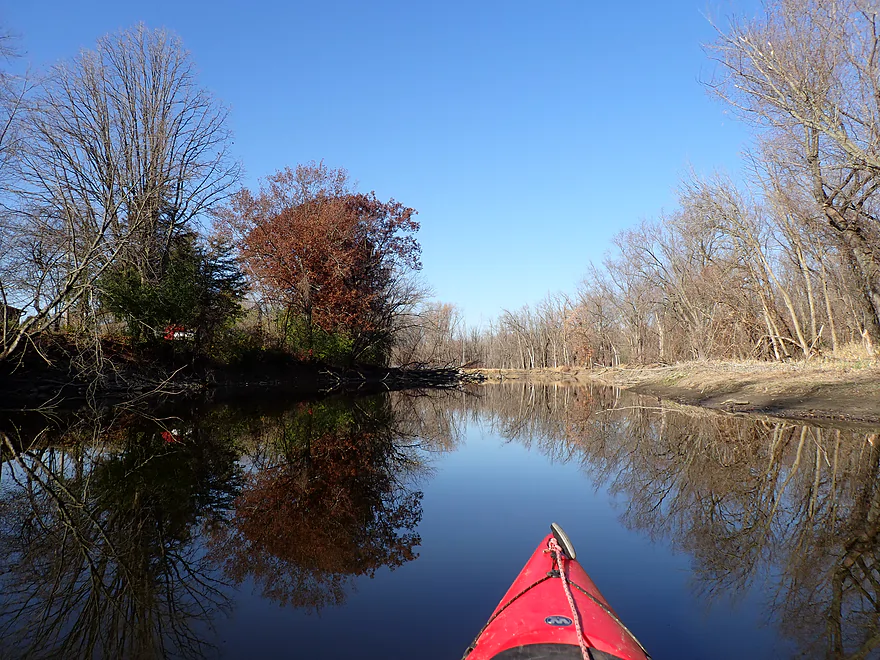
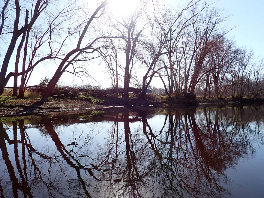
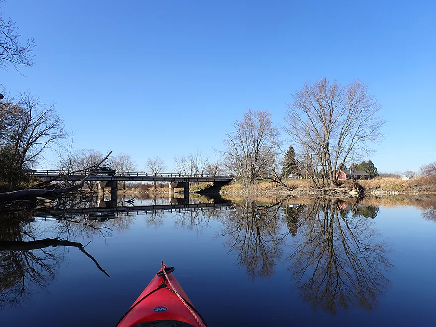
One of my favorite parts of the trip
Terrific tree silhouettes
Surprised to see pine trees
Natural framing
Natural artwork

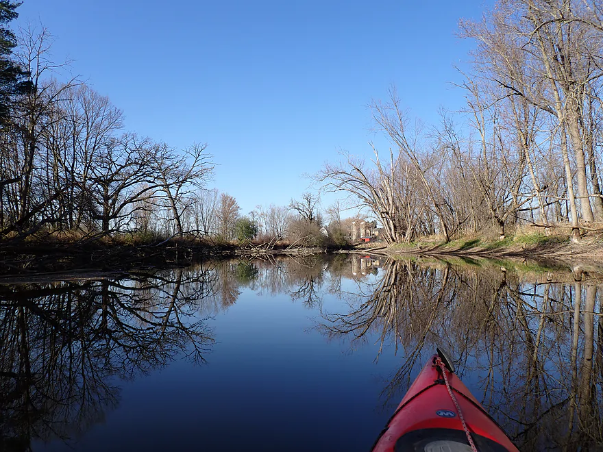
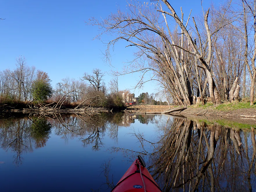
I didn’t see too many buildings, but there were a few
Rock River living up to its namesake
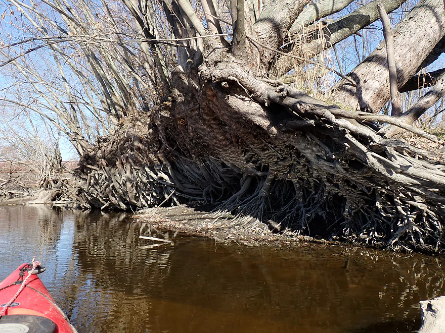
Fantastic root system
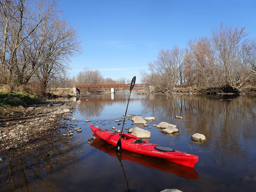
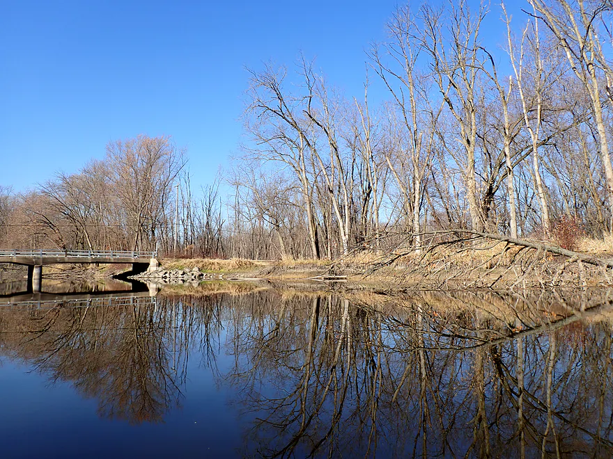
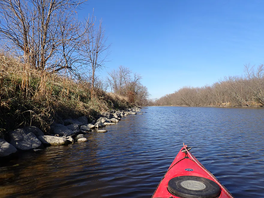
A few more glacial rocks (the Interurban Bike Trail bridge is in the background)
Rockvale Road is likely a viable access option

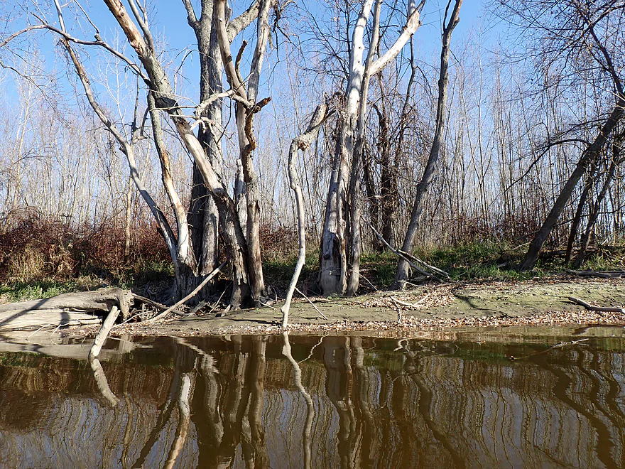
Some of the trees along the river were dead
Last leg of the trip runs adjacent to Cty F
Hwy F
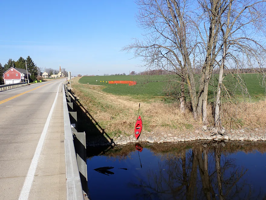
Busy road but an ok take-out
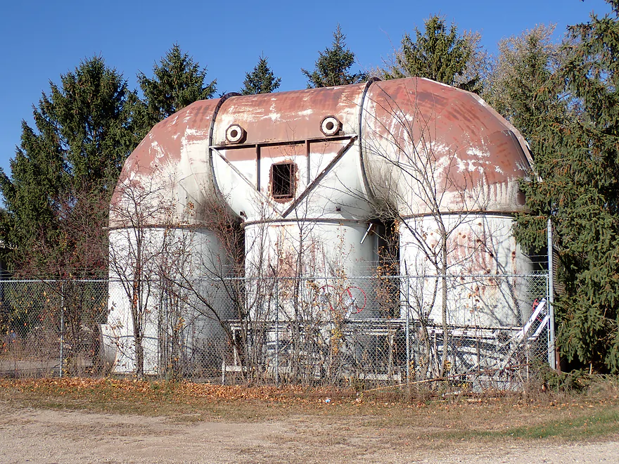
Cool ‘sculpture’ on the bike shuttle
Rock River – Kanow Park

The Rock River suffers from overdevelopment, motorboats, dams, monotonous scenery, and a slow, wide channel. However, there are still nice stretches and IMO the best is the 50 miles between Horicon and Watertown. For this trip, I kayaked just east of Ixonia from Kanow Park to Hwy F.
Kanow is an attractive and secluded riverside park located along a bend in the Rock River. Paddlers could also launch from Wayside Park, which is located about a mile downstream. That too is a good access, but it’s not as secluded and is located next to a busy highway.
The short river mile between the two parks was actually my favorite part of the trip, with fantastic mirrored tree reflections and a few small glacial hills. The only downside was road noise, which was present for almost the entire trip.
After Wayside Park, the river became a bit less interesting and generic. Water quality was turbid with some mud, but did feature a few small glacial rock piles in spots. The current was slow and unhelpful, while the banks were mostly filled with generic floodbottom trees (some of which were dead). The river channel was much flatter and straighter than my previous trips, which had featured fantastic drumlins. Here they weren’t as common.
About a mile into the trip I passed under an old railroad bridge that was barricaded shut with an orange fence. It turned out it’s a bike trail that is being paved and extended to Oconomowoc. When complete it should be a nice bike path connecting Watertown and Oconomowoc.
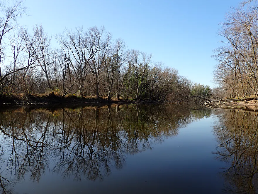
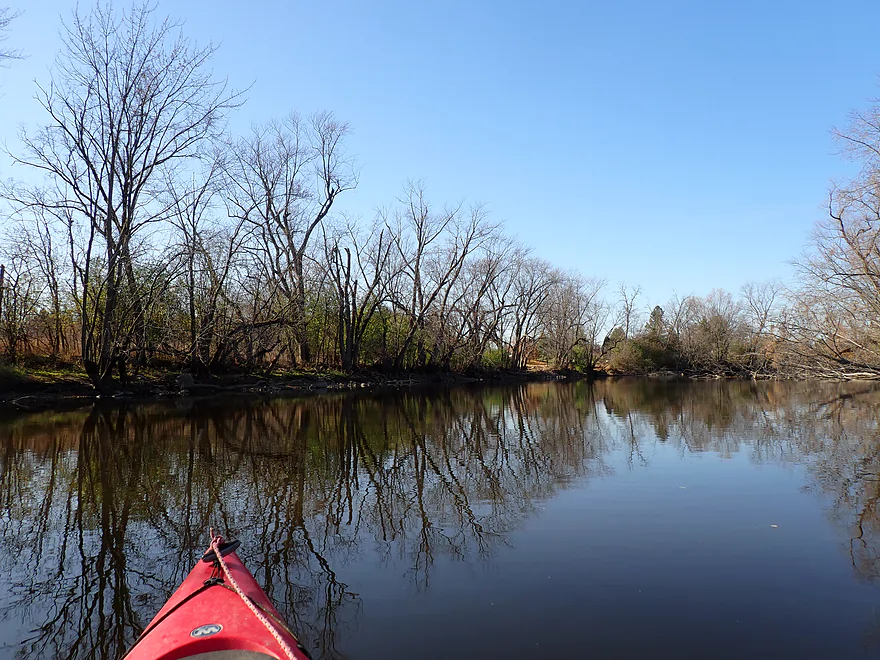
After Rockvale Road the river finally started to meander a bit and featured a scenic stretch of woods with cool mirrored reflections. It’s always a treat to do “mirrored kayak trips”, but typically you need sunny skies, little wind and not many leaves on the trees. The final stretch paralleled busy and obnoxious County Road F before I arrived at my take-out at the bridge.
In summary, this was a solid trip. I enjoyed its peaceful nature, occasional rocky banks and fantastic tree silhouette reflections. But it won’t be for everyone as the current was almost nonexistent, the water quality poor, and the shoreline scenery somewhat repetitive. If you’re just looking to get started kayaking the Upper Rock, I advise other legs instead which are more hilly and scenic. An example would be the stretch just upstream from Kanow Park, which is much more scenic and hilly.
Not much…just a few deer, squirrels and eagles.
Kanow Park: This is a terrific little park with convenient access to the river. Picnic tables and an outhouse are available. Note, the locals like to use this as a dog park (be mindful where you step). The park is gated and I believe shuts down at night and during floods. For more information, see Jefferson County Parks.
Alt Put-ins:
- Kaul Park (5.7 miles upstream from Kanow Park): This is a good public park, but is not as private or nice as Kanow. The leg between Kaul and Kanow is scenic.
- Wayside Park (0.9 miles downstream Kaul Park): Wayside Park is another good public access, but not as nice as Kanow Park. The stretch between Kaul and Wayside parks is also scenic.
Hwy F: This is a doable but not ideal bridge access. Hwy F is busy and the shoulders are steep. Probably the best access spot is along the northeast corner, but be mindful your car doesn’t block field access for the local farmer.
Alt Take-outs:
- Rockvale Road (2.4 miles upstream from Hwy F): This should be a better bridge access than Hwy F.
- Hwy P Landing (6.0 miles downstream from Hwy F): Hwy P is a great access. The stretch between Hwy P and Hwy F is slow but pleasant.
Bike Shuttle – Hwy F to Kanow Park: 3.7 miles with 46′ of ascent. This is a short and easy bike shuttle. Note though, Hwy 16 and Hwy F are busy, obnoxious roads.
Logjams/Dams: None…this is a very safe/easy river.
Wind: There wasn’t much wind during my trip (which contributed to the nice reflections). But this is an open river, so wind can be an issue. Be sure to monitor the weather forecast and avoid trips which involve a strong headwind.
Current/Rapids: Most of the trip was very slow with almost no current.
Nearest Gauge – Rock River @ Watertown: Trip was done at 170 CFS or 1.37’′. This gauge is downstream from several dams so may not be perfectly representative. The Upper Rock can be paddled both when low and high…but it is most attractive/scenic when low.
- < 100 CFS: This would be relatively low but still plenty navigable. This is one of the more drought resistant water trails in Southern Wisconsin.
- 101-200 CFS: Low depth but plenty navigable.
- 201-300 CFS: Slightly below average, but a good depth.
- 301-400 CFS: An average depth.
- 401-500 CFS: A higher depth, but still suitable for paddling.
- 501-800 CFS: This is a high depth, but the river should still be fine for kayaking.
- 801+ CFS: Maybe too high for enjoyable paddling?
Detailed Overview
East Branch:
- Upstream of Hillcrest Drive: I believe these portions are too congested to paddle.
- Hillcrest Drive to Hwy DW: 4.1 miles.
- Hillcrest Drive to Riveredge Park: 0.9 miles. Scenic stretch through the outskirts of Allenton with good clarity. However, there are two major logjams to portage and several minor logjams to squeak past.
- Riveredge Park to Hwy DW: 2.7 miles. An open stretch through wetgrass and a state natural area. One logjam needs to be portaged.
- Hwy DW to Hwy D: 5.5 miles. Outside of one nasty logjam cluster, this is a pretty open creek paddle through a protected wildlife area that might be decent.
- Hwy D Wayside to N. Pole Rd. Launch: 7.3 miles. A good wetland paddle prospect through Theresa Marsh. Maybe 1-2 downed trees on the upper part.
- Kohlsville River: Note, the Kohlsville River joins the East Branch here, but it seems too congested with downed trees to be feasible for paddling.
- N. Pole Rd to Gill Rd (East): 6.0 miles.
- N. Pole Rd Landing to River Edge Park: 1.3 miles. A slow, open, and marshy channel. Nice though.
- River Edge Park to Rock River Street/Dam: 0.5 miles. A nice town paddle through the community of Theresa. One dam to portage.
- Rock River Street/Dam to Hwy AY: 3.5 miles. One of my favorite stretches on the entire Rock River. While shallow in spots, it is scenic with nice woods, small boulder gardens and multiple light rapids.
- Hwy AY to Gill Road (East): 0.7 miles. A brief wooded stretch that is a nice paddle.
- Gill Road (East) to Hwy 67/Dam: 8.3 miles.
- Gill Road (East) to McArthur Road/Fink Creek: 4.7 miles. Starts boring, weedy, and slow, but gets nice with clear water and rocks later on. Gill Road (West) may be a viable halfway access.
- McArthur Road to Hwy 67/Dam: 3.6 miles. A less interesting paddle through a flowage and downtown Mayville with numerous alt take-outs.
- Hwy 67/Dam to Green Head Road Ramp: 6.4 miles.
- Hwy 67 to Hwy Y/Ziegler Park: 1.9 miles. One of the best paddling stretches on the entire Rock River with good current and small boulder gardens.
- Hwy Y to Hwy TW/Kekoskee Pond Ramp: 1.9 miles. A good stretch that includes a little bit of flowage paddling.
- Hwy TW to Green Head Road Ramp: 2.6 miles. An ok stretch as the river really slows and starts to turn into marsh.
- Green Head Road to N. Nebraska St. Ramp: 10.0 miles. The most popular route through Horicon Marsh. Known for its waterfowl.
South Branch:
- Upstream of E. Rock River Rd.: I suspect downed trees are too much of an issue for this to be navigable.
- E. Rock River Road to Hwy 49: 1.6 miles. Perhaps a cluster of downed trees in the middle and an electric fence upstream of Hwy 49.
- Hwy 49 to Waupun Park: 1.7 miles. Hwy 49 is not ideal for launching, but should be doable. A good prospect mostly through a golf course. Maybe 2 logjams?
- Waupun Park to E. Waupun Road: 7.2 miles. A good section.
- Waupun Park to Tanner Park: 3.1 miles. Great section though downtown Waupun. Alt access at Pine Street Park, Meadow View Park and Harris Mill Park.
- Tanner Park to Roadside Park: 3.2 miles. A pleasant paddle through a mixture of woods and open areas. A couple of logjam squeakers and one major portage.
- Roadside Park to E. Waupun Road: 0.9 miles. River widens, slows, and gets less interesting.
- E. Waupun Road to Dike Road: 10.0 miles. This is the northern unit of Horicon Marsh and is off limits to paddlers per National Wildlife Refuge rules.
- Dike Road to N. Nebraska St. Ramp: 5.6 miles. Am 80% sure you can drive on Dike Road from the east to launch in the ditch. Mostly a long, straight canal paddle through Horicon Marsh with perhaps interesting side canals to explore. You can also launch in a west canal by Burnett Ditch Road. The city of Horicon marks the confluence of the South and East Branches of the Rock River.
West Branch:
It’s a neat prospect, but I suspect the logjam situation is too much (I could be wrong).
Main Branch:
- N. Nebraska St. to Legion Park/Dam: 0.9 miles. An ok section through downtown Horicon.
- Legion Park to River Bend Park: 1.1 miles. Simple river segment…probably nothing too special.
- River Bend Park to Lions Park: 8.8 miles. A large and probably uninteresting flowage. If you get permission to take out at Ox-Bo Marine, you can avoid much of the flowage paddling.
- Lions Park to Elmwood Park: 7.2 miles. Trip starts nice with a great boulder garden, but becomes less interesting as the current dies.
- Elmwood Park to Hwy MM: 4.4 miles. An interesting prospect recommended by Frank Piraino.
- Hwy MM to Harnischfeger Park: 6.9 miles.
- Harnischfeger Park to Kaul Park/Hwy CW: 5.1 miles. Despite slow current and some motorboat traffic, this is a pleasant and relatively secluded stretch of the Upper Rock River.
- Kaul Park to Kanow Park: 5.7 miles. Despite a lack of current, dead trees, and some mud, this is a very nice leg and one of the better stretches on the Rock River.
- Kanow Park to Hwy F: 5.0 miles.
- Hwy F to Wayside Park: 0.9 miles. Short but scenic leg.
- Wayside Park to Rockvale Road: 1.9 miles. Slow, simple stretch but pleasant.
- Rockvale Road to Hwy F: 2.4 miles. Scenic leg.
- Hwy F to Hwy P: 6.0 miles. This isn't an elite trip with slow current and no exotic scenery. But it is pleasant and one of the nicer legs on the Lower Rock.
- Hwy P to Dam1st/Front St.: 5.6 miles. Probably an uninteresting flowage paddle.
- Dam(1st)/Front St. to Dam(2nd)/S. 1st Street: 2.6 miles. Possibly a unique paddle through downtown Watertown.
- Watertown Dam/1st Street to Cappie's Landing: 3.5 miles. A mediocre prospect.
- Cappie's Landing to Crossroads Landing: 9.3 miles. The put-in is SE of Hwy 26 via Jefferson Road. This segment is more undeveloped, but is still probably mediocre at best.
- Crossroad Landing to Hwy B Boat Launch: 1.6 miles. Maybe a boring mini leg...it does pass under busy I-94.
- Hwy B to Lubahn Park/N. Watertown Ave: 4.1 miles. Probably uninteresting.
- Lubahn Park to Tensfeldt Park: 2.3 miles. Paddling through downtown Jefferson might be unique, but there is a dam to portage. Many alt landings in Jefferson.
- Tensfeldt Park to Klement Park: 4.2 miles. Probably an uninteresting tweener section between Jefferson and Fort Atkinson.
- Klement Park to Lorman Bicentennial Park: 3.1 miles. A weak prospect through downtown Fort Atkinson.
- Lorman Park to Hwy 26 Ramp: 3.3 miles. A weak prospect.
- Hwy 26 to E. Knudsen Road Ramp: 11.8 miles. Mostly boring paddling on Lake Koshkonong. Many other launches on the lake.
- E. Knudsen Road Ramp to Hwy M/Dam: 3.4 miles. Boring flowage.
- Hwy M/Dam to Hwy 14: 8.2 miles. Probably uninteresting.
- Hwy 14/Rock River Park to Centerway Dam: 4.7 miles. This is a slow impounded stretch that flows through the north end of Janesville. It does include some nice parks and wooded hills, but also many piers, riverside developments, and motorboat traffic. There are many intermediate access points to choose from (see overview map for details).
- Centerway Dam to Afton Boat Launch: 2.9 miles. An interesting leg through Janesville's revitalized riverfront. Highlights include unique bridges, building art, some rapids, a cave, good waterfowl and a recently removed dam. This section can be tricky if not dangerous due to fast currents (especially when water levels are high). There are many alternative access points to choose from that aren't listed.
- Afton Boat Launch to Happy Hollow Park: 7.8 miles. A mediocre section with wooded banks, but mostly beat-up flood-bottom trees. The river here is mostly free flowing and not impounded by any dams.
- Happy Hollow Park to Preservation Park Boat launch: 3.2 miles.
- Preservation Park to Wooton Park Boat Ramp: 3.0 miles. Start of urban paddling in Beloit. Numerous other launch options in Beloit proper.
- Further Rock River Trips: From here on, you are in Illinois. For further information see “Paddling Illinois” or Rockrivertrail.com.
Trip Map
Overview Map
Video
Photos Size:
I’m just glad someone is getting out for some paddling. My season ended because of a double hernia surgery but I’m raring to go next year. Thanks for allowing me to paddle vicariously while I heal up!
Good luck with your surgery recovery. When you’re healthy, the Upper Rock is definitely worth checking out.
Thanks