
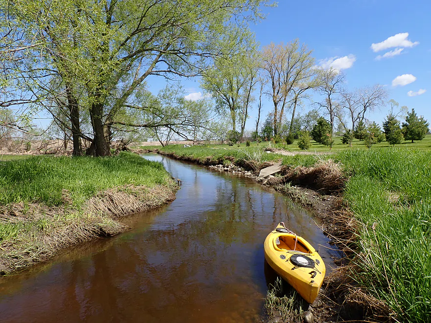
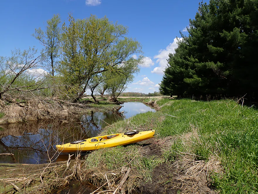
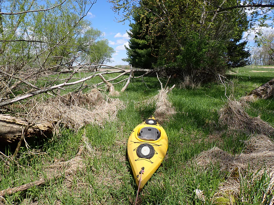
Starting the trip at Cty Rd DJ
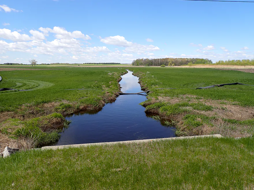
View upstream from bridge (heavily ditched)
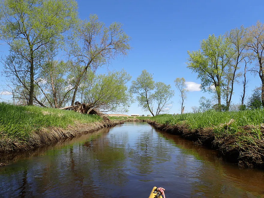
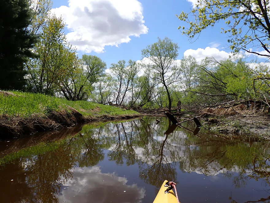
Trip starts pleasant
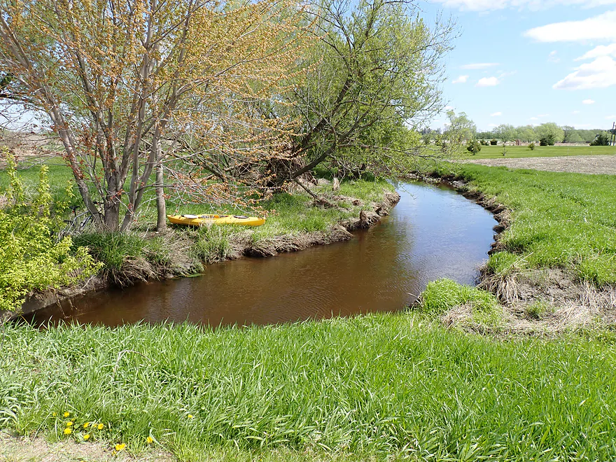
Nice small creek scene
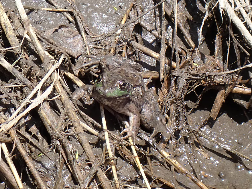
Good camouflage…only the green lips stand out
First part of the trip was artificially straightened
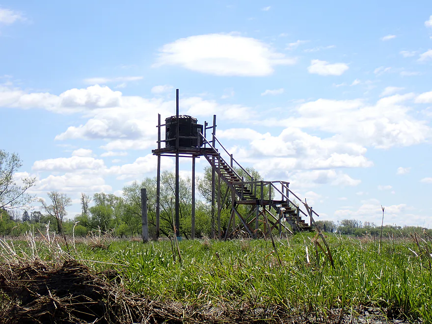
A two story hunting blind
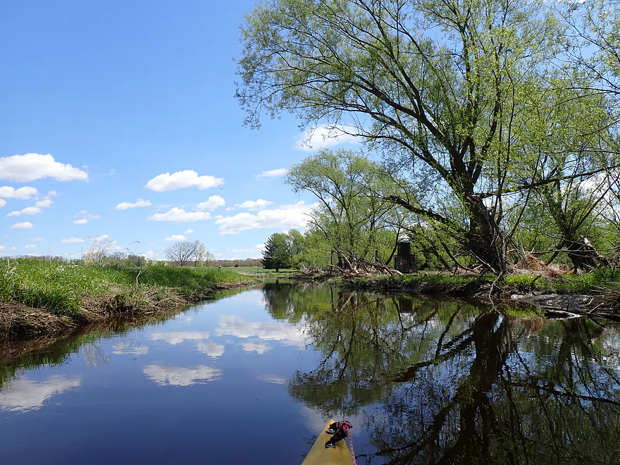
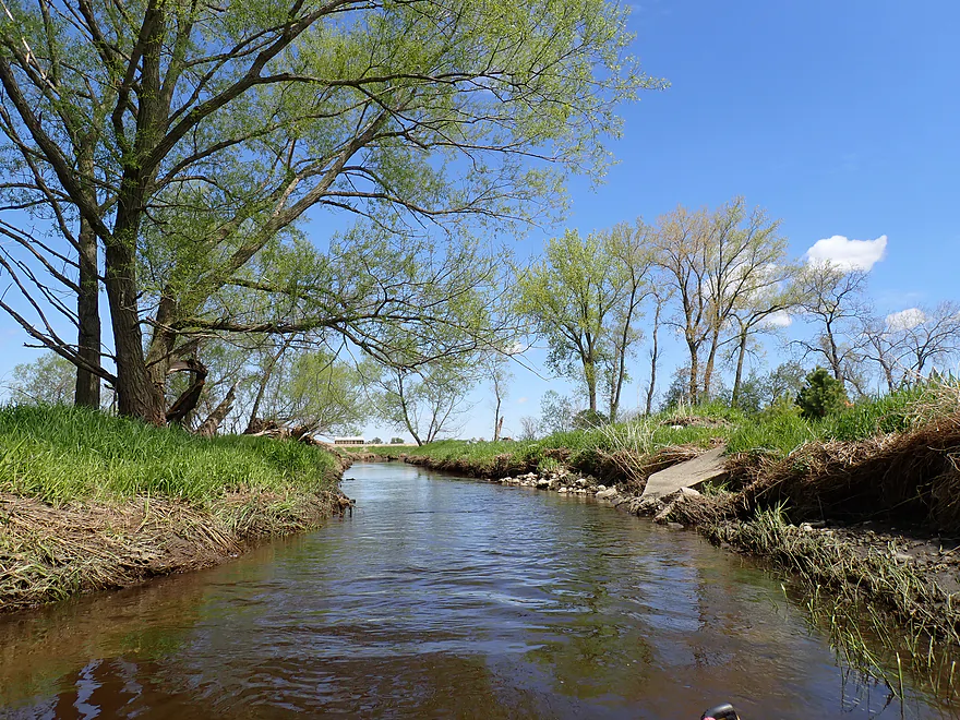
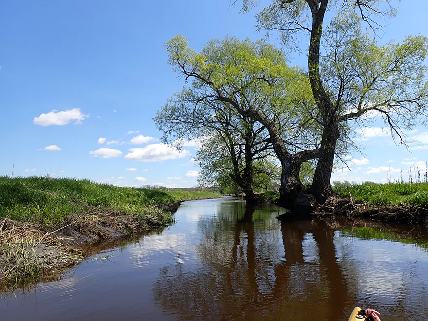
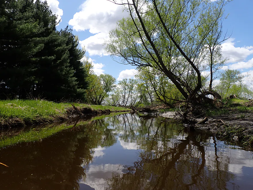
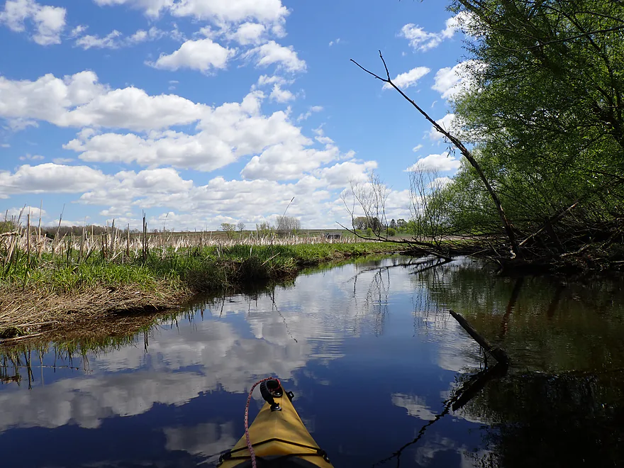
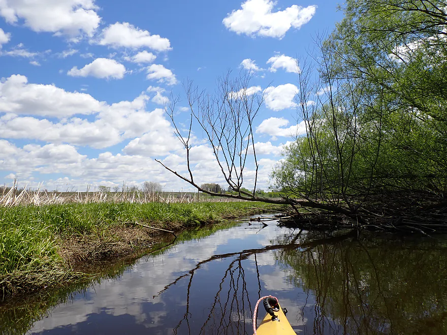
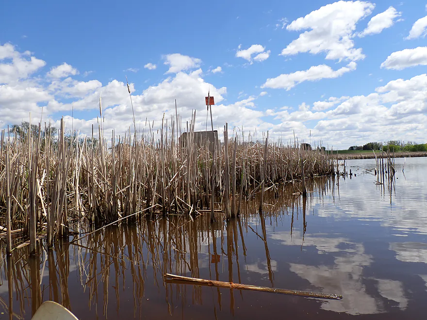
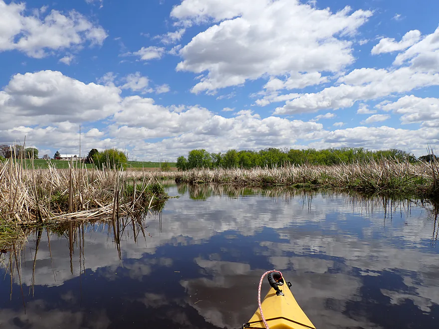
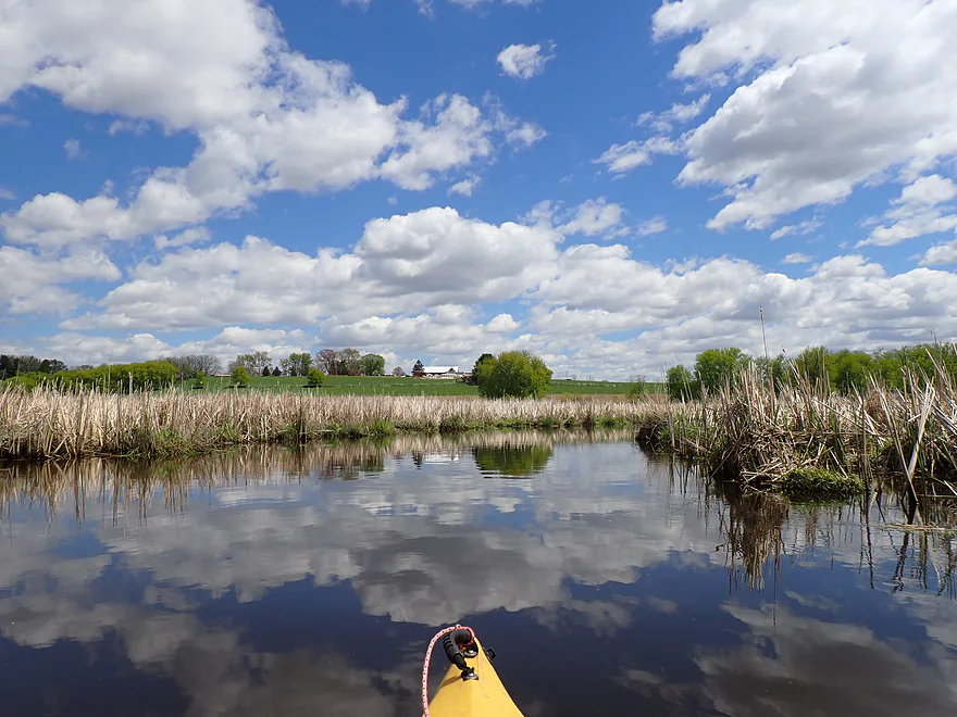
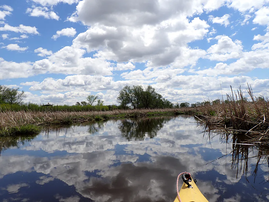
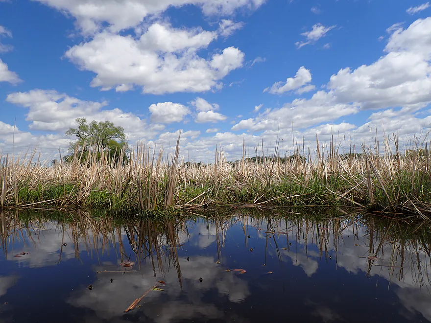
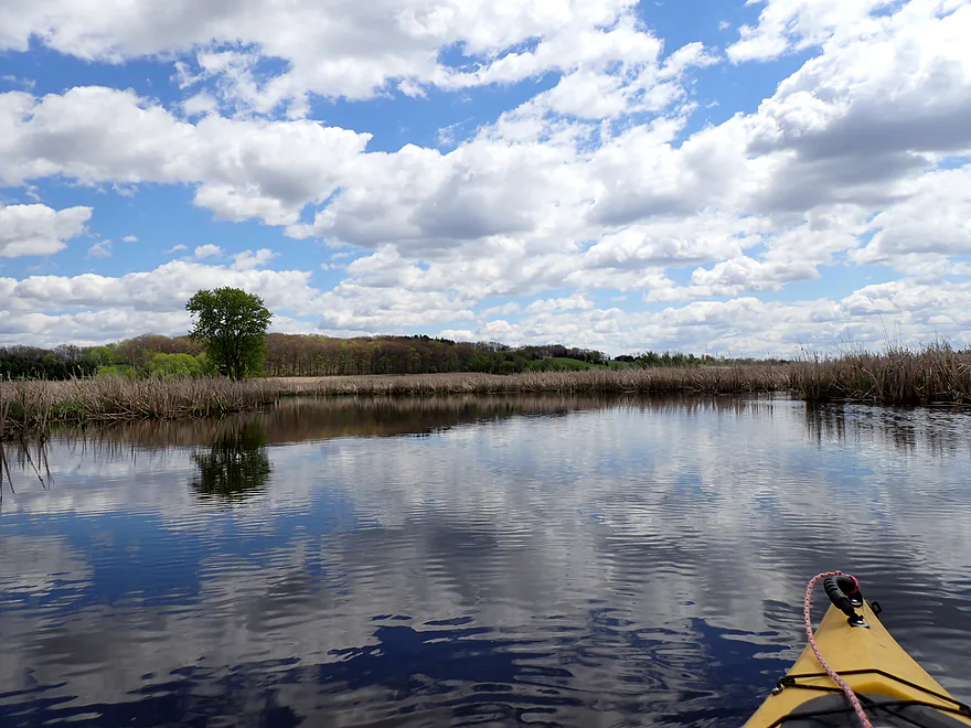
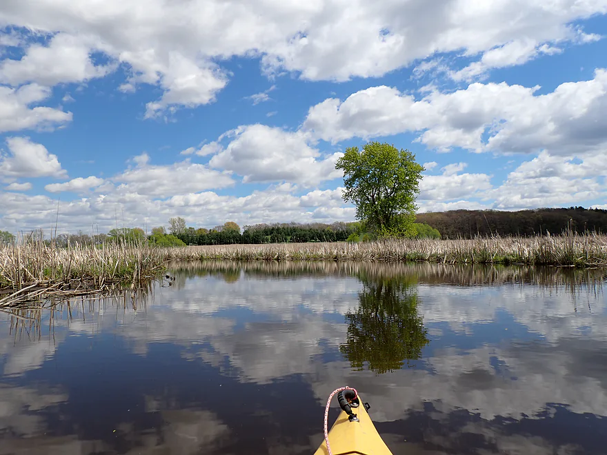
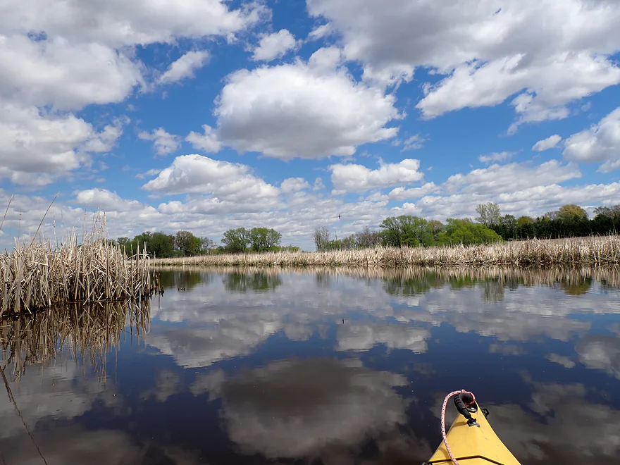
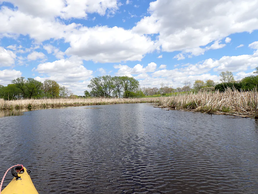
Nice reflections when the wind died down
A tributary significantly enlarges Dead Creek
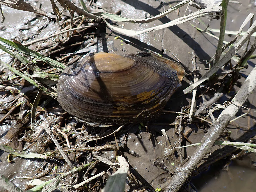
Surprised to see clam shells in the creek
Mostly open trip, but there was a brief congested spot
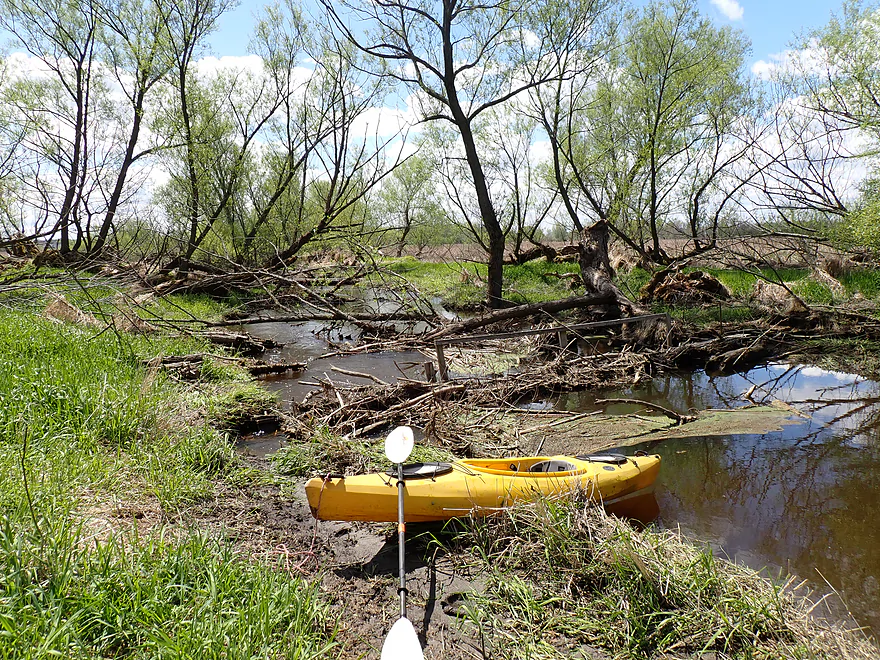
Only logjam portage
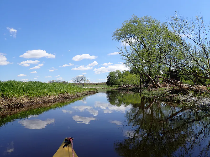
View upstream
Bit of a longer portage, but doable
Final section of wetgrass
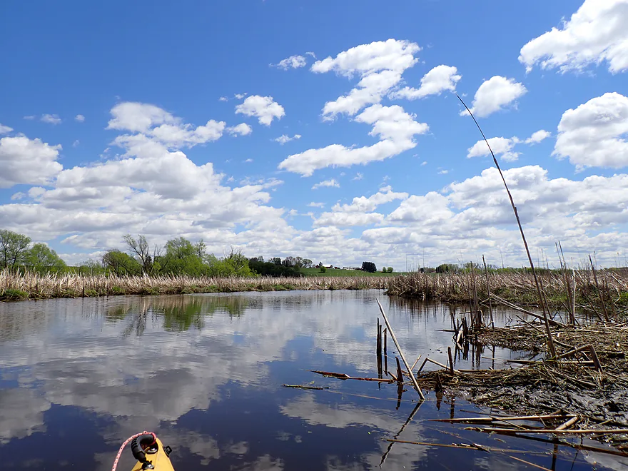
Rest of the trip was through a cattail marsh
One of many hunting blinds
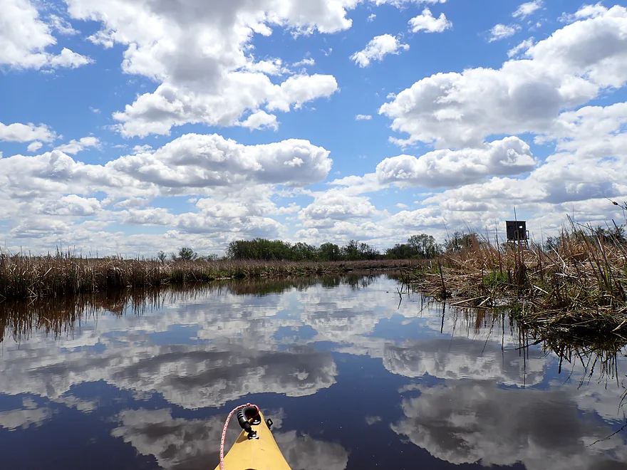
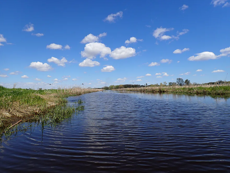
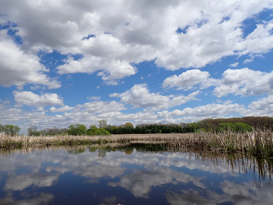
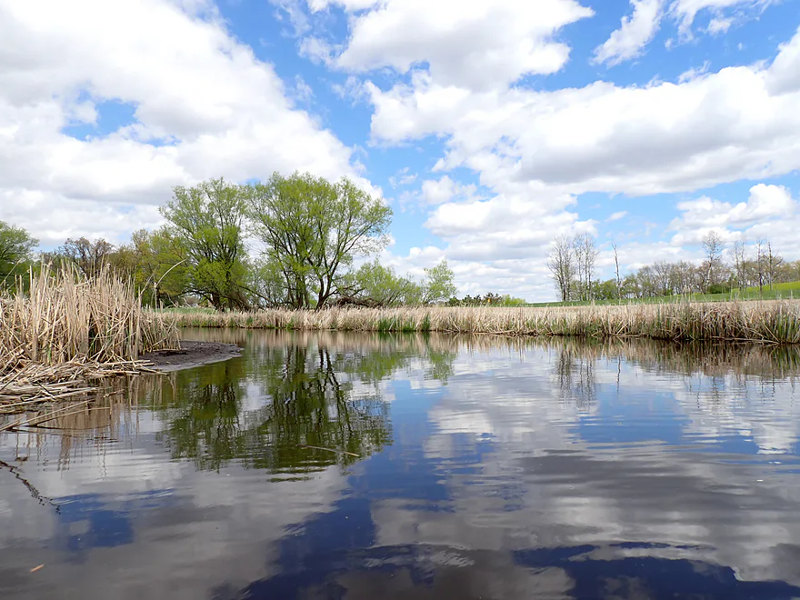
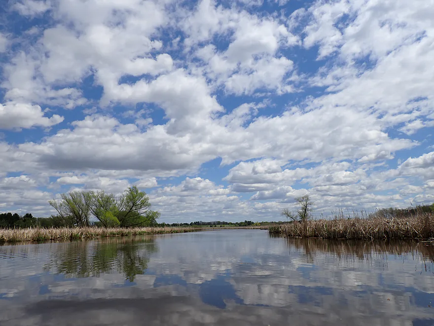
It was a great “white poofy cloud” day
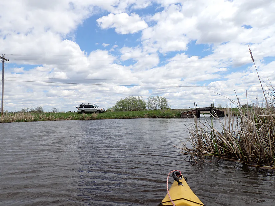
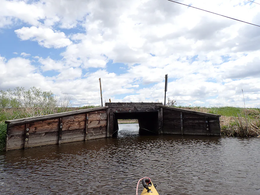
Bridge to nowhere
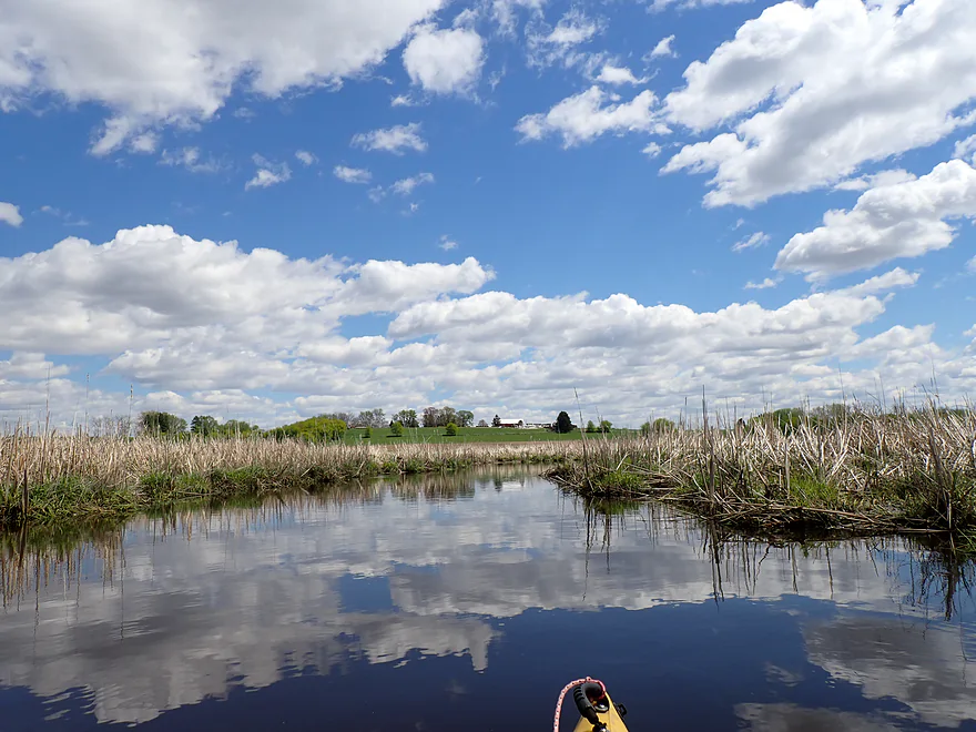
Cool drumlin in the distance
Cattail corridors were scenic
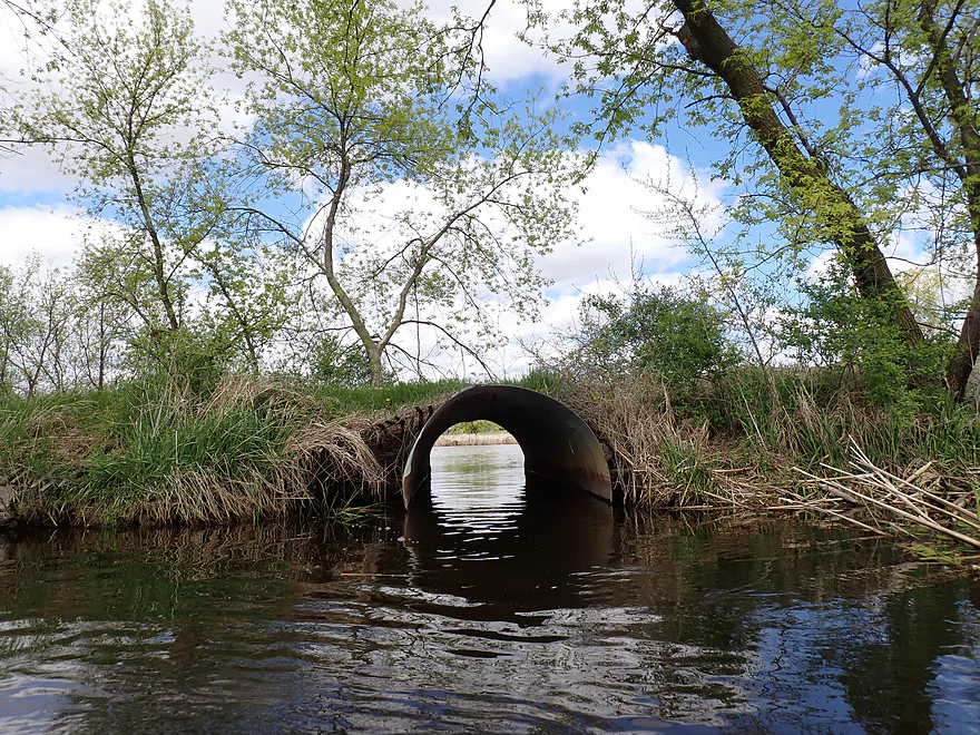
Local culvert
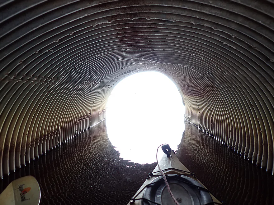
Easy to get through
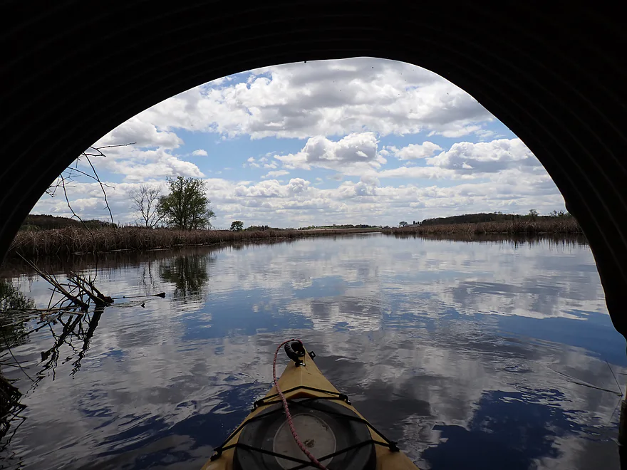
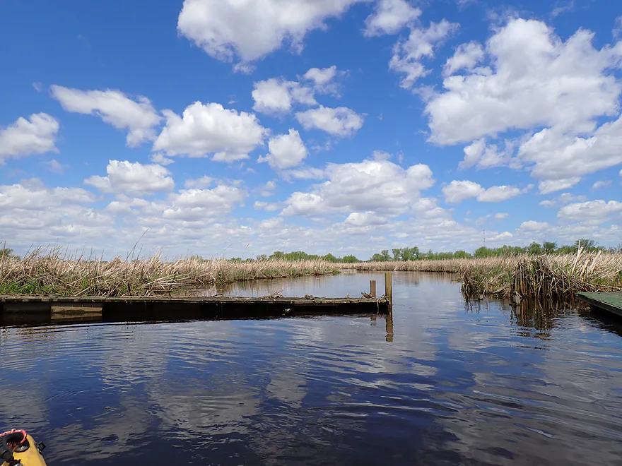
Framed view
Lots and lots of cattails…I’m not complaining though
Another drumlin in the distance…this one will redirect the creek north
I took countless mirrored cloud photos…
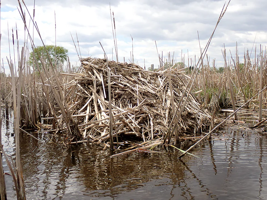
Muskrat lodge
St. Helena Road is an access option, but not recommended
Final stretch
Arrowhead Trail
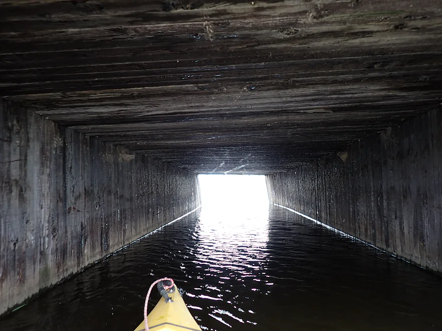
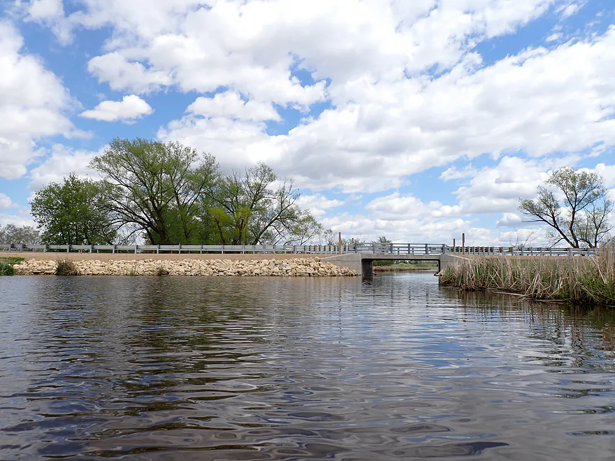
Historic all wood bridge
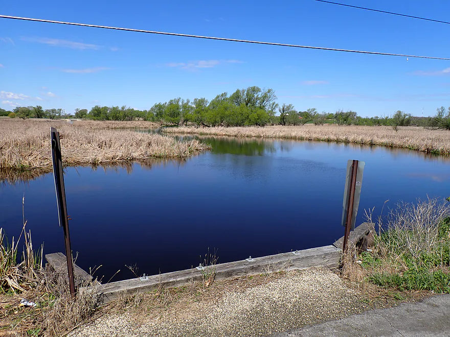
Decent bridge access
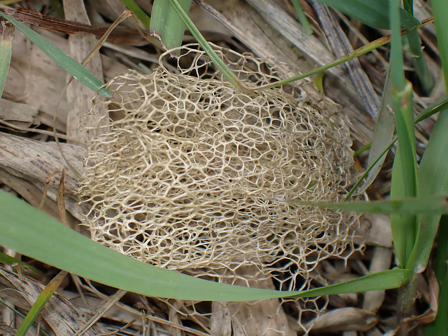
Wild cucumber skeleton
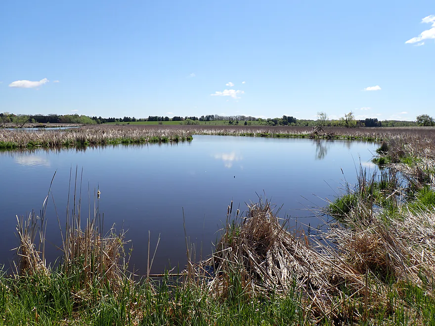
Final view upstream
View downstream (beyond the drumlin is Sinissippi Lake)
Dead Creek

If you spend enough time staring at satellite maps of southeast Wisconsin, you realize just how deceptively big the Rock River watershed is and how many obscure tributaries it has that rarely see a kayak. My plan was to explore a number of these, starting this week with the curiously named “Dead Creek.” It is a quintessential Dodge County stream, beginning as a maze of agricultural drainage ditches where it’s hard to tell exactly where the ditches end and the creek truly begins. However, as it nears its mouth on Lake Sinissippi, the creek widens into a legitimate, surprisingly navigable route.
I started the trip on a suspiciously straight section, likely ditched by farmers to maximize acreage. While the water carried the typical turbidity of spring runoff, the real story was happening on the streambed. I was surprised by the sheer number of rocks and glacial erratics scattered throughout the channel. This area sits on a ground moraine left by the Green Bay Lobe. These stones are “souvenirs” the glacier dragged from the north and dumped here as the ice stalled and melted thousands of years ago.
The creek eventually made a sharp, artificial 90-degree turn to the south, and the scenery shifted along with the direction. It was here I encountered the trip’s only real hurdle, a cluster of logjams, although I was able to bypass the entire mess with a single portage. As I got back on the water, the nice rocks and gravel from the upper stretch vanished and were replaced by muddy wetgrass and a mix of cattails. Fancy hunting lodges began to line the banks, and their presence was marked by a steady parade of “No Trespassing” signs.
The muddy banks gave way to very flat and open scenery, dominated by cattails. In the distance I could see attractive drumlin hills that pointed almost due south. Dodge County has one of the highest concentrations of these hills in the world, and on relief maps they stand out like a pod of whales all swimming south. These wooded glacial hills offered a stark contrast to the flat lowlands of the marsh. It was a “white poofy cloud” day, and the reflections on the water looked really cool as the current finally “died.”
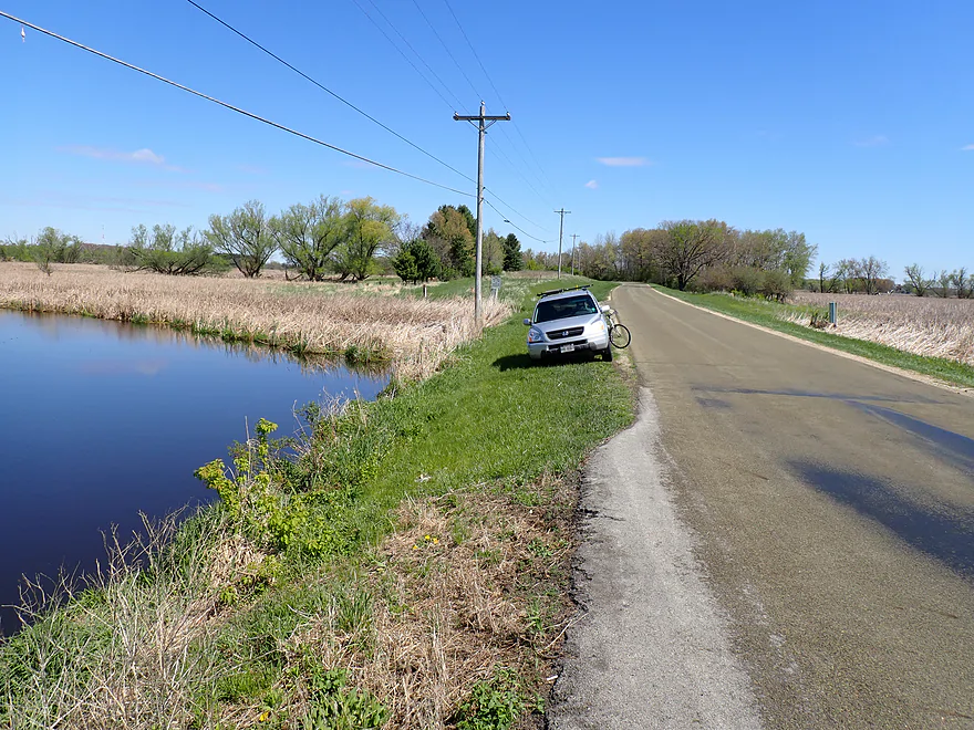
Instead of stopping at St. Helena Road, I paddled the final 1,700 feet to the next bridge at Arrowhead Trail. Here the creek felt almost like a lake…wide and slow, with carp splashing among the cattails. Arrowhead Trail itself passes over a unique and historic wooden bridge, which looks cool, although it is a bit concerning to think about all that creosote leaching into the Rock River watershed. The shoulder access by the bridge was pretty good and gave me one last terrific view of the marsh as I packed up my gear.
It was an enjoyable day on the water, especially with those great white poofy cloud reflections in the marsh (see photo gallery). That said, if you are looking for a creek/marsh combo paddle, I think Alto Creek (my trip from two weeks ago) was a nicer experience. Most paddlers will likely continue another 0.7 miles past the bridge to the mouth on Lake Sinissippi and then 1.5 miles along the lake to a public landing. But I decided to end my trip at Arrowhead Trail because I am not a fan of big-water paddling and preferred the quiet surroundings of the creek.
Ledge Park: Just a short distance up the map, this county park, located on the Niagara Escarpment, has a fantastic view of Horicon Marsh.
Sights included clam shells, cranes, lots of deer, geese, ducks, a raccoon, and several carp.
Cty Rd DJ: This is an ok bridge access.
Alternate Put-ins:
- Eagle Road: (3.3 miles upstream from DJ) I did scout this bridge and you could likely launch here, but the subsequent creek is heavily ditched and small (perhaps only floatable in high water). There might be some nice spots, but I wouldn’t consider it a marquee paddle.
Arrowhead Trail: This was a good bridge access.
Alternate Take-outs:
- St Helena Rd: (0.3 miles upstream from Arrowhead Trail) While technically an option, the shoulders are quite steep for parking. Since Arrowhead is so close and offers much better access, I’d skip it.
- Harvest Island Launch: (2.2 miles downstream from Arrowhead Trail) I suspect most paddlers will actually prefer this route. Extending your trip to Harvest Island adds 1.3 miles of beautiful cattail marsh followed by a 0.9-mile open-water paddle across Sinissippi Lake.
- Neider Park: (3.0 miles downstream from Arrowhead Trail) Located on the south end of Sinissippi Lake near Hustisford, this is a viable option if you want a longer day on the water, though it involves more lake paddling.
Bike Shuttle – Arrowhead Trail to Cty Rd DJ: 3.7 miles with 49′ of ascent. Aside from one hill and some fast traffic, this was an easy bike shuttle.
Current: It starts slow, but by the time it enters the cattails, it pretty much dies.
Logjams: The trip was fairly open with only a few minor snags that were easy to bypass. However, I did encounter a pair of logjams that required a portage (marked on the map). These are close enough together that you can bypass both in a single haul. I thought this was a medium-difficulty portage on the north bank, but in hindsight, the south bank looked much easier and is likely the better option.
Wind: Because the creek flows through open marshland, there is almost no wind cover. I would recommend crossing this trip off your list if the forecast calls for strong headwinds.
Closest Gauge: Beaver Dam River @ Beaver Dam
Trip Depth: 380 CFS or 841.02′
Navigability Estimates:
- < 100 CFS: Likely too shallow for a comfortable trip.
- 101-250 CFS: Average depth. Most of the creek will be plenty deep, though two shallow, mucky stretches may require some “paddle poling” to navigate.
- 251-500 CFS: High-ish depth. A good target range. Again, most of the creek is plenty deep, but there were two shallow spots (not horribly difficult to get past at 380 CFS).
- 501-800 CFS: Pretty high depth. Still fine for paddling.
- 801-1100 CFS: Extremely high depth. Some of the creek banks might overflow, but the channel should still be navigable (most marsh paddles are quite flood-resilient).
- 1101+ CFS: “Mega flood” levels. You can likely still paddle the creek and marsh; in fact, Sinissippi Lake would likely be under no-wake rules at these depths, which is a nice bonus for those wanting a quieter, longer trip.
- Eagle Road to Cty Rd M (0.5 miles): Small, narrow, and somewhat ditch-like with potentially one logjam. Cty Rd M is not a recommended bridge access.
- Cty Rd M to Cty Rd DJ (2.8 miles): This stretch appears narrow and straightened. You may encounter a logjam and a few low bridges, though it does feature some nice sections and even a natural spring.
- Cty Rd DJ to Arrowhead Trail (2.9 miles):
- Cty Road DJ to St. Helena Road (2.5 miles): Starts as a straightened creek before morphing into a slower cattail marsh. The scenery is surprisingly nice, offering good views of the adjacent drumlins. One logjam cluster requires a portage.
- St. Helena Road to Arrowhead Trail (0.3 miles): A short, slow “tweener” stretch between bridges with attractive marsh scenery.
- Arrowhead Trail to Sinissippi Lake Mouth (1.3 miles): This final stretch of the creek features more beautiful marsh scenery.
- Take-out options on Sinissippi Lake:
- Mouth to Harvest Island Launch (0.9 miles): This is an excellent public access point for finishing the trip.
- Mouth to Neider Park (1.7 miles): Alternatively, you can paddle south for a longer extension and take out closer to Hustisford.
Trip Map
Overview Map
Video
Photos Size: