
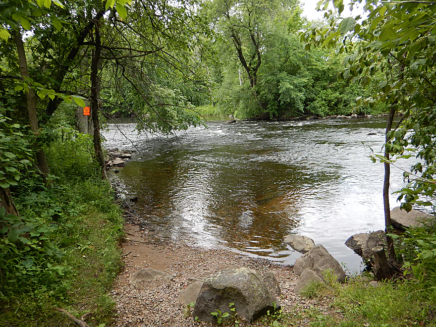
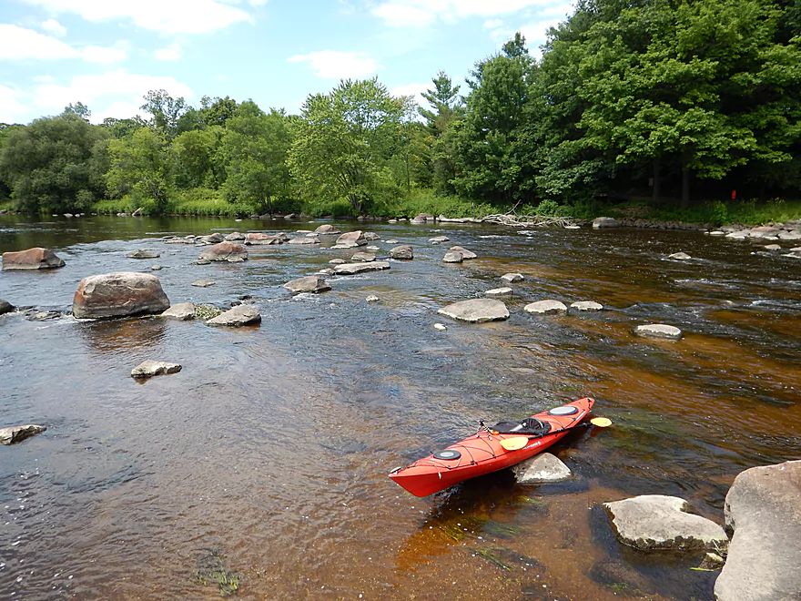
Nice put-in at highway BB
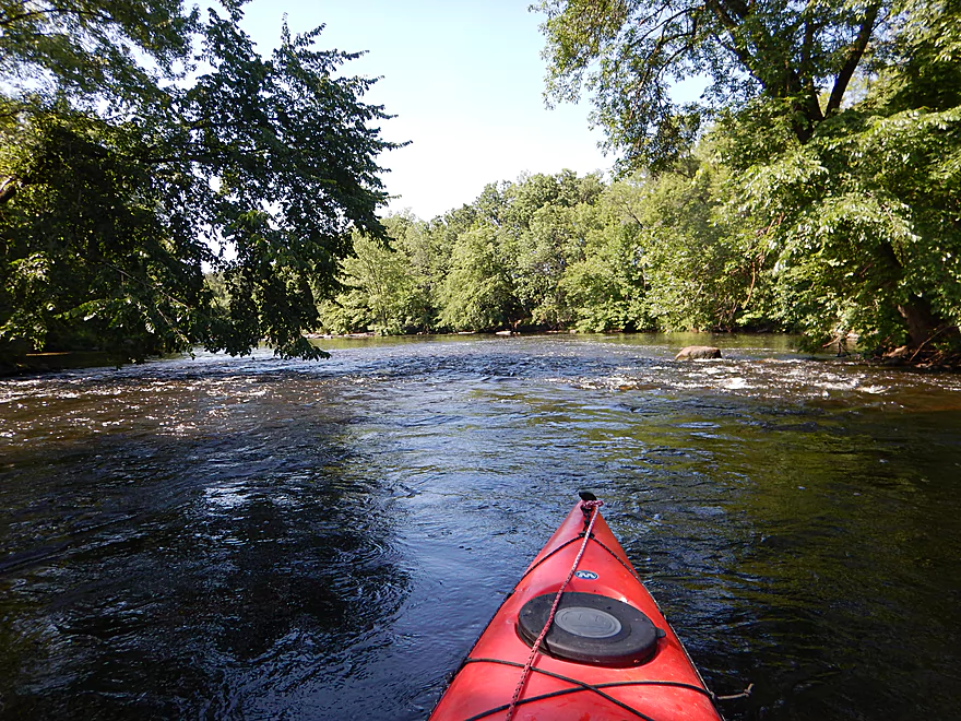
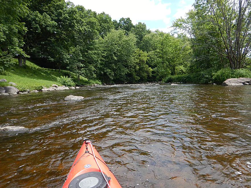
Fun riffles to get things started
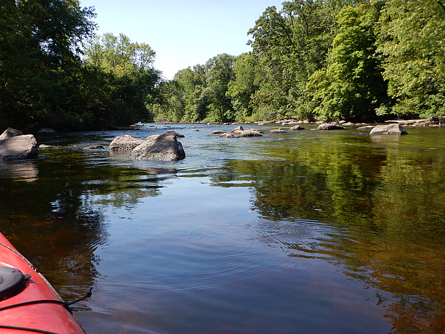
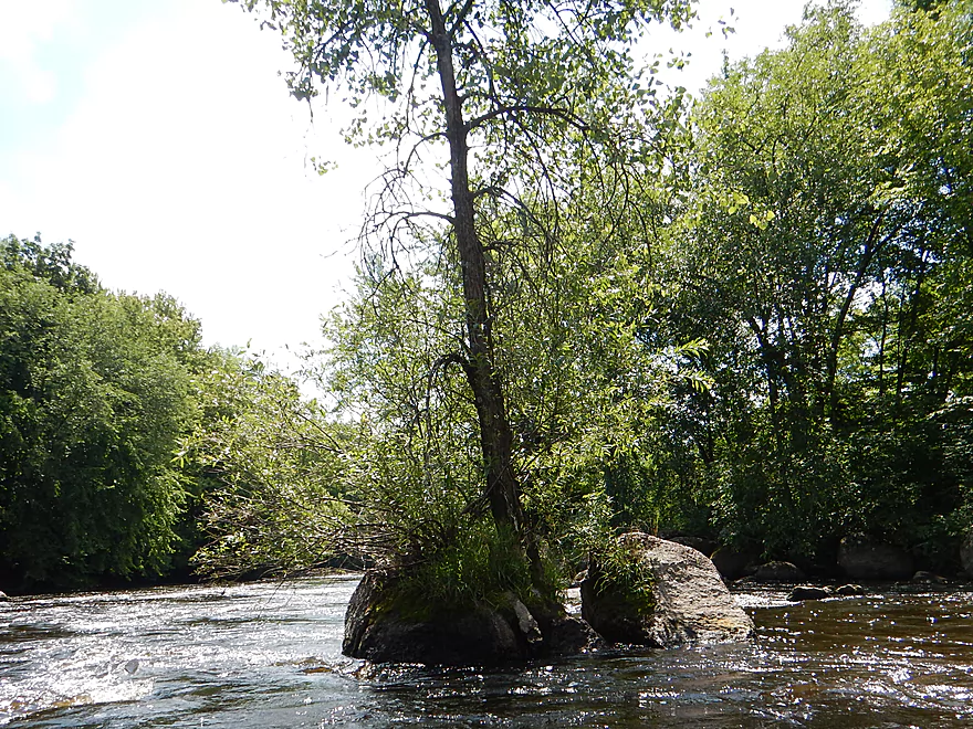
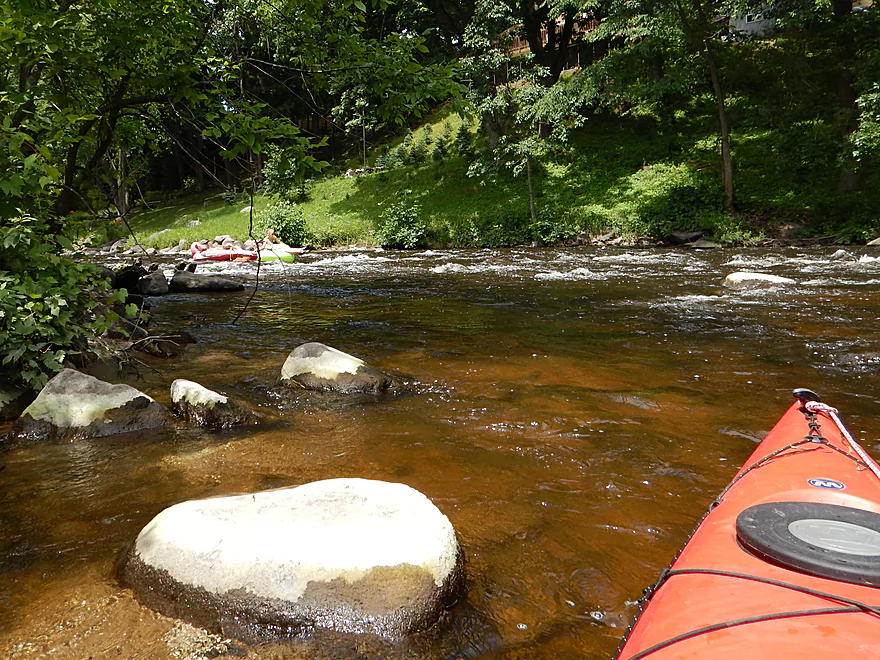
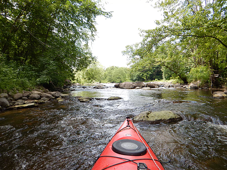
Nice little boulder garden
Current stays swift in the first half mile
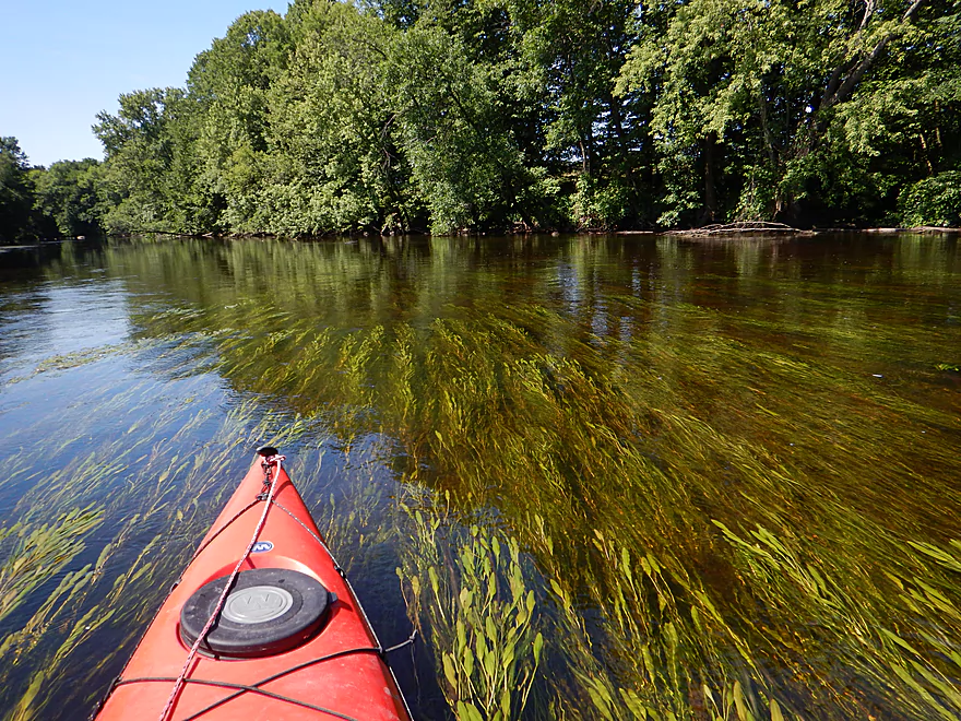
Gorgeous pondweeds
Ha ha…
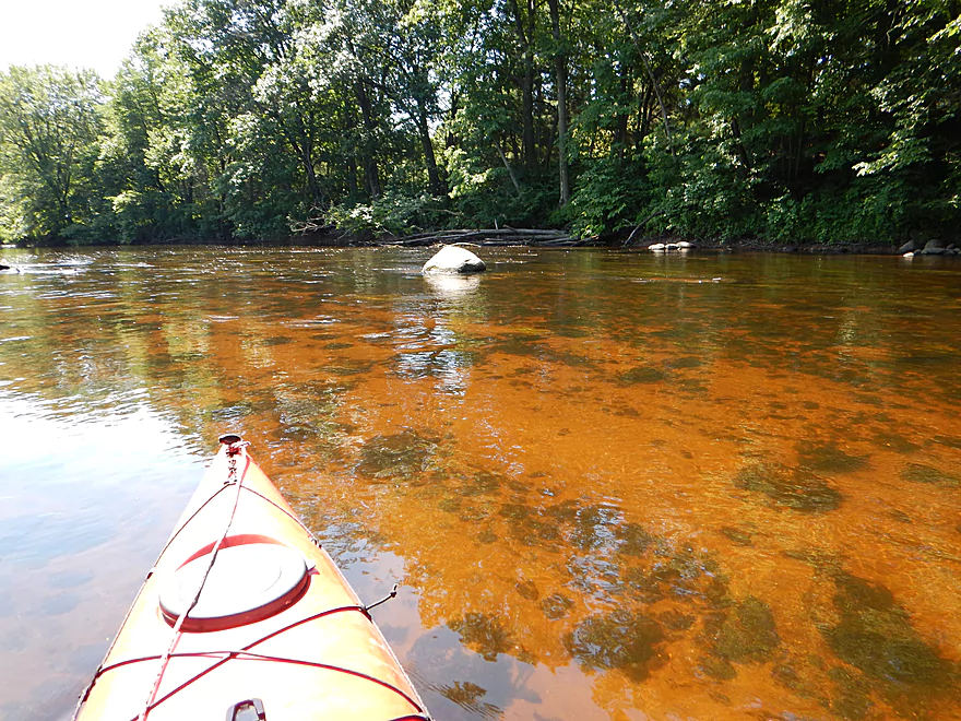
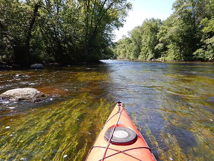
At times really good clarity
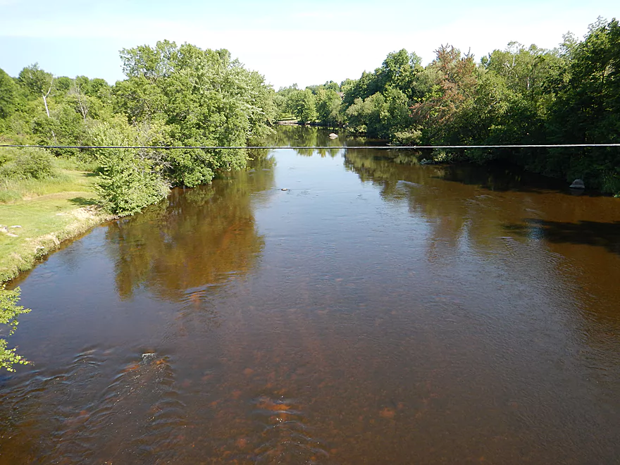
The South Branch comes in and significantly increases the channel
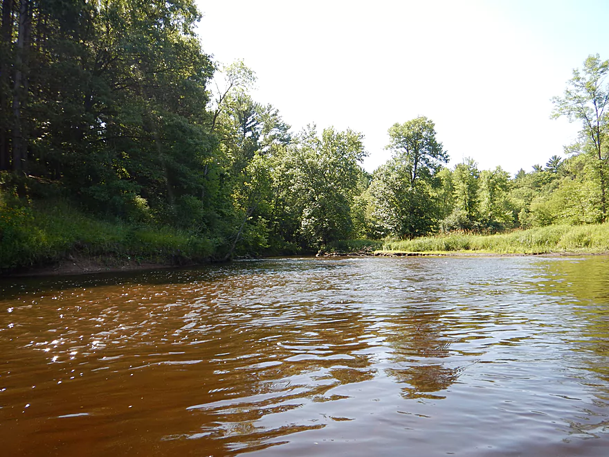
Things really slow down after that
Still nice boulder gardens
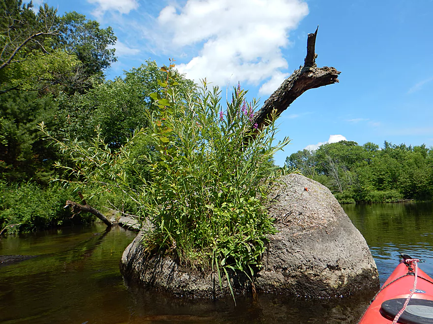
Flowers growing out of a rock
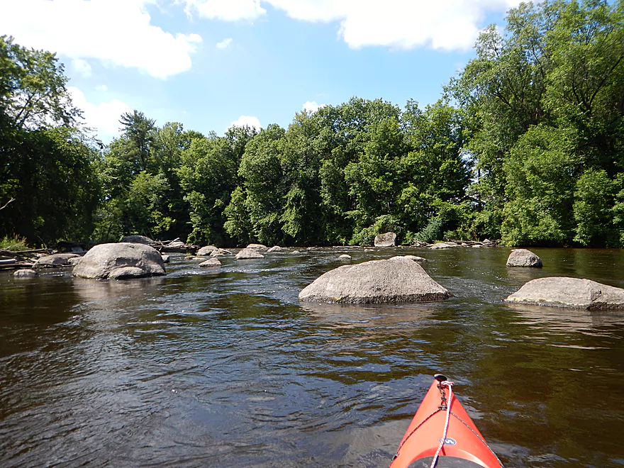
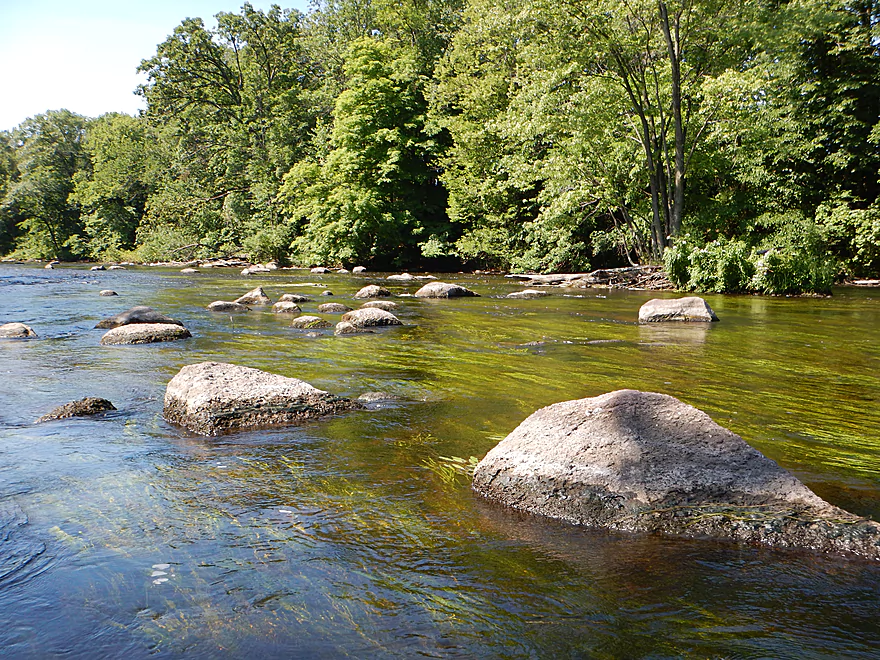
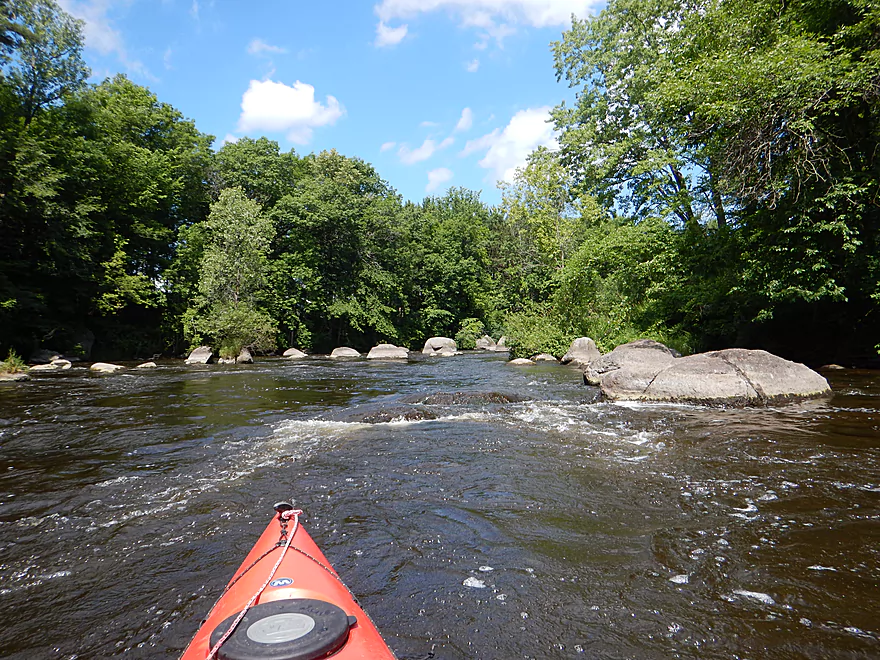
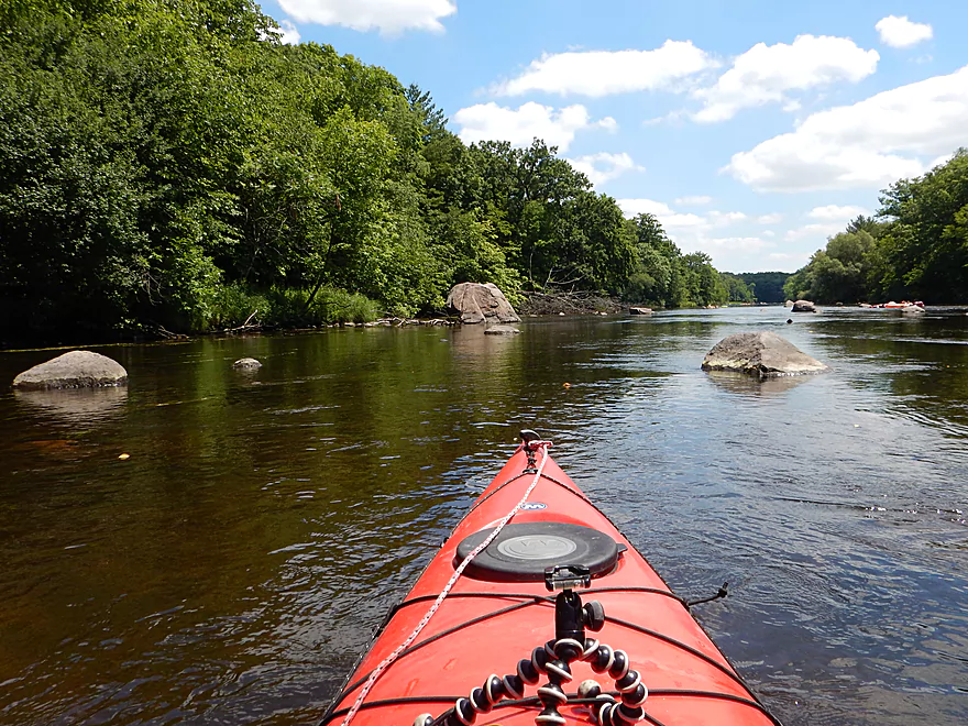
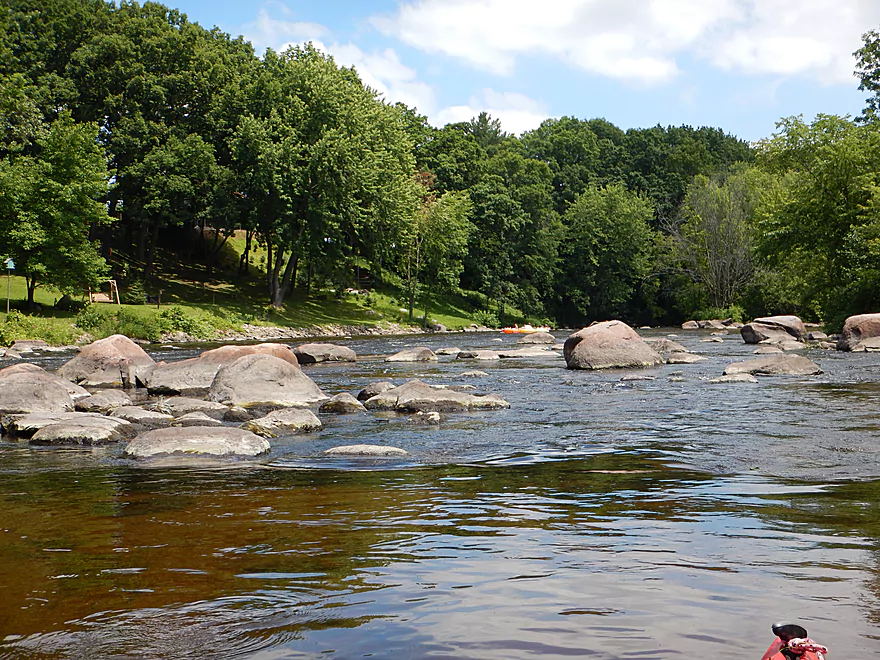
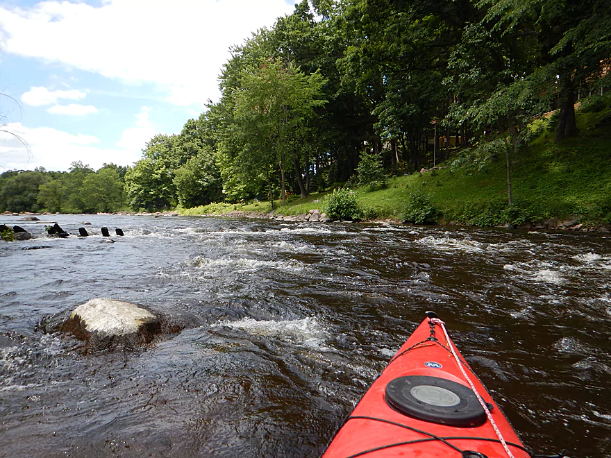
Entering one of the nicer boulder fields
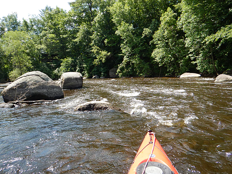
Some fun class 1 rapids
Reverse view
It appears the tree split the boulder
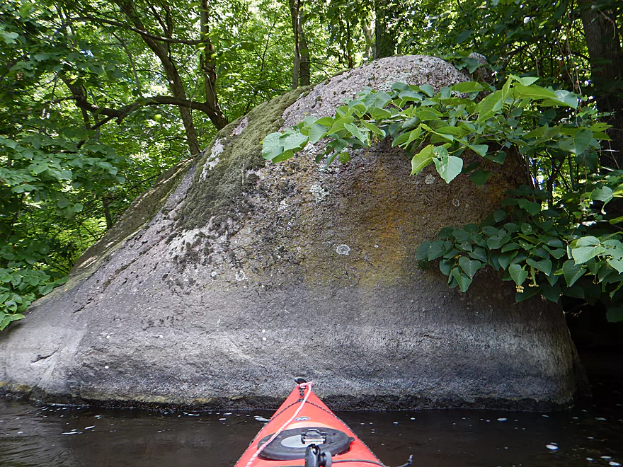
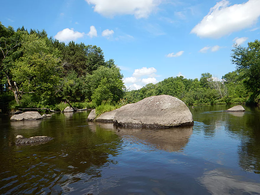
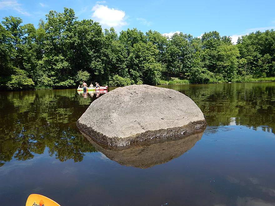
There are some big boys on the river
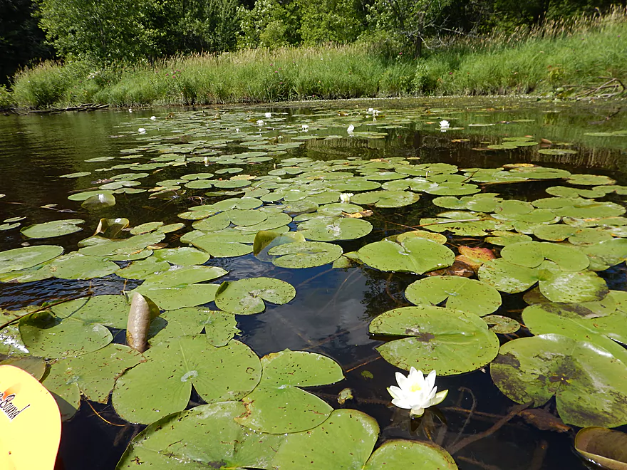
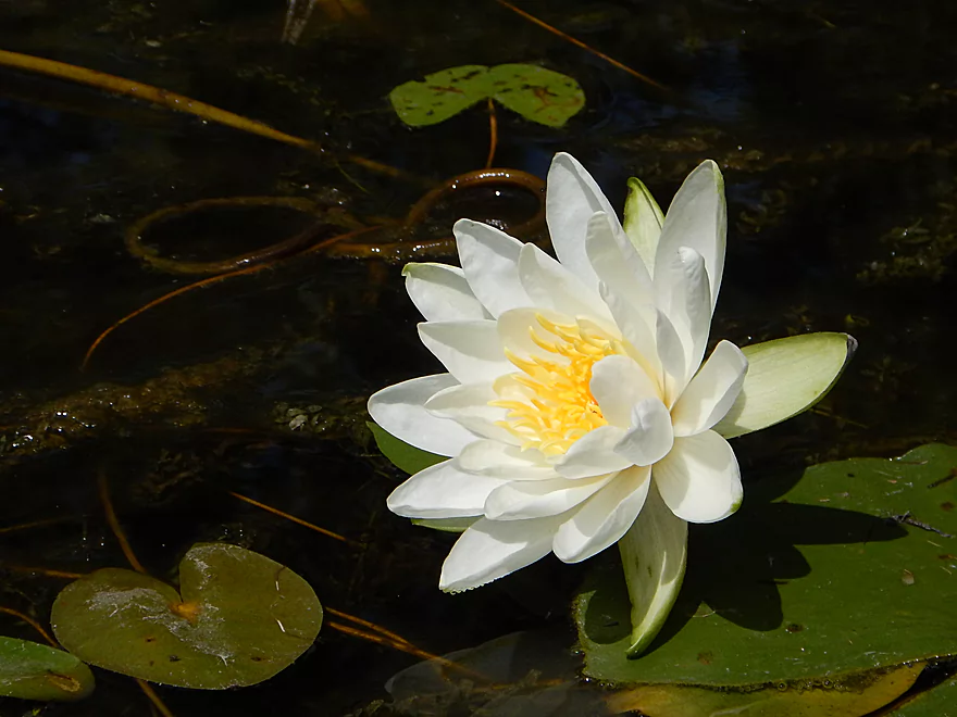
Lily fields in bloom
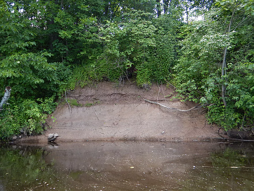
Interesting mass of clay
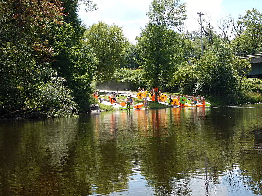
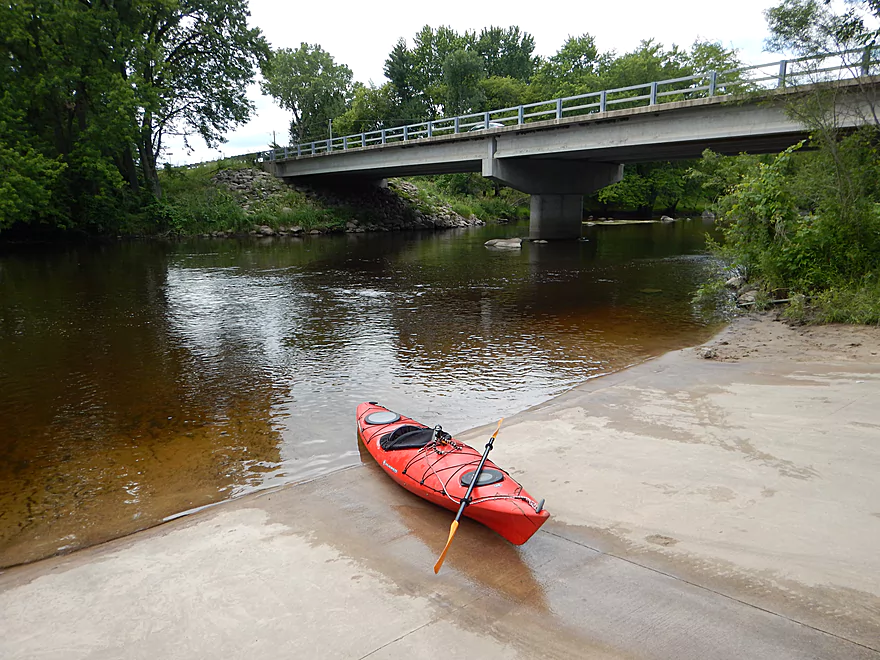
A large private ramp at Royalton for tubers
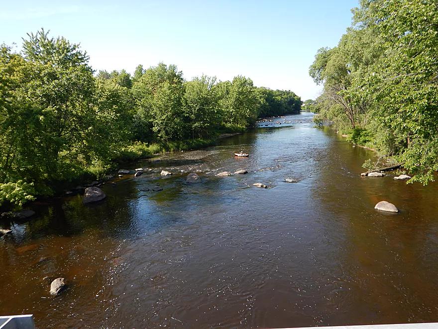
Looking upstream
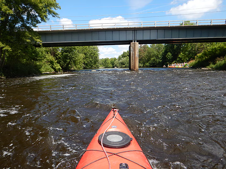
Easy rapids under Hwy 54

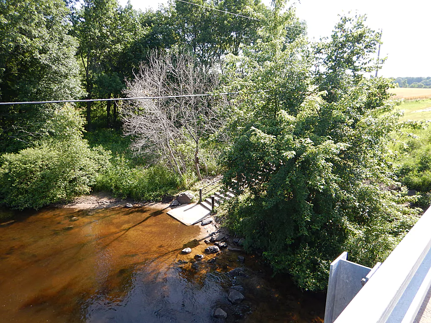
The public access for paddlers is more humble
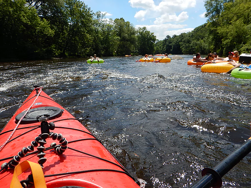
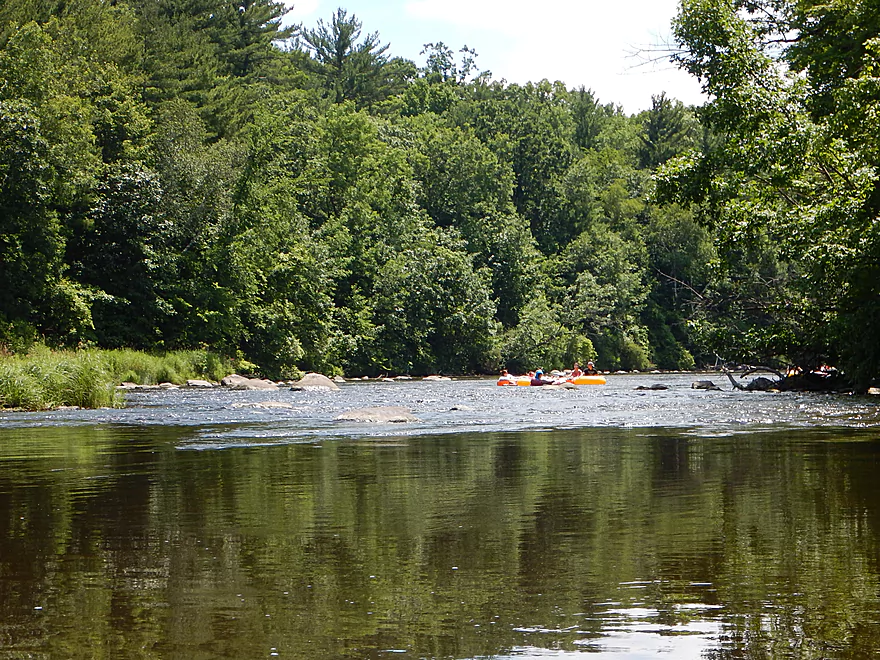
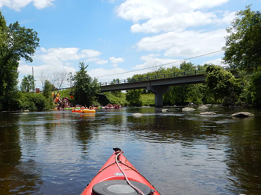
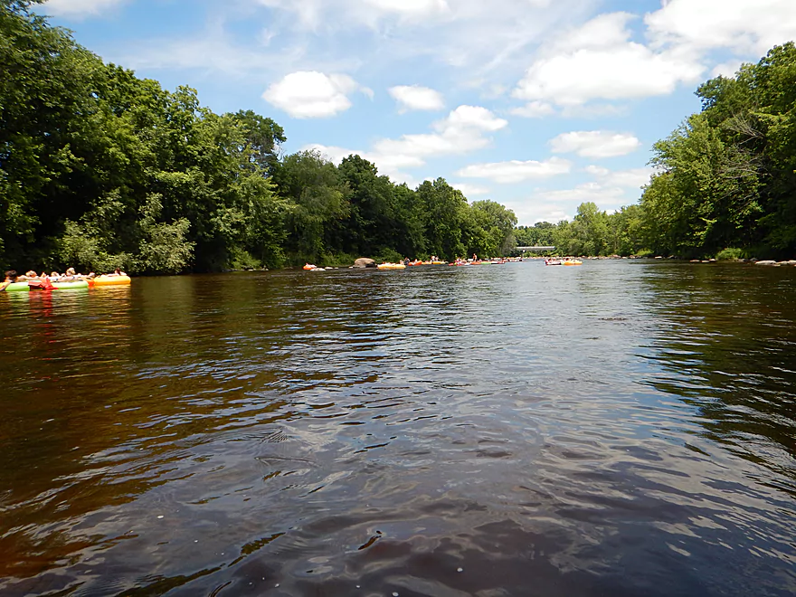
After Royalton, tubers dominate the water
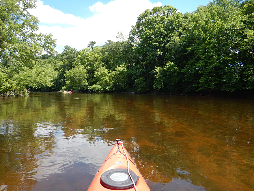
Decent number of homes along the river, which is unfortunate
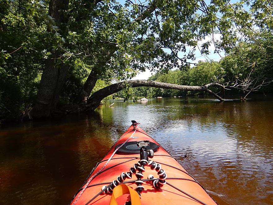
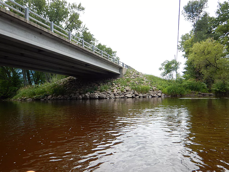
Paddling under the arch
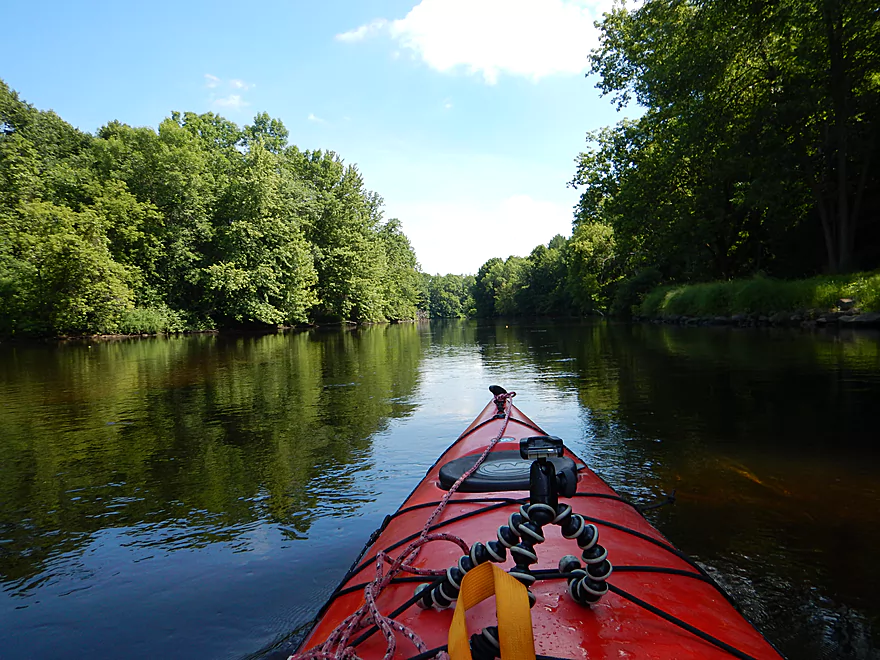
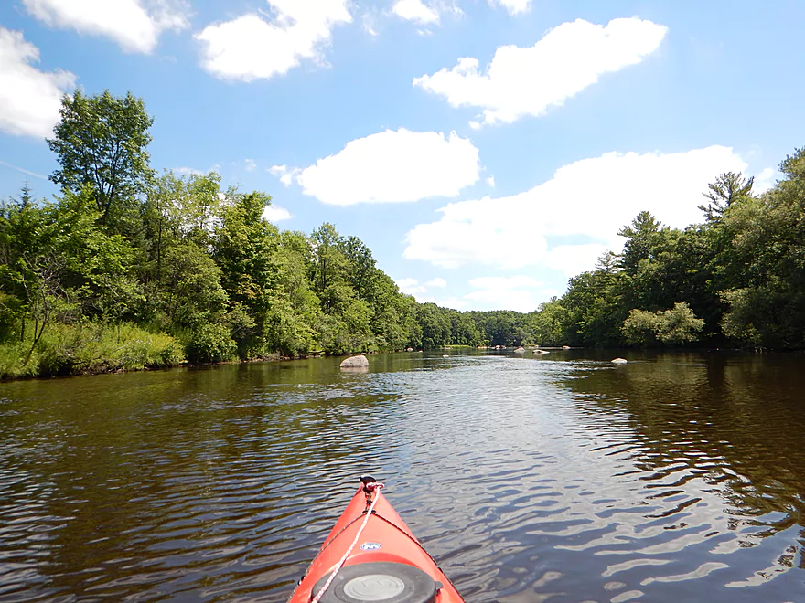
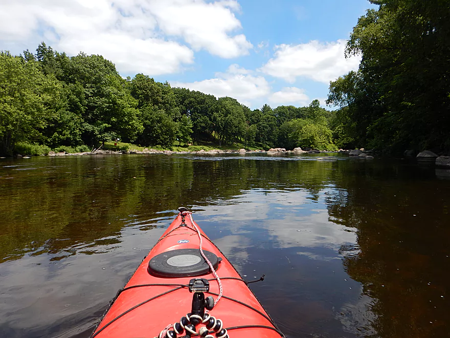
Slow, wide channel made more interesting by random rocks
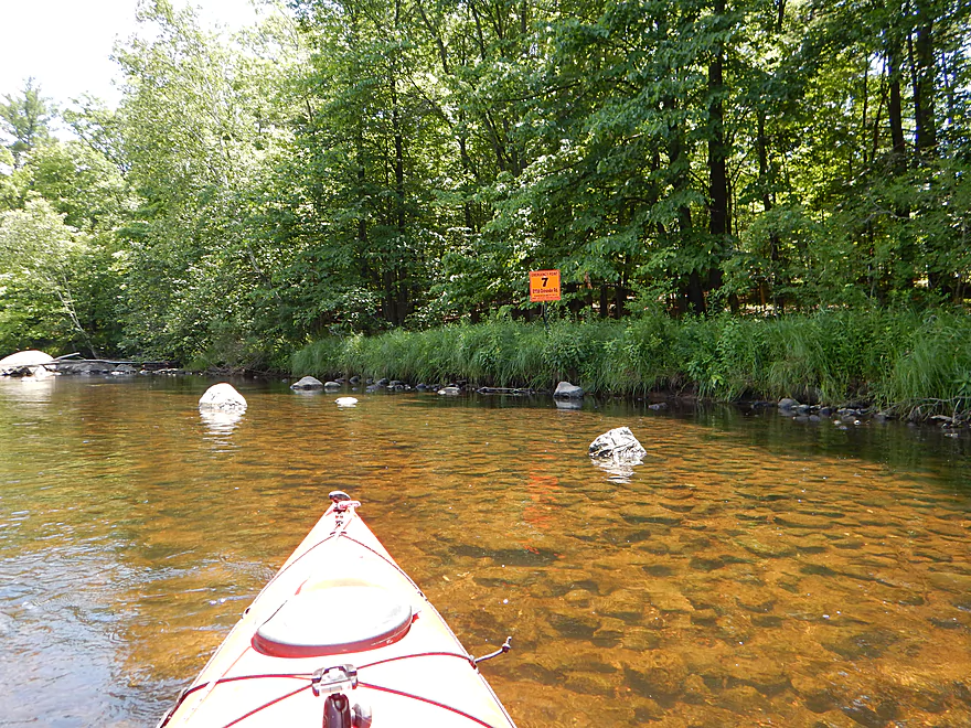
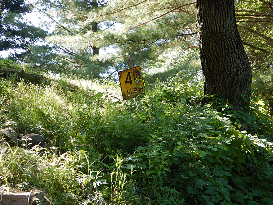
There were orange emergency take-out signs throughout the trip
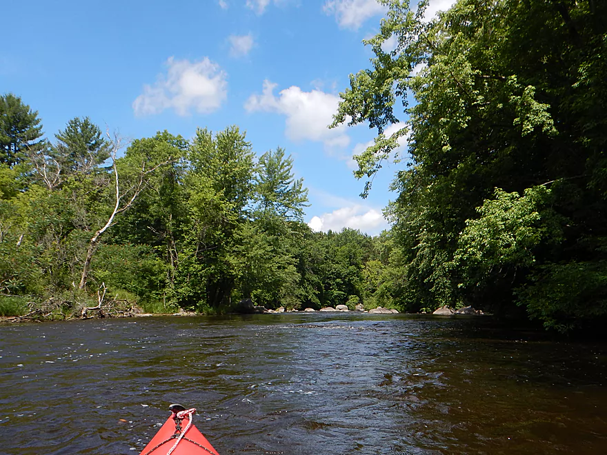
Coming up on another easy riffle
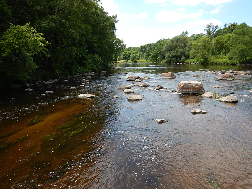
Another nice boulder garden
Major tube launch at Ostrander Road
I believe the landing is public though

Looking upstream
Looking downstream early in the morning before the rush
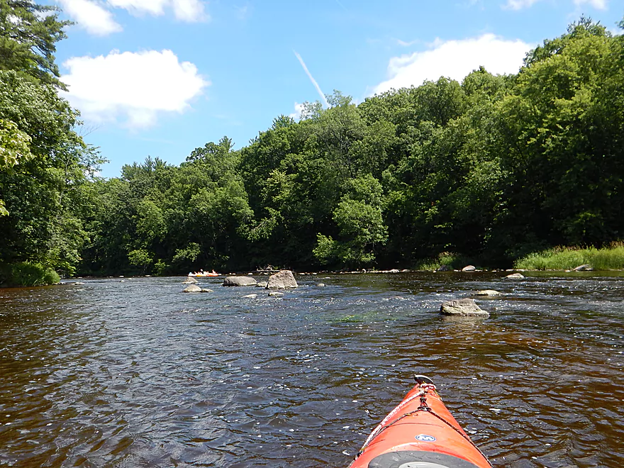
Some of the stronger rapids occur after Ostrander
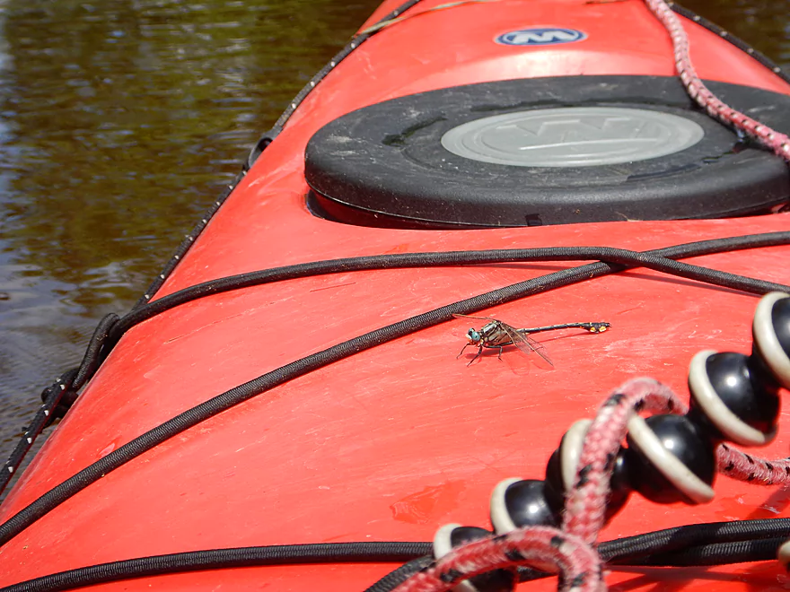
Friendly hitchhiker
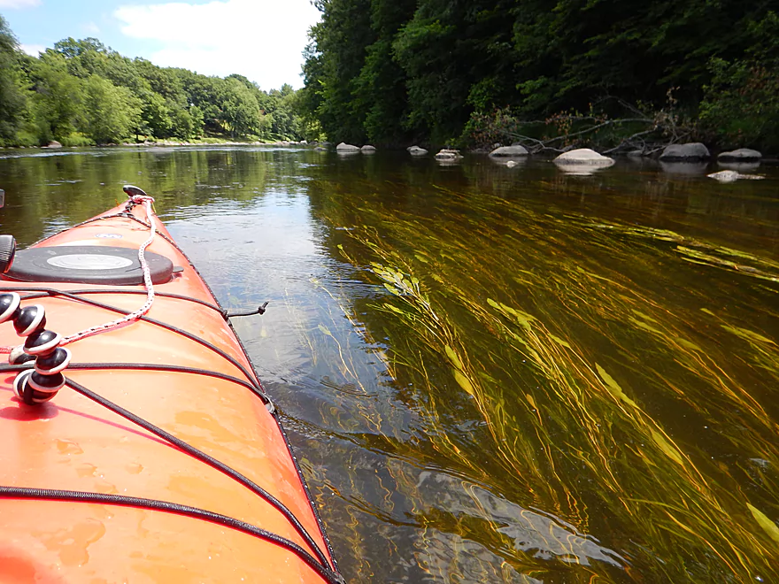
Gracefully swaying pondweeds
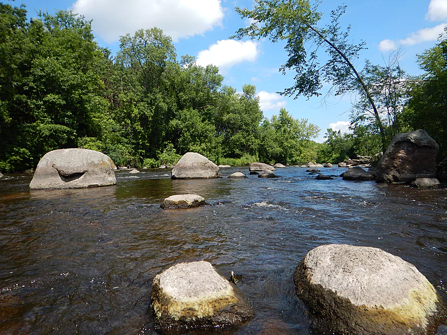
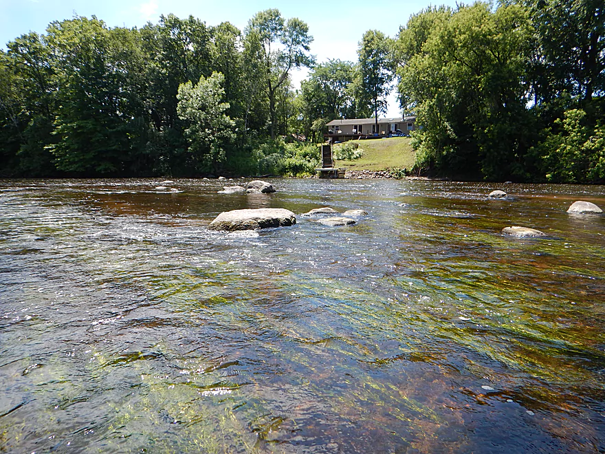
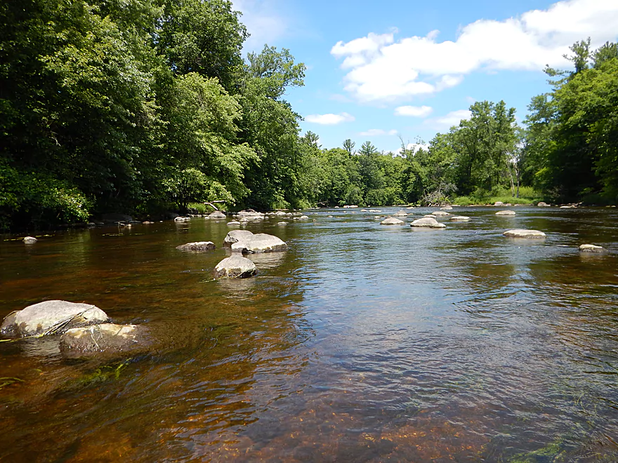
Last major boulder garden
View from the largest boulder
View to the right
Fun little rapids to end the trip
The tubers (poorly pictured) had no problem with them
In higher water you can explore more side channels
Taking out at Wolf River Campgrounds
To avoid a parking fee, you might be able to disembark by the bridge.
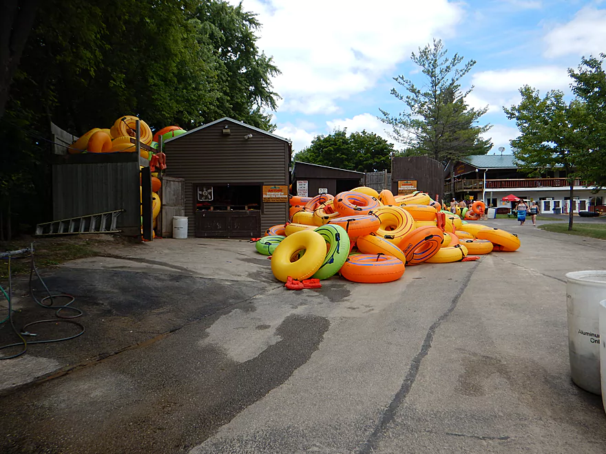
Just a small percentage of the total tubes…
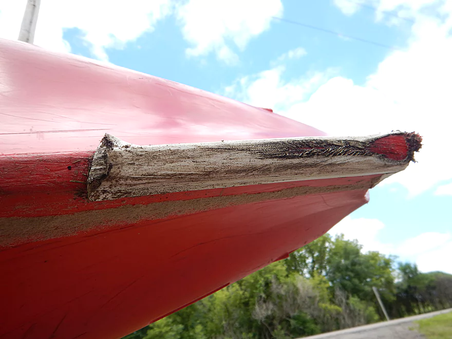
My patch job did not like the Little Wolf…
Little Wolf – Hwy BB


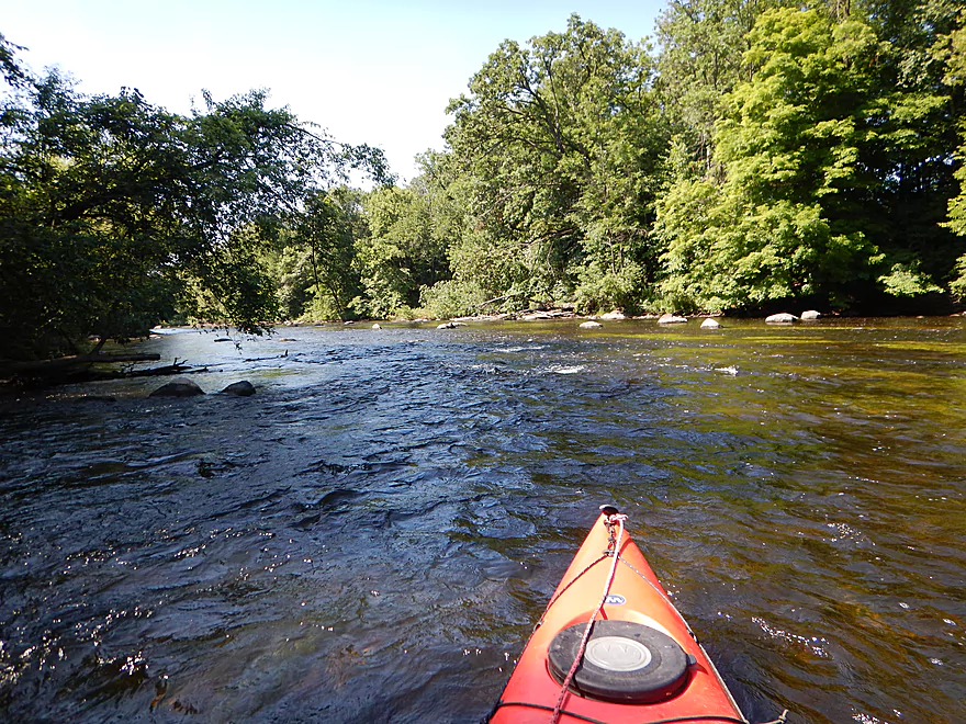
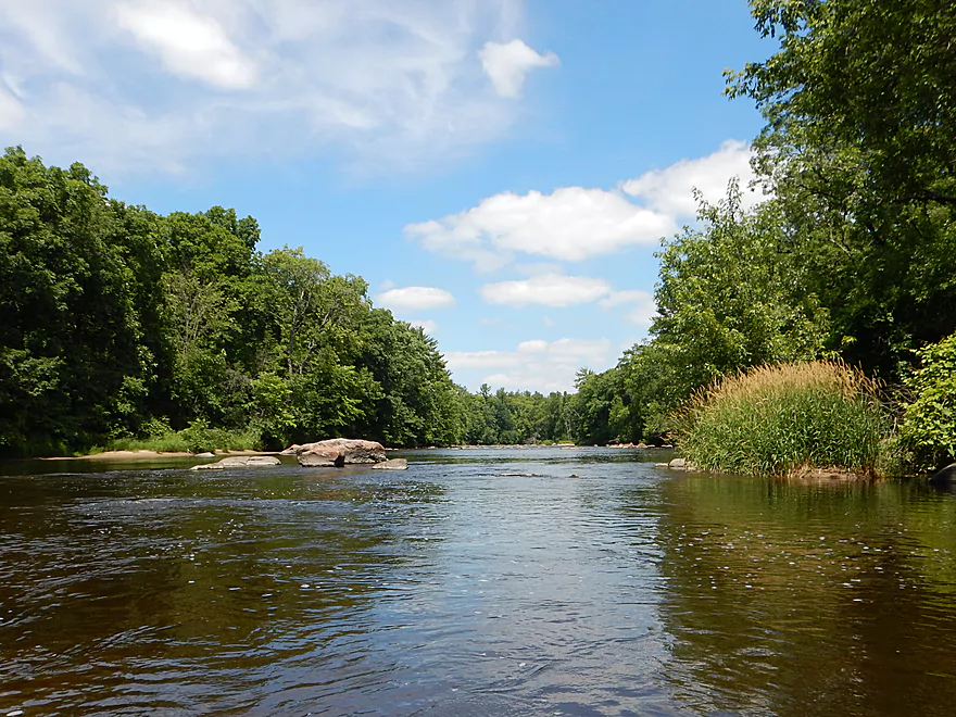
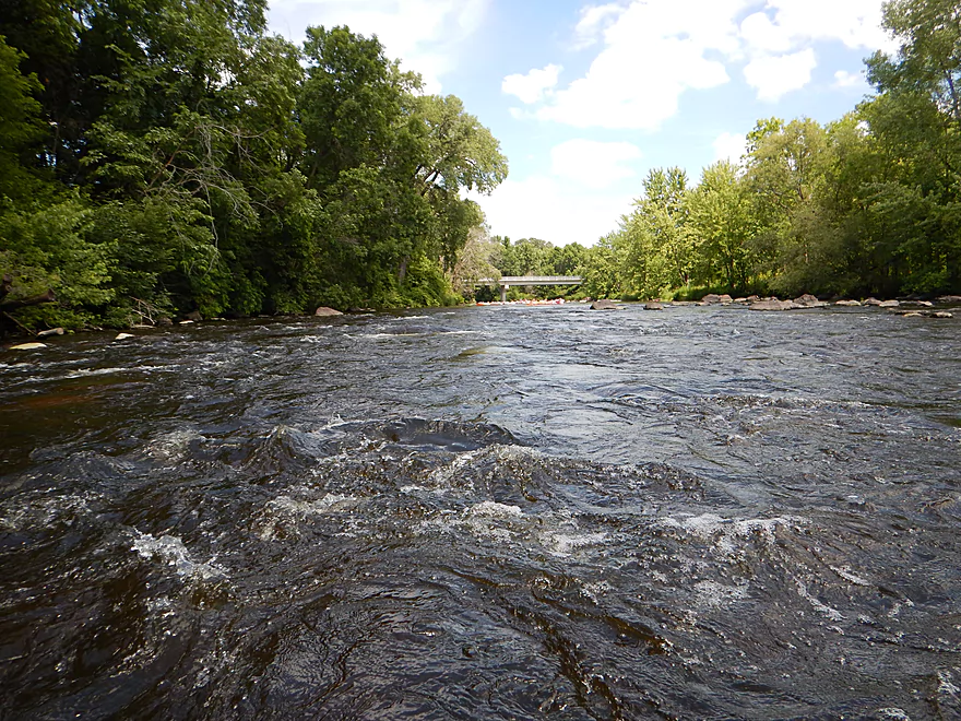
The trip starts at County Road BB on a great note. Nice landing, attractive boulder gardens, clear water and fun little rapids. The first mile or so of the trip IMO is the best part, as here the river is the narrowest and cleanest.
After the South Branch of the Little Wolf joins in (a sizable tributary), the channel changes significantly and is much slower, bigger and murkier. The next few miles were a weak point in the trip. While the banks are generally wooded, development is somewhat rampant, which was unfortunate.
A nice asset of the river is its many boulder fields which start small, but this changes by the time you get to Indigo Bunting Lane. Here you’ll find easy class 1 rapids and a gorgeous boulder field that is one of the best on the entire river.
After this, the river goes back to a snail’s pace. The Little Wolf is very fast AND very slow. The rapids are fast, but everything in between (which is most of the trip) is super slow, and with the monotonous wooded banks along the broad, straight channel, this gets a little old.
At the Hwy 54/O bridge, things pick up again. There is a mega landing on the east bank that looks inviting, but it has no trespassing signs everywhere. A local tour company drops off buses of tubers here. This was a bad thing. A VERY bad thing. For the next four and a half miles, I could ALWAYS turn my head and see at least one tuber and frequently could hear at least one group talking. We’re not talking a few hundred tubers here…the tour operator told me 1500 were on the river just the previous day!
Some of tubers were considerate, but (typical with this demographic) many were loud, drunk and bored. Some brought their radios with them to “share” their favorite tunes with everybody else. I do not understand why people escape to nature to do the exact same thing they could do in their homes or in their pools, and truly wish the DNR would have sound ordinances on public waterways.
But some tubers were friendly… I helped one guy try to find his bag that went overboard. Unfortunately we couldn’t find it, but I was able to tow him back to the landing (his lost bag had his keys, ID and everything…why you always want to use floatable dry bags!).
After the brief rapids under Hwy 54/O, the Little Wolf goes back to sleep, with pleasant but monotonous scenery (the highlight being sporadic boulders). Finally, maybe a half mile prior to Ostrander Road, there is another set of rapids (class 1) and an attractive boulder garden.
At Ostrander Road, there is a public landing which is very popular with “short trip” tubers. Tube traffic picks up significantly after this. Because a kayak is much faster than a tube, and this river is too slow for tubers, I was passing people right and left (and I’m not a fast paddler). Not fun, especially because I love to take lots of photos and this was awkward to do with so many bored tubers photobombing my shots and staring incessantly at me and my boat.
Just after Ostrander Road, we have our first decent rapids (maybe a strong class 1 or class 2), but this was pretty easy. The Little Wolf goes back to sleep for the rest of the trip before waking up just prior to the Hwy X bridge. Here there are two sets of rapids (probably strong class 1) and a great boulder garden. There was a break in the tubing traffic that allowed me to get out of my boat and climb onto a rock for some nice photos.
In summary… Good river, but not nearly as strong as its neighbors (Waupaca to the south, Wolf to the east, and upper Little Wolf to the north). Just too much “lake paddling,” but it is still super scenic in select spots and would get four stars except for the tubers, hence the 3.5 rating. If you do this, I advise going on a weekday or during a Packers game to avoid the circus.
Great and scenic put-in at the Hwy BB bridge. No outhouse though. The nice thing about BB is that tubers don’t put in here, so you’ll only have to share the next four miles with fellow paddlers (which aren’t many).
An alternate put-in four miles downstream is at Royalton. Don’t use the east landing as this is private and totally infested with tubers. On the west there is a hidey park meant for paddlers which has a nice launch (albeit a narrow steep trail).
Another alt put-in 7 miles downstream from BB would be the Ostrander Road bridge. This appears to be public and has an outhouse, but is the main launching point for the tubers. Make sure to park on the shoulder so one of the many buses can get in here.
You could take out directly at the Hwy X bridge, but this is tricky. The guardrail is long and the banks steep and rocky. Be careful where you park as the campground to the east issues parking passes and checks for these.
Your best bet is probably to pay the five dollars to use the ramp and parking lot at Wolf River Trips and Campgrounds. I wish I didn’t have to use this landing, as it was a circus. Adding onto the negative experience, I was ambushed by a manager after taking out who demanded proof that I had paid (which thankfully I had).
An alternative take-out would be to continue on 2.8 miles to the Wolf River and use a public ramp there.
Easy bike shuttle at 5.6 miles. Relatively flat and little traffic.
Wolf River Trips & Campgrounds does rent and shuttle kayaks for $23.
None really. There are some riffles here and there, and maybe 4 sets of decent rapids. But most of these are pretty easy, with only two being at least class 2 or a strong class 1. For reference, the tubers went over these no problem and without life jackets, so don’t be too concerned…
There is a local gauge at Royalton. I went at 273 CFS which is probably average. 500 CFS is high and starts to get pushy. The river infrequently gets below 200 CFS, and in those cases you might have to walk the rapids. Not a big deal as there aren’t many and the rest of the river is plenty deep.
Where there are clear sections, much of the river is too deep to see through at 273 CFS.
Several turtles, eagles, and a deer. That was it. Much of the wildlife was probably spooked by the tubers. If you were an animal, wouldn’t you find this image scary?
Detailed Overview
- Wolf River Road to Ness Road: (3.0 miles) Very narrow, heavily wooded, shallow in spots, and very rocky. Maybe 2 logjams. This is an intriguing prospect on my todo list.
- Ness Road to Wolf River Road: (2.5 miles) A good trip with clear water, boulders, and a few easy rapids.
- Wolf River Road to Big Falls Dam: (7.7 miles)
- Wolf River Road to Hwy J: (3.6 miles) Scenic section with some strong Class 2 whitewater. Good put-in.
- Hwy J to Big Falls: (4.1 miles) Also scenic and with whitewater, with perhaps a Class 3 by the Dells. Good launch by Hwy J.
- Big Falls Dam to Big Falls Powerhouse: (700') This is a steep chute of exposed granite that can create Class 4 rapids when it has sufficient water. But typically the dam penstock robs Big Falls of 99% of its flow. Access to the top of the falls is available from either the east or west shore.
- Big Falls Powerhouse to Kretchner Road: (4.4 miles)
- Big Falls Powerhouse to Little Falls Park: (1.7 miles) This is a good stretch with the highlight being a 2000' stretch of rapids.
- Little Falls Park to Hwy C: (0.3 miles) Features a Class 2 under a bridge, and then a 1500' stretch of boulders and Class 1 rapids. Hwy C isn't a great bridge access.
- Hwy C to Kretchner Road: (2.7 miles) Just below Hwy C is a series of rapids including a Class 3 that runs through a scenic gorge. After that the river slows down and becomes less interesting
- Kretchner Road to Hwy 110: (4.3 miles) A great leg with many scenic boulder gardens. Rapids on this stretch are mild and suitable for beginners. While nice, this leg isn't as terrific as Little Falls or Big Falls legs located upstream.
- Hwy 110 to Hwy 22/Symco: (8.0 miles) Unimproved bridge put-in but should be ok. This section likely has some deadfall issues (not sure how much though).
- Hwy 22/Symco to Manawa Dam: (5.9 miles)
- Hwy 22/Symco to Bridge Road: (2.0 miles) Looks like a nice section with some rapids and boulder gardens near Symco. Good put-in at Symco.
- Bridge Road to Manawa Dam: (3.9 miles) Likely a mediocre section with some flowage paddling at the end. Some of the flowage paddling can be avoided by taking out at Waupaca Park. Bridge Road is a good put-in.
- Manawa Dam to Road Bb: (3.9 miles)
- Manawa Dam to Hwy B: (1.9 miles) Honestly an uninteresting section with slow current and bland flood-bottom woods. Aquatic weeds are an issue (thanks to the Manawa Septic plant). River does get a bit more interesting after the railroad tracks and features a small boulder garden.
- Hwy B to Hwy 110/B: (0.9 miles) A good stretch with some boulder gardens and good clarity. There are Class 2 rapids by the "Rapid View" island.
- Hwy 110/B to Road Bb: (2.1 miles). A great stretch with several impressive boulder gardens and a few minor rapids.
- Road Bb to Hwy X: (7.6 miles)
- Road Bb to Royalton: (3.5 miles) Very good put-in. Nice clarity and boulders until the South Branch joins (almost doubling the river). Very nice boulder garden and rapids 2/3rds in.
- Royalton to Ostrander: (2.7 miles) After the brief rapids under Hwy 54/O, the Little Wolf goes back to sleep, with pleasant but monotonous scenery (the highlight being sporadic boulders). Finally, maybe a half mile prior to Ostrander Road, there is another set of rapids (Class 1) and an attractive boulder garden. Paddlers will have to deal with many tubers.
- Ostrander Road to Hwy X: (1.4 miles) Busiest tubing section probably in the state. Very nice boulder gardens and rapids at end. Public landing NE of Ostrander Road.
- Hwy X to the Mouth (Junction at Wolf River): (2.0 miles) Part of the Mukwa Bottomland Forest SNA
- Mouth to Dey Road/Shaw Road Boat Ramp: (0.8 miles) A short stretch on a now large Wolf River.
Trip Map
Overview Map
Video
Photos Size:
We paddled the Little Wolf with our 7 and 10 year olds, from Manawa to Hwy 54. Manawa was a great easy put-in; Hwy 54 has a trail on the SW side of the bridge that leads to a small road-side park. We had to carry our kayaks up the trail, which is fairly steep. We were new to rapids, and our kids were new to maneuvering around boulders. The kids had been on plenty of inland lakes and a pretty easy section (Iverson Park to McDill Pond) of the Plover River before, so we thought that they (and we) were ready for that next step. There was a sizable (for us) drop under Hwy 10 that we didn’t expect, so we didn’t take chances with the kids and decided to portage it. There is an island there, with rapids and a drop on both sides, with the right (west) side seeming more wide open and more easily navigable and the left side having more boulders to navigate. On the next set of small rapids, not associated with a bridge, one of our kids panicked (it was our first time navigating any rapids), and he ended up against a rock and capsized his kayak. One of us was able to wade through the water (not too fast for this) and get him and his kayak. Bilge pump was very handy! My 7 year old did fine, but by sheer luck! As we paddled through the slower areas, we talked more about looking farther ahead and what to look for to determine where to go through the rapids. On the next couple of rapidy areas, they did a great job, better than me, even! I would say for kids that mostly like a relaxing paddle and fishing but enjoys the occasional excitement of small rapids, this is a great spot, but for kids that like that adrenaline rush (my 7 year old) and get bored with too much flat water paddling, this river is almost too sluggish. He enjoyed the rapids and maneuvering around boulders but got bored on the slow parts. It was also a long paddle for kids. Even my other kid that likes the relaxing steady paddling was getting tired by the time we got to Hwy 54. Just an FYI, our kids were using 8 foot Pelicans that originally had no foot braces, but we installed aftermarket foot braces in them to give them more leverage. I think without these, the kids would not have been able to do this entire river. These little 8 foot kayaks are obviously not the most expensive kayaks, but for our kids, we have found them to be stable, trustworthy, and very easy to maneuver around boulder fields and through rapids (with foot-braces were installed). As far as OUR (the parents’) experience, we though the river was really beautiful, the rapids and riffles were fun (and we now have the confidence to do the first drop next time), and the 8 miles and 3 1/2 hours was just right for us recreational kayakers (but we paddle every weekend). My arms were getting a bit tired by the time we got to Hwy 54. It was a great first experience for anyone new to rapids. I hope this helps anyone considering this part of the Little Wolf River, especially with kids!
I also forgot to mention that the river gauge was at 433 c.f.s., which worried me, but it ended up being just fine.
Thanks for the update! I’ll have to check it this upstream section and it sounds really nice.
Correction to my last submission: the drop was not with the Hwy B bridge but instead was before Hwy 110. There is an island there, with rapids and a drop on both sides, with the right (west) side seeming more wide open and more easily navigable and the left side having more boulders to navigate.
Warning…the Little Wolf dam at Manawa is on the verge of collapsing. Local officials are evacuating some of the low lying areas. Paddlers should definitely stay off the lower Little Wolf. https://www.facebook.com/photo?fbid=446137034969545&set=a.141092518807333 Update…the Dam has been breached. Video of the breach can be seen here: https://www.facebook.com/NBC26GreenBay/posts/pfbid05RNgkaJfqfDhM4YUkwFoez1iLZP5pmheDtohExuhnjzNLGx9xoiRK5WKLxviX61Xl