
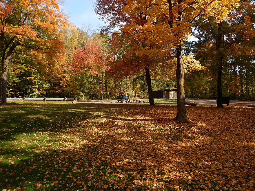
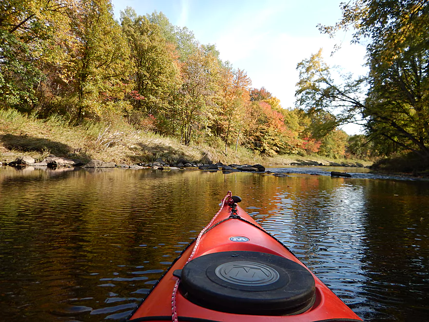
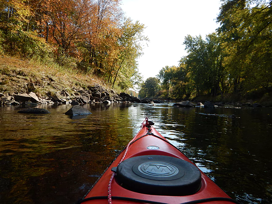
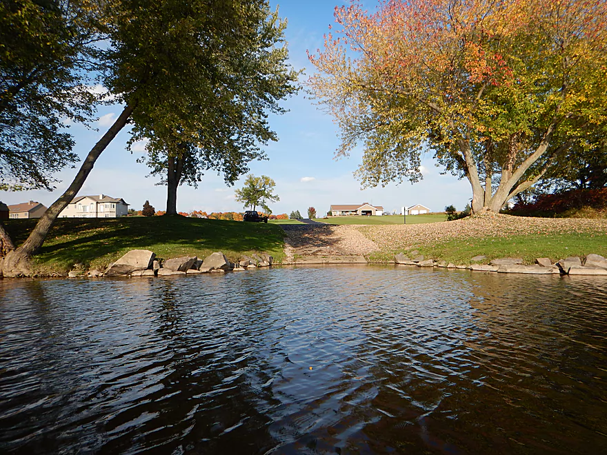
Putting in at Big Rapids County Park
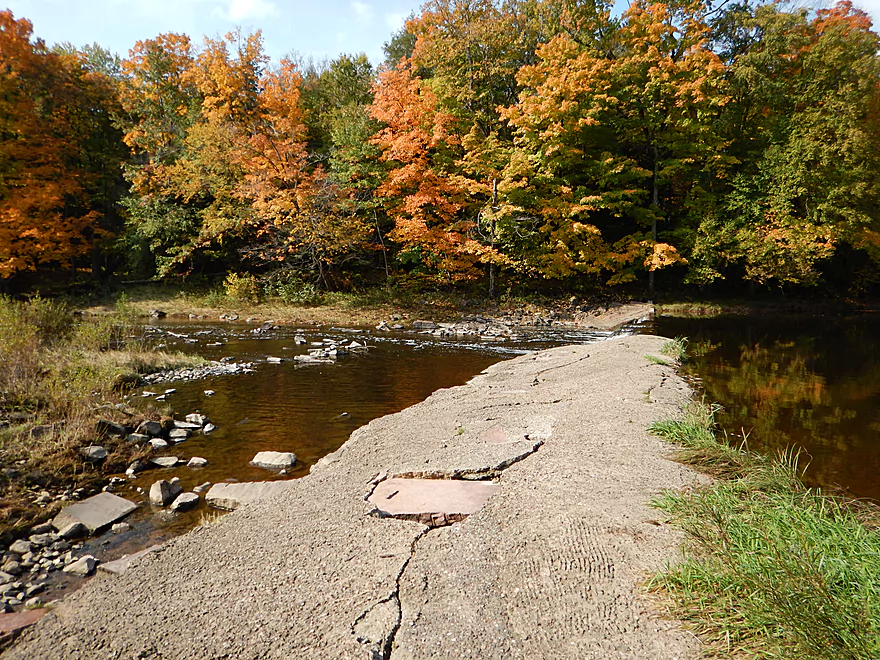
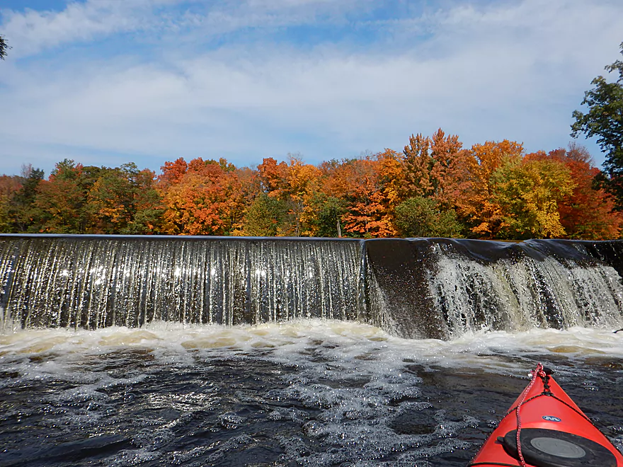
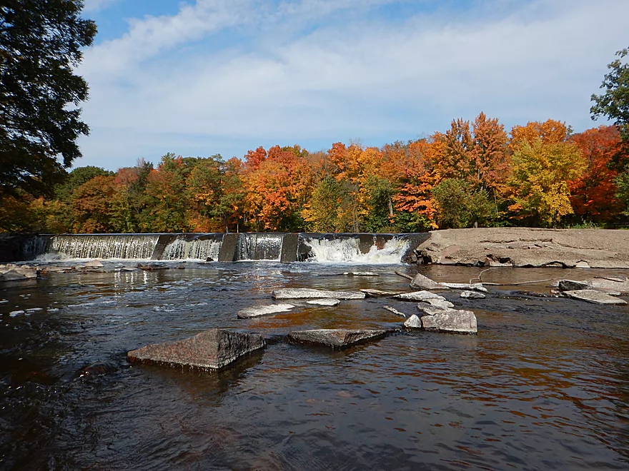
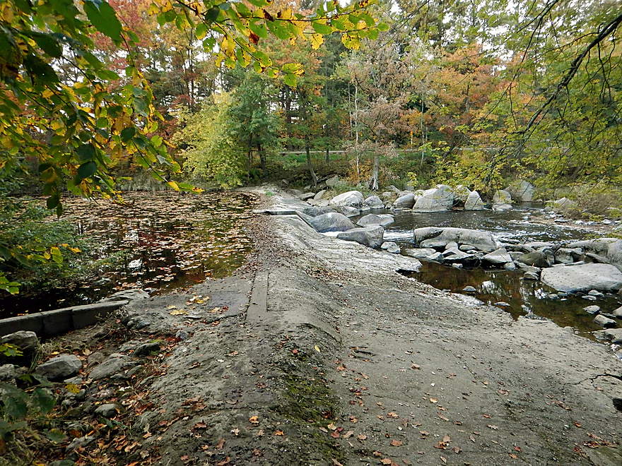
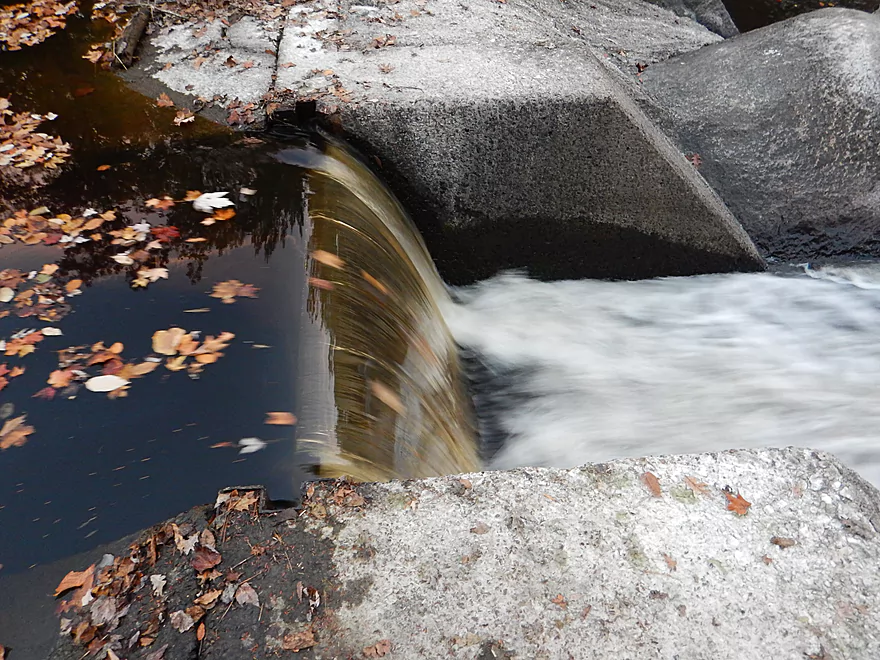
Small dam
You can put in below, but it is a rocky trail
Nice launch above the dam
Scouting Big Rapids (upstream of put-in)
Not too fierce at these water levels
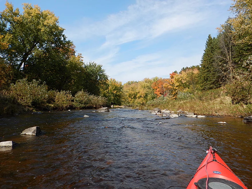
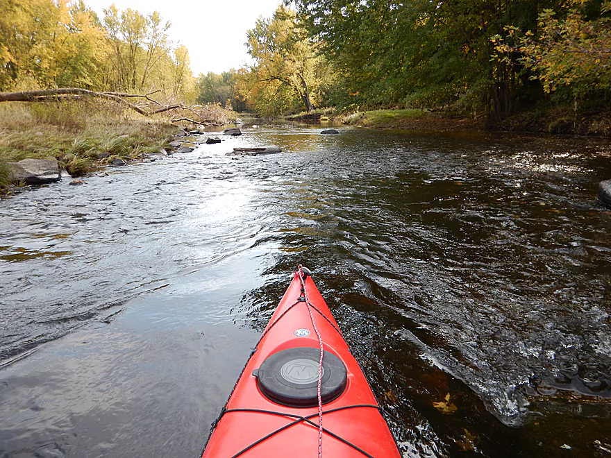
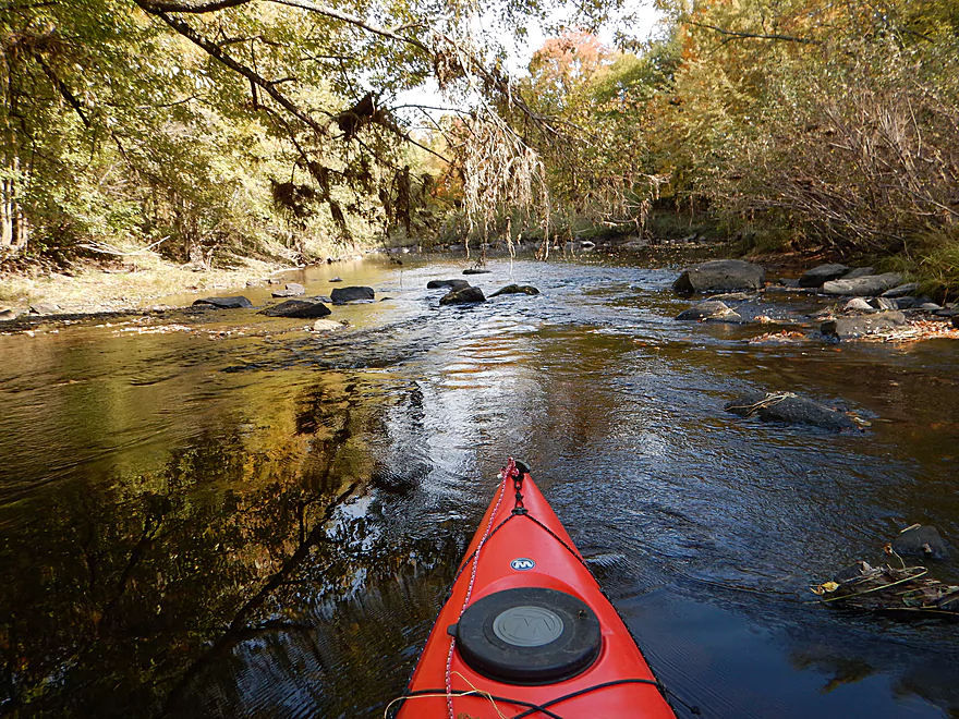
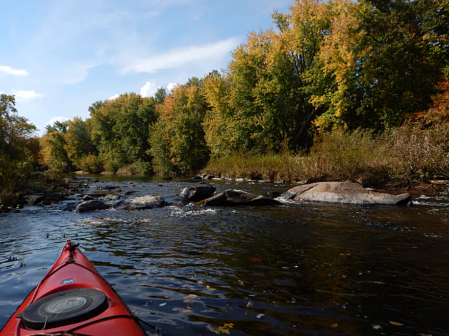
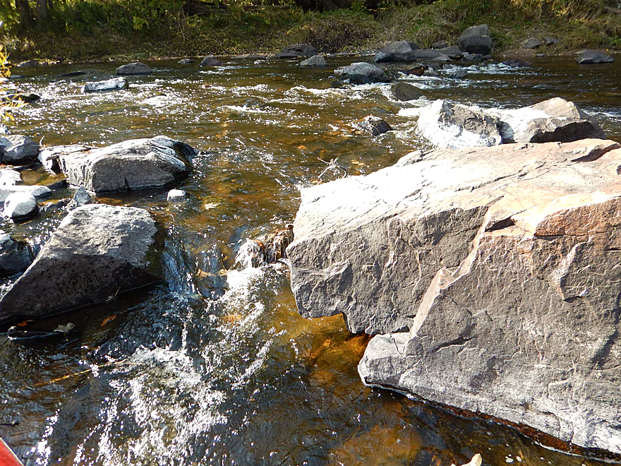
First of many nice boulder gardens
Passing by the park again

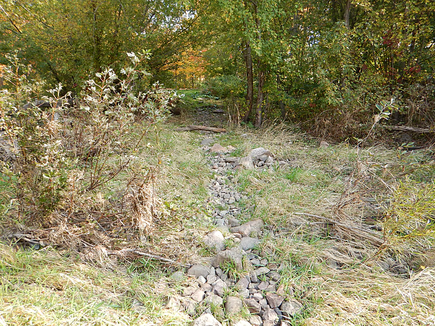
Ok portage path river-right
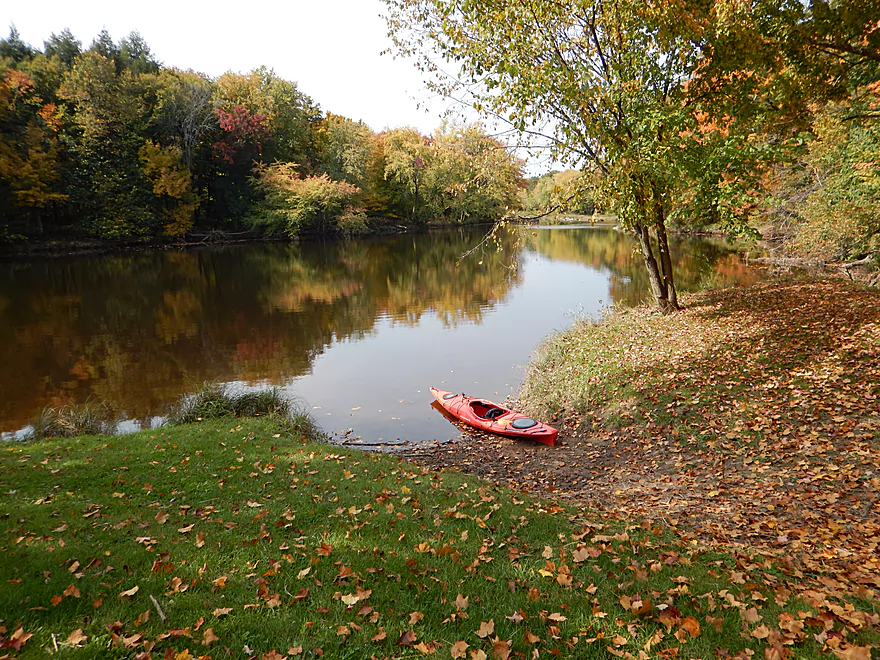
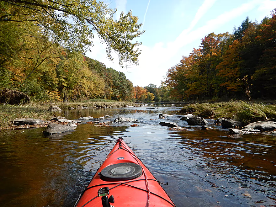
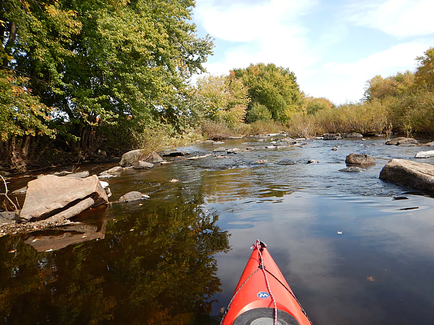
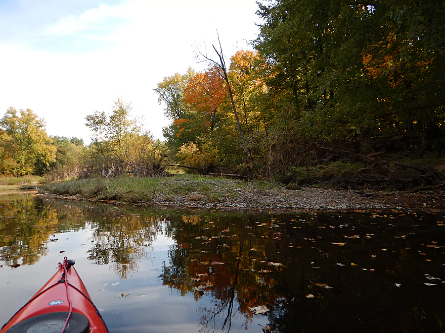
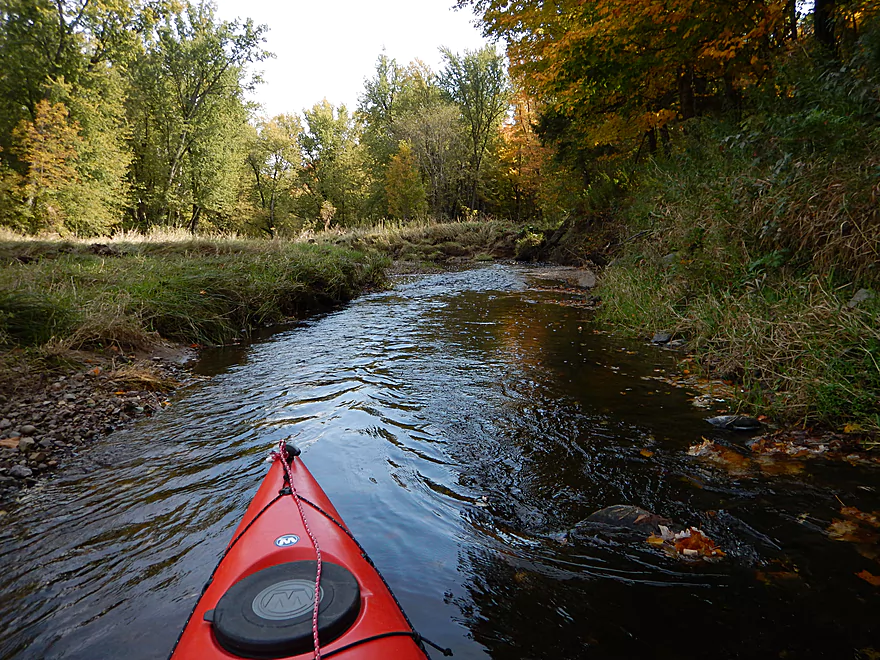
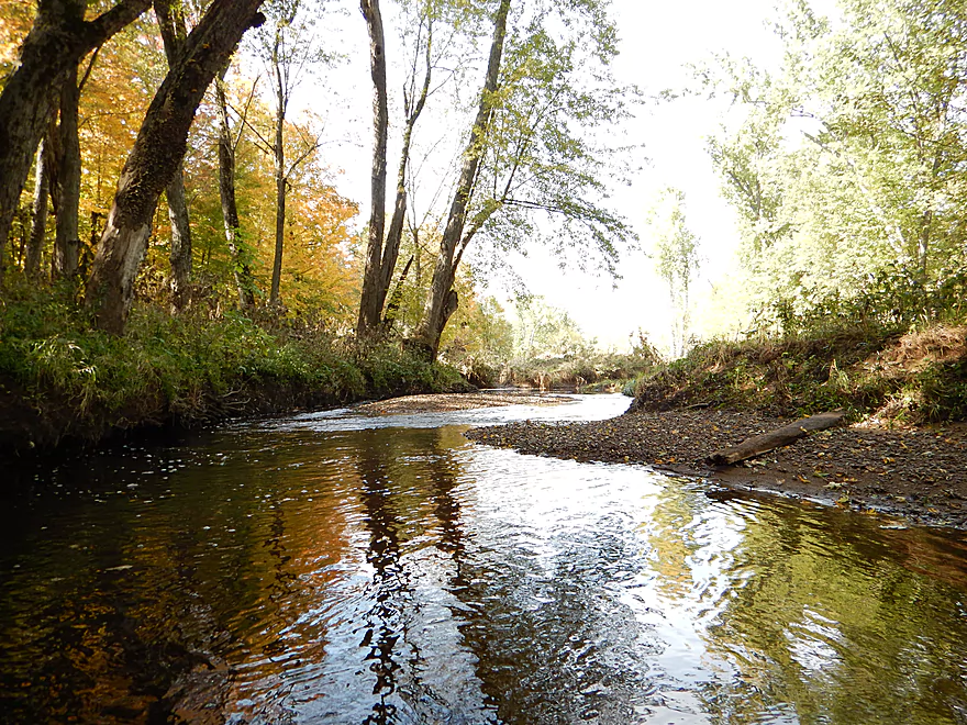
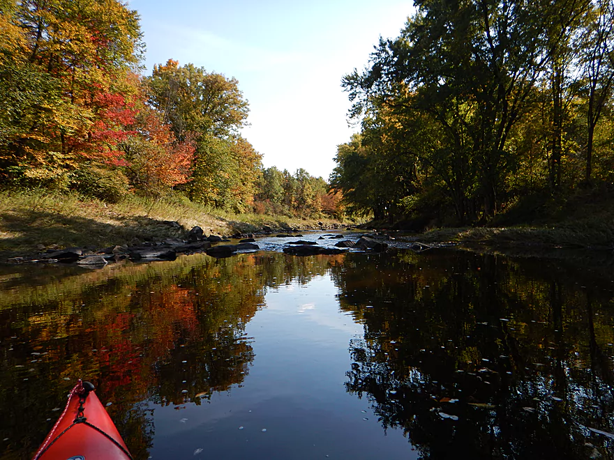
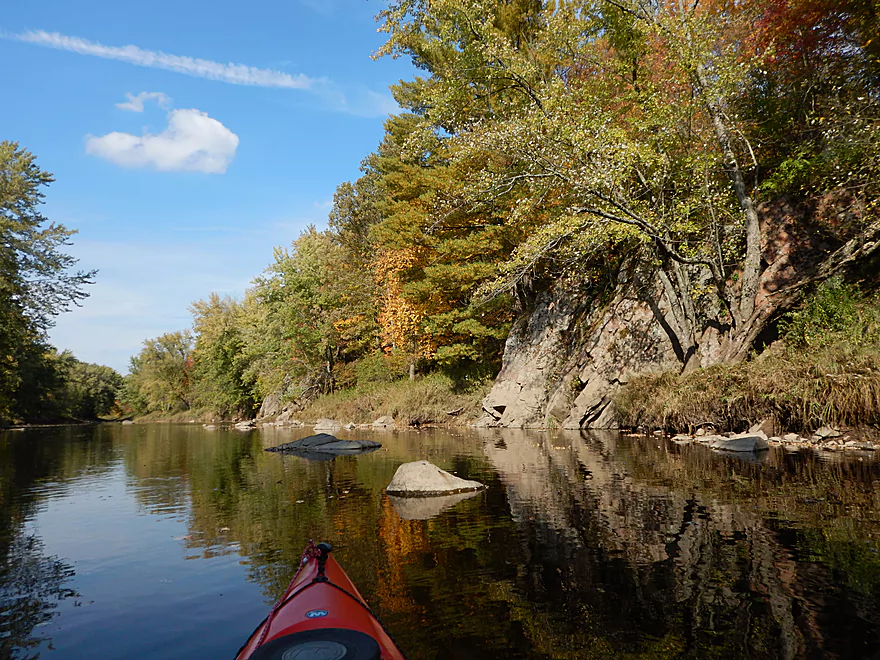
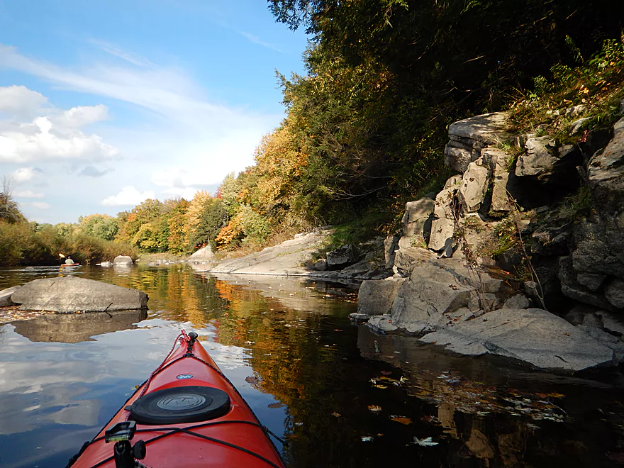
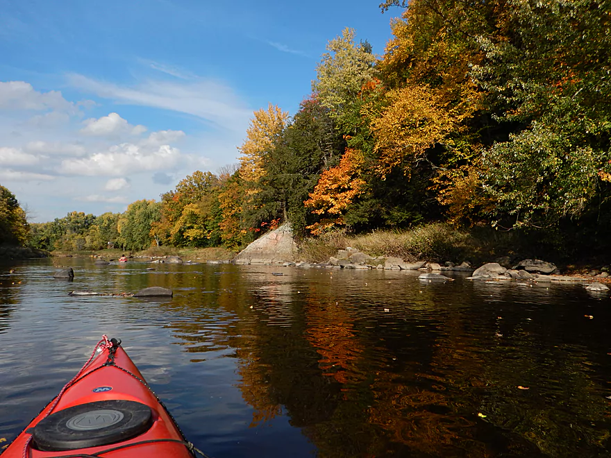
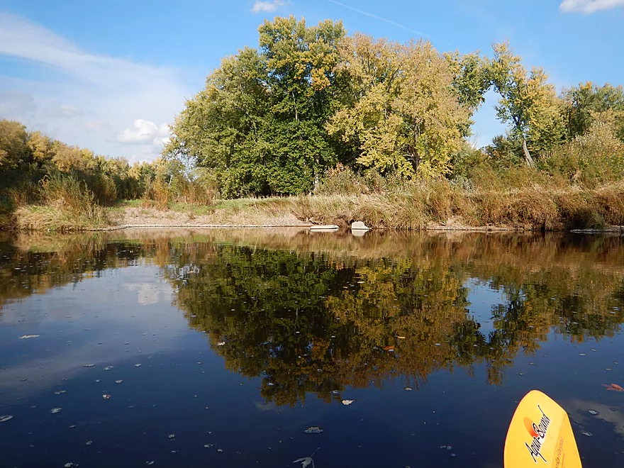
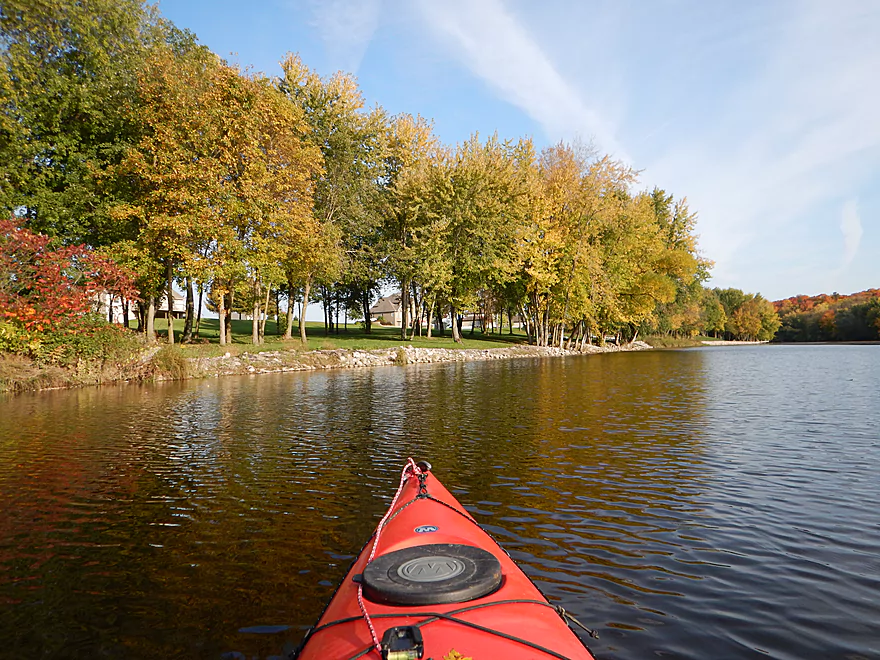
Very scenic
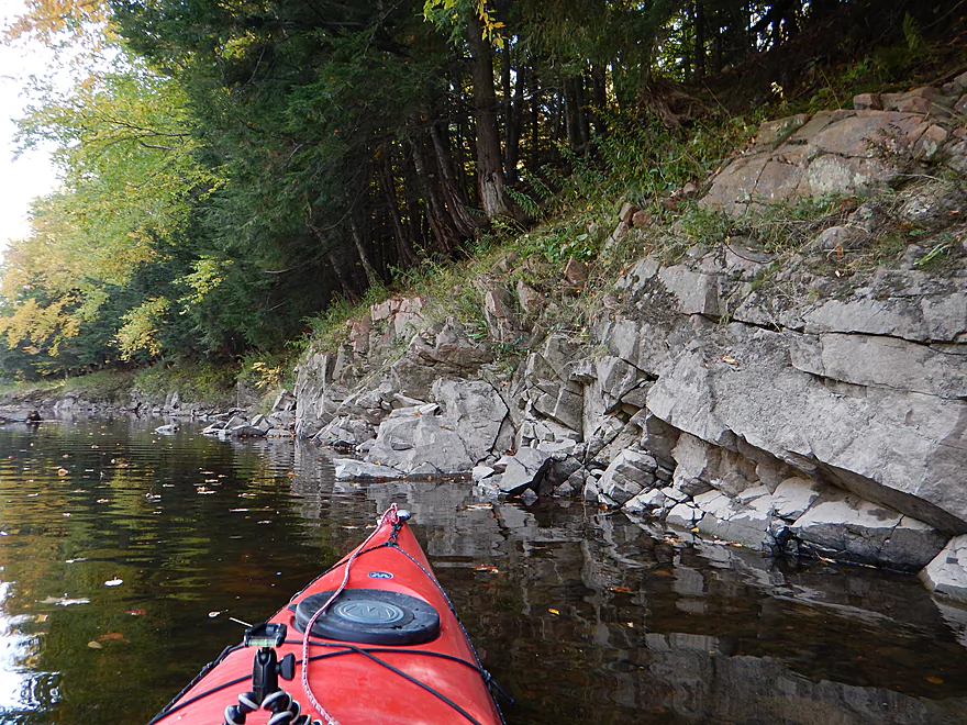
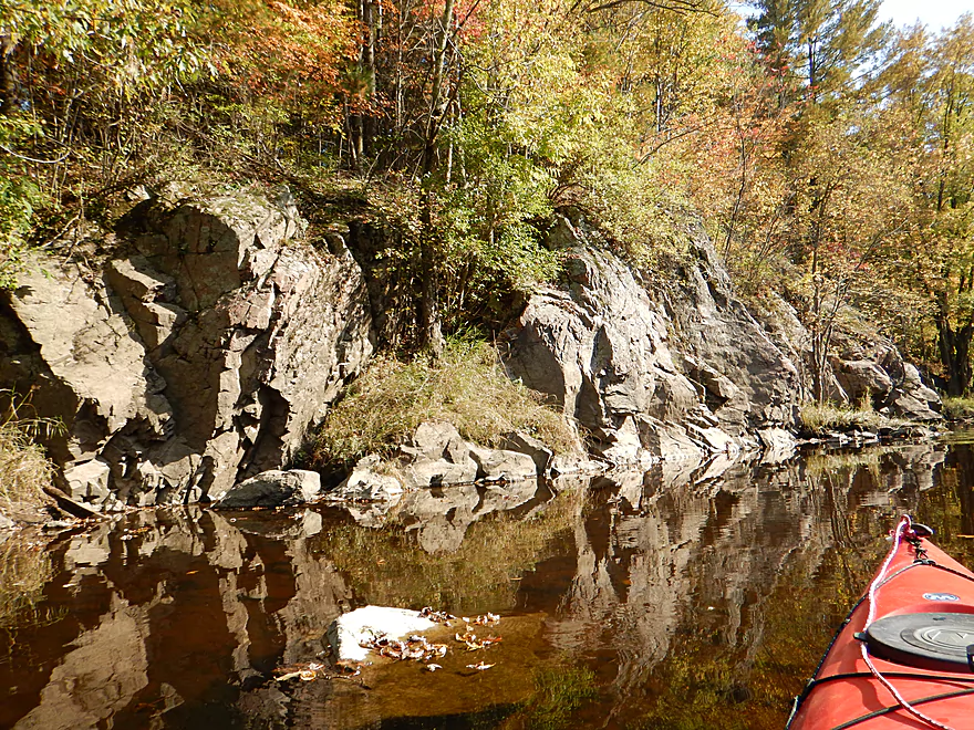
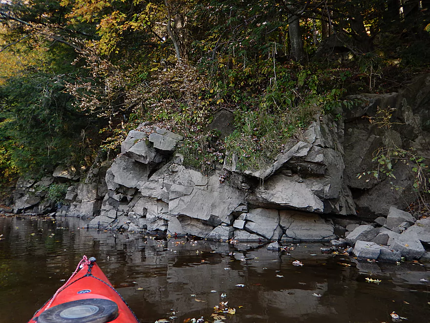
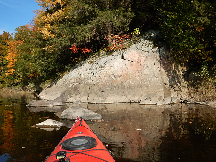
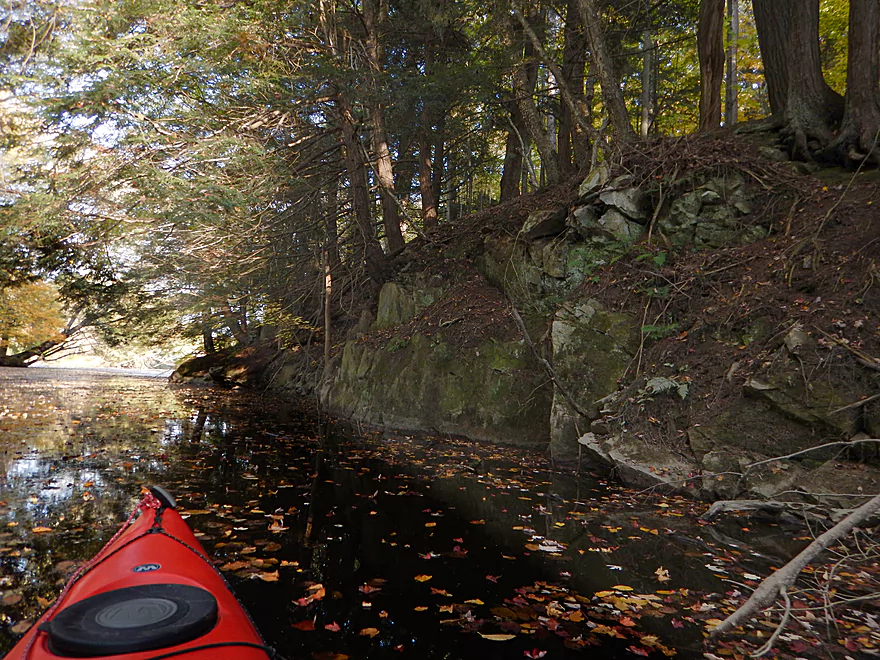
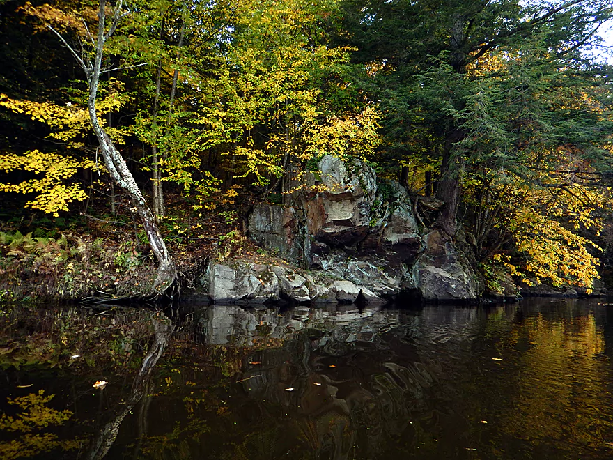
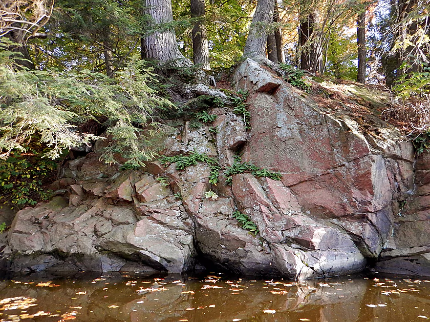
First rock bluff on this segment
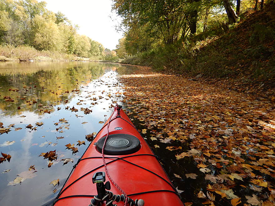
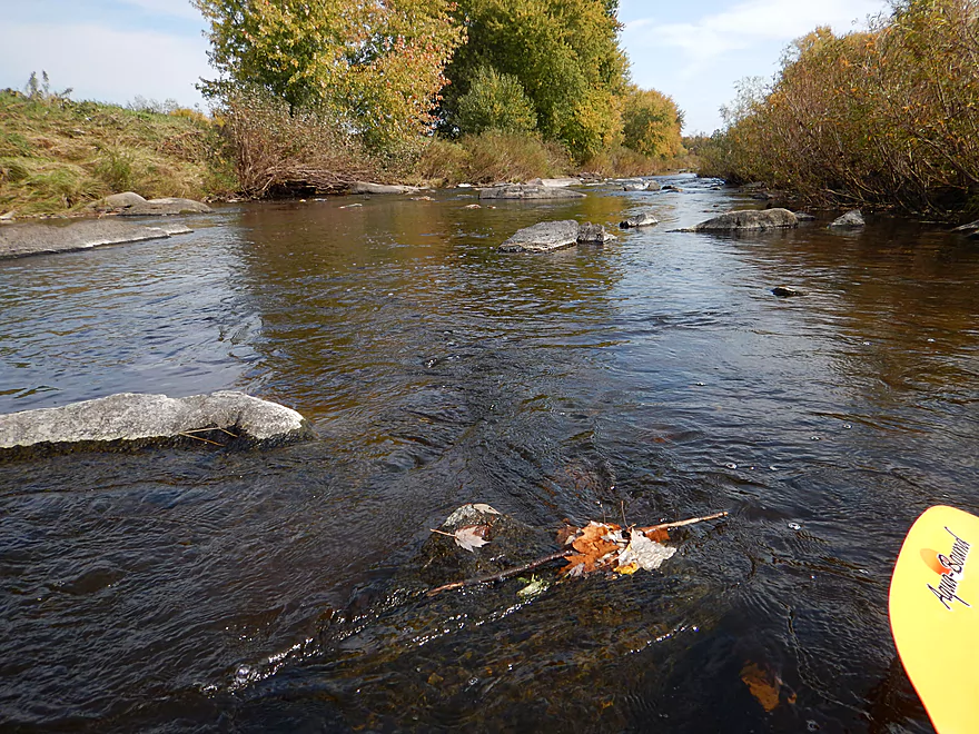
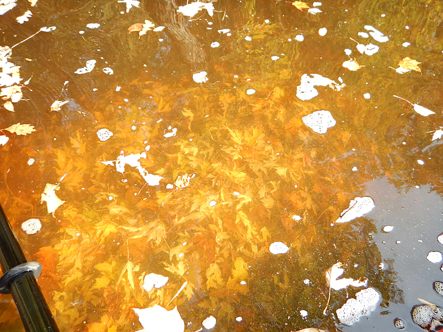
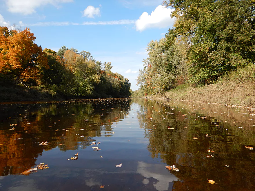
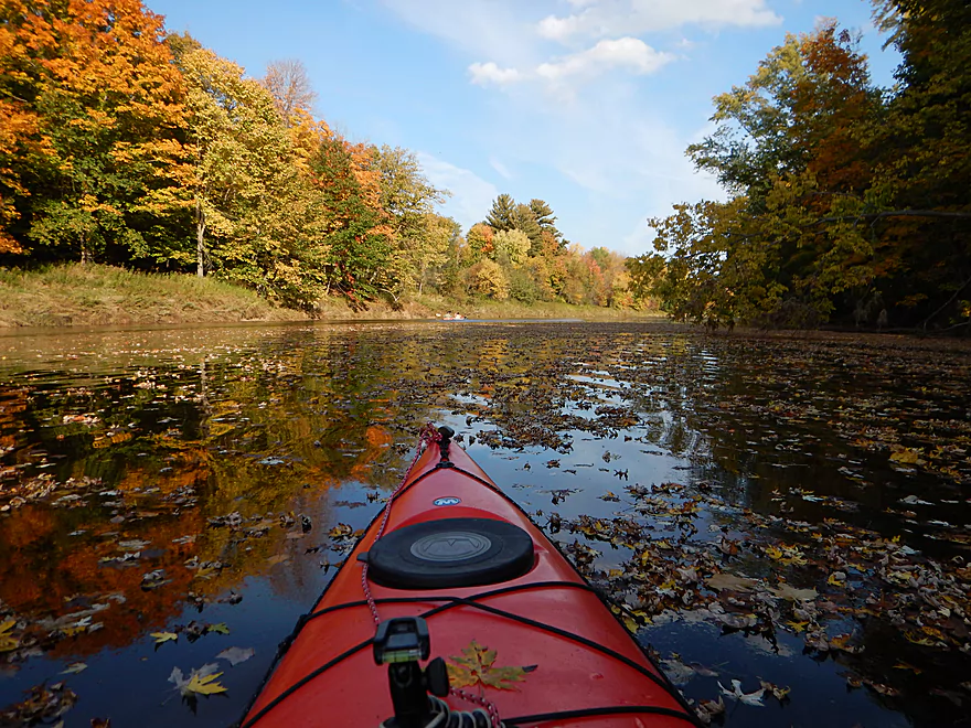
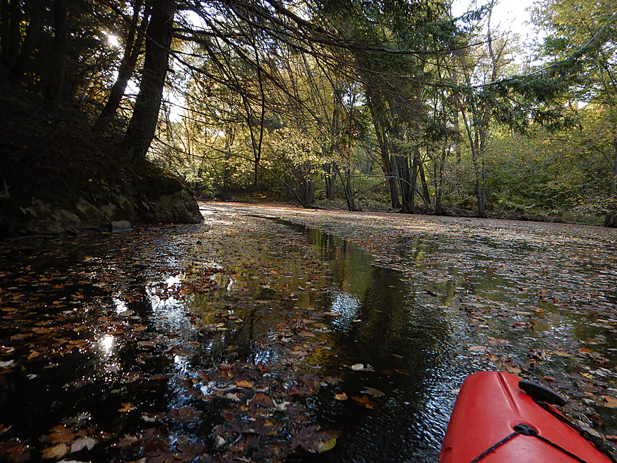
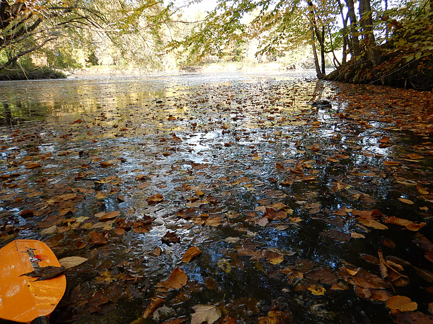
Attractive leaf rug for the river
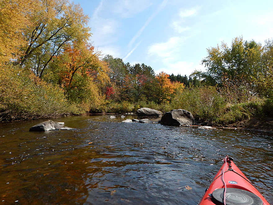
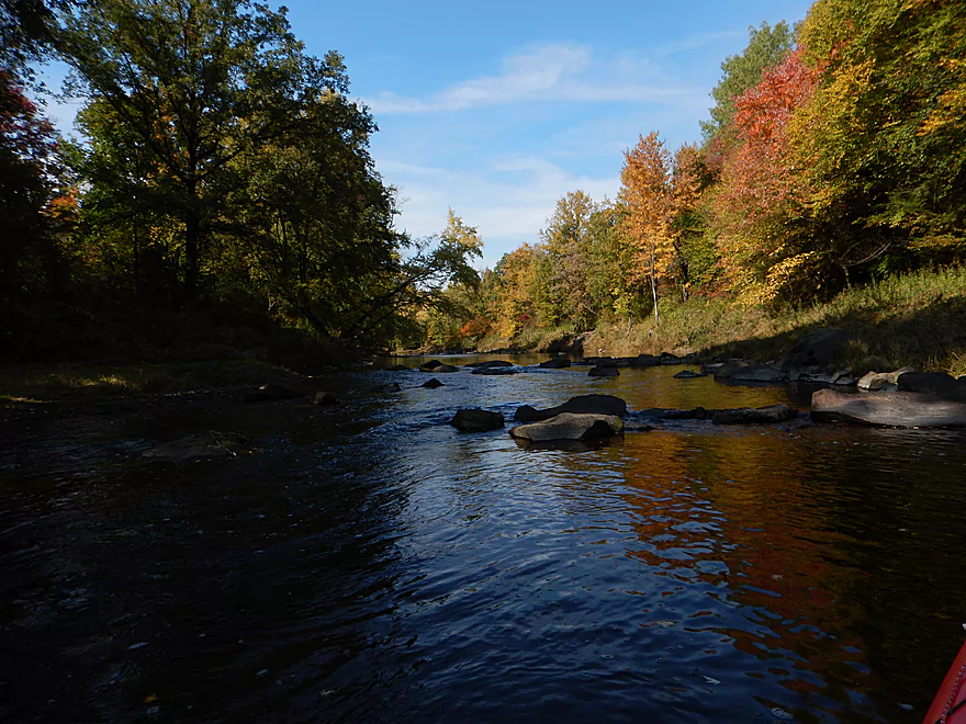
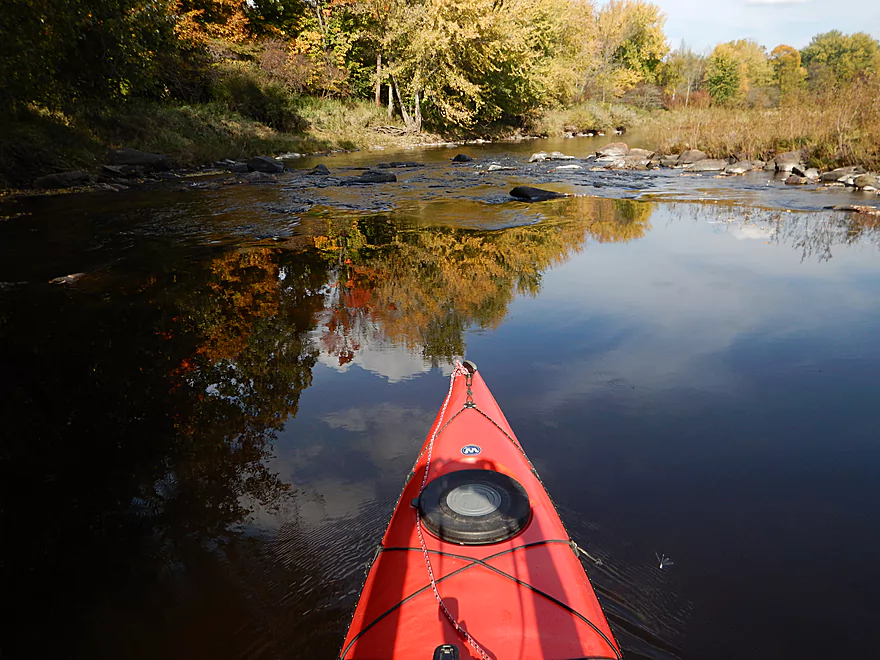
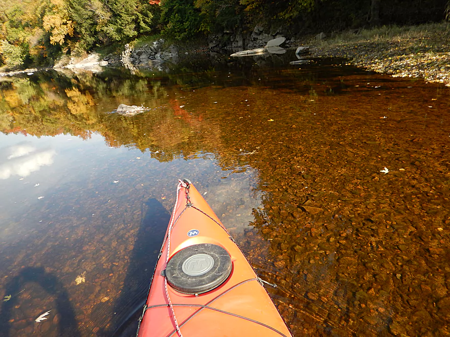
One of many boulder gardens and riffles
Nice rocky substrate
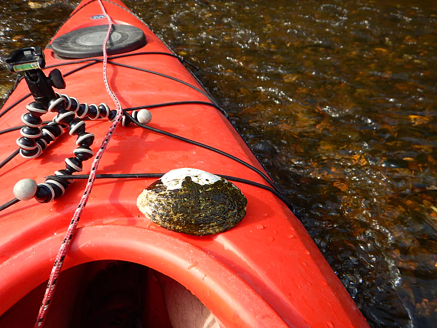
One of multiple clams (this is a Pocketbook)
Bumpy, but always a path through
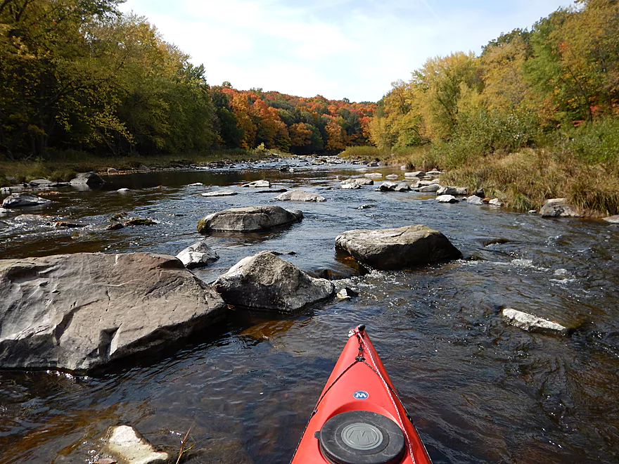
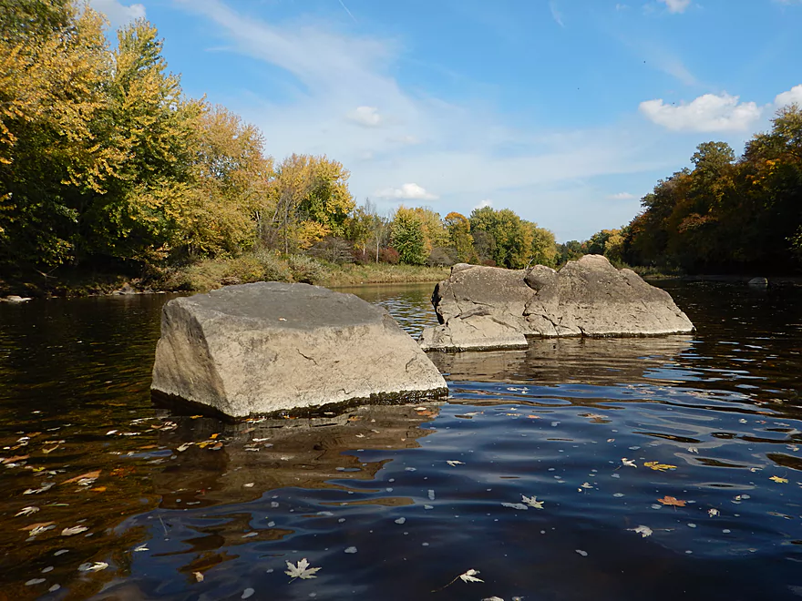
Largest boulder garden
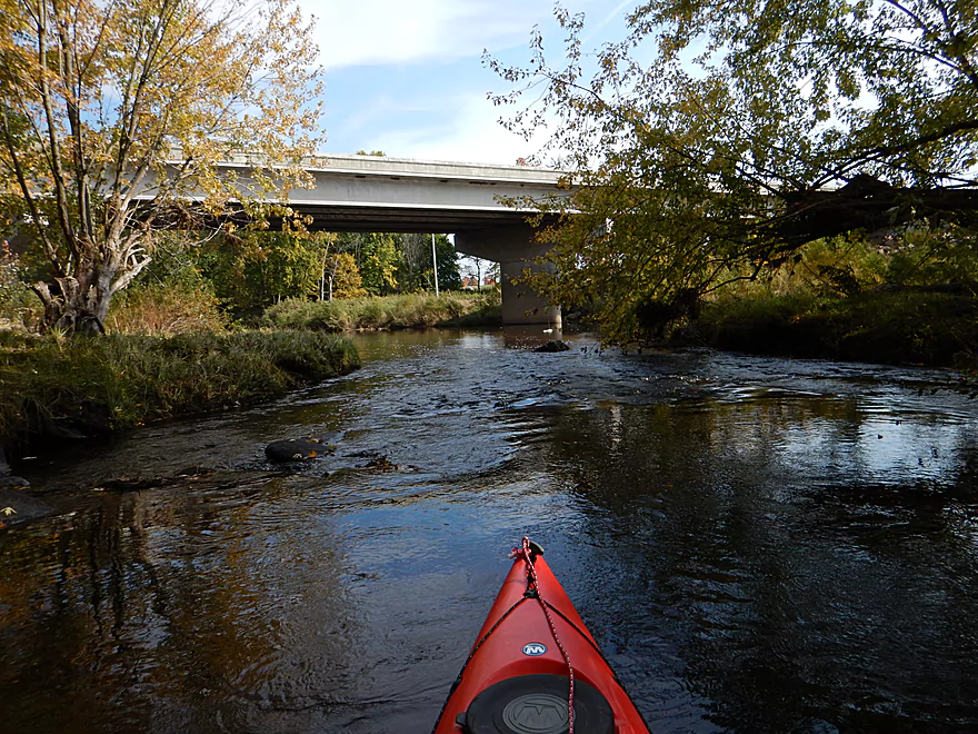
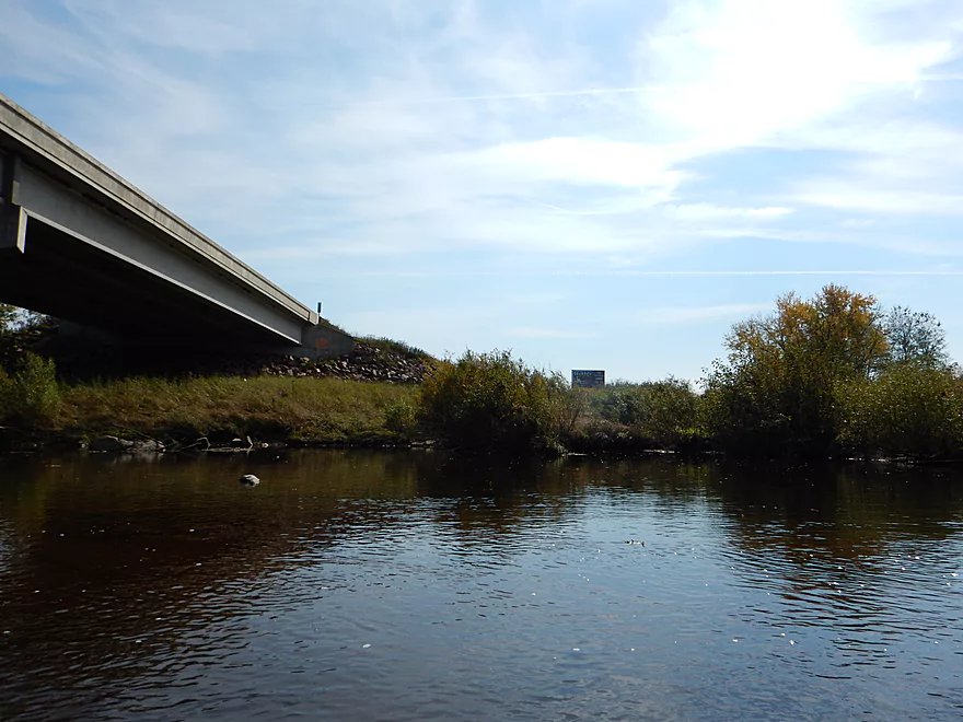
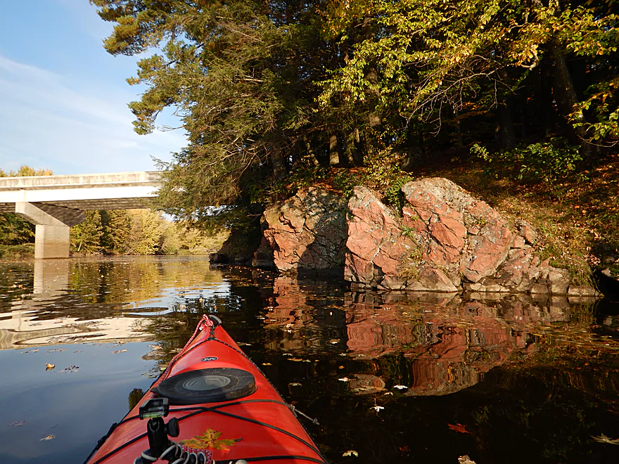
Hwy 97 Bridge
You can put in on the SW side (not ideal but doable)
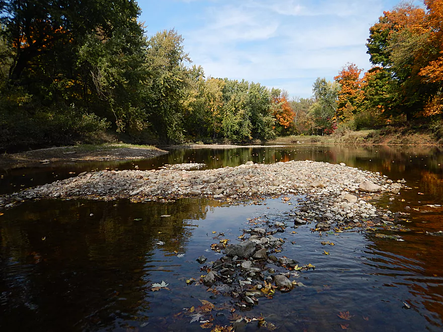
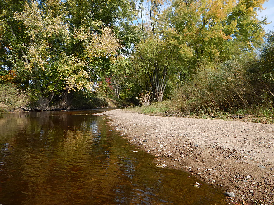
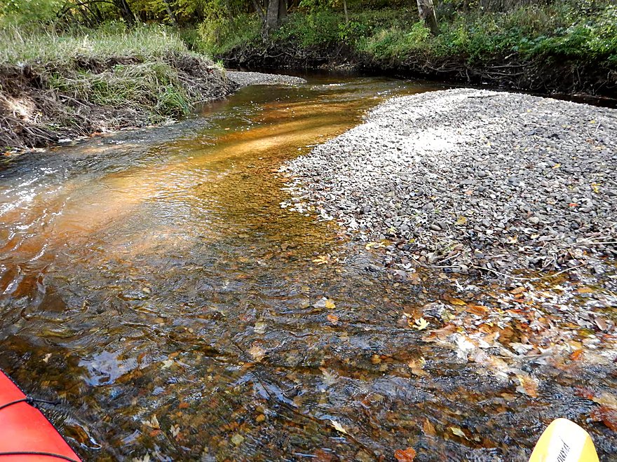
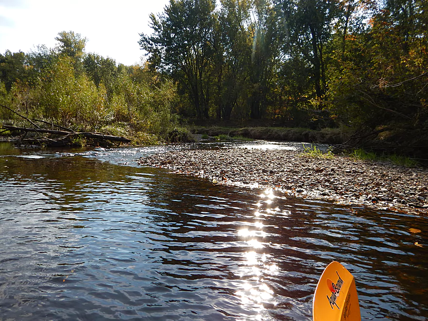
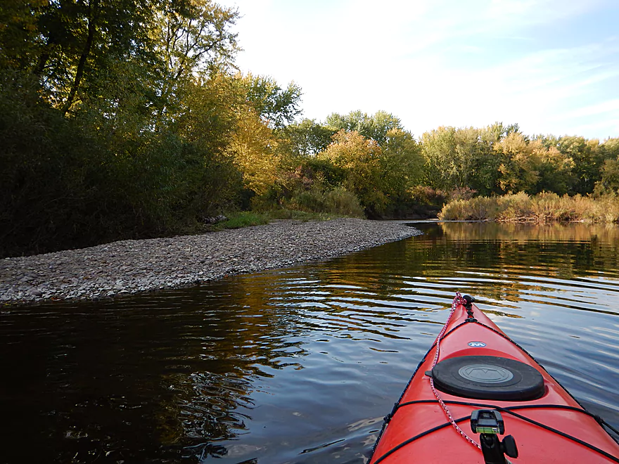
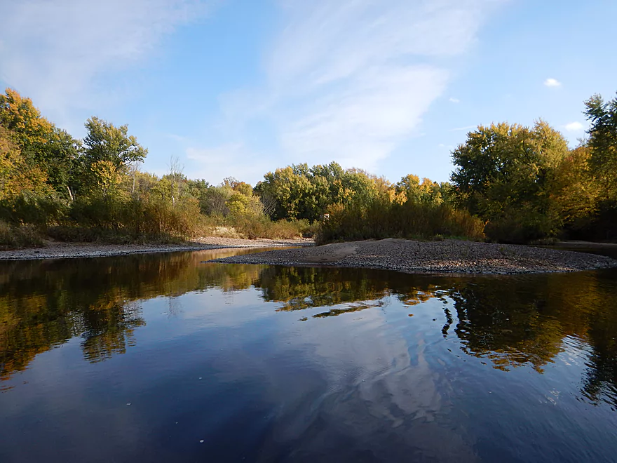
One of multiple gravel bars
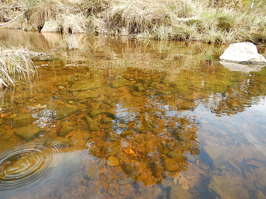
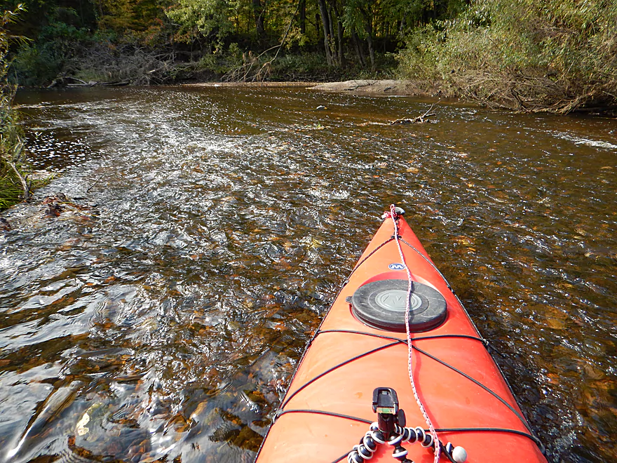
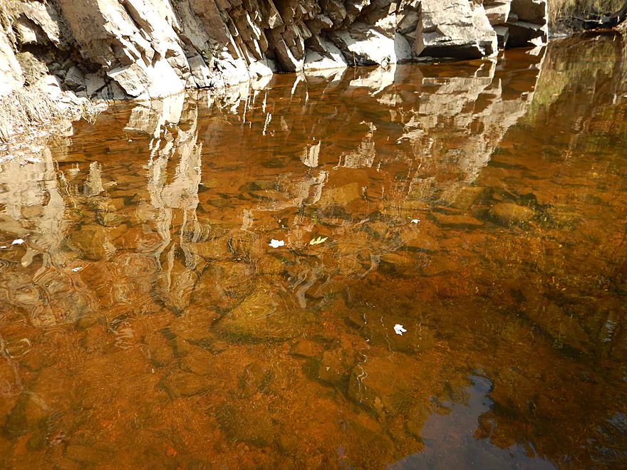
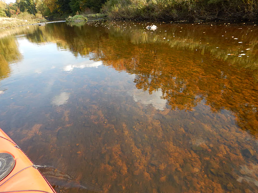
Great water clarity
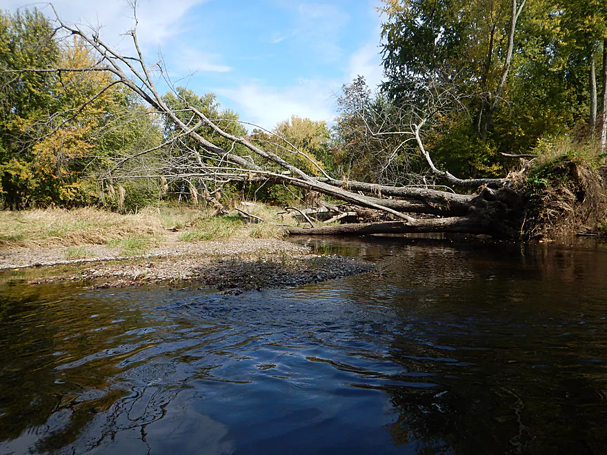
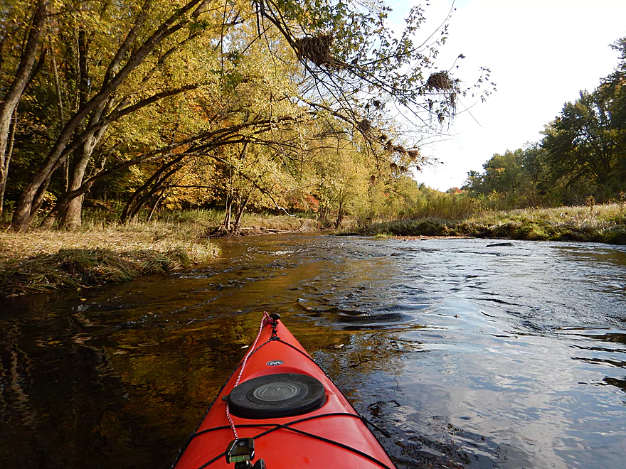
Log jam blocks the main channel at the top of an island
But the smaller channel is free
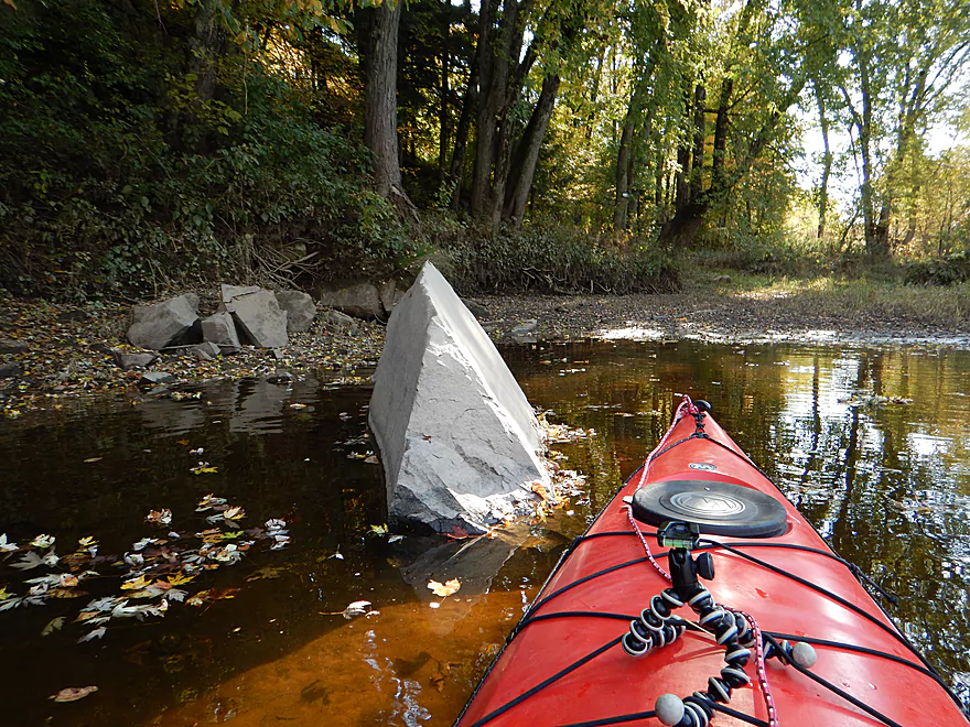
Sunken treasure
This sub-channel is shallow….
But nice
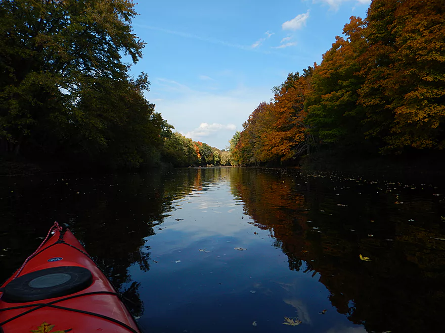
Classic Big Eau Pleine

Looks like a washed out bridge
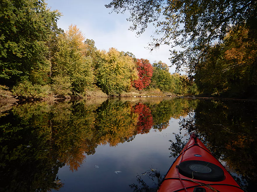
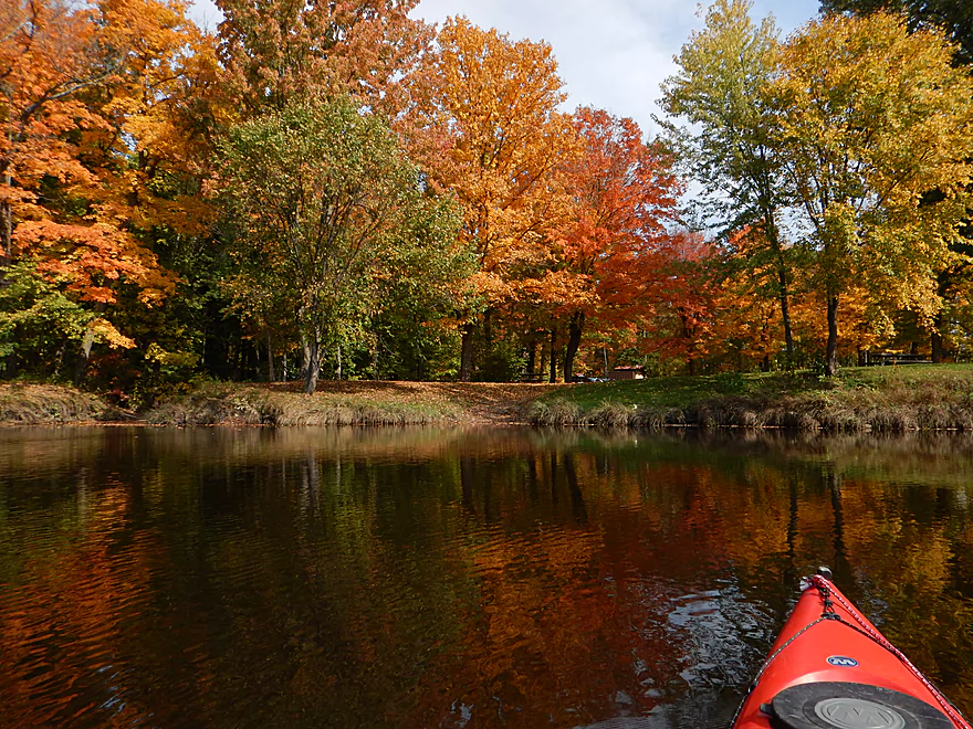
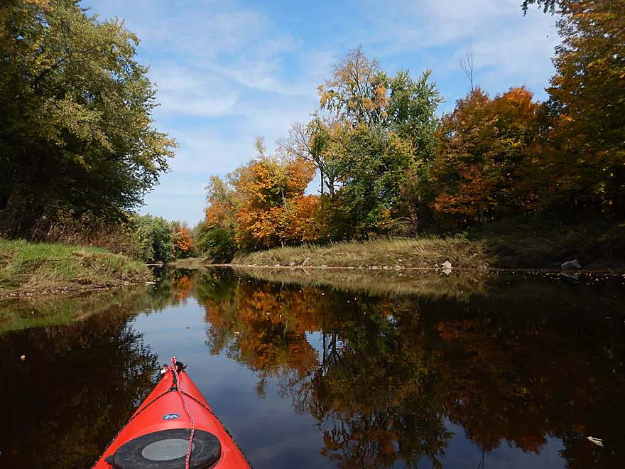
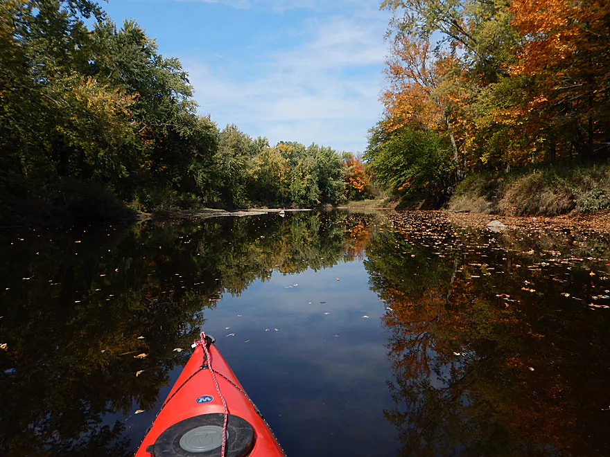
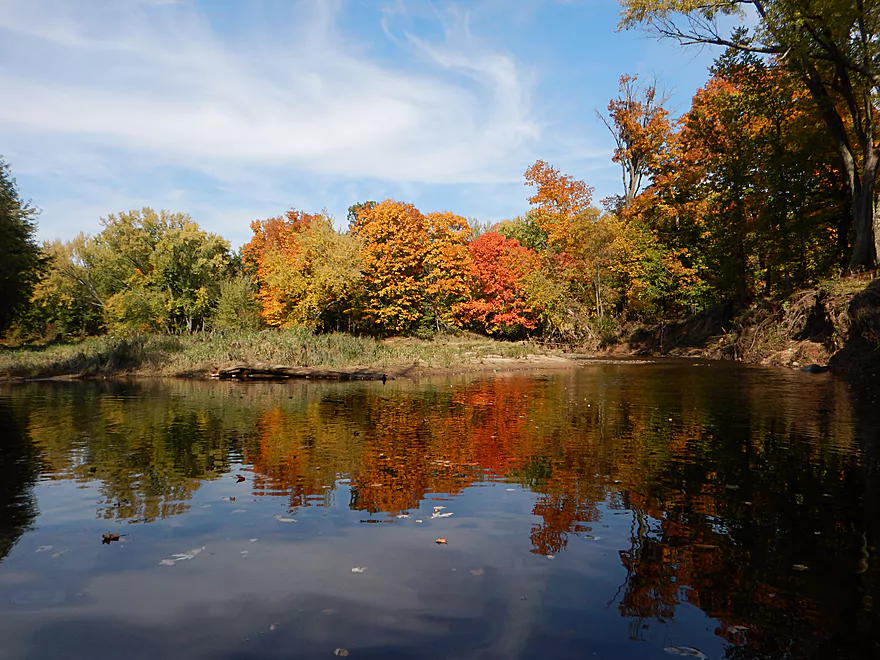
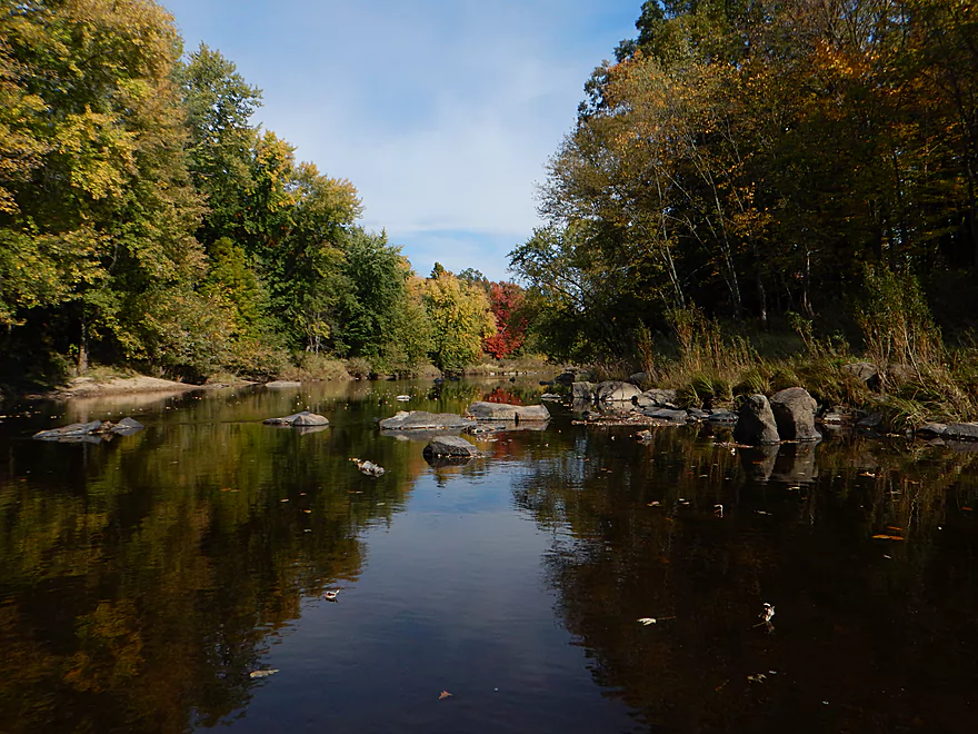
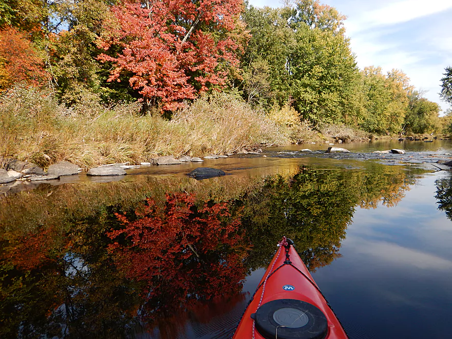
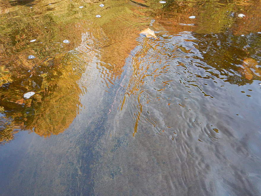
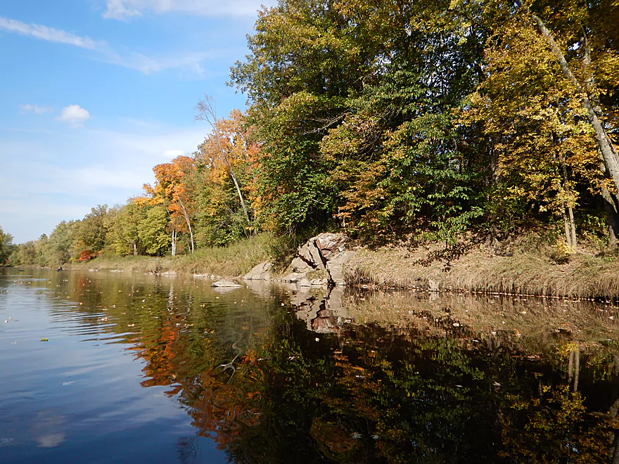
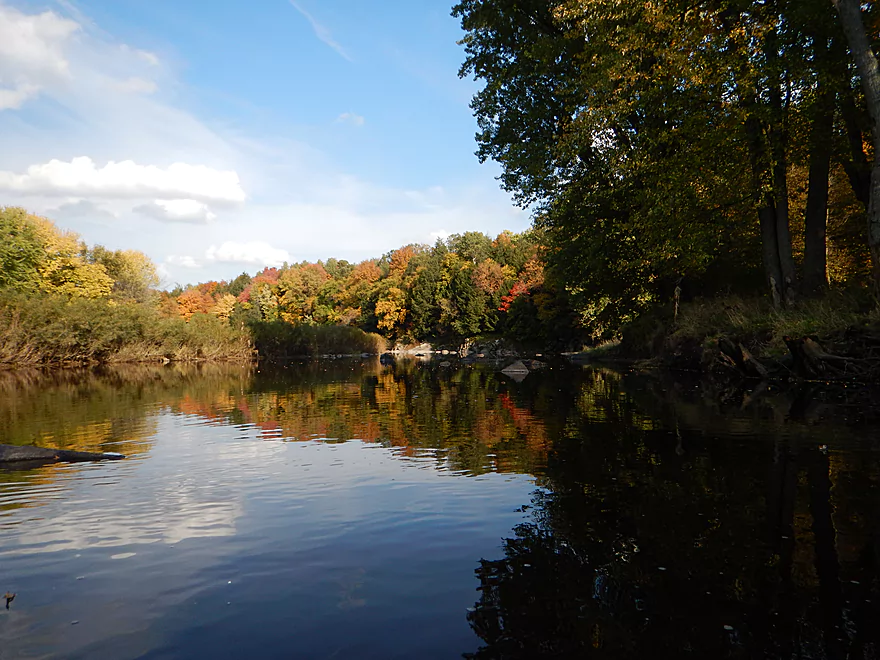
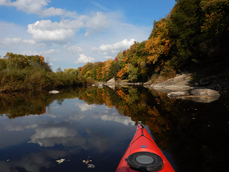
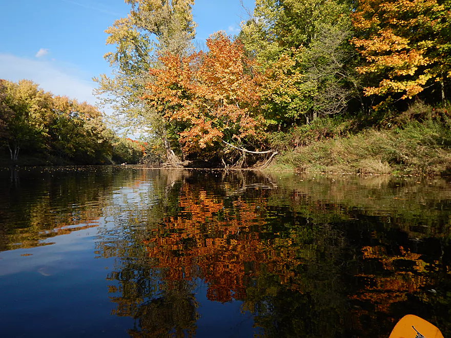
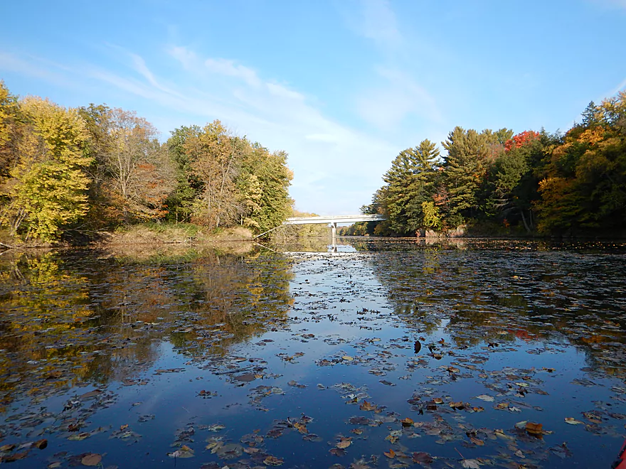
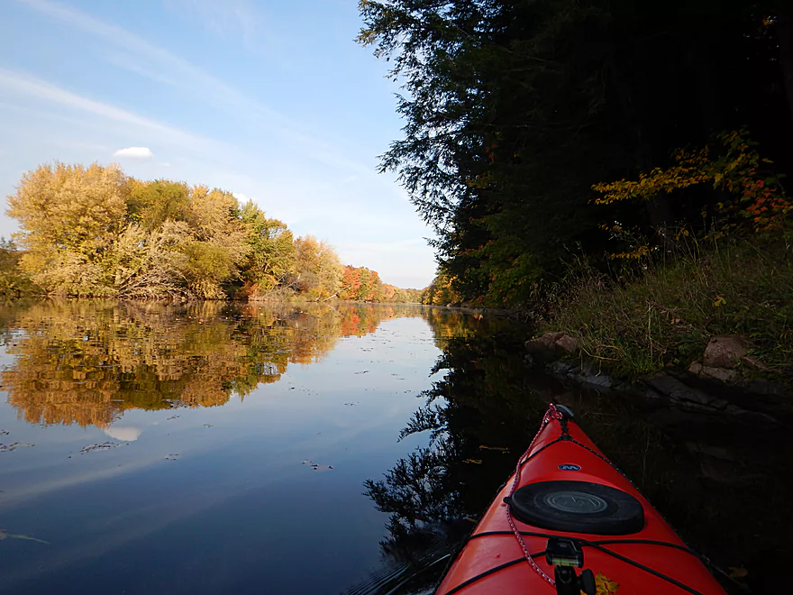
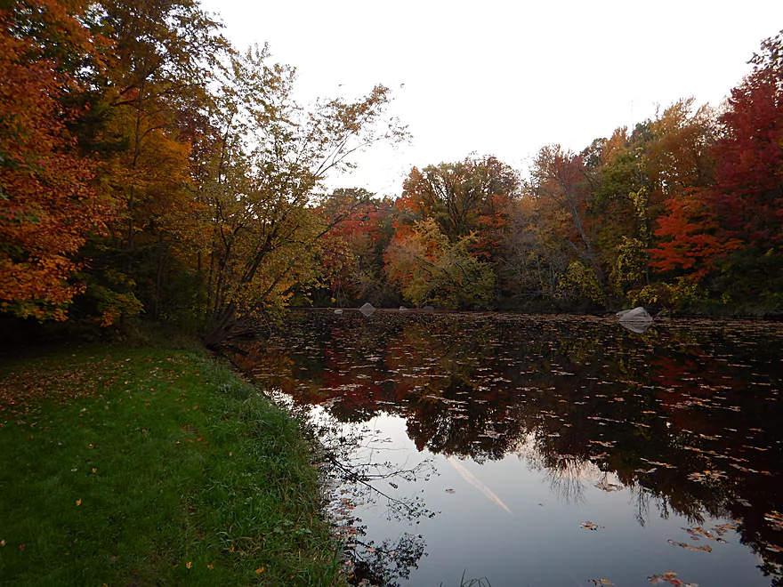
Fall color reflections
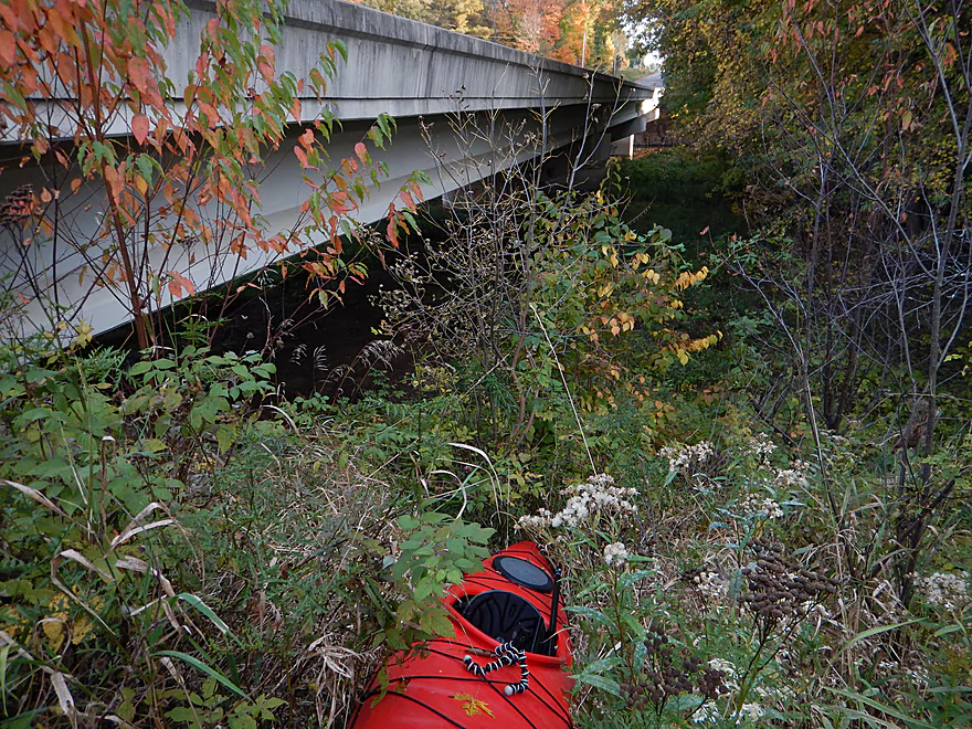
That red stuff…used to be part of my kayak (shallow trip!)
Nice rock bluff
Red water reminded me of the Black River
One of the more shallow areas
These riffles are tame now, but could be rough during high water
Terrifically clean
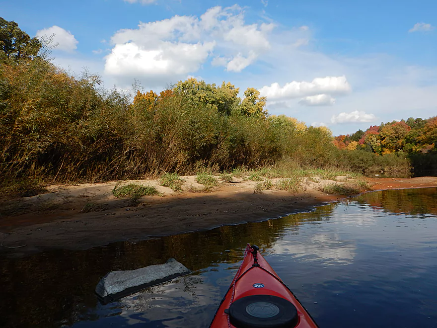
Were multiple sandbars on the trip
Underwater Martian landscape
My favorite section
Do not want to step on that
It is Optimus Prime!
Very nice rock bluffs
Surprised to see two other paddlers
Largest gravel bar
The flowage now kicks in :(
Sad to see how a dam can change a river
Still some nice leafy moments
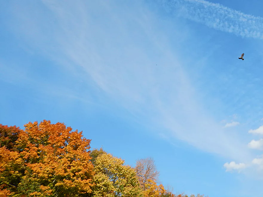
One of multiple eagles
Terrific landing…but private
Now entering a development

With unsightly McMansions and outdoor knick-knacks
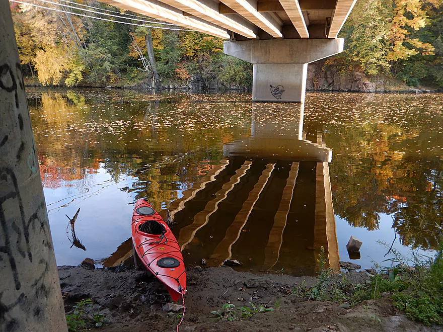
Hwy M Bridge
Exploring some nice rock bluffs northeast of the bridge
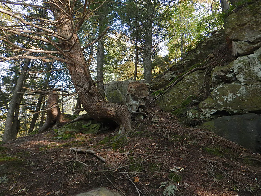
Tree is growing around the boulder
Hope you like leafy photography
Ferns finding their niche
Would be more impressive without the flowage
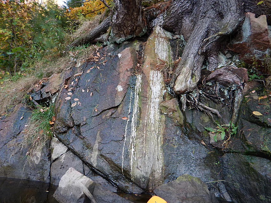
Tree sap stains on the rock
Nice flat disembarking area (but a tad muddy)
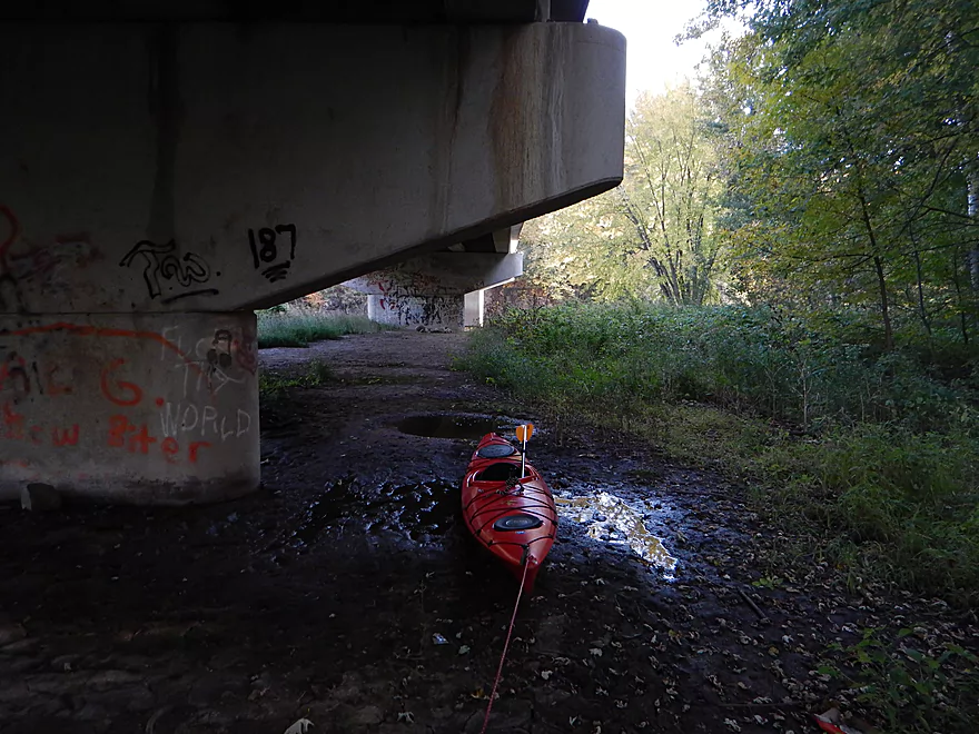
Muddy hike to get to the car
A steep drag up the embankment
Good parking
Scouting Cherokee Park
Dam splits the river here
You can put in above or below the dam
This looks a little shallow for paddling
Scouting the Little Eau Pleine–a nice future paddling prospect
Big Eau Pleine River

This is a pretty obscure prospect that is rarely reviewed and infrequently paddled…probably because most people associate the river with the massive flowage to the east, but a good length of the river upstream flows freely (mostly) and is actually a good paddling prospect.
Nice public access is available at Big Rapids County Park, with facilities and picnic area. Here there is a small dam and small flowage and you’ll have the choice of putting in above or below the dam. If you put in above the dam, you’ll get to use a very nice launch area for canoes by the grass and you can paddle a bit upstream to check out “Big Rapids” (what I did). At 34 CFS, Big Rapids wasn’t very big, but instead was an attractive boulder garden that was very photogenic against the fall colors. I believe you could navigate Big Rapids in a smallish boat at 34 CFS if you chose your route well and were willing to accept a bunch of bumps and get out a few times. To get around the dam (from upstream) there is a portage path on the SW side that is pretty good. Maybe not so good during high water though.
Again, you can put in below the dam, but the path is rougher and rockier, which I did not prefer.
No local livery service is available that I know of. “Silent Glide Canoe and Kayak Shop” is located to the north and may service the far upper sections of the Big Eau Pleine, but I doubt they come this far south. Their phone number is 715-748-0148 .
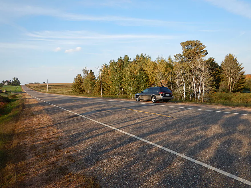
The bike shuttle is an adventure. There are many gravel roads in this part of the state, but if you bike shuttle south of the river, you will avoid most of them. On the downside, Hwy 97 and Hwy 153 are VERY busy, very fast and the shoulders are poor, with the city of Stratford being your only reprieve. The bigger problem is the hills. It is 7.7 miles, with a total 367′ climb and total 312′ drop (that is hilly).
In hindsight, the gravel roads aren’t too bad and the gravel is actually fairly small–more akin to a rails-to-trails path than your typical rural gravel road. Would have preferred (maybe) to bike shuttle north of the river on these gravel roads to avoid the traffic. That would be 7.2 miles–a drop of 249′ and climb of 318′.
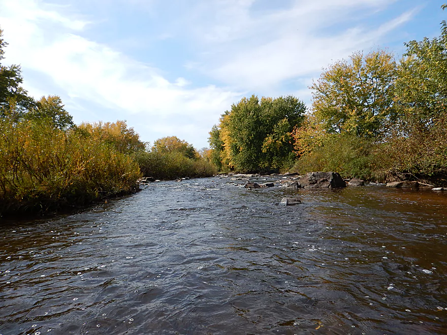
This was a pretty shallow trip, with most of the riffles being somewhat bumpy. I went at 34 CFS (measured by the local Stratford Gauge) and would not want to go much lower. I never once had to get out…but it would have been nice to glide over the riffles instead of bumping down them like stairs. On the flip side, you don’t want to go too high, or the attractive boulder gardens will be buried. And then even higher, the riffles could become dangerous rapids. My “guestimate” of a good depth range would be a floor of 40 CFS and a ceiling of 70 CFS. Possibly a ceiling of 100 CFS…and things could be pushy above that. I do believe this river flash floods (the gauge peaked at 8000 CFS a month ago), so do keep an eye on levels. As far as rapids go, nothing was above class 1 at this low flow rate. Mostly riffles, with maybe one slightly pushy section that could be tougher in higher water.
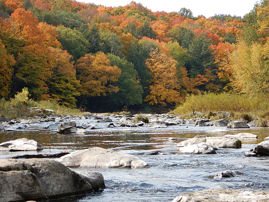
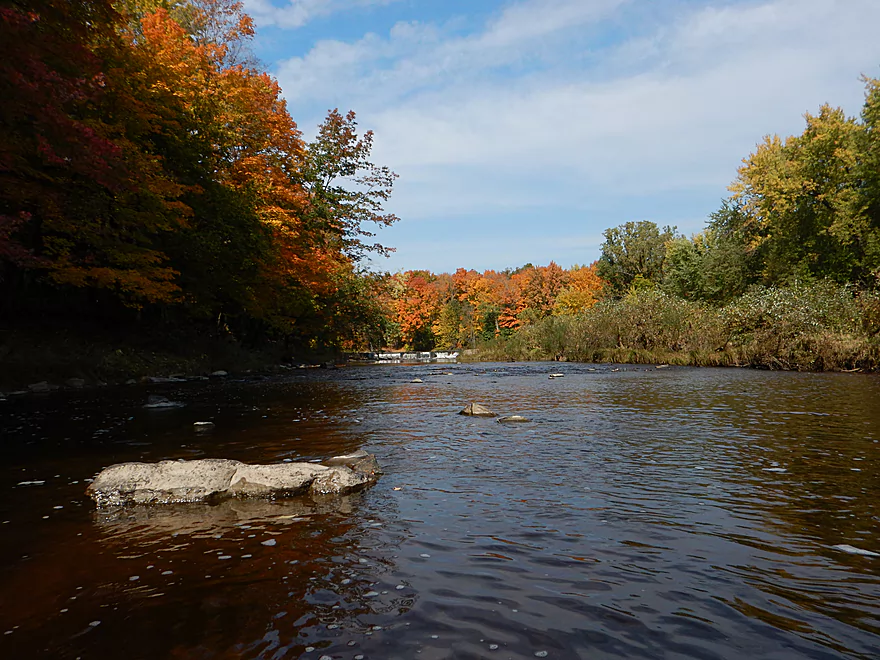
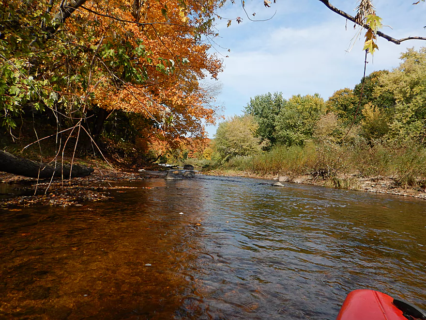
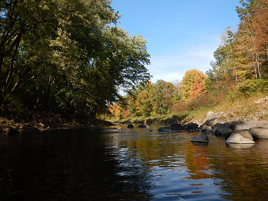
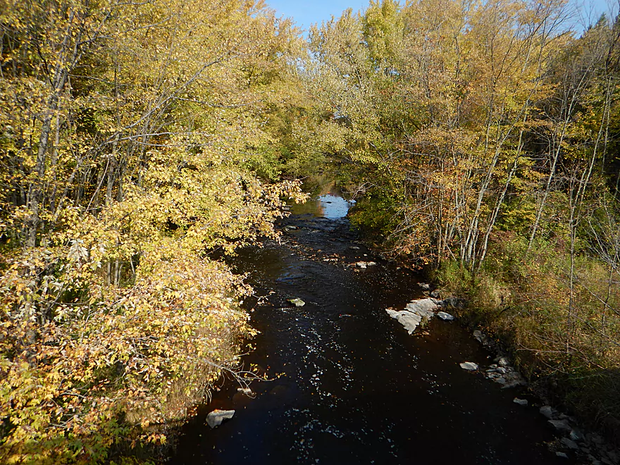
Very good water clarity with a slight red hue to it (the Black River watershed is just to the west). Clean banks with a mixture of sand and small rocks. There are some minor sandbars and several nice gravel bars on this trip. On occasion large rocks and boulder gardens will pop up, creating fun obstacle courses and mini-mazes (not always evident which path is clear, but it isn’t a problem).
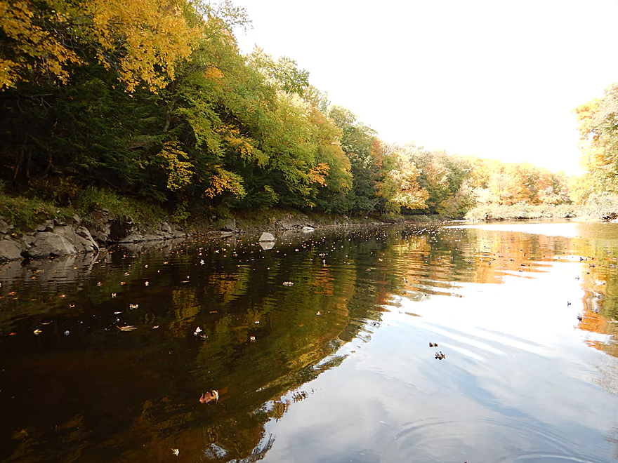
Some clams, dragonflies, an eagle and a deer. For all practical purposes this is an “up-north trip,” and yet there were very few pines and, instead, mostly hardwoods, which gives the river a unique character and made for a great fall color paddle. Not many open sections, with good dense tree cover giving the river a more intimate feel despite its decent width.
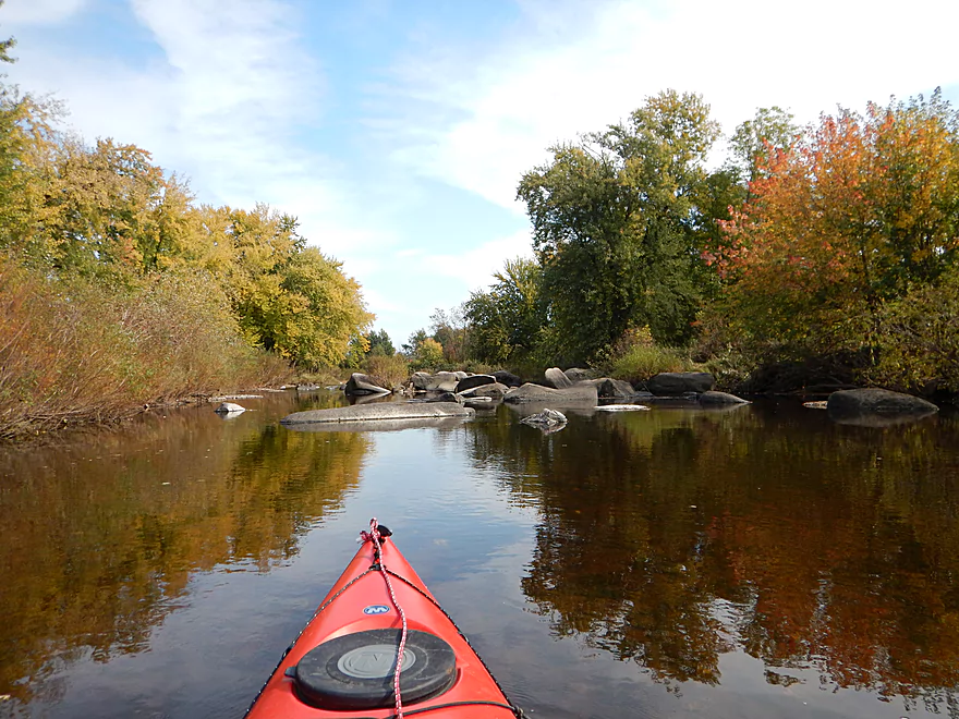
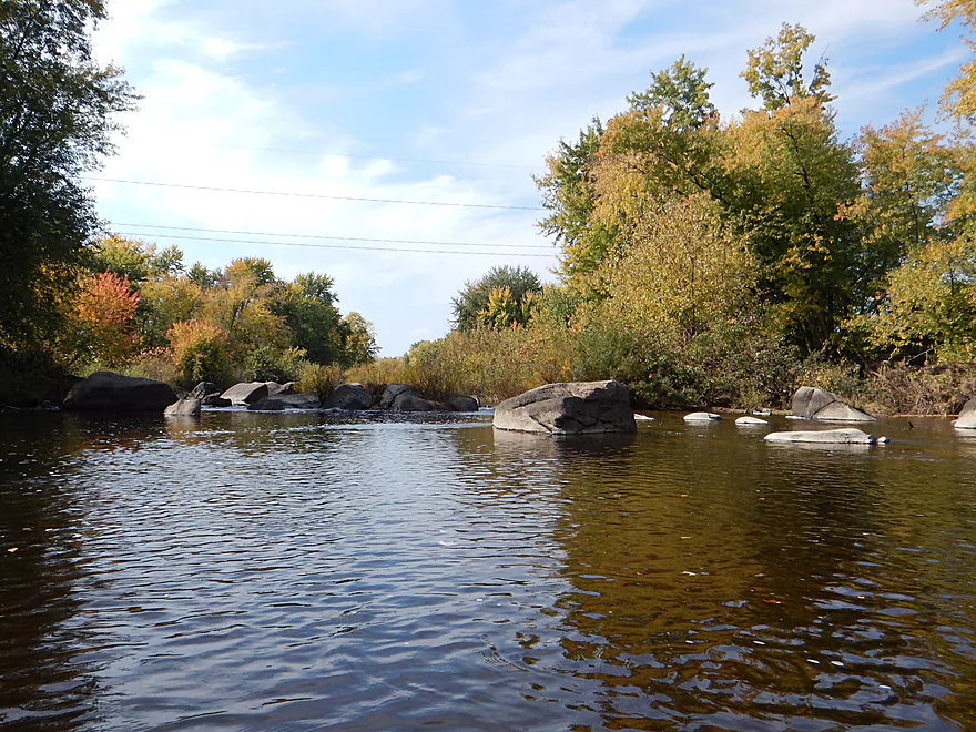
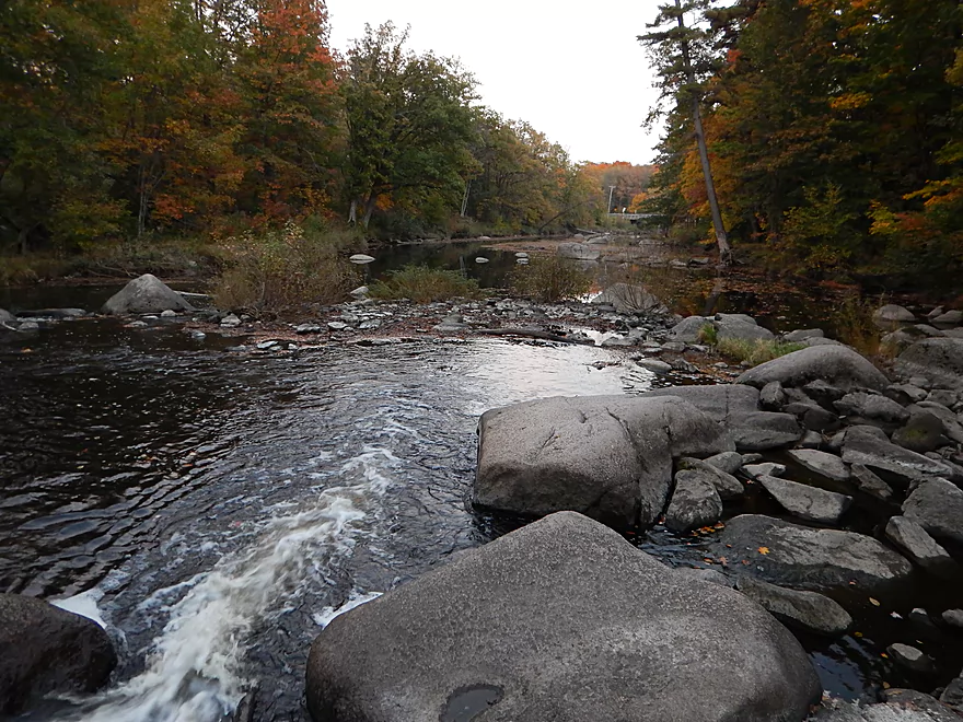
The put-in at Big Rapids County Park is very nice. The start after the dam will be one of the most shallow sections of the entire trip, so don’t be too discouraged. It gets better…especially after Hwy 97. Right off the bat, you’ll be treated to a nice rock bluff on your right bank, then a small boulder garden and riffle. There are a number of boulder gardens, but my favorite one is just upstream of the Hwy 97 bridge, which is the largest and most “maze-like.” Honestly, this is more of what I had hoped the East Fork of the Black River (neighbor to the west) would have been like and that was still a good trip.
The other highlight of the Big Eau Pleine will be the rock bluffs. The second best will be a mile after Hwy 97 on your left. The best will be maybe two miles after this on your right–a combination of great water clarity, attractive boulder gardens, massive river boulders and cool rock bluffs, all in one section.
Was thinking what a wonderful undiscovered paddle this was, when *surprise* I was passed by two paddlers (I get passed a lot on my trips as taking pictures chews up a lot of time…don’t trust my trip times!). They were friendly and were having a good time despite the low water levels. I would be surprised if you saw anybody else on this trip though due to the lack of developed take-outs.
What made this trip extra special was the timing: it was terrific for fall color! Not only on the banks…but the fallen leaves (especially the many maple leaves) created very attractive patterns on the water surface. A log or obstruction would block the leaves to create very cool leaf dams. In some cases, the leaves had sunk in mass in clear water, creating a striking scene to paddle over.
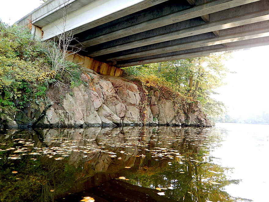
The flowage and development at the end of the trip were unfortunate, but there are still some nice sections of the river here as well. On the right bank, just upstream of Hwy M, will be the fourth set of shoreline rock bluffs. You can sneak to your right (just before the bridge) to explore a hidey Dells-ish cove more in depth. The take-out was not great (which I’ll cover below), but there aren’t that many other options.
Only one jam a little after Hwy 97. It closes the main left channel, but you can continue on with the smaller right channel (bumpy, but very scenic). None of the rapids were dangerous (all class 1), although at much higher flow rates, they could be pushy. Other than that, it was clear sailing.
Not good and probably the reason so few paddle this trip. The take-out is directly under the Hwy M bridge (north side) and there is a nice flat sandy area for disembarking. Drag your kayak maybe 300′ over a sandy/muddy surface before you get to the wing walls. From here it is a pretty steep “pull-up” to the shoulder through thick grass and with the only mosquitoes on the trip. You can choose the west or east banks…but they’re about the same. I’ve faced plenty worse and wasn’t too fazed by this, but more pampered paddlers might not care for this. Bring rope. Parking is fine on the shoulders.
The frustrating thing is that there is an excellent boat landing just a half mile upstream. The problem is that it is owned by the local homeowners association and is clearly marked for members only. Oh well…at least by taking out a half mile later you get more scenic rock bluffs.
For the most part, this is a pretty wild and undeveloped section of the river, which is fantastic. There is a little road noise close to Hwy 97 but, all in all, not bad.
A mile upstream of the Hwy M take-out, the flowage starts and this is most unfortunate. You lose your helping current, the boulder gardens and gravel bars are submerged, the deep water masks the water clarity, and the river loses a lot of appeal.
Like a vulture on a roadkill, developers love flowages because of their stable water line and ability to support power boats…and this was no exception. Not very sightly…there were too many McMansions, football field-sized lawns, yard knick-knacks and other eyesores. After my take-out, the development only gets worse, and from here on, it is powerboat land. If you develop by a river…you should at least preserve the tree line and tuck the houses away from the river. The houses ideally would use neutral natural colors (dark greens, browns) to blend in and the developer should be aware that what makes the river distinct and attractive is paradoxically taken away by riverside development.
Rant #2 is reserved for the two dams. The small dam by Big Rapids County Park is only maybe 1000′ long, but ~3′ high, which is significant and means really cool rapids and boulder gardens are being submerged. This is tragic. The bigger problem is the Big Eau Pleine Reservoir. Quite huge (believe it is fifth largest flowage in Wisconsin), it has no current nor character and significantly submerges some of the rocky dells (deja Kilbourn Dam in Wisconsin Dells). Hopefully, one day the powers that be will realize that undammed rivers are more of a recreational asset than dammed. We have lots of lakes in Wisconsin (~15,000) and really don’t need more. Much of this is driven by greed…waterfront owners and developers want the resale value associated with waterfront properties, and do not value the ecological nor recreational harm these flowages cause.
Not many paddle reviewers cover the Big Eau Pleine River. But one that did is Frank F. Piranio and his reviews were very much appreciated.
Detailed Overview
- Upstream of Gierl Ave: Only runnable at very high flow rates. A reader by the name of Jeremy provided a quick summary here.
- Gierl Ave to Elderberry Road: 2.1 miles. This leg doesn’t have quite the concentration of boulders/rapids as downstream legs but is a good prospect with maybe one major stretch of rapids/boulders and three mediocre stretches. This is a shallow leg that can only be run in high water.
- Elderberry Road to Cherokee Park: 3.7 miles.
- Elderberry Road to Huckleberry Road: 1.9 miles. A shallow wooded stretch with a handful of Class 1's and two Class 2's at the end.
- Huckleberry Road to Cherokee Park: 1.5 miles. Very wooded flowing mostly through Cherokee Park. Nice leg with three Class 3's and one large boulder garden.
- Cherokee Park to Hazelnut Road: 3.1 miles. Fantastic trip with clear water, many boulder gardens, and fun rapids. The highlight is an 800′ long boulder field below Hwy N.
- Hazelnut Road to March Rapids Park: 6.1 miles. Heavily wooded leg with multiple boulder gardens and a few small outcrops. There are two sets of significant Class 2 rapids.
- March Rapids Park to Big Rapids Park: 3.4 miles. A good trip with 7 Class 1’s and 2 Class 2’s.
- Big Rapids Park to Hwy M: 8.5 miles.
- Big Rapids Park to Hwy 97: 1.9 miles. Shallow but scenic section.
- Hwy 97 to Hwy M: 5.6 miles. Scenic section with several rock outcrops.
- Hwy M to Hwy 153: 0.9 miles. There are some rock walls after Hwy M, but you could just paddle down and back to explore, instead of taking out at Hwy 153. Hwy 153 is not an ideal take-out.
- Hwy 153 to Maryel Drive Boat Ramp: 2.2 miles. Probably uninteresting flowage padding. Put-in at Hwy 153 would be tricky, but the take-out at the ramp would be good.
- Maryel Drive to Reservoir Dam: 13.3 miles. A huge lake that is not paddle friendly. Numerous launch options are marked on my overview map. The dam is located on the mouth near the Wisconsin River.
Trip Map
Overview Map
Video
Photos Size:
As a Stratford native, we paddle this river often. It is a great trip when the water is high, but in the middle of summer, water levels get low and make the pushing over the shallow sections, or getting out and pulling the kayak over, more work than it is worth. There are many rapids along the river, and all are navigable even in high water, even for an amateur paddler like myself. We often put in at March Rapids, and depending on available time, we will pull out at the “rendering plant” off of Hillside St. There is good parking here and is a semi-popular fishing spot. If we have more time, we paddle past Big Rapids and pull out where Equity St. curves next to the river. Here, parking is on the road, which doesn’t get much traffic. I’ve never taken it as far as the M bridge, but now I’ll have to! My husband has put in at Cherokee before as well, so that is always an option. It certainly is a beautiful piece of river!
Thanks for the comment!
Great review and amazing pictures. Got into kayaking last year after my girlfriend got me a kayak. Which i also bought a house just south of Cherokee park which the river runs right through the back yard. So plenty of opportunity to run the river north of big rapids. During a big rain in August 2016 I put in 10 miles north of Cherokee on the river, 1 mile north of Hwy A that runs to Dorchester. Much smaller “creek” normally, but with the rains it was flowing great. Going through cow-fields and watching out for barb wire fencing going across the river made it interesting. A nice lazy, curvy river, through fields and woods that you normally wouldnt be able to go in. There is also another dam halfway between Hwy A and Hwy 29 that you need to go over. The closer you get to Cherokee Park the more rapids are encountered. The high water made it relatively easy, much lower and it would be challenging (I dont know what height it was at when I ran it). Between 29 and Cherokee park There are 3-4 sets of much larger rapids. Hiking north in Cherokee park along the river and you can see 2 areas that are a boulder field. Made it right over the dam at Cherokee under the watchful eyes of about 20 Mennonites that were having a get-together at the park that day. Then south of Cherokee park there is about a 500′ stretch of another boulder field. Navigable only in higher waters. Also where I tipped over right at the end of the rapids.
From that point I’ve traveled to March Rapids park many times and Big Rapids park a handful of times. Also one time to Hwy M. Very nice stretch of water from Cherokee to Big Rapids. Many sets of easier rapids with sections of lazy river. Plenty of forest areas, a few rocky bluffs, but mostly mud or sand for sides and banks. Deer, turkey and eagles are seen quite a bit.
Thanks so much Jeremey for the information on the river! Especially appreciate the tidbits on the sections upstream of Big Rapids Park which I don’t know much about. My next trip will be probably Cherokee Park to Big Rapids Park which should be a neat experience.
Just want to say this is a valuable site. I used it to discover the Bark river which is just a bit south of us . The only drawback of the trip was my girlfriend realizing at the end that she left her keys in the put-in car at Pickets.
The way you have the star rating, video and pictures is also great. Keep up the good work, I’m planning next years Wisconsin trips with the info I get through this site. Thanks a lot and have a nice winter.
Florida is another great place for paddling, we try to get down there every winter. Once spent 5 days in Everglades starting in fresh water out to the gulf (my girlfriends favorite vacation). Also north Florida the Santa Fe river, St Marks, Ichetuknee and many more unbelievably clear rivers. If you ever get a chance to escape the cold in the winter, I highly recommend Florida paddling.
Gary
Thanks Gary for the comment and sorry for the delay in getting back to you (I’ve been having some system issues). I actually have seriously considered doing some Florida Rivers before…they look terrific!