
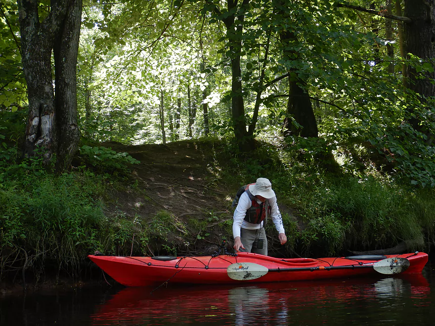
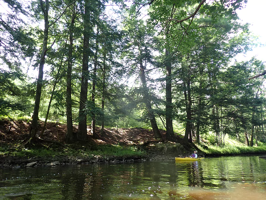
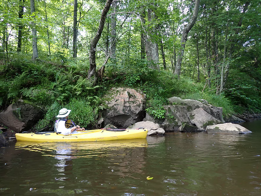
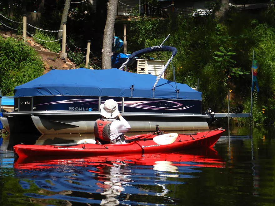
Putting in off Robin Lane
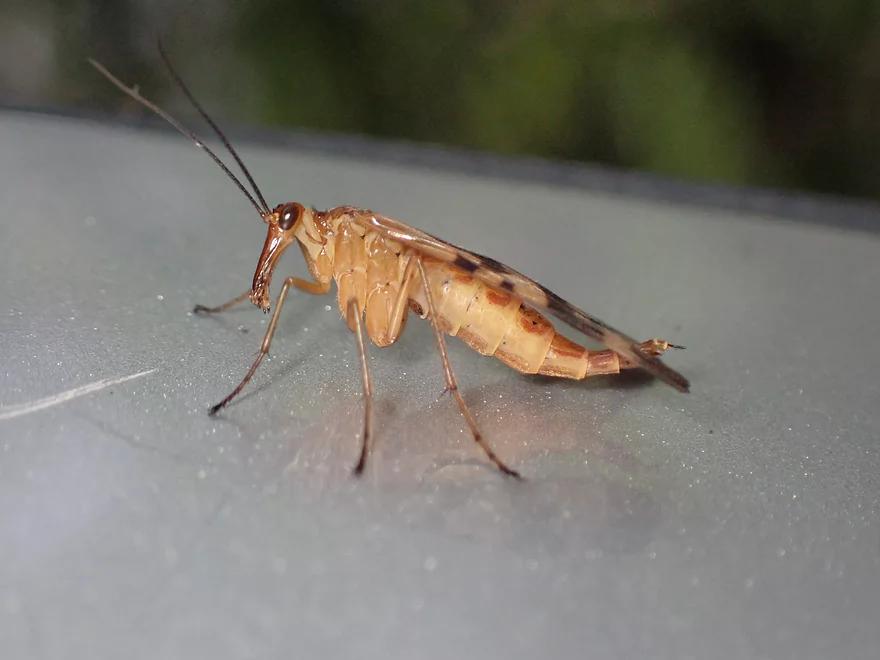
Scorpionfly
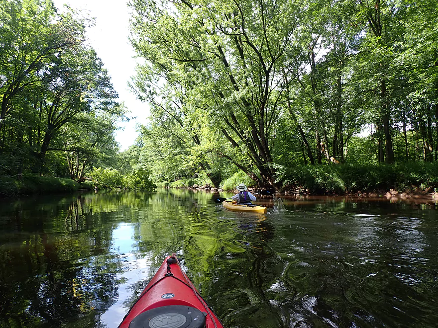
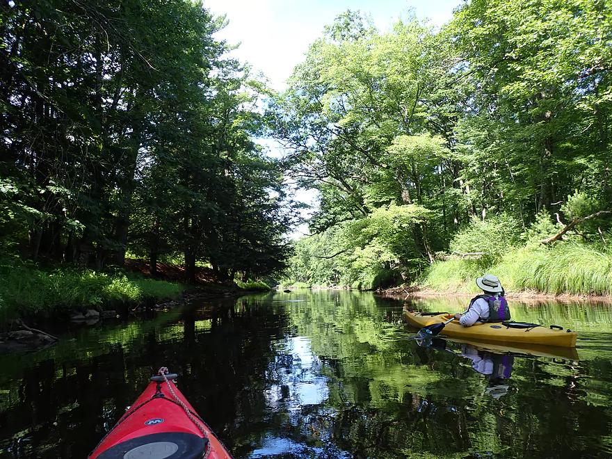
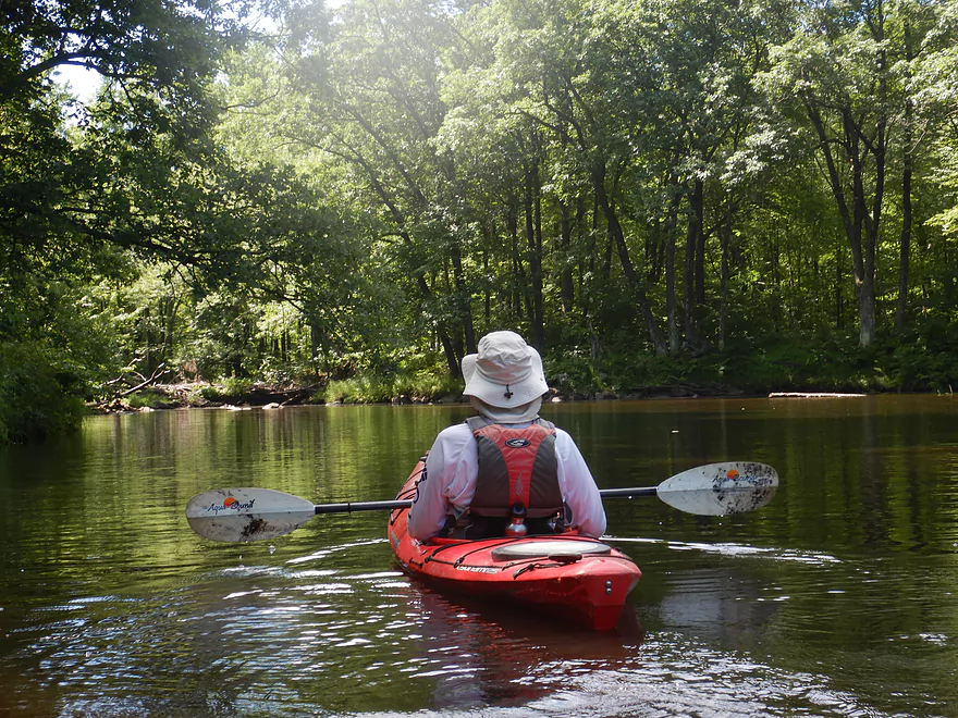
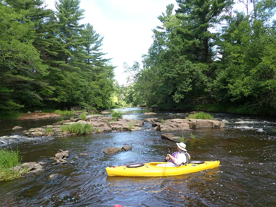
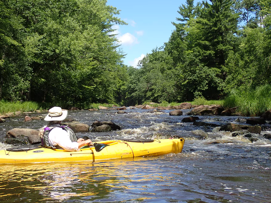
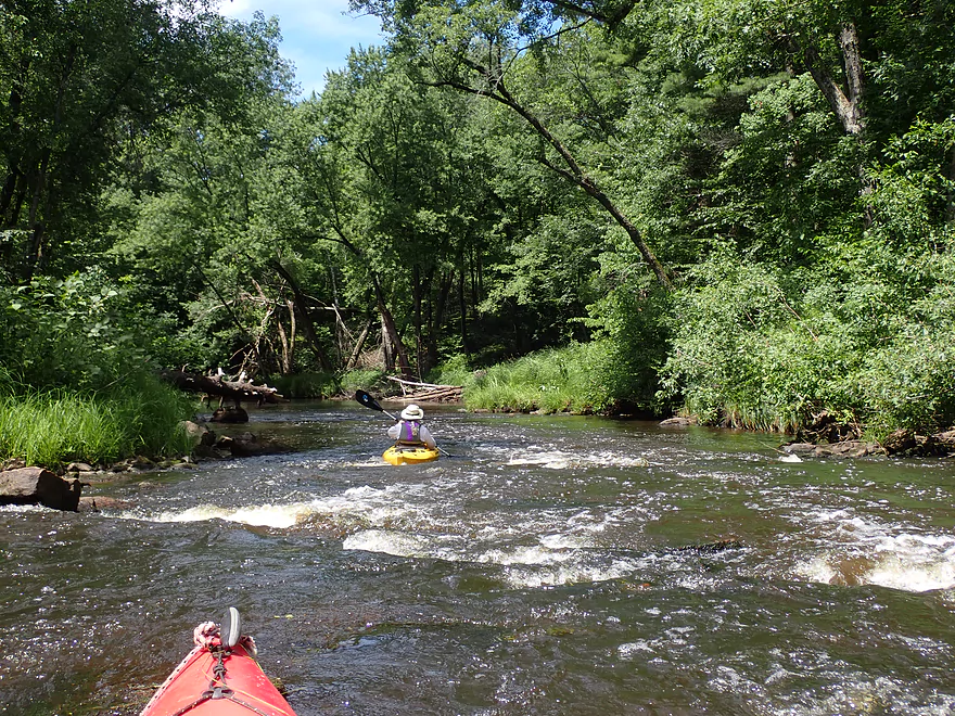
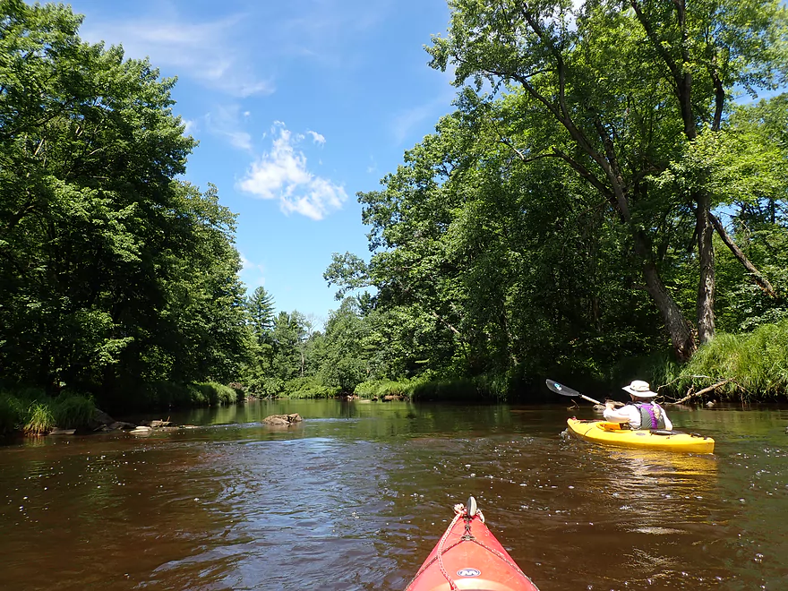
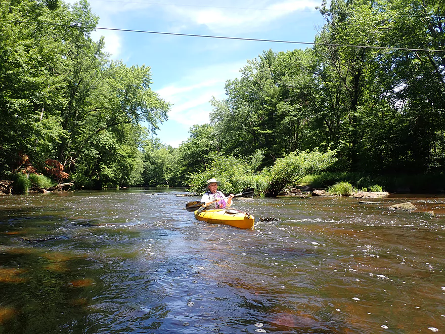
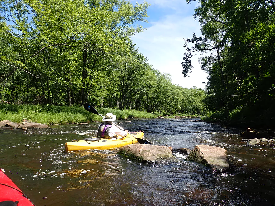
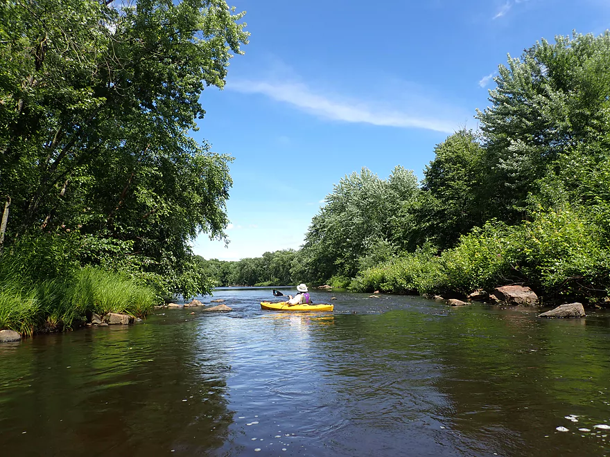
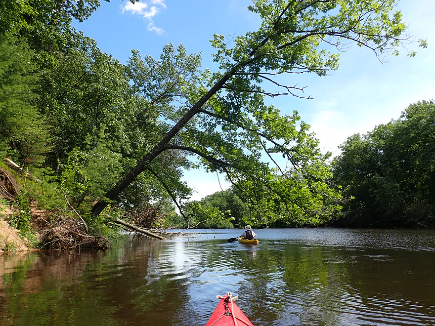
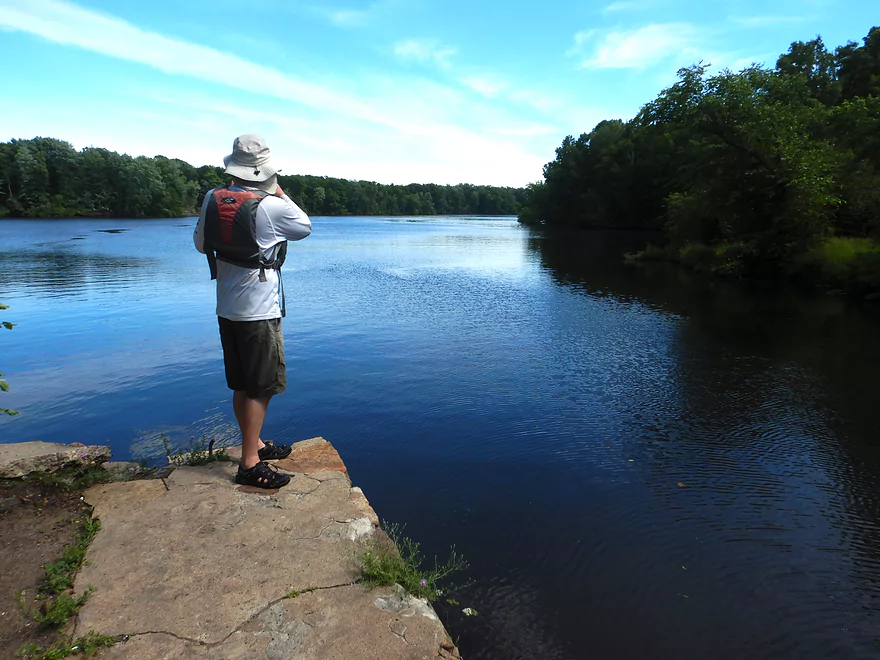
Nice peaceful stretch to start
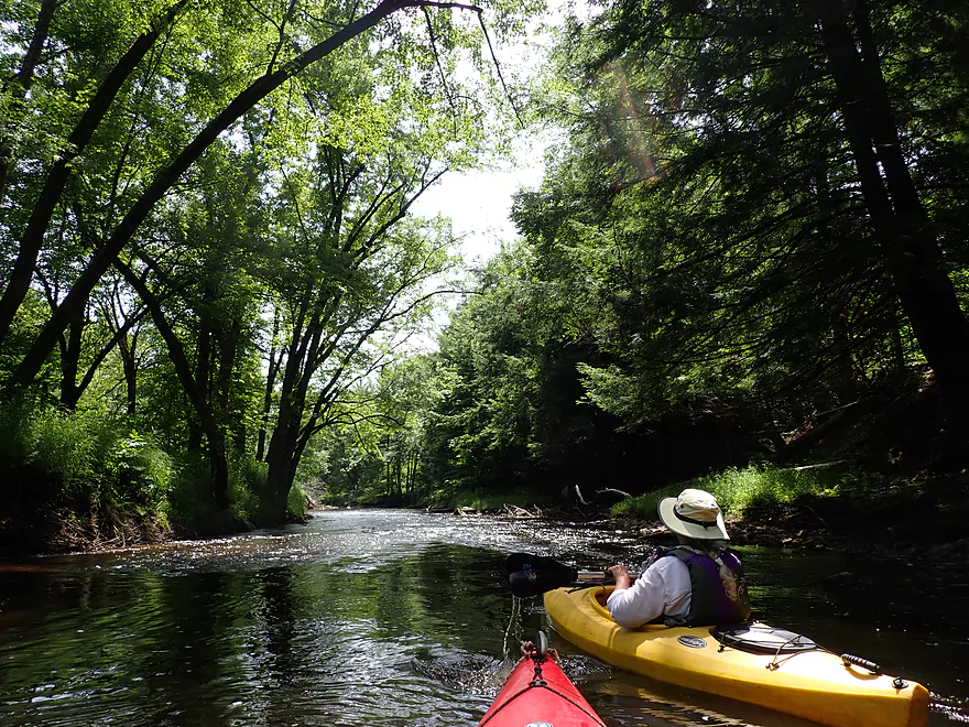
Attractive row of hemlocks
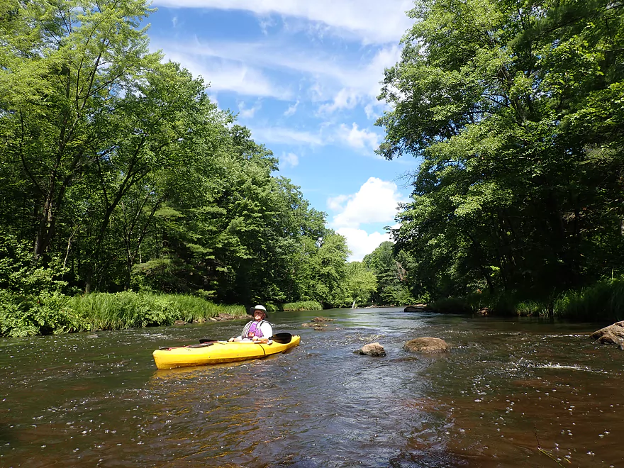
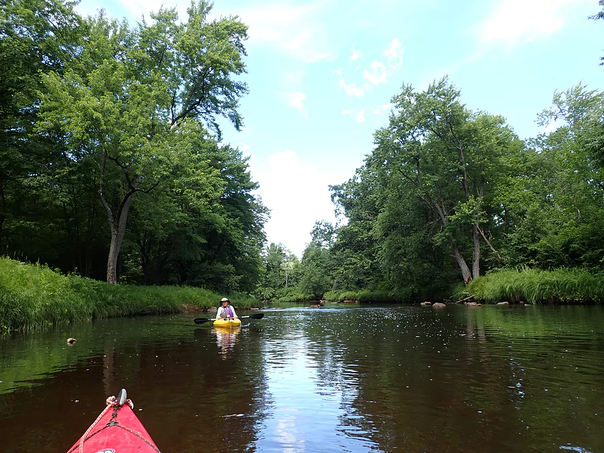
Very much reminded me of the Yellow River by Pittsville
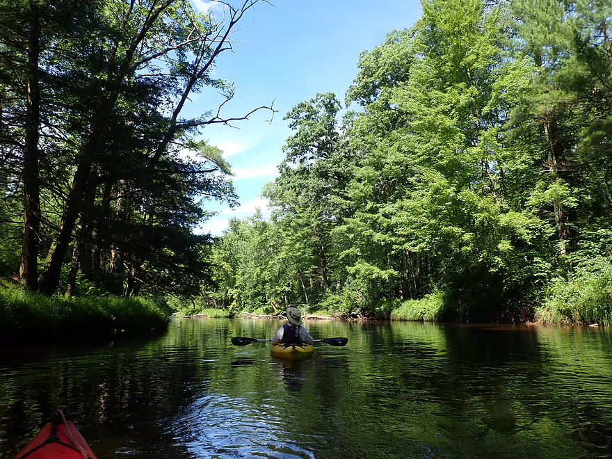
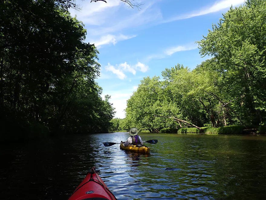
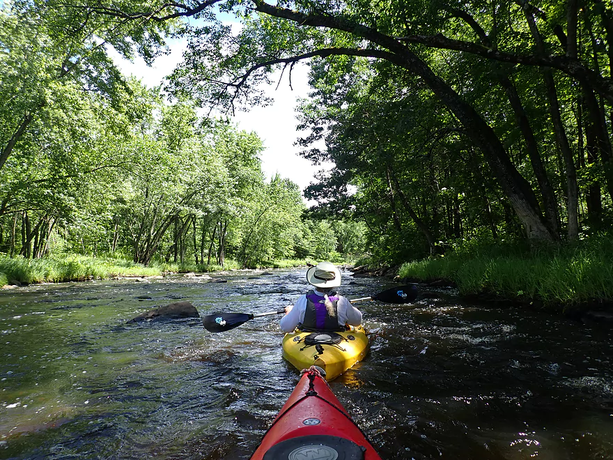
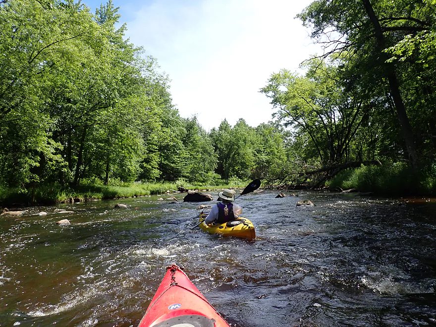
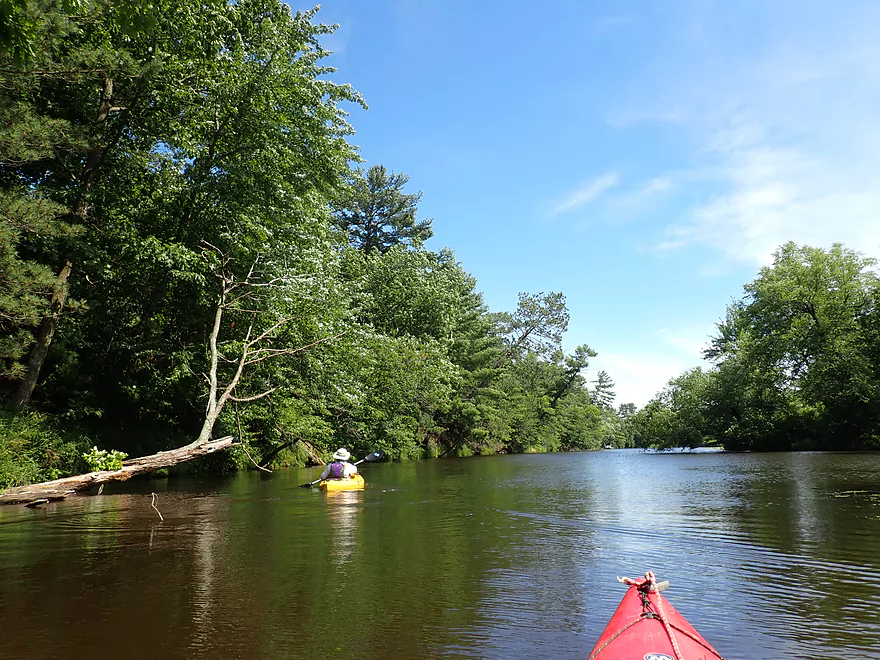
Mostly flatwater paddling in the first few miles
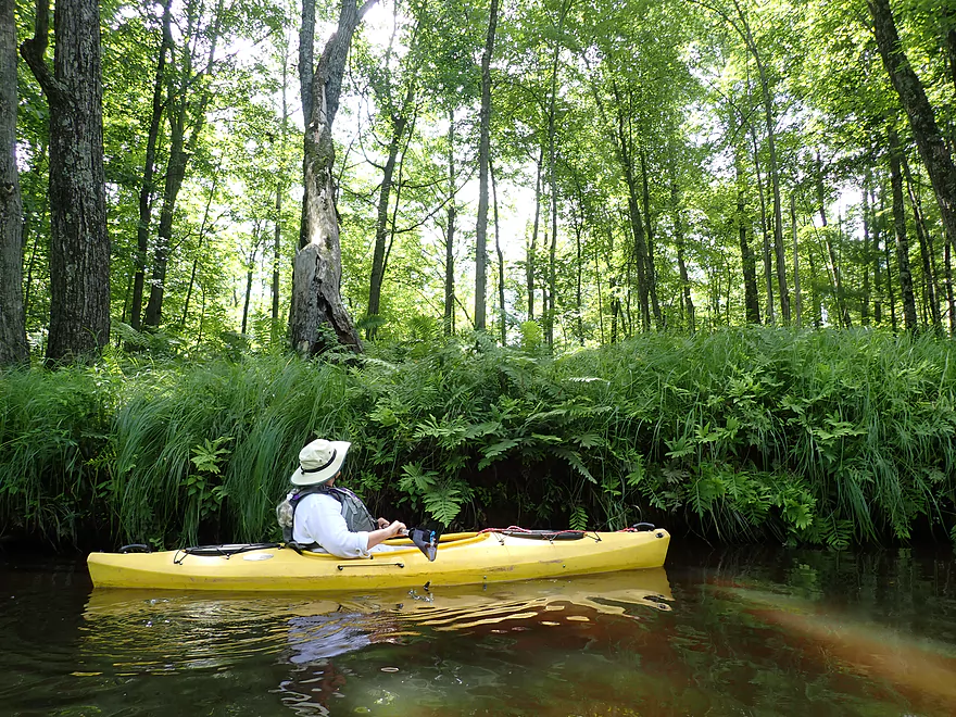
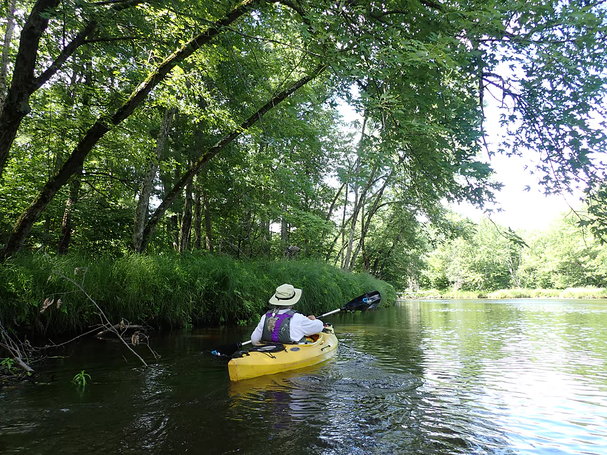
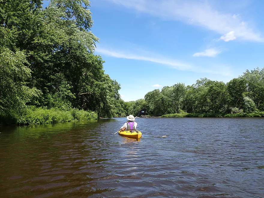
Ostrich ferns and sedges gracefully arching over the river
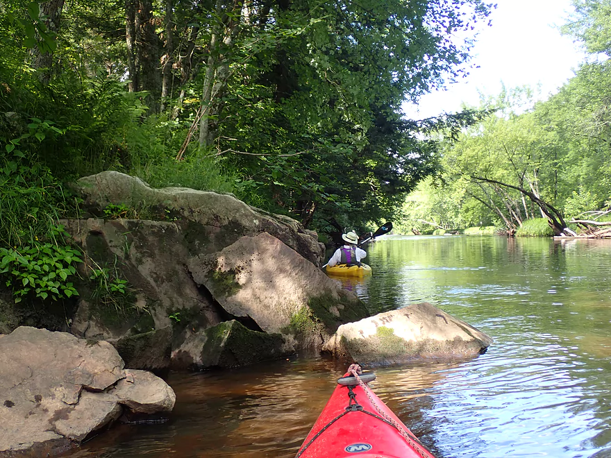
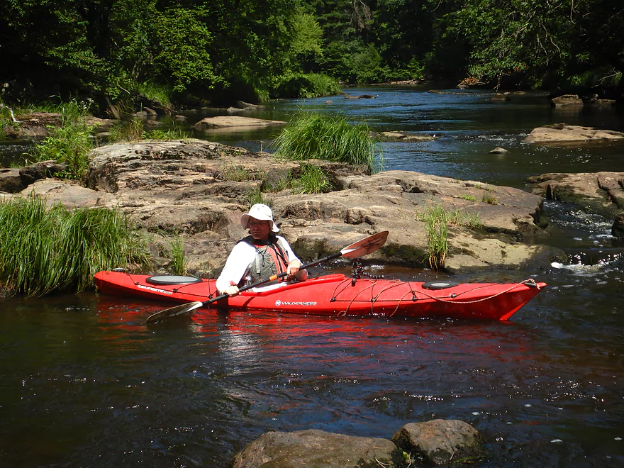
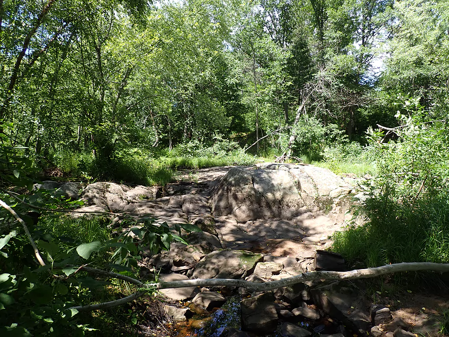
Some nice granite boulders
This river would look very different in spring or fall
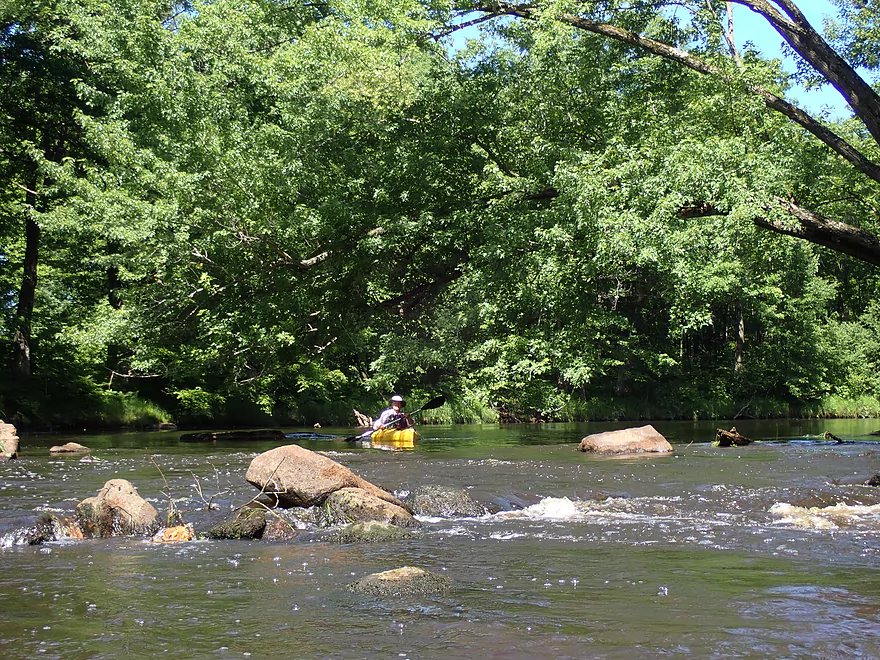
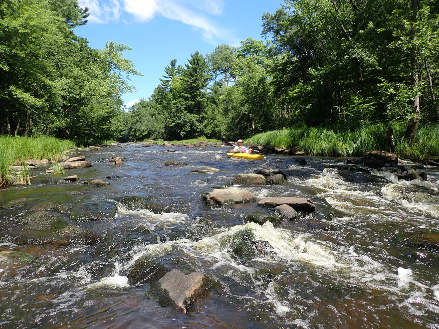
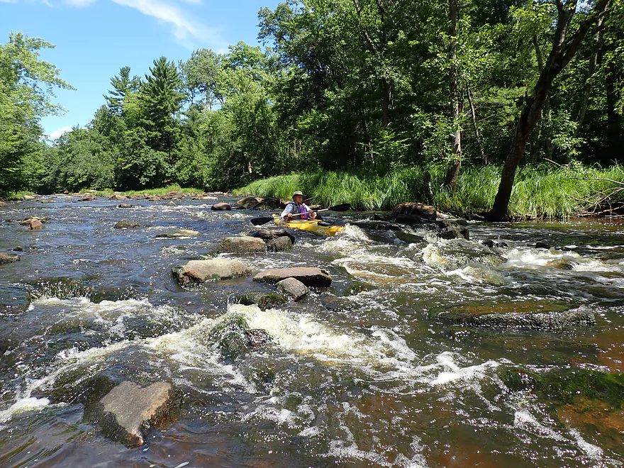
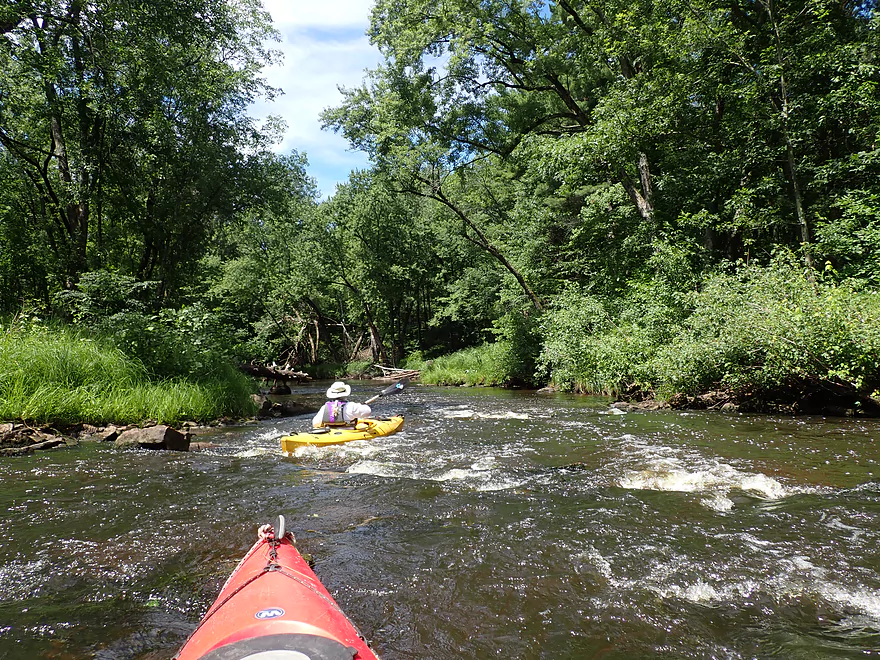
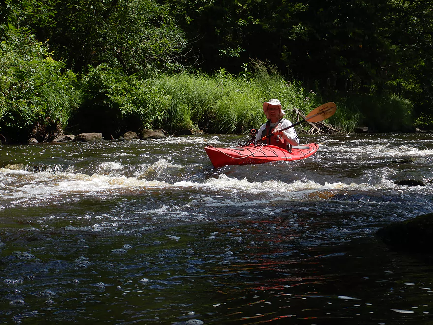
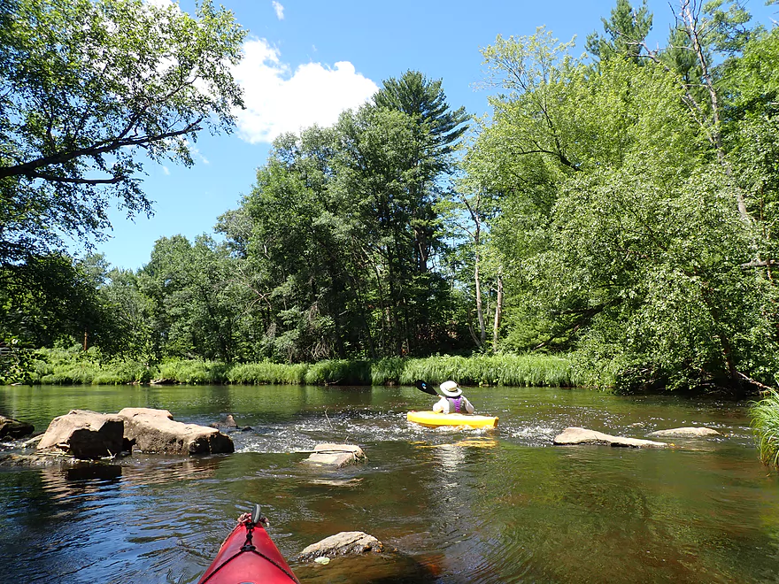
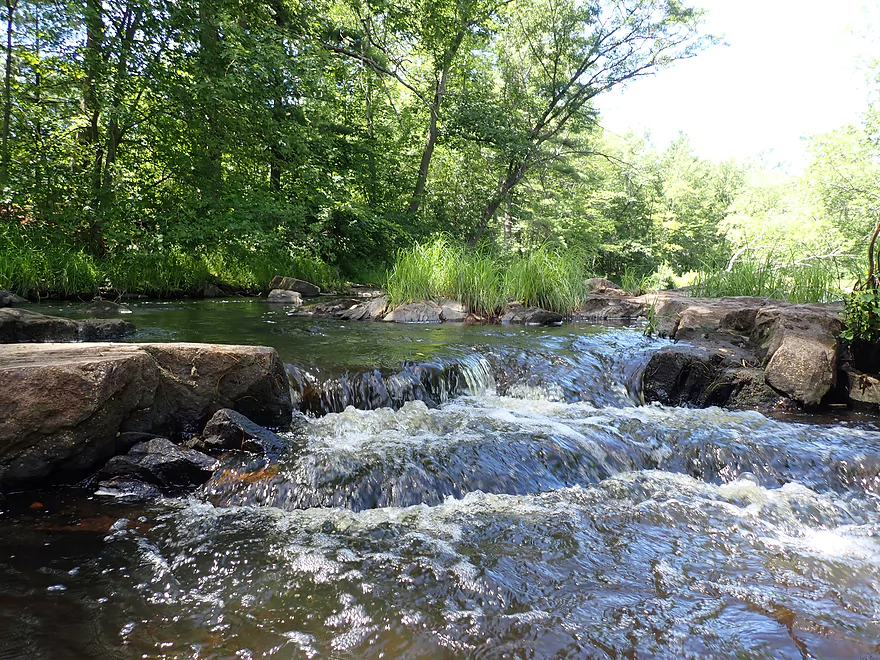
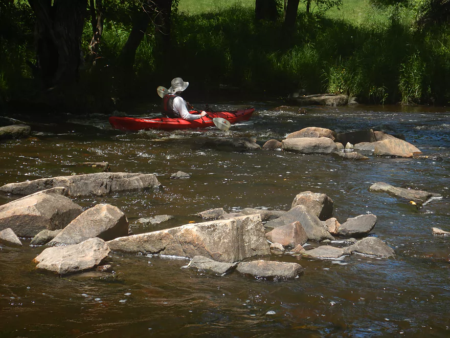
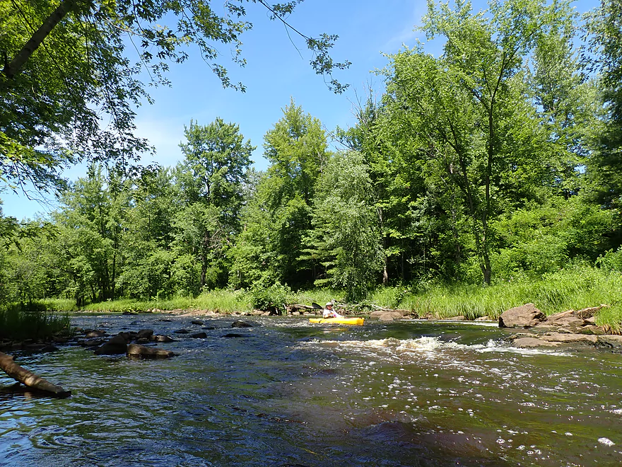
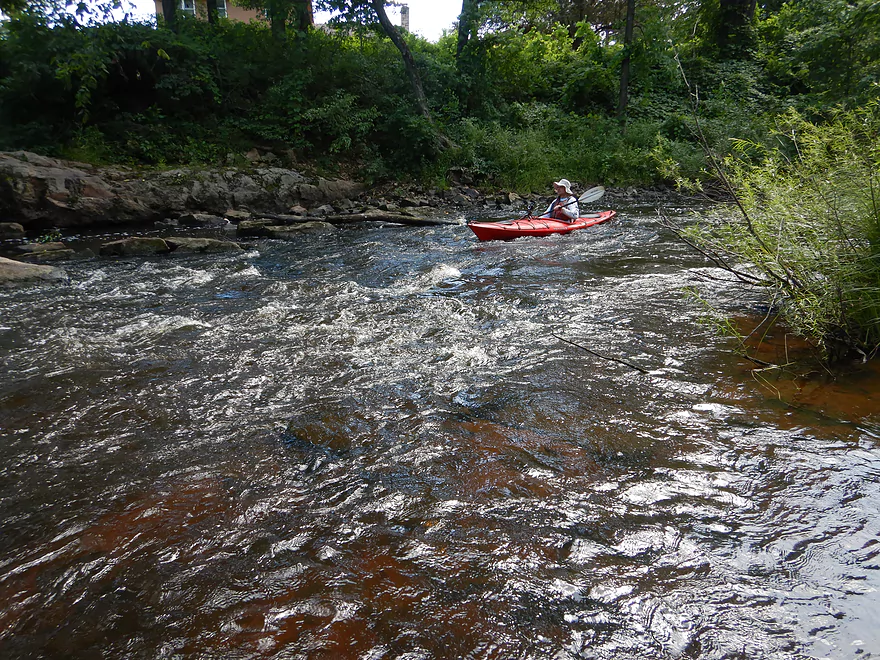
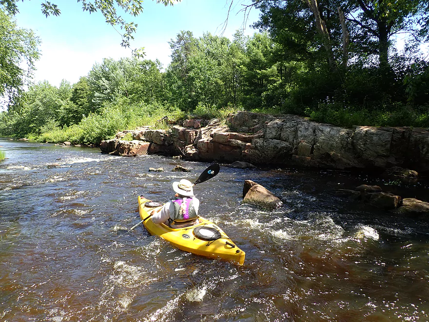
The first rapids
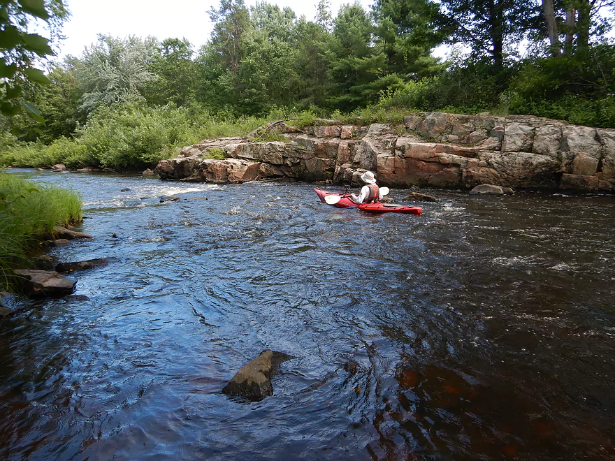
Followed by some nice riffles
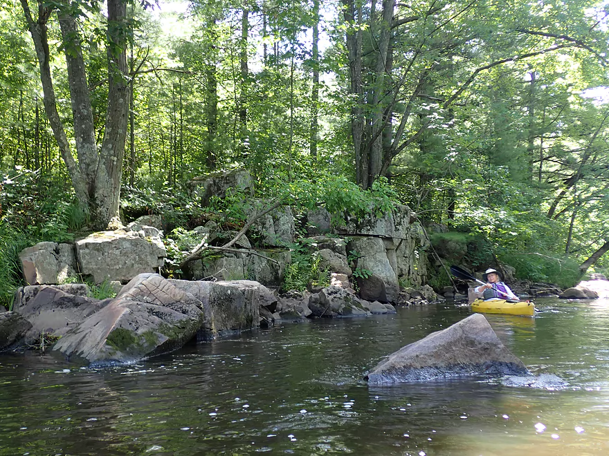
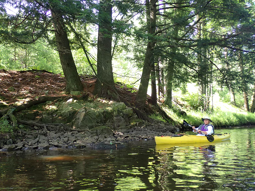
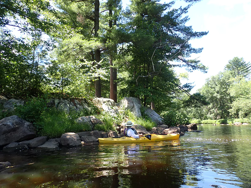
One of the nicer outcrops of the trip
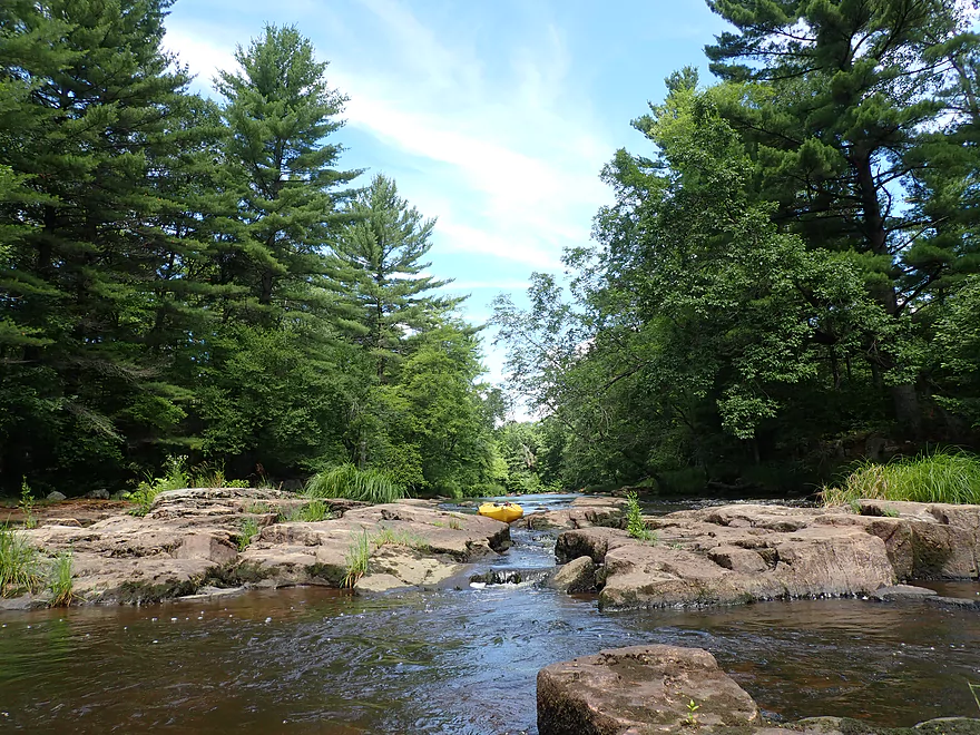
Start of the first Class 2 rapids
Super scenic
Exposed granite bedrock
This is followed by a second pitch of rapids
And a third
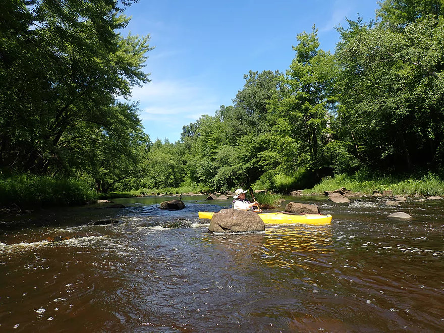
Good fun
Reverse view…this would be more fun in higher water though
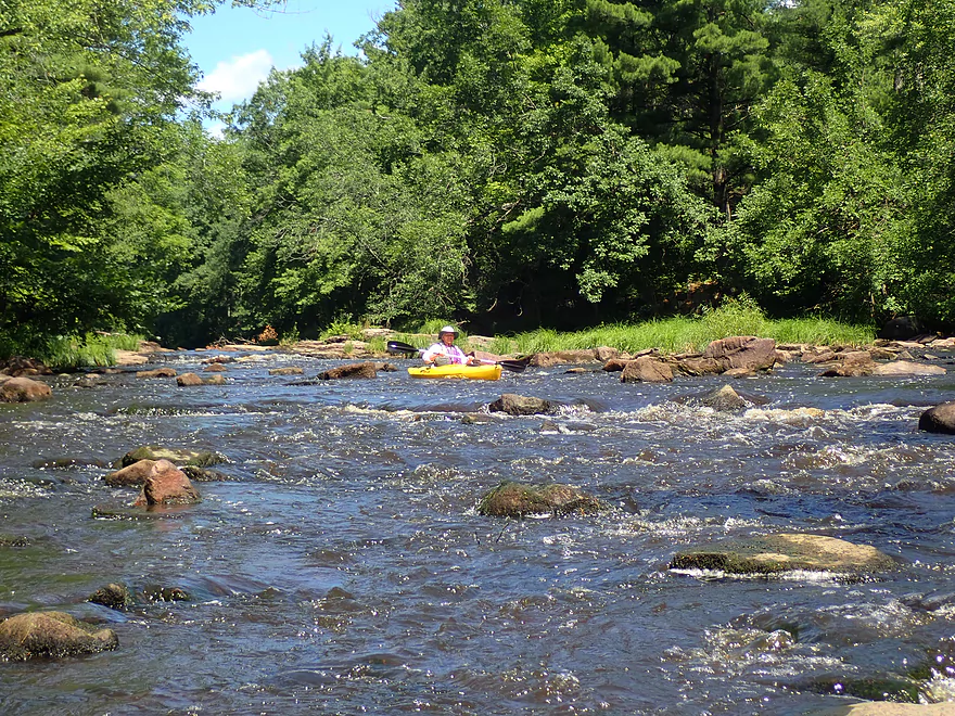
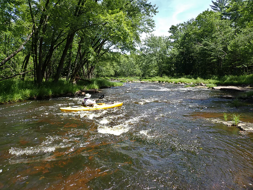
More rapids
These are pretty easy
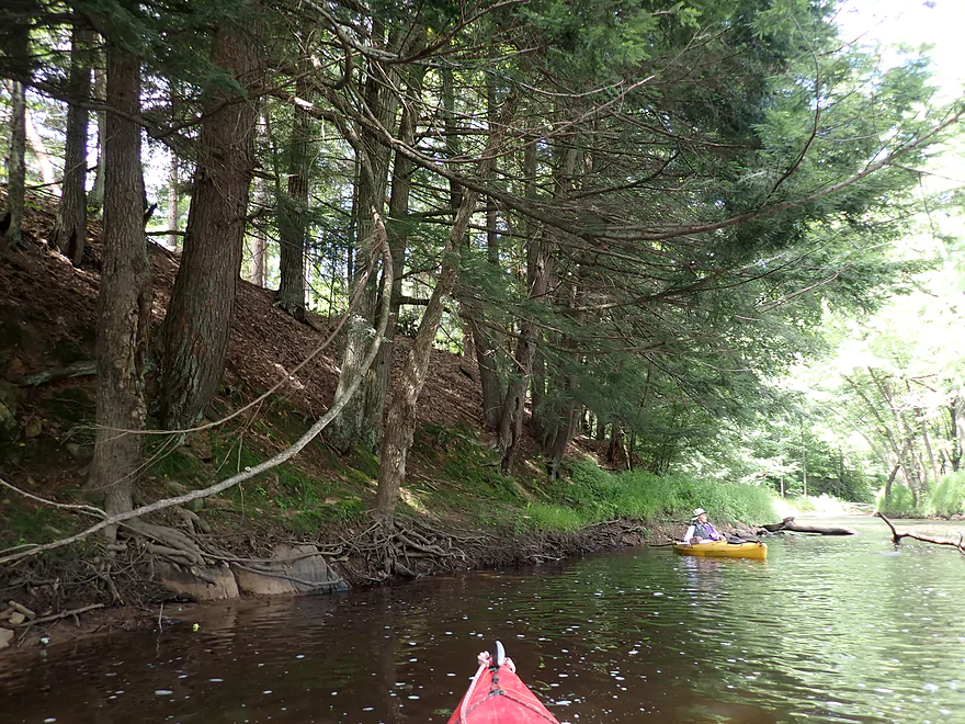
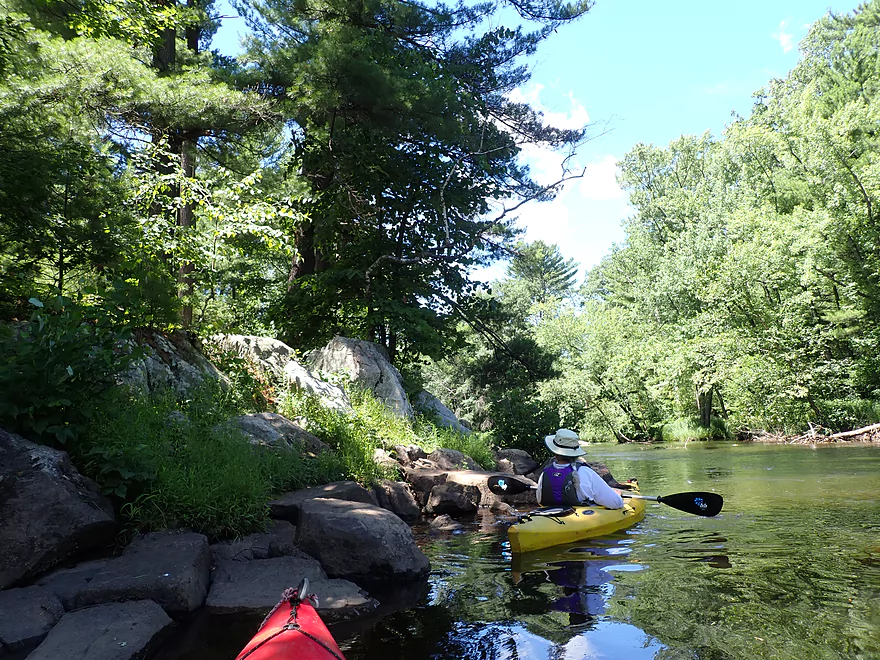
Another stand of helmocks
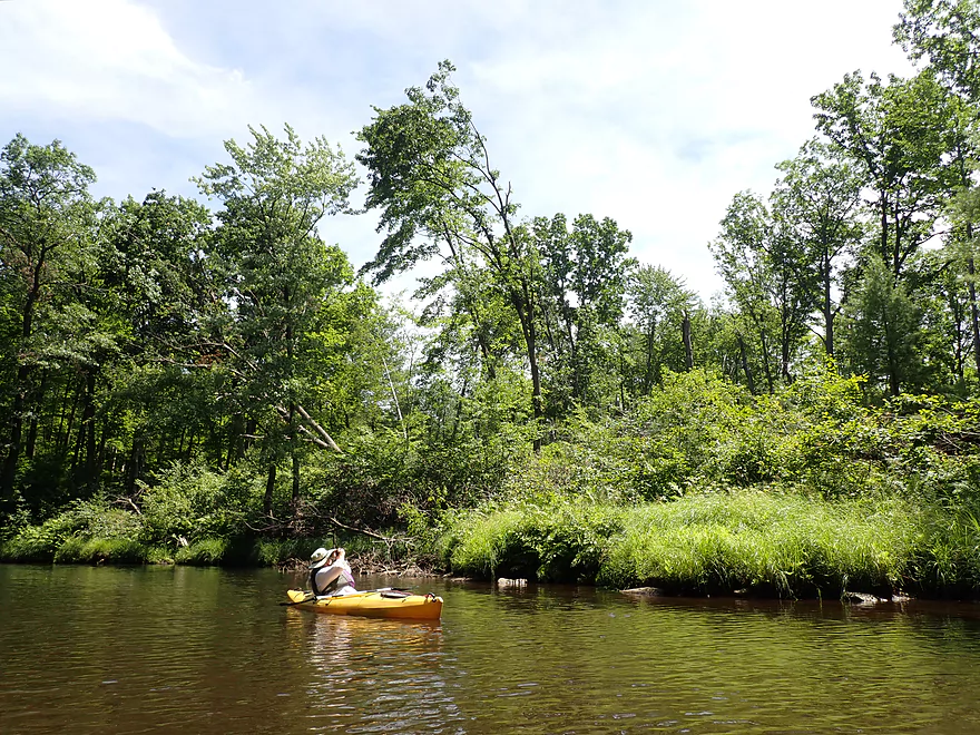
River opens and slows after that
Very peaceful
Damage from the 2019 derecho
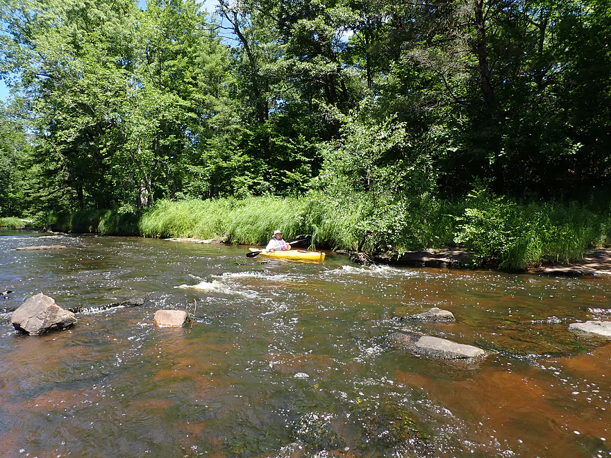
Some bumpy rapids
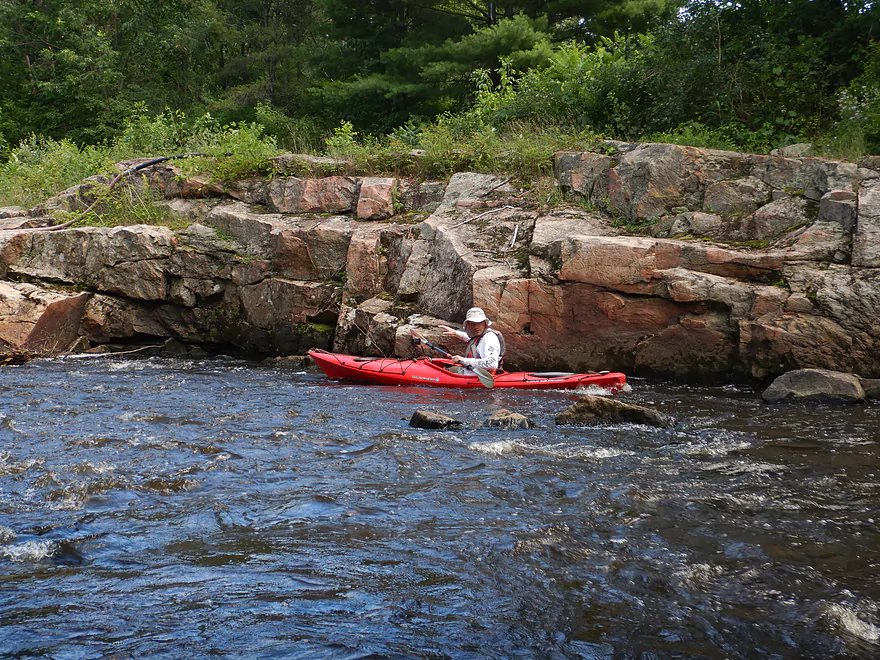
Another scenic outcrop
Behind the pine trees is a good access option off of PP Road
In high water these rapids can be fierce…now they’re tame
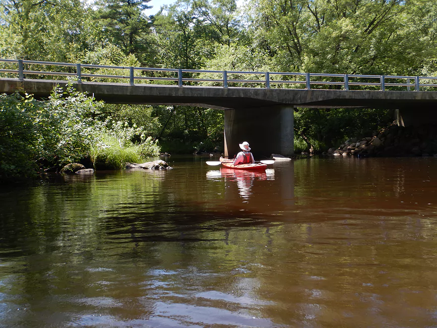
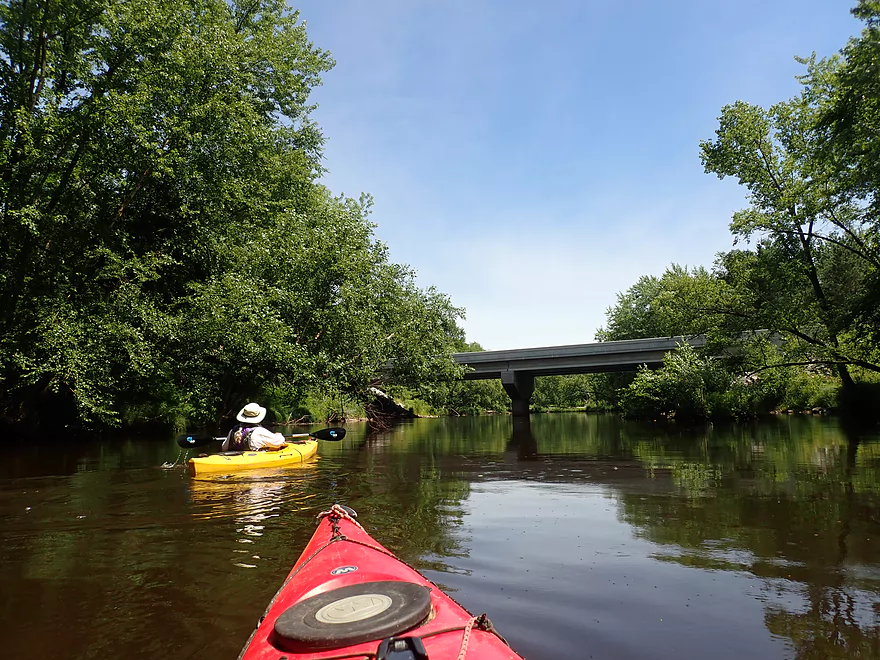
PP Road
View from bridge
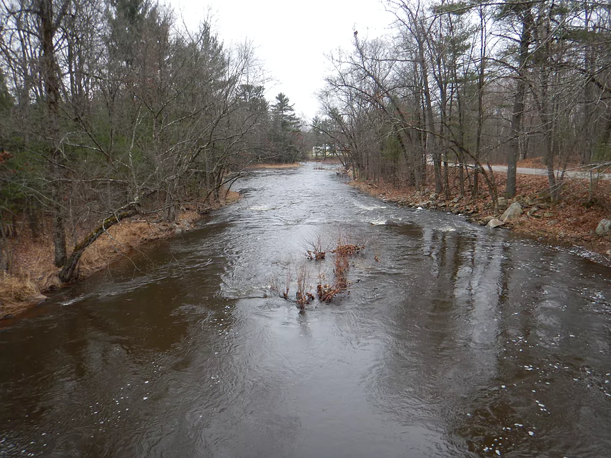
Same view but during high water
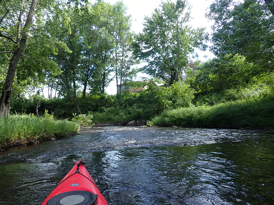
After PP there are a lot of rapids
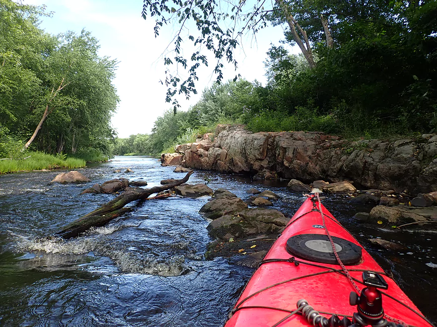
And more exposed granite bedrock
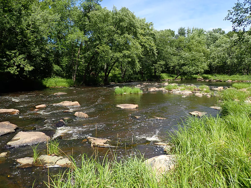
Not all side channels are navigable
Start of another Class 2 run
Nice boulder garden
The main channel and rapids are along the far bank
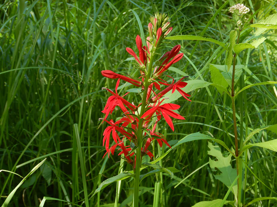
Cardinal flower
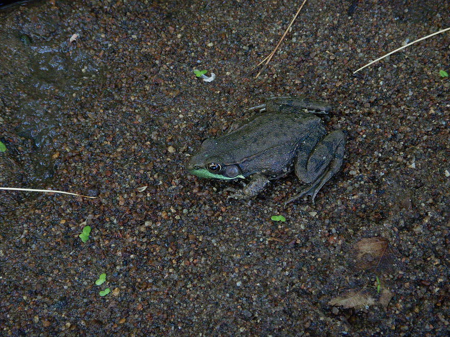
A green frog
Start of another long stretch of rapids
Typically this would be a Class 2
But now it was pretty bumpy
Reverse view
Another pitch
Reverse view
Hwy 66/P
Immediately after the bridge is an island and a final set of rapids
The Mill Creek Dells
Super scenic
Side view
The island is very rugged…in high water the channel flows through here and creates huge waves
Final run
And that’s it for rapids
It’s flatwater paddling for the next mile
We start to see some homes and piers along the banks
The creek after the dells has a more bottomland feel to it…but is still scenic
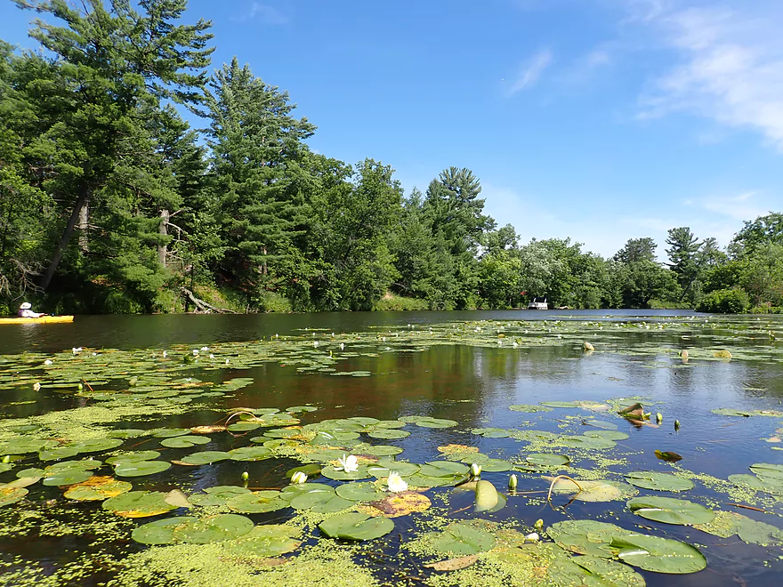
Paddling through a large field of waterlilies
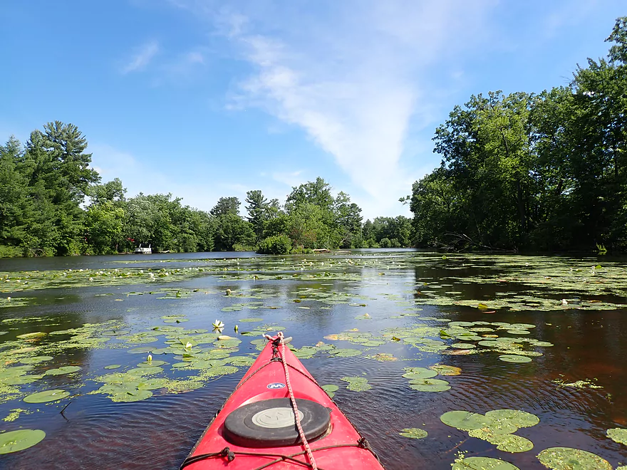
Mill Creek joins the Wisconsin River
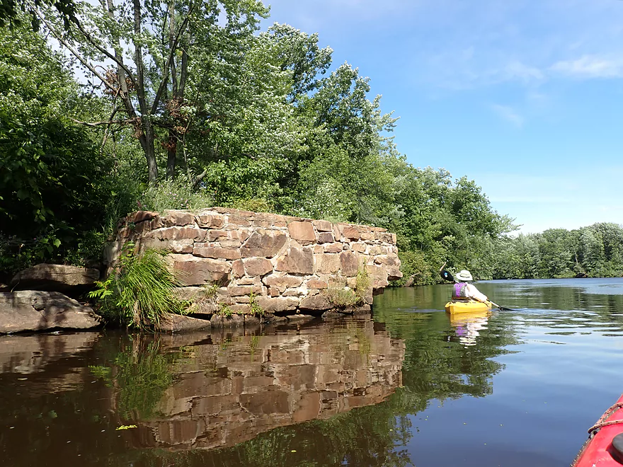
A scenic old bridge foundation marks the end of Mill Creek
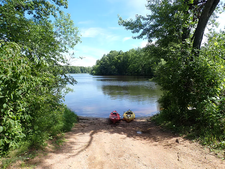
Public take-out at Ole River Road
One final vista of the Wisconsin River
Mill Creek

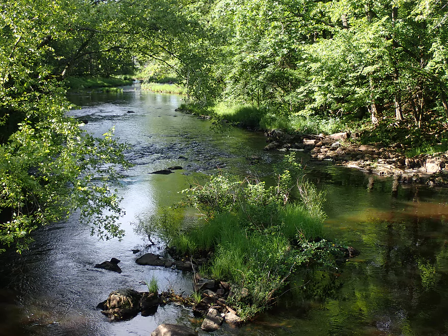
Our trip started at Robin Lane which was a good put-in. Despite its reputation as a whitewater creek, the first two miles were mostly mild flatwater. This was still enjoyable though as the banks were heavily wooded with oak, maple, and occasional scenic hemlocks. Given the sheer number of sugar maples this could be a great fall color trip. Unlike most southern Wisconsin creeks, which are overgrown with thick invasive reed canary grass, the banks here were topped with ferns and native sedges that gracefully arched over the river.
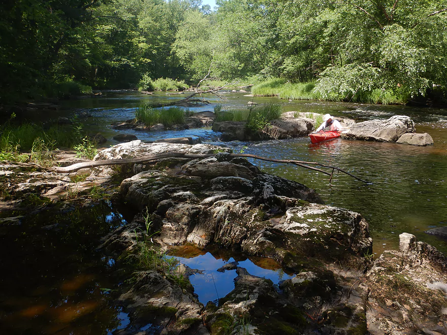
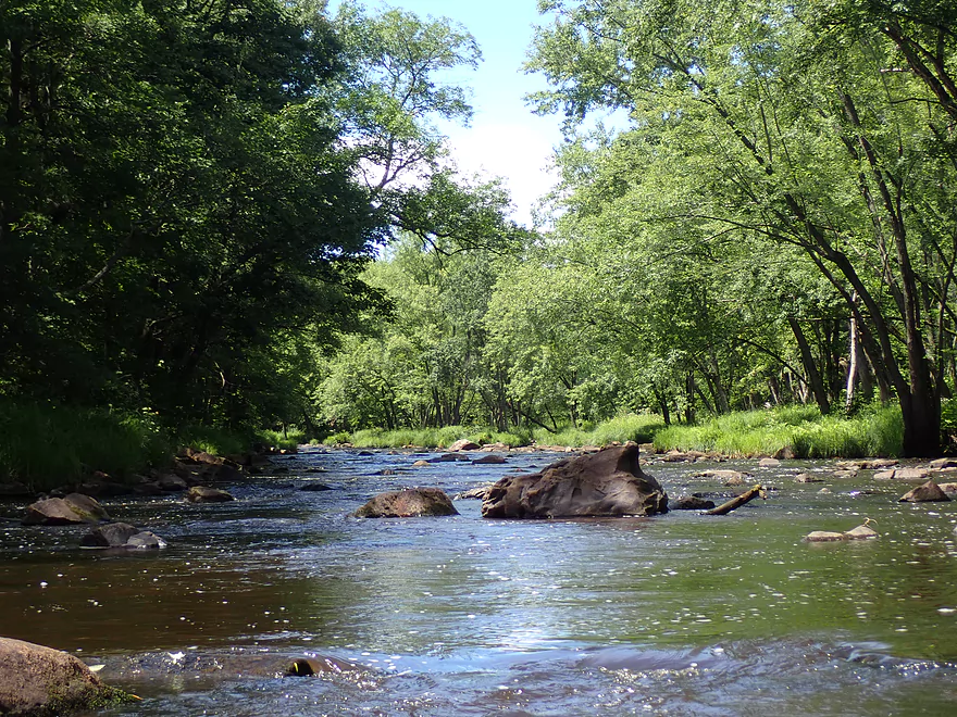
The channel itself averaged 18-24 inches deep and was mostly turbid with a slight red hue. The substrate was quite rocky with mostly broken granite. In several spots there was exposed granite bedrock and small outcrops along the shore which were quite photogenic.
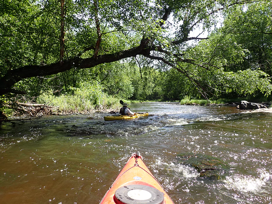
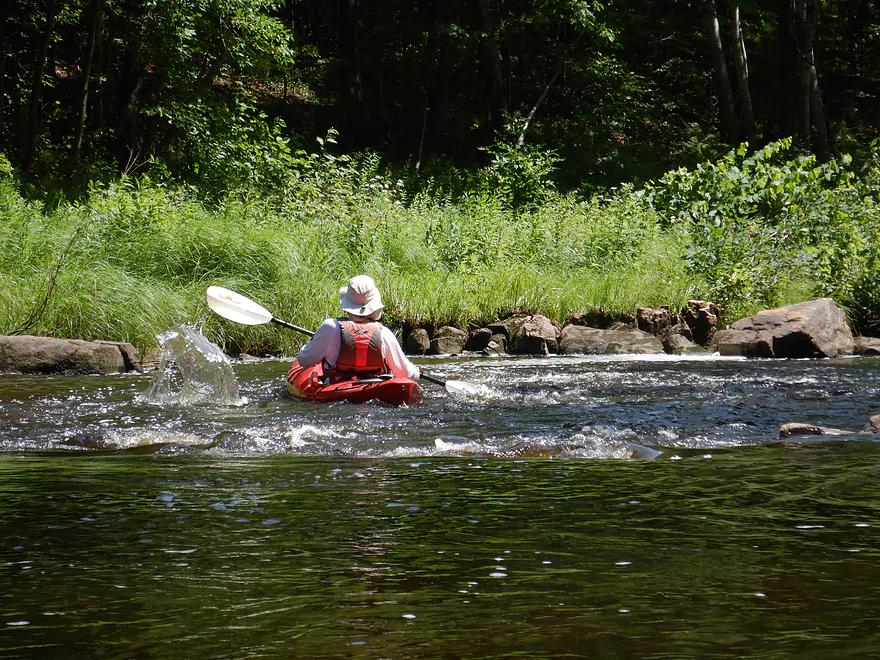
Almost a mile into the trip we finally came to our first significant rapids. This was about 500′ long and dropped about 10′ (if not more). The view from the bottom was calendar-worthy with pine trees, huge mounds of exposed granite, boulder gardens, and Class 2 rapids. Most of the rapids were fairly straightforward, although there was a tight turn near the top and some steeper ledges near the bottom. This was one of the trip highlights.
This would be followed by a few more minor rapids and boulder gardens in the next few miles. All of this very much reminded me of the Yellow River near Pittsville…especially the occasional hemlocks. Something that had me concerned going into this trip was the 2019 derecho which downed a lot of trees in this area and could have meant many logjams. But…thankfully logjams were never an issue. While we did see occasional downed trees in the river and several patches of missing woods…actual logjams were never a problem. Likely this section of the creek is just too wide, rocky, and fast for them.
We then came to the Hwy PP wayside, which is an obscure river access upstream of the Hwy PP bridge. It’s a great access and scenic with granite outcrops and huge white pines…but more importantly it marks an important divide in the river. This is the start of a mile-long stretch of almost continuous rapids. This leg was gorgeous with calendar quality scenes at almost every pitch. Granite boulder gardens and exposed bedrock were a common site amidst the rapids. I would have to rank this as one of the most fun Class 1-2 stretches of rapids in Central Wisconsin.
The only downside was they were shallow and we did hit a number of rocks. One particular sharp rock opened a pinhole opening in my boat and I would take on water for the rest of the trip. Fortunately I had my bone sponge handy and it wasn’t difficult to keep my boat (mostly) dry. This is the third time my kayak has sprung a leak and this time around I’m going to try my hand at plastic welding which should be an adventure.
The rapids mostly conclude by the Hwy P/66 bridge…but the best is saved for last. Just downstream from the bridge the channel takes a sharp left turn and roars past some scenic granite dells. Just to the left of the dells is an interesting island with exposed granite bedrock. In high water the channel will completely submerge this island and create large standing waves.
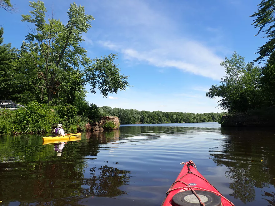
After the dells, the creek widened and slowed considerably. We started to see piers, homes and occasional boats…a sign we were approaching the Wisconsin River. There was no more granite, hemlocks or rapids…but it was still a pleasant paddle with the highlight being a nice lily field. We ended the trip at the mouth of the creek where there was a good public access.
Special thanks to Austin Smith, a Wisconsin Rapids local, who provided a lot of detailed information about this creek which was used to plan this trip.
Robin Lane: The road dead-ends at the creek. While there are no public/private signs here, I checked a plat map and it appears public. If you launch here make sure to park your car off to the side so others can turn around. There is a bit of a ledge along the bank, but if you just wade in ahead of your boat it isn’t too difficult to launch.
Alternate Put-ins:
- Hwy C (2.7 miles upstream of Robin Lane): Hwy C isn’t a great access spot as several areas by the bridge have No Trespassing signs, but it should be doable. This stretch might have 2-3 logjams…but also a few rapids including one significant set.
- Hwy PP Wayside (2.4 miles downstream of Robin Lane): Hwy PP would be a good put-in if you’re just interested in running the main rapids (which run almost continuously from Hwy PP to Hwy 66).
Ole River Road Landing: This is a small public boat launch (next to an old stone bridge abutment). There is a narrow parking lot by the landing…but if this fills up you can simply park on the shoulder. Make sure you don’t block cars with trailers. This can be a popular landing on summer weekends.
Alternate Take-outs:
- Hwy PP Wayside (2.0 miles upstream of Ole River Road): When water levels are low, you may want to avoid the stretch below Hwy PP as it can be very rocky and shallow. While most paddlers will prefer to paddle Hwy PP to the mouth, Robin Lane to Hwy PP is still a good stretch in its own right with six Class 1’s, one Class 2, and several small outcrops.
Ole River Road Landing to Robin Lane: 4.8 miles (85′ of ascent). This would be a straightforward bike shuttle. About a mile of Robin Lane is gravel, but it is well packed and not too bad to bike on.
Current: This creek is mostly pool and riffle. The rapids are fast, but in between the rapids the river is mostly slow. The fastest part of the river is between the Hwy PP wayside and Hwy P/66 (roughly a mile of almost continuous rapids).
Rapids: Upstream of the Hwy PP wayside it’s mostly flatwater, but there are roughly six Class 1 rapids and one Class 2. This is mostly a pretty manageable stretch. Between Hwy PP and Hwy P/66, it’s almost continuous rapids with two Class 2’s. These should not be taken lightly as there are a few tight turns which can be difficult in high water. I know of a case where somebody got badly pinned on this stretch (presumably at high water…at our low depth this stretch was easy). The good news is you can scout almost the entire mile between PP and P/66 because the adjacent roads are so close to the creek. In high water serious standing waves can develop. After Hwy P/66 there is one last set of rapids by the Dells (a strong Class 1 or weak Class 2). In high water the channel will cut left over exposed bedrock and create significant waves. After the dells, it’s all flatwater paddling for the next mile to the mouth.
Logjams: None….I think this part of the creek is just too wide and fast for logjams to block the channel.
Footing: Angular pieces of granite everywhere make it tough to get a firm footing. Wear water shoes with a good grip.
This is an important but very complicated subject. If the creek is too low it will be too bumpy…but if too high it will be too pushy and rough. The creek drains quickly after a rainfall and it no longer has a gauge so it’s a difficult watershed to size up. Why oh why does the USGS keep dropping good gauges!!! On the upstream side of Hwy PP there are markings on the bridge pylon which signify depth. We did this trip at 1.25′ which was fine from Robin Lane to Hwy PP (outside of some bumps), but between Hwy PP and Hwy P/66 it was quite bumpy. I’ve been told that 1.5′ is “the real deal” and that 2′ “is awesome but getting kind of intense, even scary for a novice” (thanks Austin!). Truly the best way to size up the creek is along Mill Creek Drive and Shady Lane which have terrific views of the rapids…you’ll know just by looking at them if they’re in your wheelhouse.
If you’re not a local and have to drive some ways to reach Mill Creek, then obviously a bridge gauge isn’t a practical suggestion, and you should “rely” on an analogous online gauge. Based on my previous scouting experience, the Big Eau Pleine is just not a good analogue (FWIW we did it at 230 CFS at Stratford). Your best bet is likely the Babcock gauge on the Yellow River…but this is flawed as it is affected by erratic releases from the Dexter Lake Dam. The following are just very rough estimates based on the Babcock gauge, but remember when you arrive to scout the rapids with your own eyes. It’s also a good idea to have a backup paddle planned in case levels are too high or low.
Gauge: Yellow River @ Backcock – Trip done at 140 CFS
- 0-100 CFS: Likely too low for paddling below PP. Upstream of PP would likely be a doable trip, but you might have to walk 4-5 rapids.
- 101-200 CFS: Upstream of PP you should be fine, although some rapids will be bumpy. Downstream of PP the rapids will likely be a bit too low (but safe for beginner paddlers).
- 201-350 CFS: This is likely a good target range. The rapids downstream of PP will likely still have some bumps…but I think it should be manageable.
- 351-500 CFS: This is starting to get a bit high for rec paddlers. I scouted the creek at 425 CFS and it looked like a lot of fun and seemed mostly manageable, but paddlers should have good boat control.
- 501-700 CFS: This depth might be more appropriate for intermediate whitewater paddlers.
- 701-1000 CFS: Very high conditions…likely only suitable for advanced whitewater paddlers.
- 1000+ CFS: Extreme conditions with large standing waves…likely only suitable for expert whitewater paddlers.
Not to beat a dead horse…but again don’t trust my estimates…and do your own scouting before you run this creek. This is one of the easiest creeks to scout.
- Upstream of Hwy F: I haven’t scouted these legs, but they look interesting and mostly free of logjams.
- Hwy F to Swedish Road: 2.2 miles. Maybe 7 logjams. The creek looked quite wooded and nice when I scouted it.
- Swedish Road to Hetze Road: 1.2 miles. Maybe 2 logjams.
- Hetze Road to Hwy S: 1.4 miles. Maybe 4-5 logjams.
- Hwy S to Hwy 13/34: 3.2 miles. Maybe 4-5 logjams.
- Hwy 13/34 to Hwy G: 2.2 miles. Maybe 6 logjams.
- Hwy G to Hwy O: 3.0 miles. Maybe 10 logjams
- Hwy O to N. Elm Road: 1.2 miles. Maye 3 logjams.
- N. Elm Road to Hwy M: 6.0 miles. Maybe 7 logjams.
- Hwy M to Hwy C: 2.4 miles. Maybe 3 logjams.
- Hwy C to Robin Lane: 2.7 miles. Maybe 2-3 logjams. Very heavily wooded with one significant set of rapids and a few minor boulder gardens. Hwy C is not a great access as some areas by the bridge are marked private, but I think it’s doable.
- Robin Lane to Ole River Road Landing: 4.4 miles.
- Robin Lane to Hwy PP Wayside: 2.4 miles. This is mostly flatwater but there are roughly six Class 1 rapids and one Class 2. This is a scenic stretch with good geology.
- Hwy PP Wayside to Ole River Road Landing: 2.0 miles. Between PP and Hwy 66 is roughly one mile of almost constant rapids, including two Class 2’s. This is a fantastic stretch for beginner whitewater paddlers but can be shallow. It can also be quite rough in high water. The highlight is the dells just after Hwy 66. After the dells, it is roughly one mile of flatwater paddling to the Wisconsin River.
Trip Map
Overview Map
Video
Photos Size:
Ha had to make a comment after ready the little shout out to me! Not sure how much of it is bias to proximity and frequency of paddling but this is one of the better “whitewater” runs in all of the land.
Yes, as noted it is EXTREMELY difficult to time. Sorry to even mention also but what a shame about the gauge(s!). Honestly can’t we think of some sort of work around for this on the cheap??(i have two concepts if anyone wants to colab)
I would consider this a must paddle at adequate flows for most of us looking for doable but actual/”real” whitewater. Sure it’s on the lower end of the spectrum but that’s also a good thing for many of us. It gets really fun when running but without the pushiness or technical currents of many similar level rapids. You can have a bump free run too which is always nice.
If you find yourself in the main rapid after the bridge AND bend left and are feeling overwhelmed, there is a easy sneak on the left near the shore. The boil/hole is intimidating but it’s not sticky or tricky at 1.5 up to 2.5 or even 3.0. Not sure after that and don’t want to know ha! It was the first time I ever punched through a wave and had it go over my head! So as you see it is very special to me.
I live in Rapids and have headed here several times and decided not to paddle. Only once because it was too high(great decision). All the other times it was low. Not to discourage but it might take some effort, patience and luck to time it right but is worth it.
The only comparable River with similarly “easy” but exhilirating Class II segments I have paddled is the Big Eau Pliene by Stratford. Lil Wolf, Wolf, Yellow River, Halls Creek, Black River, ETC. all have difficult sections or tricky water(especially the Yellow River; be careful with that one).
Can you elaborate on the pin somebody experienced here?
A few years ago I was running it at a high ~2.5 and encountered some boaters who had gotten their rented kayak pinned and mangled on a rapid in that long continuous section(prob the rock in “revers view” right before “another pitch”. Couldn’t really stop at the time and wasn’t exactly sure what was going on. I headed there after finishing and was surprised to still see them there. I didn’t notice the boat when i first passed by in the water. They couldn’t get it free. It was one of those PERFECT sunny/warm early season days but the water was still chilly. It was impacting their ability to be in the water and it was quite pushy when standing in it. Luckily I had my farmer john wet suit on cause i do not like being cold. So with some effort, a tie down strap and luck i managed to get it free. Don’t think they got their deposit back though! So do treat this with some caution if you run it open boat and/or at higher levels but also with a dash of confidence as it really is a just right, choice Goldilocks paddle!!
What is ten plus 3?
Thanks for the comments Austin! Yeah, Mill Creek is one of the most underrated Whitewater paddles in Wisconsin. It does really need a depth gauge. You might contact your local community and NOAA about adding a gauge…I think it would be so helpful.