
Starting the trip at Hwy 10
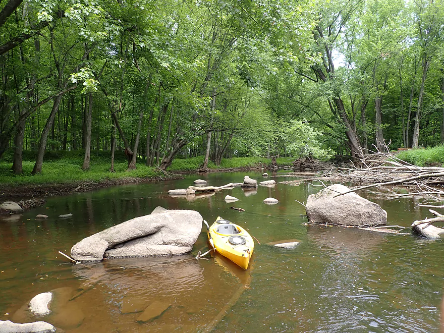
First of many boulder gardens
I think this is a man-made boulder bridge
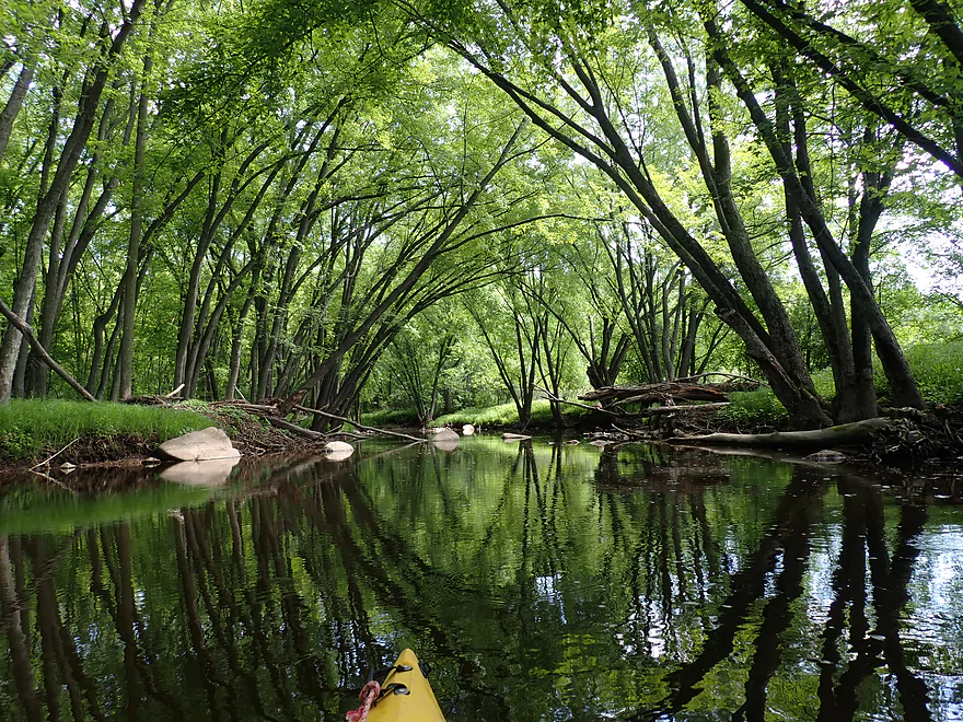
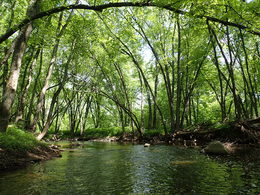
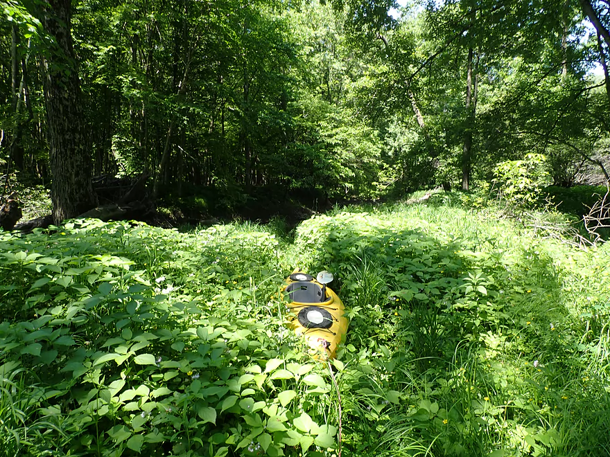
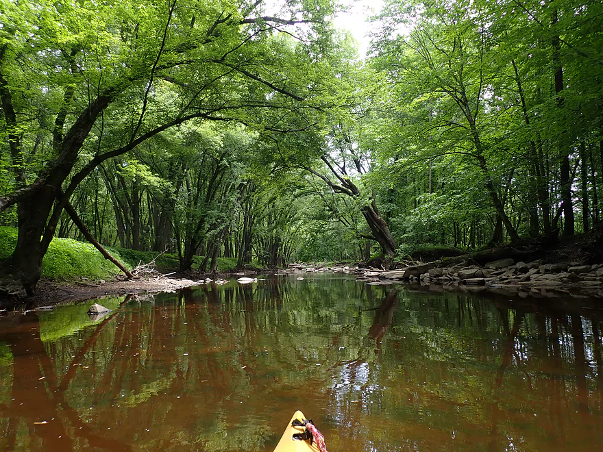
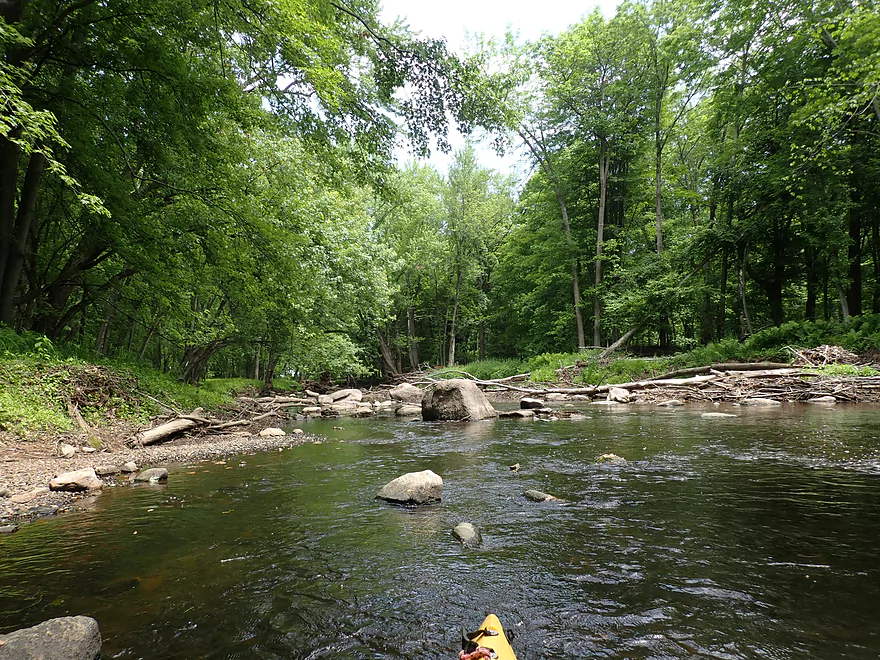
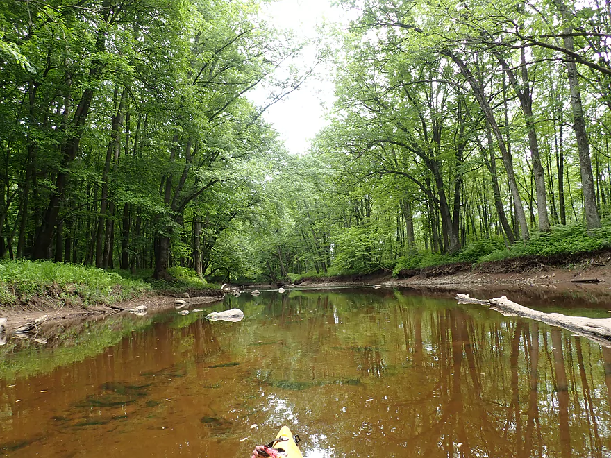
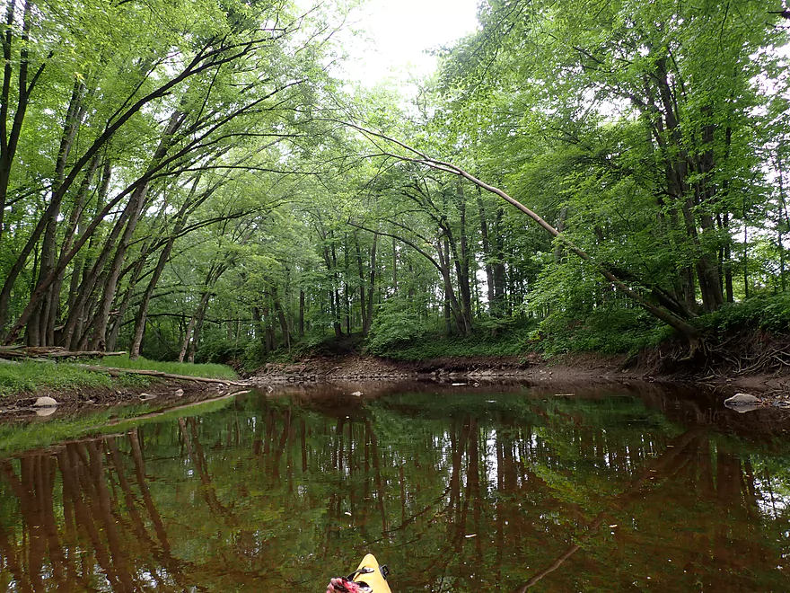
Entering the deep woods
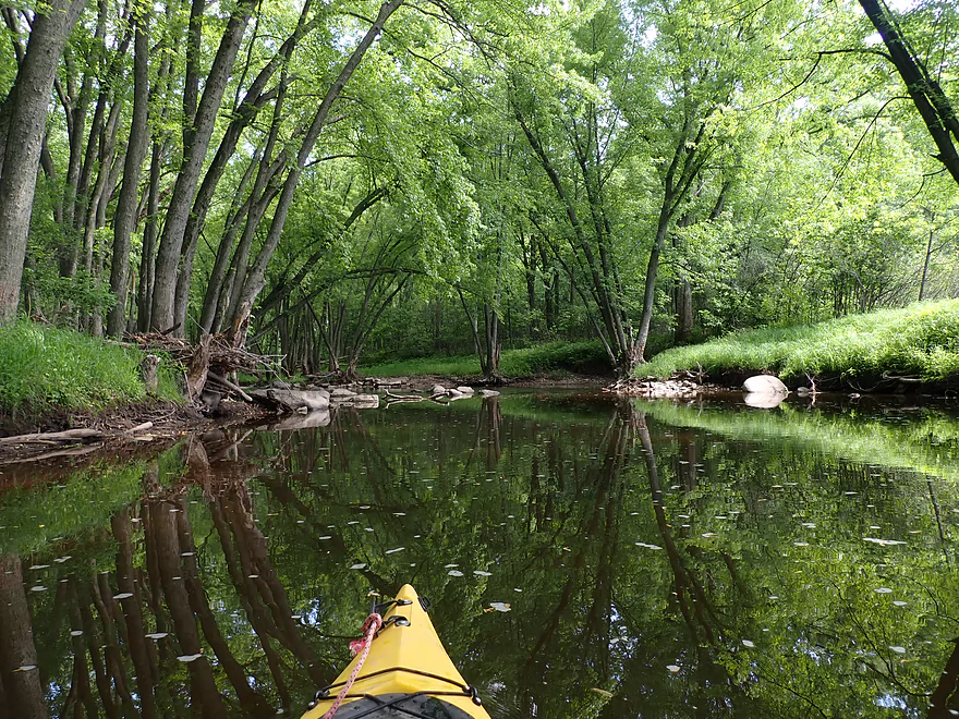
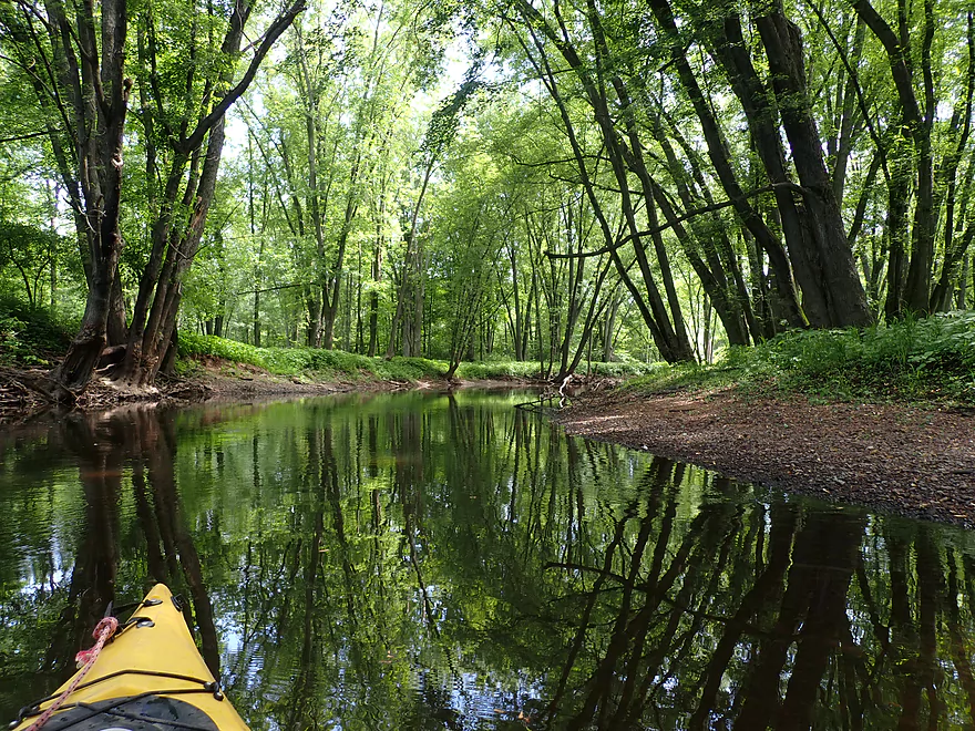
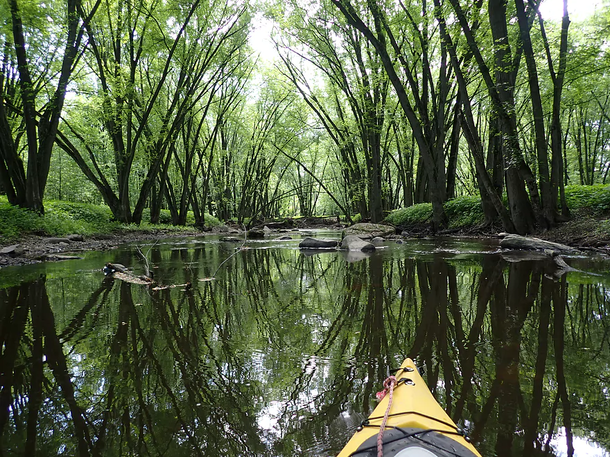
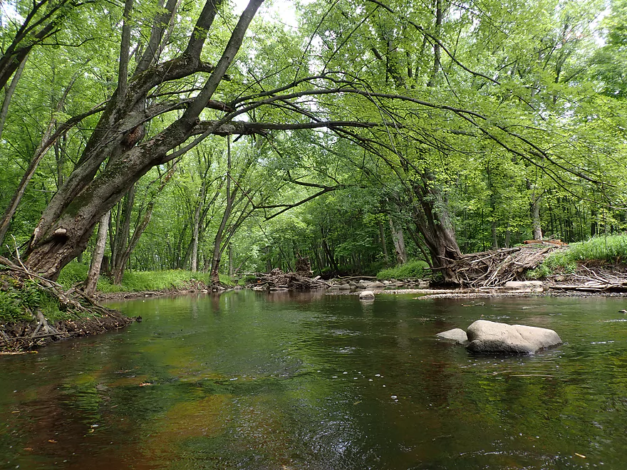
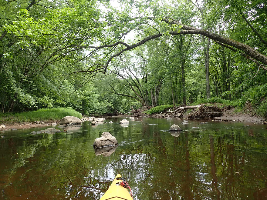
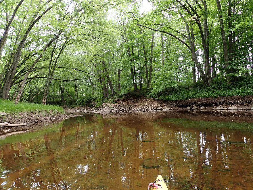
Very scenic
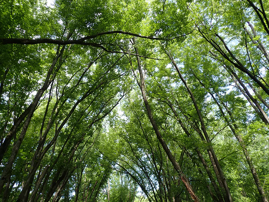
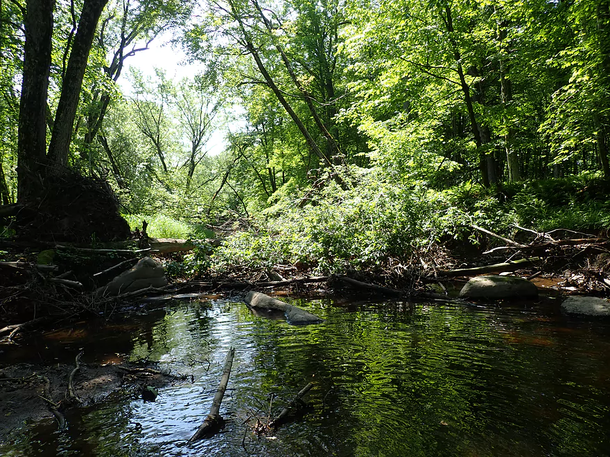
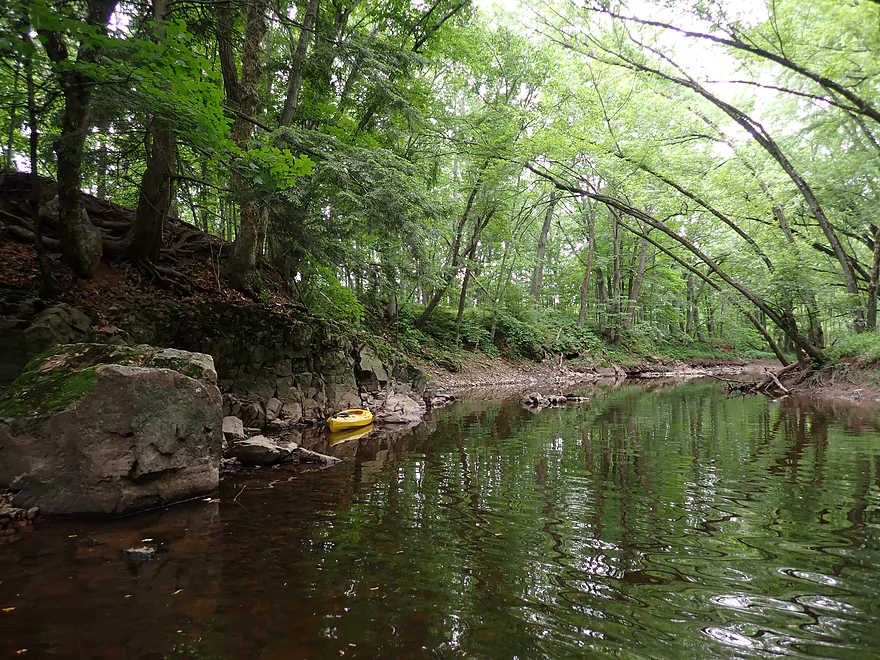
The very dense tree canopy let little light through
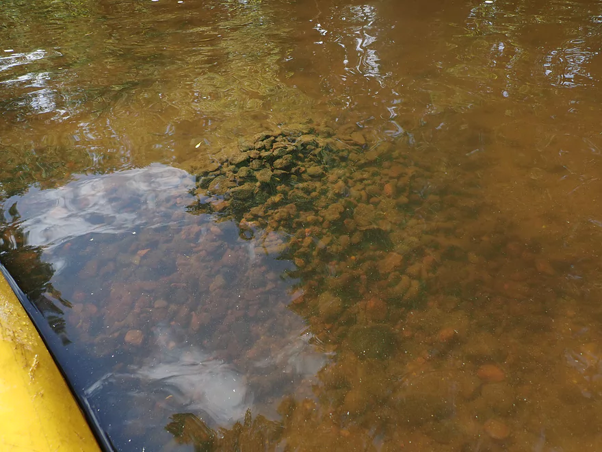
A huge fish mound or nest (created to protect eggs)
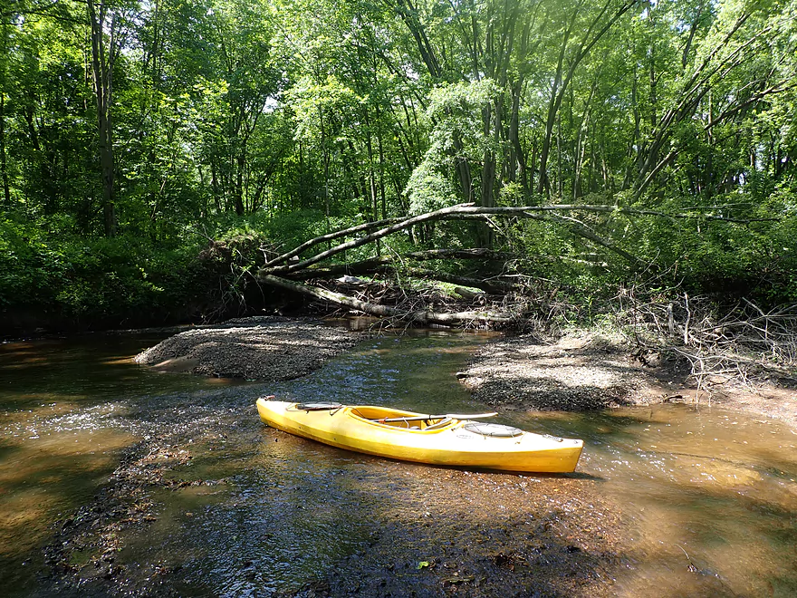
First logjam

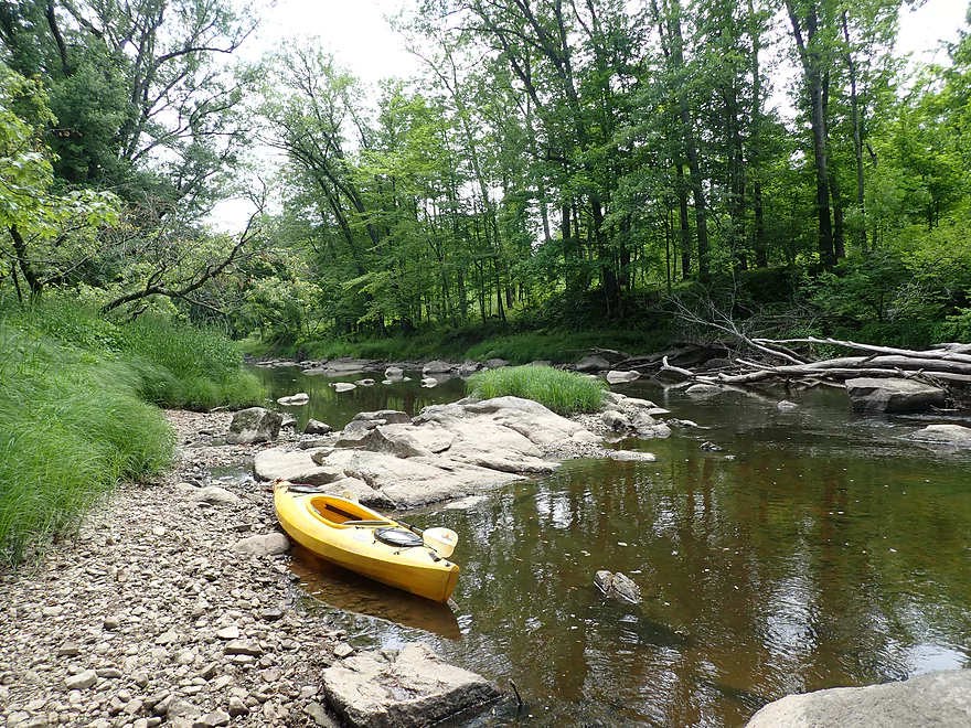
Easy portage along adjacent gravel bar
Second logjam is by a big island
Not so easy portage…but I think the other island channel would have been better
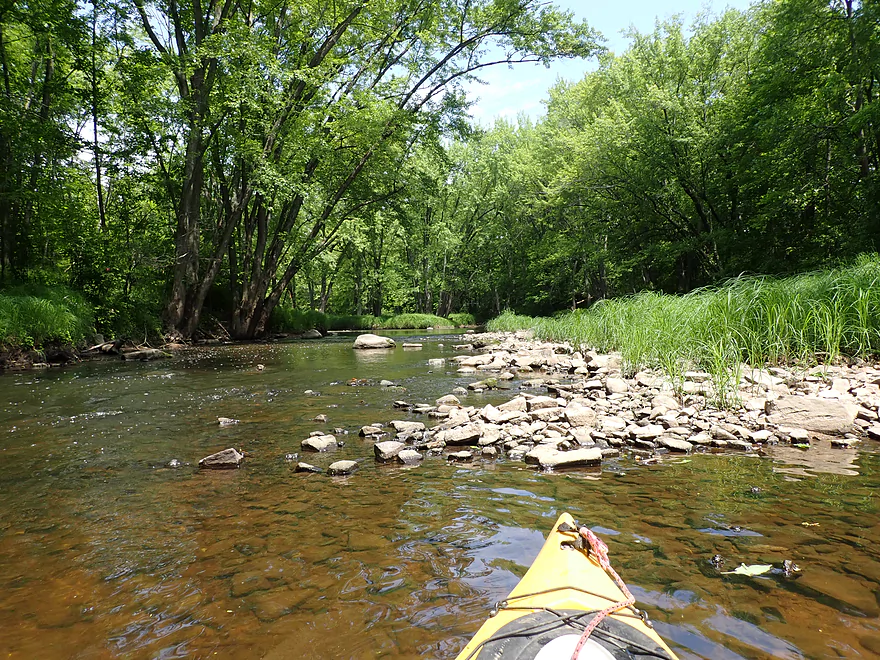
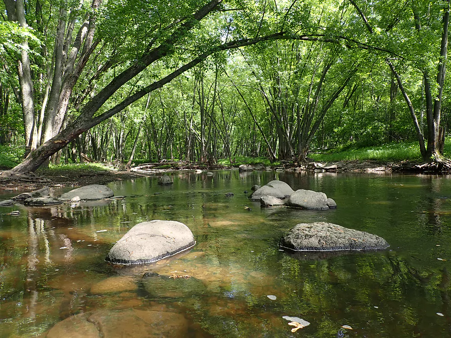
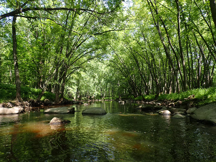
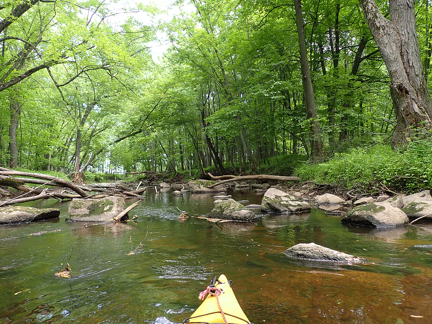
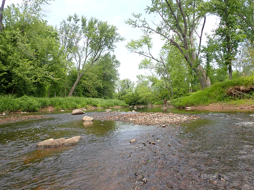
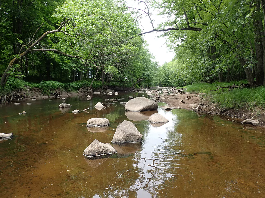
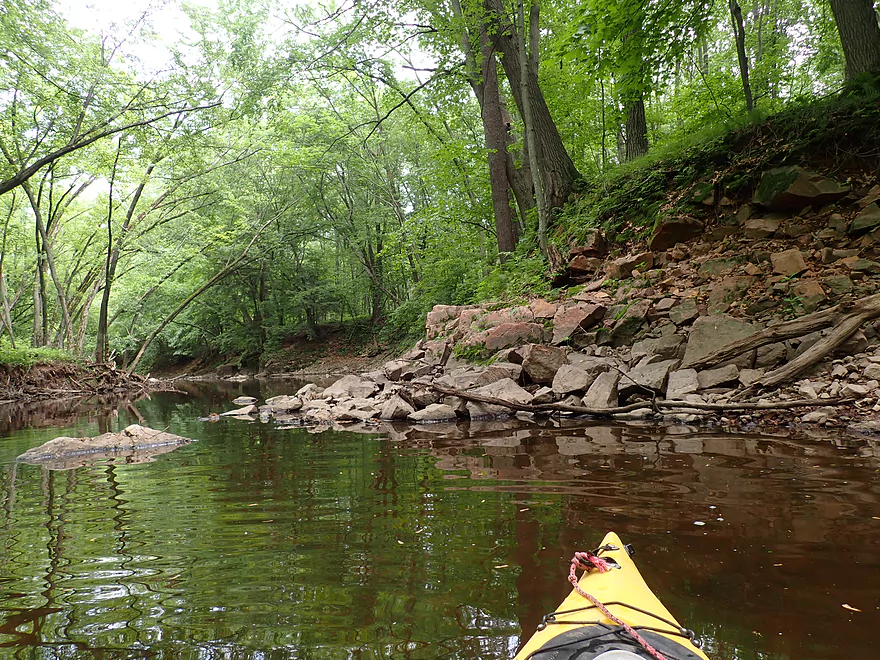
Very rocky river
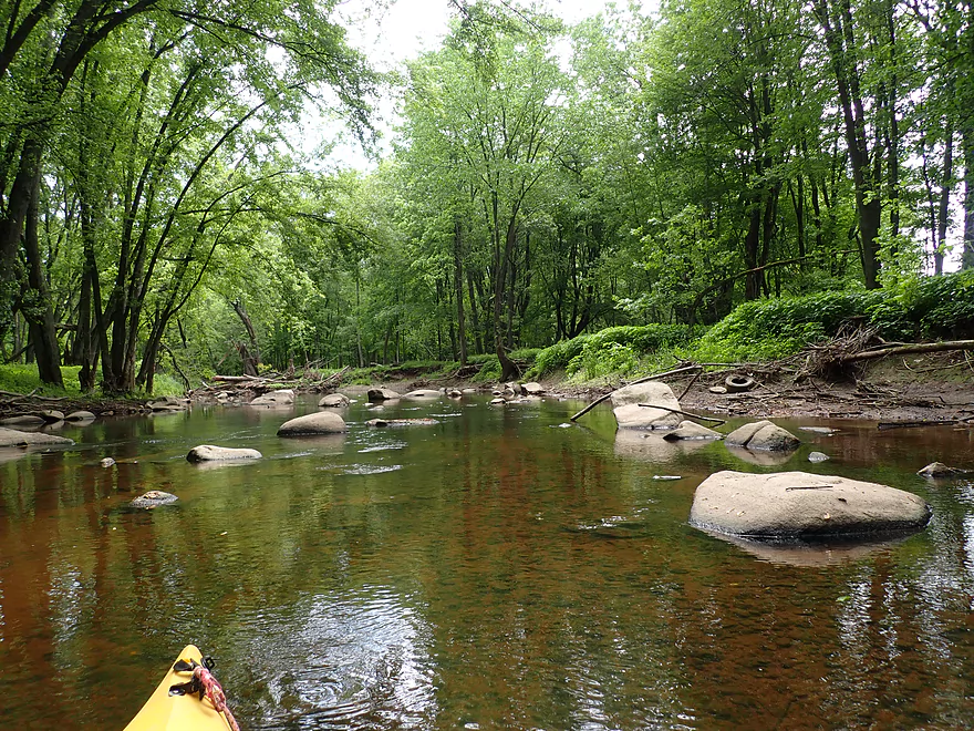
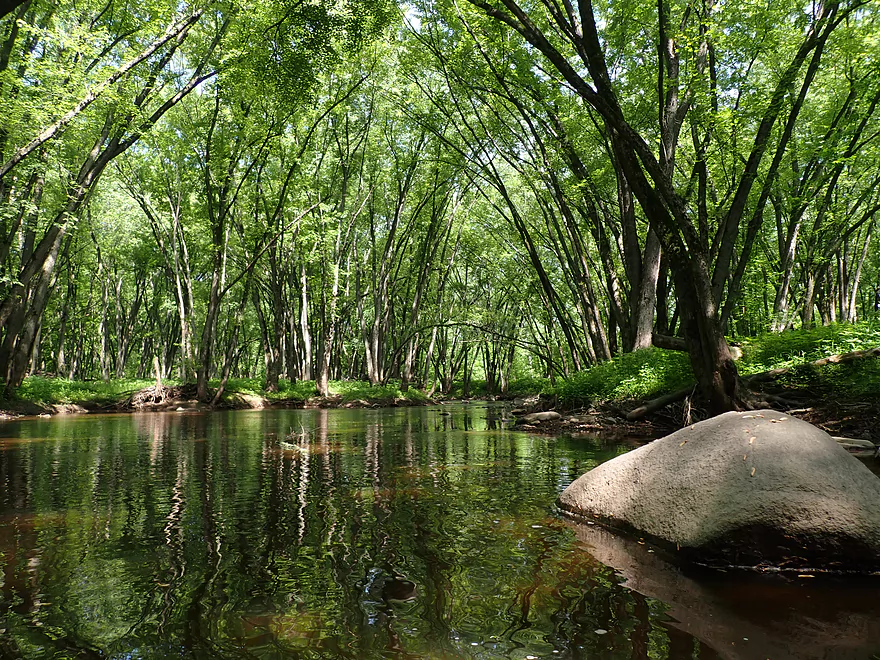
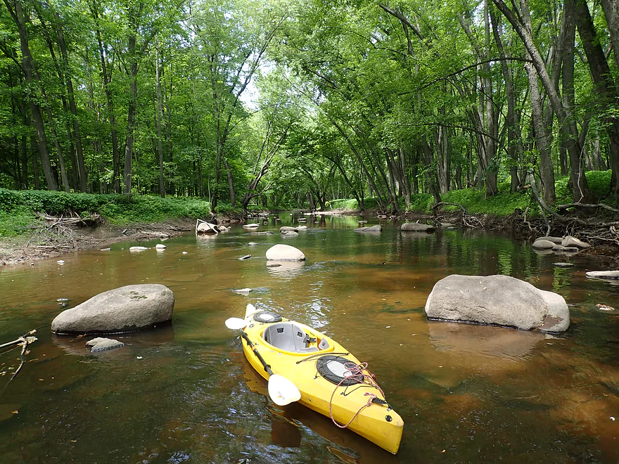
A larger boulder garden
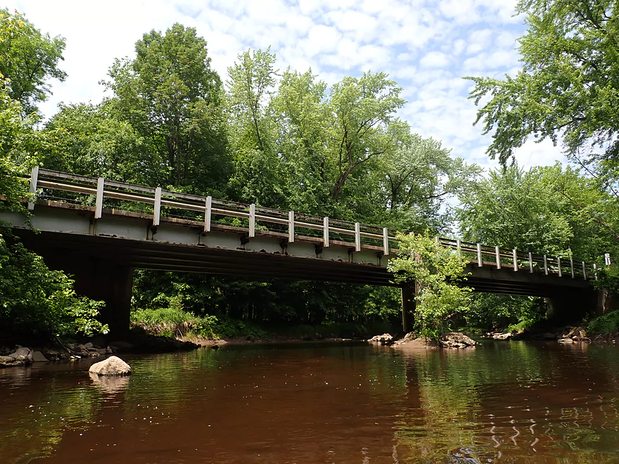
Lincoln Ave
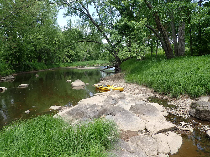
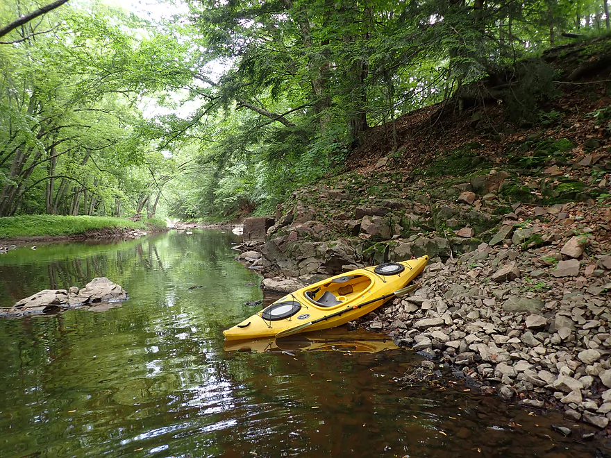
Getting out for photos
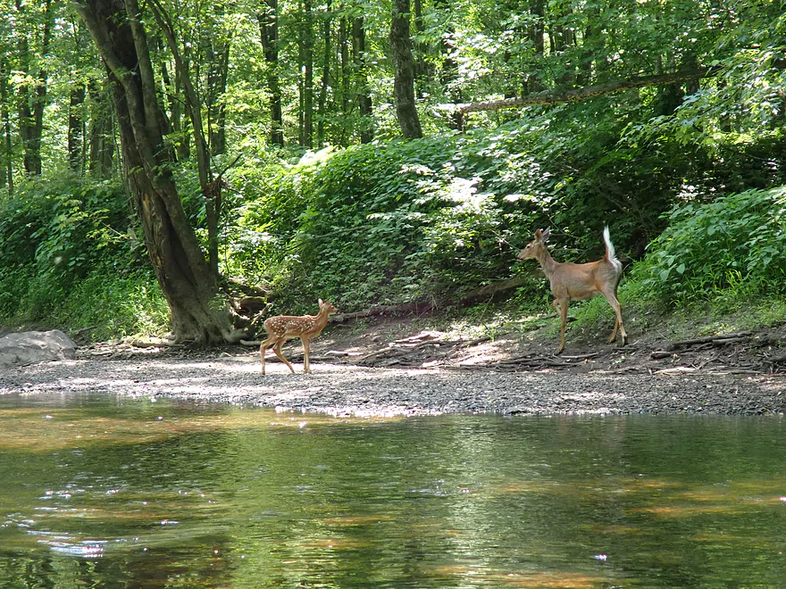
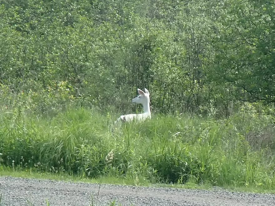
Mama deer not happy the fawn got so close to me
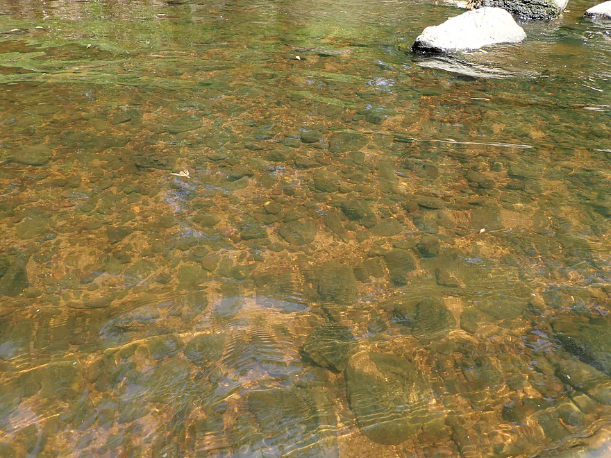
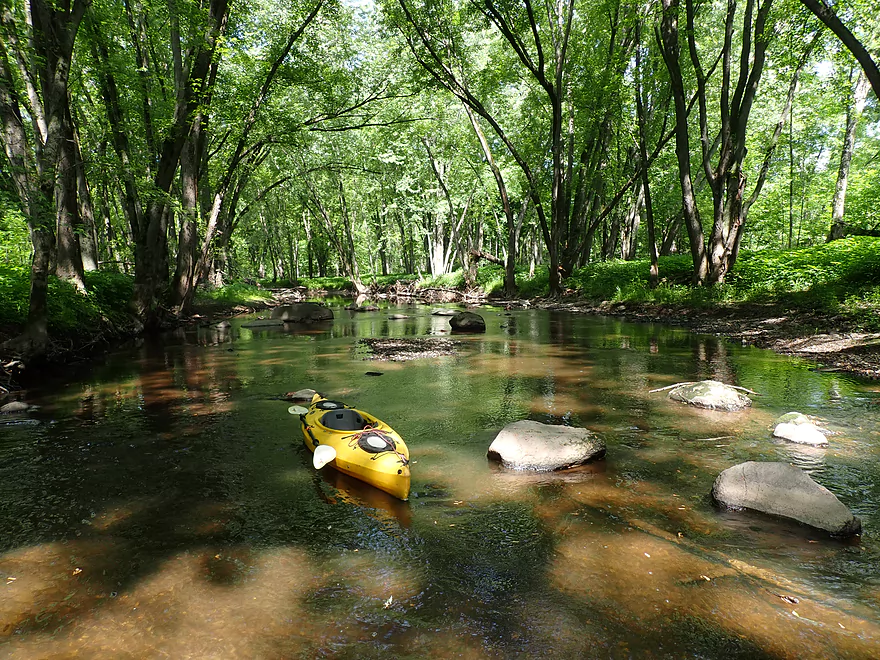
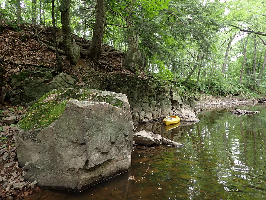
Great clarity
One of several shallow spots
Exposed granite bedrock
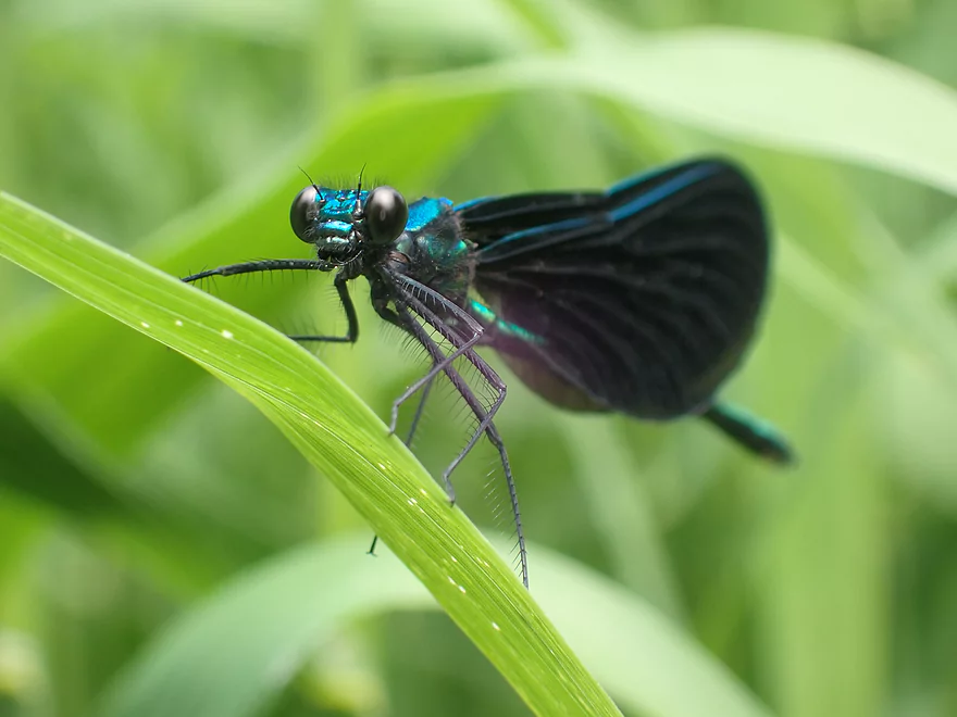
Lot of insects on the river

Some of the “stronger” rapids
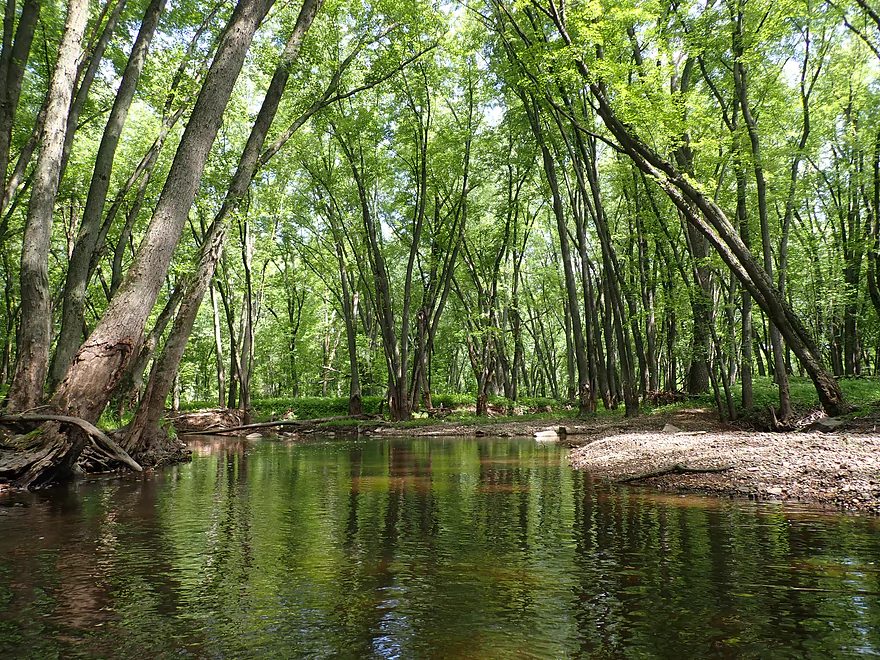
Yet another nice boulder garden
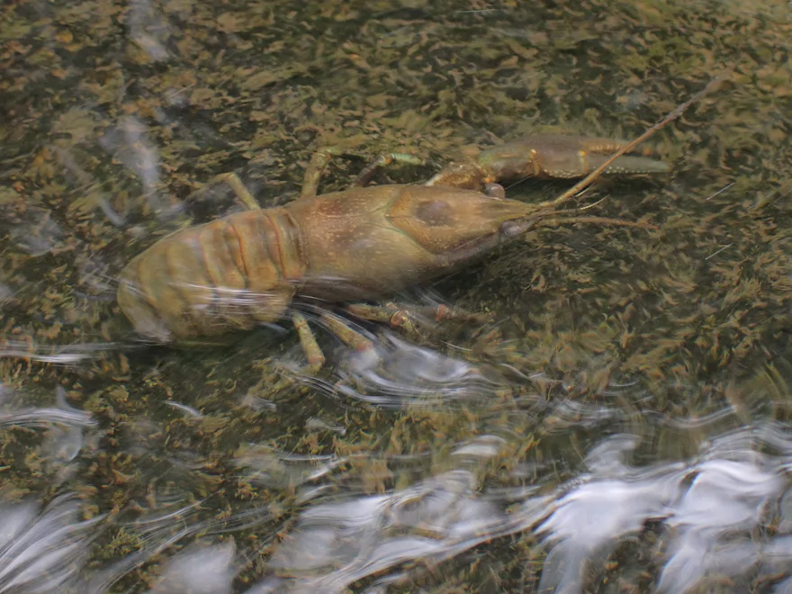
Countless crayfish in the river
Coming up on the best part of the trip
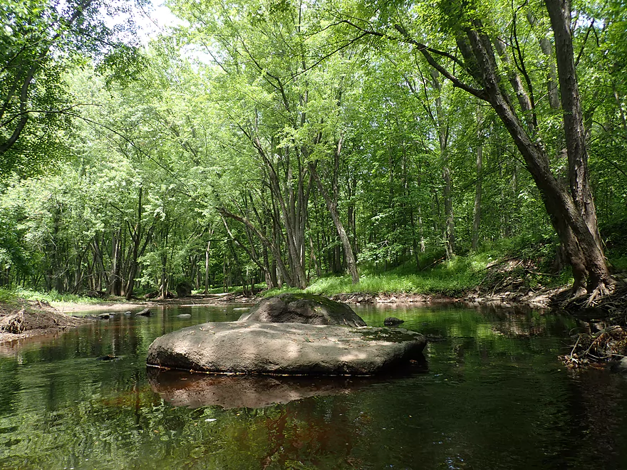
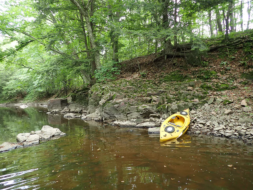
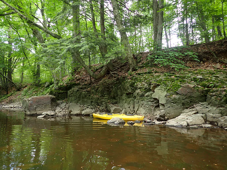
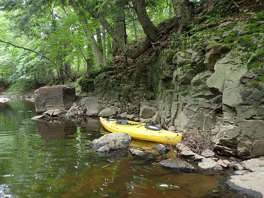
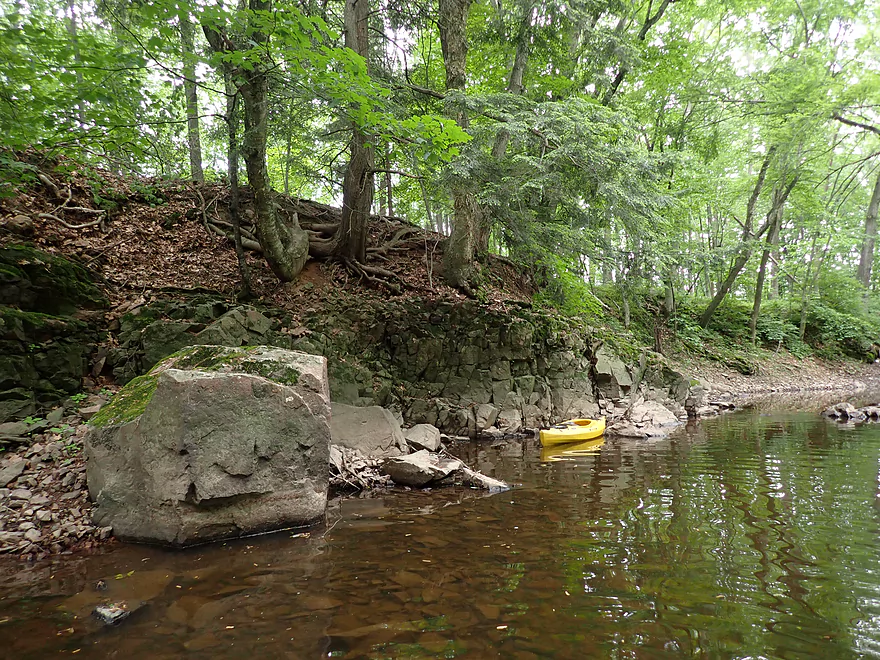
First one outcrop
Then another
Rotating around for a panorama
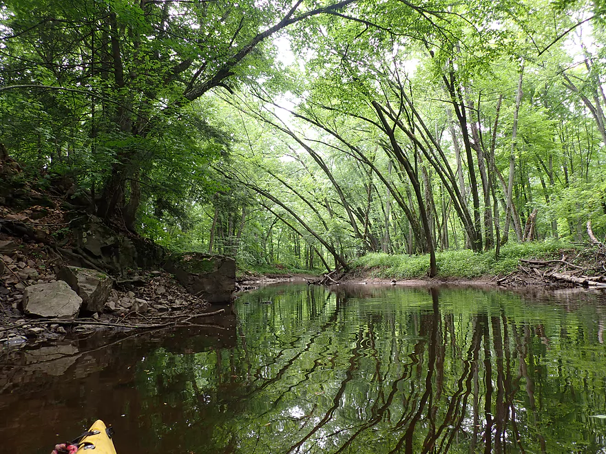
Lot of great reflections on the river
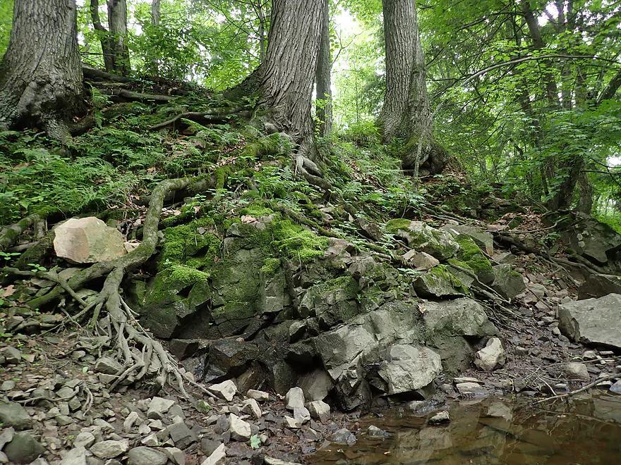
Neat combo of ferns, rocks, roots, and moss
I portaged this ledge
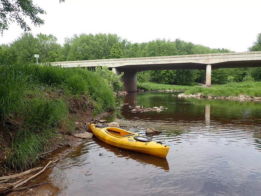
Taking out at Hwy 80
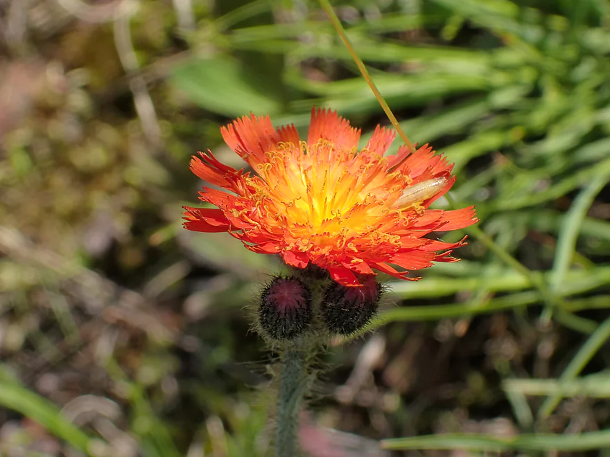
A closeup of orange hawkweed
Paddlers can continue beyond the bridge for a longer trip
A surprise sight by the river
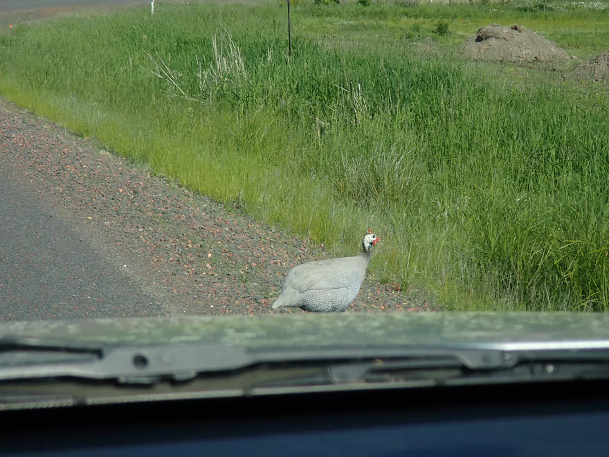
Another surprise…this looks like a domestic guinea hen that escaped
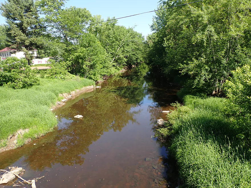
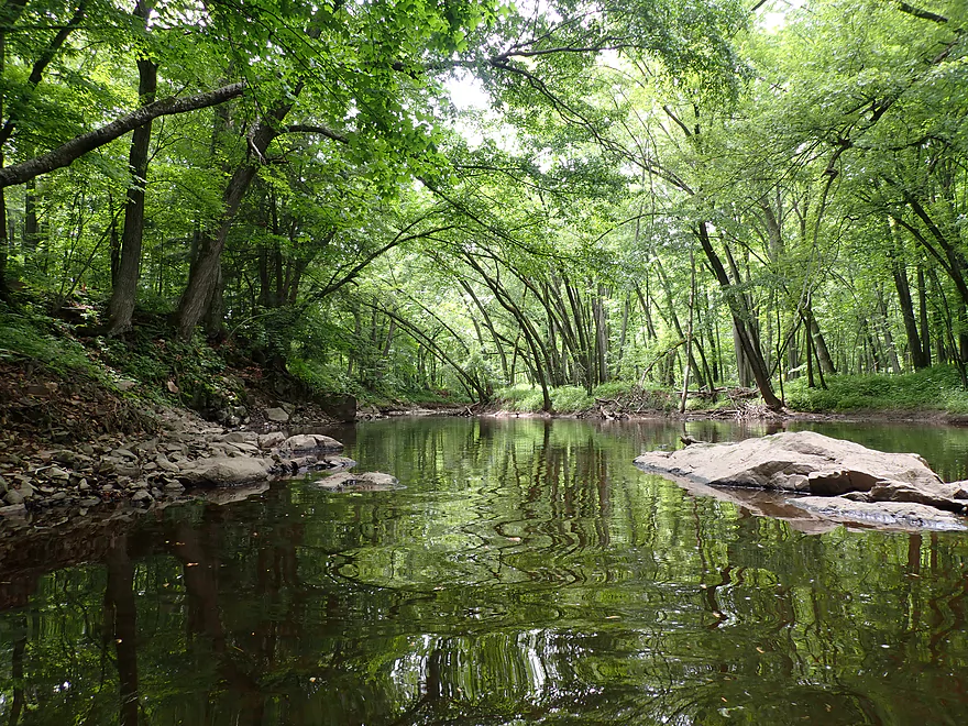
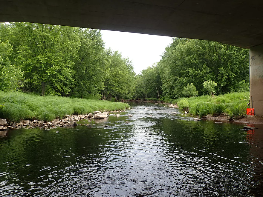
Yellow River – Hwy 10

The Yellow River is an obscure tributary to the Wisconsin River that flows south from Marshfield. Below Lake Dexter the river honestly isn’t that great, with a lot of sandy banks that can contain boring flood bottom trees and logjams. Above Lake Dexter though the river is a paddling gem, albeit quite depth dependent. After my last Yellow River Trip (North Wood County Park to Little Bull Falls), I got a great tip from a reader (Daniel) that the far upper river (upstream of Hwy 80 and almost all the way to Marshfield) was actually navigable and a good prospect.
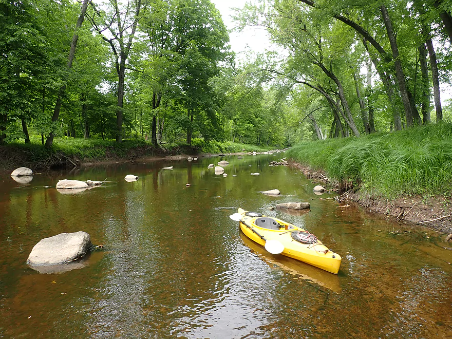
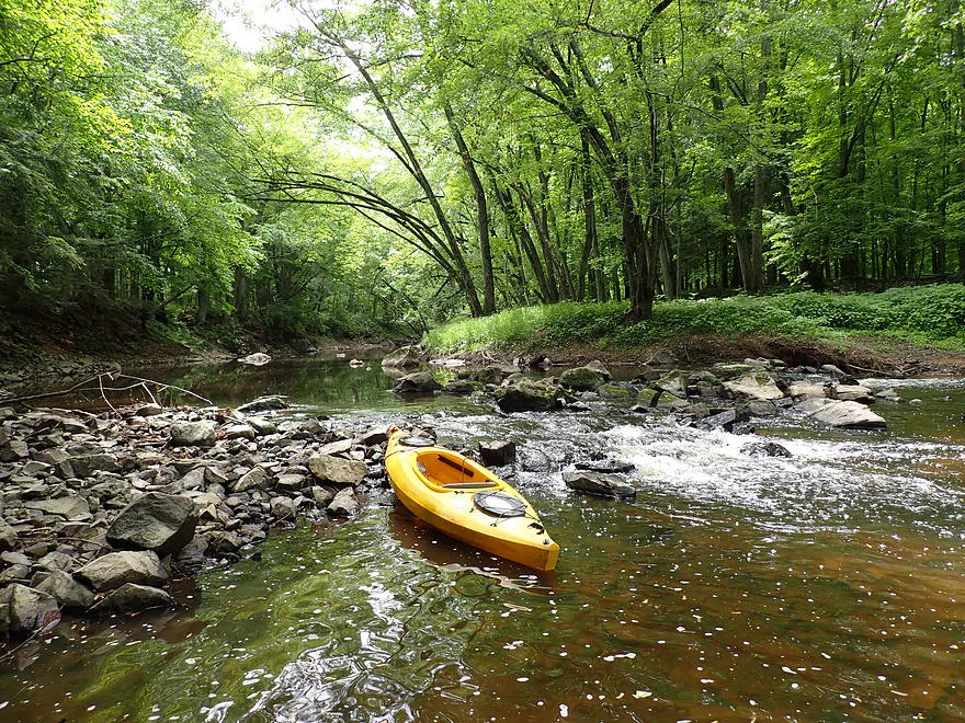
I started the trip at Hwy 10, which was a decent bridge access. My first impression was just how shallow the river appeared, which had me worried. But I did pack my aquatic boots and was game for some wading if need be. Shallow rivers have the advantage of being very clear and this was no exception. Clarity was fantastic, and it was fun to watch the countless crayfish scurrying about. Also the lower depth meant I was able to see some scenic rocks and boulders that would have been otherwise hidden.
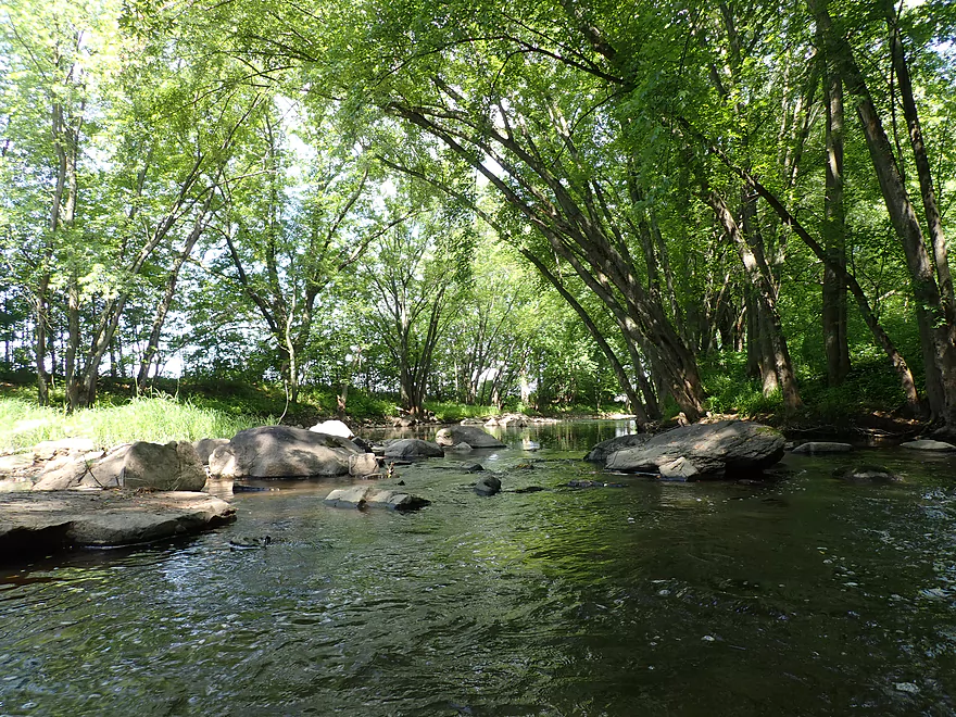
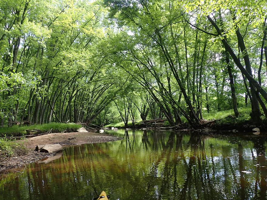
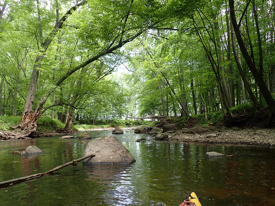
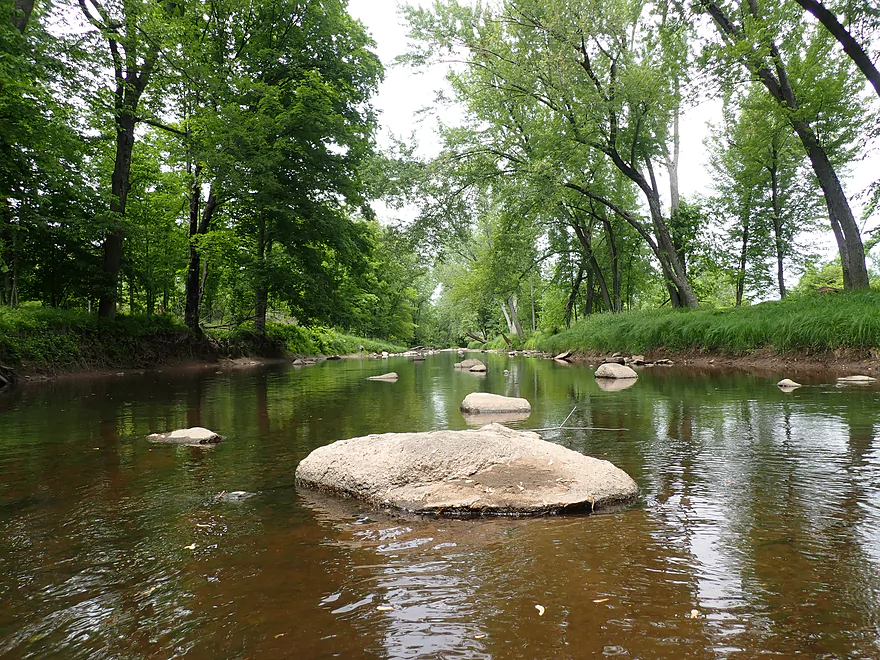
The first two miles were heavily wooded. There were countless sugar maple that formed epic tree canopies that let little light in. If you look at a satellite map, there are instances where you just can’t see the river. This was fantastic and was like paddling through a tunnel made of trees. This was enhanced by the still water which created fantastic mirrored reflections. This is likely a stunning trip to do in early October when the maples turn to shades of orange and red. It’s also a trip to save for overcast days which would provide optimal lighting.
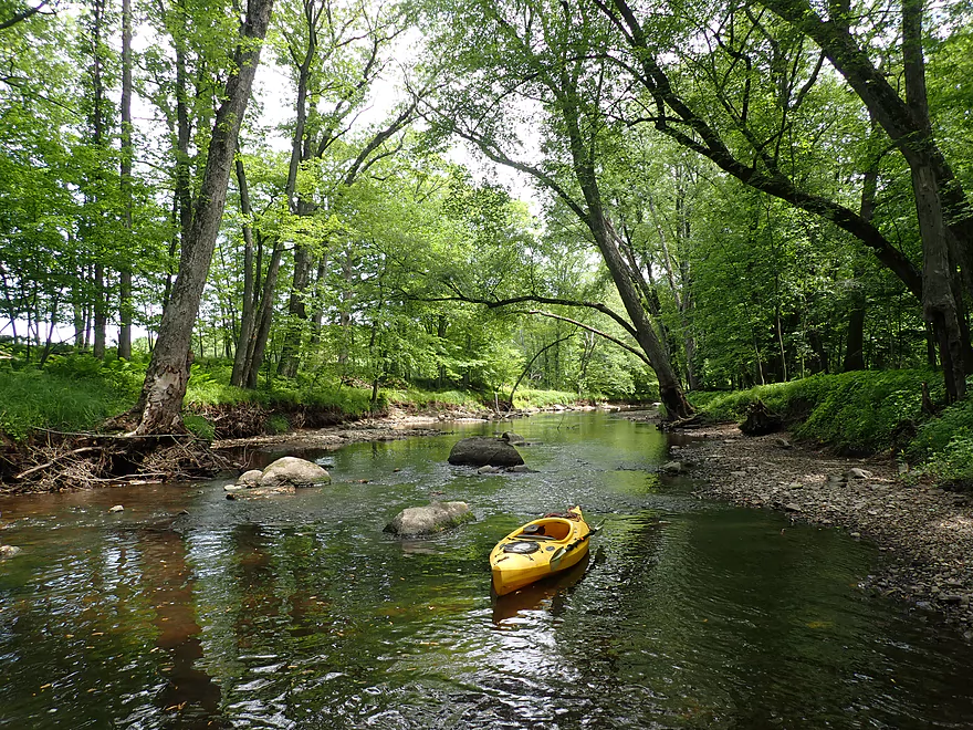
The other highlight was the scenic boulder gardens I encountered. Often these were accompanied by light rapids, but unfortunately many of these were shallow and some even had to be waded. There were two logjams I had to portage upstream of Lincoln Ave, but these were manageable and there wasn’t much deadfall beyond that.
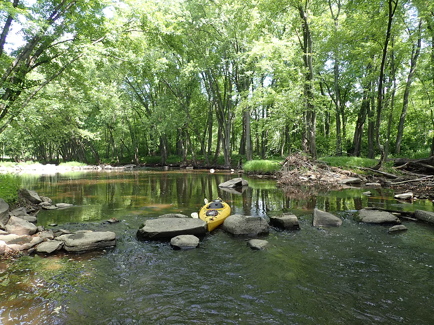
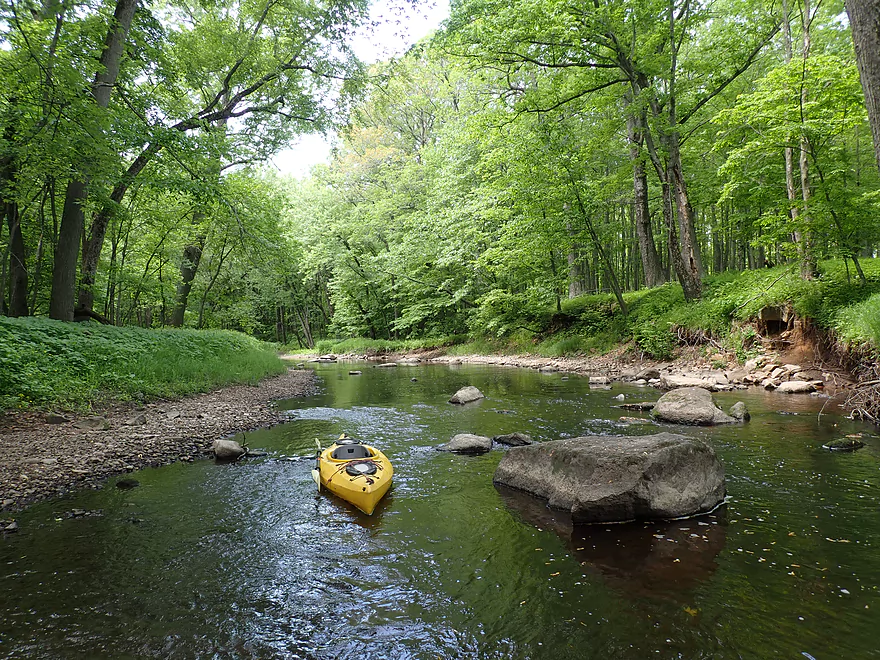
The second half of the trip (after Lincoln Ave) was more open, but still wooded, and featured bigger and nicer boulder gardens. Unlike the Lower Yellow, which has a number of small sandbars, the Upper Yellow instead features gravel bars which were pretty cool.
Near the end of the trip I encountered a fantastic granite outcrop with an interesting fractured texture. This would be the trip highlight.
I ended the trip at Hwy 80, which was overgrown but a doable access. This brought back memories of my 2016 trip when I had launched here. At the time the river was quite high, fast, muddy and very ugly. It was remarkable to see how much nicer the river looked at lower levels.
In summary this was not only a great trip, but the best so far for 2022. Yes, it was on the shallow side, but I actually preferred it that way even if I had to do some wading. This is my fourth Upper Yellow trip and paddlers may be wondering which I would recommend? Little Bull Falls to Dexter Park is still my favorite, but this was a close second. It lacks the major rapids you normally face on the Upper Yellow so Hwy 10 to Hwy 80 may be more suitable for beginners. I actually believe the best stretch of the river I haven’t done yet (Yellow River Road to Hwy 10) which I’m saving for a fall color paddle.
Sights included turkeys, an eagle, a raccoon hiding under tree roots, tons of crayfish zipping around like vorlons, and some escapee guinea hens I saw on my commute. The highlight was all the deer I saw (which was a lot). This included two fawns I was able to get relatively close to when they came down to the river to drink. Just south of Hwy 80, I saw a white doe and her two brown fawns. The Pittsville area is actually somewhat famous for its white deer. If you would like to learn more about Wisconsin’s white deer and the efforts to protect them, I suggest checking out the website ProtectTheWhiteDeer.com.
Hwy 10: This was a decent bridge access. The river here is split by an island with the east channel being a bit shallow. I launched from the northeast side, but in hindsight the southwest shoulder likely would have been better. There is a bar located along the northwest side, and I advise getting their permission if you prefer to launch from their lawn.
Alternative Put-ins:
- Robin Road: 2.1 miles upstream from my put-in. Robin Road should be a viable put-in. This stretch is very straight, but wooded and nice with some boulder gardens.
Hwy 80: There is a large pull-off area northwest of the bridge, but it is quite overgrown and weedy. There is a gap and faint trail in the tall bank where it is easy to launch or take out. With tall weeds come ticks…six years ago I got one from this spot and this time I did as well. Remember to pack your DEET-free repellent. Hopefully one day Wood County will develop proper kayak landings along the Upper Yellow to make it more accessible.
Alternative Take-outs:
- Hwy N: 3.4 miles downstream from my take-out. This is a weaker stretch of the Upper Yellow, but is still decent with some boulders and rapids. There isn’t much room to park on Hwy N, but you can simply park on nearby Polish Road instead.
Bike Shuttle – Hwy 80 to Hwy 10: 3.7 miles with 56′ of ascent. This was a reasonable bike shuttle with no major hills. Hwy 80 though was a fast road and contained a not very bike friendly round-about. In hindsight, I could have avoided a lot of the traffic by simply rerouting to either Half Mile Drive or Eisenhower Drive.
Logjams: There are a pair of logjams located about a mile downstream from Hwy 10. The first is a super easy portage. The second isn’t so easy, but is located on an island and I think I just took the wrong channel. Both jams are marked on the trip map.
Rapids: There are a number of light riffles. There were two instances of bigger rapids I would rate as Class 1 after Lincoln Ave, but in higher flow rates these could be more difficult.
Current: This is mostly pool and riffle. Largely speaking this is a pretty lazy stretch, but it might get rougher in high water.
Trip Depth – Yellow River @ Pittsville: 4.37′
Depth Guide: Note, the following are just rough estimates. Always use your own judgement before paddling a river.
- 0-4.2′: Maybe too shallow.
- 4.3-4.5′: Shallow with a few spots needing to be waded. Scenic though with good clarity and pronounced boulder gardens.
- 4.6-4.9′ Average depth and a good target range.
- 5.0-5.2′: Above average depth. Water clarity will be poor.
- 5.3-5.8′: High depth. Some pushy spots.
- 5.9-6.4′: Very high depth only suitable for experienced paddlers.
- 6.5+: Likely flood conditions. Only suitable for expert paddlers.
Detailed Overview
- Eagle Road to Yellow River Road: 4.3 miles. Background provided by WisconsinRiverTrips.com contributor Daniel Akin.
- Eagle Road to Hwy HH: 2.2 miles. This is a dangerous section with Class 3 and 4 rapids. There’s also a wire fence across the river to deal with.
- Hwy HH to Yellow River Road: 2.1 miles. A more wooded stretch that I don’t know much about. Nice street view image.
- Yellow River Road to Hwy 10: 4.3 miles.
- Yellow River Road to Hwy BB: 1.3 miles. A nice wooded stretch with no major rapids.
- Hwy BB to Robin Road: 0.8 miles. A scenic stretch of the river. The South Branch joins up by the BB bridge and adds significant volume.
- Robin Road to Hwy 10: 2.1 miles. A great stretch featuring several fun rapids and small outcrops. Much of this flows by a large golf course which can be scenic in the fall because of all the maple trees.
- Hwy 10 to Hwy 80: 4.0 miles.
- Hwy 10 to Lincoln Ave: 2.2 miles. Very narrow and wooded. At times little light reaches the river, which is really cool. Neat boulder gardens and a great stretch, but there are two logjams.
- Lincoln Ave to Hwy 80: 1.7 miles. Good stretch with a number of scenic boulder gardens and one nice outcrop.
- Hwy 80 to Hwy N: 3.4 miles. Starts slow, but ends with nice boulder gardens and rapids.
- Hwy N to North Wood County Park (2nd Dam): 2.9 miles. A rocky stretch with some rough whitewater, including a Class 3 near the put-in by the “dells”.
- North Wood County Park (2nd Dam) to Little Bull Falls Grill: 4.2 miles.
- North Wood County Park (2nd Dam) to Hwy C: 2.8 miles. Scenic stretch with many boulder gardens and rapids. The most serious rapids are near Hwy C and include Jenny Falls, which is a Class 3.
- Hwy C to Little Bull Falls: 1.2 miles. More rapids and boulder gardens. There is a logjam shortly after Hwy C. Little Bull Falls is a Class 4 and is preceded by a Class 3.
- Little Bull Falls to Dexter Park: 7.5 miles.
- Little Bull Falls to Hwy 73: 1.6 miles. Many rapids on this stretch with some nice rock outcrops. Launch below the falls and at a private access.
- Hwy 73 to Riverside Park: 1.7 miles. More rapids and the biggest and best outcrops. Hwy 73 is a weedy but doable access option.
- Riverside Park to Dexter Park: 4.2 miles. Far fewer outcrops and rapids, but a nice wooded section. Two miles in the flowage kicks in which is less interesting.
- Hwy 54 (Dexter Park) to Hwy 80 (Babcock): 9.7 miles. While you could launch by the park, your best bet will be to launch SW of the dam off Hwy 54. Paddling author Frank Piraino liked this section and said it had no logjams, but I think it has since filled in...could have 10+ logjams. Can be pushy when high and only for adventurers. Not too many sandbars.
- Hwy 80 to Hwy F: 10.6 miles. Good sandbars. Am not sure about jams....maybe 6.
- Hwy F to 9th Street: 8.3 miles. A nice stretch with good sandbars. 2024 update...this stretch now has many logjams (~8?) because of recent storms.
- 9th Street to the dam (Necedah): 16 miles. A lot less sandy and many oxbows. Jams are a question mark. I suspect this is a weak section.
- Necedah to Yellow River Bay: A nice stretch with good sandbars.
- Castle Rock Lake: Blah. A big , open and dangerous flowage (3rd largest in the state).
- Buckhorn State Park: You can explore the back channels and they seem nice, with interpretive signs…but with no current and only 1.5 miles. Here is a map of the official water trail in the park.
Trip Map
Overview Map
Video
Photos Size: