
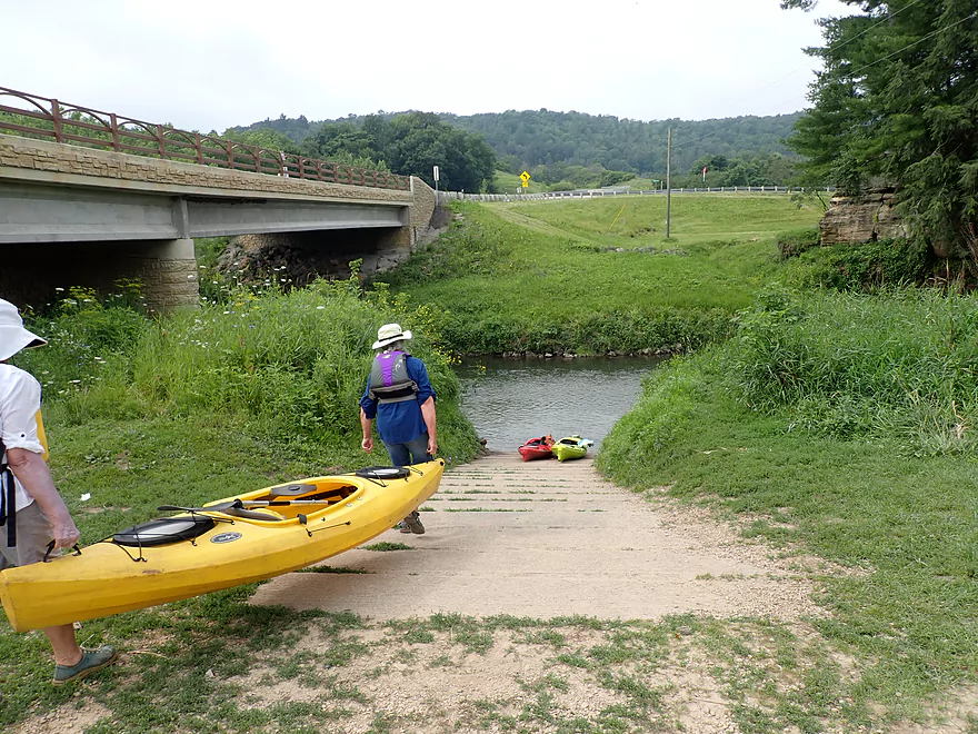
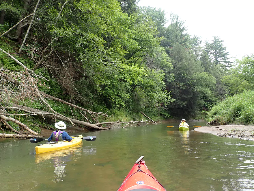
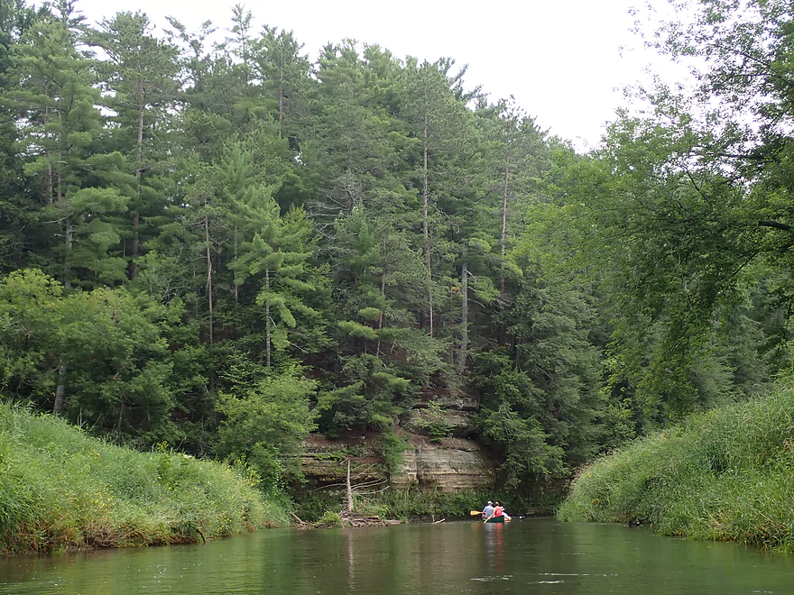
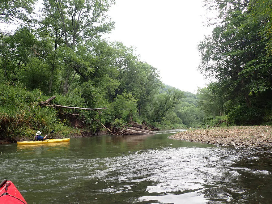
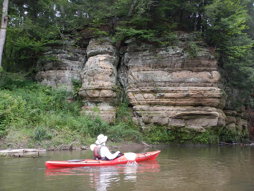
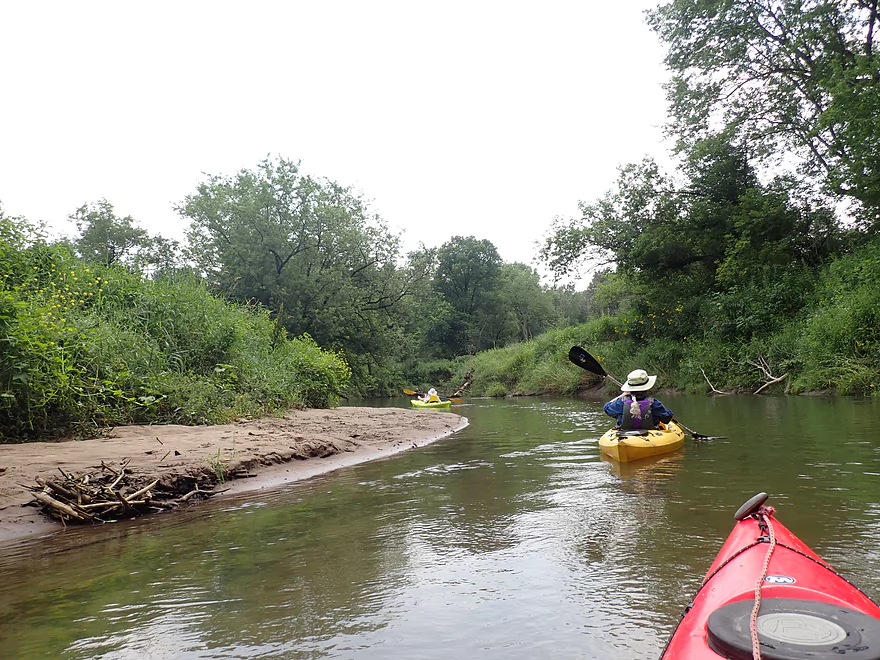
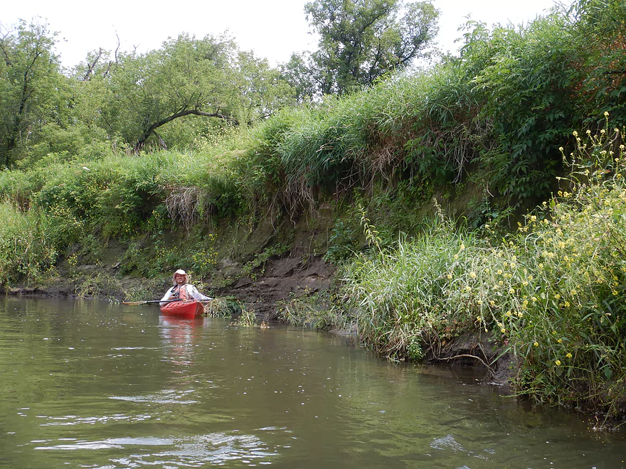
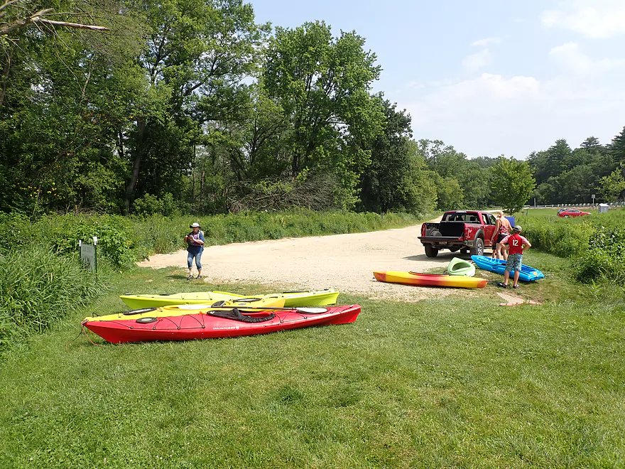
Starting the trip at Bridge #4
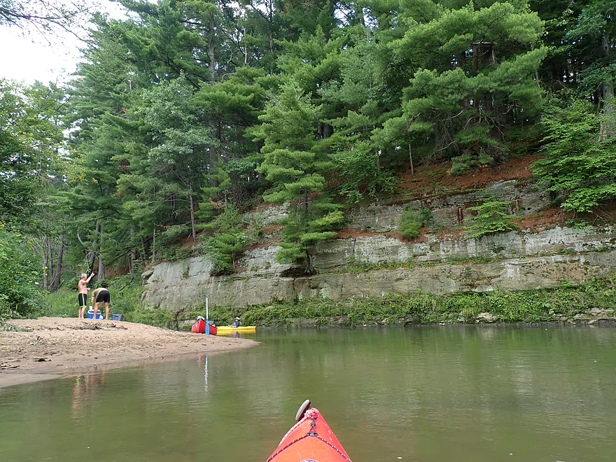
Good launch
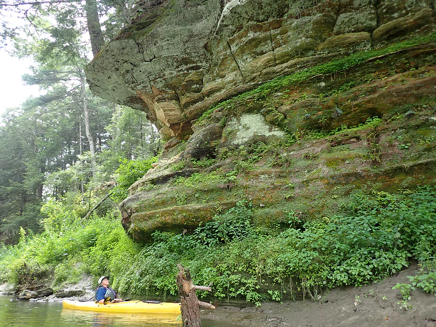
Nice outcrop just behind the landing
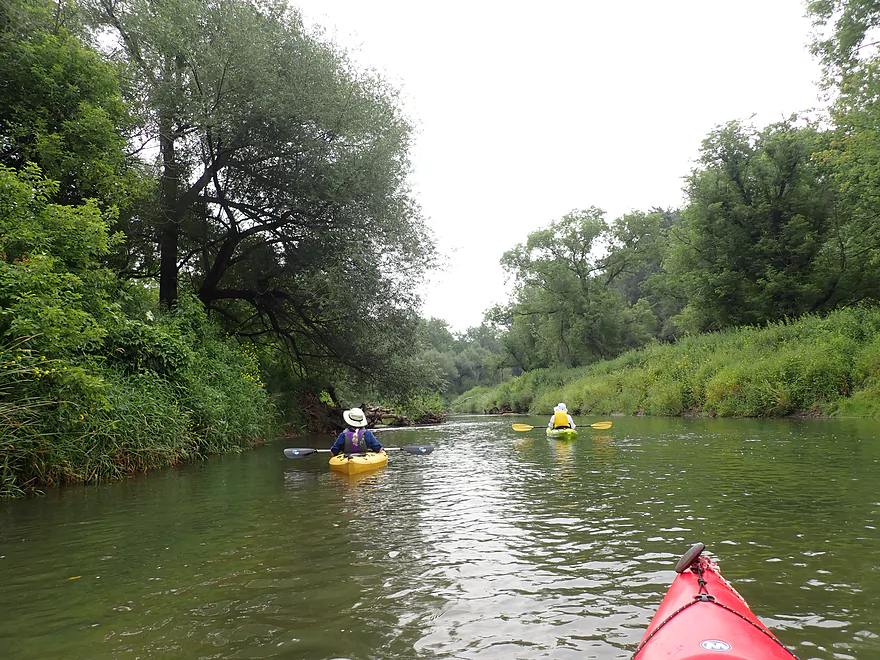
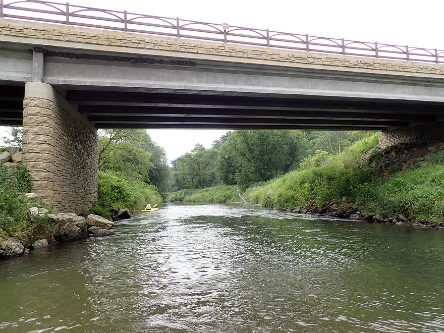
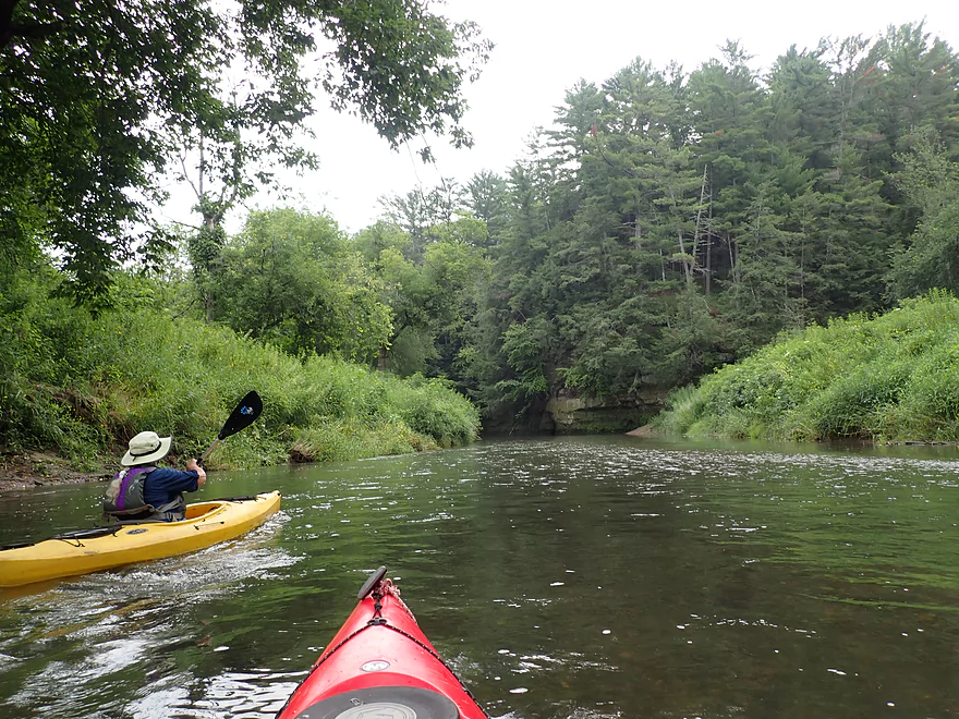
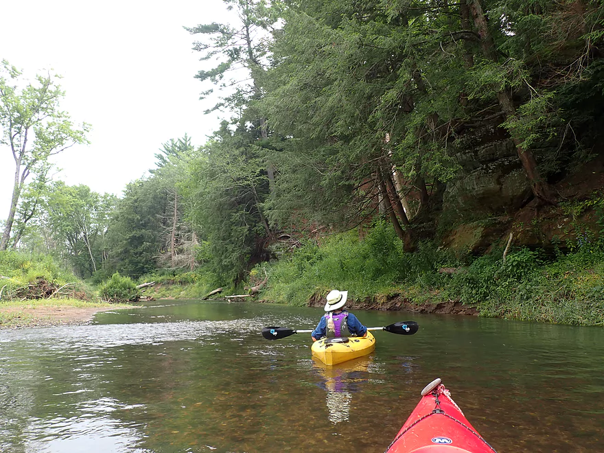
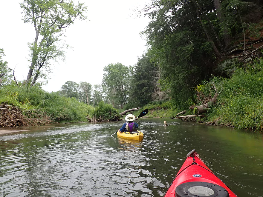
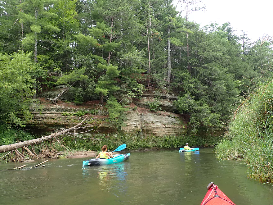
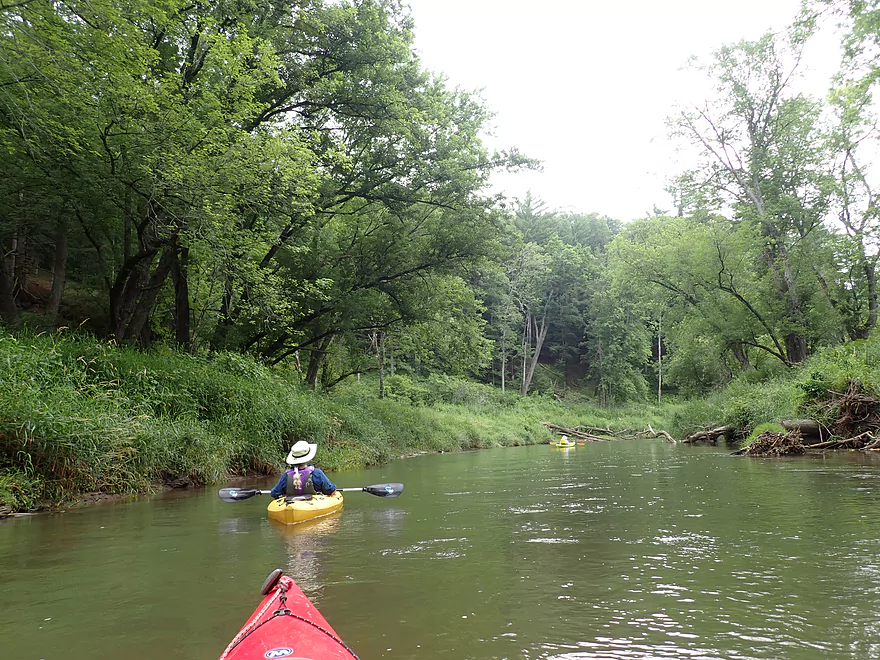
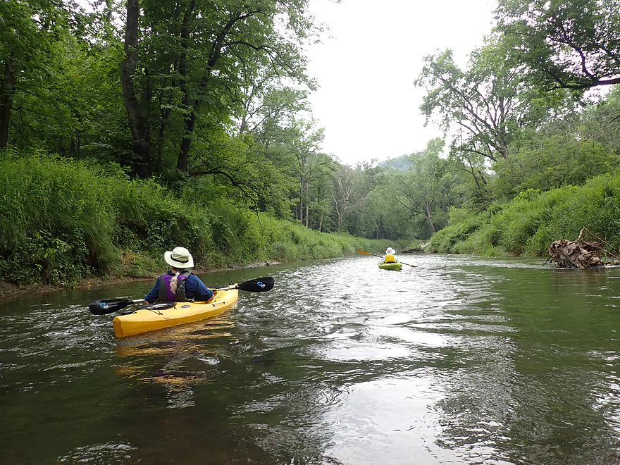
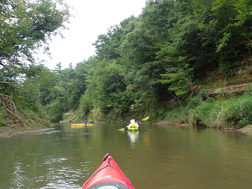
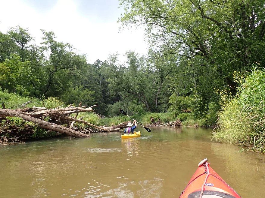
One of a handful of kayakers that passed us
This would be a terrific ice flow in early spring
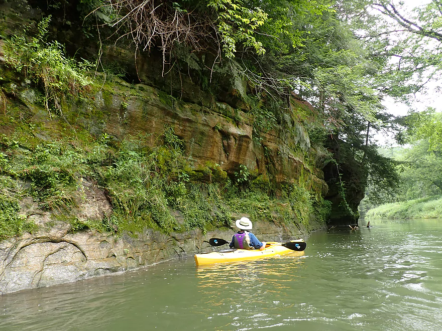
Interesting rock stains
Bands of green decorate this rock wall
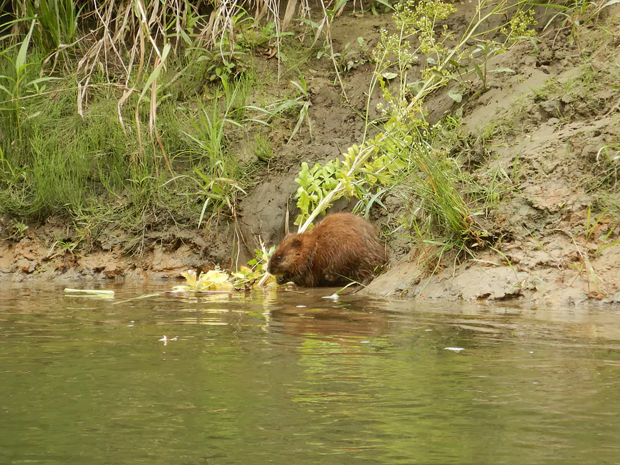
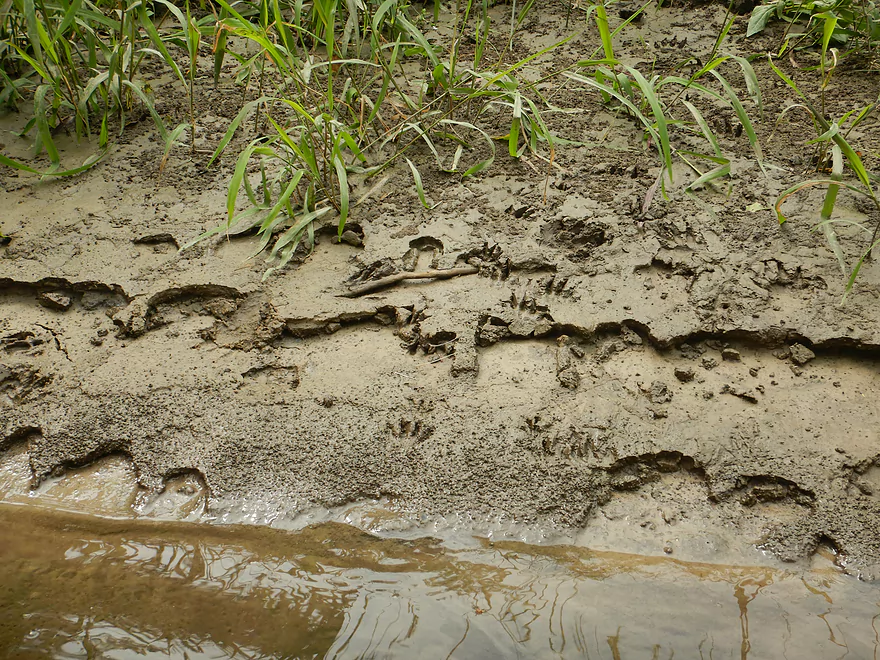
This snacking muskrat let us get very close
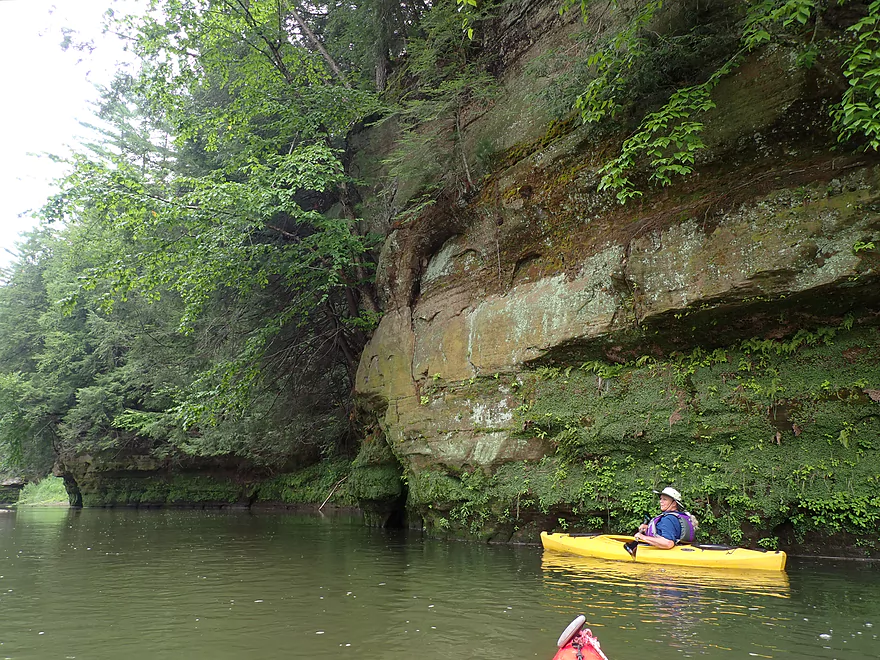
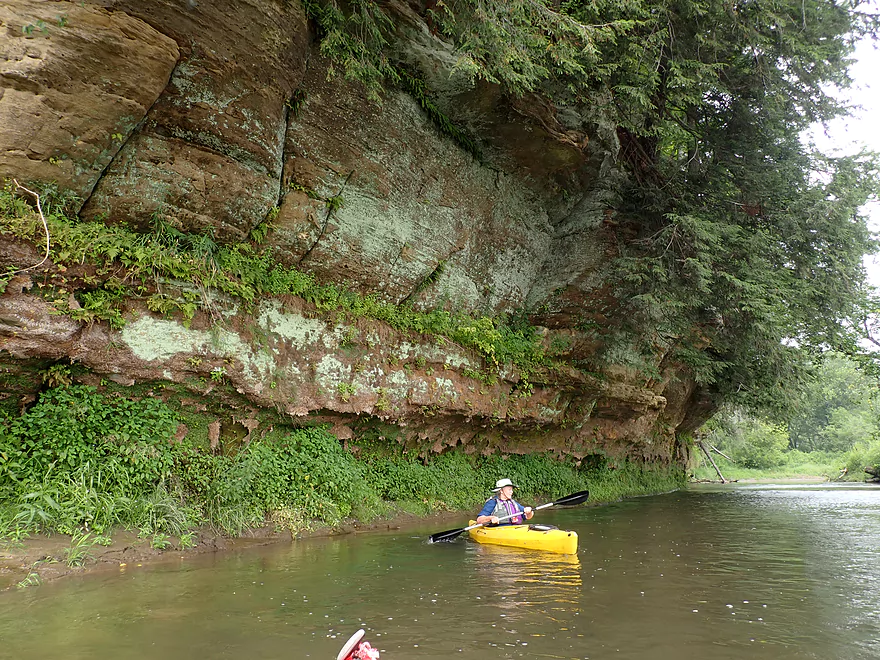
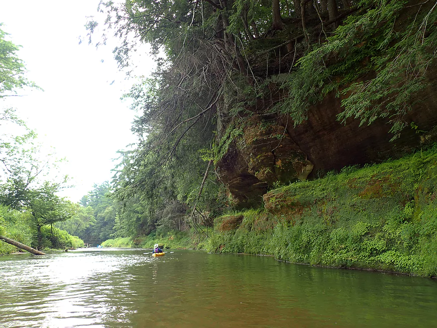
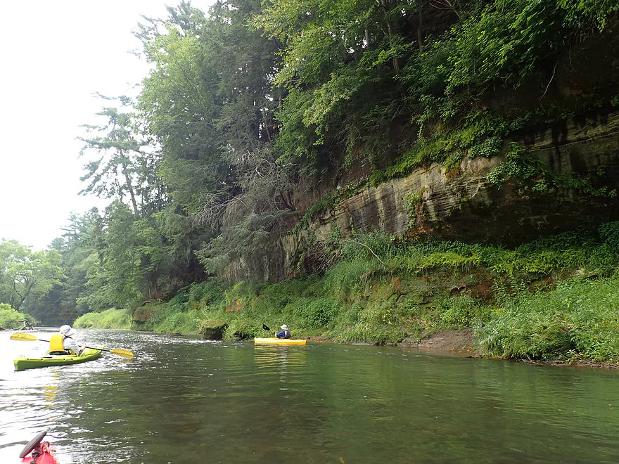
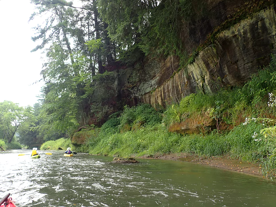
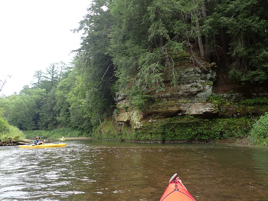
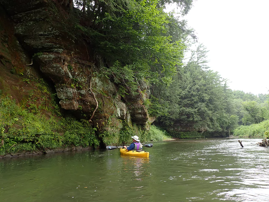
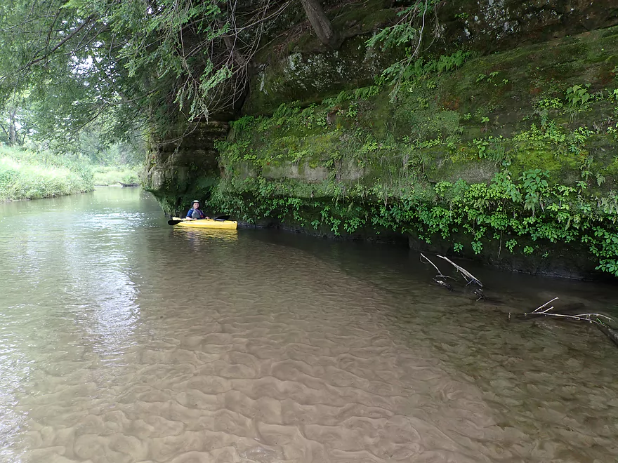
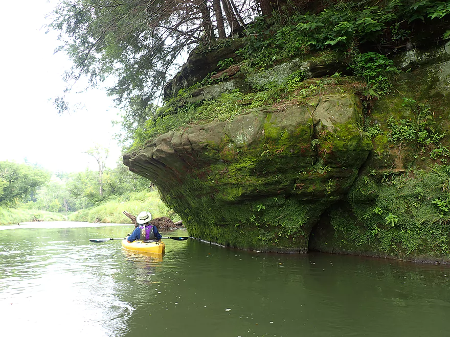
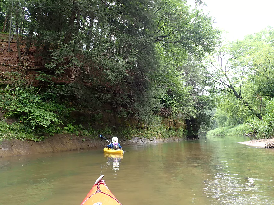
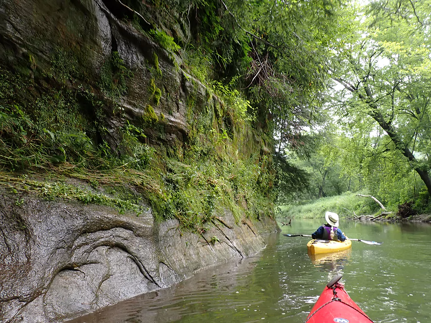
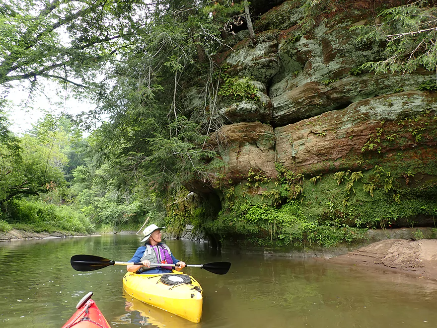
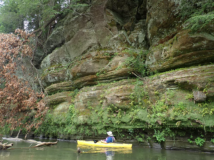
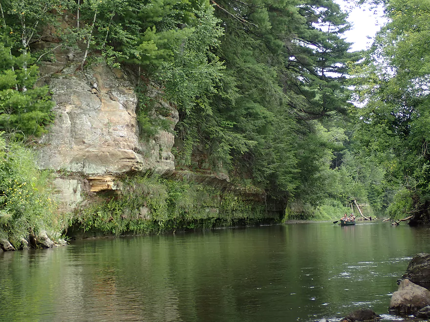
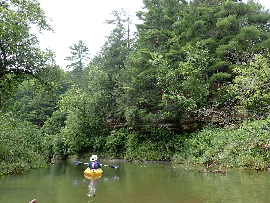
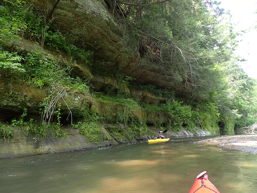
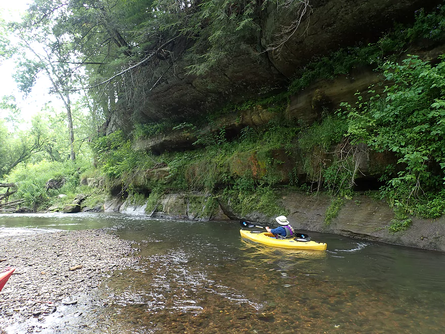
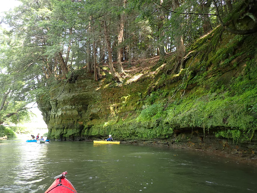
This stretch has the highest density of rock outcrops on the river
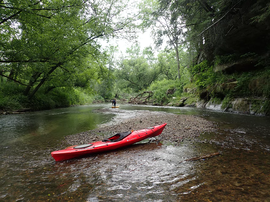
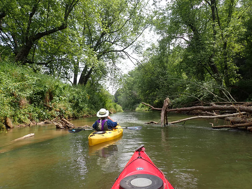
Some shallows, but mostly the river was plenty deep
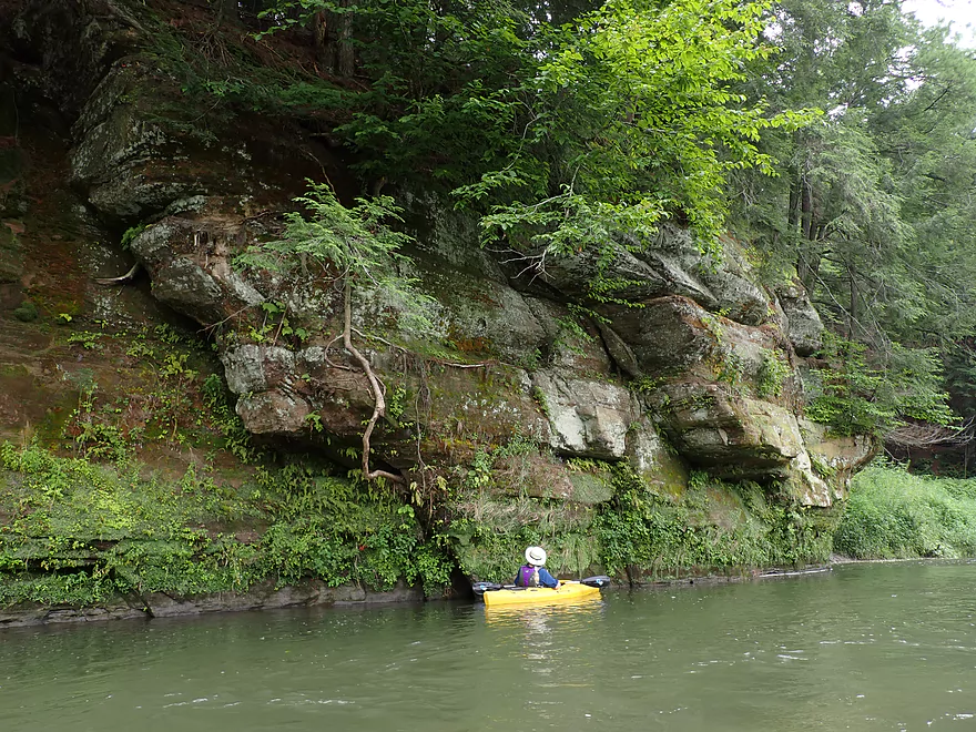
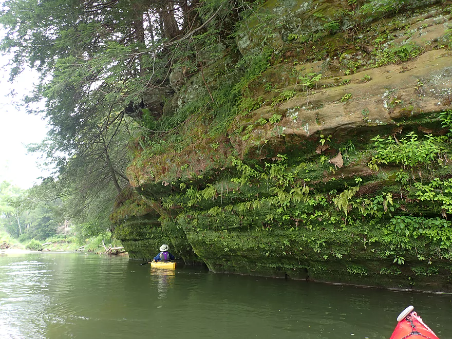
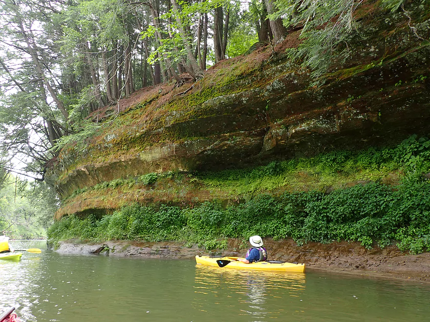
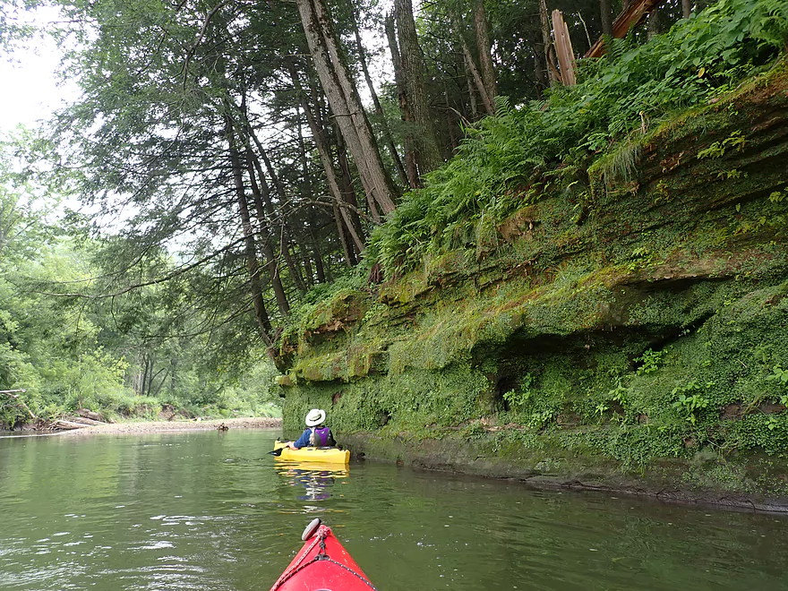
Terrific plant ecosystems growing on the cliffs
Riverside visitors
White pines on top and hemlocks at the bottom….a common combination
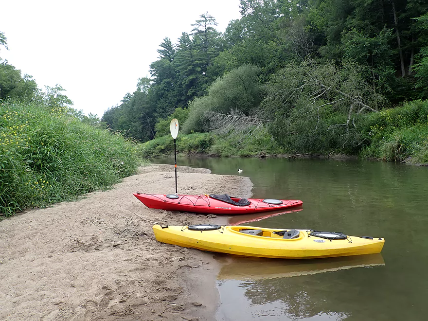
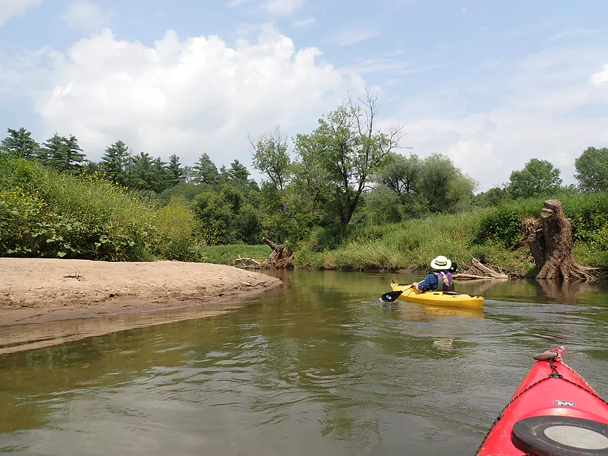
The Kickapoo has a number of nice little sandbars
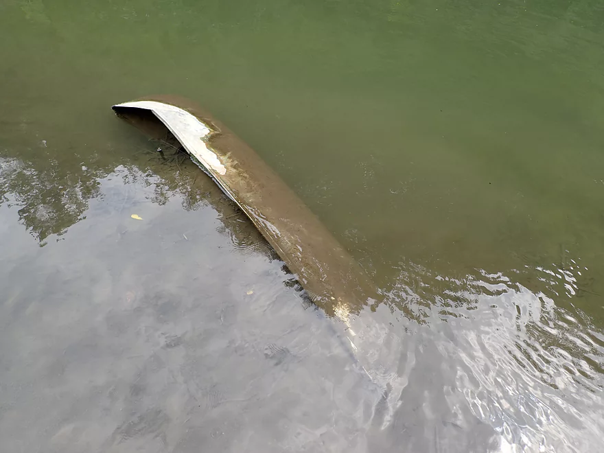
Somebody lost their canoe
Cool sand patterns
Hemlock branches hang low over the water
Those round patterns might be ice flow erosion
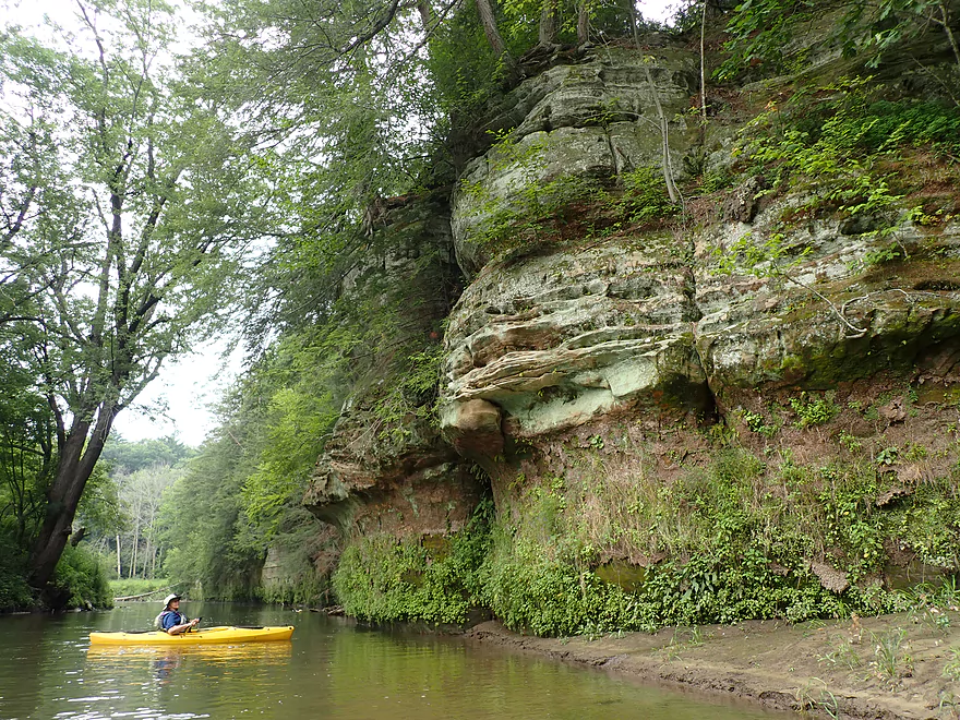
Side view
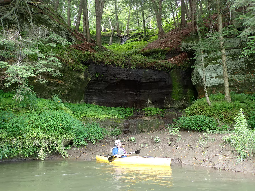
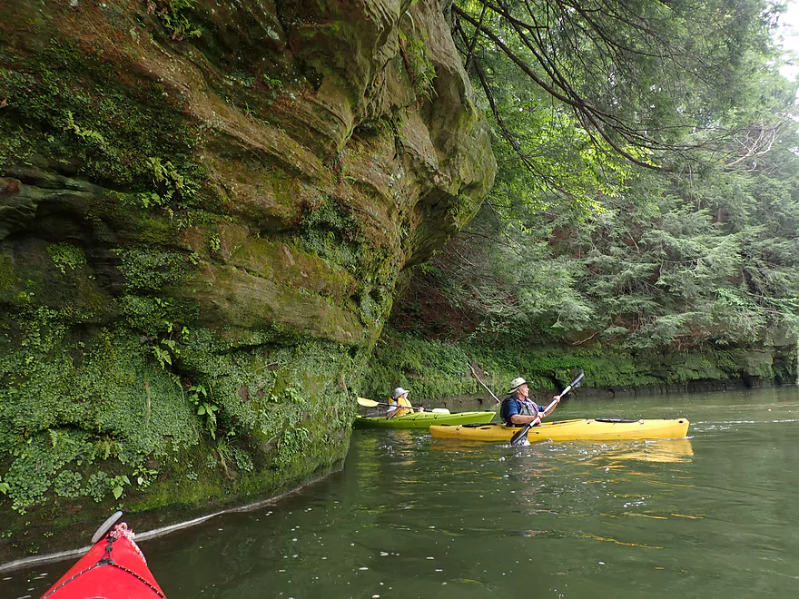
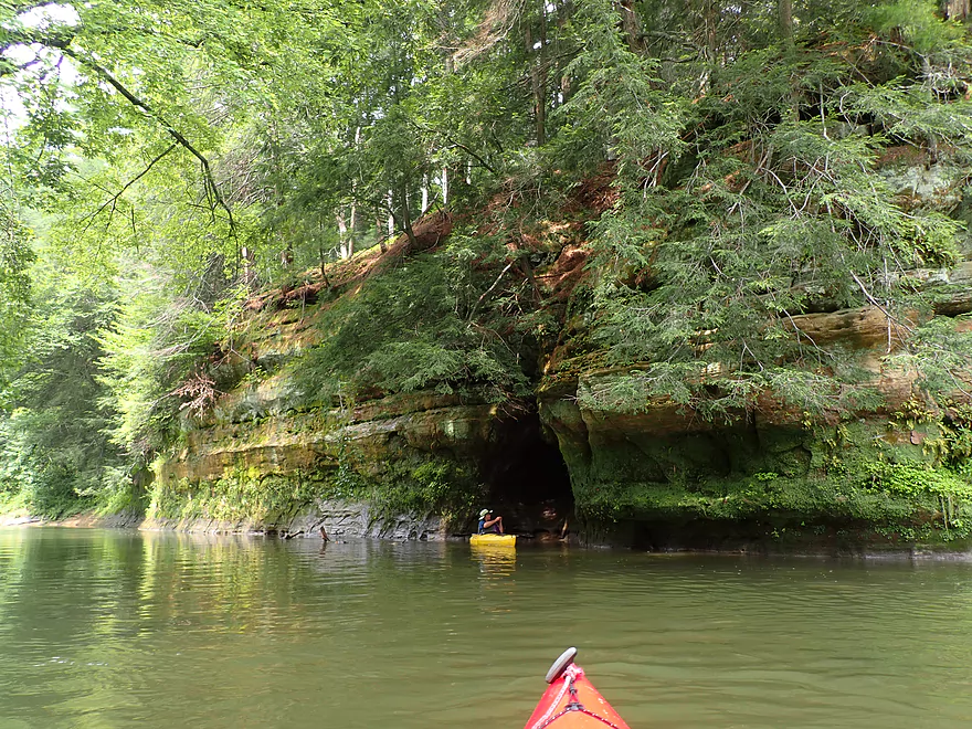
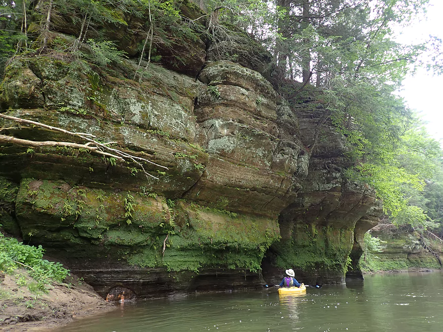
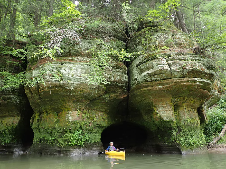
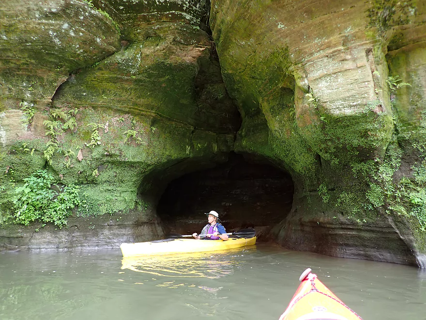
The first of three little caves on the trip
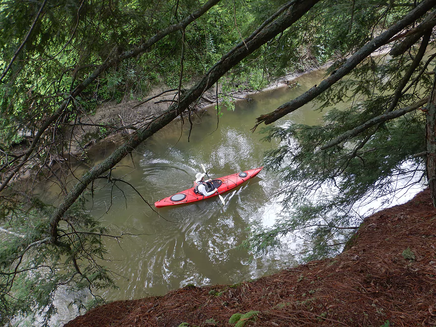
View from up top
Reverse view
Fantastic white pines
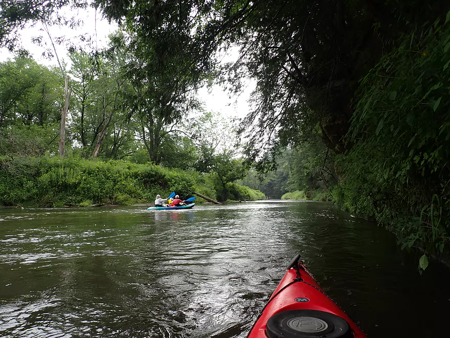
More kayakers
A large colony of ferns
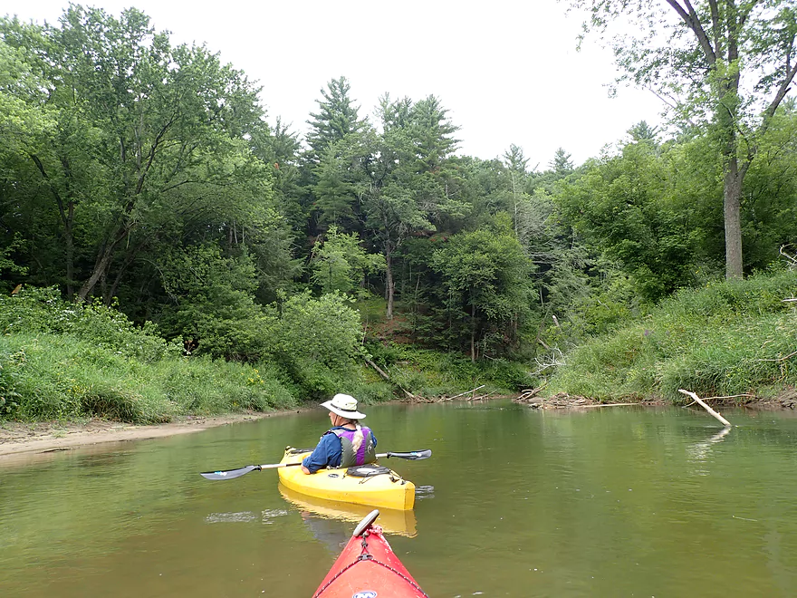
River starts to open up
And the banks get a little more rugged
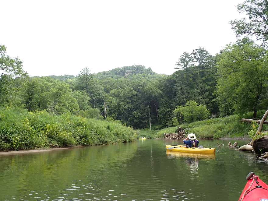
In the distance is a popular overlook at Wildcat Mountain State Park
While only a couple pixels high, there are people up there
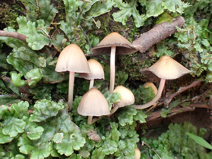
A group of mushrooms poke through a green carpet of liverworts
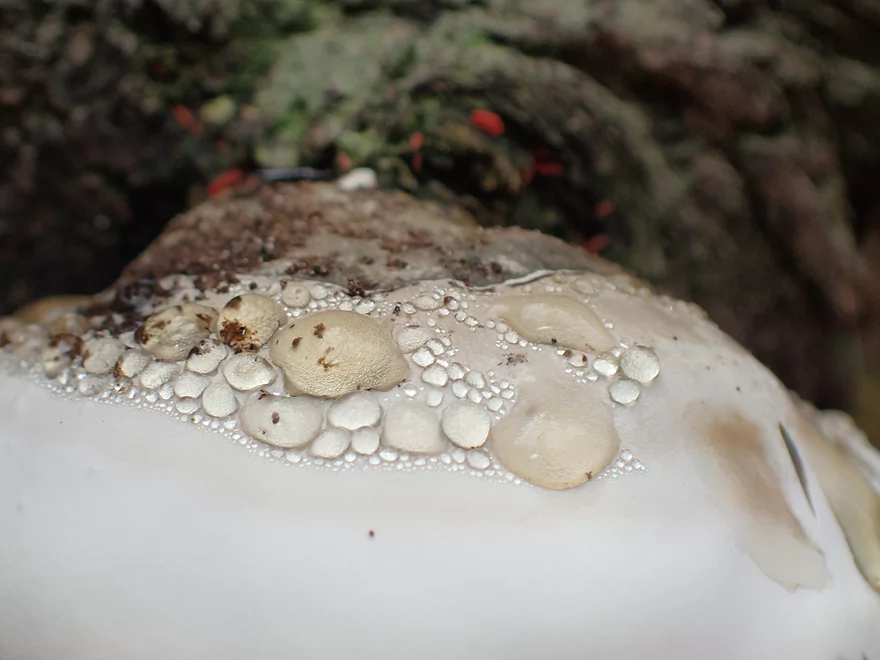
They look like droplets but aren’t…interesting fungus
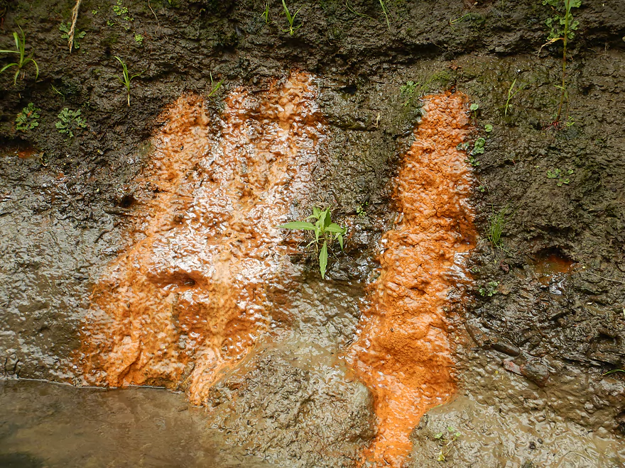
Some of the seeps had a red stain
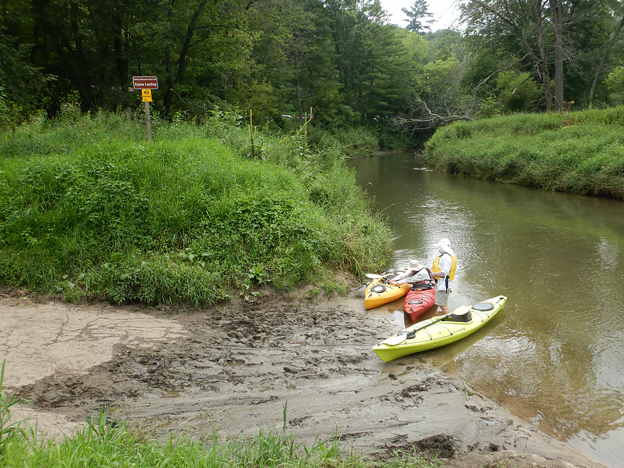
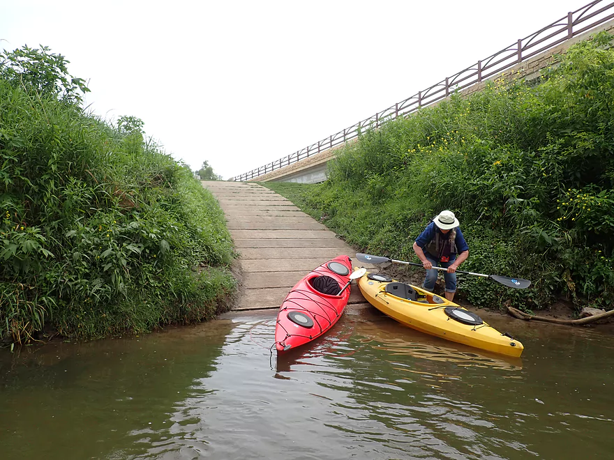
Wildcat Landing is a muddy but doable access

This butterfly was attracted to the yellow on the kayak
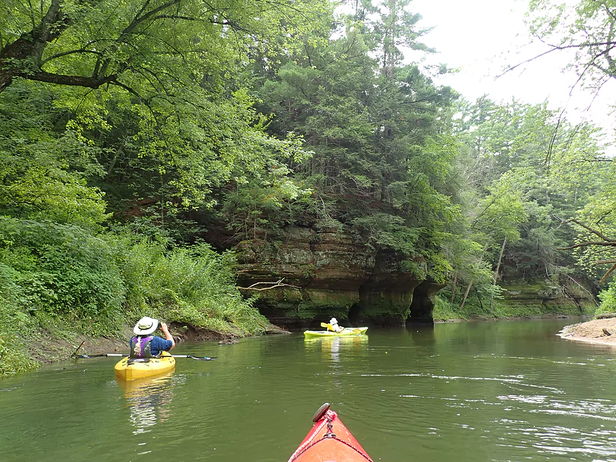
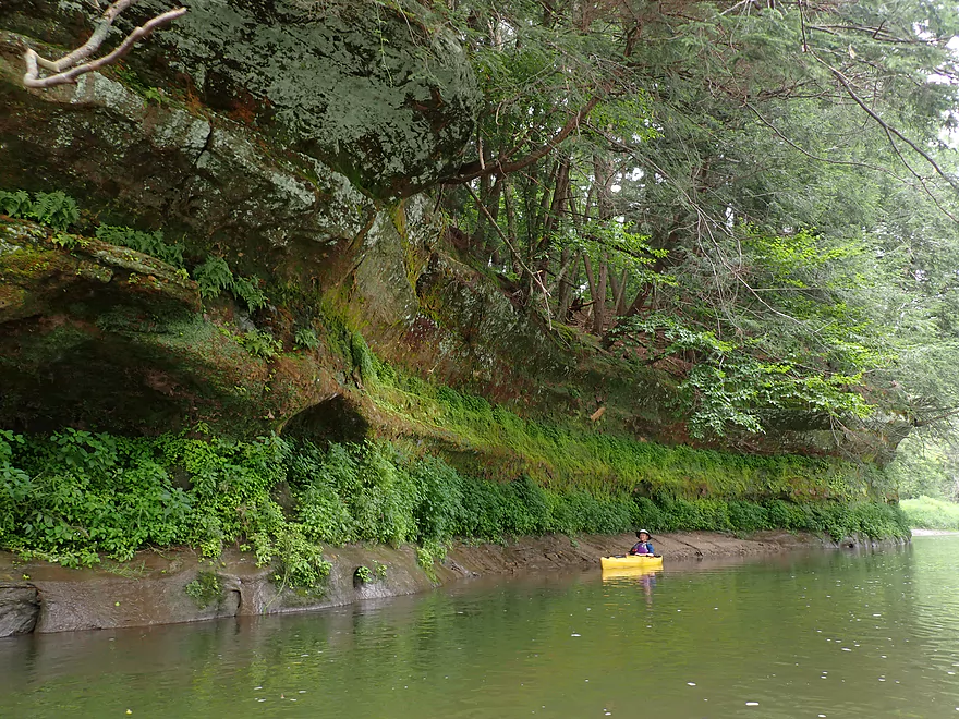
Coming up on another great outcrop
The second of three caves on our trip
Close view
More of what I believe is ice flow erosion
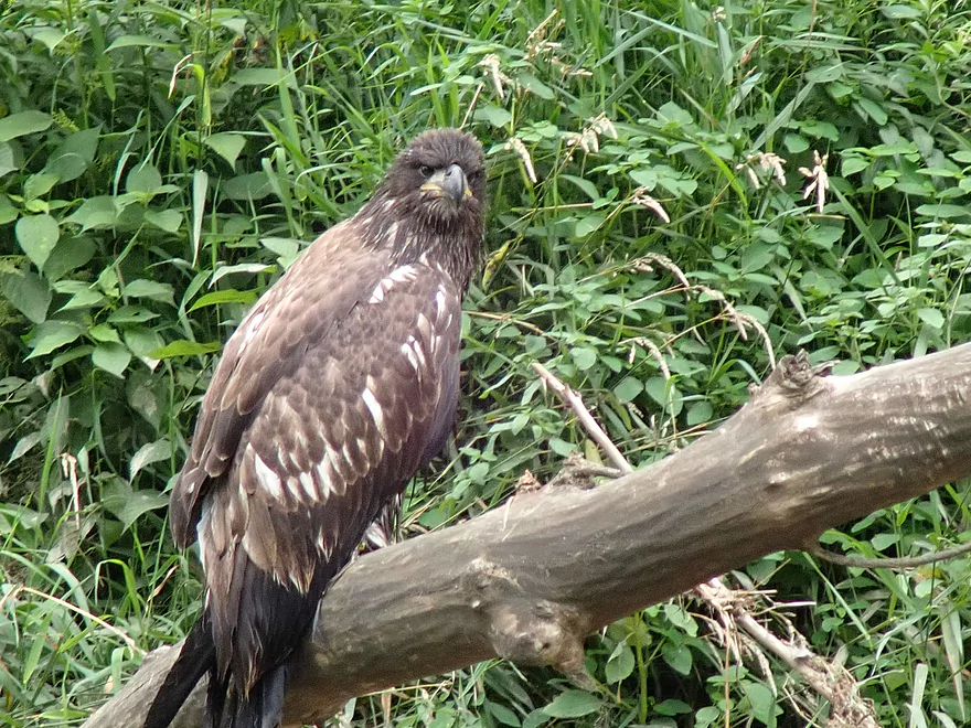
This fledgling eagle is not happy after going for an unexpected swim
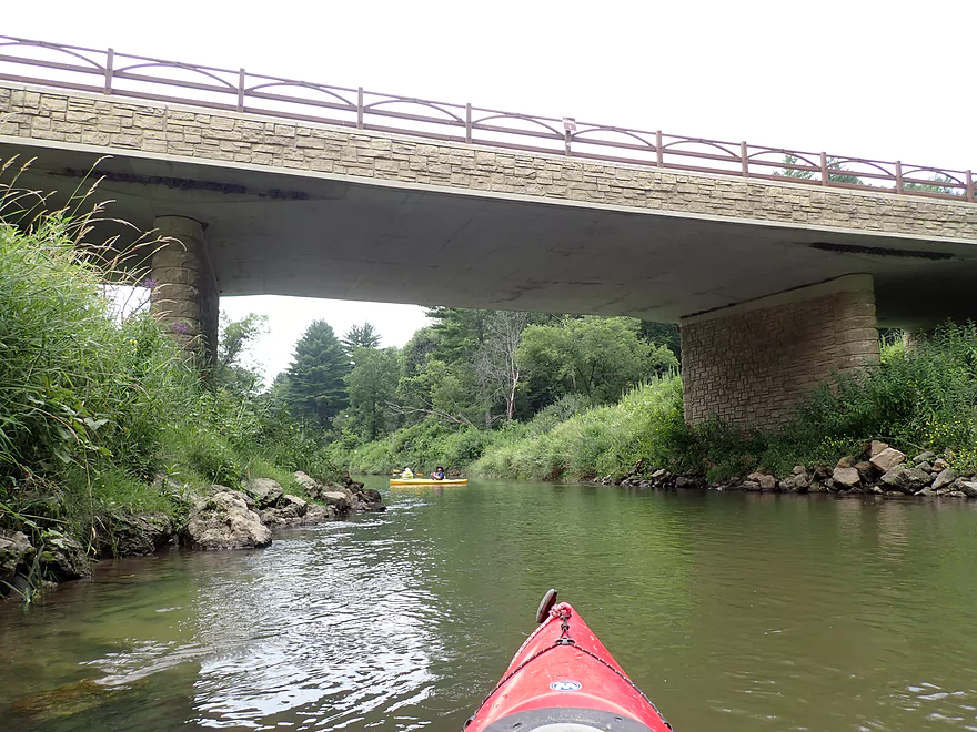
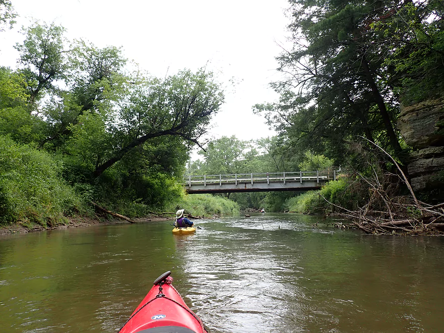
That brown sign says “Bridge 5”
It’s a busy access
Great spot for a sandbar picnic
The liveries do a great job of cleaning out the logjams
Another cool area
A small rapids runs along the base of this cliff
Bridge #6 (not a good access)
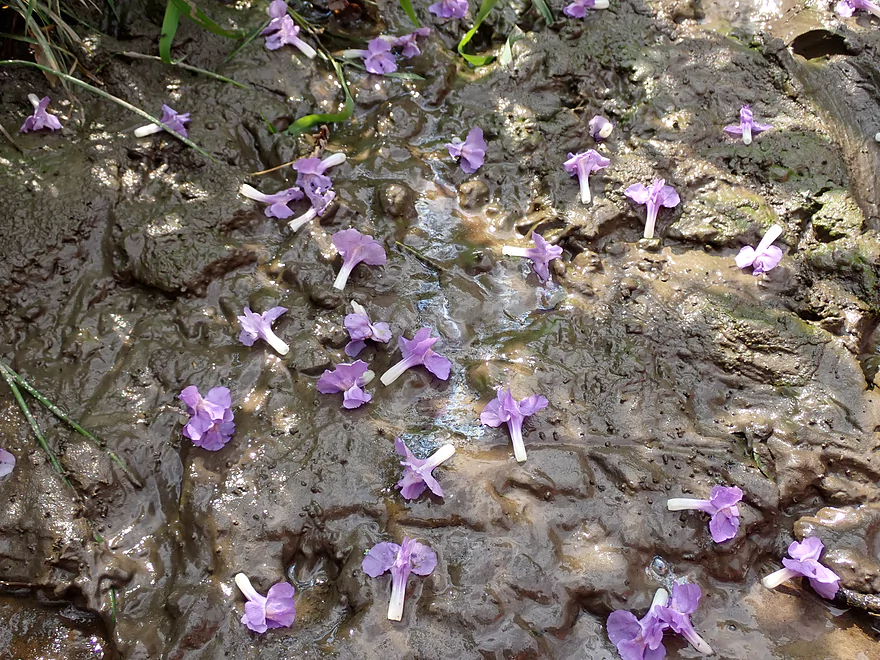
Monkey flowers
Starting to see larger eroded mud banks
Still some sandbars though
Last outcrop of the trip
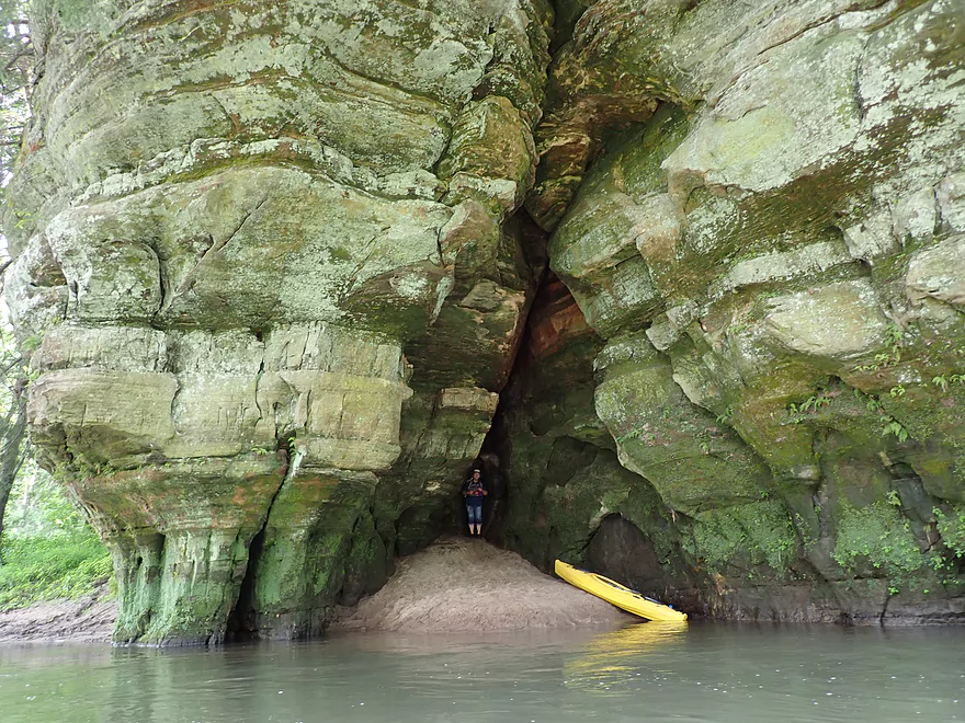
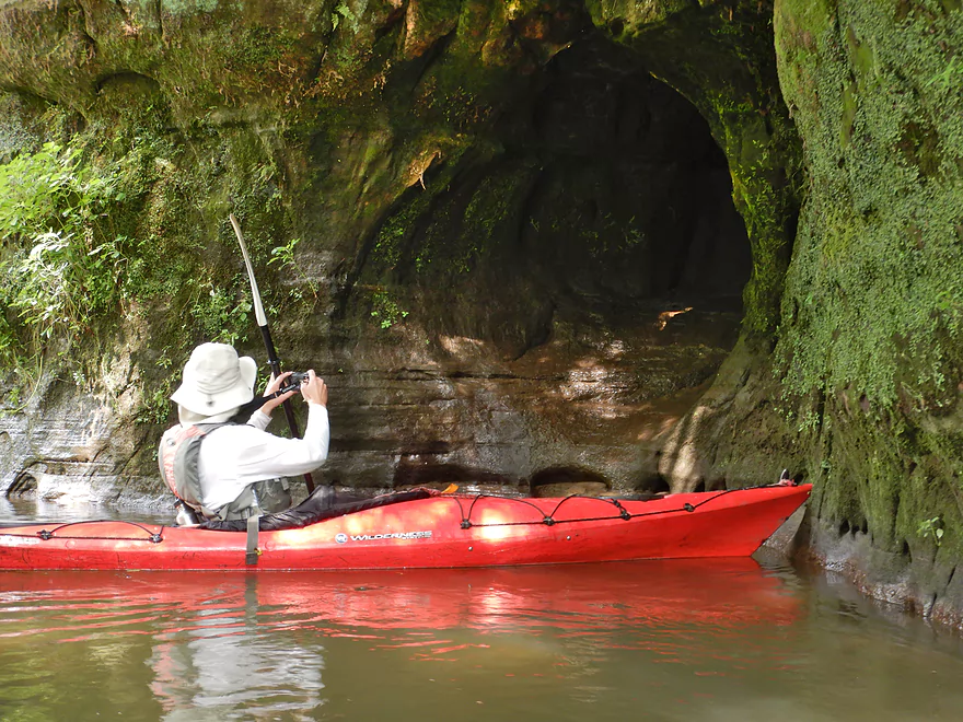
The third cave of the trip
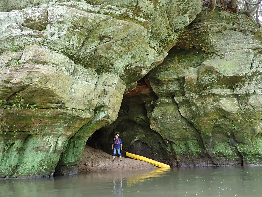
This one was the best
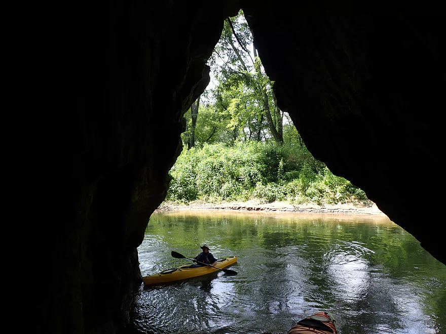
Keyhole view looking out
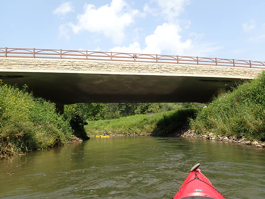
Bridge #7
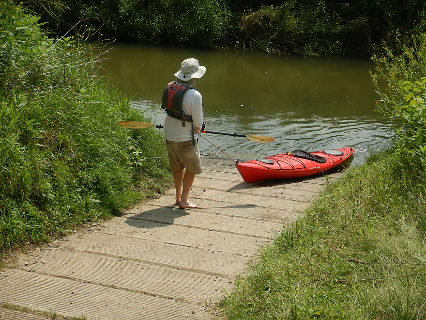
…is immediatly followed by the landing
This is a popular access and take-out for many paddlers
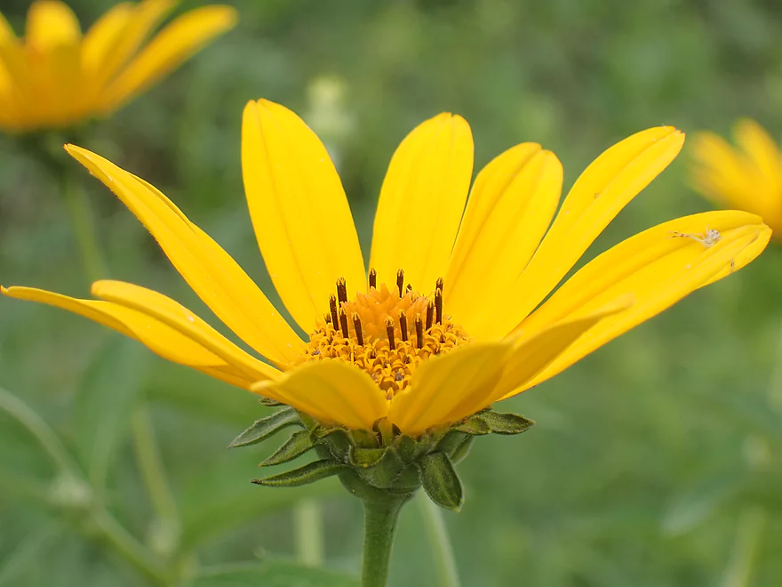
Wild sunflowers along the riverbank
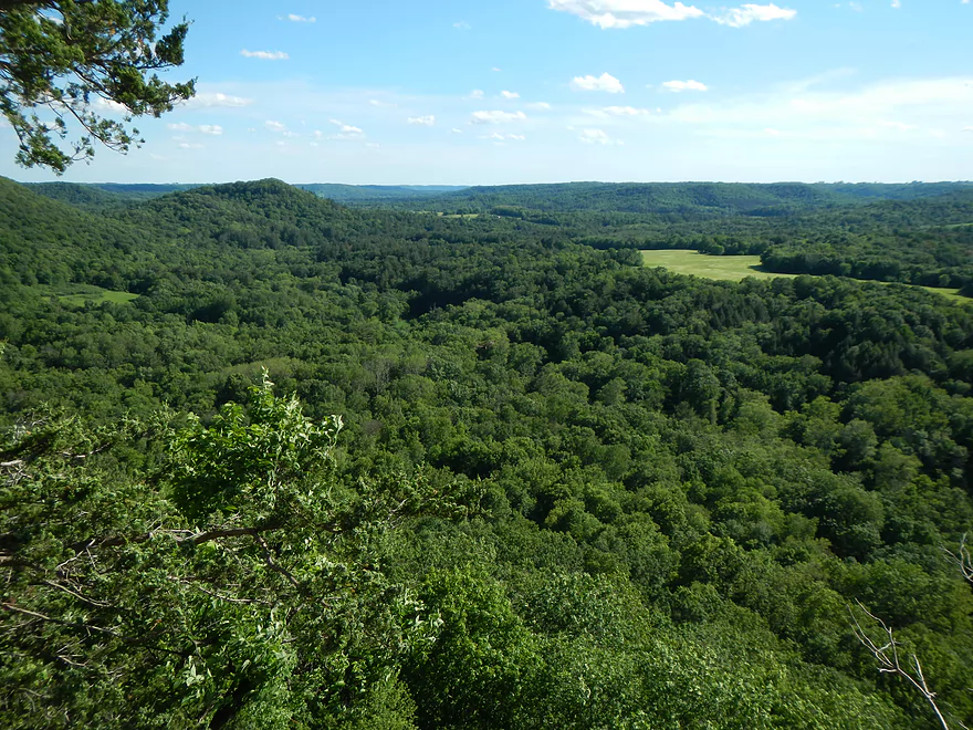
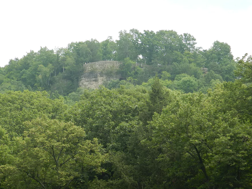
View of the Kickapoo Valley from the Wildcat Mountain overlook
Kickapoo River – Bridge 4 to Bridge 7

The Kickapoo is the 2nd most paddled river in the entire state (after the Lower Wisconsin of course). What makes it so famous are its scenic outcrops and fantastic driftless bluffs. Of the many trips that can be paddled, the best IMO is from Bridge #4 to Bridge #7. I actually reviewed this trip from 11 years ago, but many of those photos were outdated and that review lacked video, so I was eager to do the trip again to give it the proper review it deserved.
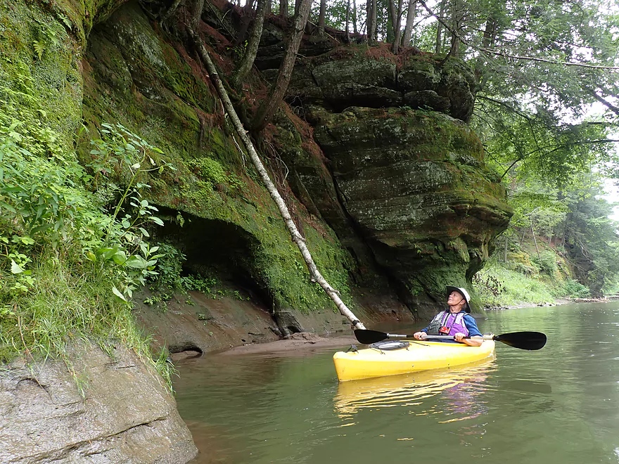
The first three miles of this trip (Bridge #4 to Wildcat Landing), was the best leg of the trip if not the entire river. Here there was the highest concentration of outcrops (at least 16) including a fantastic one back-dropping the put-in. Many of these cliffs have unique plants and trees not seen in much of Southern Wisconsin. At the very top were the tall white pines, hemlocks often arched over the cliffs, and on the faces were many mosses, ferns, and liverworts. There were also a surprising number of seeps and natural springs. The scenery in the distance was fantastic as well. Here the river was hemmed in by tall and steep driftless bluffs, which made this feel more like the Smoky Mountains than Southern Wisconsin.
The next mile (Wildcat Landing to Bridge #5) didn’t have nearly as many outcrops (figure three large ones and a small alcove/cave), but they were still nice. It was here I was able to get remarkably close to a perched young eagle (~8′). I suspect the wildlife is relatively tame on the Upper Kickapoo because they are so used to the noisy hoards that move through on weekends. We went on a weekday during a “slow period”, but still probably saw 30 paddlers total (either on the river or at the landings).
The final two miles (Bridge #5 to Bridge #7) saw the river really start to open up. There were still hills and bluffs, but it no longer felt like you were paddling in hidden valleys. Here the banks were taller and muddier (although not as tall and muddy as the Lower Kickapoo). Despite this, clarity actually was decent in spots and the bottom was surprisingly sandy (one of the benefits of doing a trip at lower levels). There were a handful of small sandbars scattered through this trip that can make nice picnic breaks. On the weekend, these fill up fast (another advantage of doing a weekday paddle).
Eleven years ago, one of the worst memories of that trip was how bad the noise pollution was. Many individuals were yelling, drunk, and often played loud stereos. Most people don’t appreciate how far sound can travel or how annoying it can be for other people. Definitely mind your manners when on the river and try to keep a low profile. This time things weren’t too bad, but one person did have loud music playing from his phone.
Just prior to Bridge #7 and the take-out was one final and fantastic sandstone outcrop. Nestled within the rock wall (and a bit easy to miss) is the best cave on the river. You can actually get out on a sandbar here and cool off inside the cave (which we did). Immediately after Bridge #7 was our take-out, which is a nice area, but a surprisingly difficult access because of the deep, fast water here and steep ramp.
In summary this was a fantastic trip…among the very best in the entire state. If you’re new to the Kickapoo then this trip (Bridge #4 to Bridge #7) is the best of the best. Experienced paddlers may prefer a longer route though as the current moves at a good clip. See the overview section below for other trip ideas.
Sights included ducklings, a muskrat eating a snack, and four eagles. Three of the eagles were probably fledglings and not good at flying. One was sitting on a snag by the river, soaking wet, and (according to the canoers ahead of us) had been under the water when they saw him (oops). What was surprising was how close (as in ~8′) we were able to get to the wildlife (especially the non-nonchalant muskrat and the one eagle). I presume this is because the wildlife is so used to people.
Wildcat Mountain Overlook: Wildcat Mountain State Park has a number of overlooks but the best and most popular is located at the west end of the park. Here you have a terrific view of the Kickapoo and can wave to the distant paddlers.
Ice Cave Trail: A short trail leads to a sandstone outcrop/cave that can feature spectacular ice flows. The best time to visit is late February or early March.
Kickapoo Valley Reserve Visitor Center: Part nature center and part museum, the visitor center does a good job of providing background info on the Kickapoo River and its unique history. They are closed on Sundays.
Organic Valley: This is the largest organic dairy cooperative in the US. Many of their products, including those rarely seen in grocery stores, can be purchased at their outlet store in La Farge. Unfortunately they are closed on Sundays.
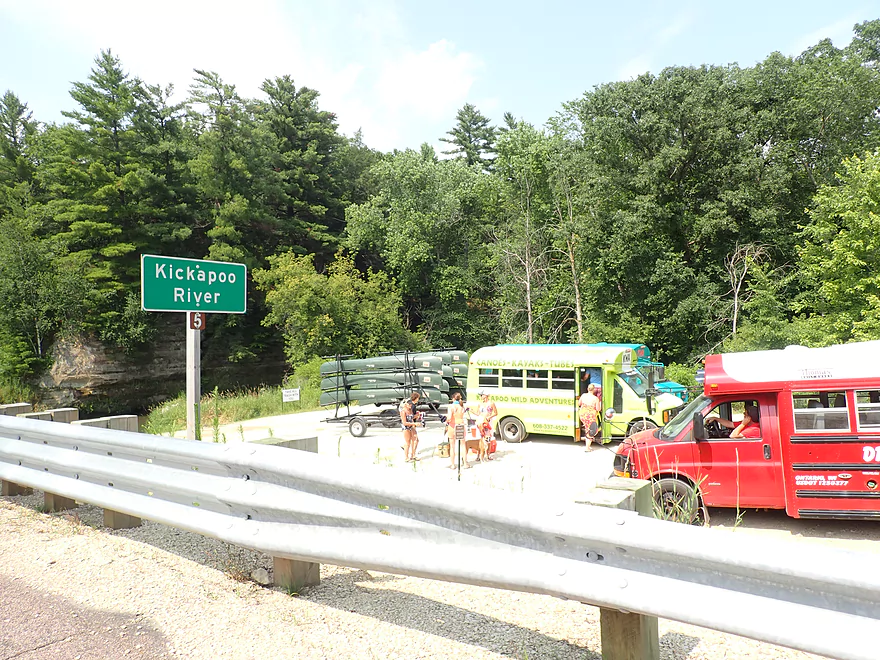
Bridge #4 (Hwy 131): Because Hwy 131 crosses the Kickapoo so often, it’s more helpful to refer to the bridge names by their number. These are posted on the upstream side of the bridge for paddlers to see, they are listed on Google maps, and I list them on my maps. Bridge #4 has a great public parking lot and a nice ramp for launching your boat. No parking fees are required and there is no outhouse on site. This is one of the less popular “super landings” so isn’t as crowded. It’s a great spot to start a trip as the next six miles has the highest density of cliffs on the entire river.
Alternate Put-ins:
- Bridge #1/Ontario (3.6 miles upstream from #4): Just northeast of the main Ontario bridge (Hwy P) is a nice public access for launching. An outhouse is available as well as a public parking area. This is a popular landing, but most Ontario paddlers actually launch from one of the private liveries which have their own landings. This leg actually doesn’t have as many outcrops (maybe 3-4).
- Wildcat Landing (3.1 miles downstream from #4): This landing is part of Wildcat Mountain State Park. It’s a great access with picnic areas and an outhouse. But…the current ramp is a bit muddy. The downside to launching here, is you miss out on one of the best stretches of the river and roughly 16 sandstone outcrops.
Bridge #7 (Hwy 131): This is a major canoe/kayak landing with a large parking lot, take-out ramp, and outhouse. A $5 parking fee (payable via a self-pay kiosk) is required to leave your car here. Make sure you don’t park in the turn-around area used for loading/unloading (signs will mark this). Warning the take-out ramp is surprisingly steep, the channel fast, and the river deep…this combines for a surprisingly difficult take-out.
Alternate Take-outs:
- Bridge #6 (2.1 miles upstream from #7): This is a great access for those wanting a shorter trip. Many liveries end their Ontario trips here. An outhouse is on site, but I’m not sure if a parking fee is required. Taking out here means you’ve still seen the best parts of the river, but you’ll miss out on the next leg (7+ outcrops and a nice cave).
- Bridge #8/Winchel Valley Ave (1.2 miles downstream from #7): This is a more difficult bridge access that I used during my Billings Creek trip. The slope is steep and weedy, but it’s doable for determined paddlers. Taking out here will add maybe +3 outcrops to your tip.
- Bridge #10 ( 2.5 miles downstream from #7). This is a major landing and a good access. Ending your trip here will add ~8-9 outcrops to your trip.
Bike Shuttle – Bridge 7 to Bridge 4: 2.2 miles with 177′ of ascent. This is a very short but hilly bike shuttle. At 2 miles, you could just hike back to your car if you wanted to. The shuttle route is quite scenic.
Rentals/Shuttles:
- Kickapoo Wild Adventures: 608.337.4522 – 30352 State Hwy 131, Norwalk, WI 54648
- Drifty’s Canoe Rental: 608.337.4288 – Highway 33 & 131, North Ontario, WI 54651
- Fred Flasher’s Canoe Camping Trips: (608) 435-6802 – PO Box 114, Wilton, WI 54670
- Mr. Ducks Canoe Rental: (608) 337-4711 – 100 Main Street, Ontario, Wisconsin 54651
- Titanic Canoe Rental: 1-877-438-7865 – 300 State Highway 131, Ontario, WI 54651
Current: The current is consistently fast but not really that dangerous. This is a good trip for lazy paddlers.
Logjams: There were none. The local liveries do a good job of cleaning these out.
Rapids: There are a handful of minor Class 1 rapids (all easy).
High Water: The Upper Kickapoo can rise dramatically after a rainfall. During these times, the river can become very fast and pushy, and paddling is not advised.
Closest Gauge: Kickapoo River @ Ontario
Trip Depth: 8.74′ or 76 CFS
Navigability Estimates: The following are just estimates. Always use your own judgement.
- < 8.5′: Maybe too shallow for paddling.
- 8.5-8.6′: Very shallow with maybe some wading required.
- 8.6-8.7′: Shallow but a good depth.
- 8.7-8.8′: Average depth…good target range.
- 8.8-8.9′: Above average but a decent range.
- 8.9-9.1′: A high depth with turbid water and pushy current, but likely manageable for seasoned paddlers.
- 9.1-9.4′: A very high depth only suitable for expert paddlers.
- 9.4’+: Perhaps too high for enjoyable paddling.
The key to enjoying a good trip on the Kickapoo is good timing. Below are some helpful tips:
- Avoid the Crowds:
- Try Weekdays: The weekends get crazy busy with a lot of drunk and noisy paddlers/tubers (especially Ontario to Bridge #7).
- Try Early Morning: If you have to do a weekend, try to get out onto the river before 9 or 10 to beat much of the crowd.
- Summer is the Worst: Doing a trip prior to Memorial Day or after Labor day will significantly reduce the crowds you see.
- Ice Flow Paddles: The Kickapoo produces fantastic ice flows, but timing a trip to see them is difficult. Usually your best bet is the last week of February or the first week of March.
- Fall Color Paddles: This area of the state is famous for its fall color. Paddling the Kickapoo during this time can be a special experience. Ideal timing is usually between October 7th and October 20th.
- Leafless Paddle: Summer paddlers don’t realize they aren’t seeing many outcrops in all their glory because the cliffs are covered up by leaves. Doing a leafless paddle (prior to say May 10th or after October 15th) can be a really neat experience.
- Winter Paddle: While I haven’t done it, I’ve heard the Kickapoo mostly stays open in the winter because of its springs and can be a unique experience.
- Avoid High Water: The Kickapoo commonly experiences significant flooding. Ideal levels will be below 9.1′. At 9.4’+ the river may start to burst some of its banks.
- Overcast vs Sunny: Try timing a trip for overcast skies. It will make the cliffs more vibrant and photogenic. When sunny, it can be difficult to photograph the cliffs because of extreme glare and contrast.
- First Time Paddlers: This is a great river for introducing a friend to paddling to because of the number of landings, liveries, the lack of obstacles, and the current which is brisk but not too unsafe. It’s also super scenic. If they’re not hooked on kayaking after the Kickapoo, then there is no hope for them.
Taking photos of the Kickapoo cliffs is a lot of fun, but it is deceptively difficult and most that attempt it are disappointed with their results. The following are some helpful tips.
- Scale: It helps a lot to have another kayaker or something else in the picture against the sandstone to show scale.
- Horizon Line: You want this fairly low…ideally most of your picture is of the cliff and not the river.
- Angle: The best angle is usually 45 degrees. Pictures at 0 or 90 degrees will produce flat/2D looking outcrops.
- Exposure Compensation: It’s super easy to over-expose cliffs using the default settings. Typically you want to reduce your light by 2/3rds to a full stop.
- Overcast vs Sunny: If the trees have leaves on them, you want to shoot the cliffs when it is overcast. A slight early morning fog or mist from rain will be even better. This will produce rich greens and reduce dynamic range issues. If you’re stuck in sunny conditions, absolutely try to get under a shadow before you take your picture.
- Blurry Images: Because the cliffs take a lot of light to photograph, the shutter speed will slow which increases the chance of blurry shots. Try using a 1-2 second delay to reduce shutter button shake. Also take extra backup photos with the assumption that some will be blurry.
There are a number of area camping options:
- Wildcat Mountain State Parking Campground: While the main campground isn’t located by the river, it’s still super cool as the campsites are perched atop a tall and scenic bluff. You can book a campsite here. Warning the main campsite is popular on weekends, and at times it may be difficult to get an available site.
- Kickapoo Valley Reserve: KVR owns much of the land south of Wildcat Mountain State Park. They have ~25 primitive campsites scattered throughout the Reserve, with roughly 8 having riverside access. These are first-come, first-served so you are gambling on their availability. You must register and pay $10 to use them. Many of the riverside campsites are in rough shape (muddy, weedy and flood damaged)…plus they lack amenities so keep your expectations low. Recently some campsites were closed or relocated due to flood damage. See this KVR overview map for a location of campsites.
- La Farge Village Park: If Wildcat Mountain is filled up and you don’t want to rough it on a KVR campground, this is actually a surprisingly nice option that few use. This campground while close to the river is not located immediately next to it.
Quick Overview
- Wilton to Ontario: 12 miles. This stretch is seldom paddled, but is cleaner and faster than downstream legs. Those willing to endure weedy bridge accesses and occasional snags will be rewarded with spectacular outcrops. A very underrated part of the river.
- Ontario to Rockton: 13.5 miles. This is the most popular section for kayaking on the river (if not the entire state). Highlights include many spectacular sandstone outcrops. This stretch can easily be subdivided. Shuttle services are plentiful, but this leg can get crowded and noisy during summer weekends.
- Rockton to La Farge: 11 miles. This is the second most popular stretch of the river. While the outcrops here aren’t as numerous as the Ontario leg, they do tend to be larger and more impressive.
- La Farge to Mouth: ~90 miles. After La Farge there are few rock outcrops and the river becomes much less interesting. The Lower Kickapoo is a generic hardwood floodplain that is at best a mediocre paddle.
- Tributaries:
- Kickapoo River – West Fork: While lacking the outcrops of the main branch and a bit shallow in spots, this is a very underrated river with many fun rapids.
- Billings Creek: I actually like this creek better than the main river itself. There are just as many outcrops, and the water and banks are much cleaner.
- Tainter Creek: While not very big and lacking in outcrops, it’s still a cool creek with very swift current.
Detailed Overview
- Upstream from Lincoln Ave: The river is likely too small and degraded by open pasture to have much appeal for kayaking. Although "Kickapoo Springs" (the primary source of the river and a public DNR area) might be interesting.
- Lincoln Ave to Keystone Road: 2.5 miles. The river is small here (likely too small for most paddlers) and more scruffy with fewer outcrops. Figure 1-2 logjams and 3 outcrops. Several of the Elroy-Sparta Trail bridges over the river are quite scenic/rustic. High water will be required to do this stretch.
- Lincoln Ave to Hwy 131 (East of Midge Road): 6.3 miles.
- Lincoln Ave to Hwy 71: 1.6 miles. Section includes five outcrops, including one really nice one. River is shallow here with many Class 1 rapids. There is one strainer that has to be portaged, but no other logjams. I encountered a bull on this stretch (here) which might be a deal breaker for most paddlers. You could possibly portage around the farm in question along the Elroy-Sparta Trail but it would be a long and difficult portage.
- Hwy 71 to Wilton Campground/Library: 0.7 miles. A nice stretch with ~3 mediocre outcrops and one really nice one. Water clarity is stunning here. There is a low tree that requires some tight ducking to get under.
- Wilton Campground/Library to Hwy 131 (by Posey Creek): 1.4 miles. Less attractive stretch but still ~4 mediocre outcrops. There is a serious logjam by Water Street that must be portaged.
- Hwy 131 (by Posey Creek) to Hwy 131 (by Mica Rd): 1.3 miles. A terrific stretch with scenic pine trees, several mediocre outcrops and one fantastic sandstone outcrop.
- Hwy 131 (by Mica Rd) to Hwy 131 (East of Midge Rd): 0.7 miles. More of a scruffy stretch, but still a few mediocre outcrops. The Black Valley hills in the distance are very scenic from this leg.
- Hwy 131 (East of Midge Road) to Hwy 131 (near Nicollet Ave): 4.1 miles.
- Hwy 131 (east of Midge) to Hwy 131 (by Michigan Ave): 0.5 miles. A good leg with one nice set of outcrops.
- Hwy 131 (by Michigan Ave) to Hwy 131: 0.6 miles. Another good leg with 3 outcrops. Some minor rapids, including a 4-6" ledge.
- Hwy 131 to Hwy 131 (by Nisswa Rd): 0.6 miles. One of the best legs on the Upper Kickapoo which features 6 noteworthy outcrops and terrific ice flows in February and early March.
- Hwy 131 (by Nisswa Rd) to Hwy 131 (by Nordale Ave): 1.1 miles. Not as scenic as other legs with messy shorelines and eroded banks. There are still a few nice outcrops.
- Hwy 131 (by Nordale Ave) to Hwy 131 (by Nicollet Ave): 1.3 miles. Another one of the Upper Kickapoo's best legs with ~6 outcrops, including a small natural bridge you can paddle through.
- Hwy 131 (near Nicollet Ave) to Ontario: 5 miles.
- Hwy 131 (by Nicollet Ave) to Hwy 131 (Oil City): 2.3 miles. Two long stretches of bluffs contain great outcrops.
- Hwy 131 (Oil City) to Hwy 131 (Kickapoo Wild Adventures): 1.4 miles. Terrific stretch with two major outcrops. One set of Class 2 rapids.
- Hwy 131 (Kickapoo Wild Adventures) to Ontario (Brey Valley Road Park): 1.5 miles. Three sets of outcrops.
- Ontario to Hwy 131/Bridge #4: 3.6 miles. A more open and flatter stretch of the Kickapoo. There are still 3-4 outcrops. This is THE most popular leg on the entire river.
- Bridge #4 to Bridge #7: 6.0 miles.
- Bridge #4 to Wildcat Landing: 3.1 miles. A super popular stretch and the most scenic on the Kickapoo. River flows past steep hillsides and many outcrops (at least 16).
- Wildcat Landing to Bridge #5: 0.9 miles. River opens up a bit, but still has three super sandstone outcrops.
- Bridge #5 to Bridge #7: 2.1 miles. A good stretch with seven major outcrops and one cave.
- Bridge #7 to Bridge #14: 7.7 miles.
- Bridge #7 to Bridge #8: 1.2 miles. From bridge #7 onward, the Kickapoo becomes much less interesting. There are still some good spots though. This stretch has maybe 3 outcrops.
- Bridge #8 to Bridge #10: 2.5 miles. A good stretch with 5-6 outcrops.
- Bridge #10 to Rockton/Landing #12: 1.4 miles. This stretch is more open, and less interesting. But there are still 3-4 mediocre outcrops.
- Rockton to P/Bridge 14 Canoe Landing: 2.4 miles. A scenic stretch with 5 noteworthy outcrops–three of which are huge.
- Bridge #14 to La Farge: 8.0 miles. A great stretch with a covered bridge and 4-5 outcrops...several of which are huge (the largest on the river).
- La Farge to Hwy 131 (by Ski Hill Road): 6.8 miles. Nice section but with a few jams.
- Hwy 131/Ski Hill Road to Viola (Banker Park): 7.0 miles. Maybe 2 bluffs, but mostly open I think. Have been told there are 26 portages between La Farge and Viola, so beware.
- Viola to Hwy 131 - Bridge 1: 5.8 miles. Maybe one outcrop and 14 major logjams.
- Hwy 131 - Bridge 1 to Hwy 131 - Bridge 2: 4.3 miles. Maybe one outcrop and 13 major logjams.
- Hwy 131 Bridge 2 to Readstown Tourist Park: 3.0 miles. Maybe one outcrop and three major logjams. The river grows significantly with the addition of the West Fork.
- Readstown Tourist Park to Soldiers Grove: 6.9 miles.
- Readstown to Hwy 61: 3.1 miles. A surprisingly nice stretch with impressive hills and good current. On the downside there is a lot of tree debris although it is always avoidable. Hwy 61 is not a good access.
- Hwy 61 to Soldiers Grove: 3.8 miles. Not as good as the previous leg with fewer hills, muddier banks, and slower current, but still not bad. The highlights include a few impressive bluffs and two minor rapids in Soldiers Grove.
- Soldiers Grove to Hwy B: 9.0 miles. I doubt there are logjams, but I think this stretch would not be very interesting. The river flows through one of the wider flood bottoms on the river.
- Hwy B to Hwy S: 8.6 miles.
- Hwy B to Gays Mills: 4 miles. Fast stretch with some strainers. Bank quality is poor, but the bluffs are attractive. A dam in Gays Mills slows the last mile of this leg.
- Gays Mills to Hwy S: 4.6 miles. A pleasant but not elite leg with some nice bluff vistas.
- Hwy S to Haney Valley Road: 5.8 miles.
- Haney Valley Road to Taylor Ridge Road: 3.6 miles. Likely an ok prospect. Note, Taylor Ridge Road is aggressively fenced by the local farmer and would be a difficult access.
- Taylor Ridge Road to Steuben Landing: 5.0 miles. A good prospect with likely some nice bluffs. Note, Taylor Ridge Road is aggressively fenced by the local farmer and would be a difficult access.
- Steuben Landing to Hwy 179: 2.9 miles. A mediocre prospect.
- Hwy 179 to Plum Creek Landing: 11.8 miles. A good prospect with nice bluffs.
- Plum Creek Landing to Hwy 60: 6.7 miles. Starts uninteresting with fast current, but features some surprisingly nice bluffs and overall was a decent trip.
- Hwy 60 to Lowell Geitz Memorial Boat Landing: 2.7 miles. This stretch mostly lacks interesting bluffs but does feature wetgrass and floodplain forests as part of the Wauzeka Bottoms State Natural Area.
- Take-out options on the Wisconsin River:
- Lowell Geitz Memorial Boat Landing to Adiantum Woods State Natural Area: 2.5 miles. This is mostly a downstream trip on the Wisconsin River.
Trip Map
Overview Map
Video
Photos Size:
Where can my husband & I rent 2 kayaks for a paddle Oct 21-23. Driving up from Milwaukee area but do not wanna trailer our kayaks that far on the freeway. Want to experience the Kickapoo river on kayaks
There are a number of rentals in the area:
– Kickapoo Wild Adventures: 608.337.4522 – 30352 State Hwy 131, Norwalk, WI 54648
– Drifty’s Canoe Rental: 608.337.4288 – Highway 33 & 131, North Ontario, WI 54651
– Fred Flasher’s Canoe Camping Trips: (608) 435-6802 – PO Box 114, Wilton, WI 54670
– Mr. Ducks Canoe Rental: (608) 337-4711 – 100 Main Street, Ontario, Wisconsin 54651
– Titanic Canoe Rental: 1-877-438-7865 – 300 State Highway 131, Ontario, WI 54651