
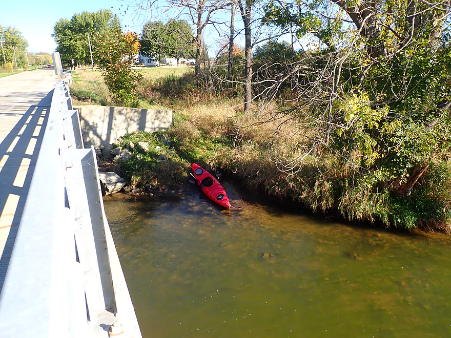
Putting in at Hwy N
Just upstream from the bridge is…
The Dunkirk Dam (Hwy N is a better put-in)
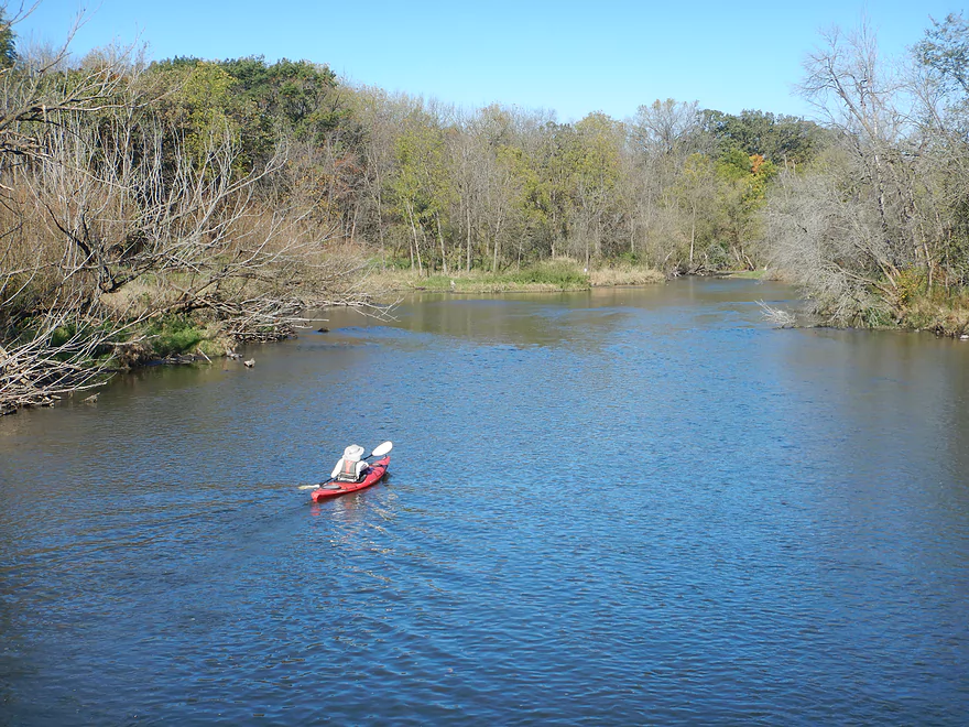
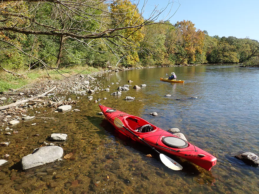
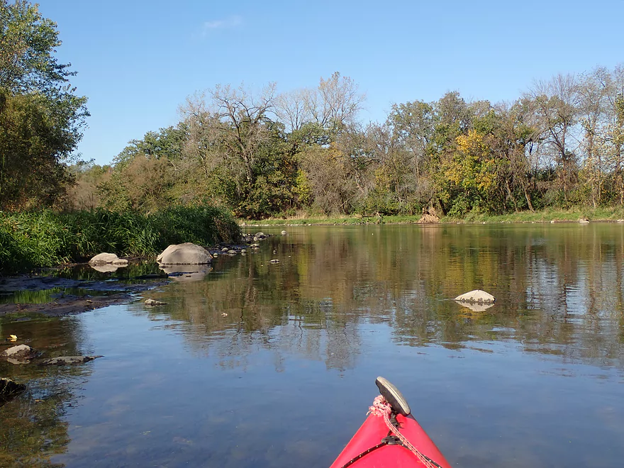
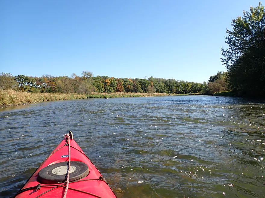
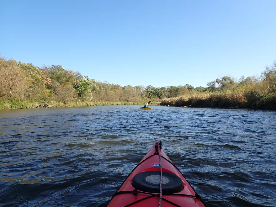
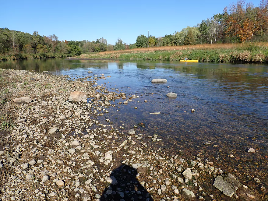
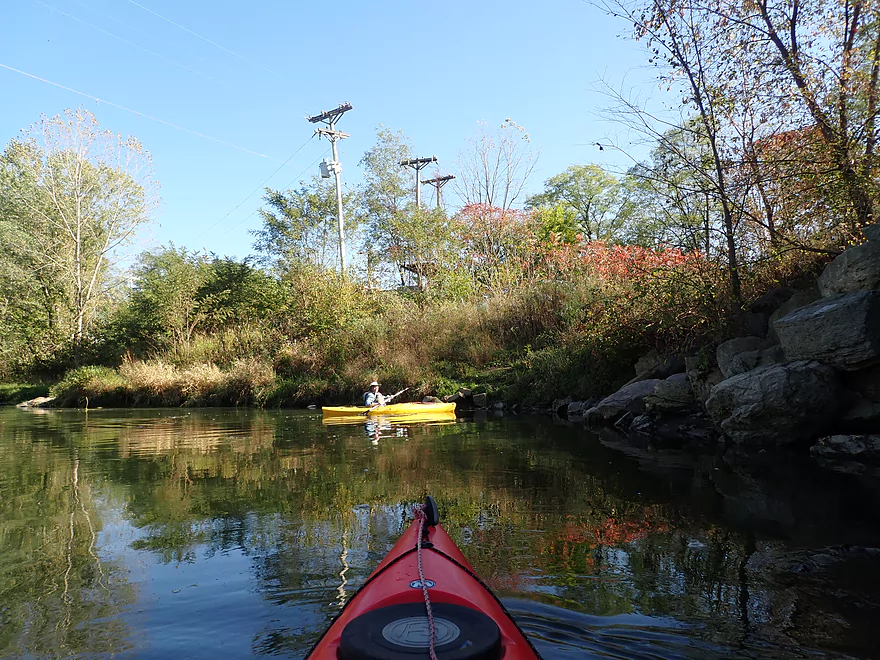
River is surprisingly wide
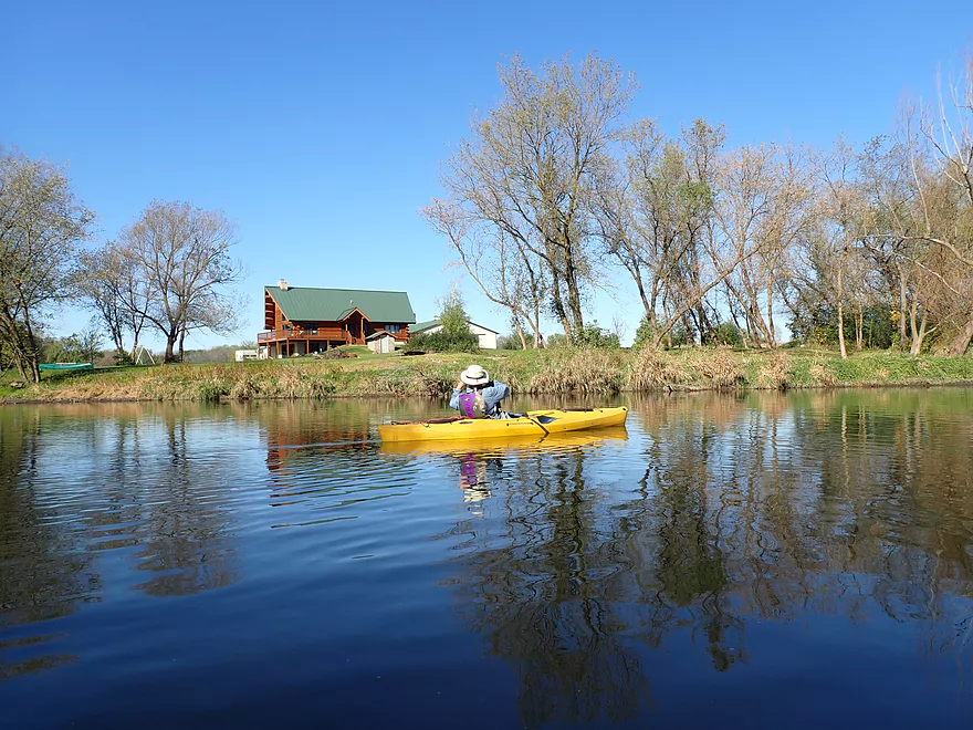
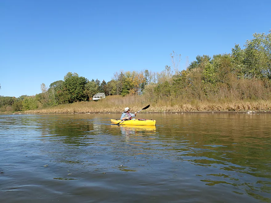
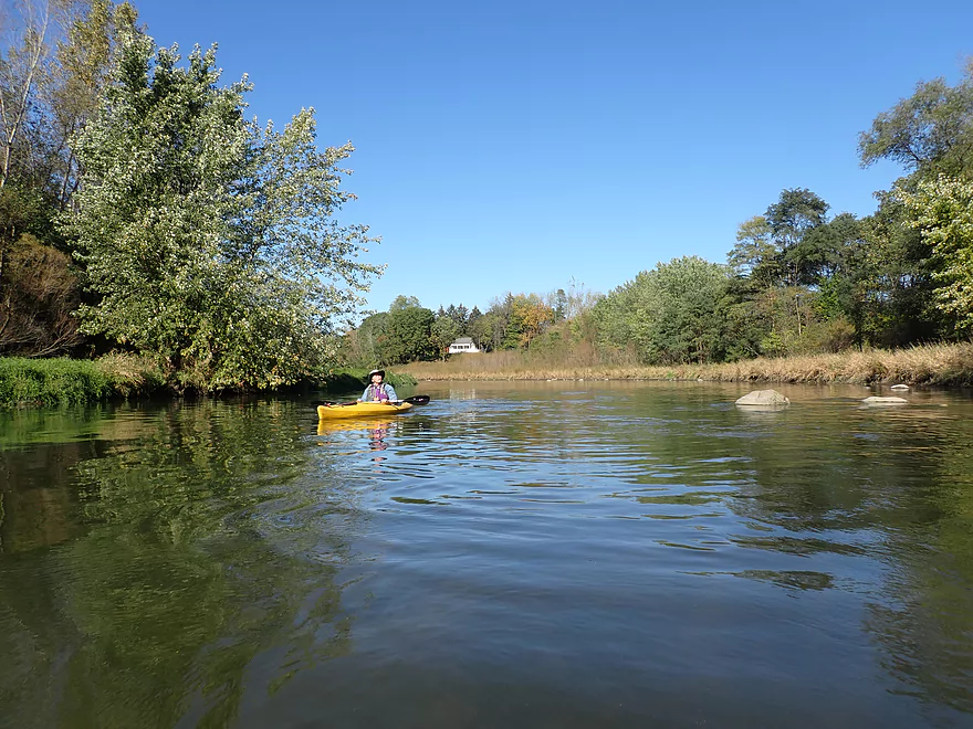
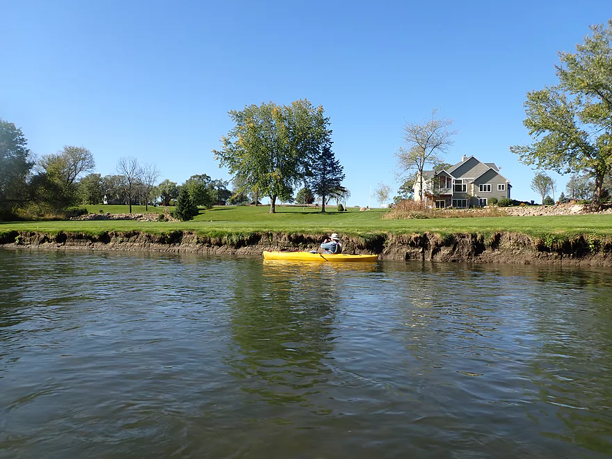
One of the few houses we saw on the trip

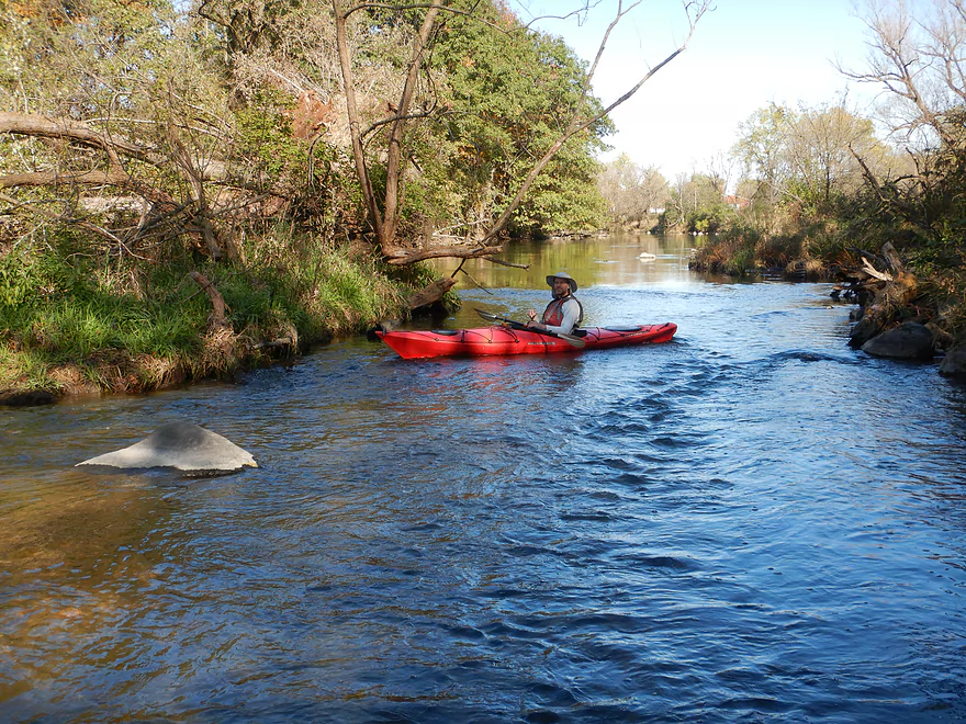
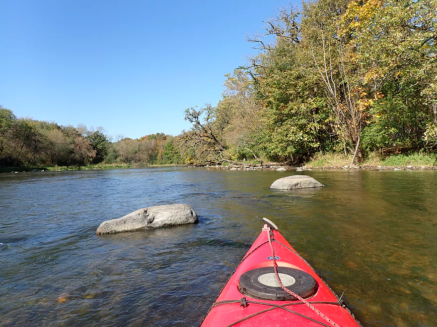
The first of many small boulder gardens
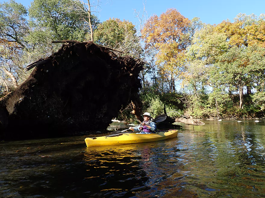
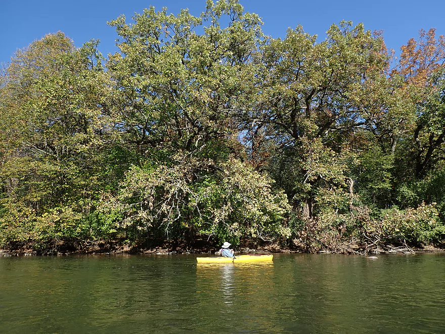
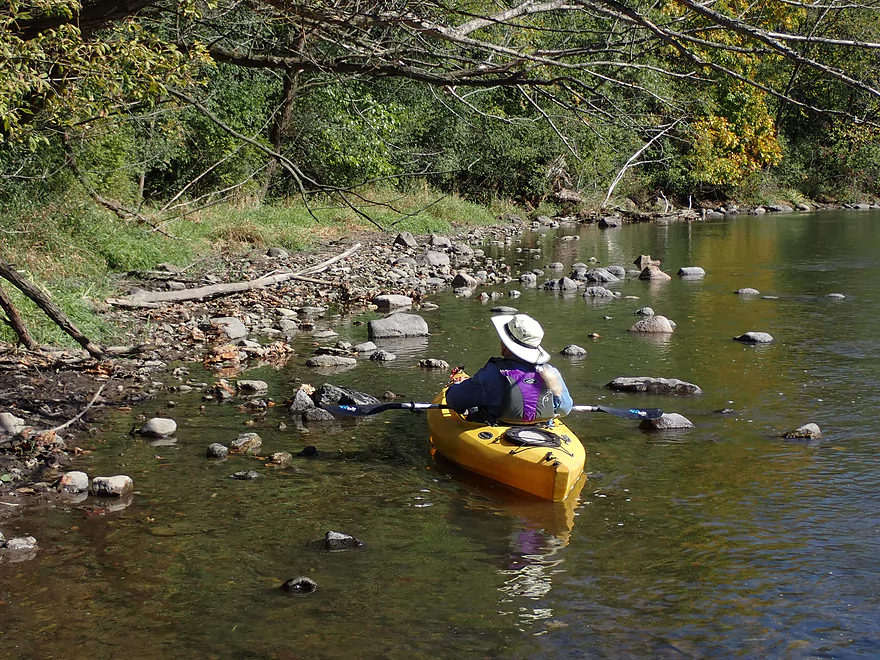
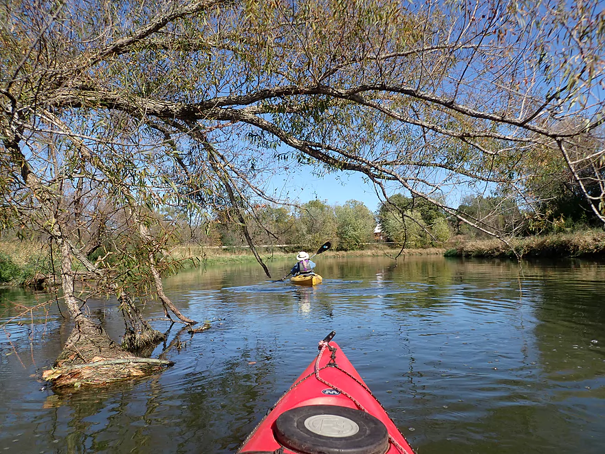
Paddling under the tree
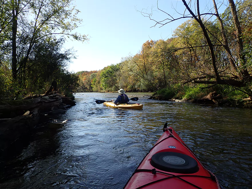
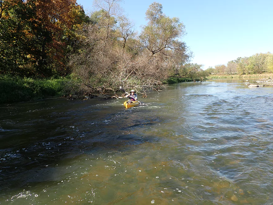
Some easy riffles
Getting a bit stuck…the other side of the island was deeper
Easy rapids
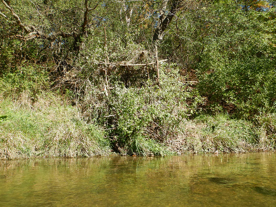
Can you spot the hunting blind?
One of the larger glacial erratics
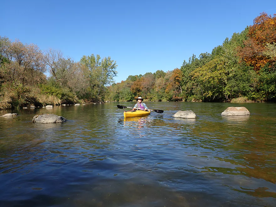
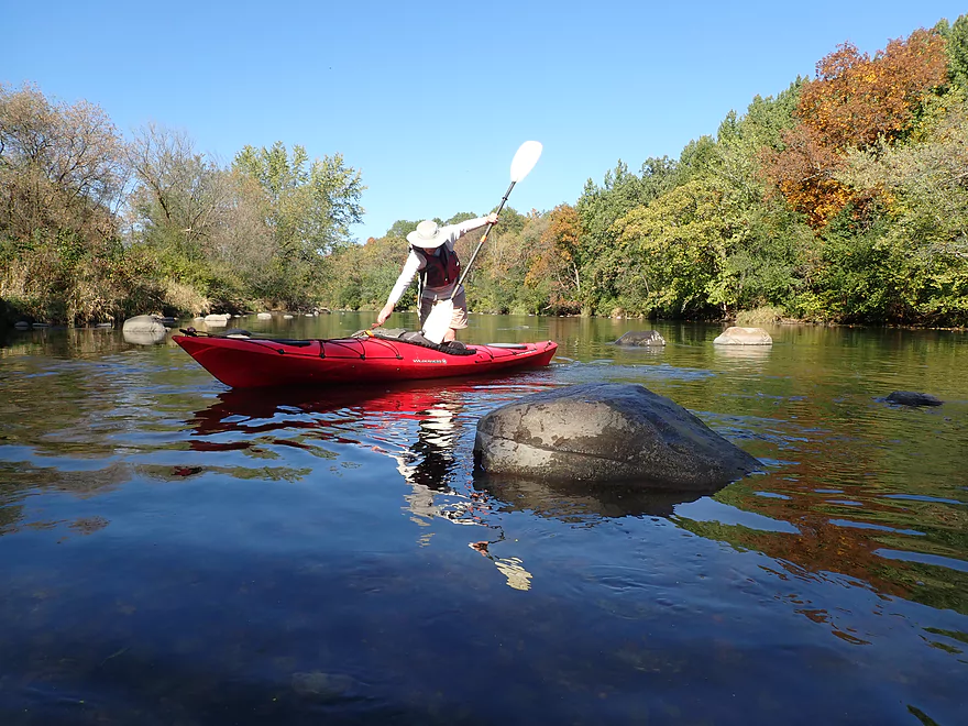
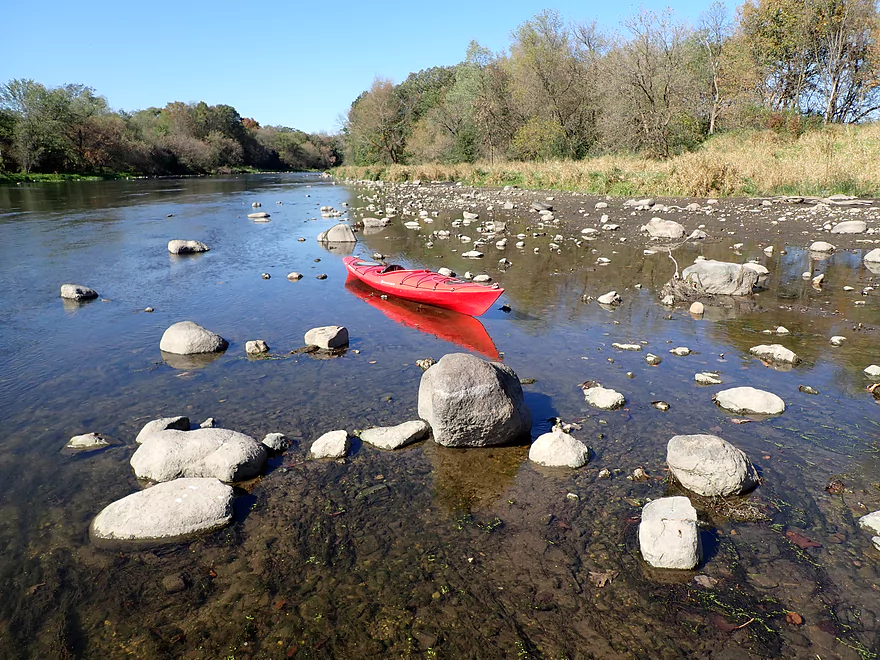
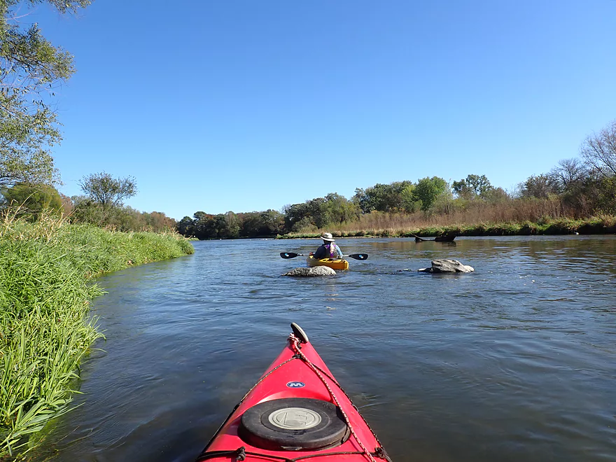
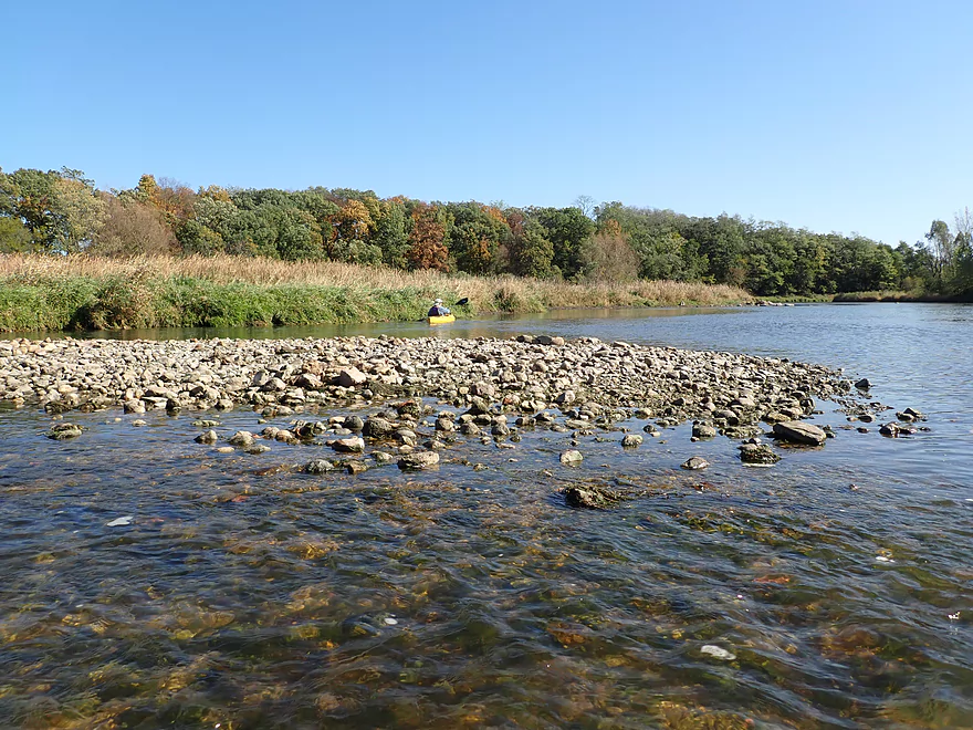
My favorite boulder field
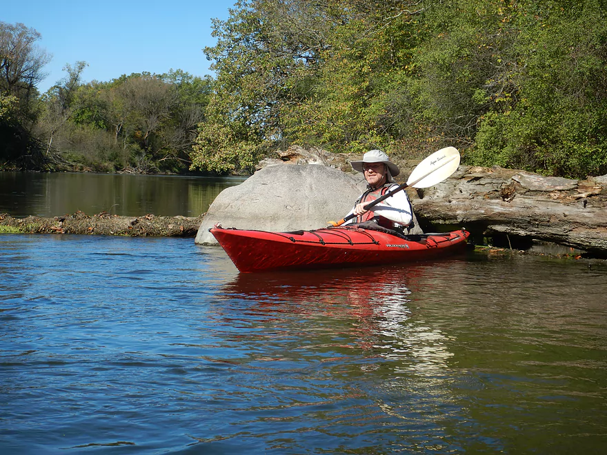
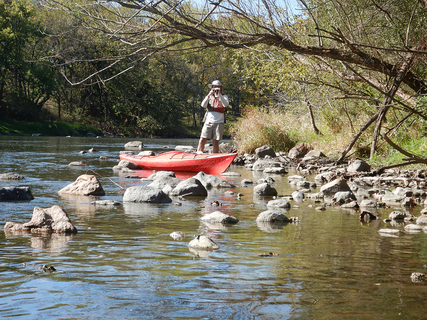
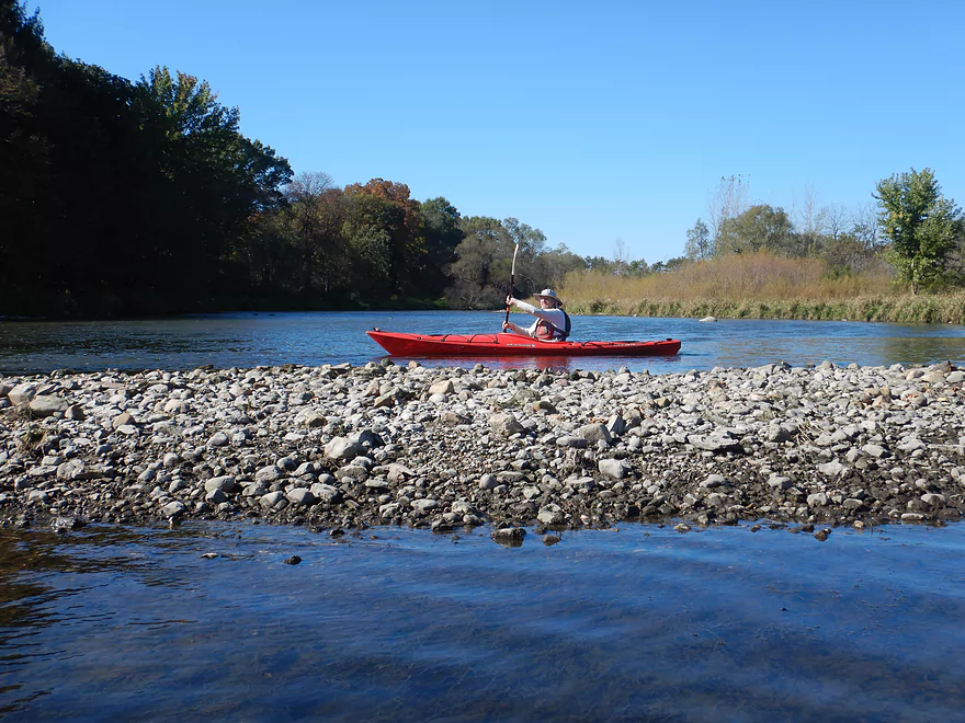
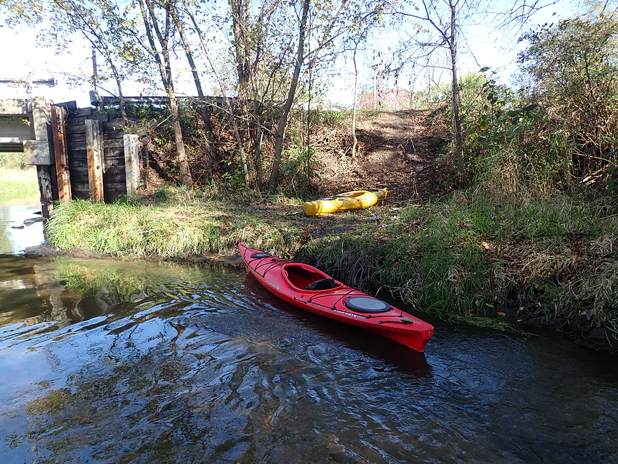
Getting out for pictures
Cool scene
This was a good stretch for oaks
Getting out to take pictures of another boulder field
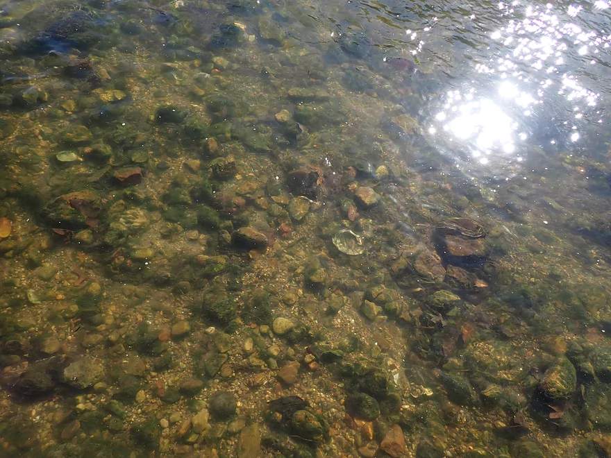
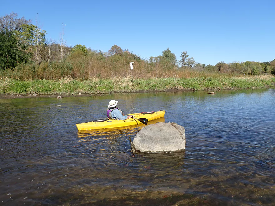
Good clarity
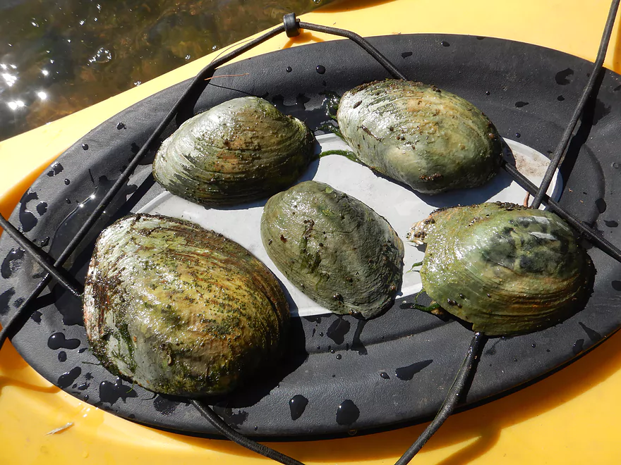
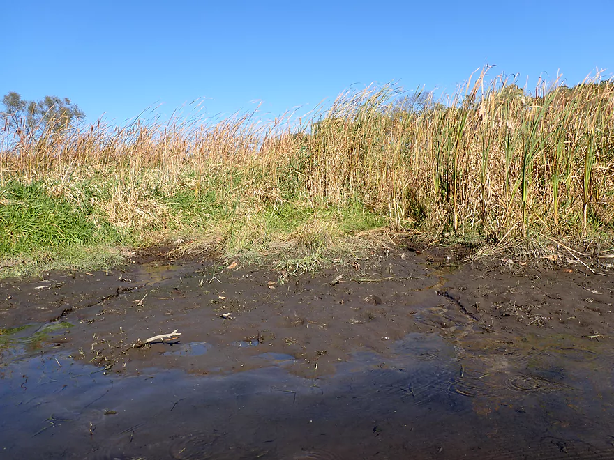
So many dead clams
Great scene
Typically you wouldn’t see this in high water
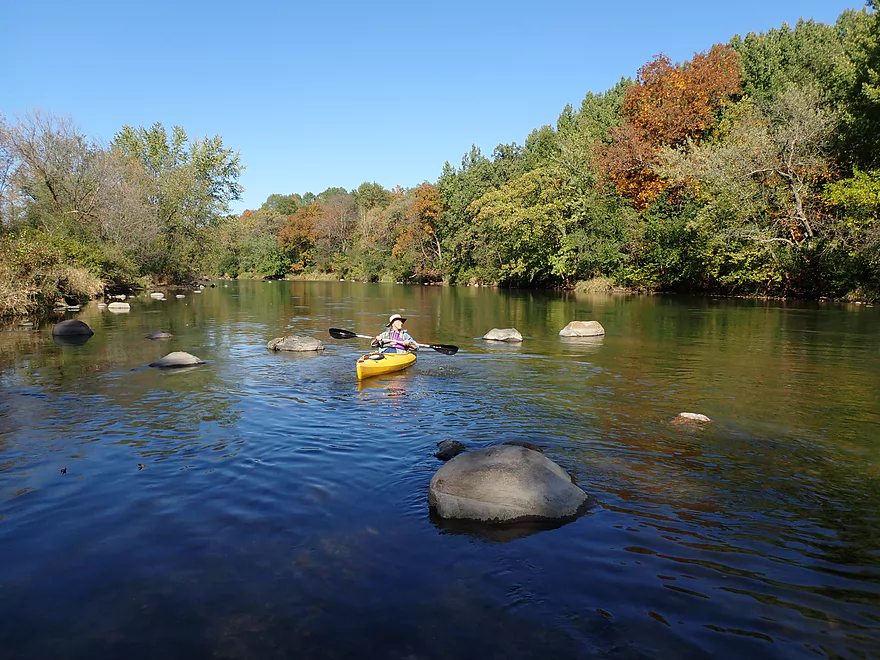
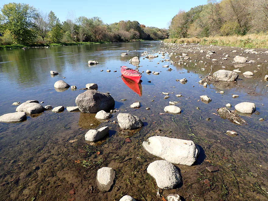
The largest boulder field of the trip
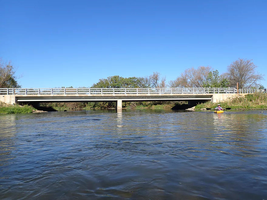
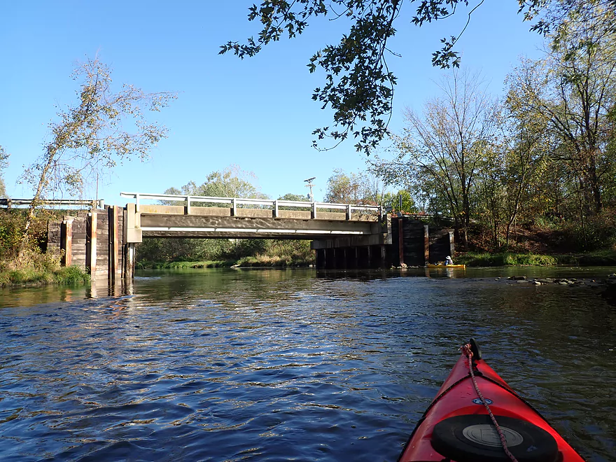
Hwy N (2nd bridge) is an access option
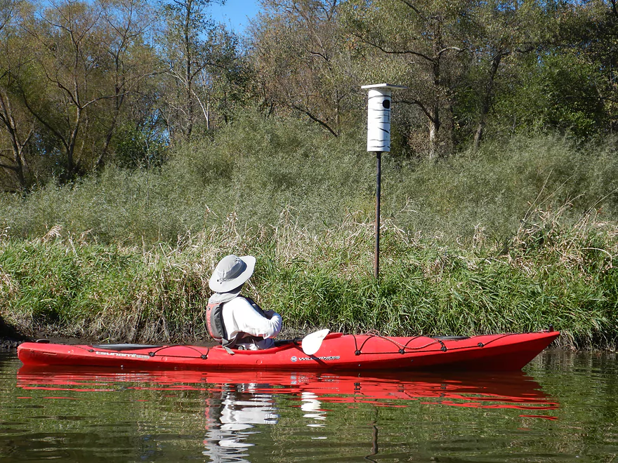
A duck house
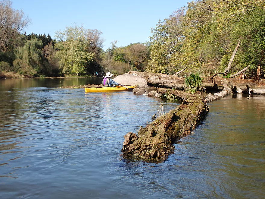
Only strainer of the trip…easy to avoid
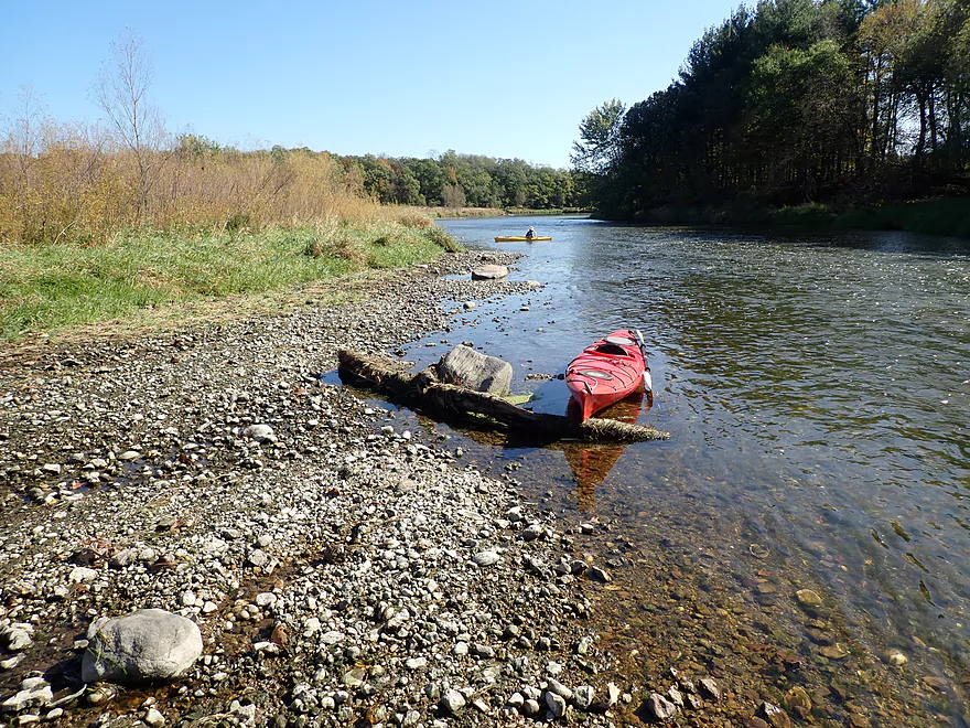
Nice gravel bar
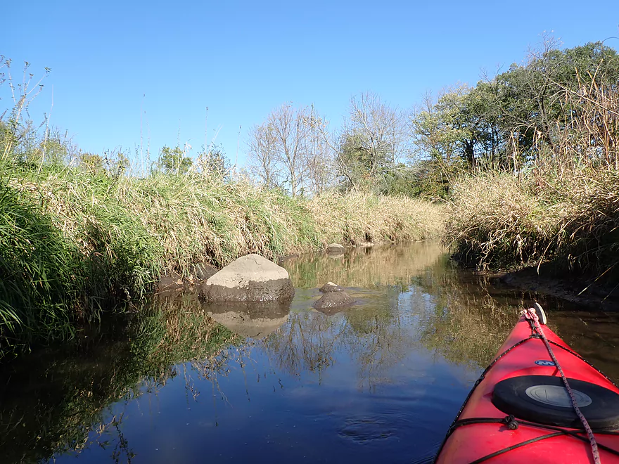
Nice little side creek…maybe navigable but unnamed
A scenic gravel bar
Seeps join the river from an adjacent moraine
Oaks growing on a moraine
The banks are a bit more open…entering the former Stebbinsville Millpond
That house was probably on the edge of the Stebbinsville pond
Neat area
This nicely mowed lawn is rapidly eroding
Oh my….
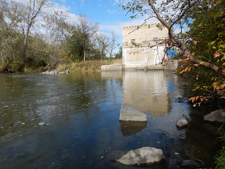
Site of the former dam
Taking out just south of Stebbinsville Rd
Ok access, but a bit steep
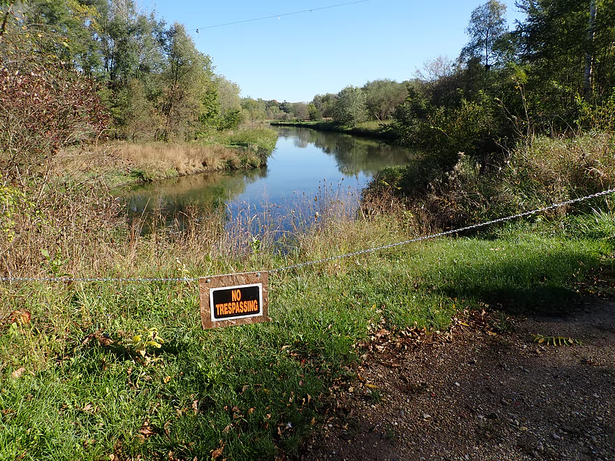
Paddlers used to be be able to take out on the upstream side but not any more
Yahara River – Dunkirk

The Yahara is a popular paddling river for local Madison kayakers. However little of it resembles an actual river. Much of its flows through a combination of natural lakes and artificial impoundments. This makes the “river” very slow and deep (and frankly a little uninteresting). But there are exceptions. North of Madison, the Yahara by Deforest has great current and is a terrific water trail. But downstream from the isthmus you have to head pretty far south to finally get real current again.
One of the first major free-flowing stretches of the Yahara is a segment downstream from Dunkirk. Three years ago, I received a guest review for this stretch. Unfortunately water levels were quite high during that trip. I was curious to know what this leg would be like at shallower levels though. We had a lot of rain in 2019 and 2020…but finally in 2021, the Yahara started running on the low side and I decided this was a great opportunity to check it out.
Our trip started at the Hwy N bridge (south of Stoughton) which was a decent bridge access. This is actually just downstream from the Dunkirk dam and you could conceivably launch there instead, but N is a better access.
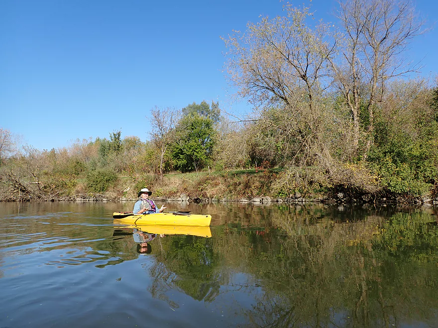
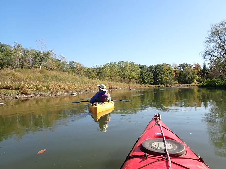
The trip to start wasn’t super interesting, with a surprisingly wide channel and unvaried banks. But things soon improved. The current picked up and there were a few stretches with riffles. This was a relatively shallow river (rarely over 18 inches) that flowed swiftly over the gravel bottom in sheets (kind of like Turtle Creek).
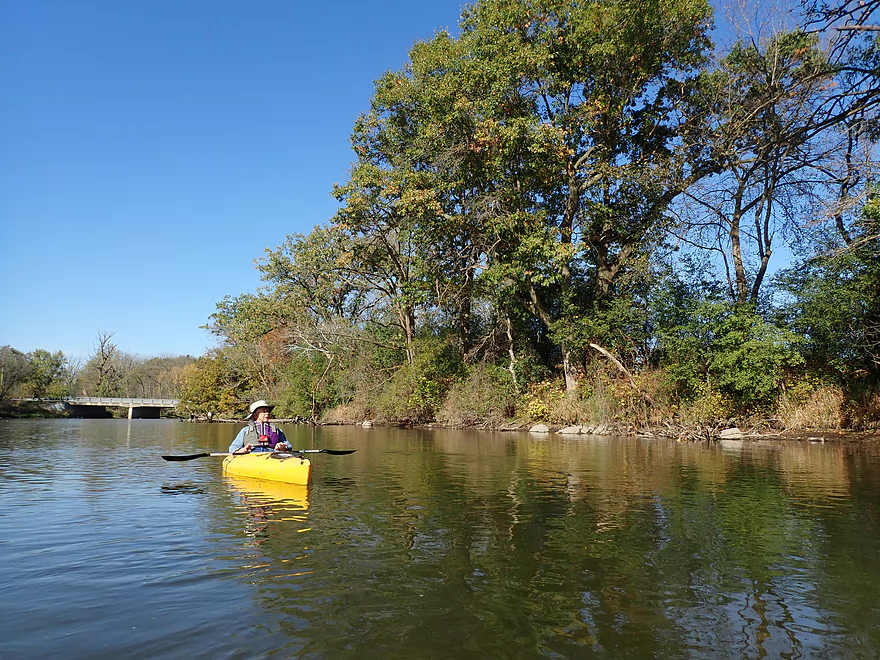
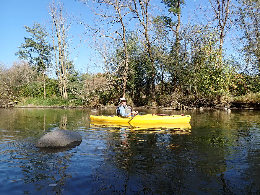
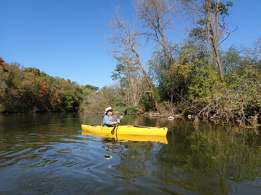
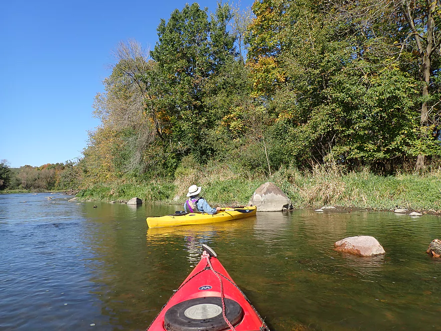
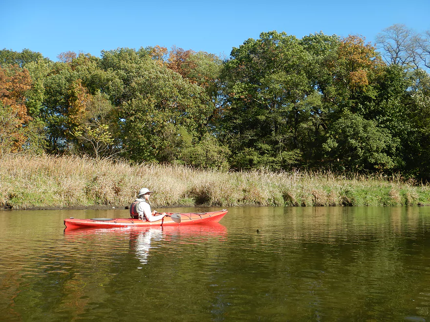
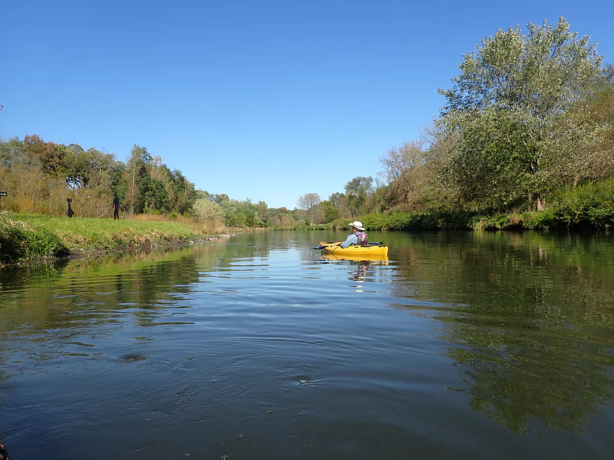
For a southern Wisconsin river the Yahara was also relatively clean with little mud, a lack of tall weedy banks, and no deadfall tangles (very dissimilar to say the nearby Pecatonica River). The banks had a number of nice oaks with a few turning hickories. It was ok for a fall color trip, but not top-notch (the Yahara doesn’t have enough sugar maple for that). The overall effect though was a pleasantly clean and scenic river corridor.
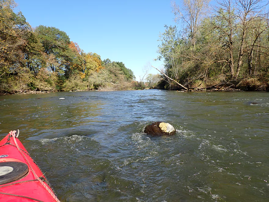
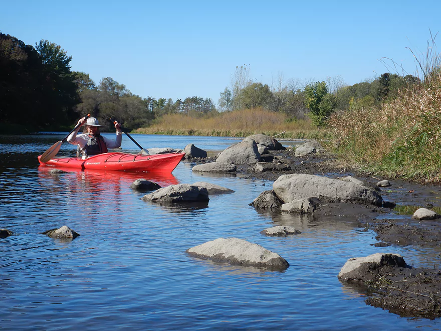
Just upstream from Hwy N (2nd bridge) we started encountering some surprise boulder gardens. These were likely gifts courtesy of the Green Bay Lobe whose terminal moraine closely paralleled the river. Rivers this close to the terminal moraine tend to be really nice for kayaking and I dub them “Ice Age paddles”. While these Yahara boulder gardens weren’t in the same caliber as the Little Falls boulder gardens from last week (few are) they were still fantastic, especially considering their location in Wisconsin’s “Deep South” which usually isn’t that interesting.
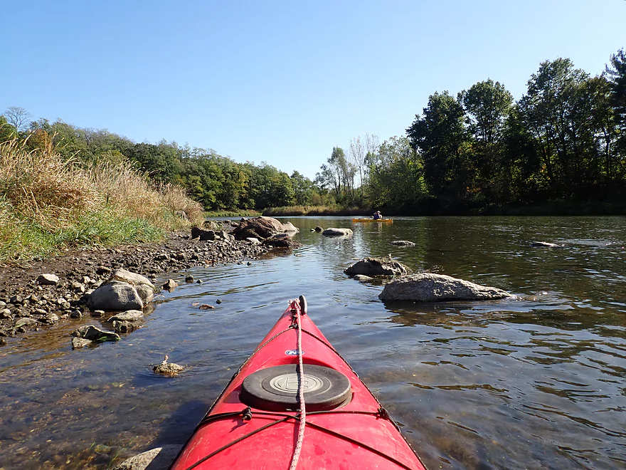
The river remained scenic, riffly, and rocky after the second Hwy N bridge. Along the east bank a long moraine hovered overhead with occasionally contributed to the Yahara via several small shoreline seeps.
The shoreline started to thin out and become scrubbier as we entered the remnants of the Stebbensville dam flowage. The River Alliance and DNR worked to remove the Stebbinsville Dam which had been an ugly impoundment filled with carp. It’s removal in 2010 was a success story that has helped with fish and clam migrations. Paddling this stretch is much more enjoyable as now there’s finally fun current and you can see some of the original native glacial substrate left over from the last ice age. The Yahara has many dams, and it’s a shame more aren’t removed to help wildlife and make paddling more enjoyable. Stoughton is actually considering removing its dam and maybe installing a whitewater kayak park. The DNR is also considering removing the Dunkirk dam which would be even better.
We ended the trip at Stebbinsville Rd which had a crazy number of No Trespassing signs on the upstream side which used to be a popular access. That area was actually the site of the former Stebbinsville dam and the owner was quite upset with the DNR for forcing him to remove it. At any rate, we simply took out on the downstream side (where it appears everybody else now does as well). This was ok as an access but a bit steep.
In summary this was a fantastic trip that turned out far better than I expected. It’s one of the better paddles in Wisconsin’s “deep south” and compares favorably to other nearby elite water trails like Badfish Creek and Turtle Creek. The main thing I suggest though is to paddle the Lower Yahara when it is low. Otherwise you won’t see all the riffles, clam, gravel bottom and glacial boulder gardens that we got to see.
Sights included a kingfisher, two blue herons, an eagle, and a few deer. The highlight was the large number of clams we saw. Unfortunately almost all of them were dead. Perhaps some unknown pollutant is killing them.
Hwy N: This is an ok bridge access. A slight path from the northeast corner leads to the water where it is easy to launch.
Alternate Put-ins:
- Riverside Drive Park (3.1 miles upstream from N): This park is an ok access but does require a 300′ hike to reach the water. You can launch upstream or downstream from 4th Street which has a ledge under it. Scout this before running and don’t attempt if it looks too dangerous. The stretch from Stoughton to Dunkirk has slow current because of a dam impoundment so it isn’t a great prospect.
- Dunkirk Dam (800′ upstream from N): This dam wouldn’t be too difficult to portage via the west end or on the island. But as a put-in or take-out it would be a bit tricky. Yes there is a public parking lot on the east end, but on the upstream side the channel is deep, next to a wing wall, and is kind of close to the intake. You can’t access the island or the west end because of a fence. The southeast corner (downstream from the powerhouse) is viable as a put-in, but requires a bit of a hike through a woods and down a steep hill. Hwy N is likely a better access option.
W. Stebbinsville Rd: The southeast corner used to be a popular kayak launch, but the local property owner put up a fence and countless No Tresspassing signs….so that is no longer an option. But the downstream/south corner of the bridge still is used by kayakers and that is a decent access. Note it is a bit steep and muddy, but it’s not too bad if you have rope.
Alternate Take-outs:
- Hwy N (2.3 miles upstream from Stebbinsville Rd): There is evidence that kayakers launch from the east end of the bridge and this seems like a doable access. Note though in 2021, this bridge is closed because of road construction. I wouldn’t advise taking out at Hwy N regardless, as the leg just after it is quite nice.
- Hwy 59 (2.1 miles downstream from Stebbinsville Rd): Hwy 59 is a decent public access. This is the last super stretch of the Yahara. After Badfish Creek joins up, the Yahara grows significantly in size and becomes much less interesting.
- Murwin Park (4.4 miles downstream from Hwy 59): The above plus a wider and less interesting stretch of the Yahara. This is still a pleasant and popular stretch. Murwin Park is a very good access.
Bike Shuttle Route – Stebbinsville Rd to Dunkirk: 4.2 miles with 95′ of ascent. This would be a relatively easy bike shuttle route.
Logjams: None. This is a good trip for beginner paddlers.
Current: Good current with occasional riffles.
Rapids: A few riffly stretches could be considered Class 1’s. These though are very easy and well suited for beginners.
Trip done at 320 CFS per the downstream gauge at Fulton. Note, the Fulton gauge is downstream from the Badfish Creek confluence which tends to oscillate in volume because of MMSD discharge schedules…so this may not be precisely representative.
- 0-200 CFS: These are near drought conditions, but I believe the river will still be navigable though. There are a few shallow spots, but with careful navigation you can usually go around them.
- 201-400 CFS: An average height and a good target range.
- 401-600 CFS: Above average height. Some of the nice rocky stretches may be submerged and the river may lose some of its unique character.
- 601-800 CFS: A high depth and plenty navigable. But most of the nice rocky stretches will be hidden underwater.
- 801+ CFS: A very high depth, but still likely mostly navigable.
Detailed Overview
- Hwy 51 to E. Yahara Road: 1.4 miles. Very small and channelized, it seems open but there might be some snags here.
- Yahara Road to Veterans Park (DeForest): 1.6 miles. Very wooded so good chance of jams if not cleared out.
- Veterans Park to Windsor Road/Sunfish Pond: 5.7 miles. A small but fast stretch that has become popular in recent years.
- Windsor Road to Linden Drive/I90: 1.5 miles. An interesting section through a golf course. Linden Drive access is privately owned by the golf course.
- Linden Drive to Hwy 19: 1.3 miles. There are too many logjams to recommend this.
- Hwy 19 to Cherokee Park: 4.5 miles including 1.8 miles of lake paddling. There are too many logjams downstream of Hwy 19 to recommend that as a put-in.
- Cherokee Park to Tenney Park (aka Lake Mendota): 7.6 miles. A nice lake but really too big and exposed for most paddlers.
- Tenney Canal and Locks to Morrison Park: 1.3 miles. A fun experience. A canal fee might be required.
- Morrison Park to Paunack Park (Lake Monona): 2.6 miles. Mostly too big and busy to paddle, paddlers still do so and enjoy scenic vistas of the downtown.
- Paunack Park to Babcock Park (Lake Waubesa): 4.2 miles. Probably too much flatwater to be interesting.
- Babcock Park to Fish Camp Park (Mud Lake): 4.1 miles. Wide and flat. Probably uninteresting.
- Fish Camp Road to La Follette Park (Lake Kegonsa): 2.4 miles. Probably uninteresting lake paddling.
- La Follette Park to Viking County Park: 3.5 miles. Finally back to river paddling! An ok prospect, but slow and big.
- Viking County Park to Dunkirk/Hwy N1st Bridge: 5.2 miles.
- Viking County Park to Riverside Drive Park (Stoughton): 2.1 miles. A flowage paddle through downtown Stoughton.
- Riverside Drive Park to the Dunkirk Dam: 3.1 miles. A small flowage that is ok but nothing special.
- Dunkirk/Hwy N1st Bridge to W. Stebbinsville Rd: 4.8 miles.
- Dunkirk to Hwy N2nd Bridge: 2.5 miles. A good stretch that starts a bit slow, but speeds up and contains a number of large scenic boulder gardens.
- Hwy N2nd Bridge to W. Stebbinsville Rd: 2.3 miles. A scenic rocky stretch flowing through glacial outwash.
- Stebbinsville Rd to Murwin Park: 6.2 miles.
- Stebbinsville Rd to Hwy 59: 2.1 miles. This is the last super stretch of the Lower Yahara. After Badfish Creek joins up, the river becomes much larger and less interesting.
- Hwy 59 to Murwin Park: 4.4 miles. While not as scenic as upstream legs, this is still a solid stretch and popular with paddlers.
- Murwin Park to the Rock River: 2.8 miles. Final stretch on the Yahara and then a short leg on the Rock River. Probably ok, but nothing special.
Many of Yahara's tributaries are navigable as well.
- Badfish Creek - A classic! One of the better paddles in Southern Wisconsin.
- Token Creek - A surprisingly nice creek located northeast of Madison.
- Nine Springs Creek - An underrated prospect located west of Lake Monona that has some attractive springs.
- Six Mile Creek
- Upper Six Mile Creek - Congested in spots, this is still a really neat paddle with character you don't expect from Southern Wisconsin.
- Lower Six Mile Creek - Recently cleared of logjams, this is a varied paddle that includes both dense woods and open marshland.
- Starkweather Creek - A slow urban paddle, but interesting because of its bridges and Olbrich Gardens.
- Pheasant Branch Creek - Located northwest of Madison, this is a short trip but has some spectacular springs.
- Wingra Creek - A short urban paddle west of the Isthmus that might be fun.
- Dorn Creek - A possible prospect west of Madison that would require a lot of water.
- Seven Mile Creek - West of Lake Monona, I've heard this is a pleasant paddle.
- Swan Creek - Possible prospect but short (south of Lake Waubesa)
- Murphy Creek - Interesting wetland prospect but access on the upstream sections looks tricky (south of Lake Waubesa)
- Door Creek - Small, slow and channelized but might be ok. Has had recent cleanup work on it from I believe Hwy MN.
Trip Map
Overview Map
Video
Photos Size:
Has anyone approached the owner that’s blocking the put in/takeout at Stebbenville? Sounds like he’s upset about litter issues, which I can’t blame him. Such a nice spot. Perhaps he can be reasoned with. I’d be willing to go, as long as I have company. Want to keep it civil.
Not that I know of…hopefully this get cleared up in the future.
Perhaps you would like to add this put-in/take-out to your map? https://goo.gl/maps/GLQ3awh9NzycfSHZ6
Several of us put in here on Oct. 31 due to a large tree downstream from the Dunkirk dam. Put-in was a bit muddy and shallow, but should work at most flows. USGS gauge at Fulton was about 450 CFS, there’s gravel parking off Hwy N. If Stebbinsville to Fulton is a too short a trip for you, this put-in adds 30 minutes or so.
Thanks for the tip…I didn’t know about that access option. I’ve added it to of my Yahara Maps which should help future paddlers.