
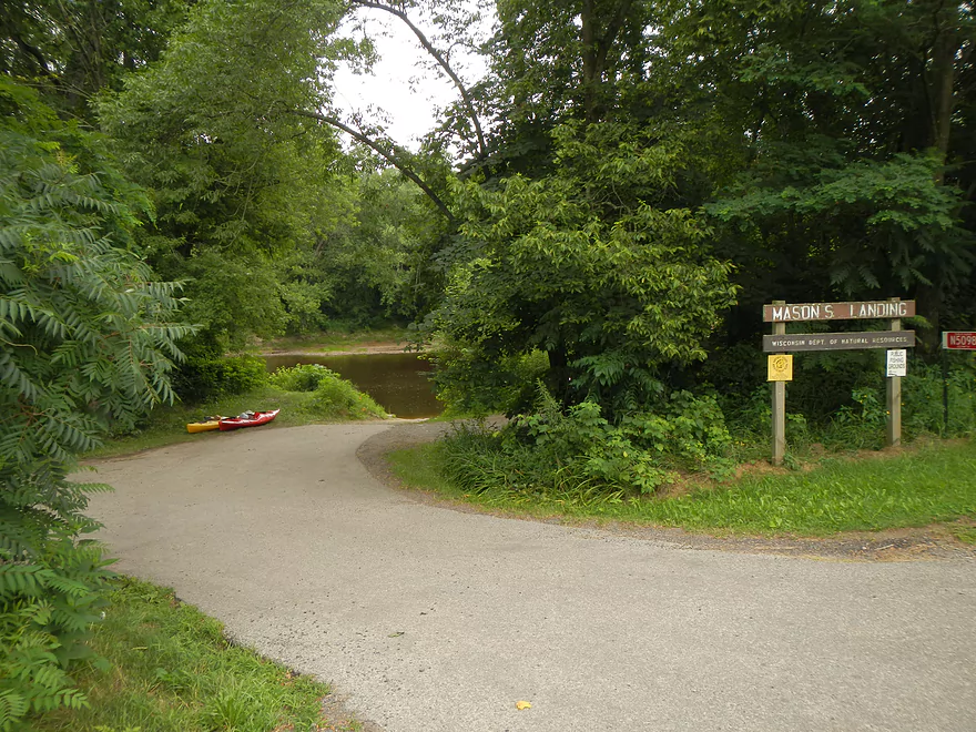
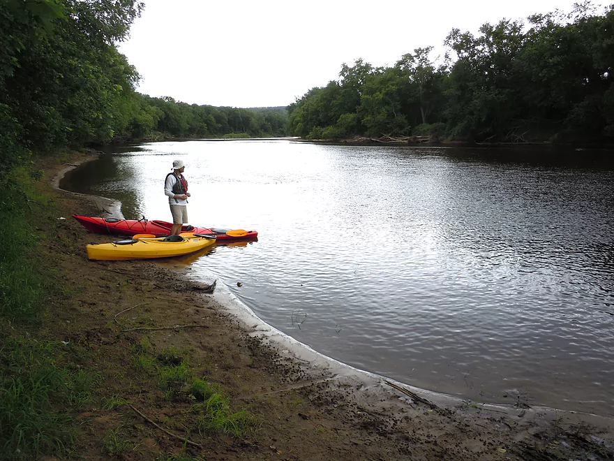
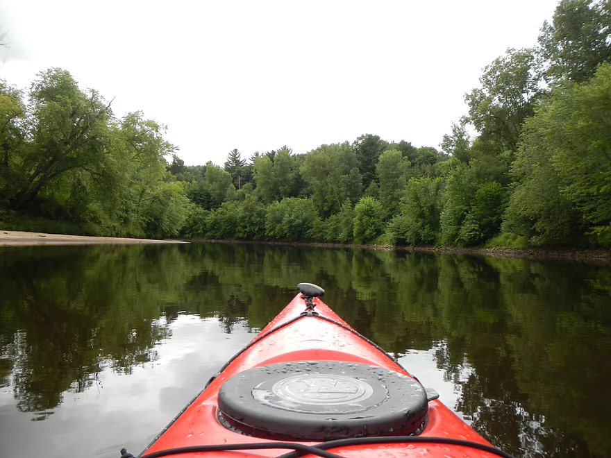
Mason Landing
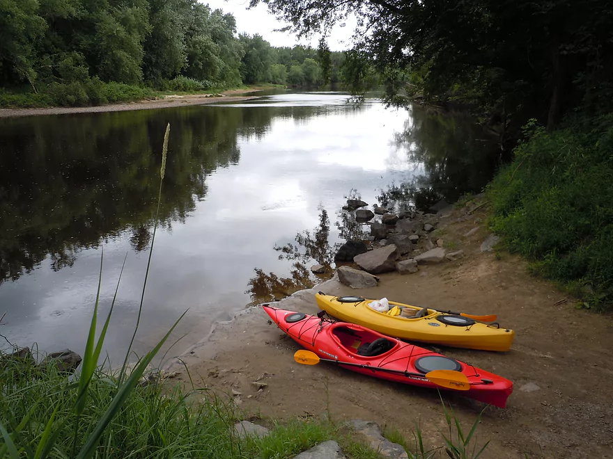
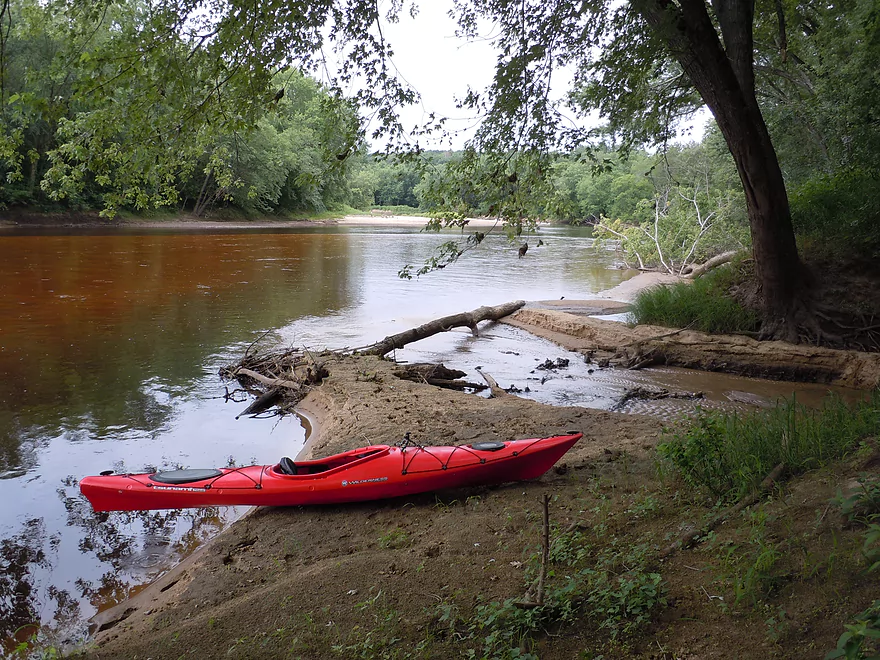
Nice put-in
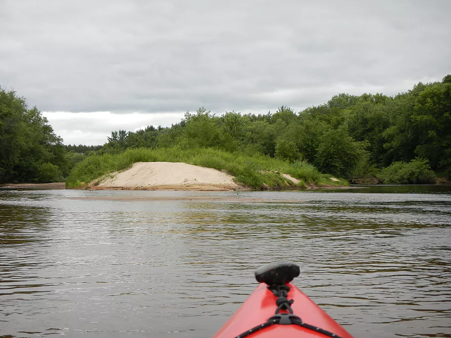
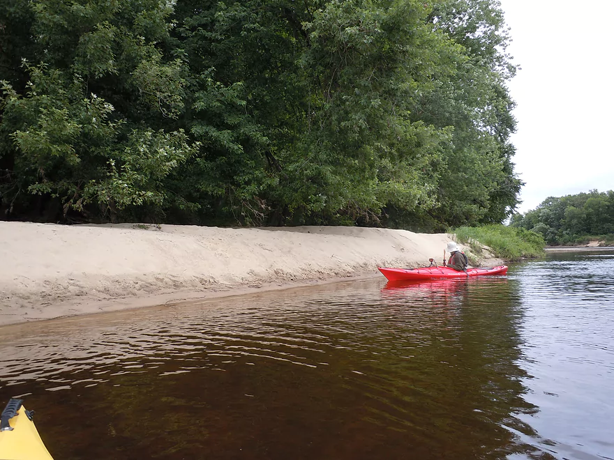
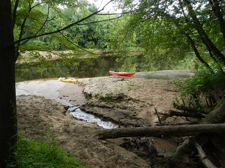
One of many nice sandbars
Taking a break…
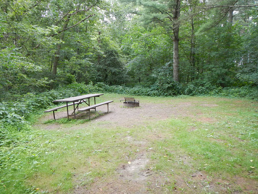
…by a riverside campground
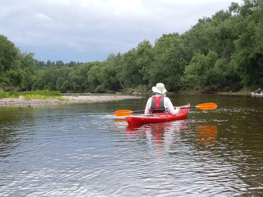
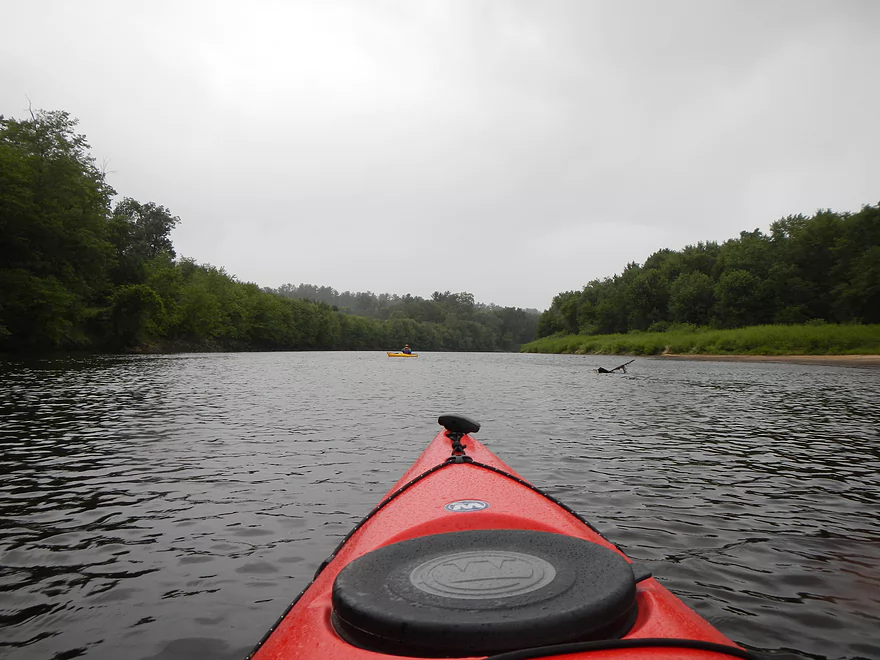
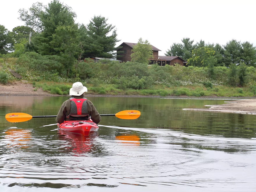
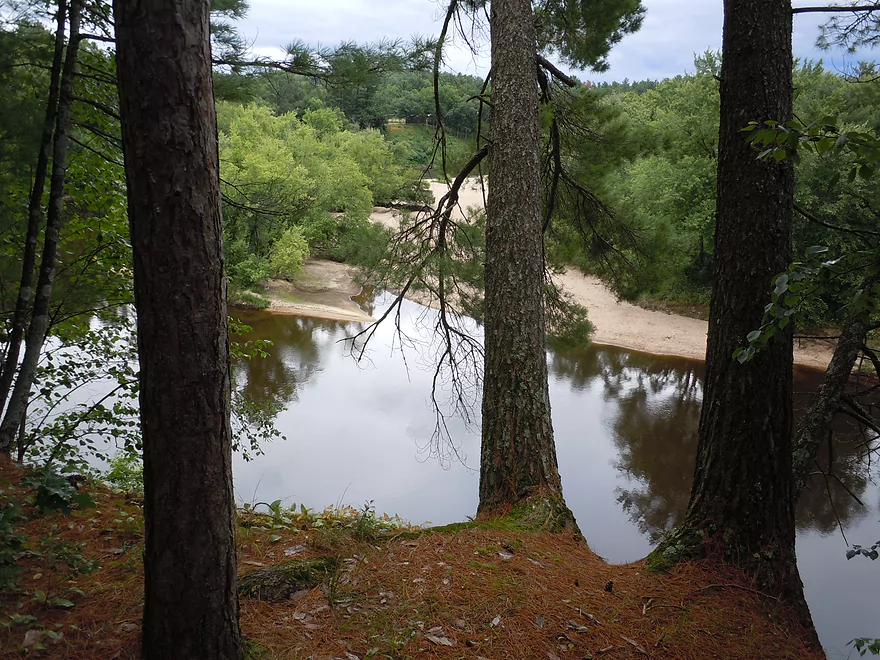
Very nice
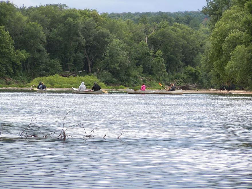
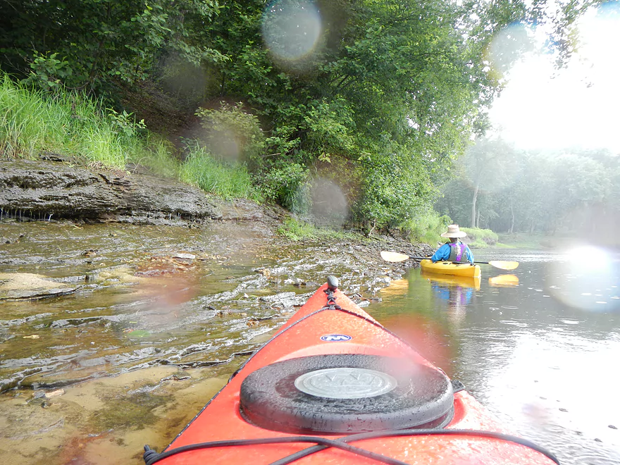
Saw many canoers
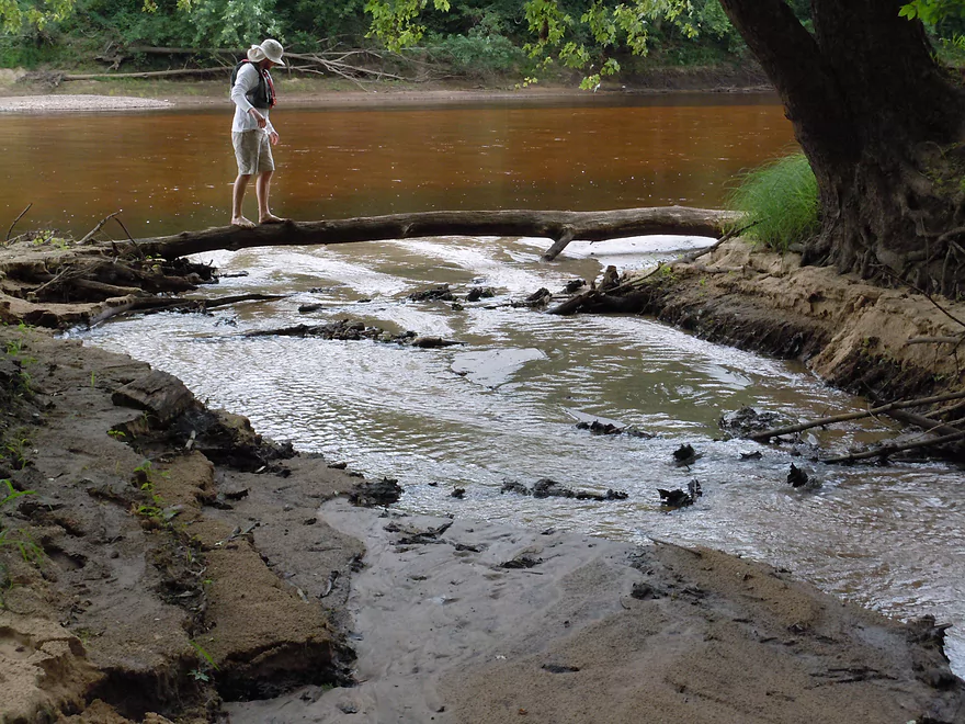
Checking out a side creek
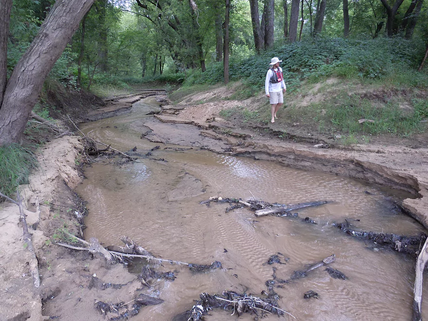
The Black River has many nifty micro creeks like this
Starting to get dark
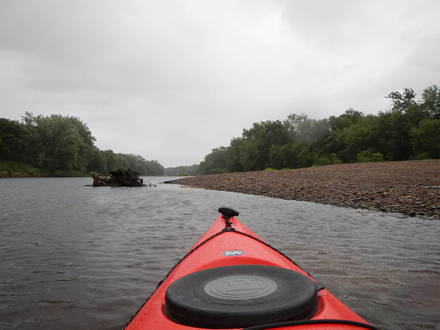
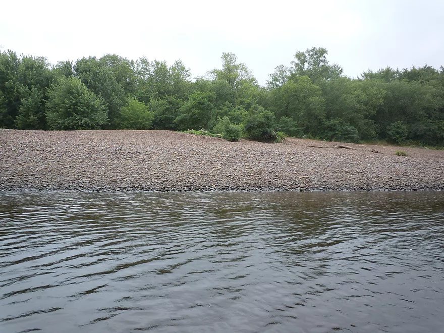
One of several really nice gravel bars
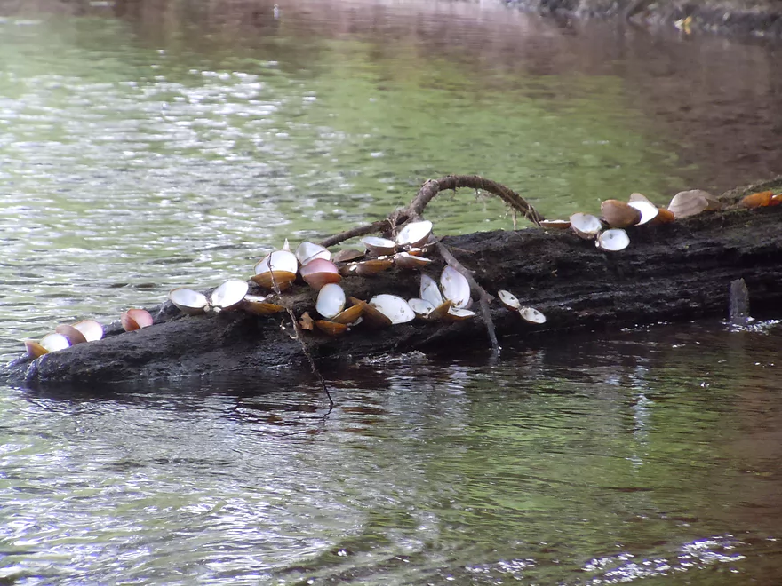
So many clams
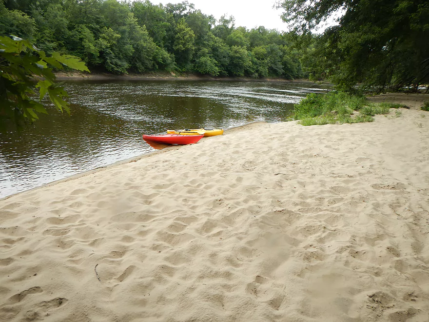
Another nice sandbar
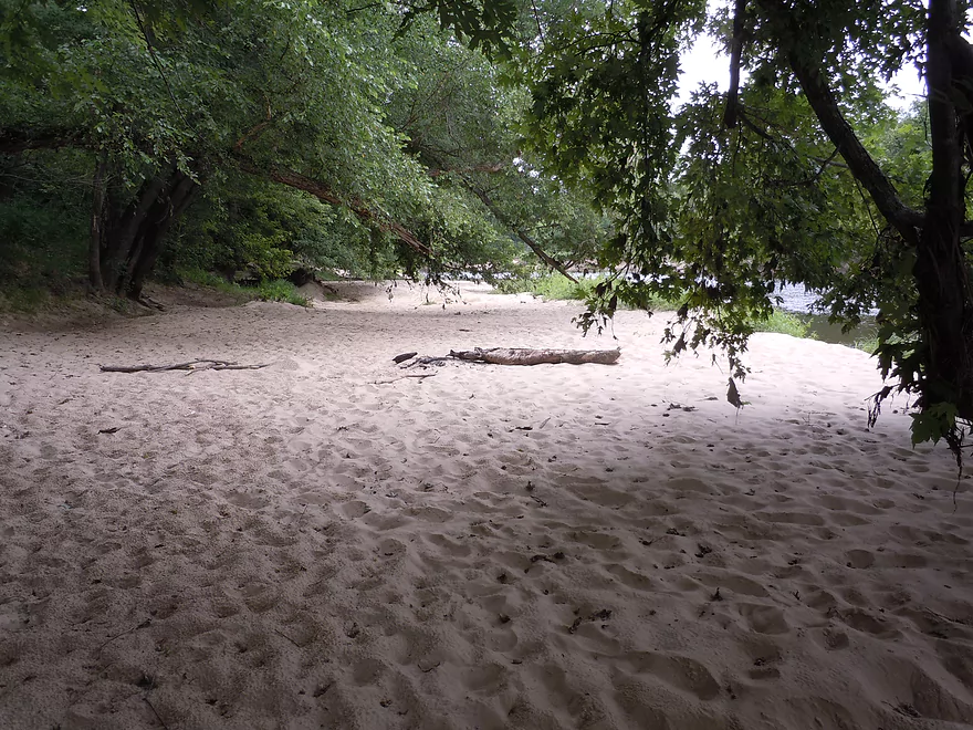
This one appears to have been camped on
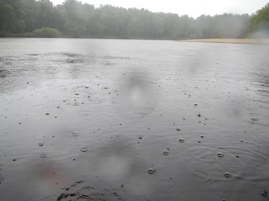
Then it started to rain
Trying to shelter from the raindrops
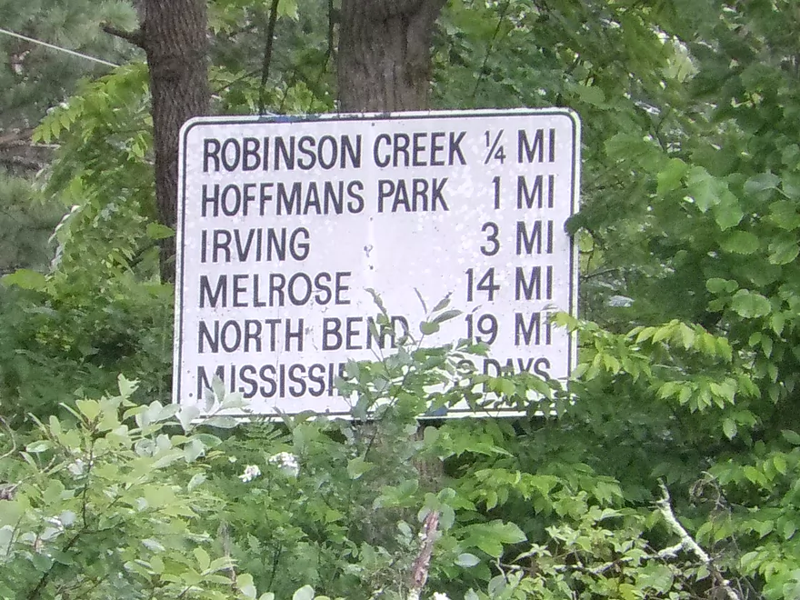
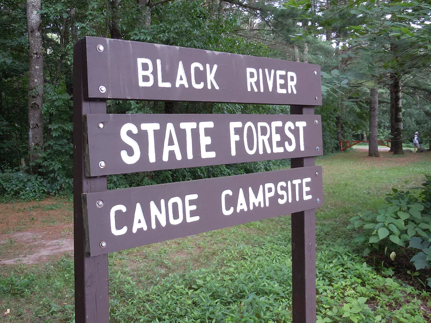
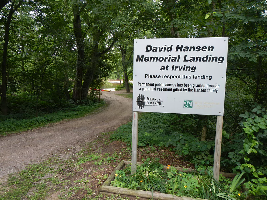
A helpful sign
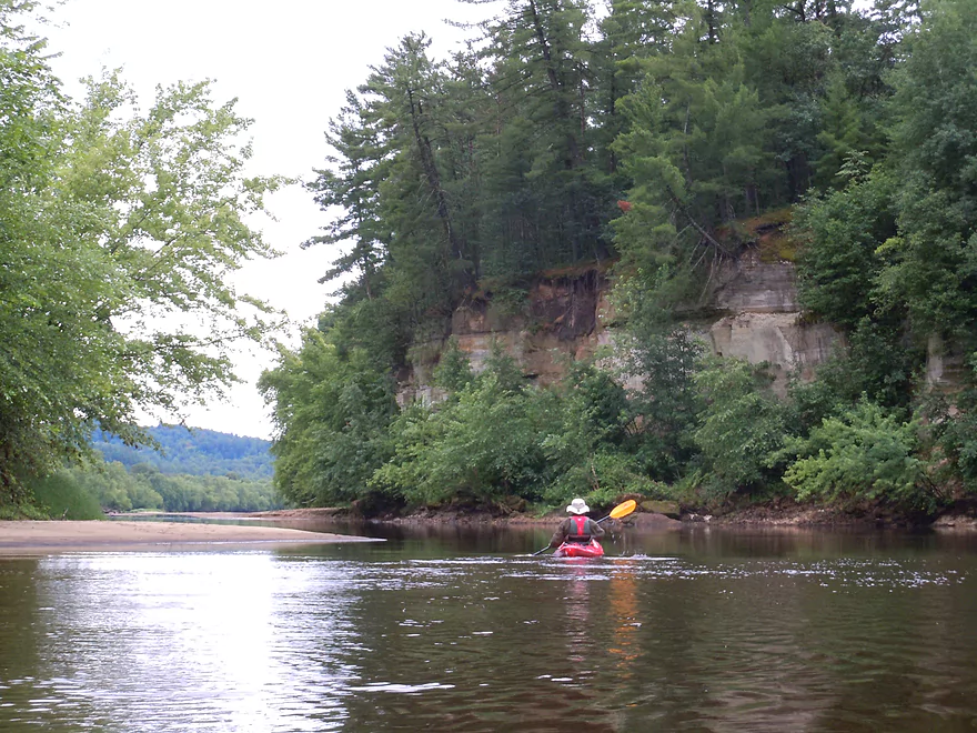
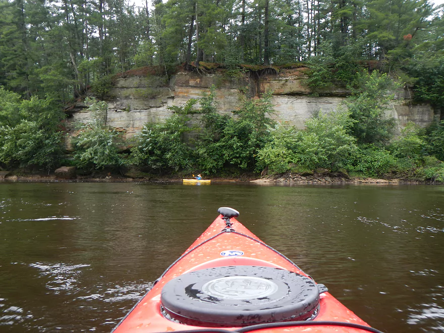
Nicest outcrop of the trip
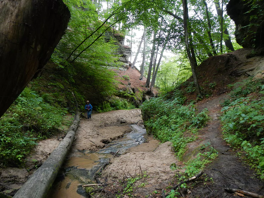
There is a hidden gully after the cliff
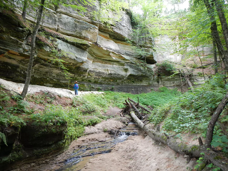
That leads to a fantastic slot canyon
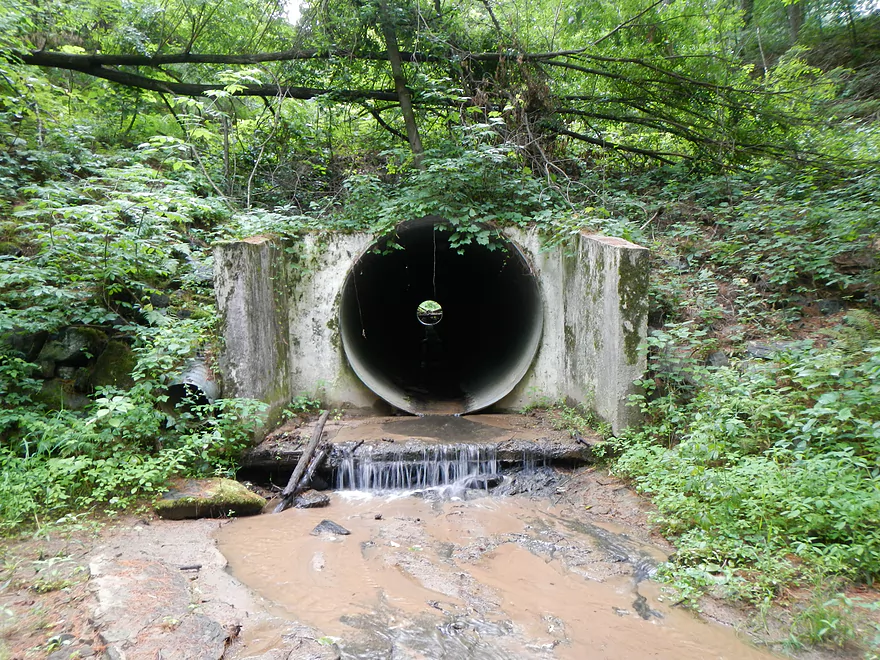
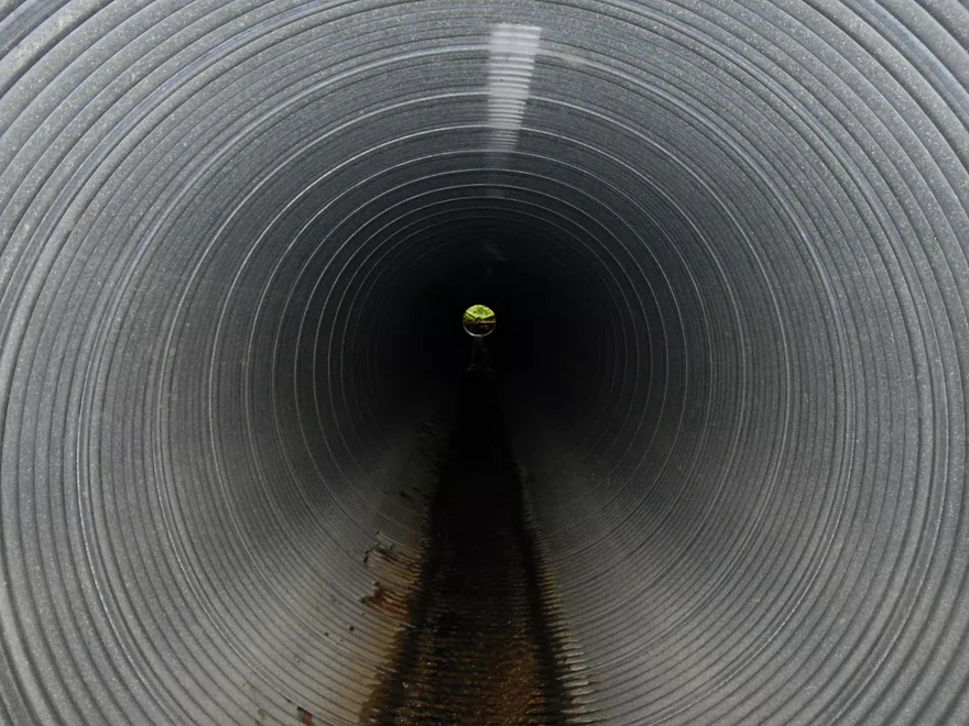
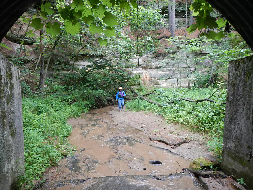
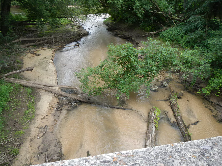
Road tunnel
View from atop of the cliff
Heading back out
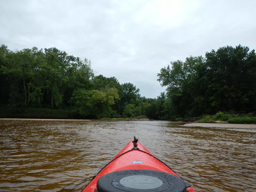
On the Black again
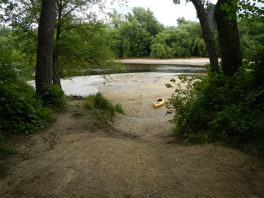
Taking out at Memorial Landing
Nice access
It’s next to Trout Run Creek (which I may paddle in the future)
Black River – Mason to Irving


This route starts 4 miles downstream of the Black River Falls dam at Mason’s landing and goes 9 miles to the Irving landing. You can put in earlier (see map for options), but that would have made a long trip IMO. You can also take out at the campground (see map), which is close to Irving if you want to extend your trip a bit.
For this route, we paid Lost Falls Campground 20 dollars to drop off my car at the Irving landing and then drop me off at Mason where I had already unloaded the kayaks. Worked well and saved money by them not having to transport the kayaks. The put-in at Mason is very nice…and is in fact a boat ramp, to my surprise (not a ton of water for power boats to navigate). I only saw one power boat on the water and it had to thread a needle to get through the channel. Note, the Mason landing does not have bathrooms.
Having done the Black River flowage a couple of weeks ago, I was surprised to see how different the river was down here. Much less pine/softwoods and much more hardwoods. Very little in the way of bluffs (with one exception…more on this later) and little in the way of diverse shoreline plant life. If you like scenery, I definitely would vote for the flowage over this segment (although there are still nice downstream segments on the Black I haven’t explored yet that could be better than both of these segments).
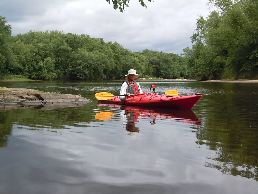
The current was also surprisingly slow for a non-flowage…and at times reminded me of the flowage and of the Lemonweir, which I had done a week before. A high contrast to the rapids located upstream of Halls Creek. Generally speaking, the water was on the shallow side and below normal, but not to the 2012 drought levels. I couldn’t complain about the water levels even though I had to completely get out of of my kayak and tow it along twice. The bottom is soft sand, so this is easy. This doesn’t bode well for the tributaries into the Black that I was considering doing though. In fact, when I talked to my livery driver, he said they wouldn’t even take people below Lost Falls Campground because of the low water. He said some campers with canoes had to drag their boats a half mile due to the shallow water. Whether this is the case or not, I don’t know. My experience is that people love to exaggerate how impassible low water conditions are and in my experience (which includes lots of small creek paddling), you can get away with a lot, with good navigation skills and a light kayak. In fact, I did a segment on the far lower Black last year during the height of the drought (much lower now) where it was rumored to be impassable (the river loses a lot of volume to side channels there) and I had no major issues, with just a couple of minor portages. Getting back to this segment, this is a good paddle if you are loaded down with a heavy canoe and want to go during low water (the best “drought” section on the Black, however, would be the flowage section).
While this section isn’t close to being as scenic as the flowage, it still has redeeming scenic values. For starter,s the sandbars are very nice and, in fact, would be great for camping (more on this later). There are also gravel bars, which are a unique and interesting contrast to sandbars. They give the river a very exotic feel. There was one micro waterfall and numerous micro outcroppings….which, while “runty,” were nice! The creeks were very nice…so clean and sandy. For wildlife, this wasn’t a rich section from what we saw, but there were oodles of bank beaver holes (with slides) and we did see a pair of eagles at Robinson Creek. Lots of clams on the river, as well as clam shell piles where somebody was snacking. There are, unfortunately, random houses here and there, and highway noise that is quite noticeable in the first third of the trip.
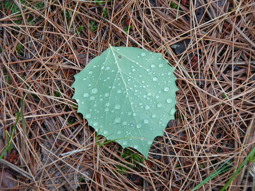
It should be noted that the conditions of the trip were somewhat unique. It was cold–maybe low 60’s, with a decent breeze. Which isn’t the end of the world if you wear something warm, but it was a bit of a shock that I wasn’t used to. The second surprise was that the 10% chance of rain…turned into full sporadic showers through the day and I got wet. We hid under some branches for a bit but did our share of paddling in the rain. Not the end of the world as this wasn’t too bad and the rain would let up at intervals. We mostly dried out by the end of the trip. Unfortunately, not being used to rain, the droplets on my camera lens really messed up a number of my pictures…oh well.
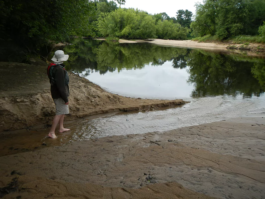
Back to the camping situation. Being a very long scenic river with lots of sandbars, this naturally caters itself toward riverside camping. Some sandbars are truely wonderful and you probably want to get out to explore some and take a break even if you don’t go camping. Much larger and cleaner than those I saw on the Lemonweir! One caveat… From a nice brochure on the web about the Black River…it states that state laws have changed and you can’t camp on sandbars or islands next to private property (you can next to public owned land). So, of the nice sandbars I saw, perhaps you can’t camp on them? I don’t know… I contacted the DNR (and a friend did as well) and they were aware of no such recent law changes. So I think you’re ok…the sandbars I saw certainly had evidence of camping. The state forest has one pull off site that is designed just for canoers (see photos and maps). Unfortunately it is not very sandy and not very river like. It has bathrooms but there is a powerful odor coming from them (not my first vote to camp here, but could be a good option during floods as this camping area is elevated well above the river).
The halfway point will be marked with a white sign with mileage to key points ahead. Just after that will Robinson creek on your left. This is a great kayaking prospect in its own right (much further up though…not at the mouth). It looked down when we went past and tough to navigate…but that might have been deceptive, as most creek mouths are unnaturally shallow due to the delta they create.
On to the highlight of the trip. About two thirds into the trip, we rounded a massive sandbar and viola…there was, finally, a large sandstone outcropping on the river. Very scenic and iconic, you’ll see this rock formation on a lot of Black River publications. But the neatest thing about this bluff, was actually the creek that came just after it. Make sure to get out of your kayaks to explore this. Follow the creek upstream (easy to do because it is so shallow and sandy) and you’ll be greeted by a hidden canyon that in my opinion is pretty epic. Keep following the canyon upstream and you’ll come across a tunnel leading under a road of moderate size. Walk on through and you should see a lot of debris somewhat clogging the other end. I didn’t see any more canyons beyond this, but there might have been, based on google terrain view. After exploring the tunnel, I doubled back and climbed up on top of the bluff itself (somewhat steep, but there is a faint trail at the top). You’ll get a wonderful view of the Black River from here, including the creek/canyon/kayaks where you disembarked. Without question this was the high point of the trip and is definitely worth checking out if you do this segment. I did take pictures, but it is tough to convey the scale of canyons with pictures because of the limited viewfinder. Did take video, but being complacent/spoiled after being used to a tripod on a kayak, they did suffer from the shakes (ugh).
Continuing on…the rest of the segment is solid but not a spectacular section. There are some nice mini outcroppings after the big bluff, as well as a mini waterfall. The takeout is at Irving just after Trout Run Creek on your right. This is a nice takeout, but with the low water, requires dragging the kayak some over sand to get to the landing (not a big deal). You can use Irving, as it is a public landing, but they do ask that you don’t park there (you can unload…that’s fine). Parking is available at a municipal lot a couple hundred yards downstream (see map). We could have taken out at Lost Falls Campground but per my subdividing of the river would have created extra long/short routes for future routes, otherwise this is a fine alternative (but private campground may charge). Just after the campground, there is a nice creek mouth that supposedly has a decent waterfall leading into the Black River and this is a popular swimming hole (don’t quote me on this as I haven’t been here, but it sounds good for future trips).
When you’re driving back, make sure to check out the overlook that is somewhat hidden (I marked it on the map). You could in theory get to the earlier mentioned canyon by car, but it would be tricky. On one side is a private boyscout camp that is restricted and has poor access to the canyon. The other side would require getting off at a hidden bridge and going down a very steep grade to get to the creek. IMO, an amphibious approach with kayaks/canoes is your best bet.
If you are interested in other segments on the Black, read my review of the flowage as I talk about other options at the bottom (I hope to have a more centralized hub for the Black River area in the future that contains better organization and information for paddling prospects). Definitely read this online brochure/map if you are curious about exploring the Black and its tributaries (it’s very well done).
Quick Overview
Black River:
- Upstream of Hwy 73: Obscure sections of the Black with little known about them. Some legs will have logjam issues.
- Hwy 73 to Lake Arbutus: 48 miles. Good legs with a mix of rapids, boulder gardens and undeveloped banks. Only reason these legs don't receive more paddling traffic is because they're located away from population centers.
- Lake Arbutus: 3 miles. A scenic but challenging lake because of the waves.
- Hatfield Dam to Halls Creek Landing: 7 miles. Some of the best and most fun whitewater on the Black River.
- Halls Creek Landing to Black River Falls Dam: 6 miles. An impounded part of the river, but nice with cool cliffs.
- Black River Falls Dam to North Bend: 37 miles. This is the heart of the Lower Black and sees the most paddling traffic. No major rapids, but there are many scenic cliffs and creek inlets.
- North Bend to Mouth: 30 miles. This is the second half of the Lower Black. While not as scenic, there are still cool sandbars and sandbanks. Few paddle these stretches.
Noteworthy Tributaries:
- Robinson Creek: One of the best paddles in all of Wisconsin.
- Halls Creek: Also one of the best and with amazing sandstone walls.
- Morrison Creek: Very scenic creek with some fun whitewater.
- Wedges Creek: Great paddle with amazing boulder gardens.
- East Fork of the Black River: Some fun riffles and unique granite geology.
- Perry Creek: Shallow but a super scenic creek.
- Dickey Creek: A wonderfully scenic creek with fantastic sandstone…but too many logjams.
- Beaver Creek: Some fun rapids and amazing sandstone in Galesville, but logjams on the downstream portions.
- Popple River: A shallow whitewater river that is very nice.
- Arnold Creek: A pleasant tributary to Lake Arbutus with really nice reflections.
- Rock Creek: Many scenic boulder gardens, but usually this creek is too shallow to run.
- Roaring Creek: Very scenic creek with a great waterfall at the mouth, but might be a challenge to paddle.
- Vismal Creek: Super scenic but has a lot of logjams and is shallow. Requires very high water conditions.
- Plus countless small creeks that are too small to paddle but quite fun to explore by foot. If you know of viable paddling options, let me know! Am very curious to know more about Douglas Creek, Levis Creek, O’Neal Creek, and Crawley Creek.
Detailed Overview
Headwaters to Neillsville:
- Upstream of Division Drive: Likely too many logjams to be navigable.
- Division Drive to Sawyer Ave: (6.5 miles) Rocky and a few light rapids. Maybe 4 logjams.
- Sawyer Ave to Hwy 64: (2.5 miles) Rocky and a few light rapids.
- Hwy 64 to Bridge Road: (14.4 miles) Solid prospect reviewed by Mike Svob. Some Class 1 rapids and nice gravel bars. Intermediate access points at Bahnkes Ave and Hwy AT.
- Bridge Road to Hwy X: (6.0 miles) Little is known of this section…likely pretty simple.
- Hwy X to Colby Factory Road: (6.0 miles) Little is known about this section…likely some rapids and outcrops. Intermediate alt access points at Hwy 29 and Hwy N.
- Colby Factory Road to Popple River Mouth: (7.9 miles) This stretch has far fewer rapids than downstream legs with only a few minor rapids. It should still be pleasant though.
- Popple River Mouth to Reese Ave: (5.3 miles)
- Popple River Mouth to Warner Drive: (1.0 miles) This is a slower and less interesting stretch, but does include 4 Class 1's and scenic Hemlock Rapids which are Class 3.
- Warner Drive to Greenwood Park: (3.4 miles) A good leg with many rapids (3 Class 2's and 17 Class 1's).
- Greenwood Park to Reese Ave: (0.9 miles) A slower stretch with just 2 Class 1's. Part of this passes through the community of Greenwood.
- Reese Ave to Twenty Six Rd: (5.1 miles)
- Reese Ave to Sladich Rd: (0.7 miles) A mostly nondescript wooded stretch. The exception is Greenwood Rapids where an island splits the river. The right side is scenic, but the left side has fun Class 3 rapids.
- Sladich Rd to Willard Rd: (1.6 miles) A somewhat slow and relatively uninteresting leg. Highlights include one nice outcrop, a few gravel bars and a 400' stretch of Class 1 rapids.
- Willard Rd to Twenty Six Rd: (2.8 miles) A great leg with 10 Class 1's and 2 Class 2's. Highlights also include scenic boulder gardens and a few outcrops.
- Twenty Six Road to Hwy H: (5.0 miles) Multiple Class 1 & 2 rapids.
- Hwy H to Grand Ave/Hill Road: (8.0 miles) A great trip with several Class 2 rapids and scenic granite outcrops.
Note, for more details on the Upper Black, I highly recommend “Indian Head Rivers” by Michael Duncanson.
Alternate Black River Trips – Neillsville to Black River Falls:
- Grand Ave/Hill Road to Opelt Road Landing: (6.7 miles)
- Grand Ave/Hill Road to Hwy 10: (2.2 miles) Nice section with a handful of rapids. These are mostly Class 1 at lower depths, but strengthen to Class 2 during high flow rates.
- Hwy 10 to River Road Landing: (4.3 miles) Fantastic whitewater section. Maybe six Class 2’s and two class 3’s. Scenic boulder gardens and a few outcrops.
- Opelt Road Landing to Bryan Ave Bridge: (1.1 miles) Not sure there is anything special about this stretch.
- Opelt Ave Bridge to Hwy 95: (4.4 miles) Ok…nothing special.
- Hwy 95 to West Arbutus County Ramp/Hatfield Dam: (4.8 miles)
- Hwy 95 to North Arbutus Boat Landing: (2.4 miles) Includes a scenic gorge, boulder gardens and rapids including the Class 3 Red Granite Rapids. River slows after rapids.
- North Arbutus Boat Ramp to West Arbutus County Ramp: (2.4 miles) A large open water paddle on Lake Arbutus that can feature challenging waves on summer afternoons.
- Hatfield Dam to West/East Channel Confluence: 0.2 or 0.3 miles.
- West Dam to West/East Channel Confluence: 0.3 miles. There is a large boulder field and Class 2 rapids below the west dam. At the outlet of the west channel is a Class 4 drop. This is easy to scout and portage.
- East Dam to West/East Channel Confluence: 0.2 miles. Perhaps the most extraordinary rapids in the state with Class 4/5+ rapids. The action starts below the dam where steep granite banks narrow the river significantly and force it down deep chutes. The gorge starts with Class 2-3 rapids but ends with two significant drops. American Whitewater warns “between the dam and this point lie some serious drops which contain near inescapable boiling cauldrons at moderate to high flows”.
- Hatfield Dam Confluence/West Clay School Road to Powerhouse Road Landing: (3.1 miles)
- Hatfield Dam Confluence to Hwy K: (0.3 miles) One of the most scenic paddling areas in the state with massive granite outcrops. There is one set of Class 2 rapids.
- Hwy K to Powerhouse Road Landing: (2.8 miles) The first half mile by Hwy K is very scenic and contains one Class 3. The second mile is mostly flatwater. The third mile is almost continuous rapids and features one Class 3.
- Powerhouse Road Landing to Halls Creek Landing: (4.0 miles) Scenic section with a few Class 2 rapids and a steep ledge.
- Halls Creek Landing to Black River Falls Dam: (6.2 miles) Wonderful sandstone cliffs.
Alternate Black River Trips – Black River Falls to Mouth:
- Black River Falls Dam to Mason’s Landing: (4.7 miles) A great little section.
- Mason’s Landing to Irving Landing: (9 miles) A good section.
- Irving Landing to Lost Falls Campground (2.3 miles) A popular stretch. Highlights include a few small outcrops, two tiny waterfalls, several impressive sandbars, and one large sandbank. A side hike to Roaring Falls can be arranged. Note Lost Falls Campground is private and you must purchase a pass from them to use their access.
- Lost Falls Campground to Grinde Landing: (6.4 miles) A popular section with some nice outcrops and a waterfall by Roaring Creek. Wolf Creek may also have a cool slot canyon. The river splinters into multiple channels, some of which may be quite shallow in later summer. As of 2023, Grinde Landing is closed because somebody stole the owner's deer stand.
- Grinde Landing to Melrose Landing: (3.9 miles) A shorter section but with a really nice rock outcrop before Melrose Landing. As of 2023, Grinde Landing is closed because somebody stole the owner's deer stand.
- Melrose to North Bend: (10.1 miles) Likely the most popular stretch with the best sandbars on the river, three sets of outcrops, and a few waterfalls.
- North Bend to Hwy 53: (13.3 miles) Likely a nice paddle with sandbars, large sandbanks and maybe a few outcrops. Unfortunately it is very long.
- Hwy 53 to Hwy 35: (8 miles) A nice section with epic sand banks.
- Hwy 35 to Lytle Road: (4.0 miles) Goes through the Van Loon Floodplain Forest. This can be a shallow trip but features many nice sandbars.
- Lytle Road to Fred Funk Boat Landing (Mississippi): (5.0 miles) Multiple options because of the river delta.
Trip Map
View Black River - Mason Landing to Irving Landing in a larger map
Overview Map
Video
Photos Size: