
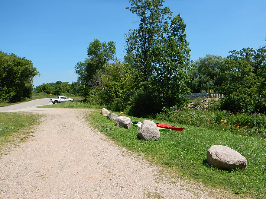
Good put-in at Hwy Q
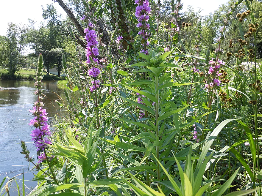
Purple loosestrife by the put-in
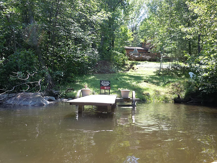
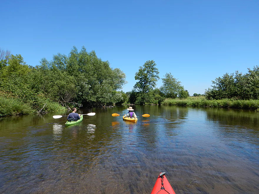
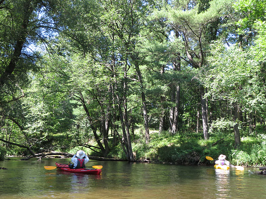
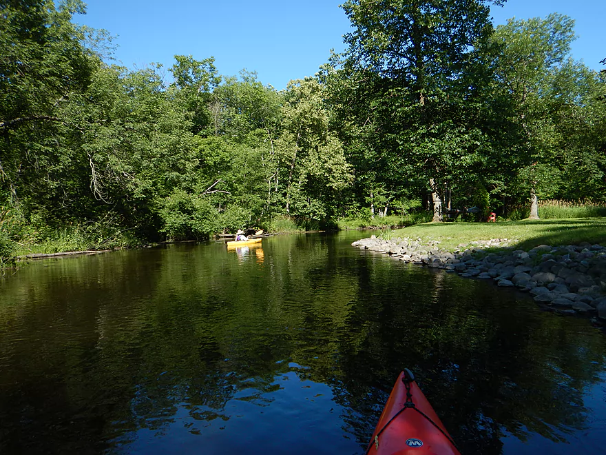
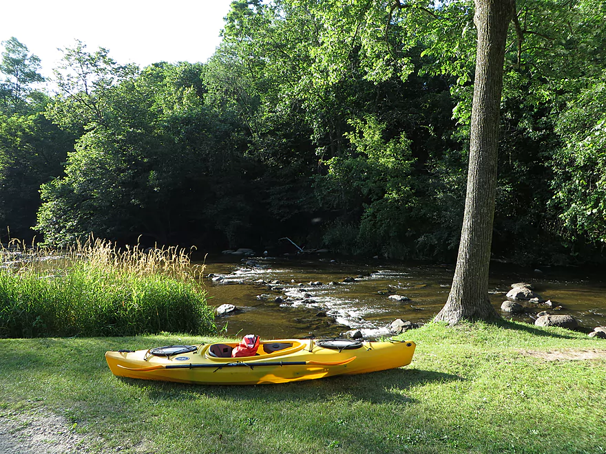
Good launch area
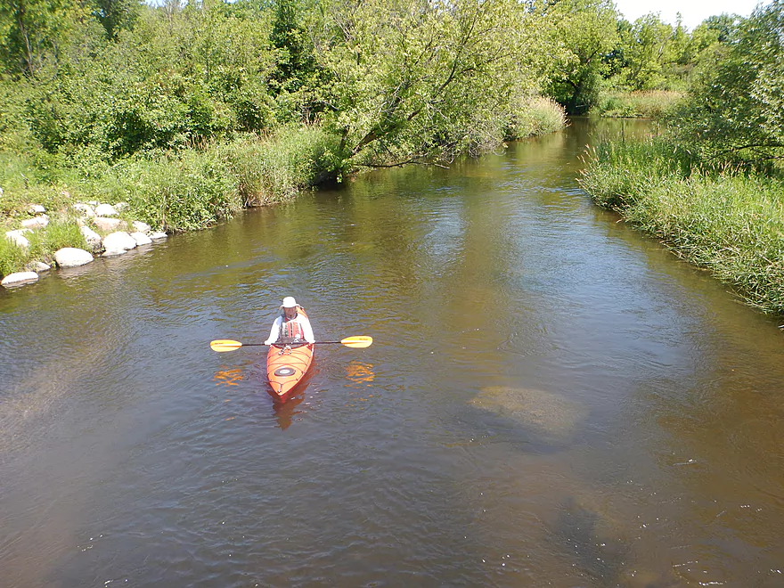
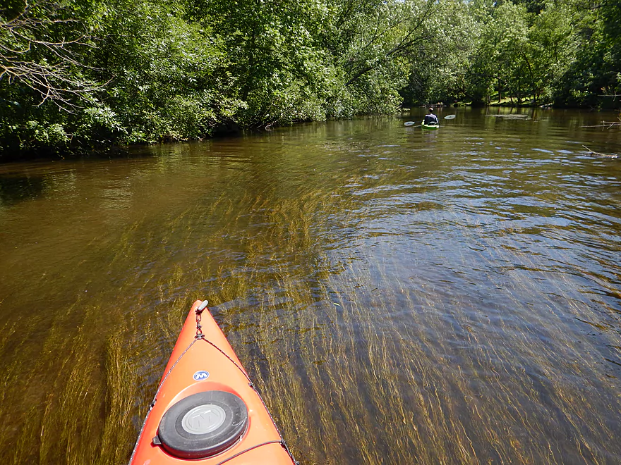
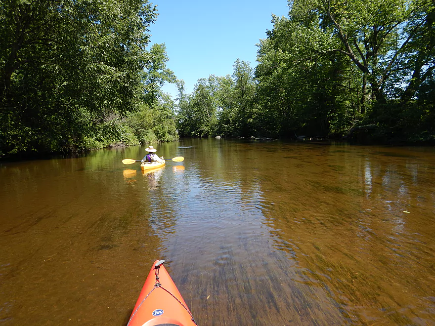
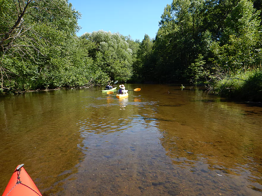
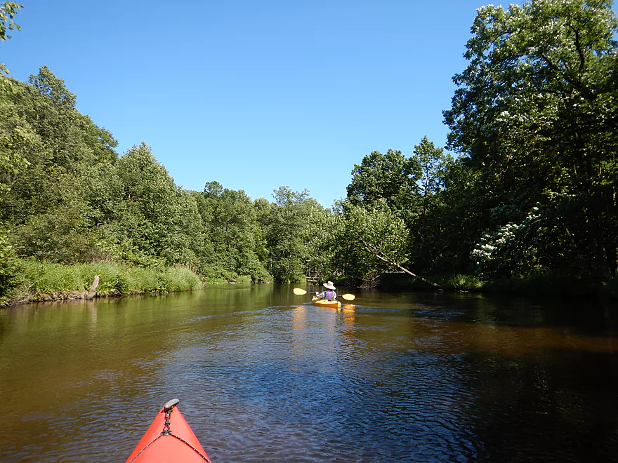
Generally clear water
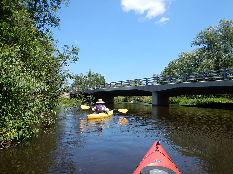
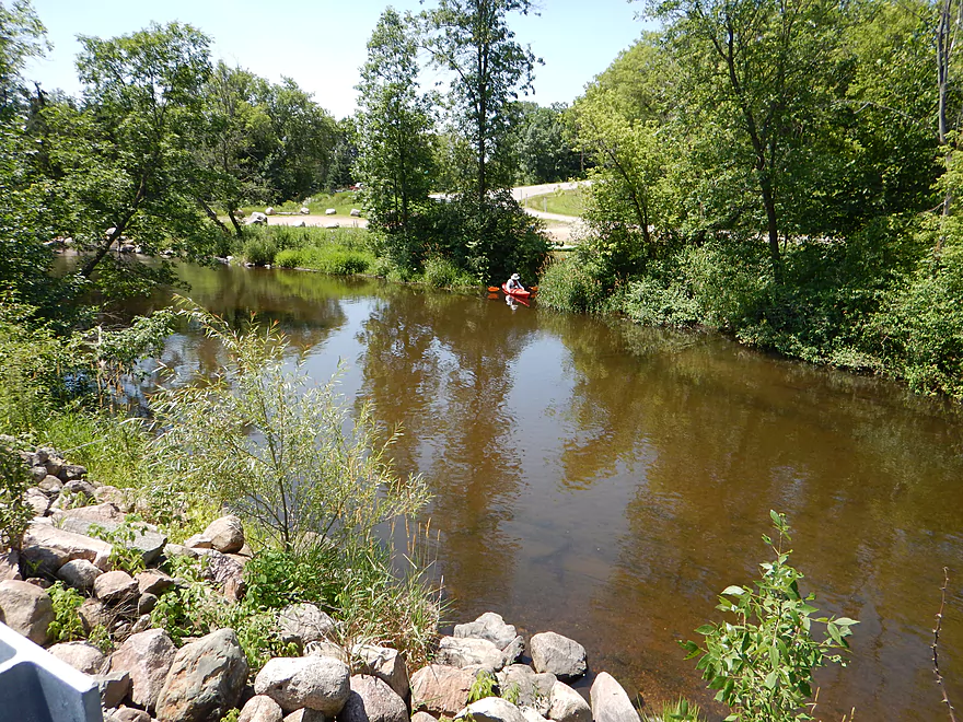
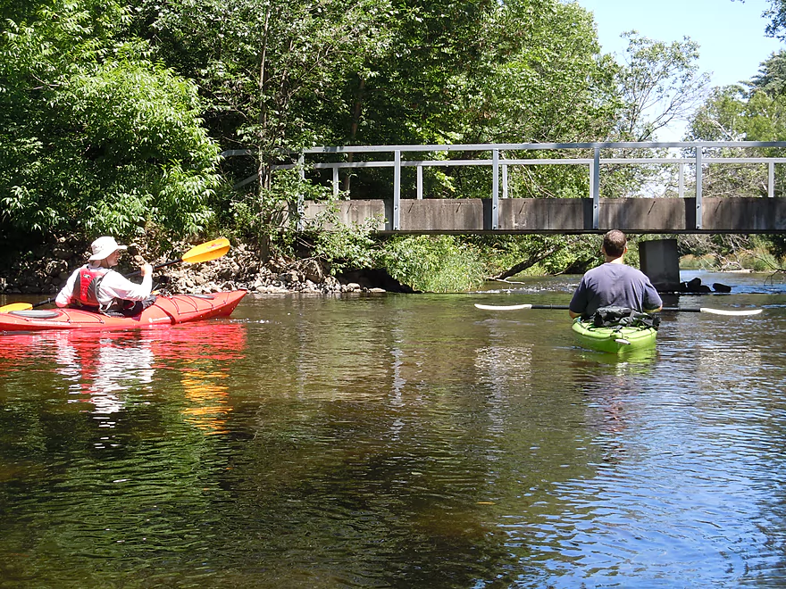
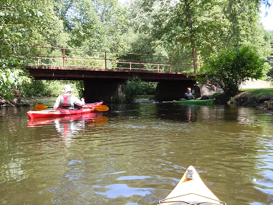
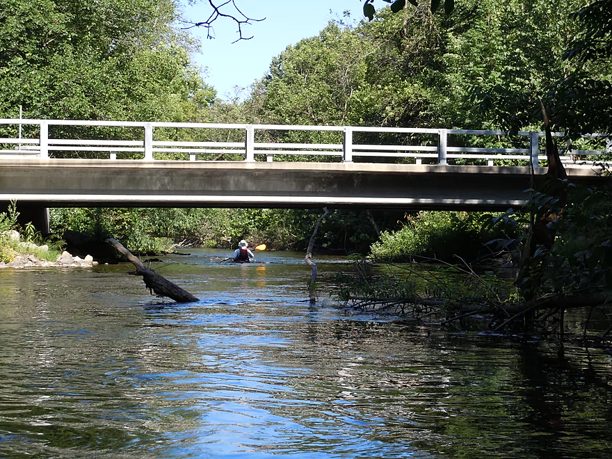
Hwy Q bridge
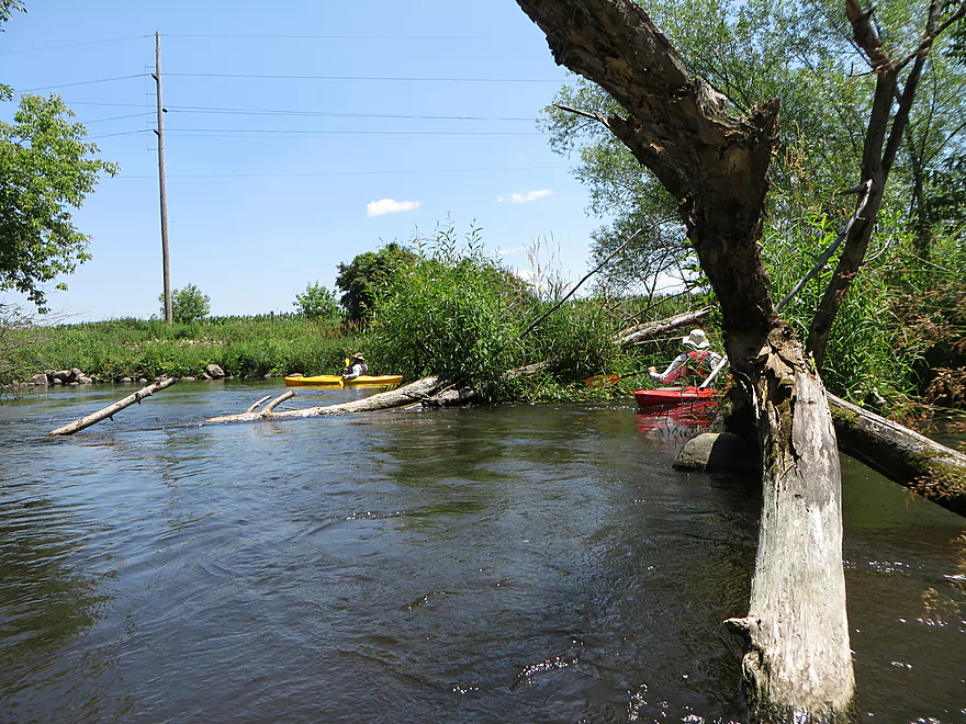
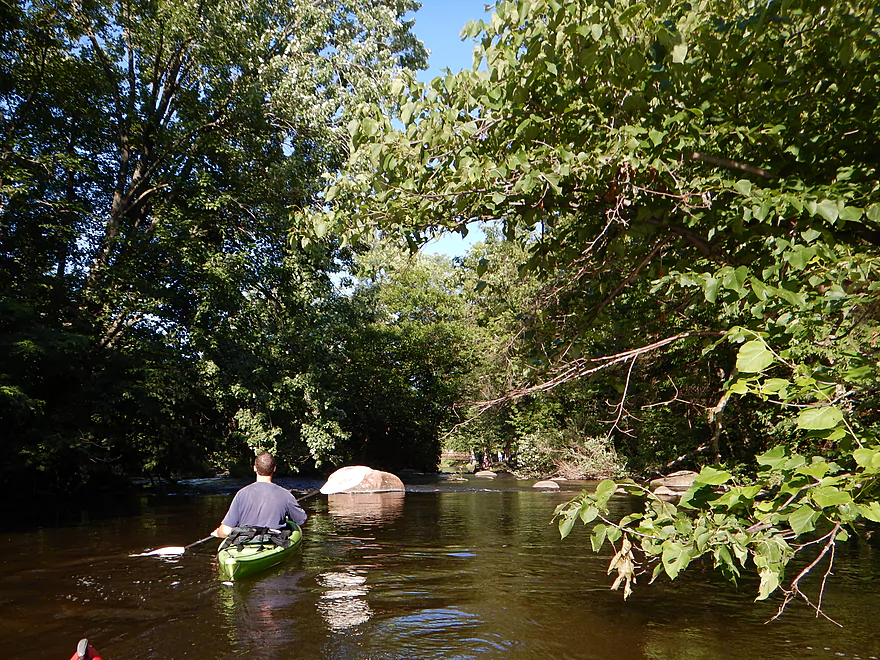
Going around some snags
…or over them
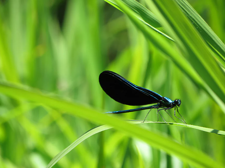
Ebony jewelwing damselfly
A challenge course bridge?
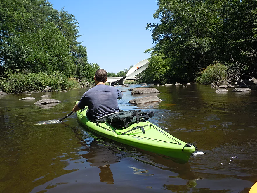
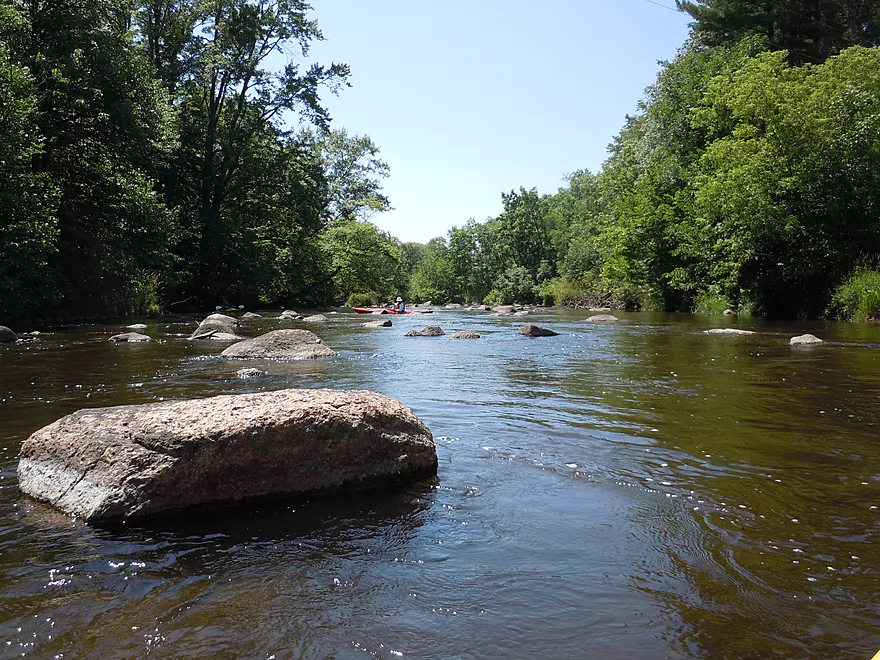
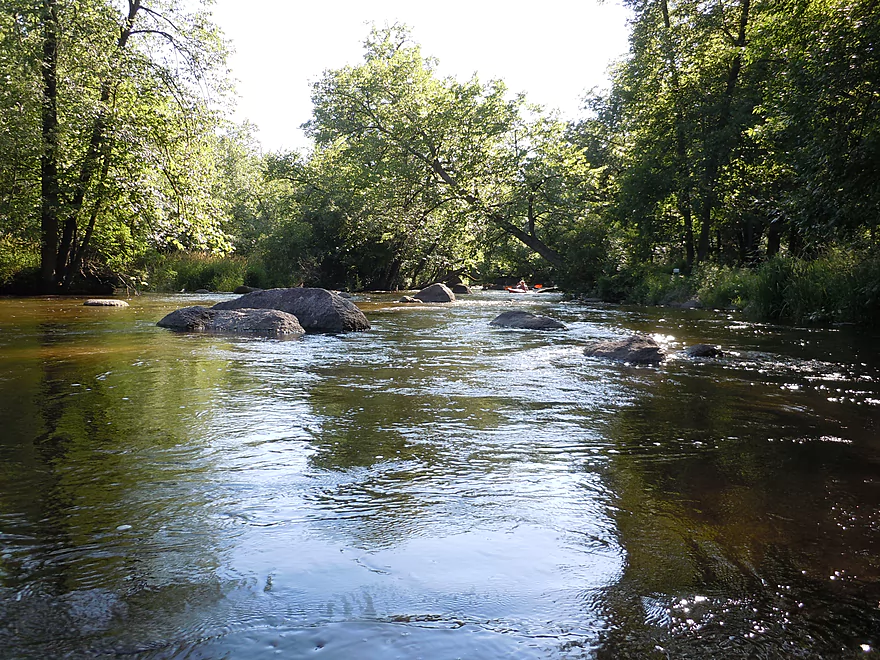
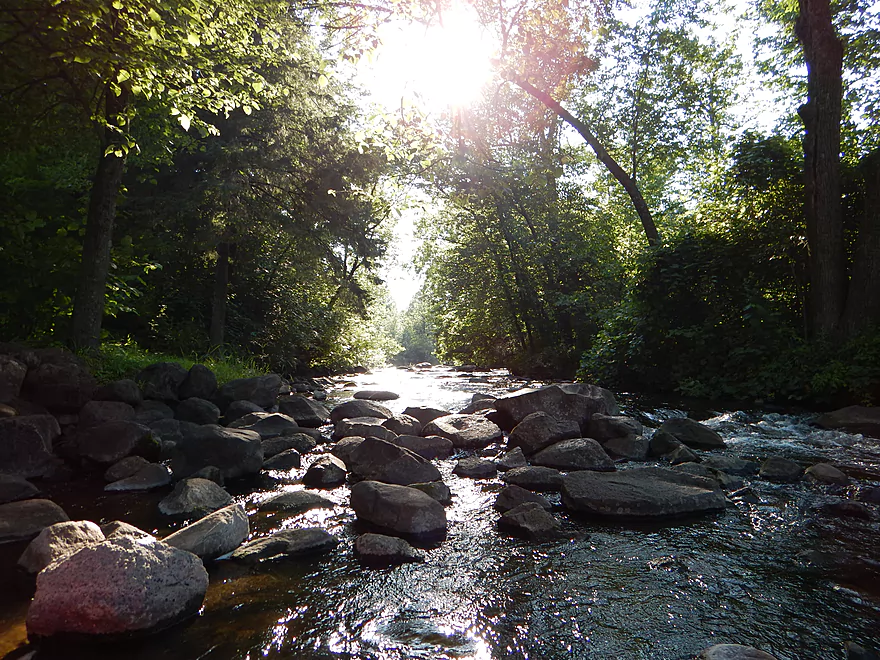
Attractive boulder garden
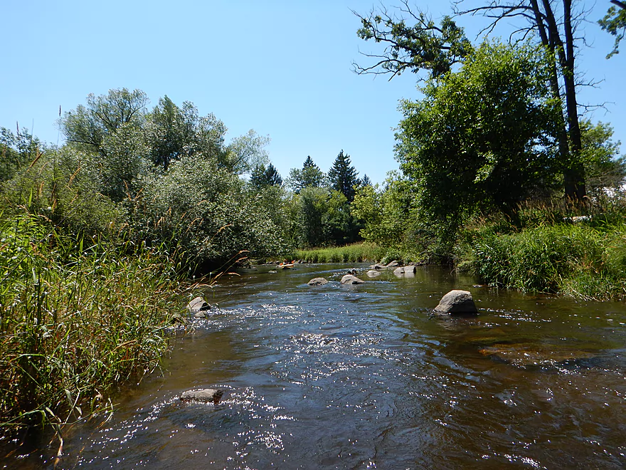
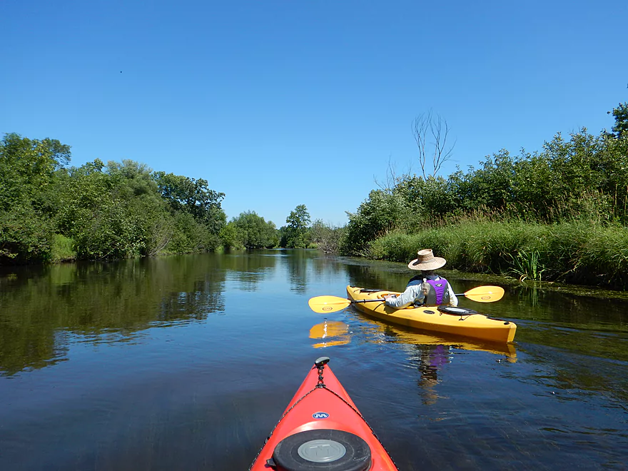
Very grassy section of the river
Very artsy
Very artsy
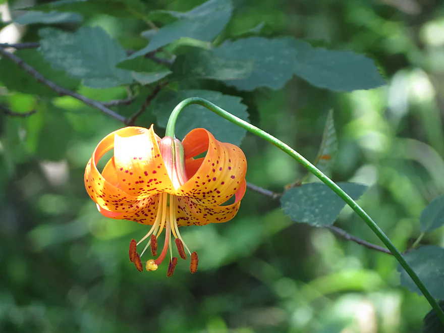
Turk’s cap lily
Flowing pondweed
Yeesh…a lot of riverside advertising
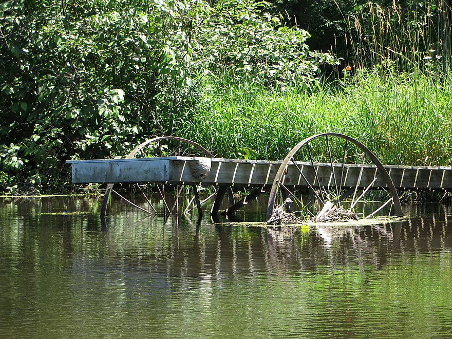
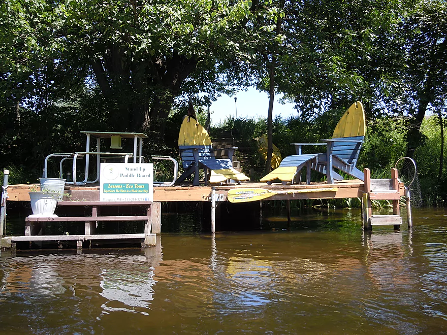
Wagon wheel pier with paper wasp nest
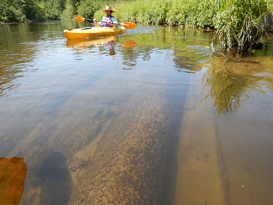
At times fantastic water clarity
Best boulder garden by I-10 bridge
Reverse view
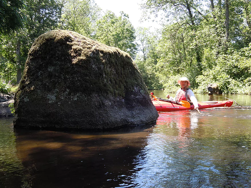
You can see the high waterline marked by the moss
This bridge might be in trouble
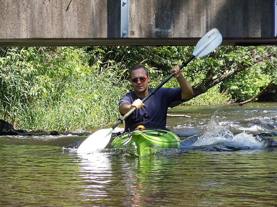
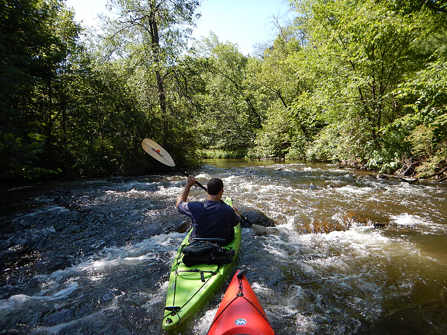
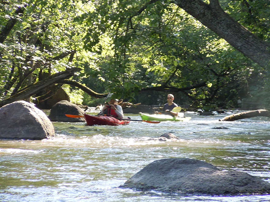
Successfully paddling upstream on the rapids (these aren’t serious)
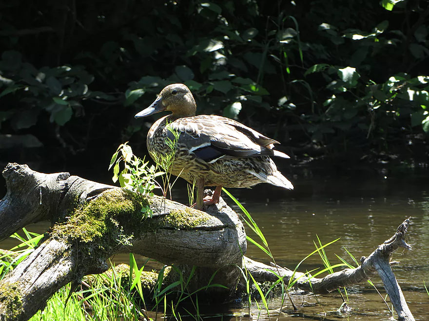
Female mallard
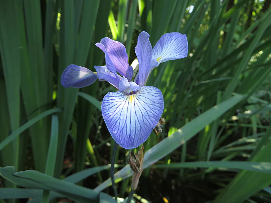
Blue flag
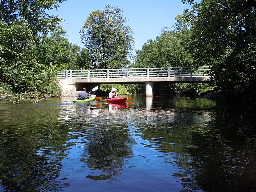
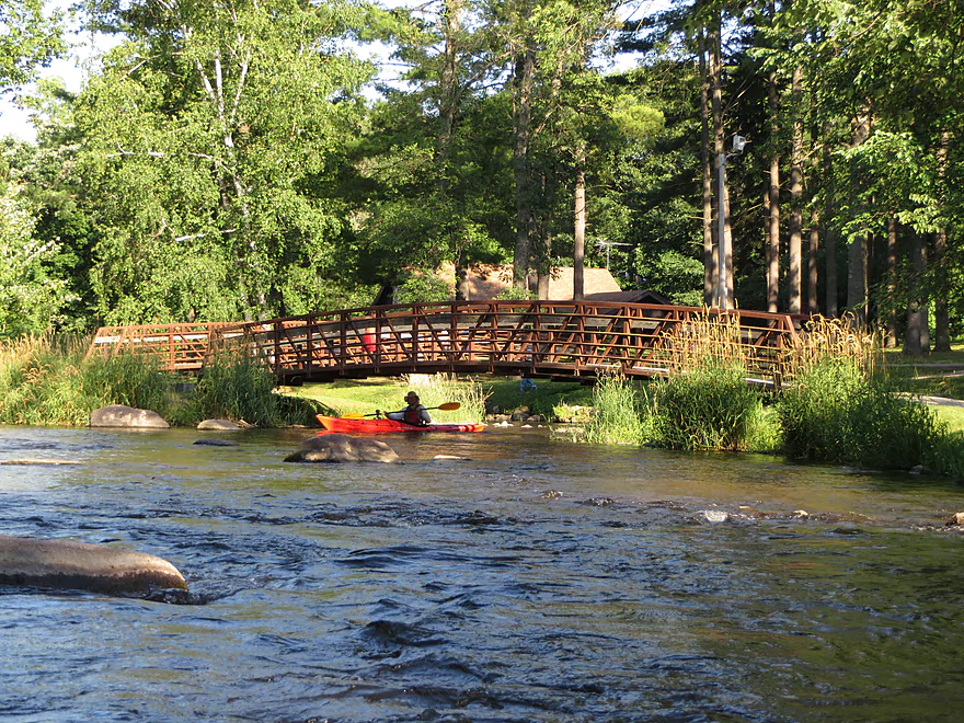
River Drive bridge
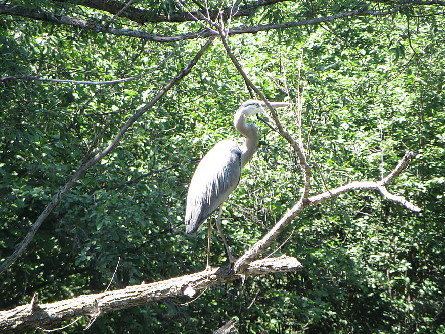
Great blue heron
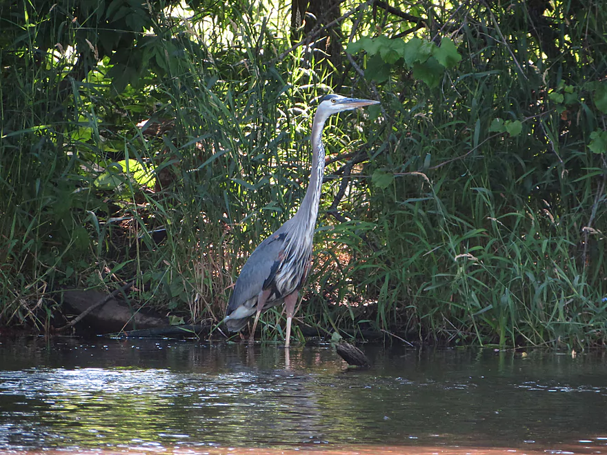
Another great blue heron
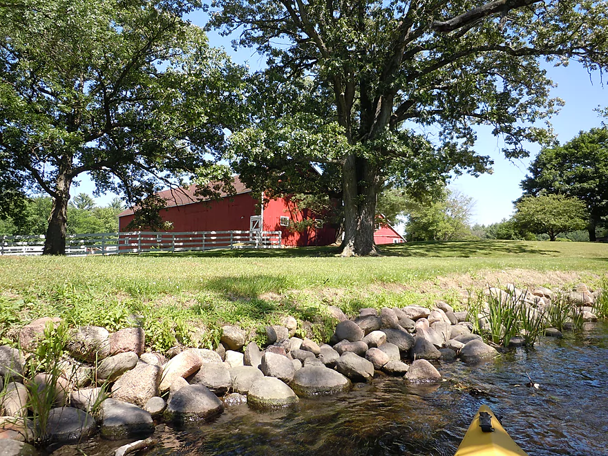
Scenic farm by the river
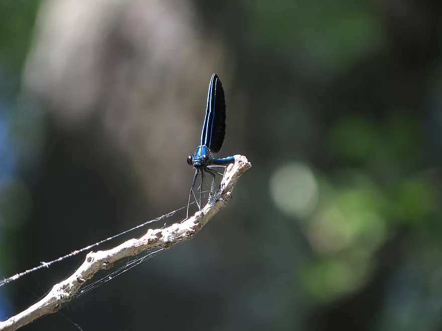
Another jewelwing
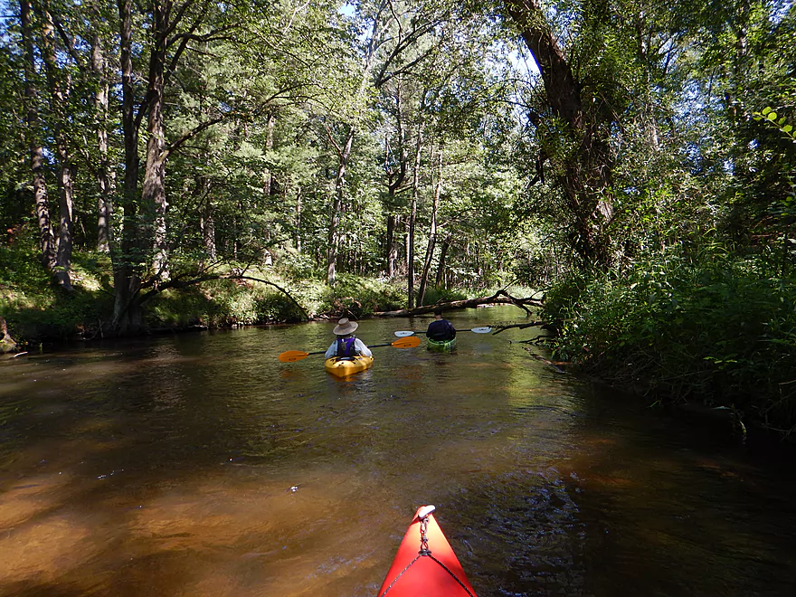
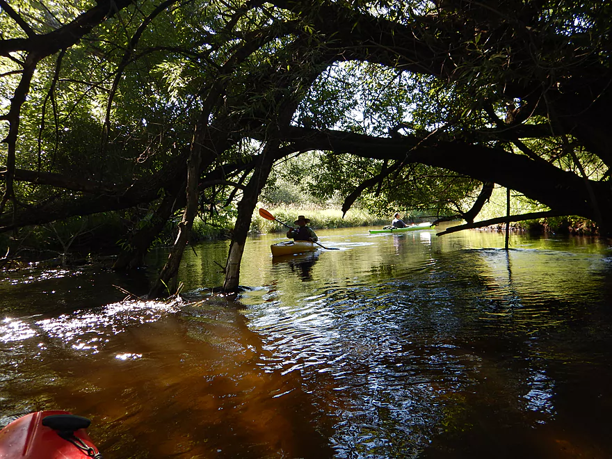
Entering a wooded section
Not dangerous at this CFS
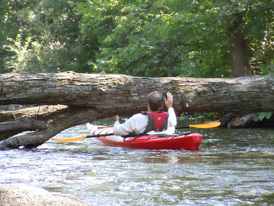
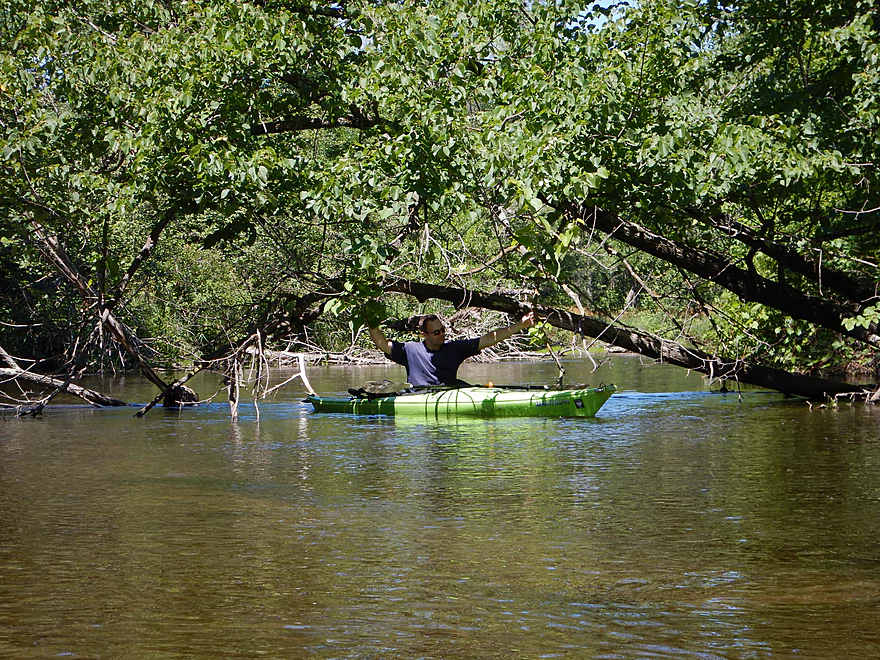
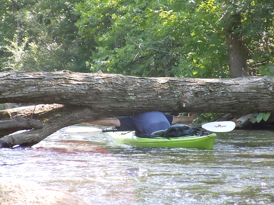
Had to bench press the kayak into the water to get under this one
A different technique…
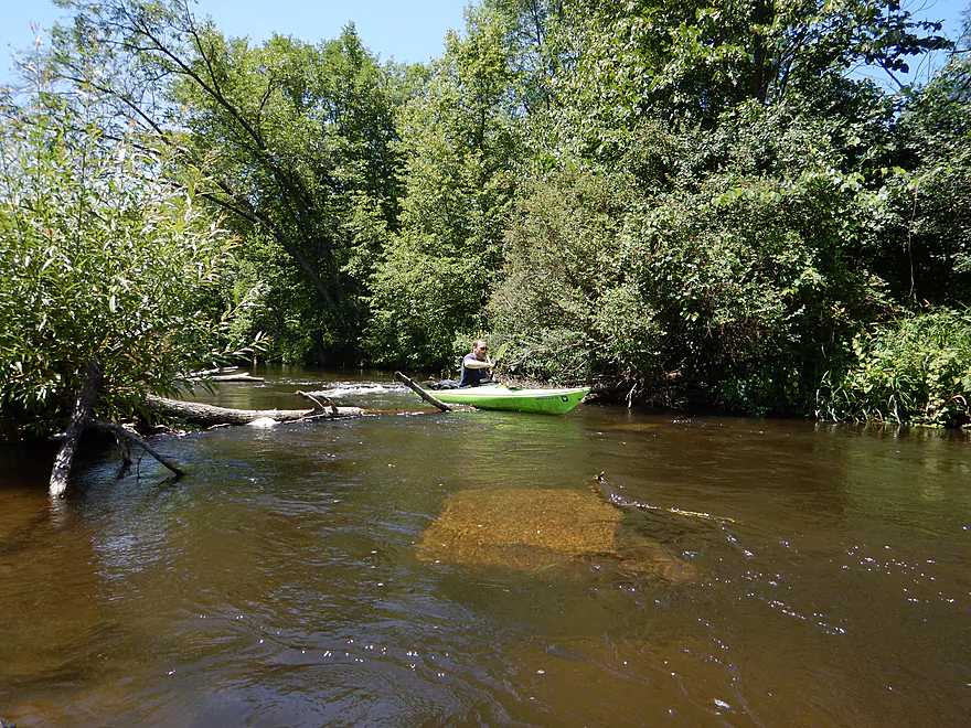
A hop-over to contend with
If you choose the main channel around this island, you won’t need to do this
Anderson Road bridge
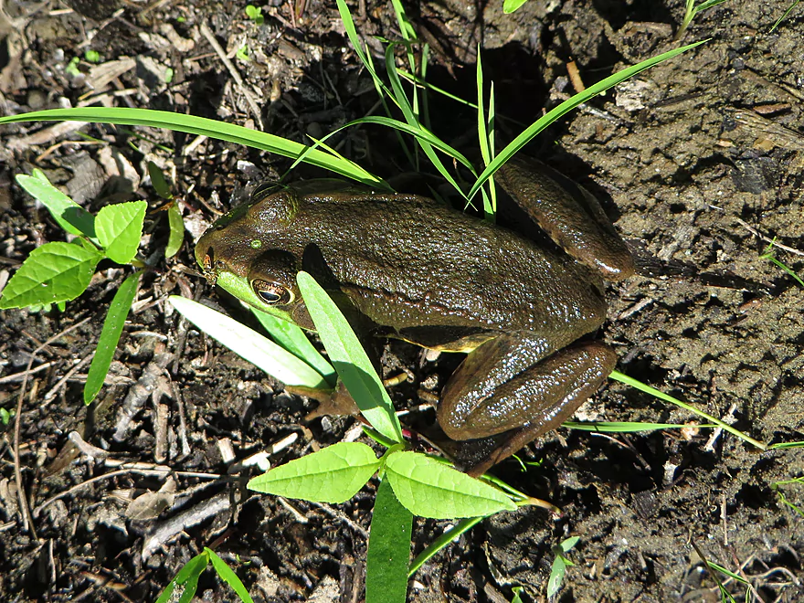
A brown green frog

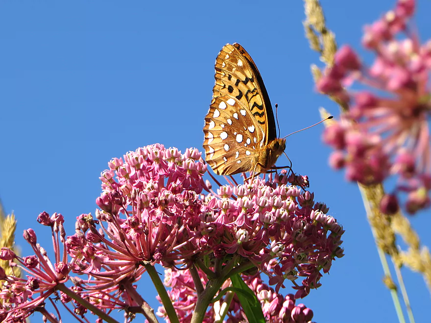
A colorful combo: fritillary butterfly on swamp milkweed
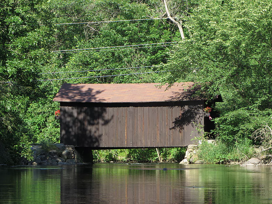
The famous Waupaca covered bridge
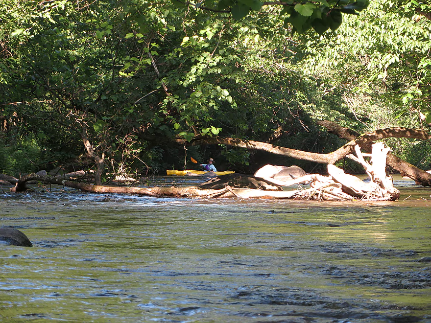
Some log dodging required
More attractive boulder gardens
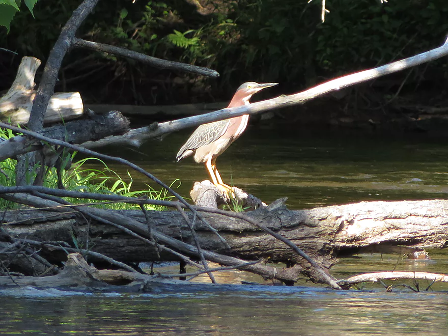
A green heron

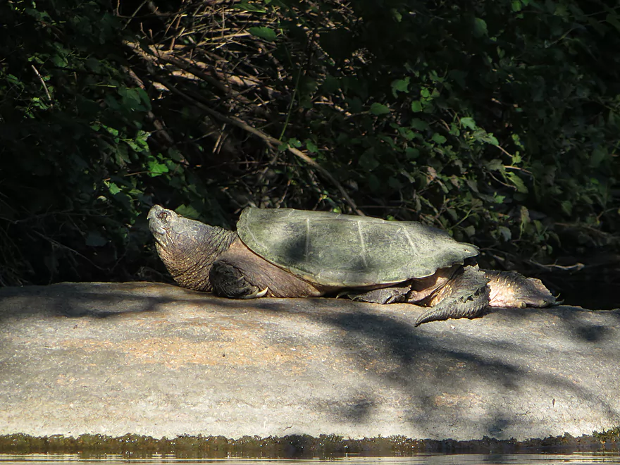
A large snapping turtle
Both left and right channels lead to take-out
Some riffles and rocks to contend with (minor)
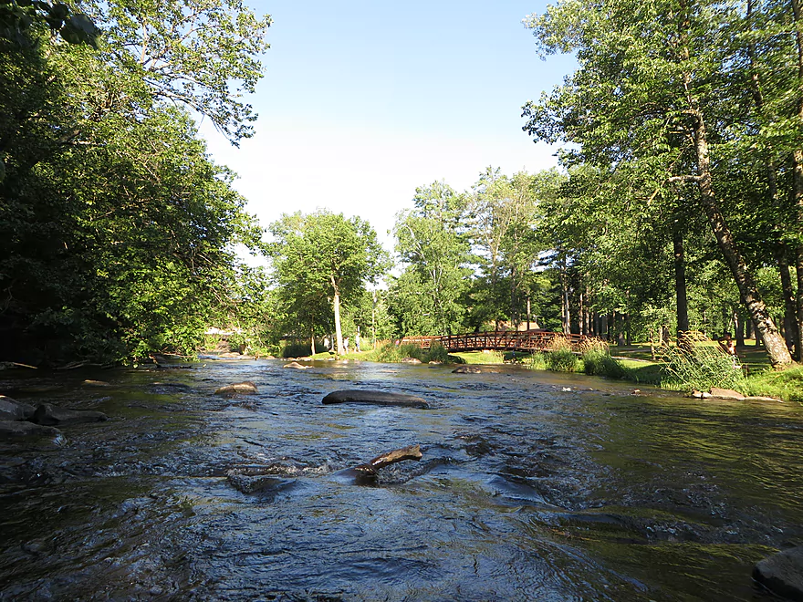
Heading into Brainard’s Bridge Park
Looking upstream of the small channel
Coming down the big channel
Cool pedestrian bridges
Take-out area
Island access
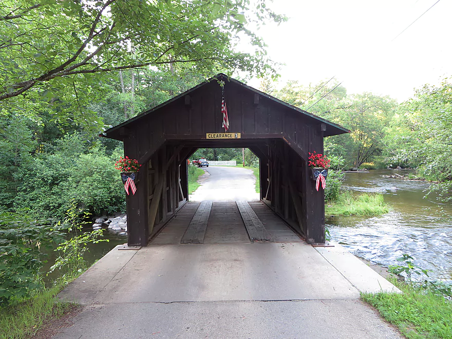
Covered bridge by road–decked out for the 4th of July
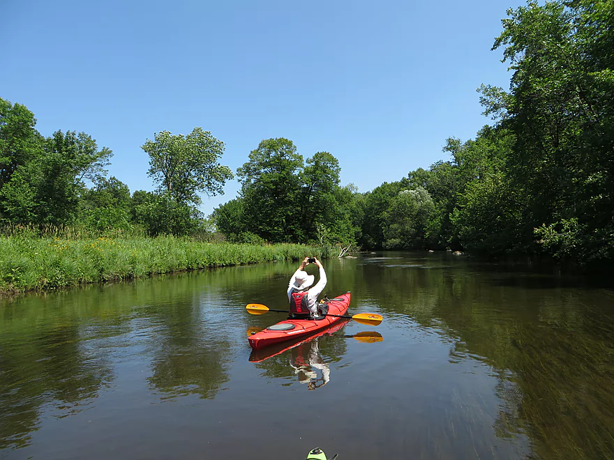
Waupaca River


A classic water trail in central Wisconsin, the Waupaca River is a great prospect with striking boulder gardens, great water quality, and fun/safe riffles. The river starts close to the city of Stevens Point and winds east before emptying into the Wolf River. I’ve actually paddled the Waupaca before…well, kind of. Last fall, I paddled a section from Hwy 161 to the Amherst Dam, which I liked and recommend. However, mapmakers refer to the upper Waupaca as the Tomorrow River.
The history of the two names goes back to when local tribes were traveling between the Mississippi and Lake Michigan and would use the Plover and Waupaca Rivers to connect the Wisconsin and Wolf Rivers. “Tomorrow” was a rough measurement of time for how long it would take to run the river. “Waupaca” was the Native American word for tomorrow, which remained in use on the lower part of the river, while Tomorrow was commonly used for the upper section. For some reason, the two names were never properly reconciled. It is interesting to think that the Waupaca River once served as a a transcontinental link much like Portage, Wisconsin, the Chicago portage, and the portage near Hayward (Bois Brule/Namekagon).
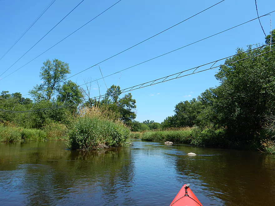
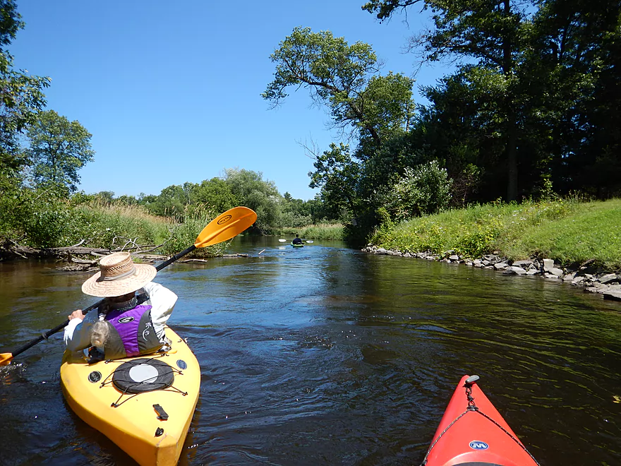
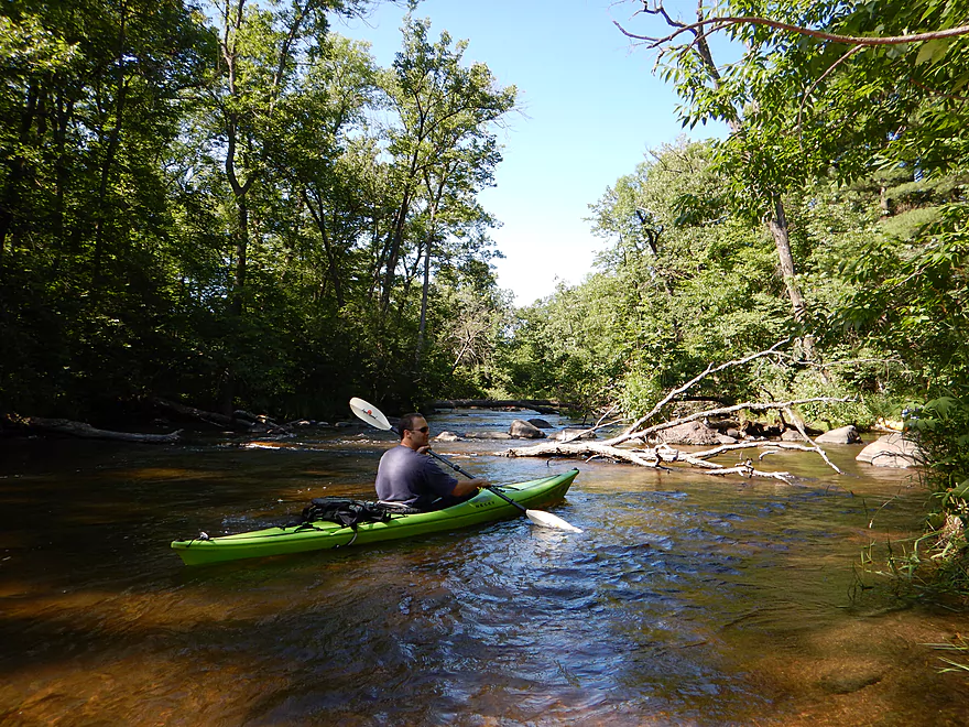
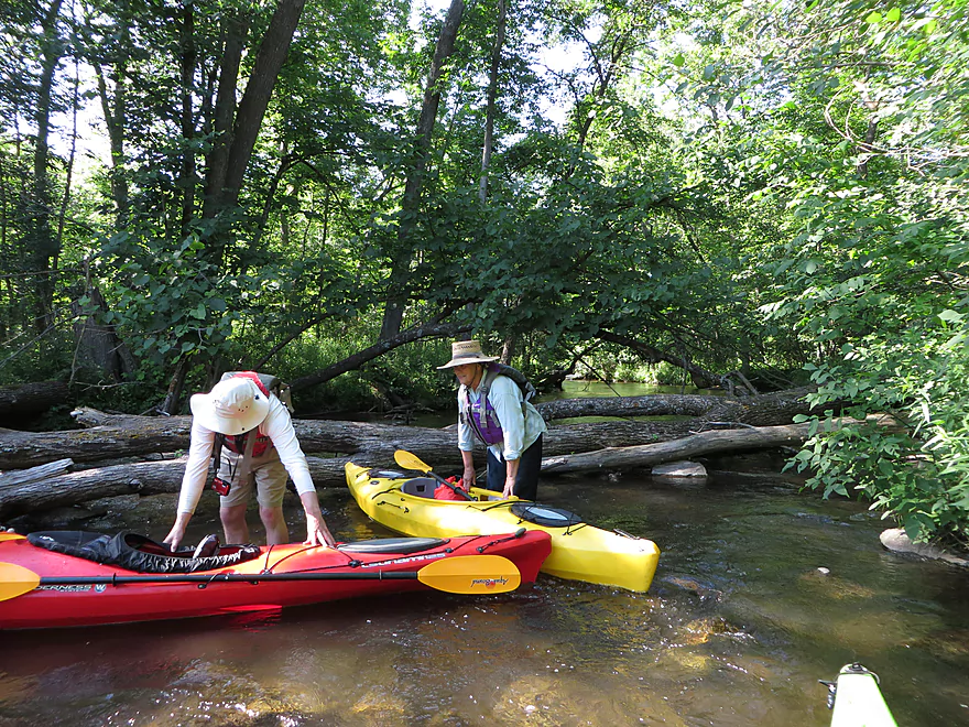
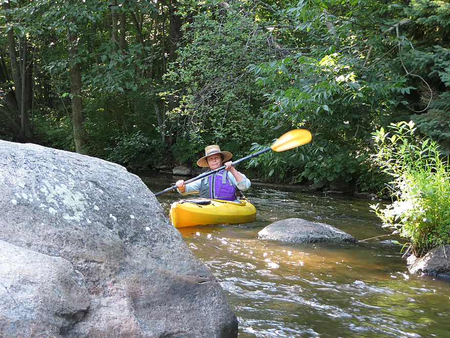
For this trip, our paddling posse put in at the Hwy Q canoe launch, which is a great put-in (sans facilities). There are other kayak routes between the Tomorrow River and Hwy Q, which I’ll touch on more later, but suffice it say these tweener sections have log jam issues and some tough ledges. The section we did from Hwy Q to Brainard’s Bridge Park is by far and away the most popular on the river and is recommended for Waupaca newbies.
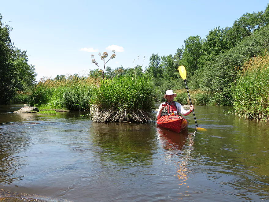
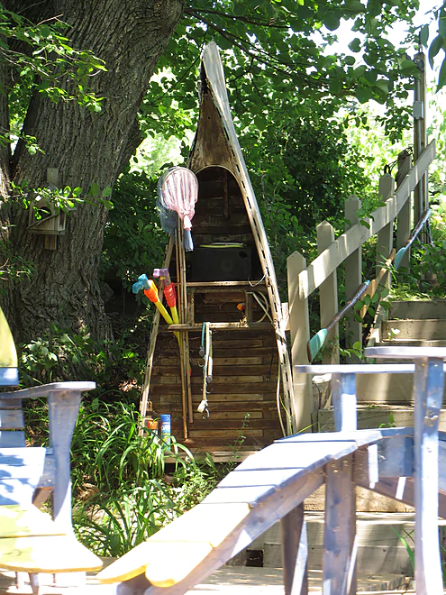
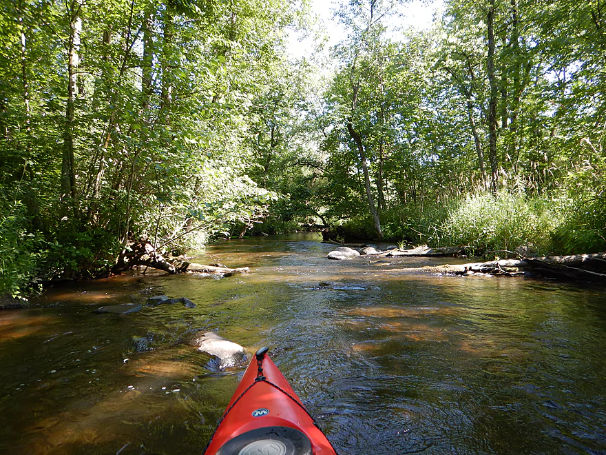
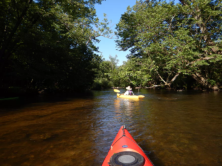
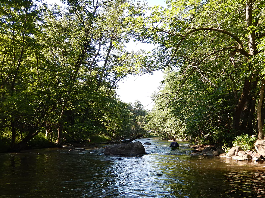
The river makes a good impression right off the bat, with clear water, boulders in the channel, a clean gravely substrate, swift but safe current,and attractive riverside wildflowers. The first half of the trip is very open and grassy–a generally positive paddling experience, but with some gripes. Nearby Interstate 10 is loud…I’ve been on some rivers with some highway noise (like the Lemonweir River), but this has to take the award for the noisiest trip I’ve done. It’s well worth it though, and the second half of the trip is generally far quieter. There aren’t too many houses on this trip but there are a handful. Some have artsy displays on the river banks, including cool “fish chairs,” a “half wagon” pier, a “canoe closet,” and a mesmerizing wind sculpture with counter-rotating blades. A number of houses posted small advertisements on the river bank for paddlers and I didn’t find this very classy.
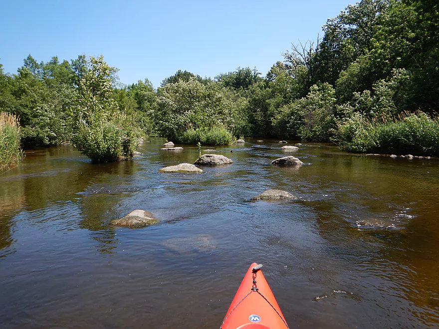
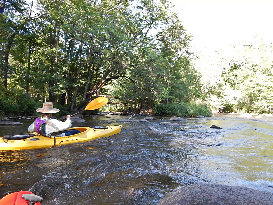
One of the better aspects of the river are the boulder gardens. It’s always fun paddling through these (kind of like navigating through an asteroid belt). The best field will be by the I-10 bridge, and there are numerous nice sections in the last mile before Brainard’s Bridge Park. Yes, with a rocky river like this you’ll bump your fair share of rocks, but honestly, it wasn’t that bad and was a far cry from my Fever River experience. We went at 172 CFS (a very accurate figure, as the gauge is right near the take-out). This is considered on the low side, but I think the river was plenty navigable and could be run lower–maybe at 150 CFS or even 140 CFS, with perhaps one get-out-and-walk section. The last mile, and specifically the take-out section, is the shallowest, so don’t be discouraged by the sight of low water here. On the upper side, I’ve read a review of this done at 265 CFS, but I’m not sure I would want to do the river over 200 CFS. There is some debris in the water (it is minor) and some rapids (these could be pushy in high water). The advantage of a low CFS run will be the water clarity and it was fantastic for us. With the low, clear water, we could see crayfish everywhere (the most crayfish I’ve ever seen in a river).
Kind of an up and down trip for wildlife. Despite the water quality, we saw few fish. Did see several great blue herons, so you know there were more around. Other sightings included a mallard, a spotted sandpiper, three mink, a couple of green frogs, many ebony jewelwing damselflies, a paperwasp nest, some dragonflies. and a fritillary butterfly. Lots of grassy plants and some scrubby alders in the first half of the trip, but a lot of nice wildflowers, too. The second half of the trip goes through some pine and attractive hardwood canopies. In the wooded section the understory had rich fern beds and massive skunk cabbage leaves (much preferred to grass). But…by far the highlight of our trip were two snapping turtles–one baby one that we scooped from the water, but unfortunately scrambled off the paddle before he could be photoed, and a large old snapper, which did let us get close enough to take a nice picture. One of the few turtles in all of my paddling trips that didn’t jump into the drink at the site of a kayak…probably big and nasty enough he didn’t fear us.
Again…for the most part, the log jams weren’t an issue. but there were some minor “hop-overs” and some major “duck-unders” maybe two thirds into the trip. The worst duck-under required me to get on the back of my seat and bench press the kayak into the water for enough clearance to pass under. Not as bad as it sounds, but be careful and don’t attempt this in deeper CFS, as a boat can become tippy when ducking under or going over logs. I did experience a proper log jam when I chose a minor channel around an island (not too bad with the shallow water…major channel is log jam free).
This is a fast river, with its share of riffles and a couple of class 1 rapids–all super safe at our CFS though. Some of these rapids (especially near the logs) could be dangerous in high water though (don’t know though). Most of the micro-runs will be by the bridges, with the best riffles being in the last mile of the trip. The highlight will be a little run that starts at the top of an island and ends at Brainard’s Bridge Park (the take-out). Not serious, but the loudest of the runs, with a choice of a rougher but bigger north channel, or a more direct but shallow south channel (fun, but with some bumpy escalator sliding over and around the attractive boulder rocks in the channel).
The most iconic part of the trip will be the covered bridge off of Baily Street. You can access it by road…kind of. It’s marked as a private drive with video surveillance (probably to protect it from graffiti), but people drive over it right and left and even use it as a kayak take-out spot (not recommended). The best way to experience the bridge is to paddle under it though. Definitely reminded me of the covered bridge at Cedar Creek which I paddled last year. Note: the bridge by Cedar Creek brags it is the last covered bridge in Wisconsin…but they mean last constructed, not last standing (this had me confused initially when I found out about the Waupaca covered bridge!).
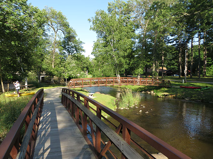
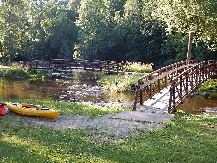
The take-out area by Brainard’s Bridge Park is superb–great parking, no fees, nice launch area and facilities. The park itself is very striking, with long, arching walk bridges connecting river islands and two rocky riffle channels that come together for a striking scene. If you bike shuttle, obviously don’t take I-10, even though it is the most direct route. Just bike south of the river, which is a good route…except for the city of Waupaca itself, which is surprisingly packed with cars. Should be able to sneak onto a sidewalk shortly to avoid crazy Hwy 49 before you make your way up north on quiet residential streets to the take-out.
For serious paddlers in southern and central Wisconsin, the Waupaca River should definitely be on your to-do list. First half of the trip was four star (good, but with road noise and grassy/scrubby banks). The second half of the trip was my favorite, with fun riffles through attractive woods and boulder gardens for five stars. Hence the 4.5 star compromise.
Webmaster Update – 2026-06-16: Recent storms have added downed trees to this leg. See comment below for details.
Detailed Overview
- Clementson Road to Hwy Q: 0.9 miles. Possible prospect, but the river is very small here.
- Hwy Q/Rolling Hills Road to Hwy 161: 1.2 miles. A good prospect.
- Hwy 161 to Amherst Dam: 5.4 miles. More of an oversized creek than a river, the Tomorrow River is still a nice paddle known for its clear water.

- Hwy 161 to 1st Street: 1.3 miles. Great trip.
- 1st Street to the Amherst Dam: 4.1 miles. Great put-in and trip.
- Hwy 161 to 1st Street:
- Amherst Dam to Buchholz Road: 5.7 miles. This section was great fun because of its many rapids, clear water, narrow channel, boulder gardens and wooded banks.
- Amherst Dam to Hwy A: 1.7 miles. Great segment through Amherst.
- Hwy A to Keener Road: 0.6 miles. A short but good section with a nice boulder garden.
- Keener Road to Buchholz Road: 3.4 miles. Aside from some Class 2 rapids at Keener Road and a few boulders, this is a more open and less interesting section.
- Amherst Dam to Hwy A:
- Buchholz Road to Stedman Park: 6.1 miles. A fantastic paddle that was narrow, fast, rocky, and scenic.
- Buchholz Road to Otto Road: 1.5 miles. Great stretch with some huge boulder gardens.
- Otto Road to Hwy T: 0.9 miles. Another great section with some boulder gardens and light rapids.
- Hwy T to Stedman Park: 3.7 miles. Good stretch with some great rapids and boulder gardens at the end.
- Buchholz Road to Otto Road:
- Stedman Park to Durant Road: 2.1 miles. A really nice leg. Starts with some terrific boulder gardens, rapids and pine stands by Stedman Park. River then flattens out for the middle portion and becomes a bit less interesting. The final leg features some terrific pine stands.
- Durant Road to Cobbtown Road: 1.4 miles. A nice section, but not as good as upstream parts with less boulder gardens and rapids. Maybe one logjam.
- Cobbtown Road to Frost Valley Road Access: 1.7 miles. Starts nice with fun rapids and a decent boulder garden. But satellite images suggests 3-5 logjams that might require portaging. 2026 Update...a chainsaw path has been cut though the logjams and Cobbtown to County Q should be navigable now.
- Frost Valley Road Access to County Q Canoe Landing: 2.0 miles. Satellite images suggest a number of logjams (maybe 8). I would wait for this stretch to get cleared out before attempting. 2026 Update...a chainsaw path has been cut though the logjams and Cobbtown to County Q should be navigable now.
- Hwy Q Launch to Brainard's Bridge Park: 7.8 miles. A great trip that is very popular with paddlers.
- Brainard's Park to Elm Street Dam: 0.8 miles. Half of this is a nice river paddle, half a boring flowage. There is a portage path around the dam.
- Elm Street Dam to Kiwanis Park: 3.3 miles. Great prospect, but perhaps a logjam or two. The Mill Street dam is VERY dangerous and preceded by Class 2 rapids. This is also a difficult portage. Scout before committing to a trip.
- Kiwanis Park to Harrington Road: 7.7 miles. A good prospect.
- Harrington Road to Weyauwega Dam: 4.4 miles. Maybe 3 miles is open flowage paddling.
- Weyauwega Dam to Decker Memorial Park (and the Wolf River): 6.2 miles. A mediocre prospect.
Trip Map
Overview Map
Video
Photos Size:
Paddled this stretch on 23Sept2018, 320 CFS at about 2ft. Good level, only minor scraping. Minor dodging of trees and rocks, but didn’t need to exit our boats.
Aside from blue herons and kingfishers, we didn’t see much wildlife. Nice paddle, but next time will likely combine it with Little Wolf and/or Crystal River for a two day trip.
Appreciate the update!
The river is open from Q all the way to the wolf. I did Hwy Q to Hwy 22/54 by fleet farm yesterday. 8/19/2022. Saw a bunch of deer and other critters. Watch out for Waupaca Falls! There are a lot of nice places to get out before just no sign to say you’re there. Use Caution. Bit of a portage to get down to the park but a great, easy paddle from there to Hwy 22/54. Waupaca Falls to Weyauwega would make a great day trip. Pack a lunch and take your time.
Thanks for the tip! I definitely want to do that specific trip…
6/14/26: 3 15′ canoes, two rec yaks. Some rain before, swift-ish flowing water, but manageable in most parts. Some hidden boulders that the canoes got snagged on. Some class 1 (borderline 2), rock gardens (some hidden) and larger riffles at this height. A LOT of downed trees, with an impassable section after the covered bridge (BEWARE! the flow under the bridge was quick with not much time to swing your boat to the left away from trees poking out from the shore. Otherwise a great river and can’t wait to do it again, but will probably do all kayaks!
Thanks for the update!