Fever River (aka the Galena River)
This is a historic river the starts in Wisconsin and runs through Illinois. Often it doesn’t have enough water to kayak, but when it does it’s a great paddle.
Trip Reports
Knee Deep Rd to Horseshoe Bend Rd
Date Paddled: July 26th, 2024
Distance: 8.6 miles
Time: 3.25 hours
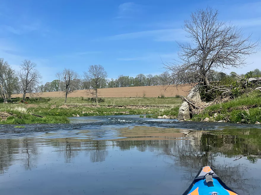
A guest review for a far upper leg of the Fever River. Highlights include many rock outcrops, but this is a shallow leg that can only be done in high water.
Read More...Bean Street to Hwy W
Date Paddled: June 24th, 2017
Distance: 8.0 miles
Time: 5 hours 21 minutes (4 hours would be more typical)
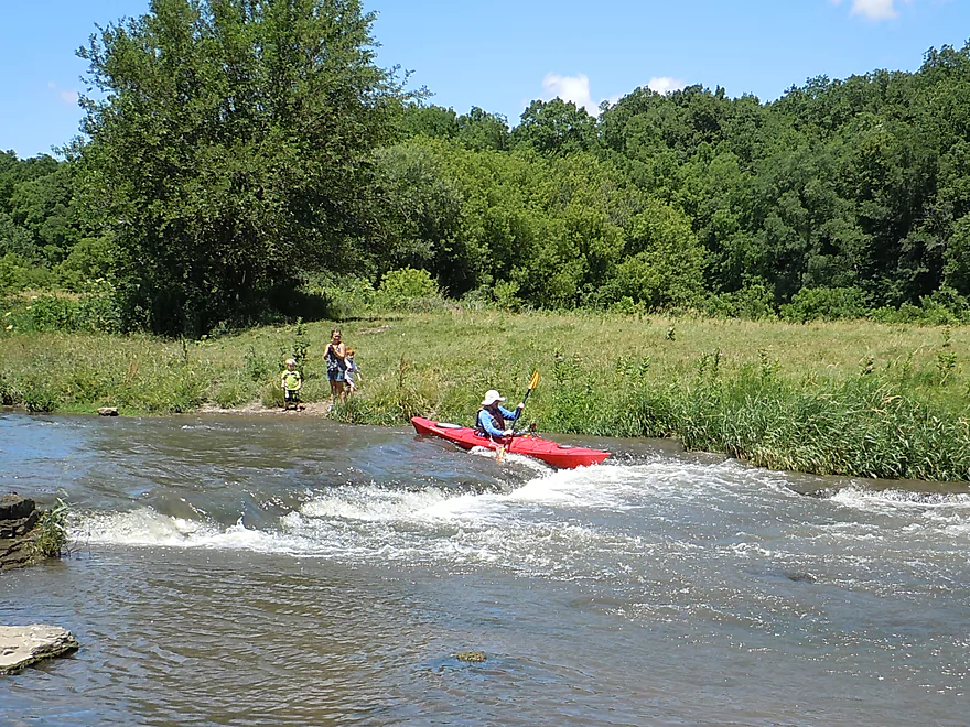
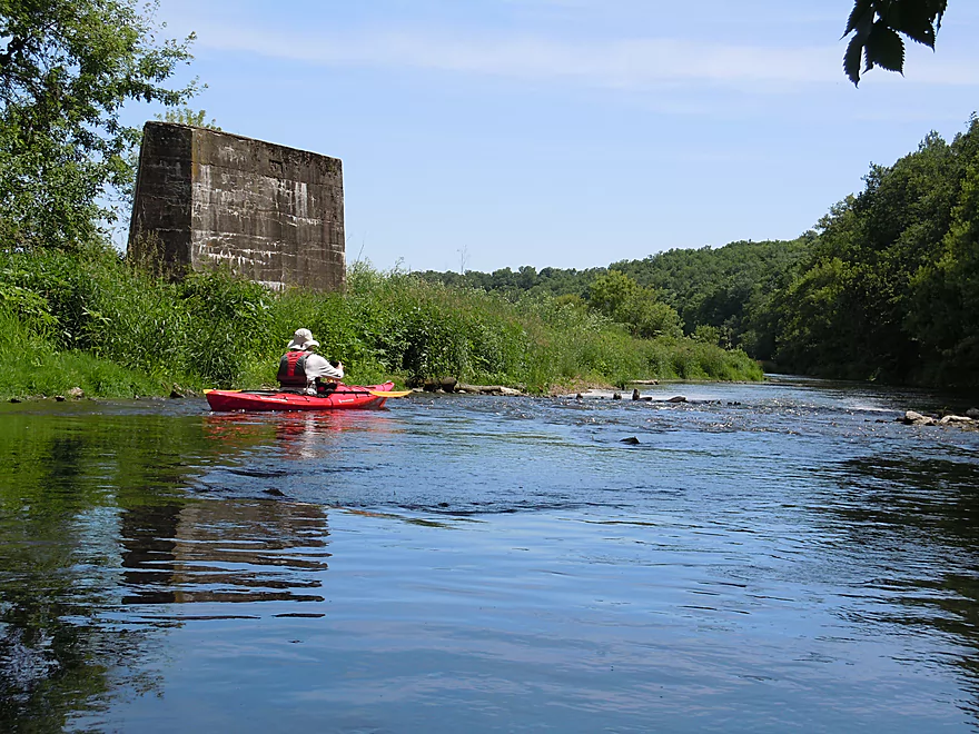
If you are willing to duck under a few fences, this section will reward you with amazing limestone outcrops and fun rapids.
Read More...Hwy W Park to Ensch Road
Date Paddled: June 14th, 2014
Distance: 6.2 Miles
Time: 5 hours 25 minutes (not representative)
The name of the river is confusing, because while originally named the Fever River, the state of Illinois (shamed to have a river named after smallpox) renamed it to the Galena River. This left mapmakers in Wisconsin confused…to this day. On the flip side, some old Galena residents in Illinois still refer to it as […]
Read More...Hwy W to Council Hill Rd Bridge
Date Paddled: May 7th, 2023
Distance: 11.8 miles
Time: 4.5 hours
A guest review for the Fever River that starts in one state and ends in another.
Read More...W. Buckhill Road to Galena Boat Landing
Date Paddled: August 26th, 2022
Distance: 5.0 miles
Time: Expect 2-3 hours
This trip is a mediocre paddle, but it ends with a bang in historic and attractive Galena.
Read More...Overview Map
Detailed Overview
- Upstream from Knee Deep Road: The creek is likely too small to run. Peter noted that Hwy H doesn't have a good access option.
- Knee Deep Road to Bean Street: 6.4 miles.
- Knee Deep Road to Twin Bridge Road: 1.3 miles. Creek is small and a bit congested. There will be 1-2 logjams, but also some outcrops.
- Twin Bridge Road to Bean Street: 5.1 miles. River widens noticeably after Twin Bridge Road. This is a shallow trip with good geology and many Class 1 rapids. There may be cow fences to deal with.
- Bean Street to Hwy W: 8.0 miles. Great section with limestone outcrops and many light rapids.
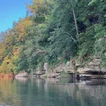
- Bean Street to Horse Shoe Bend: 2.2 miles. A five star section with open oak savannas, fun rapids including a one-foot ledge and a wonderful limestone wall north of Hwy 11. One fence to duck under which is low but manageable.
- Horse Shoe Bend to Bennett Road: 4.1 miles. You should be able to launch at Horse Shoe Bend no problem (public fishing area). This segment is not as interesting and a bit weedy and overgrown, but still fast and with a few really nice outcrops. One tricky fence to get under.
- Bennett Road to Hwy W: 1.8 miles. Bennett Road should be doable as a put-in (another fishing access). River really opens up after this bridge and is quite nice with more rapids and a few limestone outcrops.
- Hwy W to Scrabble Branch Bridge: 5.8 miles. A great section on the Fever with some cool tunnels. Note do NOT take out here or here, as the local rancher is concerned about kayaks causing erosion and you could be charged with trespass.
- Scrabble Branch Bridge to W. Council Hill Road: 5.5 miles.
- Buncombe Road to N. Birkbeck Road: 3.0 miles.
- N. Birkbeck Road to W. Council Hill Road: 2.5 miles. Put-in and take-out are likely very brushy and somewhat difficult (but think they are doable). Parking at W. Council Hill Road is a challenge.
- W. Council Hill Road to W. Buckhill Road: 4.4 miles. Both put-in and take-out are brushy with W. Buckhill being more feasible.
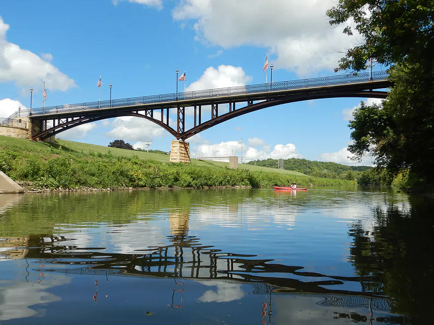
- W. Buckhill Road to Galena/Depot Park: 5.0 miles. This stretch starts interesting with good driftless scenery and riffles. Then it becomes slower and less interesting. The last part through historic Galena is very pleasant.
- Galena/Depot Park to Mouth/Gear's Ferry Landing on Mississippi River: 5.6 miles. On the Mississippi veer right and paddle upstream to reach the boat ramp. Motorboat traffic might be an issue.