
Putting in by Castle Rock Bait Shop
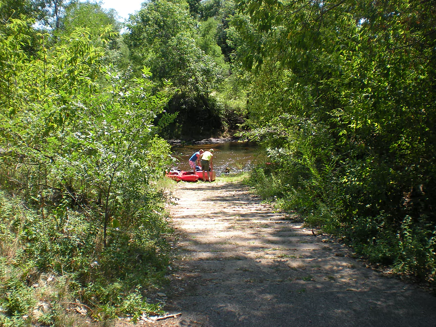
There is a special canoe launch at the south end
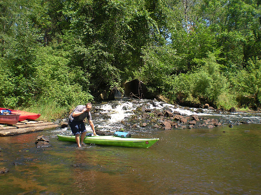
This creek actually comes from flowage seepage
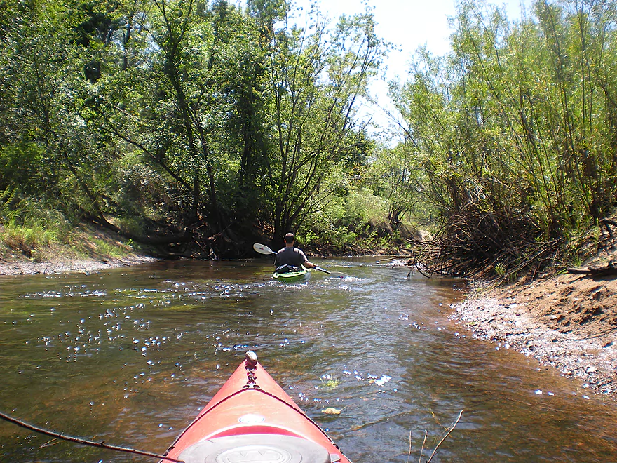
The creek is a fun little mini-paddle
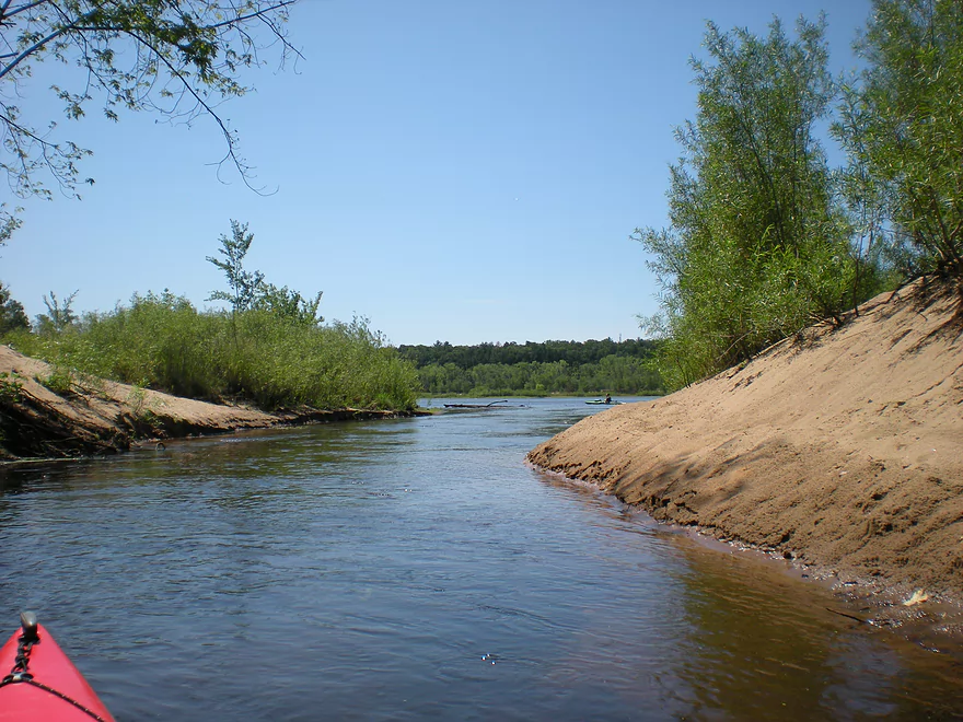
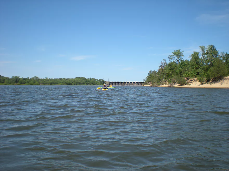
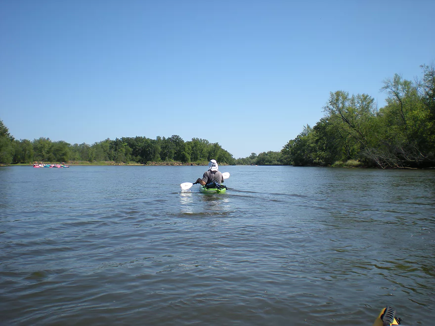
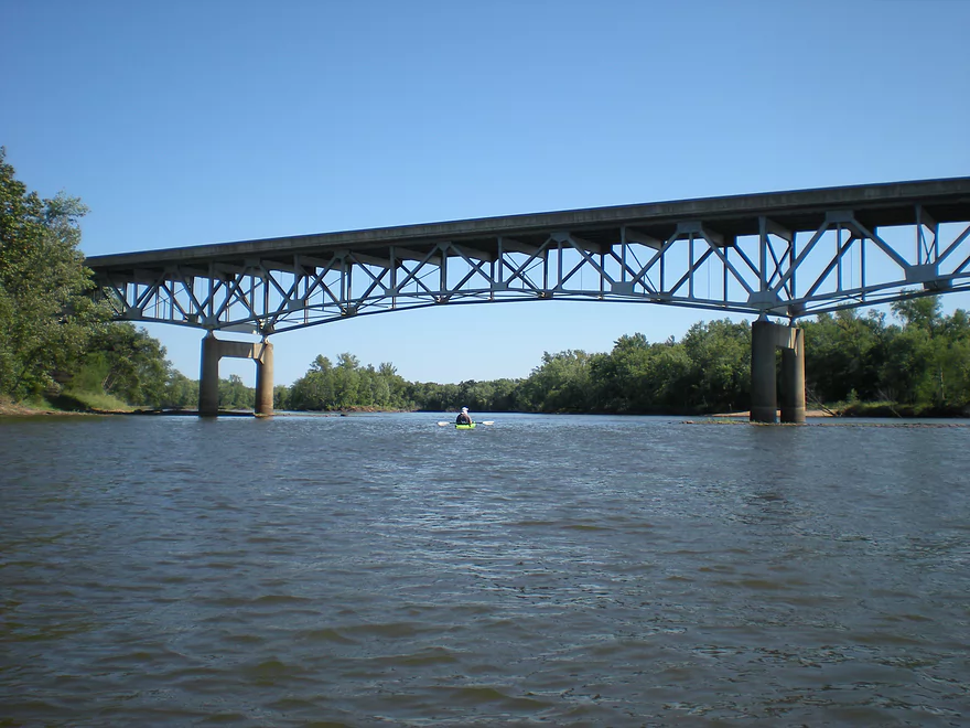
Out onto the Wisconsin River
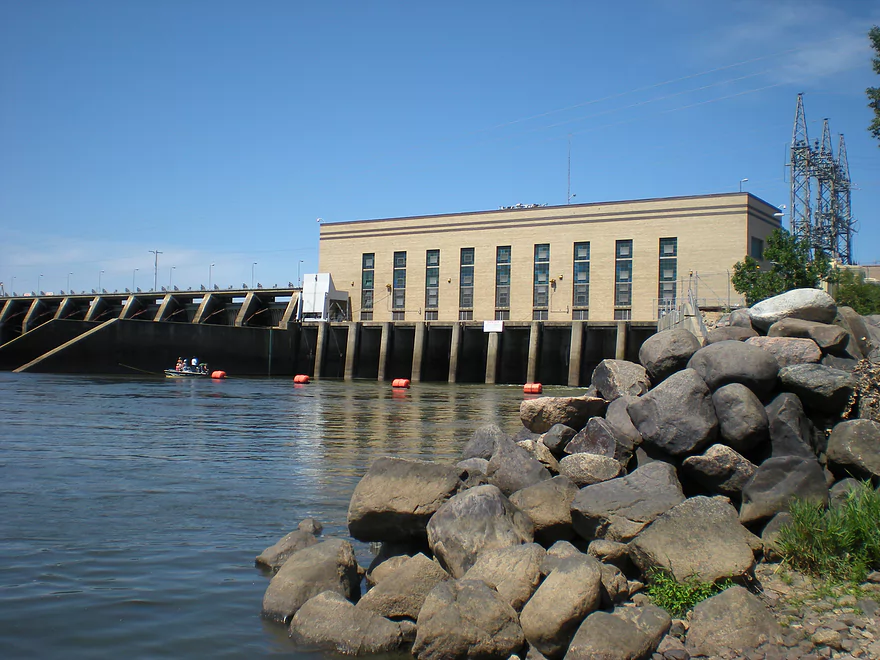
The Castle Rock powerhouse
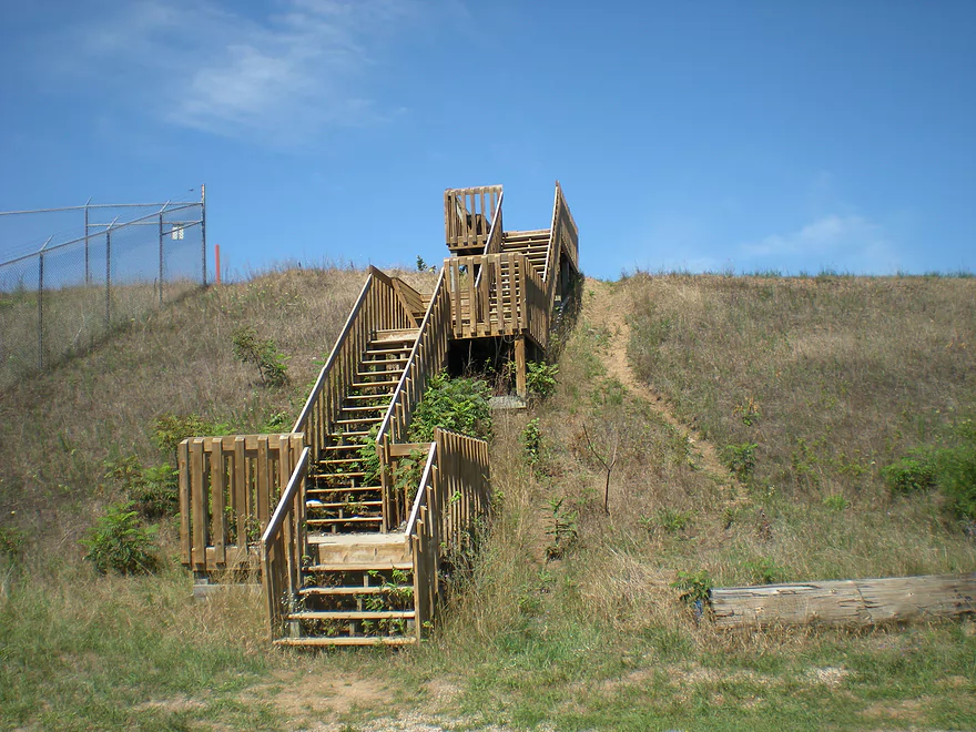
There is actually a trail that leads over the dam embankment
Where there is a portage path for padlers
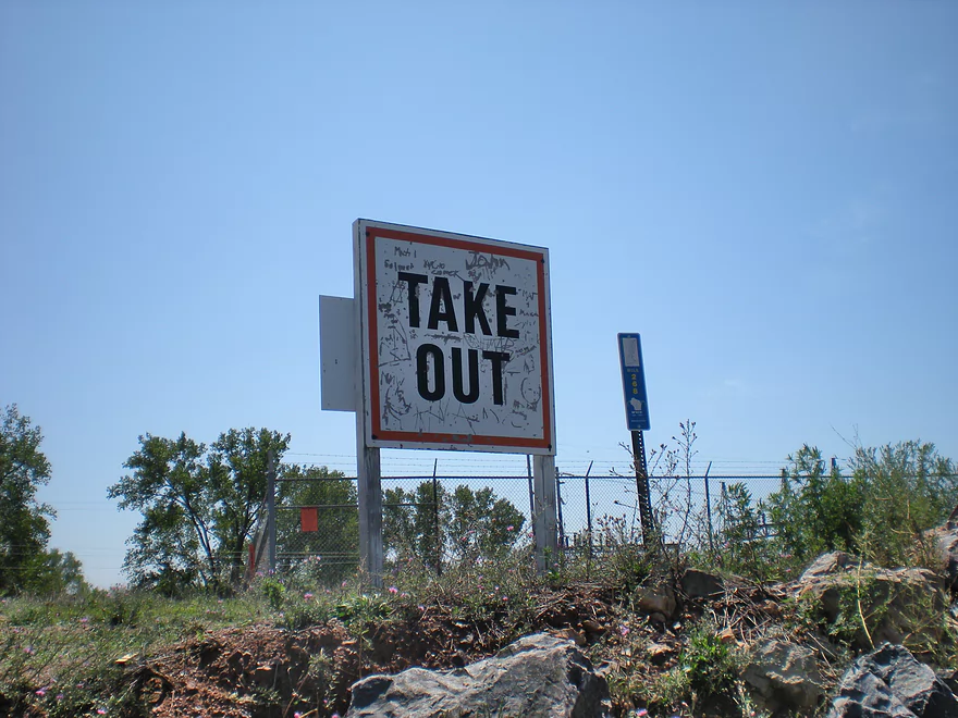
And a sign that marks this
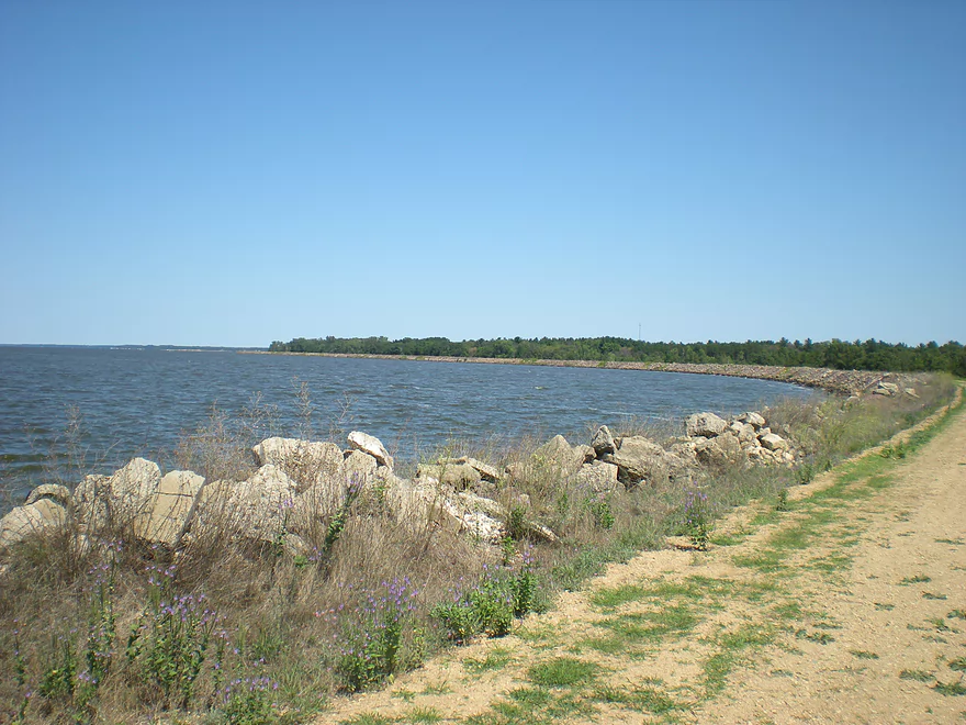
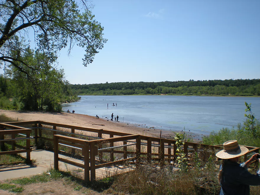
View of Castle Rock Lake
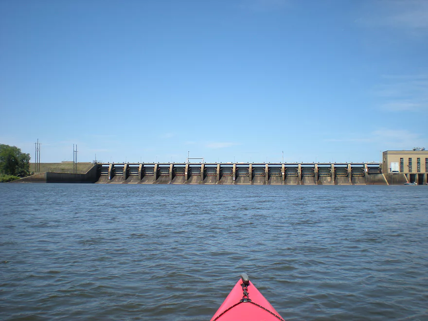
Back below the embankment…a main view of the dam
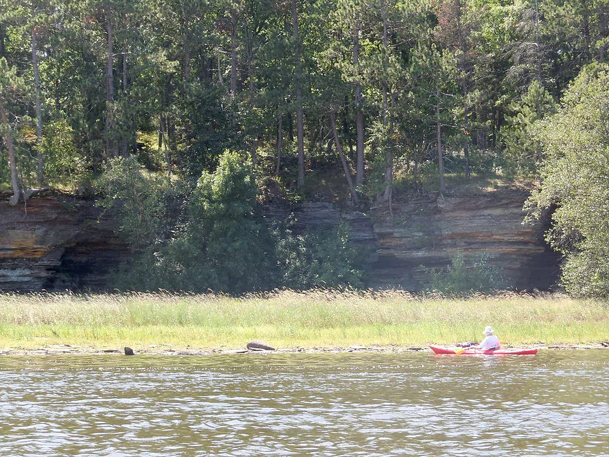
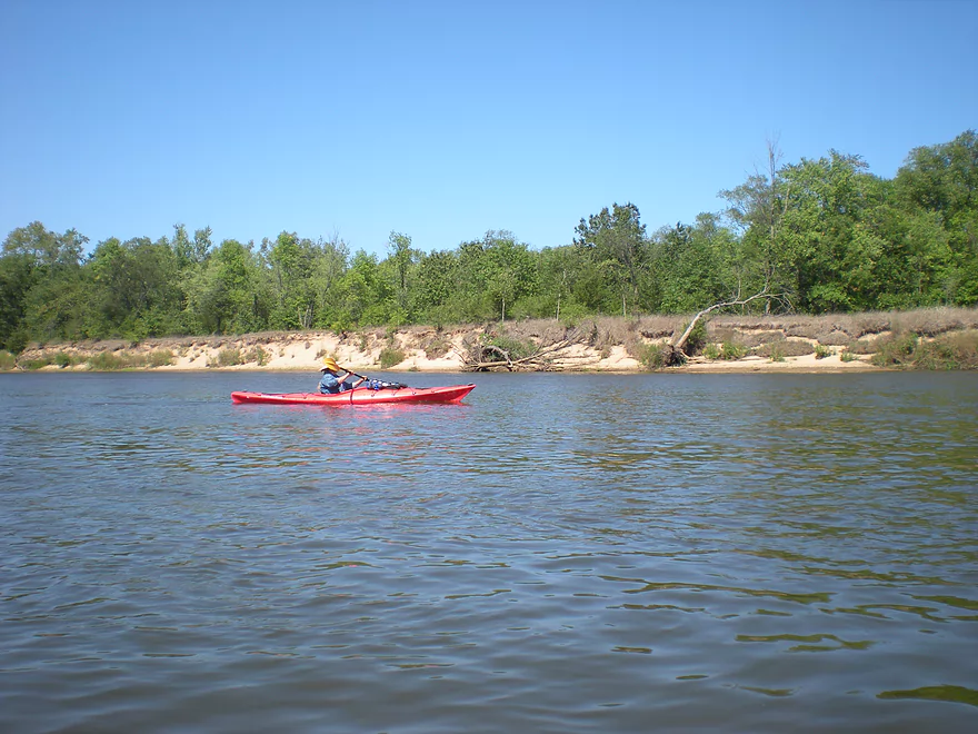
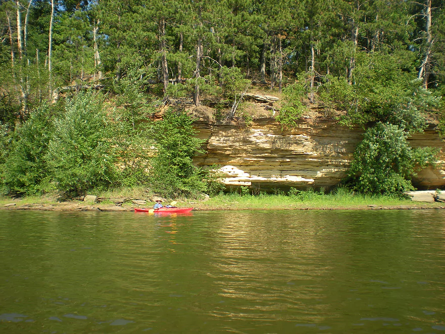
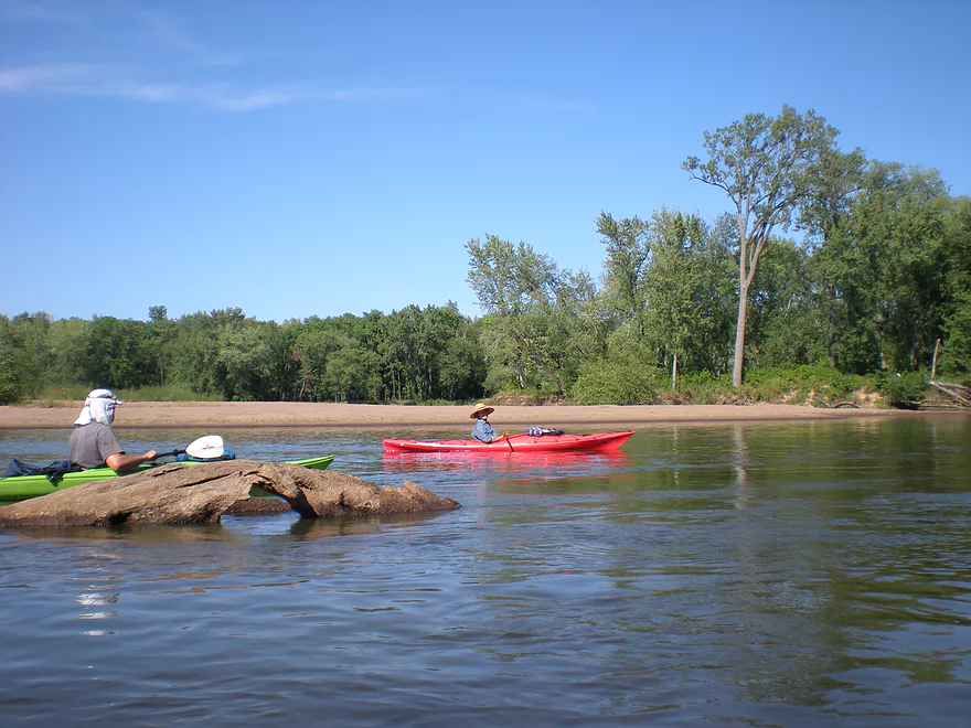
A small outcrop on the west bank
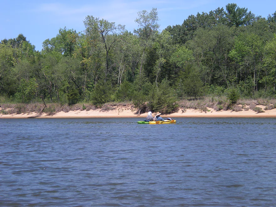
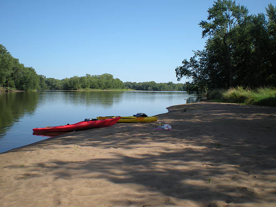
The shore was pretty sandy
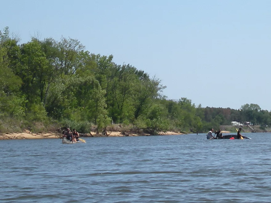
Their canoe flipped
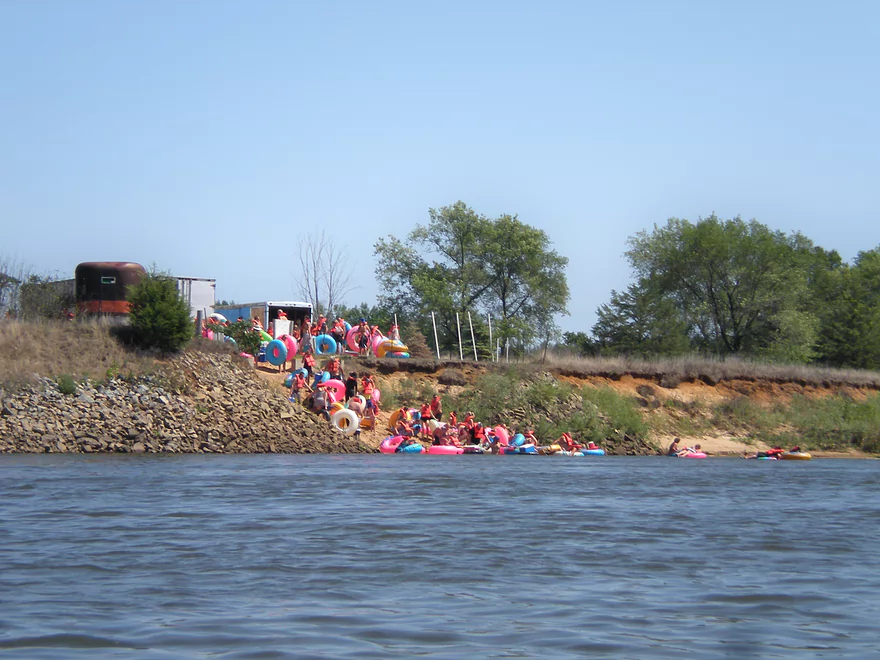
A hoard of tubers enter the river
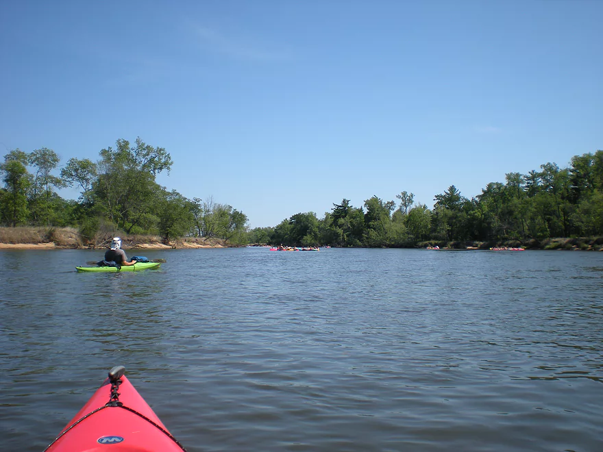
After that point, tubers were everywhere (and noisy)
Some nicer sandbanks
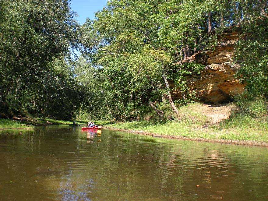
A hidden stream by Point Bluff
Reveals some nice outcrops
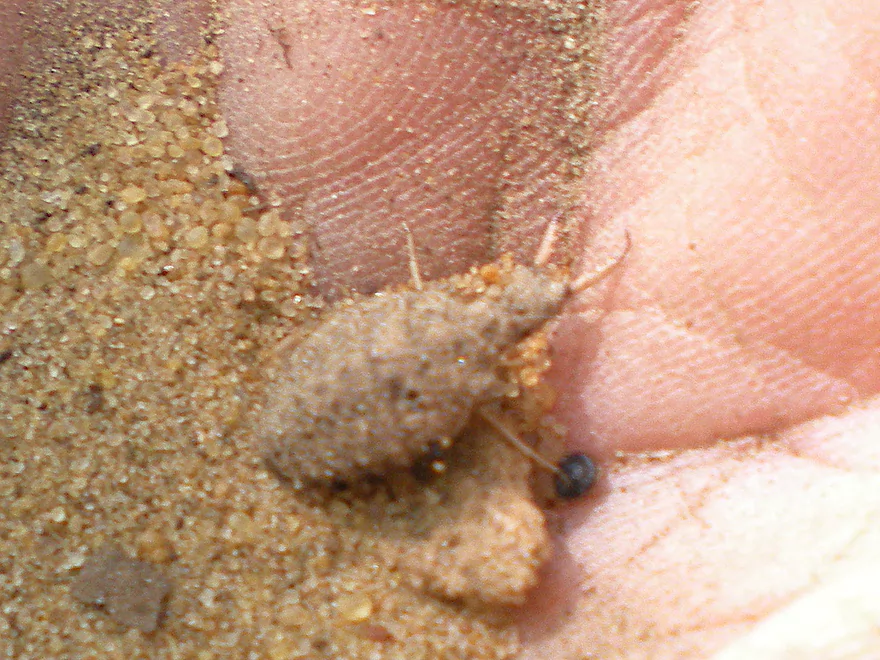
An antlion
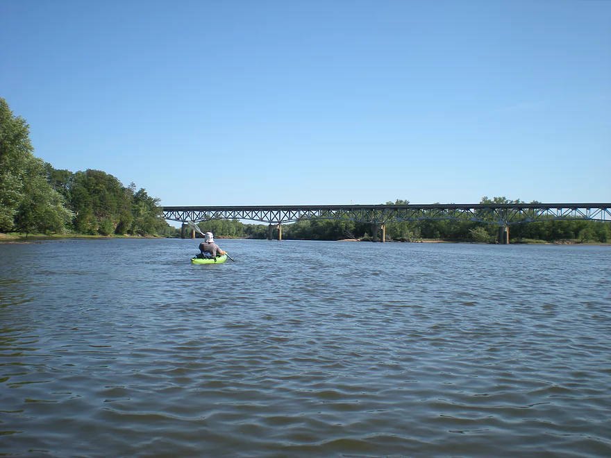
Coming up on Hwy 82
Where the tubers got out
Not pictured, but the river forks around a large island here
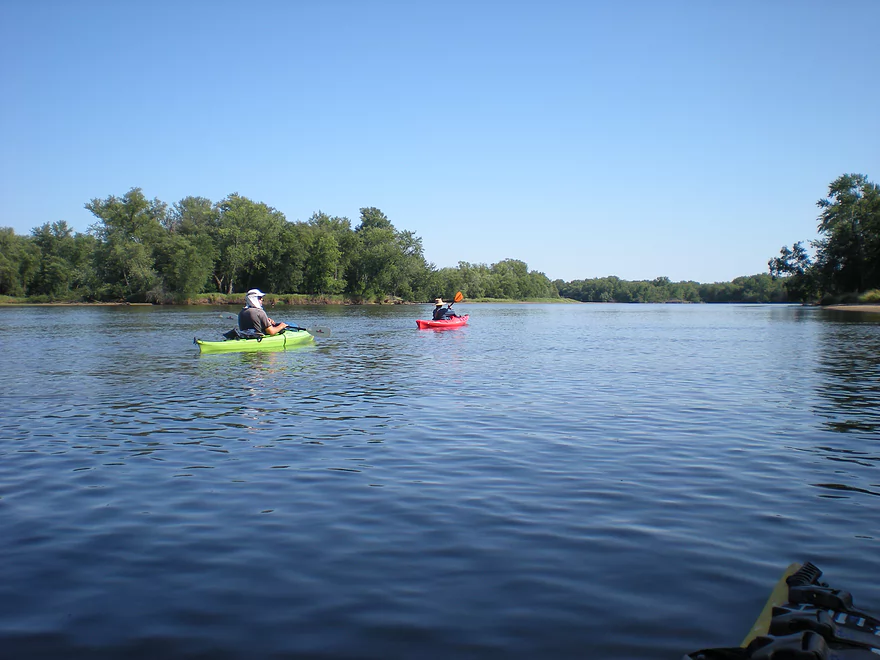
After Hwy 82, the sandbars were much nicer
Paddling the island channel
Taking a lunch break
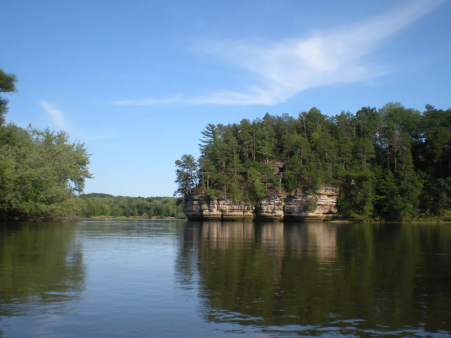
To the right is the mouth of the Lemonweir River
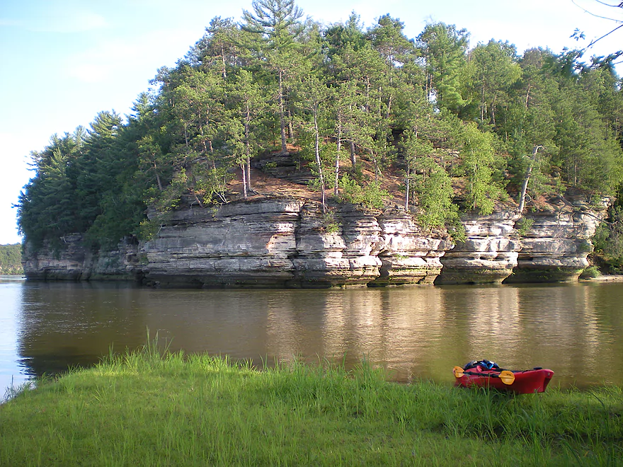
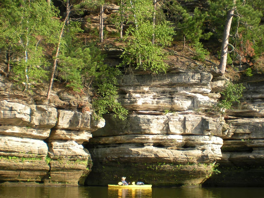
This is the unofficial start of the Dells
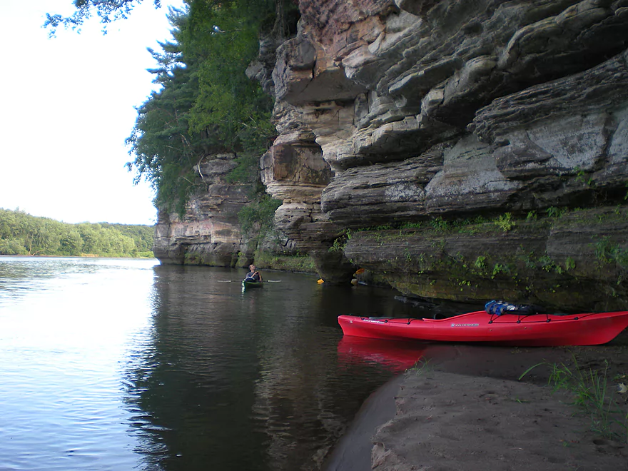
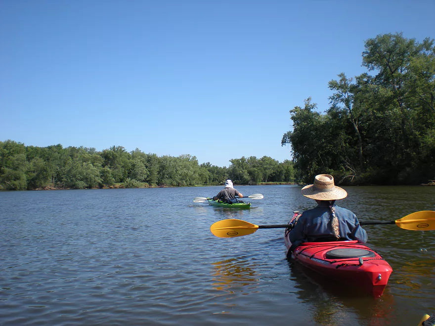
Very scenic
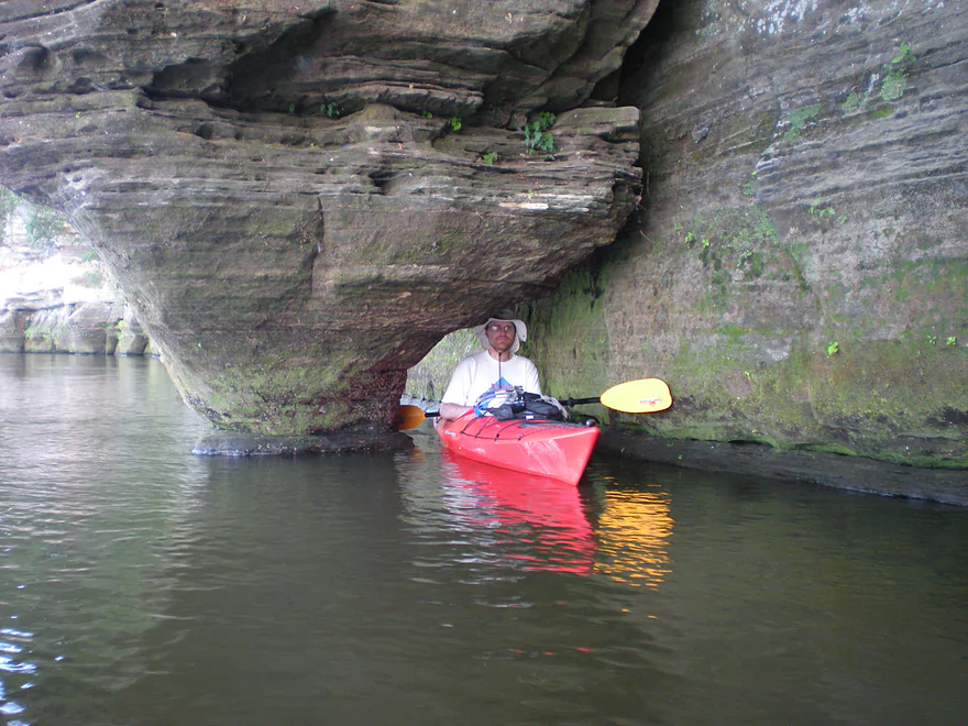
Even a small overhang that I fit under
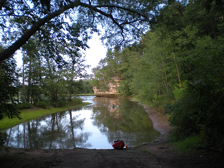
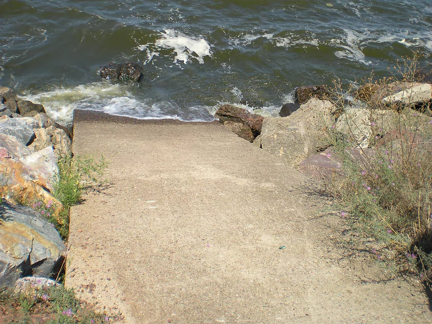
Two Rivers Landing was a fantastic take-out
Wisconsin River – Castle Rock

This is a tweener section of the Wisconsin River between the string of dams up-north (which makes those sections largely un-kayakable) and the Dells. While lacking the quantity of rock formations downstream, this is a pleasant section with mostly wooded banks, some development, and a number of sandbars and sloughs.
The start of this trip is at the Castle Rock Lake dam (not accessible from the west…see map). While most of this property seems to be owned by the power company and largely set aside for public use as an apology for their massive eminent domain use in the 40’s…the landing itself is apparently ‘private’ and costs three dollars per person. A person/troll lives in a bait-shop next to the landing and chases (literally) down cars as soon as they enter for their ‘shakedown fee’. There aren’t a lot of options outside of this landing. You could put in on the lake and portage the dam (see photo-gallery for the portage path)…but Castle Rock Lake can be pretty mean and many of the Castle Rock Lake landings charge even more than this racket. The only public landing (a very nice one) downstream is the Two Rivers landing, but that is at the end of the route. Back to the dam…there are two ‘ramps’. One is a main boat ramp…that I didn’t see kayakers use…and then there is ramp into a small creek that quickly feeds into the Wisconsin. This appears to collect water that seeps under the Castle Rock Lake dike. Very clean creek with a mini-waterfall, but quite cold. There is a bathroom at this landing if you need it.
After you get into the water, you probably won’t see that many power boaters (because, again, the lack of good public access). This is open water, so obviously you will want to monitor the wind direction and speed, and avoid a trip like this if you are paddling into a strong headwind. There is a decent amount of wildlife on this section. We saw turtles, eagles, and fish. While again…this isn’t like the Dells…there are occasional bluffs. The first you will see on the west bank soon after leaving the dam. There is, I believe, a famous ‘Castle Rock’ formation on the west bank that is not visible from the water but supposedly there is a walking path to it from the water, per Mike Svob. I never did find this.
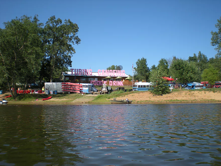
About three miles downstream, you’ll see one of Point Bluff’s put-ins on the east bank. This is primarily used for tubers. I believe they have another take-out on the east bank a few miles down…and then their main landing is 7 miles downstream from the dam. They are an option for rentals/shuttles/landings. If I remember correctly…they charge 45 dollars per shuttle/person (same if you have your own boat). To just use their landing, they charge five dollars per person (then, if you put in at the dam, you’ll pay the ‘dam master’ 3 dollars per person additionally). While the dam fee is unavoidable of sorts, a free downstream alternative to the private landing is the public Two Rivers Landing, which I recommend.
Getting back to the upstream part of the river… If you go on a weekend, you will probably see a ton of tubers on the water after the first Point Bluff. While it perhaps looks relaxing, this is not a good thing for kayakers. Most tubers are slow moving (which means you will encounter a lot of them), most are quite drunk, most are quite noisy, and they will use up the best sandbars. You will lose a certain percentage at Point Bluff’s west landing a few miles down…then all of them at Point Bluff resort itself. Just upstream from their landing, there is a cool rock formation on the east bank with a trail system that runs along the rock face. This is definitely worth exploring.
After Point Bluff, the remaining three miles to the Two Rivers landing (mouth of the Lemonweir) are quite pleasant, with few others on the river. There are plenty of islands and channels to zip around and decent sandbars to take a break on. Stay to your right and you’ll see a channel that leads to a massive rock formation (you can’t miss it, even if you take a left channel). This is unofficially the start of the Dells and is a cool formation to check out. On your right and a little upstream on the Lemonweir (it’s kind of hidey) will be the main landing. This landing is quite nice, with adequate parking and bathrooms and doesn’t cost anything. By taking out at Two Rivers instead of Point Bluff you extend the trip from 7 miles to 10 miles, but it is worth it IMO, as this is the best section of the river with a great bluff at the end.
Quick Overview
- Upstream of Stevens Point: I don't have information yet on these stretches.
- Stevens Point to Lake Petenwell: ~42 miles. This stretch in Central Wisconsin used to have many natural rapids, but most have been buried under 8 dams, some of which are now difficult portages. Despite this there is still some good paddling to be had in this region.
- Lake Petenwell: 14.9 miles. This is a large flowage lake that is challenging for paddlers because of frequent strong winds and big waves.
- Castle Rock Lake: 14.5 miles. Another large flowage lake that is likely too big for enjoyable paddling.
- Castle Rock Lake Dam to Lemonweir River: 9.4 miles. This pre-Dells leg isn't elite, but is a pleasant stretch.
- Lemonweir River to Indian Trails Landing: 21.7 miles. This includes the famous Upper Dells and Lower Dells which feature many scenic sandstone outcrops.
- Indian Trails Landing to Portage: 16 miles. This is an overlooked section sandwiched between the Dells and Portage. While the scenery isn't top-notch, it does have many sandbars and few people, which is a nice combination.
- Portage to Lake Wisconsin: 14.3 miles. This is a neat stretch of the river with many sandbars and cliffs, but the shoreline is very developed and motorboat traffic can be heavy on weekends.
- Lake Wisconsin: 14.5 miles. This is a challenging lake for paddling because of the huge and frequent waves created by motorboats.
- Prairie du Sac Dam to Port Andrews: 57 miles. This is the first half of the famous Lower Wisconsin Riverway. This is a super popular stretch for paddlers with the highlights being large sandbars, big bluffs, occasional cliffs, and fun side sloughs to explore.
- Port Andrews to Wyalusing: 40 miles. This is the second half of the Lower Wisconsin Riverway which has far fewer paddlers and sandbars. But the bluffs and sloughs are larger and more interesting.
Detailed Overview
- Upstream of Merrill: I don't have enough information yet on these legs to comment.
- Merrill Dam to Riverside Park: 0.5 miles. Might include some light rapids below the dam.
- Riverside Park in Merrill to Wisconsin River Forest Landing: 8.6 miles. A good prospect.
- Wisconsin River Forest Landing to Brokaw Boat Landing: 5.7 miles.
- Wisconsin River Forest Landing to Jesse Park: 1.4 miles. A terrific stretch with small boulder gardens, one set of Class 1-2 rapids, gravel bars and a nice sand bank.
- Jesse Park to Brokaw Boat Landing: 4.3 miles. A good stretch with scenic wooded banks and occasional gravel bars.
- Brokaw Boat Landing to Gilbert Park: 5.1 miles. River slows down and becomes hillier. This stretch is an ok prospect and goes past the old Brokaw paper plant that has been shut down. Paddlers must navigate Class 1 rapids and a 2' drop where the old Brokaw dam used to be.
- Gilbert Park to Wausau Boat Dock: 1.5 miles. An impounded stretch through Wausau. There are numerous alternate access options to choose from.
- Wausau Boat Dock to Oak Island Boat Ramp: 1.2 miles. A nice stretch that includes Barkers Island and Isle of Ferns Park. But the Wausau dam does require a portage. This stretch parallels the famous Wausau Whitewater Park.
- Oak Island Boat Ramp to Rothschild Dam Access: 5.8 miles. Likely mostly uninteresting flowage paddling. There are many alternate access options to choose from.
- Rothschild Dam Access to Zimpro Park: 1.0 miles. This might be a nice stretch.
- Zimpro Park to River Road Boat Landing: 7.6 miles. The first half of this leg is likely nice river paddling, but the second leg is probably just an uninteresting flowage.
- Chucks Landing/Mosinee Dam to Bean's Eddy Boat Landing: 2.8 miles. Likely a nice leg. You might be able to launch by the dam where there should be some nice rapids and boulders.
- Bean's Eddy Boat Landing to Seagull Boat Landing: 5.1 miles. Mostly uninteresting flowage paddling. Although there might be some nice sand banks on the eastern shore.
- Seagull Boat Landing to Dubay Dam Access: 5.3 miles. Mostly uninteresting flowage paddling.
- Dubay Dam Access to River Road Landing: 5.5 miles. This could be a nice stretch of river.
- River Road Landing to Old US 10 Landing: 2.3 miles. Likely an ok leg.
- Old US 10 Landing to Stevens Point Dam: 5.6 miles. Probably uninteresting flowage paddling. Many alternate access options closer to Stevens Point.
- Stevens Point Dam to Blue Heron Boat Landing: 4.2 miles.
- Steven Point Dam to Whiting Dam: 2.6 miles. Starts slow and uninteresting, but the river becomes very scenic after the Hwy HH bridge. The rock formations below both dams are very striking. Many alt access points.
- Whiting Dam to Kimberly Clark Dam/Al Tech Park: 0.6 miles. Incredible scenery with exposed bedrock and boulder gardens below the Whiting Dam. Some rapids, but nothing major. The Kimberly Clark Dam is a dangerous low-head dam and should be treated carefully.
- Kimberly Clark Dam to Blue Heron Landing: 1.0 miles. Class 2 rapids below the dam, but after that the river slows dramatically and splits into many sub-channels and islands. Round trips on this leg are possible. I chose the far western channel where there were some nice rocky stretches.
- Blue Heron Landing to Mill Creek Landing: 4.1 miles. Likely a mediocre paddle with nothing special. Galecke Park is an alternate access.
- Mill Creek Landing to Biron Dam North Gate: 7.6 miles. Mostly uninteresting flowage paddling. Several alternate access options on route.
- Biron Dam North Gate to Veteran's Memorial Park: 4.5 miles.
- Biron Dam North Gate to Biron Landing: 1.0 miles. Super scenic stretch by two islands with many granite boulders.
- Biron Landing to Legion Park: 3.0 miles. A nice stretch by Big Island. The west channel is more undeveloped...but the east channel has several scenic granite islands.
- Portage through Legion Park: 680'. A steep wall separates the park from the river but in two locations the wall is short enough to get over (see map). Paddlers may want to consider a longer portage to bypass some of the shallow rocky stretches by Legion Park.
- Legion Park to Veteran's Memorial Park: 0.4 miles. A scenic stretch that features a large boulder field and the powerhouse for a large paper mill.
- Veteran's Memorial Park to Port Edwards Landing: 3.8 miles
- Veteran's Memorial Park to Demitz Park: 0.8 miles. A pleasant stretch that includes Belle Island.
- Demitz Park to Ben Hansen Park: 1.2 miles. This leg goes by Garrison Island and Edwards Island. Lyon Park is located across the river from Demitz Park and is another access option.
- Ben Hansen Park to Port Edwards Landing: 1.8 miles. Above the Centralia dam there are several small but nice islands. Portage the dam on the left bank (follow the 1000' trail through the golf course). Below the dam there are scenic rock formations. Close to the Port Edwards dam are a few more scenic islands you can explore.
- Port Edwards Landing to Nekoosa/Riverside Park: 3.6 miles.
- Port Edwards Landing to Port Edwards Powerhouse: 1.3 miles. A half-mile portage is required (east bank). A very scenic boulder field is located below the dam. At high levels, the rocks are submerged and produce a half-mile stretch of rapids (some strong).
- Powerhouse to Moccasin Creek Landing: 1.8 miles. A generic wooded stretch that isn't super interesting.
- Moccasin Creek Landing to Riverside Park: 0.5 miles. During the Nekoosa dam drawdown, this stretch had nice boulder fields and rapids.
- Riverside Park to Hwy 73: 0.8 miles. An ok stretch of the river. There are scenic cliffs south of Hwy 73, but these are past the dam warning line. Hwy 73 is not a good access option.
- Hwy 73 to Point Basse Ave (Portage of the Nekoosa Dam): 1.5 miles. A difficult 1.5 mile portage through downtown Nekoosa. Don't try to portage the south bank. There is a steep hill, cliffs, and large Domtar paper mill fences to deal with.
- Point Basse Ave to Jim Freeman Memorial Boat Landing: 0.8 miles. A generic stretch going by historic Point Basse. If you're willing to backtrack to the dam, you can see scenic boulder fields (during low flows) and a few cliffs. Point Basse Ave is a somewhat speculative access, but it seems public and doable for launching.
- Jim Freeman Memorial Boat Landing to Plank Hill Small Boat Access: 2.0 miles. A generic stretch.
- Plank Hill Small Boat Access to 19th Drive Landing: 5.3 miles. Features two epic sand banks. The main channel has some minor sandbars. Several of the side sloughs can provide fun side adventures.
- 19th Drive to the Petenwell Dam: 14.9 miles. This is Lake Petenwell which is a large and challenging lake for paddling. Waves and strong winds are frequently an issue. But when calm there are nice sandbanks on the northwest shore, hidden sloughs, and large islands to explore. See the overview map for more info.
- Petenwell Dam to Ganter Lane Landing: 3.8 miles. This stretch isn't too impacted by dams and may have nice sandbars at low levels.
- Ganter Lane Landing to Castle Rock Lake Dam: 10.7 miles. Castle Rock Lake is likely too big (wind/waves) for enjoyable paddling. There are many alternate launch options along the shore.
- Castle Rock Lake to the Lemonweir River: 10 miles. An ok section.
- Lemonweir River Mouth to River Bay Landing: 7 miles. The first half of the classic Upper Dells.
- River Bay Landing to Blackhawk Island: 6.5 miles. Second half of the classic Upper Dells, known for its fantastic outcrops. Note, the Blackhawk Island landing is no longer accessible without special permission from the Upham Woods Outdoor Learning Center.
- Black Hawk Island to Wisconsin Dells Dam: 2.0 miles. More nice sandstone outcrops. You can take out at a public ramp off Indiana Ave or portage the dam and take out SW of the dam by a launch off Wisconsin Dells Pkwy/Hwy 12.
- Dells Dam to Indian Trails Landing: 6.2 miles.
- Dells Dam to Newport Park: 2.2 miles. This is the heart of the famous Lower Dells with many scenic outcrops. Unfortunately jet boats are a serious plague on this stretch.
- Newport Park to Indian Trails Landing: 4.0 miles. Features the famous "Sugar Bowl" formation and four super cool caves. The outcrops soon disappear and this stretch is mostly uneventful (but peaceful) big river paddling.
- Indian Trails Landing to Pine Island Boat Ramp: 9.8 miles. Few paddle this stretch as it isn't as interesting. But...it does have a good concentration of sandbars and few competing paddlers for them.
- Pine Island Boat Ramp to Portage/Hwy 33 Access: 6.0 miles. Not an elite section that is lacking in cliffs and bluffs. It does have good sandbars though.
- Portage to Dekorra Park: 7.7 miles
- Portage to Baraboo River/Thunderbird Road: 5.2 miles. A good section with great sandbars. Close to Portage there are few motorboats.
- Baraboo River to Dekorra Park: 2.5 miles. River splits around massive Lib Cross Island. West channel has nice sandbars. St Lawrence Bluff has scenic sandstone outcrops and includes a cave you can paddle into.
- Dekorra Park to James Whalen Memorial Park: 6.6 miles.
- Dekorra Park to Camp Rest Park: 5.1 miles. A terrific section with rock outcrops, large island deltas, hidden sloughs, and nice sandbars. Unfortunately this part of the river is popular with motorboats and jet skis which can be a plague. Multiple alternate access options.
- Camp Rest Park to James Whalen Memorial Park: 1.5 miles. Not a great section because of the open water paddling, powerboats and big waves. The west shore though does have nice outcrops.
- James Whalen Memorial Park to Merrimac Memorial Park: 4.4 miles. River turns into "Lake Wisconsin". Generally speaking this isn't ideal for kayaking as motorboat traffic can be heavy and waves can be surprisingly big. The most direct route is the north shore which has a few bluffs, but generally speaking isn't that interesting.
- Merrimac Memorial Park to Veterans Memorial Park/Prairie du Sac: 9.6 miles.
- Merrimac Memorial Park to Moon Valley Landing: 3.3 miles. Includes a lot of developed shoreline. The ferry, railroad bridge, and Moon Bay are highlights.
- Moon Valley Landing to Veterans Memorial Park/Prairie du Sac: 6.3 miles. Other than Moon Bay and the dam, this is a boring stretch. There are numerous alt access options on this route.
- Prairie du Sac to Mazomanie: 8 miles. An ok section of the Wisconsin but lacking in sandbars.
- Mazomanie to Arena: 9.7 miles. A great section with nice sandbars and scenic bluffs.
- Arena to Hwy 14: 8.0 miles. Good section with a high concentration of sandbars. One of the more popular legs on the Lower Wisconsin.
- Hwy 14 to Hwy 23/Spring Green: 2.2 miles. Neat mini-section with sandstone outcrops. Very popular in the summer.
- Spring Green to Lone Rock: 7.4 miles. Another fine sandbar/bluff section with some nice rock outcrops too.
- Lone Rock to Gotham: 8 miles. This stretch has super impressive rock outcrops and sand banks.
- Gotham to Muscoda: 7.6 miles. This leg includes more large sandbars and great outcrops. Bonus highlights include fast current and not seeing as many people.
- Muscoda to Port Andrew: 7 miles. A good stretch with many islands and sandbars.
- Port Andrew to Boscobel: 9 miles. Wooded islands start to get massive.
- Boscobel to Woodman/Big Green River: 9 miles and start of the less paddled stretch of the Lower Wisconsin. Far fewer sandbars from here to the mouth, but good bluffs and side sloughs to explore.
- Woodman to Millville: 7.7 miles. A good stretch with large bluffs and sandbars.
- Millville to Bridgeport: 5.3 miles. Huge islands, bluffs and sandbars are the highlight on this second-to-last leg on the Wisconsin River.
Bridgeport to Wyalusing (the mouth): 9 miles.
Trip Map
View Wisconsin River - Castle Rock in a larger map
Overview Map
Photos Size:
When was this trip taken? Curious if the troll is still collecting his toll?
It was done in 2012, and I’m fairly certain he is still there. It is an unfortunate situation because of the lack of public public access points on the Wisconsin River here until you get to the Lemonweir River. I suppose you could launch from the lake and portage the dam, but I’m not sure that would be fun.
I can tell you exactly how to find the Castle Rock formation, and yes, there is a path! I walk around it very often, as it is located at the campground where I have my permanent site. I’ve seen Eagles, Great Blue Herons, Deer, turtles, snakes, otters, and more. There’s even a few wolves that live up on “The Rock”…even a family of coyotes nearby that I often hear at night!
Thanks for the info Karen! I might have to take you up on your offer. By chance, do you know if though if the public can access the rock or would they have to get permission from the campsite or a camper?
How is the fishing on this part of the river for smallmouth and pike?
I honestly don’t know. I will say that most of the fishermen we saw were below the dam…so I assume if there is good fishing it is there.
The bait shop has lovely new owners as of March 2021. They are required by the power company to collect a $5 launch fee. They operate on the honor system and will not “chase you down” for payment but may leave a note on your reminding you to pay if you launch without doing so. They are very concerned about upkeep of the property and walk it daily to collect litter left behind by those less considerate.
Thanks for the update!