Yahara River
The Yahara is a mediocre paddling river, but it is very popular because of its proximity to Madison. It does have one elite water trail though and that is through the community of Deforest. This is a fantastic leg, but often it is too low for paddling.
Trip Reports
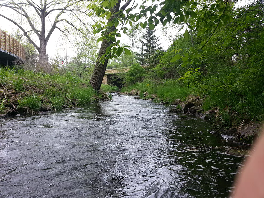
Veteran's Memorial Park to Sunfish Pond
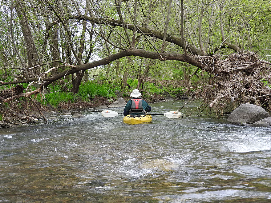
Date Paddled: May 11th, 2019
Distance: 5.7 miles
Time: 6 hours 39 minutes (2.5 hours would be more typical)
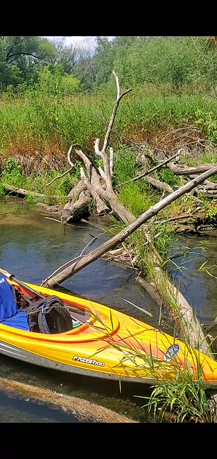
Located north of Lake Mendota by DeForest, the Upper Yahara River is no more than a creek...but a fun creek at that with great wildlife, clarity, boulder gardens, rapids and other surprises. This might be the best paddle in all of Dane County.
Read More...Veteran's Memorial Park to Sunfish Pond
Date Paddled: May 11th, 2016
Distance: 5.7 Miles
Time: 2 hours
A guest review for a great section of the Yahara River near Deforest. Small, fast, and winding this is a good prospect to try when other nearby rivers and creeks are too high.
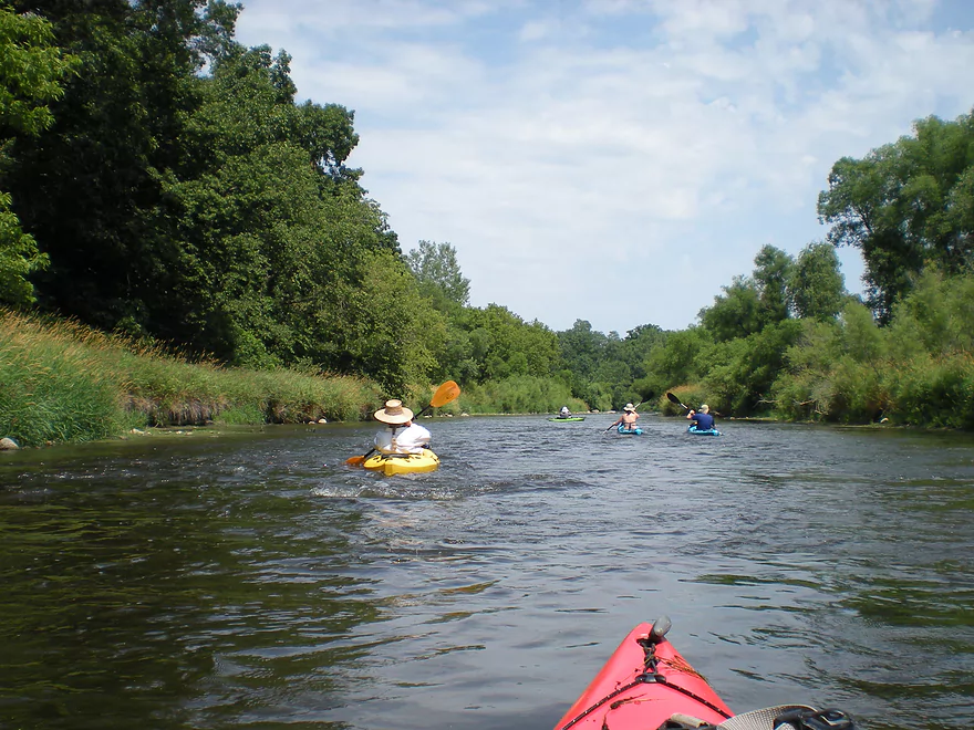
Read More...Highway 19 to Cherokee Marsh
Date Paddled: July 4th, 2023
Distance: 5.4 miles
Time: 4.5 hours
A guest review (and warning) for the Yahara River just upstream from Lake Mendota.
Read More...Hwy N to W. Stebbinsville Rd
Date Paddled: October 17th, 2021
Distance: 4.8 miles
Time: Expect 2+ hours
This is one of the nicer water trails south of Madison. Highlights include some light riffles and scenic boulder gardens.
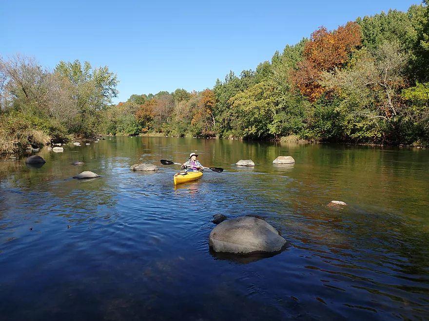
Read More...Viking County Park in Stoughton to Stebbinsville Dam Road
Date Paddled: August 25th, 2018
Distance: 10.2 miles
Time: 3 hours 30 minutes
A guest review for the Lower Yahara River near Stoughton. Done during high water, pollution was an issue. While having interesting parts, this trip did require two dam portages and did have some wide monotonous sections.
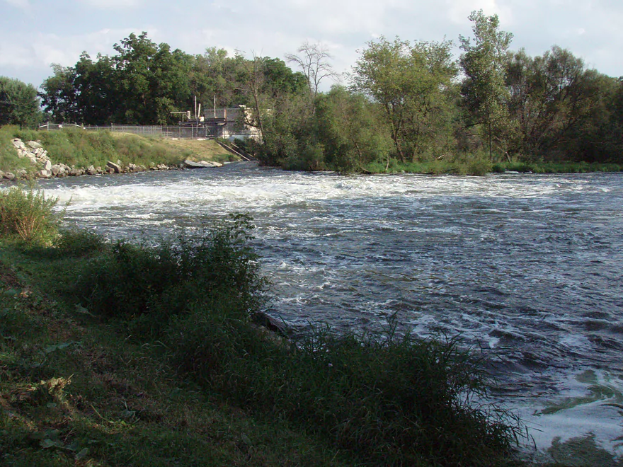
Read More...W Stebbinsville Rd to Murwin Park
Date Paddled: July 7th, 2012
Distance: 6.2 Miles
Time: Roughly 3 hours
Originating from a chain of lakes in the Madison area, the Yahara is very popular with locals. It’s not a super long river and has a number of dams, so there aren’t that many navigable areas before it reaches the Rock River. The most popular section is from the site of the old Stebbinsville Dam […]
Read More...Overview Map
Detailed Overview
- Hwy 51 to E. Yahara Road: 1.4 miles. Very small and channelized, it seems open but there might be some snags here.
- Yahara Road to Veterans Park (DeForest): 1.6 miles. Very wooded so good chance of jams if not cleared out.
- Veterans Park to Windsor Road/Sunfish Pond: 5.7 miles. A small but fast stretch that has become popular in recent years.
- Windsor Road to Linden Drive/I90: 1.5 miles. An interesting section through a golf course. Linden Drive access is privately owned by the golf course.
- Linden Drive to Hwy 19: 1.3 miles. There are too many logjams to recommend this.
- Hwy 19 to Cherokee Park: 4.5 miles including 1.8 miles of lake paddling. There are too many logjams downstream of Hwy 19 to recommend that as a put-in.
- Cherokee Park to Tenney Park (aka Lake Mendota): 7.6 miles. A nice lake but really too big and exposed for most paddlers.
- Tenney Canal and Locks to Morrison Park: 1.3 miles. A fun experience. A canal fee might be required.
- Morrison Park to Paunack Park (Lake Monona): 2.6 miles. Mostly too big and busy to paddle, paddlers still do so and enjoy scenic vistas of the downtown.
- Paunack Park to Babcock Park (Lake Waubesa): 4.2 miles. Probably too much flatwater to be interesting.
- Babcock Park to Fish Camp Park (Mud Lake): 4.1 miles. Wide and flat. Probably uninteresting.
- Fish Camp Road to La Follette Park (Lake Kegonsa): 2.4 miles. Probably uninteresting lake paddling.
- La Follette Park to Viking County Park: 3.5 miles. Finally back to river paddling! An ok prospect, but slow and big.
- Viking County Park to Dunkirk/Hwy N1st Bridge: 5.2 miles.
- Viking County Park to Riverside Drive Park (Stoughton): 2.1 miles. A flowage paddle through downtown Stoughton.
- Riverside Drive Park to the Dunkirk Dam: 3.1 miles. A small flowage that is ok but nothing special.
- Dunkirk/Hwy N1st Bridge to W. Stebbinsville Rd: 4.8 miles.
- Dunkirk to Hwy N2nd Bridge: 2.5 miles. A good stretch that starts a bit slow, but speeds up and contains a number of large scenic boulder gardens.
- Hwy N2nd Bridge to W. Stebbinsville Rd: 2.3 miles. A scenic rocky stretch flowing through glacial outwash.
- Stebbinsville Rd to Murwin Park: 6.2 miles.
- Stebbinsville Rd to Hwy 59: 2.1 miles. This is the last super stretch of the Lower Yahara. After Badfish Creek joins up, the river becomes much larger and less interesting.
- Hwy 59 to Murwin Park: 4.4 miles. While not as scenic as upstream legs, this is still a solid stretch and popular with paddlers.
- Murwin Park to the Rock River: 2.8 miles. Final stretch on the Yahara and then a short leg on the Rock River. Probably ok, but nothing special.
Many of Yahara's tributaries are navigable as well.
- Badfish Creek - A classic! One of the better paddles in Southern Wisconsin.
- Token Creek - A surprisingly nice creek located northeast of Madison.
- Nine Springs Creek - An underrated prospect located west of Lake Monona that has some attractive springs.
- Six Mile Creek
- Upper Six Mile Creek - Congested in spots, this is still a really neat paddle with character you don't expect from Southern Wisconsin.
- Lower Six Mile Creek - Recently cleared of logjams, this is a varied paddle that includes both dense woods and open marshland.
- Starkweather Creek - A slow urban paddle, but interesting because of its bridges and Olbrich Gardens.
- Pheasant Branch Creek - Located northwest of Madison, this is a short trip but has some spectacular springs.
- Wingra Creek - A short urban paddle west of the Isthmus that might be fun.
- Dorn Creek - A possible prospect west of Madison that would require a lot of water.
- Seven Mile Creek - West of Lake Monona, I've heard this is a pleasant paddle.
- Swan Creek - Possible prospect but short (south of Lake Waubesa)
- Murphy Creek - Interesting wetland prospect but access on the upstream sections looks tricky (south of Lake Waubesa)
- Door Creek - Small, slow and channelized but might be ok. Has had recent cleanup work on it from I believe Hwy MN.