
The initial plan was to put in at Firemans Park
Then continue downstream to Marinuka Lake
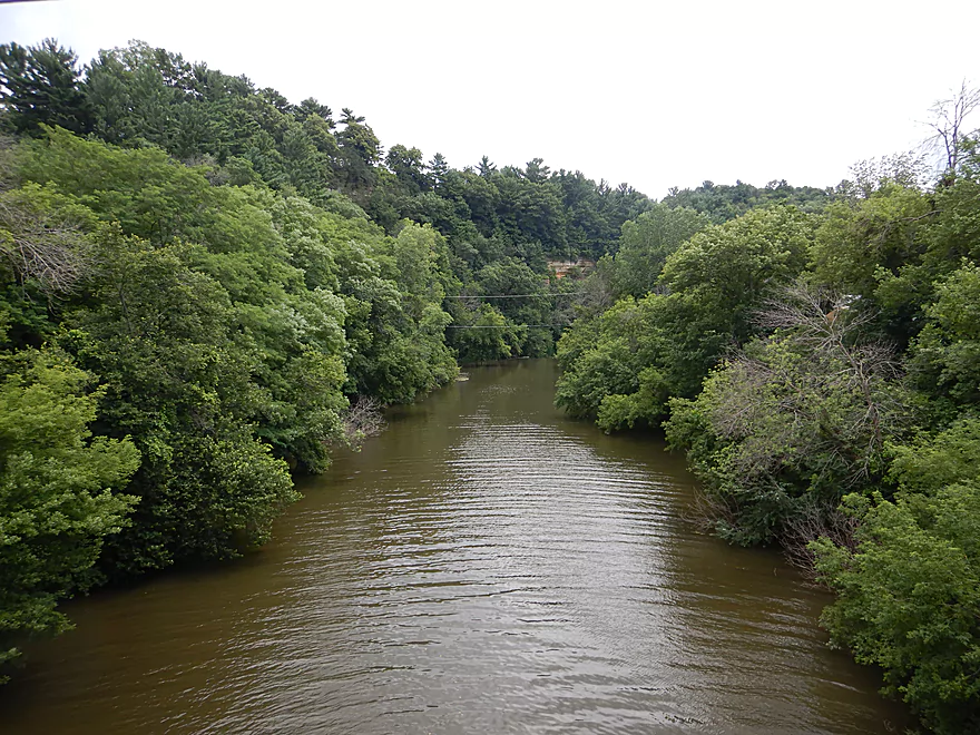
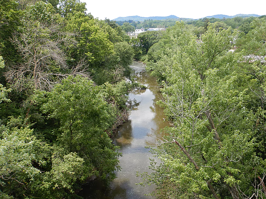
Then pass under N. Main Street and into the main gorge
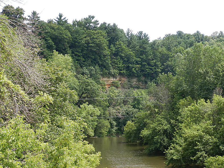
Where there is a 150 foot cliff
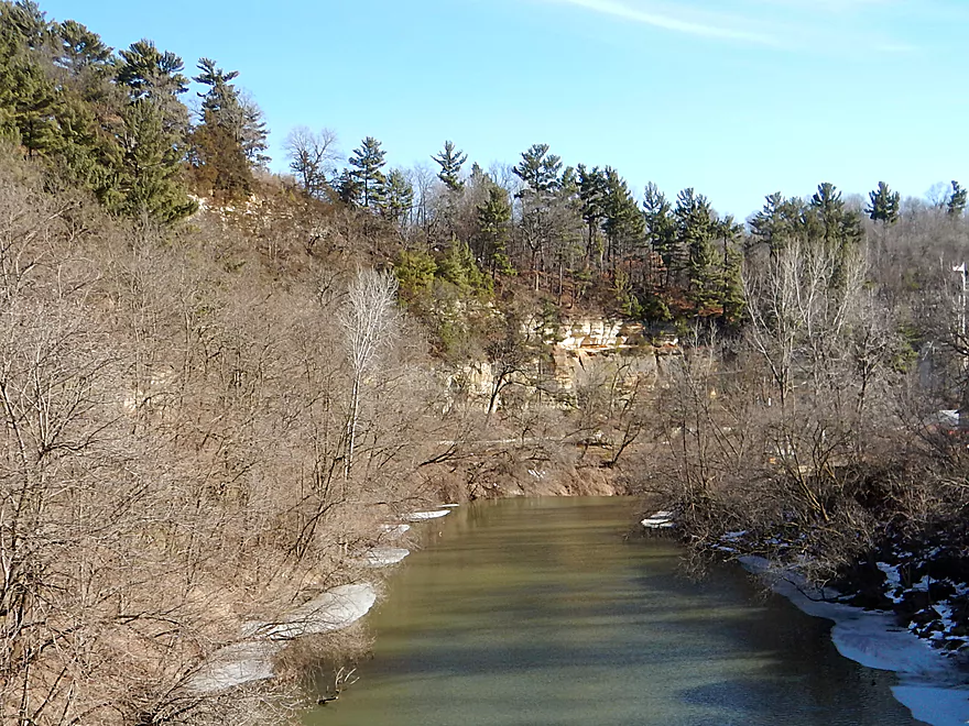
That is much more scenic in the winter
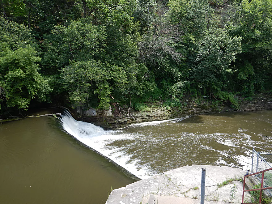
Then to portage the main dam
But portaging was not an option
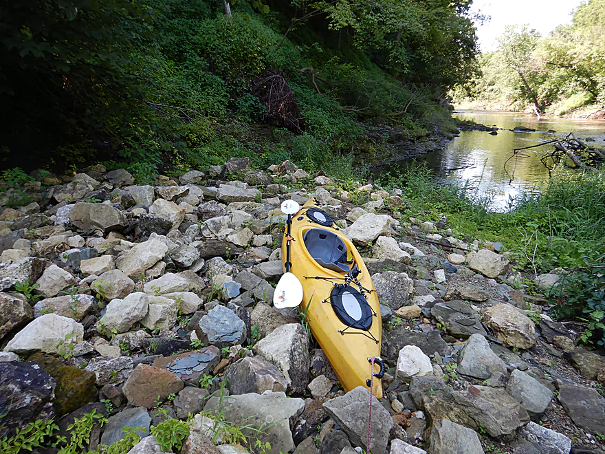
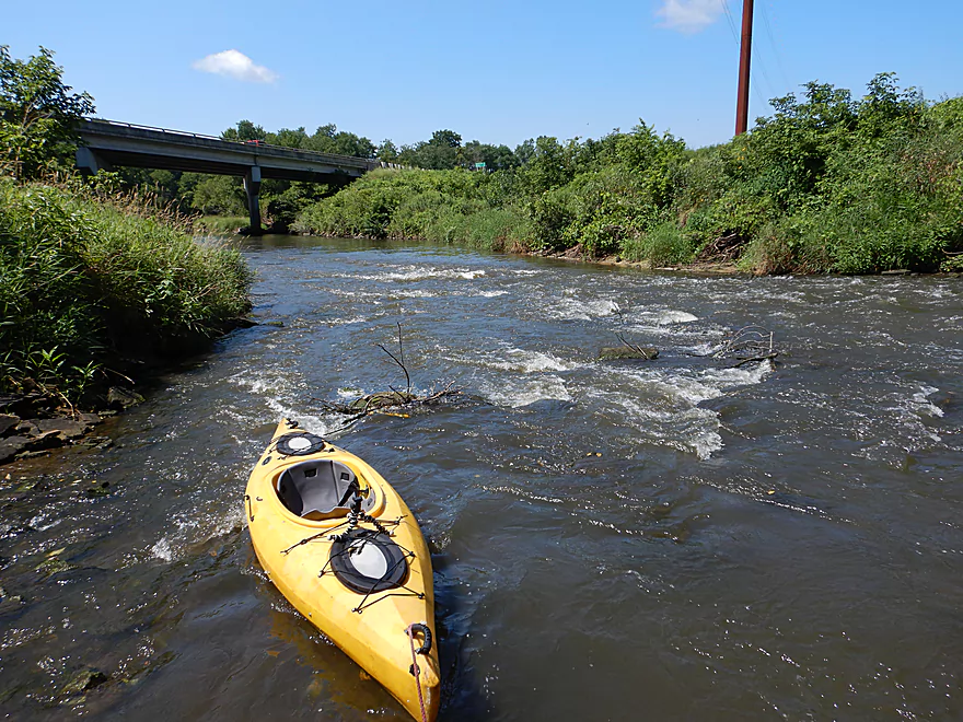
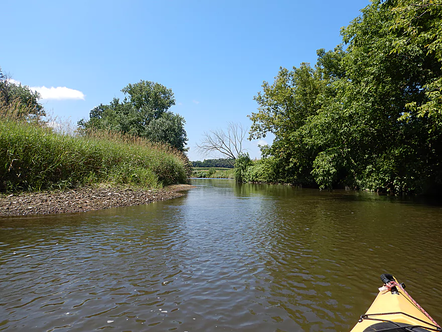
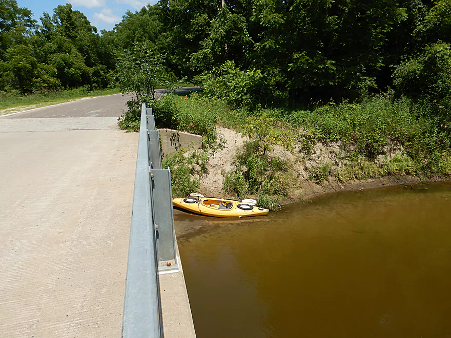
So I instead launched by the S. Main Street Bridge
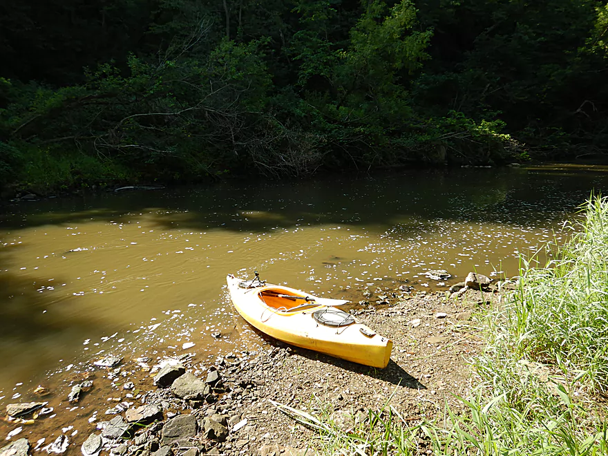
Which is a decent access option
And waded upstream to see what I missed
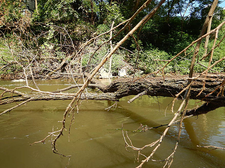
Some serious flood damage
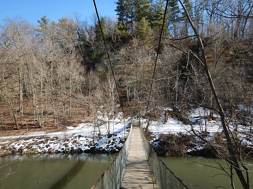
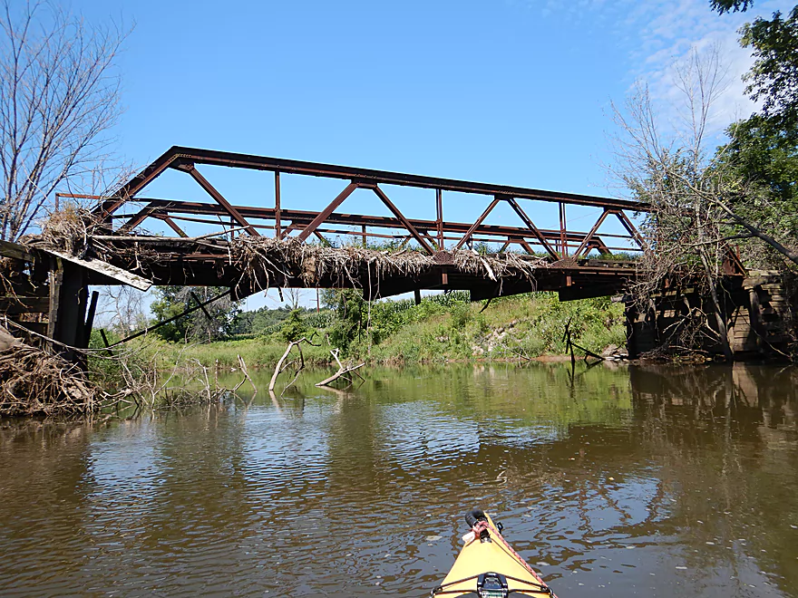
There used to be a cool suspension bridge here
View from that bridge
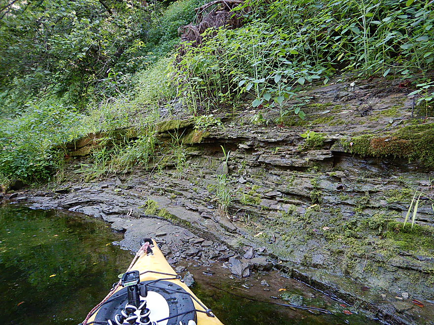
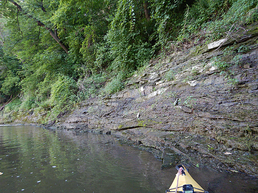
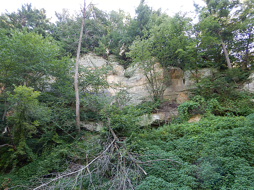
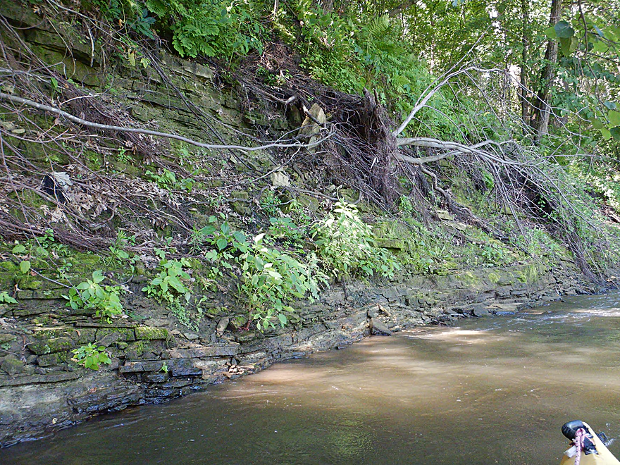
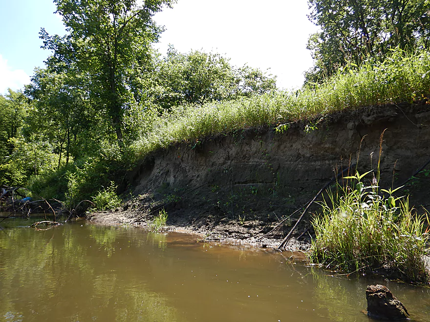
Still wading upstream…cool cliffs
The small outcrops were cool too
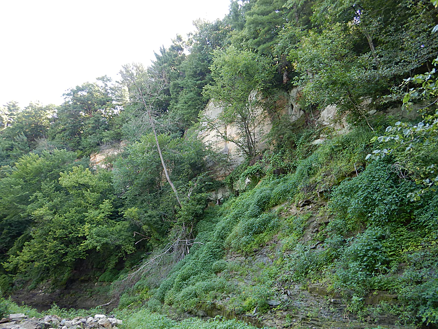
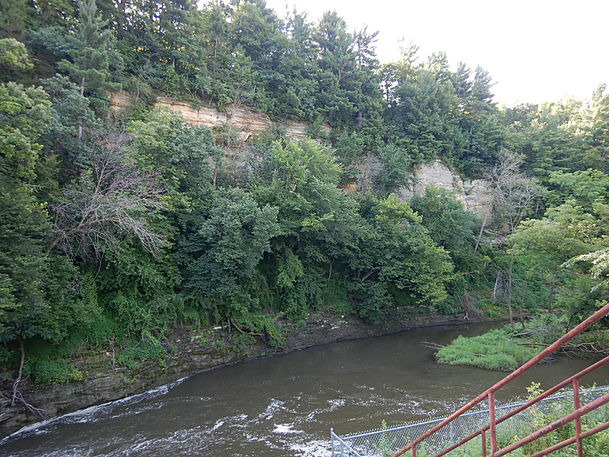
More cliff vistas
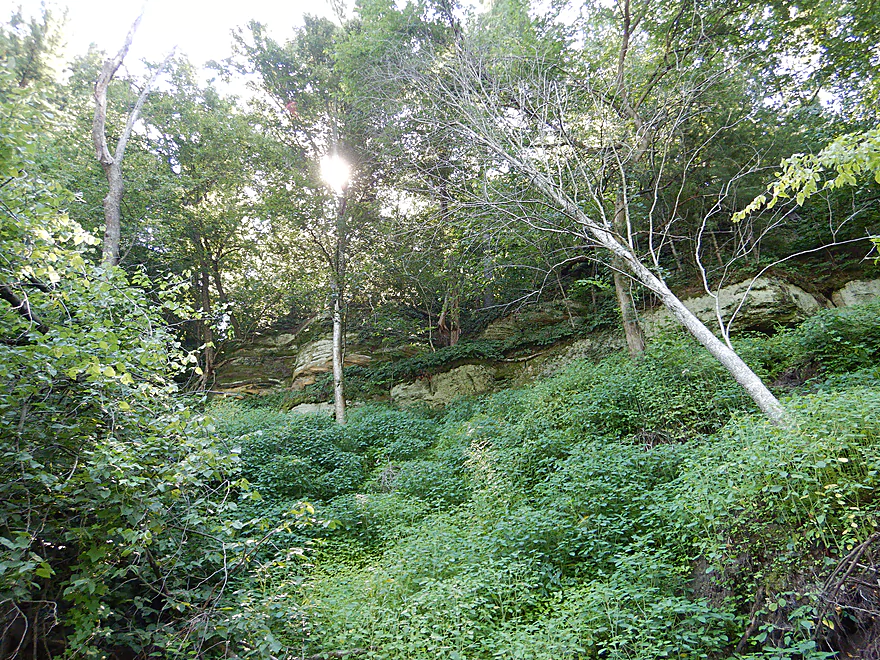
Heavily obscured by vegetation, the cliffs were tough to photo
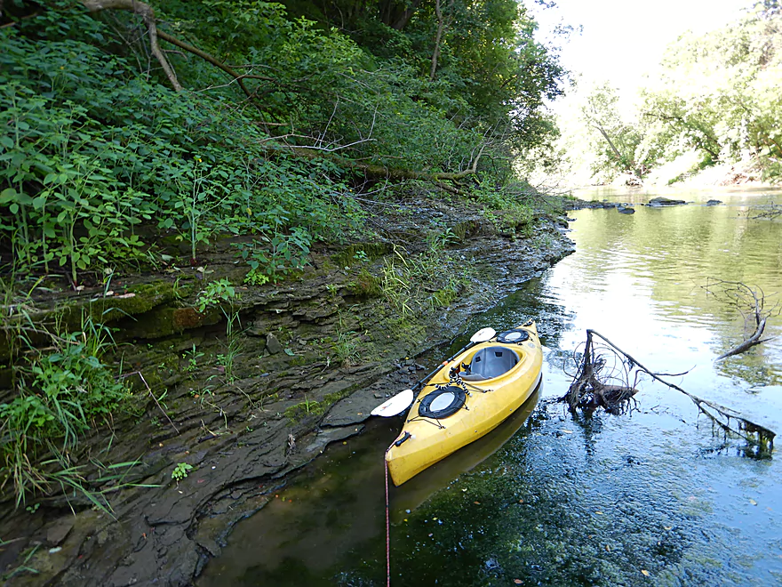
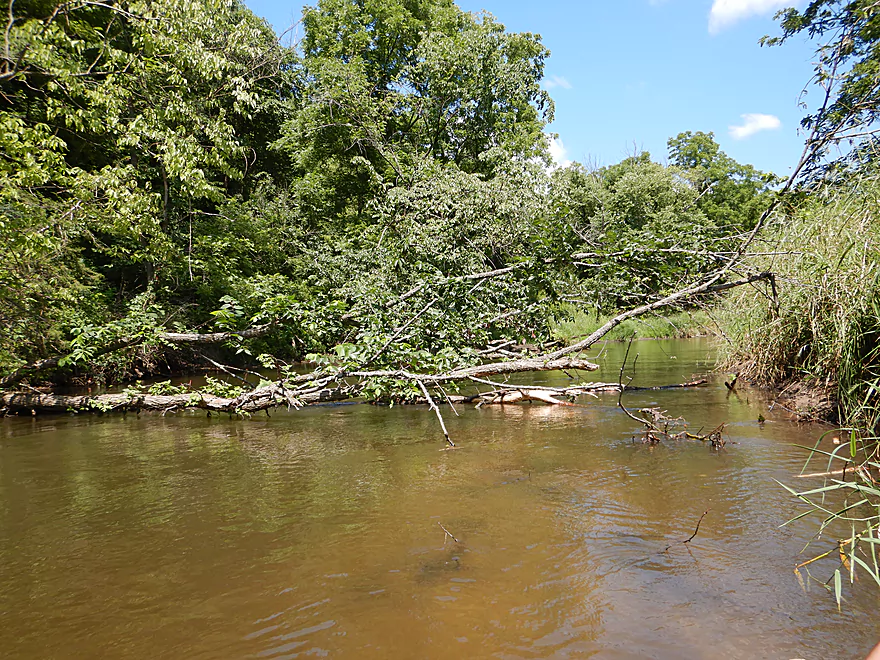
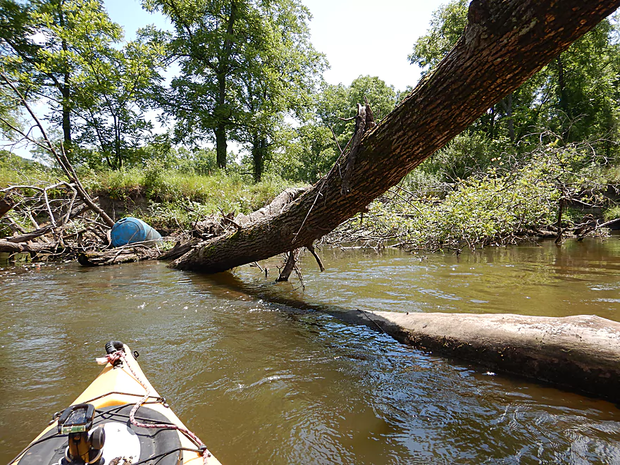
Dealing with a downed tree…
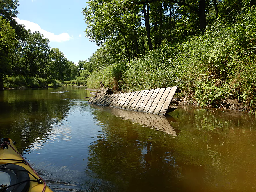
By portaging over a debris pile
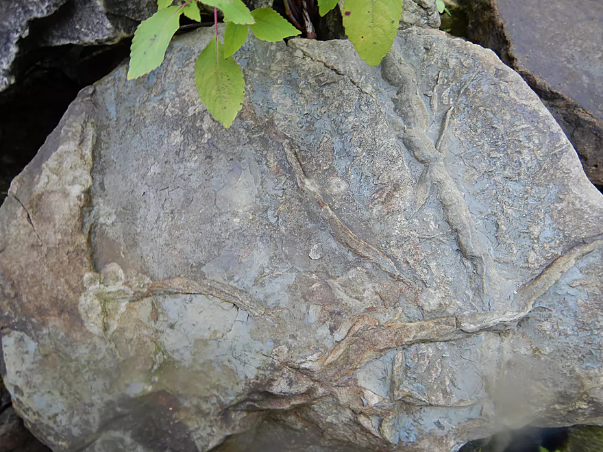
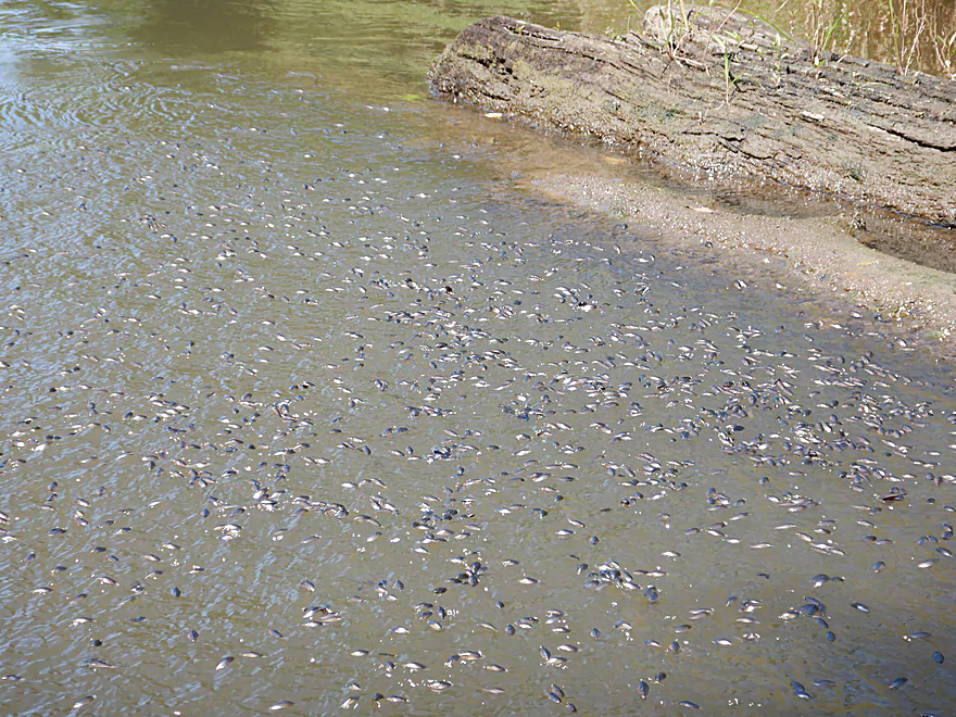
Several rocks had cool plant fossils on them
More neat mini-outcrops
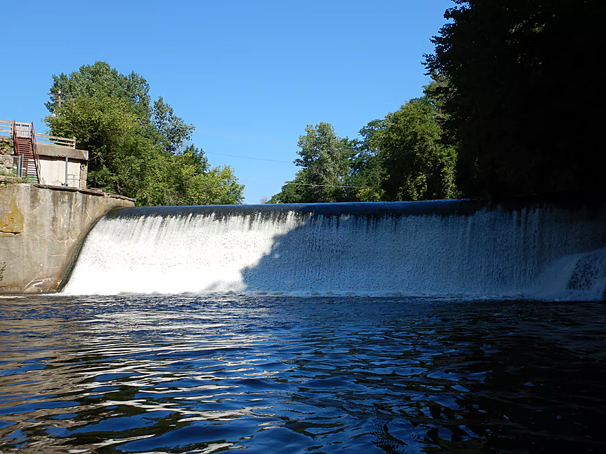
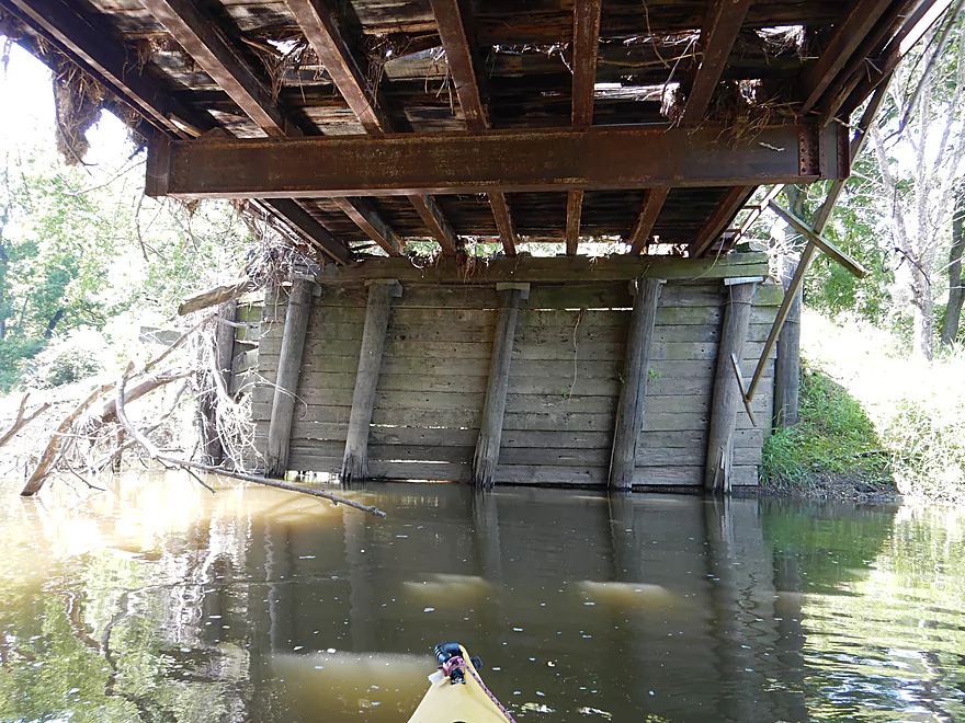
View of the main dam
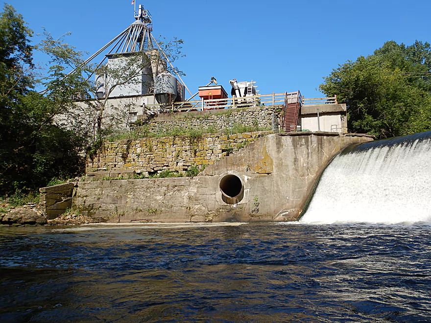
The 2017 flood went up to that wooden fence
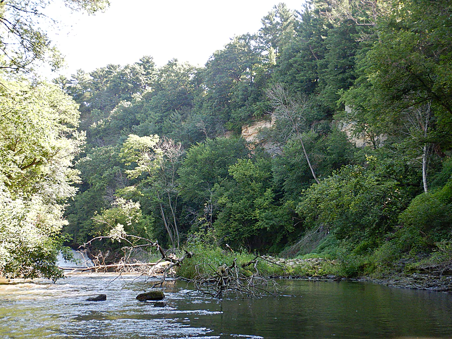
One last photo of the bluffs
Returning downstream
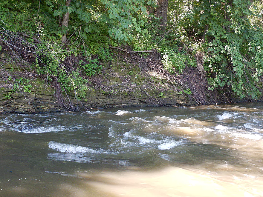
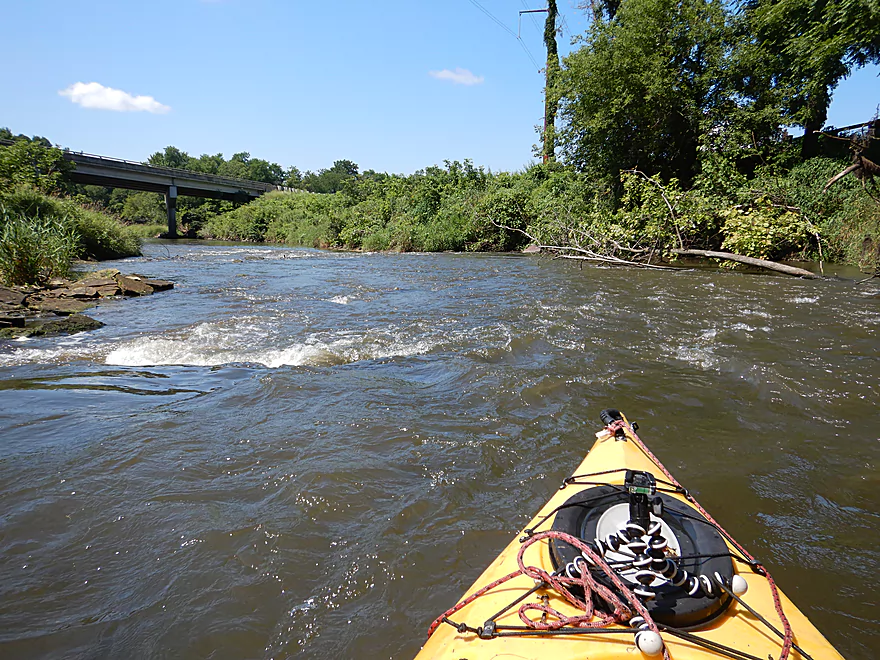
One of several Class 1 rapids
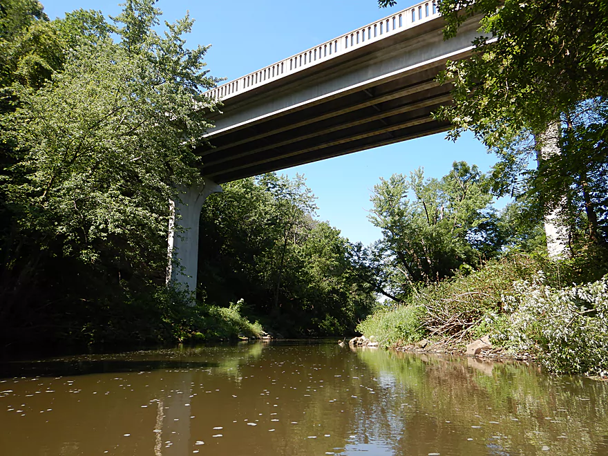
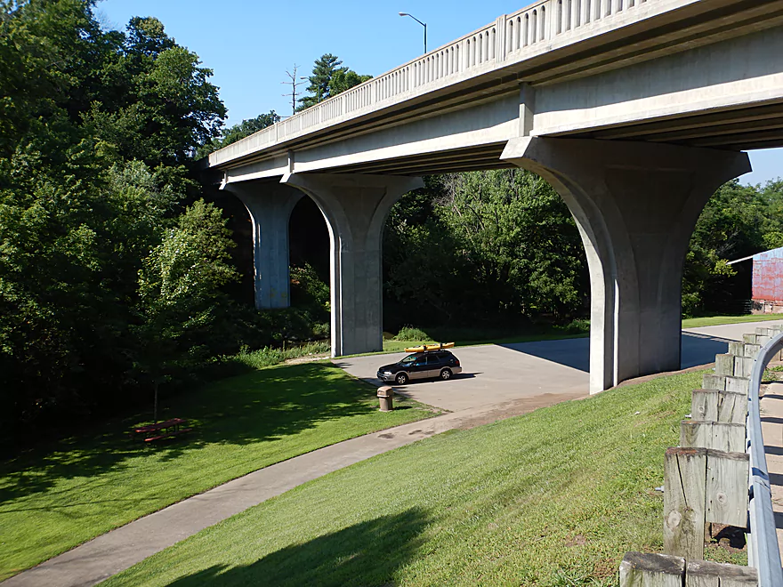
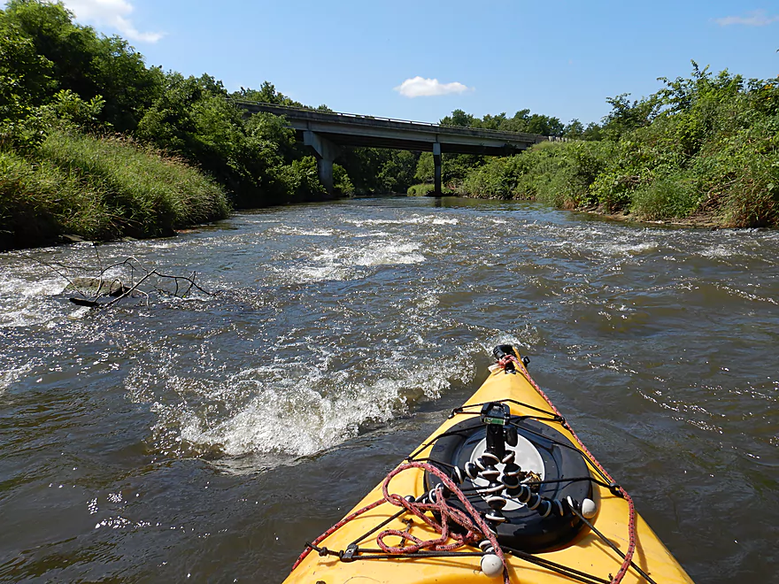
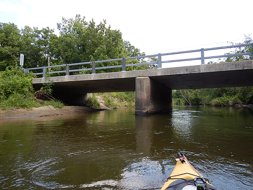
South Main Street was a very tall bridge
Downstream view from my bike shuttle
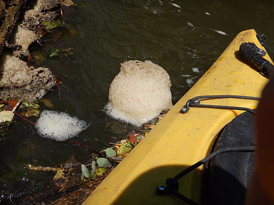
Cool foam ball…it just spun and spun
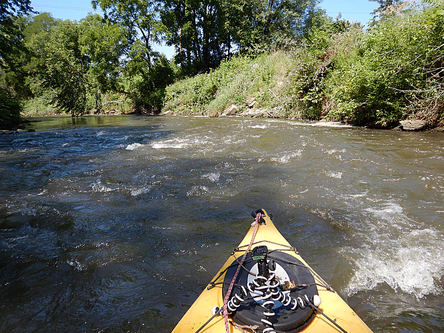
The first of three noteworthy rapids
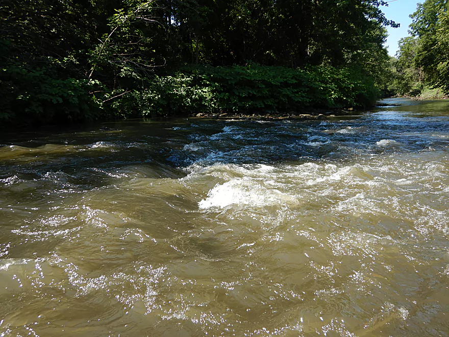
Side view
Water was very turbid
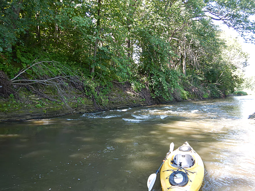
Coming up on the second set of major rapids
These were great
Flanked by a rock wall
Great texture

I got a bit wet here

Plants vs concrete
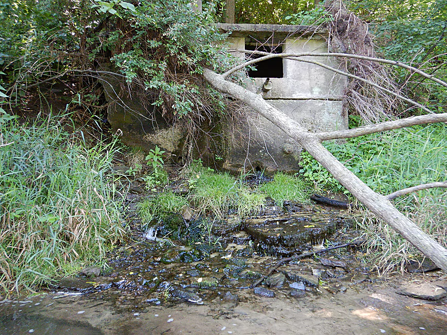
This was an artesian well…multiple springs feed Beaver Creek
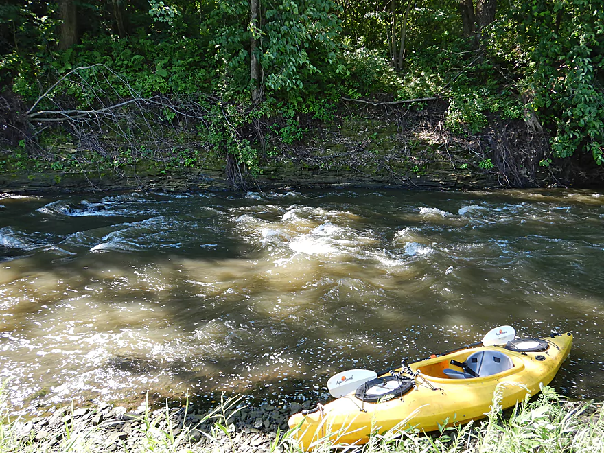
Coming up on the third set of major rapids
These were also a lot of fun
Walking upstream to run them again (and get better video)
An old farm bridge
Uh oh…
One of several large whirligig swarms I saw
The downstream portions were surprisingly sandy
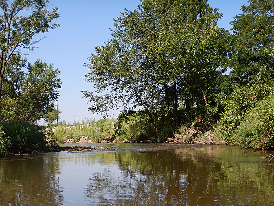
A pleasant section
Starting to enter the main flood bottom portion of the creek
This was a bit more repetitive and not as interesting
This creek has endured some big floods
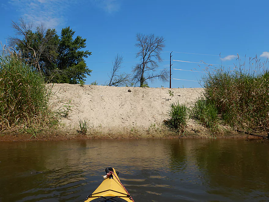
Banks are starting to get bigger
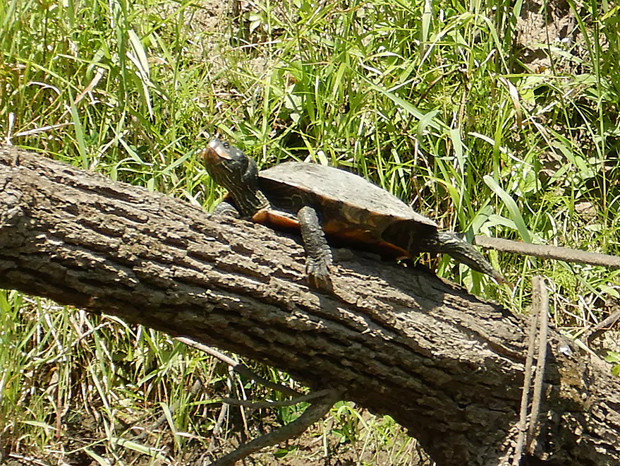
One of many turtles I saw
Example of some of the deadfall I squeaked through/over
Not fun getting through that
Coming up on Cooper Road
Which has a nice take-out area
With great shoulder parking
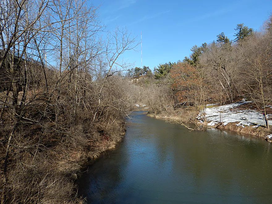
One last look downstream
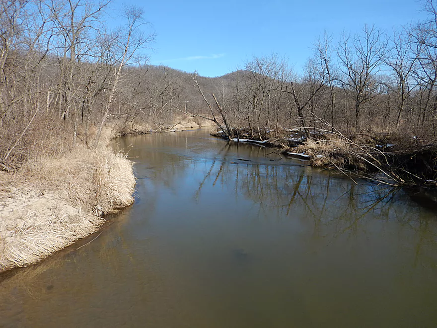
Very different from when I scouted it in the spring
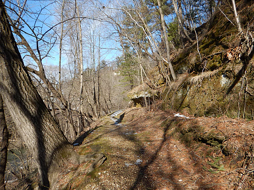
High Cliff Park has a great hiking trail worth checking out
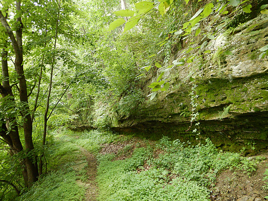
Which looks very different in the summer
There is a cave and springs at the south end of the park
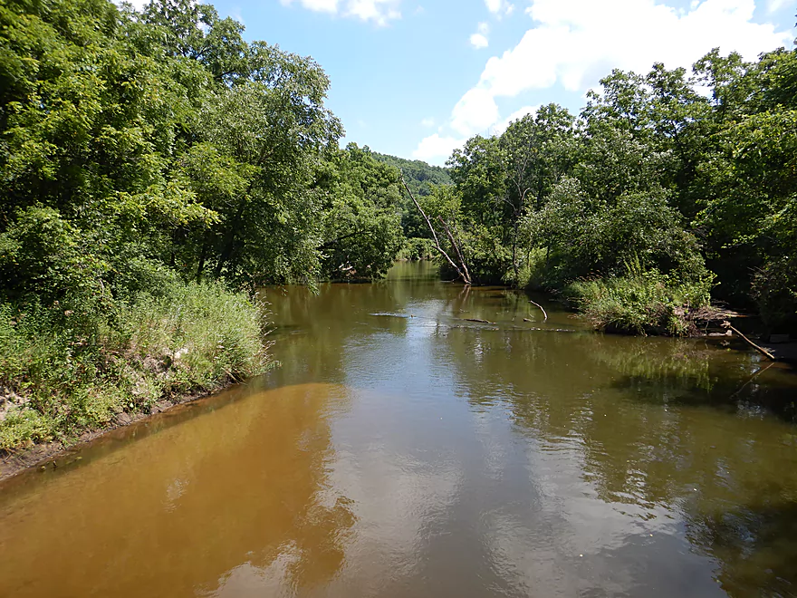
Beaver Creek

Beaver Creek is a tributary to the Black River located a bit north of La Crosse. In 2015 I stumbled across a blog picture of an attractive suspension bridge backdropped by a large sandstone cliff. Despite running through the local city of Galesville there was little information about this creek, and the following spring I saw fit to scout it in person. A little later, paddling Author Rick Kark reviewed this stream and noted that while he liked it, there were many logjams. Despite my favorable impression of the creek from my scouting trip, I had serious reservations about the creek because of the logjams combined with its long trip length and a long bike shuttle.
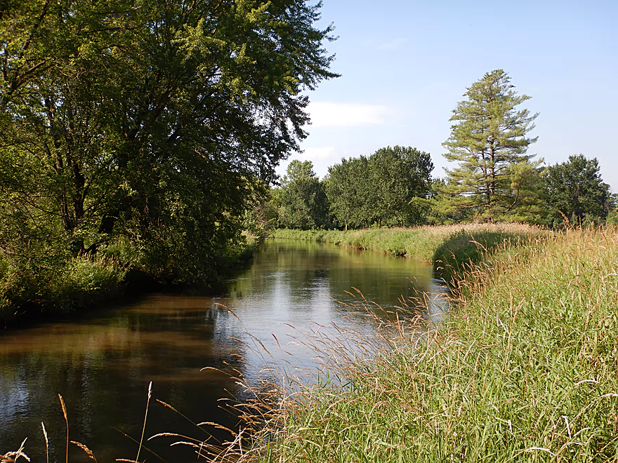
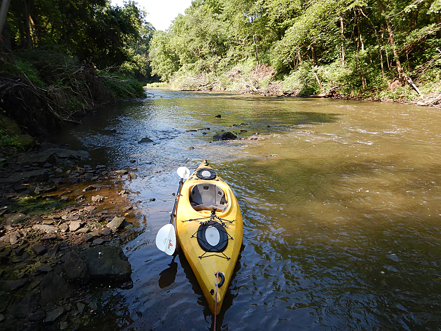
My plan for this trip was a pretty simple 4 mile trip from Fireman’s Park (well upstream of Lake Marinuka) to Cooper Road just south of Galesville. The idea being this upstream variant would avoid the logjams of the downstream sections. This would have included a nice mile of creek paddling, another mile on Lake Marinuka (where the locals used to do boat tours to Arctic Springs), a section through the main gorge, and then I would portage the dam and continue into the flood bottom portion. But this was not to be… I scouted Fireman’s Park and it looked like a great access and the creek was inviting. Lake Marinuka also looked very nice and the gorge as viewed from North Main Street bridge was incredible reminding me of Mirror Lake. But…the dam simply could not be portaged. Despite there being a state statute that navigable streams must have dam portage paths, there was none. The east end was sheer sandstone cliffs, and the west end had a large concrete wall with a mill on top of it that I didn’t see a way around. So on this disappointing note, I decided to split my trip in half by launching downstream under the South Main Street bridge.
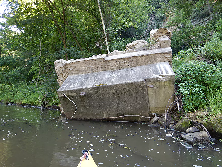
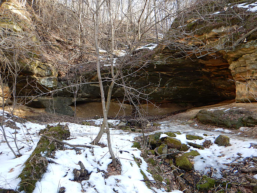
Here there was a nice public park that offered easy access to the water. The problem with my choice of launching here was that it was downstream of the good stuff (the cliffs, the rapids, and the dam), so my plan was to paddle/wade upstream as far as I could get before returning downstream. One of my first surprises was seeing some concrete debris in the water, where a few years ago I had seen a nice suspension bridge. It turned out it had been destroyed by a massive flood in 2017 which was a shame.
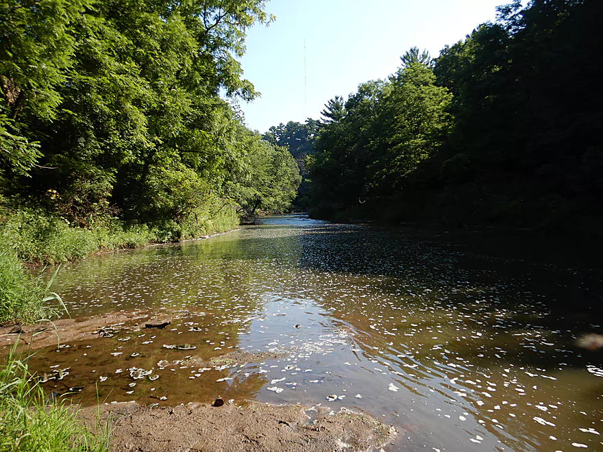
It was a neat scene as I waded upstream with small outcrops on the east bank and 150′ cliffs towering overhead. While scenic, these weren’t as striking as during my spring scouting trip, as the summer leaves really obscured the sandstone. At the base of the ravine there were light Class 1 rapids that flowed over a rocky substrate that included some plant fossils. I finally reached the massive 15-20′ high dam, where I took countless pictures and then turned around to float downstream over the rapids.
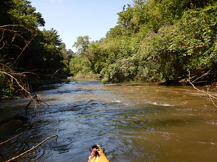
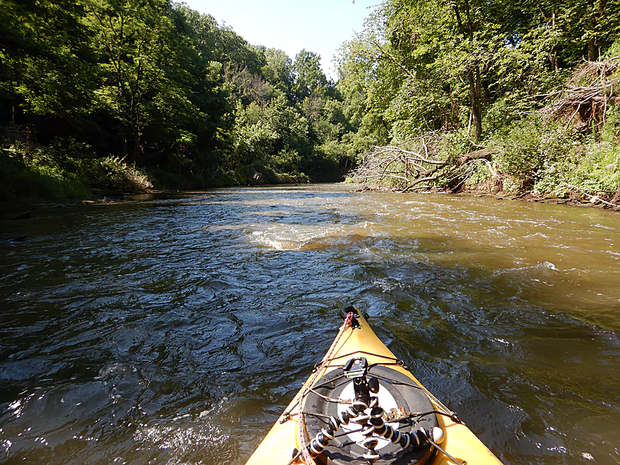
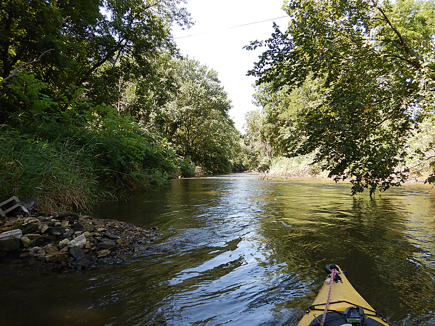
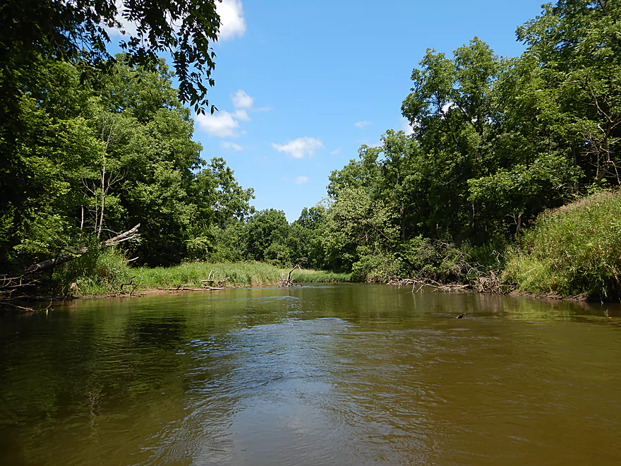
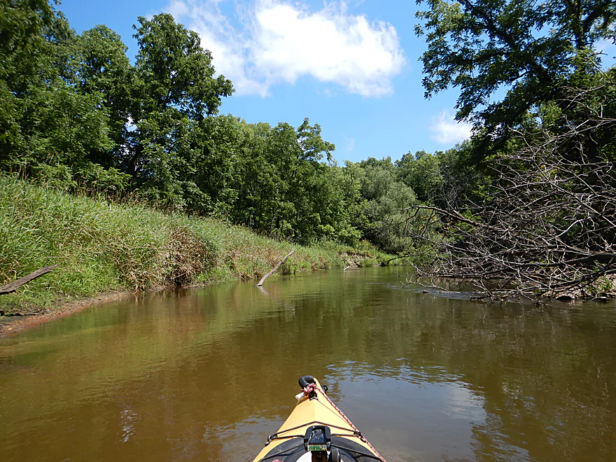
After drifting past my put-in and under the towering South Main Street bridge, I left Galesville and its cliffs behind. The channel stayed rocky and somewhat riffly, but the water quality was poor and somewhat turbid. I soon came upon the first of three noteworthy rapids which was perhaps a strong Class 1 or weak Class 2, and a fun easy run. The second set of rapids was much stronger (Class 2) and here I got a little wet (I didn’t wear my skirt). The neat thing about this second set was they ran past a rock outcrop with brick-like stratifications. Following an artesian well that fed the creek, I came upon the third and biggest set of rapids. These were a lot of fun and I did run them twice, much to the amusement of a local who was watching me from the shore.
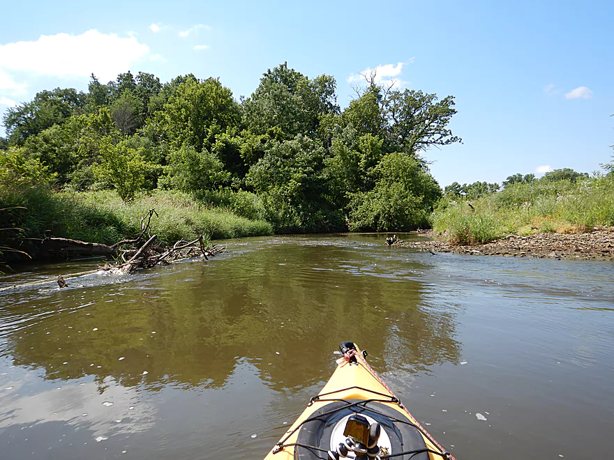
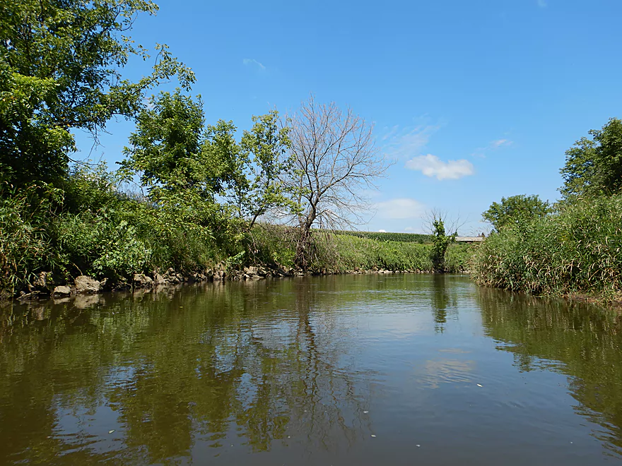
Past the Hwy 54/93 bridge the creek changed dramatically. No more rapids, no more outcrops, far fewer rocks and a heck of a lot more sand. This was the flood bottom portion of the creek and was practically a different paddle. It was still pleasant with some micro-sandbars, no visible development and occasional vistas of the Dale Valley hills in the distant. I soon came across a farm bridge that wasn’t long for this world. The supports had been heavily damaged by floods and were visibly slanted downstream…it would just be matter of time before this toppled into the creek and created a big mess. The next two miles were somewhat generic and nothing special. There was evidence some local had done logjam clearing and I never had to portage, but there were still a few tricky hoppers, duckers and zig-zaggers.
The take-out was at Cooper Road where I knew I wanted to disembark even though this meant a short trip as I knew logjams were lurking in ambush downstream. After the trip I explored High Cliff Park which is a trail system which skirts along the sheer cliffs and the creek which was very cool. Unfortunately parts of the trail (not to mention the suspension bridge) are closed due to flooding. Hopefully the locals repair this. A few years ago when I explored the trail system I had great views of the creek, the sandstone and even found a cave with a spring bubbling out of it. Determined hikers could likely still explore much if not all of the trail system. The best trailhead is at the north end of the park by the North Main Street bridge where you can park by the cemetery. Bring long pants as weeds have overgrown parts of the trail.
This was a difficult trip to judge in hindsight. The rapids were a lot of fun, the ground level outcrops scenic, the massive dam was a sight to behold, and the cliffs by Galesville were spectacular. But to experience the best parts of the creek, you’ll need to wade upstream like I did, which I’m not sure would be most paddler’s preferred cup of tea. Lazy paddlers could skip the cliffs and simply launch under South Main Street and go to Cooper Road…the highlight would be the three sets of rapids, but after Hwy 54 the creek just wouldn’t be as interesting.
A few cranes, many turtles (some of which were wood turtles I believe), and several fossilized plants. The highlight was several large swarms of whirligigs which are always a sight to behold.
2017 Flood: In 2017 a massive flood hit the Galesville area and Beaver Creek.
- Picture of the swing bridge in the process of being destroyed by flood water
- What was left of the swing bridge
- Amazing video of the dam during the flood
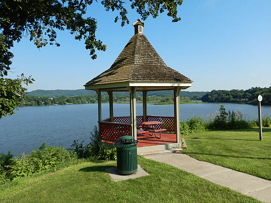
Boat Tours: The locals used to offer boat tours on the creek and the nearby lake. The previous link is a cool historical picture of a paddle wheeler in front of the cliffs.
Founding of Galesville: The early city was touted as the long lost Garden of Eden which seems a little shady…
History of the Galesville Mill: Long story short, it’s been destroyed a few times.
Picture of Arctic Springs: I never did find where these were.
The put-in was in Galesville off Mill Road (directly under the South Main Street bridge). This is a decent public access option with parking. The locals used to use this as the south entrance to High Cliff Park, but can no longer do so because the bridge has been washed out.
For an alternate put-in, you could launch at the Marinuka Lake landing. The lake is nice…but you can’t connect with downstream segments because the dam can’t be portaged.
Another mile upstream, you could also launch at Fireman’s Park. This would include a nice mile of open creek paddling until you reached the lake. But again, you wouldn’t be able to connect with downstream segments because of the dam.
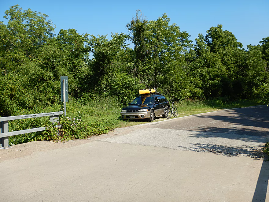
My take-out was at Cooper Road, which was a very good bridge access. Public shoulder parking is available northwest of the bridge, and there is a sandy bank northeast of the bridge where you can pull up your boat.
An alternate take-out would be at the Hwy 35 landing on the Black River. The problem with this…is I believe this last section would have many logjams while offering little in scenery and no rapids.
The bike shuttle was a bit hilly with 131′ of climbing but was only 2.0 miles…so super easy.
From the dam to South Main Street, there are only Class 1 rapids. Nothing dangerous. There is a logjam very close to the dam, which I ducked under, but paddlers wishing to explore the upstream sections could simply portage over a rocky bank (where there are cool fossils).
From the South Main Street bridge to Hwy 54/93 there are no logjams, but there are 2-3 Class 2 rapids. I didn’t find these difficult.
From Hwy 54/93 to Cooper Road, there are no rapids…but there are 5-6 downed trees to deal with. I got through with never having to portage, but some of the fits were quite tight and paddlers may need to portage a few of these.
While in general this was a safe creek, it is a different animal during high water and should be avoided then.
There is no local gauge or any nearby analogs. The best measure is likely on the Trempealeau River which is flawed because that is so much larger. That being said here is a rough and estimated depth guide:
- 0-300 CFS: Very low. You might have to walk all rapids, but this could make getting around the deadfall easier.
- 301-400 CFS: Rapids might be a bit bumpy, but otherwise a doable trip. An average summer depth.
- 401-500 CFS: A good depth for the rapids. My trip was done at 460 CFS which I thought was plenty deep.
- 501-650 CFS: A high depth, but should be navigable. Some of the downed trees may become annoying.
- 651-800 CFS: A very high depth only suitable for experienced paddlers.
- 801+ CFS: Maybe too high. Here is a video of the dam during the 2017 floods.
- Upstream of Fireman’s Park: I don’t know much…but I strongly suspect most of the upper reaches are sandy and filled with logjams.
- Fireman’s Park to W. Ridge Ave Ramp: 1.3 miles. A nice little section. One mile of open creek paddling followed by 0.3 miles on pleasant Marinuka Lake. You can extend the trip by trying to find Arctic Springs on the lake or by paddling under the N. Main Street bridge to see the cliffs and the ravine. The only issue is you can’t connect with downstream legs because the dam can’t be portaged.
- Galesville Dam to Mill Road Access: 0.2 miles. Again, portaging the dam is not an option, so to get close to it and the cliffs, you’ll need to wade upstream from Mill Road. A special section with good geology and some light rapids.
- Mill Road Access to Hwy 93/54: 0.7 miles. A neat section with three sets of rapids, a limestone outcrop and an artesian well. Hwy 93/54 would be a very poor weedy access.
- Hwy 93/54 to Cooper Road: 1.8 miles. A sandy flood bottom section that is pleasant in parts but not super interesting. I didn’t have to portage but did have to squeak through several tight fits.
- Cooper Road to Mouth on Black River: 3.7 miles. Paddling author Rick Kark liked this section, but did note it had many logjams. I suspect there are too many.
- Mouth on Black River to the Hwy 35 Landing: 3.6 miles. A neat little trip on the Black River. Highlights include 3 huge sandbanks.
Trip Map
Video
Photos Size: