
Starting the trip at the Prince’s Point Wildlife Area
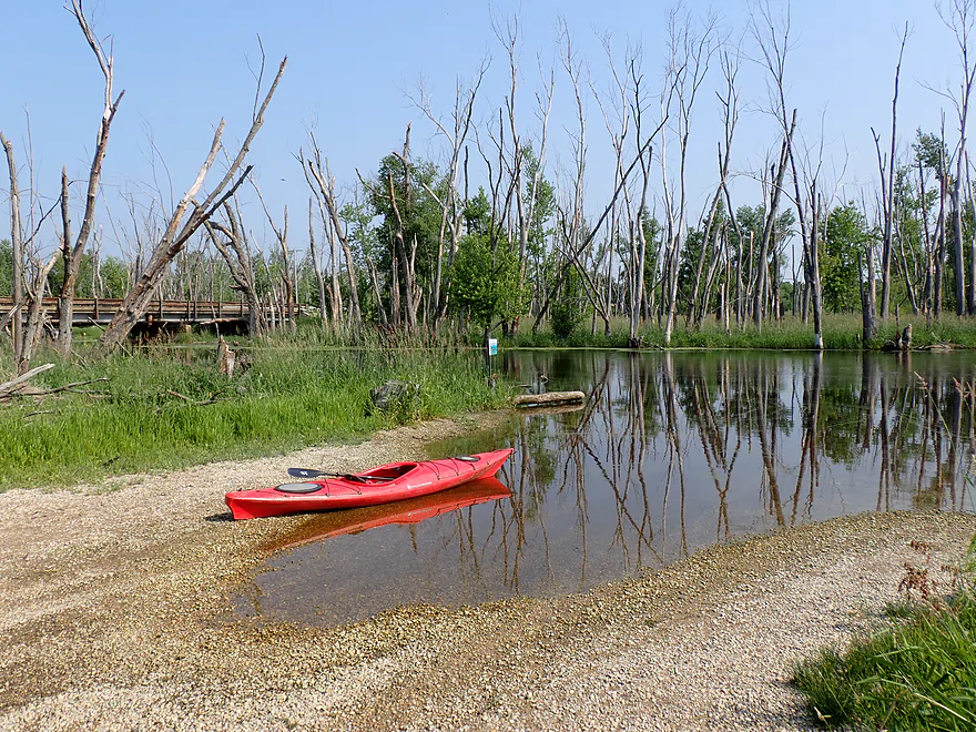
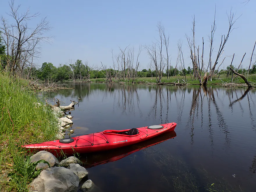
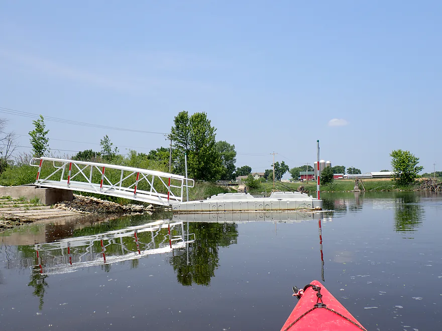
Terrific put-in off Cty D
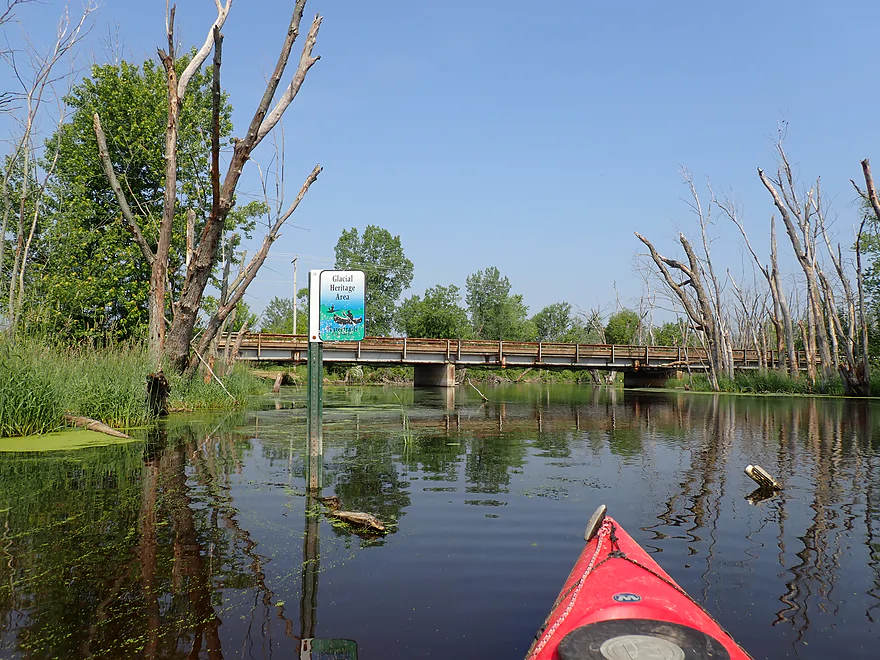
Glacial Heritage Water Trail sign (shot up by rednecks)
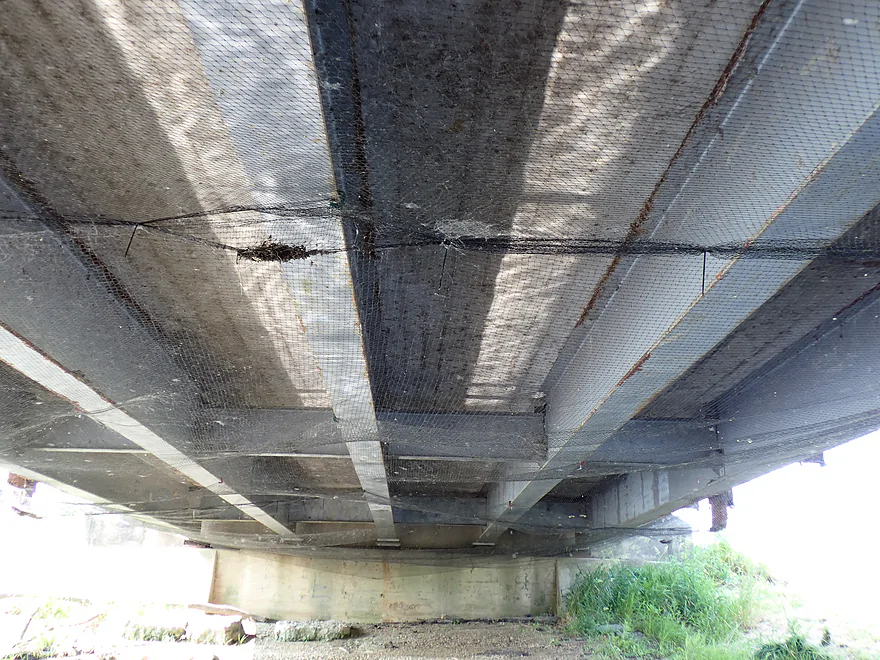
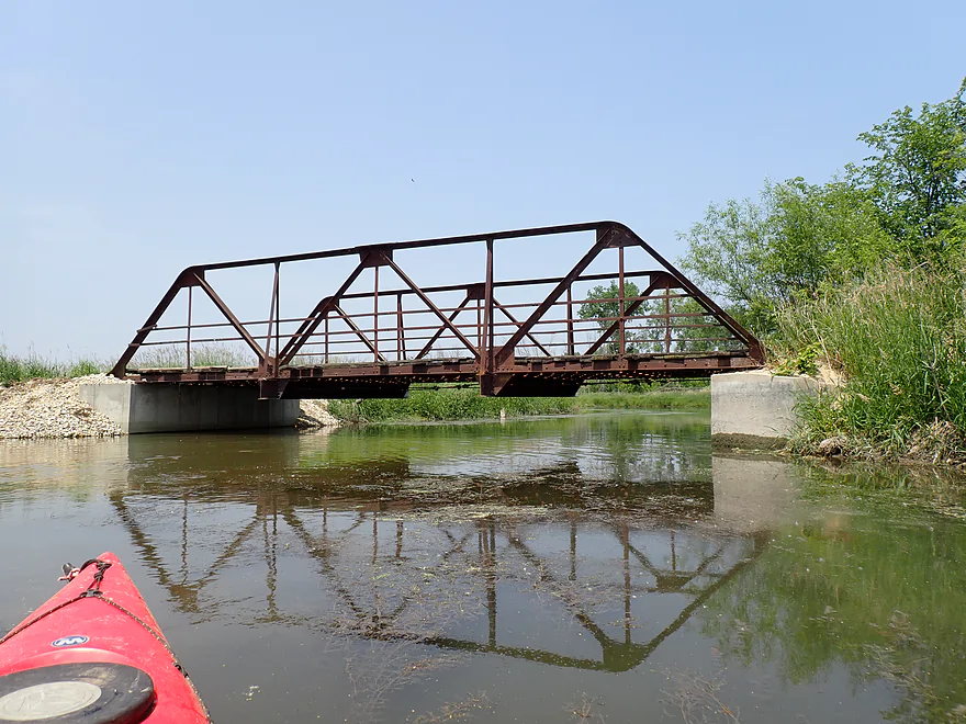
Bottom side of the bridge wrapped in a net
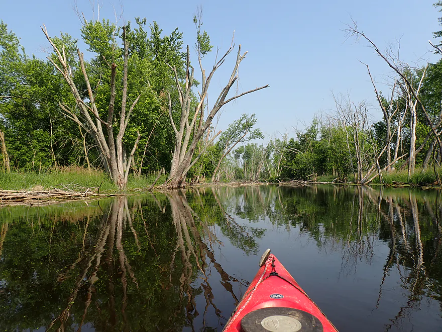
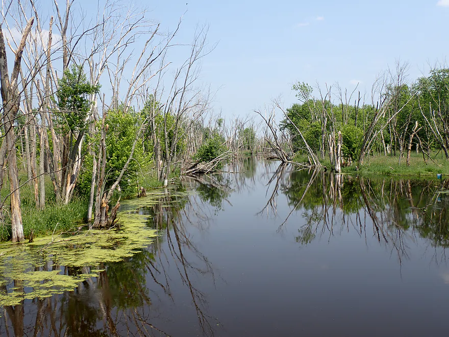
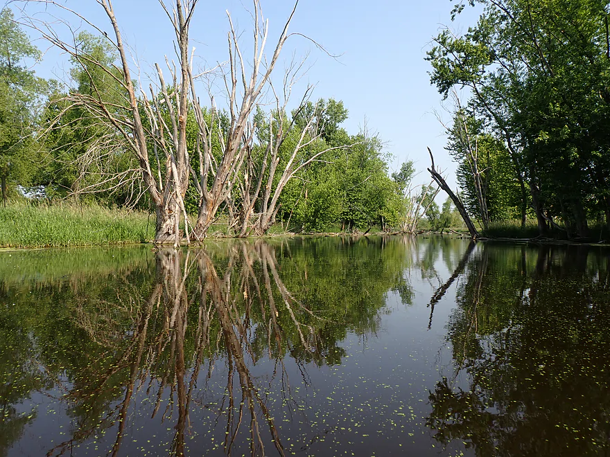
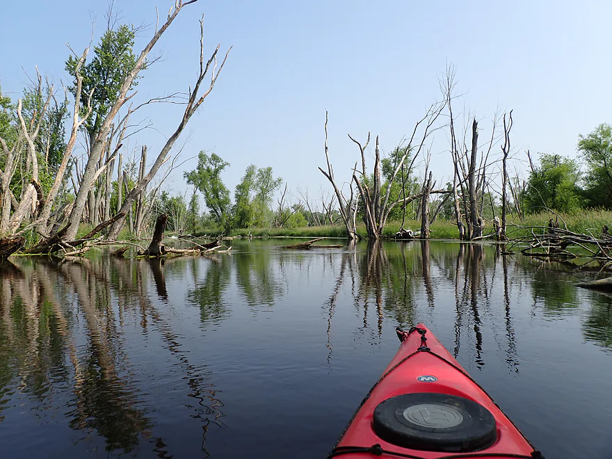
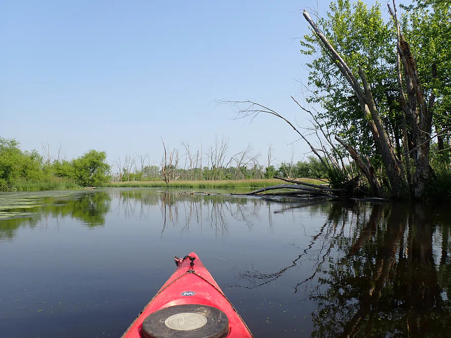
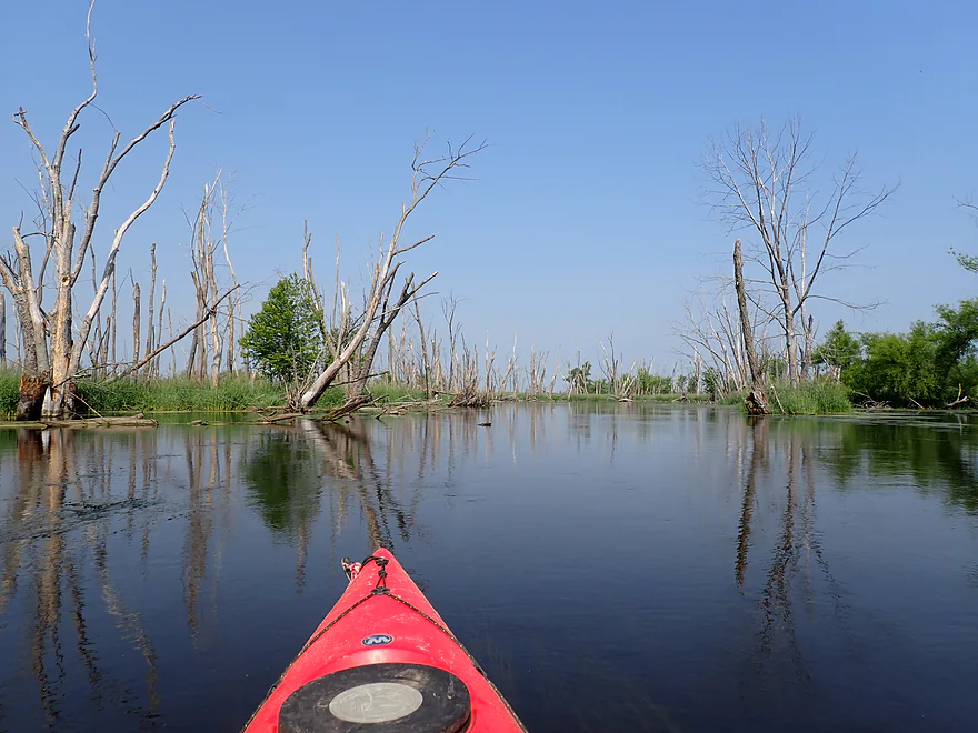
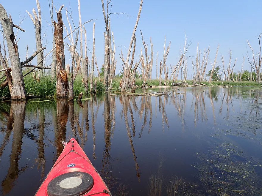
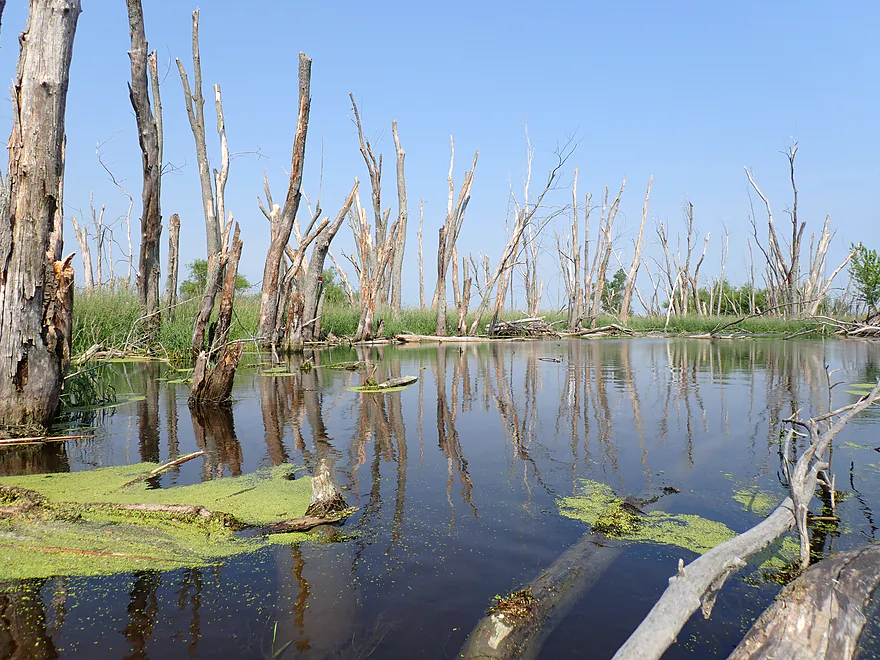
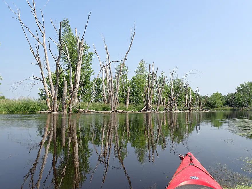
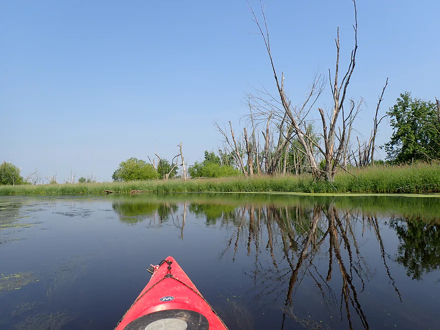
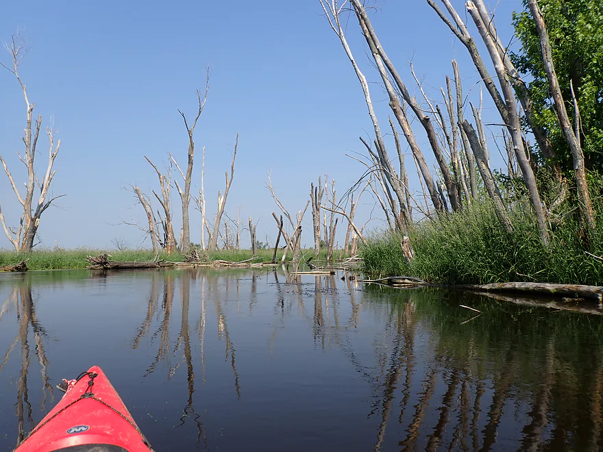
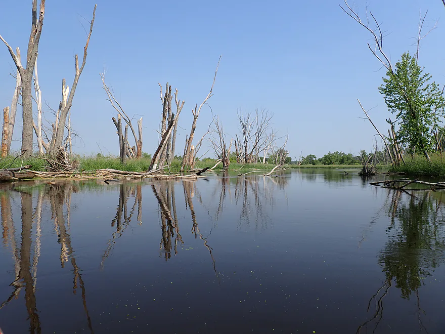
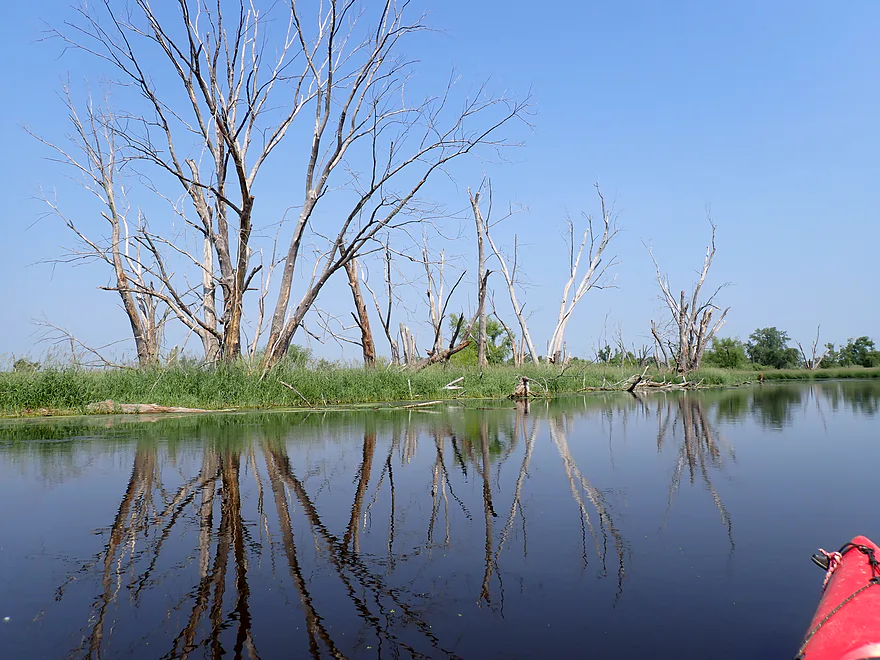
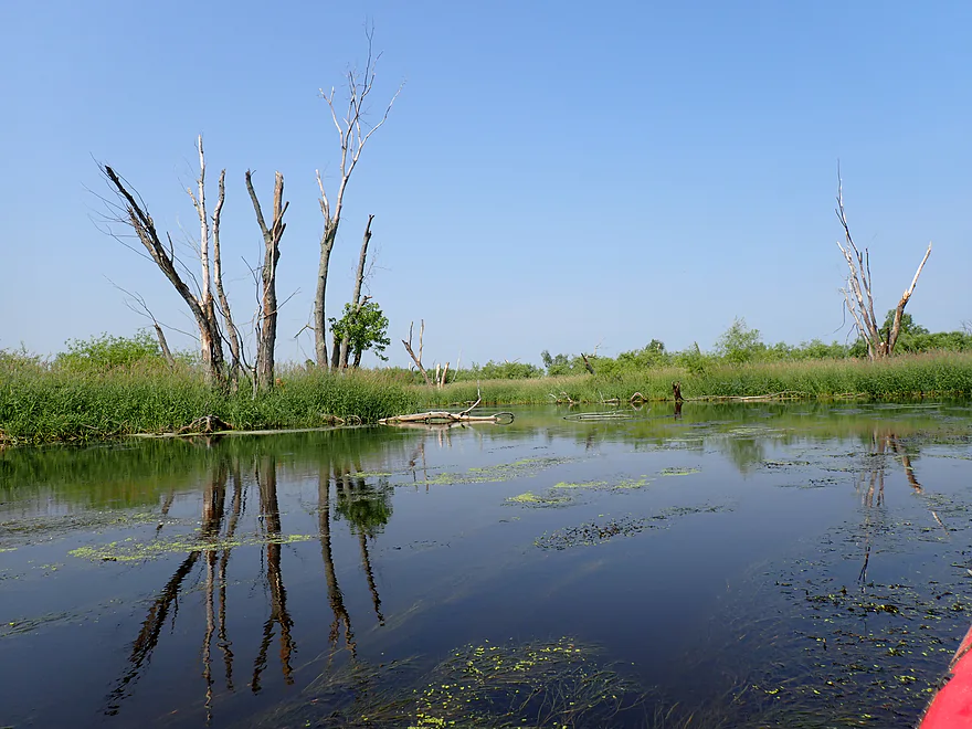
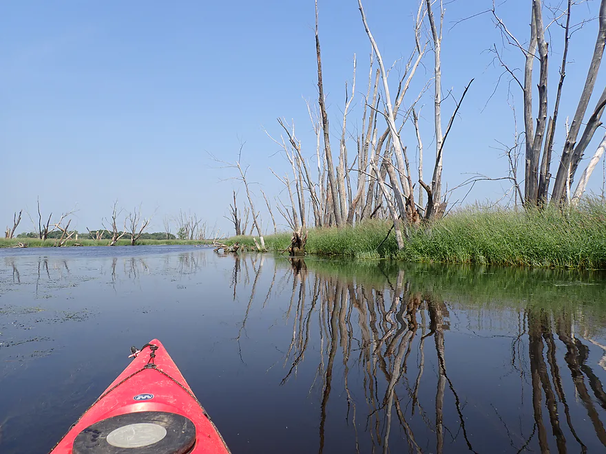
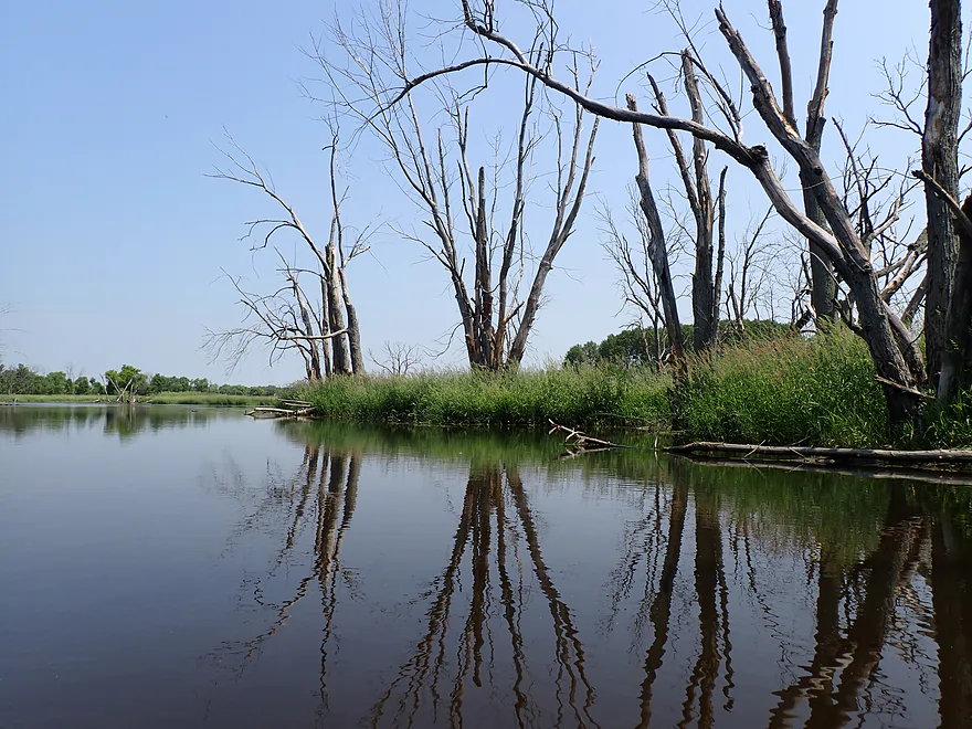
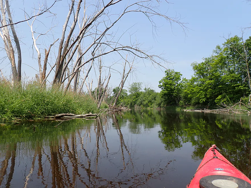
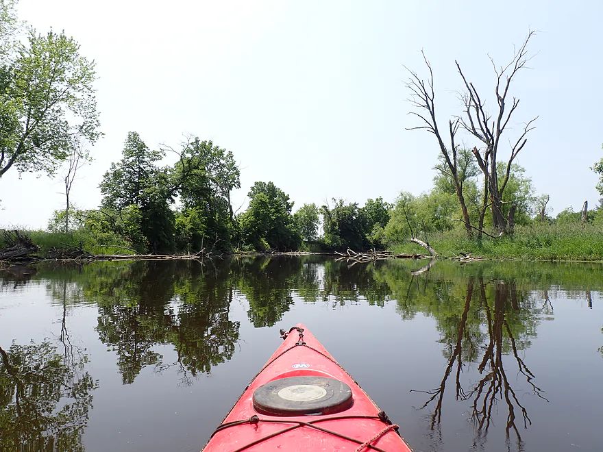
Terrific reflections of the floodplain forest
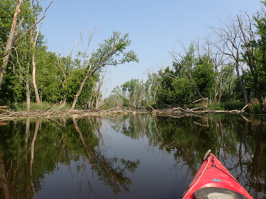
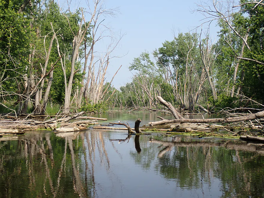
Only logjam of the trip (I was able to hop over)
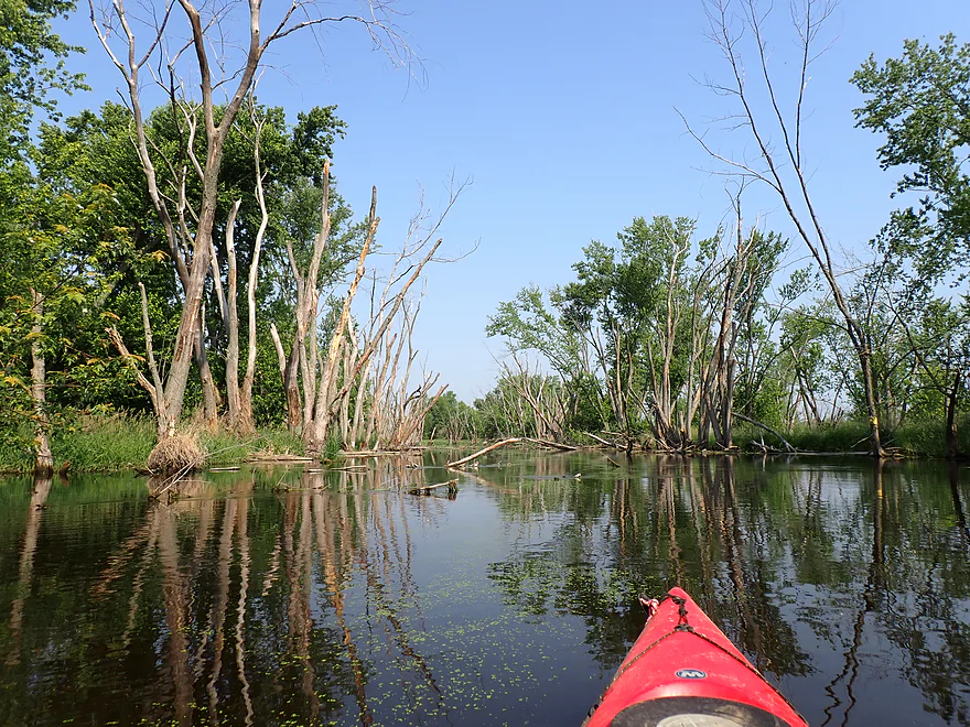
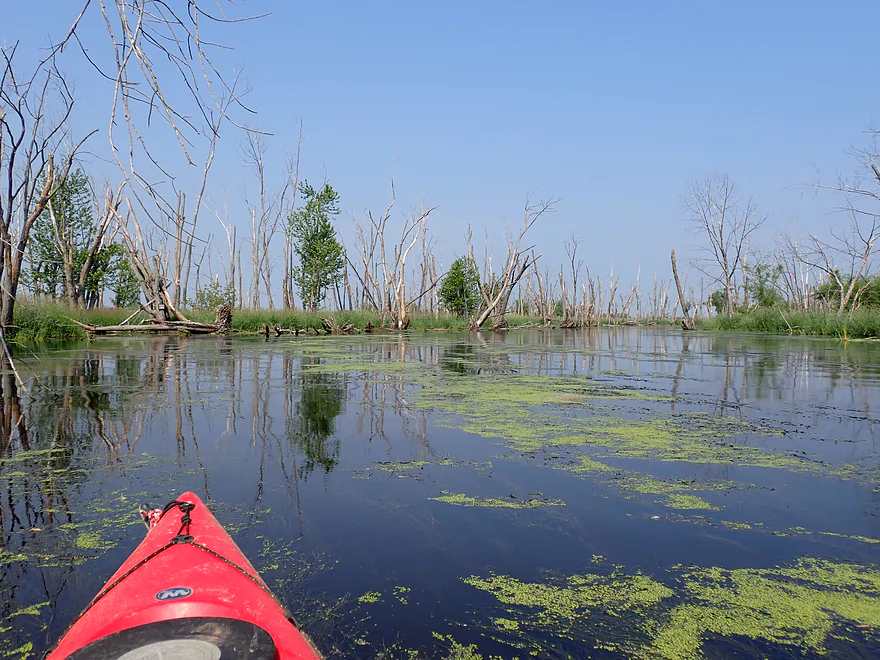
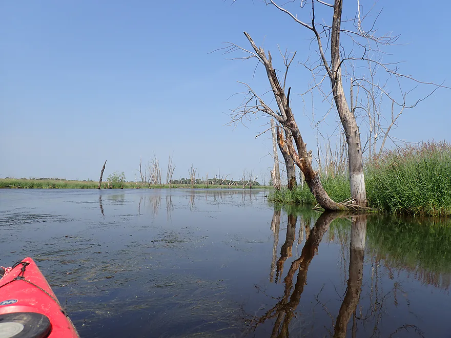
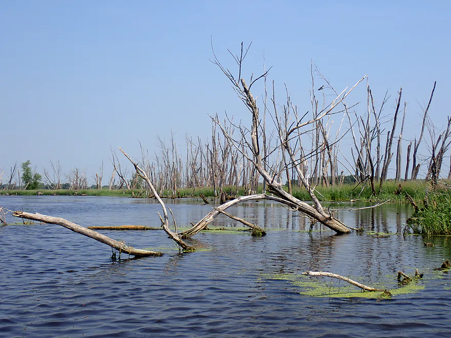
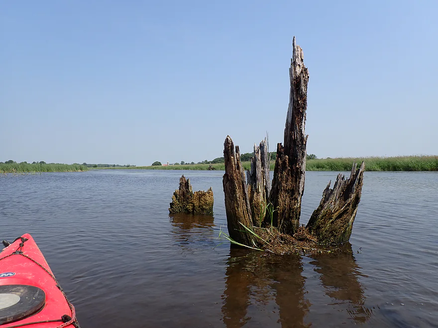
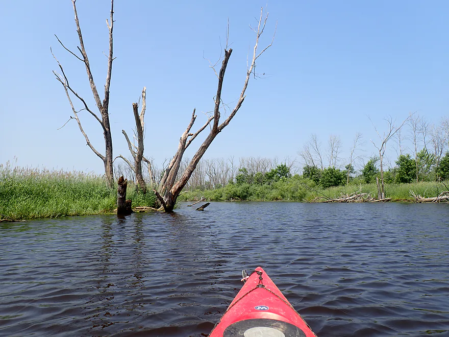
I took lots of dead tree photos (really cool)
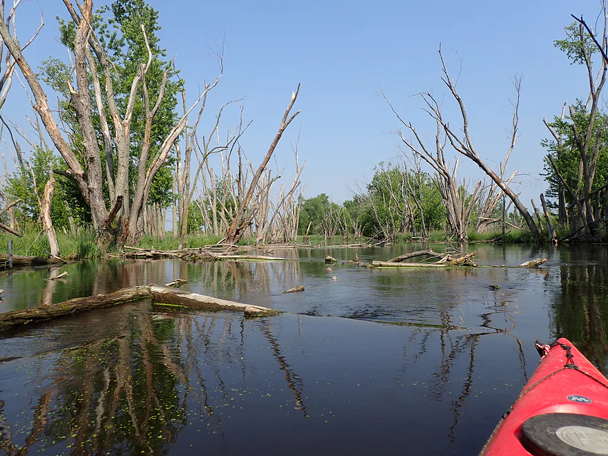
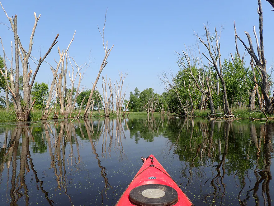
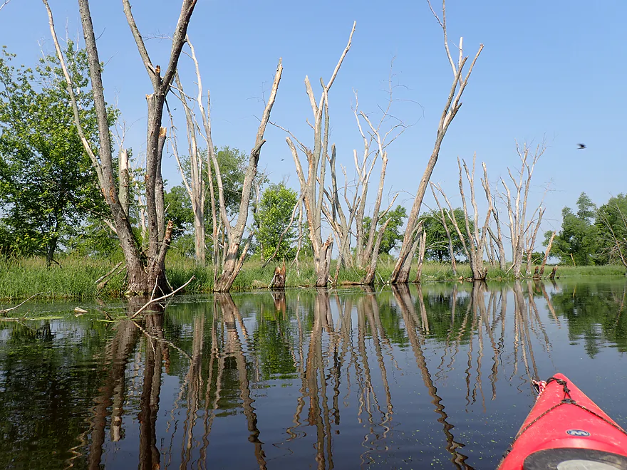
Key to getting reflections is the lack of wind

Some motorboat traffic on this leg, but not much
River starts to open up
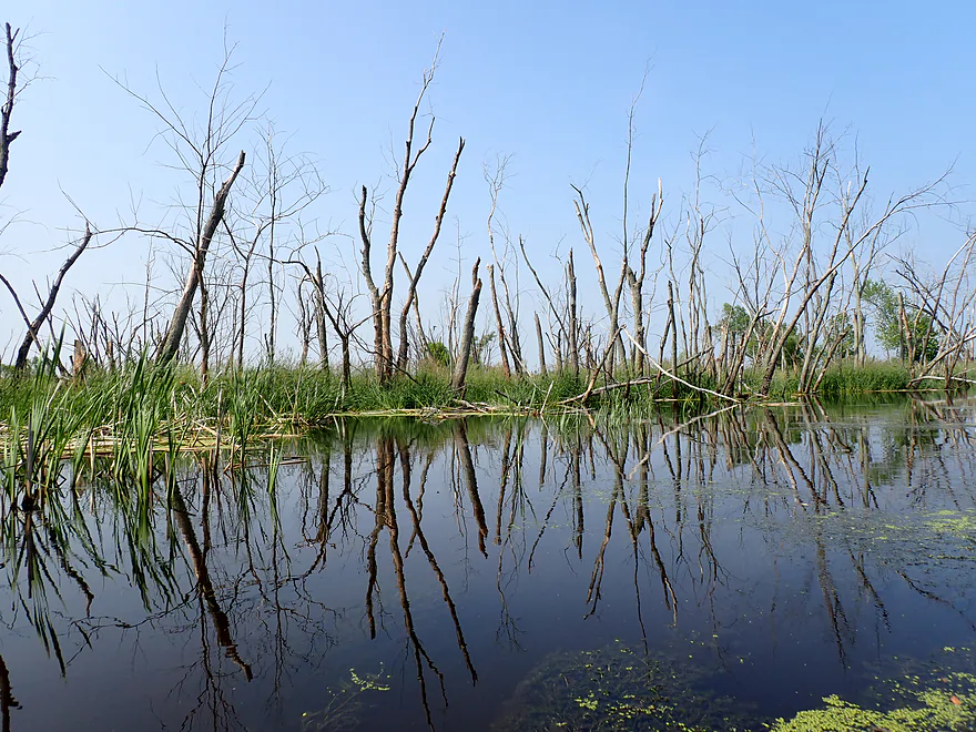
Still tons of tree skeletons
Current starts to slow
At roughly this point I leave the Prince’s Point Wildilfe Area
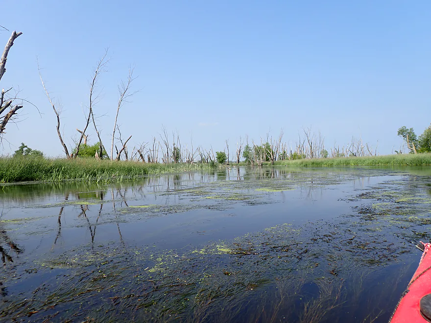
Some aquatic weeds…not bad
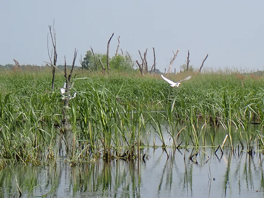
A pair of great egrets
The high water line
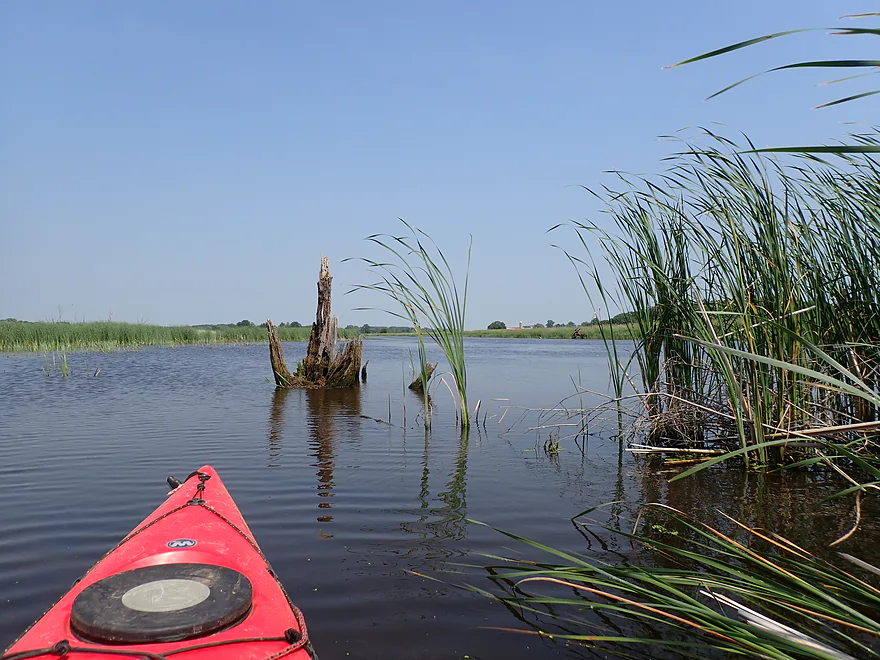
Some cattails…not many though–mostly a wetgrass marsh
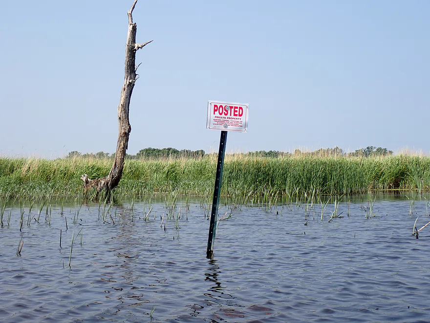
Lots of No Trespassing signs west of Prince’s Point
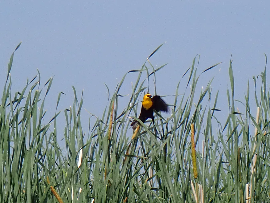
A yellow-headed blackbird
And the dead trees continue
A rare rocky stretch
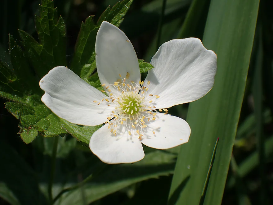
A Canada anemone flower
River becomes a bit less marshy
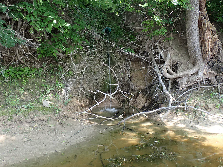
Drainage water digging a hole in the clay
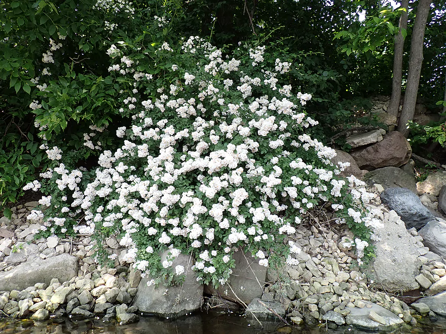
A multiflora rose (invasive)
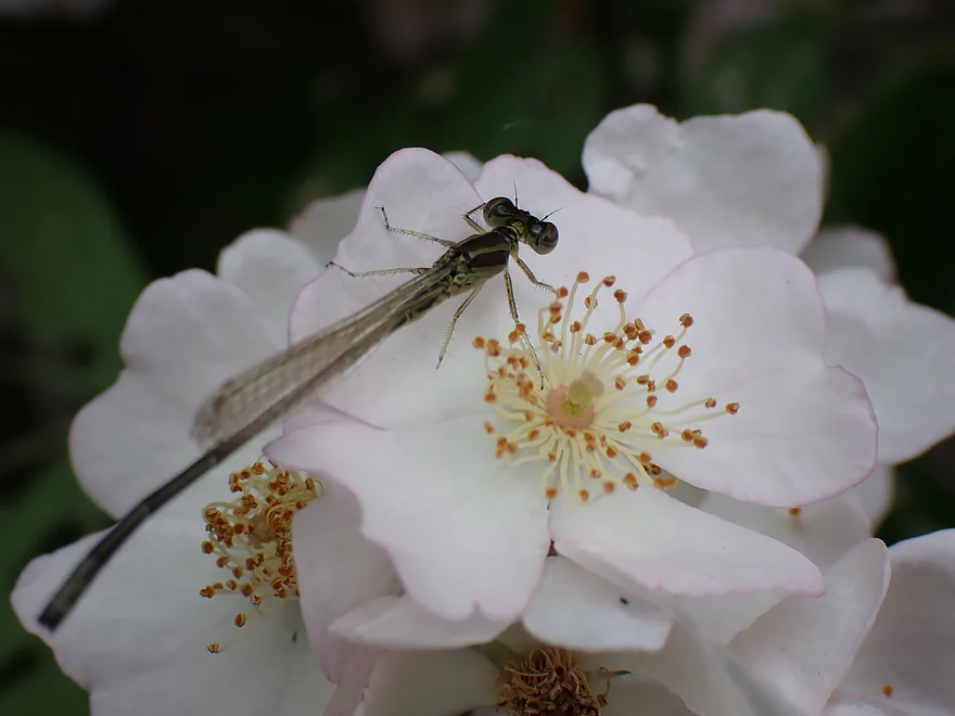
A chill damselfly
Final mile wasn’t super interesting
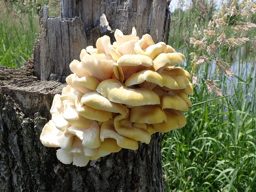
These are oyster mushrooms (edible and tasty)
Checking out Whitewater Creek
Taking out at Burnt Village Park
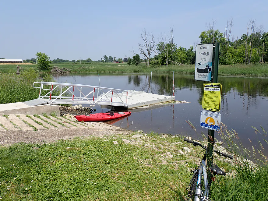
Terrific public access
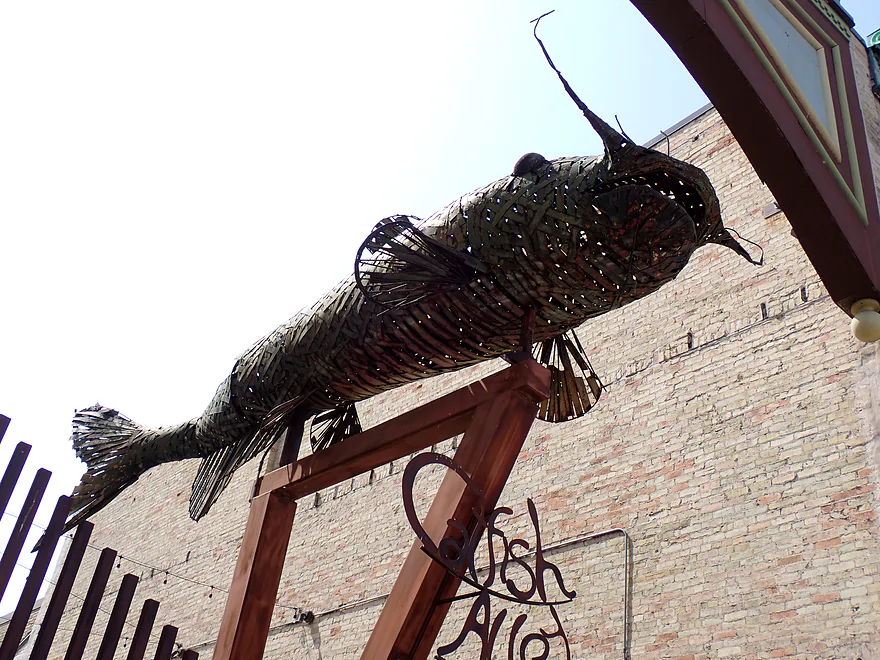
Had to take a picture of this catfish when driving home
Bark River – Prince’s Point


The Bark is a popular paddling river located in southeastern Wisconsin. Its best sections are farther north near the Milwaukee suburb of Delafield. Closer to Fort Atkinson, the lower portions become less interesting and less scenic, but they aren’t bad. For this trip I’ll explore the second-to-last stretch on the Bark before it joins the Rock River.
I started at Prince’s Point, which is a terrific public landing off Cty D. It was fortuitous timing as just a week later the road would be closed for bridge replacement, making Prince’s Point inaccessible for most of the 2025 summer.
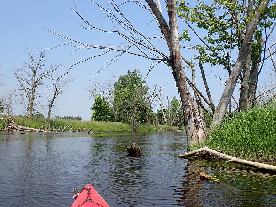
The first mile was the best of the trip. Here the river flowed through a scenic floodplain forest. Many of the trees were dead, likely killed by recent mega floods or the emerald ash borer.
This has resulted in huge ranks of tree skeletons…which created fantastic reflections on the water’s calm surface. Early morning is an optimal time for “mirror paddling” as typically the winds will be calmer and the sun will be at your back.
You won’t see that many boats (powered or not) on this segment, but I was passed by a total of two motorboats and two kayaks. There was one logjam on the trip (almost within sight of the put-in bridge), but I was able to hop over it and avoid a portage. In general the channel was slow and deep…figure about 4′ on average. High water lines on the trees suggested the river had recently been 2′ higher though.
As I transitioned out of the floodplain forest, the river became much less interesting. The channel widened, slowed, and became muckier as the river opened up into a vast wetgrass marsh (a former glacial lake bottom).
Not so neighborly “No Trespassing” signs dotted the banks, which reminded you that the shoreline was no longer part of the Prince’s Point Wildlife Area. This went on for 3-4 miles and marred the experience (and star rating) of the trip. It wasn’t awful paddling…just more of a “less exotic” experience.
The last two miles transitioned out of the marsh (somewhat) and featured a few more scruffy flood bottom trees. The scenery wasn’t great, but one highlight were the clay-lined banks. Whitewater Creek (a significant tributary) joined up and I explored it a bit before turning around. It’s a nice creek but logjams are an issue.
The final mile was the widest, slowest and least interesting. Often it felt like a lake paddle. I ended the day at Burnt Village Park, which was a terrific public access.
In summary, I enjoyed the trip, especially the first mile and its fantastic tree graveyards. But I suspect most would find the marsh portions a bit repetitive (but not bad). Bark River newbies should start further upstream…such as at Delafield or at Rome. Locals may enjoy this route as a new adventure though.
Sights included muskrats, egrets, one great blue heron, two eagles, lots of songbirds, some damselflies, one dragonfly, and a groundhog. There were some invasive species…namely zebra mussels and carp.
Prince’s Point Wildlife Area: In 2023 the DNR was able to buy 1,830 acres adjacent to Prince’s Point, doubling the wildlife area’s size. Plans are to create ponds and get rid of drainage ditches in what was previously a muck farm, making this a very important waterfowl area in this portion of the state.
Adam Birding Conservancy: A 300-acre reserve, with trails and observation blinds, located just downstream from Prince’s Point. It is privately owned but open to the public (as long as you sign in).
Prince’s Point: This was an excellent public access. Note though, the bridge will be closed due to road construction for most of the 2025 summer.
Alternate Put-ins:
- Hwy 106 (5.4 miles upstream from Prince’s Point): This is a simple but pleasant wetgrass paddle on the Scuppernong River. More info here.
Burnt Village Park: A terrific access with a floating pier for kayaks, free parking, and an outhouse.
Alternate Take-outs:
- Rock River Mouth (5.2 miles downstream from Burnt Village): This is a mediocre stretch. You should be able to get out on Rock River Road right at the mouth (unless flooded).
Bike Shuttle – Burnt Village to Prince’s Point: 5.2 miles with 112′ of ascent. There were a few hills, but I thought this was a manageable bike shuttle.
Current/Rapids: The current starts slow, but then gets progressively slower. By the last few miles, you can hardly tell the river is moving.
Logjams: There is one logjam just downstream from Prince’s Point. I was able to “hop” over it.
Closest Gauge: Bark River @ Rome
My Trip Depth: 67 CFS or 2.17′
Gauge Guide: This section should be navigable at any depth.
- 0-30 CFS : Low depth…fine for paddling.
- 31-50 CFS: Average depth.
- 51-75 CFS: Above average depth.
- 76-100 CFS: High depth but fine for paddling.
- 101+ CFS: Parts of the river will be flooded. This can be a cool kayaking experience as you will be able to paddle through woods.
Detailed Overview
For more information on access options, see my Overview Map. For a background on area human interest stories, I recommend the book “The Bark River Chronicles“.
- Cty Q to N Road: 0.1 miles. Small, channelized and weedy…this may require high water to run.
- N Road to Hillside Road: 1.4 miles. Small and marshy with maybe 2-4 logjams. High water is likely needed to run this part.
- Hillside Road to Hwy 164: 2.0 miles. Maybe 5-10 logjams. Very small and marshy. Likely needs high water to run.
- Hwy 164 to Lisbon Park: 2.9 miles. Maybe 2-4 logjams. The channel here is small, shallow, weedy and bog-like. High water is recommended.
- Lisbon Park to Merton Dam/Firemen’s Park: 1.3 miles. Mostly simple flowage paddling.
- Merton Dam to Bark River Park: 4.9 miles.
- Merton Dam to Dorn Road: 1.2 miles. Very scenic section with great fall color. Highlights include some boulder gardens, springs, clear water, and pine trees. Diverse banks with some woods and some marsh. There is one tricky logjam by the old mill.
- Dorn Road to Hartling Road: 0.7 miles. A short but pleasant open section with no logjams.
- Hartling Road to Rybeck Road: 1.0 miles. A scenic mix of light woods, marsh, and a few boulder gardens. There was one easy logjam to portage and a few hoppers/duckers, but it is mostly open.
- Rybeck Road to Centennial Park: 1.0 miles. Starts open and has a fantastic boulder garden. The last part is more cluttered with a number of logjams to hop over. I never had to portage though.
- Centennial Park to Bark River Park: 1.0 miles. A fast wooded section with multiple logjams. There are about four major logjams in a row, but you can skip them all by portaging on the boardwalk to the east (super easy). There are some additional hoppers beyond this stretch, but I didn’t think they were too bad.
- Bark River Park to Delafield Post Office: 6.1 miles.
- Bark River Park to Nixon Park: 0.7 miles. Terrific stretch through the heart of Hartland. Highlights included many fun Class 1 rapids and one Class 2.
- Nixon Park to Cottonwood Ave: 0.5 miles. Nice stretch with a mix of light woods and suburban homes.
- Cottonwood Ave to Hwy 83: 1.4 miles. Mostly an open marsh section. A few portages are required for downed trees.
- Hwy 83 to Lake Nagawicka Mouth: 1.3 miles. Less marsh and more woods…this is a nice stretch with good water clarity.
- Lake Nagawicka Mouth to Delafield Post Office: 2.2 miles. This is almost all lake paddling. Lake Nagawicka has good clarity and some attractive shoreline homes, but it is heavily developed and suffers from excess motorboat traffic. Several alternate access options exist along the lake shore.
- Delafield Post Office to Hwy 67: 7.7 miles.
- Delafield Post Office to Nemahbin Lake Boat Launch: 1.8 miles. Likely the best stretch on the entire river. Highlights include attractive rocky sections and stunning clarity.
- Nemahbin Lake Boat Launch to Sawyer Road: 0.7 miles. Mostly a simple paddle on Lower Nemahbin Lake. Highlights include great water clarity, an attractive cattail corridor and the “Blue Hole”.
- Sawyer Road to Genesee Lake Road: 2.2 miles. Very nice marsh paddle.
- Genesee Lake Road to Summit Ave: 3.0 miles. A good stretch with ecologically diverse banks.
- Summit Ave to Hwy 18 Wayside: 3.8 miles. A decent prospect. The take-out is a small park/wayside and the last of the three Hwy 18 bridge crossings. Note, a recent reader comment says this stretch has many serious logjams.
- Hwy 18 Wayside to Hwy E: 6.2 Miles. Heavily channelized, but some of it still seems like it has potential. Note a reader noted that this stretch has many serious logjams, some of which are difficult to portage.
- Hwy E to the Rome dam: 4.2 miles. Half of this leg would be a flowage paddle on Rome Pond.
- Rome to Cushman Road: 5.6 miles. A fantastic stretch and one of southeast Wisconsin’s paddling gems.
- Cushman Rd to Hwy 106 Canoe Launch: 4.4 miles.
- Cushman Rd to Hagedorn Rd: 0.6 miles. A great leg with clear, fast water and many rocks. Only downside is, it can get shallow.
- Hagedorn Rd to Hwy 106: 3.8 miles. The first half is pleasant, clear and rocky. The second half is more of a floodplain paddle with more mud and downed trees, which was less interesting.
- Hwy 106 canoe launch to Prince's Point Wildlife Area: 5.5 miles. Be careful of the partly removed dam at Hebron. There are definitely downed trees in this section.
- Prince's Point to Burnt Village County Park: 7.1 miles. Much of this was a mediocre wetgrass paddle through a large marsh. However kayaking through the floodplain forests of the Prince's Point Wildlife Area was very cool.
- Burnt Village County Park to the Rock River: 5.5 miles. Does not seem super interesting. Landing is just upstream of the mouth on the east bank.
Trip Map
Overview Map
Video
Photos Size: