
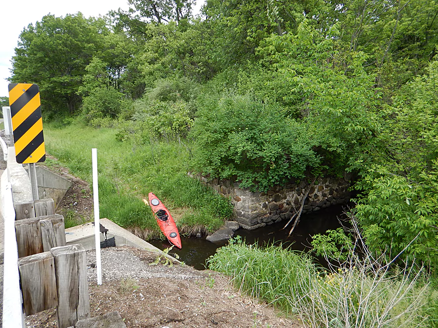
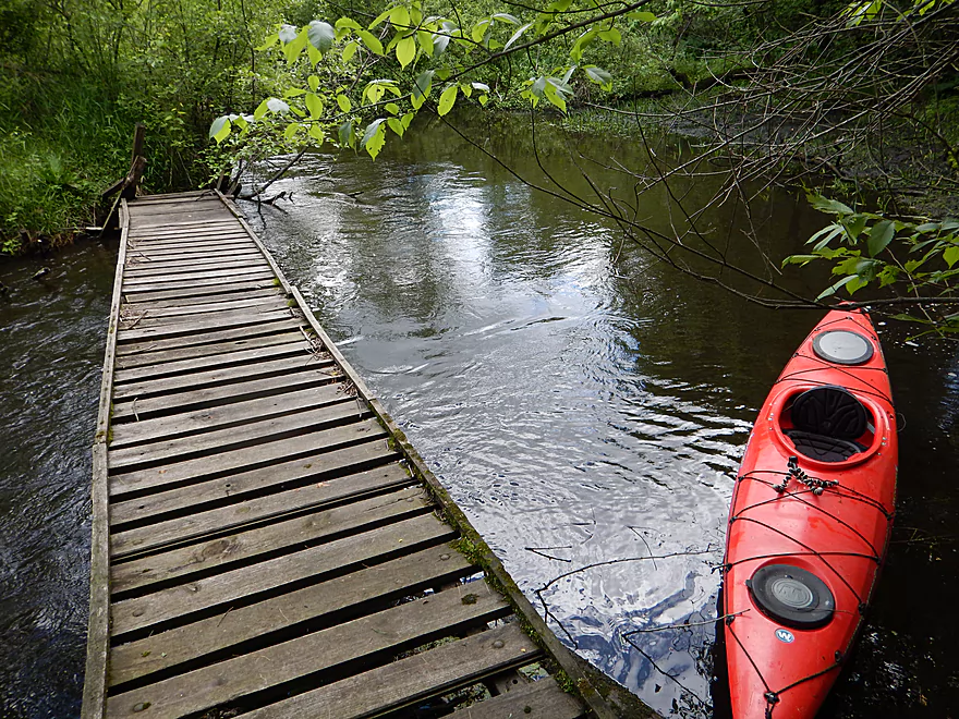
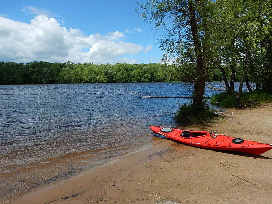
Ok put-in at Hwy 51
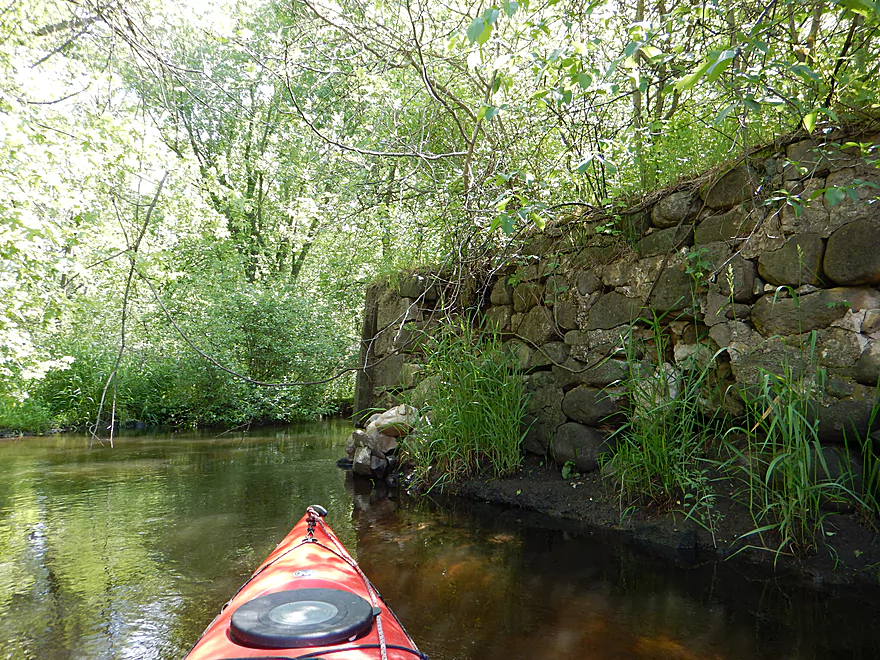
Attractive stonework from washed out bridge
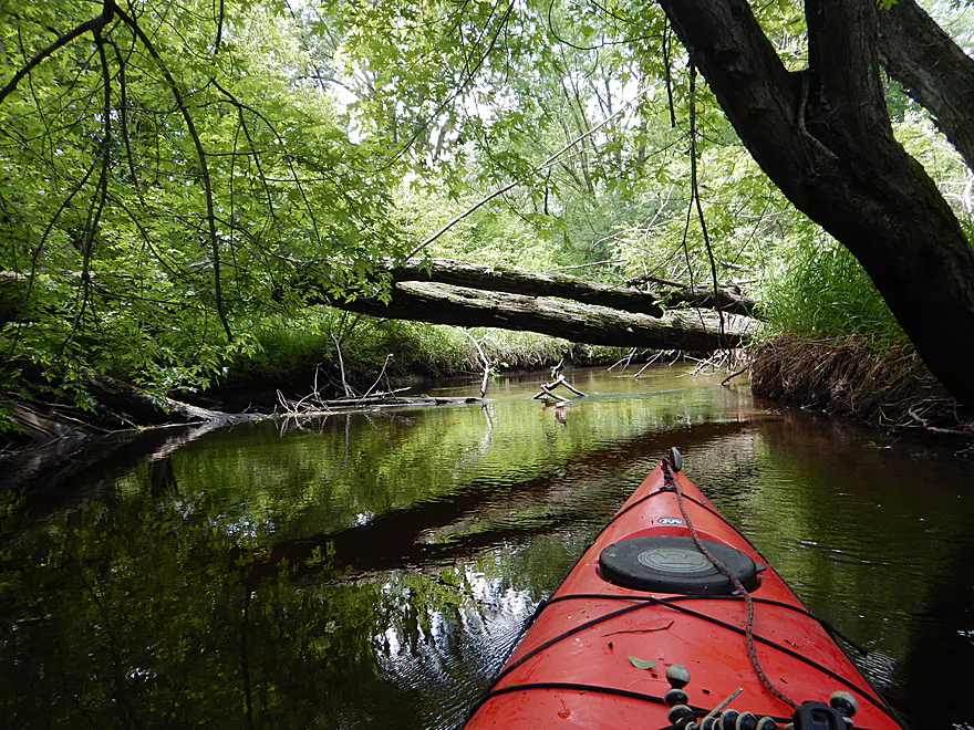
Down tree right away (easy to hop over)
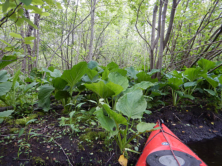
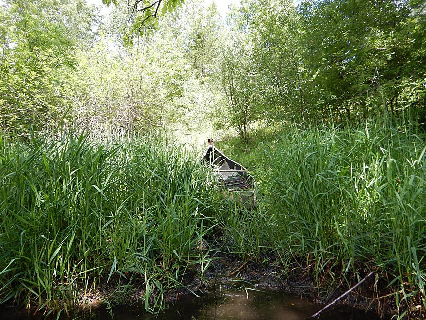
Jungle of skunk cabbage
More of this…
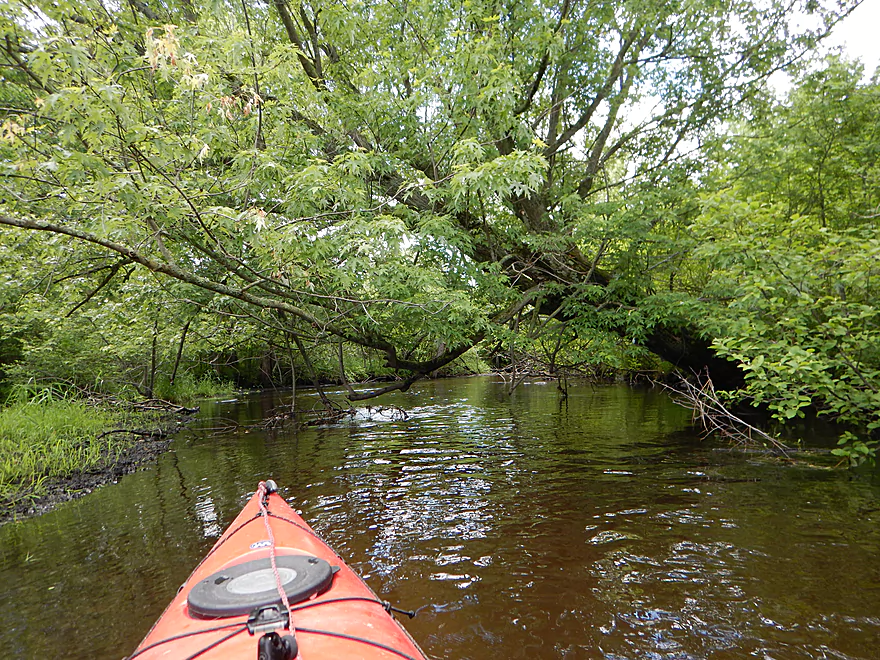
Time to duck low
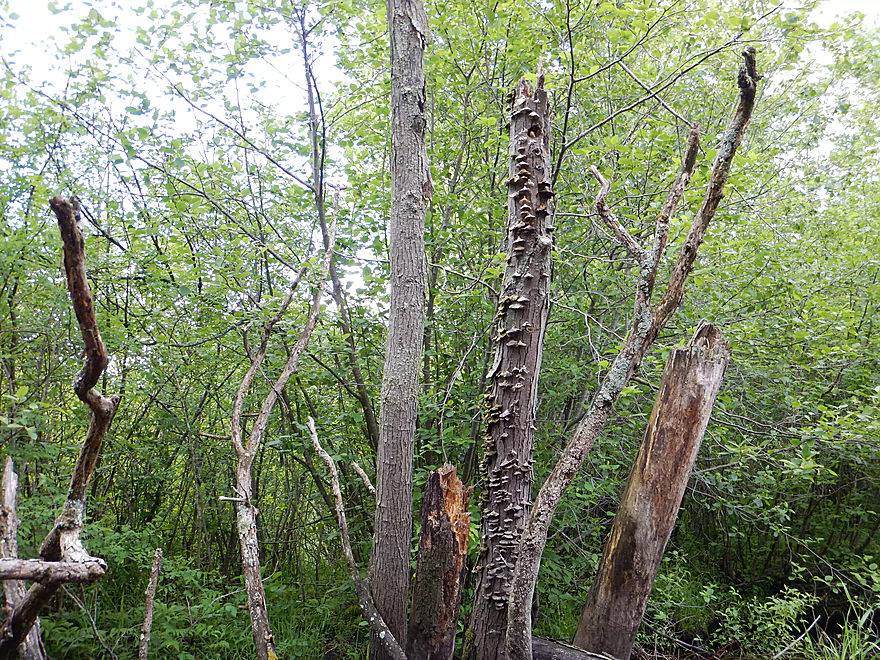
Quite the fungal infestation
They get much bigger…
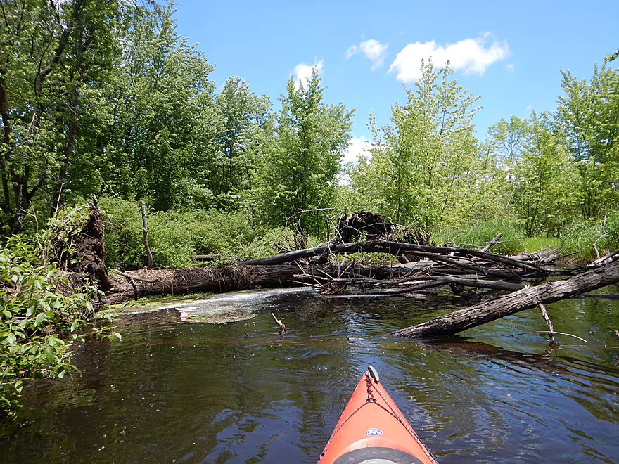
This jam was partly cleared out by someone
Local likes to canoe the creek
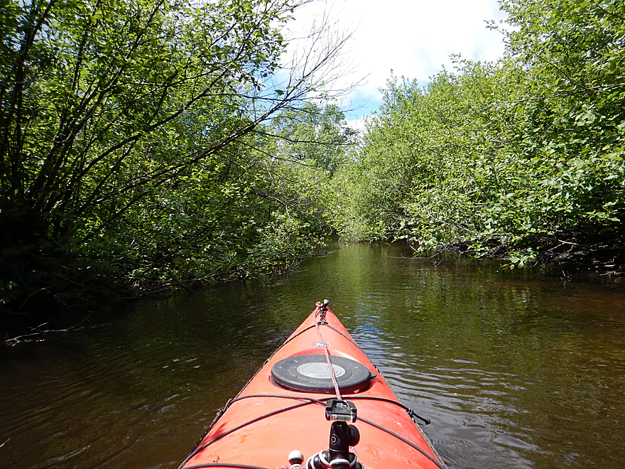
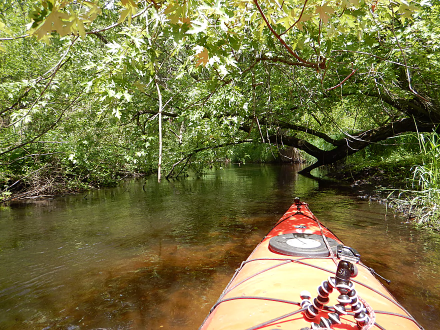
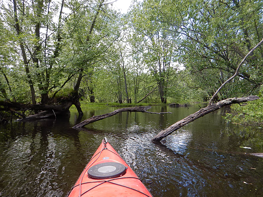
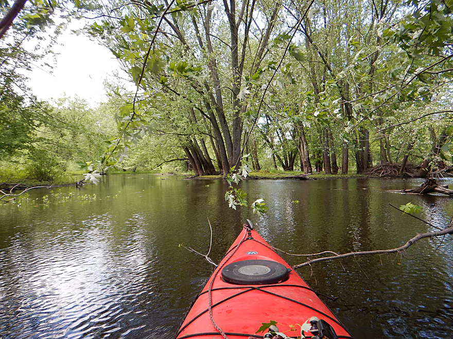
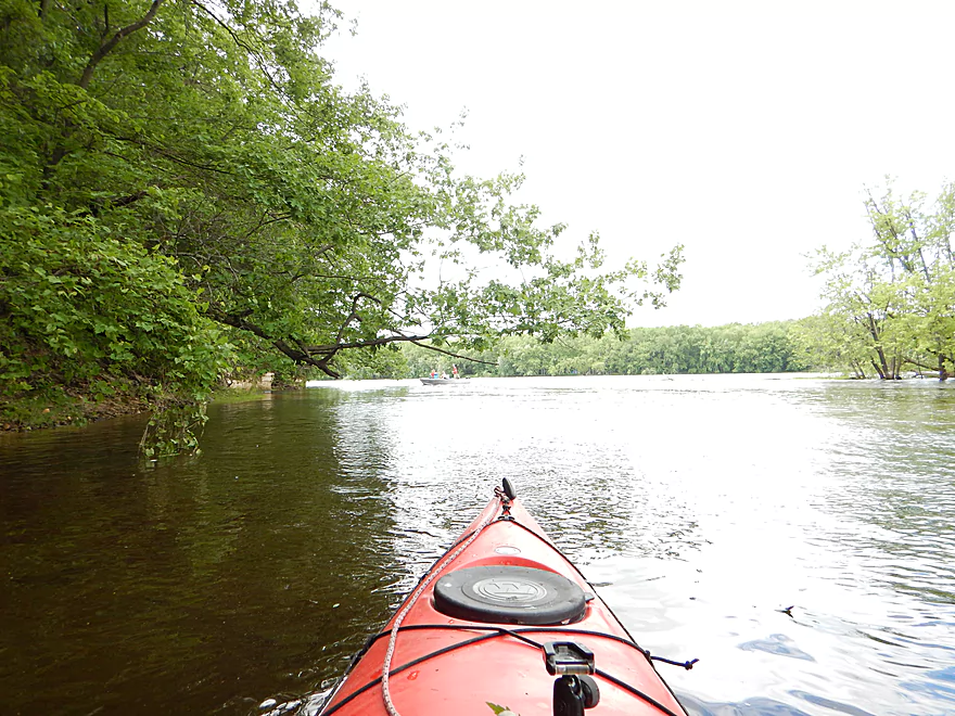
Entering the alder gauntlet
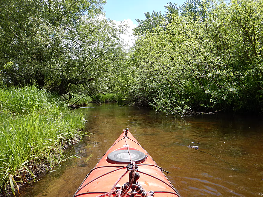
Ok water clarity in some parts
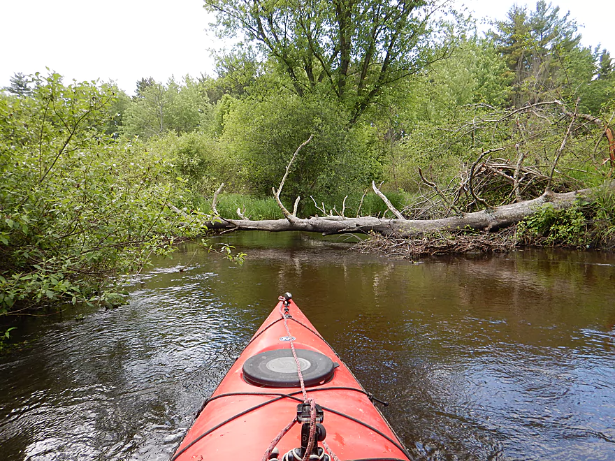
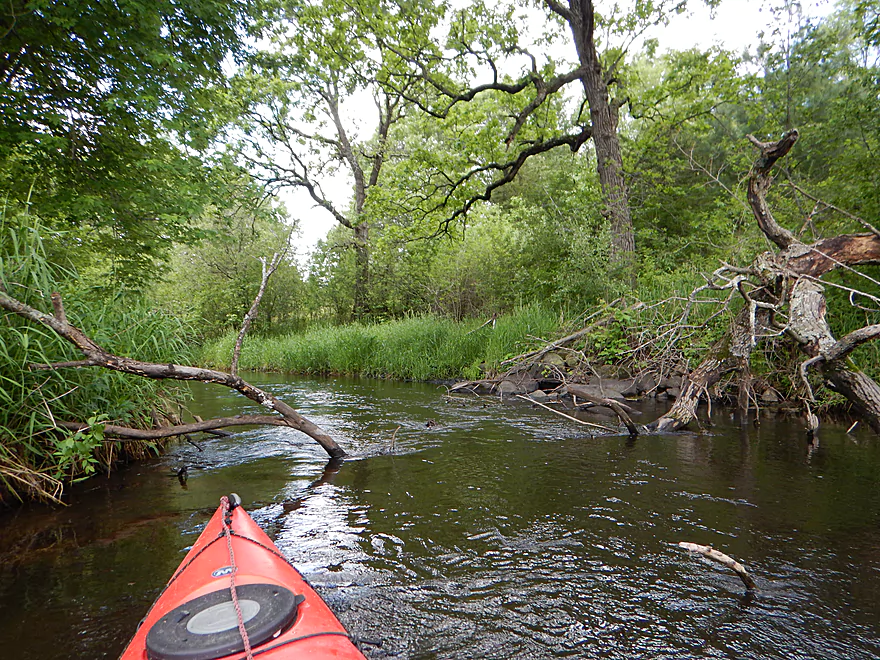
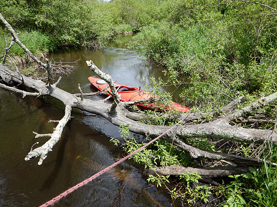
Log jam giving me the middle finger
Fun…
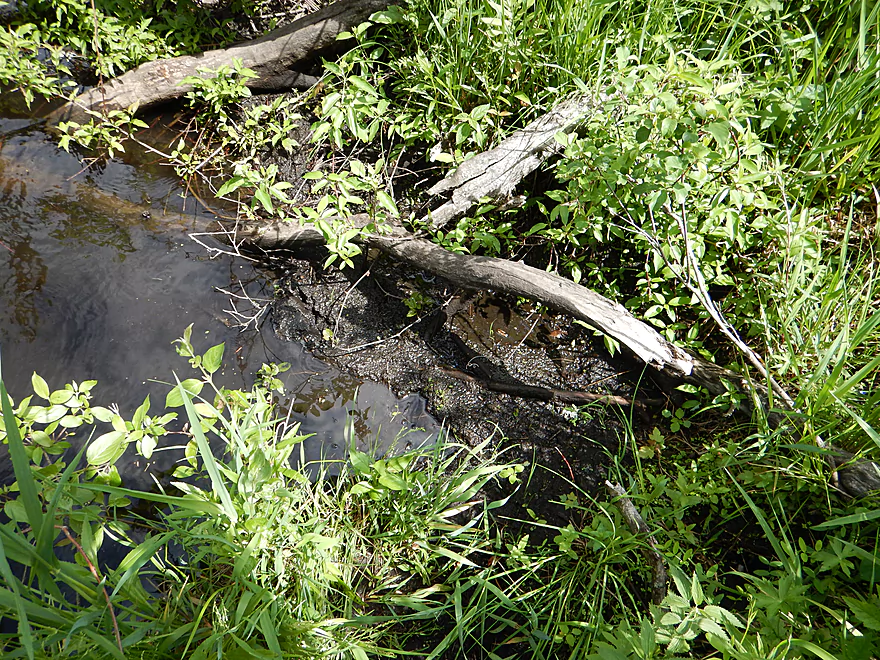
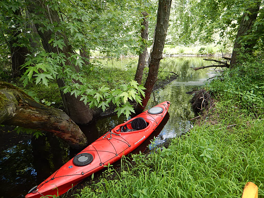
The mud on this portage was awful
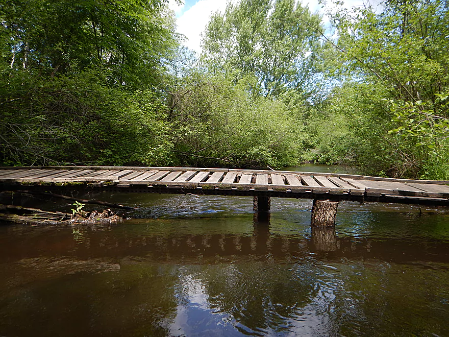
I tried unsuccessfully to go under
So time for portage #2
More tight maneuving required
You could hear the crackling sounds reflect off the water…
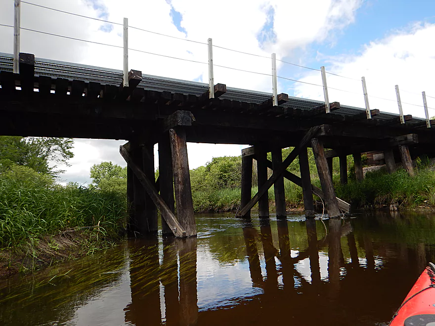
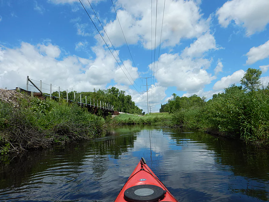
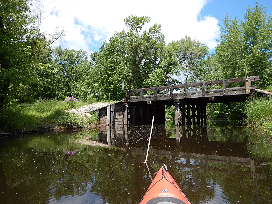
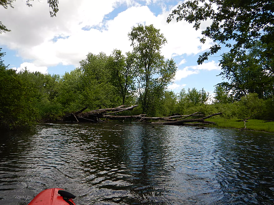
Creek changes after the railroad bridge
Slows down and widens
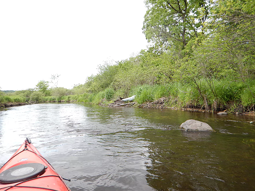
Rocky Run finally living up to its namesake
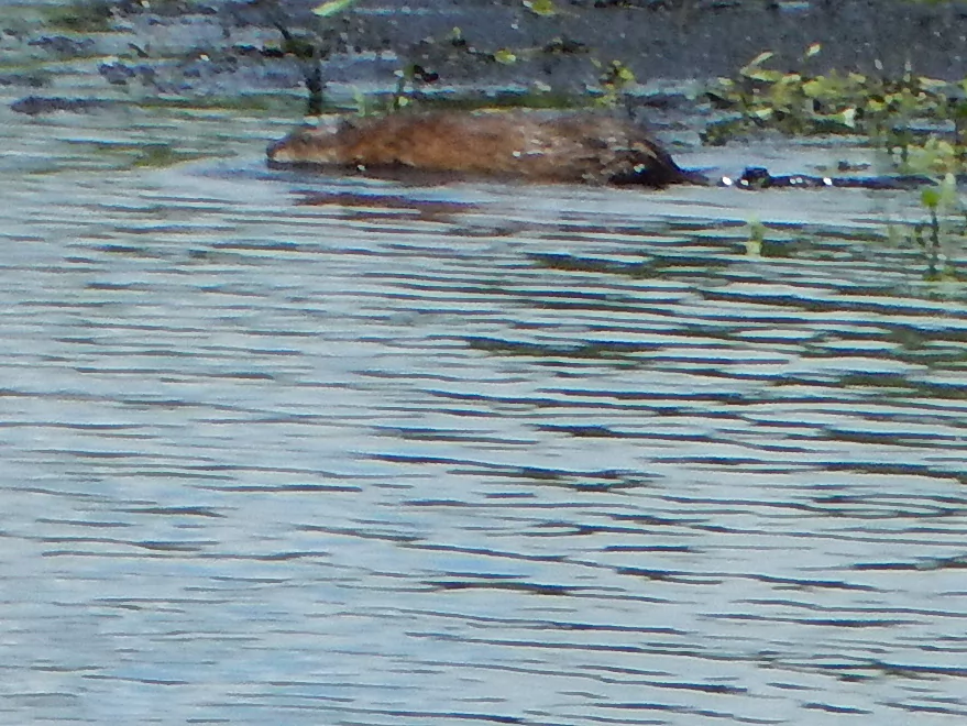
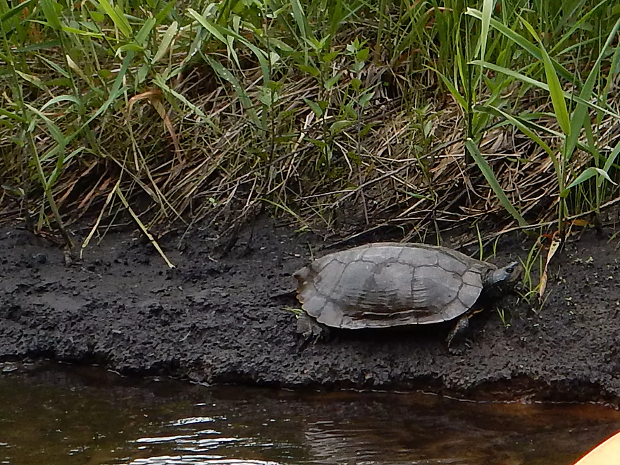
I interrupted a muskrat’s lunch
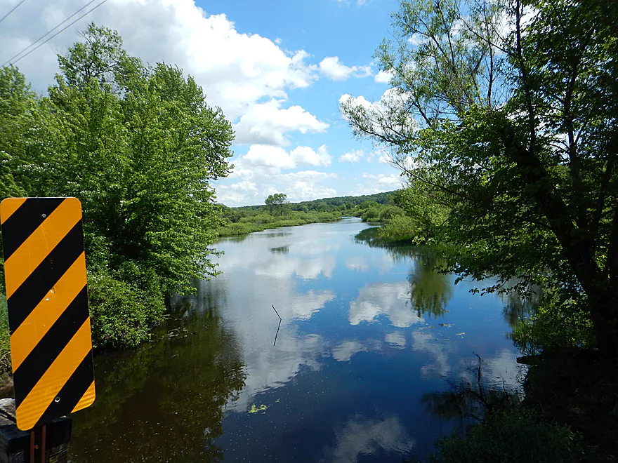
Hwy J/V is an alt put-in (or take-out)
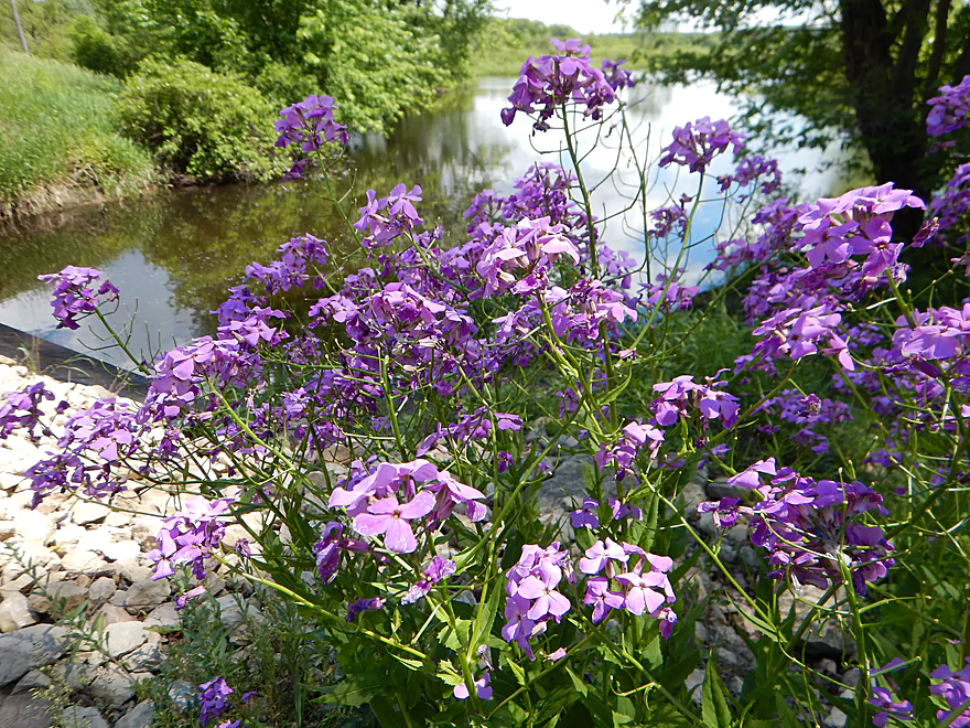
Lot of purple flowers (Dames Rocket)
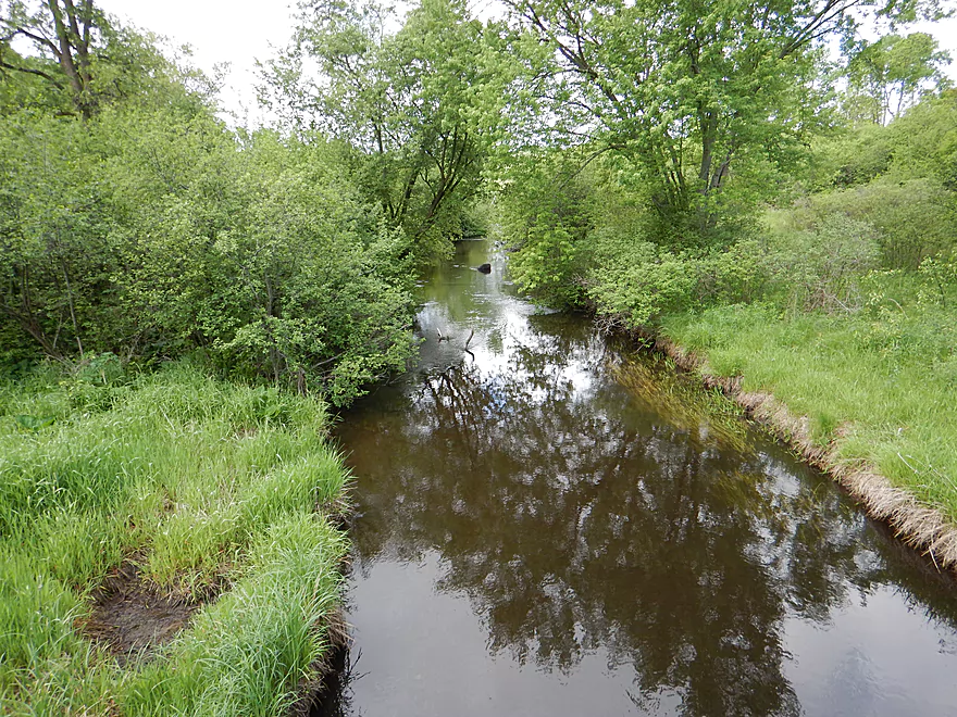
Looking back over the creek
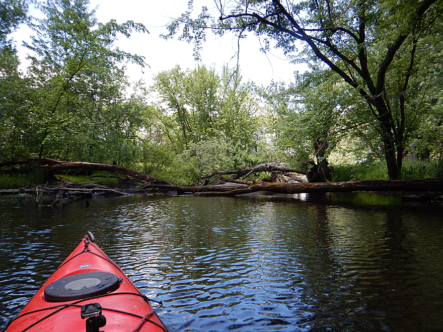
Not again!
Portage #3 was not so bad
Portage #4
Portage #5
Plus some tight fits
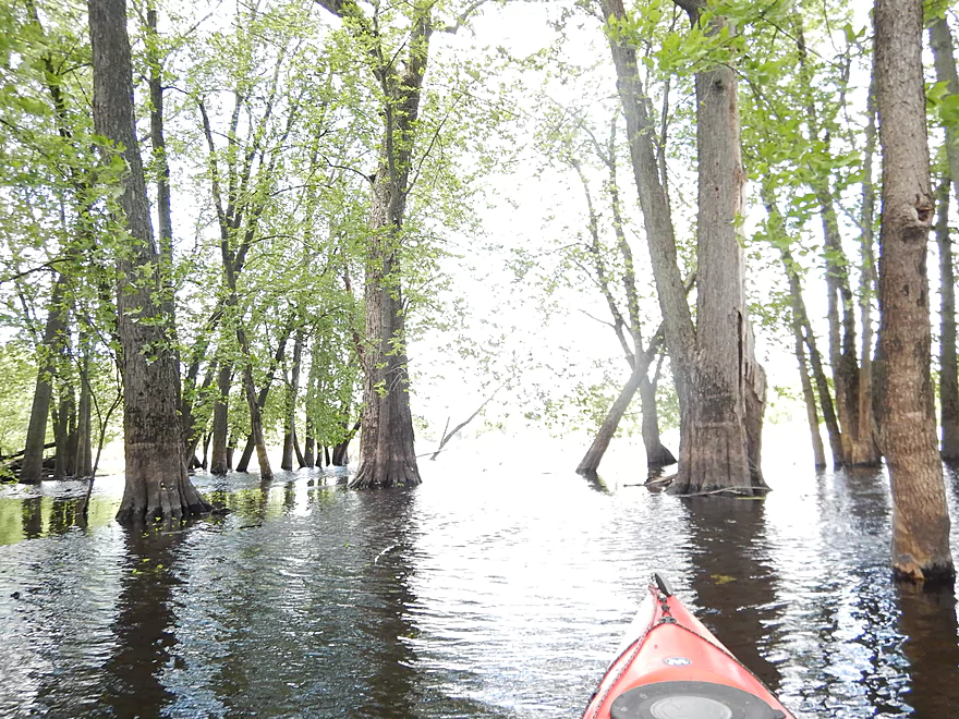
The floodplain forest is very neat (during floods)
Creek starts to get backed up
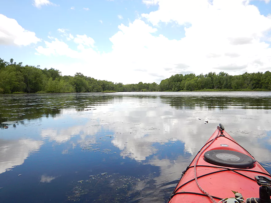
Welcome to the Wisconsin River
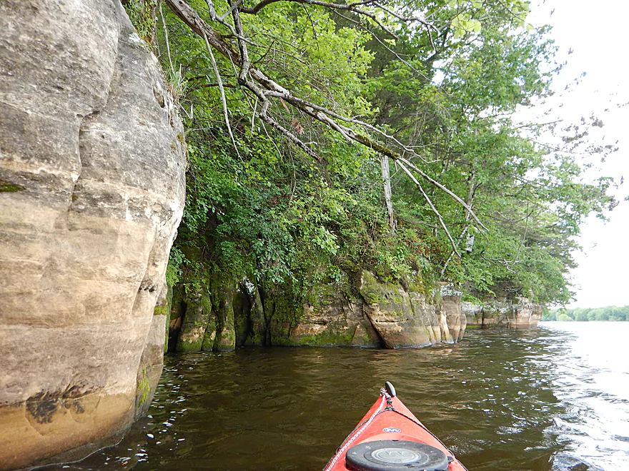
Quite the staircase
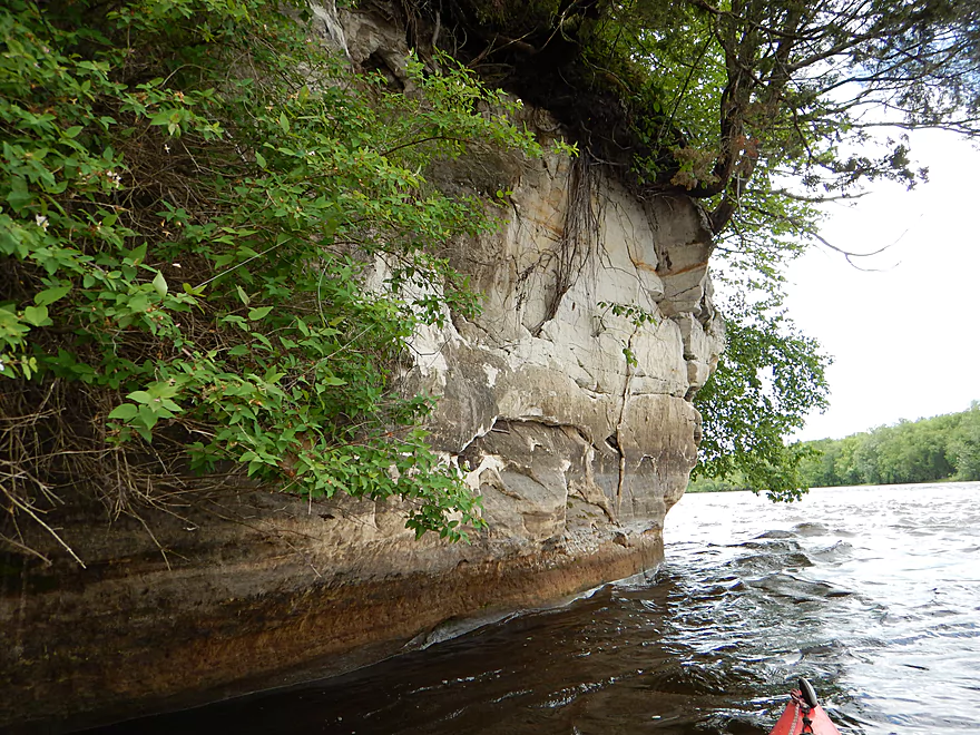
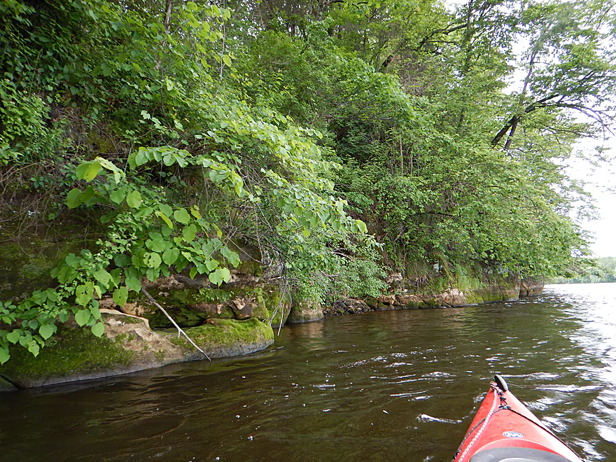
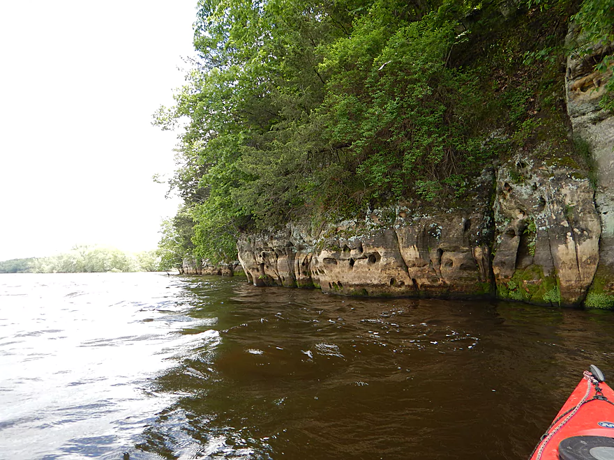
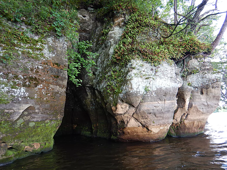
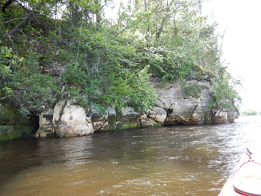
Nice sandstone along the river
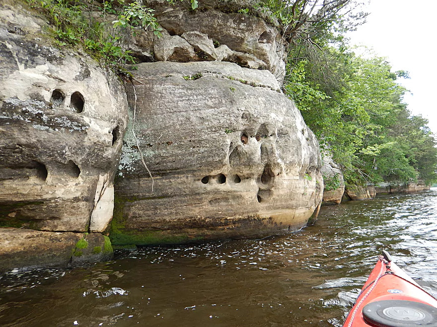
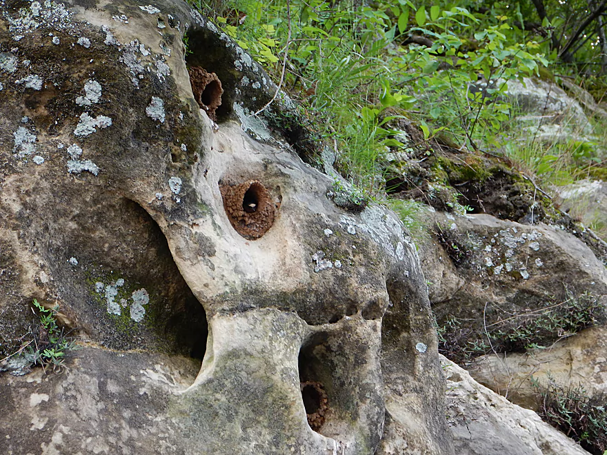
Some Swiss cheese sandstone
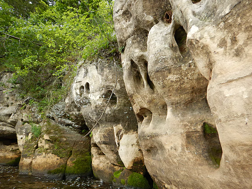
Terrific erosion patterns
Cool sandstone folds
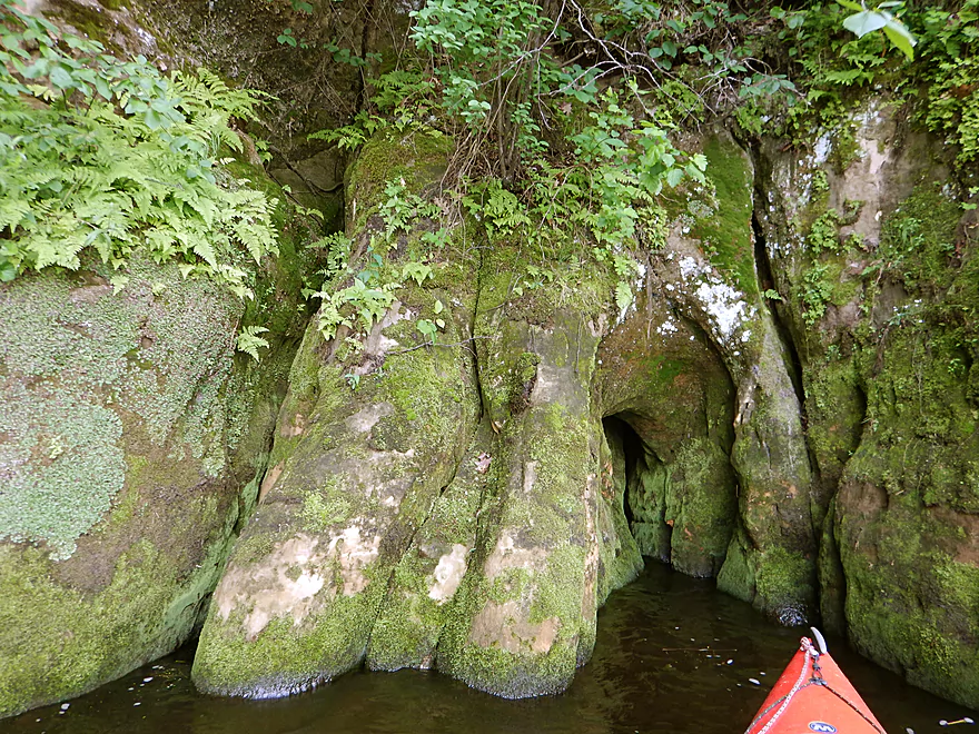
A beak is poking out of one of them…
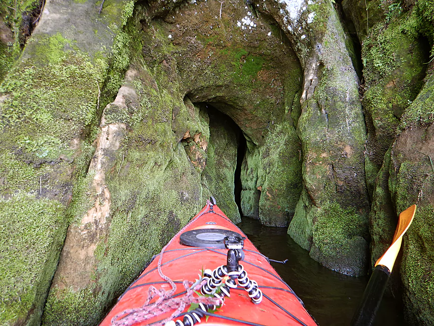
This cave is much bigger
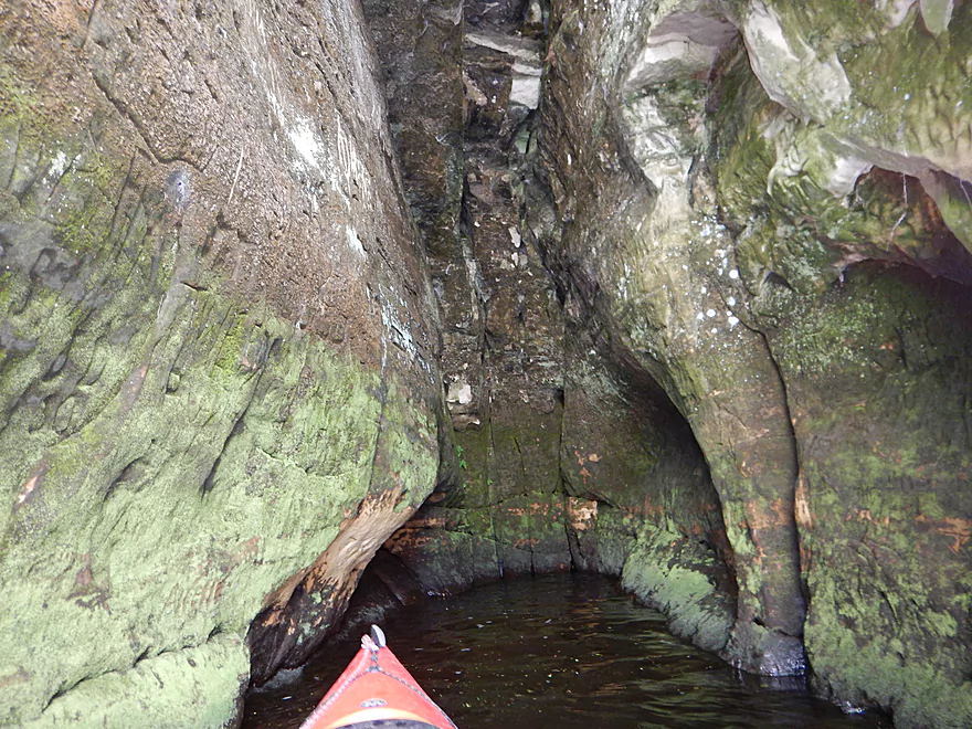
Hard to picture but pretty neat
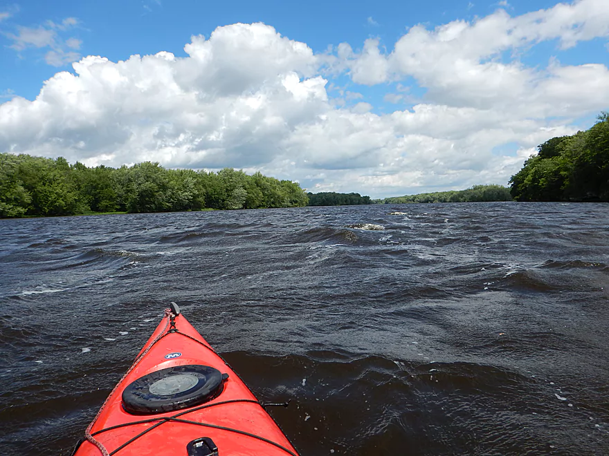
Braving the high seas
Taking out at Dekorra
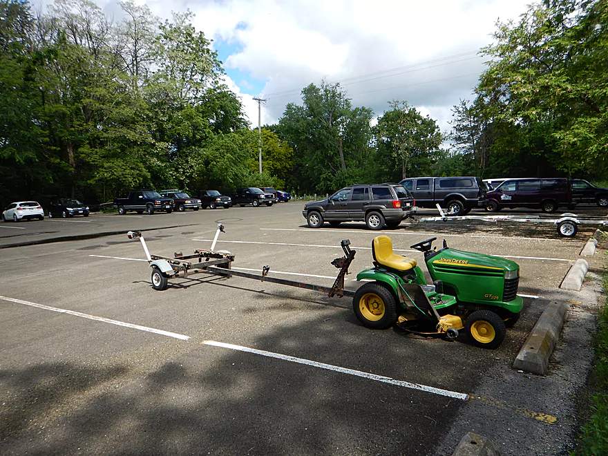
A popular landing…even with lawn mowers!
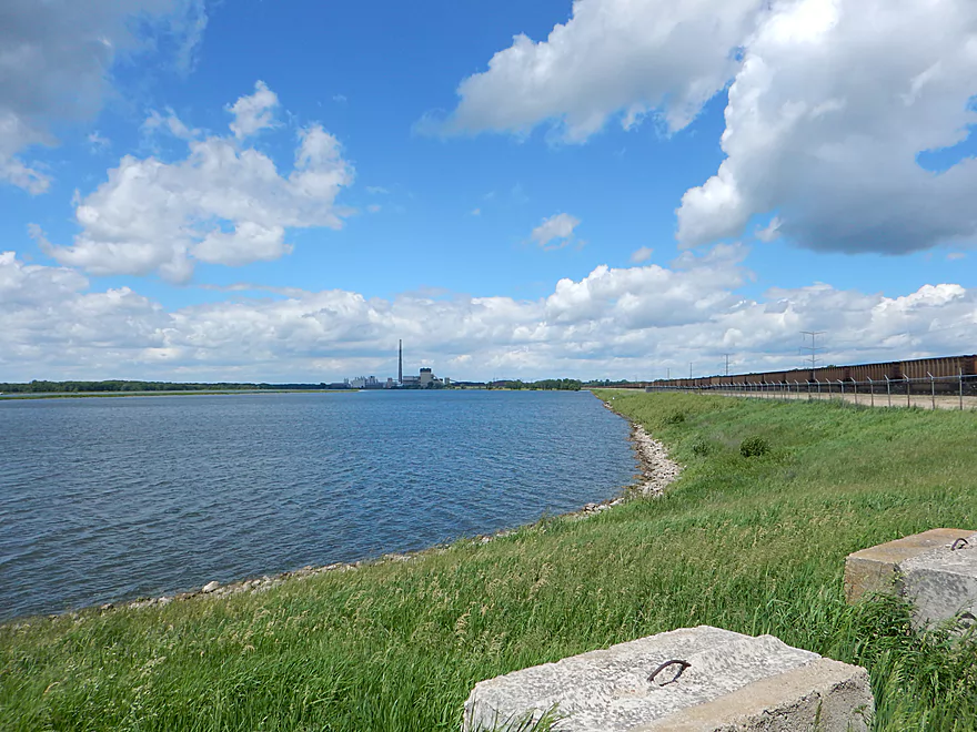
Nearby power plant is one of the largest in the state
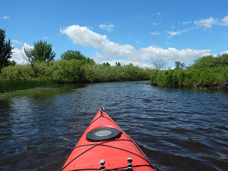
Rocky Run Creek – Hwy 51


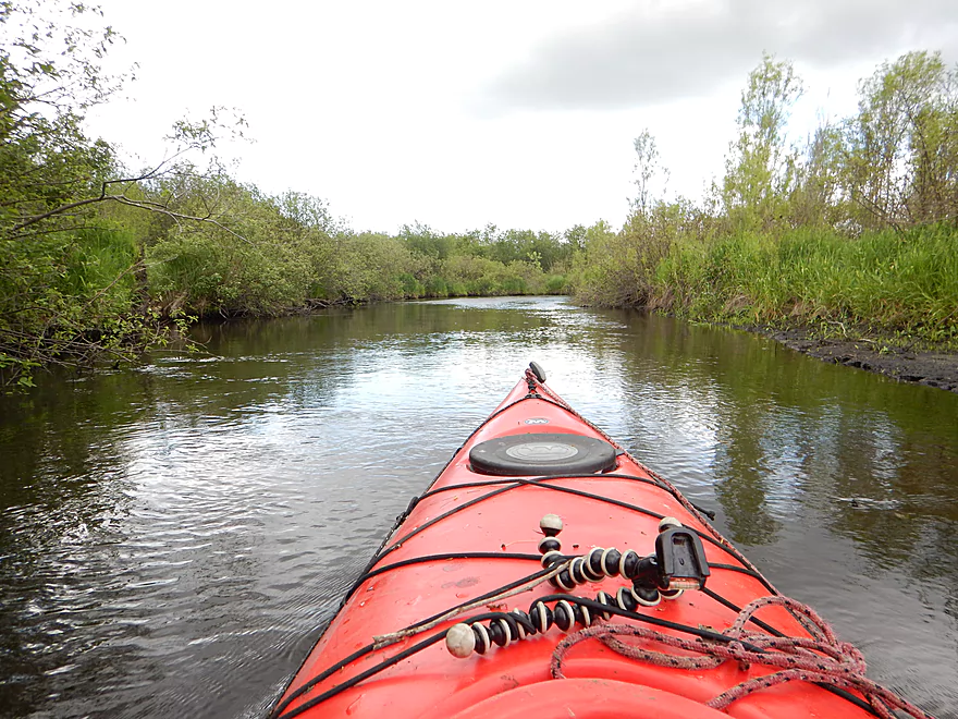
Rocky Run Creek is a small tributary to the Wisconsin River located just a little upstream of Lake Wisconsin. This is a small creek paddle, and is not suitable for larger boats because of the tight turns, decent current, and low hanging alder gauntlets.
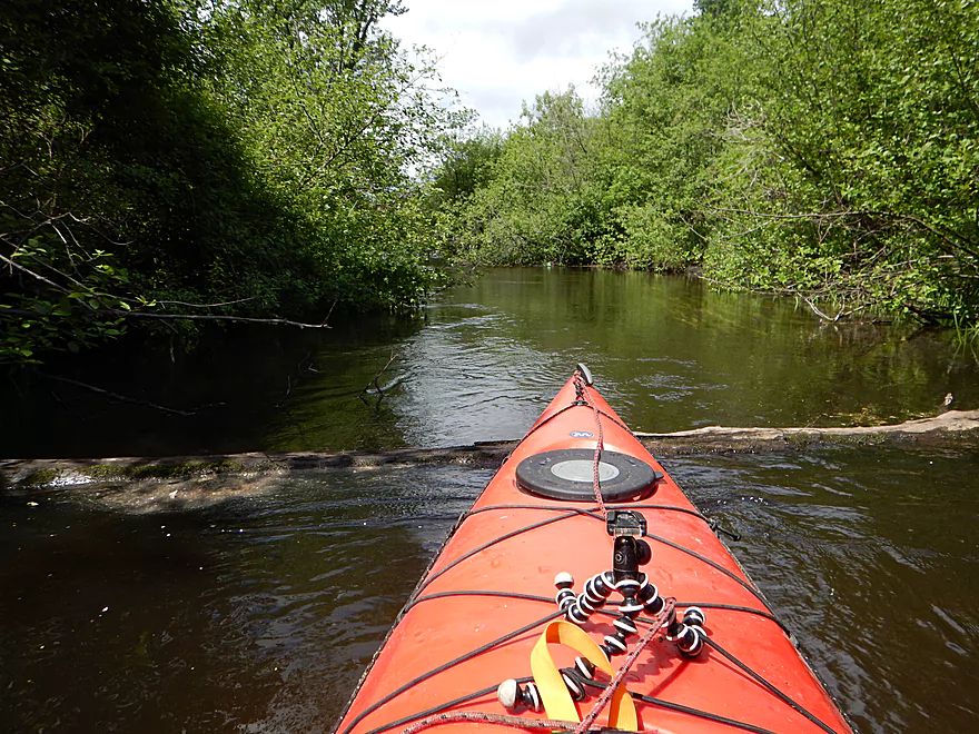
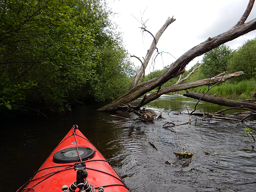
What really is the problem are the log jams. There is one down tree immediately downstream of the put-in, which I was able to hop over with a running start. After that there was a down tree that required a portage, which was difficult because of how muddy the banks were. Next up, was a very low walk bridge necessitating portage #2 (also muddy). On top of this there were several squeakers to thread through all just within the first mile, which put a damper on my enthusiasm for the creek.
I don’t want to overplay the log jam situation though. If you’re a local looking for a new adventure this could be a good option. In my case, I did the trip after it had rained for almost three days straight so the banks were unusually moist (never do a portage-fest prospect after a big rain). Also I was in my “red boat” which is not suited to doing jams and portages unlike my “yellow boat” (an excellent jam buster). So that and the overcast weather, might have jaded what could have been a three star creek.
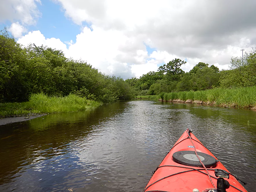
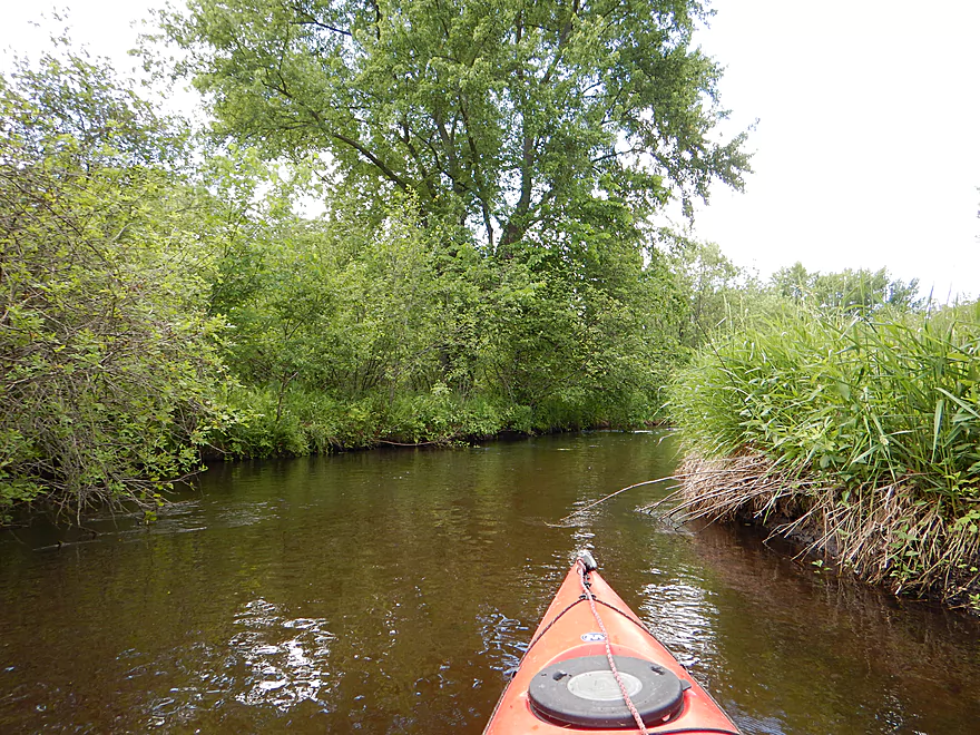
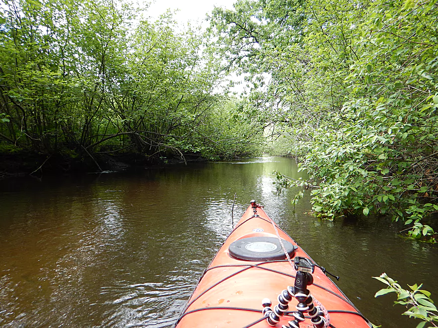
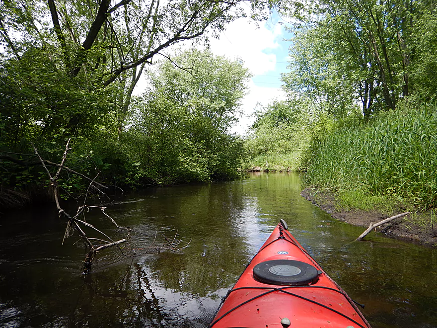
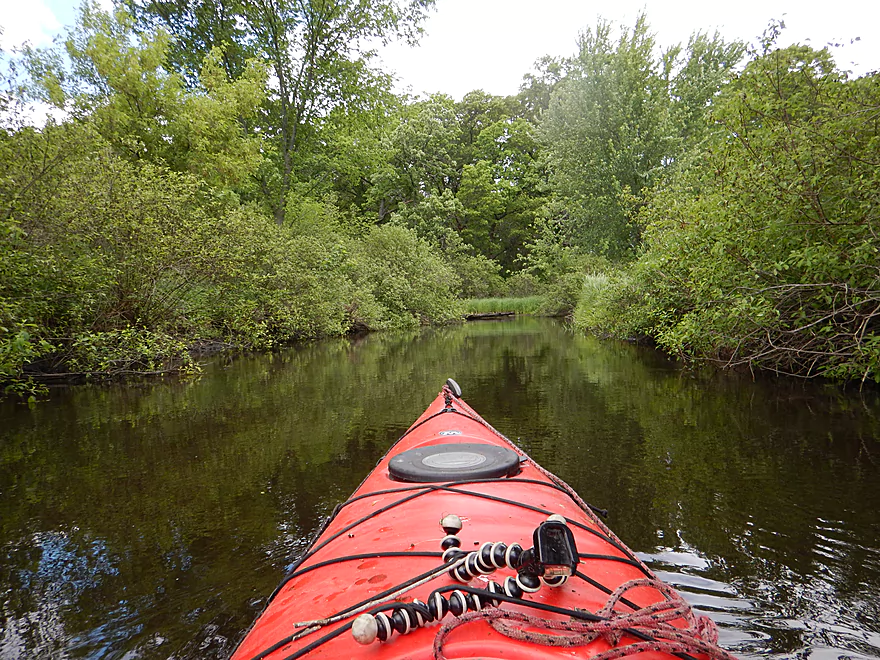
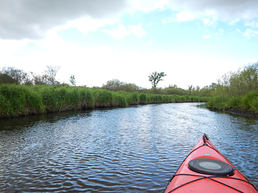
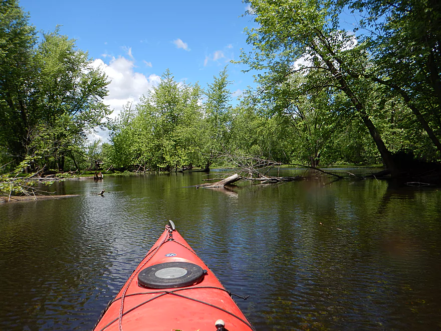
While the first mile is a small, tight, twisty creek in fast current hugged by alders, the second mile after the railroad bridge is completely different. The channel widens, the current slows down and best of all there are absolutely no jams to contend with. This was a very nice section that I liked. The trees receded and bottomlands flattened out into an open and pleasant wetland.
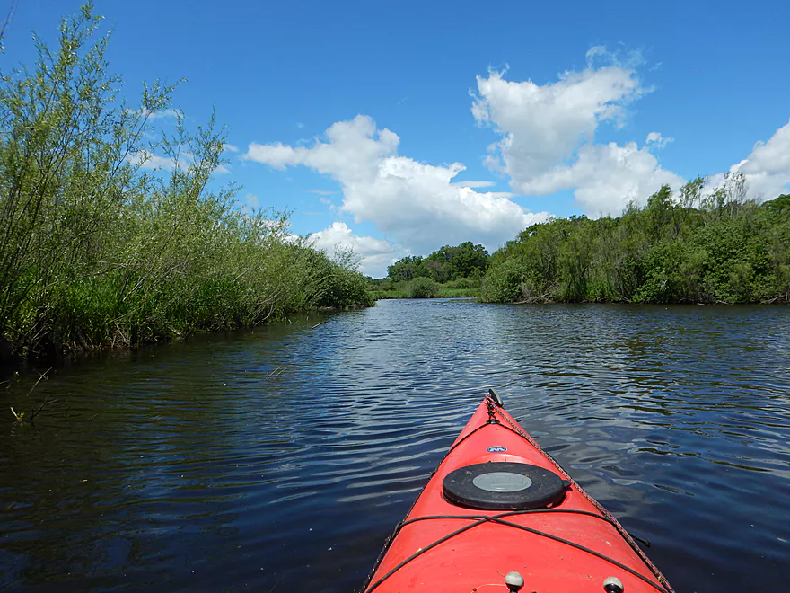
After Hwy J/V, the channel changes dramatically again. The twisty channel returns as well as the trees (and with them log jams). These were easier to portage than the upstream jams, but this was still annoying (especially as I hadn’t had to face these on my last trip). The creek soon widens out at as a mixture of Duck Creek, Lake Columbia, and the Wisconsin River collude to backfill Rocky Run Creek. Some of the slough sections were simple open water sections and not as interesting to paddle.
The best part of the creek was ironically enough the Wisconsin River. Immediately at the mouth, there are splendid sandstone cliffs running a third of a mile all the way to the take-out. These are fantastic with little alcoves carved out and even a cave that you can poke into. The cliffs are filled with swallows who have made attractive mud nests in the eroded recesses which at times looked like sandstone swiss cheese.
So to provide a big picture recap here:
- Mile 1 (Hwy 51 to the Railroad Bridge): A small, fast section that was a bit brushy and had “two” many portages for my taste. If you do this, wait for a dry spell so the portages won’t be muddy. Two stars.
- Mile 2 (Railroad to Hwy J/V): A very pleasant open wetland paddle. Three stars.
- Mile 3 (Hwy J/V to the Wisconsin): Several portages and then open slough paddling. Not super interesting and only two stars. However…if you paddle this during high water, you can not only easily go over the jams but you can also paddle through the lush silver maple floodplain forest. An amazing experience (4-5 stars), which I did previously.
- Mile 4 (Wisconsin River to Dekorra): Great section of the Wisconsin with a really nice sandstone bluff. (5 stars)
Hwy 51 is actually not bad for a bridge access point despite the fast, heavy traffic. There is plenty of room to pull over and nice beaten down trail north of the bridge leading to the water.
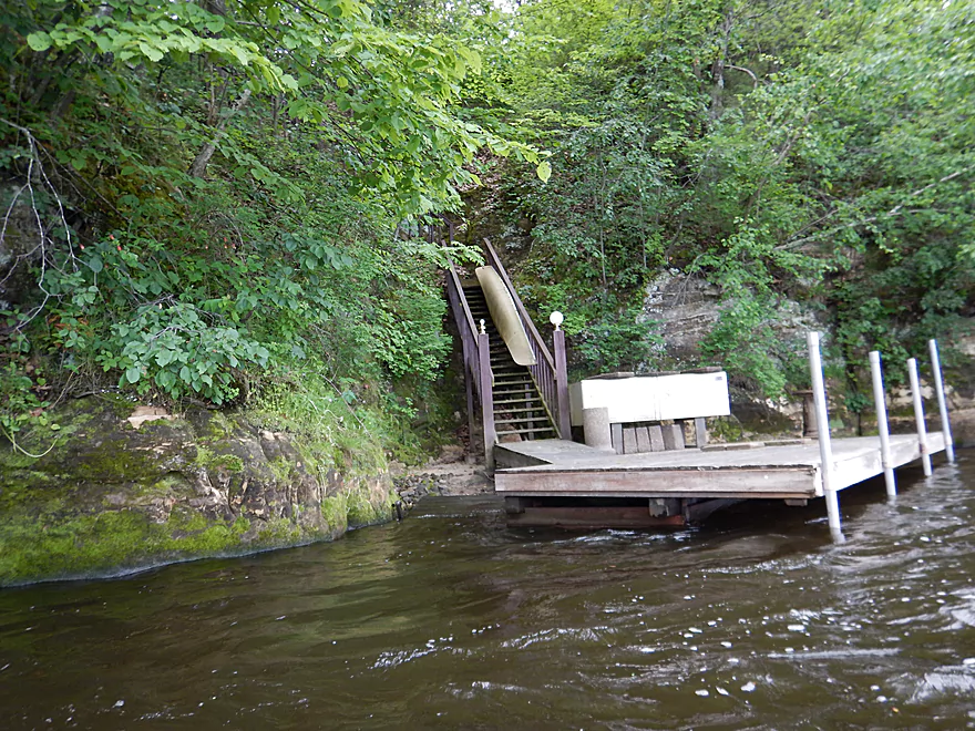
Dekorra Landing is one of several take-out options on the Wisconsin River. This is a good option with free parking, but is very busy and has no outhouse.
T&G Canoeing is a rental and livery that provides service to the Wisconsin River. Am not sure if they service Rocky Run Creek, but you can call and ask: (608) 617-2818.
The bike shuttle is pretty easy at 3.18 miles and no major hills.
The second half of the trip is very exposed to the wind, so keep this in mind. Not only can this be grueling, but it can make the Wisconsin River very choppy. In my case, I ended up paddling through whitecaps. Not a big deal for me and many readers, but beginners want to avoid big waves.
The logjams were a problem. Basically, there are two jams that need to be portaged between Hwy 51 and the railroad bridge. These are muddy and not easy. Plus there were several tough squeakers.
Between the railroad bridge and Hwy J/V, is clear sailing.
Between Hwy J/V and the take-out there are at least 3 portages plus some close squeakers. Interestingly enough, they are all very close to Hwy J/V and you could in theory avoid most by launching 500′ west of the bridge where the creek doubles back on the road. During high water, it would be easy to get over these jams.
The creek itself is actually relatively stable and somewhat immune to spur-of-the-moment floods and running dry late in the summer. The bigger concern is the Wisconsin River. It will backfill between one-to-three miles of the creek depending on the flow rate. I went at about 7,500 CFS per the Dells gauge which is about average for a spring paddle. Previously, I did the lower section at 24,000 CFS which was perfect. Not only did it allow me to go over the log jams, but I was able to paddle through the floodplain forest which was an amazing experience. My recommendation is to launch from Hwy J/V and at a depth of at least 20,000 CFS.
A mother duck pulling the old “lame duck” trick to lure me away from her kids when she should have been more worried about the snapper I saw nearby. Other highlights included dragonflies, deer, muskrat having lunch, and local monkeys bellowing and jumping off the sandstone cliffs. Unfortunately, biting insects were an issue. Pulled one tick off me and swatted many mosquitoes.
Detailed Overview
- Traut Road to Cuff Road: (2.6 miles) Surprisingly open and clear of most deadfall, this is a simple wet-grass prospect but very small and would require above average conditions to be feasible. An intriguing prospect.
- Cuff Road to Dunning Road: (3.1 miles) Deadfall appears to be too much of an issue for this leg.
- Dunning Road to Hwy 51: (3.9 miles) Swift current, gravel, and an attractive marsh are highlights. Unfortunately logjams and low hanging alders are a bit much.
- Hwy 51 to Hwy J: (2.5 miles) An ok section but with several muddy portages.
- Hwy J to Dekorra Landing: (2.0 miles) This section has too many jams to be enjoyable. But during high water you can go over these and through the silver maple forest which is an amazing experience.
- Additional Wisconsin River Options: For other take-outs and adventures on the Wisconsin, see my Wisconsin River overview map.
Trip Map
Overview Map
Video
Photos Size:
Paddled Rocky Run from 51 to Dekorra on Oct. 16, 2016. Even more log jams and very muddy portages than you reported. Fun and scenic in between jams, though. At high water levels you might have fewer portages.
Thanks Jon for the update and sorry for the delay in getting back to you. Hopefully the locals will eventually clear out this creek.
I live at that entry point. I am amazed at how many people try this paddle. Years ago my son and I did it twice at the same time….First and Last. It is a miserable route…in low water one must literally pull yourself through mud and not more than inches of flowing water below VJ bridge…nettles galore if you portage…just today I suggested to a group of five with one canoe that they should reconsider as two of the five were small kids. A more interesting trip is from the next road east which is dunning to the bridge over hwy. 51…winding through aldershot and open but many oxbow bit it has been cleared out and is smooth paddling
Thanks Bob for the tips. It is too bad about the lower section.
As far as Dunning to Hwy 51…appreciate the tip! I scouted this and it did look nice. Will have to check it out sometime.
Have now done Rocky Run twice. Thanks for your pictures and advice. First time in June 2018 from J/V bridge up to Hwy 51 and back. So much fun. Today, from 51 all the way to river. 2 trees and 1 bridge to portage in the 51 to J/V bridge section. That section was lovely and took about 1 hour. I could have stopped there. I agree I also should have just gotten out at J/V Bridge and launched 500 ft down the way to avoid 4 more portages, but kind of proud I could do them. I just moved in to the area and wanted to really explore. I took out an 8 ft kayak with a good rope, so the portages went well. Really is beautiful. No bugs, ticks, or deep mud for me on either trip,but, have to be willing to portage. I will do the 51 to J/V bridge again when the trees turn color, but I am done with that first 2000 ft of creek after the bridge for now. So wish someone could get in there with a chainsaw but that is above my pay grade. I am a 58 year old, 5 ft 3 in female, with low center of gravity, so popping in and out of a kayak and over a few trees isn’t that big a deal. Nice change from the Wisconsin.
I appreciate the comments. Yeah, I do wish somebody would tidy up the creek, but it is doable now for adventurous paddlers.
What are the rules about cleaning out a public waterway? Can anyone try to cut out deadfall?
I’m not aware of any specific rules. Generally speaking it is quite common for paddlers and liveries to remove logjams.
I ran the section from the hwy 51 Bridge to the second Dekorra landing (behind Hookers resort)with A bike shuttle. There was plenty of water and just a few obstructions. most of them simple. I had to get out of my boat a couple of times and out of the river once, the rest I was able to squeeze over, under or through. Fairly clear water and nice sandy bottom in many places. There was a foot bridge that was in the process of being built, unfortunately it is being built at the worst possible height, to low to get under yet high enough to require you get out of your and go to shore to get over it. On the upside the river is not very deep and there is not much current, so it is not hard, just a hassle. The Wisc was high so there were a lot of cool exploring possibilities in the flood plan forests. Felt very Bayou like, almost expected to see an alligator. The bike shuttle was a short 3.3 miles (15 mins) fairly level and a nice country road except for the last 200 yards or so which is on Hwy 51, but it has a nice wide shoulder, and is down hill so it only takes a minute or 2 to bike it.
I wonder if the Wisconsin backfilling the the lower portion of the creek covered up some the jams. Yeah that section is really cool when flooded…another similar flood paddle would be to the north by the power plant and on Duck Creek. But I’ve heard getting lost can be an issue.
Went from Hwy 51 to Dekorra landing today. Lots of recent rain. Branches hanging down and impeding paddling every 50 yards. As we put in a local resident stopped and asked if we had a saw. The hardest challenge was the rebuilt foot bridge (now an ATV bridge) that is too low to go under and very hard to portage. About mile 2. After that the going was much better. We spooked 7 deer and 2 turkeys. A trip only for hardy paddlers.
Thanks for the update and warning.