
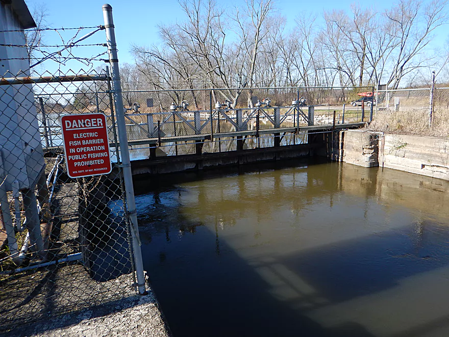
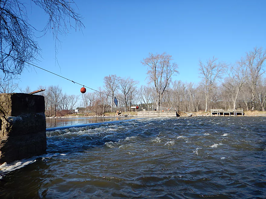
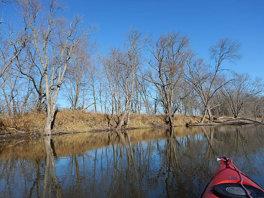
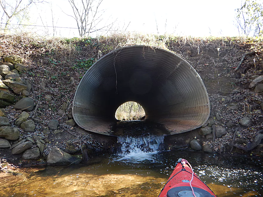
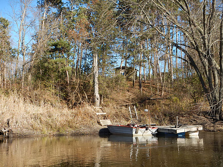
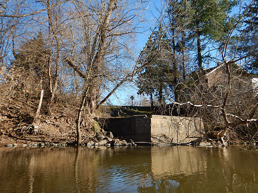
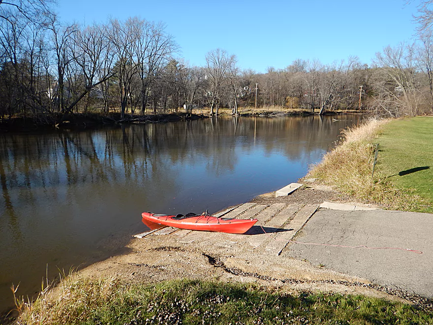
Good launch by the Princeton locks
Locks are sealed shut and have a fish barrier now
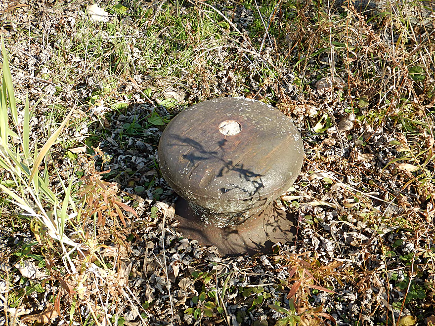
A lot of historical memorabilia in the area
Paddling down the original lock
The other side of the island has a nasty low head dam
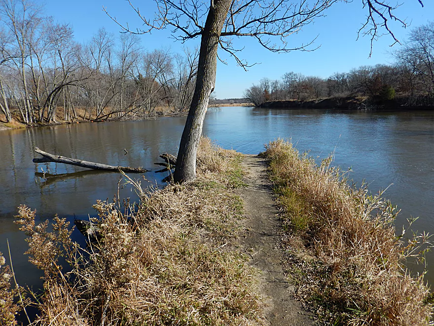
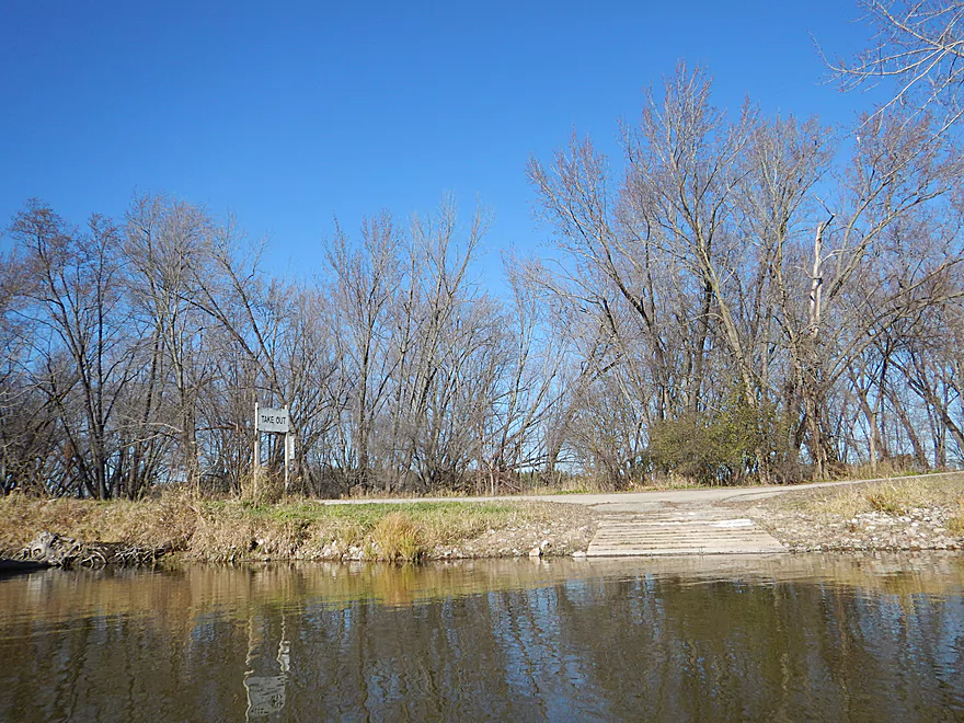
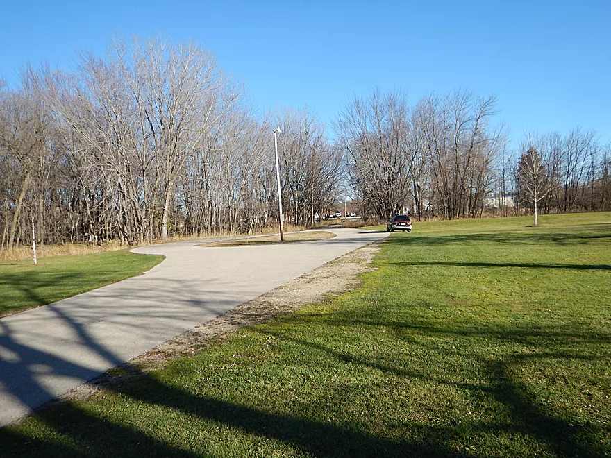
Path to nowhere
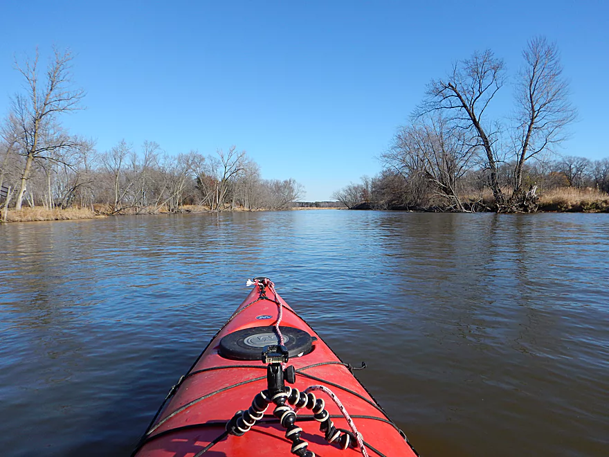
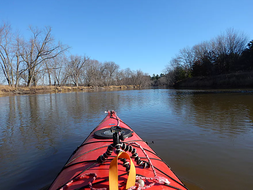
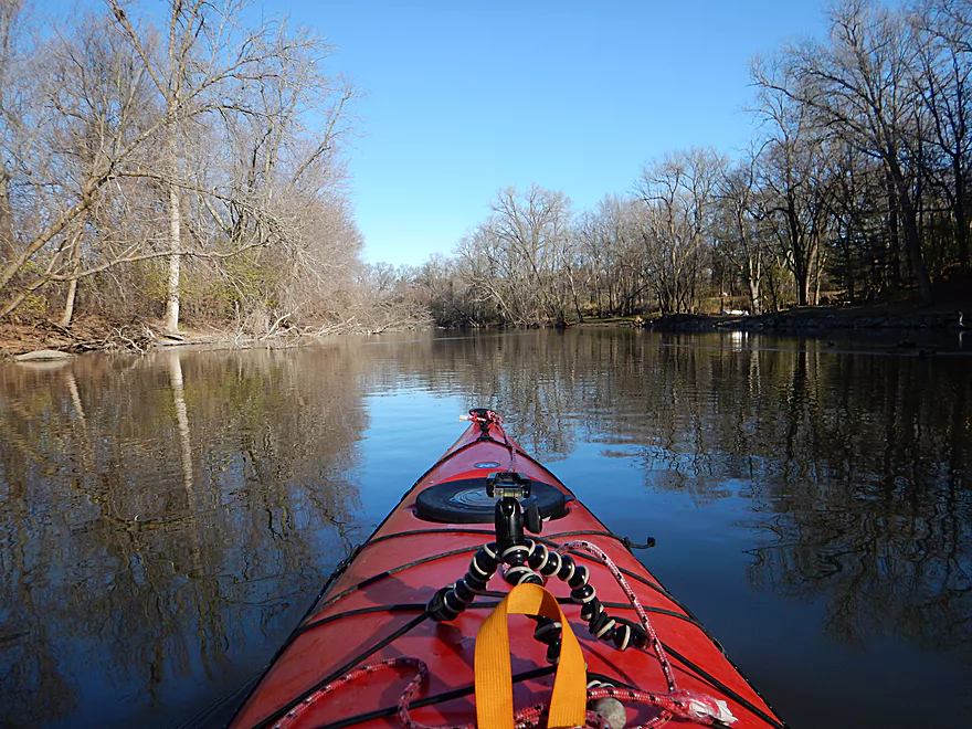
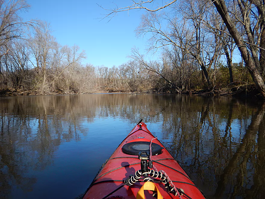
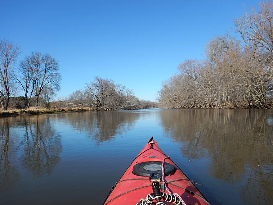
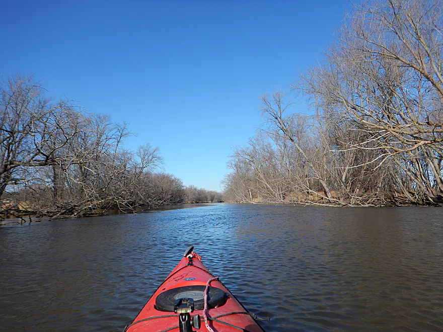
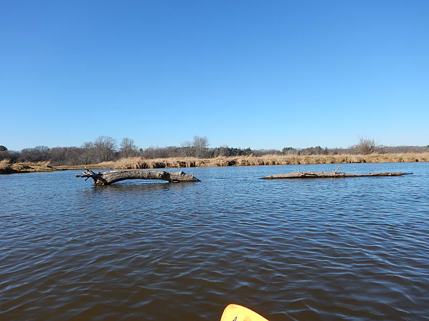
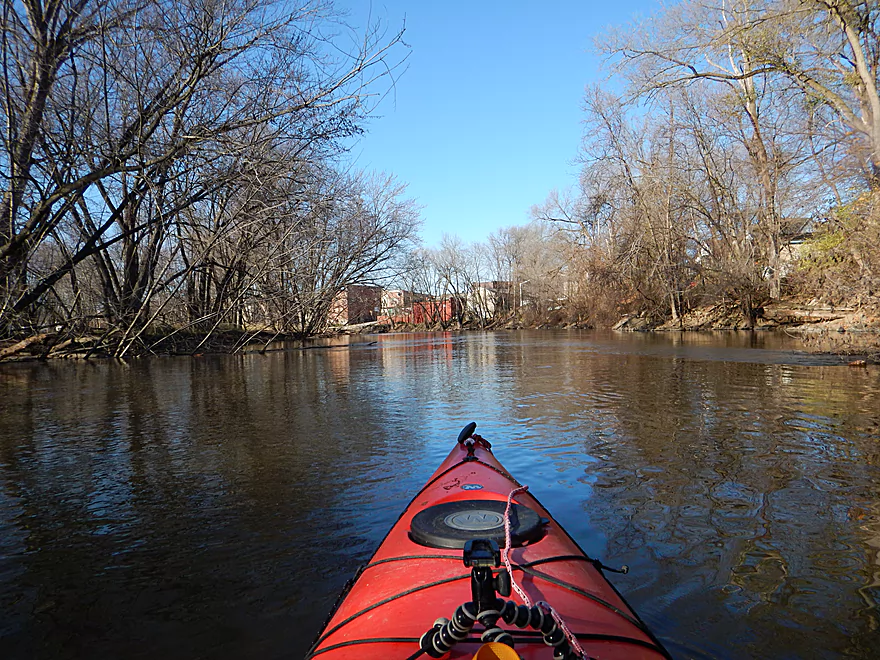
A big, slow river
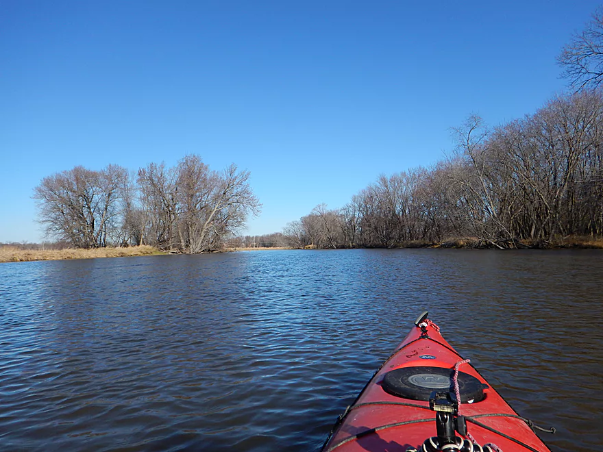
Wooded banks on the Fox?
Many years ago this channel was dredged for commercial traffic
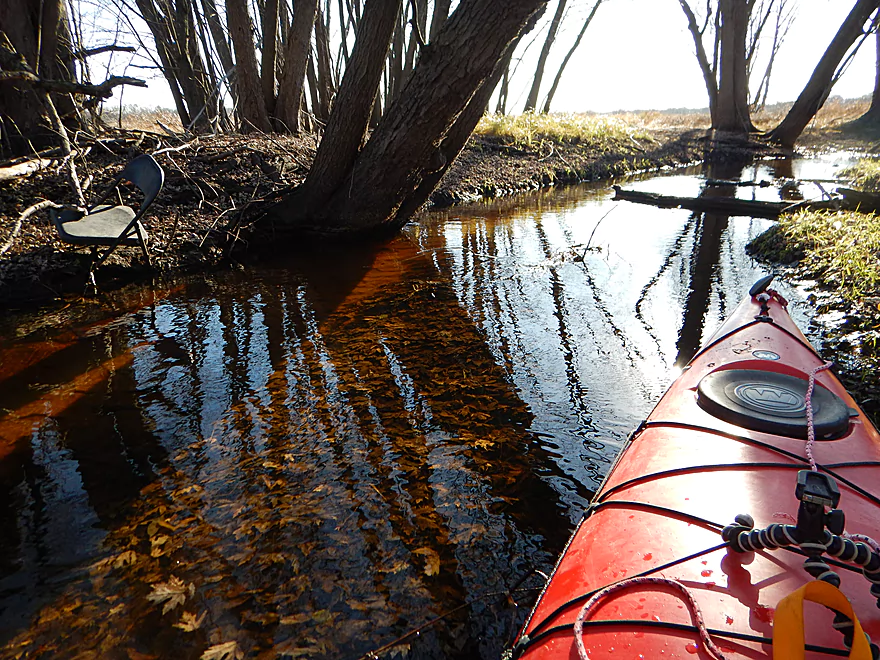
One of several small feeder creeks that looked nice
Crystal clear water coming from this creek
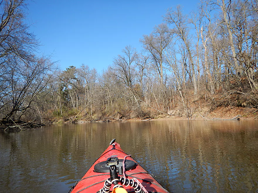
Steep banks (another Fox rarity)
Some powerboats, but not many
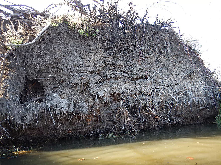
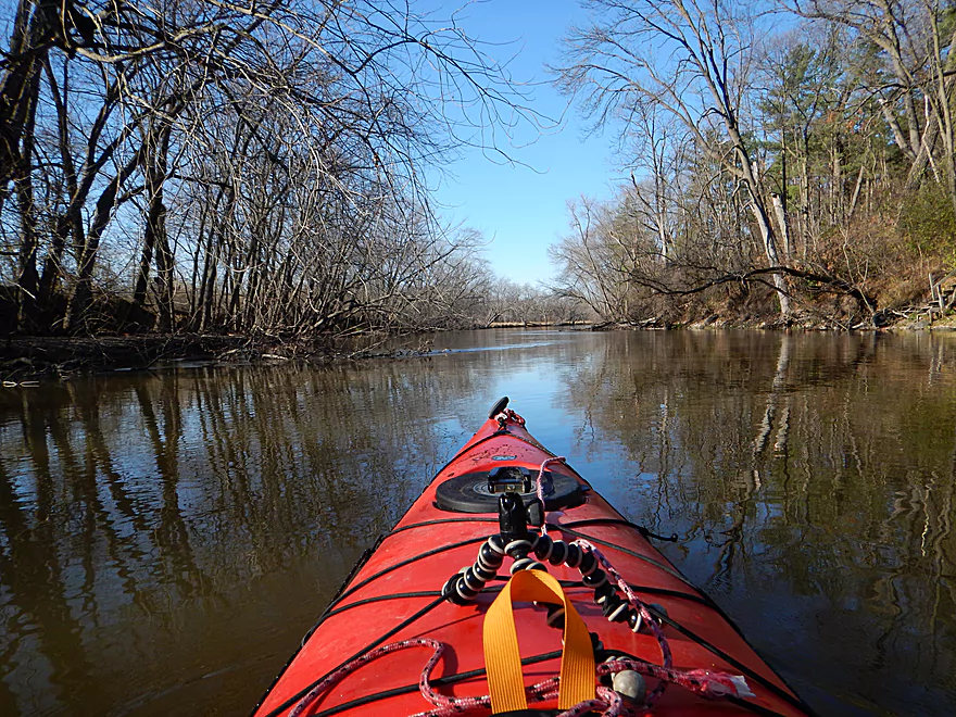
Down trees were never an obstacle
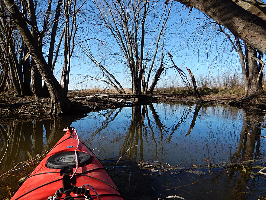
Entering a marshy area
A sea serpent (was not much to photo!)
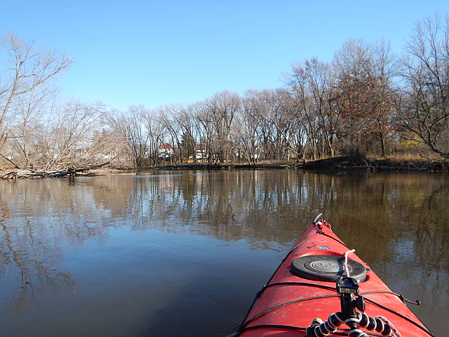
Entering Princeton city limits
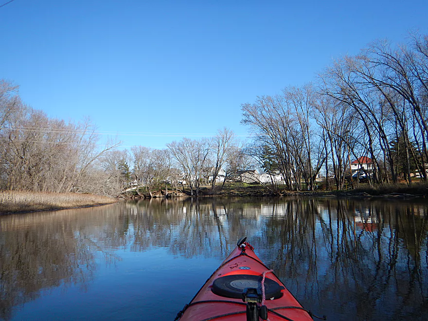
A pleasant river town
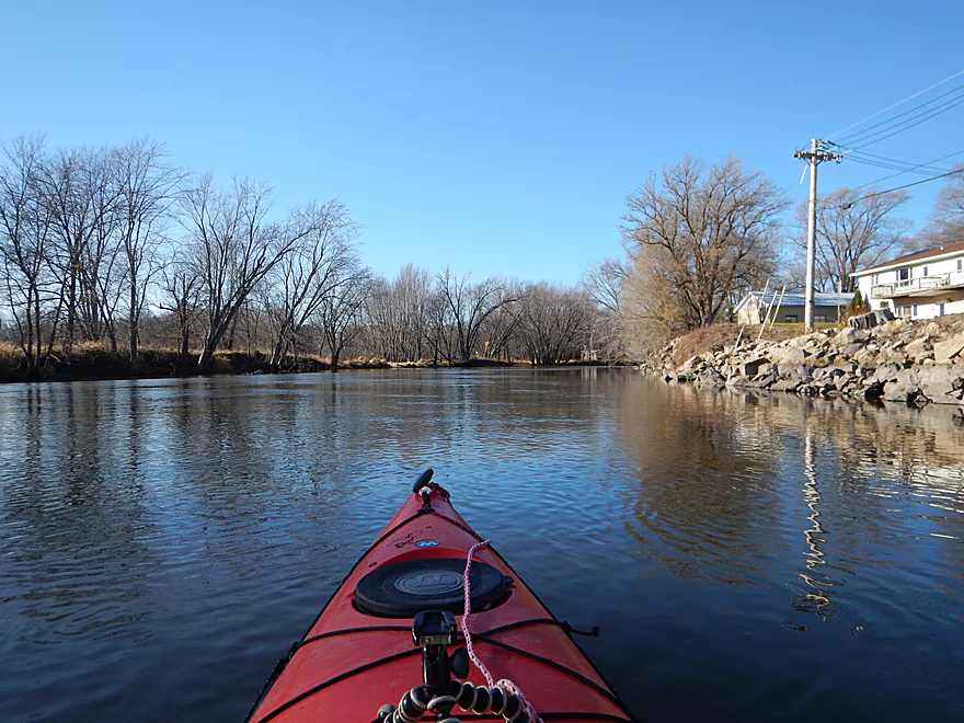
The river is absolutely deep enough for a pontoon
Perhaps an old mill dam?
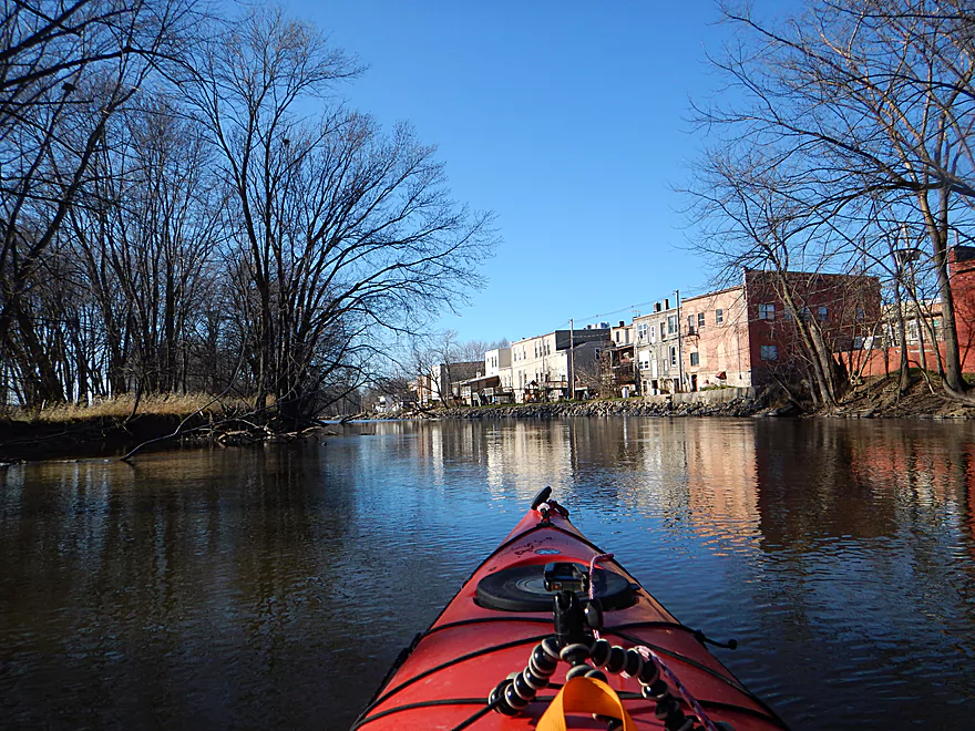
Downtown Princeton
The Princeton millrace might be fun to explore in high water
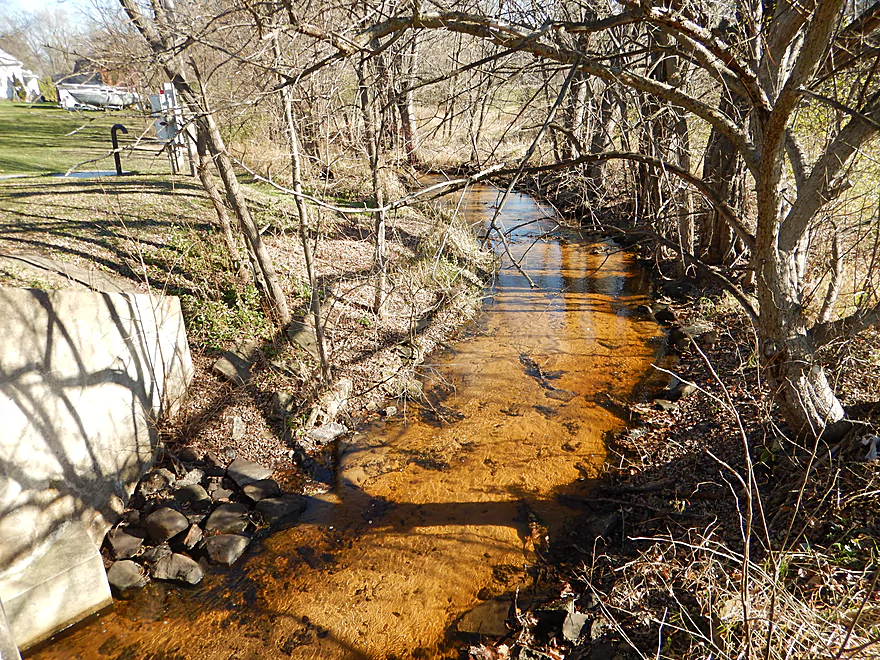
Crystal clear water escaping from the Mecan River
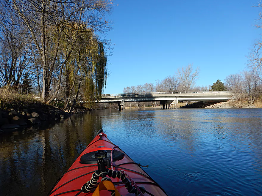
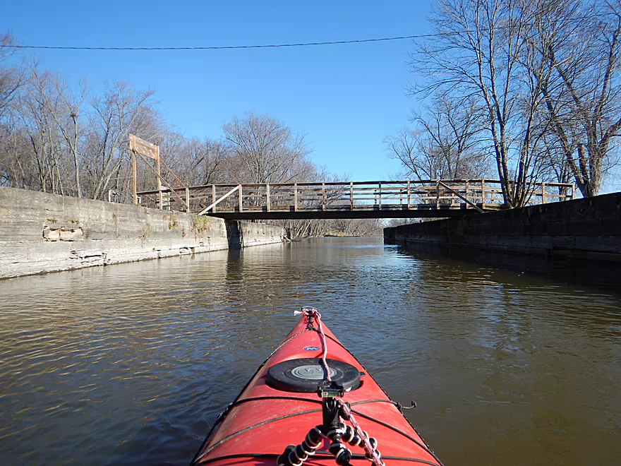
The only Fox bridge within a 50 mile diameter of Princeton
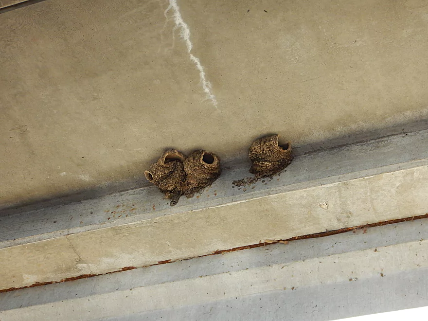
Cliff swallows appreciate this rare Fox River bridge
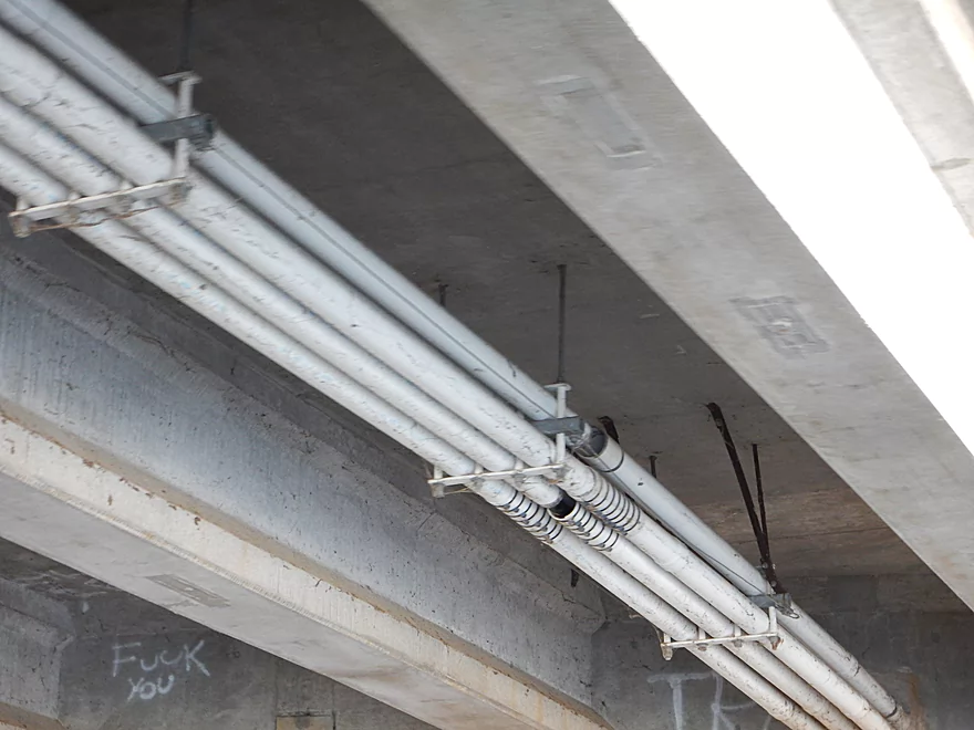
Not sure those should be left open
Nice take-out in Princeton
Good parking
Trip was too short. Wish I had kept paddling…
Fox River – Princeton Locks

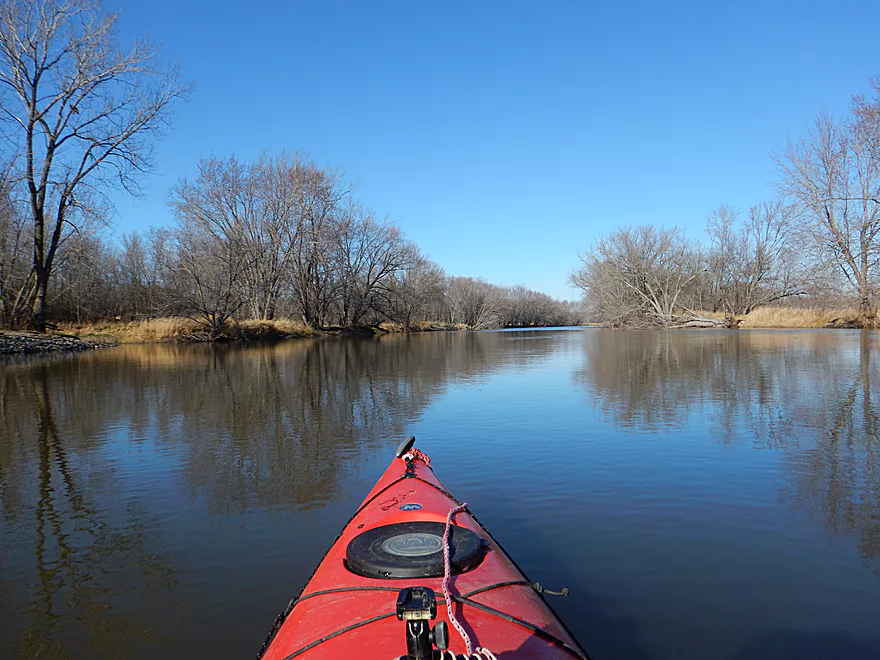
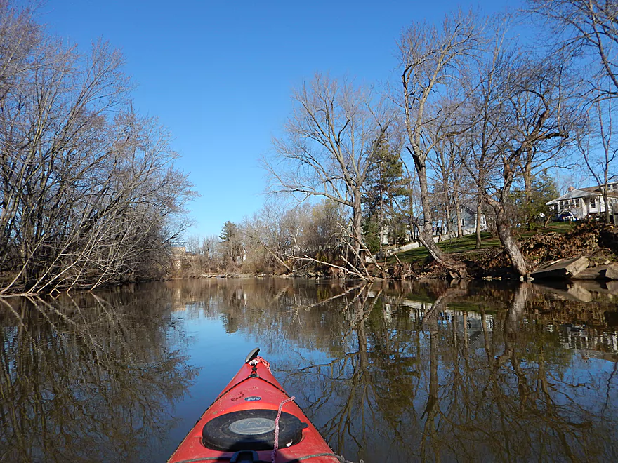
A short but pleasant stretch on the historic Fox River starting from the remnants of the Princeton Locks and taking out in the city of Princeton. So…yet another trip on the Fox. What makes this segment unique? Well, much of the Upper Fox River is very flat and marshy with a lot of grass. Many sections have been widened, straightened and dredged for boat traffic which has killed the river and resulted in stagnant water and unvaried scenery. Don’t get me wrong…there are nice sections on the river, but it is not an elite paddling river in Southern Wisconsin. After Puckaway Lake, the river takes a while to unwind its girth, which makes for boring paddling. But…after the dam/locks, the river changes significantly. The channel narrows considerably, you get steeper banks, more trees and less grass which all give this stretch a different and nicer feel relative to the rest of the river.
The put-in at the locks is a good launch for the trip. Long removed from its historical glory, the locks no longer function. The rear gate has been removed and the front gate has been sealed shut, but you can still appreciate the engineering that went into this. The engineering that you won’t appreciate is the low-head dam on the other side of the island formed by the locks. The dam serves no purpose, creates a boring flowage upstream and is very dangerous. Hopefully, one day it will be removed. If you are coming from upstream, you definitely want to portage the dam (and electric fish barrier), which is easy to do as there are multiple access points in the park.
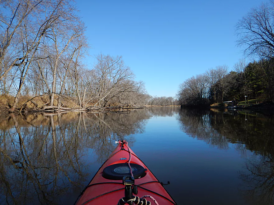
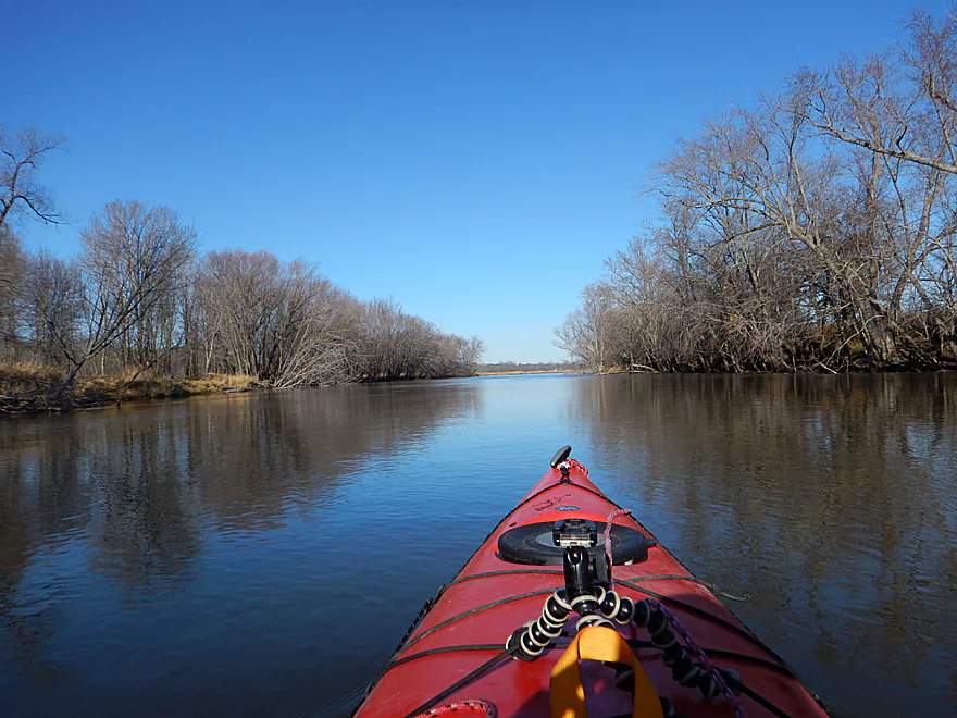
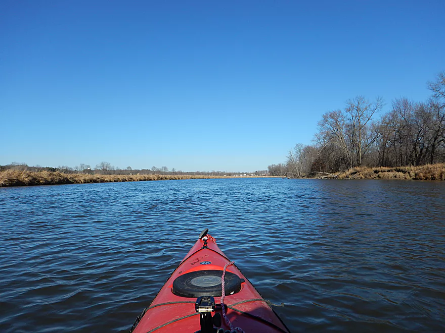
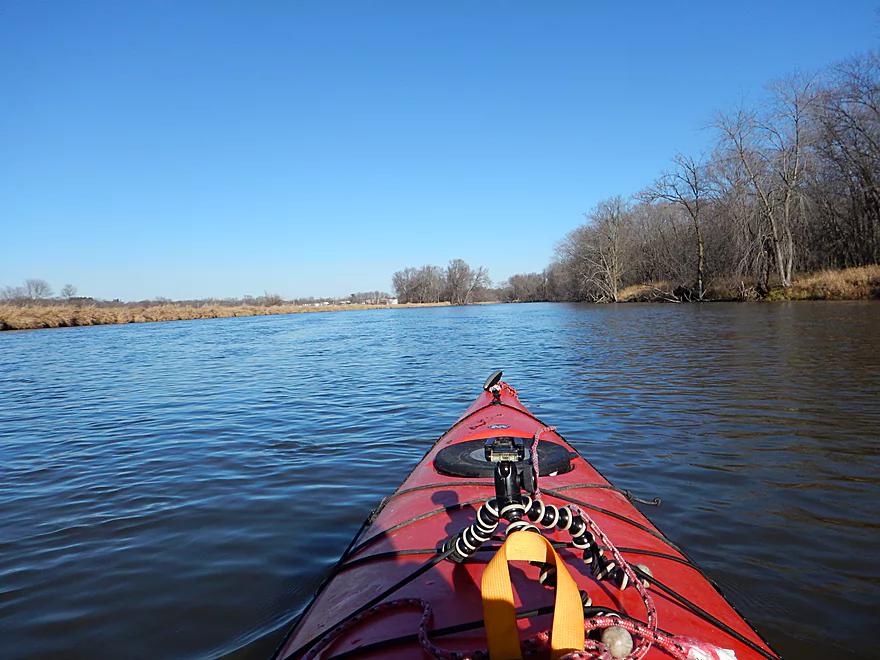
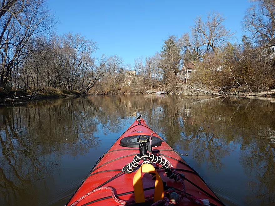
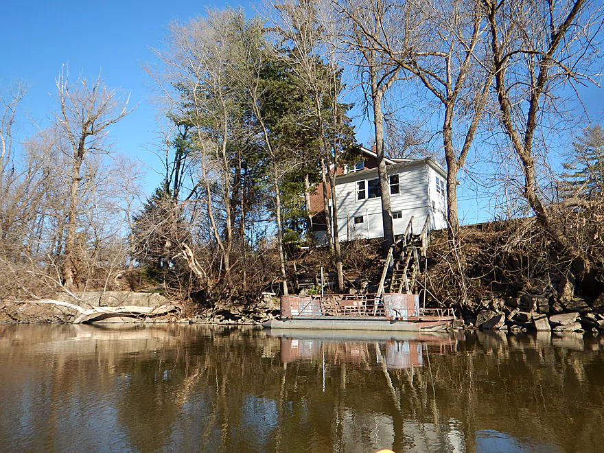
As for the rest of the river, there is honestly not too much to describe. This stretch (like much of the Fox) has been artificially dredged and straightened, which is unfortunate, but it is still nice. The banks don’t exactly have heavy woods, but they are “clean, lively woods” with healthy banks (unlike, say the lower Mecan or Baraboo River). There are still open parts on the river with some wetgrass sections, but these are pleasant and afford attractive vistas of the Fox River valley. Houses pop up here and there, but really there isn’t too much development. I suspect there is minor motorboat traffic in the summer, but doubt it is ever too congested. The water clarity was turbid, but not awful.
One of the perks of this trip is that you will be paddling to the north, a rarity for Wisconsin rivers. Why is this important? It means you will not be paddling into the sun, and in turn the water won’t reflect light into your eyes nor will the woods be muddied by dark shadows. It is a subtle effect that gives the illusion of the scenery being better than it is (after taking countless river pictures, let me tell you…you ALWAYS want the sun behind you).
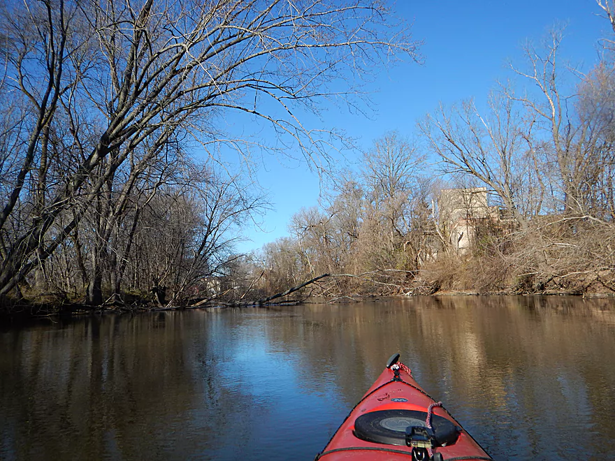
For a mile this trip winds through the city of Princeton, which is actually a pleasant experience and the older 2-3 story buildings along the waterfront give a unique vibe to the trip. Just prior to the only bridge in Princeton, you’ll encounter a historic millrace that originates from the Mecan River and cuts a shortcut to the Fox at Princeton. The channel is still open and actually looks like it would be fun to explore, but it is very shallow. Maybe during one of our spring floods, I’ll put in at Elk Road and float 4 miles down to the mouth.
All in all, a trip that was very satisfying and peaceful. My only complaint was that it was too short at only 3.5 miles…but this is an easy problem to remedy. One of the most popular paddle sections of the Fox just happens to be the next section. This would be from the city of Princeton six miles downstream to the White River locks (popular for its attractive wooded banks and lack of dams…both rare for the Fox). So from the Princeton locks to the White River locks would be 9.5 miles. Figure 4-5 hours and a very pleasant trip.
The put-in is at the Princeton locks. This is mostly a public park that is popular with fishermen and has two major ramps (one above the lock/dam and one below). Plenty of free parking, this is a good option…but not exactly private because of all the people and the multiple signs concerning trail cameras. This trail camera trend is getting to be kind of annoying…
The Jefferson Street boat ramp, just downstream from the West Main Street bridge, is a great public launching option with good parking, no fees and a ramp for disembarking. Neither the put-in nor the take-out have outhouses.
Hwy 23 is a bit busy, but is otherwise an easy bike shuttle at a mere 2.6 miles and with only mild slopes.
Mecan River Outfitters services this stretch of the Fox and they can be reached at 920-295-3439.
There is a dangerous low-head dam (and electric fish barrier) at the put-in, but this is easy to portage or just launch below it. No other dangers or log jams as this should be a pretty safe river. Do be mindful of wind direction and speed as this is a pretty open and exposed trip.
This is a wide, slow river that is mostly 2-4′ deep. I doubt this stretch ever gets too low to run, but can be ugly at high levels. I went at a relatively low depth (820 CFS). Figure for a year, 350 CFS might be the low (mostly in later summer/fall) and 1500 CFS might be the high. I suggest not running this at 1000 CFS and up (guestimate). It’s not unusual to have to wait until July to get the Fox at the right levels.
An eagle, some geese, a great blue heron and many frogs. Not much else, but you know there were a LOT of deer around based on the number of gun shots I heard (maybe 50 total for the day…it was a lot and sounded like a fireworks show). Highlight was seeing three cranes in the Princeton Canal–significant because Princeton is home to the Whooping Crane Festival where captive cranes are introduced to the wild.
And so concludes the 2015 paddling season! Thank you to everybody who followed the blog. I am looking forward to 2016, but this was a big season (37 trips) and I’m not sure if I’ll do that many next year. Yada, yada…let’s get to the awards!
- The Best:
- Halls Creek
- Wolf River
- Upper Iowa River
- Little Platte River
- Worst Log Jams:
- Spring Creek – Lodi
- Fox River – Pardeeville
- Milwaukee River – East Branch (just the upper part)
- Maunesha River
- Seeley Creek
- Honestly, I was lucky this year as far as portages go
- Best Rapids:
- Wolf River
- …
- Maunesha River (underrated)
- Halls Creek
- Illinois Fox
- Spring Creek through Lodi
- Puchyan River
- Little Platte River
- Clearest Water (so many good ones)
- Big Spring Creek
- Duck Creek
- White Creek
- White River
- Puchyan River
- Black Earth Creek – Salmo Pond
- Bark River
- La Crosse River – Fort McCoy
- Best Rock Formations:
- Upper Iowa River
- Halls Creek
- Little Platte River
- …
- Baraboo River – Dutch Hollow
- Seeley Creek
- Nicest Marsh/Wetland Paddles:
- Fox River – Endeavor
- French Creek
- Fox River – Princeton
- Nicest or Most Interesting Human Touches:
- The fake waterfall by the Montello River
- Mississippi bridges, barges and trains by the La Crosse River
- The locks on the Fox by Portage, Montello, and Princeton
- The urban corridor flanking the Montello River
- The old mill at French Creek
- The old mill at White Creek
- The old Dells dam on the Black River
- Best Wildlife Moments:
- All the snapping turtles, but the one on the Bark was the best
- Seeing an ichneumon wasp and its 3 inch ovipositor deposit eggs in a tree on the Mecan River
- Seeing an osprey catch a fish on the Germania lake
- The massive crane flocks on the Fox River by Endeavor
- All the big fish in the Bark River
- All the muskrat houses on the Fox River by Endeavor
- Kayaking over a beaver dam by Pardeeville and later over one on the Maunesha
- Best Boulder Gardens:
- Wolf River
- Wedges Creek
- …
- Rock River – Mayville
- Rock River – Waupun
- Best Sandbars:
- Wisconsin River – Mazo
- …
- Yellow River
- Smelliest River:
- Fox River by Portage
- Most Frustrating Non-Log Jam Moments:
- Getting incessantly yelled at by a dam owner for legally portaging a dam on Duck Creek and taking pictures of “her” creek
- Maunesha River (need a sublist for this one)
- Getting my AWD car stuck at the put-in
- Having my car damaged by the tow truck driver
- It’s many log jams
- Getting stuck trying to go over log jams
- Some rough drops
- Getting VERY wet on the river
- Having my car break down halfway to the Little Wolf River (don’t buy a Subaru)
- Getting stuck halfway on one of Halls’ steeper ledges
- Driving all the way to the Beaver Dam River only to cancel because of low water
- Dealing with another dam owner who doesn’t understand portage law on the Rock River by Kekoskee
- The hilly bike shuttle for the Little Platte River (ugh)
- Nicer Human Moments (for contrast)
- Getting a great tip regarding public access for the Montello River while shopping at a natural food store
- Friend reveals he owns a nice access spot next to French Creek just prior to my French Creek trip
- While getting yelled at for kayaking Duck Creek, a different really nice woman came over and wanted to know about my trip and website
- Getting bridge access tips from a local on White Creek
- Bumping into fellow kayakers on Spring Creek who gave me helpful log jam tips and permission to use their land
- The canoers on the Platte River who actually knew about Wisconsinrivertrips.com!
- Having a crowd gather to watch me run the Puchyan Rapids
- Bumping into the Prairie Street Paddlers on the Mecan and the livery driver who provided good background on the river
- For the Maunesha River, there were people we met at a hardware store and by the old railroad bridge who were VERY helpful
- Accidentally doing a Baraboo trip during the Lazy Beaver race
- While spur-of-the-moment scouting of the Wolf, one of the Boy Scout leaders provided extensive river access and information on the rapids
- Getting a free livery ride from Mark on the Pine River
- Seeing the work that had been done to make Black Earth Creek navigable for kayaks
- Meeting the paddlers who were cleaning up trash on the Bark River
- Meeting an elderly couple canoeing the Fox River by Portage
- Bumping into fellow paddle blogger Timothy Bauer on Seeley Creek
- All the nice comments I got on the website and from social media!
If you have ideas or requests for water trails that you want to see explored and reviewed, I do take suggestions which you can leave below or on one of my social channels.
![]()
![]()
![]()
![]()
![]()
Detailed Overview
- Hwy H to Hwy E: 3.1 miles. Creek/river is kind of small here and you may need high water. Route is 3.1 miles and logjams shouldn’t be an issue. A very open and grassy route.
- Hwy E to Ross Road: 2.9 miles. Hwy E has tough parking because of steep shoulders but you should be able to park in a drive NW of the bridge. Next 2.7 miles will be mostly open wetgrass and logjams shouldn’t be an issue.
- Ross Road to Hwy 44: 3.3 miles. More open wetgrass for the next 2.9 miles with possible logjams before Hwy 44. Parking isn’t the greatest at Ross because of the steep shoulders.
- Hwy 44 to Haynes Road: 6.6 miles. An obscure section of the Fox River upstream of Pardeeville that has redeeming values, but can be a frustrating paddle because of the logjams in the stream.
- Haynes Road to Hwy 22 Dam (the south one): 2.0 miles. Looks like a boring lake paddle IMO. I did not see public access at either dam, so you may have to portage them. Am not sure. I believe canoe author Frank Piraino put in on the Hwy 22 bridge by the north dam/fork.
- Hwy 22 to Swan Lake Campground: 2.6 miles. I do not know much about this route, but it was paddled by Frank Piraino who had a favorable opinion of it. Rumor has it there are snags here. I suspect there will be jams in the north fork after Hwy 22, but the south fork should be free (but less scenic). Swan Lake Campground requires a fee for access.
- Swan Lake Campground to Swan Lake (South Shore Boat Ramp): 2.7 miles. An ok stretch. In essence a creek paddle through grasslands with a bit of lake paddling at the end. Serviced by a local livery.
- Swan Lake to Hwy 33: 5.8 miles. Pleasant marsh paddle. Does include 1-2 miles of paddling.
- Portage Canal: 2.3 miles. A unique experience filled with history. Unfortunately the canal can be at times challenging to navigate.
- Hwy 33 to Governor Bend: 5.4 miles. A classic stretch and one of the best water trails on the Fox.
- Governor Bend to Hwy O: 5.7 miles. A pleasant stretch.
- Hwy O to Endeavor: 7.6 miles. A surprisingly nice section with good wildlife.
- Buffalo Lake: 10.6 miles. An artificial lake/flowage. Looks boring…. Beware of the weeds in late summer.
- Montello to Grand River Locks: 3.4 miles. A good section.
- Grand River Locks to Lake Puckaway: 5.3 miles. Probably a nice section.
- Puckaway Lake: 6.2 miles. Also looks boring and to be avoided. At least it’s not fake like Buffalo Lake. Maybe 7 miles.
- North Puckaway Lake to Princeton Locks/Dam: 9.8 miles. I do not know much about this stretch.
- Princeton Locks/Dam to the City of Princeton: 3.5 miles. A simple but pleasant section.
- City of Princeton to White River Locks: 6.0 miles.
- City of Princeton to Old St. Marie Landing: 1.9 miles. A pleasant wooded section with a historic turn bridge.
- Old St. Marie Landing to the White River Locks: 4.1 miles. A slow, broad channel that is ok, but gets repetitive.
- White River Locks to Landing Road: 10.4 miles. The White and Puchyan Rivers add a lot of volume by now. Not sure this is a great paddling stretch.
- Landing Road to Riverside Park in Berlin: 3.4 miles. A simple section that flows through downtown Berlin.
- Riverside Park to Eureka Boat Landing: 7.8 miles. River is probably no longer a cute baby and is instead an ugly teenager.
- Eureka to Omro: Roughly 6.5 miles. Probably too big to be enjoyable.
- Omro to Lake Butte des Mortes: 5.0 miles. Likely uninteresting.
Trip Map
Overview Map
Video
Photos Size: