
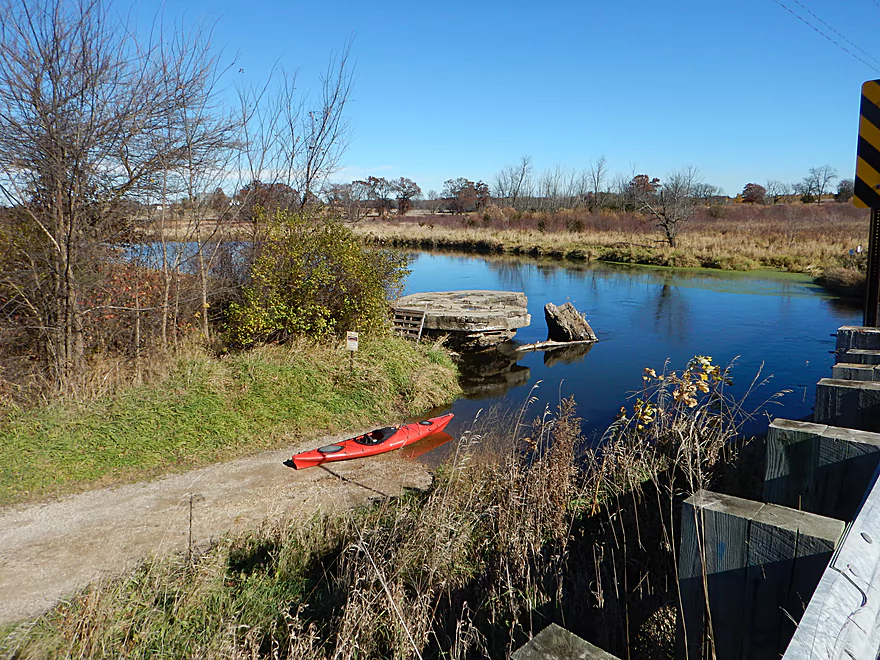
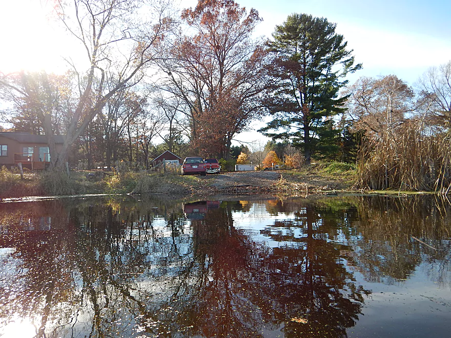
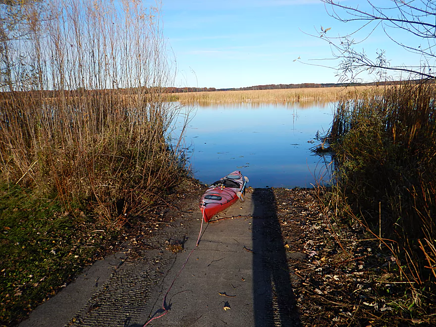
Really nice landing at Hwy O
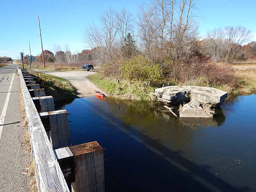
Good free parking
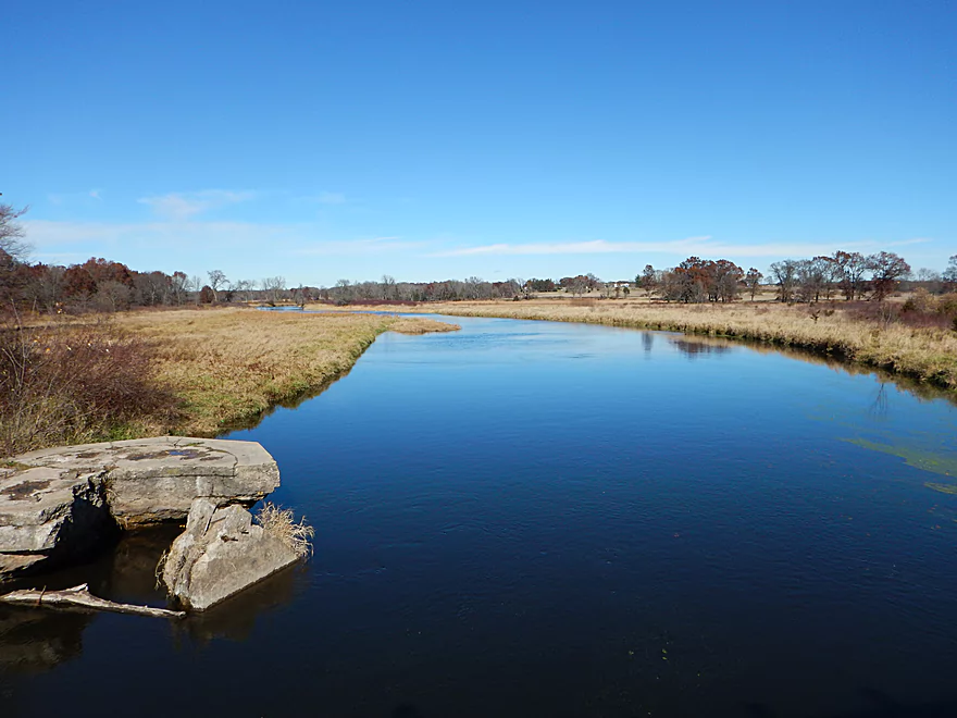
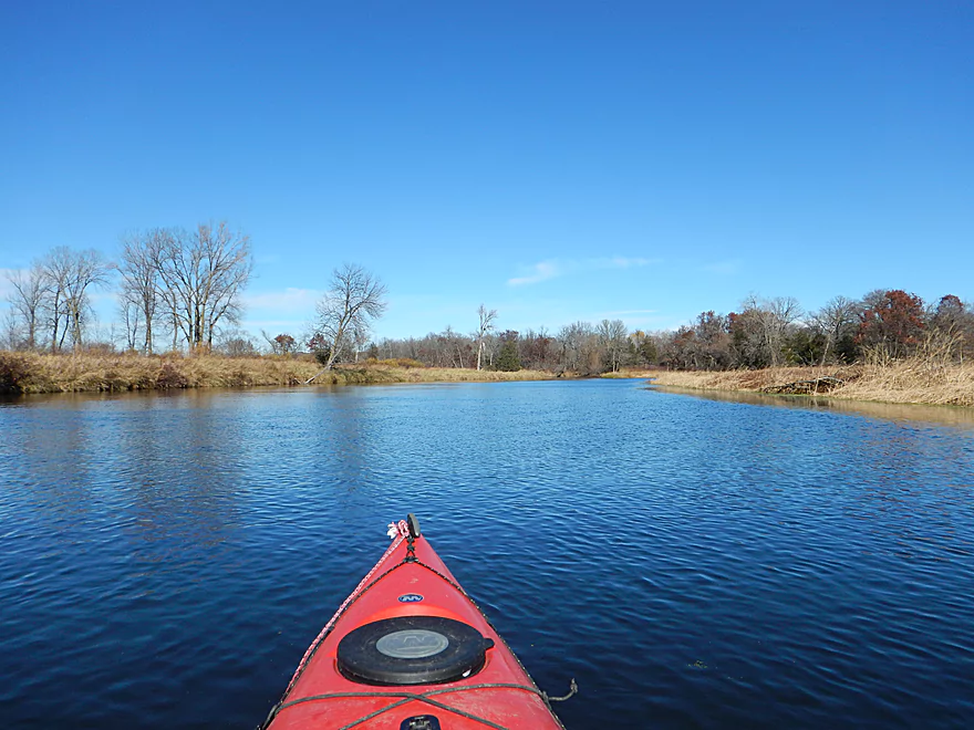
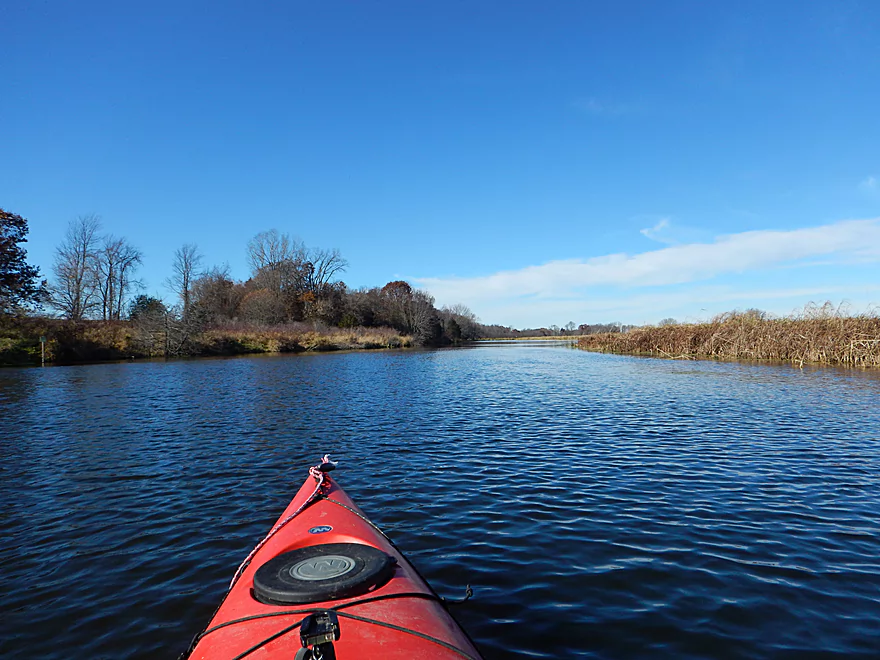
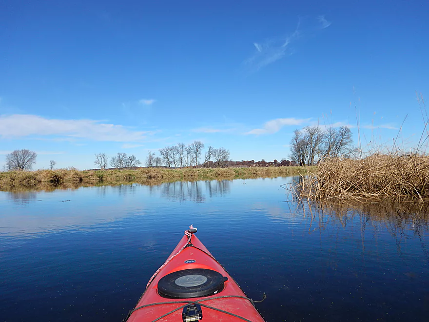
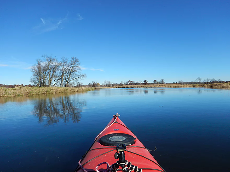
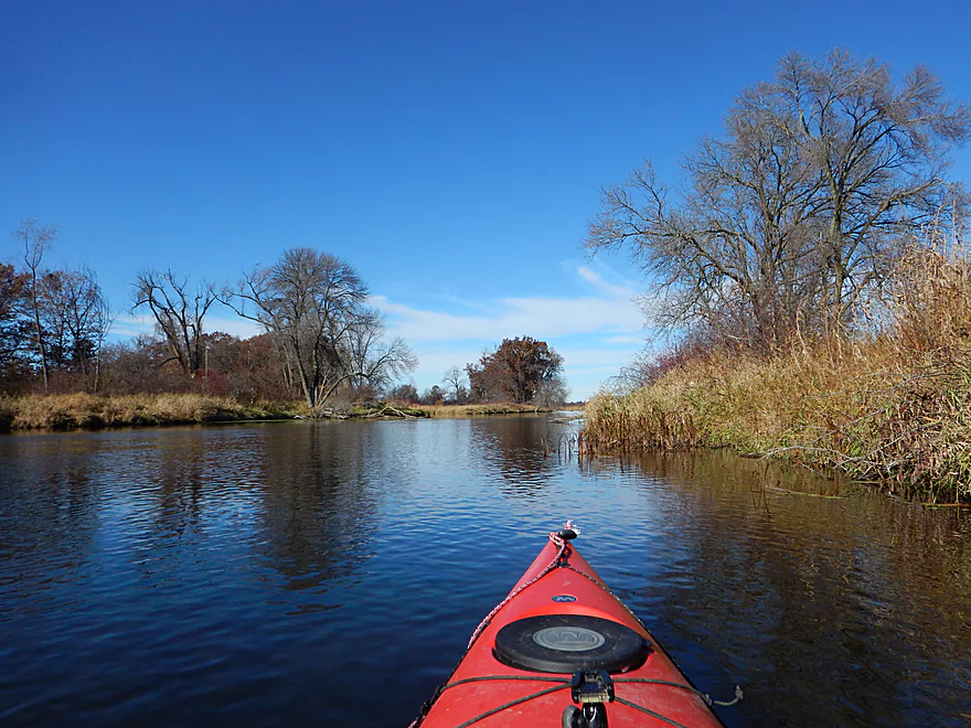
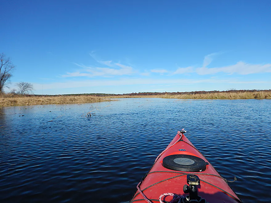
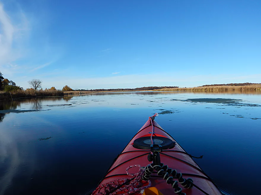
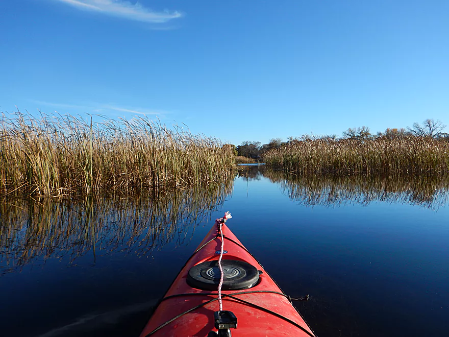
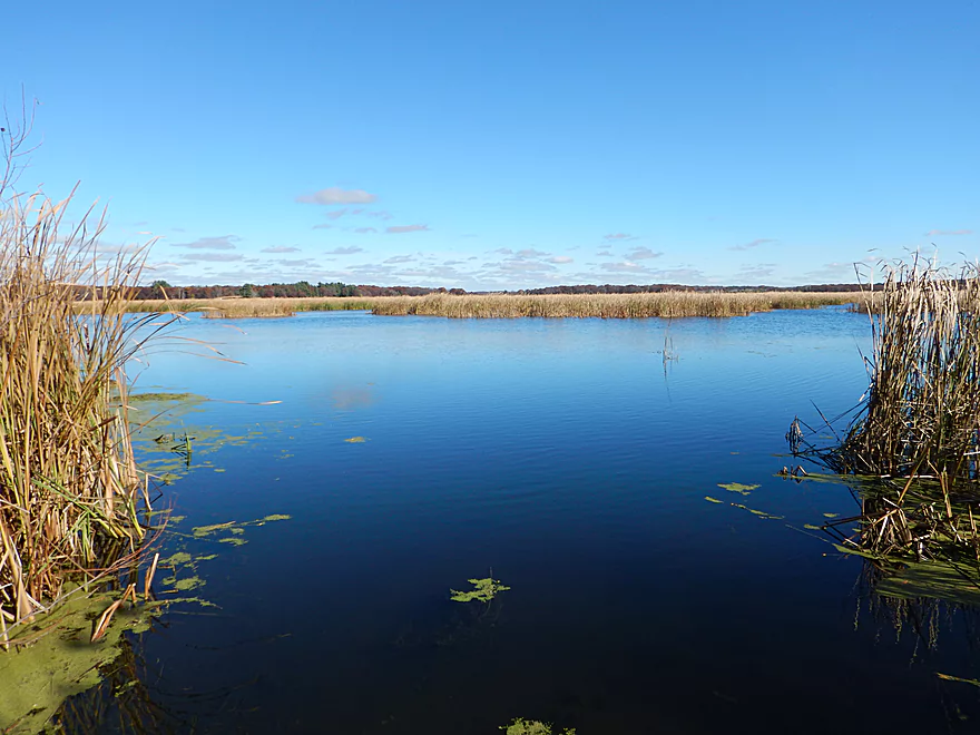
Scenic vista downstream
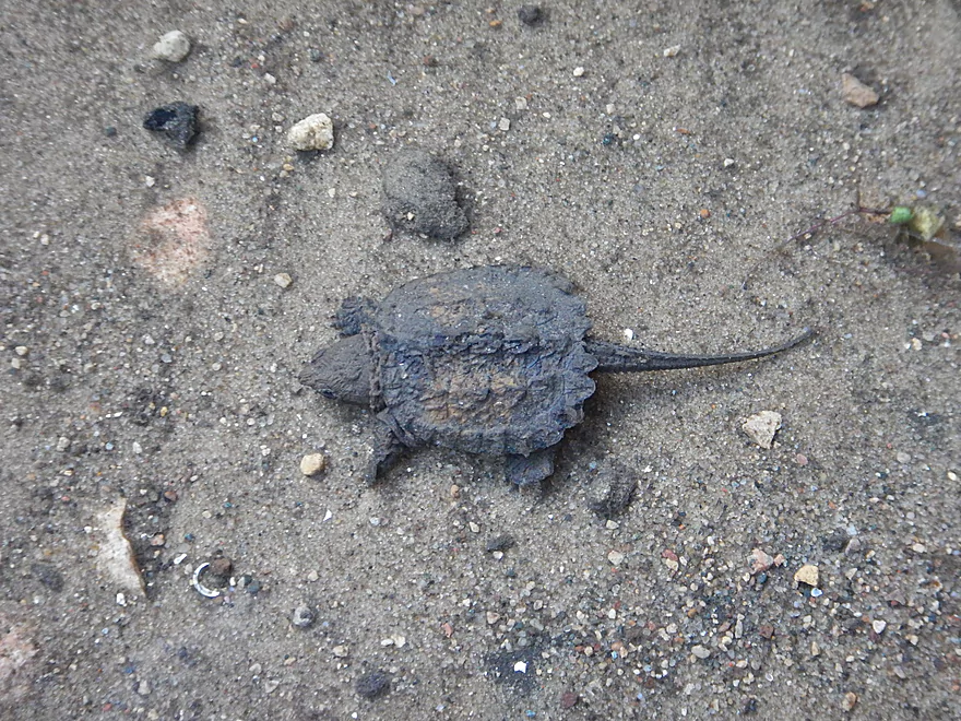
Just a baby snapping turtle (not so fierce)
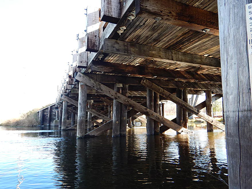
Kind of a historic bridge
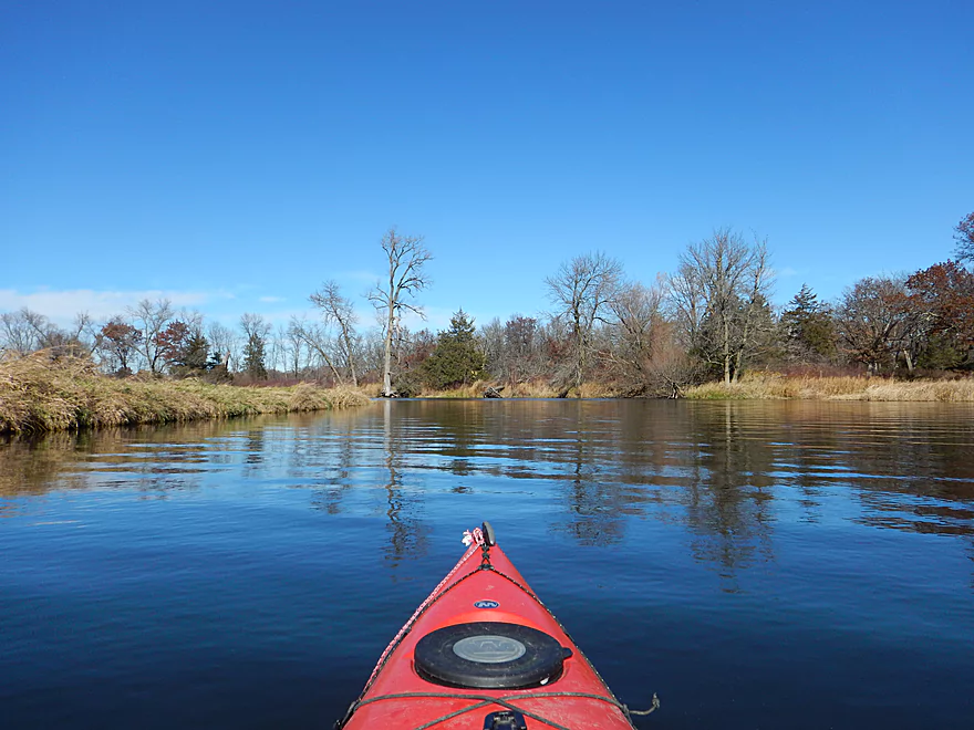
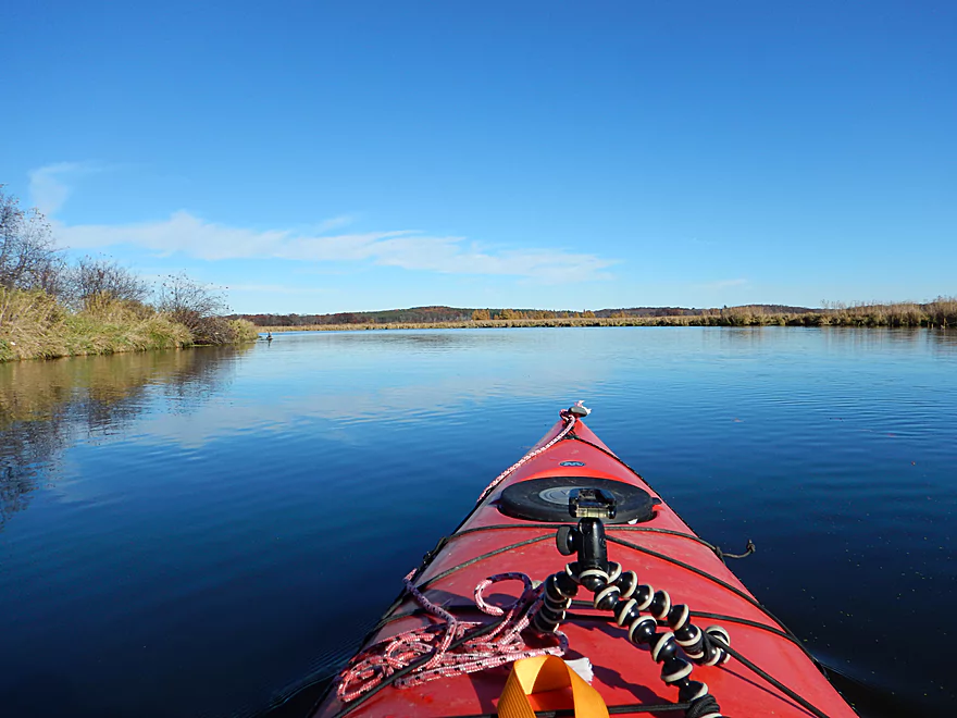
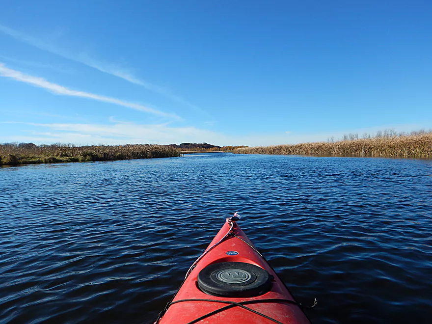
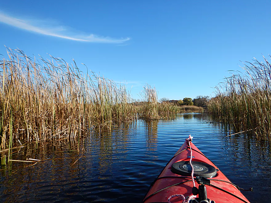
Slow, wide channel
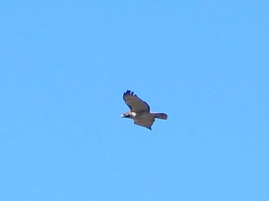
Red-tailed hawk
The sandy soil does not support many trees
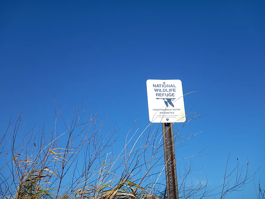
Much of this is along a wildlife refuge
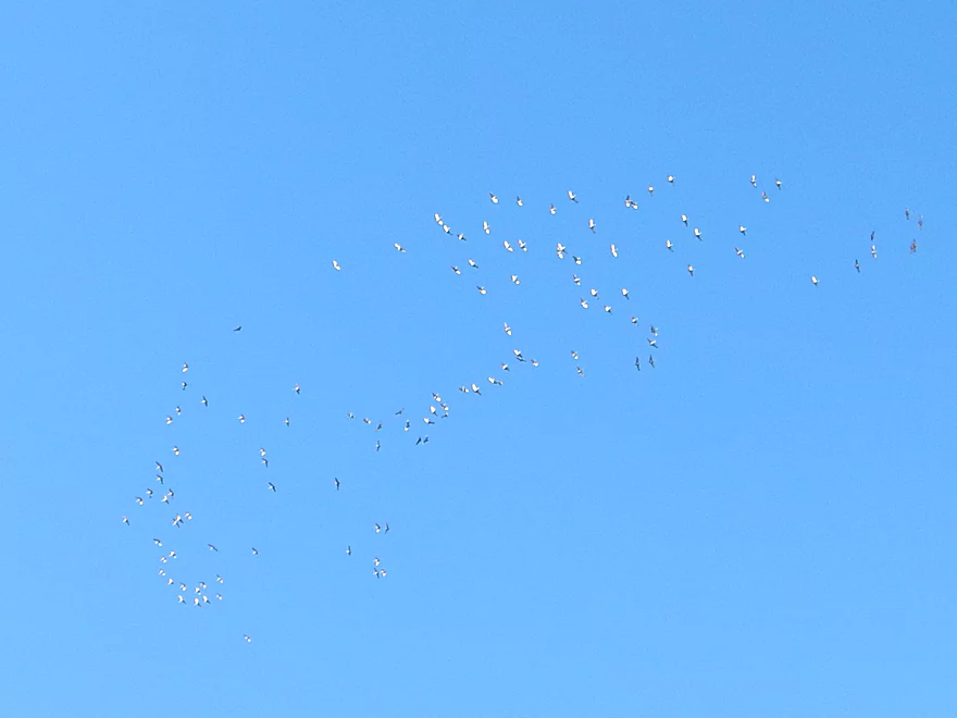
Largest crane flock I have ever seen (many are not pictured)
Very peaceful
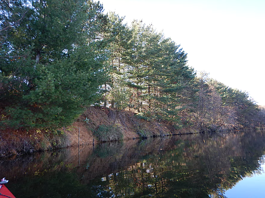
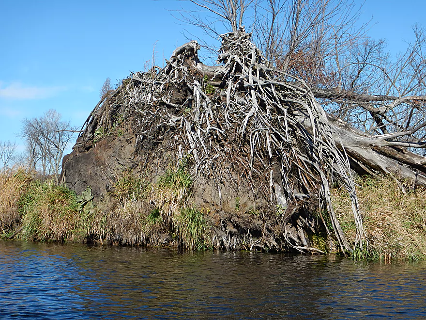
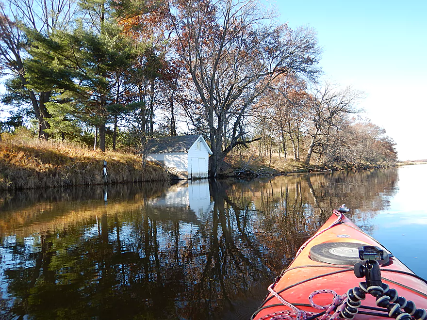
One of the few banks on the river
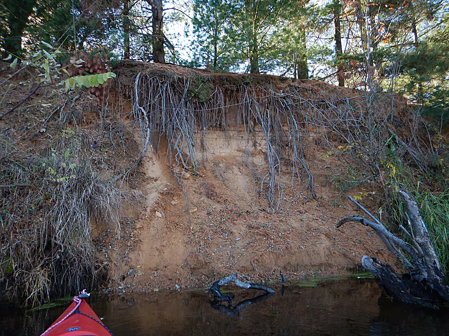
Roots left dangling
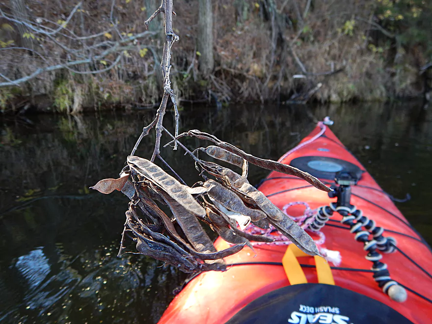
Black locust pods
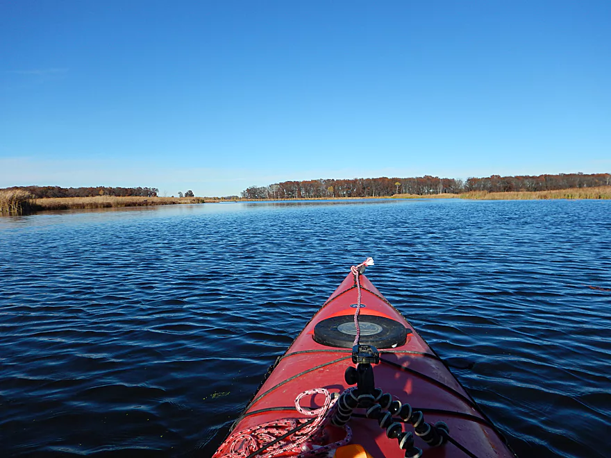
Channel is starting to get big now
You can see where the flood line is
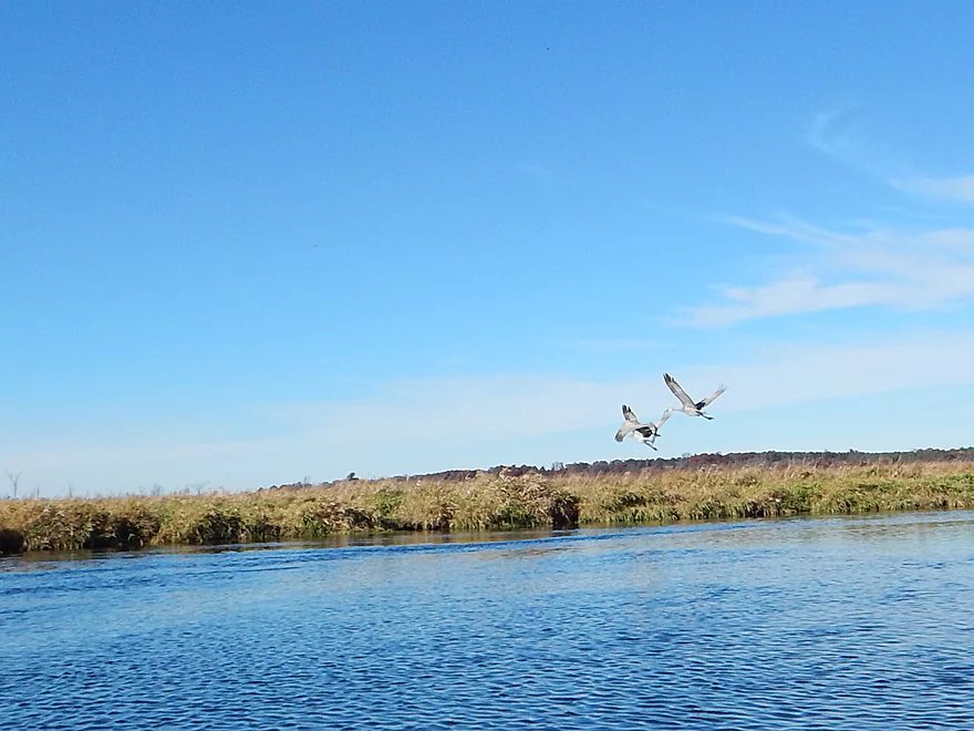
Some of many cranes
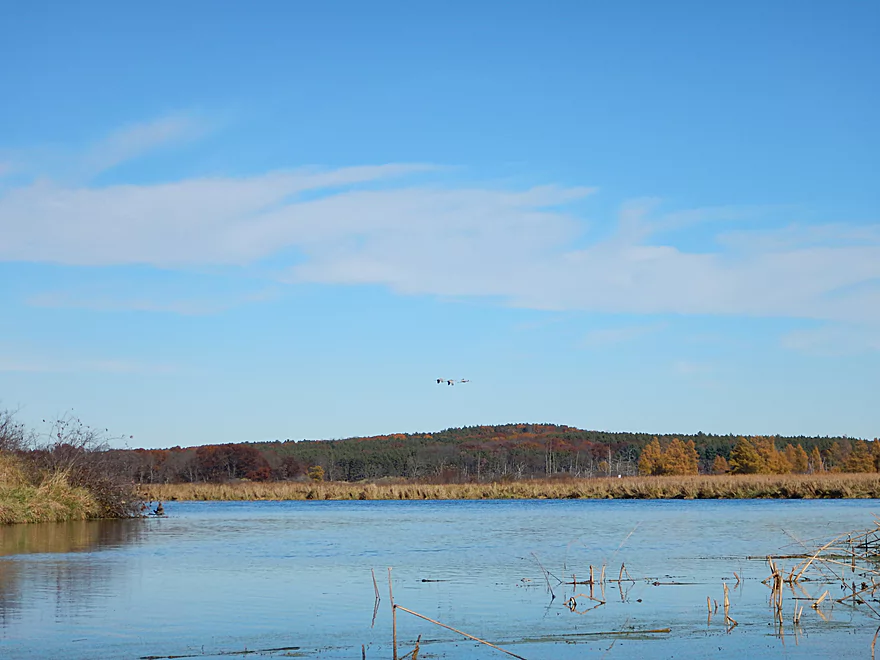
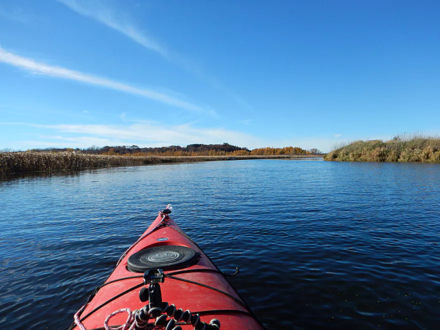
The low banks provide great views of the distant hills
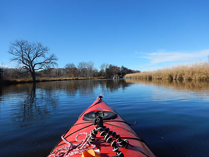
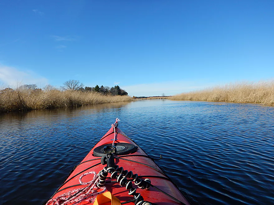
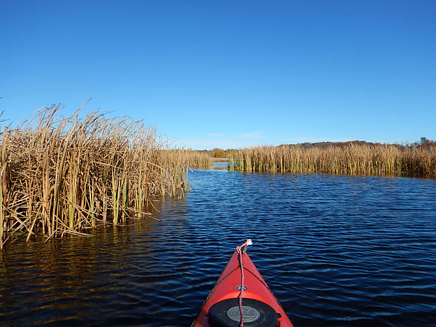
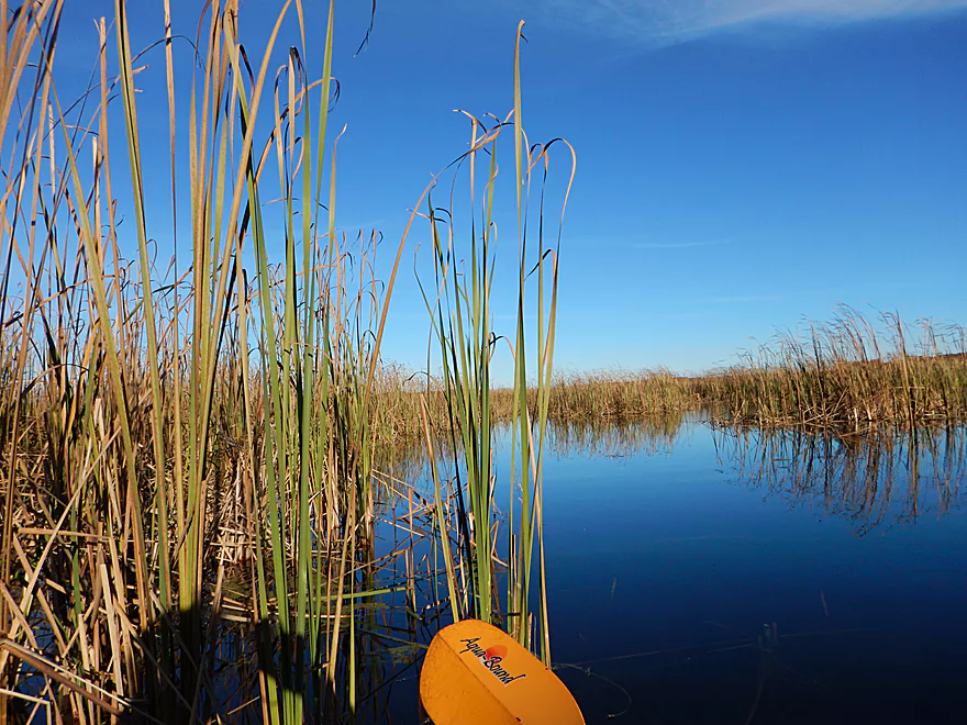
Entering cattail country
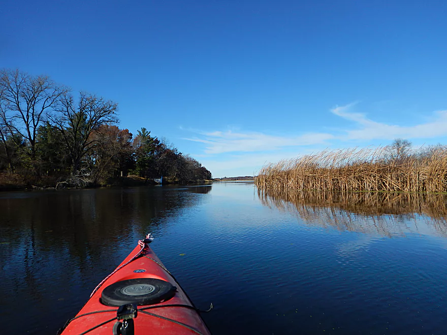
Lot of grass on the trip
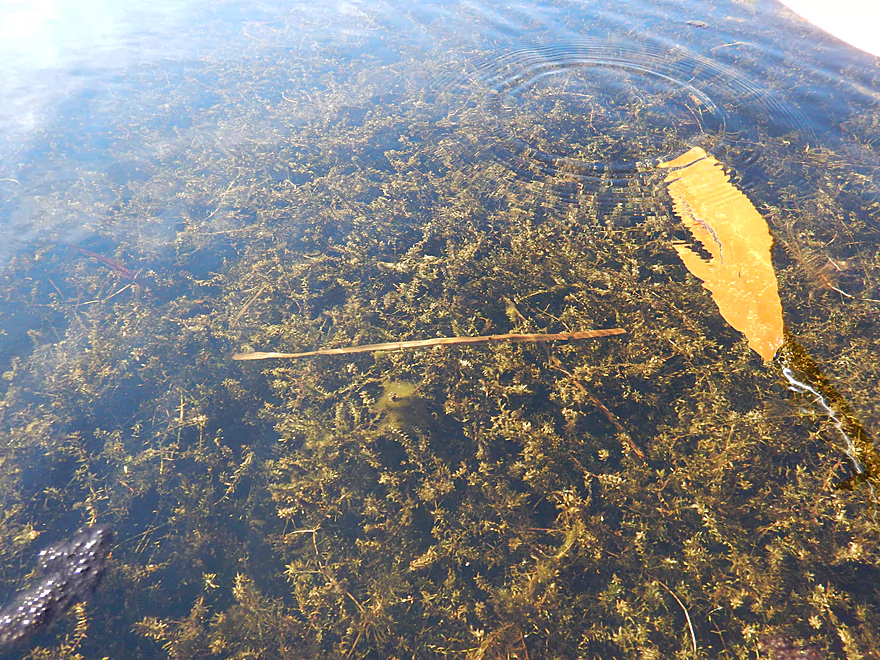
Super clear water in the back channel
Side adventure by Packwaukee Island
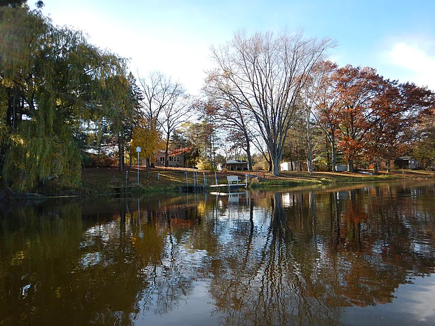
Entering the town of Endeavor
The south ramp is the recommended take-out
But I will paddle two more miles to the north ramp
At this point the Buffalo Lake Flowage really kicks in
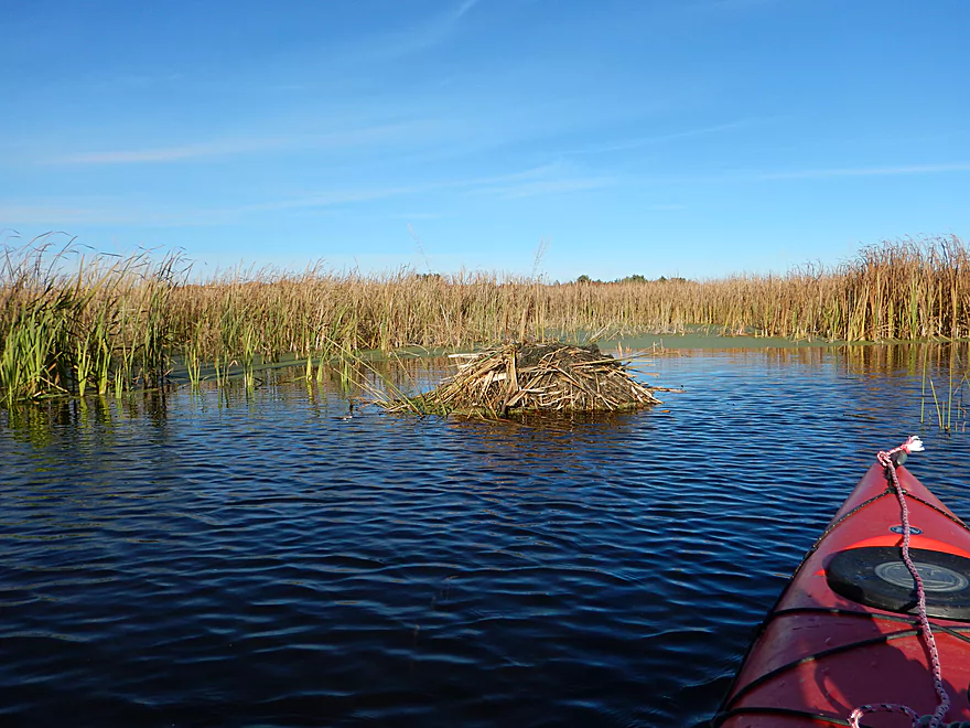
One of three muskrat houses
Trying to find the take-out (not easy)
Evening light on the grass is a neat effect
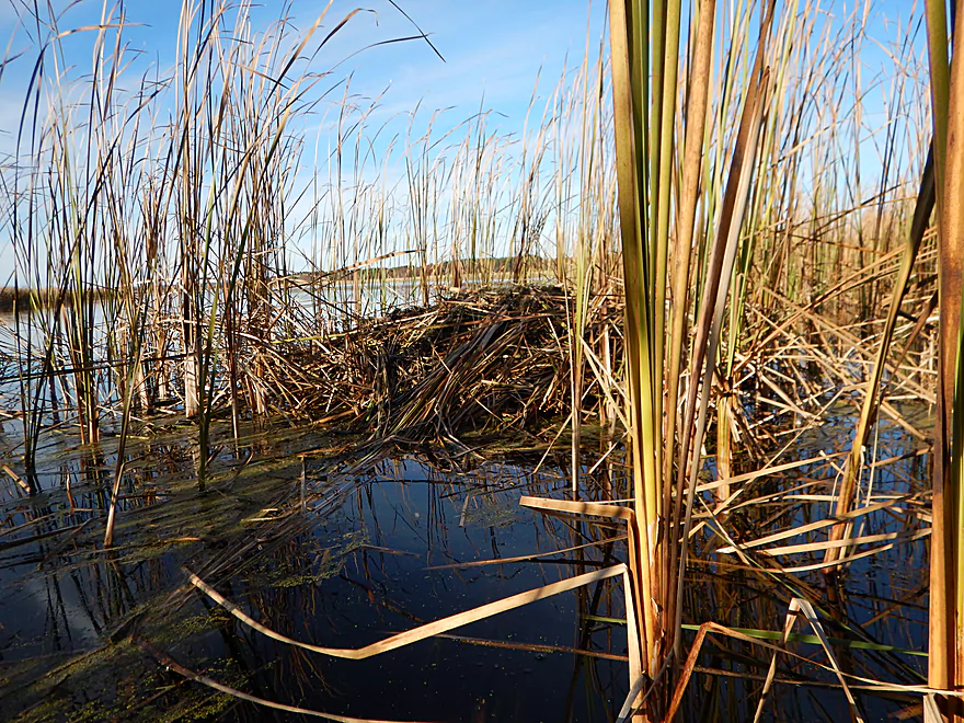
Another muskrat house (plenty of cattails to eat)
Few boaters use this bay because of the cattails
The north ramp in Endeavor
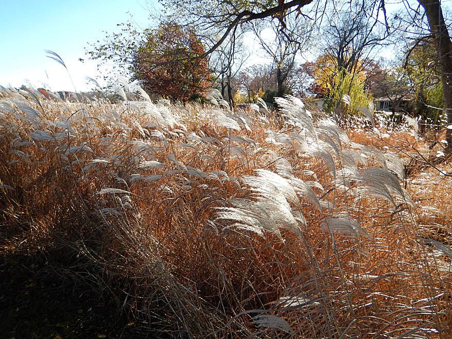
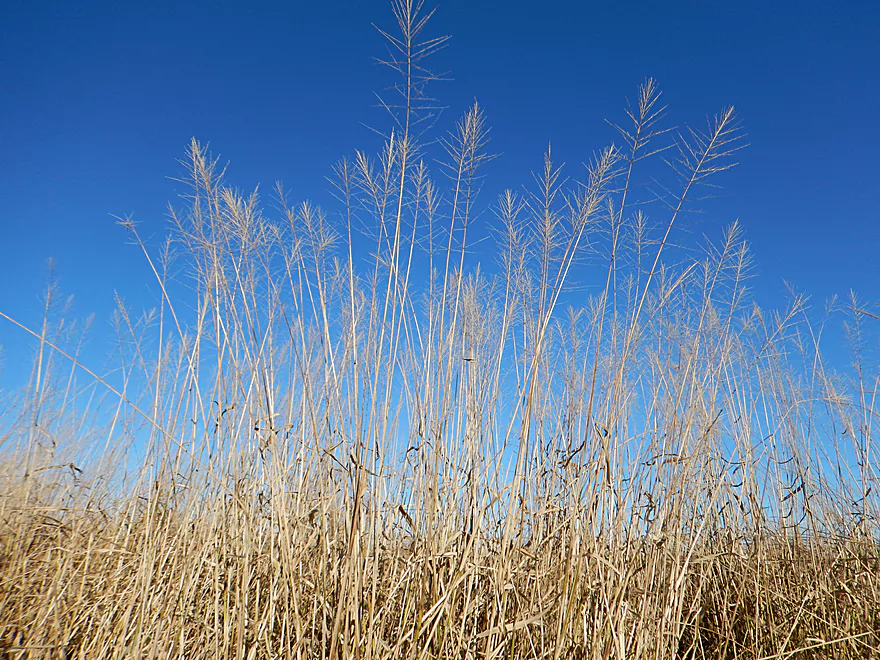
Maiden grass
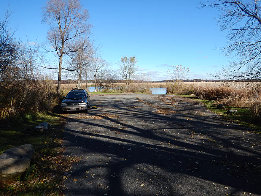
Plenty of elbow room here (the other ramp was quite busy)
Fox River – Endeavor


This is a tweener section of the Fox River between the more popular Portage to Hwy O route and Buffalo Lake. Not super exotic, with no bluffs, no current, no banks, nor woods; this is nevertheless a pleasant section that I’m glad I did. Does this seem like a contradiction? Well, not really. What makes this section unique is its openness, with vast unobstructed views across expansive wetgrass prairies and cattail marshes to the hills beyond. Perhaps what helps is that the trip points north (a rarity for Wisconsin rivers), which makes for terrific lighting (if the sun is out).
Another nice perk to this trip will be the lack of people you will see. Despite there being a public boat launch at Hwy O, this is not heavily used and I only saw one other fisherman on the river. Much of the nearby land is protected as a national wildlife refuge and there was little shoreline development until I reached Endeavor.
For its flow rate, this is a relatively wide river. About two-thirds into the trip the effect of the Montello Dam (Buffalo Lake) kicks in and the river significantly widens and the cattails replace the wetgrass. The river loses a little magic here, but still has redeeming value, as the endless sea of cattails are a sight in and of themselves. All that said though, by the end of the trip I was getting a little cattail fatigued. This is why I recommend taking out at the first Endeavor landing (unless you want to see muskrat houses and lots of cattails).
If you continue on, I recommend bringing a GPS, as the cattails can create a maze and there is no current to help point you in the right direction. To access the second landing, you’ll have to double back onto a small side channel which is not intuitively located.
If you REALLY wanted to, I suppose you could continue on to Buffalo Lake and take out at one of its three launches, but I’m not sure why you would want to. This is heavily developed, has a lot of motorboat traffic, is very wide and does not seem to have much going for it. This stretch of the Fox wasn’t always this boring. Before the Montello Dam, the channel was considerably narrower and faster. In fact, they recently drained the flowage to rebuild the dam (a travesty that was financed with conservation funds). While the flowage and dam are back now, you can see from Google maps where the old channel was as well as the silted-in mess the lake is now (and even the old wing dams).
All in all, a pleasant, peaceful trip that I would recommend, especially in the fall or spring for waterfowl. If you find wetgrass paddles boring, this may not be your cup of tea, but if you’re looking for a peaceful paddle and a great way to experience waterfowl, this is a great option.
Very good public boat ramp at the Hwy O bridge (aside from the monster potholes and lack of an outhouse).
There are two public launches in the village of Endeavor. I chose the second one, which was very nice and less busy than the upstream launch (none of them have outhouses). However, I honestly recommend taking out at the first (upstream) launch in hindsight, as by this time the Lake Buffalo flowage really starts to kick in and the extra 2.2 miles between the launches doesn’t seem worth it (although I did find 3 muskrat houses here).
I am not aware of any local livery options. Bike shuttle is doable at 5.6 miles and moderately hilly, but nothing too extreme and shouldn’t be an issue.
No hazards and no log jams. A good safe prospect for families and bigger boats. The only gotcha would be that this area is very open and susceptible to wind. Do mind the wind direction and speed before embarking on this trip. Also, be mindful that if you take out at the second Endeavor landing it is possible to get a little lost in the cattails. GPS is recommended.
This is a pretty deep section of the Fox, with the depth alternating between maybe 2-4 feet for much of the trip. I doubt the river ever gets too low to run, but frequently the Fox gets too high to be enjoyable. This is a very seasonal river that is often too high in May/June, but perfect from July to October unless there was a heavy rain. I recommend no more than 1000 CFS per the Princeton Gauge (I ran this at 840 CFS). As for the current…well, there really isn’t any.
A baby snapping turtle, many ducks and a couple of falcons. The highlight was a mega-flock of cranes. I’ve never seen so many… For much of the trip, I would not only see massive flocks circling in the air, but would hear their constant calls as well, as if they were readying the wagon train to head south and wanted to make sure no stragglers were left behind. Highlight runner-up #1 was seeing three muskrat lodges close to the take-out.
Detailed Overview
- Hwy H to Hwy E: 3.1 miles. Creek/river is kind of small here and you may need high water. Route is 3.1 miles and logjams shouldn’t be an issue. A very open and grassy route.
- Hwy E to Ross Road: 2.9 miles. Hwy E has tough parking because of steep shoulders but you should be able to park in a drive NW of the bridge. Next 2.7 miles will be mostly open wetgrass and logjams shouldn’t be an issue.
- Ross Road to Hwy 44: 3.3 miles. More open wetgrass for the next 2.9 miles with possible logjams before Hwy 44. Parking isn’t the greatest at Ross because of the steep shoulders.
- Hwy 44 to Haynes Road: 6.6 miles. An obscure section of the Fox River upstream of Pardeeville that has redeeming values, but can be a frustrating paddle because of the logjams in the stream.
- Haynes Road to Hwy 22 Dam (the south one): 2.0 miles. Looks like a boring lake paddle IMO. I did not see public access at either dam, so you may have to portage them. Am not sure. I believe canoe author Frank Piraino put in on the Hwy 22 bridge by the north dam/fork.
- Hwy 22 to Swan Lake Campground: 2.6 miles. I do not know much about this route, but it was paddled by Frank Piraino who had a favorable opinion of it. Rumor has it there are snags here. I suspect there will be jams in the north fork after Hwy 22, but the south fork should be free (but less scenic). Swan Lake Campground requires a fee for access.
- Swan Lake Campground to Swan Lake (South Shore Boat Ramp): 2.7 miles. An ok stretch. In essence a creek paddle through grasslands with a bit of lake paddling at the end. Serviced by a local livery.
- Swan Lake to Hwy 33: 5.8 miles. Pleasant marsh paddle. Does include 1-2 miles of paddling.
- Portage Canal: 2.3 miles. A unique experience filled with history. Unfortunately the canal can be at times challenging to navigate.
- Hwy 33 to Governor Bend: 5.4 miles. A classic stretch and one of the best water trails on the Fox.
- Governor Bend to Hwy O: 5.7 miles. A pleasant stretch.
- Hwy O to Endeavor: 7.6 miles. A surprisingly nice section with good wildlife.
- Buffalo Lake: 10.6 miles. An artificial lake/flowage. Looks boring…. Beware of the weeds in late summer.
- Montello to Grand River Locks: 3.4 miles. A good section.
- Grand River Locks to Lake Puckaway: 5.3 miles. Probably a nice section.
- Puckaway Lake: 6.2 miles. Also looks boring and to be avoided. At least it’s not fake like Buffalo Lake. Maybe 7 miles.
- North Puckaway Lake to Princeton Locks/Dam: 9.8 miles. I do not know much about this stretch.
- Princeton Locks/Dam to the City of Princeton: 3.5 miles. A simple but pleasant section.
- City of Princeton to White River Locks: 6.0 miles.
- City of Princeton to Old St. Marie Landing: 1.9 miles. A pleasant wooded section with a historic turn bridge.
- Old St. Marie Landing to the White River Locks: 4.1 miles. A slow, broad channel that is ok, but gets repetitive.
- White River Locks to Landing Road: 10.4 miles. The White and Puchyan Rivers add a lot of volume by now. Not sure this is a great paddling stretch.
- Landing Road to Riverside Park in Berlin: 3.4 miles. A simple section that flows through downtown Berlin.
- Riverside Park to Eureka Boat Landing: 7.8 miles. River is probably no longer a cute baby and is instead an ugly teenager.
- Eureka to Omro: Roughly 6.5 miles. Probably too big to be enjoyable.
- Omro to Lake Butte des Mortes: 5.0 miles. Likely uninteresting.
Trip Map
Overview Map
Video
Photos Size: