
Sheboygan River
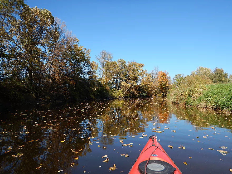
The Sheboyan River is one of the nicer East-Central water trails in Wisconsin. Expect some riffles, rocky stretches, good fall color and maybe even salmon depending on your location and time.
Trip Reports
Johnsonville Dam to Dassow Park
Date Paddled: October 11th, 2015
Distance: 6.4 Miles
Time: 3 hours 40 minutes
A great paddle on Wisconsin's "east coast" that starts by a famous brat factory and ends in scenic Dassow Park.
Rochester Park to Esslingen Park
Date Paddled: October 23rd, 2021
Distance: 9.8 miles
Time: Expect 4-5 hours
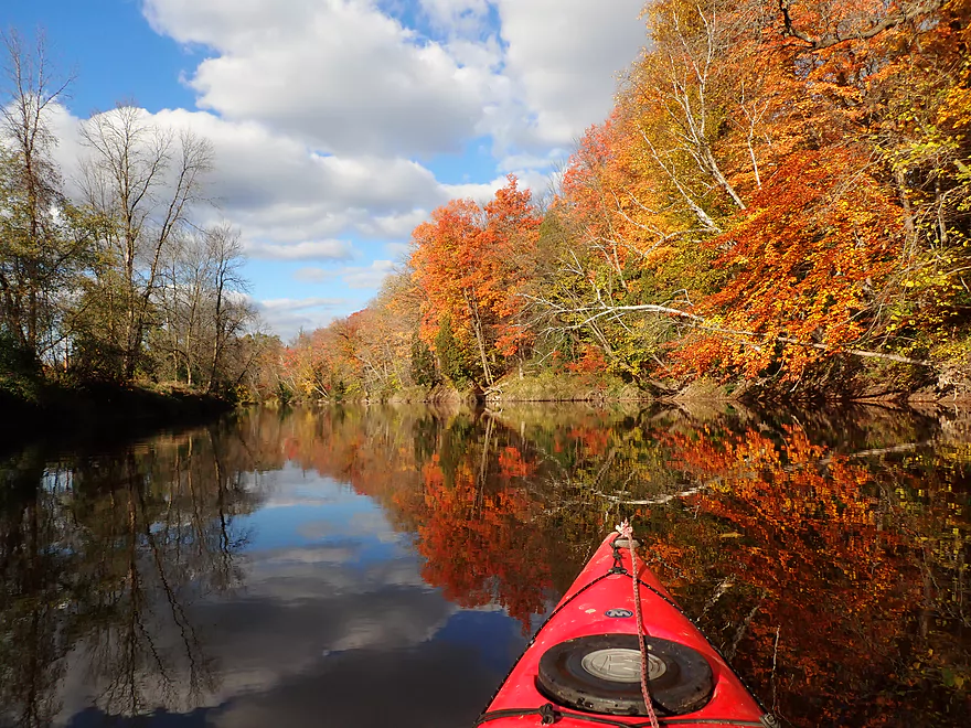
This was a unique paddling experience that featured good fall color, light rapids, and spawning salmon.
Read More...Overview Map
Detailed Overview
Thanks to Mike Svob, author of "Paddling Southern Wisconsin", for much of this information.
- Upstream of Hwy CCC: River looks too small and channelized to be interesting.
- Hwy CCC to Palm Tree Road landing: 3.17 miles. Interesting creek prospect with a mix of wetlands and woods. Part of a State Natural Area with a cool bridge. Warning the weeds in late summer can make navigation difficult. A group got lost here and had to call 911.
- Palm Tree Road to Sheboygan Marsh Tower: 8.8 miles. The heart of the Sheboygan Marsh and probably similar to Horicon Marsh. Some flowage paddling and channelized sections.
- Sheboygan Marsh Tower to Hwy MM: 1.1 Miles. Probably nice, but with logjams and a possible fish barrier. Am not 100% sure that Hwy MM is ok for public access.
- Hwy MM to Kiel (8th St.): 5.9 miles. First 1.3 miles is mostly wooded and probably nice, with perhaps a few jams. Then it is open marsh to Kiel.
- Kiel (8th St. landing) to Kiel (Rockville Road landing): 2 miles. Seemingly pleasant urban paddle, but a dam and two flowages to contend with.
- Kiel (Rockville Road) to Steinthal Road/Dam: 0.7 miles. Very big flowage...looks boring.
- Steinthal Road/Dam to Rockville Road: 1.2 miles. Looks like a pleasant wooded section with maybe a log jam.
- Rockville Road to Millhouse (Gierke Road/Dam): 2.5 miles. Mostly minor flowage paddling.
- Millhouse Dam to Hwy FF: 5 miles and a good prospect. Dam might not be a good put-in though. Hwy 57 is a half-mile downstream and a good backup plan.
- Hwy FF to Johnsonville Dam: 5 miles and also a good prospect. Be careful of the dam in high water.
- Johnsonville to Dassow Park: 6.4 miles. A good stretch. Hwy J and Hwy M are alternate launch options.
- Dassow Park to Hwy TT: 5 miles and a good prospect.
- Hwy TT to Hwy C: 3 miles and also seems good.
- Hwy C to Settlers Park (by the dam): 2.8 miles. A mediocre urban paddle through the city of Sheboygan Falls.
- Settlers Park to Sheboygan Falls View Park: 0.3 miles. A scenic but dangerous section with strong whitewater. Americanwhitewater.org has a nice review.
- Sheboygan Falls View Park to Rochester Park: 0.7 miles. A narrow wooded stretch with perhaps some Class 1 and even Class 2 rapids.
- Rochester Park to Esslingen Park: 9.5 miles. Despite being mostly a golf course paddle and needing to portage two dams, this is a really nice paddle. This trip is best timed in October when fall color can be quite good and you can see large salmon spawn.
- Esslingen Park to the 8th St. landing: 3.1 miles through the heart of Sheboygan. One more mile and you can get out onto the breakwater and disembark on one of Sheboygan's Lake Michigan parks.
Also nearby are the Pigeon, Meeme, Mullet, Black, and Onion rivers, as well as Sauk and Sucker Creek. I'm trying to find which are feasible water trails, so if you have some tips leave them in the comment section below.
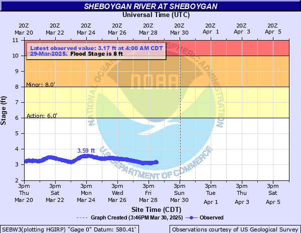
Nearby Guages
Videos
Comments
Appreciate the clarifications.
There is an eagle nest (not in the frame) to the left at 5:40 on the video.
Salmon start running in September.
Thanks for updated and the offer!
Just did Rodchester to my house (~ 11 miles) in 5 hours with 2 teenage boys. River is down to normal again. Did it in 3 hours a month ago. Postage around both dams to the left. They are marked, but the signs are a little overgrown.
@ Aaron, let me know when you are coming. I love this trip. Salmon are starting to swim up already.
Hi Sandi...by law each dam is supposed to have a portage path. Most are marked or somewhat obvious...you simply take out along the shore...then re-enter where you can. Some dams are tricky to portage though (such as the one in downtown Sheboygan Falls). For more information you might contact the DNR or local city council.
we are beginner paddlers with basic kayaks. We want to paddle the sheboygan river. I'm unclear how you deal with the dams. When you stop at a sidebank and walk your kayaks do you do this while still in the river? or along a side trail?
Sounds like a nice trip! You're from the Pigeon river, eh? That's a cool prospect that is definitely on my todo list...
Any day on the water is better than any other day, so when the mercury hits 65 degrees on April 8th, you gotta grab the opportunity, right? There was plenty of water, but never pushy. We could have drifted the whole way except for minor strainers on the sides - easy to avoid because the river is plenty wide. Highlight was a goose sitting on her nest amid tall grass on a small island -- and the crazy-mad gander who taunted us from nest to 10 minutes downstream.
I really want to do that section...almost did it last year. I might save it for a fall paddle when the salmon are spawning. Thanks for the feedback.
Onion River from county road V to Sheboygan falls - Rochester park is a nice fast run with good scenery and a lot of class I and I+ Rapids .
As a reverence We have done this stretch when the Sheboygan River was running at 775 Cfs and at 937 cfs.
Steep gradient but you need the flow not to scrape.
Checkout site miles paddled.com for their review.
Just found your site today and really like it!
Hi Gary,
No I haven't although it looks like an interesting prospect. I do want to get back to the Sheboygan River this year is possible. If you do this leg, definitely let me know how it turned out.
Aaron,
Have you ever kayaked the Sheboygan River from the Sheboygan Marsh Park to Kiel WI?
It looks like it would a great paddle and it looks like a take out on Water street in Kiel a block before the dam.
5 miles as the crow flies, maybe?
I get my Remix XP10 tomorrow. :)
Thanks for the advice on a kayak.
Gary M.
Thanks for the comment Jon! I hope to do this section later this year.
Did the 9.5 from Falls to Esslingin Park. Beautiful and great 3 hour downstream paddle two portages. Great idea, thanks.
Thanks Scott for the comment! Yes, this is a great paddling prospect and I look forward to returning to it. I suspect some of the downstream sections might be really nice.
Found your site when googling for some info on kayaking the Sheboygan River. So glad I did. Very helpful. I followed your exact route on July 16, 2016, and had an enjoyable time. River was shallow and I scraped the bottom more than I'd have liked, but still happy I did this. Maybe go in spring next time when it's deeper.
Thanks for creating and maintaining this site. Looking forward to trying some of your other trips in the future.
How did your trip turn out? Questions or comments? Feel free to leave your feedback.
SUBMIT COMMENT!
Be notified when future paddle reviews go live by subscribing!
