
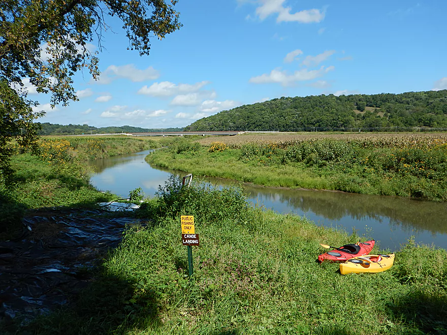
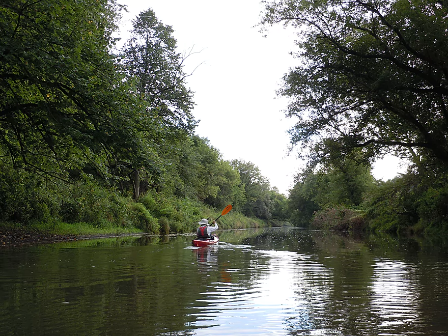
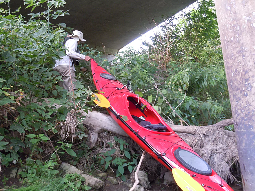
Public put-in by Shortcut Road
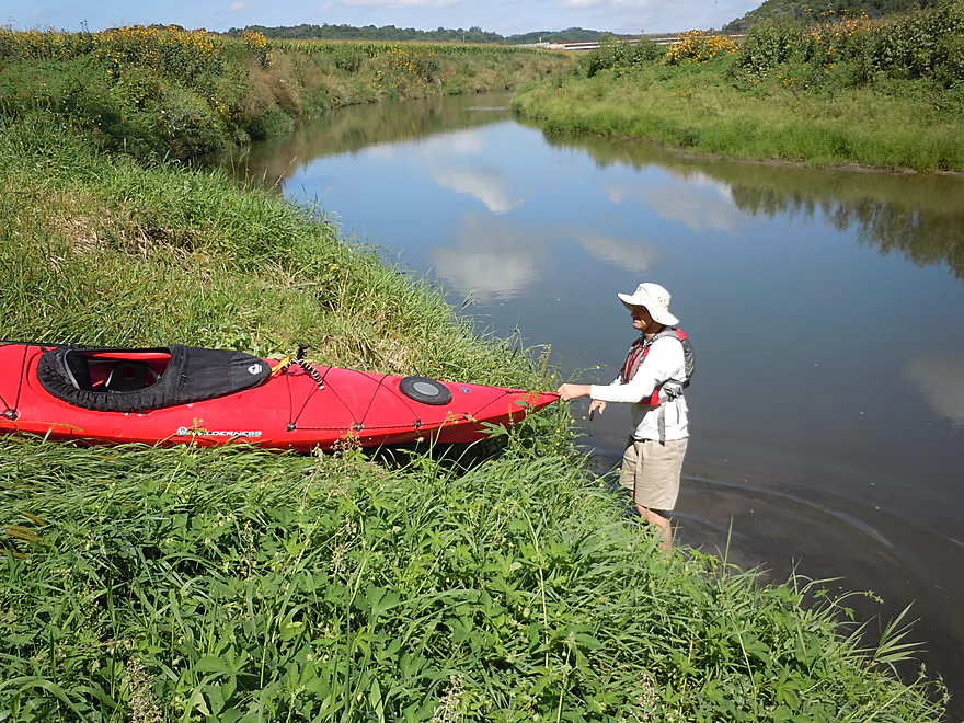
Short drop-off to water
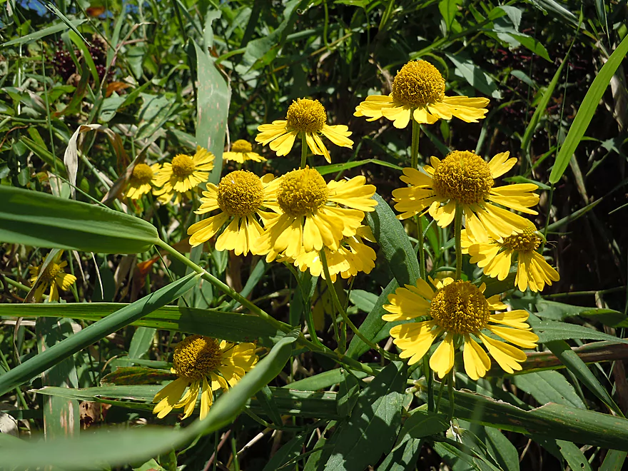
Sneezeweed
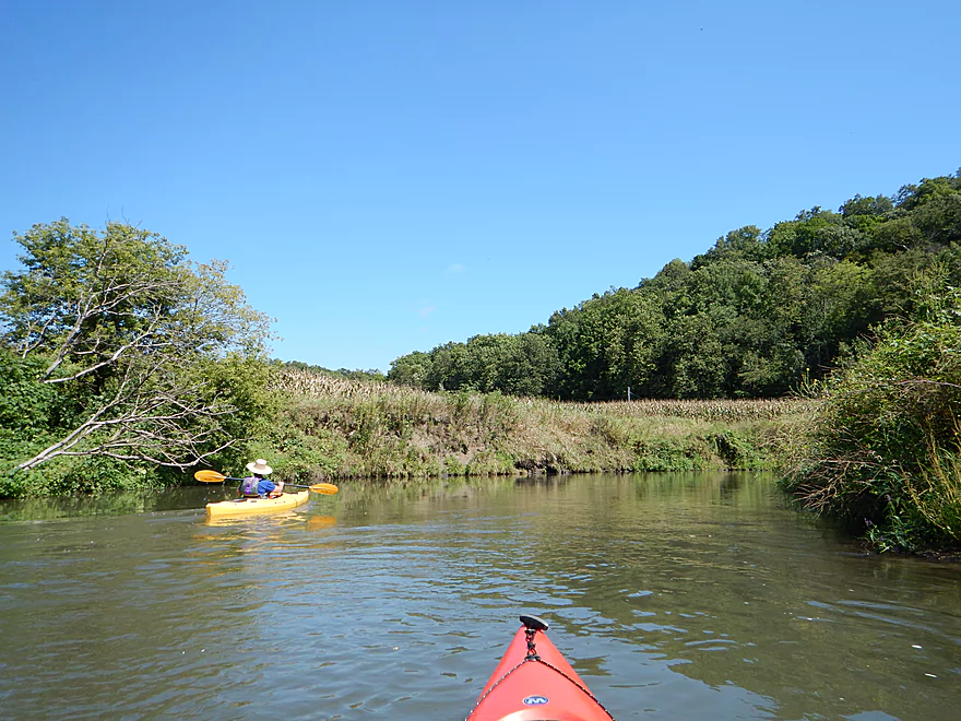
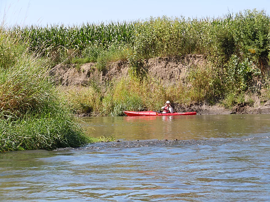
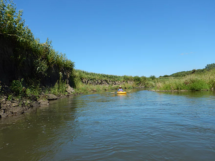
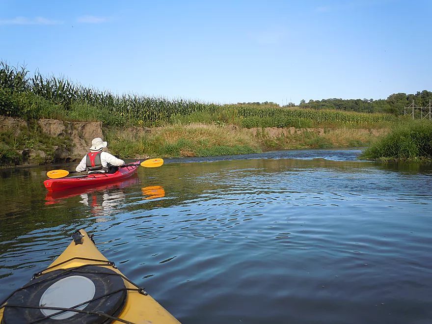
Lot of corn on the this trip
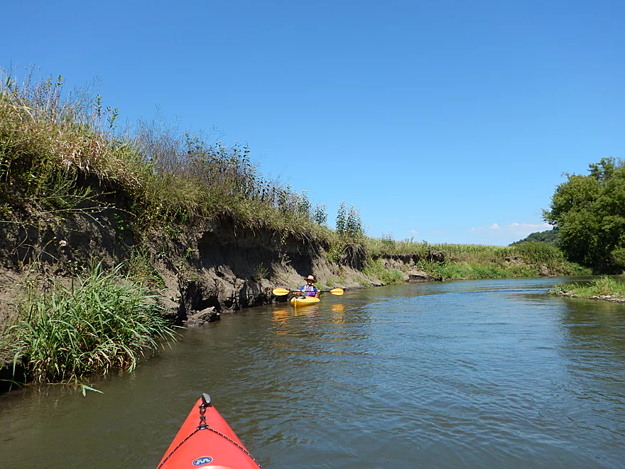
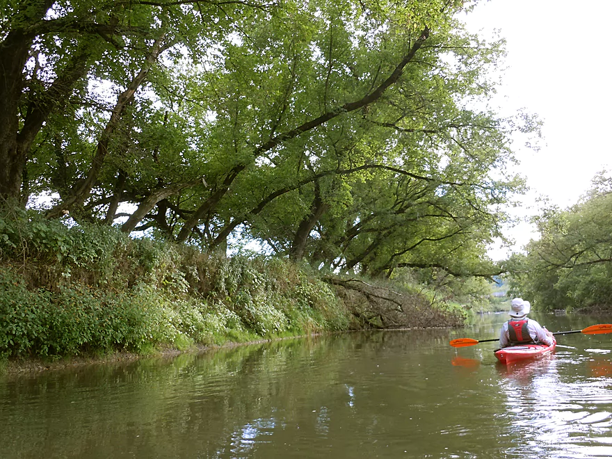
…and mud banks
Beggar-ticks
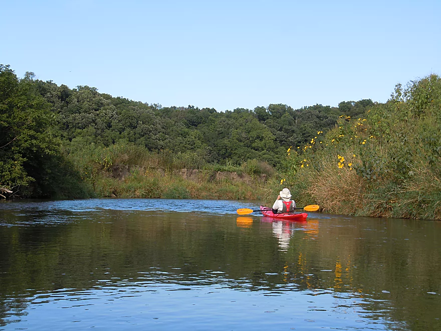
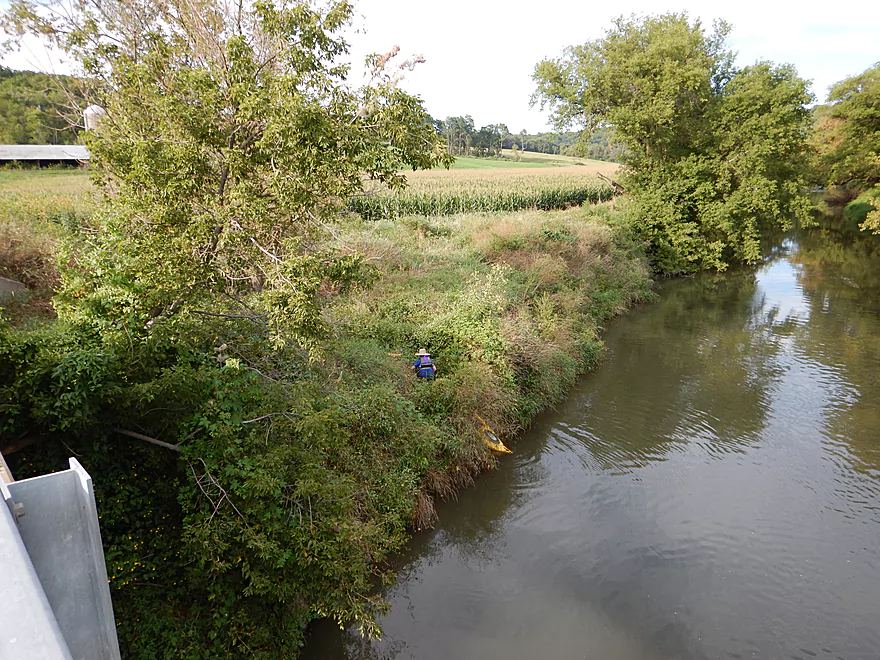
One of many hilly vistas
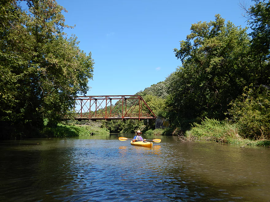
Terrific iron trestle bridge (complete with tire swing)
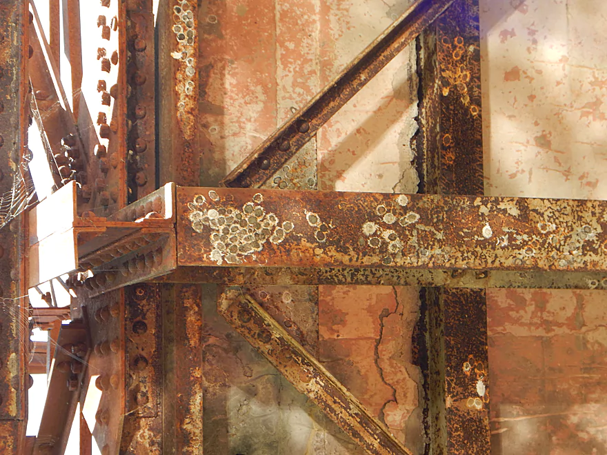
Dobsonfly eggs cases on rusty bridge frame
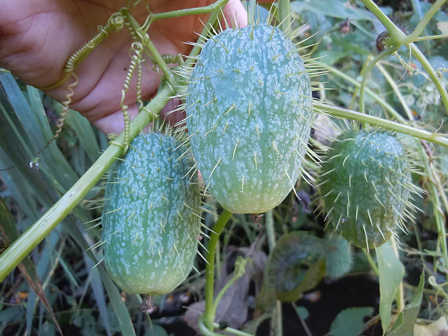
Wild cucumbers (do not eat!)
Yummy
A bank of jewelweed (aka touch-me-not)
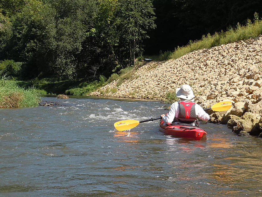
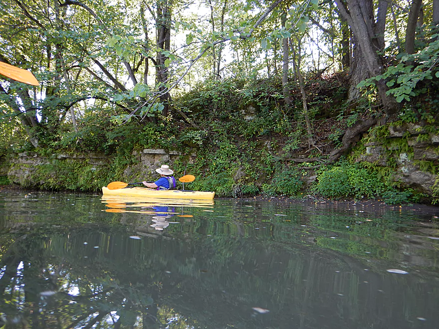
Massive bank of limestone riprap supports Porter Bridge Road.
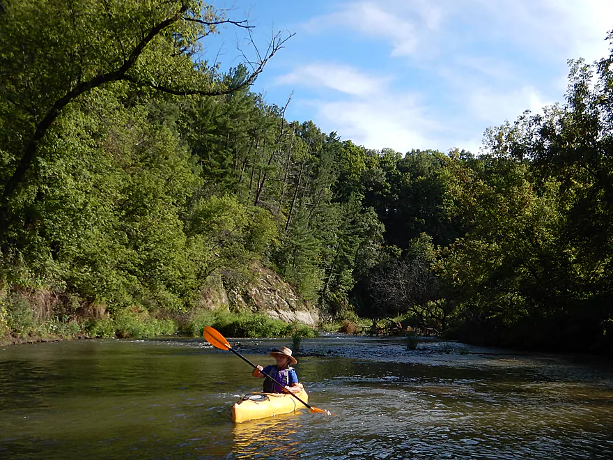
Minor riffles here and there
These were the biggest on the trip though (class 1)
Decades of erosion from logging and farming
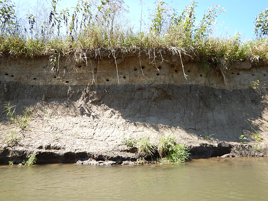
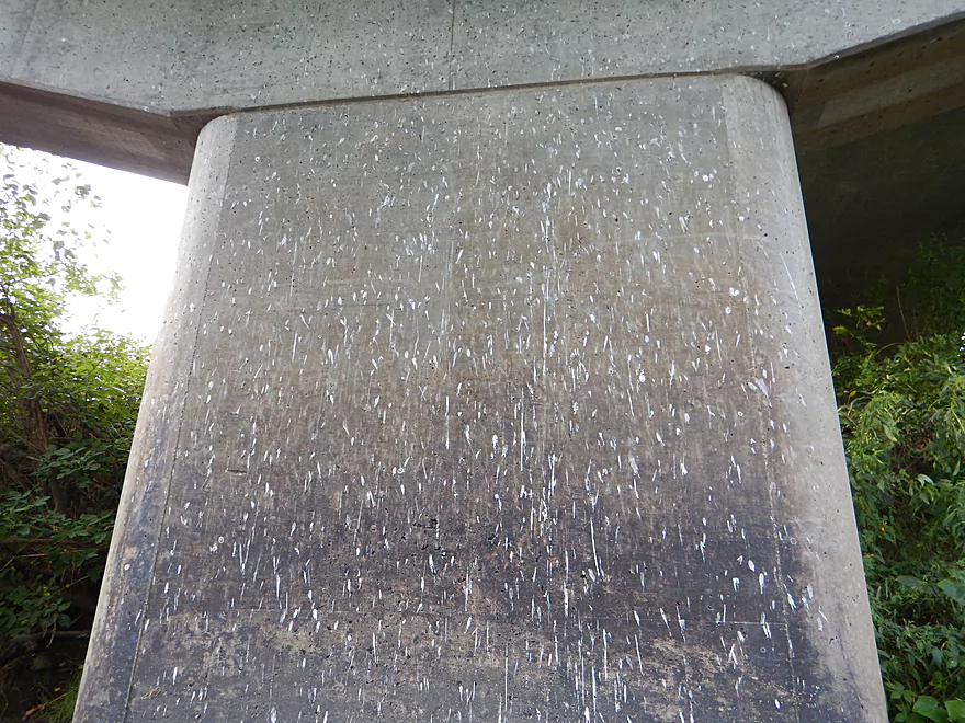
Bank swallow homes (interesting soil banding)
Another section of limestone riprap
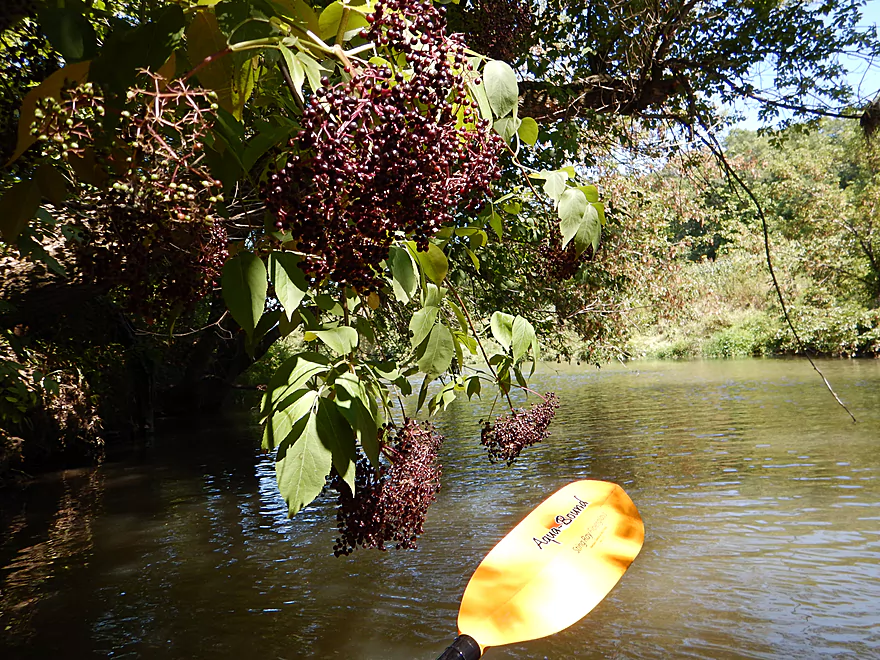
Ripe elderberries
Minor riffles with an almost-boulder garden
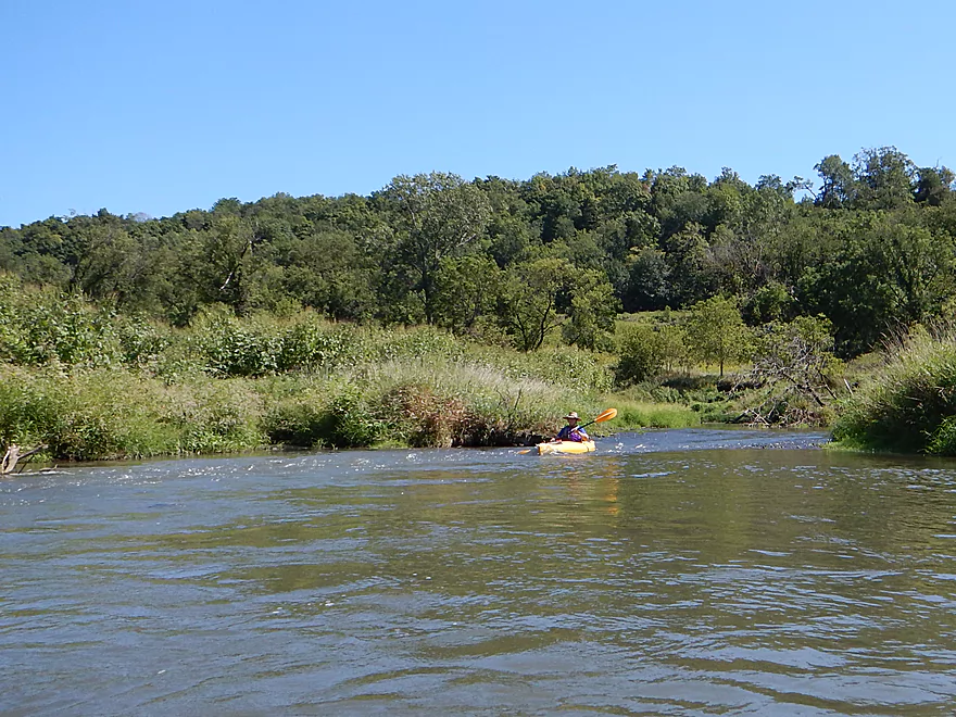
More nice hilly vistas
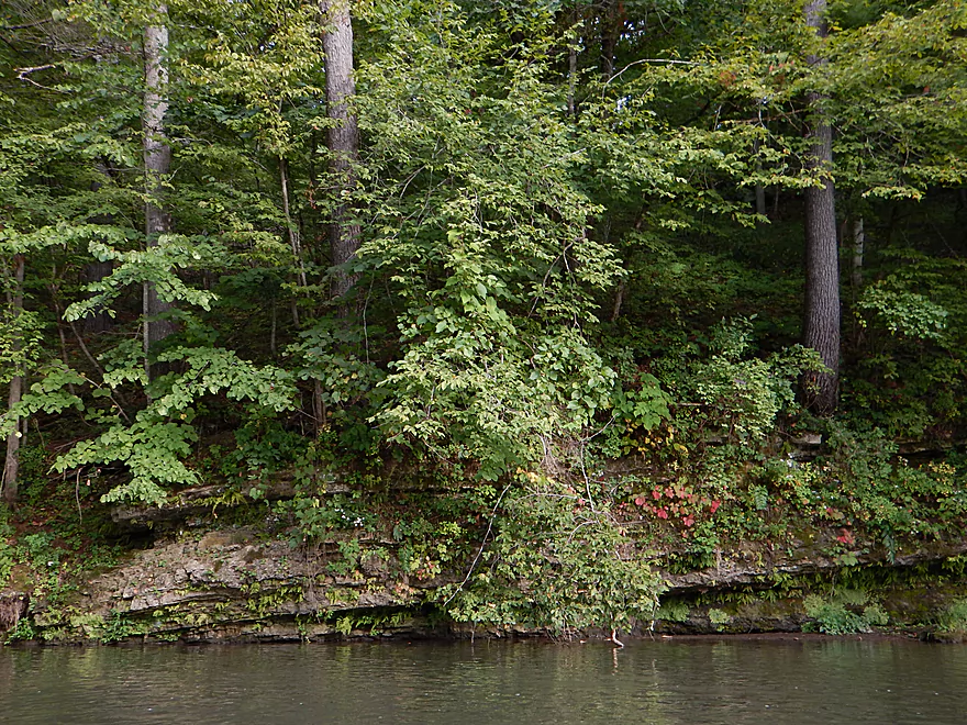
Some mud banks were actually attractive
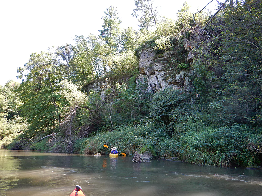
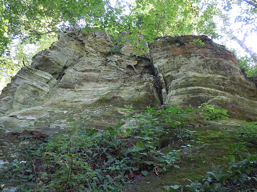
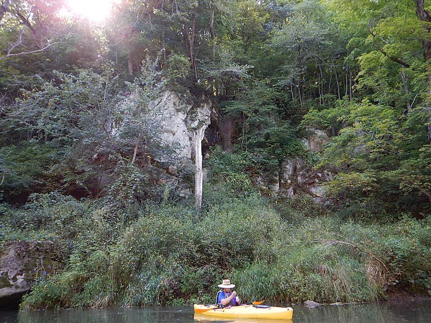
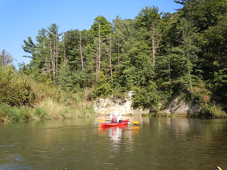
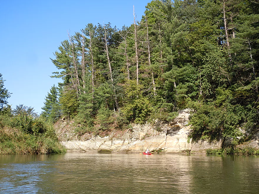
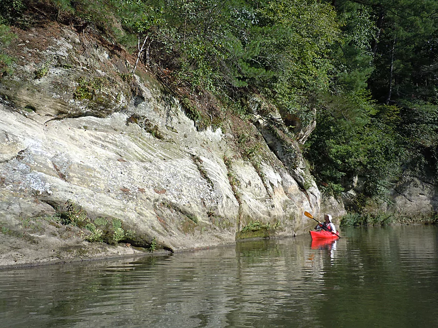
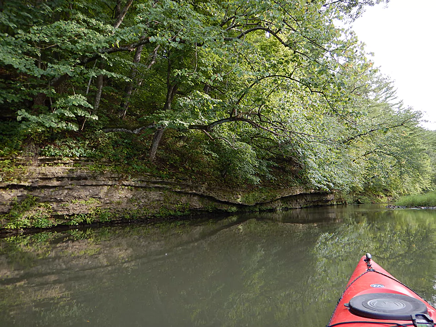
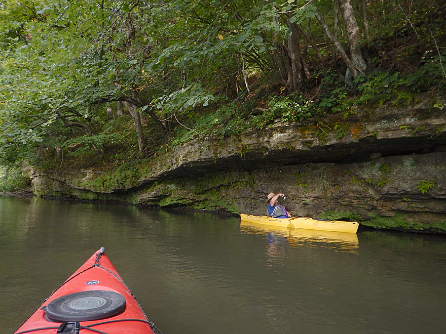
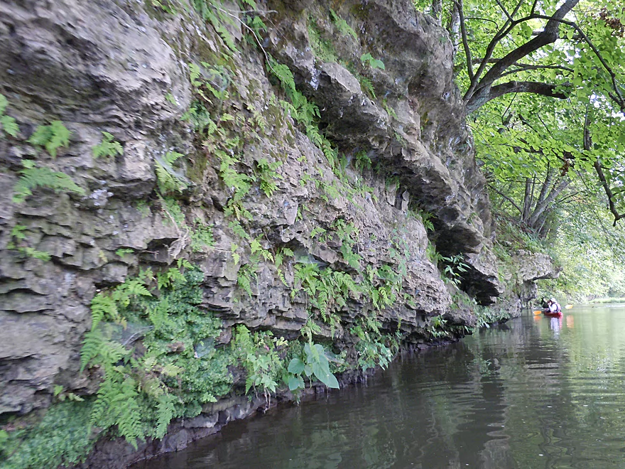
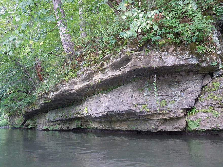
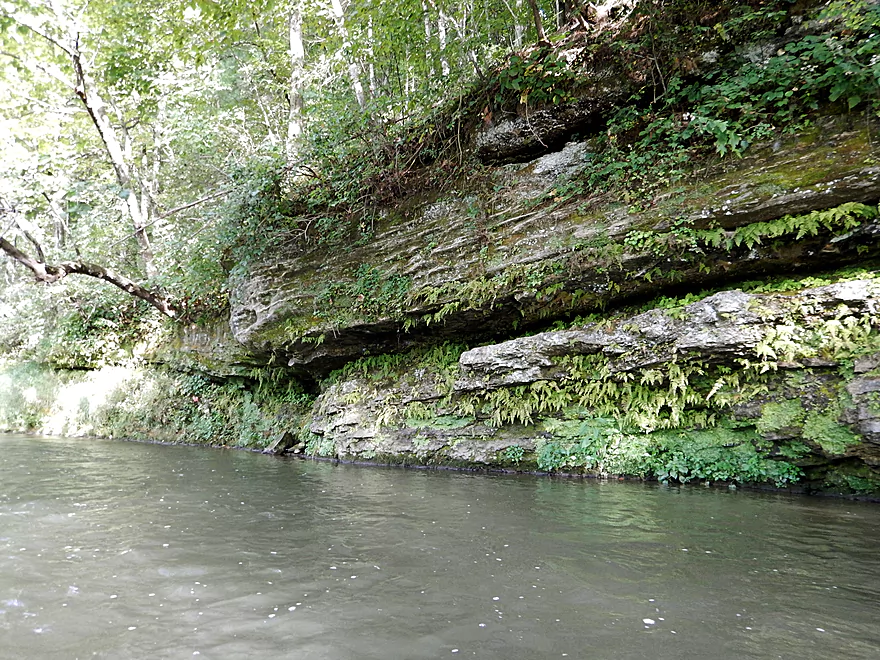
Rock formations at last!
Scenic sandstone bluffs
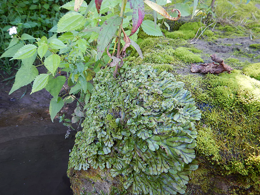
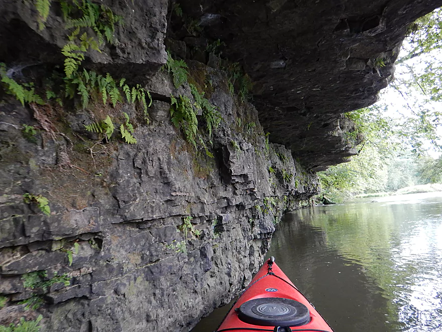
A rock-covering of liverworts and mosses
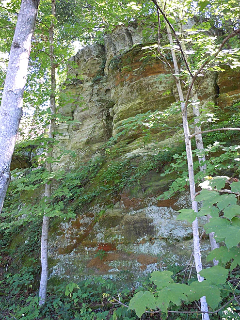
More sandstone
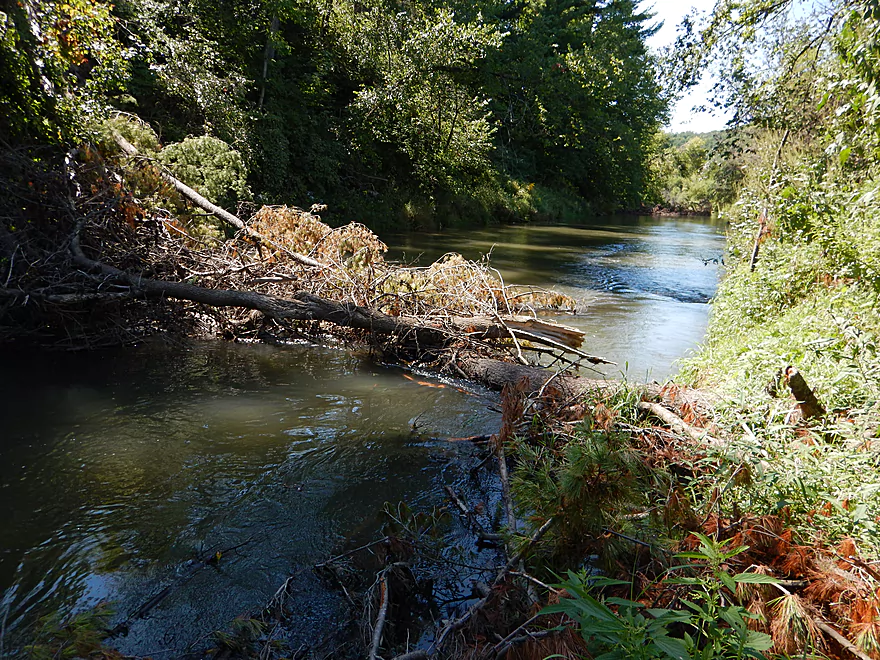
A decent log jam
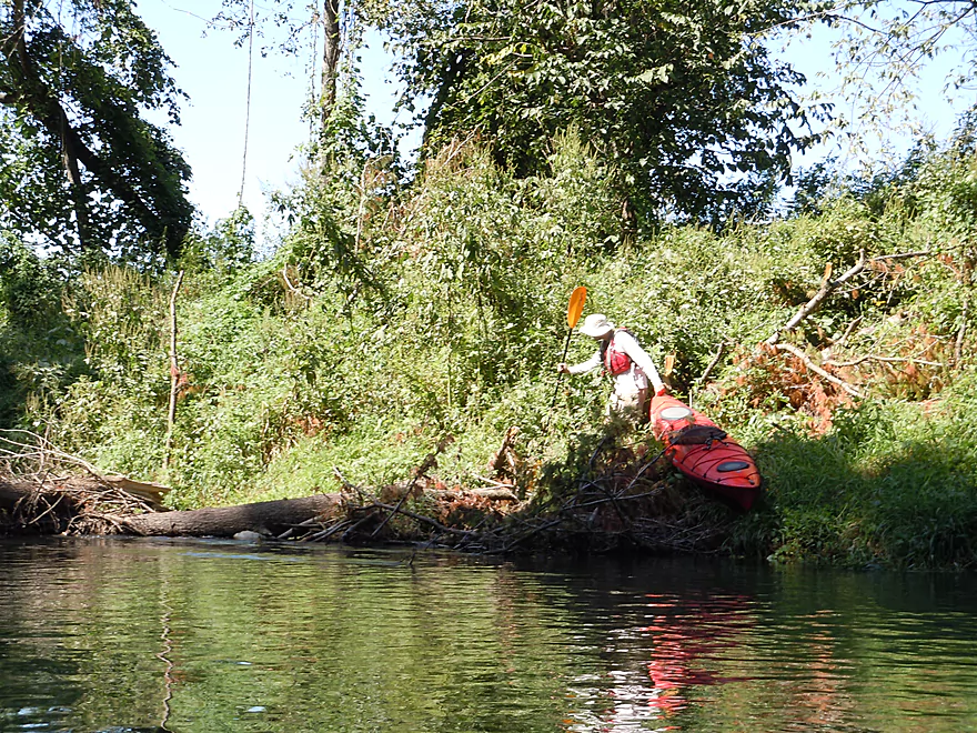
Not the easiest to portage
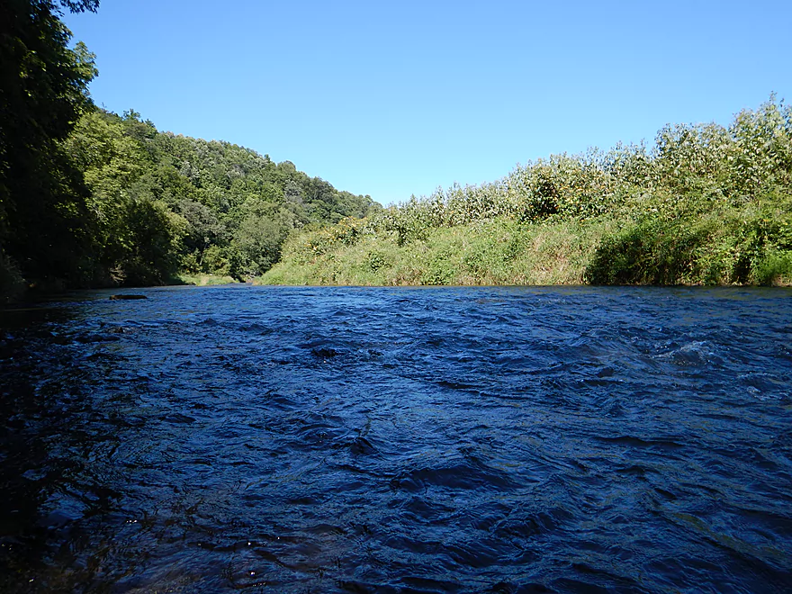
Nice riffles with the hilly backdrop
Another nice small bluff area
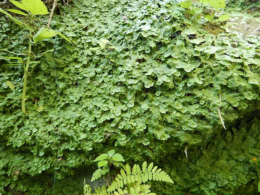
A different kind of liverwort
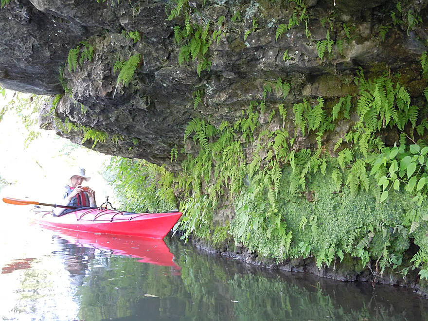
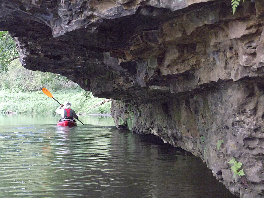
Cool overhang

Great plant life on the rock face
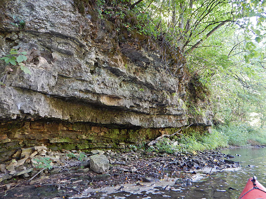
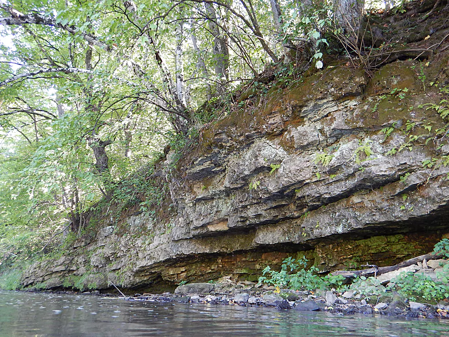
Striking stratification
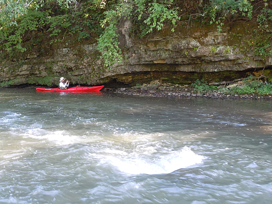
Undulating bluff at base of riffle
Superb!
Plants hanging over the bluffs
Approaching standstone bluffs with terrific white pine stand
Current here pushes you into the wall
Feels like the Kickapoo
Reverse view of leaning pines
Favorite bluff of the trip
Great lighting late in the day
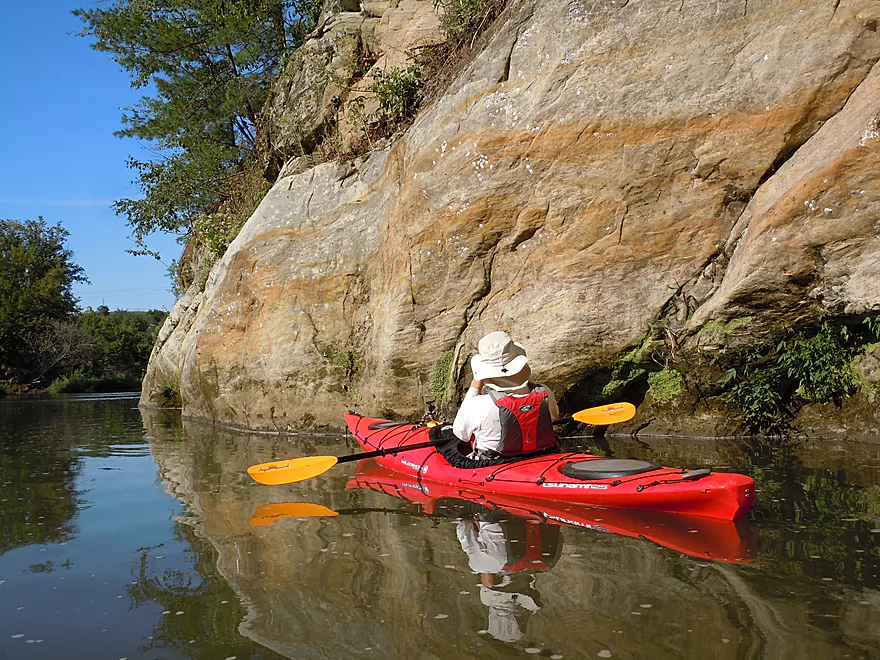
Nice red bands
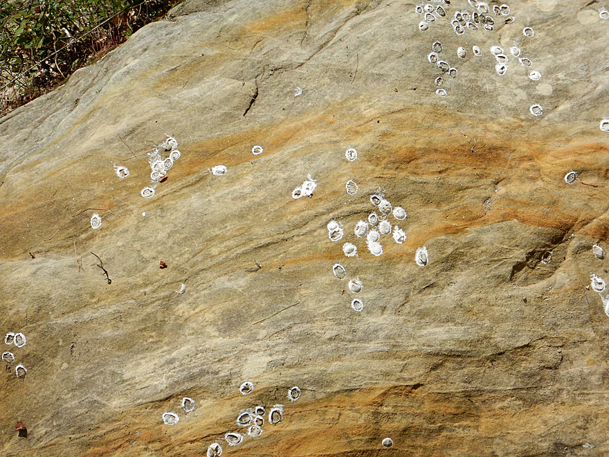
Dobsonfly egg cases on “rusty” sandstone
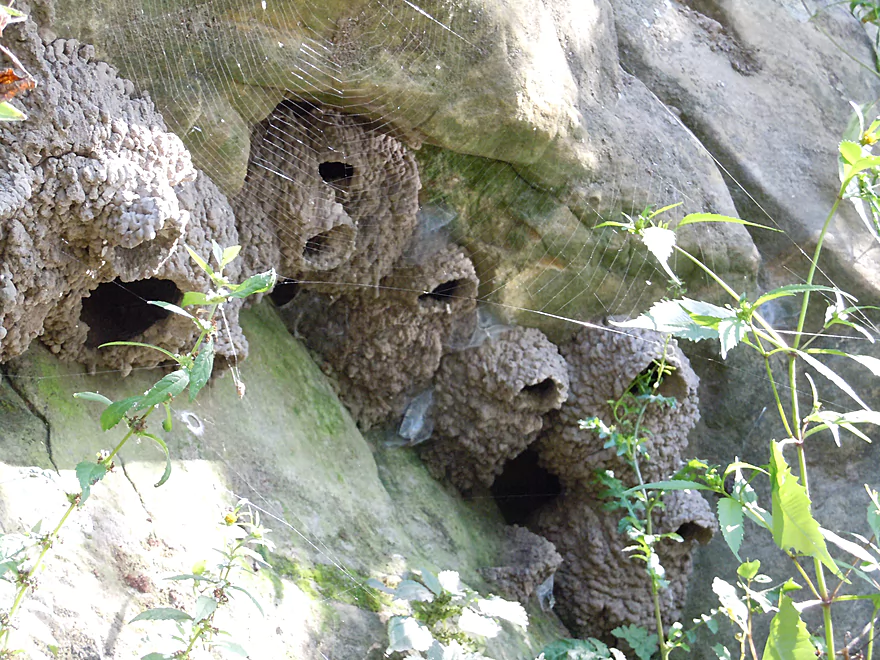
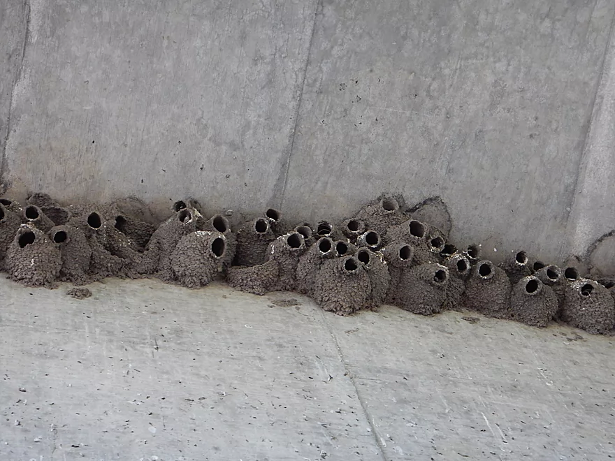
Cliff swallow nests not under a bridge?!
Before, it looked like the Kickapoo…now, the Dells
Leaving “the Dells”
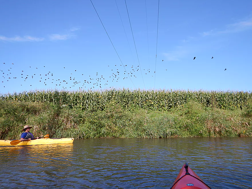
Spooking a flock of blackbirds
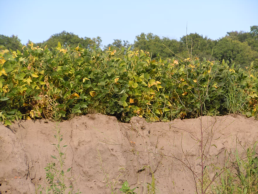
Corn planted WAY too close to the edge
Unnatural but scenic part of the river
Would not be surprised if a tractor ended up in the river
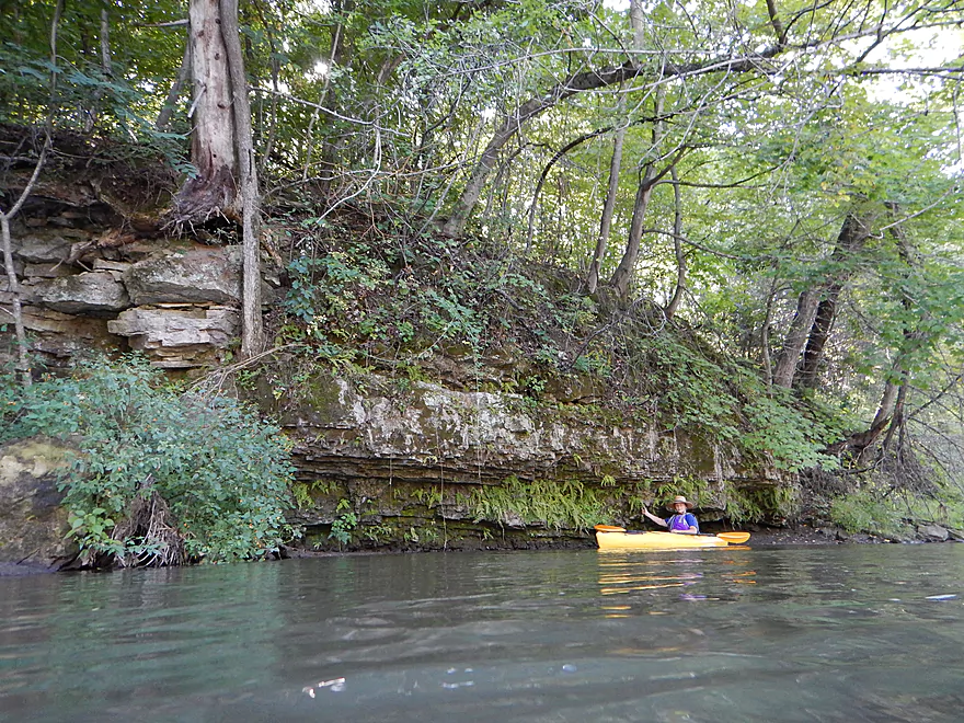
Another small bluff area
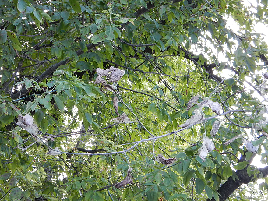
Tent caterpillar webs
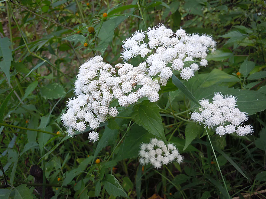
White snakeroot
Reflections of ancient stone
Fantastic overhang
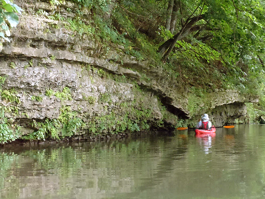
Incredible geology
Reverse view
Many more bluffs on this section
Some with nice plant life
Ferns are quite at home here
What could have caused this?
The culprits
Grant River Road is a BAD take-out
Is public though…
Scouting Pigeon River Road
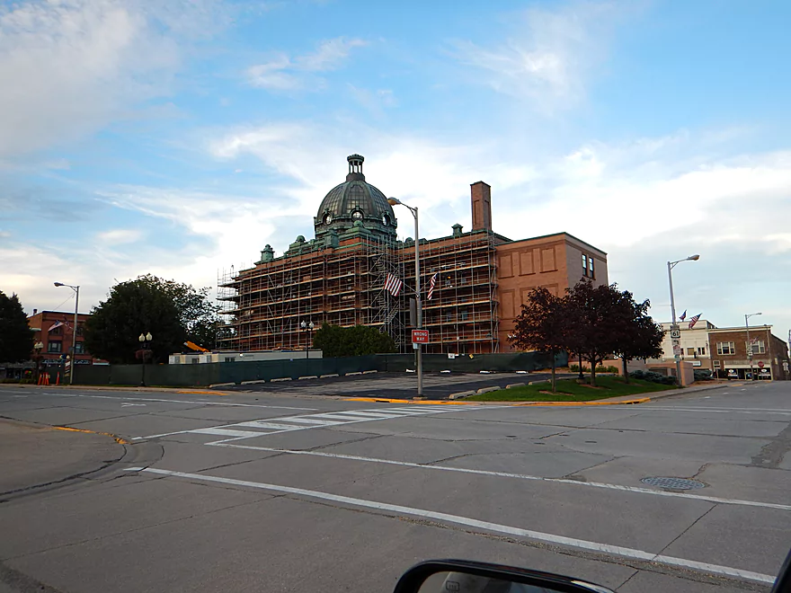
Grant County has quite the courthouse…
Grant River

Not being the cleanest river nor the best wilderness experience, the Grant River is pretty much a one-trick pony. But it is a good trick though! What makes the Grant special are the occasional limestone and sandstone bluffs, which are fantastic and make this trip worth doing.
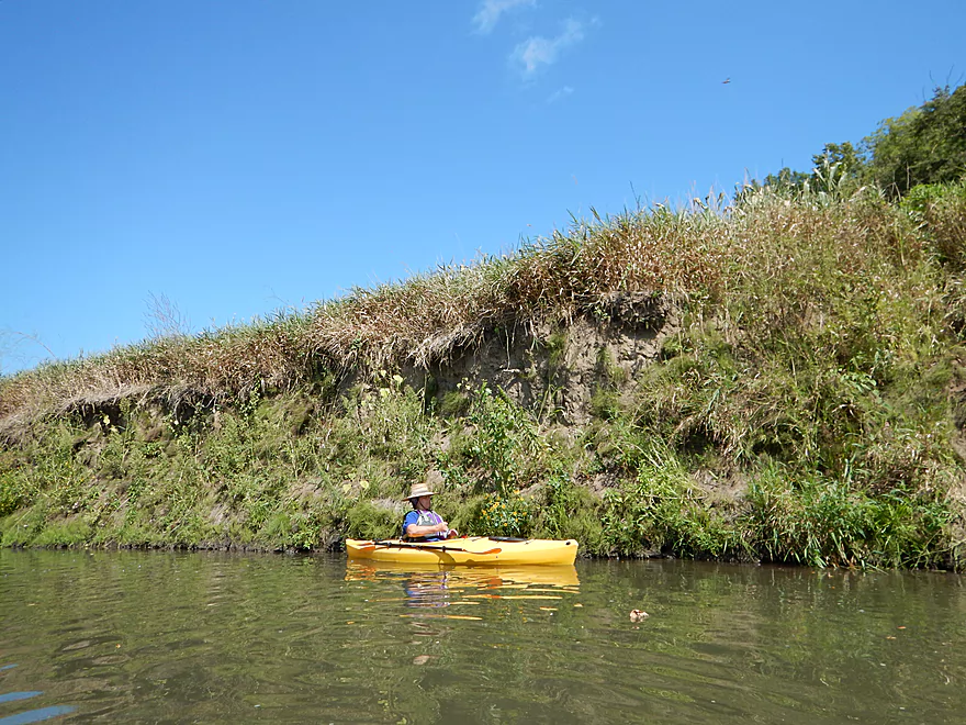
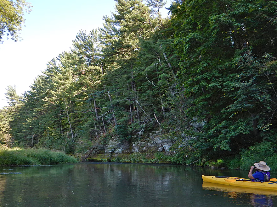
For a river fraught with access issues, the put-in is actually pretty good. Basically, it is a public fishing area at the junction of Hackett Branch Creek and the river. The road by the landing is called Short Cut Road or Porter Hill Road and is marked on the map below as a green teardrop. This is clearly a public access area, with good parking and an ok launching ledge.
Not many rivers in Wisconsin have a livery service, but this one does. The business is called Grant River Canoe and Kayak and can be reached at 608-794-2342. They don’t have a base of operations and instead, all coordination is conducted by phone appointments, so definitely call in advance to make sure you’ll be set. If you do use their service, they ask that you don’t bring styrofoam, glass or alcohol.
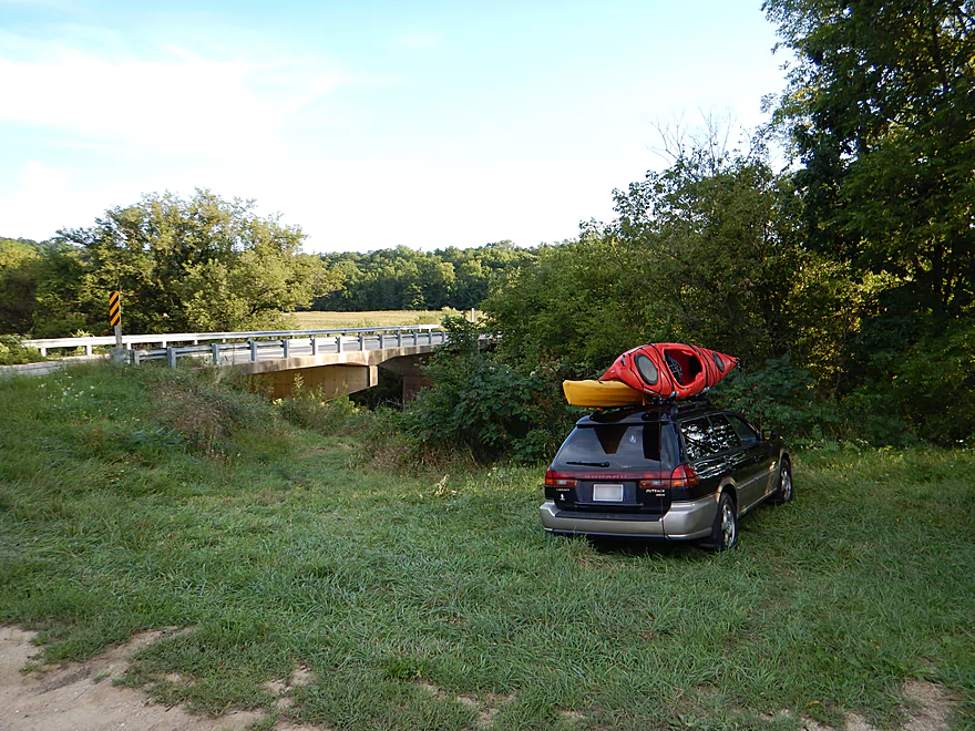
A bike shuttle would be possible but not ideal. No gravel that I saw, but the grade is steep. You’ll peddle 4.69 miles (or just a bit further to the next bridge) but will climb 300′ and drop 328′. That is a lot of energy lost to braking.
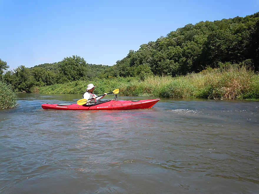
The Grant actually has a stable flow rate, despite its gradient. We went at 139 CFS, which might be a tad low for a canoe, but fine for a kayak–with just some minor scootching over a few rocks in the riffles. The rest of the river (outside of the riffles) is actually pretty deep. This is a mean river during high water and can get close to 2000 CFS in the spring. I suggest not going over say 190 CFS (guess) and not under 120 CFS (guess). At 190 CFS the current will start to push you into the rock walls, which could be an issue.
The Grant has a “pool and riffle” configuration with long, slower stretches and shallow, faster riffles. The grade was 5.4′ per mile.
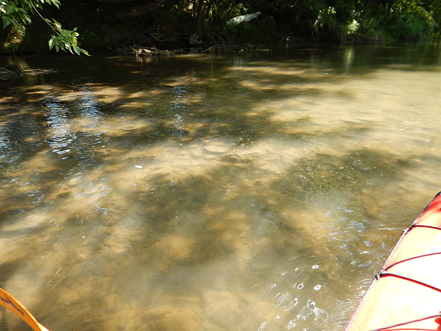
This is not the cleanest of rivers! In fact, it is kind of dirty….but not unbearably. The substrate is mostly a mixture of rock and mud. The river does clean up some in the second half of the trip, but never gets close to the Fever or Platte for water clarity (neighbors to the east).
Not much. On the bridges and some of the sandstone were dobsonfly egg cases, which are always exotic looking. Saw cliff swallow nests on the bridges (common) but also saw cliff swallow nests on cliffs (rare!). Also saw a great blue heron, bald eagle, wood ducks and bank swallow nests. Most rivers have a great soundtrack, and the Grant was no exception, with grasshoppers and crickets providing the primary performance.
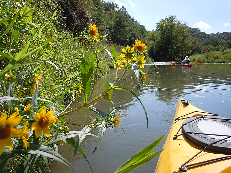
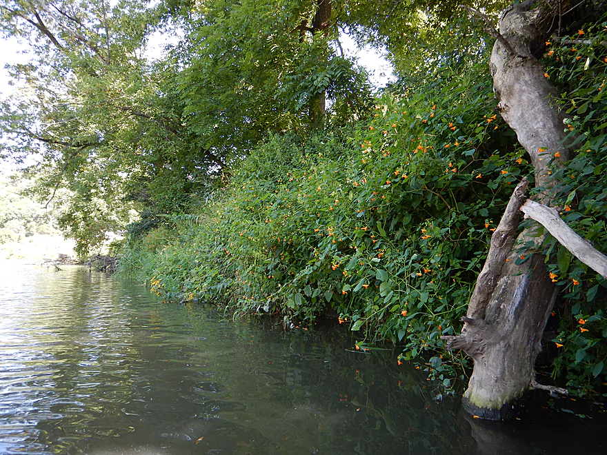
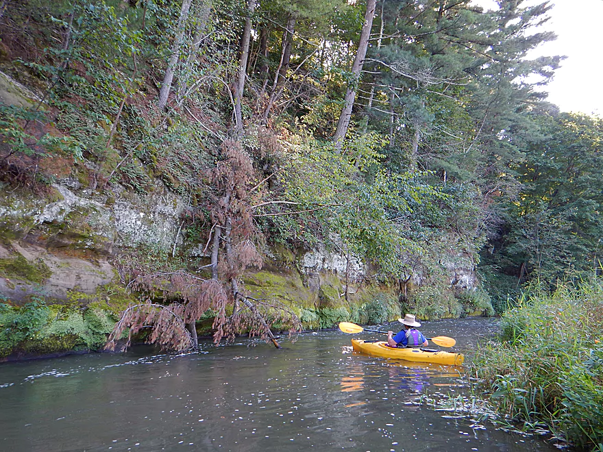
For trees, it was mostly oak, ash, and basswood, with some scattered white pines on the hillsides, especially on the sandstone bluffs and ridges. The banks consisted mostly of reed canary grass, jewelweed, nettles, giant ragweed and vines. Also, a number of wild cucumbers were bearing fruit…but you don’t want to eat these puppies…
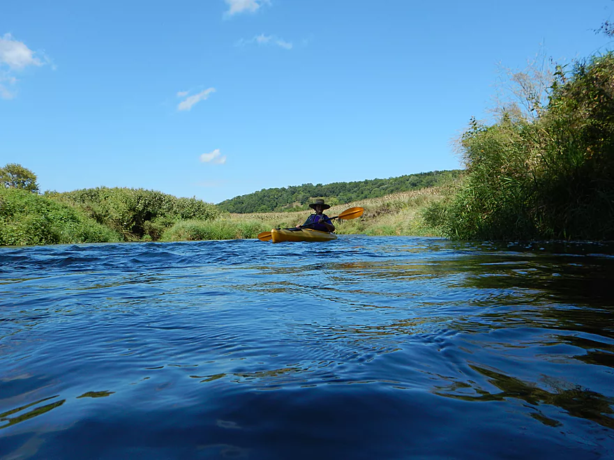
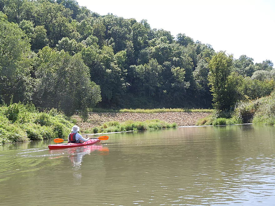
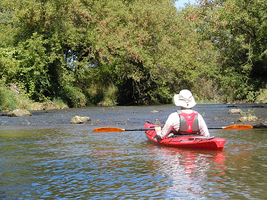
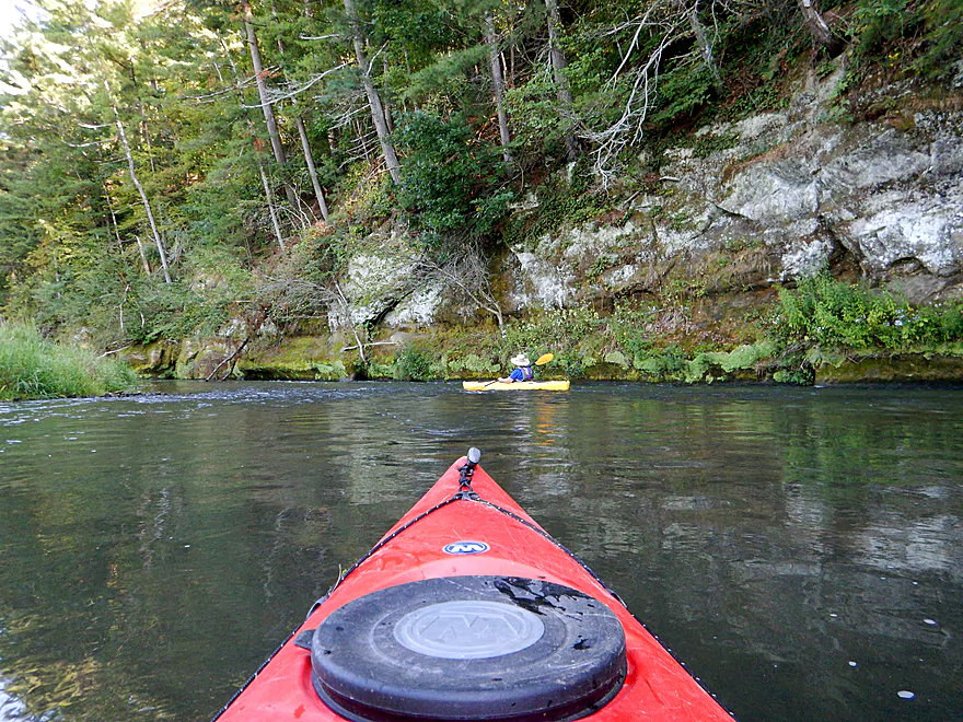
I’m sure paddlers who first put into the river will be initially a little confused by my five-star rating, as the Grant doesn’t make a great first impression. But it doesn’t start bad either, with nice views of the hills and occasional riffles.
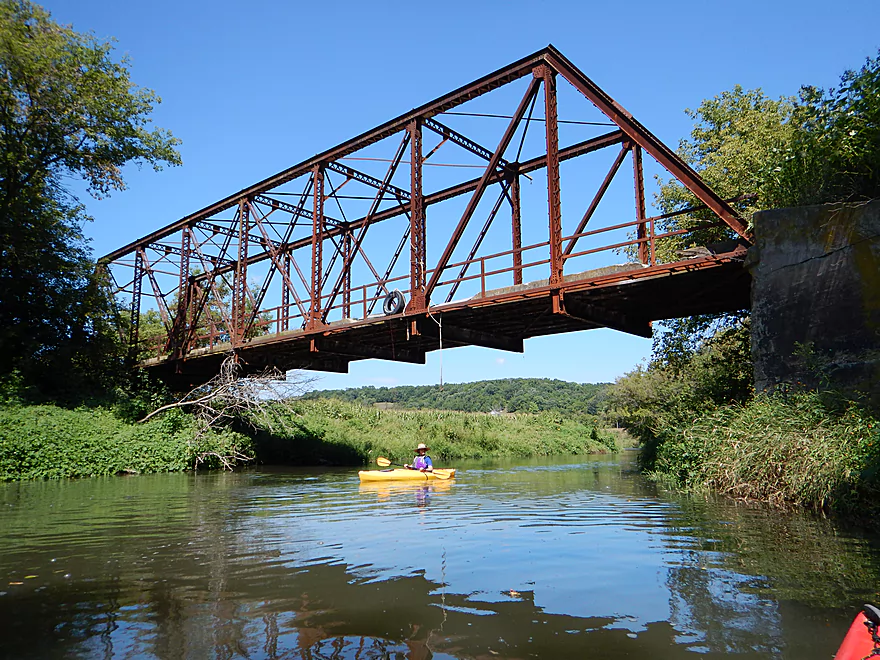
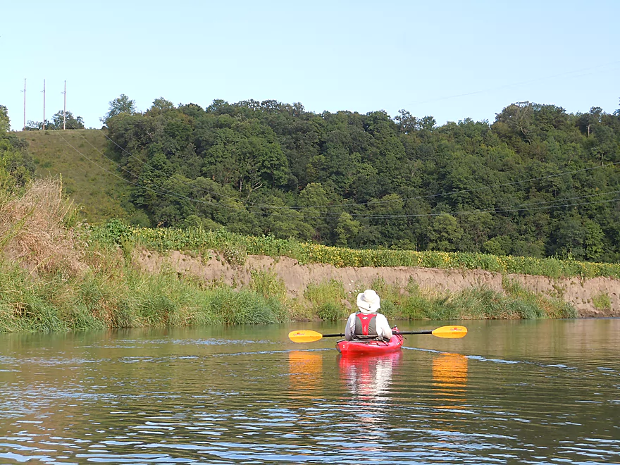
You’re first photo-op will be a historic and stately iron bridge (Short Cut Road). Soon you’ll encounter perhaps your most serious rapids on the trip by Porter Hill Road (easy at our flow rate), with large artificial banks of broken limestone propping up the road. No doubt this river has a mean streak when flooding and I was surprised that our take-out had a “watch for high water” sign given how high up the bridge was.
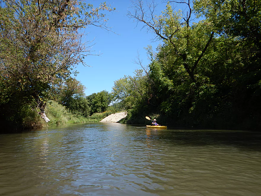
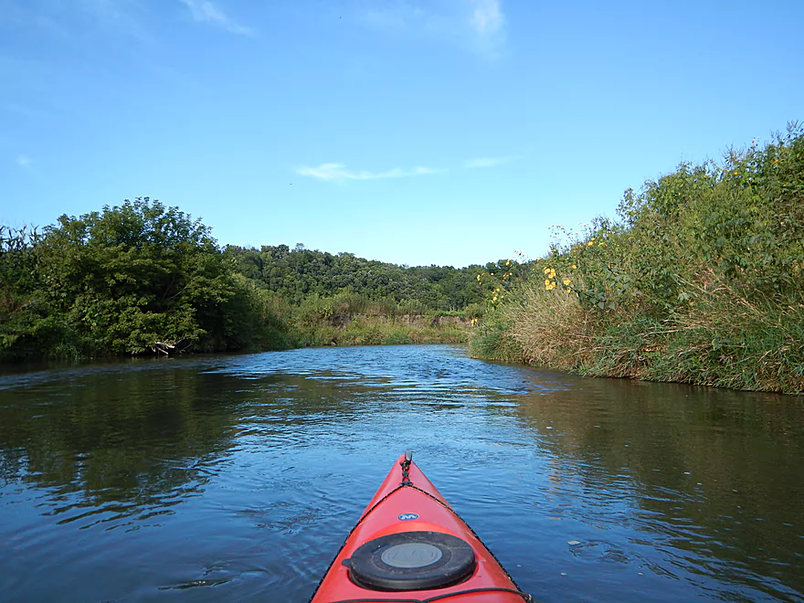
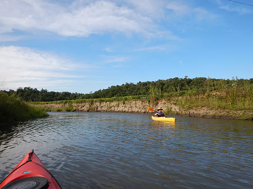
Your first major bluffs will come soon after and be on your left. These are nice but heavily recessed into the hill and obstructed somewhat by the leaf cover. To truly appreciate this and some other bluffs like it, you might consider a leafless paddle in May/October. The river then straightens a bit and slows down (aka gets very boring) but takes a sharp left and gets interesting again, with some nice rocky riffles and attractive forest cover on the right hillside.
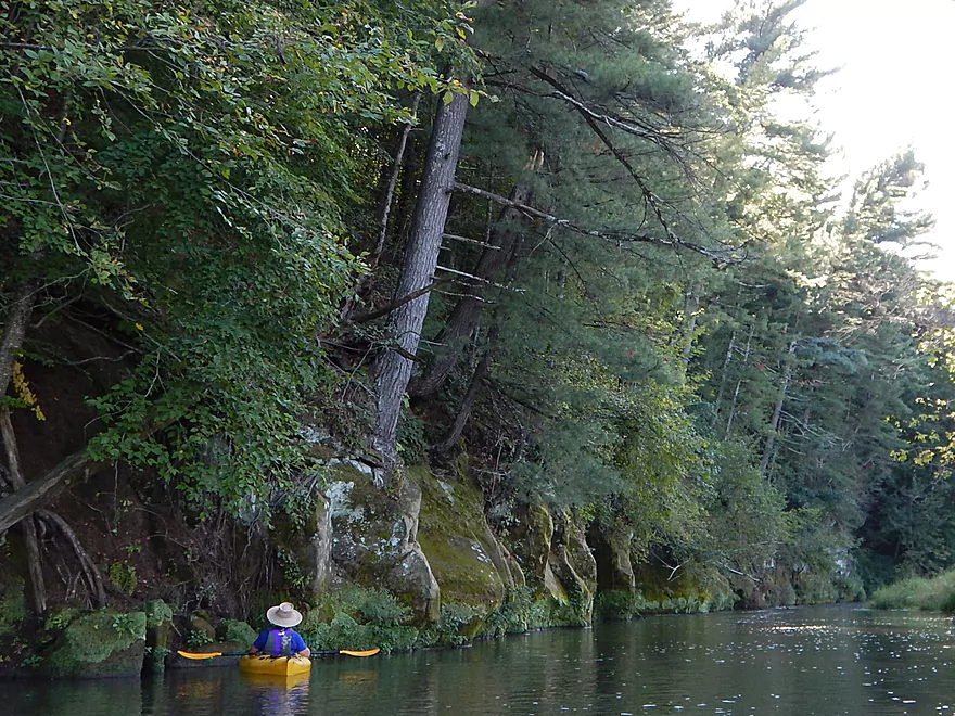
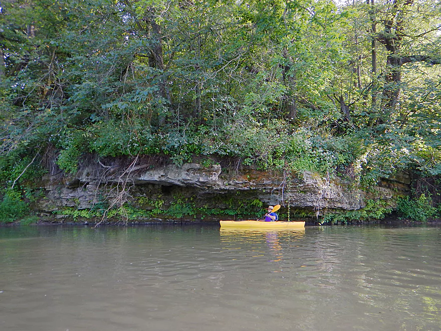
The Grant is unique in that it has both limestone and sandstone bluffs. Sandstone is basically smoother and lighter in color. Limestone is more textured and layered (which makes getting enough light to photo it hard). It also tends to have much more in the way of exotic plant life, like mosses and ferns that can cling to the rough surfaces. A good portion of the “limestone” was probably really dolomite, but you would need to run chemical tests to determine this.
Soon on your right, you’ll encounter some classic Grant River limestone that you’ll often see pictured in reviews of the river. Not overly tall, the limestone bluffs make up for it in character, with exotic texture, undulations and lush plant life–all right by the water.
The bluffs aren’t over yet though. You’ll swing around a corner and have to avoid the riffly current pushing you into a wall of sandstone (a problem more so for high flow rates…not ours). Then you’ll see a majestic sandstone bluff dead-ahead with fantastic white pines growing on the top, deja-Dells. One advantage of arriving here late in the day was that the lighting was perfect and there were fantastic wave reflections on the sandstone to boot (which I got a video of). This sandstone bluff was so nice the cliff swallows actually nested here instead of under the nearby man-made bridges!
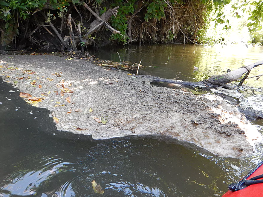
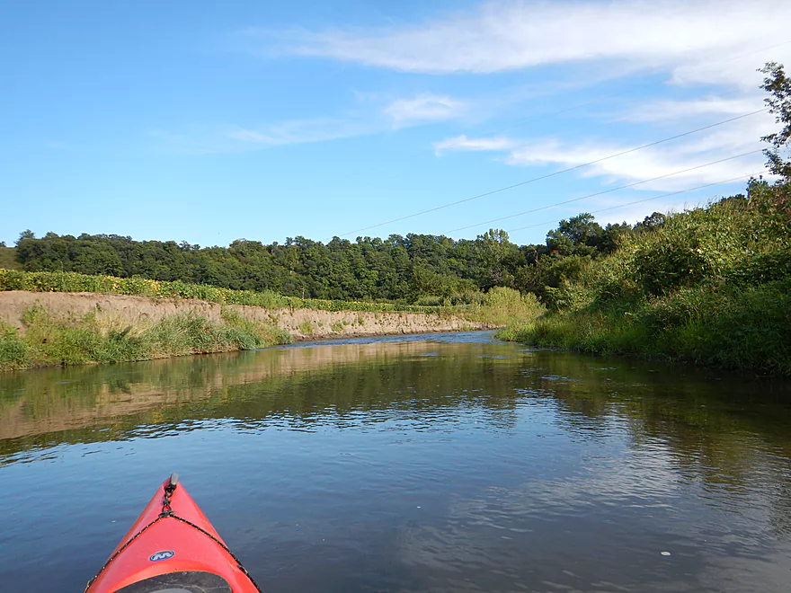
The water actually seems to clear up after this, and despite the following section being mostly a corn maze paddle with some minor limestone bluffs, it had a nice feel to it difficult to describe. Even the epic mud banks from decades of erosion appeared to be artistic.
The rock bluffs aren’t done though, as the final hurrah consists of terrific limestone bluffs on the final hillside to your left. What made these unique was the way the limestone layers folded and bent up and down, which indicated some interesting earlier geological phenomenon at work.
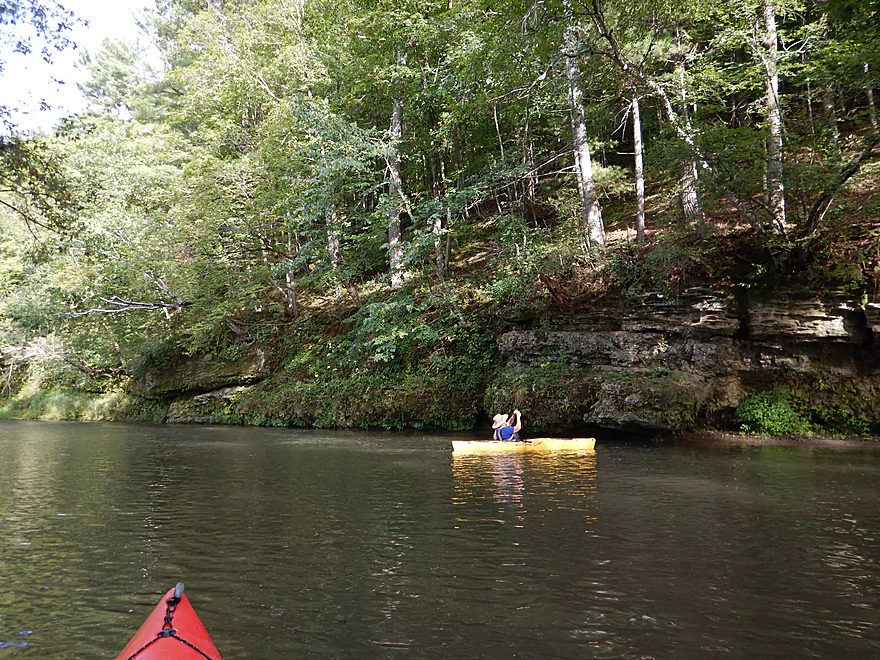
Figuring this was a well serviced livery route, I didn’t pack my trusty rope on this trip and, sure enough, paid the price. There is a big log jam by the first sandstone bluff, which is annoying. This is a bit more on the difficult side because of the steep bank, deeper water and stinging nettles. It’s manageable though and was better than our take-out experience (more on that later). Other than that, it is clear sailing. There are multiple rapids that were easy at our flow rate–none were class 2. Be careful during high water, though, as this could be a dangerous river. In two sections the water can push you by and under the bluffs (super easy to avoid at our low flow rate).
In the summer I suspect the Grant has 10-20 paddlers a weekend (based on info from the livery), and most prefer the next or lower section. I doubt you’ll see too many other paddlers, but may see their cars at the launch points, as we did.
This is farm country and it does negatively impact the river. On occasion you’ll see massive mud banks from decades of erosion. The far upstream sections (above what we did) still has a lot of pastureland, with cows hoofing up the river and dropping untreated sewage directly into this nice watershed. The downstream section used to be mostly pastureland, too (a “pasture paddle”) but times have changed for the Grant River (and elsewhere) as corn is rapidly replacing pasture. Not sure if this is good or bad. The pastures are probably worse for erosion and biological pollution, whereas the corn fields probably cause more in the way of chemical pollution.
The water quality of the river is not great, and it would be nice to see the DNR promote green space buffers around the river. The farmers went crazy planting their corn–so close to massive (and flimsy) mud banks you have to wonder when a tractor is going to end up in the river. All that said…I at least don’t recall seeing a single house on the river.
For our take-out, we chose the Grant River Road bridge. Public access is an issue on much of the river, but this bridge is public. Parking is good…but…this is the worst take-out I’ve ever endured. The ground around the wing walls and on down to the river is extremely steep and you really should have rope if you use this landing. On top of that, the grass is tough to walk though and the air stinks from dead animals and coon feces.
If you are willing to paddle 1.35 more miles (and you should) there is a good take-out at Pigeon Road bridge. One advantage of this extended route is that terrain view shows a high probability it has nice bluffs (and the livery driver said these were the best, too…which I’m not sure of, but still…). Oh well…live and learn.
Pigeon Road isn’t without issues, though, and is the first of many questionable legal access points. It is complicated though. A good portion of its parking area, trail and launch is inside DOT public land, but…is maintained as if private. There is a dock and jon boat directly under the bridge, where somebody is probably illegally staking claim to DOT land. But on the flip side, the landing is large enough that you’re probably trespassing on private land to some degree if you use it.
If you want to stay perfectly legal, then don’t park in the nice mowed area, but just park on the shoulder a bit down the road. When you drag your kayak down, hug the bridge wing walls and you’ll be in DOT land and will be fine. When I asked the livery driver, he admitted this was the case. Practically…most people use the private mowed parking area and path and there really aren’t too many issues, but this is upsetting to the livery owner who has obtained special access from the nearby private property owners to use this for his service. He does do a good job of mowing and maintaining the landings and you can donate for his efforts to: C/O Grant River Canoe Rental, PO Box 23, Beetown, WI 53802. If using the private parking areas/paths, at least park out of the way so he can turn his trailer around. All that said…the Pigeon River bridge is very good for a bridge access point.
Detailed Overview
- Pine Grove Road to Hwy 61: 2.1 miles. Very small and would need flood-like levels to be navigable. Likely not interesting with several fences, 3-4 logjams, and flowing mostly through cow pasture.
- Hwy 61 to Mt. Ridge: 5.0 miles. A rugged and small paddle that needs high water. Unfortunately there is a lot of mud and pasture to deal with not to mention a few logjams. However, there are many fun rapids and several scenic outcrops.
- Mt. Ridge to Pine Knob Road: 2.6 miles.
- Mt. Ridge to Hwy K: 1.7 miles. Narrow and fast with several rock outcrops. No logjams, but a few tricky strainers.
- Hwy K to Pine Knob Road: 0.9 miles. A neat section with more outcrops, a longer set of Class 2 rapids, and Klondike Springs.
- Pine Knob to Hwy A: 2.7 miles. Likely way too many logjams.
- Hwy A to Grays Mill Road: 0.7 miles. Maybe one downed tree. Mostly a simple farm field paddle.
- Grays Mill Road to University Farm Road: 3.4 miles. Maybe 2-3 downed trees and one set of rock outcrops. River gains significant volume in this stretch from tributaries.
- University Farm Road to Short Cut Road: 3.7 miles.
- University Farm Road to Slab Town Road: 1.5 miles. Very muddy and one noteworthy strainer, but also has a great series of limestone outcrops.
- Slab Town Road to Short Cut Road: 2.0 miles. Less muddy and with several sets of fun rapids, but has only one tiny outcrop and there is a logjam to deal with.
- Short Cut Road to Grant River Road: 5.5 miles. Great section with some attractive outcrops.
- Grant River Road to Hwy U/Blackjack Road: 6.2 miles.
- Grant River Road to Pigeon River Road(1st): 1.4 miles. Great stretch with some of the best outcrops on the river. Grant River Road is a bad access.
- Pigeon River Road(1st) to Hwy U/Blackjack Road: 4.8 miles. A good leg with a mix of sandstone and limestone outcrops. Outcrops aren't as common as other legs, but it's still a nice stretch..
- Hwy U to Camel Ridge Road: 6.0 miles. Good stretch with some nice rock outcrops.
- Camel Ridge Road to Chaffie Hollow Road: 3.2 miles. Very scenic section with good current. Features a waterfall and some nice outcrops. Very popular with tubers.
- Access note – The Chaffie Hollow Road landing is private. Get permission from one of the three liveries like “Y’Allbee Tubin” to use it, or take out under the bridge (the latter is not easy).
- Chaffie Hollow Road to Hwy N/Burton: 3.3 miles. I don’t know much about this section. Likely more open and less interesting…but likely some outcrops and light rapids.
- Access note – The landing at Burton is private. If you take out here, use the bridge instead.
- Hwy N to Great River Road: 8.5 miles. Should be a few nice rock outcrops, but the channel is much larger and muddier. Maybe 3 logjams. Take out at Hwy 133 on SE side…not an ideal launch area.
- Great River Road to Mouth: 1.6 miles.
- Mouth/Mississippi to Potosi Point: 1.2 miles. A short trip on the Mississippi before disembarking at Potosi Point.
Trip Map
Overview Map
Video
Photos Size: