
Nice landing below Okauchee Lake
Not very friendly though
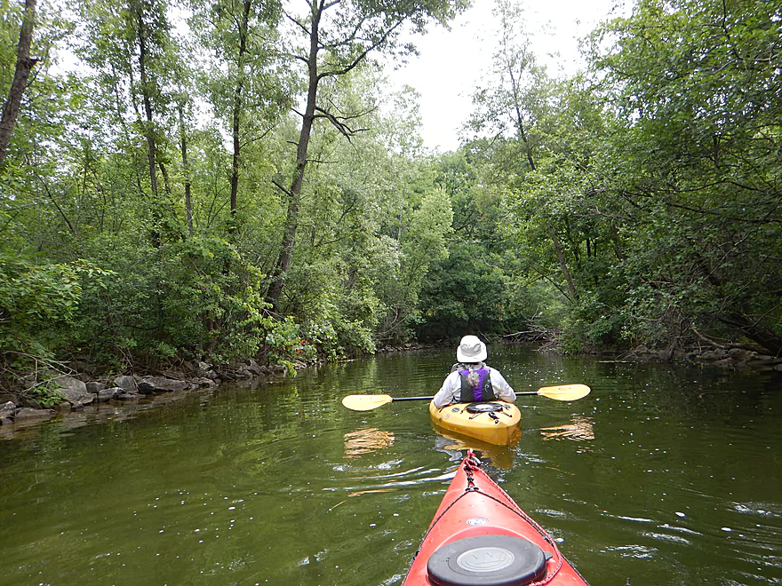
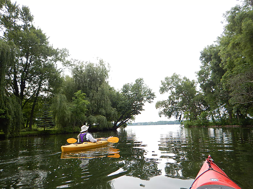
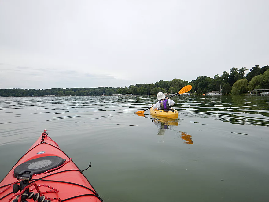
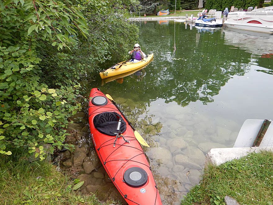
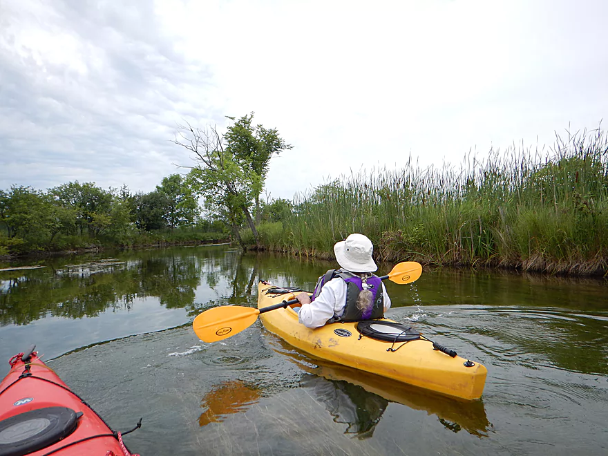
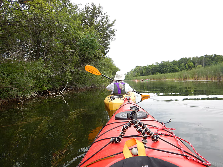
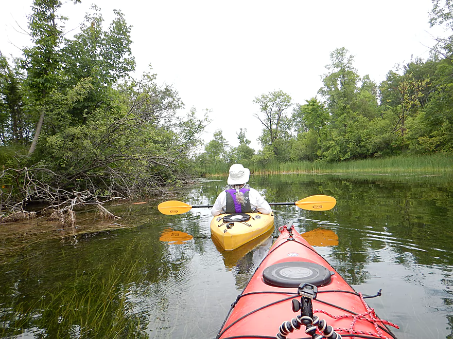
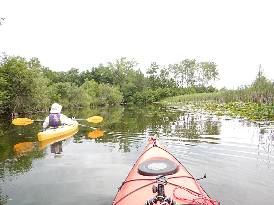
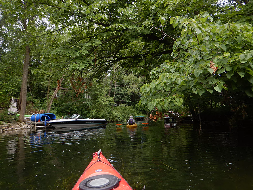
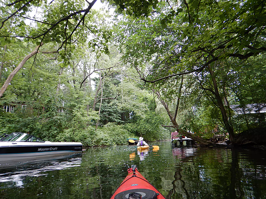
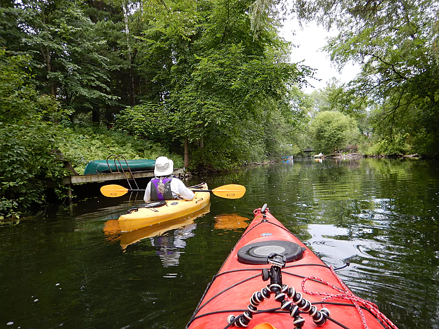
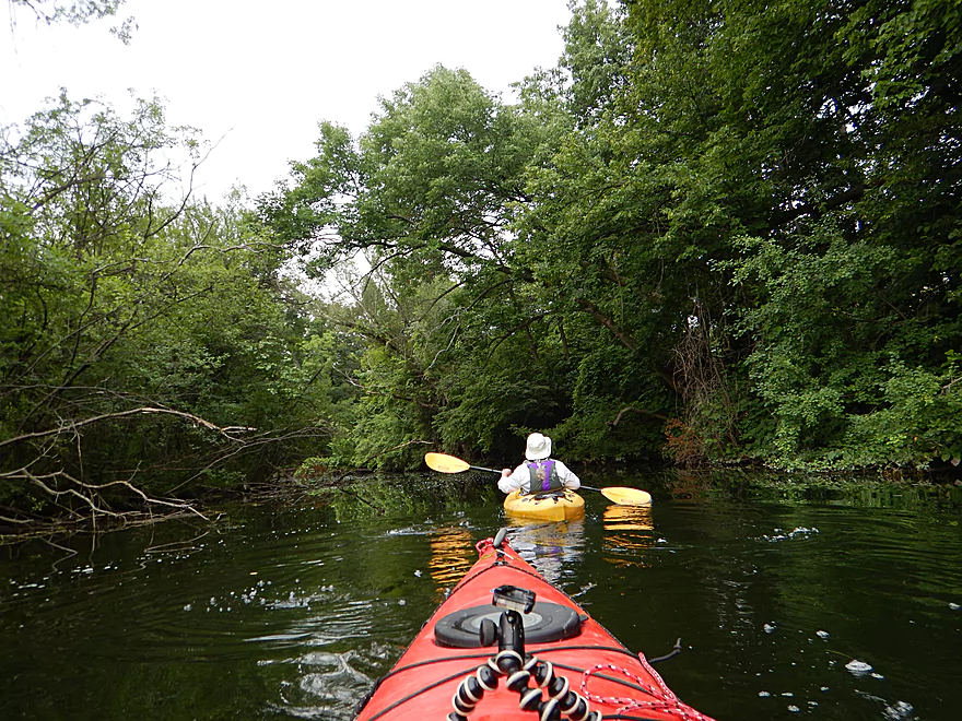
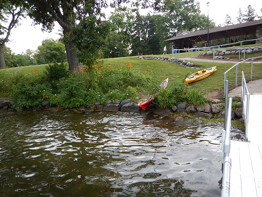
Starting the trip
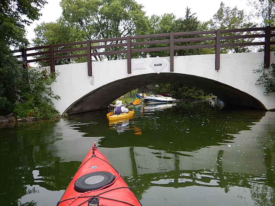
The landing is located below a dam
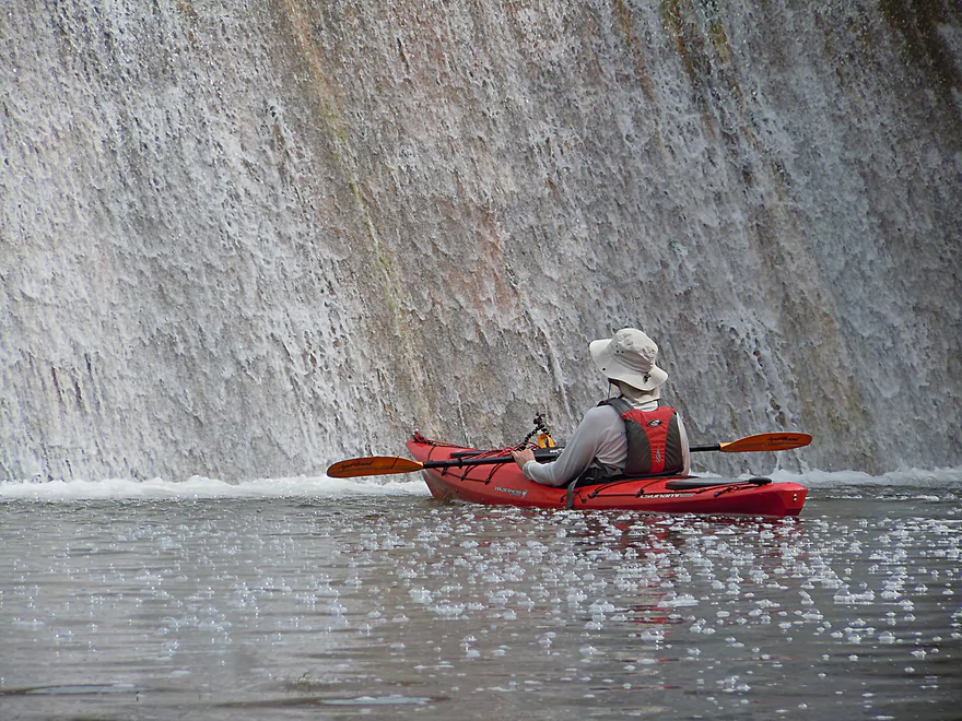
Kind of a low volume dam
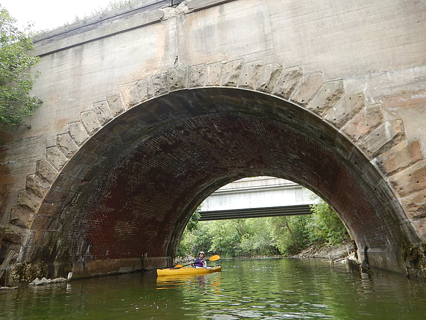
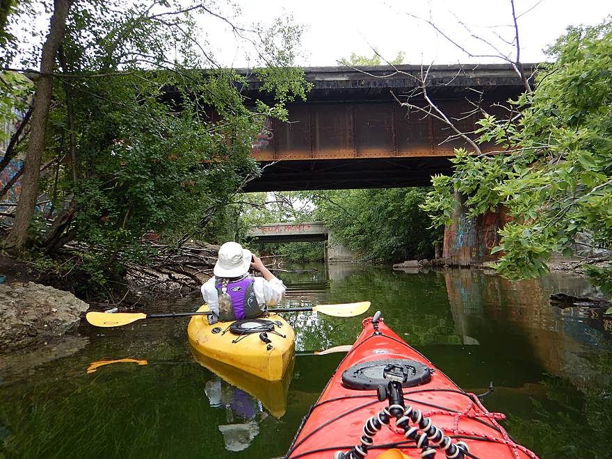
Gorgeous railroad bridge arch
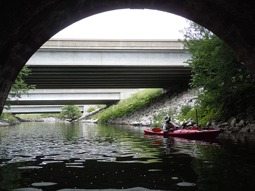
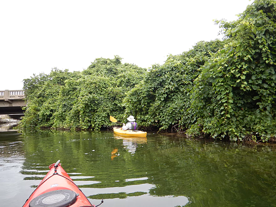
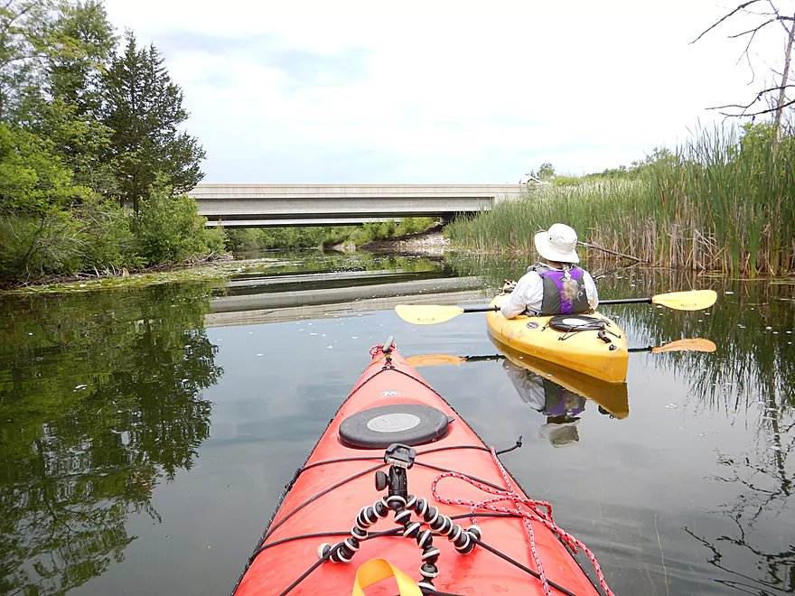
Looking back under four bridges
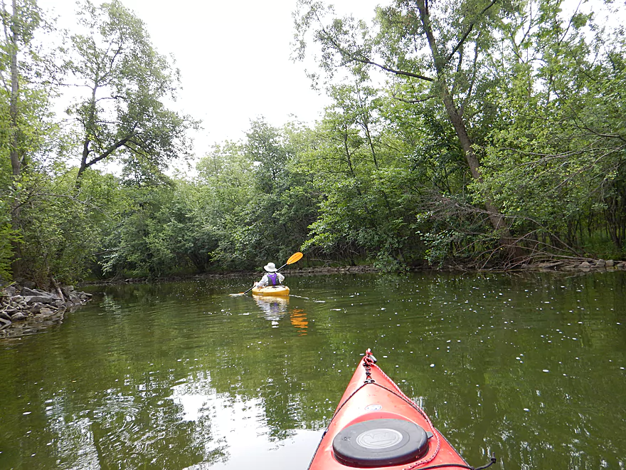
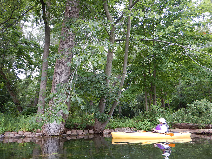
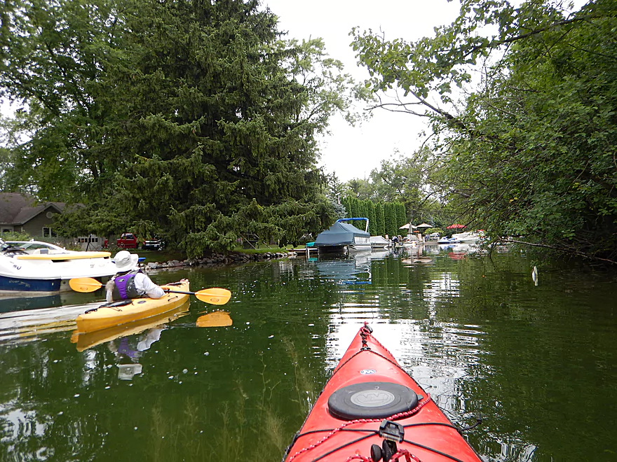
A nice wooded section
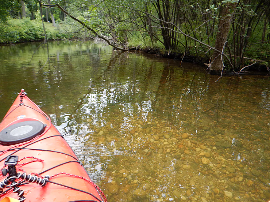
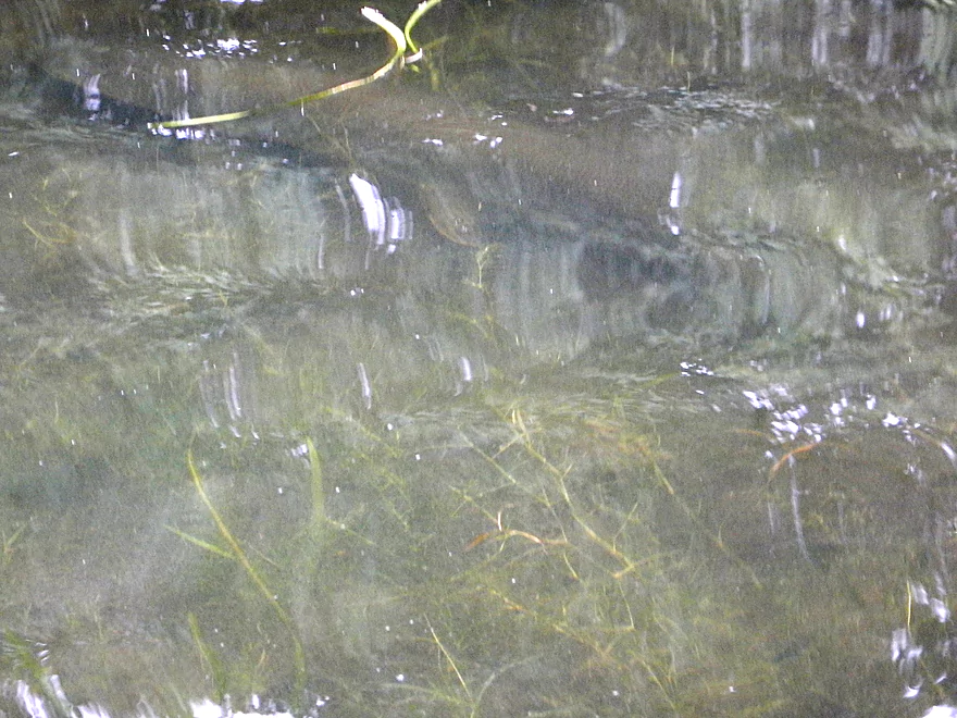
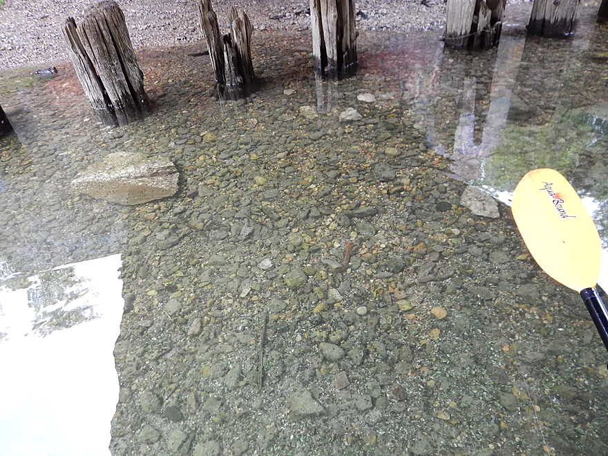
Pretty gravel bottom
Chances are you will encounter powerboats on the river
Going right on a split channel
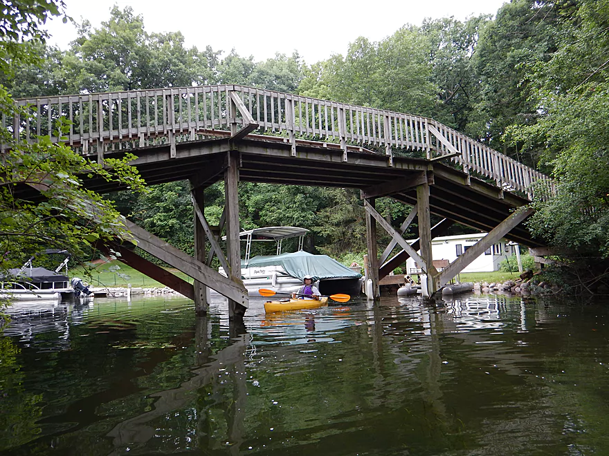
Scenic wooden walk bridge
Poorly pictured, but a massive northern pike
Nicely riprapped shoreline
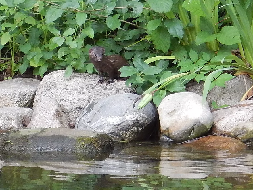
A friendly mink
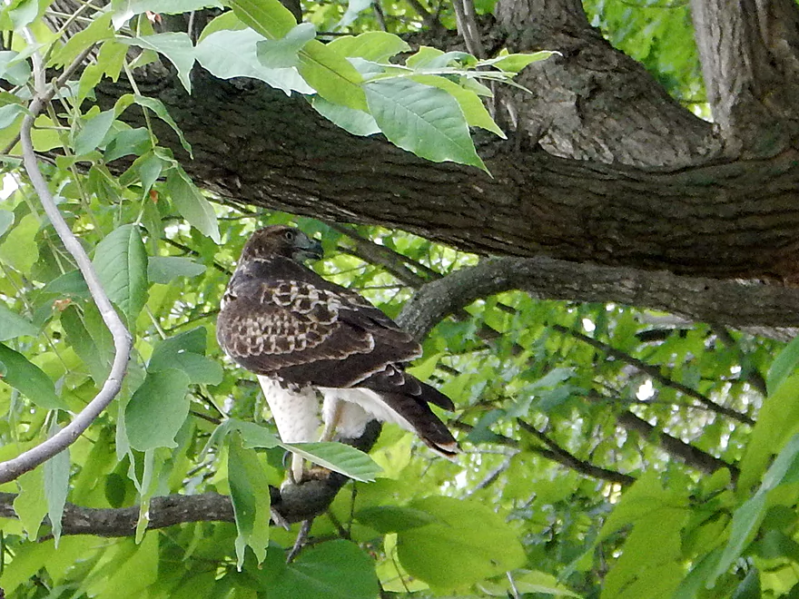
A young red-tail, reluctant to fly
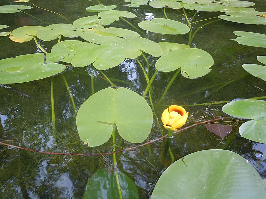
Bullhead lillies
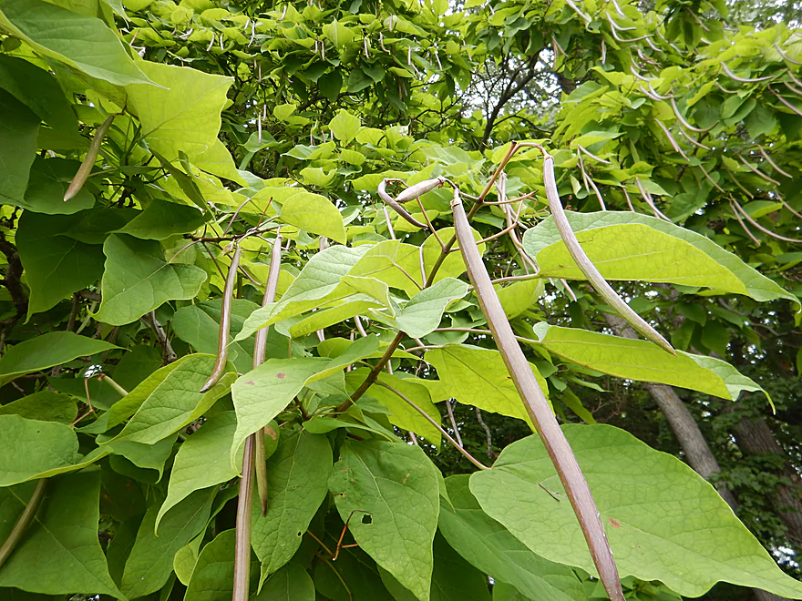
Catalpa beans
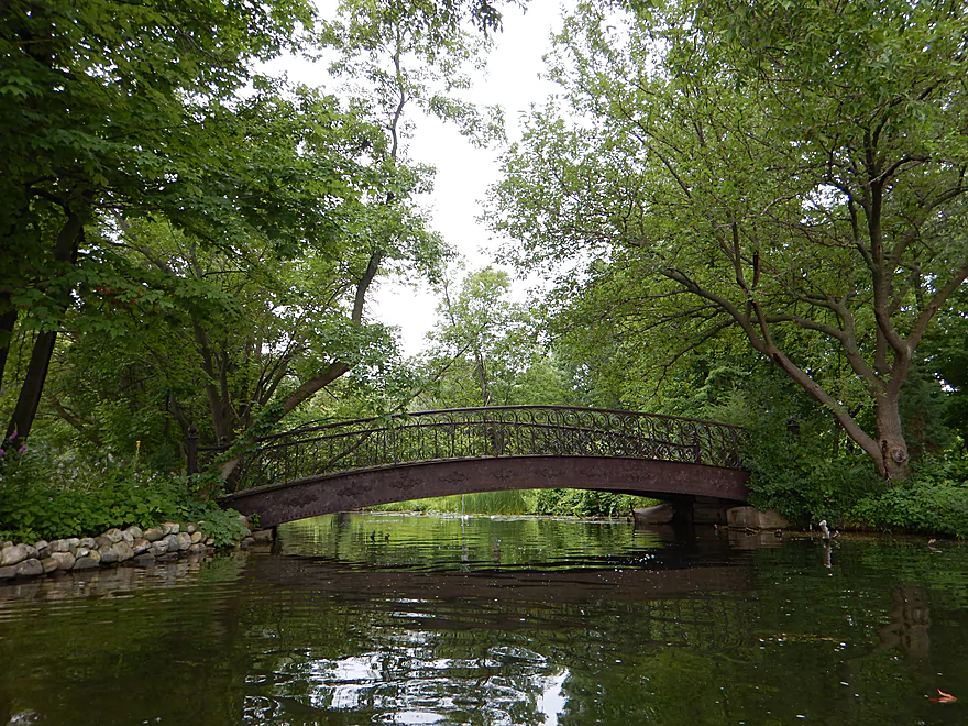
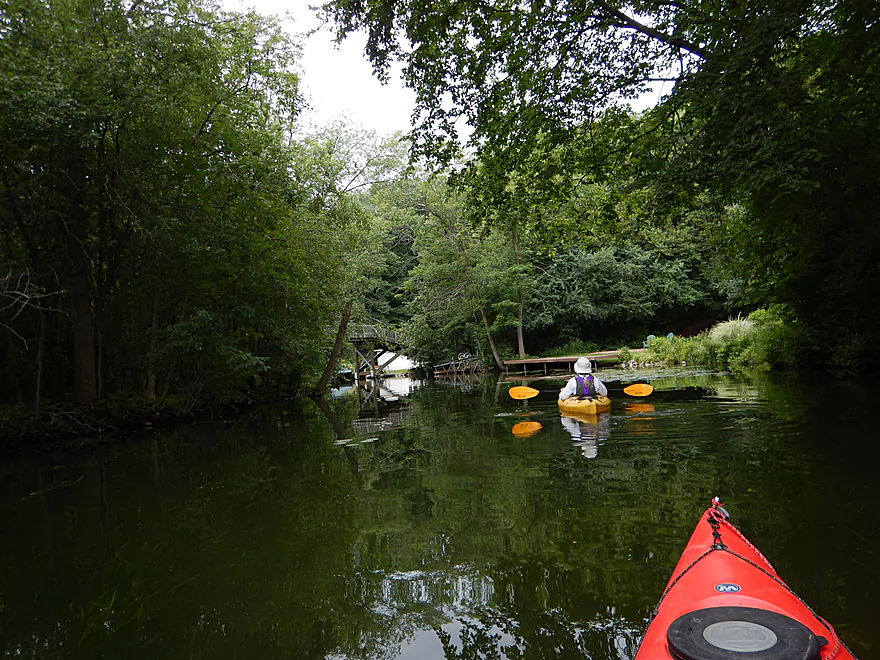
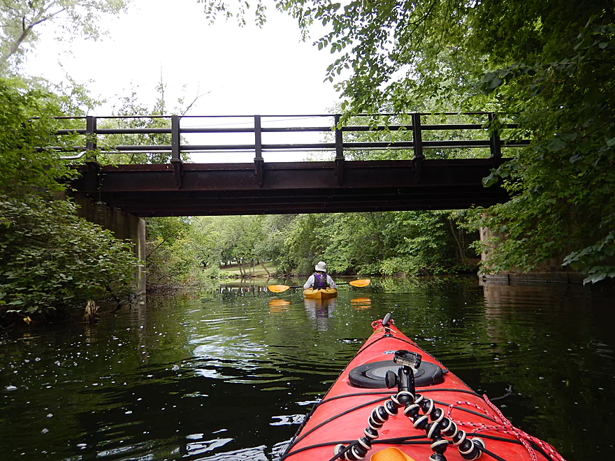
Another nice pedestrian bridge
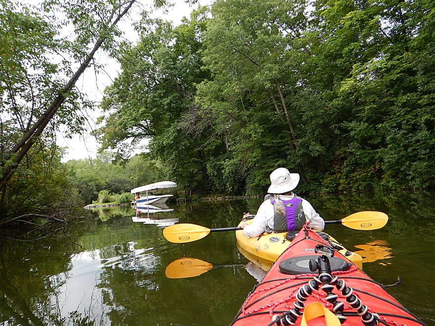
Gateway to Oconomowoc Lake
About a mile paddle to get across
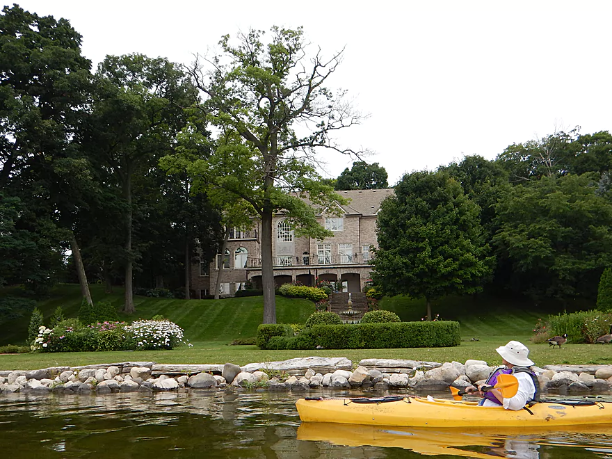
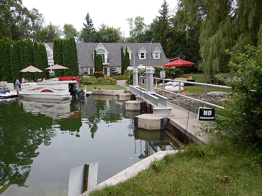
A 3.9 million dollar home (an affluent shoreline)
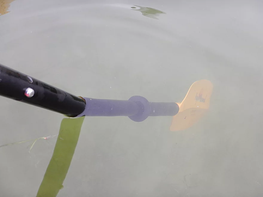
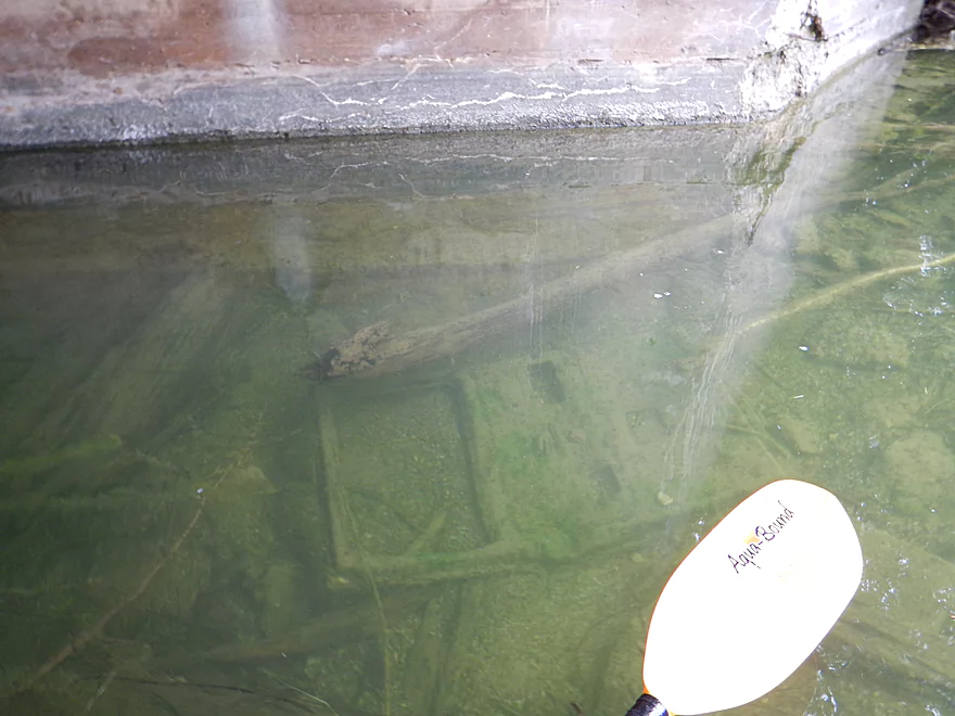
Great clarity
Heading to the northwest corner of the lake
Finally back onto the river
Attractive but overly developed corridor
Dam backdropped by an expensive home
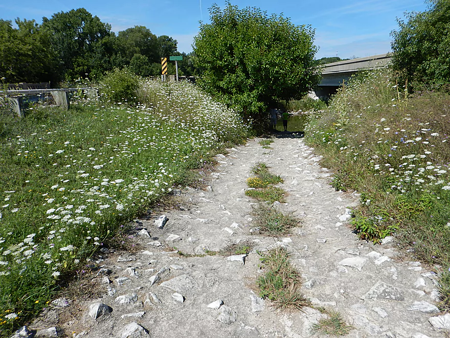
Time to portage
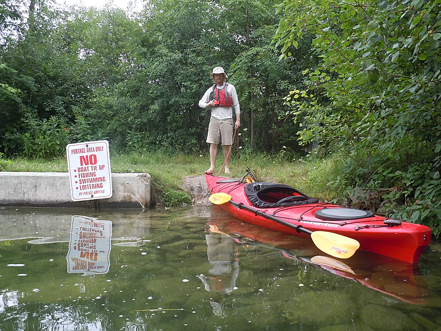
A very restrictive portage path…
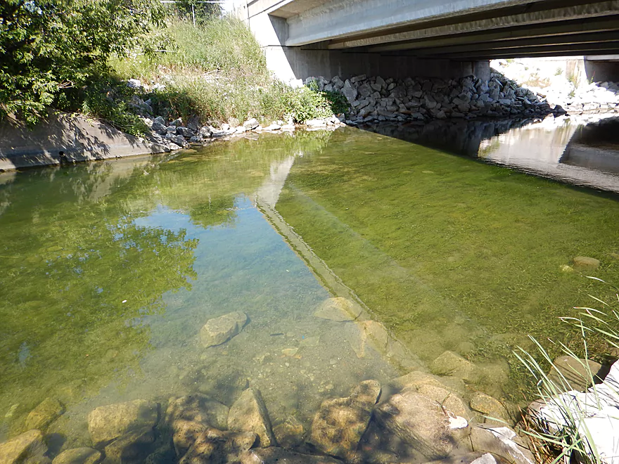
Good reentry

Looking upstream at the flowage
Heading down the river again
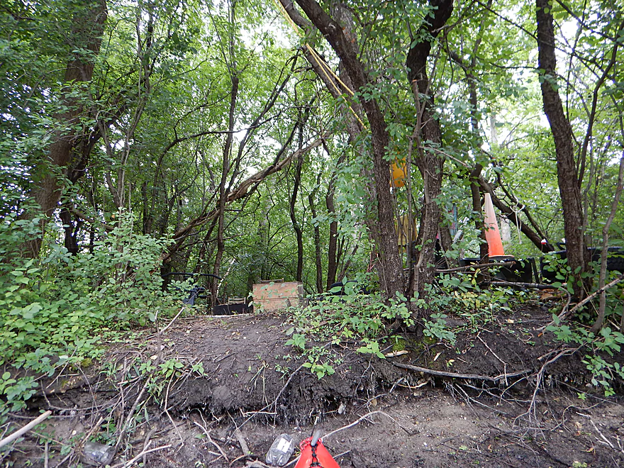
Looks like a hobo camp
Terrific water clarity
Somebody is missing a car door
The Oconomowoc jungle…
E. Wisconsin Ave
Nice canoe launch here
Beautiful water
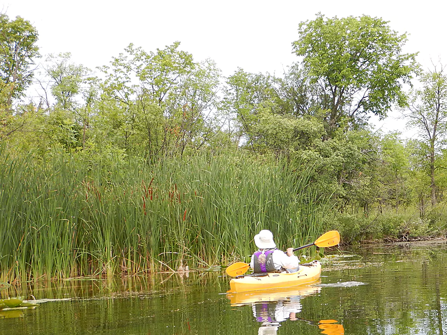
Entering a nice marsh area
A lot of cattails
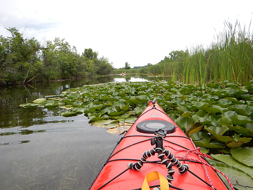
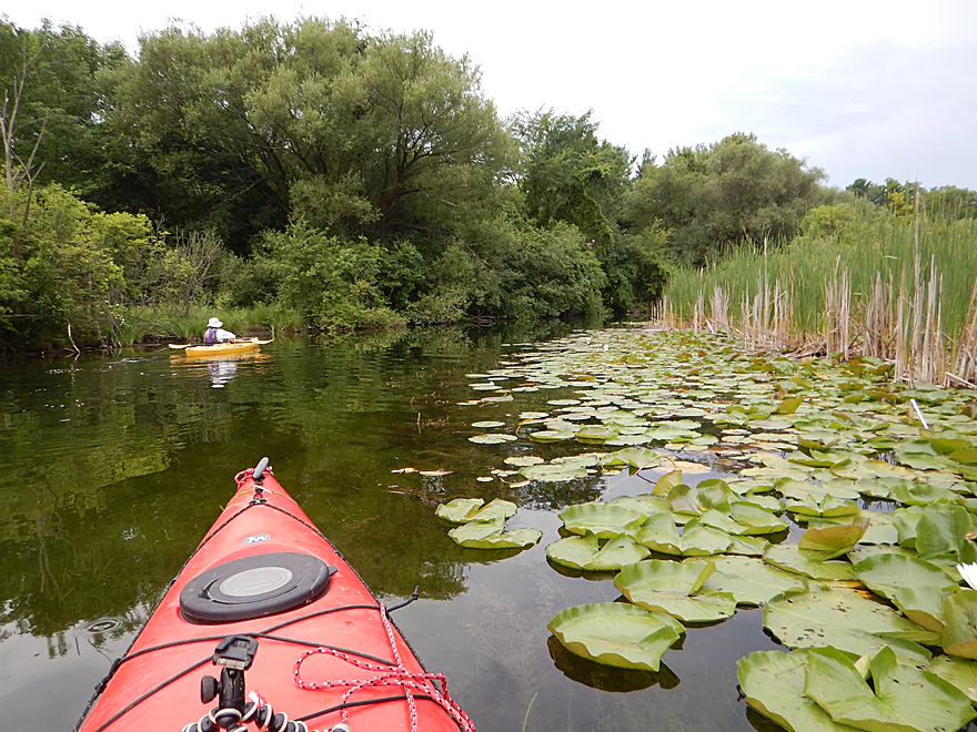
A river inlet filled with waterlilies
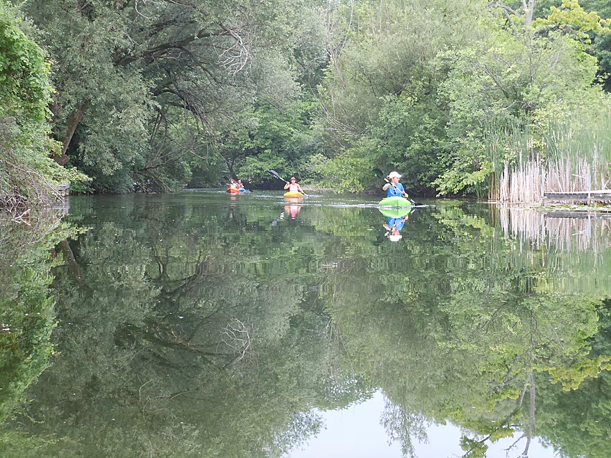
Some of the many kayakers we saw
Another cool inlet
A flower close-up
A typical scene on this section
Hwy 16/67
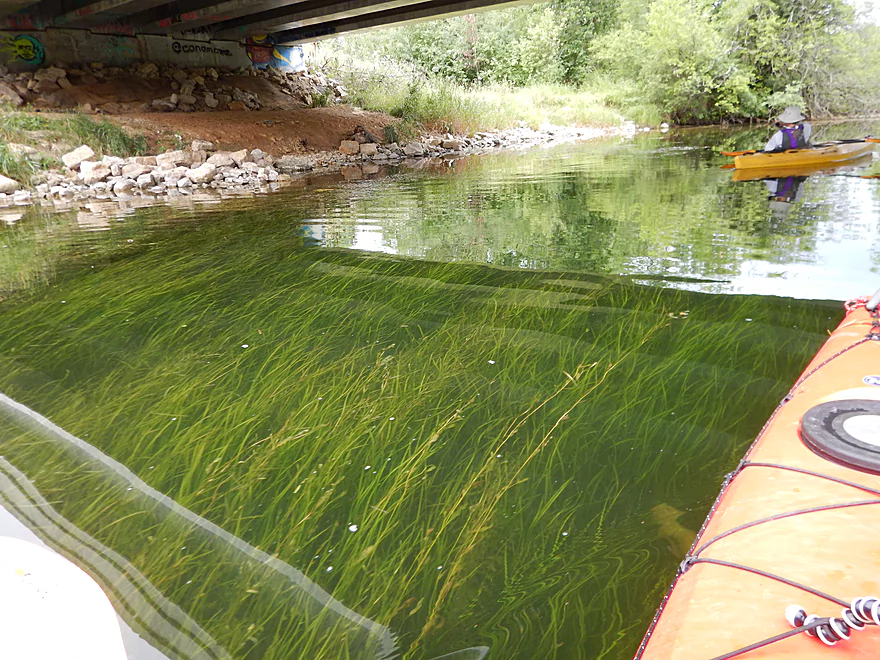
Pondweeds flowing in the current
Nice weeping willows
More attractive pondweeds
This is a popular section with paddlers
Arching branches create a cozy corridor
A fern lawn (much better than grass)
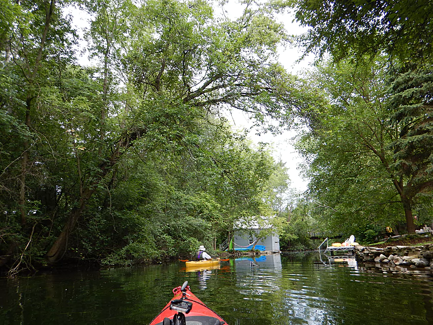
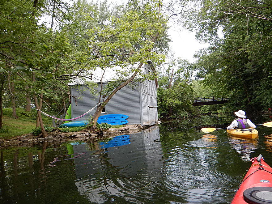
Quite the boathouse
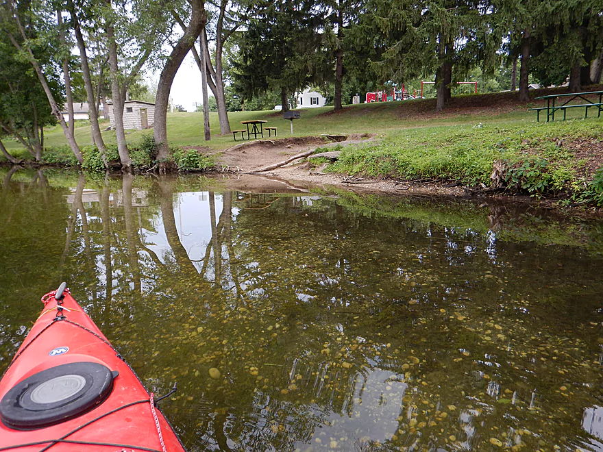
Riverside Park is an access option
Still a cool wooded corridor
After E. Grove Street, the flowage starts
Soooo many lilies
Entering downtown Oconomowoc
N. Oakwood Ave
A jet ski escorts us onto Fowler Lake
Pier at Fowler Lake Park
Fowler Park is a good take-out option
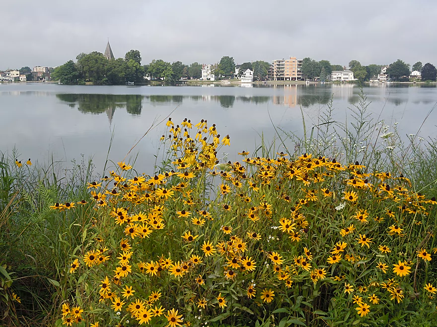
Scenic view from park
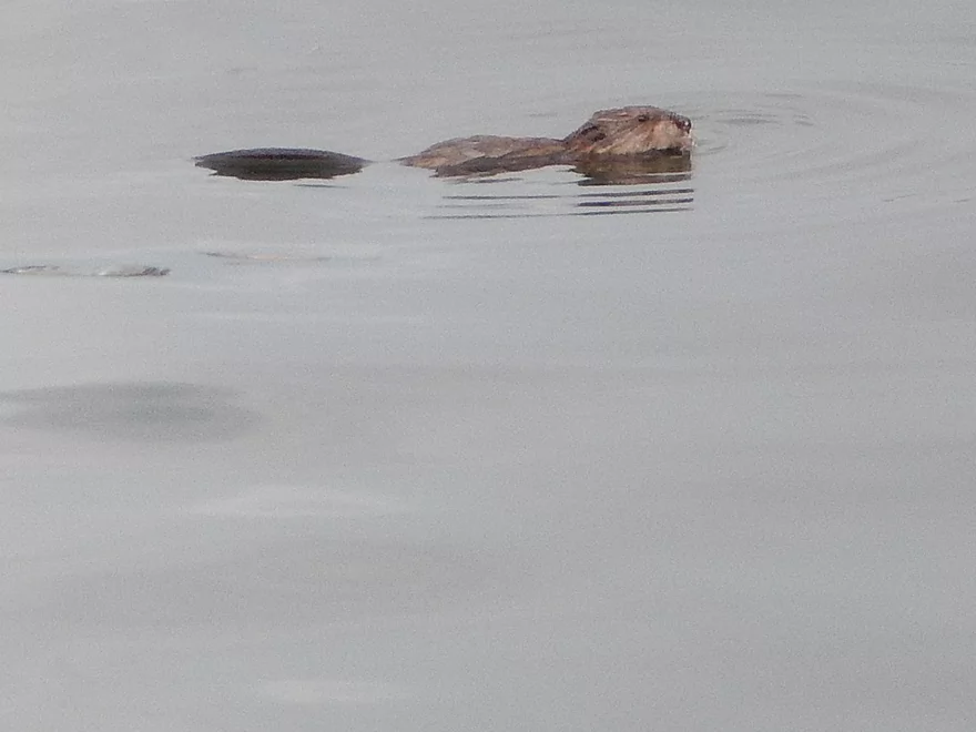
Still nice wildlife…here is a beaver
Still nice wildlife…here is a beaver
Oconomowoc River

The Oconomowoc River is a tributary of the Rock River originating in the far west suburbs of Milwaukee. The middle section runs through several glacial kettle lakes and is very popular with locals but fairly obscure to those outside of the area. Despite the urban setting this is actually a nice paddle with remarkably clear water.
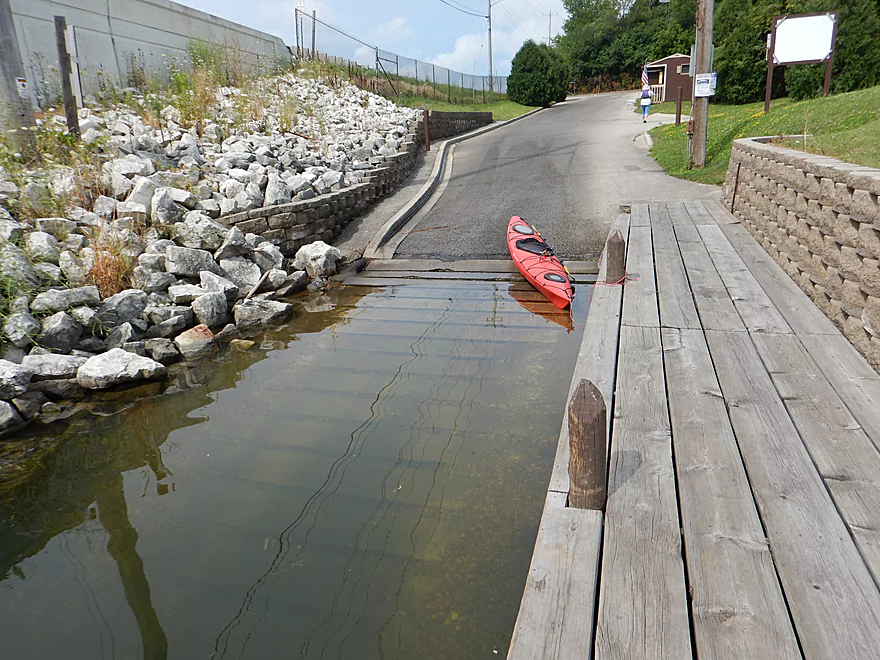
The trip starts at the bottom of Upper Oconomowoc Lake below a dam. The public launch here is unfortunately a bit pricey, but is one of few access points in the “Lake Country” portion of the river (more on this later). The river here also doubles as motorboat access to Oconomowoc Lake to the south.
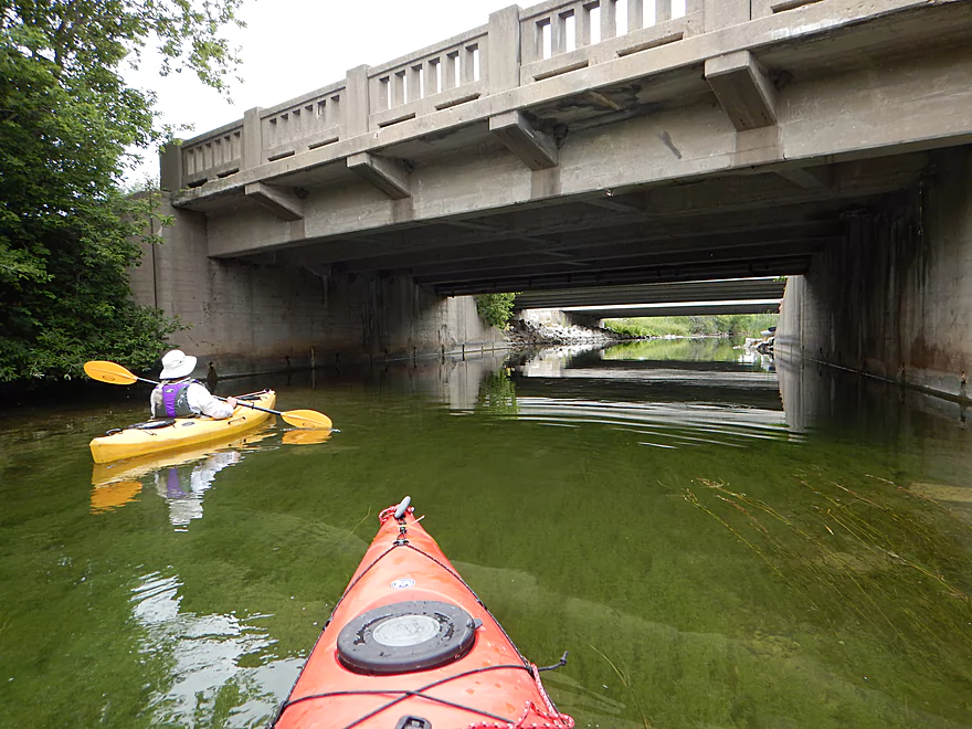
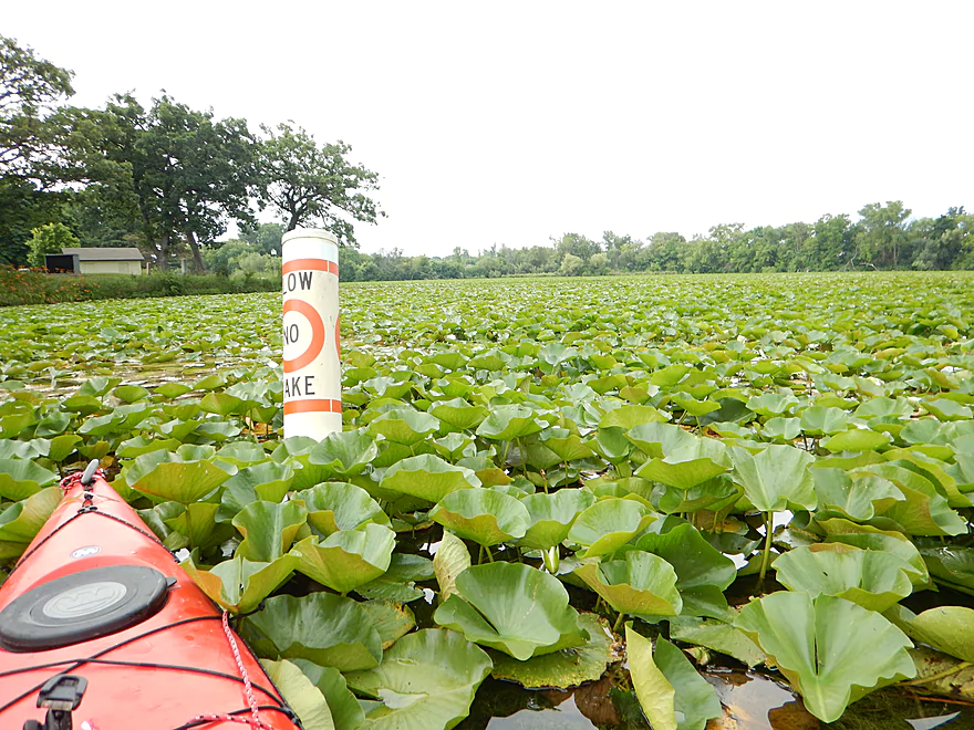
Despite loud highway noise, the trip makes a positive first impression with its good water clarity and a striking stone-arched railroad bridge you will paddle under. You will undoubtedly pass some powerboats, but these are restricted to no-wake so aren’t so bad.
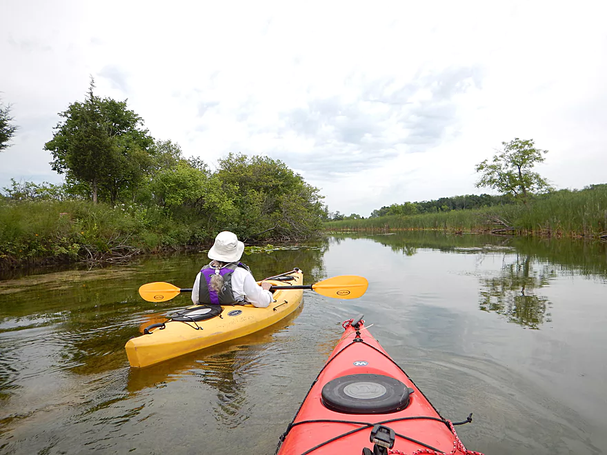
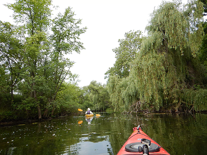
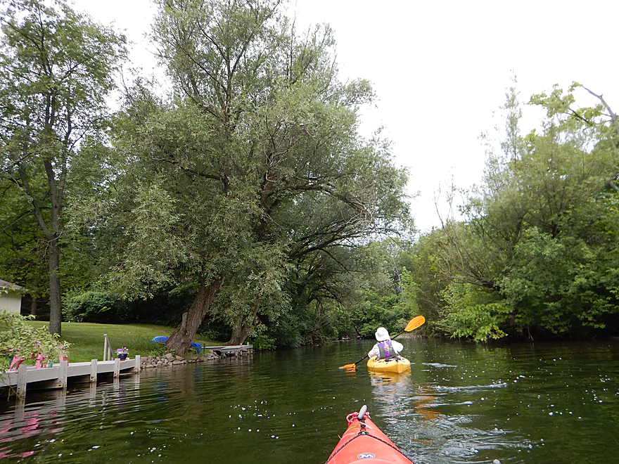
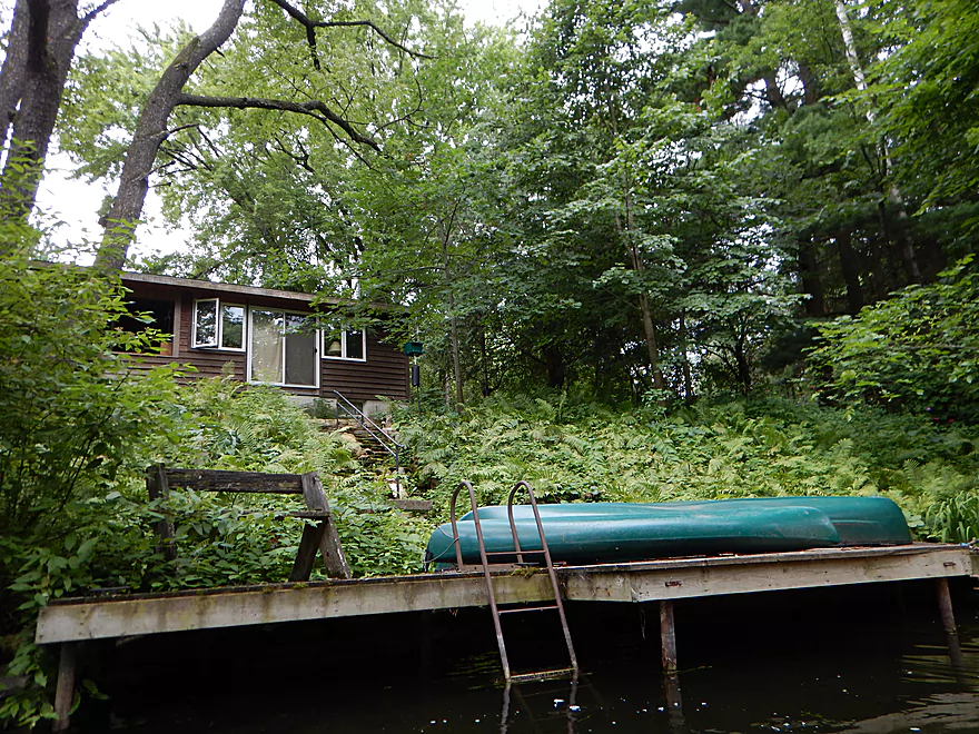
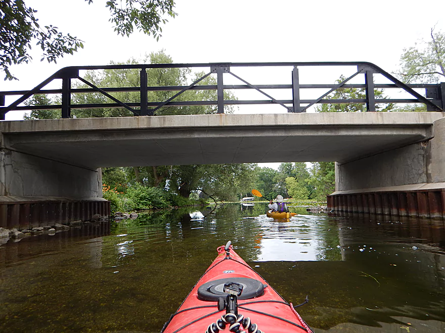
For the first half mile, the river narrows and runs though thick woods and by some expensive homes. The bank quality is excellent (little mud, little grass and shallow). The water clarity is fantastic, with great vistas of the gravel substrate below. Even the homes were somewhat interesting and there are a few artsy bridges you can paddle under.
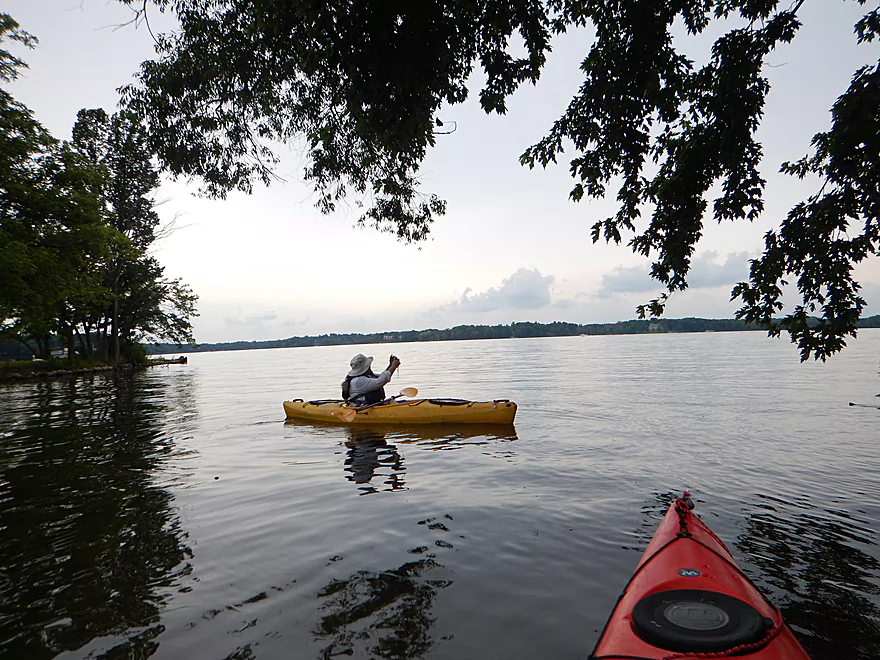
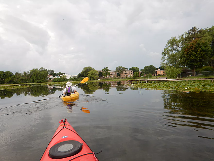
After this you are on Oconomowoc Lake. You will need to hang a sharp right and cross the lake to resume river paddling. The lake is very over-developed and seems set aside as an exclusive playground for the rich (no public parks, no public ramps). The homes are extremely expensive, with some of the biggest mansions I’ve ever seen located along the north shore.
The cool thing about Oconomowoc Lake is its clarity, which is fantastic–reminding me somewhat of Devil’s Lake and the Chain O’ Lakes/Crystal River. Like the Waupaca Chain O’ Lakes, the Oconomowoc chain has its own marl lake (Beaver Lake), whose aquamarine color is quite striking from satellite view (but that is a different trip idea).
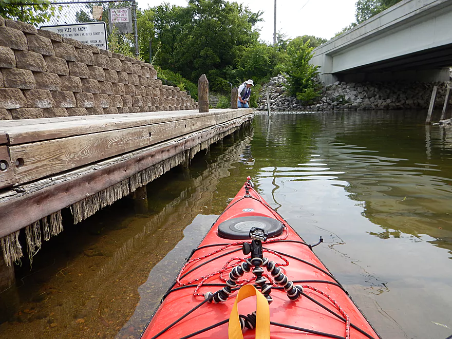
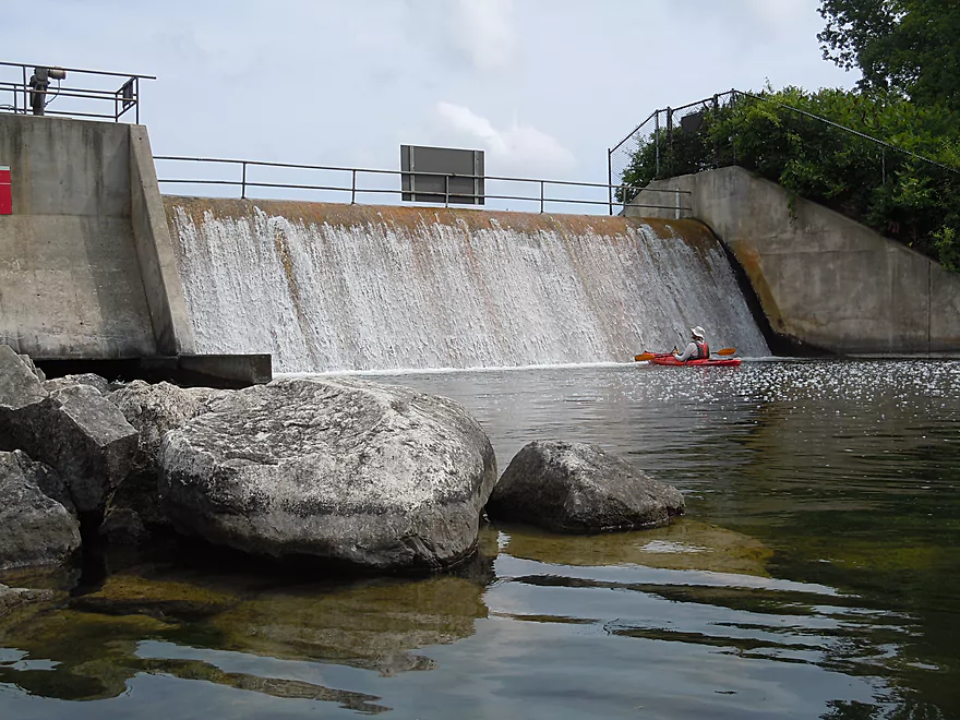
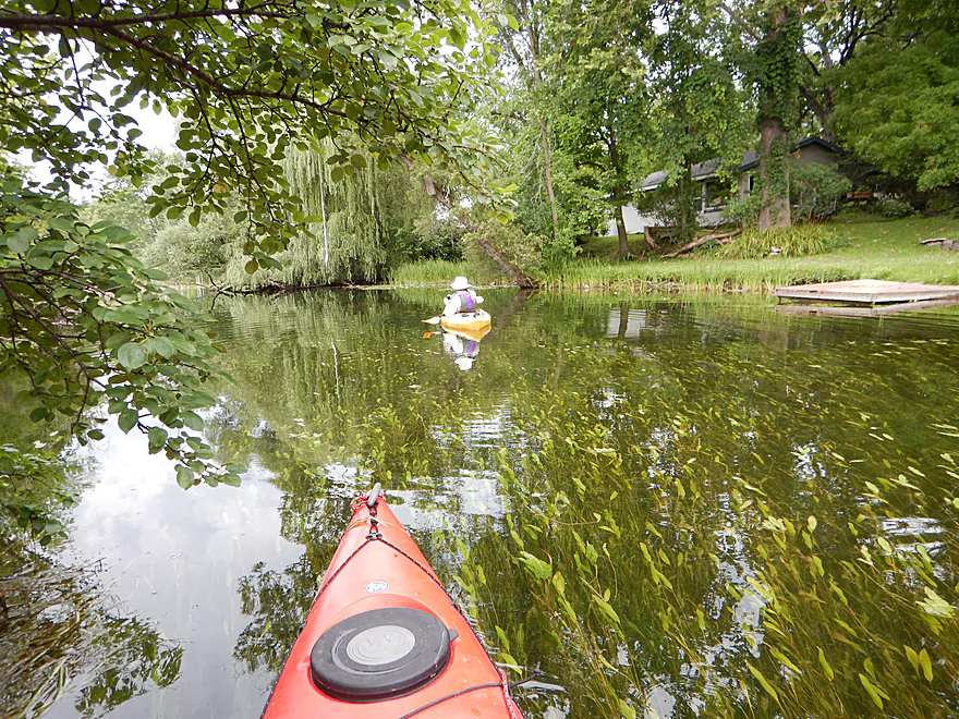
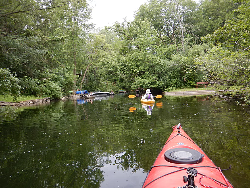
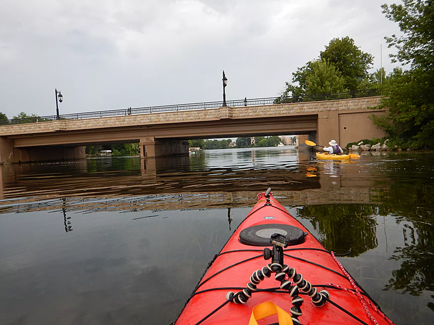
After almost a mile of lake paddling you’ll come to the outlet by Beach Road. Here you’ll paddle through a nice short stretch of the river before you reach the next dam. Despite the many No Trespassing signs on both banks and a looming mega-mansion on the north bank, you can portage the dam 100% legally and there is a nice path for this on the east bank.
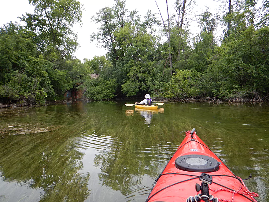
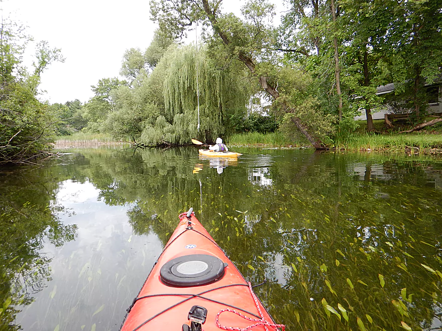
Once you lose the flowage, the water clarity goes from good to excellent. The trees return and gracefully shade the now narrow channel, making this one of the nicer stretches.
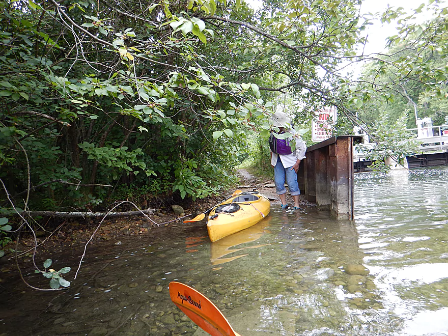
North of “Silver Lake Auto” and between E. Wisconsin Ave and Wisconsin Ave, there is a rare public launch option. Here we saw two paddlers taking out. Given the forecast for rain that day, it was surprising to see the number of kayakers we did (most below the second dam), and I suspect in better weather there would have been many more. I do suggest going on a cloudless, sunny day to best appreciate the clear water.
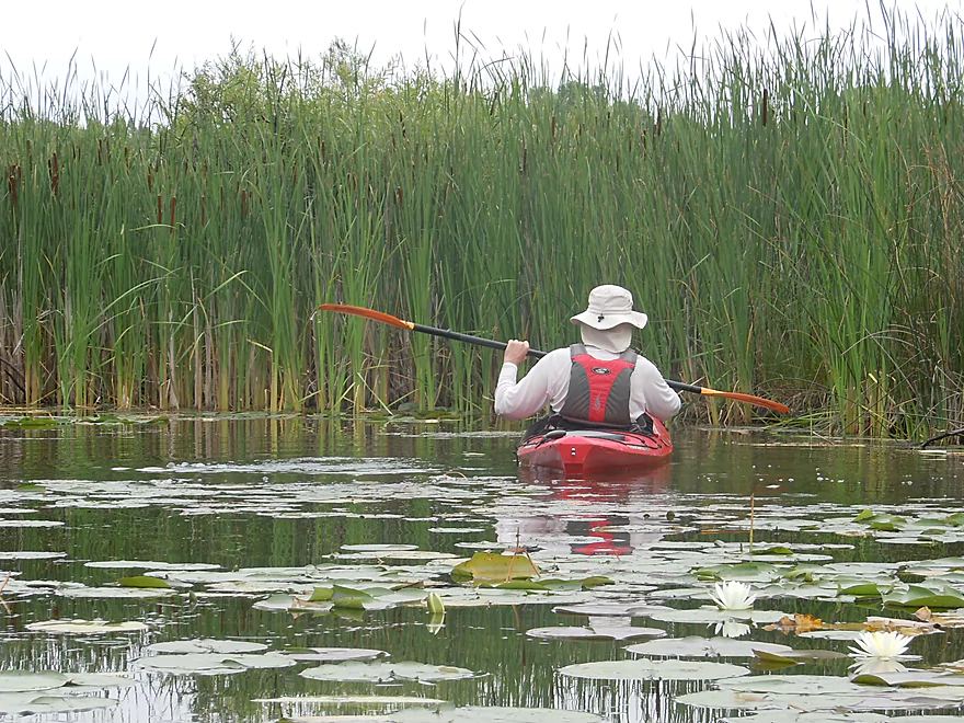
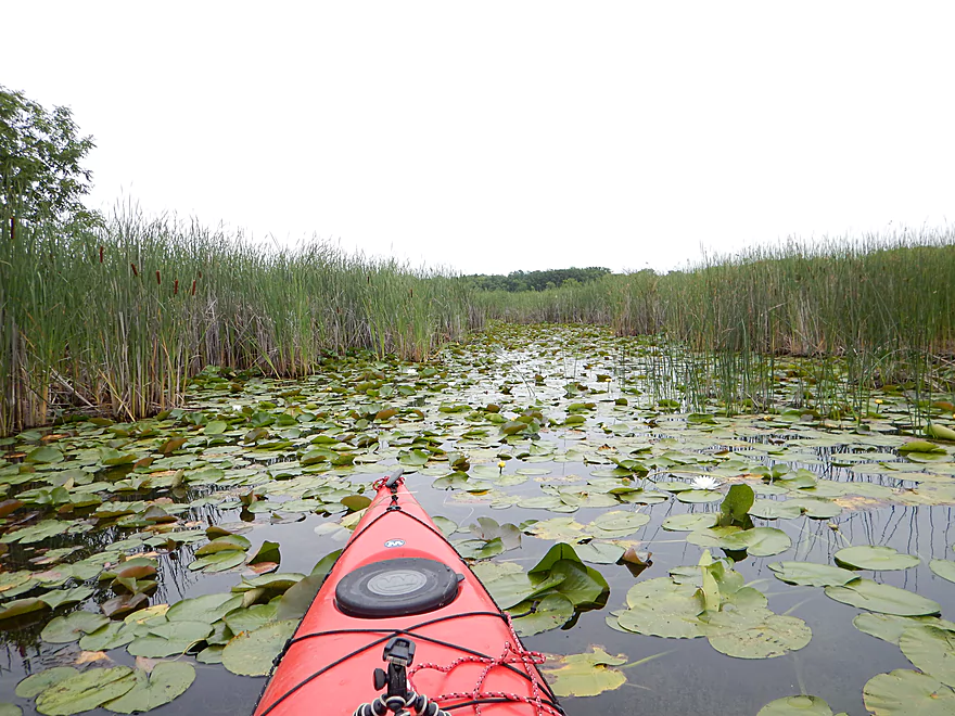
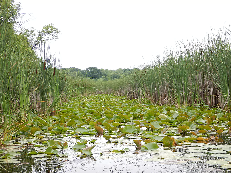
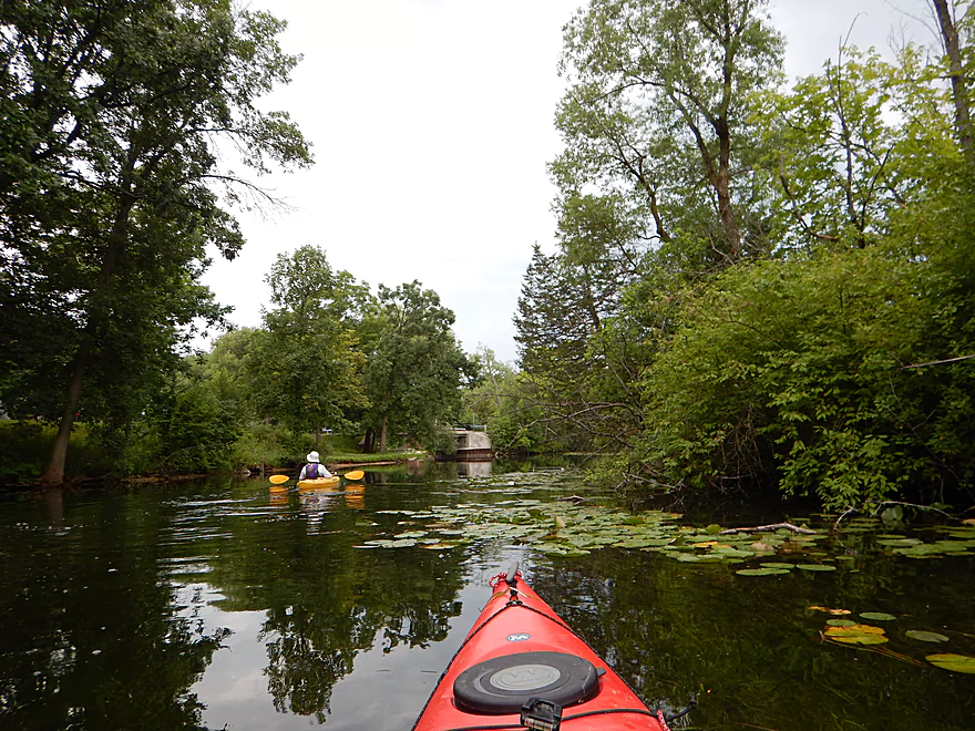
After Wisconsin Ave the river enters a marsh–a very nice marsh though with a healthy, undeveloped shoreline and thick colonies of waterlilies. This was one of the best wetland paddles I’ve done, as it didn’t have the muck typical of other wetlands, the water was clear and deep, and the marsh plants were lush and diverse (not just a desert of cattails). Very much had an “up north” feel to it.
After Hwy 67 the trees return for a very nice wooded section of the trip. Many paddlers take out here at Riverside Park, which is an option, but in my opinion would have cut the trip a tad short. Interestingly enough (perhaps because of the limited access and slow current), most paddlers prefer to do round trips instead of car shuttles.
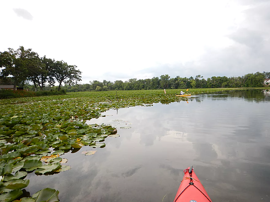
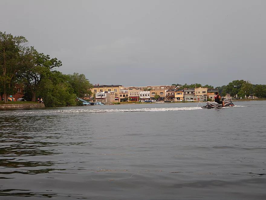
The river then really slows down and opens up. You’ll see a HUGE field of waterlilies to your left just prior to Oakwood Ave. Houses become more common here and you’re soon in the heart of Oconomowoc (the city). After Oakwood Ave, hang a hard right to get to Fowler Lake Park where there is a large pier and nice take-out area.
So, all in all, a great trip, despite the occasional road noise and development. This, in my opinion, is Milwaukee’s version of the Waupaca Chain O’ Lakes and the Crystal River, with the highlight being the water clarity, making this an easy four star trip.
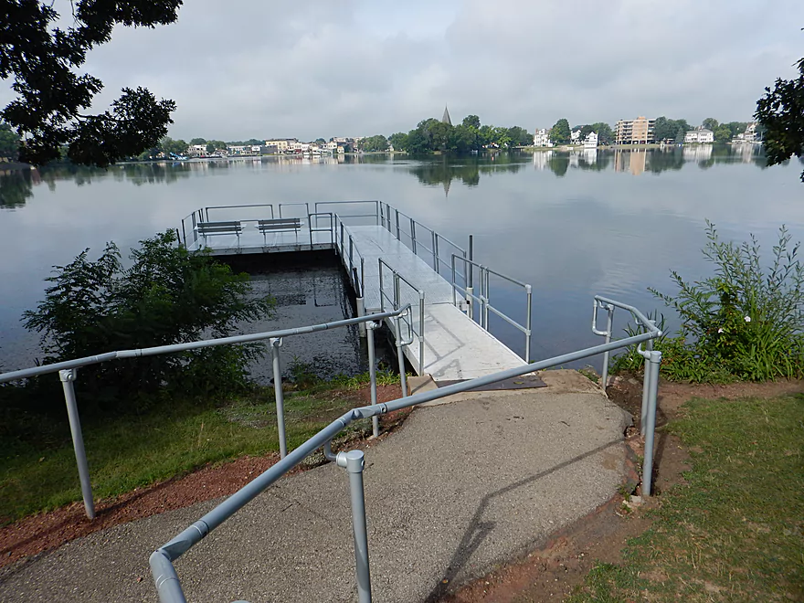
There is a public launch just below the Upper Oconomowoc dam off Wisconsin Ave. This is a very nice boat ramp with good parking, a good location, and an outhouse, but… It is relatively pricey and costs $10 to launch your kayak ($8.25 if the attendant is present). Also of concern, the parking does fill up and you are not allowed access to the ramp when this is the case (I suggest doing your trip early in the morning). This overly serious landing has warning signs everywhere ($500 fine if you don’t pay!), and a curfew between 11:00 PM and 4:00 AM. As a side note, I’m not sure I understand the logic of hiring a parking attendant to guard a simple boat ramp. For what they pay the attendant, couldn’t they just build a second ramp to alleviate congestion? I did see people parking along the side of Wisconsin Ave, perhaps as a way to avoid the fee. Am not sure this is possible with an attendant, unless they launch/fish directly at the bridge itself (a little rocky but perhaps doable).
Put-in alternatives in the “Lake Country” section of the Oconomowoc aren’t great. One idea is to launch just above the dam at the Okauchee Lake Boat Launch. This is a popular boat launch but does require a fee (am not sure how much). You would then have to portage the dam (not difficult and with a marked path). There are no further launches on Okauchee Lake or even public parks, which is surprising given its size (I suspect the local landowners don’t care for outsiders).
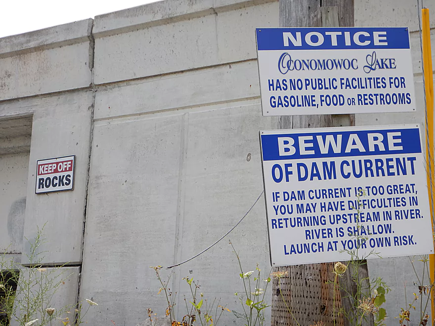
Put-in options below the dam are even worse. Oconomowoc Lake doesn’t have one public ramp nor public park (a sign at the main launch makes sure you know this). There is a private launch at the Oconomowoc Lake Club, but that is for members only.
Excellent take-out at Fowler Lake Park. No fees, has an outhouse, good parking and not overly congested. In fact, there appeared to be more people in the park for Pokémon Go than to access the lake.
For a bike shuttle this would be short. Only 2.7 miles and pretty flat, although some city traffic to contend with (not too bad if you stay off Hwy 176/16).
None really…a pretty safe river. You will have to portage one dam, but this is easy.
The gauges on the Oconomowoc have been discontinued, unfortunately. The closest comparison would be the Bark River at Delafield, and I went at 21 CFS. The Bark is a bigger and faster river, so is not a great comparison. I suspect the Oconomowoc is relatively stable because of the dams and wetlands and varies little.
The channel was relatively deep and I doubt it ever gets too low to run. Because the strength of the trip is the clarity, you don’t want to go when the water is high (50-60 CFS is probably starting to get murky). As for current, there hardly is any, making round trips a very viable strategy if you hate (or can’t do) car shuttles.
The highlight was a huge (30′?) northern pike that was easy to track in the clear water. This was a good trip for wildlife, which also included a young red-tail (that let me get very close), many ducks, geese, countless small fish, a small muskrat, and a relatively tame mink that let me get unusually close as he hunted the shoreline.
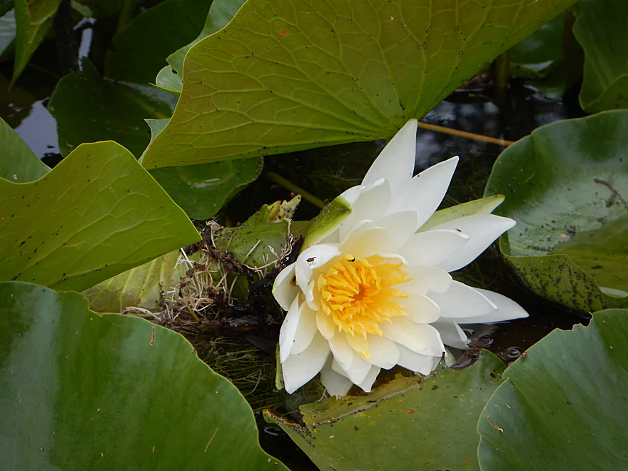
Many of the aquatic plants were quite beautiful and included white waterlilies, yellow bullhead lilies (all in bloom), and many attractive pondweeds. An unusual plant was muskgrass (chara), an algae whose delicate underwater mounds of mineral-coated stems crunched when touched with a paddle.
Detailed Overview
- Hwy 164 to Holy Hill Road: (0.9 mile) Mostly unknown. Appears pretty open, but with one wooded section that probably has logjams.
- Holy Hill Road to Hubertus Road: (2.2 miles) Pretty open marsh paddle and should be no downed trees. Some lake paddling to contend with.
- Hubertus Road to Elmwood Road: (0.9 miles) Downed trees are definitely an issue in the first half, but the second half is open and has some nice rocky sections with clear water.
- Elmwood Road to St. Augustine Road: (0.9 miles) A good prospect with nice rocky sections. There will be portages for downed trees, but am not sure how many.
- St. Augustine Road to County Line Road: (4.4 miles)
- St. Augustine Road to Loew Lake: (1.0 miles). A scenic stretch with glacial boulders, rapids and springs. Some parts of the creek here are shallow and will have to be waded.
- Loew Lake to County Line Road: (3.3 miles). A popular wetland paddle with locals. Most do this as a round trip from County Line Road.
- County Line Road to Kettle Moraine Drive/Monches Dam: (0.3 miles) A slow large millpond.
- Kettle Moraine Drive to West Shore Drive: (5.9 miles) A great trip with clear water, boulder gardens, scenic bridges, fun rapids and attractive marshes. Only a few logjams prevent this from being five star.
- Hwy E to E. Kilbourn Road: (2.6 miles) Starts with some light woods and boulder gardens then opens into a marsh before closing with some rapids. There are three logjams, but the portages aren’t difficult. 2024 update...the logjam situation is now significantly worse because of downed ash trees. Paddling this stretch is not recommended.
- E. Kilbourne Road to Hwy 83: (1.2 miles) Fun wooded section with the longest rapids and several scenic bridges. There are three logjams and one tricky strainer. Note Hwy 83 used to be a good landing, but new owners have declared it private property and put up No Trespassing signs. 2024 update...the logjam situation is now significantly worse because of downed ash trees. Paddling this stretch is not recommended.
- Hwy 83 to West Shore Drive: (2.2 miles) Mostly lake paddling (North Lake). The short river section goes through a scenic marsh.
- West Shore Drive to Hollywood’s Roadhouse Bar: (1.3 miles) Section with good potential. Might be a downed tree to portage. The bar is private and you must get permission to disembark here.
- Hollywood’s Roadhouse Bar to Wisconsin Ave Launch: (3.5 miles) Probably an uninteresting paddle through Okauchee Lake, but the one mile river portion looks interesting. The Okauchee Lake Boat Launch is an alternate take-out.
- Wisconsin Ave Boat Ramp to Fowler Lake Park: (3.95 miles) A great lake and river prospect with amazing water clarity.
- Wisconsin Ave Boat Ramp to Wisconsin Ave Fishing Access: (1.7 miles) Mostly a lake paddle on Oconomowoc Lake, but some nice connecting river sections and a scenic railroad bridge.
- Wisconsin Ave Fishing Access to Fowler Lake Park: (2.3 miles) Half of this is through a nice marsh and half runs though a nice attractive suburbs.
- Fowler Lake Park to N. Golden Lake Road: (4.2 miles) Another good lake/river combo trip with good clarity.
- Fowler Lake to Veterans Memorial Park: (0.4 miles) A neat lake paddle with stunning clarity and attractive lakeside buildings.
- Veterans Memorial Park to W. Wisconsin Ave/Dam: (1.3 miles) A short section on Lake Lac La Belle. Heavily developed, this was a mediocre experience. Easy portage or take-out at end by dam, but parking is difficult. Ask permission from Paddleboard Specialists to park in their lot or park one block to the south at Chaffee Road Park.
- W. Wisconsin Ave/Dam to Chaffee Road Park: (0.3 miles) Terrific section with perfect water clarity.
- Chaffee Road Park to South Concord Road: (0.9 miles) Great section with clear water and scenic bridges.
- S. Concord Road to Concord Rd(2nd Bridge): (1.6 miles) Section starts good, but gets mucky after the sanitation plant. Still an ok section. Take-out at North Golden Lake Road is good, and apparently open to the public but can’t be 100% sure of this.
- Concord Rd(2nd Bridge) to N. Morgan Road: (2.6 miles) Some ok clarity, but the river starts to slow down and become less interesting.
- N. Morgan Road to Elm Drive: (2.2 miles) Ok prospect (river is getting slower and wider). For Elm Drive, you should be able to launch NE of the bridge, but must park further to the north to clear the No Parking signs.
- Elm Drive to Hwy F: (1.8 miles) Ok prospect. Hwy F is not great, but one of the more secluded bridge accesses on the lower section.
- Hwy F to W. River Drive: (2.6 miles) Weaker prospect. No Trespassing signs beyond the ditch by W. River Drive and a sign that limits parking doesn’t make this an appealing access. Probably doable for access though.
- W. River Drive to Northside Drive: (1.4 miles) River is getting less interesting and muddy. You must portage by an electric fish barrier under Northside Drive (plenty doable but a bit brushy and super muddy…do scout this before running). Parking is good at Northside Drive.
- Northside Drive to mouth on Rock River: (1.0 miles) Probably an uninteresting section.
- Mouth to Hwy P: (2.6 miles) The lower Rock River is not an interesting prospect IMO (too wide and muddy). Hwy P should be adequate for taking out if you do this section.
Trip Map
Overview Map
Video
Photos Size:
LOL! Oconomowoc Lake probably is the most private lake in Lake Country and even SE Wisconsin. There is no public property because most of those properties have. Een handed down for generations. The lake probably has the highest tax base per foot of frontage in the area. It’s its own “village” with its own police force There is an attedent at the launch to enforce that fact that they don’t want extra boats on the lake. The property owners don’t care what it costs. Be glad there is a public launch of any type on the lake. Every owner either has their own or is a YC member. Its a beautiful lake and is kept that way. 🤪
Yeah, it did have that exclusive/private vibe to it.
Just a note from our visit yesterday, July 3, 2022: The “alternate take-out . . . behind the Bear Lake Post Office (west of the Hwy 83 bridge)” is now closed — a new owner has declared it private property and put up no trespassing signs.
Thanks for the updates. I’ve added your information the maps and review. Paddlers can alternatively take East Kilbourne Road or the North Lake Ramp.
Paddlers should be warned that there is a new logjam located between the la Belle Cemetery and Lapham Street. Here are the exact coordinates: 43.114960397435915, -88.48762805698316 If this gets cleared out, let me know.
Good news…the logjam previously reported by the Cemetery ( 43.114960397435915, -88.48762805698316) should be gone now.