
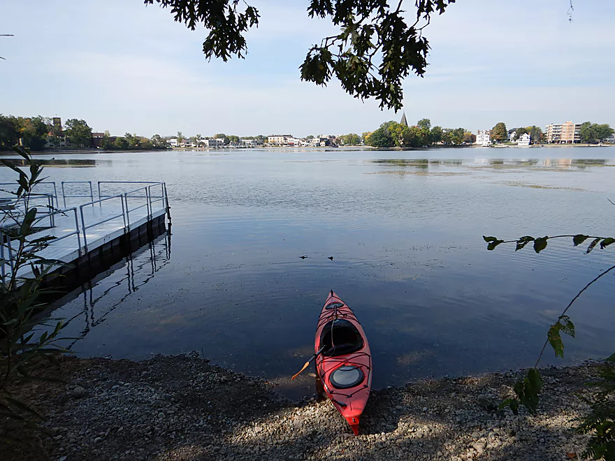
Starting the trip at Lake Fowler Park
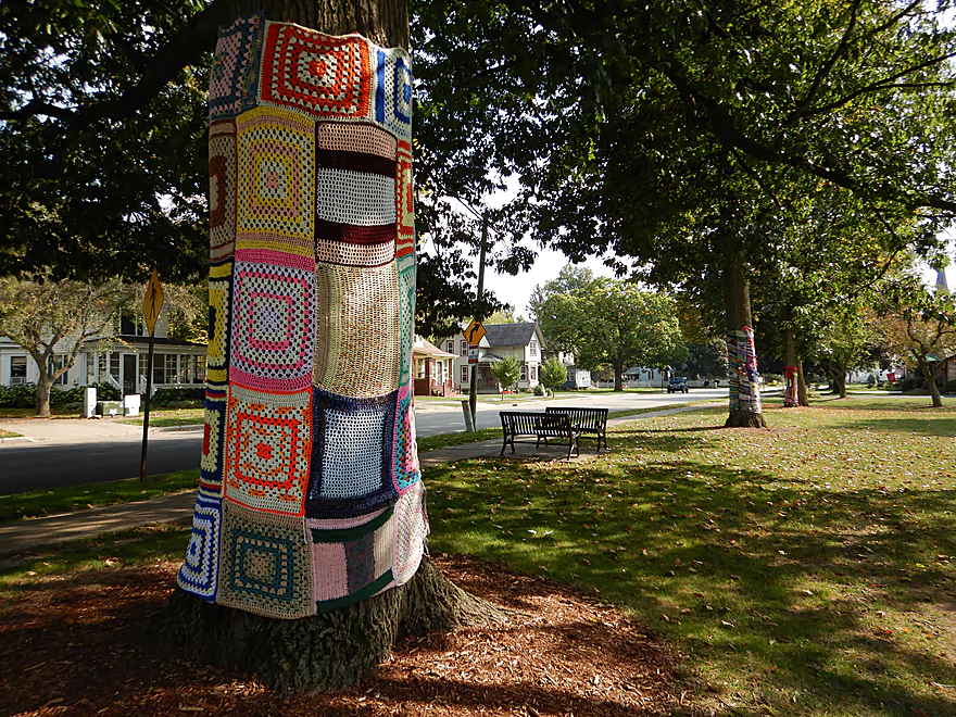
…which has a serious quilt infestation
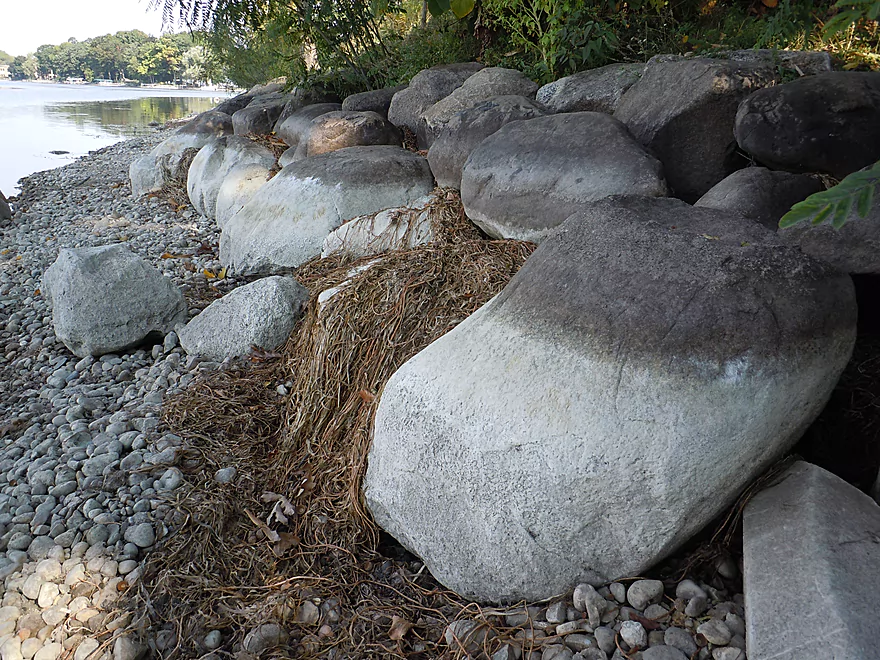
Cool stain marks
Lake Fowler is quite nice
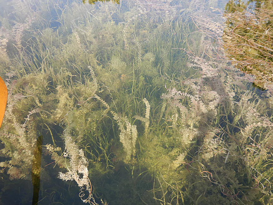
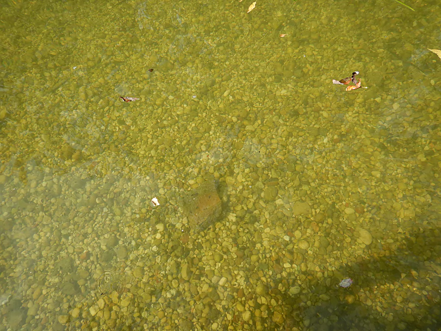
With great clarity
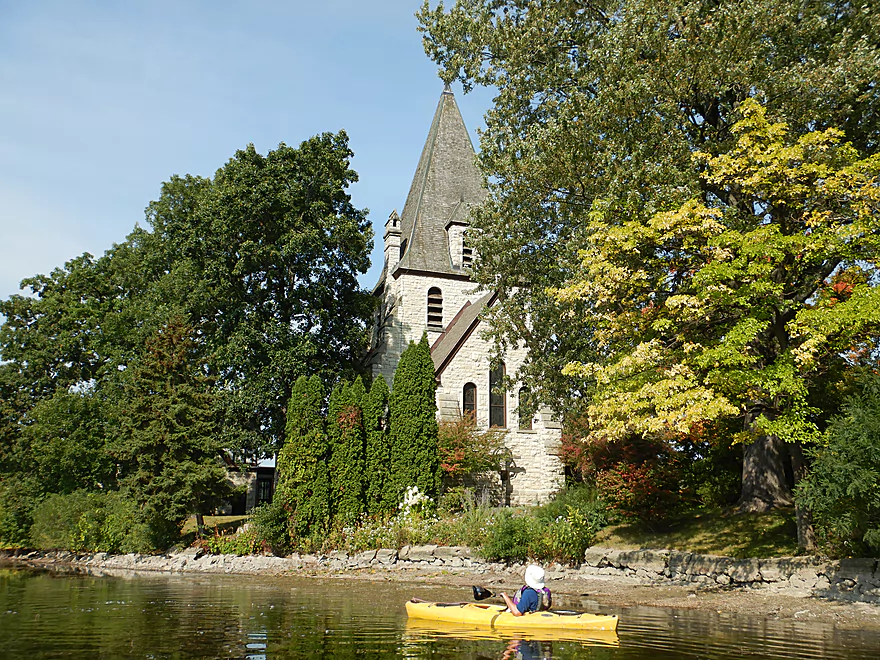
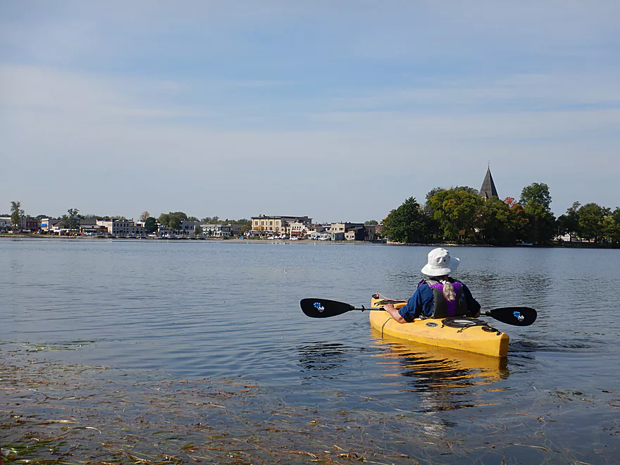
Zion Episcopal Church looms over the lake
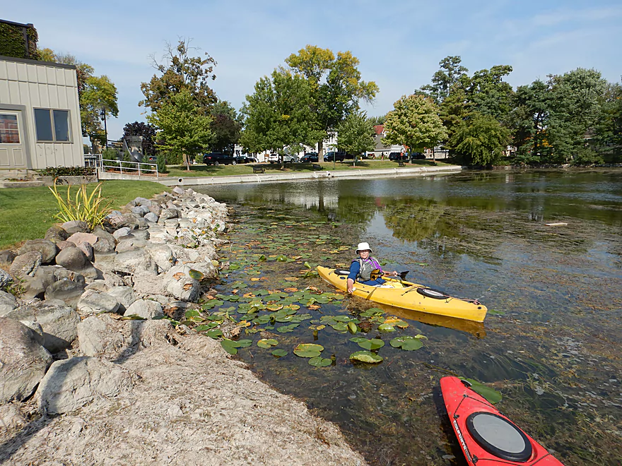
An attractive waterlily bed
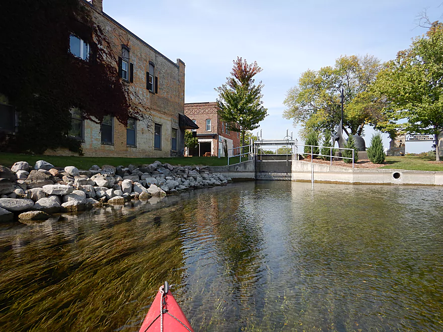
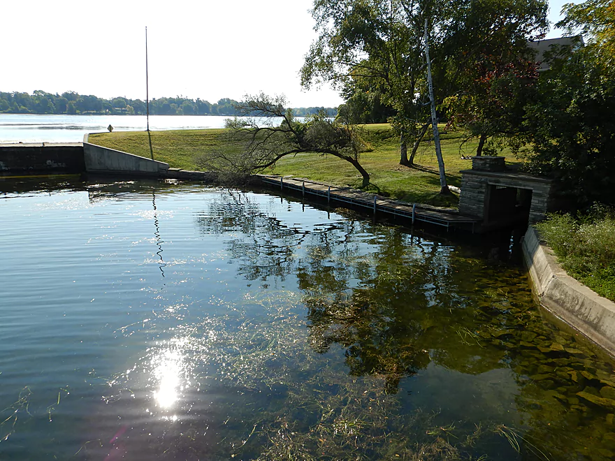
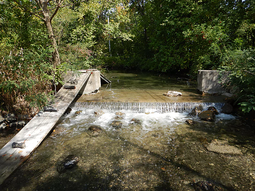
Coming up on the Lake Fowler dam
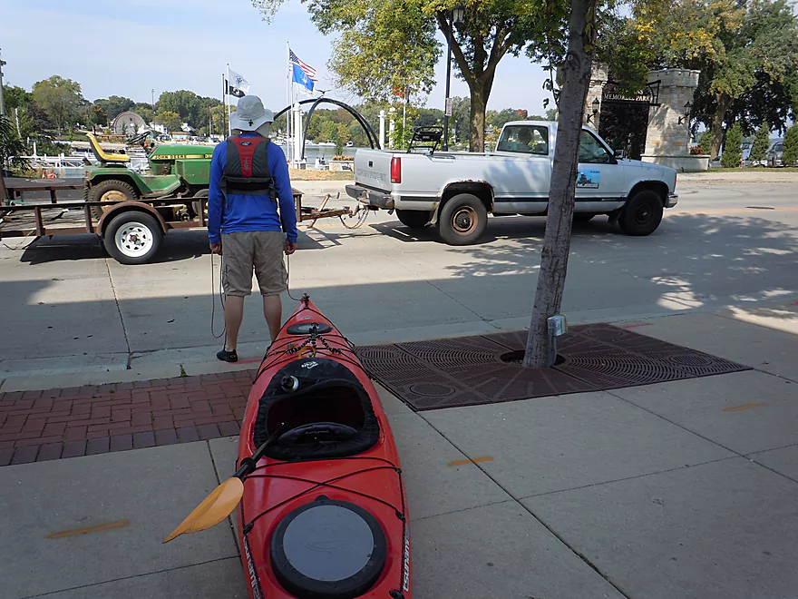
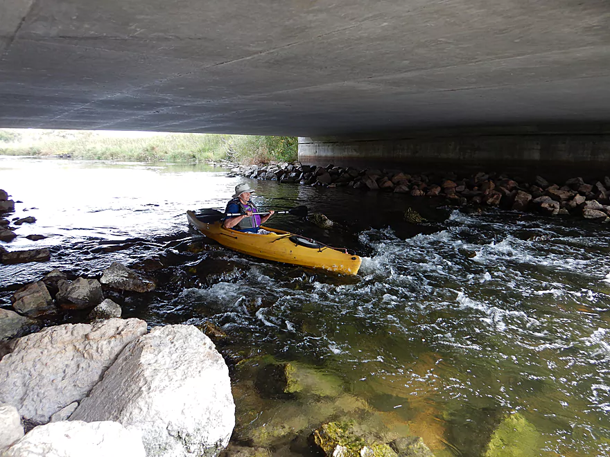
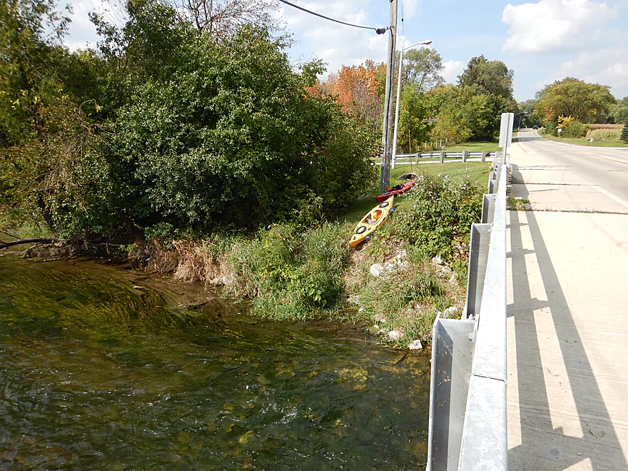
Which does require portaging a busy street
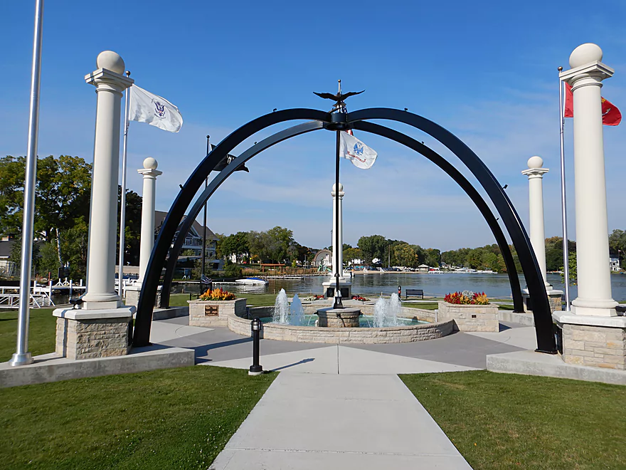
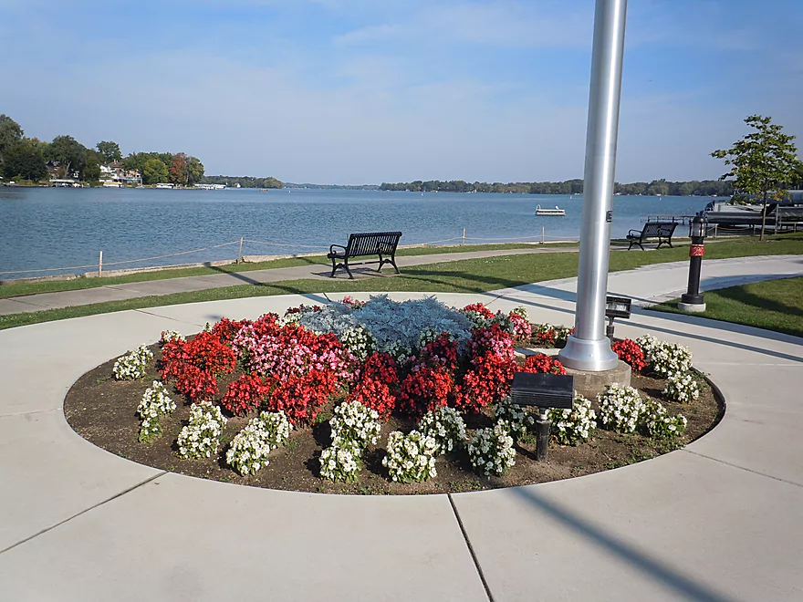
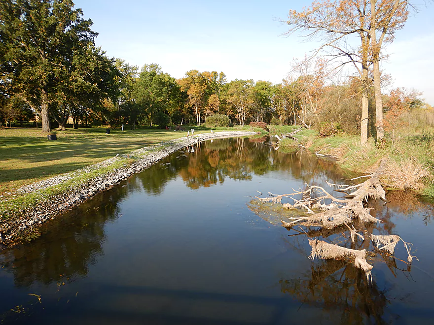
Cool sculpture in Veterans Memorial Park
Outlet from the dam
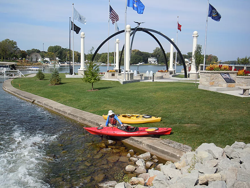
Rocky but doable reentry
Now on Lake Lac La Belle
Which also has good clarity
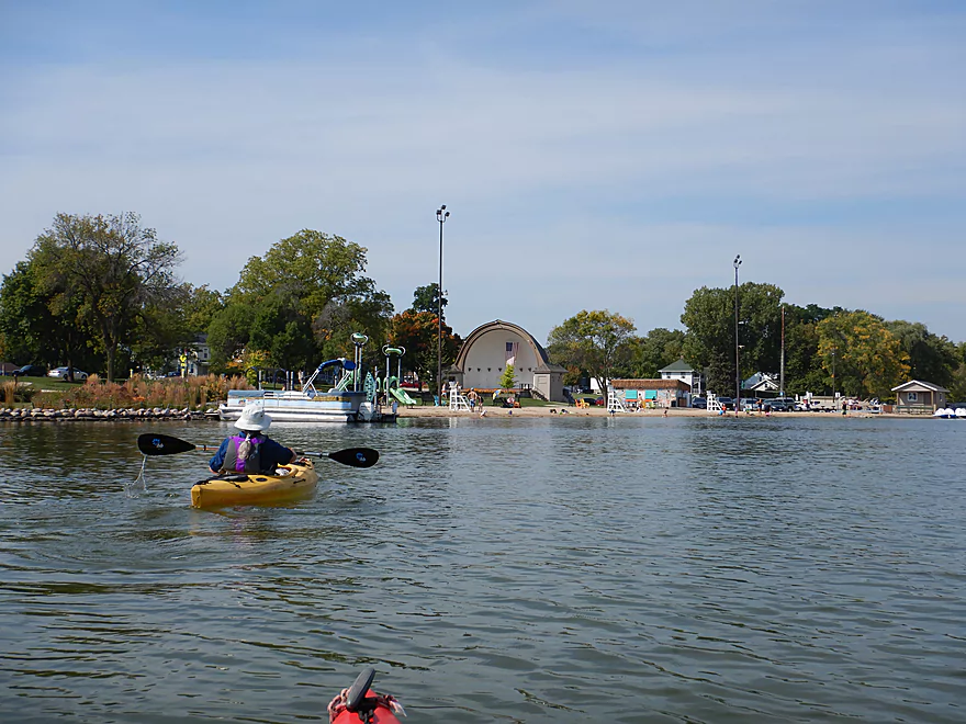
The main city beach
Further to the north is the 2nd Lake Fowler dam
This would have been a trickier portage (looks private)
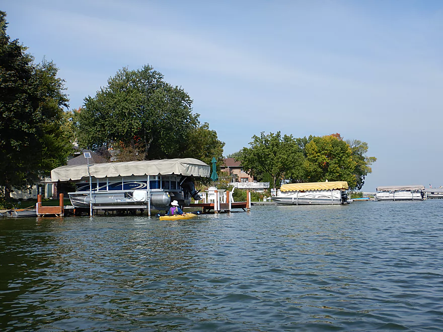
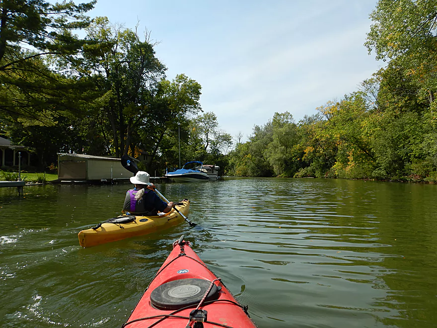
Lake Lac La belle is quite developed
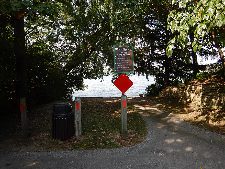
Lot of access options along the south shore
A pedal-powered Hobie!
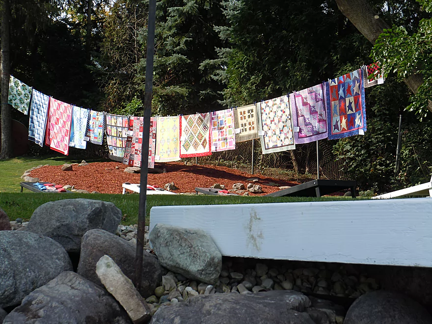
Oconomowoc sure likes its quilts
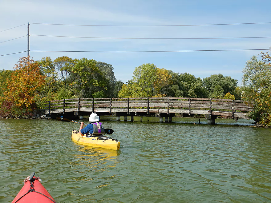
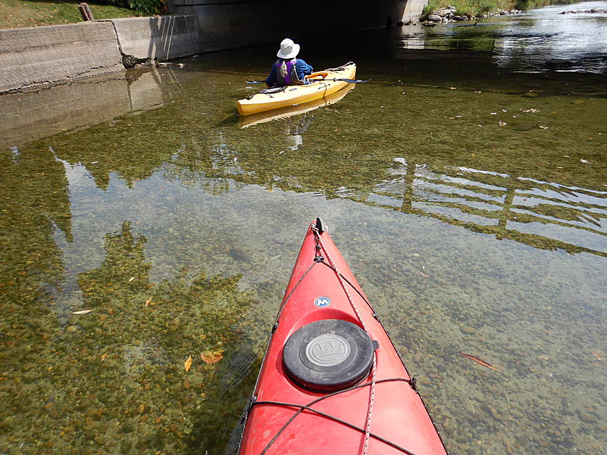
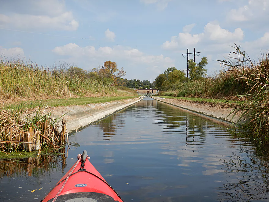
Crossing under the Islandale isthmus
Paddling toward the Lac La Belle spigot
Great portage option by the dam
And easy to re-enter the water
Kind of a scenic area
Almost attempted to paddle over this…
This side dam appears to have a portage ramp
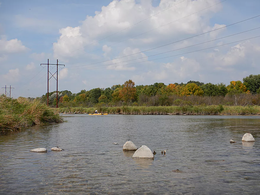
The river is finally a river again under Wisconsin Ave
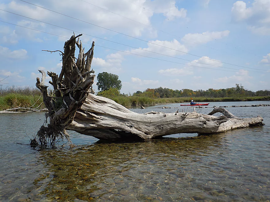
Logjams were never an issue
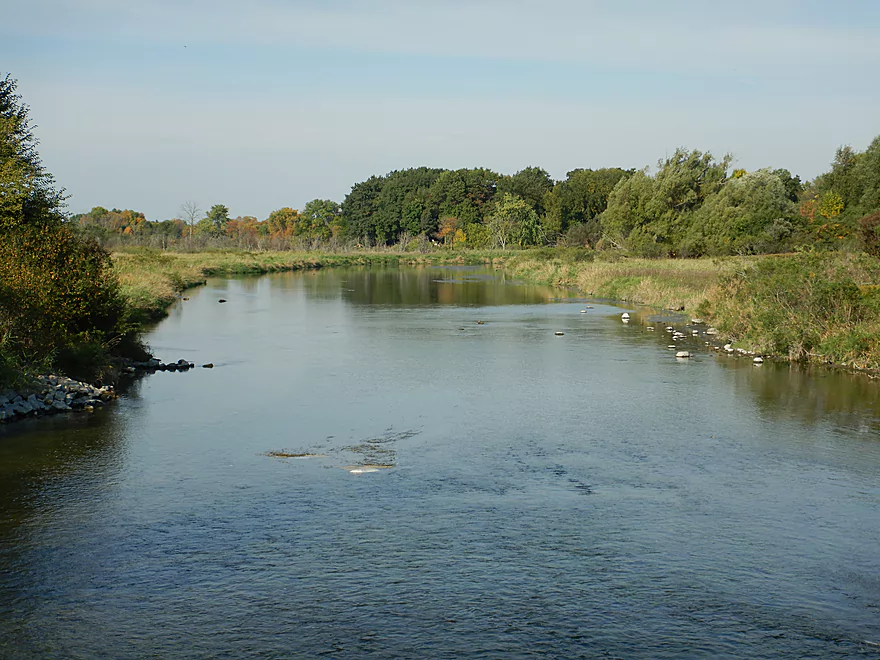
Neat section of the river
With near perfect clarity
Good access option near Chaffee Road
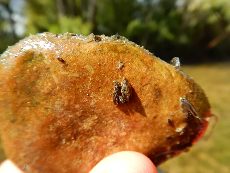
One of countless zebra mussels
A fantastic 1902 built railroad bridge
One of the trip highlights
More top-notch clarity
2nd Street is actually not a good access option
Some way too early fall color
Kind of a clever touch
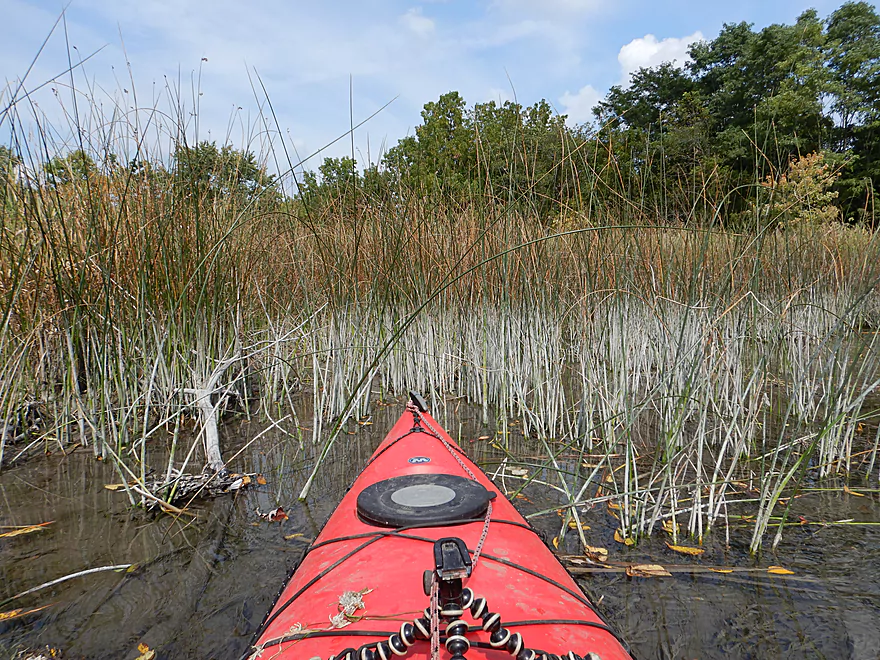
Much of the upper river was like this
River starting to open up
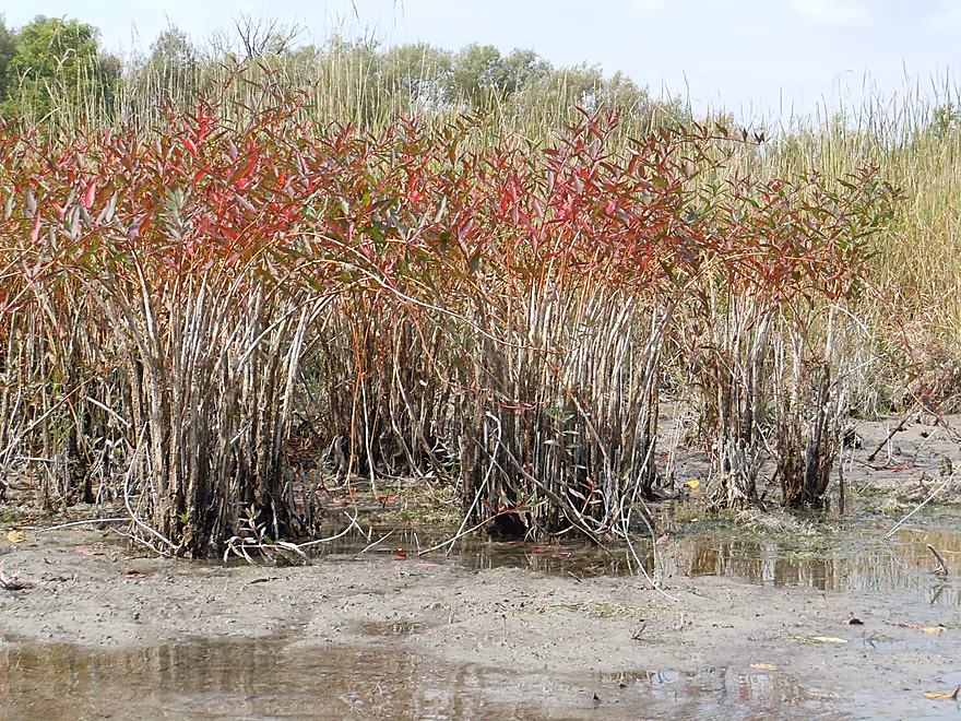
Several clumps of water willow (also called swamp loosestrife)
Unique marl stains
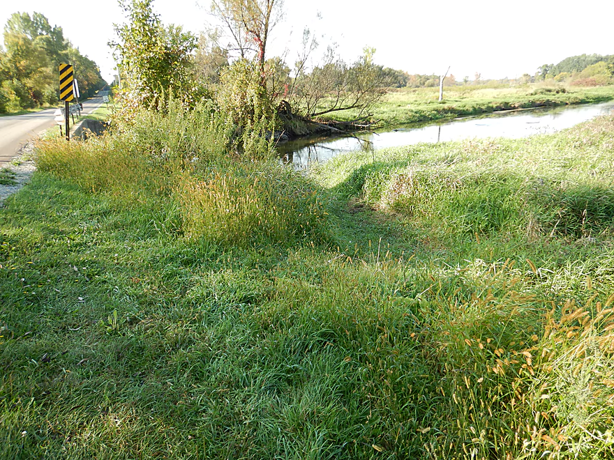
Concord Road is a popular alternate access option
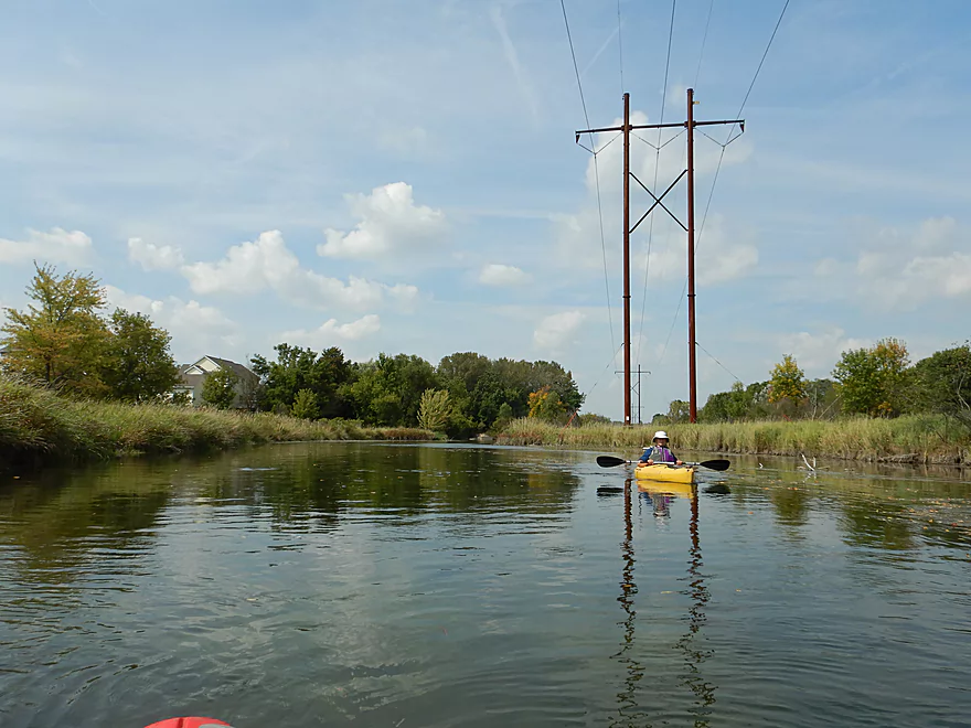
Ugly highline wires (deja I90)
One of the few truly shallow spots on the entire river
Think the locals tried to raise levels with this dam
Kind of cool looking
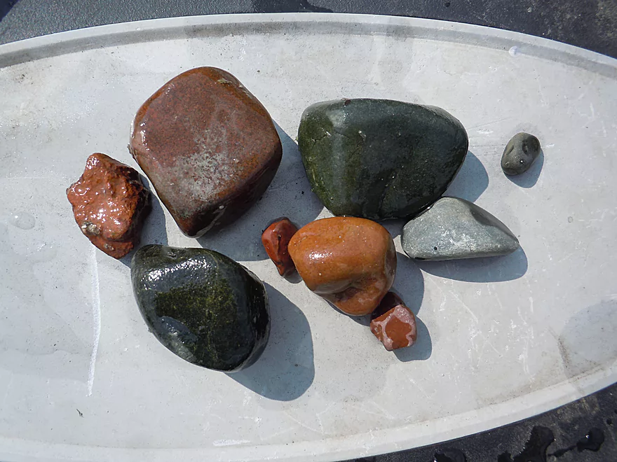
The Oconomowoc substrate was quite colorful
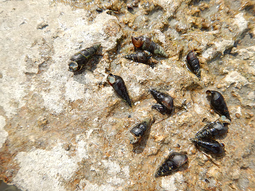
Saw many snails
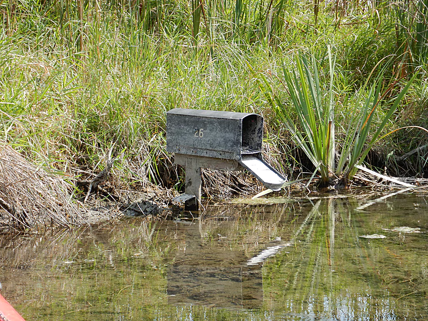
Outlet for the local effluent plant
Do tell
Water quality and clarity plummet after this point
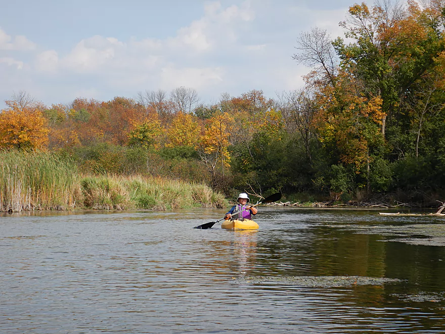
Some more nice fall color
Last mile was slow, open and less interesting
Fun little rapids under Golden Lake Road
Which is where we took out
And totally missed the much nicer access path a little to the west
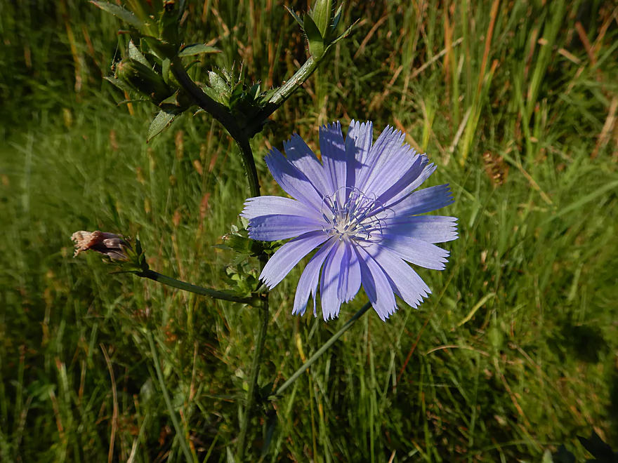
Some roadside chicory flowers
There are still nice sections remaining on the Lower Oconomowoc
New in 2017, an access path has been mowed by Morgan Road
River also looks nice by Elm Drive
Oconomowoc River – Fowler Park


Located in the far west suburbs of Milwaukee, the Oconomowoc River is a unique chain of kettle lakes and river segments known for its good water clarity. Last year I had reviewed a section from Upper Oconomowoc Lake to Fowler Lake, which was a great experience. For this trip, I wanted to continue where I left off to see how subsequent sections compared.
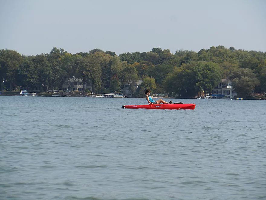
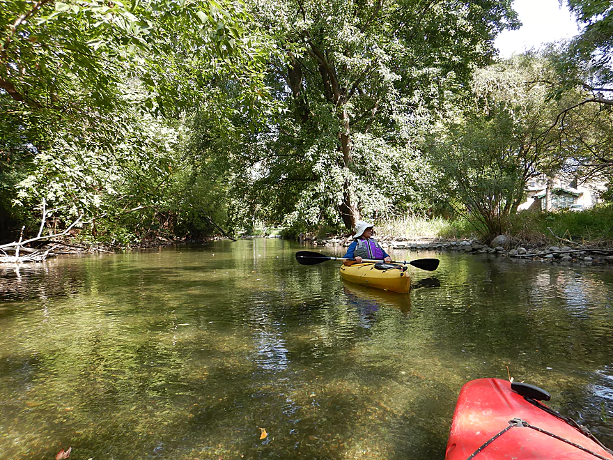
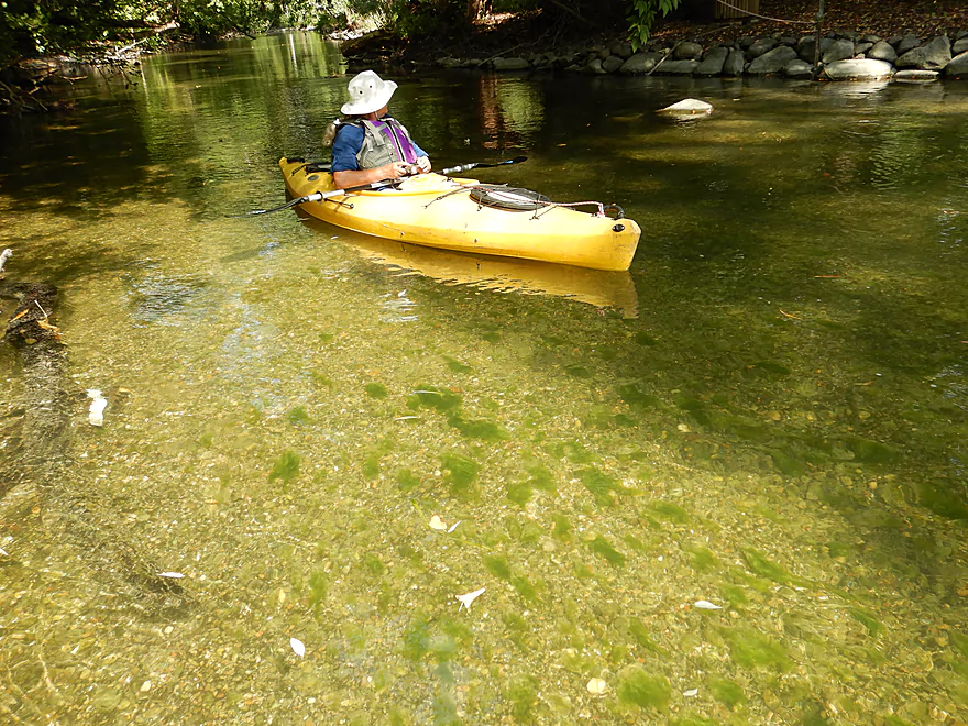
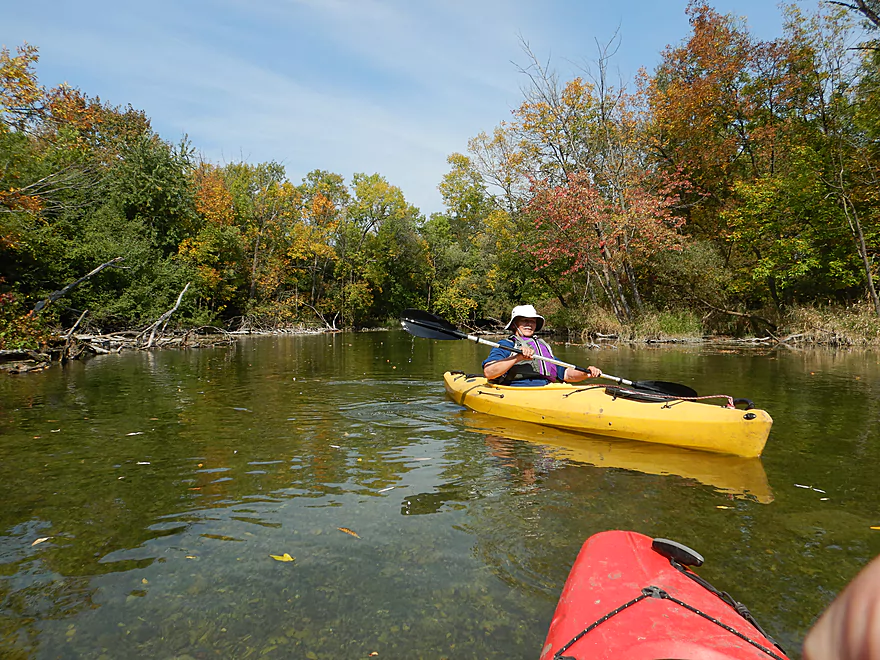
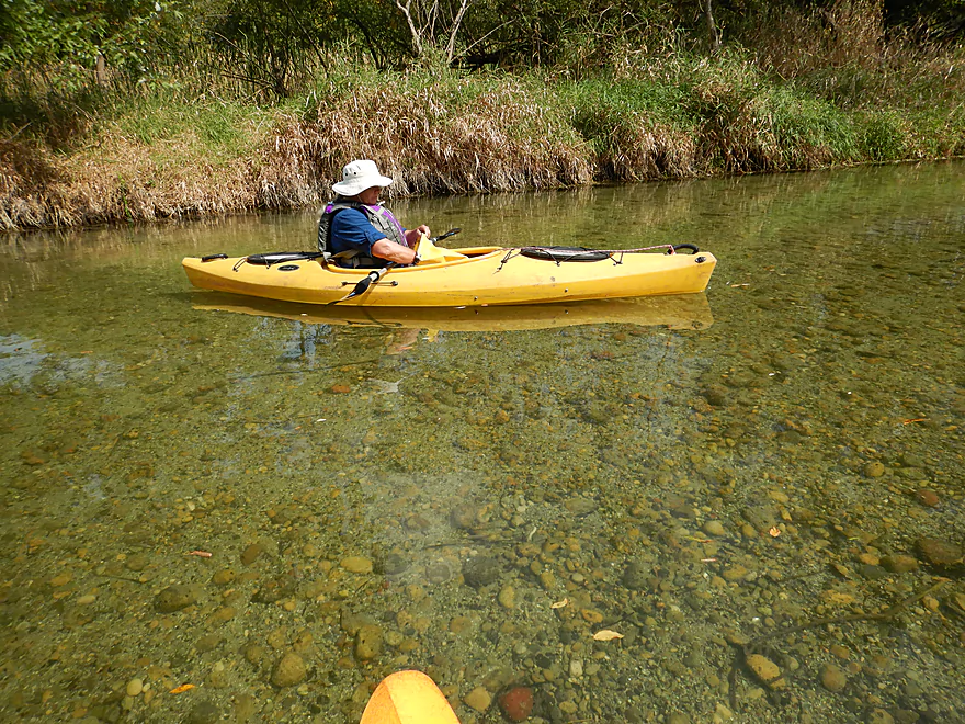
The first part of the trip started at the east end of Fowler Lake at Fowler Park. Spanning only 0.4 miles, this short paddle was really nice with still, super clear water that you could see through to the bottom. Fish were easy to spot darting along the lake bottom and attractive lake plants grew like miniature forests. While the banks are developed as part of downtown Oconomowoc, they had a tidy and peaceful vibe to them. Zion Episcopal Church looms over the horizon and is quite striking. We got lucky with the wind direction, and enjoyed a nice bakery smell wafting over the lake from the nearby Brownberry bread factory.
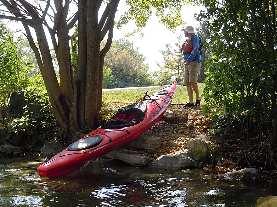
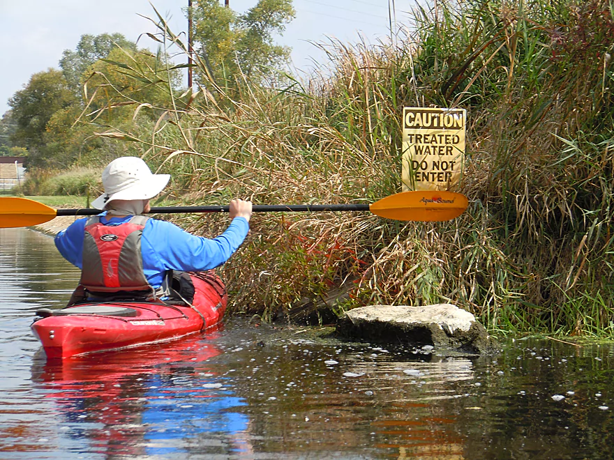
Lake Fowler is separated from Lake Lac La Belle by a north-south isthmus that must be portaged. This was relatively easy to do near Veterans Memorial Park where you take out south/left of the dam along the rocky shoreline. We then had to carry our boats across busy Hwy 67 frogger style to launch in the park. There we were able to launch at the culvert outlet where footing was a bit tricky but doable. If you want an easier launch option you can continue dragging your boat to the west end of the park which is less rocky. Veterans Memorial Park is a nifty little park that features a scenic arches sculpture.
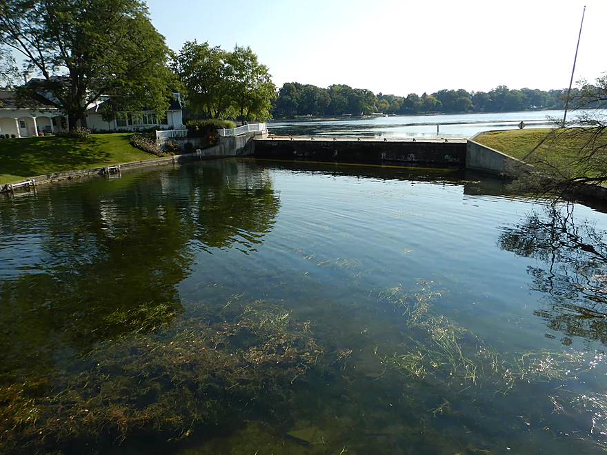
An alternative portage option is further north on the isthmus where there is a second larger dam. That wouldn’t require a road crossing, but the portage path would go through somebody’s back yard. Interestingly enough this second dam was completely dry thanks to low water levels.
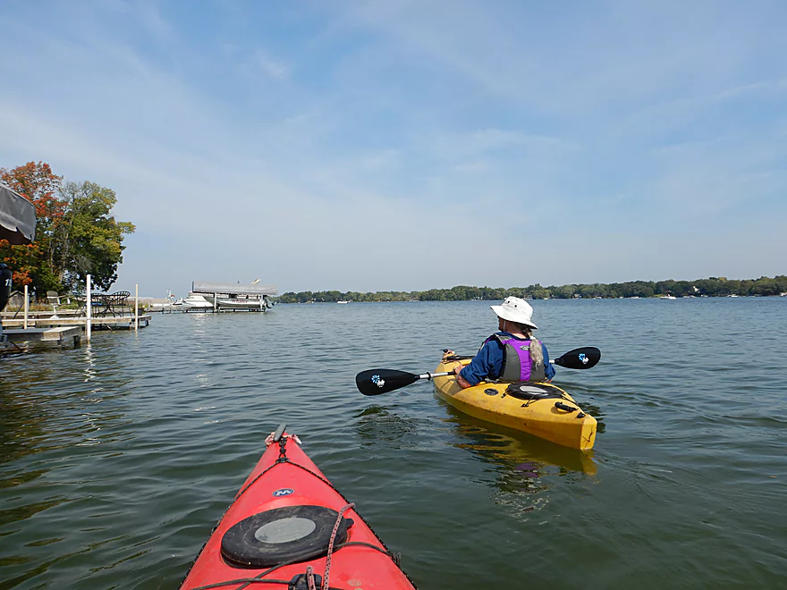
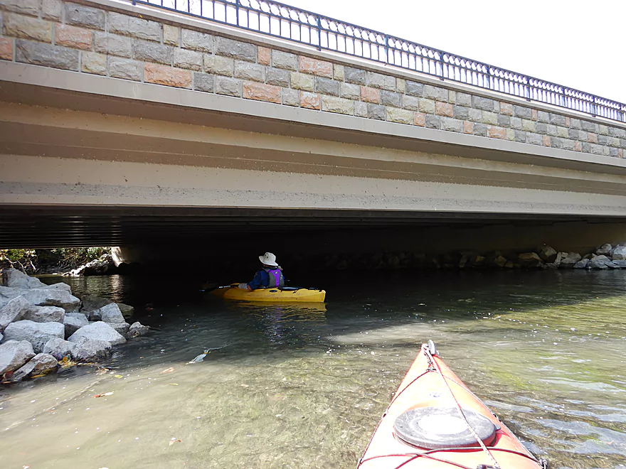
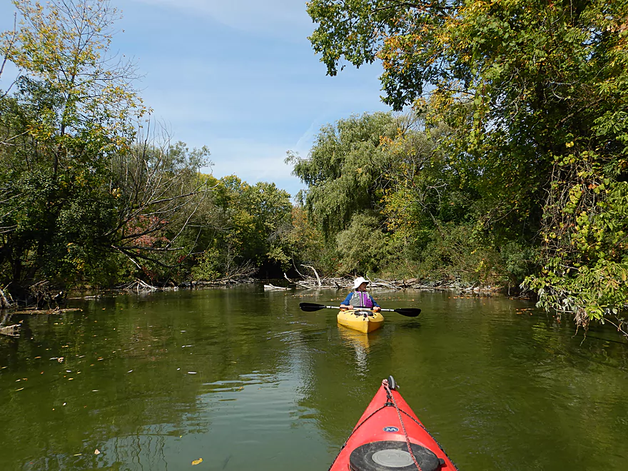
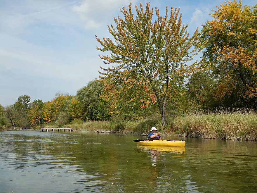
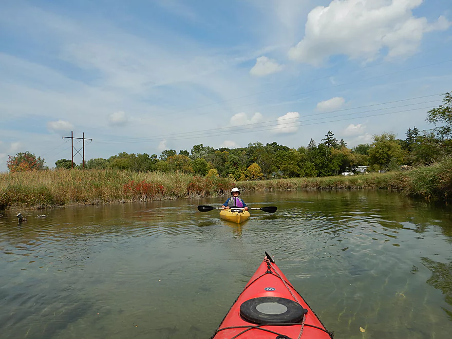
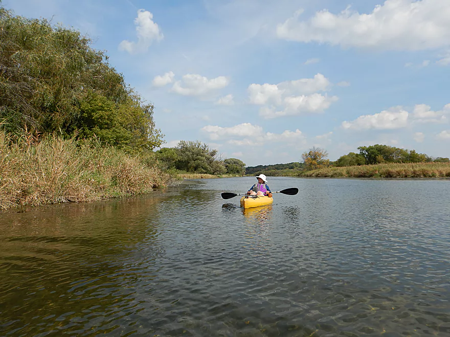
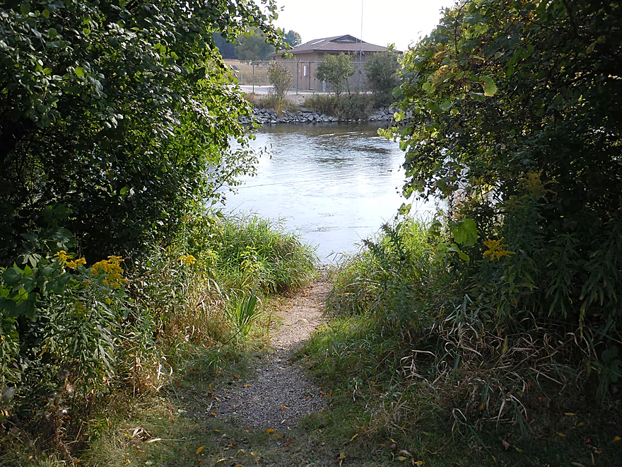
The next 1.3 miles cross Lake Lac La Belle, which is nothing special. This large lake is very busy and somewhat overdeveloped. Clarity is ok, but not as good as Lake Fowler. For choosy paddlers, there are numerous alternate access options along the lake shore (see map for details). Finding the lake outlet is not the most intuitive thing and I suggest carefully reviewing a map beforehand. Basically you’ll need to cross under a bridge by Islandale drive, then take a sharp left to wrap around an isthmus to find the proverbial spigot.
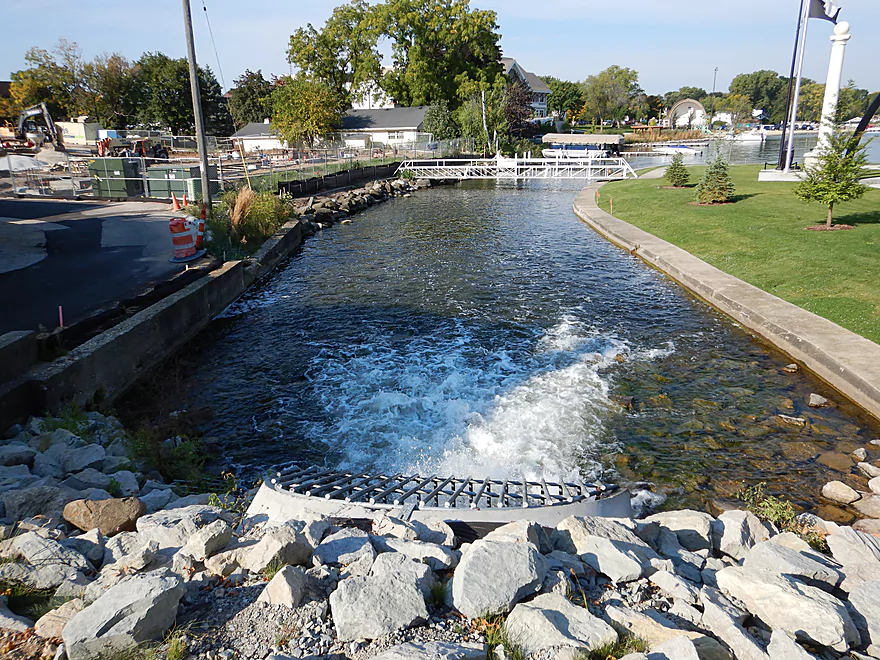
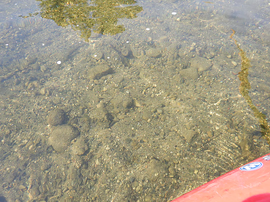
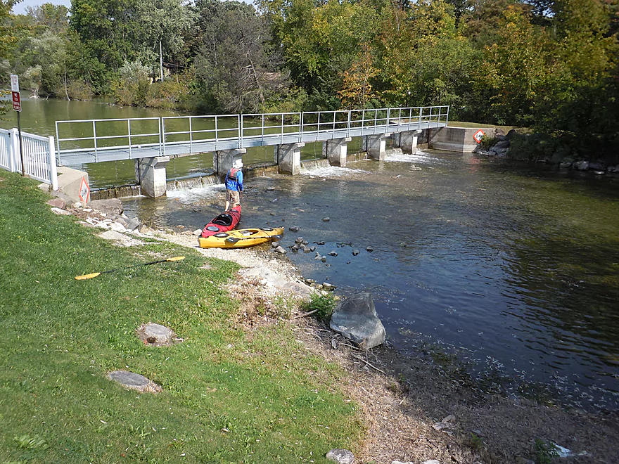
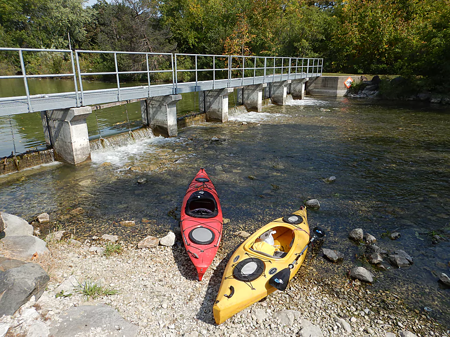
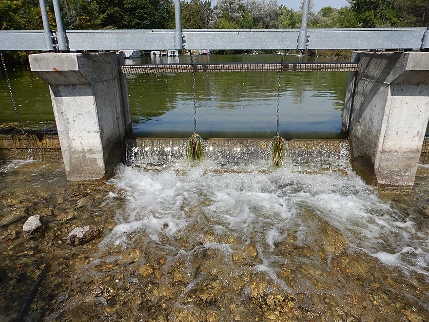
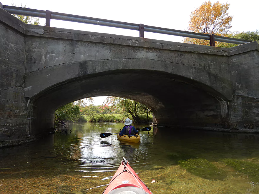
The dam at Hwy 16 is super easy to portage. In fact the dam at low levels might even be runnable by adventurous paddlers (it would be boney though). The channel immediately below the dam was really cool with crystal clear water, no mud, and an attractive gravel substrate that you could wade around in. To the east, there is a side channel (perhaps an old mill race) with its own small dam that might be navigable. Curiously enough this second little dam had a ramp with wheels on it, implying paddlers could use it to pull their boats over the ledge.
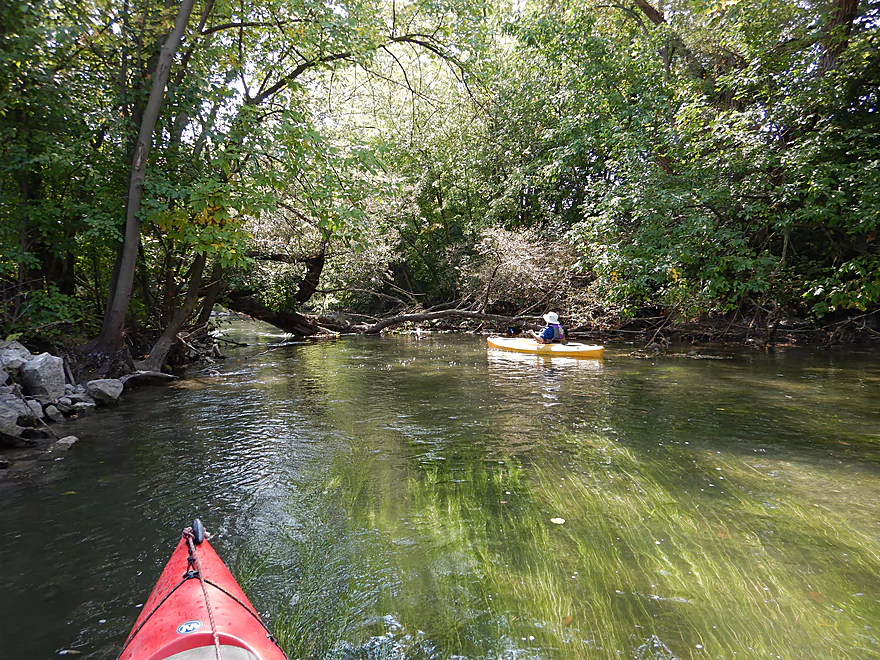
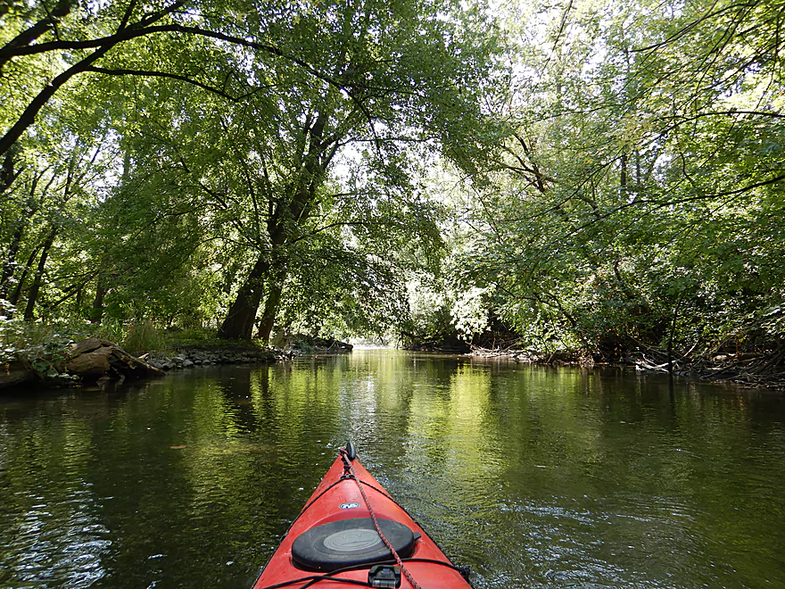
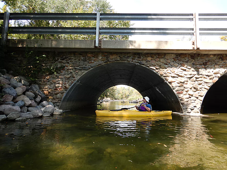
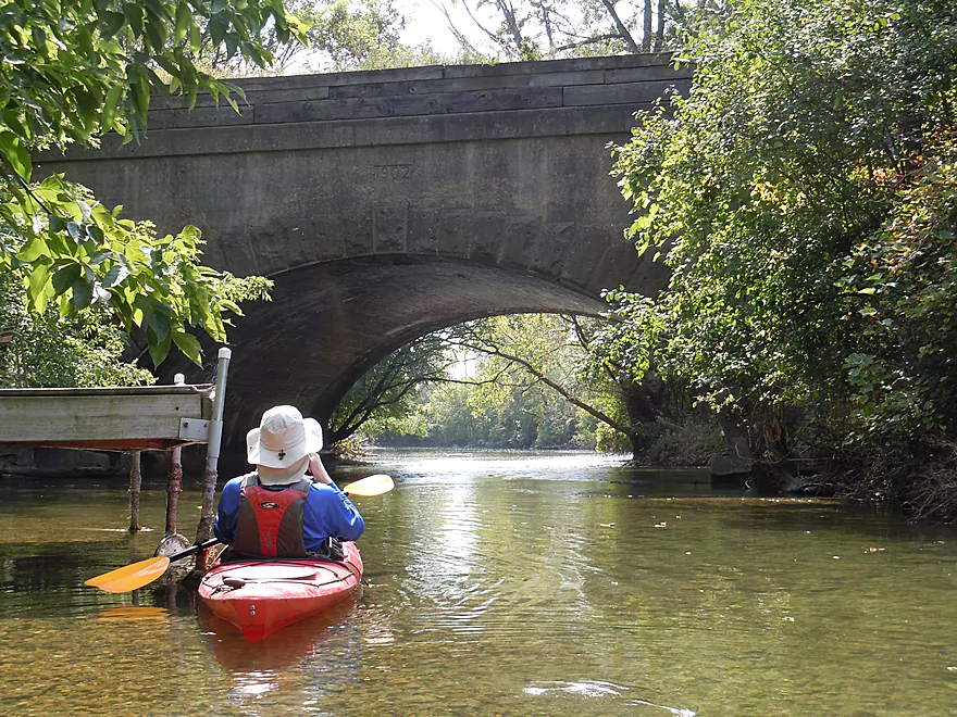
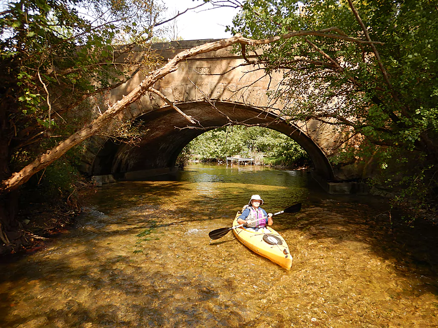
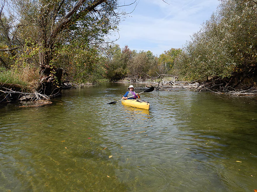
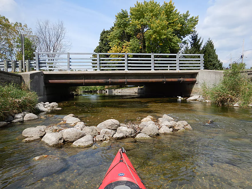
At long last, the Oconomowoc River was once again a river with no more dams to worry about. The first few miles are the best and flow through suburban Oconomowoc. The channel here is shallow but plenty navigable, with a gravel marl substrate, many fish, at times riffly current, and stunningly clear water. This is likely due in part to the inordinate number of zebra mussels in the river (you can see them everywhere). Several of the bridges are scenic including a large stone arch railroad bridge built in 1902.
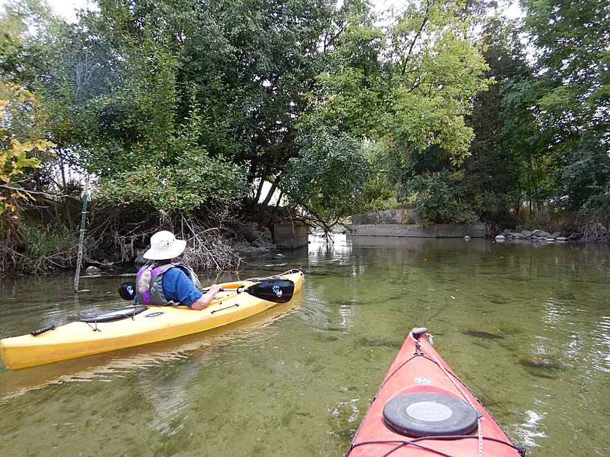
Following the 2nd Street bridge, the river does change somewhat as the channel slows and broadens, and the banks become less wooded and more grassy. Water clarity still stays top-notch as the river flows by a small marsh section.
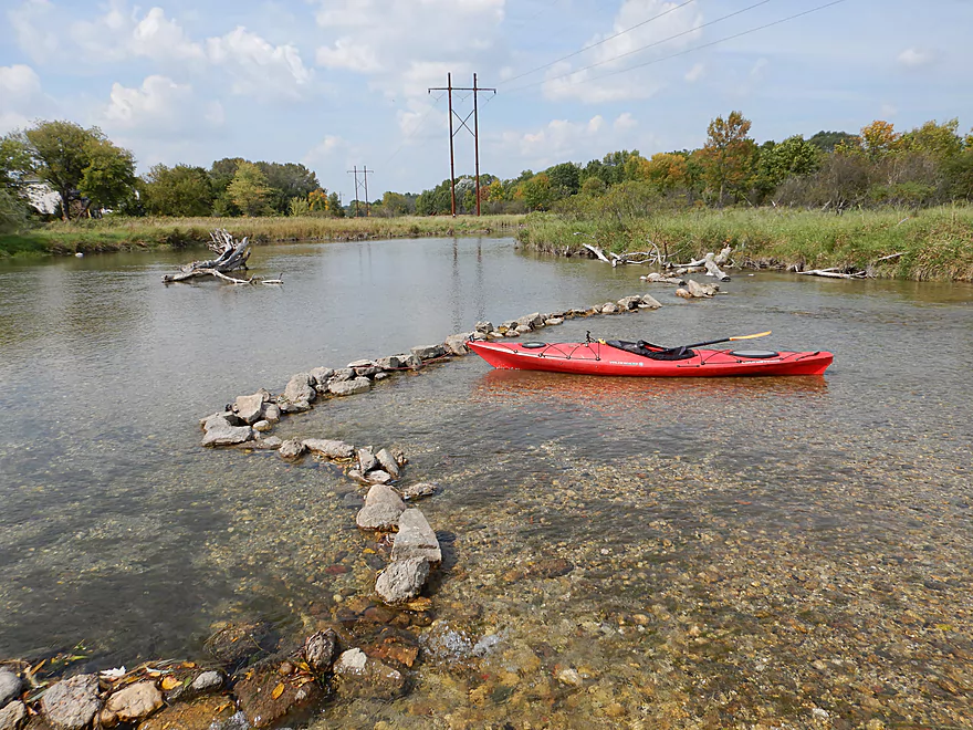
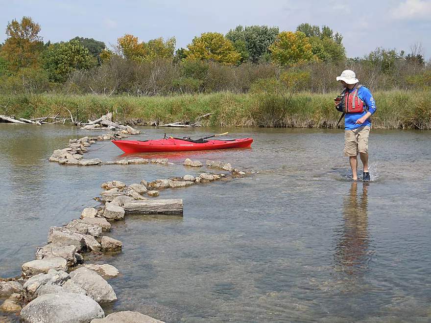
The bridge at Concord Road is an alternate access option and marks a change in the river. Shortly after, you come across a handmade rock dam that was actually artistically well done. This marked the only really shallow spot in the river where I had to get out (perhaps why the locals attempted a “dam” here).
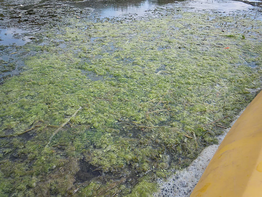
Just downstream, you’ll come across the first of three Oconomowoc Wastewater Facility outlets. The effect on the river is devastating. The once crystal clear water coincidentally becomes mucky, the clean gravel substrate is buried, and the channel becomes filled with unsightly algae. Not even the zebra mussel can keep up with Oconomowoc’s nutrient rich effluent. It would be nice to see the city work to fix this problem, but I doubt anything will ever happen.
For the next mile, the channel continues to slow and broaden as it goes through a simple marsh. This felt more like a lake paddle and minus the snapping turtle I saw, wasn’t as exciting. There are still clear spots here and there, but the river never really recaptures its glory after being polluted with effluent (reminiscent to what happened to the Bark River after Summit Ave). The trip does end on a nice note at Golden Lake Road where there is a decent access and a fun Class 1 chute you can ride over.
In summary this was a nice trip, but a bit inconsistent. Fowler Lake was great, but Lake Lac La Belle was mediocre. The first two miles of the river after Wisconsin Ave (the 2nd dam) were terrific with stunning water clarity, but the section after the wastewater plant was only mediocre. So instead of a 2.5 and 4.5 star ranking, we’ll go with a 3.5 star compromise. Because the clarity is the main star of this show, I highly advise saving this for a sunny day when water levels are low so you can best appreciate it. As for further downstream trip ideas, there are still good sections, but the closer the Oconomowoc gets to the Rock River, the less interesting it becomes.
Fowler Park is a good public access option. Free parking and restrooms are available. To launch, drag your boat down the hill and you can access the water by the pier.
If you like crocheted quilts…this park had plenty of them (most are wrapped around large trees).
At North Golden Lake Road, there are a pair of utility stations along the road. There are no signs marking this as a public or private access, but there is evidence other paddlers have used this before and the caretaker has mowed a path access up to the river. The best access will be northwest of the bridge where you can disembark after the tiny rapids and pull your boat ashore. I didn’t see this until afterwords, but hiding just a bit further west was a small path and much nicer launch area that I recommend using in hindsight. If you feel squeamish about parking in the utility area (again not 100% sure if public), you easily park along the shoulder of Hwy BB where there is plenty of room.
For other Oconomowoc access options and trip ideas, see my trip and map overview at the bottom of this write-up.
I’m not aware of any local rental or livery services.
For bike shuttles this would be super easy. Only 2.6 miles and virtually no hills. You do have to peddle through downtown Oconomowoc but this should be quite manageable especially if you use side streets.
The current is slow and pretty safe. There are a few riffles on the river portion with the only true rapids (easy Class 1) being below the take-out bridge at North Golden Lake Road.
Absolutely no logjams to worry about, but there are two dams to portage (pretty manageable…see main writeup above).
Much of the trip is in the exposed open, so you will want to be mindful of wind speed and direction.
The lake portions were deep, while the river portions shallow. Despite the shallow depth, we only had to get out of our boats once. The Oconomowoc doesn’t have a gauge but the very nearby Bark River does at Delafield. Below are just rough guidelines…use your own discretion.
- 0-10 CFS: Near drought conditions, you would likely have to walk your boat in several sections of the river.
- 11-25 CFS: A common late fall depth. A very ideal level for the water clarity (21 CFS was the depth of last year’s trip). You might have to get out 2-3 times.
- 26-40 CFS: A good depth with good clarity. Again, we went at 33 CFS for this trip and only had to get out once.
- 41-55 CFS: Likely an enjoyable depth, but much of the water clarity might start to be lost.
- 56-80 CFS: Still quite doable as a trip, but likely almost no good clarity.
- 81+ CFS: I suspect the banks may burst at this point. The Oconomowoc would actually be navigable during flood stage, but it would be a different experience (not my choice).
Some painted turtles, a snapping turtle, an eagle, a great blue heron, some clam shells, many small tube-shaped snails, and countless zebra mussels. The highlight was the many fish we saw in the clear water…mostly minnows, but some larger fish as well including suckers, bluegill, carp, and I thought even a muskie.
Detailed Overview
- Hwy 164 to Holy Hill Road: (0.9 mile) Mostly unknown. Appears pretty open, but with one wooded section that probably has logjams.
- Holy Hill Road to Hubertus Road: (2.2 miles) Pretty open marsh paddle and should be no downed trees. Some lake paddling to contend with.
- Hubertus Road to Elmwood Road: (0.9 miles) Downed trees are definitely an issue in the first half, but the second half is open and has some nice rocky sections with clear water.
- Elmwood Road to St. Augustine Road: (0.9 miles) A good prospect with nice rocky sections. There will be portages for downed trees, but am not sure how many.
- St. Augustine Road to County Line Road: (4.4 miles)
- St. Augustine Road to Loew Lake: (1.0 miles). A scenic stretch with glacial boulders, rapids and springs. Some parts of the creek here are shallow and will have to be waded.
- Loew Lake to County Line Road: (3.3 miles). A popular wetland paddle with locals. Most do this as a round trip from County Line Road.
- County Line Road to Kettle Moraine Drive/Monches Dam: (0.3 miles) A slow large millpond.
- Kettle Moraine Drive to West Shore Drive: (5.9 miles) A great trip with clear water, boulder gardens, scenic bridges, fun rapids and attractive marshes. Only a few logjams prevent this from being five star.
- Hwy E to E. Kilbourn Road: (2.6 miles) Starts with some light woods and boulder gardens then opens into a marsh before closing with some rapids. There are three logjams, but the portages aren’t difficult. 2024 update...the logjam situation is now significantly worse because of downed ash trees. Paddling this stretch is not recommended.
- E. Kilbourne Road to Hwy 83: (1.2 miles) Fun wooded section with the longest rapids and several scenic bridges. There are three logjams and one tricky strainer. Note Hwy 83 used to be a good landing, but new owners have declared it private property and put up No Trespassing signs. 2024 update...the logjam situation is now significantly worse because of downed ash trees. Paddling this stretch is not recommended.
- Hwy 83 to West Shore Drive: (2.2 miles) Mostly lake paddling (North Lake). The short river section goes through a scenic marsh.
- West Shore Drive to Hollywood’s Roadhouse Bar: (1.3 miles) Section with good potential. Might be a downed tree to portage. The bar is private and you must get permission to disembark here.
- Hollywood’s Roadhouse Bar to Wisconsin Ave Launch: (3.5 miles) Probably an uninteresting paddle through Okauchee Lake, but the one mile river portion looks interesting. The Okauchee Lake Boat Launch is an alternate take-out.
- Wisconsin Ave Boat Ramp to Fowler Lake Park: (3.95 miles) A great lake and river prospect with amazing water clarity.
- Wisconsin Ave Boat Ramp to Wisconsin Ave Fishing Access: (1.7 miles) Mostly a lake paddle on Oconomowoc Lake, but some nice connecting river sections and a scenic railroad bridge.
- Wisconsin Ave Fishing Access to Fowler Lake Park: (2.3 miles) Half of this is through a nice marsh and half runs though a nice attractive suburbs.
- Fowler Lake Park to N. Golden Lake Road: (4.2 miles) Another good lake/river combo trip with good clarity.
- Fowler Lake to Veterans Memorial Park: (0.4 miles) A neat lake paddle with stunning clarity and attractive lakeside buildings.
- Veterans Memorial Park to W. Wisconsin Ave/Dam: (1.3 miles) A short section on Lake Lac La Belle. Heavily developed, this was a mediocre experience. Easy portage or take-out at end by dam, but parking is difficult. Ask permission from Paddleboard Specialists to park in their lot or park one block to the south at Chaffee Road Park.
- W. Wisconsin Ave/Dam to Chaffee Road Park: (0.3 miles) Terrific section with perfect water clarity.
- Chaffee Road Park to South Concord Road: (0.9 miles) Great section with clear water and scenic bridges.
- S. Concord Road to Concord Rd(2nd Bridge): (1.6 miles) Section starts good, but gets mucky after the sanitation plant. Still an ok section. Take-out at North Golden Lake Road is good, and apparently open to the public but can’t be 100% sure of this.
- Concord Rd(2nd Bridge) to N. Morgan Road: (2.6 miles) Some ok clarity, but the river starts to slow down and become less interesting.
- N. Morgan Road to Elm Drive: (2.2 miles) Ok prospect (river is getting slower and wider). For Elm Drive, you should be able to launch NE of the bridge, but must park further to the north to clear the No Parking signs.
- Elm Drive to Hwy F: (1.8 miles) Ok prospect. Hwy F is not great, but one of the more secluded bridge accesses on the lower section.
- Hwy F to W. River Drive: (2.6 miles) Weaker prospect. No Trespassing signs beyond the ditch by W. River Drive and a sign that limits parking doesn’t make this an appealing access. Probably doable for access though.
- W. River Drive to Northside Drive: (1.4 miles) River is getting less interesting and muddy. You must portage by an electric fish barrier under Northside Drive (plenty doable but a bit brushy and super muddy…do scout this before running). Parking is good at Northside Drive.
- Northside Drive to mouth on Rock River: (1.0 miles) Probably an uninteresting section.
- Mouth to Hwy P: (2.6 miles) The lower Rock River is not an interesting prospect IMO (too wide and muddy). Hwy P should be adequate for taking out if you do this section.
Trip Map
Overview Map
Video
Photos Size: